APPLICANT Development Victoria - mov TOWN PLANNING Report
←
→
Page content transcription
If your browser does not render page correctly, please read the page content below

mov

                                                                                         TOWN PLANNING Report
                                                                                                              1 April 2021

                                                                                                           APPLICANT
                                                                                                  Development Victoria

                                                                                                           PROPOSAL
Subdivision in stages, removal of native vegetation, creation of access to a road in a road zone and associated buildings
                                                                                                              and works

                                                                                                             ADDRESS
                                                                                        621 Burwood Highway, Knoxfield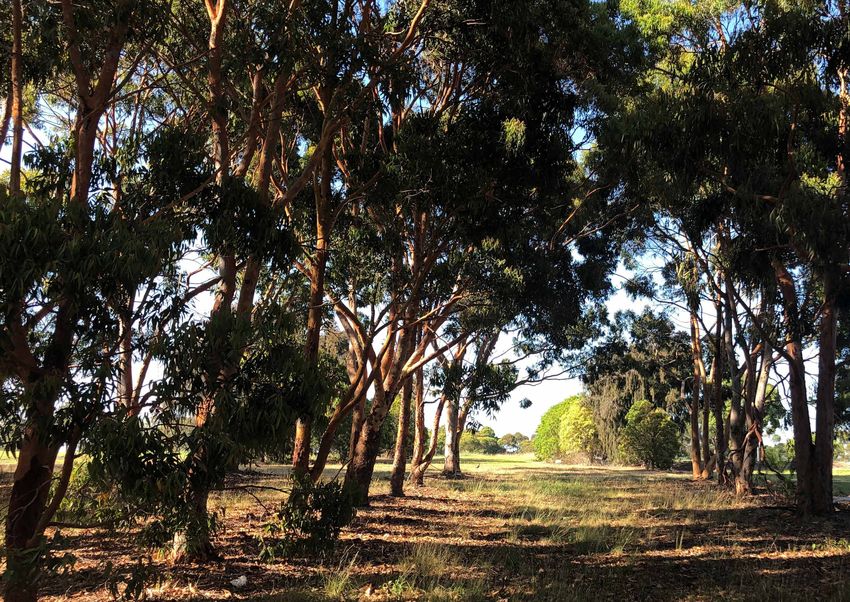
TOWN PLANNERS | URBAN DESIGNERS | LANDSCAPE ARCHITECTS

                                                                                                                                                  Collie Pty Ltd
                                                                                                                                                         ABN 11 076 755 069
                                                                                                                                       Level 16, 356 Collins Street
                                                                                                                                         Melbourne Victoria 3000
                                                                                                                                                          Australia
                                                                                                                                                  +61 3 8698 9300
                                                                                                                                         consult@colliepl.com.au
                                                                                                                                                www.colliepl.com

This document was prepared by Collie for the benefit of the client and in response to the specific services required by the client. Collie has used its best endeavours
to ensure this document reflects the required services and outcomes and the client intentions, at the time of preparing the document. In preparing the document,
Collie has relied upon stated or implied assumptions, data (reports, plans, surveys, correspondence, photographs and such), commentary, responses to enquiries and
other third party information, available to it at the time of preparing the document. Notwithstanding that Collie attempted to ensure it was using the most current
versions of such documents and other information, it did not check independently their accuracy or completeness. Collie does not warrant their accuracy and points
out that those assumptions, data and responses may have been qualified and may have been given with a disclaimer of responsibility.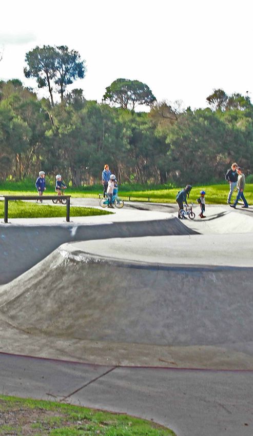
TABLE OF CONTENTS

          TABLE OF CONTENTS

                           1               INTRODUCTION                                                           4
                           1.1             BACKGROUND                                                             4
                           1.2             THE SUBJECT LAND                                                       4
                           1.3             THE SURROUNDS AND NEIGHBOURHOOD                                        4
                           1.4             Construction of dwellings on lots less than 300 square metres          5

                           2               PROPOSAL                                                               7
                           2.1             DESCRIPTION OF THE PROPOSAL                                            7

                           3               KNOX PLANNING SCHEME                                                   9
                           3.1             PLANNING POLICY FRAMEWORK                                              9
                           3.2             LOCAL PLANNING POLICY FRAMEWORK                                       10
                           3.3             SCHEDULE 2 TO THE COMPREHENSIVE DEVELOPMENT ZONE                      10
                           3.4             OVERLAYS                                                              11
                           3.5             PARTICULAR PROVISIONS                                                 11
                           3.6             CLAUSE 56 ASSESSMENT                                                  12

                           4               CONCLUSION                                                            14

                           APPENDICES
                                                Copy of Title
                                                Comprehensive Development Plan
                                                Masterplan
                                                Subdivision Plan
                                                Housing Concepts
                                                Landscape Concept Plan
                                                Temporary Stormwater Plan
                                                Native Vegetation Removal and Retention Plan

\\colliepl.com.au\dfs\collie\projects\16-8340 dv knox\00200 now 00201\word\working\32963l.docx             Version 310321
                                                                                                                  Page: 3
INTRODUCTION
1 INTRODUCTION
This report has been prepared by Collie Pty Ltd (Collie) in response to a request by Development Victoria (the
applicant) in relation to a town planning permit for subdivision at 621 Burwood Highway, Knoxfield (the subject land).
Specifically, the planning permit application seeks a planning permit for:
Subdivision (including a balance lot) in stages for lots to be developed for dwellings;
removal of native vegetation;
creation of access to a road in a road zone from an abutting subdivision;
associated buildings and works.
This town planning report provides a detailed description of the proposed subdivision and an assessment of the
proposal against the relevant provisions of the Knox Planning Scheme (the Scheme).
1.1 BACKGROUND
The subject land (referred to as 621 Burwood Highway and as shown as Crown Allotment 2258 in appendix A), was
affected by planning scheme amendment C160 (AmC160) which rezoned it from Public Use Zone and Urban
Floodway Zone to Schedule 2 to the Comprehensive Development Zone. In addition, AmC160 varied the location of
the Environmental Significance Overlay and Land Subject to Inundation Overly affecting the subject land. Lastly,
AmC160 incorporated the 'Burwood Highway and Scoresby Road Knoxfield Comprehensive Development Plan'
September 2018 (the CDP) (refer appendix B) and the Small Lot Housing Code (SLHC) in the Scheme.
It should be noted as part of the AmC160 process, various environmental investigations of the subject land were
completed to determine the likelihood of any contamination being present on the subject land. These investigations
and subsequent reports determined that the land was not 'potentially contaminated land' under Minister Guideline
No.1 and as a result, an environmental audit overlay was not required to be applied to the subject land.
1.2 THE SUBJECT LAND
The subject land is irregular in shape and has a slope from south to north of approximately 20 metres. It has frontages
to Burwood Highway (to the south) of approximately 210 metres and to Scoresby Road (to the east) of approximately
290 metres.
For the exact location of the works associated with this planning permit application, refer to the CDP in appendix B.
The subject land was used previously as the horticultural research and flora quarantine facility and comprises grassed
vacant land, some sparse tree cover, a dam and some old farm roads.
Native vegetation is present on the subject land and comprises remnant indigenous trees and small patches. Further
discussion on the location and extent of native vegetation is provided in the Ecological Assessment: Stage 1 – 7
Development Area, February 2021 report prepared by Ecocentric Environmental Consulting and provided with the
background reports to this application.
For further details in relation to the proposed development of the subject land, the surrounding land uses and the
intended future development of the remaining areas of the CDP, please refer to the masterplan prepared by
Architectus, which is included with this application for context and information purposes only (refer appendix C).
It should be noted that although part of the subject land is identified as potentially containing areas of aboriginal
cultural heritage significance, Cultural Heritage Management Plan 15226, 20 February 2018 by Archaeology at Tardis
(CHMP), confirmed that there was no cultural heritage significance on the subject land. The CHMP is included as one
of the background reports to this application.
1.3 THE SURROUNDS AND NEIGHBOURHOOD
The subject land forms part of the Knox Central Principal Activity Centre and is surrounded by a range of uses: a mixture
of residential generally to the north, east and south and light industrial and service industries to the west. Fairhills High
\\colliepl.com.au\dfs\collie\projects\16-8340 dv knox\00200 now 00201\word\working\32963l.docx Version 310321
Page: 4
INTRODUCTION
School abuts the subject land to the north while Blind Creek Reserve (and its shared path) is located further north of
the subject land.
Being located within the Knox Central Principal Activity Centre, the subject land is in close proximity to a range of
services including:
Fairhills High School, immediately north and adjacent to the subject land;
Fairhills Primary School, 800 metres to the northeast;
Lewis Park, approximately 800 metres to the northwest;
St Andrews Christian College, located approximately 1 kilometre to the southwest;
Knox City Council offices, approximately 1 kilometre to the west;
Westfield Knox, a major retail shopping centre located approximately 1 kilometre to the west;
various bus stops adjacent to the subject land on Burwood Highway and Scoresby Road.
1.4 CONSTRUCTION OF DWELLINGS ON LOTS LESS THAN 300 SQUARE METRES
Lots at the subject land, including later stages, are expected to be less than 300 square metres in area.
Development of dwellings on these lots will be via two different planning mechanisms:
identification of lots to be developed in accordance with the SLHC, as will be the case with all lots in this
application (stages 1 and 2) for subdivision; or
planning applications / permits for the development of dwellings on lots (less than 300 square metres) in
accordance with a permit condition enabling an 'approved building envelope' via a restriction on the plan
of subdivision.
In future applications for subdivision of further stages of the subject land balance lot, a 'shandy' of the above two
mechanisms is expected to be used in order to enable Development Victoria to include in the development even
more innovative affordable housing products on small lots.
1.4.1 Small Lot Housing Code
The SLHC is an incorporated document under the Scheme and as a result eliminates the need for a planning permit
for dwellings on lots less than 300 square metres identified as SLHC lots and where the design and siting requirements
of the SLHC are met.
As noted above, all of the lots proposed by this application in stages 1 and 2 will be identified (on the plan of subdivision
for certification) as SLHC lots and developed in accordance with the SLHC.
In regard to identification of SLHC lots, it is expected that the following conditions will be placed on a planning permit
for subdivision.
"Before the certification of the plan of subdivision for the relevant stage and if the Small Lot Housing
Code is to be applied, a plan must be submitted for approval to the satisfaction of the responsible
authority. The plan must identify the lots that will include a restriction on title allowing the use of the
provision of the Small Lot Housing Code incorporated pursuant to Clause 72.04 of the Knox Planning
Scheme.".
"The plan of subdivision submitted for certification must identify whether type A or type B of the Small
Lot Housing Code applies to each lot to the satisfaction of the responsible authority.".
As no planning permit is required for dwellings under the SLHC, house plans will be approved by an appropriately
qualified building surveyor and do not require assessment or approval from a planning compliance point of
view.
1.4.2 Approved Building Envelope / Memorandum of Common Provisions
For those future lots where the SLHC will not apply, it is intended they be developed in accordance with an approved
building envelope (ABE) / memorandum of common provisions (MCP).
\\colliepl.com.au\dfs\collie\projects\16-8340 dv knox\00200 now 00201\word\working\32963l.docx Version 310321
Page: 5
INTRODUCTION
The ABE is the mechanism to vary the design parameters under Clause 54 and the Building Regulations 2018, as they
refer to a particular site.
An ABE replaces for the relevant site Clause 54 / Building Regulations 2018 in respect of the design parameters in the
ABE that vary from Clause 54 / Building Regulations 2018.
The ABE is enabled / gains its status as a result of provisions in:
Knox Planning Scheme Clause 56.04-2 (in terms of Clause 54 and planning permits);
Building Regulations 2018 regulation 71 (in terms of building approvals, report and consent and building
permits).
In order for an ABE to be approved and thus vary the design parameters in Clause 54 and the Building Regulations
2018, it must:
be enabled / called up by a specific condition in a planning permit; and
be enabled / called up by a restriction on the relevant plan of subdivision.
Once an ABE has been approved under the enabling provisions (planning permit condition and restriction on plan of
subdivision), the mechanism for including it on title (a requirement) is to include it under the Restriction as a
memorandum of common provisions (MCP).
The MCP is the specific document therefore, under the Restriction, for implementing the ABE rather than it being a
separate / independent level of control.
For all intents and purposes, the MCP is the ABE.
House plan assessments under an ABE / MCP must be completed by assessing:
firstly, compliance with the design parameters under the ABE / MCP;
secondly, compliance with the design parameters NOT covered by the ABE / MCP but included in Clause
54 / Building Regulations 2018.
The ABE / MCP replaces Clause 54 / Building Regulations 2018 insofar as it goes.
It should be noted that both the Building Regulations 2018 and clause 56.04-2 allow the creation of ABE / MCP and
therefore, Council cannot refuse the creation of an ABE / MCP.
It is stressed however, that the ABE / MCP is not used in this application for stages 1 and 2 as all dwellings on lots will
comply with the SLHC.
\\colliepl.com.au\dfs\collie\projects\16-8340 dv knox\00200 now 00201\word\working\32963l.docx Version 310321
Page: 6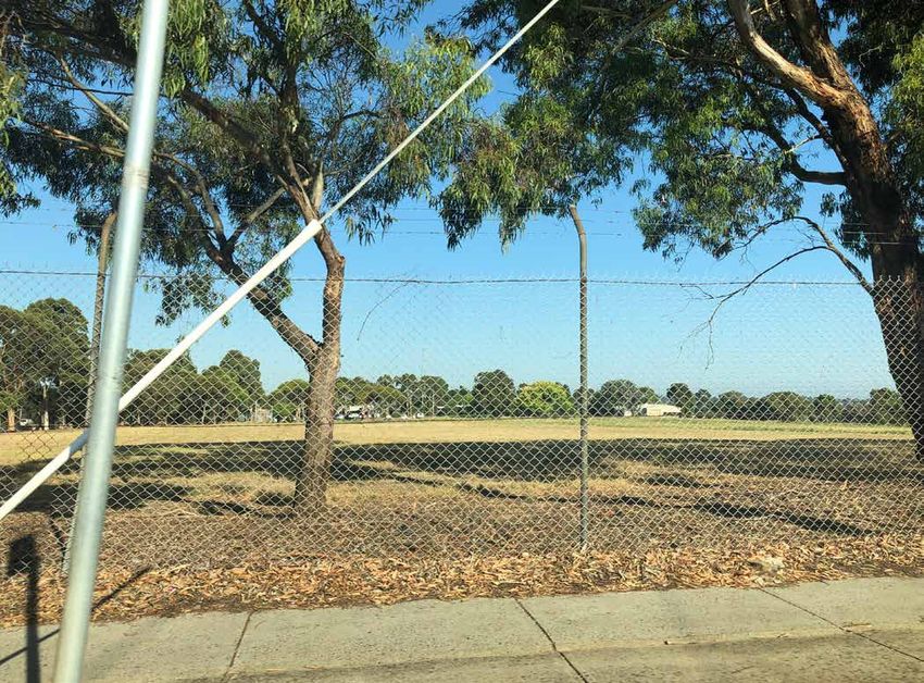
PROPOSAL
2 PROPOSAL
2.1 DESCRIPTION OF THE PROPOSAL
The proposal has been prepared based on several significant background studies, one of which has been the
Ecological Assessment: Stage 1 – 7 Development Area, February 2021 report prepared by Ecocentric Environmental
Consulting and included as one of the background reports to this planning permit application. This report, as its title
states, identified and assessed the ecological attributes, issues and recommended actions to ensure a good
ecological outcome from the proposal.
Architectus was appointed to prepare an overall masterplan for the subject land in accordance with the CDP and
this 621 Burwood Highway Knoxfield - Master Plan Report, 18 December 2020 has set the scene for the intended
subdivision layout for the residential areas of the land. The Report provides context for this application but is submitted
for information purposes only. It forms one of the background reports to this application.
The following summary of the proposal should be read in conjunction with the 621 Burwood Highway Knoxfield
Subdivision Plan (two sheets), 25 February 2021 prepared by Collie Pty Ltd (refer appendix D and provided separately
for endorsement).
The key features of the proposal include:
subdivision of the subject land to create:
105 lots (ranging between 113 square metres to 259 square metres) to be developed for a single
dwelling on each;
a balance lot (15.38 hectares) for the remainder of the subject land;
creation of three reserves ranging from 975 square metres to 1,635 square metres for public open
space;
a population target of approximately 294 based on a long term average occupancy rate of 2.8 persons
per household;
a network of local streets;
the creation of easements to reflect the new subdivision layout and associated servicing with the exact
location of these easements to be determined at detailed design stage;
lots typically with an east-west or north-south orientation to ensure good solar access;
the removal of native vegetation;
associated buildings and works.
It is expected that a select number of builders (three or four) will construct the dwellings, with modules of the subdivision
allocated to one specific builder. Graphics providing an indication of the housing products proposed have been
included with this report (refer Appendix E). It should be noted that whilst these graphics are conceptual, it is expected
that the final design of the housing products will be generally in accordance with the images provided.
For further details of the proposed road layout, refer to the Traffic Impact Assessment prepared by One Mile Grid and
included as one of the background reports with this planning permit application. The traffic impact assessment
confirms that the proposed road network, accessibility to potential and existing public transport routes as well as
pedestrian and cycling connectivity through the proposed development, are appropriate.
A 'Knoxfield - landscape masterplan + concepts' plan, prepared by MDG Landscape Architects has been prepared
and is included in appendix F.
A Sustainability Management Plan (SMP) has been prepared by Aurecon as one of the background reports with this
planning permit application. As outlined in the SMP, the proposal includes a range of sustainable design features and
will achieve best practice across a range of sustainability measures.
A Waste Management Plan, 19 February 2021 (WMP) has been prepared by One Mile Grid as one of the background
reports to this planning permit application. As outlined in the WMP, household waste will be managed in accordance
with the Sustainability Victoria Better Practice Guide for Waste Management and Recycling in Multi-unit Developments
and the relevant Council requirements.
\\colliepl.com.au\dfs\collie\projects\16-8340 dv knox\00200 now 00201\word\working\32963l.docx Version 310321
Page: 7
PROPOSAL

          A Housing Diversity and Adaptability Report for 621 Burwood Highway, Knoxfield, 15 December 2020 prepared by
          Development Victoria is included as one of the background reports to this planning permit application. As outlined in
          the Report, Development Victoria intends to provide a range a dwelling types to increase the diversity of housing
          options in the area, which includes providing a mix of one, two, three and four bedroom dwellings. Furthermore,
          Development Victoria intends to provide up to 10 per cent of the dwellings as affordable housing, which is defined as
          a dwelling for sale at an affordable price point for moderate income earners.

          Engineering services for the subdivision can all be supplied appropriately as indicated in the 609-621 Burwood Highway,
          Knoxfield Services Investigation & Development Report, 26 October 2020 prepared by Paroissien Grant and Associates
          Pty Ltd and included as a background report to this planning permit application.

          Related to this planning permit application, a minor utility installation (temporary sedimentation basin and outfall drain)
          will be constructed to manage stormwater flow from the development of the stages 1 and 2 development and to
          ensure the ultimate sedimentation basin, wetland and habitat wetland facility can be completed in the north of the
          subject land (and the subject of a concurrent but separate planning permit application). It should be noted that as
          this temporary sedimentation basin and outfall drain is a 'minor utility installation' the use and buildings and works
          associated are exempt from requiring a planning permit under clauses 62.01 and 62.02 of the Scheme. As noted, the
          construction of the temporary sedimentation basin will prevent sediment laden runoff produced during and post
          construction of stages 1 and 2 from entering the existing dam located on the subject land and ultimately discharging
          into Blind Creek. For more information on the temporary sedimentation basin and outfall drain, refer to the sketch plan
          (for information purposes only) shown on the Temporary Stormwater Management Plan, prepared by Paroissien Grant
          and Associates and included in appendix G.

\\colliepl.com.au\dfs\collie\projects\16-8340 dv knox\00200 now 00201\word\working\32963l.docx                      Version 310321
                                                                                                                           Page: 8
KNOX PLANNING SCHEME
3 KNOX PLANNING SCHEME
3.1 PLANNING POLICY FRAMEWORK
The Planning Policy Framework (PPF) provides a context for spatial planning and decision making by planning
authorities. The PPF is State-wide in nature and guides more specific planning policies within each municipality.
Various sections of the PPF are of some relevance to the consideration of the proposed subdivision, including:
Clause 11.01-1S - Settlement;
Clause 11.03-1S - Activity centres;
Clause 12.01-2S - Native vegetation management;
Clause 15.01-3S - Subdivision design;
Clause 15.01-4R - Healthy neighbourhoods - Metropolitan Melbourne;
Clause 15.015S - Neighbourhood character;
Clause 16.01-1R - Housing supply - Metropolitan Melbourne;
Clause 16.01-2S - Housing affordability;
Clause 18.01-1S - Land use and transport planning;
Clause 19.03 - Development infrastructure.
The proposed subdivision is consistent with the objectives set out in clause 11 (Settlement). It has been identified for
residential use under the zoning of the land and is consistent with the land use objectives sought by the CDP, which
identifies the subject land for residential development. The proposed subdivision facilitates the planned and orderly
development of residential land that has convenient access to jobs, services, infrastructure and community facilities
(clause 11.01-1S). The subdivision will provide an overall residential density of approximately 27 dwellings per net
developable hectare (stages 1 and 2 only), which achieves the policy of encouraging a diversity of housing types at
higher densities in and around activity centres (clause 11.03-1S).
The subdivision has been designed to ensure there is minimal removal of native vegetation and therefore, minimal loss
to the biodiversity of the subject land. Further detail in relation to this is provided in the Ecological Assessment: Stage
1 – 7 Development Area, March 2021 report prepared by Ecocentric Environmental Consulting (clause 12.01-2S) as
well as the tree retention and removal plan dated February 2021 by MDG Landscape Architects indicating native
vegetation to be removed and retained (refer appendix H).
The proposed subdivision has been designed to facilitate liveable, walkable and sustainable communities with open
space and well connected movement networks. The design of the subdivision incorporates energy efficient initiatives
by orientating lots for optimum solar access. Furthermore, the proposed development will add to the range of lot sizes
in the Municipality while promoting higher residential density in an appropriate area (within an activity centre) and will
increase the diversity of housing types to be constructed to cater for the needs of a variety of home buyers (clause
15.01-3S).
The location of the subdivision within the Knox Central Principal Activity Centre will assist in creating a 20 minute
neighbourhood in which future residents of the subject land are able to meet most of their everyday needs within a 20
minute walk, cycle or local public transport trip from their home (clause 15.01-4R).
The proposed subdivision will help to achieve a preferred neighbourhood character of medium and higher density
housing outcomes in a location that is in proximity to an existing activity centre and therefore, appropriate for
increased housing (clause 15.01-5S).
The location of the subdivision assists in managing the supply of new housing to meet population growth and to create
a sustainable city by developing housing in a location that is within an existing activity centre (clause 16.01-1R).
The lot sizes provided by the proposed subdivision will assist in improving housing affordability while provide for the
requirements of comfortable and appropriate modern living (clause 16.01-2S).
The proposed subdivision provides appropriate links to the existing road network and will provide walking and cycling
infrastructure to increase participation in sustainable personal transport and alternative modes of travel (clause 18.01-
1S).
\\colliepl.com.au\dfs\collie\projects\16-8340 dv knox\00200 now 00201\word\working\32963l.docx Version 310321
Page: 9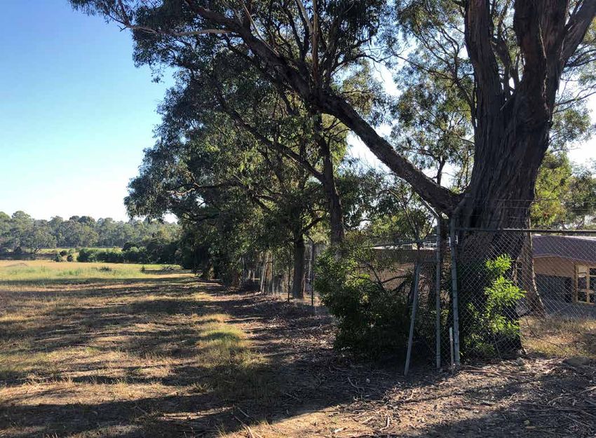
KNOX PLANNING SCHEME

          Development infrastructure including energy, water, stormwater, telecommunications and pipeline infrastructure, will
          be supplied easily to the subject land (clause 19.03).

          3.2              LOCAL PLANNING POLICY FRAMEWORK

          The Scheme contains the Local Planning Policy Framework (LPPF) including the Municipal Strategic Statement (MSS),
          which outlines the objectives for future land use planning and development within the Municipality. Of particular
          relevance to the proposal are clauses 21.03 (Environmental and Landscape Values), clause 21.05 (Built Environment
          and Heritage), clause 21.06 (Housing), clause 21.08 (Community Development), clause 21.10 (Local Areas), clause
          22.04 (Environmentally Sustainable Development) and clause 22.07 (Development in Residential Areas and
          Neighbourhood Character).

          The subdivision has been designed to maximise the retention and enhance native vegetation. Whilst some vegetation
          is necessary for removal (for example, at the new signalised intersection in Scoresby Road at Applegum Crescent), this
          is limited to unavoidable removal only. Furthermore, the proposal not only retains certain native vegetation in open
          space reserves and protection buffers but also proposes to enhance native vegetation across the subject land through
          the provision of native street tree and open space planting (clause 21.03).

          The proposal will contribute to creating a well-planned neighbourhood, which contributes to perceptions of safety
          and potential community participation. The addition of walking and cycling links as well as the proximity of the
          subdivision to an existing activity centre will help reduce car dependency and promote sustainable living (clause
          21.05).

          The subdivision has been designed to provide for lot sizes to help support a diversity of housing choices in the area and
          to cater for the Knox community current and future needs. Furthermore, the provision of smaller lots will help to facilitate
          housing affordability as well as provide opportunities for those wishing to downsize and age in place (clause 21.06).

          The subdivision has been designed with a range access to walking and cycling paths to provide a walkable,
          accessible, safe and attractive neighbourhood that supports health and wellbeing of the community. In addition,
          public open space is provided in the form of a 975 square metres reserve in stage 2 which assists in providing the active
          open space needs for the new community (clause 21.08).

          The Knox Central Activity Centre is identified in the LPPF as having significant capacity for the provision of new higher
          density residential development as well as the opportunity to provide public open space attributes within Knox Central.
          The subdivision has been designed to provide smaller lot sizes (higher density) as well as areas of open space that
          together will increase the provision of higher density dwellings and open space in the Knox Central Activity Centre
          area (clause 21.10).

          Clause 22.04 (Environmentally Sustainable Development) is also relevant to the proposal. For details responding to the
          objectives of clause 22.04, please refer to the Sustainability Management Plan (SMP). The SMP confirms that the
          proposal will adhere to and exceed all sustainability policies within clause 22.04 including achieving a 6 star rating.

          As stated previously, the proposal responds to various local policies which seek residential development in this strategic
          location with an incorporated CDP identifying the subject land for residential development. Furthermore, the lot sizes
          will help to increase the variety of housing types including smaller dwellings and higher density housing in proximity to
          a range of services. Finally, the provision of open space as well as an integrated landscape outcome for the
          streetscape will assist in providing a higher density and attractive preferred neighbourhood character for the site
          (clause 22.07).

          3.3              SCHEDULE 2 TO THE COMPREHENSIVE DEVELOPMENT ZONE

          3.3.1            Subdivision
          The Scheme includes the subject land in Schedule 2 (CDZ2) to the Comprehensive Development Zone (CDZ).

          The purpose generally of CDZ2 is to provide for the use and development of land that is generally in accordance with
          the Burwood Highway and Scoresby Road Comprehensive Development Plan September 2018 (the CDP).

          It is noted that the CDP is incorporated into the Scheme and shows the subject land as residential.

\\colliepl.com.au\dfs\collie\projects\16-8340 dv knox\00200 now 00201\word\working\32963l.docx                       Version 310321
                                                                                                                           Page: 10
KNOX PLANNING SCHEME
The CDZ2 states that an application for subdivision of land must be generally in accordance with the CDP. As stated
previously in this report, the CDP identifies the subject land for residential development and therefore, the use of land
is generally in accordance with it.
Under clause 37.02-3 a planning permit is required to subdivide land in the CDZ. An application to subdivide land into
60 or more lots must meet all the objectives of clause 56, aside from clause 56.03-5. A detailed response to clause 56
is provided in section 3.6 of this report.
Under CDZ2, an application to subdivide land is exempt from the notice requirements of Section 52(1)(a),(b)
and (d), the decision requirements of Section 64(1), (2) and (3) and the review rights of Section 82(1) of the Act.
3.3.2 Construction of Dwellings
Under the CDZ, a planning permit is required to construct a dwelling on a lot less than 300 square metres in area,
except as specified in a schedule to the CDZ. It is noted that under clause 4 of the CDZ2 a "permit is not required to
construct or extend one dwelling on a lot with an area less than 300 square metres where a site is identified as a lot to
be assessed against the Small Lot Housing Code via a restriction on title, and it complies with the Small Lot Housing
Code, incorporated pursuant to Clause 72.04 of the Knox Planning Scheme". A permit is NOT required therefore, for
the construction of dwellings on lots in stages 1 and 2 (all less than 300 square metres) on the subject land as all lots will
be identified and developed in accordance with the SLHC.
3.4 OVERLAYS
Stages 1 and 2 are not affected by any overlays.
3.5 PARTICULAR PROVISIONS
3.5.1 Clause 52.17 - Native Vegetation
Clause 52.17 relates to native vegetation. The purpose generally of clause 52.17 is to protect and conserve native
vegetation by either avoiding removal or minimising removal and ensuring appropriate offsets.
Under clause 52.17-1, a planning permit is required to remove, destroy or lop native vegetation.
As detailed in the Ecological Assessment: Stage 1 – 7 Development Area, February 2021 report prepared by Ecocentric
Environmental Consulting, it is proposed to remove some native vegetation however, the report concludes that all
native vegetation proposed for removal is considered of low habitat significance.
The Ecological Assessment also provides a response to the avoid and minimise requirements of clause 52.17 by stating
that the proposal will retain native vegetation wherever possible and minimise impacts to low significance habitat
areas though careful siting and design and the use of public open spaces and buffer reserves. This includes the careful
siting and design of the open space and buffer reserves to retain native and non-native vegetation around the
property boundaries, including the retention of a range of large and small native canopy trees.
For further information on native vegetation, refer to the Ecological Assessment, which confirms the location of native
patches and trees proposed for removal.
3.5.2 Clause 52.29 – Land Adjacent to a Road Zone, Category 1 and a Public Acquisition
Overlay for a Category 1 Road
Scoresby Road to the east of the subject land is identified as a Road Zone Category 1.
As a result a planning permit is required under Clause 52.29 to create access to a road in roads zone category 1 and
to subdivide the subject land.
Access to the subject land will be provided from the intersection of Scoresby Road and Applegum Crescent. The
intersection is proposed to be signalised.
For further details on the proposed access arrangements, refer to the traffic report included with this application.
\\colliepl.com.au\dfs\collie\projects\16-8340 dv knox\00200 now 00201\word\working\32963l.docx Version 310321
Page: 11KNOX PLANNING SCHEME
3.5.3 Clause 53.01 - Public Open Space Contribution and Subdivision
Under clause 53.01 Public Open Space Contribution and Subdivision, a person who proposes to subdivide land must
make a contribution for public open space in the amount specified in the schedule to the clause. If no amount is
specified, a contribution for public open space may still be required under section 18 of the Subdivision Act 1988. There
is no amount specified in the schedule to clause 53.01 of the Scheme.
It is proposed to provide 975 square metres of passive public open space as a land contribution. It is also expected
that additional areas of public open space will be provided as part of the concurrent wetland application as well as
future subdivision applications for the CDP area as indicated in the masterplan included in appendix C. As a result of
these open space provisions, a cash contribution should not be required to be made.
3.6 CLAUSE 56 ASSESSMENT
Clause 56 of the Scheme relates to subdivision. The purpose generally of clause 56 is to ensure appropriately
designed subdivision that responds to the site and context and creates liveable and sustainable communities.
The following sections show how the proposed subdivision of the subject land responds to relevant provisions of
clause 56.
3.6.1 Clause 56.01 - Subdivision Site and Context Description and Design Repose
Refer to section 1.2, 1.3 and the subdivision plan / master plan included with this application.
3.6.2 Clause 56.02 - Policy Implementation
The proposed subdivision is consistent with and implements relevant policy set out in the Scheme as described in this
and the other parts of Section 3. In particular, the proposed subdivision is generally consistent with the development
plan.
3.6.3 Clause 56.03 - Livable and Sustainable Communities
The proposed subdivision is consistent with the relevant objectives and standards of clause 56.03 in the following ways.
The proposal will create a compact and walkable neighbourhood that allows and encourages easy
pedestrian movement within the subject land. In addition, all lots will be within walking distance to
areas of public open space (clause 56.03-1).
The subdivision is provided with good access to existing bus routes along Burwood Highway and
Scoresby Road as well as potential bus route along the main east-west road through the CDP area
(clause 56.03-1).
The subdivision design provides ease of movement though the subject land and beyond via various
methods of transport, including walking and cycling (clause 56.03-1).
The subdivision and proposed development has been designed with reference to the Knoxfield
Residential Development Sustainability Management Plan, 14 December 2020 prepared by Aurecon,
which forms one of the background reports to this planning permit application.
3.6.4 Clause 56.04 - Lot Design
The proposed subdivision is consistent with the relevant objectives and standards of clause 56.04 as outlined below.
The proposal provides a range of lot sizes ranging from 113 to 259 square metres, which will allow for
the development of a variety of households and dwelling types to meet the diverse needs of the
community (clause 56.04-1).
All lots will be within 400 metres walking distance of potential or existing bus routes (clause 56.04-1).
It is intended to apply the Small Lot Housing Code to any lots with an area less than 300 square metres
(clause 56.04-2).
Solar access is maximised with appropriate solar orientation of lots which are either on a north-south
or east-west axis (clause 56.04-3).
The encouragement of informal surveillance with lots having either frontages to streets, public open
space or both (clause 56.04-4).
\\colliepl.com.au\dfs\collie\projects\16-8340 dv knox\00200 now 00201\word\working\32963l.docx Version 310321
Page: 12KNOX PLANNING SCHEME
The provision of streets along the boundaries of public open space (clause 56.04-4).
Other than the road reserves and areas of public open space, no areas common to all lots are
proposed (clause 56.04-5).
3.6.5 Clause 56.05 - Urban Landscape
A landscape masterplan has been included with this application and demonstrates that attractive and continuous
landscaping will be provided to public open space areas and the street network. It is intended to prepare and submit
more detailed landscape plans to the satisfaction of the responsible authority in accordance with an appropriately
worded condition on the planning permit (clause 56.05-1 and 56.05-2).
3.6.6 Clause 56.06 - Access and Mobility Management
The Traffic Impact Assessment report, 19 February 2021 prepared by One Mile Grid and included with this application
addresses the relevant access network objectives and standards as listed in clause 56.06. In summary, the proposed
subdivision will provide an appropriate internal access network with a hierarchy of street providing access to the
proposed lots and links with the surrounding street network. Furthermore, the proposal will provide bicycle and
pedestrian links that will connect with existing and future development within the wider CDP area.
It should be noted that the traffic report has been prepared to be common report for various applications relating to
the subject land and thus some aspects of the report may not be relevant to a particular application. Nevertheless, it
is considered more appropriate to provide the expected ultimate situation.
3.6.7 Clause 56.07 - Integrated Water Management
The services report included with this application provides a summary of servicing matters that affect the proposal. In
response to clause 56.07, the services report outlines the following.
The services report prepared by Paroissien Grant and Associates and included with this application provides a summary
of service matters that affect the proposal.
In response to clause 56.07, the serves report outlines the following.
As stated above, a temporary sedimentation basin and outfall drains to manage stormwater flow
from the subject land catchment is proposed until the ultimate sedimentation basin, wetland and
retarding basin facility can be completed in the area designated in the Development Plan.
South East Water has confirmed that the existing sewers in proximity to the subject land have sufficient
capacity to service the proposed development.
South East Water has confirmed that the subject land is able to be serviced with connection to the
existing external infrastructure in the adjoining roads for the supply of potable water.
3.6.8 Clause 56.08 - Site Management
The site will be managed before and during the construction period to the satisfaction of the responsible authority
(clause 56.08-1). It is expected that a condition will be included on the planning permit that will require a site
management plan to be prepared to the satisfaction of the responsible authority before any works can commence.
Whilst expected to be submitted in response to a condition on the planning permit, a Construction and Demolition
Waste Management Plan has been prepared by Aurecon and is included as part of this application for information
purposes only.
3.6.9 Clause 56.09 - Utilities
The service report included with this application provides a summary of utility connections available to the proposal.
In summary, all lots will be serviced with necessary public utilities including electricity, telecommunications and gas in
shared trenches where appropriate (clause 56.09-1 and 56.09-2). The subject land will be provided with fire hydrants
and public lighting in accordance with relevant requirements (clause 56.09-3 and 56.09-4).
\\colliepl.com.au\dfs\collie\projects\16-8340 dv knox\00200 now 00201\word\working\32963l.docx Version 310321
Page: 13CONCLUSION
4 CONCLUSION
Based on the assessment outlined in this report, the proposed subdivision of the subject land, removal of native
vegetation, creation of access to a road in road zone and associated buildings and works, are consistent generally
with the relevant provisions of the Scheme and should be supported, subject to appropriate conditions.
\\colliepl.com.au\dfs\collie\projects\16-8340 dv knox\00200 now 00201\word\working\32963l.docx Version 310321
Page: 14Copy of Title \\colliepl.com.au\dfs\collie\projects\16-8340 dv knox\00200 now 00201\word\working\32963l.docx
Copyright State of Victoria. This publication is copyright. No part
may be reproduced by any process except in accordance with the
provisions of the Copyright Act 1968 (Cth) and for the purposes of
Section 32 of the Sale of Land Act 1962 (Vic) or pursuant to a written
agreement. The information is only valid at the time and in the form
obtained from the LANDATA REGD TM System. None of the State of
Victoria, LANDATA REGD TM System, Victorian Land Registry Services
Pty. Ltd. ABN 86 627 986 396 as trustee for the Victorian Land
Registry Services Trust ABN 83 206 746 897 accept responsibility for
any subsequent release, publication or reproduction of the
information.

REGISTER SEARCH STATEMENT (Title Search) Transfer of Land Act 1958
--------------------------------------------------------------------------------
VOLUME 12014 FOLIO 690                            Security no : 124088242783K
                                                  Produced 20/02/2021 11:00 PM

CROWN GRANT

LAND DESCRIPTION
----------------
Crown Allotment 2258 Parish of Scoresby.
PARENT TITLE Volume 11770 Folio 351

REGISTERED PROPRIETOR
---------------------
Estate Fee Simple
Sole Proprietor
    DEVELOPMENT VICTORIA of LEVEL 9 8 EXHIBITION STREET MELBOURNE VIC 3000

ENCUMBRANCES, CAVEATS AND NOTICES
---------------------------------

      Any crown grant reservations exceptions conditions limitations and powers
      noted on the plan or imaged folio set out under DIAGRAM LOCATION below.
      For details of any other encumbrances see the plan or imaged folio set out
      under DIAGRAM LOCATION below.

DIAGRAM LOCATION
----------------
SEE TP961547B FOR FURTHER DETAILS AND BOUNDARIES

ACTIVITY IN THE LAST 125 DAYS
-----------------------------

NIL

DOCUMENT END

Delivered from the LANDATA® System by InfoTrack Pty Ltd.

The information supplied by Feigl & Newell Pty. Ltd. has been obtained from InfoTrack Pty Limited
by agreement between them. The information supplied has been obtained by InfoTrack Pty Limited
who is licensed by the State of Victoria to provide this information via LANDATA® System.
Comprehensive Development Plan \\colliepl.com.au\dfs\collie\projects\16-8340 dv knox\00200 now 00201\word\working\32963l.docx
LEGEND

Page 2
Masterplan

\\colliepl.com.au\dfs\collie\projects\16-8340 dv knox\00200 now 00201\word\working\32963l.docx
Prepared for:
Development Victoria
Date:
08 February 2021
621 BURWOOD HIGHWAY KNOXFIELD
— MASTER PLAN
REPORT
Prepared byProject and report 621 Burwood Highway Knoxfield
Date February 08, 2021
Client Development Victoria
Document no. 180388.00\Docs\C_Client\C05_Reports\03. Master Plan Report_v3 Adelaide
Lower Ground Floor
Version and date issued Issue A: External Draft (for Client review) - 28/02/2019 57 Wyatt Street
Adelaide, SA 5000
Issue B: External Draft (for Client review) - 23/11/2020 t. (+61) 08 8427 7300
Issue C: External Draft (for Client review) - 10/12/2020 e. adelaide@architectus.com.au
Issue D: External Draft (for Client review) - 18/12/2020 Perth
Issue F: Final Issue - 08/02/2021 Lower Ground Floor
57 Wyatt Street
Report contact Gabriel Jensen Perth, WA 000
Senior Urban Designer, Urban Design and Planning t. (+61) 08 8427 7300
e. perth@architectus.com.au
This report is considered Signature (Dean Thornton)
a draft unless signed by a Melbourne
Director or Principal Level 25, 385 Bourke Street
Melbourne VIC 3000
t. (+61) 03 9429 5733
f. (+61) 03 9429 8480
e. melbourne@architectus.com.au
General Disclaimer Sydney
– The information contained here is believed to be correct at the time of preparation, however it is not guaranteed. Recipients must Level 18, MLC Centre
rely on their own enquiries to satisfy themselves in all respects. Architectus accepts no damages, liabilities or costs, including legal 19 Martin Place
costs of defence, arising from changes made by anyone other than Architectus or from the information contained here without prior Sydney NSW 2000
consent of Architectus. t. (+61) 02 8252 8400
– Architectus Pty Ltd does not accept any liability to any third party for the contents of this report. f. (+61) 02 8252 8600
– This report is not intended for use by any other person or for any other purpose. Only the original drawings should be relied on. e. sydney@architectus.com.au
– Further development of the design, measurement and construction tolerances and/ or further client/ tenant requests will inevitably
result in changes to these areas [which could involve significant reductions] and Architectus Pty Ltd accepts no legal responsibility architectus.com.au
for any decision, commercial or otherwise, made on the basis of these areas.
– The Copyright in this report belongs to Architectus Group Pty Ltd.
2 | MDG Landscape ArchitectsCONTENTS
01
BACKGROUND RESEARCH AND ANALYSIS 7
1.1 Demographics and Trends 8
1.2 Strategic Location 10
1.3 Wider Context 11
1.4 Site Context 12
1.5 Access and Interfaces 14
1.6 Landscape Character 16
1.7 Site Issues 18
02
MASTER PLAN 21
2.1 Vision 22
2.2 Principles 22
2.3 Master Plan 23
2.4 Home Builders Distribution 24
2.5 Access and Movement 25
2.6 Open Space 26
03
STREET PROFILES 29
3.1 Access Boulevard 30
3.2 Access Street 31
3.3 Typical Street 15.6m 32
3.4 Typical Street 14m 33
3.5 Mixed-Use Interface Street 34
3.6 Fairhills High School Southern Interface Street 35
3.7 Fairhills High School Western Interface Street 36
3.8 Wetlands Interface Street 37
3.9 Linear Park Interface Street 38
3.10 Industrial Precinct Interface Laneway 39
3.11 Typical Laneway 39
3.12 DELWP Interface Laneway 40
3.13 Scoresby Road Interface Laneway 40
3.14 Mixed-Use Interface Laneway 41
621 Burwood Highway, Knoxfield | Master Plan 3
                                                   AD
                                               RO
                                              IS
                                             LEW

                                                                                             AD
                                                                                            RO
                                                                                            BY
                                                                                        ES
                                                                                       OR
                                                                                       SC
                                                        BU
                                         D                   RW
                                  R   OA                          OO
                                                                       DH
                               ET                                         IGH
                          RE                                                  W
                     ST                                                           AY
                GH
           HI

    Figure 01: Local Site Location Plan

4
Project Introduction
Introduction Project Aims and Objectives Project Process
Architectus together with MDG Landscape Architects The purpose of this piece of work is to provide: This report has been prepared by Architectus, the lead
have been engaged by Development Victoria to develop • A Master Plan with urban design parameters to consultant for this Master Plan, with inputs from our
a master plan (hereby referred to as the Master Plan) for guide future built form outcomes for the residential sub-consultant team. The report has been informed
the land at 621 Burwood Highway in Knoxfield (hereby development of the strategic redevelopment Site; and by extensive investigation, reviews and analysis,
referred to as the Site or Subject Site). and a comprehensive process of engagement with
• Strategic objectives and guidelines for the Site,
Development Victoria.
taking into consideration the key objectives under the
Residential development will be the primary use of the
Comprehensive Development Plan and opportunities
19.2ha Site, which will focus on the provision of medium Consultant Team
for delivery of infrastructure for community benefit.
density, incorporating a range of housing typologies
Architectus — background research, analysis,
from volume builders to deliver a mix of town-houses The Purpose of this document is to build upon the engagement and urban design.
and conventional products to the market. The south objectives of the Comprehensive Development Plan,
east component of the Site (measuring approximately MDG Landscape Architects — landscape architecture
providing more specific direction for the renewal of the and public realm design.
10,000m2) has been identified as a mixed-use Site through focused direction on:
development precinct.
• Precinct layout, having consideration of site frontages, Working Process
An existing dam, located at the north-west corner of the placement of density and ensuring new uses consider
The project process for Stage 01 is summarised as
Site, will be partially filled in and replaced with a new the Site context and surrounding land;
follows:
wetlands complex, providing best practice storm water • Arrangement of built form and height in accordance
• Study area visits and consultation meetings
treatment and retardation, in addition to habitat for known with the Comprehensive Development Plan, having
• Background document reviews
significant species occupying the current dam. The future regard to landmark opportunities, sensitive interfaces,
• Urban context analysis
wetlands will also provide amenity for the residents and transition zones, setbacks and street wall heights;
• Engagement with Development Victoria
surrounding community, delivering new connections to • Combination of uses and character of development • Site assessment
the adjacent school and Blind Creek Corridor. that do not prejudice the amenity of surrounding areas; • Landscape assessments
The proposed Master Plan is the result of a design and • Encourage contemporary design and architecture that
testing process, which has been driven by research, incorporates environmentally sustainable design (ESD) Stage 02 of work includes the development of the
market trends, demographics, and urban design and principles; Master Plan, with strategic benefits, design concept,
city-shaping practices. • Enhancing pedestrian connectivity through the Site via development guidelines and staging plan.
permeable street networks to encourage walkability,
pedestrian and cycling connections to the Blind Creek
Trail and adjoining areas;
• Open space, landscape and public realm improvement
opportunities, which adhere to best practice water
sensitive urban design principles, local environmental
conditions, and provide for community benefit, amenity
and safety;
• A set of principles to guide consideration of net
community benefit within future redevelopment; and
• Best practice urban design and transport strategies to
manage vehicle access and car parking.
621 Burwood Highway Knoxfield | Master Plan Report 501 BACKGROUND
RESEARCH AND
ANALYSIS
This chapter provides analysis and
overview of the urban context for the
Subject Site, from municipal, local and site
specific scales.Background Research and Analysis
1.1 Strategic Location
The Subject Site is located in Knoxfield, approximately
38km from the Melbourne CBD. Access to metropolitan
Lilydale
areas occurs via Burwood Highway and further through Line
Eastlink, Eastern Freeway and Monash Freeway.
Public transport access is provided by bus services and
the Belgrave Rail Line, with closest station approximately
3km from the Site.
Sitting in proximity to several activity centres, including
Knox, Boronia and Ferntree Gully Activity Centre, the Site
is provided with shopping, services and entertainment Mt Danden
ong Rd
options.
Eastern
Fwy
RNE Rd
ury
BOU terb
MEL CBD Can
Be
lgr
av
eL
ine
Bur Subject
woo Site
dH
wy
Eastlink
KNOX CITY
COUNCIL
Dandeno
M
on
ng
as
h
Valley Hw
Fw
Port Phillip y
Bay
y
Subject Site
Municipal Boundaries
Employment Clusters
Activity Centres /
Corridors N
Train Lines
Train Station
Figure 01: Strategic Location Plan
8 | MDG Landscape ArchitectsBackground Research and Analysis
1.2 Local Context Analysis
The Subject Site is approximately 19.2 hectares in size
and is located at the intersection of two major roads,
Burwood Highway and Scoresby Road. 2k
m
The local context comprises primarily of low-scale
residential development with a light-industrial precinct
and major shopping centre west of the Site. Significant
number of schools and childcare centres are provided
within 2km from the Site.
A network of open spaces runs east-west along the
northern interface of the Site, connecting shopping and
recreation destinations. To the south, RD Egan-Lee
Reserve provides additional recreation opportunities.
10 80
m 0m
Public transport options are limited within the area. in
wa
Although serviced by two railway stations, Boronia and lk
Ferntree Gully, these are not located within walking-
distance to the Site. Bus stops are provided along
Scoresby Road and Burwood Highway, with a larger bus
terminal within the shopping centre to the west.
Subject Site Stations:
Education Police
Sports Grounds / Facilities Fire
Shopping Precincts Ambulance
Health / Community Health Centres
Bus Terminal / Routes
Green Spaces / Gardens N
Train Lines
Aged Care / Retirement Villages
Train Station
Child Care Centers
Figure 02: Local Context Map
621 Burwood Highway Knoxfield | Master Plan Report 9Background Research and Analysis
1.3 Site Context Analysis
The Site sits within a number of key activity clusters,
including:
02
Blind Creek Trail to the north - 11.5km shared-use Lewis Park
circulation and recreation path for pedestrians and
cyclists;
Four major open and recreation spaces: Blind Creek
Trail, Lewis Park, Fairpark Reserve and RD Egan-Lee
Reserve;
Blind Creek
03
Westfield Knox shopping centre to the west, with 01 Fairpark Reserve
diverse retail and commercial activities;
Civic uses, including the Knox City Council Civic
t
dS
Centre, Knox Police Station and Knox Library;
Bon
Westfield Knox
walk
800m
Major education facilities, including Fairhills High
10min
School, St Andrews Christian College and further
Swinburne University of Technology.;
Knox City Council
Light industrial uses bounding the west and north- Civic Centre
west of the site; and
Fairhills High
d
School
is R
Low-density residential, which forms the majority of
e
Driv
Lew
uses to the south and east of the Site.
urst
h
Park
Subject
Site
St Andrews Department of ive
Christian College Environment, Land, n Dr
Water and Planning so
hn
Jo
ad 06
Ro
et
tre
hS
Hig
y Rd
Ap
Bur
resb
woo
p
dH
leg
ive
wy
Sco
um
d Dr
Cr
woo
es
Lake
Subject Site
Residential
Commercial / Retail
Bunnett Rd
Industrial
Civic / Community
Green Open Space RD Egan-Lee
Reserve N
Bike Path
Bus Stop
Figure 03: Site Context Map
10 | MDG Landscape ArchitectsBackground Research and Analysis
01 02
03
Figure 04: 1 Westfield Shopping Centre / 2 Lewis Park / 3 Fairpark reserve
621 Burwood Highway Knoxfield | Master Plan Report 11Background Research and Analysis
1.4 Access and Interfaces
Access and interface conditions vary across the Site.
Whereas to the north Blind Creek Trail provides direct Lewis Park
access to open space and opportunities for pedestrian
and bicycle connections, the western an southwestern
Blind Creek Trail
interfaces of the Site are concealed by an existing
industrial precinct and the DELWP facilities.
Fair Park
To the east, the Site abuts a residential estate and Fairhills
High School. Future pedestrian connections may occur
Existing Ecology
between the Site and the school's open space (subject interface condition
to School approval). Street interface and vehicle access 10
are limited to the south and southeastern interfaces of the
Site, along Burwood Highway and Scoresby Road.
02 Wantirna Lea
Estate
Existing Dam
d
is R
06
Lew
Residential interface
condition
07
e
Driv
Subject
urst
Site
kh
Fairhills High
Par
School
d
es R
Jam
Education interface
y Rd
Industrial / Commerical condition
03
resb
interface condition
11
Sco
05
e
riv
01 onD
h ns
09 Jo
Department of
Environment, Land,
Water and Planning
04
App
legu
mC
res
e
Driv
ood
Bur
woo
dH
08
lew
rive
wy
App
od D
ewo
N
Lak
Street / Road interface
condition
Figure 05: Access and Interfaces Plan
12 | MDG Landscape ArchitectsBackground Research and Analysis
01 02 03
04 05 06 07
08 09 10 11
Figure 06: Interfaces Condition Photos
621 Burwood Highway Knoxfield | Master Plan Report 13Background Research and Analysis
1.5 Landscape Character
The Subject Site presents significant south-
north sloping topography, with a 23-metre 01 02 03 04
downwards fall from Burwood Highway/
Scoresby Road intersection to Blind Creek.
Various native and exotic trees are scattered
on the Site, primarily around the perimeter
and in the wetlands area. They vary in quality
and value.
Busy road interface, peripheral native canopy Peripheral native trees forms distinctly vegetated Golden Elm (tree 55) of high retention value near Open, constant grade grassed area with long views
planting of varying condition and species. edge to site and provide morning shade. DELWP boundary. from site to Blind Creek environs and existing dam
showing western industrial factory interface.
05 06 07 08 09
Scattered trees of differing species and medium Copse of Angophora (trees 330-348) forming shaded Northern boundary to Fairhills High School with Distant northeasterly views to adjoining residential Long attractive views from site to Blind Creek environs
retention value across site. distinctly monodominant character drainage swale and scattered yet relatively consistent interface and Dandenong Ranges and dam with significant vegetation clusters
native planting along boundary
10 11 12 13 14
Poor edge interface with retaining wall and rear Significant Swamp Gum specimen (tree 449) of View across existing dam into site showing area of Long views into site from Blind Creek cyclepath Cycle path along attractive Blind Creek environs
fencing to adjoining residential properties medium retention value ecological and fauna habitat value (location of proposed wetland treatment) with distinctly native character
14 | MDG Landscape ArchitectsBackground Research and Analysis
Blind Creek
12
08 13
DELWP
Dam
virons
re e k e n
to Blind C
Views
04 14
Burwood Hwy
05
V
no iew 11 09
r th s 10
ac
ro
ss
03 sit
e to
long
dist
06
an c
e vi
ew s
02
to D
07
an d
Fairhills
eno
High School Low retention value trees
rth
ng R
no
e to Moderate retention value trees
sit
an g
s
ros High retention value trees
es
a c
ws
V ie General direction of fall
Contours at 1.0m intervals
Significant viewlines
Transparent fenced site boundaries
Scoresby Rd
01 Solid site boundaries
N 01 Image view direction
Figure 07: Landscape Character Plan
621 Burwood Highway Knoxfield | Master Plan Report 15You can also read