B.F. Sisk Dam Raise and Reservoir Expansion Project Environmental Impact Report/ Supplemental Environmental Impact Statement - Appendix K2: B.F ...
←
→
Page content transcription
If your browser does not render page correctly, please read the page content below
B.F. Sisk Dam Raise and
Reservoir Expansion Project
Environmental Impact Report/
Supplemental Environmental
Impact Statement
Appendix K2: B.F. Sisk Dam Raise and Reservoir
Expansion Project Biological Survey Report 2020
DRAFT

B.F. SISK DAM RAISE PROJECT
           Biological Survey Report
           Merced County, California

Prepared for                           May 2020
CDM Smith Incorporated &
San Luis and Delta-Mendota Water
Authority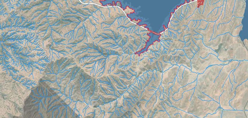
DRAFT

B.F. SISK DAM RAISE PROJECT
               Biological Survey Report
               Merced County, California

Prepared for                                      May 2020
CDM Smith Incorporated &
San Luis and Delta-Mendota Water Authority

2600 Capitol Avenue
Suite 200
Sacramento, CA 95816
esassoc.com

Bend               Orlando         San Jose
Camarillo          Pasadena        Santa Monica
Delray Beach       Petaluma        Sarasota
Destin             Portland        Seattle
Irvine             Sacramento      Tampa
Los Angeles        San Diego
Oakland            San Francisco

D201901099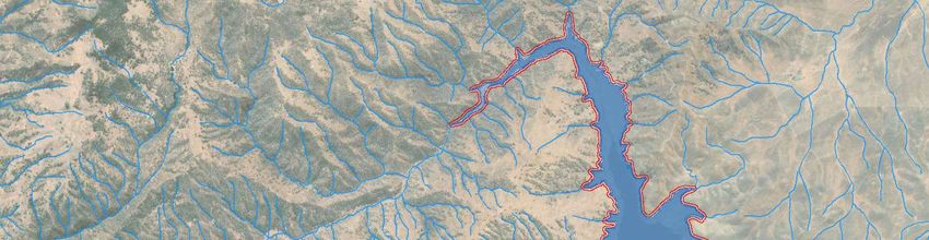
OUR COMMITMENT TO SUSTAINABILITY | ESA helps a variety of
public and private sector clients plan and prepare for climate change and
emerging regulations that limit GHG emissions. ESA is a registered
assessor with the California Climate Action Registry, a Climate Leader, and
founding reporter for the Climate Registry. ESA is also a corporate
member of the U.S. Green Building Council and the Business Council on
Climate Change (BC3). Internally, ESA has adopted a Sustainability Vision
and Policy Statement and a plan to reduce waste and energy within our
operations. This document was produced using recycled paper.
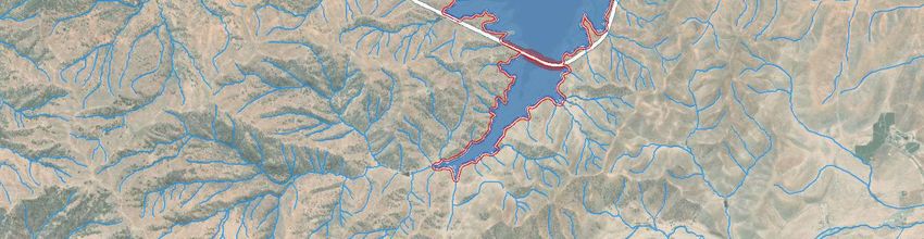
TABLE OF CONTENTS
B.F. Sisk Dam Raise Project Biological Survey
Report

                                                                                                                                    Page

Executive Summary ........................................................................................................ ES-1
Chapter 1, Introduction ...................................................................................................... 1-1
    1.1 Background and Purpose .................................................................................. 1-1
    1.2 Property Location .................................................................................................. 1-1
    1.3 Regulatory Context ............................................................................................... 1-5
Chapter 2, Methods ............................................................................................................ 2-1
    2.1 Study Area ............................................................................................................ 2-1
    2.2 Survey Methodology ............................................................................................. 2-1
    2.3 Review of Background Information ....................................................................... 2-5
Chapter 3, Environmental Setting..................................................................................... 3-1
    3.1 Natural Communities and Associated Wildlife Habitats......................................... 3-1
    3.2 Potential Waters of the United States ................................................................. 3-14
    3.3 Special-Status Species ....................................................................................... 3-14
    3.4 Critical Habitat for Listed Fish and Wildlife Species ............................................ 3-36
Chapter 4, References and Report Preparation............................................................... 4-1
    4.1 References ............................................................................................................ 4-1
    4.2 Document Preparation .......................................................................................... 4-5

Attachments
A.      Regulatory Context
B.      Plant Species Observed in the Study Area in March 2020
C.      Special-Status Species with Potential to Occur in the Study Area
D.      Wildlife Species Observed in the Study Area or Near Vicinity in March 2020
E.      Detailed Mapbook of Habitat Mapping in the Study Area
F.      Photographs of Ponds Assessed for California Red-Legged Frog and California Tiger
        Salamander Habitat
G.      California Natural Diversity Database Reporting Forms
H.      United States Fish and Wildlife Service, California Department of Fish and Wildlife, and
        California Native Plant Society Special-Status Species Lists

List of Tables
Table 3-1              Habitat Types by Acreages............................................................................ 3-3
Table 3-2              Ponds Assessed for Potential Breeding Sites for Special-Status
                       Species ........................................................................................................ 3-25

B.F. Sisk Dam Raise Project                                           i                                                   ESA / 201901099.00
Biological Survey Report                                                                                                            May 2020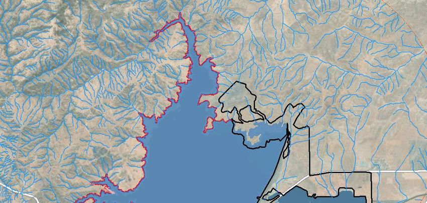
Table of Contents

                                                                                                                                Page
List of Figures
Figure 1-1             Regional Location .......................................................................................... 1-3
Figure 1-2             Land Ownership Adjacent to the Study Area ................................................. 1-4
Figure 2-1             Study Area and Survey Buffers ..................................................................... 2-3
Figure 3-1             Vegetation Communities in the Study Area ................................................... 3-2
Figure 3-2             Typical Annual Grassland Habitat in the Study Area
                       Photo dates: March 18 and 19, 2020 ............................................................. 3-4
Figure 3-3             Typical Blue Oak Woodland Habitats in the Study Area
                       Photo date: March 16, 2020 .......................................................................... 3-6
Figure 3-4             California Sycamore Woodland and California Sagebrush Scrub Photo
                       date: March 17, 2020 ..................................................................................... 3-8
Figure 3-5             Freshwater Emergent Wetlands and Seep Habitats in the Study Area.
                       Photo date: March 19, 2020 ........................................................................ 3-10
Figure 3-6             Intermittent Channel and Ephemeral Channel in the Study Area. Photo
                       dates: March 17 and 16, 2020 ..................................................................... 3-13
Figure 3-7             Potential Waters of the United States .......................................................... 3-15
Figure 3-8             CNDDB Occurrence Records within 5-miles of the Study Area ................... 3-17
Figure 3-9             Potential Ponds for Special-status Species ................................................. 3-24
Figure 3-10            USFWS Designated Critical Habitat in Proximity to the Study Area ............ 3-37

Acronyms and Other Abbreviations

 CDFW                                   California Department of Fish and Wildlife
 CEQA                                   California Environmental Quality Act
 CESA                                   California Endangered Species Act
 CFR                                    Code of Federal Regulations
 CNDDB                                  California Natural Diversity Database
 CNPS                                   California Native Plant Society
 CRPR                                   California Rare Plant Rank
 DPS                                    Distinct Population Segment
 ESA                                    Environmental Science Associates
 FESA                                   federal Endangered Species Act
 IC 1                                   unnamed intermittent channel 1
 MBTA                                   Migratory Bird Treaty Act
 NMFS                                   National Marine Fisheries Service
 SR                                     State Route
 USC                                    United States Code
 USFWS                                  United States Fish and Wildlife Service
 USGS                                   United States Geological Survey

B.F. Sisk Dam Raise Project                                         ii                                                ESA / 201901099.00
Biological Survey Report                                                                                                        May 2020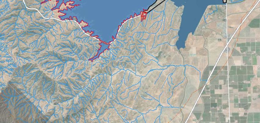
EXECUTIVE SUMMARY

The United States Department of the Interior, Bureau of Reclamation, the California Department
of Water Resources, and the San Luis & Delta-Mendota Water Authority are considering multiple
alternatives to improve the reliability of the water supply from San Luis Reservoir. In support of
the effort to evaluate a water crest raise of 10 feet, this report describes the biological resources
that occur within 61.60 acres of construction areas at State Route 152 and Dinosaur Point, and at
an approximately 382.89-acre strip along the edge of the reservoir in Merced County, California.

Vegetation communities and wildlife habitat in the Study Area include: annual grasslands, blue
oak woodlands, California sycamore woodland, California sagebrush scrub, urban, intermittent
channel, ephemeral channel, freshwater emergent, seep, and lacustrine. Ponds, which are not
directly located in the Study Area, are also discussed because of their importance in providing
aquatic breeding and non-breeding habitat for special-status species. Potential federal and state
jurisdictional wetlands were identified within the Study Area.

A total of 20 special-status species were identified as having moderate to high potential to occur
in the Study Area. These include the following wildlife species: San Joaquin coachwhip,
California tiger salamander, tricolored blackbird, golden eagle, western burrowing owl,
Swainson’s hawk, ferruginous hawk, northern harrier, prairie falcon, bald eagle, American
badger, and San Joaquin kit fox. In addition, western pond turtle and California red-legged frog
were identified at various locations within the Study Area during March 2020 reconnaissance-
level surveys. Special-status plants with potential to occur include Lemmon’s jewelflower,
Hospital Canyon larkspur, spiny-sepaled button-celery, arcuate bush-mallow, Hall’s bush
mallow, and chaparral ragwort.

B.F. Sisk Dam Raise Project                     ES-1                                    ESA / 201901099.00
Biological Survey Report                                                                          May 2020
Executive Summary

                              This page intentionally left blank

B.F. Sisk Dam Raise Project                 ES-2                   ESA / 201901099.00
Biological Survey Report                                                     May 2020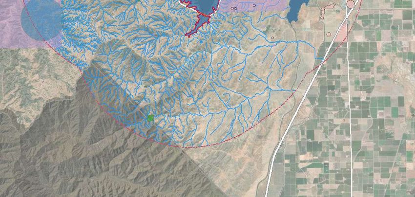
CHAPTER 1
Introduction

1.1 Background and Purpose
The United States Department of the Interior, Bureau of Reclamation, the California Department
of Water Resources, and the San Luis & Delta-Mendota Water Authority are considering multiple
alternatives to improve water supply reliability from San Luis Reservoir. Previous studies have
evaluated alternatives addressing water quality issues, including reservoir expansion (San Luis
Low Point Improvement Project), and multiple alternatives addressing dam safety risk (B.F. Sisk
Dam Safety of Dams Modification Project).

In support of the effort to evaluate a water crest raise of 10 feet, this report describes the
biological resources that would be affected by increased water levels and construction
improvements that would accompany the water raise. This report presents the findings of
reference vegetation, wildlife, and wetland surveys that identify the potential presence and
distribution of common and special-status plant and wildlife species, sensitive natural
communities, and federally and state-regulated waters and wetlands. The intent and scope of this
document is to characterize biological resources in the new inundation area of San Luis Reservoir
and characterize biological resources constraints that may affect the use of the site.

The biological Study Area, as described in this report, consists of areas on the edge of San Luis
Reservoir that would be inundated by the 10-foot increase in water crest level, as well as
construction improvements to facilities at the Dinosaur Point boat launch and State Route (SR)
152 at Cottonwood Bay. The water elevation would increase by 10 feet from the existing
elevation, 544 feet, to 554 feet above mean sea level. The surveys included an additional study
buffer of 100 feet in which the presence of biological resources was characterized for most
wildlife. Ponds that could support special-status species were assessed up to 1 mile from the
inundation footprint.

This report incorporates the findings of the representative biological surveys, which were
reconnaissance in level and were conducted in March 2020.

1.2 Property Location
The Study Area is located in Merced County, in the Pacheco Pass United States Geological
Survey (USGS) 7.5-minute quadrangle, and is positioned mostly south of SR 152 and west of
Interstate 5, in the far northwestern portion of the county (Figure 1-1). Situated on the eastern
slopes of the Diablo Range of the California Coast Ranges, the Study Area consists of steep hills

B.F. Sisk Dam Raise Project                     1-1                                   ESA / 201901099.00
Biological Survey Report                                                                        May 2020
1. Introduction

and valleys, with some rocky cliffs to the west progressing to rolling slopes and grasslands on
more flat terrain toward the east.

The Study Area includes the shoreline of San Luis Reservoir, excluding areas examined for the
B.F. Sisk Dam Safety of Dams Modification Project, located between the 544-foot contour
(current reservoir elevation at full capacity) and the 554-foot contour. The immediate area
surrounding San Luis Reservoir includes federally owned lands that are leased to the California
Department of Parks and Recreation for use as designated State Recreation Areas. Some private
lands within the Study Area would also be subject to inundation. State parks, wildlife areas, and
open cattle pastures occur beyond the immediate area surrounding San Luis Reservoir (Figure
1-2). SR 152 runs along and through the northern portion of the reservoir and between O’Neill
Forebay and San Luis Reservoir.

The Dinosaur Point Use Area is located on the west side of San Luis Reservoir, at the end of
Dinosaur Point Road, and contains a boat launch, parking, and picnic area (Figure 1-2). North of
Dinosaur Point Road is the San Luis Wildlife Area, which is managed by California Department
of Fish and Wildlife (CDFW) and is designated for hiking, bird-watching, and hunting. South of
Dinosaur Point Road is Pacheco State Park.

B.F. Sisk Dam Raise Project                     1-2                                   ESA / 201901099.00
Biological Survey Report                                                                        May 2020
¨
¦
§
5
Å
Ä
152
O'Neill
Forebay
San Luis Reservoir
Å
Ä
152
Path: U:\GIS\GIS\Projects\19xxxx\D191099_SanLuisReservoir\03_MXDs_Projects\BioBlitz_2020\Fig1_1_RegionalLocation.mxd, JMCNAMARA 4/28/2020
^
N N
0 40 0 2
Miles
Miles
SOURCE: ESA, 2020; National Hydrology Dataset, 2020;
B.F. Sisk Dam Raise Project - Biological Survey Report
Imagery-ESRI, 2020
2020 Study Area 100 foot Buffer Water Flowline Figure 1-1
Dinosaur Point Boat Launch Safety of Dams Study Area Pipeline
Inundation Area 5 mile Buffer Stream/River
Regional Location
State Route 152 ModificationsPrivate
Private
Upper Cottonwood Creek Cottonwood Bay
Lower Cottonwood Creek
Wildlife Area
Wildlife Area
Å
Ä
152 Honker Bay
San Luis Reservoir
Wildlife Area
rP
a u oint
Ro
s
ad
Dino
San Luis Reservoir
State Recreation Area
Dam
Path: U:\GIS\GIS\Projects\19xxxx\D191099_SanLuisReservoir\03_MXDs_Projects\BioBlitz_2020\Fig1_2_LandOwnerStudyArea.mxd, JMCNAMARA 4/28/2020
Pacheco State Park
Private
Lone Oak Bay
San
Luis
Cr
ee
k
Private
Portuguese Creek
Area
N
0 2
Miles
SOURCE: Property Boundary-CalFire, 2020; ESA, 2020;
B.F. Sisk Dam Raise Project - Biological Survey Report
National Hydrology Dataset, 2020;
2020 Study Area Bureau of Reclamation Water Flowline
Imagery-ESRI, 2020
Dinosaur Point Boat Launch California Department of Fish and Wildlife Pipeline Figure 1-2
Land Ownership Adjacent
Inundation Area California Department of Parks and Recreation Stream/River
State Route 152 Modifications California Department of Water Resources
100 foot Buffer Department of Defense to the Study Area
Safety of Dams Study Area1. Introduction
1.3 Regulatory Context
Biological resources in the Study Area may fall under the jurisdiction of various regulatory
agencies and be subject to their regulations. In general, the greatest legal protections are provided
for plant and wildlife species that are formally listed by the federal or state government. The
following regulations and agencies are commonly associated with projects that have the potential
to affect biological resources:
• Federal Endangered Species Act (FESA)
• Migratory Bird Treaty Act
• Bald and Golden Eagle Protection Act
• Clean Water Act, Section 404
• California Endangered Species Act (CESA)
• California Fish and Game Code Sections 3500–3705, Migratory Bird Protection
• Native Plant Protection Act
• California Fish and Game Code Section 1600, Lake or Streambed Alterations
• Porter-Cologne Water Quality Control Act
• California Environmental Quality Act (CEQA) Guidelines Section 15380
These regulations are presented and discussed in Attachment A.
B.F. Sisk Dam Raise Project 1-5 ESA / 201901099.00
Biological Survey Report May 20201. Introduction
This page intentionally left blank
B.F. Sisk Dam Raise Project 1-6 ESA / 201901099.00
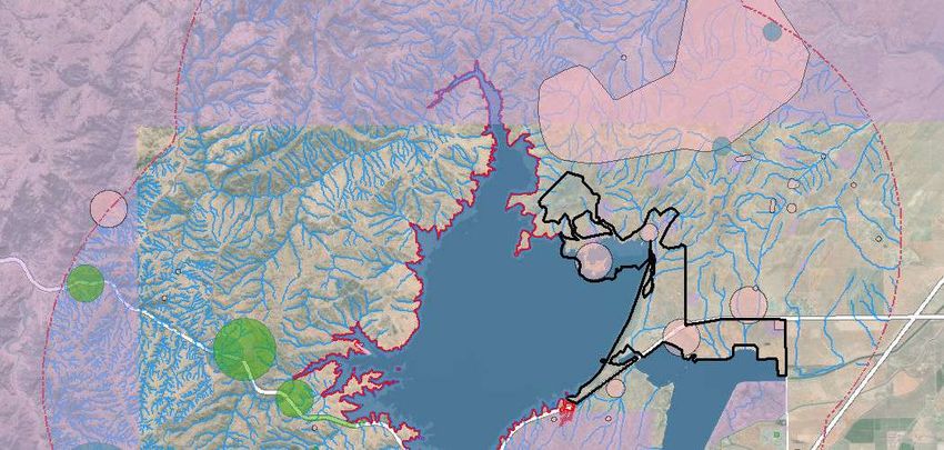
Biological Survey Report May 2020CHAPTER 2 Methods 2.1 Study Area The term Study Area in this report specifically refers to 382.89 acres along the edge of San Luis Reservoir that would be inundated by the increase in water crest elevation and 61.60 acres of lands at Dinosaur Point that includes the Dinosaur Point Boat Launch and Pacheco Pumping Plant berm. Three areas at SR 152 were also reviewed, including at Cottonwood Bay, the East Dike saddle, located approximately 1,300 feet north of the main dam embankment (near the Romero Visitor Center), and a small highway fill area approximately 2,100 feet southeast of Cottonwood Bay. These areas were used as the starting point to define the biological survey area; however, in practical terms, biological resources have varied sensitivity to disturbance, and a somewhat larger area was considered for many species. The Study Area for special-status plants and vegetation communities focused on the immediate Study Area; however, areas of potential habitat for special-status wildlife were also considered up to 100 feet beyond the Study Area (Figure 2-1). Ponds that could potentially support special-status species were analyzed at a buffer of up to one mile. 2.2 Survey Methodology 2.2.1 Survey Dates and Personnel Environmental Science Associates (ESA) wildlife biologists Brian Pittman, Kelly Bayne, Julie McNamara, and Joseph Huang conducted representative reconnaissance-level surveys of the Study Area March 16–19, 2020. The surveys were conducted to observe and characterize vegetation communities in the Study Area and to assess habitat quality and the potential for common and special-status wildlife species and special-status plant species. California red-legged frog specialists Kelly Bayne and Brian Pittman, CWB, were the lead surveyors for the frog habitat assessment. Dip net surveys for California red-legged frog were performed with advance approval from the United States Fish and Wildlife Service (USFWS) under Ms. Bayne’s and Mr. Pittman’s USFWS 10a(1)(A) recovery permits (#TE-185595 and TE-027422, respectively). An aquatic resource delineation (ESA 2020) and reconnaissance-level special-status plant survey was conducted by ESA Botanists Chuck Hughes and Joseph Sanders on March 16–19, 2020. All surveys conducted in March 2020 are a representative sample of the Study Area and should not be considered complete coverage of the Study Area. Cottonwood Bay, in the north arm of San Luis Reservoir, is private property and ESA was not able to obtain access for surveys B.F. Sisk Dam Raise Project 2-1 ESA / 201901099.00 Biological Survey Report May 2020
2. Methods

because inclement weather conditions resulted in poor road access. This area was surveyed
remotely via Google Earth and aerial imagery.

2.2.2 Habitat and Vegetation Surveys
No protocol-level rare plant surveys were performed as part of the 2020 surveys. Botanical
surveys were reconnaissance in nature to identify the potential locations of habitat for rare plants
and determine which species have the potential to occur in the Study Area. Plant species observed
in the Study Area in March 2020 are listed in Attachment B, Table B-1. Plant communities were
characterized for their potential to occur within the Study Area and buffer (Attachment C,
Table C-1).

Potential federal and state jurisdictional wetlands were identified within the Study Area.

2.2.3 Wildlife Surveys
No focused (i.e., protocol-level) surveys for the B.F. Sisk Dam Raise Project were conducted in
March 2020. Wildlife surveys of the Study Area were performed by ESA biologists Brian
Pittman, Kelly Bayne, Julie McNamara, and Joseph Huang March 16–19, 2020. Wildlife species
observed in the Study Area during these surveys are listed in Attachment D, Table D-1. Wildlife
surveys cataloged all common and special-status wildlife species observed within the Study
Area or nearby, and determined the potential presence of suitable habitat for special-status
wildlife species (Attachment C, Table C-2).

During each survey, biologists were dropped off by boat and surveyed accessible locations in the
Study Area on foot to assess habitat features that support wildlife species. Wildlife species were
documented when encountered. When access was possible, biologists walked up to about one-
half mile to investigate the suitability of seasonal and perennial ponds to support special-status
species. Ponds beyond this distance or on private property were reviewed using aerial imagery.

B.F. Sisk Dam Raise Project                     2-2                                    ESA / 201901099.00
Biological Survey Report                                                                         May 2020
COTTONWOOD BAY SR-152 IMPROVEMENTS ROMERO VISITORS CENTER SR-152 IMPROVEMENTS
N
0 800
N
0 800 Feet
Feet
Cottonwood Bay
Honker Bay
Å
Ä
152
oint Roa
rP d
u
sa
D i no
San Luis Reservoir
State Recreation Area
Dam
DINOSAUR POINT BOAT LAUNCH
Path: U:\GIS\GIS\Projects\19xxxx\D191099_SanLuisReservoir\03_MXDs_Projects\BioBlitz_2020\Fig2_1_StudyArea.mxd, JMCNAMARA 4/30/2020
Lone Oak Bay
Sa n L
uis C
r ee
k
Portuguese Creek
Area
N
0 800
Feet
N
0 2
Miles
SOURCE: ESA, 2020; National Hydrology Dataset, 2020;
B.F. Sisk Dam Raise Project - Biological Survey Report
Imagery-ESRI, 2020
2020 Study Area 100 foot Buffer Water Flowline Figure 2-1
Dinosaur Point Boat Launch Safety of Dams Study Area Pipeline Study Area and
Inundation Area Stream/River Survey Buffers
State Route 152 Modifications2. Methods
This page intentionally left blank
B.F. Sisk Dam Raise Project 2-4 ESA / 201901099.00
Biological Survey Report May 20202. Methods
2.3 Review of Background Information
Existing biological survey data were available for the Study Area from previous studies for
San Luis Reservoir. The following are the main documents used for this report:
• United States Department of the Interior, Bureau of Reclamation, and California Department
of Water Resources. 2019. B.F. Sisk Dam Safety of Dams Modification Project Final
Environmental Impact Statement/Environmental Impact Report. State Clearinghouse
#2009091004. August 2019.
• Environmental Science Associates. 2018. B.F. Sisk Safety of Dams Modification Project:
Biological Survey Report. Prepared for United States Department of the Interior, Bureau of
Reclamation, and California Department of Water Resources. October 2018.
• United States Department of the Interior, Bureau of Reclamation, and Santa Clara Valley
Water District. 2019. San Luis Low Point Improvement Project: Draft Environmental Impact
Statement/Environmental Impact Report. State Clearinghouse #2002082020. July 2019.
• Environmental Science Associates. 2019. Pacheco Reservoir Expansion Project: Biological
Survey Report. Prepared for United States Department of the Interior, Bureau of Reclamation,
and Santa Clara Valley Water District.
Before performing field surveys, ESA biologists reviewed publicly available and subscription-
based biological resource data. In part, the field surveys confirmed the general accuracy of the
publicly available data.
The following data sources assisted in this analysis:
• USGS topographic maps (Pacheco Pass and surrounding eight quadrangles)
• Historic and current aerial imagery (Google Earth 2020).
• California Wildlife Habitat Relationships database (CDFW 2020a).
• CDFW California Natural Diversity Database (CNDDB) (CDFW 2020b).
• The California Native Plant Society (CNPS) online database (CNPS 2020).
• A USFWS Information for Planning and Consultation species list (USFWS 2020).
B.F. Sisk Dam Raise Project 2-5 ESA / 201901099.00
Biological Survey Report May 20202. Methods
This page intentionally left blank
B.F. Sisk Dam Raise Project 2-6 ESA / 201901099.00
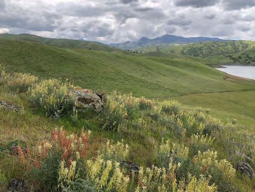
Biological Survey Report May 2020CHAPTER 3 Environmental Setting This chapter provides the environmental baseline for natural communities and habitats, wetlands, and special-status plant and wildlife species in the Study Area. 3.1 Natural Communities and Associated Wildlife Habitats Ten habitat types were identified within the Study Area and the 100-foot buffer. They can be divided into two main classifications: uplands and aquatic habitats. Natural communities are assemblages of plant species that occur together in the same area and are defined by species composition and relative abundance. The natural community classification presented herein is based on field observations and the current California Natural Community List maintained by CDFW (2019) at the alliance level. Plant communities generally correlate with wildlife habitat types; wildlife habitats were classified and evaluated using A Guide to Wildlife Habitats of California (Mayer and Laudenslayer 1988). The distribution of vegetation communities in the Study Area is presented in Figure 3-1 and in Attachment E, Detailed Mapbook of Habitat Mapping in the Study Area. Table 3-1 provides a summary and acreages of the habitat types in the Study Area. Note that the acreages presented exclude the 100-foot buffer. Ponds are included in the discussion of habitats, as they relate to wildlife species, but they are not located within the Study Area. Commonly occurring wildlife are identified for each habitat type. 3.1.1 Annual Grassland Description Annual grassland composes the majority of the terrestrial habitat in the San Luis Reservoir region. Annual grassland corresponds to the wild oats and annual brome grassland (Avena spp.–Bromus spp.) alliance recognized by CDFW (2019). Most of the east side of the Study Area consists of annual grassland. Most grassland areas have not been grazed recently and are dominated by tall non-native annual grasses interspersed with forbs. The annual grassland is heavily invaded by non-natives overall, but natives are still common in some areas, particularly in rockier areas. Dominant plants include bromes (Bromus spp.), wild oat (Avena spp.), Italian ryegrass (Festuca perennis), clovers (Trifolium spp.), bur clover (Medicago polymorpha), and stork’s bill (Erodium spp.). B.F. Sisk Dam Raise Project 3-1 ESA / 201901099.00 Biological Survey Report May 2020
Cottonwood Bay
Path: U:\GIS\GIS\Projects\19xxxx\D191099_SanLuisReservoir\03_MXDs_Projects\BioBlitz_2020\Fig3_1_HabitatMapping.mxd, JMCNAMARA 4/30/2020
Honker Bay
O'Neill Forebay
Wildlife Area
ur
s a Po i
nt
San Luis Reservoir
o
R o ad
Din
State Recreation Area
Dam
Å
Ä
152
Å
Ä
152
Lone Oak Bay
San
L ui s
Cr
e ek
N
Portuguese Creek
0 800
Area
Feet
N
0 2
Miles
SOURCE: ESA, 2020; Merced County GIS - Original Habitat Mapping,
B.F. Sisk Dam Raise Project - Biological Survey Report
Imagery-ESRI, 2020
2020 Study Area 5 mile Buffer Type California Sycamore Woodland Pond
Dinosaur Point Boat Launch
Inundation Area
Safety of Dams Study Area
County Line
Agriculture
Annual Grasslands
Ephemeral Channel
Intermittent Channel
Purple Needle Grass
Seep Figure 3-1
State Route 152 Modifications Water Flowline
100 foot Buffer Pipeline
Blue Oak Woodland
California Sagebrush Scrub
Emergent Wetland
Lacustrine
Urban
Vegetation Communities
Stream/River in the Study Area
* A detailed mapbook of vegetation communities in the Study Area can be found in the Attachments.3. Environmental Setting
TABLE 3-1
HABITAT TYPES BY ACREAGES
Habitat Type Acreage1
Uplands Habitats
Annual Grassland 336.34
Perennial Grassland 3.95
Blue Oak Woodland 55.13
California Sycamore Woodland 0.36
California Sagebrush Scrub 4.21
Urban 26.20
Aquatic Features
Pond 0.12
Intermittent Channel 3.37
Ephemeral Channel 0.86
Freshwater Emergent 1.19
Seep 0.04
Lacustrine 12.79
Total 444.55
SOURCE:
Data compiled by Environmental Science Associates in 2020
1
Geographic information system calculations may not reflect exact acreage of study area due to rounding.
Native perennial purple needlegrass (Stipa pulchra), a CDFW sensitive natural community, is
present in low abundance in some grassland areas, totaling 3.95 acres. Patches of native perennial
Stanislaus milkvetch (Astragalus oxyphysus) are also present, particularly in the more eastern
portions of the study area. Isolated trees and shrubs occur in the grassland. Figure 3-2 provides
representative photos of Study Area grasslands. Annual grassland is not a sensitive natural
community (CDFW 2019).
Wildlife Habitat Relationships with Annual Grassland
Annual grassland provides little cover for wildlife, yet numerous species forage and several
species breed in this habitat. Some areas of grasslands in the Study Area are seasonally grazed.
Grasslands attract reptiles and amphibians such as western fence lizard (Sceloporus occidentalis),
common garter snake (Thamnophis sirtalis), and western rattlesnake (Crotalus viridis).
Bird species that nest in grasslands include northern harrier (Circus cyaneus), burrowing owl
(Athene cunicularia), western meadowlark (Sturnella neglecta), and California horned lark
(Eremophila alpestris). Birds that commonly forage in grasslands include turkey vulture
(Cathartes aura), red-tailed hawk (Buteo jamaicensis), American kestrel (Falco sparverius),
white-tailed kite (Elanus leucurus), and golden eagle (Aquila chrysaetos).
Common small mammals expected in the Study Area include western harvest mouse
(Reithrodontomys megalotis), California ground squirrel (Otospermophilus beecheyi), California
vole (Microtus californicus), Botta’s pocket gopher (Thomomys bottae), desert cottontail
(Sylvilagus audubonii), and black-tailed jackrabbit (Lepus californicus).
B.F. Sisk Dam Raise Project 3-3 ESA / 201901099.00
Biological Survey Report May 2020Source: Environmental Science Associates
B.F. Sisk Dam Raise Project
Figure 3-2
Typical Annual Grassland Habitat in the Study Area
Photo dates: March 18 and 19, 20203. Environmental Setting Grasslands are important foraging grounds for aerial and ground-foraging insect eaters such as Myotis bat species and pallid bat (Antrozous pallidus). Larger mammal species such as tule elk (Cervus canadensis nannodes), black-tailed deer (Odocoileus hemionus columbianus), coyote (Canis latrans), and San Joaquin kit fox (Vulpes macrotis mutica) may use grasslands in the Study Area. 3.1.2 Blue Oak Woodland Description Blue oak woodlands tend to occur on the west side of the Study Area. They are dominated by blue oak (Quercus douglasii), with California buckeye (Aesculus californica) trees occurring in lower abundance, mostly on northern aspect slopes. Trees are well-spaced and in most places lack a shrub understory. The herb layer is similar to the grassland community, except that in general there is a higher component of native species. Figure 3-3 provides representative photos of woodlands and forests. Some associations of blue oak woodland are sensitive natural communities. The CDFW (2019) list was reviewed; none of the sensitive associations occur in the Study Area because some of the co-dominant species either do not occur in the Study Area at all, or occur only in low abundance. Wildlife Habitat Relationships with Blue Oak Woodland Animals within blue oak woodlands in the Study Area are those that rely heavily on acorns, such as the acorn disseminators western scrub jay (Aphelocoma californica), acorn woodpecker (Melanerpes formicivorus), and western gray squirrel (Sciurus griseus). Wild turkey (Meleagris gallopavo), California quail (Callipepla californica), dusky-footed woodrat (Neotoma fuscipes), feral pig (Sus scrofa), and black-tailed deer use acorns as a major food source. Chestnut-backed chickadee (Poecile rufescens), oak titmouse (Baeolophus inornatus), Hutton’s vireo (Vireo huttoni), dark-eyed junco (Junco hyemalis), ash-throated flycatcher (Myiarchus tuberculifer), brown creeper (Certhia americana), northern flicker (Colaptes auratus), Lawrence’s goldfinch (Carduelis lawrencei), and lesser goldfinch (Spinus psaltria), also nest in woodland habitat. Cavity nesters include great horned owl (Bubo virginianus), western bluebird (Sialia mexicana), and ash-throated flycatcher. Special-status birds such as Cooper’s hawk (Accipiter cooperii) and sharp-shinned hawk (Accipiter striatus) are known to nest in this habitat classification; and pallid bat, also a special-status species, inhabits cismontane woodlands. Many amphibians and reptiles are found on the forest floor where moisture is retained under fallen wood and in tree crevices. Among these species are arboreal salamander (Aneides lugubris), Pacific slender salamander (Batrachoseps pacificus), ensatina (Ensatina eschscholtzii), and Sierran treefrog (Pseudacris sierra). Reptiles include western fence lizard, southern alligator lizard (Elgaria multicarinata ssp. multicarinata), ringneck snake (Diadophis punctatus), western skink (Eumeces skiltonianus), rubber boa (Charina bottae), pacific gopher snake (Pituophis catenifer catenifer), western rattlesnake (Crotalus viridis helleri), California kingsnake (Lampropeltis zonata), and sharp-tailed snake (Contia tenuis). Wildlife species observed during the field surveys are listed in Attachment D, Table D-1. B.F. Sisk Dam Raise Project 3-5 ESA / 201901099.00 Biological Survey Report May 2020
Source: Environmental Science Associates
                                                                            B.F. Sisk Dam Raise Project
                                                                                     Figure 3-3
                                           Typical Blue Oak Woodland Habitats in the Study Area
                                                                   Photo date: March 16, 2020
3. Environmental Setting 3.1.3 California Sycamore Woodland Description California sycamore woodland occurs in two limited areas in the study area: along San Luis Creek and an unnamed intermittent channel (channel IC 1). California sycamore (Platanus racemosa) is the dominant tree. Along San Luis Creek the sycamores are widely spaced, few other trees are present along the margins of the creek, and the understory is similar to that of annual grassland. Along IC 1, the sycamores exist with an understory of willows (Salix sp.) and mule fat (Baccharis salicifolia) providing more shade to the creek. California sycamore woodland is a sensitive natural community (CDFW 2019). Figure 3-4 provides a representative photo of California sycamore woodland. Wildlife Habitat Relationships with California Sycamore Woodland California sycamore woodland habitat in the Study Area is not extensive and runs adjacent to San Luis Creek. Therefore, wildlife expected to use this habitat include species similar to those that use blue oak woodlands and annual grasslands, but may also use or need an aquatic feature for their life cycle. Amphibians may use the overhanging roots as refuge. Avian species such as belted kingfisher (Megaceryle alcyon) may use sycamores as perches for hunting. 3.1.4 California Sagebrush Scrub Description Chaparral in the Study Area is dominated by California sagebrush (Artemisia californica). California buckwheat (Eriogonum fasciculatum) and chamise (Adenostoma fasciculatum) are present in lower abundance. Trees are isolated and uncommon. The herb layer is sparse and non-native annual grasses are a substantial component. Figure 3-4 provides a representative photo of chaparral. Some associations of California sagebrush scrub are sensitive natural communities. The CDFW (2019) list was reviewed; none of the sensitive associations occur within the Study Area because some of the co-dominant species either do not occur in the Study Area at all or occur only in low abundance. Wildlife Habitat Relationships with California Sagebrush Scrub California sagebrush habitat provides cover for wildlife including desert, western rattlesnake, coyote, and special-status San Joaquin coachwhip (Masticophis flagellum). B.F. Sisk Dam Raise Project 3-7 ESA / 201901099.00 Biological Survey Report May 2020
Source: Environmental Science Associates
                                                                   B.F. Sisk Dam Raise Project
                                                                            Figure 3-4
           California Sycamore Woodland (top) and California Sagebrush Scrub (bottom).
                                                            Photo date: March 17, 2020
3. Environmental Setting 3.1.5 Pond Description Pond habitat in the Study Area includes any aquatic habitat that contains relatively slow-moving to stagnant perennial water up to about 5 acres in size. These ponds can result from either human manipulation or a natural process and include bermed ponds within existing perennial streams, stock ponds, and natural ponds disconnected from any aboveground water sources. Often these ponds do not contain a complex vertical structure, but they can contain some aquatic vegetation or woody debris. Associated plants can include cattail (Typha sp.), curly dock (Rumex crispus), clustered dock (Rumex conglomeratus), and rough cocklebur (Xanthium strumarium). Some ponds are used as stock ponds (water sources for cattle), as indicated by their low vegetative cover and the presence of hoof prints, while others appear to have cattle access. Representative photographs of the pond classification in the Study Area are presented in Attachment F. Wildlife Habitat Relationships with Ponds Ponds provide habitat for species that either live in them or use them for breeding or foraging. These species include California newt (Taricha torosa) and occasionally western pond turtle (Actinemys marmorata). One western pond turtle was observed at a perennial pond within the current reservoir footprint above San Luis Creek (Attachment G). A few ponds in the Study Area also provide potential breeding habitat for California tiger salamander (Ambystoma californiense) and/or California red-legged frog (Rana draytonii), which are discussed in the following sections. Ponds with dense enough emergent vegetation provide habitat for the special-status tricolored blackbird (Agelaius tricolor). 3.1.6 Freshwater Emergent Wetland Description Emergent wetlands are a small component of the Study Area, mostly occurring downhill from seeps or stock ponds. Many of the stock ponds are uphill and outside of the Study Area. They impound water well into the dry season and leak water downhill into the emergent wetlands. The emergent wetlands are dominated by perennial hydrophytic vegetation including Baltic rush (Juncus balticus), iris-leaved rush (J. xiphioides), cattail (Typha sp.), hedge-nettle (Stachys ajugoides), dock (Rumex sp.), and rye grass (Festuca perennis). Soils are hydrophytic. Surface water, or saturation in the upper 12 inches of the soil, was present in most of the emergent wetlands during the March 2020 surveys. Figure 3-5 provides a representative photo of freshwater emergent wetlands. Wildlife Habitat Relationships with Freshwater Emergent Wetlands Emergent wetlands are important foraging and breeding habitat for many species of waterbirds: wading birds such as great egret (Ardea alba); waterfowl including green-winged teal (Anas crecca), mallard (A. platyrhynchos), and American coot (Fulica americana); shorebirds B.F. Sisk Dam Raise Project 3-9 ESA / 201901099.00 Biological Survey Report April 2020
Source: Environmental Science Associates
                                                                B.F. Sisk Dam Raise Project
                                                                         Figure 3-5
   Freshwater Emergent Wetlands (top) and Seep (bottom) Habitats in the Study Area.
                                                       Photo date: March 19, 2020
3. Environmental Setting including killdeer (Charadrius vociferous), black-necked stilt (Himantopus mexicanus), greater yellowlegs (Tringa melanoleuca), and American avocet (Recurvirostra americana); and passerines including Brewer’s blackbird (Euphagus cyanocephalus), red-winged blackbird (Agelaius phoeniceus), brown-headed cowbird (Molothrus ater), and American pipit (Anthus rubescens). Emergent wetlands provide wildlife habitat similar to that provided by ponds. 3.1.7 Seeps Description Seeps are a small component of the Study Area. Areas mapped as seeps were categorized by locations where groundwater appeared to be expressing at the surface, and not merely collecting or flowing from uphill runoff. The USGS topographic quadrangle map names two of the seeps as springs: Coyote Spring and La Baig Spring. Figure 3-5 provides a representative photo of seep habitat. Like emergent wetlands, seeps are dominated by perennial hydrophytic vegetation. Soils are hydrophytic. Surface water, or saturation in the upper 12 inches of the soil, was present in most of the emergent wetlands during the March 2020 surveys. Wildlife Habitat Relationships with Seeps Wildlife species associated with seeps are similar to those associated with freshwater emergent wetlands. The seeps may provide water for wildlife farther into the dry season than the emergent wetlands. 3.1.8 Intermittent Channels Description Intermittent channels have flowing water seasonally. Groundwater is the primary component of flow, and runoff from precipitation is a supplemental flow source. Intermittent channels are generally dry by the mid to late summer. Three of the intermittent channels in the Study Area are named San Luis Creek, Portuguese Creek, and Cottonwood Creek. San Luis Creek, the largest intermittent channel in the Study Area, was flowing during the March 2020 surveys. This creek has a bed composed mostly of cobble and gravel. San Luis Creek is large enough to support a narrow band of California sycamores (Platanus racemosa) that grow along the reach in the Study Area. Portuguese Creek has a bed composed primarily of boulders and cobble, and was flowing during the March 2020 surveys. The creek bed is mostly unvegetated, but sparse perennial hydrophytic vegetation occurs, mostly mule fat. There is no riparian corridor outside of the creek bed and bank. Cottonwood Creek, at the far northern end of San Luis Reservoir, drains into the Cottonwood Bay area. Cottonwood Creek appears to have a bed composed primarily of bedrock and cobble. No woody riparian vegetation is visible along the creek in the Study Area. B.F. Sisk Dam Raise Project 3-11 ESA / 201901099.00 Biological Survey Report May 2020
3. Environmental Setting

Intermittent channel 1 (IC 1), the largest unnamed channel in the Study Area, is located slightly
north of Dinosaur Point Road. IC 1 has a bed composed of cobble and gravel. It was flowing
during the March 2020 surveys. The creek bed is mostly unvegetated, but occasional woody
riparian species do occur. IC 1 is large enough in the Study Area to support a narrow band of
riparian vegetation. The riparian vegetation is dominated by California sycamore, is relatively
dense, and shades much of the channel.

The other intermittent channels in the Study Area are smaller than the four described separately
above. They generally have a bed composed of either scoured rock or thick mud. Several are
downhill from stock ponds that appear to leak water into the channels well into the dry season in
some years. In addition, the USGS topographic quadrangle maps show numerous springs in the
small watersheds west of the reservoir. Figure 3-6 provides a representative photo of an
intermittent channel.

Wildlife Habitat Relationships with Intermittent Channels
Wildlife associated with intermittent channels include amphibians, such as California red-legged
frog, that may use the channels during the wet season for dispersal and foraging. Mammals may
also use intermittent channels for dispersal and access to water during the spring into the summer.
Avian species likely use intermittent channels for foraging.

3.1.9 Ephemeral Channels
Description
Ephemeral channels flow sporadically and temporarily in response to precipitation during the wet
season, but their flow is too brief to support a riparian community. Groundwater is not a
component of flow. The ephemeral channels were dry during the March 2020 surveys. Most of
the ephemeral channels have beds of scoured soil, and many are on very steep slopes above the
reservoir. Figure 3-6 provides a representative photo of an intermittent channel.

Wildlife Habitat Relationships with Ephemeral Channels
Wildlife species associated with ephemeral channels are similar to those associated with
intermittent channels. This community provides less access to water for wildlife because it flows
only sporadically, in response to precipitation.

3.1.10 Lacustrine
Description
Lacustrine habitat in the Study Area includes San Luis Reservoir. This natural community is used
for large, permanent bodies of water that do not support emergent vegetation and are not subject
to tidal exchange; these water bodies include lakes, ponds, oxbows, gravel pits, and flooded
islands.

Pond plant associates may be present along the edges of the reservoir in low-water years and
where the water is shallow.

B.F. Sisk Dam Raise Project                    3-12                                   ESA / 201901099.00
Biological Survey Report                                                                        May 2020
Source: Environmental Science Associates
                                                                     B.F. Sisk Dam Raise Project
                                                                              Figure 3-6
            Intermittent Channel (top) and Ephemeral Channel (bottom) in the Study Area.
                                                    Photo dates: March 17 and 16, 2020
3. Environmental Setting
3.1.11 Disturbed/Urban
Description
Urban/disturbed areas include the boat ramp, facilities, roads, and roadsides. These areas have either
maintained landscapes or ruderal vegetation.
Wildlife Habitat Relationships with Disturbed/ Urban
Developed areas provide limited habitat for wildlife. However, bird species typically found in
developed areas include American robin (Turdus migratorius), mockingbird (Mimus polyglottos),
American crow (Corvus brachyrhynchos), house sparrow (Passer domesticus), European starling
(Sturnus vulgaris), and rock pigeon (Columba livia). Other wildlife adapted to living in
developed areas include Norway rat (Rattus norvegicus), western gray squirrel (Sciurus niger),
opossum (Didelphis virginiana), and raccoon (Procyon lotor).
3.2 Potential Waters of the United States
The intermittent/ephemeral channels, freshwater emergent wetland, and seeps are a special-status
natural community because they are potential waters of the United States and state subject to
regulation by the United States Army Corps of Engineers and the Central Valley Water Quality
Control Board. These areas are depicted in Figure 3-7.
3.3 Special-Status Species
Several species known to occur in or near the Study Area are protected by federal and/or state
endangered species laws, or have been designated as Species of Special Concern by CDFW. In
addition, Section 15380(b) of the CEQA Guidelines defines rare, endangered, or threatened
species that are not included in any listing. 1 Species recognized under these terms are collectively
referred to as special-status species.
A list of special-status wildlife and plant species with potential to occur in or near the Study Area
was compiled from nine-quadrangle searches of the CNDDB (CDFW 2020b) and CNPS’s Rare
Plant Inventory (CNPS 2020); a search of the USFWS Information for Planning and Consultation
database (USFWS 2020); and review of biological literature of the region for the following
7.5-minute USGS topographic quadrangles:
Mustang Peak Crevison Peak Howard Ranch
Pacheco Peak Pacheco Pass San Luis Dam
Three Sisters Mariposa Peak Los Banos Valley
1 For example, vascular plants listed as rare or endangered or as Rare Plant Rank 1 or 2 by CDFW are considered to
meet the requirements of CEQA Guidelines Section 15380(b).
B.F. Sisk Dam Raise Project 3-14 ESA / 201901099.00
Biological Survey Report May 2020WETLANDS
N
0 800
Cottonwood Bay
Feet
Honker Bay
ur
s a Po i
nt
San Luis Reservoir
Dino
R o ad
State Recreation Area
Dam
Å
Ä
152
Path: U:\GIS\GIS\Projects\19xxxx\D191099_SanLuisReservoir\03_MXDs_Projects\BioBlitz_2020\FigXX_Waters.mxd, JMCNAMARA 4/29/2020
OTHER WATERS
Lone Oak Bay
San
L ui s
Cr
ee
k
Portuguese Creek
Area
N
0 2
Miles
N
0 800
2020 Study Area Other Waters Wetlands
Feet Dinosaur Point Boat Launch Ephemeral Channel Emergent Wetlands
Inundation Area Intermittent Channel Seep
State Route 152 Modifications Lacustrine Water Flowline
100 foot Buffer Stockpond Pipeline
2018 Study Area Stream/River
SOURCE: ESA, 2020; National Hydrology Dataset, 2020;
Imagery-ESRI, 2020 B.F. Sisk Dam Raise Project - Biological Survey Report Figure 3-7
Potential Waters of the United States3. Environmental Setting From the full list of species, each species was individually assessed based on habitat requirements and distribution relative to the vegetation communities present in and around the Study Area, and on the results of previous surveys and assessments. Special-status fish species are not analyzed in this report and do not occur in the Study Area. Comprehensive lists of the special-status plant and wildlife species considered in the analysis are provided in Attachment C and Attachment H. The species with moderate or high potential to occur in the Study Area are described below in greater detail. Figure 3-8 presents a map of CNDDB special-status species occurrences within 5 miles of the Study Area. A total of 20 special-status plants and wildlife species were identified as having moderate or high potential to occur in or near the Study Area. The special-status plants include Lemmon’s jewelflower, Hospital Canyon larkspur, spiny-sepaled button-celery, arcuate bush- mallow, Hall’s bush mallow, and chaparral ragwort. The special-status wildlife species include San Joaquin coachwhip, California tiger salamander, tricolored blackbird, golden eagle, western burrowing owl, Swainson’s hawk, ferruginous hawk, northern harrier, prairie falcon, bald eagle, American badger, and San Joaquin kit fox. Western pond turtles and California red-legged frogs were present in the Study Area during the March 2020 reconnaissance-level surveys. 3.3.1 Special-Status Plants Lemmon’s Jewelflower Lemmon’s jewelflower (Caulanthus lemmonii) is not listed under the FESA or CESA. It has a California Rare Plant Rank (CRPR) of 1B.2. Lemmon’s jewelflower is an annual herb found in pinyon and juniper woodland, chaparral, and valley and foothill grassland from 250 to 5,200 feet in elevation. The blooming period is from February through May. It is known from the Bay Area, San Joaquin Valley, and south Coast Ranges (CNPS 2020; Jepson 2020). There is one record in the vicinity of San Luis Reservoir (CNDDB Occurrence #48). The record is a 1986 collection about 5.4 miles to the southeast. The habitat is described as an exposed south-facing conglomerate rock outcrop on middle and lower slopes along a creek (CCH 2020). Some of the soils in the study area have conglomerate as the parent material. Rock outcrops or areas of thin soil over bedrock in the Study Area, especially in drier areas such as grassland, chaparral, and south-facing slopes, provide potential habitat for Lemmon’s jewelflower. Lemmon’s jewelflower has moderate potential to occur in the Study Area. During the reconnaissance survey, several rock outcrops were inspected for special-status plants in general and Lemmon’s jewelflower was not observed. Hospital Canyon Larkspur Hospital Canyon larkspur (Delphinium californicum ssp. interius) is not listed under the FESA or CESA. It has a CRPR of 1B.2. B.F. Sisk Dam Raise Project 3-16 ESA / 201901099.00 Biological Survey Report May 2020
¨
¦
§ 5
Cottonwood Bay
Honker Bay
O'Neill Forebay
Wildlife Area
o s au r P d San Luis Reservoir
o i n t R oa
State Recreation Area
Din
Å
Ä
152 Dam
Å
Ä
152
Path: U:\GIS\GIS\Projects\19xxxx\D191099_SanLuisReservoir\03_MXDs_Projects\BioBlitz_2020\FigX_CNDDB.mxd, JMCNAMARA 4/30/2020
Lone Oak Bay
S an
Lu
is C
reek
Portuguese Creek
Area
N
0 2
Miles
SOURCE: ESA, 2020; Imagery-ESRI, 2020;
B.F. Sisk Dam Raise Project - Biological Survey Report
CDFW, 2020; USFWS, 2020
2020 Study Area 100 foot Buffer Plants Figure 3-8
Dinosaur Point Boat Launch
Inundation Area
5-mile Buffer
Safety of Dams Study Area
Amphibians and Reptiles
Birds
CNDDB Occurrence Records
State Route 152 Modifications Mammals within 5-miles of
the Study Area3. Environmental Setting Hospital Canyon larkspur is a perennial herb found in chaparral openings, mesic cismontane woodland, and coastal scrub from 600 to 3,600 feet in elevation. The blooming period is from April through June. It is known from the Bay Area and inner south Coast Ranges (CNPS 2020; Jepson 2020). There is one record in the vicinity of San Luis Reservoir (CNDDB Occurrence #3). The occurrence is about 3.5 miles to the north and based on a 1995 collection (CCH 2020). The habitat is described as a “canyon bottom setting bordering woodland” downhill from a spring. The woodland is described with California buckeye and holly leaf cherry (Prunus ilicifolia). Chaparral and woodland in the Study Area, especially in more mesic areas such as north-facing slopes or areas near intermittent creeks or seeps, provide potential habitat for Hospital Canyon larkspur. Hospital Canyon larkspur has moderate potential to occur in the Study Area. This species was not observed during the reconnaissance survey. Spiny-Sepaled Button-Celery Spiny-sepaled button-celery (Eryngium spinosepalum) is not listed under the FESA or CESA. It has a CRPR of 1B.2. Spiny-sepaled button-celery is a biennial to perennial herb found in vernal pools, swales, and ditches of valley and foothill grassland from 250 to 3,200 feet in elevation. The blooming period is from April through June. It is known from the San Joaquin Valley and southern Sierra Nevada foothills (CNPS 2020; Jepson 2020). There are two records in the vicinity of San Luis Reservoir (CNDDB Occurrences #91 and #103). Occurrence #103 is about 4 miles to the east near Santa Nella on clay soil in grassland. Occurrence #91 is based on a 2010 collection in the Study Area, although the CNDDB record is mapped along SR 152 (CCH 2020). The elevation of the collection was reported at 545 feet, very near the elevation of the San Luis Reservoir spillway (544 feet). The habitat of the collection was described as grassland, with species associates that are common in the study area, and also just below the Study Area at the highest elevations reached by the water surface when the reservoir is full. Eryngium was observed in another area during the reconnaissance survey. The specimens were observed near a swale in a grassy area a few feet above the spillway elevation. They were not in or near bloom and could not be identified to species. Spiny-sepaled button-celery is differentiated from common Eryngium species that also occur in the area, primarily on floral and fruit characteristics. The habitat described for the location of the 2010 collection is common in the study area. Spiny- sepaled button-celery and Eryngium in general tend to occur in areas of seasonally mesic conditions. The 2010 collection is along the reservoir margin. It is possible that spiny-sepaled button-celery occurs in multiple locations along the reservoir margin, as there is nothing unique about the habitat or location where the collection was made. Spiny-sepaled button-celery has high potential to occur in the Study Area. B.F. Sisk Dam Raise Project 3-18 ESA / 201901099.00 Biological Survey Report May 2020
3. Environmental Setting

Arcuate Bush-mallow
Arcuate bush-mallow (Malacothamnus arcuatus) is not listed under the FESA or CESA. It has a
CRPR of 1B.2. Arcuate bush-mallow is recognized at the species level by CNPS, but Jepson
(2020) treats it as a synonym of M. fasciculatus.

Arcuate bush-mallow is a perennial evergreen shrub found in open chaparral and cismontane
woodland from 250 to 1,200 feet in elevation. The blooming period is from April through
September. There are no CNDDB records near the Study Area. There are multiple collection
records of M. fasciculatus from 1894 to 1950 in the vicinity of Pacheco Pass, approximately
1 mile west of the Study Area (CCH 2020). Some subspecies of M. fasciculatus circumscribe the
taxon described as M. arcuatus by CNPS and previous authors. The older collections of M.
fasciculatus near Pacheco Pass do not report a subspecies.

The Study Area, especially chaparral and the edges of woodland, could provide potential habitat
for arcuate bush-mallow. Arcuate bush-mallow has moderate potential to occur in the Study Area.
Arcuate bush-mallow was not observed during the reconnaissance survey.

Hall’s Bush-mallow
Hall’s bush-mallow (Malacothamnus hallii) is not listed under the FESA or CESA. It has a
CRPR of 1B.2.

Hall’s bush-mallow is a perennial evergreen shrub found in open chaparral and cismontane
woodland from 30 to 2,500 feet in elevation. The blooming period is from April through October.
It is known from the north Coast Ranges, Bay Area, San Joaquin Valley, Sierra Nevada foothills,
and central high Sierra Nevada (CNPS 2020; Jepson 2020).

There are seven records of Hall’s bush-mallow in the vicinity of San Luis Reservoir:

•     One occurrence (CNDDB #1) is about 4 miles to the south from 1986, at a seep in grassland
      on a south-facing slope.
•     One occurrence (CNDDB #48), from 2016, is about 0.7 mile to the north in the Cottonwood
      Creek Wildlife Area.
•     Three occurrences (CNDDB #2, 3, 18) along SR 152 west of the Study Area encompass
      several historical collections from the 1800s until 1950.
•     One occurrence (CNDDB #33) is just south of SR 152, about 0.3 mile from the study area.
      There are two collections from that location, from 1994 and 1995. The habitat is described as
      “open chaparral on sedimentary rocks” and “open slope” (CCH 2020).
•     The last occurrence (CNDDB #39) is very near the study area, but there are some
      uncertainties regarding the precise location. The occurrence is based on a 2002 collection.
      The CNDDB mapped the occurrence around a pull-off along SR 152. The pull-off is about
      250 feet from the Study Area. The coordinates in CCH (2020) place the location below the
      San Luis Reservoir spillway’s elevation (which is not consistent with the species’ biology),
      but the reported elevation is 662 feet, which is even higher than SR 152 at the pull-off. The
      likely location is one of two small hills between SR 152 and the reservoir, adjacent to the

B.F. Sisk Dam Raise Project                      3-19                                     ESA / 201901099.00
Biological Survey Report                                                                            May 2020
You can also read