Characterisation and conservation assessment of terrestrial biodiversity in the Ghar El Melh area - IUCN Centre for Mediterranean Cooperation WWF ...
←
→
Page content transcription
If your browser does not render page correctly, please read the page content below
Characterisation and
conservation assessment of
terrestrial biodiversity in the
Ghar El Melh area
IUCN Centre for Mediterranean Cooperation
WWF North Africa

                                                 164 mm

INTERNATIONAL UNION FOR CONSERVATION OF NATURE
Characterisation and
conservation assessment of
terrestrial biodiversity in the
Ghar El Melh area
IUCN Centre for Mediterranean Cooperation
WWF North Africa
Characterisation and conservation assessment of terrestrial biodiversity in the Ghar El Melh area.

The designation of geographical entities in this report, and the presentation of the material, do not imply the
expression of any opinion whatsoever on the part of IUCN or other participating organisations, concerning the
legal status of any country, territory, or area, or of its authorities, or concerning the delimitation of its frontiers
or boundaries.

The views expressed in this publication do not necessarily reflect those of IUCN or other participating
organisations.

This document has been edited by IUCN Centre for Mediterranean Cooperation (IUCN Med) and World Wide
Fund for Nature North Africa (WWF-NA) as part of the GEMWET Project « Conservation and sustainable
development of coastal wetlands with high ecological value: the case of Ghar el Melh - Tunisia ». The
GEMWET project is the product of a partnership between the World Wide Fund for Nature North Africa (WWF-
NA), Stichting BirdLife Europe, Association les Amis des Oiseaux (AAO), Global Water Partnership
Mediterranean (GWP-Med), Priority Actions Programme Regional Activity Centre (PAP/RAC), Institut National
Agronomique de Tunis (INAT), Tour du Valat (TdV) and IUCN Med.

Published by:                   IUCN Centre for Mediterranean Cooperation, Málaga, Spain, and World
                                Wide Fund for Nature North Africa (WWF-NA).

Copyright:                      © 2021 IUCN, International Union for Conservation of Nature and Natural
                                Resources

                                Reproduction of this publication for non-commercial purposes, including
                                educational purposes, is authorized without prior written permission from the
                                copyright holder(s) provided the source is fully acknowledged.

                                Reproduction of this publication for commercial purposes, including sale, is
                                prohibited without prior written permission of the copyright holder(s).

Citation:                       IUCN and WWF-NA, 2021. Characterisation and conservation assessment of
                                terrestrial biodiversity at Ghar El Melh. Malaga: 58 pages + annexes.

Coordinators
Khouloud Ben Charfi             WWF North Africa
Catherine Numa                  IUCN Centre for Mediterranean Cooperation
Authors
Richard V. Lansdown             Ardeola Environmental Services
Amina Daoud-Bouattour           University of Tunis El Manar, Tunis, Tunisia
Zeineb Ghrabi-Gammar            Institut national agronomique de Tunisie (INAT)
Imtinen Ben Haj Jilani          Institut national agronomique de Tunisie (INAT)
Errol Véla                      University of Montpellier

Ridha Ouni                      Department of Biology, University of Tunis El Manar, Tunis, Tunisia
Translation                     Khouloud Ben Charfi [English]
Designed by:                    Cecilia Saura Drago
Cover photo:                    Panoramique Ghar El Melh, June 2012, by Citizen59 - CC BY-SA 3.0
                                (https://creativecommons.org/licenses/by-sa/3.0)

An introduction and interactive web version of this report is available at:
https://digital.iucn.org/water/ghar-el-melh-lagoon/

ii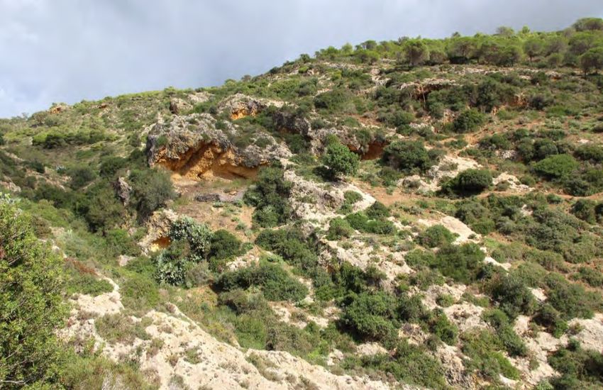
Contents
EXECUTIVE SUMMARY                                                                       4
COLLABORATORS                                                                           7
CHAPTER 1
Characterisation and Conservation Assessment of Terrestrial Habitats at Ghar El Melh    1
1.1 Introduction                                                                        2
1.2 Habitat description and conservation assessment                                     4
1.2.1 General characteristics                                                           4
1.2.2 Lagoons (Habitat 13.4)                                                            4
1.2.3 Saltmarsh and other halophyte communities (Habitats 5.16, 5.17)                   7
1.2.4 Agricultural land (Habitats 14.1, 14.2, 14.3, 14.4)                               8
1.2.5 Ditches and other freshwater wetlands (Habitats 15.1, 15.2, 15.7, 15.8, 15.9)    11
1.2.6 Sandy habitats (fixed and mobile dunes) (Habitat 13.3 and unclassified)          15
1.2.7 Rocky coast (Habitat 13.1 and unclassified)                                      17
1.2.8 Indigenous woodland and scrub (Habitats 1.4.4, 3.8.1, 3.8.2, 3.8.3)              19
1.2.9 Cliffs and other rock exposures (Habitat 6.2)                                    25
1.2.10 Settlements and other anthropogenic habitats (Habitats 14.4, 14,5)              26
1.3 Threats                                                                            27
1.4 Conservation                                                                       29
CHAPTER 2
Assessment Study of Herpetiles Diversity at the Ghar El Melh Area                      31
2.1 Introduction                                                                       32
2.2 Study area                                                                         32
2.3 Methodology                                                                        32
2.4 Taxonomic Structure Of Ghar El Melh Herpetofauna                                   33
2.4.1   Amphibians: Analysis and status of taxa                                        33
2.4.2   Reptiles: Population analysis and taxa status                                  34
2.5 Biotopes and occupation of space                                                   36
2.5.1 Habitat diversity and spatial occupation by herpetofauna                         36
2.5.2 The paralic environment                                                          37
2.5.3 Lagoon borders                                                                   38
2.5.4 Micro-island habitat: the lagoon islets                                          39
2.5.5 Coastal Dunes and the backshore                                                  39
2.5.6 The rocky coast                                                                  40
2.5.7 The Garrigues and Maquis                                                         40
2.5.8 Forest Habitat                                                                   42
2.5.9 Grazing Areas and Agricultural Fields                                            43
2.5.10 The Urban Habitat                                                               43
2.6 Spatial Distribution of species                                                    44
2.7 Conclusions                                                                        46
2.8 References                                                                         57
ANNEXES                                                                                48
Appendix A - Map of the main habitats represented within the study area                49
Appendix B - Plant species recorded in the study area                                  50
Appendix C - IPA-Med / field sheet codes habitats                                      58
Appendix D - IPA-Med / field sheet codes menaces / threats                             61

iii
Beach Sidi Ali El Mekki. Photo: ©Ugo Mellone

Executive summary
This report presents a conservation assessment of the vegetation, habitats and herpetile fauna within the area
covered by Jebel Nadhour and Ghar El Melh KBA and Sidi Ali el Mekki KBA in northeastern Tunisia. The area
includes a range of habitats from forest grading through maquis to low over-grazed scrub with sand deposits
and rocky habitat on the peninsula, as well as a range of habitats of varying salinity on the plain, from saltmarsh
through dunes to agricultural land and a small number of water bodies. Apart from the tip of Jebel Nadhour from
Sidi El Haj Embarek to Ras Ettarf and parts of the saltmarsh and coastal dunes south of Ghar El Melh Lagoon,
all habitats in the area have been dramatically modified and are degraded. All of the plain on which the soils are
not too saline has been converted to agriculture or settlements.

The area supports more than 230 vascular plant species, including Allium duriaeanum and Daucus rouyi that
are globally classed as Endangered and Stipa tenacissima which is Vulnerable, as well as Desmazeria sicula
which is classed as Near Threatened. In addition, a species of Linaria has been recorded in the area which
appears to be new and requires formal description. There is a need to collect more data on the vegetation of
the saltmarsh and dunes to complement data on Jebel Nadhour and provide a comprehensive assessment of
the plant conservation of the two KBAs.

Of the 7 species of Amphibians in Tunisia, 5 are found in this area. Among these species reported with certainty,
only the Berber toad, Sclerophrys mauritanicus, is common and even abundant in the studied area. All other
species are rare and some of them are threatened with extinction globally such as Pleurodeles nebulosus which
is Vulnerable. The reptile population of Ghar El Melh is rich and diverse, with 16 of 17 species confimed; the
total species richness present in this area represents about 28% of the total number of species in Tunisia.

The most significant threat to natural habitats throughout the area is the decline in water quality which ultimately
affects most habitats but is particularly important for surface water systems, including the lagoons. Dam

                                                                                                                     4
iv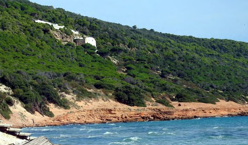
construction is also having a significant effect on the quantity of fresh water flowing into the lagoons. The
combined effects of reduced freshwater inflow from the catchment and increasing wastewater discharge into
the lagoon have potential to tip the ecology of the lagoon beyond its capacity to recover. The second most
significant threat to natural resources is construction. In the area, the most damaging current construction
project is the development of the new road between Tunis and Aousja via Kalaat el Andaluus. Other construction
threats to the natural habitats in the area arise from the poorly controlled construction of facilities, including
houses, recreation facilities and accommodation associated with tourism east of Ghar El Melh and around Sidi
Ali el Mekki which are affecting the woodland and scrub, as well as the rocky coast on Jebel Nadhour.

The increase in tourist pressure, linked to the development of both temporary and permanent facilities will have
a significant effect on much of the coast. Not only is there already damage and degradation of rocky coastal
habitats and the upper margins of sandy beaches, but many subsidiary effects are taking place, such as
increases in wastewater discharge into the lagoons and coastal waters, loss of mature trees along the base of
Jebel Nadhour to make way for buildings, degradation of both fixed and mobile sand dunes and planting of
invasive non-native plants such as Opuntia ficus-indica as hedges. Other threats such as the expansion of
small-scale agriculture, the increasing spread of non-native species and over-grazing are less important than
the direct impacts of human activities, however they too are contributing to the degradation of natural habitats.
It is also highly likely that the impacts of many of these threats will be exacerbated by climate change.

The wetland area (paralic environments) as well as the borderd of the lagoon are the most impacted habitats
for herpetiles. Road killings of amphipians during its breeding season, filling the lagoon claiming new areas for
agiculture and water pollution are the main threats for the herpetiles in the area.

The most effective method of achieving most, if not all, of the conservation actions needed within the area is to
prepare a conservation management plan. This must include a hydrological assessment to provide alternative
long-term water supplies to replace those currently provided by dams on rivers and streams. This should be
combined with restoration of meanders to the channels of flowing watercourses in the plain and buffer zones
along all flowing water courses to reduce pollution. In addition, there is a need for a review of existing wastewater
collection, treatment and disposal to inform upgrades and installation of new facilities toward considerable
reduction in water pollution in the lagoons and other coastal waters. Innovative alternatives to reduce mortality
of animals by road traffic will be also a cost-effective measure to conserve the rich diversity of terrestrial animals
such as herpetiles.

v
                                                                                                                   5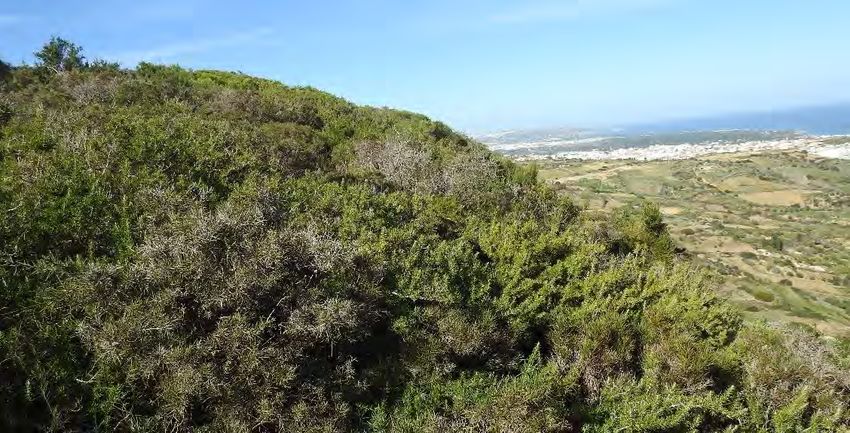
Chapter 1 __________________________________
Characterisation and conservation
assessment of terrestrial habitats at
Ghar El Melh

                               Dunes in Sidi Ali el Mekki. Photo: © E. Véla

                                                                          1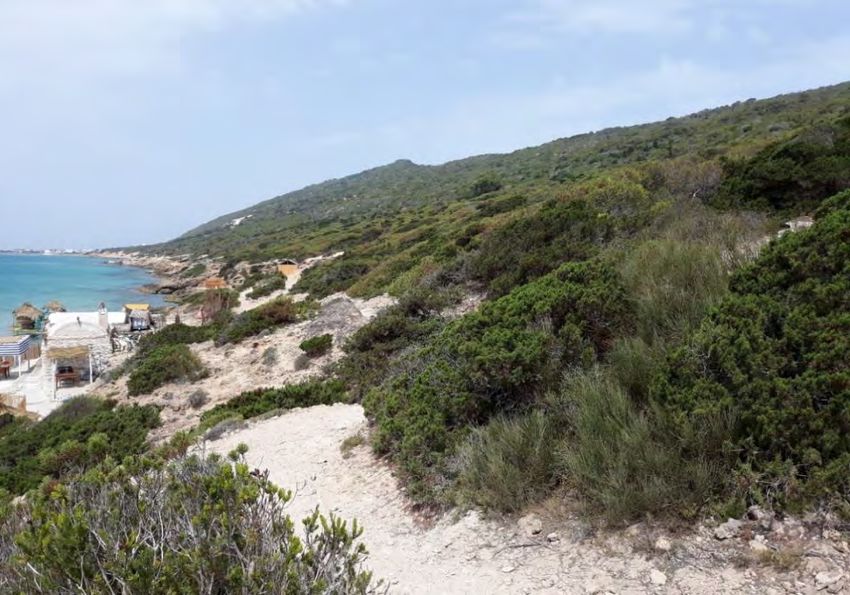
1.1 Introduction
This report presents the results of surveys of the habitats around Ghar El Melh Lagoon, combined with data
from the literature to characterise the vegetation of the lagoon and its surroundings. The area covered by this
report extends from the outskirts of Tunis in the south, north to Raf Raf and east to the settlement and peninsula
of Sidi Ali el Mekki, mainly following the C69 from Tunis through Utique and Aousja toward Raf Raf in the west
(Figure 1). The report forms part of a series of documents supporting work toward the conservation of the
Ramsar Site: Lagune de Ghar El Melh et Delta de la Mejerda (see https://rsis.ramsar.org/ris/1706), Jebel
Nadhour and Ghar El Melh KBA and Sidi Ali el Mekki KBA. The lagoon is located in north-eastern Tunisia,
approximately 50 kilometres north of the capital, Tunis (see Figure 1) and 40 kilometres east of the town of
Bizerte.

Data were collected by walked surveys of all different habitat types, noting general characteristics of the
vegetation, as well as any notable plant species. The aim was to collect reasonably comprehensive data on the
occurrence and distribution of vascular plants, with notes on lower plants where practicaL. Surveys were carried
out between the 10th-12th July and 5th-7th November 2019 by the authors of this report.

                                                                             Figure 1 Location of the study area

The area supports more than 230 vascular plant species (Ghrabi-Grammar and Véla 2008, Appendix B),
including the following threatened species (IUCN 2019):

                                                                                                                   2
Table 1   IUCN Red List categories for some plant taxa found in Ghar El Melh

                                                                                          IUCN Red List
 Taxon
                                                                               Global         EU         Mediterranean
 Allium duriaeanum                                                               EN
 Daucus rouyi Spalik & Reduron                                                   EN
 Stipa tenacissima L. s.L.                       Table 1
                                                                                 VU                             VU
                                                           IUCN Red List categories for some plant taxa found in Ghar El Melh
 Desmazeria sicula (cf.) (Jacq.) Dumort.                                         NT
                                                                                          IUCN Red List
 TAmmophila
   axon arenaria (L.) Link subsp. arundinacea H. Lindb.*                        DD
                                                                               Global         EU         Mediterranean
 Olea europaea L.                                                                             DD
 Allium duriaeanum                                                               EN
 Prospero pulchellum (Munby) Speta                                               DD
 Daucus rouyi Spalik & Reduron                                                   EN
 * - unpublished draft assessment
 Stipa tenacissima L. s.L.                                                       VU                             VU
 Desmazeria sicula (cf.) (Jacq.) Dumort.                                         NT
In addition, a species of Linaria has been recorded and is classed as a “trigger species” for the Sidi Ali el Mekki
 Ammophila arenaria (L.) Link subsp. arundinacea H. Lindb.*                      DD
KBA, which was originally recorded as L. cossonii, a name recognised by Le Floc’h, Boulos and Vela 2010 but
 Olea europaea L.                                                                             DD
not by Plants of the World Online (http://www.plantsoftheworldonline.org) (PoWo) but it has subsequently been
 Prospero pulchellum (Munby) Speta                                               DD
re-determined
  * - unpublished draftas  Linaria heterophylla Desf. var. dichroa Litard. & Maire (which is recognised by few published
                        assessment

sources). For the purposes of this report, it is recorded as L. heterophylla var. dichroa but recognising that
In addition,
this identityawill
               species of certainly
                   almost Linaria has been recorded and is classed as a “trigger species” for the Sidi Ali el Mekki
                                    change.
KBA, which was originally recorded as L. cossonii, a name recognised by Le Floc’h, Boulos and Vela 2010 but
not by Plants
Habitat       of the codes
        and threat   World Online (http://www.plantsoftheworldonline.org)
                           referred to in this document are reproduced as (PoWo) but it has
                                                                            Appendices      subsequently
                                                                                         C and           been
                                                                                                D respectively.
re-determined
They           asfrom
     are derived  Linaria
                      theheterophylla Desf.
                          Mediterranean     var. dichroa
                                        Important   PlantLitard.
                                                          Areas&project
                                                                 Maire (which is recognised
                                                                        (IPA-MED)            by few
                                                                                   and are largely   published
                                                                                                   comparable
sources).
with       For the purposes
     the classifications       of this
                         used for IUCN report, it isassessments.
                                         Red List    recorded as L. heterophylla var. dichroa but recognising that
this identity will almost certainly change.
Names follow Plants of the World Online except in the case of Rosmarinus officinalis var. prostratus (R. officinalis
Habitat and threat
is recognized      codes
              as Salvia    referred Spenn.
                        rosmarinus  to in this
                                            bydocument aredoes
                                               PoWo which  reproduced
                                                               not even as
                                                                        list Appendices   C and
                                                                             var. prostratus     D and
                                                                                             Pasq.) respectively.
                                                                                                        Satureja
They are(Willk.)
barceloi derivedPau
                 from the Mediterranean
                    which               Important
                          is recognized as        Plantinodora
                                           Micromeria    Areas project
                                                               (Desf.) (IPA-MED)  and are largely comparable
                                                                       Benth. by PoWo.
with the classifications used for IUCN Red List assessments.

Names follow Plants of the World Online except in the case of Rosmarinus officinalis var. prostratus (R. officinalis
is recognized as Salvia rosmarinus Spenn. by PoWo which does not even list var. prostratus Pasq.) and Satureja
barceloi (Willk.) Pau which is recognized as Micromeria inodora (Desf.) Benth. by PoWo.

                                                                                                                          3

                                                                                                                          3
1.2 Habitat description and conservation assessment
1.2.1 General characteristics
The habitats represented within the area can be divided into three groups (see also the habitat map reproduced
as Appendix A).
• Areas heavily influenced by salt which extend from the base of Jebel Nadhour around the lagoon
margin and the coastal fringe to the south.
• Low-lying agricultural land which occupies the less heavily salt-influenced areas of the plains.
• Forest and scrub with associated habitats on higher ground, mainly on Jebel Nadhour.
Almost all of the habitats within the area have been heavily and extensively modified by humans, to the extent
that the only remaining natural habitats are on the eastern extreme of Jebel Nadhour between Sidi Ali el Mekki
and Ras Ettarf and some lagoon habitats around Sebkhet el Ouafi Lagoon, Sidi Ali el Mekki Lagoon and the
coastal fringe south of Sebkhet el Ouafi Lagoon. Apart from some areas of saltmarsh (presumably on very saline
soils), the entire plain has been converted to agriculture, with remnant areas of semi-natural habitat now
restricted to the margins of ditches and oxbows. On Jebel Nadhour the woodland has been degraded through,
fire clearance and grazing or has been converted to agriculture around settlements such that there is a
gradation from low forest on the tip of the peninsula, grading through tall scrub to low over-grazed scrub with
scattered arable fields on the slopes above the settlements of Ghar El Melh and Raf Raf.
1.2.2 Lagoons (Habitat 13.4)
Ghar El Melh Lagoon is shallow (Figure 2 Ghar El Melh Lagoon from the south, with Jebel Nadhour in the background. Photo: © E. Véla
Figure 3 Sidi Ali el Mekki Lagoon from the firebreak above the village. Photo: © R. Lansdown
5Table 2 Plant taxa recorded in Ghar El Melh Lagoon (Shili et aL. 2002)
Taxonomic group Species
Green algae (Chlorophyceae) Acetabularia acetabulum Codium bursa
Bryopsis hypnoides Enteromorpha torta
Caulerpa prolifera Enteromorpha intestenalis
Chaetomorpha linum Enteromorpha linza
Derbesia sp. Ulothrix sp.
Cladophora rupestris Rhizoclonium sp.
Cladophora spp. Ulva rigida
Red algae (Rhodophyceae) Ceranium sp. Herposiphonia secunda forma
tenella
Dasya sp. Polysiphonia setularoides
Gracilaria gracilis Sphaerococcus coronpifolius
Hypnea musciformis
Brown algae (Phaeophyceae) Dictyopteris menbranacea Halopteris filicina
Vascular plants Cymodocea nondosa Rupia cirrhosa
(Angiosperms) Nanozostera noltii Ruppia maritima
Posidonia oceanica Zostera marina
Notable Taxa
No notable plant taxa have been recorded in the lagoons; however, seagrass beds are of high conservation
value.
Threats
The lagoon is already somewhat degraded as a consequence of development pressures such as along the road
from the village of Ghar El Melh to Sidi Ali el Mekki, construction of the fishing port of Ghar El Melh (Daoud-
Bouattour 2007) (Threats 1.3, 6.1) and other increasing pressure from tourism, combined with domestic
wastewater discharge from the village of Ghar El Melh and other settlements around the margin, industrial
effluent discharge from the complex at Utique and inflow of water polluted by pesticides and fertilisers through
the drainage network (Threats 7.2, 9.1, 9.2, 9.4). The quantity of water reaching the lagoons and even coastal
waters is critical for the maintenance of the existing ecology, particularly in the light of potential increases in
extreme weather events including droughts due to climate change. Construction of dams (Threats 7.2.4, 7.2.9)
on inflow streams such as those flowing off Jebel Nadhour and rivers such as the Mejerda leads to increase
salinity levels. The combined effects of reduced freshwater inflow from the catchment and increasing discharge
of wastewater and pollutants into the lagoon have potential to tip the ecology of the lagoon beyond its capacity
to recover.
6Conservation Action
• A review of existing facilities for wastewater collection and treatment, combined with identification of
potential for installation of additional facilities for Ghar El Melh and Sidi Ali el Mekki, as well as for
houses along the road between the two, as well as upgrading the existing facilities at Aousja and
Kalaat el Andaluus would go a long way toward reducing eutrophication in the lagoons. Such a review
should include potential for use of vegetative water-treatment systems wherever possible.
• Imposition of a requirement for adequate wastewater treatment for all new buildings would also
contribute to reducing the pollution of the lagoons and coastal waters.
• There is also a need for a hydrological assessment of the area, combined with a review of current
and predicted water requirements to identify alternatives to dams for provision of water for the area
and for Tunis.
1.2.3 Saltmarsh and other halophyte communities (Habitats 5.16, 5.17)
Figure 4 Saltmarsh on then south-western margin of Ghar El Melh Lagoon. Photo: © R. Lansdown
The influence of salt on the vegetation can be seen from the coastal fringe inland, at least along water courses,
as far as Utique. The margins of all the lagoons support a broad fringe of saltmarsh grading from vegetation
dominated by Sarcocornia fruticosa, through Arthrocnemum macrostachyum to Halocnemum strobilaceum,
then to Juncus maritimus and J. subulatus, through Phragmites australis or Bolboschoenus glaucus to oxbows
supporting species such as Typha domingensis and Ruppia sp. (Daoud-Bouattour in litt. 2019). South of Ghar
El Melh Lagoon, there is a gradation from the bare sand of the beach, through mobile dunes (see 2.2.5 below)
to a zone of seasonal and large, permanent water bodies and saltmarsh. This zone is characterised by shrubby
species such as Atriplex halimus, Halocnemum strobilaceum, Juncus acutus, Limbarda crithmoides, Obione
portulacoides, Suaeda vermiculata and S. maritima, with patchy occurrence of Limoniastrum monopetalum,
Limonium virgatum, Plantago coronopus and Salicornia patula (S. europaea agg.). In less saline habitats,
particularly around the small-holder cultivation on the eastern side of Sidi Ali el Mekki Lagoon and along the
7northern margin of both this and Ghar El Melh lagoon, there is a range of typically coastal or salt-tolerant species
such as Hordeum marinum, Parapholis filiformis, Silene coeli-rosa and Torilis nodosa f. bratiosa, as well as
fringing stands of Phragmites australis and Juncus species (Daoud-Bouattour in litt. 2019).
Notable Taxa
No notable plant taxa have been recorded in the saltmarsh and associated halophile vegetation in the area.
However, whilst there is good information on the perennial vegetation, there has yet to be a thorough survey of
annual plants or vegetation. It is likely that such a survey would find notable species in these habitats.
Threats
Much of the saltmarsh habitat is relatively intact and appears to be in good condition, mainly because it has not
been possible to convert it to other uses. There are areas where it is degraded, such as around the port of Ghar
El Melh, wherever settlements are located on the margin of the lagoons such as to the east of Aousja, around
seasonal pools in the plains and along creeks and ditches. The ongoing construction of the road from Tunis to
Aousja via Kalaat el Andaluus has already affected some saline habitats and is likely to have an increasing effect
as the hydrology of the plain will be significantly disrupted (Threat 4.1).
Conservation Action
• There is a need for a thorough survey of the annual vegetation of the saltmarsh (and of the coastal
dunes) to complement data on perennial plants.
• There is a need to document the settlements which are located in the saltmarsh, including waste
treatment and other potentially harmful effects on the habitat.
• There is a need to develop a detailed map of the distribution of saltmarsh, agriculture and development
(settlements and industry) on the plains. This should serve as a baseline for monitoring trends.
1.2.4 Agricultural land (Habitats 14.1, 14.2, 14.3, 14.4)
There are three main types of agricultural land within the area surveyed:
• Intensive arable with some orchards on the level ground of the plain.
• Small fields and orchards on the slopes of Jebel Nadhour above Raf Raf and the village of Ghar El Melh.
• Small allotments (a.k.a potagers, culture ramli or guettayas) around the settlement of Sidi Ali el Mekki.
8Figure 5 Agricultural land with seasonally flooded areas of remnant saltmarsh east of Utique. Photo: © R. Lansdown
Intensive agriculture occupies most of the plain between the saltmarsh and the hills to the west. Cereals,
pumpkin and a few other crops, together with scattered orchards are separated by hedges, ditches or lines of
trees and scrub along the lines of former streams and rivers.
Small fields on Jebel Nadhour typically occupy the gentler slopes with easy access from the settlements of Raf
Raf and Ghar El Melh. They support no notable plants species but appear to suffer less herbicide and other
pesticide application than the more intensive agricultural land and consequently allow a reasonable species
diversity to persist in the margins and between fields. The allotments occur wherever there is sufficient depth of
soil and a layer of freshwater over the groundwater to enable cultivation and where soils are sufficiently saline
to preclude cultivation by other methods. They are not subject to pesticide or other chemical treatment and
consequently support a wide range of native species., grading on their margins into the less halophyte-
dominated saltmarsh communities.
Notable Taxa
No notable taxa are associated with agricultural land in the area.
Threats
Intensive agricultural habitats and the small fields on the hills are not threatened except by the expansions of
settlements and industrial complexes (Threats 1.1, 1.2) but may themselves pose a threat to other habitats and
species. Areas of traditional, extensive agriculture are threatened by intensification and industrialisation of
agricultural processes.
The allotments are extremely vulnerable to the effects of climate change as well as other factors which may
affect the hydrology of the lagoons. They are also critically dependent upon the balance of fresh to saline water
and consequently could become unsustainable as a consequence of the construction of dams on streams
9flowing into the lagoon from Jebel Nadhour. There is also a risk that if no measures are put in place to treat
wastewater from new buildings in Sidi Ali el Mekki, the groundwater will become contaminated which could
increase the risk of diseases among people using vegetables produced from the allotments.
Conservation Action
The allotments represent an ancient traditional cultivation method which is unintensive and therefore enables
the persistence of a wide range of native plant species, it also has potential to contribute to cultural aspects of
tourism. It is important to ensure that this practice is allowed to continue. Areas need to be identified and
designated for this use, particularly in the face of increasing development pressure in the area.
Figure 6 Traditionally grown Pumpkins drying in the sun south of Kalaat el Andaluus. Photo: © R. Lansdown
101.2.5 Ditches and other freshwater wetlands (Habitats 15.1, 15.2, 15.7, 15.8, 15.9)
Figure 7 Heavily overgrown and shaded canalised channel south of Aousja. Photo: © R. Lansdown
A range of wetland types occurs within the area:
• Two arms of the Mejerda River which flow from the hills in the west, to the sea south of Ghar El Melh
lagoon. Both of these water courses have been heavily modified, with trapezoid channels and engineered
flood relief bunds. They support very little marginal vegetation and even less channel vegetation., all of
which appears to be very species-poor. The former floodplains have been converted to arable and
support no vegetation of note.
• A number of small seasonal streams flowing off Jebel Nadhour south into Ghar El Melh and Sidi Ali el
Mekki Lagoons. These small streams are generally reasonably intact, although small dams are being
constructed on an increasing number for water supply to houses in Ghar El Melh and the ribbon
development to the east. Apart from dams, these streams are typically modified only as far as the
adjacent habitats have been degraded through clearance and grazing. In many areas they are quite
11deeply incised into the bedrock of the hills, creating gorge-like conditions which support diverse
bryophyte communities.
• A number of large linear water bodies cross the plain, which resemble the river channels except that flow
is slow or lacking. As is the case with the river, these canals support little or no aquatic or wetland-
dependent vegetation.
• There are ditches throughout the area, ranging from narrow channels designed to carry excess flow off
arable fields and away from settlements on the hills, to road drains and the multitude of field drains
crossing the plain. Most of these ditches carry or hold water only for hours or at most a few days and
support few wetland-dependent plants, apart from occasional Cyperus species and the non-native
Symphyotrichum subulatum. Those ditches which do hold water for longer are mainly in arable areas of
the plain and are dominated by Phragmites australis.
• There are a few small standing water bodies in the plains. Most of those which still have a natural
structure and hydrology are situated in remnant patches of saltmarsh or Juncus stands around
settlements. They are typically polluted, eutrophic and otherwise degraded, supporting only low plant
species diversity and no notable taxa. In a few areas, particularly in the southern part of the plain around
the new road, there are extensive seasonally inundated areas in fields where the crop has failed due to
inundation. Most of these are largely bare, supporting only a few scattered halophytes, but one
immediately adjacent to a junction on the road supported a good stand of Damasonium bourgaei.
Figure 8 Saline canal confluence south of Aousja. Photo: © R. Lansdown
12Figure 9 Saline seasonal pool east of Utique. Photo: © R. Lansdown
• In a few places, large oxbow lakes occur, remnants of the former dynamic hydrology of the plain. Most
of these are overgrown by dense scrub and or polluted and support no species of note, although one
area along a former river channel is shaded by trees supported extensive carpets of acrocarpous mosses
such as Aloina, Barbula and Didymodon species, with liverworts of the genus Fossombronia. One oxbow
just outside Utique, although much degraded in parts, supports a wide range pf wetland-dependent
plants dominated by beds of Phragmites australis, Schoenoplectus tabernaemontani and Typha
domingensis, with Chara connivens, Ruppia sp., Ulva flexuosa and Vaucheria species in the water and
the banks covered with Tamarix sp. supporting a large stand of Cynanchum acutum.
• There are a few water storage small reservoirs on the plain.
Notable Taxa
No globally threatened species have been recorded in association with non-lagoon wetlands in the area.
However, Chara connivens and Damasonium bourgaei are remnants of what may have been important wetland
vegetation in the past and it is possible that restoration of freshwater wetlands could restore species from the
seed or spore bank. The main conservation value of freshwater and less saline wetlands in the area is as habitat
for animals, apart from the oxbow at Utique which could support other species, particularly charophytes, of note
and some of the small streams on the hills which could support notable bryophytes.
13Figure 10 Construction of the crossing of the River Mejerda by the new road from Tunis to Kalaat el Andaluus. Photo: Google Earth
Threats
Apart from a few of the small seasonal streams flowing south off Jebel Nadhour, all water bodies in the area
suffer from some level of water quality decline (Threats 7.2, 9.1, 9.2, 9.4). This is caused by a range of factors,
including:
• Sediment mobilisation and run-off due to increased erosion as a consequence of actions such as grazing,
use of unmetalled roads, arable farming without adequate buffer zones and development. The degree of
sediment mobilisation from the new road from Tunis to Aousja is striking with all flowing water extremely
turbid and deposits of silt throughout when the site was visited in October 2019. This will have significant
effects on streams, rivers, lagoons and coastal waters.
• Un-treated or inadequately treated domestic waste water discharge. This is a particular risk with new
development along the road east of Ghar El Melh and around Sidi Ali el Mekki where the space available
for wastewater treatment is very limited and will become increasingly constrained with ongoing
development. It also appears highly unlikely that any of the small settlements on the margins of the
lagoons will have adequate wastewater treatment facilities. There is a need for formal planning and
provision of water collection and treatment facilities for all settlements, linking in small and isolated
settlements with systems installed for the larger villages and towns.
• Water abstraction, either directly from springs, from underground sources or by construction of dams,
affects all flowing water bodies in the area. This abstraction causes a reduction in flow with secondary
effects, such as reduced hydroperiod, reduction of the humidity profile, leading to declines in bryophyte
populations and reduced of dilution of pollutants.
14• In general, development throughout the area is adding pressure to the level and extent of degradation of
flowing freshwater habitats (e.g. the crossing of the River Mejerda by the road from Tunis to Kalaat el
Andaluus), either by constraining channels or by increasing the artificialisation of channels.
Conservation Action
The degree of degradation of almost all non-lagoon wetlands in the area is such that these have little or no
conservation value, except as habitat for a fairly impoverished fauna. Only through extensive restoration work
can this be remedied. Actions are needed such as:
• Restoration of a meanders to the channels of flowing water courses in the plain, including use of seasonal
wetlands to provide flood storage capacity and possibly water pollution attenuation.
• Establishment of buffer zones along all flowing water courses, as well as along ditches.
• Hydrological assessment to provide long-term water supplies to replace those currently provided by
dams on rivers and streams.
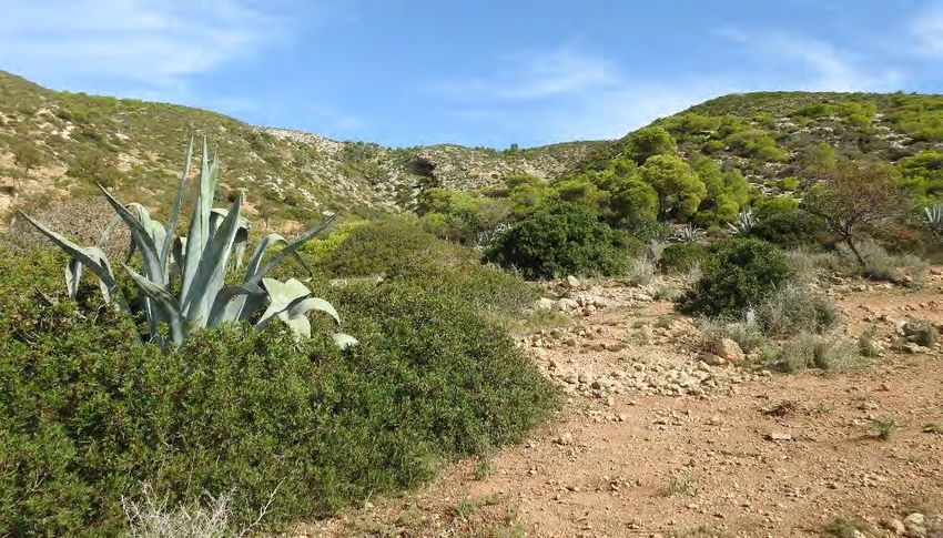
1.2.6 Sandy habitats (fixed and mobile dunes) (Habitat 13.3 and unclassified)
Figure 11 Daucus rouyi (Thapsia polygama). . Photo: © R. Lansdown
Psammophilous (sand-loving) vegetation occurs in three main places in the survey area:
• Fixed dunes and sand deposits on Jebel Nadhour. Most of this habitat on the north face of Jebel Nadhour
east of Raf Raf is planted with Pinus pinea, along the crest of the hill, throughout much of the peninsula,
there are extensive areas where Acacia cyclops is dominant or actually forms monospecific stands. It is
not clear whether these have replaced former areas of indigenous forest or whether these areas were
formerly bare. This area supports little natural vegetation apart from the planted trees on most of the
15slopes but along the lower part of the hill, above the sea there is a reasonably diverse band of vegetation,
including species such as Linaria heterophylla var. dichroa.
• The beach and narrow fringe of dunes below Sidi El Haj Embarek and extending almost to Ras Ettarf
support sparse vegetation including: Aeluropus litoralis, Arthrocnemum macrostachyum, Atriplex
portulacoides, Cakile maritima, Elymus farctus subsp. farctus, Eryngium maritimum, Euphorbia paralias,
Limonium spp., Lotus creticus, Polygonum maritimum and Salsola kali. Similar sandy areas along the
coast support other species such as Cyperus capitatus and Eryngium maritimum.
• Between the beach and the saltmarsh, south of Ghar El Melh Lagoon there is a band of mobile dunes
supporting species such as Cakile maritima, Crucianella maritima, Eryngium maritimum, Euphorbia
paralias, Plantago coronopus and Rumex bucephalophorus.
Notable Taxa
Psammophilous habitats on Jebel Nadhour support a range of notable taxa, particularly Daucus rouyi which
occurs in large, dense populations in sandy areas both on the crest and above the rocky coast, as well as
patchy Linaria heterophylla var. dichroa among the planted pines near Sidi Ali el Mekki. No notable taxa have
been recorded in the beach and mobile dune but there has been no comprehensive survey of the coastal dunes
in the southern part of the KBA.
Threats
In addition to the extensive Pinus pinea plantation on fixed dunes and the apparent preferential colonisation of
open areas on sand by Acacia cyclops on the crest of Jebel Nadhour, the main threat to the vegetation of these
habitats is from increasing tourism (Threats 1.3, 6.1). This is particularly apparent along tracks over sandy
ground between Sidi Ali el Mekki beach and Ras Ettarf, where casual use of the tracks has caused them to
spread to a width of up to 10 m of bare sand. Equally, the mobile dunes south of Ghar El Melh Lagoon are
vulnerable to uncontrolled vehicle access, as well as destabilisation as a result of the many people walking over
them. Improved access to this area and Sidi Ali el Mekki beach provided by the new road from Tunis through
Kalaat el Andaluus to Aousja will almost certainly increase pressure on these habitats.
Conservation Action
• It is difficult to see how the beach between Sidi El haj Embarek and Ras Ettarf can be protected from
tourism, given that it is the focus of intensive establishment of tourist facilities. Much could be achieved
to reduce the impact of tourism on the fixed dunes on Jebel Nadhour and the mobile dunes along the
beach south of Ghar El Melh by providing defined and marked access routes. These could be installed
in a way which encourages people to follow them and discourages casual access away from these
routes.
• If Pinus pinea plantations are harvested, this needs to be done in a way which minimises damage to the
soil structure and mobilisation of the sand. If they are not to be harvested then they should be selectively
16felled out in small groups, allowing re-establishment of natural regeneration of native species
progressively as the plantations are cleared.
• There is a need for a survey of the vegetation of the coastal dunes south of Ghar El Melh Lagoon to
document species diversity and locate any populations of notable taxa.
1.2.7 Rocky coast (Habitat 13.1 and unclassified)
This is a zone either grading from bare, very rocky
cliffs above intertidal bedrock exposures or from the
beach into the downhill margins of the indigenous
woodland. It is characterised by species such as
Crithmum maritimum, Cyperus capitatus, Daucus
rouyi, Limbarda crithmoides subsp. longifolia,
Limonium intricatum, L. pyramidatum, Medicago
marina, Pancratium maritimum, Thymelaea hirsuta
and Zygophyllum album. In a few areas north of Raf
Ettarf, there are patches of Schoenus nigricans and
Carex flacca, presumably where there is seepage of
fresh water. At the upper edge of this zone, the
vegetation grades into the lower shrubby elements of
the indigenous woodland.
Notable Taxa Figure 2 Casual construction of wooden tourist facilities
along Ghar El Melh beach. Photo: © R. Lansdown
Many of the species which are widespread on the
slopes and crest of the peninsula extend onto the
rocky coast. In particular Daucus rouyi and Rosmarinus officinalis var. prostratus are widespread along the
upper margin of this habitat, while Limonium intricatum and L. pyramidatum are particularly strongly associated
with this habitat.
17Figure 11 The coastal zone and Ghar El Melh Beach, showing the gradation from the marine fringe
through bare sand to scrubby juniper-dominated vegetation. Photo: © R. Lansdown
Figure 12 Building construction on the base of the hill, along the coastal fringe. Photo: © R. Lansdown
Threats
The rocky coast between Sidi Ali el Mekki beach and Ras Ettarf is already becoming degraded both by
intentional actions associated with the construction of tourist facilities and by increasing casual access by
tourists moving out from the beach (Threats 1.3, 6.1). The ongoing installation of facilities supporting beach
recreation, such as wooden shelters, buildings which often have electricity through generators and formal
construction of steps, ramps and platforms, as well as planting of non-native Opuntia ficus-indica as hedges,
18are all adversely affecting the vegetation of the coast. This is likely to continue and increase significantly as more
affluent tourists are ferried by boat to the more remote areas.
Conservation Action
It is difficult to see how development of tourist infrastructure along this coast can be controlled except by
designation and enforcement of zones within which no infrastructure is allowed, including temporary structures.
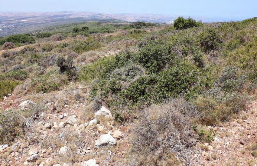
1.2.8 Indigenous woodland and scrub (Habitats 1.4.4, 3.8.1, 3.8.2, 3.8.3)
Indigenous woodland extends from the fire break west of Sidi Ali el Mekki to the tip of the peninsula at Ras Ettarf
(see Figure 13). The upper canopy is characterised by Pinus halepensis and Juniperus phoenicea subsp.
turbinata, with Quercus coccifera subsp. pseudococcifera and Juniperus oxycedrus subsp. macrocarpa over
lower shrubs or bushes of Pistacia lentiscus and Phillyrea species. Gaps in the vegetation support shrubby
Cistus salvifolius, Erica multiflora, Genista aspalathoides, Retama raetam subsp. bovei, Rosmarinus officinalis
subsp. officinalis and Thymbra capitata, over a diverse ground flora. On the east-facing slope from Ras Ettarf
north the woodland is lower and shrubbier.
The woodland is more species-rich and varied in the eastern part of the peninsula from Sidi Ali el Mekki
eastward, west of which it is more impoverished with fewer Juniperus oxycedrus, J. phoenicea and Quercus
coccifera and the canopy in places is almost entirely dominated by Pinus halepensis. Fire breaks typically
support species which elsewhere form the shrub layer and provide an indication of the vegetation which
develops when trees are cleared, including Acacia cyclops, Brachypodium ramosum, Cistus salvifolius,
Dittrichia viscosa, Ephedra fragilis, Fumana scoparia, Genista aspalathoides, Globularia alypum, Hippocrepis
multisiliquosa, Phagnalum rupestre, Retama raetam subsp. bovei, Rhamnus myrtifolia, Rosmarinus officinalis
var. prostratus, Satureja barceloi, Sedum sediforme, Stipa tenacissima and Thymbra capitata.
19Figure 13 The southern face of t Jebel Nadhour looking west from Sidi El Haj Embarek, showing the gradation from diverse
woodland in the east to species-poor Pinus halapensis-dominated woodland in the west. Photo: © R. Lansdown
20Figure 14 Scrubby habitat characteristic of past over-grazing immediately above the coastal road. Photo: © R. Lansdown
Figure 15 Mature Quercus coccifera subsp. pseudococcifera on level ground among recent buildings. Photo: © E. Véla
21At the base of the hill along the road to the village of Ghar El Melh, between the lagoon and the hill there are the
remains of a band of taller woodland, involving large, mature Ceratonia siliqua and Quercus coccifera subsp.
pseudococcifera trees. This band of taller woodland apparently formerly occupied much of the level ground
between the halophytic vegetation on the lagoon margin and the base of the slopes. Most of this band of taller
woodland has been lost to uncontrolled ribbon-development along the road and this process continues. There
are occasional taller Q. coccifera subsp. pseudococcifera trees in some of the shallow valleys running down
the hill and it is possible that these represent remnants of more widespread high forest, although it is clear that
this would not have extended to the tip of the peninsula.
Where the trees have been removed or damaged, the indigenous woodland is replaced by low scrub (garrigue)
which is characterised by species typical of the understorey of the indigenous woodland. This includes species
such as Genista aspalathoides, Retama raetam subsp. bovei, Rosmarinus officinalis var. officinalis and Thymbra
capitata, as well as a number of other species typical of over-grazed habitats, such as Asphodelus ramosus,
Calicotome villosa and Thymelaea hirsuta. This vegetation is well-developed on the southern slope of the hill
above the two lagoons and in particular, near the masts above the village of Ghar El Melh, there are the remains
of terraces and the scrub shows very strong evidence of past over-grazing with some evidence of renewed
grazing. This habitat is characterised by very scrubby vegetation dominated by Calicotome villosa, Rosmarinus
officinalis var. officinalis and Thymelaea hirsuta, with Ampelodesmos mauritanicus, Asphodelus ramosus,
Brachypodium ramosum, Carlina lanata, Centaurea sp., Cistus salviifolius, Cutandia divaricata, Daucus carota,
Dittrichia viscosa, Genista aspalathoides, Marrubium vulgare, Onopordon platylepis, Quercus coccifera subsp.
pseudococcifera (bushes), Rhamnus lycioides subsp. oleoides, Satureja barceloi, Scolymus hispanicus, Stipa
tenacissima, Teucrium fruticans and Thymbra capitata.
An area to the east, just below the crest, is characterised by bare ground with scattered low, shrubby plants,
showing evidence of past over-grazing with current heavy grazing pressure and extensive exposures of karstic
limestone. In this area Brachypodium ramosum, Calicotome villosa, Genista aspalathoides and Rosmarinus
officinalis var. officinalis are dominant with Ampelodesmos mauritanicus, Blackstonia perfoliata, Capparis
spinosa, Carlina lanata, Convolvulus lineatus, Dittrichia viscosa, Erica multiflora, Malva subovata, Marrubium
vulgare, Pistacia lentiscus, Ruta chalepensis, Satureja barceloi, Thymbra capitata and Thymelaea hirsuta, with
occasional local patches of Pinus halapensis and Pinus pinea. Acrocarpous mosses were very abundant in soil-
filled hollows in limestone exposures.
22Figure 16 Scrubby habitat typical of past and ongoing over-grazing near the television masts. Photo: © R. Lansdown
An additional habitat which has completely replaced the natural vegetation include extensive Pinus pinea
plantations, a small one on the southern flank of Jebel Nadhour and an extensive plantation covering the lower
slopes of the northern flank of Jebel Nadhour.
Notable Taxa
The woodland and scrub, grading into garrigue and phrygana, support most of the notable plant species
recorded from the area. In particular Allium duriaeanum, Daucus rouyi, Genista aspalathoides, Muscari
maritima, Rosmarinus officinalis var. prostratus, Satureja barceloi and Stipa tenacissima all occur wherever
habitat is suitable. Ironically, past over-grazing throughout all but the eastern extreme of Jebel Nadhour with
some continued lighter grazing has led to conditions which are particularly favourable for many of these species,
with extensive bare or open ground among scrubby bushes and patches of scrub with occasionally trees. This
open habitat favours many of the bulb-forming species and other notable taxa which currently occur in some
abundance.
Threats
• Most of the habitat degradation due to over-grazing (Threat 2.3.3) or fire (Threat 7.1.1) continues to be
a threat, in spite of recent work to control fires, leaving extensive areas which support scrubby vegetation
which would, presumably, if left alone, eventually revert to indigenous woodland. However, there is an
23area above the town of Ghar El Melh where the influence of past overgrazing is becoming exacerbated
by current grazing. The effects of over-grazing can most effectively be monitored through use of aerial
imagery to map the extent of extant woodland, compared to scrub and open habitats. Degradation
causing modification of the indigenous semi-natural woodland, may also be a consequence of past
selective felling of mature trees, particularly of Juniperus oxycedrus subsp. macrocarpa, J. phoenicea
subsp. turbinata and Quercus coccifera subsp. pseudococcifera. The woodland and scrub on Jebel
Nadhour continue to be threatened. The natural woodland and scrub are also threatened by expansion
of small-holder agriculture on level ground near the villages of Ghar El Melh and Raf Raf (Threat 2.1.2).
• Loss of tall, mature trees is occurring at the base of the hill due to construction of buildings along the
road (Threats 1.1, 1.3, 6.1). This construction is apparently occurring under permits issued by the Ghar
El Melh municipality. However, there is an urgent need to bring this development under control as it is
threatening many of the most mature trees remaining in the area as well as threatening significant areas
of the coastal fringe. The effects of this construction can most effectively be monitored through use of
aerial imagery to map the extent of a) construction and b) clearance of vegetation. In some cases, mature
trees are actually protected by their inclusion within gardens or around houses, however these represent
exceptions to the normal situation.
• There is also quite a lot of uncontrolled clearance of native vegetation among and around houses. This
needs to be quantified and controlled. Some habitat is also being lost to expansion of small-scale
agriculture.
• Non-native species such as Acacia cyclops, A. karoo, A. saligna, Agave americana, Carpobrotus edulis
and Opuntia ficus-indica are widespread and increasing, colonising open habitats as well as displacing
native species. This spread is exacerbated by planting of some of these species for ornament and as
hedges.
Conservation Action
Apart from the ongoing loss of mature trees along the base of the hill, most of the woodland and scrub on Jebel
Nadhour appears either to be in good condition, to be providing temporarily suitable habitat for notable herbs
or to be recovering toward good condition. There is therefore a need to monitor the condition of different
elements of this habitat, particularly in relation to development and the expansion of small-scale agriculture, but
also as the suitability of the habitat for notable species changes. The most effective way to do this is to use
remote tools, supported by infrequent ground truthing.
There is also a need to monitor the condition of the mature trees along the base of the hill. This could best be
done by tagging all of the trees in combination with remote methods for monitoring construction.
241.2.9 Cliffs and other rock exposures (Habitat 6.2)
Cliffs and rock outcrops occur throughout Jebel Nadhour. These vary from a discontinuous line of outcrops
along the northern face of the crest, mirrored by other more broken lines on the slopes above Raf Raf, to isolated
boulders and bedrock exposures in gorges and the predominantly rock slope above Ras Ettarf.
Notable Taxa
In many places shelves and hollows in the rock faces have filled with soil and these support a wide range of
plants, including Allium duriaeanum and Satureja barceloi. However, no specific saxicolous taxa of note have
been recorded.
Threats
No threats specific to this habitat have been recorded. Where vegetation is cleared away from rock faces, this
leads to a decline in humidity and ultimately loss of the bryophyte flora and where goats have access to these
rock exposures, they will often graze and trample the pockets of soil, leading to the loss of all vegetation.
However, these threats are not yet widespread.
Conservation Action
There is no need for specific action to conserve these habitats for their vegetation, as they are rarely threatened.
However, they are likely to be extremely important both for bat roosts (in caves) and for reptiles. it is therefore
important that the condition of these outcrops is monitored.
25Figure 17 Rock outcrops along a valley above the village of Ghar El Melh. Photo: © R. Lansdown
1.2.10 Settlements and other anthropogenic habitats (Habitats 14.4, 14,5)
There are settlements throughout the survey area. The largest of these are Kalaat al Andaluus, Aousja, Raf Raf,
Ghar El Melh and Sidi Ali el Mekki. These areas include a wide range of habitats, from hedges and gardens to
open, waste ground between housing plots. In addition to planted species, these areas generally support a
diverse range of ruderals and many non-native species such as Arundo donax and Symphyotrichum
squamatum. These habitats are generally of very low conservation value but occasionally where they have
suffered little damage, they may support notable species. Some of these areas from Sidi Ali el Mekki to Ghar El
Melh, including gardens and areas between housing plots are now important for the remaining mature Quercus
coccifera and Ceratonia siliqua trees.
Notable Taxa
The only notable taxon recorded in settlements in the area is the as yet taxonomically unclear Linaria
heterophylla var. dichroa, which occurred alongside a track on the western edge of Sidi Ali el Mekki and around
houses to the east of Raf Raf beach.
Threats
26The only threats to habitats in and around settlements arise from increased urbanisation, the spread of industrial
units leading to a loss of open and green spaces in settlements and the “tidying” of areas around buildings
which will lead to a loss of notable ruderal species.
Conservation Action
There is no need for specific action to conserve these habitats for their vegetation or the species which they
support.
1.3 Threats
Table 3 presents a summary of the threats identified as potentially affecting the features of note and importance
associated with the Jebel Nadhour and Ghar El Melh KBA and the Sidi Ali el Mekki KBA and IPA. The level of
importance is based on a three-point scale, based on the following criteria:
Timing Scope Severity Importance
Ongoing whole (> 90 %) Rapid decline High
Future majority (50-90 %) Slow decline Medium
Past minority (< 50 %) Negligible decline Low
The level of importance given in the table is then based on the highest level of threat identified.
Table 3 Threats potentially affecting habitats or species in Ghar El Melh
Feature
(Habitat or species) Threat Importance Recommended response
Lagoon Development High Planning controls
Tourism High Planning controls
Wastewater discharge High Installation of treatment facilities
Water abstraction Medium Hydrological assessment
Saltmarsh Habitat degradation Medium Planning assessment and
controls
Development High Planning controls
Agricultural habitats Intensification Medium Unknown
Development Medium Planning controls
Freshwater wetlands Sediment mobilisation High Buffer zones, good practice
guidance
Wastewater discharge High Installation of treatment facilities
27Canalisation Medium Habitat restoration
Water abstraction Medium Hydrological assessment
Sandy habitats Pine plantation Medium Felling and restoration
Invasive alien species High Planning controls, eradication
Tourism High Planning controls, good practice
Rocky coast Tourism High Planning controls, good practice
Invasive alien species High Planning controls, eradication
Woodland and scrub Over-grazing Low Managed stocking levels
Development High Planning controls
Domestic clearance Medium Good practice
Invasive alien species High Planning controls, eradication
Cliffs and rock Decline in shading Medium Good practice
exposures
Settlement Urbanisation Low Planning controls
The most significant threat to natural habitats throughout the area is the decline in water quality. This arises
through a range of influences, from untreated or inadequately treated domestic and industrial waste water
discharge into water bodies, discharge of industrial effluent into water bodies and sediment mobilisation and
run-off from erosion resulting from poor management of agriculture and unmetalled roads. Most habitats
throughout the area are affected by the decline in water quality, but the most severely affected are the lagoons
and coastal waters which are the last stage of dispersal of pollutants and sediment.
Dam construction on streams flowing off Jebel Nadhour is also having a significant effect on the quantity of fresh
water flowing into the lagoons from the north, as is construction of dams on the upstream reaches of the rivers
flowing into the lagoons from the west. The combined effects of reduced freshwater inflow from the catchment
and increasing wastewater discharge into the lagoon have potential to tip the ecology of the lagoon beyond its
capacity to recover.
The second most significant threat to natural resources is construction. In the area the most damaging current
construction project is the development of the new road between Tunis and Aousja via Kalaat el Andaluus. This
road is already disrupting the hydrology of the plain and causing mobilisation of large quantities of sediment into
water courses but will have dramatic impacts on natural species and habitat for years to come through
increased access to vulnerable areas and particularly the increase in tourism associated with Sidi Ali el Mekki.
Other construction threats to the natural habitats in the area arise from the poorly controlled construction of
facilities, including houses, recreation facilities and accommodation associated with tourism east of Ghar El
Melh and around Sidi Ali el Mekki which are affecting the woodland and scrub, as well as the rocky coast on
28Jebel Nadhour. Expansion of other settlements, including development of industrial facilities in the plain are also
damaging natural habitats.
The increase in tourist pressure, linked to the development of both temporary and permanent facilities will have
a significant effect on much of the coast. Not only is there already damage and degradation of rocky coastal
habitats and the upper margins of sandy beaches, but many subsidiary effects are taking place, such as
increases in wastewater discharge into the lagoons and coastal waters, loss of mature trees along the base of
Jebel Nadhour to make way for buildings, degradation of both fixed and mobile sand dunes and planting of
invasive non-native plants such as Opuntia ficus-indica as hedges.
Figure 18 Hillside between the village of Ghar El Melh and Sidi Ali el Mekki dominated by the non-native Opuntia ficus-indica with
Agave americana. Photo: © R. Lansdown
Other threats such as the expansion of small-scale agriculture, the increasing spread of non-native species and
over-grazing are less important than the direct impacts of human activities, however they too are contributing
to the degradation of natural habitats. It is also highly likely that the impacts of many of these threats will be
exacerbated by climate change.
1.4 Conservation
Three plans have been produced to inform management of parts of the area (APAL 2010, WWF-DGF 2011,
WWF-DGF 2012). None of these have been designed for the long-term and none have developed a set of
targets for habitat conservation throughout the zone of influence of the lagoons. There is a need to develop a
conservation management plan for the area of influence of both KBAs. This would necessarily include both
29You can also read