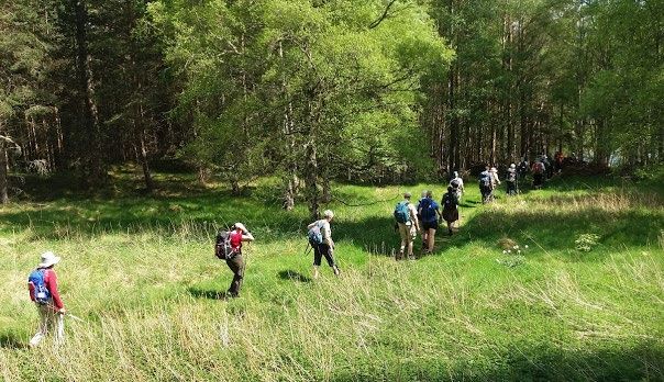
Ballater Walking Festival 16th to 22nd May 2020
←
→
Page content transcription
If your browser does not render page correctly, please read the page content below
Ballater Walking Festival   16th to 22nd May 2020

.
Essential Information If in doubt about anything, email jenny@walkballater.com
Walks Grading Each day, there are three or four categories of walk; Strenuous, Medium, Easy
and Special Interest. A professional guide will lead the high-level Strenuous ones. Other walks will be
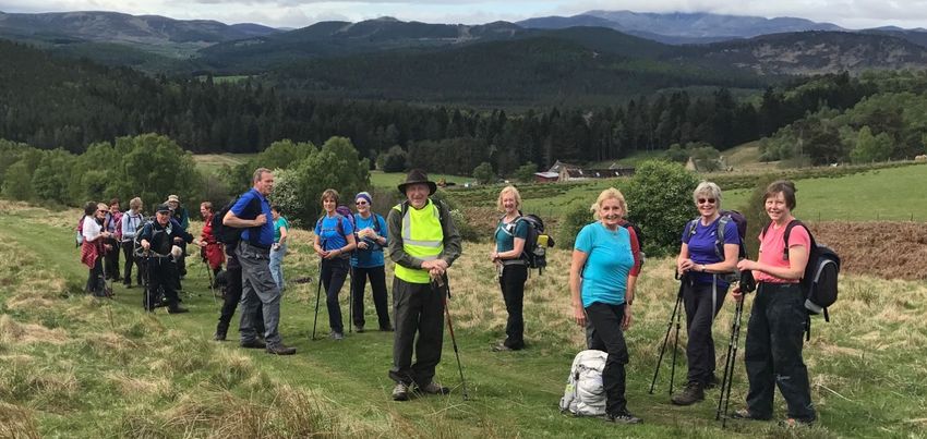
led by experienced walkers with knowledge of Royal Deeside or rangers from Muir of Dinnet NNR,
Aberdeenshire Council and Balmoral with expertise in flora, fauna and local history. Before making a
choice, please read each walk description and the walk gradings listed below.
• Strenuous These may include some of the following; significant ascent and descent of a
Munro or two, considerable length in a remote area, crossing burns, easy scrambling, exposure
to drops and perhaps at a brisk pace. These walks are for experienced hillwalkers with an above
average level of fitness and stamina. Walking boots and warm, waterproof clothing are essential.
Walkers unsure of their ability should contact the organisers in advance.
• Medium Normally around nine to twelve miles, these walks are for participants who
have a good level of fitness and experience of walking longer distances. There may be significant
overall ascent, including a hill and other demanding aspects such as bog, thick heather, and varied
surfaces including open hillside in a remote area.
• Easy Taken at a fairly relaxed pace and usually under seven miles, there will be
minimum gradients. For anyone who does not have a mobility difficulty, a specific health problem
or is seriously unfit. An easy walk will be mainly on good paths and tracks with no sustained, very
steep slopes or significant stretches of slippery or uneven surfaces. There may be a stile to cross.
• Special Interest Led by a ranger or someone with a specific interest, these walks of about five
to six miles will be at an easy pace to allow plenty of time to look and learn about many things
including wildlife, conservation, flowers, history, geology and archaeology.
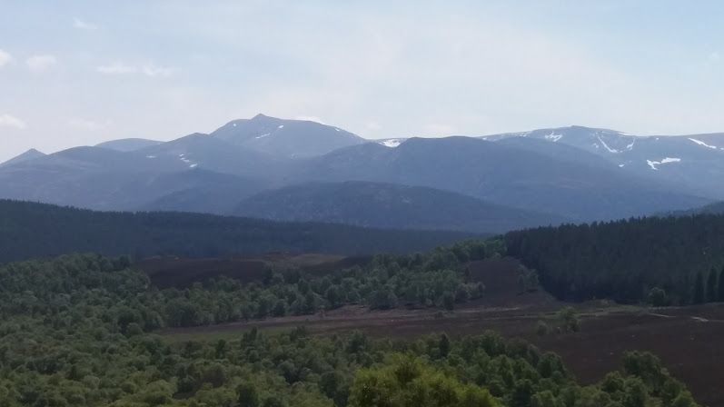
Equipment In Upper Deeside and the Eastern Cairngorms, the weather and ground
conditions can be challenging, particularly on high-level walks. An ill-equipped walker can pose a
threat to their own safety and to the group as a whole. Being suitably equipped is essential. Looking
back over the years of the Ballater Walking Festival, we have had snow on high level walks and also
some very hot weather; both extremes pose a different set of potential problems. Everyone should
be aware of the weather forecast and prepare accordingly. On a hill or a remote area, conditions can
be significantly cooler, wetter and windier than in Ballater and can change very quickly. Always carry
plenty of water. If a sunny day is forecast, include a sun hat, sunglasses, sunscreen and extra water.
• For Easy walks we recommend sturdy, ankle-supporting footwear, warm clothing, warm hat,
gloves, waterproof jacket and over trousers, a rucksack to carry adequate food and drink for the
length of the walk, a spare layer of clothing, and any personal medication that might be needed.
• For Medium and Strenuous walks, we ask walkers to ensure they have all of the things needed
for an Easy walk plus full hillwalking gear: Boots, warm clothing, quick drying trousers (not denim
jeans), waterproof jacket and over trousers, rucksack, warm hat, gloves, spare fleece, packed
lunch, spare food and drink, small personal first aid kit including any medications and perhaps a
mobile phone, walking poles, gaiters and a sun hat.
Sunday 17th May

Strenuous             Walk 1:                East Glenshee Munros

Distance                  19km/12mls        Ascent 1020m/3350ft
Walking time approx 8 hrs                   Map       Landranger 43/44
Departure                 7 am              Start     NO 145 806          Finish NO 145 806
4 Munros – Carn an Tuirc 1018m. Cairn of Claise 1062m. Tolmount 958m. Tom Buidhe 957m. A
climb, steep and rocky in places, takes us to the summit of Carn an Turic, which is a fine viewpoint.
From here we pick up a good track across a hill to reach Cairn of Claise. We leave the summit
heading in a direct line across the peat hags for Tolmount, which affords impressive views down to
Glen Callater. From here, Tom Buidhe is only a short distance away. We return over moorland
terrain around the ridge around Garbh-choire down to Sron na Gaoithe and a final steep descent
back towards the glen. Terrain: Intermittent hill paths connect the Munro summits with a mixture
of heather, grass, boulders and peat hags.

Medium                Walk 2:                Carn na Drochaide

Distance                 11km/7mls        Ascent 590m/1965ft
Walking time approx 5 hrs                 Map       Landranger 43
Departure                9 am             Start     NO 116 908        Finish NO 116 908
From the Linn of Quoich, we will follow the path leading up past the Punch Bowl and into the
picturesque Glen Quoich. There follows a climb on rough ground up Carn na Criche and on to the
summit of Carn na Drochaide. We will return via Allanaquoich back to the Punch Bowl. This walk
offers stunning views of the River Dee and the area north of Braemar.

Easy                  Walk 3:                Braemar and the Queen’s Drive

Distance                  10km/6mls        Ascent 100m/430ft
Walking time approx 5 hrs                  Map         Landranger 43
Departure                 10 am            Start       NO 152 913         Finish NO 152 913
Starting in the centre of Braemar, we will visit the ruins of Kildrochit Castle before heading past
the refurbished Fife Arms to the Duke of Rothesay Pavilion and the Games Park. From there we
will go up to the duck pond before walking down to the River Clunie and over the Society Bridge to
join the Queen’s Drive. Continuing past the Lion’s Face, we will return to Braemar via the Castle.
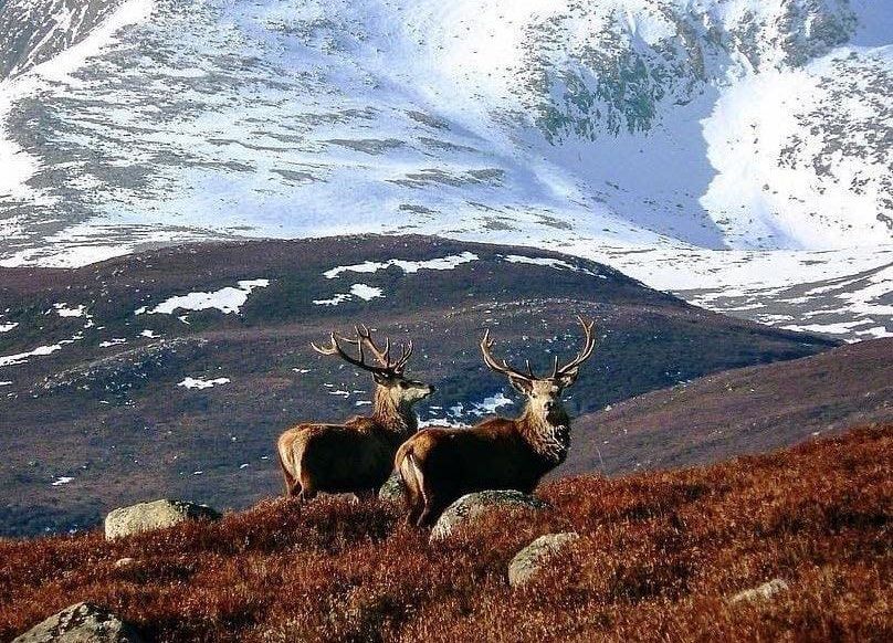
Monday 18th May

Strenuous              Walk 4:        Loch Avon and Loch Etchachan - Ski Centre to Linn of Dee

Distance                 25km/15mls       Ascent 850m/2789ft
Walking time approx 9 hrs                 Map       Landranger36/43
Departure                7am              Start     NH 989 059          Finish NO 062 898
Loch Avon and Loch Etchachan are in the very heart of the Cairngorms. This route involves steep
ascents and descents in wild, remote country. The highlight is passing through the magnificent
Loch Avon basin. We start at Cairngorm Ski Centre and climb to a height of 1141m before
descending into Coire Raibeirt. The inflow into the Loch may involve wet feet where we seek out
the Shelter Stone before climbing once more to Loch Etchachan. We then enjoy a beautiful return
to the Linn of Dee through the Glen Derry pinewoods. Terrain: A testing mountain walk, not to be
underestimated, passing through very remote country, lacking clear paths, far from help. Strong
fitness and ability to cope with rough steep ground is necessary.

Medium                 Walk 5:                The Coyles of Glenmuick

Distance                  15km/9.3mls      Ascent 500m/1640ft
Walking time approx 6.5 hrs                Map        Landranger 44
Departure                 9 am             Start      NO 340 951        Finish NO 340 951
This walk starts by the secluded Loch Ullachie and goes up all 3 Coyles – Meall Dubh, the Coyles of
Muick and finally the Craig of Loinmuie. We will visit the newly rebuilt cairn erected to celebrate
the marriage of Edward 7th and, from here, there are stunning views of Loch Muick, Glen Muick
and the Balmoral Estate. We then meander back down through the Alltcailleach Forest where we
will visit the old township of Loinmuie. We finish back at Loch Ullachie where we started with
Birkhall to the east.

Easy                   Walk 6:                Along the River Gairn to Ballater

Distance                10km/6mls          Ascent 100m/330ft
Walking time approx 5 hrs                  Map       Landranger 37
Departure               10 am              Start     NJ 316 004        Finish NO 370 959
From the foot bridge over the River Gairn, we start the linear walk back to Ballater. The first part is
through the Long Haugh, a peaceful riverside meadow with historical associations. We pass
through the hamlets of Balno, Inverenzie, Lary and Abergairn, with a detour to the ruins of
Abergairn Castle. We return to Ballater through the Hilton Grand Vacations Resort at
Craigendarroch and along the Deeside Way.
Tuesday 19th May

Strenuous             Walk 7:                Broad Cairn and Cairn Bannoch - 2 Lochs, 2 Munros

Distance                 24km/15mls       Ascent 870m/2854ft
Walking time approx 8 hrs                 Map      Landranger43/44
Departure                8 am             Start    NO 309 851          Finish NO 309 851
Whilst the nearby cliffs of Lochnagar are famed and celebrated, the magnificent beetling black
precipice of Creag an Dubh-loch is much less known. On this fine hill walk, we will visit this great
crag and its lonely loch before ascending Cairn Bannoch and Broad Cairn to make a return to Loch
Muick, taking the south bank path back to the Spittal of Glenmuick.

Medium                Walk 8:                Glen Feardar

Distance                  16km/10mls       Ascent 450m/1480ft
Walking time approx 6 hrs                  Map        Landranger 44
Departure                 9 am             Start      NO 234 938        Finish NO 188 914
We start this linear walk going through birch woods and open moors with wonderful views of
Lochnagar, visiting the late Queen Mother’s picnic house and a restored cruck framed cottage at
Auchtavan, an 18th-19th century fermtoun. We then continue on, ascending through Glen Feardar,
the Glen of High Water. We cross a stream at a ford and head back south through the Invercauld
Forest with Craig Leek to the east. Our destination is the car park at Keiloch.

Easy                  Walk 9a:               The Tarland Way

Distance                 11km/7mls        Ascent 150m/490ft
Walking time approx 5 hrs                 Map        Landranger 37
Departure                10 am            Start      NJ 529 986         Finish NJ 481 043
From Aboyne, we will walk through the wrought iron gates towards Aboyne Castle, then head
westward along an avenue of trees. A short detour from the track, we will visit a stone circle. The
Way then winds up and down through forest. From the road bridge at Coull we will walk along the
southside of the Tarland Burn. Before reaching Tarland, we will turn south and visit the recumbent
stone circle with wonderful all round views and finish in the village square.

Easy Special Interest Walk 9b:               Heritage /Archaeology Tarland

Distance                  12km/7.5mls        Ascent 330m/1080ft
Walking time approx       5 hrs              Map      Landranger 37
Departure                 10 am              Start    NJ 481 043      Finish NJ 481 043
We will travel back in time around Tarland on a circular walk from the village square, taking a trip
back over 4,000 years ago to Tomnaverie stone circle, built by Bronze Age farmers. We will visit
Culsh earth house, an Iron Age underground storage chamber and follow an old drove road up to
the slopes of Pittenderich, to take in the view over the Howe of Cromar and beyond. The route we
take descends through moorland and woodland, passing Douneside House to return to Tarland.
(Moderate ascent and short steeper section, mostly on grass / gravel paths).
Wednesday 20th May

             4pm Festival Gathering at Crathie Church Hall, 2 course meal and more!

Strenuous              Walk 10:               Spittal of Glen Muick to Crathie via Conachraig

Distance                  16km/10mls        Ascent 500m/1640ft
Walking time approx 6.5 hrs                 Map       Landranger 44
Departure                 9 am              Start     NO 310 852      Finish NO 269 948
From the Spittal, we cross the River Muick and head up to Alt-na-guibhsaich and Clais Rathadan
where we will get stunning views of Lochnagar. Leaving the track, we’ll climb up the rounded top
of Conachcraig. A very short descent and ascent leads to Caisteal na Caillich before we head down
to the landrover track via Little Conachcraig to Crathie Church Hall.

Medium                 Walk 11:               Balmoral and the Colonel in Chief’s Trail

Distance                  15km/9.5mls     Ascent 320m/1050ft
Walking time approx 5.5 hrs               Map        Landranger 44
Departure                 10am            Start      NO 286 951        Finish NO 269 948
From Abergeldie, we will follow a quiet road to the Lochnagar Distillery and Easter Balmoral. After
Rhebreck, we will pass several Royal cairns before heading down to the estate road. Further on,
we reach The Colonel in Chief’s Trail meandering uphill and down. After crossing the River Gelder,
from the Lochnagar track, we will go up over Creag an Lurachain with Prince Albert’s Cairn atop
before finishing at Crathie Church Hall

Easy                   Walk 12a:              Balnacroft and the Genechal

Distance                 10km/6 mls         Ascent 160m/520ft
Walking time approx 4.5 hrs                 Map       Landranger 44
Departure                11 am              Start     NO 264 949        Finish NO 269 948
We will start by walking from the car park to the Distillery and then along a back road to
Balnacroft. Following a woodland track, we will make a detour to The Genechal, now a derelict
cottage associated with Queen Victoria. Before we emerge onto open hillside, there is a stile to
cross. The downhill route offers amazing vistas of Balmoral and the Eastern Cairngorms. We will
retrace our steps from the distillery, back over the White Bridge to finish at Crathie Village Hall.

Easy Special Interest Walk 12b:               Around Crathie

Distance                  5km/3mls           Ascent minimal
Walking time approx 2 hrs                    Map      Landranger 44
Departure                 1.25 pm            Start    NO 264 949        Finish NO 269 948
Meet at the Hut on the Green in plenty of time to catch the Braemar service bus at 1.37pm
alighting at Crathie. The walk will be at an easy pace on tracks around Crathie and include a tour
of the Kirk which the Royal Family attend when they are resident at Balmoral and the cemetery
where Queen Victoria’s servant John Brown is buried. We will finish at Crathie Village Hall.
Thursday 21st May Strenuous Walk 13: Ben Macdui 1309m and Derry Cairngorm 1155m Distance 29km/18mls Ascent 1070m/3510ft Walking time approx 11 hrs Map Landranger 43 Departure 7 am Start NO 062 898 Finish NO 062 898 Ben Macdui is Britain’s second highest peak, situated in the centre of the Cairngorm plateau. We approach from Deeside amongst the ancient pines of Glen Derry reaching Derry Lodge and the Luibeg burn. We climb Sron Riach and skirt the tremendous cliffs above Lochan Uaine. The return journey takes us over rocky Derry Cairngorm before retracing our steps back to the Linn of Dee. Medium Walk 14: The Maim, Geallaig Hill and Carn Dearg Distance 12.5km/8mls Ascent 320m/1050ft Walking time approx 6 hrs Map Landranger 44 Departure 9 am Start NO 266 987 Finish NJ 336 002 With not a great deal of ascent, the views from this walk are spectacular. Starting from the highest point on the Old Military Road, we head up a track to the top of The Maim with amazing views over Balmoral and west up the Dee Valley. Retracing our steps, we then follow a great high-level track across the top of Geallaig Hill, Creag na Creiche and Carn Dearg. Once down into the glen, we will cross a footbridge over the River Gairn and walk through Balno and Inverenzie to finish the walk at Lary. Easy Special Interest Walk 15: Muir of Dinnet Distance 8km/5mls Ascent 20m/65ft Walking time approx 5 hrs Map Landranger 37 Departure 10 am Start NO 429 997 Finish NO 429 997 The Scottish Natural Heritage Ranger will lead us through the Burn o’ Vat trail on to Parkin’s Moss, then to Loch Kinord and Little Ord. This rough circular walk is steeped in history and archaeology, especially along the little Ord trail.
Friday 22nd May

Strenuous             Walk 16:              Culardoch and Carn Liath from Keiloch

Distance                24km/15mls        Ascent 850m/2790ft
Walking time approx 8.5 hrs               Map        Landranger 43
Departure               8 am              Start      NO 188 912      Finish NO 118 912
These two rounded Corbetts on the eastern side of the Cairngorms are easily climbed together.
Culardoch offers extensive views across much of Aberdeenshire, whereas Carn Liath provides a
superb vantage point for admiring the granite tors of nearby Ben Avon.
Leaving Keiloch on good tracks, we climb to the top of the Bealach Dearg, which is the high point
on the old drove road between Invercauld and Tomintoul. Further ascent takes us to Culardoch,
then a heathery traverse to Carn Liath before a pleasant descent back to the tracks of Invercauld.
This route may be boggy in places.

Medium                Walk 17:              Craig Vallich and Pannanich Hill

Distance                  18km/11mls       Ascent 430m/1420ft
Walking time approx 6 hrs                  Map      Landranger 44
Departure                 9 am             Start    NO 370 958        Finish NO 370 958
Leaving Ballater by the Royal Bridge, we take the new woodland path skirting Glenmuick House to
the Bridge of Muick. From there, we follow the track known as Pollagach Road for a steepish
climb up to Craig Vallich. We then continue to Pannanich Hill before descending into the forest,
passing the old curling ponds and emerging back at the Royal Bridge.

Easy                  Walk 18:              Mar Lodge to Keiloch

Distance                 11km/7mls        Ascent minimal
Walking time approx 5 hrs                 Map       Landranger 43
Departure                10 am            Start     NO 102 895       Finish NO 188 914
From the Victoria Bridge, we cross the River Dee and walk towards Mar Lodge, built for Princess
Louise, a granddaughter of Queen Victoria. We will join the minor road to the Linn of Quoich and
cross the new bridge which reopened at the end of 2019. During the floods of 2016, the river
changed its course leaving the old one very badly damaged and leading to nowhere. From here,
we continue on a good track through the Invercauld Estate and woodlands to finish at Keiloch.
.
Cambus O’May Suspension Bridge
                           damaged in Storm Frank

Cambus O’May bridge is a cherished feature on a beautiful part of the River Dee,
between Ballater and Dinnet, and forms part of the Cairngorm National Park Core Path
Network. It was devastatingly damaged by Storm Frank and we (BRD) are raising
funds to reopen this iconic bridge, much loved by the local community and walkers
alike. We hope to raise £150,000 and any donation you feel able to make would be
much appreciated. This can be made directly on the booking form.
You can also read