Benchmarking National Highways - 2021 Progress update 08 February 2022
←
→
Page content transcription
If your browser does not render page correctly, please read the page content below
Benchmarking National Highways
2021 Progress update
08 February 2022
Contents
Executive summary                                    3
    Regional benchmarking highlights                 4

1. Benchmarking National Highways                     5

2. Benchmarking National Highways’ regions            6
    Monitoring performance                            6
    Expanded suite of indicators for road period 2    6
    Impacts of the pandemic                           7
    Performance overview                              9
    Improving Safety for All                         12
    Fast and Reliable Journeys                       21
    A Well Maintained and Resilient Network          28
    Meeting the needs of all road users              36

3. Ongoing activities                                44
    Area-level cost and efficiency benchmarking      44
    Comparing road condition                         46
    Enhancement costs                                46

2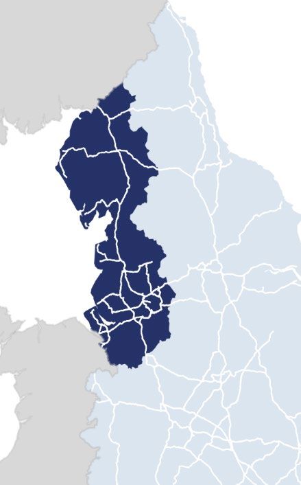
Executive summary
Benchmarking the performance and efficiency of National Highways helps inform our work
as the Highways Monitor and informs the advice we provide to government.

We have maintained a regional benchmarking series since 2016. The second road
investment strategy set out an aim for more disaggregated performance reporting,
including at a regional level. National Highways acted on this by publishing an expanded
set of regional performance data in July 2021.

This expanded set of indicators provides us with a more rounded understanding of
regional performance. The regional indicators span five themes – safety for all; fast and
reliable; well maintained and resilient; meeting the needs of road users; and delivering
better environmental outcomes. This allows us to explore the linkages between different
aspects of performance.

Most of the data included in this year’s report is for the first year of the second five-year
road period (2020-21). Whilst providing a snapshot of performance, it also sets a baseline
to gauge the progress of the regions over the next four years. Many indicators in this
year’s report have been affected by the impacts of the pandemic on travel behaviours and
traffic levels. As travel demand recovers, it will provide new insights into the relationship
between traffic levels and aspects of performance such as safety.

We hope that greater regional performance transparency will incentivise National
Highways regions to improve performance, ultimately leading to better outcomes for users
of the strategic road network (SRN) as well as for the environment and the taxpayer.

We also provide an update on a range of other activities relating to benchmarking. We
summarise the findings of a review of National Highways’ area-level maintenance cost
data. This work identifies opportunities to use area-level data to measure the progress
National Highways has made in delivering more efficiently. We will continue to work with
National Highways to implement these approaches during road period 2.

3

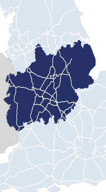
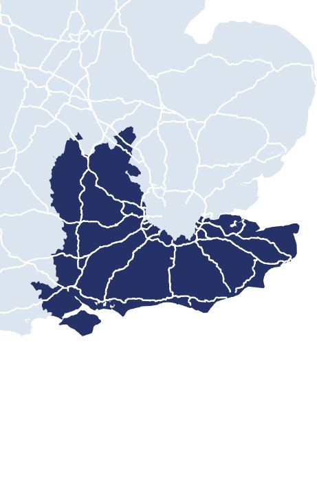
Regional benchmarking highlights
(2020-21 unless stated)

Safety for all
In 2020, the number of people killed or seriously injured (KSIs) on the SRN fell
dramatically and National Highways met its target to reduce KSIs to 40% against a 2005-
2009 baseline. The reduction in KSIs in 2020 was primarily due to lower traffic levels
although KSIs fell faster than traffic.
Data for National Highways’ regions is available for 2019. Each of the regions experienced
similar long-term reductions in casualties (of all severities). Our analysis shows that the
Midlands has seen the largest reduction (56% in 2019 against 2005-09 levels) whilst the
South East (including the M25) has seen the smallest reduction (35% in 2019).
Providing fast and reliable journeys
As the most heavily trafficked region, the South East stands out as having the highest
levels of delay, the least reliable journeys, and the most delays due to roadworks. The
South West was the best performer in ensuring the network remains open and available
for traffic, closely followed by Yorkshire and the North East. The South West also dealt
with motorway incidents more quickly than any other region.
A well maintained and resilient network
Most regions are performing at or beyond the national level target for pavement condition
– ensuring that 95% of road surfaces do not require further investigation for maintenance.
The East is an exception to this at 92% – 2 percentage points lower than in 2019-20 and 3
percentage points below the national average. The North West was the best performer at
97%.
Meeting the needs of all road users
National Highways will need to make substantial progress during road period 2 to meet its
national level target for timeliness and accuracy of roadworks information. The South East
– the region with the most delays due to roadworks – was the lowest ranked region for this
measure.
Delivering better environmental outcomes
Regional level data is included for environmental performance indicators related to air
quality, noise and water quality. Progress against these indicators tends to be driven by
localised actions to deliver environmental mitigation. We would expect each of the regions
to make progress in mitigating the impact of the SRN on the environment and we will
continue to track progress against these indicators during the remainder of road period 2.

4

1. Benchmarking National
   Highways
1.1   National Highways maintains, renews, operates and aims to improve the SRN –
      the motorways and main 'A' roads in England. As the ‘Highways Monitor’, the ORR
      is responsible for monitoring and enforcing the performance and efficiency of
      National Highways.

1.2   One of the key activities we undertake is to benchmark the performance and
      efficiency of National Highways. We do this in two ways: comparing National
      Highways and the SRN against organisations and highway networks elsewhere in
      the UK and internationally; and benchmarking the performance of National
      Highways’ regions against each other. Both forms of benchmarking provide us
      with additional insights and contribute to a more rounded view of the company’s
      performance.

1.3   We have published an annual progress update on our benchmarking activities
      since 2016. In this update we report on activities undertaken during 2020-21 – the
      first year of the second road period (2020-21 to 2024-25). The remainder of this
      report comprises two main sections:

      ●    In section 2 we provide an update of the regional benchmarking series.
           The data in this section provides an overview of regional performance during
           2020-21, highlighting key trends and new insights.

      ●    In section 3 we provide an update on some of our ongoing activities. There
           are three areas: the cost and efficiency of National Highways’ regions and
           operating areas with respect to maintenance and renewals; comparing road
           surface condition between different networks in the UK and Europe; and
           benchmarking the cost of enhancement projects delivered by National
           Highways.

5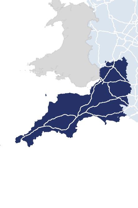
2. Benchmarking National
   Highways’ regions
      Monitoring performance
2.1   We hold National Highways to account for its achievement of targets set at a
      national level and report on this in our Annual Assessment of National Highways.
      We accept that some degree of regional variation will occur, and we don’t expect
      all the regions to achieve the national targets across all the KPIs. Nevertheless,
      we expect National Highways to explore and understand regional variations in
      performance and, where possible, to ensure lessons are learned to improve
      performance across the network.

2.2   Regional benchmarking has several benefits. It provides insights into National
      Highways’ performance that are not always visible at a national level. It also helps
      inform our advice to government on the setting of future performance targets.
      Moreover, it increases transparency around the company’s performance and
      provides extra incentives for regions to improve performance.

2.3   This section compares the performance of National Highways’ regions during
      2020-21. The Key Performance Indicators (KPIs) and Performance Indicators (PIs)
      used here are a sub-set of the indicators we use to monitor National Highways’
      national-level performance. ‘KPIs’ are the headline performance measures which,
      in most cases, are associated with national-level performance targets. Below
      these sit a range of ‘PIs’ for which targets are not set but which provide a more
      rounded view of performance.

Expanded suite of indicators for road period 2
2.4   We established a regional benchmarking series during the first road period (2015-
      2020). In our 2020 Progress Report we summarised the performance of National
      Highways’ regions across the entirety of the first road period. This report presents
      data for the first year of the second road period (2020-2025). As well as providing
      a snapshot of performance in 2020-21, it sets the baseline against which we will
      track performance throughout the remainder of the road period.

2.5   To date, regional benchmarking has been undertaken using a selection of five
      KPIs. In last year’s report we set out our desire to broaden the range of indicators
      that are available at a regional level. National Highways has made significant

6
progress in this regard. In 2021 it published data for 22 out of a total of 37 national
level indicators (excluding those related to efficiency) across five themes. This
provides a much richer picture of performance. We expect further indicators to be
added next year although we also recognise that not all indicators lend themselves
to regional disaggregation.
2.6 The indicators included in this report are set out in Table 2.1.
Impacts of the pandemic
2.7 Most indicators set out in this report use data for the 2020-21 financial year.
Indicators that are influenced by the level of traffic on the network have been
significantly affected by the impact of the pandemic on travel demand. We have
highlighted where we consider this to be the case.
2.8 The pandemic has also meant that indicators of user satisfaction, generated by
Transport Focus, are again missing from this year’s analysis. The Strategic Roads
User Satisfaction survey (SRUS) has moved to on-line data collection, rather than
face-to-face interview. In addition, journey patterns and purposes of travel were
impacted by different phases of lockdown and restrictions. Consequently, the
SRUS target was suspended for 20-21 and 21-22, whilst the new methodology
and travel patterns settle.
7Table 2.1 Regional performance indicators included in this report for 2020-21
Safety for all Providing fast and A well maintained Meeting the needs of Delivering better
reliable journeys and resilient network all road users environmental
outcomes
Key The number of people Average delay Pavement condition Roadworks Noise
Performance killed or seriously injured on information timeliness
Indicators the SRN Network availability and accuracy Air quality
(KPIs)
Incident clearance
Performance The number of people Delay from Structures condition Timeliness of Water quality
Indicators killed or injured on the SRN roadworks information provided to
(PIs) Drainage resilience road users through
The number of non- Journey time electronic signage
motorised and motorcyclist reliability Geotechnical
users killed or injured on the condition Ride quality
SRN Average speed
Number of injury
collisions on the SRN
The accident frequency
rate for National Highways’
staff
The accident frequency
rate for National Highways’
supply chain staff
8Performance overview
2.9 There are two types of indicators used to monitor performance – KPIs and PIs.
Table 2.1 provides a high-level overview of regional performance in 2020-21
based on a selection of headline measures (primarily KPIs). During the remainder
of road period 2 we will continue to track each regions’ progress in delivering
better outcomes for users, the environment, and the taxpayer.
2.10 Key highlights for each of the five themes in 2020-21 are as follows:
Safety for all
2.11 In 2020, the number of people killed or seriously injured (KSIs) on the SRN fell
dramatically and National Highways met its target to reduce KSIs to 40% of a
2005-2009 baseline. The reduction in KSIs in 2020 was primarily due to lower
traffic levels resulting from the pandemic although KSIs fell faster than traffic
levels.
2.12 There are technical reasons – explained in section 2.21 of this report – why it is
difficult to directly compare regions based on the number of KSIs (the safety KPI).
Therefore, for the purposes of regional comparison, we focus on ‘all severity’
casualties (a PI). Each of the regions experienced similar long-term reductions in
casualties (of all severities). Our analysis shows that the Midlands has seen the
largest reduction (56% in 2019 against 2005-09 levels) whilst the South East
(including the M25 which is operated via a Design Build Finance Operate – DBFO
- contract) has seen the smallest reduction (35% in 2019).
2.13 The types of roads that make up a region’s network have an important influence
on casualty rates and the speed with which numbers of casualties have reduced.
In this year’s report we also include analysis of regional casualties and fatalities
adjusting for differences in casualty rates observed for motorways and A-roads. In
2019, Yorkshire and the North East was the region that had the most to do to
reduce KSIs to a target level set by National Highways, although our analysis
suggests that fatalities and all-severity casualties are at the level that would be
expected given the mix of motorways and A-roads in this region.
Providing fast and reliable journeys
2.14 As the most heavily trafficked region, the South East continues to stand out as
suffering the highest levels of delays. Moreover, users in the South East also
experience the least reliable journeys and spend more time in delays due to
roadworks. This highlights that each of these measures is strongly influenced by
9the level of traffic on the network. Overall, delays reduced and reliability improved
as a result of the fall in traffic on the SRN.
2.15 In 2020-21, all the regions outperformed the national targets with respect to
network availability (keeping the network open and available for traffic) and
incident clearance. The South West was the best performer in respect of network
availability, closely followed by Yorkshire and the North East. The South West
also dealt with traffic incidents more quickly than any other region.
A well maintained and resilient network
2.16 The KPI under this theme relates to the condition of the road surface (‘pavement
condition’) although further asset condition measures have now been added to the
suite of regional indicators. Four out of the six regions are performing close to or
beyond the national level target of ensuring that 95% of the network does not
require further investigation for maintenance. An exception to this is the East
which sits at 92% - 2 percentage points lower than was the case in 2019-20 and 3
percentage points below the national average. The North West has the highest
pavement condition score at 97%.
Meeting the needs of all road users
2.17 National Highways will need to make substantial progress during road period 2 to
meet its target relating to the timeliness and accuracy with which it provides
roadworks information. Notably, the South East – the region in which users
experience the greatest delays due to roadworks – was the lowest ranked region
for this measure.
Delivering better environmental outcomes
2.18 We also hold National Highways to account for its performance against a range of
environmentally focussed indicators and those relating to noise, air quality and
water quality, are now available at a regional level. Progress against these
indicators tends to be driven by localised actions to deliver environmental
mitigation. In any given year, we would not expect these actions to be spread
evenly across the regions. Nevertheless, we would expect each of the regions to
make progress in mitigating the impact of the SRN on the environment and we will
continue to track progress against these indicators during the remainder of road
period 2.
2.19 The remainder of this section of the report describes performance within each of
the themes in more detail.
10Table 2.2 Regional performance overview
Well Meeting the
Safety for all Providing fast and reliable journeys maintained needs of all
and resilient road users
Roadworks
Number of Network Pavement
Average delay Incident information
people killed availability condition
Region (KPI) clearance (KPI) timeliness and
or injured (PI) (KPI) (KPI)
accuracy (KPI)
seconds per % of incidents
% reduction % of network
vehicle per cleared within % of network % accuracy
on 2005-09 open to traffic
mile 1 hour
2019 Rank 20-21 Rank 20-21 Rank 20-21 Rank 20-21 Rank 20-21 Rank
Yorkshire and
-45% 3 6.2 3 98.3% 2 88.8% 4 95.6% 4 58.4% 3
North East
North West -47% 2 6.0 1 97.8% 5 88.1% 5 97.2% 1 58.3% 4
Midlands -56% 1 6.9 5 98.2% 3 88.6% 3 94.4% 5 66.3% 1
East -38% 5 6.0 1 98.0% 4 87.9% 6 92.1% 6 58.0% 5
South East -35% 6 7.9 6 97.7% 6 88.8% 2 96.6% 2 42.4% 6
South West -40% 4 6.2 3 98.5% 1 89.7% 1 96.0% 3 63.5% 2
National Highways -43% - 6.7 - 98.0% - 88.6% - 95.2% - 54.5% -
National Target
(*by end of road NA 9.5* - 97.5% - 86.0% - 95.0% - 90.0%* -
period 2)
11Improving Safety for All
Key Performance Indicator: Killed or seriously injured (KSI)
Measure: Number Target: 40% reduction by
of KSI casualties 2020 (2005-09 baseline)
Performance Indicators
Total number of Number of injury The accident
people killed or collisions on the frequency rate for
injured on the SRN National Highways’
SRN
staff
The accident frequency The number of non-motorised
rate for National and motorcyclist users killed or
Highways’ supply chain injured on the SRN
staff
Key Performance Indicators
2.20 There is a single KPI under the ‘Improving safety for all theme’: It measures the
number of people killed or seriously injured (KSI) on the SRN. National
Highways is set a target for the number of KSIs on its network as compared to a
2005-2009 average baseline. For 2020 its target was to achieve a 40% reduction
in KSIs compared with the baseline. By 2025, National Highways must achieve a
50% reduction in KSIs compared with the same baseline.
2.21 At a national level, trends in KSIs are ‘adjusted’ to take account of differences in
the way police forces across the country record serious injuries. It is not possible
to perform this adjustment at a regional level and therefore the data presented in
this report is ‘unadjusted’. This means that injuries that would be classified as
‘serious’ in one region may be classified as ‘slight’ in another region. This needs to
be borne in mind when making direct comparisons between the regions in respect
of KSIs. At a national level, the ‘unadjusted’ measure of KSIs understates the
reductions that have been achieved (because, under the new police recording
system, more injuries tend to be classified as ‘serious’).
122.22 In 2020, the adjusted measure of KSIs on the SRN was 54% lower than the
2005-09 baseline, meaning that the 2025 target was met well ahead of the
schedule expected when the target was set. However, this figure was strongly
influenced by the reduction in traffic levels during the pandemic and we expect
KSIs to increase again as traffic levels rise.
2.23 Data for National Highways’ regions is available for 2019 and is not affected by the
pandemic. In contrast to the indicators given elsewhere in this report, data
includes collisions that have occurred on roads operated under DBFO
arrangements.
2.24 Figure 2.1 shows the reduction in KSIs (unadjusted for differences in police
recording) achieved by National Highways’ regions against the 2005-09 baseline.
Large differences can be observed across the regions. For example, in the
Midlands KSIs were 29% lower, but in Yorkshire and the North East no such
reduction was apparent. Given the influence of changes in police recording
practices it is unwise to draw any firm conclusions from this.
2.25 Figure 2.1 shows the further reduction in KSIs, against 2019 levels, that National
Highways considered would be required to meet the 40% reduction target. These
regional ‘targets’ – taken from National Highways’ 2019 Safety Performance
Report – are provided only to illustrate the differing levels of progress required
across the regions as the 2020 target was achieved.
13Figure 2.1 Number of KSIs in 2019 (unadjusted for differences in recording
practices): % reduction on 2005-09 baseline
KSIs in 2019: % Change against 2005-09 baseline
Further reduction on 2019 levels required to meet 2020 target
0% 0%
KSIs in 2019 (% change on baseline)
0%
-5%
-5%
Further reduction required
-10%
to meet 2020 target
-10% -12%
-14% -15%
-15% -15% -17% -20%
-19%
-20% -25%
-30%
-25% -26%
-29% -28% -35%
-30%
-30% -32%
-40%
-35% -40% -45%
Yorkshire North Midlands East South South
and North West East (incl. West
East M25
DBFO)
Performance Indicators
2.26 Data for the total number of people killed or injured on the SRN is not affected
by differences in police recording practices.
2.27 On this measure, as shown in Figure 2.2, the reductions in casualties since 2005-
09 are more consistent across the regions, although substantial differences
remain. In the Midlands, a 56% reduction in casualties occurred, whilst in the
South East the reduction was only 35%.
2.28 It is incumbent on National Highways to reduce the number of casualties on its
network. However, many factors that influence casualty rates – such as vehicle
technology and driver behaviour – are largely outside of the company’s control.
Regional differences such as the mix of road types, levels of traffic and weather
conditions mean that National Highways’ regions each face different challenges
when trying to achieve reductions in casualties.
14Figure 2.2 Number of people killed or injured in 2019: % reduction on 2005-09
baseline (PI)
0%
Killed or injured (% change on 2005-09 baseline)
-10%
-20%
-30%
-35%
-38%
-40%
-40% -43%
-45%
-47%
-50%
-56%
-60%
Yorkshire North Midlands East South South National
and North West East West Highways
East (including
M25
DBFO)
2.29 The remaining performance indicators under this theme are shown in Figure 2.3.
2.30 Accident frequency rates are used to monitor performance in respect of the
safety of National Highways’ staff or staff employed in the supply chain. The
accident frequency rates are based on Reporting of Injuries, Diseases and
Dangerous Occurrences Regulations (RIDDOR) incidents and are expressed as a
function of hours worked.
2.31 For both National Highways’ operational staff, and those employed by its supply
chain in road maintenance and construction, the accident frequency rate stands at
0.05 incidents per 100,000 hours worked. At a regional level, the data for 2020-21
provides only a snapshot. In any given year, a relatively small number of incidents
can show up as large differences in the accident frequency rate. If tracked over a
longer period, patterns may emerge that provide insights into safety performance
at a regional level.
15Figure 2.3 Performance indicators – Improving safety for all
Accident frequency rate for National Highways' staff (PI) Accident frequency rate for supply chain staff (PI)
0.12 0.11 0.16 0.14
Accident frequency rate
0.14
Accident frequency rate
0.10
0.12
0.08 0.10
0.06 0.06 0.07 0.07
0.06 0.05 0.05 0.08
0.06 0.05
0.04
0.04 0.03
0.02 0.02
0.00 0.00 0.00 0.00
0.00 0.00
YNE NW MIDS E SE SW NH YNE NW MIDS E SE SW NH
Number of people killed or injured
All severity injury collisions (PI) Non-motorised and motorcyclist users
0% killed or injured on the SRN (PI)
1,200
% reduction on baseline
-10% 962
1,000
-20%
800
-30%
600
-40% -35% 400 333
-40% -41%
-50% -43% -43% 192
200 118 78 128 113
-48%
-60% -54%
0
YNE NW MIDS E SE SW NH YNE NW MIDS E SE SW NH
16Key trends – casualty rates
2.32 In 2020, the number of casualties (of all severities) on the SRN fell by 36%, the
number of KSIs (adjusted) fell by 32%, and the number of fatalities fell by 34%
compared with the previous year. Overall traffic levels on the SRN fell by 25%.
Therefore, not only was there a reduction in the number of casualties but also a
reduction in the rate of casualties per mile travelled.
2.33 Falling casualty rates in 2020 appears to be a continuation (or possibly an
acceleration) of a longer-term trend. Figure 2.4 shows casualty rates (casualties of
all severities per billion vehicle miles) on the SRN since 2016. Casualty rates fell in
each of these years. There is a large difference between casualty rates on
motorways and A-roads with the latter exhibiting much higher rates of casualties.
Nevertheless, progress is being made in reducing casualty rates on both road
types.
Figure 2.4 Casualty rates on the SRN since 2016
Motorways A-roads
300
Casualties (all severities) per billion vehicle miles
262
250
219
202
200 189
166
150
129
112 107
93
100
76
50
0
2016 2017 2018 2019 2020
172.34 Figure 2.5 shows fatality rates over the same period. The picture is less clear cut
for fatalities. It appears that there has been a downward trend in fatalities on
A-roads. However, fatality rates on motorways have seen little change since 2016.
As for all casualties, the rates remain substantially higher for A-roads than for
motorways.
Figure 2.5 Fatality rates on the SRN since 2016.
Motorways A-roads
6.0
Fatalities per billion vehicle miles
4.8 4.9
5.0
4.4
4.0 3.6
3.0 2.8
2.0
1.5 1.4 1.4
1.3 1.4
1.0
0.0
2016 2017 2018 2019 2020
18Casualty rates and regional variation (administrative regional boundaries) Given the difference in casualty rates, the proportion of motorways and A-roads in a region will have an important bearing on safety outcomes. All things being equal, a region with a higher proportion of A-roads would be expected to exhibit a higher level of casualties. We have compared the number of casualties in each region to the level that would be ‘expected’ based on the casualty rates observed at a national level. The ‘expected’ level of casualties is calculated by applying the national level casualty rates for motorways and A-roads to the vehicle miles travelled on each type of road within the region in question. Where actual casualties exceed ‘expected’ casualties, this means that casualties are higher than might be expected given the amount of traffic using motorways and A-roads. Conversely, where actual casualties are less than ‘expected’ casualties, this means that casualties are lower than might be expected given the amount of traffic using each road type. There are many complex factors that explain casualty rates beyond road types and therefore a degree of variation is to be expected, with some regions showing casualty rates above the average, and some below. The data in this section is based on administrative regional boundaries, rather than National Highways regions. The boundaries of National Highways regions and administrative regions do not always align. Using administrative boundaries enables us to apply data on traffic flows and casualties broken down by road type. The analysis has been undertaken for a 5-year period (2016-2020) which reduces the influence of year-to- year fluctuations. For casualties of all severities, for four of the six regions, the difference between actual and ‘expected’ casualties is 10% or less. In the Midlands, actual casualties have been around 25% lower than might be expected given traffic levels on motorways and A-roads. In London and the South East, casualty rates have been 24% higher than expected. Further exploration of local conditions would be required to establish why this is the case, although it may be that traffic levels play a part. In London and the South East, heavily trafficked roads are congested for more of the time such that collisions between vehicles are more likely. 19
Actual vs 'Expected' casualties: 2016 to 2020 (% difference)

                                      Actual casualties           Expected casualties based on national rates

                              20000                                                               24%
                              18000
Casualties (all severities)

                                                                        -25%
                              16000
                              14000
                                                                                      8%
                              12000
                              10000        -5%
                                                            5%                                                 -10%
                               8000
                               6000
                               4000
                               2000
                                  0
                                         Yorkshire North West         Midlands       East     London and South West
                                         and North                                            South East
                                           East

For fatalities, the differences between actual and expected casualties are smaller. It is
notable that the South East shows lower than expected fatalities, but higher than expected
casualties of all severities. The opposite is the case for the Midlands and the South West.

                                       Actual vs 'Expected' fatalities: 2016 to 2020 (% difference)
                                       Actual fatalities         Expected fatalities based on national rates
                              300
                                                                       7%                        -4%
                              250
                                                                                    -8%
                              200
                                        -18%
Fatalities

                                                                                                               20%
                              150                          8%

                              100

                               50

                                0
                                      Yorkishire   North West       Midlands        East     London and South West
                                      and North                                              South East
                                        East

20
Fast and Reliable Journeys
Key Performance Indicator: Average delay
Measure: Seconds Ambition: No worse than
per vehicle mile February 2020 (9.5
seconds)
Key Performance Indicator: Network availability
Measure: % of SRN free from lane Target: 97.5% lane
closure due to roadworks availability
Key Performance Indicator: Incident clearance
Measure: % cleared in less Target: 86% of motorway
than 1 hour incidents cleared within
Performance Indicators
Journey time Delay from roadworks Average
Key Performance Indicators
2.35 There are three KPIs under the theme of ‘fast and reliable journeys’. They relate to
the delays that users experience on the network (average delay), the speed with
which National Highways deals with traffic incidents (incident clearance) and the
availability of the network for traffic (network availability).
2.36 Average delay is the difference between observed travel time and the speed limit
travel time. In last year’s report we showed how differences in average delay are
strongly influenced by the amount of traffic on the network. As might be expected,
the effect of the pandemic on travel behaviours and traffic levels had an impact on
the level of congestion and delay. All of National Highways’ regions experienced a
reduction in delays in 2020-21.
212.37 The South East is the most heavily trafficked region of the network and, in
2020-21, users continued to experience higher levels of delay than any other
region.
Figure 2.6 Average delay (KPI)
2020-21 National Highways Ambition (by 2024-25)
10
Seconds of delay per mile travelled
9
8
7.9
7
6.9 6.7
6
6.2 6.0 6.0 6.2
5
4
3
2
1
0
Yorkshire North West Midlands East South East South National
and North West Highways
East
2.38 Transport Focus’ strategic roads user satisfaction surveys demonstrate that users’
perception of the SRN is strongly influenced by the delays they experience during
their journey, including roadwork management. National Highways must carefully
balance the requirement to maintain and improve the network with the need to
minimise disruption to travel.
2.39 In 2020-21 National Highways was tasked with ensuring that 97.5% of its network
(lane kilometres) is open and available for traffic and free from closure due to
roadworks. Each of National Highways’ regions achieved the network availability
national target. There was little variation in performance across the regions with
availability ranging from 97.7% (South East) to 98.5% (South West).
22Figure 2.7 Network availability (KPI)
2020-21 National Highways Target
100%
98.3% 97.8% 98.2% 98.0% 97.7% 98.5% 98.0%
% of the network free from closure
80%
60%
40%
20%
0%
Yorkshire North Midlands East South South National
and North West East West Highways
East
2.40 The impact of traffic incidents is a further dimension of traffic disruption and delay.
The incident clearance KPI measures the percentage of incidents on the
motorway that impact traffic flow but are cleared in less than one hour. Achieving
the 86% target was less challenging during 2020-21 because the level of traffic
and the number of collisions on the network were substantially reduced.
Nevertheless, as we set out in our Annual Assessment 2020-21, National
Highways deserves credit for the way in which it maintained operations during the
pandemic.
2.41 All of the regions exceeded the national target for incident clearance. The
differences between the best and worst performing regions were slight with the
South West performing at 89.7% but no region falling below 86%.
23Figure 2.8 Incident clearance (KPI)
2020-21 National Highways Target
100%
% of incidents cleared within 1 hour
88.8% 88.1% 88.6% 87.9% 88.8% 89.7% 88.6%
80%
60%
40%
20%
0%
Yorkshire North Midlands East South South National
and North West East West Highways
East
Performance Indicators
2.42 National Highways has provided regional results for three of the PIs under this
theme. This provides us with a richer picture of the conditions faced by users.
2.43 In many ways, unreliable journeys and unexpected delays are more important to
users than the delays they experience on an ‘average journey’ with normal levels
of congestion. At a national level, journey time reliability – the average
difference between observed travel times and ‘normal’ travel times – fell from 2.9
seconds per mile travelled in 2019-20 to 1.9 seconds in 2020-21.
2.44 The South East exhibits both the highest level of delays as well as the worst
journey time reliability. This illustrates how closely both measures are related to
the level of traffic on a network – more traffic congestion leads to both higher
delays and less predictable journey times (see delays and reliability section).
2.45 Users in the South East also experience the greatest delays due to roadworks.
This is despite the fact that network availability in the South East is similar to the
national average. This suggests that roadworks have a substantially greater
impact on travel times on congested parts of the network. At a national level,
delays from roadworks also fell markedly during 2020-21.
24Figure 2.9 Performance indicators – Fast and reliable journeys
Journey time reliability (PI) Delays due to roadworks (PI)
1.6
2.5
(mins per hour travelled)
Difference in seconds between observed and actual travel time
Average annual delay
1.4
1.2 1.3
1.0 1.1
0.8 1.0 0.9
2.1 0.9
2.0 0.6
0.4 0.6 0.6
1.9
1.8 1.8 1.8 0.2
1.7 1.7 0.0
1.5 YNE NW MIDS E SE SW NH
Average speed (PI)
1.0 60
61.0 61.7 60.1 62.0 59.6 60.6 60.7
50
Miles per hour
40
0.5 30
20
10
0.0 0
YNE NW MIDS E SE SW NH YNE NW MIDS E SE SW NH
25Key trends – Average delay
2.46 Data for 2020-21 shows that levels of traffic on the network are the dominant
factor in determining the levels of delays experienced by users. During the first
road period (2015-2020) there was a general trend of increasing average delay on
the SRN. 2020-21 was the first year in which average delay on the SRN
substantially reduced.
2.47 During 2020-21, traffic levels (annual average daily traffic flows) were at 67% of
pre-pandemic levels. Average delay for the SRN fell by 28% from 9.3 seconds per
mile in 2019-20 to 6.7 seconds in 2020-21. The data does not suggest that the
speed with which National Highways dealt with traffic incidents, or the availability
of the network due to roadworks, had any significant bearing on the reduction in
average delay.
Figure 2.10 Key trends: Average delay (KPI)
Average Delay KPI
10.0 9.4 9.3
9.2
8.9 9.0
9.0
8.0
Seconds per mile travelled
7.0 6.7
6.0
5.0
4.0
3.0
2.0
1.0
0.0
2015-16 2016-17 2017-18 2018-19 2019-20 2020-21
26Delays and reliability
Measures of average delay, reliability and delays during roadworks are highly correlated
because each is heavily influenced by the density of traffic on the network. More heavily
trafficked regions suffer more delays and also less reliable journeys.
Average delay and journey time reliability
2.2
South East
2.0 South West
North West
Reliability PI
1.8
Midlands
1.6 East Yorkshire and
North East
1.4
1.2
R² = 0.8152
1.0
5 5.5 6 6.5 7 7.5 8 8.5
Average delay KPI
Regions with poor reliability tend to be those with higher delays due to roadworks. Whilst
roadworks seem to make journeys less reliable, the correlation between these indicators
may be because both are influenced by traffic levels.
Delays due to roadworks and reliability
2.2 South East
2.0
South West
Reliability (PI)
1.8 Midlands
North West
1.6 East Yorkshire and
North East
1.4
1.2
R² = 0.516
1.0
0.4 0.6 0.8 1 1.2 1.4 1.6
Delays due to roadworks (PI)
27A Well Maintained and Resilient Network
Key Performance Indicator: Pavement condition
Measure: % of pavement asset that does Target: 95% of road surface
not require further investigation for that does not require further
possible maintenance investigation
Performance Indicators
Structures Drainage Geotechnical
condition resilience condition
Key Performance Indicators
2.48 There is a single KPI under the theme of a well maintained and resilient network
which relates to the condition of the road surface or pavement. Research
undertaken by Transport Focus found ‘improved quality of road surfaces’ to be the
number one priority for road users for improvements to the SRN. For the SRN,
National Highways is meeting its target to ensure that 95% of the network does not
require further investigation.
2.49 Most of National Highways’ regions are performing at or above the national level
target. An exception is the East region which is 3 percentage points below the
national target. There are several possible explanations for this lower level of
condition in the East. One contributing factor is that the East region has a high
proportion of the SRN’s concrete roads. However, this only partly accounts for the
gap in performance as 5% of roads in the East are concrete, compared with 2%
for the SRN as a whole.
282.50 A large proportion of SRN roads in the East are A-roads (83% by route length as
compared with 57% for the SRN as a whole). We have seen evidence that, on
average, pavement condition tends to be maintained at a higher standard on
motorways than A-roads which might be expected given higher volumes of traffic
on motorways. Furthermore, because the road network in the East is more spread
out than in other parts of England, there are fewer parallel routes to accommodate
traffic during periods of maintenance. This will make it more difficult for National
Highways to deliver pavement renewals.
2.51 The gap in performance between the East and the rest of the network was higher
in 2020-21 than has been the case since 2015.
Figure 2.11 Pavement condition (KPI)
2020-21 National Highways Target
% of the SRN not requiring further investigation
100%
96% 97% 94% 97% 96% 95%
92%
80%
for maintenance
60%
40%
20%
0%
Yorkshire North Midlands East South South National
and North West East West Highways
East
2.52 From April 2022, National Highways is due to update the pavement condition KPI.
Under the updated metric, condition will be measured on all lanes with traffic not
just lane one (the inside lane). This should provide a better linkage between
investment in pavement renewal and pavement condition performance.
2.53 Section 3 of this report describes a proposed exercise to compare the condition of
the SRN with a variety of comparator road networks in the UK and elsewhere.
29Performance Indicators
2.54 In 2020-21, for the first time, the suite of regional performance indicators has been
expanded to include those related to the condition of other assets, namely
structures condition, drainage asset condition and geotechnical asset
condition.
2.55 The condition of geotechnical assets is relatively uniform across National
Highways’ regions. In contrast, there is a much higher degree of variation in
respect of structures and drainage assets.
2.56 For structures, the condition scores are based on the proportion of structures that
are rated as ‘good’ in the opinion of an inspector. The ‘critical’ PI is based on the
condition of the asset’s most critical elements. Both structures condition scores are
highest in the South East.
2.57 Drainage assets are those that collect, move or store surface water run-off. The
proportion of the network that does not have an observed susceptibility to flooding,
through national flood mapping or reported flood events, ranges from 66% in the
Midlands to 85% in the East. In part this may be related to the drier climate in the
East of England although, aside from the East, it does not appear that regions with
higher levels of rainfall have poorer drainage resilience.
30Figure 2.12 Performance indicators – A well maintained and resilient network
Structures condition: average (PI) Structures condition: critical (PI)
100% 100%
Condition of structures
Condition of structures
80%
across the SRN
80% 88%
across the SRN
84% 84% 84% 85% 85% 85%
60% 71%
60% 65% 63%
59% 61% 60% 59%
40% 40%
20% 20%
0% 0%
YNE NW M E SE SW NH YNE NW M E SE SW NH
100% Drainage resilience (PI) Geotechnical condition (PI)
100%
% length of carriageway without
% length of the geotechnical
99.6% 99.6% 99.7% 99.5% 99.7% 99.6% 99.6%
asset that in good condition
80% 85%
susceptibility to flooding
an observed significant
79% 80%
70% 69% 72%
60% 66% 68%
60%
40%
40%
20% 20%
0% 0%
YNE NW M E SE SW NH YNE NW M E SE SW NH
31Key trends – Pavement condition
2.58 At a national level, National Highways has maintained the pavement condition KPI
at or slightly above the 95% target for four years running. Performance fell very
slightly in 2020-21 from 95.4% to 95.2%. Across most of the regions, very little
change in the KPI was observed between 2019-20 and 2020-21. Only the East
experienced a notable decline in pavement condition with the KPI falling from
94.3% to 92.1%.
Figure 2.13 Key trends: Pavement condition (KPI)
2019-20 2020-21 National Highways Target
% of the SRN not requiring further investigation
100%
97% 96% 97% 97% 97% 97% 95% 96% 95% 95%
94% 94% 94% 92%
80%
for maintenance
60%
40%
20%
0%
Yorkshire North Midlands East South South National
and North West East West Highways
East
32Investing to maintain the SRN
We monitor the investments that National Highways delivers to maintain and renew the
SRN. A higher level of funding has been allocated to maintenance and renewals in road
period 2 as compared with road period 1.
In the first year of road period 2, National Highways spent more, per lane mile, on
renewing the network than it did, on average, during road period 1. This increase was not
replicated across all regions, although the nature of renewals activity is such that year-to-
year fluctuations should be expected.
Spending on renewals in road period 1 and 2020-21
RP1 - Average 2020-21
£60
£000s per lane mile, 2020-21 prices
£57 £56
£50
£51 £49
£47
£46
£40 £43 £43 £42 £44
£38
£30
£31
£28
£20 £24
£10
£0
Yorkshire North Midlands East South East South National
and North West West Highways
East
33Spending on maintenance activities tends to be more stable from year-to-year. Each of the
regions spent more on maintenance in 2020-21 than in an average year during RP1
Spending on maintenance in road period 1 and 2020-21
RP1 - Average 2020-21
£18
£000s (real) per lane mile, 2020-21 prices
£16 £17
£17
£16
£14 £15
£15
£14 £14
£12 £13
£12 £12 £13
£12 £12 £12
£10
£8
£6
£4
£2
£0
Yorkshire North Midlands East South East South National
and North West West Highways
East
34The amount spent on maintenance and renewals can vary significantly between the
regions, even when viewed per lane mile. During road period 2 we will be undertaking
work to understand these differences in more detail and the drivers of differences in cost.
One such driver is the level of traffic on each network. This is further described in Section
3. We would expect National Highways to spend more where traffic levels are higher and
there is evidence to suggest this is the case.
Spending on maintenance and renewals in road period 1 and
traffic density
£350,000 South East
£300,000 Midlands
Yorkshire and
£250,000 North East
£ per lane lime ( 2019-20 prices)
South West
£200,000
North West
£150,000 East
£100,000
£50,000 R² = 0.4156
£0
3.3 3.4 3.5 3.6 3.7 3.8 3.9 4.0 4.1
Traffic density (vehicle kms travelled per lane km)
35Meeting the needs of all road users
Key Performance Indicator: Roadworks information timeliness and
accuracy
Measure: % of overnight road closures that Target: Achieve 90%
are accurately notified by National accuracy seven days in
Highways seven days in advance of works advance by 2024-25
Performance Indicators
Timeliness of information provided to road
Ride quality
users through electronic signage
Key Performance Indicators
2.59 The accuracy and timeliness with which National Highways provides
roadworks information is a new KPI for road period 2. It measures the
percentage of overnight road closures that are accurately notified by National
Highways, seven days in advance, on the company’s Network Occupancy
Management System (NOMS).
2.60 At a national level, the company is working towards a target of achieving 90%
accuracy by 2024-25. National Highways made substantial improvements in this
area during 2020-21. The KPI stood at 54.5% for the year so there is some way to
go.
2.61 Regional variation in performance will need to be addressed if National Highways
is to achieve its target. The best performing regions were the Midlands and South
West at 66.3% and 63.5% respectively. In contrast, the South East showed the
lowest performance against this measure at 42.4%.
2.62 It is notable that the South East experiences the highest delays from roadworks.
Whilst a lack of accurate or timely roadworks data might result in more delay, it is
more likely that higher levels of roadworks delay in the South East are a product of
higher traffic levels and, to a lesser extent, the frequency of roadworks.
36Figure 2.14 Roadworks information timeliness and accuracy (KPI)
2020-21 National Highways Target (by 2024-25)
100%
% of overnight road closures that
are accurately notified
80%
60% 66.3% 63.5%
58.4% 58.3% 58.0%
54.5%
40%
42.4%
20%
0%
Yorkshire North Midlands East South South National
and North West East West Highways
East
Performance Indicators
2.63 There are two performance indicators under this theme for which regional data is
available. Both indicators have been newly introduced for road period 2.
2.64 During road period 2 we will also monitor the speed with which National Highways
uses electronic signage to alert users of an incident on a motorway. There is a
degree of regional variation in this measure. The North West was the best
performing region in 2020-21, taking a median time of one and a half minutes to
set motorway signs and signals after receiving notification of an incident. In
contrast, Yorkshire and the North East and the South East both averaged over two
minutes.
2.65 The ride quality performance indicator is a sub-set of the pavement condition
metric discussed under the ‘well maintained and resilient’ theme. It focuses
specifically on those aspects of pavement condition that most affect the ride
quality that users experience. As for the overall pavement condition measure,
performance is relatively consistent across the regions, ranging from 97.9% in the
East to 99.1% in Yorkshire and the North East.
37Figure 2.15 Performance indicators – meeting the needs of all road users
Timeliness of information provided to road users through
Ride quality (PI) electronic signage (PI)
% of pavement delivering ride quality
100%
99.1%
Average median signal setup
98.9% 98.8% 98.9% 98.5%
time in response to incidents
98.1% 97.9%
03:00
80%
60% 02:19
02:00 02:09
01:53 01:52
01:48
40% 01:43
01:34
20% 01:00
0%
YNE NW M E SE SW NH 00:00
YNE NW M E SE SW NH
38Roadworks information and delays
As we reported in our Annual Assessment National Highways is taking steps to improve
performance in this area. Examples of actions to improve performance include a better
focus on planning of works and developing and improving its ability to analyse the reasons
for why some roadworks did not start on time. It has also undertaken to share examples of
good practice across the regions.
It might be expected that regions carrying out a higher volume of roadworks would be
more practiced and therefore more effective in the way they provide roadworks
information. However, our analysis suggests that the reverse might be the case – regions
that carry out more roadworks (as indicated by the network availability KPI) show worse
performance against the roadworks information KPI. One possible explanation could be
that resources required for effective roadworks information become more stretched when
the frequency with which roadworks are undertaken increase. It should be noted, however,
that the correlation between these two KPIs is relatively weak and may be skewed by the
influence of the South East which appears to be something of an outlier in respect of its
performance against both KPIs. We will continue to monitor this during the remainder of
road period 2 to see if this relationship continues to hold.
Network availability and provision of roadworks information
70%
Midlands
65% South West
Roadworks information (KPI)
60% North West East
Yorkshire and
55% North East
50%
R² = 0.5324
45%
South East
40%
97.5% 97.7% 97.9% 98.1% 98.3% 98.5% 98.7%
Network availability (KPI)
39Delivering better environmental outcomes
Key Performance Indicator: Noise
Measure: Number of Target: 7,500 households
households within mitigated in noise important areas
noise important areas mitigated
Key Performance Indicator: Air quality
Measure: Number of SRN links Target: Bring links into
above the legal nitrogen dioxide compliance in the shortest
(NO2) limits possible time
Performance Indicators
Water Quality
Key Performance Indicators
2.66 Each of the indicators under this theme relate to actions taken to mitigate the
environmental impact of the SRN. They comprise noise, air quality and water
quality. Environmental indicators related to carbon, biodiversity, cultural heritage
and litter are tracked at a national level and are not yet available at regional level.
2.67 The environmental impact of the SRN and the opportunities to mitigate its impact
will depend on the region’s geography and planned schemes. We would expect a
high degree of regional variation against these measures. Nevertheless, we would
expect each of the regions to make progress in mitigating the impact of the SRN
on the environment.
2.68 It should also be noted that performance against these KPIs in any given year will
provide only a snapshot that will be influenced by the timing of specific projects or
initiatives. It will be more instructive to review the progress made by each of the
regions over road period 2 as a whole.
2.69 The noise KPI is based on the number of households within Noise Important
Areas (NIAs) where action by National Highways has resulted in a reduction in
noise pollution. Opportunities to deliver such mitigations will depend on the extent
to which the SRN in a particular region passes through built-up areas. In 2020-21,
40National Highways delivered mitigation to 2,111 households. A resurfacing
scheme on the M602 in the North West delivered mitigation for 1,528 households.
Figure 2.16 Noise: households receiving mitigation (KPI)
1800
1600 1528
1400
Number of households
1200
1000
800
600
400 332
224
200
0 25 2
0
Yorkshire North West Midlands East South East South West
and
Northeast
2.70 In respect of air quality, National Highways is tasked with bringing into
compliance links that are above legal levels for nitrogen dioxide. The company has
identified 31 links that are not in compliance and require intervention. These are
not spread evenly across the country. There are 11 in the Midlands but none in the
East. We will monitor progress in addressing these non-compliant links across
National Highways’ regions throughout the remainder of road period 2.
41Figure 2.17 Air quality: links above legal limits (KPI)
12
11
Number of SRN links above the legal nitrogen
10
8
8
7
dioxide (NO2) limits
6
4
3
2
2
0
0
Yorkshire North West Midlands East South East South West
and
Northeast
Performance Indicators
2.71 The water quality PI is a new metric for road period 2. It measures the length of
watercourses enhanced through the mitigation of medium, high and very high-risk
outflows as well as through other enhancements, for example river retraining or
rewilding.
2.72 In 2020-21, the mitigation delivered by National Highways was highly concentrated
in the East which accounted for 12.6km of the 16.8km of watercourses enhanced.
We would expect a more balanced distribution of mitigation schemes to emerge as
the road period progresses.
42Figure 2.18 Water quality: length of watercourse enhanced (PI)
14
12.6
12
Length of watercourses enhanced (km)
10
8
6
4
2.2
2
1.0 1.0
0.0 0.0
0
Yorkshire North West Midlands East South East South West
and
Northeast
433. Ongoing activities
3.1 Alongside our regional performance benchmarking series, we continue to pursue
benchmarking opportunities in other areas of National Highways’ performance and
efficiency, in line with the plans we set out for road period 2.
3.2 External benchmarking – comparing the SRN and National Highways against road
networks and authorities elsewhere – is challenging. There are few organisations
like National Highways, either in respect of its status as an arms-length
government-owned company, or in respect of the characteristics of the highway
network which it maintains and operates.
3.3 There are several targeted areas where we are continuing to pursue opportunities
for benchmarking, each one can provide valuable insights into National Highways’
performance and efficiency. In this report we highlight three areas we have
progressed during 2021. These are:
(a) benchmarking the cost and efficiency of National Highways’ regions and
operating areas in respect of maintenance and renewals activities;
(b) comparing road surface condition between different networks in the UK and
Europe; and,
(c) benchmarking the cost of enhancement projects delivered by National
Highways.
Area-level cost and efficiency benchmarking
3.4 As we set out in last year’s report, we see an important role for regional or area
level cost benchmarking in informing our understanding of the company’s
efficiency, particularly in maintenance and renewals.
3.5 Regulators often employ modelled approaches to compare the costs faced by
different companies or regional delivery units. By controlling for the factors that are
known to affect costs (cost drivers), such models can give insight to the relative
efficiency of the companies or delivery units in question. This can inform
regulators’ views on the scope for future efficiency gains as it may be possible for
less efficient companies/units to move towards the efficiency levels of the more
efficient companies or delivery units.
443.6 In recent years we have produced an annual report setting out the findings of our
cost benchmarking of Network Rail’s maintenance and renewals expenditure. This
will be used to inform our assessment of the company’s plans during the 2023
periodic review (PR23). For National Highways it has proved challenging to
develop robust datasets. This is partly due to the way data has been recorded and
how funding has been allocated to National Highways’ operating areas in the past.
This has made it difficult to explain differences in spending based on cost drivers.
3.7 In 2021, we asked Dr. Phill Wheat – an associate professor at the Institute for
Transport Studies at the University of Leeds and a member of our Road Expert
Panel – to review an area-level dataset compiled by National Highways and to
advise us on the opportunities and barriers to the development of econometric
cost models.
3.8 Dr Wheat concluded that, subject to several important technical challenges being
overcome, there is potential to use an updated version of the dataset to better
understand regional differences in the performance of National Highways. In
particular, the review highlighted the potential to use this analysis to evidence
National Highways’ efficiency improvements over time. It may also be possible to
assess the impact of the adoption of new delivery models, most notably the ‘Asset
Delivery’ approach to maintenance and renewals that is being rolled out across
National Highways over several years. Based on Dr Wheat’s findings, we will be
working with National Highways to further develop the data and this form of
analysis.
3.9 We also asked Dr Wheat to comment on the feasibility of benchmarking National
Highways’ operating areas against Local Highway Authorities (LHAs) in England
using data held by the CQC Efficiency Network (part of the National Highways and
Transport Network – NHT Network) for the purposes of efficiency benchmarking.
3.10 Through this work we have established that the maintenance cost and network
condition data held by National Highways and the CQC Efficiency Network are
broadly compatible. However, it would be necessary to secure datasets for local
authority operated A-roads in isolation from other road types. This would be
theoretically possible but time consuming. Moreover, the differences in service
standards to which National Highways and LHAs are held would complicate any
analysis. Given the complexities involved and the costs of data collection we have
decided not to pursue benchmarking against LHAs at this stage and will focus our
efforts on internal benchmarking.
45You can also read