BUTTERTUBS MARSH CONSERVATION AREA MANAGEMENT PLAN - A consolidated review (2004-2015) & Future Directions (2016-2021) - The City of Nanaimo
←
→
Page content transcription
If your browser does not render page correctly, please read the page content below
BUTTERTUBS MARSH CONSERVATION AREA MANAGEMENT PLAN
A consolidated review (2004-2015) & Future Directions (2016-2021)
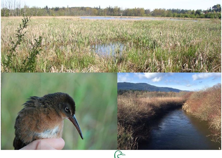
Cover Photos:
        Top:           Buttertubs East Marsh
        Bottom Left:   Virginia Rail
        Bottom Right   Millstone River

                                               2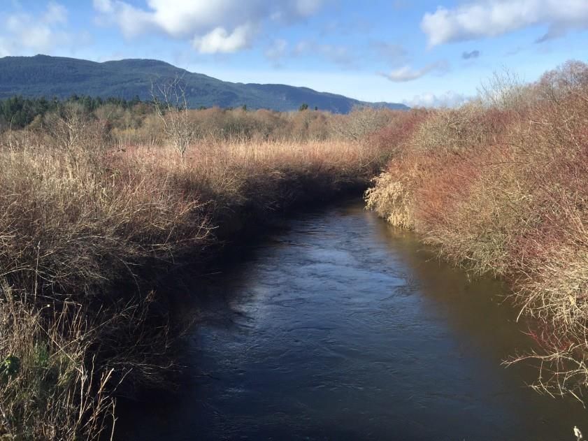
Contents
Introduction……………………………………………………………………………………………………………………………………………………………………..…. 5
Background to Plan Update……………………………………………………………………………………………………………………………………………….. 5
Guiding Documents……………………………………………………………………………………………………………………………………………………………. 5
Achievements in the Management of Buttertubs Marsh…………………………………………………………………………………………………… 8
Purpose and Management Goals ................................................................................................................................................ 9
Partners in Managing the Buttertubs Marsh Conservation Area. ............................................................................................. 10
         Nature Trust of British Columbia......................................................................................................................................... 10
         City of Nanaimo……………………………..................................................................................................................................... 10
         Ducks Unlimited Canada……………………………………………… ................................................................................................... 10
          Vancouver Island Conservation Land Management Program……………………………………………………………………………….... 11
          Friends of Buttertubs Marsh…………………………………………………………………………………………………………………………………...11
 Ecological and Community Values…………………………………………………… ............................................................................................12
         Ecological Context…………… .......................................................................................................................................... 12
         City of Nanaimo Parks, Recreation and Culture Master Plan ....................................................................................... 13
Description of Ecosystems……………………… ................................................................................................................................ 14
         Millstone River and Riparian Area ……………………………………… ........................................................................................... 15
         Marsh-Shallow Water…………………………………………....................................................................................................... 16
         Upper and Lower Shoreline…………………………………… ................................................................................................... 17
         Vegetated Upland…………………..……………………………………………………………… ...................................................................... 18
Description of Land Uses and Activities..................................................................................................................................... 19
Land Management Zones …… ................................................................................................................................................... 20
Management Zones .................................................................................................................................................................. 20
         West Marsh Conservation Management Area ............................................................................................................ 20
         East Marsh Conservation Management Area ………… ................................................................................................... 22
         Millstone River Riparian Ecosystem…… ........................................................................................................................ 24
         Marsh Shallow Water Ecosystem……............................................................................................................................ 25
         Lower Shoreline Ecosystem……………………………………………………………… ............................................................................. 27
         Upper Shoreline Ecosystem………………….……… ............................................................................................................. 28
         Vegetated Upland Ecosystem…………….……………………………………………………………………………………………….……………....... 29

                                                                                                         3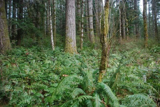
Appendix ................................................................................................................................................................................... 31

            1. Prior Management Plans
                   o Buttertubs Marsh Conservation Area Management Plan (Nov 2004)
                   o Management Plan for Buttertubs West Marsh (July 2012)

            2. Review of Management Activities in Buttertubs Marsh and Buttertubs West Marsh by Madrone Environmental (2015)

            3. Reference Bibliography

            4. Maps
                 o             Properties and Land Ownership
                 o             Infrastructure
                 o             Terrestrial Ecosystems
                  o            Management Zones

                                                                                                              4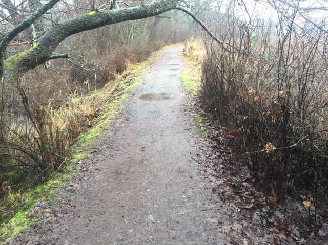
Introduction
    The Buttertubs Marsh Conservation Area (BMCA) is a 55ha reclaimed
    wetland and floodplain habitat adjacent to the Millstone River within
    the City of Nanaimo (Figure 1). In the 1800’s, this shallow flood plain,
    known then as Pearce’s Plain, was originally drained to become
    seasonal farmland and pasture. Over time, a North-South elevated
    walkway was created overtop a City of Nanaimo Waterline. This has
    created two separated wetlands, referred to in this document as the
    East and West Marsh.

    The Buttertubs Marsh Conservation Area is comprised of several
    parcels of land and includes lands secured by The Nature Trust of
    British Columbia (TNTBC), Ducks Unlimited Canada (DUC) and the City
    of Nanaimo; with substantial support received from the local
    community and funding organizations. Map 1 in Appendix 4
    identifies the land ownership makeup within the Conservation Area.

                                                                                     Figure 1: General characteristics of the Buttertubs Marsh Conservation Area
    Background to Plan Update                                                        (BMCA). Areas in Green are either parks or conservation lands . Dark blue
                                                                                     indicates the Millstone River and light blue denotes riparian areas in
    The Buttertubs Marsh Co-Management Steering Committee (the                       Conservation Area. The water pipe which bifurcates the two marsh properties
    Committee) is made up of representatives of the property owners and              is shown as the vertical light grey line just to the right of center of the figure.
                                                                                     Areas subject to regular inundation are shown as light blue stippling. This
    volunteer organizations involved in managing the Marsh1. In 2004 the             figure was adapted from the City of Nanaimo map server found online at
    Committee adopted a Management Plan for the East Marsh that provided             maps.nanaimo.ca/nanaimomap/
    recommendations for protecting, enhancing and restoring fish and
    wildlife habitat while continuing to allow for passive recreation.

1
    Nature Trust of British Columbia, Ducks Unlimited Canada, City of Nanaimo, Friends of Buttertubs Marsh

                                                                                 5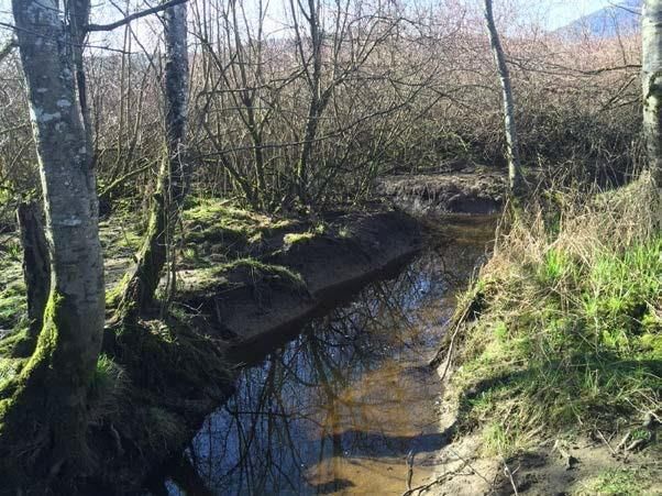
Since 2004 the Committee has undertaken several projects and initiatives in partnership with community volunteers and more recently
Vancouver Island University (VIU), to achieve the goals and objectives of the Management Plan. As a result of these efforts, the conservation
area has been expanded; several restoration projects have been completed; more information about the biophysical features and human use of
the area has been collected; and several land management issues have been addressed.

In recognition of these successes, the Committee hired Madrone Environmental Services to undertake a strategic review of the 2004
management plan (See Appendix 2). This review, coupled with the Committee’s desire to create a plan that reflects the expanded conservation

                                                                     6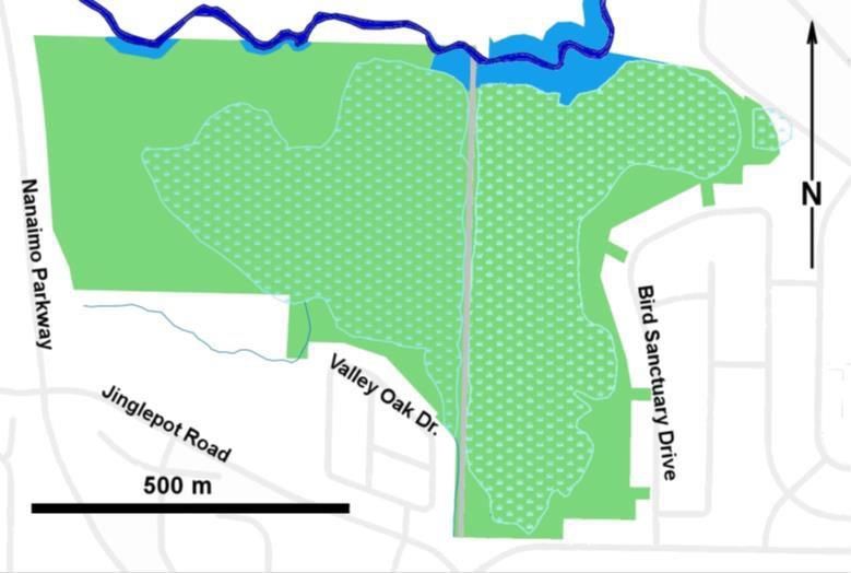
area, resulted in this updated 5-year strategic plan. While respecting the underlying guiding documents and legal framework of the properties
that make up the Buttertubs Marsh Conservation Area, this plan allows for the management of the entire Marsh under one management plan.
This plan describes acceptable land use activities to assist with land management decisions and establishes a number of five
(5) year targets to meet the overall management goals. The goals and targets will guide our annual work plans moving forward.

This document is not meant to totally replace the original plans; it is a supplementary document that consolidates the East and West Marsh Plan
and Madrone’s 2015 strategic review of the 2004 management plan. The goal of this document is to update information, highlight achievements
and prioritize the next steps through the establishment of management targets.

Guiding Documents
The following background documents provide the guiding direction for the management of Buttertubs Marsh and the development of this
strategic plan:

Document                                        Key Highlights

Agreement between City of Nanaimo &             Lease agreement between DUC and the City of Nanaimo to manage the West Marsh as
Ducks Unlimited Canada (2012)                   Public Park and to provide recreational amenities to the public consistent with the
                                                conservation purposes for which the land was acquired.

City of Nanaimo Parks Master Plan               The Master Plan guides City Council with a long range vision and guidance on the
                                                development of facilities, parks, open spaces and the delivery of services that best meet
                                                the needs of the community. The Master Plan was last updated in 2005.

City of Nanaimo Official Community Plan         The Official Community Plan provides land use direction for the City. Within the OCP,
(2008)                                          the Watercourse and Environmentally Sensitive Development Permit Areas restrict
                                                development of environmentally sensitive lands and includes guidelines and
                                                requirements to protect and enhance environmentally significant lands within the City
                                                of Nanaimo.

                                                                       7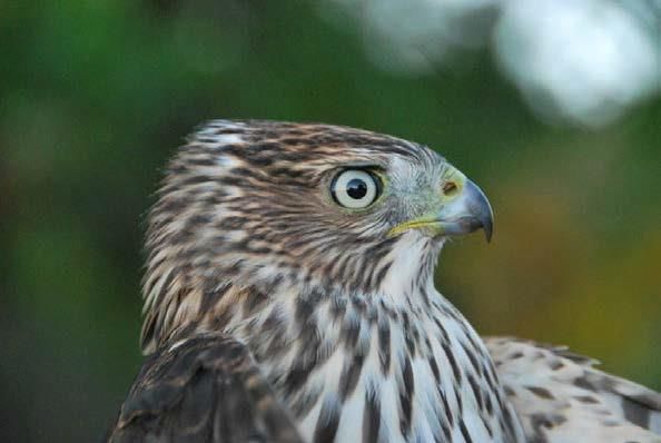
Ducks Unlimited Canada Conservation           Renewed in 2007 this conservation agreement allows DUC to construct and maintain a
Agreement with Province of BC/TNTBC           water control structure on Buttertubs Marsh to an FSL of 57.16m geodetic; conduct
                                              engineering inspections annually and implement bio-inventory monitoring every 5
                                              years.

“Hyde” Property (1946 Jingle Pot Rd.) Lease   The lease compels the City to maintain the property in accordance with the Buttertubs
Agreement between City of Nanaimo and         Marsh Conservation Area Management Plan. The Parks and Recreation Department
TNTBC (2011)                                  have indicated their intent to maintain the land in its natural state, with little or no
                                              public access or improvements for the foreseeable future.

TNTBC and Province of BC Lease Agreement      Assigns management authority for lands owned by The Nature Trust of BC to the
                                              Province of British Columbia; these leased lands are managed via the Vancouver Island
                                              Conservation Land Management Program.

Utility Right of Way Agreement between City   Right of Way Agreements for Water and Sewer lines within the Buttertubs Marsh
of Nanaimo and Nature Trust of British        Conservation Management Area.
Columbia (2001)

Wildlife Act – Conservation Lands             Enacted in 2014 these regulations prohibit camping, motorized vehicles, fires and dogs
Regulations                                   on the provincially managed land at Buttertubs Marsh.

Municipal Natural Assets                      This project establishes the economic value of Buttertubs Marsh to the City of Nanaimo
Initiative                                    and will be used by the City to invest in the long term maintenance and management
                                              of the marsh

                                                                     8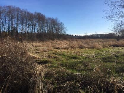
Achievements in the Management of Buttertubs Marsh
The original 2004 Buttertubs Marsh Management Plan contained two (2) goals:

GOAL 1: Maintain and, where possible, enhance plant and animal resources of the Conservation Area
          Objective 1: Provide wildlife habitat
          Objective 2: Control exotic, invasive plant and animal species Objective
          3: Gradually increase wildlife habitat and biological diversity

GOAL 2: Provide for compatible public recreational and educational use of the area
          Objective 4: Provide controlled public access
          Objective 5: Provide wildlife and nature viewing opportunities
          Objective 6: Provide public education opportunities

In 2015, Madrone Environmental reviewed the management goals and activities of the original 2004 management plan. This review identified
that of the 136 individual tasks listed in the 10 broad categories of the 2004 management plan, the partners have completed 58% of the tasks
with another 18% underway; leaving 24% of the tasks not completed to date (Madrone 2015, Appendix 2).

Of the tasks and goals successfully achieved the partners of the Buttertubs Marsh Conservation Area have:

    •   Resolved several long standing trespass issues;
    •   Installed new interpretive and regulatory signage;
    •   Conducted inventories and removals of invasive species;
    •   Built new viewing platforms;
    •   Replaced and upgraded the Buttertubs Marsh water control structure;
    •   Implemented Wildlife Act Regulations to address concerns of motorized vehicles, camping, fires and dogs;
    •   Secured an additional 0.342Ha of habitat from the Hyde property (1946 Jingle Pot) and 26.13 Ha in the West Marsh;
    •   Implemented a restoration plan for Western Painted Turtles; and
    •   Partnered with VIU to undertake public use studies and to create the VIU bird banding station at the West Marsh.

                                                                                9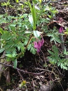
Purpose and Management Goals
The Buttertubs Marsh Conservation Area Management Plan (the "Plan") has been developed for the purpose of consolidating the planning and
management of the properties making up the BMCA. The Plan, while respecting the underlying legal jurisdiction of the property owners and
lease holders (City of Nanaimo, the Province, The Nature Trust of BC, and DUC), will provide general direction for the management of all the
properties within the BMCA.

Guided by the importance to conserve, maintain and enhance the natural processes of the BMCA, the overall management goal for the Plan is to
direct the maintenance and enhancement of water, plant and animal resources within the BMCA and provide compatible public recreational and
educational use. The management goals for the Plan are:

GOAL 1:         Monitor, maintain and, where possible, enhance the Natural Ecosystems of the Buttertubs Marsh Conservation Area

                Objective 1: Provide wildlife habitat
                Objective 2: Control priority exotic, invasive plant and animal species
                Objective 3: Gradually increase and improve fish and wildlife habitat and native species diversity
                Objective 4: Conserve ecological values in the West Marsh to maintain the integrity of its Eco-gift designation
                Objective 5: Over the long-term, work to acquire the remaining lands that make up the natural boundaries of the marsh

GOAL 2:         Provide for compatible public recreational and educational use of the area

                Objective 6: Provide controlled public access
                Objective 7: Provide wildlife and nature viewing opportunities
                Objective 8: Provide public interpretive and educational opportunities to foster public appreciation for the values and benefits of nature, and
                an understanding of the need to protect sensitive ecosystems. Physical structures required to support education and passive recreation (e.g.
                trails, structures, and signage) will be designed and located in a manner that minimizes habitat impacts.

GOAL 3:         Cooperative Management
                Objective 9: DUC and the City of Nanaimo will hold title on the West Marsh property as "tenants in common" and will manage the West
                Marsh through a management agreement and in the same spirit of collaboration as seen in the East Marsh under the Buttertubs Marsh
                Management Plan.
                Objective10: The principle of co-operative management will include consulting with stakeholders on the East Marsh Committee to plan
                monitoring work, enhancement activities, and control of invasive species between Buttertubs Marsh and West Marsh.
                Objective 11: The Committee will work to encourage key partners, such as VIU, to join the Co-Management Steering Committee.

                                                                              1
Partners in Managing the Buttertubs Marsh Complex
The Nature Trust of British Columbia (TNTBC)
The Nature Trust of British Columbia is a leading land conservation organization based in BC with a mandate to:
1. Acquire habitats of high biodiversity values and at greatest risk of being lost; and
2. Manage conservation lands as part of landscapes to ensure ecosystem resilience and connectivity.
Since 1971, TNTBC along with its partners has invested more than $80 million to secure over 70,000 hectares (170,000 acres) of land. This
includes over 23,000 hectares (56,000 acres) that is owned, leased or covenanted.
TNTBC as the property owner is responsible for ensuring that the conditions of the 99 year lease agreement with the Province of British
Columbia for the East Marsh are being met. TNTBC also responds to requests to upgrade present and future utilities which pass through the
East Marsh and provides input towards annual work plans by participating on the Committee.
City of Nanaimo
The West Marsh is co-managed by the City of Nanaimo w it h D UC as a nature park that provides passive recreation and education
opportunities that are consistent and compatible with the conservation purposes for which the Land was purchased. As the property is the
subject of an Ecological Gift, any dispositions or changes in use of the property require an authorization from the Federal Minister of
Environment and Climate Change Canada.
For the East Marsh, the City is responsible in part for trail and facility maintenance and contributes toward interpretive program development.
Under the 1997 co-management agreement between the Province, local conservation groups and the City:
• Maintains trails, public facilities (benches, viewing platforms, etc.);
• Continues maintenance responsibilities over the City dyke which delineates the western boundary of the Conservation Area; and
• Manages land use through its Official Community Plan and zoning processes and works with other government agencies to address
storm water management within the municipality.
The City of Nanaimo Parks Master Plan guides park development and acquisition priorities. The Master Plan was last updated in 2005 and
involved significant public input. The public suggested that additional waterfront parks and continued trail development are most needed in
terms of new and improved facilities, followed by environmentally sensitive areas (ESAs) and natural /passive parks.
Ducks Unlimited Canada
A non profit organization dedicated to the conservation, restoration and management of wetlands and associated habitats for North America’s
waterfowl. DUC partners with government, industry, non-profit organizations and landowners to accomplish its goals. For the East Marsh, DUC is
responsible for the construction, maintenance and repair of the north dyke and associated water control structures as part of a long standing
10agreement signed between DUC and the Province of British Columbia. This includes clearing of mud and debris piled around the outlet level
control structure each fall, as well as annual inspections of the north dyke and associated structures and repairs or maintenance, as required. For
the West Marsh, DUC and the City hold the property as Tenants in Common. As part of the purchase, the former owners agreed to a donation
that qualified under the Ecological Gifts Program administered by Environment Canada.
Vancouver Island Conservation Land Management Program
The Vancouver Island Conservation Land Management Program (VICLMP) is an innovative partnership program which involves the management
of over 100 conservation areas mostly coastal wetlands and estuaries owned by The Nature Trust of British Columbia (TNTBC), DUC and
managed by the Ministry of Forests, Lands, and Natural Resource Operations (FLNRO). Projects are coordinated by the Conservation Lands
Manager who assists FLNRO, TNTBC and the other program partners (Habitat Conservation Trust Foundation, DUC, and the Canadian Wildlife
Service) with land management, restoration/enhancement projects, and inventory and habitat securement activities.
Friends of Buttertubs Marsh
A volunteer organization dedicated to providing support to the management of Buttertubs Marsh. The group is a direct "descendant" of the
Nanaimo Field Naturalists Club which was a prime stakeholder in the formulation of, and signatory to the original 2004 Buttertubs Marsh
Management Plan. Since 2005, Friends of Buttertubs has carried out maintenance, enhancement, inventory and public engagement projects
and activities throughout the East Marsh. The group's eclectic membership consists of an array of disciplines and backgrounds, all with the
single aim of working to ensure the preservation of the values of the expanded Buttertubs Marsh Conservation Area.
11Ecological and Wildlife / Habitat Values
Ecological Context
In 2008, Biodiversity BC pr o duc e d t he r e po r t titled, Taking Nature’s Pulse - the Status of Biodiversity in British Columbia (Austin et al.,
2008) that listed 23 major findings on the most significant components of biodiversity in the Province and where impacts have occurred and
where vulnerabilities will likely be in the future. Below are the relevant findings that are applicable to the Buttertubs Marsh Conservation
Area that have a bearing on management activities:
• Of the species assessed to date in British Columbia, 43% are of provincial conservation concern and are concentrated in four biogeoclimatic zones of
conservation concern (Coastal Douglas-fir, Interior Douglas-fir, Coastal Western Hemlock, and Ponderosa Pine).
• Significant areas of wetlands in British Columbia have been lost or degraded.
• The flow of water in lakes, streams, wetlands and groundwater systems is being seriously impacted in British Columbia by dams, water diversions,
logging, stream crossings and climate change.
• British Columbia has many significant seasonal concentrations of species [e.g., migratory birds, spawning salmon] that are vulnerable to human
impacts.
• Alien species are seriously impacting British Columbia’s biodiversity, especially on islands and in lakes. Climate change is already seriously impacting
British Columbia and is the foremost threat to biodiversity.
• The cumulative impacts of human activities in British Columbia are increasing and are resulting in the loss of ecosystem resilience.
• Gaps in our knowledge of biodiversity in British Columbia create major challenges for effective conservation action.
The protection of Buttertubs Marsh contributes toward fulfilling a key goal in the Wetland Action Plan for British Columbia (Wetland Stewardship
Partnership 2010): Goal 5. Secure the protection of priority wetlands and the conservation and restoration of natural wetlands throughout the
province.
The Buttertubs Marsh Complex conserves wetland, riparian and upland forest ecosystems. The area is within the Moist Maritime Coastal
Douglas-fir (CDFmm) Biogeoclimatic Zone and the Georgia Depression (Nanaimo Lowland Ecosection). Currently, only 11% of the CDFmm is
protected in either parks or protected areas (Province of British Columbia 2011).
The wetland is clay bottomed and located on the floodplain of the Millstone River. The wetland component comprises 57% of the property with
the remaining area function as riparian habitat and upland wooded habitat sections. The entire marsh complex provides an important flood
protection zone as it can absorb overflow from the Millstone River during high water events.
12City of Nanaimo Parks, Recreation and Culture Master Plan
The last master plan for the department was completed in 2005. Within the plan the following mandate regarding the provision of recreation,
cultural and parks services was established: “City Council will use public leisure services as a vehicle for achieving certain socially worthwhile
goals and objectives, where such achievement clearly results in indirect benefit to all citizens.”
Many of the goals and desires identified in the 2005 plan, such as access for the public through a managed trail system and protection of
environmentally sensitive areas are applicable to the Buttertubs Marsh Conservation Area.
13Description of Ecosystems
For the purpose of this plan, the Buttertubs Marsh Complex is made up of 5 distinct management zones based on ecological features and
updated Terrestrial Ecosystem Mapping (TEM)() (Map 3 & 4 of Appendix 4). Table 1 provides a description of these zones within both the
West Marsh and East Marsh Management Areas.
Table 1: Buttertubs Marsh – Ecosystem Descriptions
Management Zone Ha* % Ecological Features Anthropogenic Features
This management area contains a range of habitat Small access road from south into old field; some
West Marsh 30.6 56% types including forested upland, marsh shallow limited trails for bird banding station; limited
water, riparian and shoreline habitat. private fencing along south boundary
Millstone River Riparian 30m city designation strip on the riparian bank of Drainage ditches (West Marsh)
0.8 1.0% identified streams.
Marsh Shallow Water Wetland habitats; swamps, ferns, cattail marshes, minimal Drainage ditch by previous owner
8.4 15% open water.
Lower Shoreline Open areas for passerine species. Scarified by previous owner – Alder forest
2.6 5.0%
Upper Shoreline Seasonally flooded agricultural fields; open field habitat for Previously cultivated fields filling in with
3.1 6.0% wildlife. Hawthorn
Vegetated Upland Mix of older second growth conifer forest; deciduous shrub Trails and Road access. Squatter shack ruins
15.7 29% woodlands. Selectively logged.
This management area contains a range of habitat Open water habitat with significant cattail
East Marsh 24.1 44% types including vegetated upland, marsh shallow marsh. English Oak dominates riparian area.
water, riparian and shoreline habitat. Public trail around marsh
Millstone River Riparian 30m riparian setback on the riparian bank of identified Water control structure
2.1 4.7% streams.
Marsh Shallow Water Wetland habitats; cattail, open water. Osprey nesting platform
15.5 28%
Lower Shoreline 1.4 2.0% Open areas for passerine species. Benches; viewing platform
Upper Shoreline Seasonally flooded agricultural fields; open field habitat for Previously cultivated fields filling with non native
0.2 0.3% wildlife. Hawthorn. City sewer line.
Vegetated Upland Mix of older forest with deciduous shrub woodlands. Trails, benches, viewing platforms, interpretative
4.9 9.0% Largely non-native. signs; other historic features; fences. Sewer and
water line, Old Dairy Barn Foundation
TOTAL 54.7 100%
*Areas based on GIS assessment of zone designations.
14Millstone River and Riparian Zone
A narrow strip of riparian woodland bordering the Millstone River, dominated by alder and large English oaks with a shrub understory. The well
vegetated riparian strip is the least disturbed area and contains mainly native plant species and represents 5.7% of the Marsh Conservation
Area. Note: Considered to be 30 meters in width but only extends to northern walkway. In West Marsh, the situation is very different with
the existing riparian not 30 meters from top of bank due to past farming activity.
Vegetation Wildlife Habitat Values
• English oaks planted along the river bank in the early • Habitat provides feeding by Wood Ducks, Band-Tailed Pigeons, hunting and
1900’s. In the West Marsh, red alder and other native roosting by Barred Owls and several hawk species and feeding and nesting
deciduous trees occur with a dense native shrub under by woodpeckers and numerous songbirds.
storey of ninebark, red osier dogwood, snowberry and • Mammals, including deer, raccoons, beaver, muskrat, mink, and river otter
willow. The under storey vegetation resembles a mid- feed and/or rest in this area.
late seral native plant association indicative of • This also provides a wildlife corridor linking the Buttertubs area with
floodplain sites (CDFmm Site Series 08). The West adjacent upstream and downstream habitats.
Marsh has a narrower riparian area dominated by
similar native shrubs.
Invasive Plants
• Broom and blackberry are invasive species that are no longer the dominant cover in this habitat as there is a sufficient tree-shrub canopy
to shade out these invasive shade-intolerant species.
• Reed canary grass is highly invasive along wetland margins where soils are saturated for part of the growing season.
15Marsh - Shallow Water Zone
Cattail vegetation and shallow water wetlands occupy about 43% of the surface area of the Marsh Conservation Area.
Vegetation Wildlife / Habitat Values
• The Marsh consists of open water areas up to 1-2m • The marsh area is used for roosting, feeding and nesting by red-winged
deep interspersed with emergent cattail marsh, floating blackbirds, common yellowthroats, marsh wrens, mallard ducks, pied-billed
cattail islands, hummocks and four small constructed grebes, Canada geese, Virginia and Sora rails and formally American bittern
islands with herbaceous vegetation. (blue-listed). Mallards, wood ducks, hooded mergansers and other
• Shallow open water areas support emergent and waterfowl use these areas for cover while flightless. These areas are also
floating aquatic vegetation, including common mares used for feeding and resting by beaver, mink, raccoon and river otter.
tail, water smartweed, bladderwort, duckweed, • Open water areas are used for feeding and resting by many waterfowl
pondweed and yellow pond lily. species, including ducks, diving ducks, grebes, American coots, geese and an
• Shallow wetland areas, to some extent isolated from occasional trumpeter swan (blue-listed). These habitats are heavily used
the main marsh, partially dry out during the summer during fall and spring migration and for waterfowl over wintering in the
drawdown and have different more diverse vegetation. Nanaimo area.
The dominant vegetation is hardhack, young willows • Red-listed - one bird and one reptile species:
and some red-osier dogwood characteristic of a shrub o Purple martin (Progne subis)
swamp habitat. o Painted turtle (Chrysemys picta)
• Blue-listed birds:
o Trumpeter swan (Cygnus buccinators)
o American bittern (Botaurus lentiginosus)
o Great blue heron (Ardea Herodias)
16
Indian Hellibore
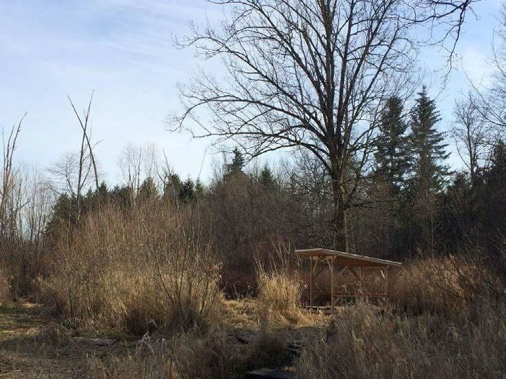
Pacific Bleeding Heart West Marsh – Former hay field with alder forest Veratrum viride
Dicentra formosaUpper and Lower Shoreline Zone
Combined, the upper and lower shoreline make up to 13.3% of the Marsh Conservation Area.
Vegetation Wildlife / Habitat Values
• Lower shoreline = Cattail-yellow iris plant association • Marsh riparian areas are utilized by various bird species, depending on the
Dominated by cattail and yellow flag iris, growing on vegetation type, for cover, foraging and/or nesting, (e.g. red-wing blackbird,
saturated soils. marsh wren, Virginia rail, mallard, wood duck, Canada goose, common
yellowthroat, song sparrow, willow flycatcher). These areas are also used by
Upper shoreline = Reed canary grass-hardhack shoreline a number of mammal species including beaver, raccoon, mink, river otter,
plant association voles and shrews. The habitat is important for some life stages of frogs and
salamanders (with aquatic larval and terrestrial adult stages) painted turtles
The area above the full standing water level is dominated in (blue-listed) and garter snakes. In general, areas with greater vegetation
most areas by a dense growth of reed canary grass with species diversity and structural Conservation Areaity tend to be utilized by a
scattered clumps of hardhack. Red-osier dogwood, Douglas wider range of species.
water hemlock, common rush occur in some areas. This
may be the lower extent to the riparian area distinguished
by the absence of a tree or shrub canopy.
Invasive Plants
• The cattail areas are heavily intermixed with yellow flag iris, an invasive non-native species originally planted in the 1970’s.
• Purple loosestrife is present but not yet well established.
17Vegetated Upland Zone
Approximately 38% of the Buttertubs Marsh Conservation Area is represented by two upland units, one in the East and one in the West
Marsh consisting of blackberry, broom/grass, hawthorn shrub land (East Marsh), mixed forest, with English oak in the West Marsh. Most of
these uplands exist on remnants of an abandoned farm that was created after dyking.
Vegetation Wildlife Habitat Values
• Old farm pasture/hay field with a variable shrub cover • The upland scrub vegetation areas are utilized by numerous bird species for
dominated by common hawthorn, Scotch broom and cover and foraging, including many residents, over wintering and migrating
Himalayan blackberry. song birds attracted by insects and berry crops (e.g. chickadee, Berwick’s
• Limited numbers of native tree and shrub species are wren, kinglets, various warblers, American robin, cedar waxwing, house
present. Some were planted by various groups over the finch). In spring and summer a number of species also nest although the
past 20 years (primarily conifers) and others re- low habitat diversity likely limits this activity (e.g. American robin, spotted
colonized, (e.g. red alder, arbutus, cascara, mountain towhee, song sparrow, house finch, Bewick’s wren, bush tit, orange-
ash (non-native), bitter cherry, Pacific crabapple, crowned warbler, California quail and ring-necked pheasant). Mammals
snowberry, Nootka rose, trailing blackberry, spreading using this habitat include bear, deer, raccoon, eastern cottontail, deer
dogbane, spurge laurel (invasive)). mouse, Townsend’s vole and shrews. Garter snakes are fairly common in
summer and Pacific tree frogs are present. The lack of decaying large woody
debris likely limits terrestrial salamander abundance.
Recorded Rare-listed Fauna
Blue-listed :
o Green heron (Butorides virescens)
o Turkey vulture (Cathartes aura)
o Short-eared owl (Asio flammeus)
Immature Cooper’s hawk
18Description of Land Uses & Activities
In developing the Buttertubs Marsh Conservation Area Management Plan , the area was assessed for current and potential land uses. From this,
a list of land use activities was developed and defined to form the basis for management direction within each of the 5 defined zones (Table 2).
Table 2 Land Use Definitions for Buttertubs Marsh Conservation Area
Land Use/Activity Definition
Restoration Actions to restore natural ecological processes; riparian planting, invasive species removal, fish/
wildlife habitat creation, reforestation with native species.
Enhancement Actions to enhance or introduce desirable environmental features; wetland creation, water
flows/storage, wildlife trees, spawning gravel, nest boxes and placement of woody debris.
Scientific/Research Inventory for Species at Risk, baseline inventory for fish, wildlife and vegetation monitoring.
Education Public awareness and appreciation. Educational programming, Interpretative signs, Naturalist,
Stewardship, Guided tours.
Public Access/Recreation Passive activities (i.e. walking, wildlife viewing) appropriate to a nature park.
Water Control Structures Dams, Weirs, Spill ways.
Fixed infrastructure – conservation Boundary demarcation, regulatory and interpretive signage; Viewing platforms; Trails.
Linear infrastructure Trails, bridges, gates, culverts, utility lines (stormwater, sewage, water lines), fences, drainage
ditches.
Fixed infrastructure - Heritage Old Barn Foundation, Archimedes Screw, etc.
19
Upland area West Marsh (Douglas-Fir, Dull Oregon Grape Millstone River with Riparian Vegetation (primarily
and Sword Fern) Red Osier Dogwood)Land Management Direction
West Marsh Management Area
This management area is managed between DUC and the City of Nanaimo as Tenants in Common, under the Ecological Gifts Program, which is
administered by Environment and Climate Change Canada. Both DUC and the City of Nanaimo are joint recipients of the donation and are
responsible for maintaining the conservation values of the land. Management zones within this area include Millstone River Riparian, Vegetated
Upland, Marsh Shallow Water, Lower and Upper Shoreline (refer to Appendix 4 – Map 4 – Management Zones).
Land Use Activity Management Priority Management Actions for West Marsh 5 Year Management Target
Direction*
Restoration A - Map invasive species - Year 2 – invasive species mapped
- Invasive species removal - Year 5 – 50% reduction in invasive
- Native species planting species cover
- Boundary management along south boundary - All boundary issues resolved
Enhancement A - Undertake hydrological study of West Marsh to - Hydrological study completed
identify opportunities for increased open water with multiple stakeholder
habitat and to determine appropriate baseline water engagement
levels - Installation of basking logs for
- Improve habitat for Western Painted Turtle and Western Painted Turtle
American Bittern - Undertake study to determine
- Enhance 30 m riparian zone along Millstone River. American Bittern habitat
Seek letter of agreement with property owner of requirements
Pryde Vista Golf Course to allow for enhancement
work within the Millstone River Riparian Area and
north of the West Marsh
Scientific/Research A/C - Expand involvement of VIU at West Marsh - Baseline inventory completed in
- Conduct baseline inventory of West Marsh and accordance to standardized
establish permanent baseline monitoring protocols; 5-year monitoring plan
plots/transects developed
- Annual engagement with VIU
Education A/C - Support the involvement of VIU or other school - Develop a permit system and
groups in conducting research and educational protocols for educational and
opportunities in the area research work in the Marsh
Complex with VIU
Public Access/Recreation C - Complete a trail and access plan that respects the - Approved trail plan developed
requirements of the eco-gift
20Water Control Structures A - As part of hydrological study assess whether or not a - Completion of hydrological study
water control structure would benefit the marsh - Implementation of restoration
work identified by hydrological
study
Fixed Infrastructure - A - Support the establishment of a field research shelter
conservation - Install boundary fencing and signage
Linear Infrastructure C - Formalize access point to the West Marsh - Fencing completed in areas of
- Construct environmental fencing along boundaries potential threat of trespass/
currently unfenced. incursion
- Identify appropriate corridors for public use trails
- Maintain service road/trail to banding station
*A Acceptable use/activity
*C Conditional – subject to provisions identified
*N Not acceptable
*N/A Not applicable
West Marsh Management Area Comments
• Management must adhere to conditions of Ecological Gift Program
• Currently public access is limited to permission only
West Marsh Bird Banding Shed
21East Marsh Management Area
This management area is the eastern portion of the Buttertubs Marsh Conservation Area that has dual land management obligations with the
Province of British Columbia (as the lease holder) and The Nature Trust of British Columbia (as the land owner). The City of Nanaimo helps to
maintain the trail system and infrastructure features found on the property. The Friends of Buttertubs Marsh coordinate volunteer
stewardship activities. Management zones within this area include Millstone River Riparian, Vegetated Upland, Marsh Shallow Water, Lower
and Upper Shoreline (refer to Appendix 4 – Map 4 Management Zones).
Land Use Activity Management Priority Management Actions for East Marsh 5 Year Management Target
Direction*
Restoration A - Map invasive species - Year 2 – invasive species mapped
- Invasive species removal - Year 5 – 50% reduction in invasive
- Native species planting species cover
- Boundary management - All boundary issues resolved
Enhancement A - Improve habitat diversity - Installation of basking logs for
Western Painted Turtle and other
wildlife
Scientific/Research A - Expand involvement of VIU at Buttertubs - Annual engagement by VIU
- Revisit Materi (2004) vegetation report to assess changes Resource Management Officer
Training (RMOT) student in
conducting field studies
Education C - Support the involvement of VIU or other school groups in - Increase the number of faculty
providing educational opportunities in the area led projects occurring within
- Upgrade West Marsh sign along public trail Buttertubs focused on fish,
wildlife and ecosystem inventory/
research.
- Develop an educational
brochure/trail guide for
Buttertubs Marsh.
- The brochure will be printed and
regularly updated and easily
available to visitors to Buttertubs
Marsh.
- Annual faculty inspections
completed and necessary repairs
undertaken.
Public Access/Recreation C - Maintain trails cut back tall grass and blackberry - All trails are maintained to City of
- Repair minor surface erosion and maintain drainage Nanaimo standards
22culverts on east and south trails
Water Control Structures A - DUC maintains the water control structure. - Water control structure
maintained annually
- Water level managed according
to Conservation Agreement with
an FSL of 57.16m geodetic
Fixed Infrastructure - A - Conduct a sign review and remove old/outdated signs - All regulatory signs in the East
conservation - Install boundary signage as required Marsh will follow provincial
template
- Interpretive signs are updated as
necessary
Linear Infrastructure C - Maintain fences along boundaries
- Maintain interpretive kiosk signs and replace interpretive
kiosk signs adjacent to miner’s cottage
*A Acceptable use/activity
*C Conditional – subject to provisions identified
*N Not acceptable
*N/A Not applicable
East Marsh Management Area
• Public access is allowed
• Area is subject to Provincial Wildlife Act Conservation Land Regulations (no dogs, no camping, no motorized vehicles no fires)
• Trails/infrastructure maintained by the City of Nanaimo
Ditch in West Marsh used for drainage by previous owner
23Millstone River Riparian Zone
Land Use Activity Management Priority Management Actions Applies within 5 Year Management Target
Direction* East or West
Marsh Only?
Restoration A - Remove invasive species - 50% reduction of invasive species
- Plant native riparian cover coverage
- Identify and map invasive species - 50% increase in native riparian
- Assess opportunities for instream fish vegetation cover
habitat enhancement (e.g. Gravel
placement/Large Woody Debris
placement)
Enhancement A - Re-vegetation of riparian vegetation - West Marsh - 25% increase in native plant
- Bird habitat enhancement study diversity
- Assess opportunities for off channel - West Marsh - Off channel habitat assessment
habitat for fish complete
- Nest box program development - Nest boxes installed. Monitoring
focusing on Wood Ducks and Swallows program in place
Scientific/Research A - Establish baseline monitoring plots to - Establish monitoring plots
gauge effectiveness of riparian - Fish inventory survey complete
restoration projects
- Invasive plant inventory
- Fish inventory survey
Education A - Provide interpretive opportunities - Platform project completed
- Assess opportunity for development of - East Marsh - Interpretive panel about riparian
viewing platform zone developed
Public Access/Recreation C - Public access is limited to existing trails - East Marsh - Sensitive areas fenced off
- No new trails into riparian area other - East Marsh - Riparian restoration signs
than to viewing platform completed
Fixed Infrastructure - C - Maintain existing trail network - Trails maintained to City of
conservation - Maintain water control structure - East Marsh Nanaimo standards
- Fence/sign areas for no public access - Control structure maintained for
where required conservation needs
Linear Infrastructure C - Map right of ways; utility corridors - East Marsh
*A Acceptable use/activity
*C Conditional – subject to provisions identified
Zone Comments
o Goal for the this ecosystem is to have a 30m wide riparian area established
24Marsh Shallow Water Zone
Land Use Activity Management Priority Management Actions Applies within 5 Year Management Target
Direction* East or West
Marsh Only?
Restoration A - Maintain open water habitat - East Marsh - 50% removal of priority invasive
- Map invasive plant species species
- Prioritize and remove invasive species
Enhancement A - Review and assess water license on - East Marsh - Install turtle basking logs
Buttertubs (e.g. raise or lower levels) - Install bird nest boxes
- Assess opportunities to increase open - Hydrological study
water habitat - Assessment, design,
- Assess opportunity for waterfowl / implementation of hydrological
turtle nesting/loafing areas restoration program completed
- Assess feasibility of connecting West
Marsh and East Side through
hydrological study
Scientific/Research A - Resurvey staff gauges, re-set them to - Staff gauges installed
standard map/survey datum for the - Year 2 and 5 – complete
area spring/fall amphibian surveys
- Amphibian and reptile inventory - Year 1, 3 – complete fish
(i.e. ongoing Western Painted Turtle presence/absence utilization
work – install wildlife cameras); Egg surveys
laying beach effectiveness monitoring - Year 2 – establish photo
- Complete Fish & Wildlife Inventory monitoring plots and revisit every
2 years
Education A - Work with VIU and local schools to - East Marsh - Increased partnership with VIU
provide educational opportunities and local school district in
- Develop brochure for Buttertubs - West Marsh providing education and research
Marsh opportunities
- Increased number of faculty lead
projects occurring at Buttertubs
focused on fish, wildlife,
ecosystems inventory
Public Access/Recreation N - Fence access to wetland (Former duck - East Marsh - Access to wetland fenced off
feeding area)
25Water Control Structures A - Maintain water control structure - East Marsh - Control structure maintained
- Review options to reduce outflow according to Conservation
obstruction from beaver activity Agreement
- Remove beaver material from in front
of marsh outlet debris grating
Fixed Infrastructure - A - Assess Osprey, Swallow and Purple - East Marsh - Breeding bird habitat condition
conservation Martin nest site assessed
- Check & replace, stucco wire wrapped - Enhancement to breeding bird
around trees to protect from beaver habitat implemented via nest box
program
*A Acceptable use/activity
*C Conditional – subject to provisions identified
*N Not acceptable
North Walking trail along the interface with the Millstone River Riparian Area
26Lower Shoreline Zone
Land Use Activity Management Priority Management Actions Applies within East or 5 Year Management
Direction* West Marsh Only? Target
Restoration A - Map invasive plant species - 50% reduction of
- Assess feasibility of removal of priority invasive species
invasive plants -
- Prioritize removal targets
Enhancement A - Review and assess water license on - East Marsh - Control structure
Buttertubs (e.g. raise or lower levels) maintained and
- Assess opportunities to increase operated according to
open water habitat DUC/Province
- Assess opportunity for waterfowl / Agreement
turtle nesting areas - Implement hydrological
- Assess feasibility of connecting West study of Buttertubs
Marsh and East Marsh (hydrological Marsh including options
study) to increase open water
habitat and fish habitat
complexity
Scientific/Research A - Amphibian and Reptile Inventory - Staff gauges installed
- Ongoing Western Painted Turtle Year 2 and 5 complete
work – install wildlife cameras; spring/fall amphibian
effectiveness monitoring (mammals) surveys
- Complete Fish & Wildlife Inventory - Year 1, 3 – complete fish
presence/absence
- Year 2 – establish photo
monitoring plots and
revisit every 2 years
Education A - Work with VIU and local schools to - West Marsh - Increased number of
provide educational opportunities faculty lead projects
- Develop brochure for Buttertubs - East Marsh occurring at Buttertubs
Marsh focused on fish, wildlife,
- Refresh Interpretative signage - East Marsh ecosystems inventory
Public Access/Recreation N/C
Water Control Structures N/C
Linear Infrastructure N
*A Acceptable use/activity
*C Conditional – subject to provisions identified
*N Not acceptable
27Upper Shoreline Zone
Land Use Activity Management Priority Management Actions Applies within East or 5 Year Management Target
Direction* West Marsh Only?
Restoration A - Map invasive plant species - 50% reduction of priority
- Assess feasibility of removal of invasive species coverage
invasive plants by year 5 from mapped
- Maintain field mowing in West - West Marsh areas
Marsh to maintain habitat and - Follow Provincial Early
control Hawthorn. Reassess after Detection Rapid Response
hydrological study is complete approach to invasive
species control
Enhancement A - Assess feasibility of connecting - Hydrological study
West Marsh and East Marsh completed and
(hydrological study) recommendations
implemented
Scientific/Research A - Amphibian and Reptile Inventory - - Year 2 and 5 – complete
- Ongoing Western Painted Turtle spring/fall amphibian
work surveys
- Install wildlife cameras; establish - Year 1, 3 – complete fish
effectiveness monitoring Program presence/absence
(mammals) utilization
- Complete Fish & Wildlife Inventory
Education A - Work with VIU/local schools to -
provide educational opportunities
- Develop brochure for Buttertubs
Marsh
- Interpretative signage
Public Access/Recreation N/C
Water Control Structures N/A
Fixed Infrastructure N/A
*A Acceptable use/activity
*C Conditional – subject to provisions identified
*N Not acceptable
*N/A Not applicable
28Vegetated Upland Zone
Land Use Activity Management Priority Management Actions Applies within East or 5 Year Management Target
Direction* West Marsh Only?
Restoration A - Map invasive species - Year 2 – invasive species
- Invasive species removal mapped
- Native species planting - Year 5 – 50% reduction in
- Identify priority restoration - East Marsh invasive species cover
- Girdle pine trees - All boundary issues
- East Marsh
- Remove Cypress grove and replant resolved
with native species in East Marsh
Enhancement A - Develop and maintain nest box - West Marsh - Nest boxes for swallows,
program for swallows wood duck installed
- Remove Squatter’s Shelter and - West Marsh
debris
Scientific/Research A - Establish baseline monitoring plots - Annual engagement by VIU
- WPT population estimates biology department in
- Amphibian and Reptile Inventory conducting field studies
- Small mammal inventory - West Marsh - Baseline inventory
- Bird banding and Monitoring - West Marsh completed in accordance
Program to standardized protocols;
5 year monitoring plan
developed
- Year 2 and 5 – complete
spring/fall amphibian
surveys
- Year 1, 3 – complete fish
presence/absence
utilization surveys
- Year 2 – establish photo
monitoring plots and revisit
every 2 years
Education A - Work with VIU/local schools to - Increased number of
improve opportunities for learning faculty lead projects
- Develop new brochure for - East Marsh occurring at Buttertubs
Buttertubs focused on fish, wildlife,
ecosystems inventory
29Public Access/Recreation A - Passive recreation continued on - East Marsh - All trails in Conservation
existing trails Area are maintained to City
of Nanaimo standards
- Annual facility inspections
completed and necessary
repairs undertaken
Fixed Infrastructure - A - Maintain existing trails, viewing - East Marsh
conservation platforms, interpretive signs
- Boundary and regulatory signage
Linear Infrastructure A
*A Acceptable use/activity
*C Conditional – subject to provisions identified
*N Not acceptable
*N/A Not applicable
Zone Comments
The Trans Canada Trail should be retained within this ecosystem
30Appendix
1. Prior Management Plans
o Buttertubs Marsh Conservation Area Management Plan (Nov 2004)
o Management Plan for Buttertubs West Marsh (July 2012)
2. Review of Management Activities in Buttertubs Marsh and Buttertubs West Marsh by Madrone Environmental (2015)
3. Reference Bibliography
4. Maps
o Properties and Land Ownership
o Terrestrial Ecosystems
o Management Zones
31You can also read