Byford Railway Extension Targeted Fauna Survey for Westralunio carteri Carter's Freshwater Mussel - PREPARED FOR GHD PTY LTD JANUARY, 2021 - EPA WA
←
→
Page content transcription
If your browser does not render page correctly, please read the page content below
Byford Railway Extension Targeted Fauna Survey
for Westralunio carteri Carter’s Freshwater Mussel
PREPARED FOR GHD PTY LTD

JANUARY, 2021

                            Stream Environment and Water Pty Ltd
                            PO Box 606, Dunsborough WA 6281
                            info@streamew.com.au
                            www.streamew.com.au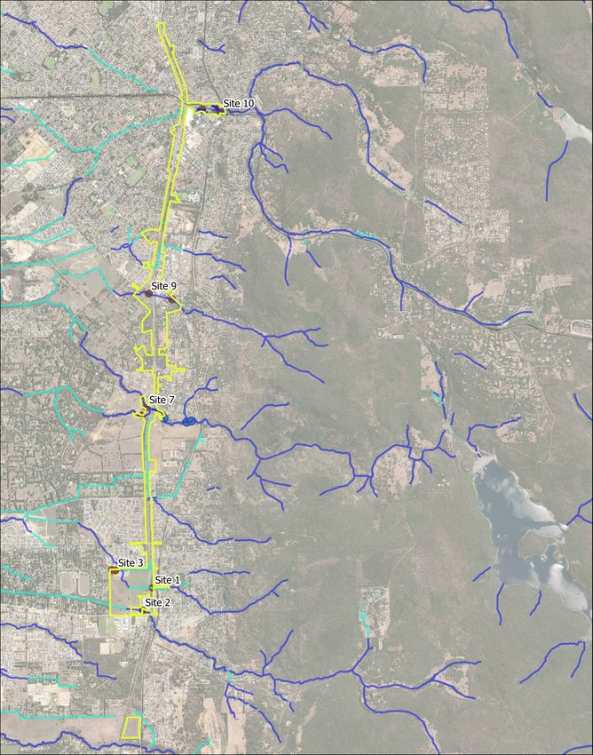
Document Status

Document title: Byford Rail Extension_Targeted Fauna Survey for Wetralunio carteri, Carter’s
               Freshwater Mussel

Document reference: 200404/rev0

 Version         Author         Issued             Reviewed by       Approved by      Date
 V1              JW             10/11/2020         MB
 V1              JW             13/11/2020         RP                                 13/11/2020
 Rev0            JW             18/01/2021         MB                MB               18/01/2021
Contents
Executive Summary................................................................................................................................. 3
1      Introduction .................................................................................................................................... 5
    1.1       Project Understanding ............................................................................................................ 5
    1.2       Project Scope .......................................................................................................................... 5
    1.3       Project Location and Survey area ........................................................................................... 6
2      Background and Regional Context .................................................................................................. 8
    2.1       Climate .................................................................................................................................... 8
    2.2       Hydrology ................................................................................................................................ 8
    2.3       Carter’s Freshwater Mussel .................................................................................................... 9
3      Methodology................................................................................................................................. 11
       3.1.1          Overall Approach .......................................................................................................... 11
       3.1.2          Desktop Assessment ..................................................................................................... 11
       3.1.3          Field Assessment ........................................................................................................... 11
       3.1.4          Survey Limitations ......................................................................................................... 13
4      Results and Discussion .................................................................................................................. 15
    4.1       Desktop Assessment Results................................................................................................. 15
       4.1.1          DAWE and DBCA database searches............................................................................. 15
       4.1.2          Watercourses and fisheries assessments ..................................................................... 15
       4.1.3          Identification of target habitats and watercourses ...................................................... 16
    4.2       Field Assessment Results ...................................................................................................... 17
       4.2.1          Habitat assessment ....................................................................................................... 17
       4.2.2          Distribution and Density of Mussels ............................................................................. 24
5      Discussion...................................................................................................................................... 31
6      Conclusions and Recommendations ............................................................................................. 32
7      References .................................................................................................................................... 34
Appendix A Desktop Search Results
Appendix B Habitat Assessment Sites
Appendix C Transect Photos and Descriptions

Stream Environment and Water Pty Ltd                                                                                                                 2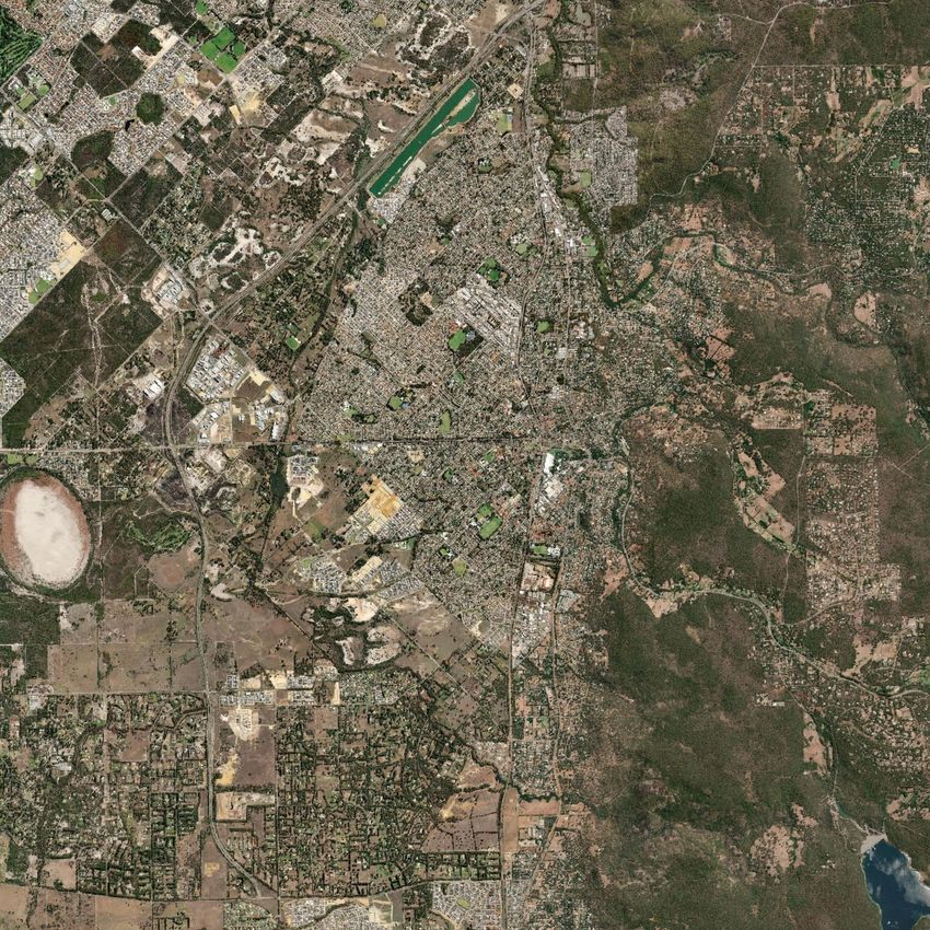
Executive Summary
The Public Transport Authority of Western Australia (PTA) are proposing to develop the Byford Rail
Extension (BRE) project as part of the Western Australian Government’s METRONET program aimed
at transforming Perth’s transport network.

Stream Environment and Water Pty Ltd (Stream) were engaged by GHD to conduct a targeted fauna
survey for Westralunio carteri (Carter’s Freshwater Mussel) within the BRE survey area. The survey
included assessment of suitable habitat and confirmation of the presence and distribution and
density of Carter’s Freshwater Mussel. Carter’s Freshwater Mussel is the only native freshwater
mussel found in south-western Australia and is currently listed as Vulnerable on state (Biodiversity
Conservation Act 2016 (BC Act 2016)), national (Environment Protection and Biodiversity
Conservation Act (EPBC Act 1999)) and international conservation lists (ICUN Redlist (ICUN 2020).

The survey area intersects five watercourses, including Neerigen Brook, Wungong Brook, Beenyup
Brook and two drains. The majority of watercourses within the survey area have historically been
modified as part of clearing and agricultural land use and drainage control. A desktop assessment
was undertaken to identify previous records of Carters Freshwater Mussel in, or near the survey
area, identify areas of suitable habitat and verify field methodology. The field assessment occurred
from the 14th- 16th of September 2020 with follow-up surveys on the 29th and 30th of October 2020,
and included habitat assessments, targeted searching and surveys using replicate quadrats within
transects. Below is a summary of the key findings:

    −   One watercourse and two lakes within the survey area were found to provide suitable
        habitat for Carter’s Freshwater Mussel: Wungong Brook, Sanctuary Lake and Wright Lake.
        The mussel was recorded at all three locations.
    −   Carter’s Freshwater Mussel were consistently recorded at low-moderate density at all four
        transects within Wright Lake. Overall a mean mussel density of 4.4 mussels/m2 was recorded
        and the size of the mussels ranged from 41 to 88mm with a median of 69mm. The age of the
        population of mussels is unknown, however, the dominance of larger mussels (96% >60mm)
        and absence of smaller mussels at Wright Lake suggests an aging population. Recruitment to
        this location may be impeded by the multiple modifications to Neerigen Brook upstream and
        downstream of this lake which may affect movement of fish necessary for mussel
        recruitment.
    −   The presence of mussels in Wungong Brook, with a range of size classes, indicates a healthy
        self-sustaining population. Carter’s Freshwater Mussel was found in variable but generally
        low densities within Wungong Brook (approximately 500m of Wungong Brook surveyed).
        Where recorded mussel density within quadrats ranged from 1 to 12 mussels per m2, with an
        overall mean mussel density of 2.6 mussels/m2. Mussel size ranged from 9 to 65mm (median
        shell length of 52mm). Densities within Wungong Brook are consistent with other surveys
        reported for south west watercourses of 1-15 per m2 (Klunzinger et al. 2012a).
    −   Sampling was conducted within the rail corridor within Wungong Brook. Mussels were
        recorded, however at low density (0.6/m2). This area was without riparian vegetation and
        having been subject to historical disturbance may not provide ideal habitat when compared
        to upstream and downstream areas.
    −   Targeted surveys at Sanctuary Lake recorded only one mussel, although sampling at this site
        was restricted due to depth. Based on the suitability of the habitat present it is considered
        likely that the mussel occurs at low densities within the lake.

3         Byford Railway Extension Targeted Fauna Survey           for Westralunio carteri Carter’s
Freshwater Mussel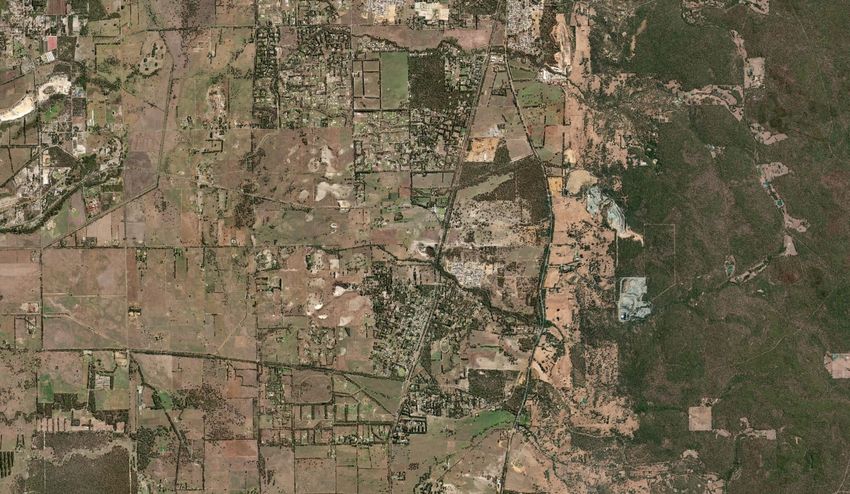
−   Based on the recorded presence of juvenile mussels it is considered likely that fish hosts are
       moving through the Wungong Brook system. Carter’s Freshwater Mussel are therefore
       considered likely to occur in other sections of the Wungong Brook and possibly the
       Wungong River where suitable habitat exists.
   −   Carter’s Freshwater Mussel has been found upstream of Wright Lake and Sanctuary Lake
       within Neerigen Brook. It is possible that the species occurs in other areas of suitable habitat
       within this waterway.
   −   Maintaining existing habitats and population strongholds is considered of key importance
       for the survival of the species (Klunzinger et al. 2015). Although it is considered likely that
       Carter’s Freshwater Mussel occurs in suitable habitat in other areas of the Wungong Brook
       and Neerigen Brook, impacts to the existing populations of Carter’s Freshwater Mussel in
       Wungong Brook, Wright Lake or Sanctuary Lake, or to host native fishes should be avoided.
   −   Where direct or indirect impacts are proposed measures such as erosion controls, water
       quality monitoring and relocation of susceptible populations are recommended in
       accordance with relevant guidelines and best management practices in consultation with the
       Department of Biodiversity, Conservation and Attractions (DBCA).

Stream Environment and Water Pty Ltd                                                              4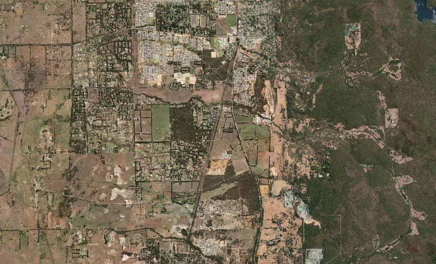
1 Introduction
1.1 Project Understanding
The Public Transport Authority of Western Australia (PTA) are proposing to develop the Byford Rail
Extension (BRE) project as part of the Western Australian Government’s METRONET program aimed
at transforming Perth’s transport network to improve and integrate the public transport network
and align with the State Government’s vision for future land use planning in Western Australia. The
BRE project includes an extension of the current Armadale train line from Armadale Station, south to
Byford. The proposed alignment is approximately 9 kilometres (km) long and will utilise the existing
Australind rail corridor.

The BRE project extends from Armadale Station in the City of Armadale, south to Byford in the Shire
of Serpentine Jarrahdale. The BRE project was referred to the Environmental Protection Authority
(EPA) and the Commonwealth in September 2020.

To support the environmental impact assessment and approvals process for the proposed BRE
project, the PTA via GHD Pty Ltd (GHD) are currently completing technical studies of environmental
values within the survey area. There are several waterway crossings within the survey area that
potentially provide habitat for Carter’s Freshwater Mussel (Westralunio carteri), endemic to the
south-west region of Western Australia (Walker 2004) and currently listed as Vulnerable on state
(Biodiversity Conservation Act 2016 (BC Act 2016)), national (Environmental Protection and
Biodiversity Conservation Act 1999 (EPBC Act 1999)) and international conservation lists (ICUN
Redlist) (ICUN 2020).

1.2 Project Scope
Stream Environment and Water Pty Ltd (Stream Environment and Water) were engaged by GHD to
conduct a targeted fauna survey for Carter’s Freshwater Mussel within the BRE survey area. The
survey included assessment of suitable habitat and confirmation of the presence and distribution of
Carter’s Freshwater Mussel within the BRE survey area.

Specifically the scope of the assessment included:

−     Completion of a desktop review to identify Carter’s Freshwater Mussel records previously
      recorded in, or near the survey area and identify suitable habitats within the survey area.
−     A targeted field survey for Carter’s Freshwater Mussel within suitable habitats identified in the
      desktop assessment.
−     Preparation of a technical report accompanied by suitable maps presenting the results of the
      targeted fauna survey.

The outcomes of the survey and report will be used to inform and support environmental
assessment of the project.

5         Byford Railway Extension Targeted Fauna Survey            for Westralunio carteri Carter’s
Freshwater Mussel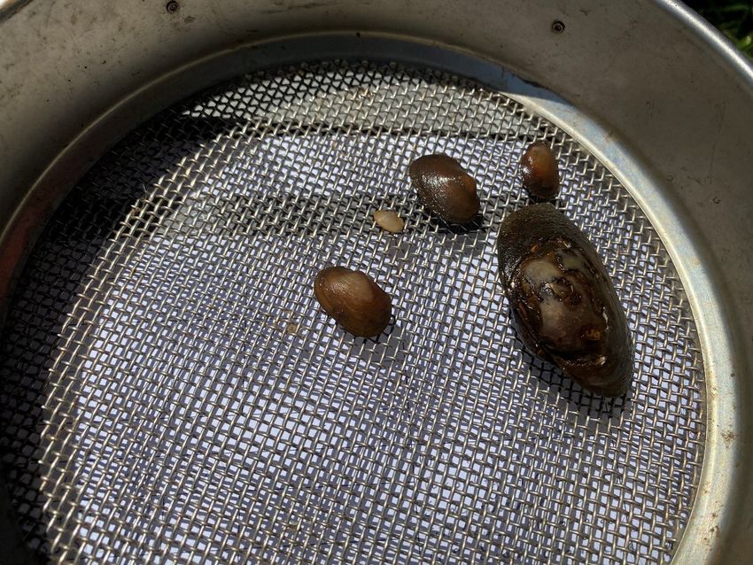
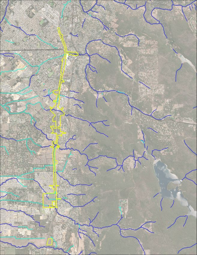
1.3 Project Location and Survey area
The BRE extends from near Armadale Station in the City of Armadale, south to Byford in the Shire of
Serpentine Jarrahdale. A desktop study area (known as ‘desktop study area’) has been defined and
includes a 5 km buffer of the project. The targeted fauna survey was completed over the proposed
development envelope as well as adjacent areas with potential habitat for Carter's Mussel (known as
the 'survey area') (refer Figure 1). Carter’s Freshwater Mussel occurs in freshwater rivers and lakes.
The survey effort therefore focused on the watercourses, drains and lakes that intersect the survey
area.

Stream Environment and Water Pty Ltd                                                                6
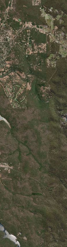
Survey Area
                                                            Desktop Survey Area

                      Figure 1: Location of Desktop Study
                      area and Survey Area
                                                             Projection: GDA zone 50
                      Byford Rail Extension - CFM Survey     Source: Base map © ESRI and its data suppliers.
www.streamew.com.au   Date: 15/01/20 Author: MB              Landgate (2020).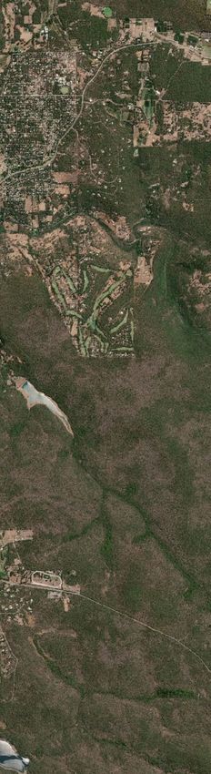
2 Background and Regional Context
2.1 Climate
The survey area experiences a Mediterranean climate with cool wet winters and hot dry summers.
Rainfall in the area predominantly occurs during winter, with on average 66% of total annual
rainfall falling between May and August (inclusive based on monthly data from Forrestdale BoM site
9257 from 1986 to 2020). Monthly mean maximum temperatures (based on monthly data from
Gosnells BoM site 9106 from 1991 to 2020) range from 33oC in January/February to 18.7oC in
July. Monthly mean minimum temperatures (from the Gosnells BoM site) range from 18.8oC to 8.8oC
in February to July respectively.

In the 12 months prior to the field survey in September 2020, rainfall at Forrestdale (BoM site
9257) was below average in 10 of 12 months (Figure 2). The total rainfall for 2019 was 637 mm
compared to the average of 827 mm. A drying climate may be considered a threat to Carter’s
Freshwater Mussel habitat.

Figure 2: Rainfall for 12 months prior to survey and monthly averages (Forrestdale BoM site 9257, data from 1986 – 2020).

2.2 Hydrology
The survey area intersects five watercourses, including Neerigen Brook, Wungong Brook, Beenyup
Brook and two drains. The majority of watercourses within the survey area have historically been
modified as part of clearing and agricultural land use and drainage control.

The Wungong Brook is the largest watercourse intersecting the survey area. The Wungong
catchment extends east of the survey area onto the Darling Plateau and covers approximately 130
km2 (DoW, 2007). On the Darling Scarp, flows from the upper catchment are captured within the
Wungong Dam and this water is used as part of Perth’s water supply. West of the survey area the
Wungong Brook flows into the Southern River and joins the Swan-Canning system. Flow in the
Wungong Brook downstream of the Wungong Dam is maintained (in part) by releases from the two
release points downstream of the dam. Releases occur through late spring to autumn to maintain
flows for licensed water users and to maintain water quality and habitat availability for aquatic biota
(DWER, pers comm.). Wungong Brook flows in a northwesterly direction, crossing the survey area
south of Eleventh Road.

Stream Environment and Water Pty Ltd                                                                                 8
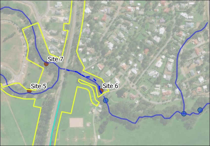
Neerigen and Beenyup brooks both have headwaters in the foothills of the Darling Scarp and flow
east to west across the survey area. On the Swan Coastal Plain both brooks have been highly
modified and flow into constructed drains.

Neerigen Brook is part of the Water Corporation’s main drain network. Neerigen Brook crosses the
survey area through the Armadale town centre. Within the survey area the brook is highly modified
and has been directed under road culverts or modified into constructed lakes. Two constructed
lakes, Sanctuary Lake and Wright Lake occur along Neerigen Brook through this section of the survey
area. Both are set in landscaped parks.

Beenyup Brook flows in a north westerly direction, crossing the survey area in its southern part,
north of Abernethy Drive. Beenyup Brook has linkages to the west through constructed drains and
discharges to the Birrega Main Drain and then to the Serpentine River system, which links to the Peel
Harvey Estuary (GHD 2020).

2.3 Carter’s Freshwater Mussel
Carter’s Freshwater Mussel is the only native freshwater mussel found in south-western Australia
and is currently listed as Vulnerable on state (BC Act 2016), national (EPBC Act 1999) and
international conservation lists (ICUN Redlist (ICUN 2020)). They are a long-lived species (up to 50
years) that can be sensitive to environmental changes. The species has undergone a 49% reduction
in distribution in less than 50 years, primarily due to secondary salinization (Klunzinger et al. 2015).
The species is now restricted to freshwater streams, rivers, reservoirs and lakes, generally within 50-
100km of the coast, from Gingin Brook in the north to the Kent, Goodga and Waychinicup Rivers in
the south (Klunzinger et al. 2015). Carter’s Freshwater Mussel life cycle includes a larval stage
(glochidia) that parasitise freshwater fish as a means of dispersal.

The species prefers perennial stream, riverine and wetland habitats, with stable sediments and low
salinity, living partially and fully buried in sand and finer sediment (Klunzinger 2012). Carter’s
Freshwater Mussel is found to show high rates of mortality when exposed to prolonged drying under
experimental conditions (Klunzinger 2012) and mussels exposed to drying in natural habitats have
been recorded to have higher mortality rates than those that have not (Klunzinger et al. 2012b).
Investigations into the conservation status of Carter’s Freshwater Mussel by Klunzinger et al. (2015)
indicated that mussels were very rarely found at sites with mean salinity concentrations of >1.62 g L–
1
 , were more common at sites with mean total nitrogen concentrations of
Neerigen Brook

                                                                                                              Sanctuary Lake
                                                                              Wright Lake

                                            Flet
                                                cher
                                                       Park
                                                              wat
                                                                 erco
                                                                       urse

                                       Wungong Brook
                      Wungong Brook
                      Tributary

                              Macora
                              Brook Drain
                                                                         k
                                                                    roo
                                                             o  ra B
                                                         Mac

                                      Bee
                                         nyu                                                    Survey Area
                                              p Br
                                                   ook
                                                                                       Hydrography
                                                                                           Drain
                                                                                                Watercourse

                         Figure 3: Watercourses within the survey area

                         Byford Rail Extension - Wetland Assessment                   Projection: GDA zone 50

                         Ref: 200404                                                  Source: Base map © ESRI and its data suppliers.
www.streamew.com.au                                                                   Landgate (2020).
                         Date: 15/01/20 Author: MB
3 Methodology
3.1.1 Overall Approach
The survey included desktop and field components. Further details of each are provided below. The
field survey followed methods previously used to locate and assess the distribution and population
structure of the species, including assessment of mussel density on transects (Klunzinger et al.
2012a, 2012b; Beatty et al. 2017).
3.1.2 Desktop Assessment
A desktop assessment was undertaken to identify previous records of Carter’s Freshwater Mussel in,
or near the survey area. This included a review of:
− The Department of Agriculture Water and the Environment (DAWE) Protected Matters Search
Tool
− The DBCA NatureMap
− Department of Water and Environmental Regulation (DWER) Healthy Rivers Program
− DBCA’s Threatened Species Database (previous search results provided by PTA)
− Relevant policy and conservation advice
− Relevant literature for the species.
The desktop survey:
− Identified previous records of Carter’s Freshwater Mussel within or adjacent to the survey
area
− Identified areas of potentially suitable habitat within the survey area (based on a review of
relevant literature, aerials and desktop information)
− Confirmed the suitability of the proposed sampling methodology.
Results of the desktop survey informed the field assessment (Section 3.1.3)
3.1.3 Field Assessment
The field assessment occurred from the 14th- 16th of September 2020 with follow-up surveys on the
29th and 30th of October 2020.
Habitat Assessment
Habitat assessments were completed at sites representative of potentially suitable habitat identified
during the desktop survey. The following details were recorded at each site:
− Site location (easting and northing using hand held GPS)
− Site photographs
− Length of site to be assessed
− Details of physical form (water depth, channel width)
− Instream habitat (substrate, macrophytes, debris, shading)
− The presence and condition of fringing vegetation
− Flow.
Where surface water was present, water clarity, colour and odour were assessed, and details
recorded. Water quality parameters including salinity (Carter’s Freshwater Mussel are not present in
systems where salinity is >1.6gL-1), dissolved oxygen, pH and temperature were recorded using a
hand held multiparameter water quality probe. Turbidity was also measured in situ with a turbidity
probe.
11 Byford Railway Extension Targeted Fauna Survey for Westralunio carteri Carter’s
Freshwater MusselBased on the field observations, each site was assessed for the potential to support Carter’s
Freshwater Mussel (assessed as low, moderate or high likelihood).
Targeted Search for Carter’s Freshwater Mussel
Where areas of suitable habitat were identified (assessed as moderate or high likelihood of
supporting Carter’s Freshwater Mussel) targeted searches for Carter’s Freshwater Mussel were
conducted immediately following the habitat assessment. Visual and hand searching for mussels was
conducted by two people in-stream along the bed and banks of each watercourse to a wadable
depth. Methods included gentle raking of sediment, hand searching and use of bathyscope. Where
mussels were found, additional sampling using transects and quadrats was conducted.
Transect and Quadrat Sampling
In watercourses where Carter’s Freshwater Mussel was observed during targeted searching,
additional sampling using replicate quadrats within transects was undertaken. The methodology
followed that developed by Klunzinger et al. (2012a, 2012b) which allows the quantification of
mussel abundance and population structure. Transect number and length was determined on site to
capture the distribution of mussels and with consideration to access and safety constraints. For each
transect, 10m in length, five randomly placed 1m2 quadrats were intensively searched by hand.
Sieving of sediment (0.56mm sieve) was carried out within random quadrats to assist in detecting
juvenile mussels. Transects were established within Wungong Brook, Wright Lake and Sanctuary
Lake (receiving flow from Neerigen Brook) (Table 1).
Table 1: Transect Establishment
Waterway Transect Establishment Total Total
Number of Number of
Transects Quadrats
Wungong Eight 10m transects were placed along a 200m length of the 8 x 10m 40
US waterway. The channel was generally 2-3m wide so the 10m
transect was placed along the channel (measured with a tape
measure) with 5 quadrats placed randomly on either side of the
transect.
Wungong Eight 10m transects were placed along a 200m length of the 8 x 10m 40
DS waterway. The channel was generally 1-4m wide so the 10m
transect was placed along the channel (measured with a tape
measure) with 5 quadrats placed randomly on either side of the
transect. One transect was located within the rail corridor.
Sanctuary Due to depth constraints, and the low density of mussels found 130m NA
Lake in the initial targeted search quadrats were not established at search
this site. Visual searches using a bathyscope and gentle raking along bank
of the sediment was conducted along a 130m stretch
approximately 0-5m from the bank (at a wadeable depth).
Wright Lake Four 10m transects were established within Wright lake, with 4 x 10m 20
two transects on either side of the footbridge on opposite
banks. The transects were approximately 1-5m from the bank.
Transects were placed parallel with the bank (measured with a
tape measure) with 5 quadrats placed randomly on either side
of the transect.
Transects were established using a tape measure and marked using a stake and flagging tape. A GPS
coordinate of the start and finish of each transect was taken and a photograph of the transect. Each
live captured Carter’s Freshwater Mussel was measured using vernier callipers before being
Stream Environment and Water Pty Ltd 12immediately returned to the same quadrat. Mussel density (individuals /m2) was recorded for each
quadrat. The presence of dead mussels was also recorded.
Estimates on the age of mussels found were based on existing length-frequency distributions of
Carter’s Freshwater Mussel for other watercourses (Klunzinger et al. 2014).
3.1.4 Survey Limitations
In accordance with Technical Guidance (EPA 2016) potential survey limitations are identified below.
Table 3: Survey Limitations
Aspect Constraint Comment
Competency No Jane Wilshaw is an ecologist with 20 years’ experience in
conducting biological surveys throughout NSW and WA. Her
experience has included numerous aquatic and invertebrate
surveys.
Robyn Paice is an aquatic ecologist with 20 years’ experience
in WA aquatic invertebrate surveys, specifically with previous
experience with surveying, translocation and monitoring of
Carter’s Freshwater Mussel.
Surveys were carried out under a DBCA Section 40 licence.
Scope No The scope was prepared in response to request by GHD. The
scope is considered sufficient to inform the impact
assessment with regards to the distribution and density of
mussels within the survey area.
Proportion of fauna Minor Two surveys were conducted in Spring 2020. Where suitable
identified / recorded. habitat was identified mussels were located through intense
targeted searches and further sampling effort was initiated to
further the understanding of distribution, density and
population structure. A wide variety of collecting techniques
were used including use of a bathyscope, hand searching, a
rake and a sieve. Hand-searching methodology is skewed as it
limits the capture of very small of juveniles, however sieving
of sediments provided an indication of juvenile presence. It
was not practical to sieve all material within all quadrats.
Sources of information Minor The report builds on the previous findings in the area as
presented in DBCA and DWER databases. Other relevant
literature has also been used where appropriate.
The proportion of the task No The surveys were completed adequately, carried out to a
achieved and further work sufficient level with respect to the scope.
Timing/weather/season/cycle No Surveys were carried out in favourable conditions. Timing of
the survey was not a limitation for the survey.
Disturbances No There were no disturbances that affected the survey.
Intensity (in retrospect was No Based on the results the survey intensity is considered
the intensity adequate) adequate to have met the scope. A multi-tiered approach
including habitat assessment, targeted searching and
intensive sampling of quadrats was included.
Completeness (e.g. was No The relevant area was surveyed sufficiently.
relevant area fully surveyed)
Resources No The resources made available to the survey were sufficient.
Remoteness and/or access Minor Several areas directly within the rail corridor were inaccessible
problems due to safety constraints. The extent of survey effort
immediately surrounding these areas is considered sufficient
to meet the objectives of the survey.
13 Byford Railway Extension Targeted Fauna Survey for Westralunio carteri Carter’s
Freshwater MusselAspect Constraint Comment
Availability of contextual Low Naturemap database and DWER Healthy Rivers Database
information on the region. provide additional regional context for the target
species. Relevant literature (previous reports and journal
articles) were also used to provide context where appropriate.
Stream Environment and Water Pty Ltd 144 Results and Discussion
4.1 Desktop Assessment Results
A review of relevant databases suggested that Carter’s Freshwater Mussel was highly likely to occur
within the survey area, in particular within Wungong and Neerigen Brooks.
4.1.1 DAWE and DBCA database searches
The DAWE Protected Matters Search Tool and DBCA NatureMap results showed Carter’s Freshwater
Mussel as known to occur within the desktop search area (Appendix A). A search of the DBCA
Threatened Species Database by GHD in 2020 showed a previous record of Carter’s Freshwater
Mussel in Neerigen Brook, approximately 1km upstream of the survey area (Figure 4).
4.1.2 Watercourses and fisheries assessments
Nine waterway assessment sites from the Department of Water and Environmental Regulation
(DWER) Healthy Rivers website (DWER 2020) are located within the desktop survey area. Three of
the nine sites have opportunistically recorded Carter’s Freshwater Mussel. These sites are described
in Table 4 and shown on Figure 4 (Table 4, Figure 4) (only fish and crayfish were targeted by
sampling methods used by DWER). The Bruns Drive site (site ref SCCIS10) is located within the survey
area and the SW Highway site (WUNG4A) is located approximately 1.3 km upstream of the survey
area. Of note is the record of Carter’s Freshwater Mussel from the Bruns Drive site within the survey
area. Consultation with the Department regarding this record showed the mussel (one mussel
opportunistically recorded) had been recorded at this location.
Table 4: Carter’s Freshwater Mussel presence records at DWER Healthy Rivers sites within the desktop study area.
Site Name Site System/River Within Key findings*
Reference survey
(Figure 3) area
Stocker Road CR41CANN2 Canning No Carter’s freshwater mussel recorded.
River (upper) Overall condition summary not
prepared. Six fish and one crayfish
(including 2 exotic fish species)
recorded. Long-necked turtle and
Brookton Highway CR41CANN1 Canning No Carter’s freshwater mussel recorded.
River (upper) Overall condition summary not
prepared. Eight fish and two crayfish
species recorded (including 3 exotic
species).
Bruns Drive SCCIS10 Wungong Yes Carter’s freshwater mussel recorded.
River Overall condition summary not
(middle) prepared. Five fish and two crayfish
species were recorded (including two
exotic fish species). South west glass
shrimp and Western long-necked turtle
were also recorded.
WUNGRIV05 WUNGRIV05 Wungong No Overall condition summary not
River prepared. Four fish and two crayfish
(middle) were recorded (including one exotic
crayfish species).
WUNGRIV05a WUNGRIV05a Wungong No Overall condition summary not
River prepared. Fish and crayfish not
(middle) assessed.
15 Byford Railway Extension Targeted Fauna Survey for Westralunio carteri Carter’s
Freshwater MusselSite Name Site System/River Within Key findings*
Reference survey
(Figure 3) area
WUNGRIV01 WUNGRIV01 Wungong No Overall condition summary not
River prepared. Three fish and one crayfish
(middle) were recorded (including one exotic
crayfish species).
WUNGRIV01a WUNGRIV01a Wungong No Overall condition summary not
River prepared. Fish and crayfish not
(middle) assessed.
Wattledale Road CR13SOUT2 Wungong No Overall condition summary not
River prepared. Three fish species and one
(middle) crayfish species were recorded (all
species were exotic).
South West WUNG4A Wungong No Overall condition summary not
Highway River (upper) prepared. Five fish and two crayfish
species were recorded (including two
exotic fish species).
(Source: DWER 2020)
* Overall river health condition summaries were not prepared (by DWER) for these sites. Key outcomes
relevant to this study were taken from available data.
Search of Fisheries freshwater fish database identified 8 species of freshwater fish (including 3
introduced species), one species of freshwater shrimp and three species of freshwater crayfish,
(including one introduced species) as occurring in the desktop survey area (Table 5). No records of
Carter’s Freshwater Mussel were reported from the freshwater fish database within the desktop
survey area. However several of the freshwater fish are confirmed host species for Carter’s
Freshwater Mussel.
Table 5: Freshwater fish database search results
Common name Species Name Native/Introduced
Fish
Freshwater cobbler Tandanus bostocki Native
Nightfish Bostockia porosa Native
South-western Goby Afurcagobius suppositus Native
Western Minnow Galaxias occidentalis Native
Western Pygmy Perch Nannoperca vittata Native
Goldfish Carassius auratus Introduced
Mosquitofish Gambusia holbrooki Introduced
Speckled Mosquitofish Phalloceros caudimaculatus Introduced
Shrimp
Freshwater Shrimp Palaemonetes australis Native
Crayfish
Gilgie Cherax quinquecarinatus Native
Smooth Marron Cherax cainii Native
Yabby Cherax destructor Introduced
(Source: Department of Fisheries 2020)
4.1.3 Identification of target habitats and watercourses
Based on the habitat requirements for the species, the survey effort focused on watercourses, drains
and lakes that intersect the survey area. In total 6 watercourses, one drain and 2 lakes were
identified for assessment (from south to north) (Figure 3):
− Minor Water Course (Referred to as Beenyup Brook)
Stream Environment and Water Pty Ltd 16− Minor Water Course (Referred to as Macora Brook) − Macora Brook Drain − Wungong Brook Tributary − Wungong Brook − Minor Water Course (Referred to as Fletcher Park Waterway) − Wright Lake − Sanctuary Lake − Neerigen Brook Where watercourses extended on both sides of the rail corridor separate habitat assessment sites were established on either side. These are referred to as US (upstream of rail corridor) and DS (downstream of rail corridor). Several drains also intersect the survey area. A review of aerial photography and spot checks in the field revealed these drains provide limited/no potential habitat for Carter’s Freshwater Mussel due to modified habitat, lack of vegetation on the banks, no shade, very little water (dry by late spring) and unsuitable substratum. One exception, the drain that feeds Macora Brook (Macora Brook Drain) was included in the habitat assessment (Figure 3). 4.2 Field Assessment Results 4.2.1 Habitat assessment Habitat assessments were undertaken in all watercourses and lakes considered to have potential for Carter’s Freshwater Mussel (from the outcomes of the desktop investigation and review of aerial photography). A total of twelve habitat assessments were undertaken across six watercourses, one drain and two lakes. Sites were chosen based on representativeness and access. The results of the assessment are summarised in Table 6 with each site assessed as low medium or high suitability for Carters Freshwater Mussel Habitat (based on a combination of desktop results and field assessment of habitat) and detailed in Appendix B. The locations of the assessment sites are presented in Figure 5. 17 Byford Railway Extension Targeted Fauna Survey for Westralunio carteri Carter’s Freshwater Mussel
Survey area
                                                                     Desktop survey area
                                                                     DBCA records
                                                            DWER sites
                                                               CFM recorded
                                                                     CFM not recorded

                      Figure 4: Desktop survey results

                      Byford Rail Extension - CFM Survey   Projection: GDA zone 50

                      Ref: 200405                          Source: Base map © ESRI and its data suppliers.
www.streamew.com.au                                        Landgate (2020).
                      Date: 15/01/21 Author: MB
Survey area
CFM Transects
Habitat assessment sites (site number)
Targeted search site (outside survey area)
Hydrography
Drain
Watercourse
Figure 5: Field survey sites
Byford Rail Extension - CFM Survey Projection: GDA zone 50
Ref: 200405 Source: Base map © ESRI and its data suppliers.
www.streamew.com.au Landgate (2020).
Date: 15/01/21 Author: MBTable 6: Results of the Habitat Assessment Survey
Waterway Habitat Summary September 2020 Photos Previous Potential Habitat Targeted search
(Site #) (Refer to Appendix A for details) known record for Carters conducted
of CFM Freshwater Mussel
within this (High, Moderate or
waterway in Low suitability)
the desktop
study area
Macora Brook Narrow channel, 30m section of Brook. NO LOW SUITABILITY NO
US (Site 1) Water depth 0.1m, flowing. Instream
filamentous green Algae present. Fringing Unsuitable habitat
vegetation present. Partially Shaded. High due to shallow
weed cover. Almost dry by late October water depth
2020. Substrate (where accessible) mostly (considered highly
silt and gravel and large cobbles. likely to be dry in
Immediately downstream of rail corridor summer) highly
Highly modified upstream (urban) and modified upstream
downstream of the rail corridor (cleared habitat and
paddock). severely degraded
downstream
habitats.
Beenyup Narrow channel, highly modified. Water NO LOW SUITABILITY NO
Brook depth 0.1m, flowing. In-stream
(Site 2) macrophytes present, minor Unsuitable habitat
(filamentous green algae). Fringing due to shallow
vegetation present (planted). Limited water depth
shade. Modified substrate mostly clay (considered highly
and compacted sand. Almost dry by late likely to be dry in
October 2020. summer),
completely
modified habitat
and lack of sand-
silt substrate.Waterway Habitat Summary September 2020 Photos Previous Potential Habitat Targeted search
(Site #) (Refer to Appendix A for details) known record for Carters conducted
of CFM Freshwater Mussel
within this (High, Moderate or
waterway in Low suitability)
the desktop
study area
Macora Highly modified. Water depthWaterway Habitat Summary September 2020 Photos Previous Potential Habitat Targeted search
(Site #) (Refer to Appendix A for details) known record for Carters conducted
of CFM Freshwater Mussel
within this (High, Moderate or
waterway in Low suitability)
the desktop
study area
Wungong Degraded. Water flowing. Water depth YES HIGH SUITABILITY YES
Brook 0.1-0.9m. Substrate primarily and-silt with (DWER
(Site 6 and some areas of gravel and bedrock. Fringing Healthy Suitable habitat
7) vegetation present. Mostly shaded. High rivers due to sandy-silt
weed cover on the banks. Macrophytes substrate, shaded
database)
present in some areas. Fish observed. riparian vegetation
and permanent
water. Previously
recorded nearby by
DWER.
Fletcher Connectivity within waterway intermittent NO LOW SUITABILITY NO
Park during September 2020 with shallow
Waterway pools, very shallow riffles and marshy Unsuitable habitat
US (Site 8) areas remaining. Water observed was due to shallow
clear and approximately 0.10m (average water depth (dry in
depth) deep and 0.5m wide. Mostly summer) and lack
shaded. Waterway highly disturbed at of sandy-silt
western boundary of Fletcher Park – substrate.
flowing into culvert downstream.
21 Byford Railway Extension Targeted Fauna Survey for Westralunio carteri Carter’s Freshwater MusselWaterway Habitat Summary September 2020 Photos Previous Potential Habitat Targeted search
(Site #) (Refer to Appendix A for details) known record for Carters conducted
of CFM Freshwater Mussel
within this (High, Moderate or
waterway in Low suitability)
the desktop
study area
Wungong Highly modified, cleared with the NO Unsuitable habitat NO
Road (Site 9) exception of established Eucalyptus due to lack of
wandoo and Eucalyptus rudis trees. water and
Waterway not connected in late October modified habitat.
2020 with shallow pools remaining. Grass covering
Remaining water observed was substrate.
approximately 0.15m deep and 0.3-0.4m
wide in a small pool. Partially shaded.
Neerigen Within the survey area Neerigen Brook is YES – LOW SUITABILITY NO
Brook highly modified flowing from a culvert Upstream
(upstream of underneath Albany Highway. Water was (DBCA Unsuitable habitat
Sanctuary flowing and clear, exotic and planted database) due to modified
vegetation on the banks. The Brook was substratum and
Lake)
approximately 1.5m wide and 0.1-0.3m artificial riffle
(Site 10) deep with a modified substratum. structures
impeding fish
passage.
Stream Environment and Water Pty Ltd 22Waterway Habitat Summary September 2020 Photos Previous Potential Habitat Targeted search
(Site #) (Refer to Appendix A for details) known record for Carters conducted
of CFM Freshwater Mussel
within this (High, Moderate or
waterway in Low suitability)
the desktop
study area
Sanctuary Highly modified man-made lake. Fed by YES – MODERATE YES
Lake (Site Nerrigen Brook. Water 0->1m deep. Upstream in SUITABILITY
11) Fringing planted sedges and rushes and Neerigen
trees. Partially shaded. Sediment silty Brook Neerigen Brook is
sand and some cobbles. highly modified
before it flows into
Sanctuary Lake.
The lake itself is
artificially
constructed with
no shade. However
it does have
permanent water.
Wright Lake Highly modified man-made lake. Fed by YES – MODERATE YES
(Site 12) Nerrigen Brook and connected to Upstream in SUITABILITY
Sanctuary Lake. Water mostlyWater Quality A snapshot of water quality conditions was undertaken as part of the habitat assessment in September and October 2020. Table 7 summarises the water quality at each habitat assessment site (where there was enough water). Water quality was not measured if depth was
transect 3) recorded no mussels. The mean mussel density was calculated at 4.4 mussels/m2. Only
two dead mussels was located at this site.

Maximum shell length ranged from 41 to 88mm with a median of 69mm (Figure 6). The mussels
sampled at this site were relatively large (96% were >60mm) and based on shell size > 27mm, all
mussels recorded were considered sexually mature (Klunzinger et al. 2014, 2015). The age of the
population of mussels was not estimated, however the dominance of larger mussels and apparent
absence of smaller mussels potentially suggests an aging population. Recruitment to Wright Lake
may be impeded by the multiple modifications to Neerigen Brook upstream and downstream of this
lake. Large mussel size may also be a function of environmental factors including relatively high
water temperatures (which have been linked to mussel growth Klunzinger et al. 2014), potential
absence of predation or high nutrient levels.

Table 8: Results for Wright Lake
 Transect      GPS Coordinates            Quadrat   Mussels   Mussel Density    Live Mussel Size
                                                    Present   (1m2)             range (mean) /
                                                     (Y/N)                      quadrat
               Start          Finish                          Live     Dead
 1             407273mE       407282mE       Q1       Y          3       0         65-72 (67)
               6442612mN      6442616mN      Q2       Y          6       0         65-86 (71)
                                             Q3       Y          3       1         65-73 (68)
                                             Q4       Y          8       0         64-78 (69)
                                             Q5       Y          4       0         64-74 (67)
 2             407306mE       407316mE       Q1       Y          2       0         65-70 (68)
               6442621mN      6442618mN      Q2       Y          6       0         41-88 (63)
                                             Q3       Y          5       0         61-72 (67)
                                             Q4       Y          8       0         62-85 (70)
                                             Q5       Y          4       1         61-75 (67)
 3             407347mE       407356mE       Q1       N          0       0              -
               6442624mN      6442619mN      Q2       Y          2       0         58-84 (71)
                                             Q3       Y          1       0             58
                                             Q4       Y          1       0             81
                                             Q5       Y          3       0         68-83 (77)
 4             0407239E       0407247E       Q1       Y          7       0         61-80 (70)
               6442627N       6442632N       Q2       Y          3       0         68-80 (74)
                                             Q3       Y          8       0         62-86 (74)
                                             Q4       Y          5       0         64-77 (72)
                                             Q5       Y          9       0         62-83 (71)
                        TOTAL MUSSEL COUNT                      88       2            NA

25        Byford Railway Extension Targeted Fauna Survey             for Westralunio carteri Carter’s
Freshwater Mussel
Figure 6: Shell Length/Frequency Histogram of Carter’s Freshwater Mussel for Wright Lake 4.2.2.2 Sanctuary Lake An intensive search was conducted at Sanctuary Lake in Minnawarra Park along a 130m stretch within an area 0-5m from shore. Only one Carter’s Freshwater Mussel was found at Sanctuary Lake. The mussel was found in a depth of approximately 0.8m and was 68mm in size. Searches in Sanctuary Lake were hindered by the depth of the water however targeted searches over 130m did not find any additional mussels indicating that densities are low. 4.2.2.3 Wungong Brook Sixteen 10m transects with five random quadrats per transect were surveyed along a 500m section of Wungong Brook. A high number of shorter transects were considered appropriate given the variation in mussel density and access limitations along the waterway (large woody debris and large areas of Blackberry Rubus laudatus). Densities of live Carter’s Freshwater Mussel recorded were variable ranging from 1 to 12 mussels per m2 from a total of 80 quadrats across 14 transects (Table 9 and 10). Every transect recorded at least one mussel. Of 80 quadrats surveyed, 29 (36%) recorded no mussels. Mean densities were very similar either side of the rail corridor (upstream mean density of 2.6/m2; downstream mean density of 2.5/m2). However, the distribution of mussels was patchy, particularly downstream of the rail corridor with high numbers of mussels occurring within transect 4 (where the brook had been partially dammed) and transect 7 (a highly shaded area with dense accumulation of organic matter). Densities within Wungong Brook are consistent with other surveys reported for south west watercourses of 1-15 per m2 (Klunzinger et al. 2012). Maximum shell length ranged from 9 to 65mm with a median of 52mm (Figure 7, Plate 1). Occurrence of mussels with a maximum shell length of 9mm indicate recruitment is occurring within Stream Environment and Water Pty Ltd 26
the brook. Approximately 98% of the mussels were over 27mm and considered sexually mature
(Klunzinger et al. 2014, 2015). Dead mussels were intermittently found within the Brook, with a
cluster of dead mussels found in the shallow area at the most upstream end of the survey area
(Transect 8). The size of dead mussels in this location was variable (21 to 50mm).

Visual and hand searches were conducted at three locations east of the survey area to determine
the distribution of the mussels upstream of the proposed BRE (Figure 5). Carter’s Freshwater Mussel
individuals were located immediately east of the survey area however, were apparently absent from
two locations further upstream, closer to South Western Highway. The substratum at these most
eastly locations was observed to be sludgy and slimy and the riparian zone degraded, dominated by
Watsonia spp. and Blackberry.
Table 9: Results for Wungong Brook Upstream of the Rail Corridor
 Transe     GPS Coordinates                Quadra      Mussels     Mussel Density     Live Mussel Size
 ct                                          t         Present     (1m2)                   range
                                                        (Y/N)                         Min-Max (mean)
            Start          Finish                                  Live     Dead
 1          0406516m       0406525m          Q1           Y            2      0          51-52 (51)
            E              E                 Q2           Y            2      0          37-38 (38)
            6437826m       6437823m          Q3           N            0      0               -
            N              N                 Q4           Y            1      0              52
                                             Q5           N            0      0               -
 2          406553mE       0406563m          Q1           Y            4      0          49-59 (54)
            6437819m       E                 Q2           N            0      2               -
            N              6437816m          Q3           N            0      0               -
                           N                 Q4           N            0      0               -
                                             Q5           N            0      0               -
 3          0406568m       0406577E          Q1           N            0      0               -
            E              6437806N          Q2           N            0      0               -
            6437812m                         Q3           Y            1      0              45
            N                                Q4           N            0      0               -
                                             Q5           Y            3      0          50-54 (52)
 4          0406584m       406593mE          Q1           Y            1      0              47
            E              6437797m          Q2           Y            4      1          48-52 (50)
            6437802m       N                 Q3           Y           12      0          44-53 (49)
            N                                Q4           Y            9      2          46-55 (52)
                                             Q5           Y            4      1          45-55 (52)
 5          0406606m       0406617m          Q1           Y            3      0          46-49 (48)
            E              E                 Q2           N            0      0               -
            6437794m       6437794m          Q3           Y            2      1          46-57 (52)
            N              N                 Q4           Y            5      0          47-55 (51)
                                             Q5           Y            6      0          49-58 (54)
 6          0406639m       0406647m          Q1           Y            2      0          50-52 (51)
            E              E                 Q2           Y            1      0              45
            6437784m       6437777m          Q3           Y            1      0              40
            N              N                 Q4           Y            1      1              49
                                             Q5           Y            4      2          43-49 (46)
 7          0406665m       0406665m          Q1           Y            1      0              50
            E              E                 Q2           Y            1      0              51
            6437750m       6437739m          Q3           Y            1      1              61
            N              N                 Q4           Y            1      2               -
                                             Q5           Y            1      0              55
 8          0406670m       0406673m          Q1           Y           11      7          46-57 (51)
            E              E                 Q2           Y            7      2          47-57 (53)

27        Byford Railway Extension Targeted Fauna Survey                     for Westralunio carteri Carter’s
Freshwater Mussel
Transe GPS Coordinates Quadra Mussels Mussel Density Live Mussel Size
ct t Present (1m2) range
(Y/N) Min-Max (mean)
Start Finish Live Dead
6437728m 6437719m Q3 N 0 0 -
N N Q4 Y 9 3 23-55 (38)
Q5 Y 4 9 43-48 (46)
TOTAL MUSSEL COUNT 104 34 NA
Table 10: Results for Wungong Brook Downstream of the Rail Corridor
Transe GPS Coordinates Quadra Mussels Mussel Density Live Mussel Size
ct t Present (1m2) range
(Y/N) Min-Max (mean)
Start Finish Live Dead
1 406350mE 406354mE Q1 N 0 0 -
6438036m 6438026m Q2 N 0 0 -
N N Q3 N 0 0 -
Q4 N 0 0 -
Q5 Y 1 0 54
2 406360mE 406363mE Q1 N 0 0 -
6438003m 6437994m Q2 N 0 -
N N Q3 Y 1 0 46
Q4 Y 1 0 49
Q5 Y 1 0 53
3 406367mE 406365mE Q1 N 0 0 -
6437971m 6437981m Q2 N 0 0 -
N N Q3 N 0 0 -
Q4 Y 2 0 50-50 (50)
Q5 Y 1 0 53
4 406368mE 406372mE Q1 Y 5 0 56-63 (61)
6437970m 6437960m Q2 Y 8 1 40-58 (53)
N N Q3 Y 8 1 52-61 (57)
Q4 Y 12 1 50-64 (57)
Q5 Y 9 0 35-65 (56)
5 406385mE 406389mE Q1 N 0 0 -
6437897m 6437887m Q2 N 0 0 -
N N Q3 N 0 0 -
Q4 Y 2 1 56-62 (59)
Q5 Y 3 0 39-60 (52)
6 406413mE 406405mE Q1 Y 7 0 41-61 (52)
6437857m 6437863m Q2 Y 2 0 55-59 (57)
N N Q3 Y 1 0 65
Q4 Y 2 0 43-57 (50)
Q5 N 0 0 -
7 406474mE 406483mE Q1 Y 10 0 44-58 (53)
6437834m 6437829m Q2 Y 11 0 26-60 (51)
N N Q3 N 0 0 -
Q4 Y 6 0 37-58 (49)
Q5 Y 5 0 9-56 (27)
8 406502mE 406489mE Q1 N 0 0 -
6437830m 6437832m Q2 Y 3 0 39-43 (41)
N N Q3 N 0 0 -
Q4 N 0 0 -
Q5 N 0 0 -
Stream Environment and Water Pty Ltd 28Transe GPS Coordinates Quadra Mussels Mussel Density Live Mussel Size
ct t Present (1m2) range
(Y/N) Min-Max (mean)
Start Finish Live Dead
TOTAL MUSSEL COUNT 101 4 NA
Figure 7: Shell Length/Frequency Histogram of Carter’s Freshwater Mussel for Wungong Brook
29 Byford Railway Extension Targeted Fauna Survey for Westralunio carteri Carter’s
Freshwater MusselPlate 1. Size variation of Carter’s Freshwater Mussel within Wungong Brook Stream Environment and Water Pty Ltd 30
5 Discussion
One watercourse and two lakes within the survey area were found to provide suitable habitat for
Carter’s Freshwater Mussel: Wungong Brook, Sanctuary Lake and Wright Lake. The mussel was
recorded at all three locations during targeted searches. Further sampling was then undertaken to
establish the distribution and density of mussels at these locations. A discussion of the results is
provided below. Six other watercourses (including drains) within the survey area were assessed as
unlikely to support mussels predominately based on lack of perennial water availability and
unsuitable substratum.

Wright Lake
Carter’s Freshwater Mussel were consistently recorded at low- moderate density (mean density of
4.4 mussels/m2) at all four transects within Wright Lake (other surveys reported for south west
watercourses are 1-15 per m2 (Klunzinger et al. 2012)). Of 20 quadrats surveyed, only 1 quadrat
recorded no mussels.

The size of the mussels ranged from 41mm to 88mm with a median of 69mm. The age of the
population of mussels is unknown, however, the dominance of larger mussels (96% were >60mm)
and absence of smaller mussels at Wright Lake suggests an aging population. Recruitment to this
location may be impeded by the multiple modifications to Neerigen Brook upstream and
downstream of this lake which may affect movement of fish necessary for mussel recruitment.
Wright Lake was not shaded at all and surrounded by lawn and urban development. Large mussel
size may be related to environmental factors at this site including higher water temperatures (higher
water temperatures have been linked to mussel growth Klunzinger et al. 2014), lack of or limited
predation or high nutrient levels (surrounding lawns may be fertilised). Higher growth rates can lead
to shorter life span and may place this population at risk. Temperatures in September 2020 were
several degrees higher than other more shaded watercourses such as Wungong Brook. In the
summer months these differences may become more extreme.

Carter’s Freshwater Mussel has been found (previous surveys) upstream of Wright Lake within
Neerigen Brook. It is possible that the species occurs in other areas of suitable habitat within this
watercourse.

Sanctuary Lake
Suitable habitat was found within Sanctuary Lake, however searches recorded only one mussel.
Targeted surveys were limited due to the depth (exceeded wadable depth) of the lake. However,
given the considerable survey effort within the shallow waters (
Wungong Brook
Carter’s Freshwater Mussel was found in variable but generally low densities within Wungong Brook
(approximately 500m of Wungong Brook surveyed). The Wungong Brook provided suitable habitat
with sandy/silty sediment, oxygenated flowing water and riparian vegetation providing shade. Fish
were observed in the brook. Recorded mussel density within quadrats ranged from 1 to 12 mussels
per m2, with an overall mean mussel density of 2.6 mussels/m2. Densities within Wungong Brook are
consistent with other surveys reported for south west watercourses of 1-15 per m2 (Klunzinger et al.
2012). Mean densities were very similar either side of the rail corridor (upstream mean density of
2.6/m2; downstream mean density of 2.5/m2). Mussels were recorded within the rail corridor,
however at low density (0.6/m2). This area was without riparian vegetation and had been subject to
historical disturbance and therefore provides less suitable habitat when compared to upstream and
downstream areas.

All sixteen transects within Wungong Brook recorded at least one mussel however the distribution
of mussels was patchy. Of 80 quadrats surveyed, 51 quadrats recorded mussels, while 29 quadrats
recorded no mussels. The patchy nature of the mussel distribution is likely due to the variability in
habitat along the watercourse. Mussel density downstream of the rail corridor was variable, with
high numbers of mussels occurring within transect 4 (where the brook had been partially dammed)
and transect 7 (a highly shaded area with dense accumulation of organic matter).

Mussel size ranged from 9 to 65mm (median shell length of 52mm). The presence of individuals as
small as 9mm indicates recruitment and evidence of a self-sustaining population.

Opportunistic observations from DWER river health sites (DWER 2020) show Carters Freshwater
mussel to occur at several sites in the catchment where suitable habitat is present. Based on the
presence of juvenile mussels it is likely that fish hosts are moving through the Wungong Brook
system and that Carter’s Freshwater Mussel occurs in other sections of the Wungong Brook and
possibly the Wungong River where suitable habitat exists. The mussel was found to be present
within Wungong Brook immediately upstream of the survey area, however not found in two
locations further upstream (closer to southwestern highway). However, these locations upstream
were weed-infested, and the sediment was of a very sludgy and slimy consistency. More suitable
habitat may occur further upstream.

6 Conclusions and Recommendations
Wungong Brook, Sanctuary Lake and Wright Lake were found to provide suitable habitat for Carter’s
Freshwater Mussel within the survey area. Mean mussel densities within Wungong Brook (2.6
mussels/m2) and Wright Lake (4.4 mussels/m2) are consistent with other surveys reported for south
west watercourses of 1-15 per m2 (Klunzinger et al. 2012a). Only one mussel was recorded within
Sanctuary Lake.

Wright Lake and Sanctuary Lake are highly modified man made lakes. These lakes have limited/no
shade and are fed by through artificial culverts and drains from Neerigen Brook. The age of the
population of mussels at Wright Lake is unknown, however, the dominance of larger mussels (96%
>60mm) and absence of smaller mussels suggests an aging population. Recruitment to this location
(and to Sanctuary Lake) may be impeded by the multiple modifications to Neerigen Brook upstream
and downstream which affect movement of fish necessary for mussel recruitment.

The Wungong Brook provides highly suitable habitat and is likely to be providing a refuge for the
species. The population in this system appears to be self-sustaining as indicated by recent
recruitment. Based on the recorded presence of juvenile mussels it is considered that fish hosts are

Stream Environment and Water Pty Ltd                                                              32
moving through the Wungong Brook system and it is considered likely that Carter’s Freshwater
Mussel occurs in other sections of the Wungong Brook where suitable habitat exists.

Carter’s Freshwater Mussel is listed as vulnerable under state and federal legislation and the Extent
of Occurrence (EOO) of the species has declined by 49% in less than 50 years (three generations)
(Threatened Species Scientific Committee 2018). Maintaining existing habitats and population
strongholds is considered of key importance for the survival of the species (Klunzinger et al. 2015).
Impacts to the existing populations of Carter’s Freshwater Mussel in Wungong Brook, Wright Lake or
Sanctuary Lake, or to host native fishes should be avoided.

If direct or indirect impacts to the known habitat of Carter’s Freshwater Mussel (identified in this
survey) are proposed, then the following management measures are recommended to avoid impacts
to existing populations and their habitat:

    •   If direct impact to the streambed/ lake bed is proposed, then relocation of susceptible
        populations with potential to be impacted should be undertaken in accordance with
        relevant guidelines and best management practices. It is recommended the approach to
        translocation will be documented in a Carter’s Freshwater Mussel translocation plan
        developed in accordance with the Environmental Management Plan Guidelines
        (Commonwealth of Australia 2014) in consultation with DBCA.
    •   Where direct impact to river/lake bed and/or banks is proposed suitable erosion controls
        such as silt curtains and anti-erosion matting on river banks, should be implemented during
        construction to minimise the risk of impact to habitat outside the area of direct impact.
    •   Implementation of monitoring of water quality (in particular turbidity and Total Suspended
        Solids) in water courses and/or lakes potentially impacted by construction activities.
    •   If water quality monitoring during the construction phase indicates that mussel habitats are
        being impacted, then the extent of impacts should be established, and appropriate
        responses implemented. Potential responses include implementation of erosion controls
        and translocation of mussels from the area of impacts.

33        Byford Railway Extension Targeted Fauna Survey           for Westralunio carteri Carter’s
Freshwater Mussel
You can also read