GREAT LAKES STAKEHOLDERS FORUM ON FRESHWATER ECOSYSTEMS
←
→
Page content transcription
If your browser does not render page correctly, please read the page content below
GREAT LAKES STAKEHOLDERS FORUM ON
      FRESHWATER ECOSYSTEMS

Addressing the Drivers of Change for Freshwater Services in the Great Lakes Region

                           PROCEEDINGS

                           KIGALI, 21-22 FEBRUARY 2013

   Organized with support from the John D. and Catherine T. MacArthur Foundation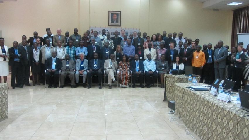
Contents
I.     List of accronymes ........................................................................................................................... 4

II.    Introduction .................................................................................................................................... 5

III. Attendance ...................................................................................................................................... 6

IV. Proceedings ..................................................................................................................................... 6

1.     Openning ceremony ........................................................................................................................ 6

       a)     Welcome Note ......................................................................................................................... 6

       b)     Opening speech ....................................................................................................................... 6

       c)     Official launch of the MacArthur Foundation’s Great Lakes Conservation Strategy ............. 7

2.     Overview of the status and trends of watersheds, wetlands and other freshwater systems in the
       Great Lakes ..................................................................................................................................... 8

       a)     On-going initiatives and Policy Framework in the GLR: challenges and Opportunities ........ 8

       b)     Overview of GL Strategy: KBAs, Biodiversity and Protection Status in the Great Lakes
              Region ..................................................................................................................................... 9

       c)     Drivers of change affecting watersheds, wetlands and freshwater systems in the GL Region
              10

       d)     Integrated Water Resources Management in Rwanda ........................................................... 11

3.     Experience sharing in the Gl Region: Regional initiatives ........................................................... 12

       a)     CEPF: Eastern Afromontane Hotspot.................................................................................... 12

       b)     Mountain Partnership and Africa Water Towers Initiative ................................................... 13

       c)     Wetlands in the Great Lakes region of Eastern & Central Africa ......................................... 13

       d)     Climate Resilient Altitudinal Gradients (CRAGs) ................................................................ 14

       e)     Transboundary Ecosystem-Based Management of Fisheries and Oil Governance Project ... 15

       f)     Lake Tanganyika Basin: Status, Challenges and Opportunities ............................................ 16

       g)     Lake Victoria Basin: Status, Challenges and Opportunities .................................................. 17

       h)     Lake Nyasa/Malawi Basin: Status, Challenges and Opportunities........................................ 19

       i)     Upper Nile Basin: Status, Challenges and Opportunities ...................................................... 20

       j)     The Turkana/Omo Basin: Status, Challenges and Opportunities .......................................... 21

                                                                                                                                                               2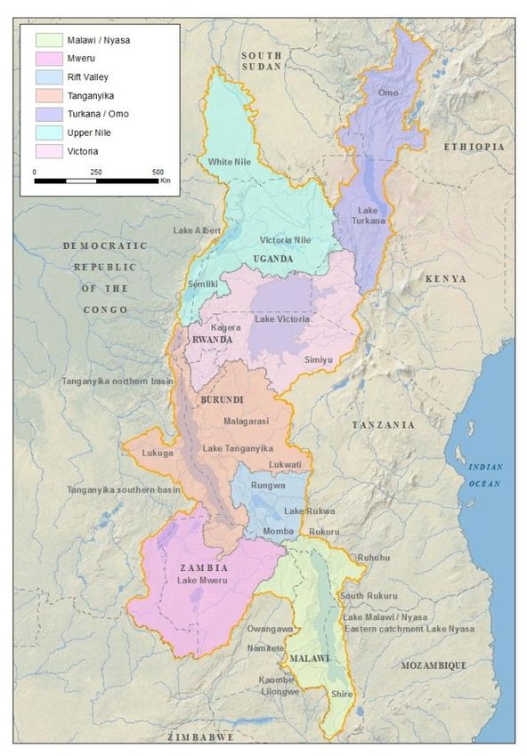
k)     Malagarasi River Basin: threats and opportunities for wetlands conservation ...................... 22

4.     Economic development, environmental change and their impact on freshwater ecosystems ....... 23

       a)     Fisheries of Lake Victoria: Current Status and Management Challenges ............................. 23

       b)     Threats from invasive species in the Great Lakes Region ..................................................... 24

       c)     Lake Turkana/River Omo basin: Dams and freshwater services. Case study: river Omo ..... 26

       d)     Oil and Gas exploration and Freshwater Ecosystems in the Albertine Rift .......................... 28

       e)     Role of Private Sector Actors in Environmental Sustainability: Case Study- Biodiversity
              baseline surveying in the Albertine Rift, Uganda .................................................................. 29

5.     Integrating community needs in water resource management ...................................................... 30

       a)     Civil society engagement and advocacy ................................................................................ 30

       b)     Watershed degradation and sustainable agriculture .............................................................. 30

       c)     Women and Water Resources Management .......................................................................... 31

       d)     Role of CSOs in the Integrated Lake Basin Management ..................................................... 32

       e)     Freshwater Services and community benefits in the GL Region: status, challenges and
              opportunities .......................................................................................................................... 33

       f)     Climate Change Adaptation: challenges and opportunities ................................................... 34

V.     Working groups ............................................................................................................................. 36

VI. Closing session .............................................................................................................................. 37

1.     Closing remarks from ARCOS ........................................................................................................ 37

2.     Vote of thanks by participants ...................................................................................................... 37

3.     Official closing by guest of honour ................................................................................................ 38

VII. Annexes ........................................................................................................................................... 1

                                                                                                                                                             3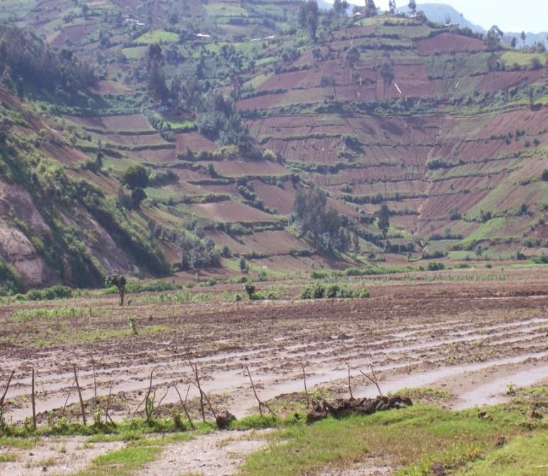
I.      LIST OF ACCRONYMES

GLR:         Great Lakes Region
DRC:         Democratic Republic of Congo
LTA:         Lake Tanganyika Athority
LVBC:        Lake Victoria Basin Commission
LVFO:        Lake Victoria Fisheries Organization
RAMCEA:      Ramsar Centre for Eastern Africa
IUCN:        International Union for Conservation of Nature
ARCOS:       Albertine Rift Conservation Society
NBD:         Nile Basin Discourse
NBI:         Nile Basin Initiative
RNRA:        Rwanda Natural Resources Authority
KBA:         Key Biodiversity Area
IBA:         Important Bird Area
UNEP:        United Nations Environment Programme
CRAG:        Climate Resilient Altitudinal Gradients
CEPF:        Critical Ecosystem Partnership Fund
EPA :        Ethiopian Environmental Protection Agency
WWF:         World Wildlife Fund
WCS:         Wildlife Conservation Society
ABO:         Association Burundaise pour les Oiseaux
ACNR:        Association pour la Conservation de la Nature au Rwanda
PES:         Payment for Ecosystem Services
IWRM:        Integrated Water Resources Management
ILBM:        Integrated Lake Basin Management
ICRAF:       International Centre for Research in Agroforestry
WHO:         World Health Organization
UNICEF:      United Nations Children’s Fund
MEEATU:      Ministère de l’Eau, Environnement, Aménagement du Territoire et Urbanisme
TAWIRI:      Tanzania Wildlife Research Institute
IRA:         Institute for Resources Assessment
INECN:       Institut National pour l’Environnement et la Conservation de la Nature
HN:          Horizon Nature
                                                                                         4
II.   INTRODUCTION

In the framework of the project termed “Stakeholders Engagement for Informed Decision-
Making, Threats Mitigation and Sustainable Freshwater Services Management in the Great
Lakes Region of East and Central Africa”; the Albertine Rift Conservation Society, in
collaboration with the Lake Tanganyika Authority (LTA), the Ramsar Centre for Eastern
Africa (RAMCEA), Nile Basin Discourse (NBD), BirdLife International (Africa Partnership
Secretariat) and International Union for Conservation of Nature through its Eastern and
Southern Africa Regional Office (IUCN-ESARO), and with funding support from the John
D. and Catherine T. MacArthur Foundation, have organized the Great Lakes Forum on
Freshwater Ecosystems at Kigali, Rwanda on 21-22 February 2013.
The two-day meeting was aimed at providing a platform for developing an integrated and
coordinated framework in which the threats affecting freshwater services in the region can be
addressed. In addition, the meeting served as an inception workshop for this project and the
launching pad for the new MacArthur Foundation’s conservation strategy in the Great Lakes
Region.
During the two days, representatives of governments, civil society and the private sector
actors, as well as experts in freshwater services from all countries of the Great Lakes region
exchanged on the status and trends in the freshwater ecosystems of the region, shared
experiences on the initiatives already going on in addressing some of the threats, examined
the impact the economic development is having on the freshwater ecosystems of the region
and emitted recommendations on actions to address the drivers of change that is happening in
these systems.
The present report outlines the major points discussed during this forum, the highlights and
the recommendations that emerged from the meeting.
Part I of the report consists of the proceedings of the event (sessions) and second part looks at
the discussions in groups. Finally, the Annex I comprises of the recommendations emitted at
the end of the meeting, and Annex II and III consist of the list of participants as well as the
agenda respectively.

                                                                                                    5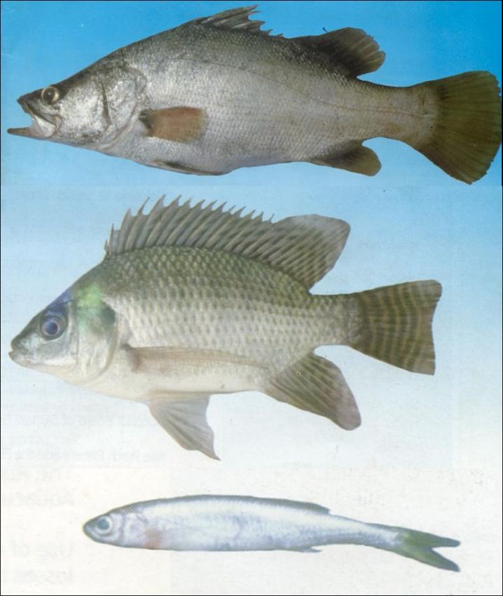
III. ATTENDANCE
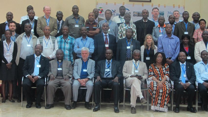
A total of 81 participants attended the forum, coming from 11 countries of the Great Lakes
Region namely: Burundi (6), DRC (6), Ethiopia (1), Kenya (10), Malawi (1), Mozambique
(1), Rwanda (23), South Sudan (2), Tanzania (3), Uganda (9), and Zambia (2). In addition,
the forum was attended by representatives of some international organizations (8), private
sector (6) and the media (2). (You can find the full list of participants in the Annex II of this
report).
IV. PROCEEDINGS
1. OPENNING CEREMONY
a) Welcome Note
After all attendants have introduced themselves; Mr Gapusi Jean, ARCOS Board member,
welcomed participants to the forum. He presented the background of the event and stressed
on the expected outcomes from the meeting. “This is one of the rare events where so many
experts, from so varied backgrounds have gathered together to discuss the common
challenges our freshwater ecosystems are facing” he said, “… and I am confident that we will
leave this room with a clear roadmap of what actions need to be done to conserve these
ecosystems and their valuable services” he added.
Mr Gapusi Jean, ARCOS Board Member, welcoming the participants to the forum
b) Opening speech
The guest of honour at the meeting was Mr Dismas Bakundukize, Deputy Director General in
charge of forestry at the Rwandan Natural Resources Authority (RNRA).
In his statement, he talked on the role of freshwater ecosystems in the region as hosts to very
rich biodiversity, source of livelihoods to communities, and important to countries’
development.
6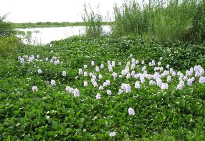
Taking the example of Rwanda, he recognized that significant efforts have been taken to
achieve sound management of these ecosystems and their services but stressed that such
efforts are not sufficient if they remain fragmented. “Many freshwater ecosystems in the
Great Lakes region are trans-boundary. This calls for coordinated effort since a
mismanagement practice in one country affects the status of the resources in the other
countries”. He said some steps have been taken in this direction such as the establishment of
the Nile Basin Initiative and many lake basin commissions but stressed on the fact that the
nowadays problems require a multi-stakeholder approach to be addressed and therefore a
forum like this, encompassing not only policy makers but also civil society and private sector
actors, is very appropriate especially when it comes at this time when we try to achieve
integration in many domains.
He expressed his gratitude to the supporters of this forum and commended the effort of the
organizers.

c) Official launch of the MacArthur Foundation’s Great Lakes Conservation Strategy

The conservation strategy for the Great Lakes region of the East and Central Africa was
developed by BirdLife International and partners in 2012 supported by the John D. and
Catherine T. MacArthur Foundation.
Its development process consisted of a comprehensive consultation between all stakeholders
to identify priority sites, threats and conservation strategies for biodiversity and ecosystem
services in the region.
Its overall goal is to prevent or reduce biodiversity loss and ecosystem degradation, and to
sustain ecosystem benefits for human well-being. It focuses on five watersheds within the
Great Lakes region namely the Lake Victoria Basin, Upper Nile Basin, Lake Tanganyika
Basin, Lake Malawi/Nyasa Basin, and Lake Turkana/Omo Basin.
The strategy aims at:
    1. Identify, document and prioritize those areas in the GLR where endangered species
        and the Ecosystem Services that are essential for human welfare are most at risk;
    2. Identify the threats to these species and services and to understand the socioeconomic
        and global change contexts (including climate change) in which those threats have
        arisen and can be reduced;
    3. Propose actions that will reduce the threats, enhance the prospects for the
        conservation of threatened species and sites, and ensure the continuation and
        improvement of ecosystem service delivery;
    4. Explore new ways of thinking about landscape conservation that will provide
        resilience against global change, especially climate change; and
    5. Identify and promote incentives at all levels to slow current trends of ecosystem
        degradation and service loss in the GLR and eventually reverse them.

                                                                                                 7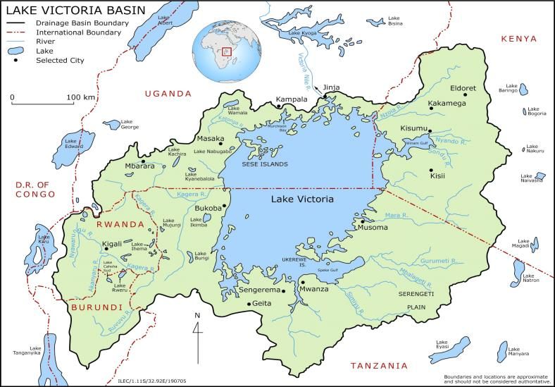
This document will guide the
Foundation’s Conservation and
Sustainable Development (CSD)
program in the region for this
coming 10 years period and all
stakeholders are encouraged to
refer to the document as well in
the bid to achieve coordination
and integration of all the efforts
towards      conservation     and
sustainable livelihoods in this
very important region.
The official launching ceremony
was led by Ms Elisabeth Chadri,
Program Officer, Conservation Ms Elisabeth Chadri handing the Great Lakes Conservation
and Sustainable Development at strategy document to the guest of honour
MacArthur Foundation. In her
brief address, she outlined the background of the strategy and stressed on the fact that it
builds on the Foundation’s legacy in Albertine Rift. She went on to explain that this is but
one component of the MacArthur Foundation’s conservation strategy that focuses on 3
regions across the world, the Great Lakes Region of East and Central Africa being one of
them.
She reminded that each of these regions has its own challenges and opportunities and that in
the great Lakes region, the main drivers include high population densities, coupled with low
percentage of natural habitats remaining.
Handing the document to the guest of honour, Ms Elisabeth told the audience that the text of
the document is available to the public through the Foundation’s website at
www.macfound.org

2.   OVERVIEW OF THE STATUS AND TRENDS OF WATERSHEDS,
     WETLANDS AND OTHER FRESHWATER SYSTEMS IN THE GREAT
     LAKES

a)   On-going initiatives and Policy Framework in the GL Region: challenges and
     Opportunities

The presentation given by Dr Tom Waako who was representing the Nile Basin Initiative
gave an overview of the cooperation on transboundary water resources in the region using the
Nile Basin Initiative as an example.
The Nile Basin Initiative is intergovernmental regional partnership established in 1999 with
the vision to achieve sustainable socioeconomic development through the equitable
utilization of, and benefit from, the common Nile Basin water resources.

                                                                                               8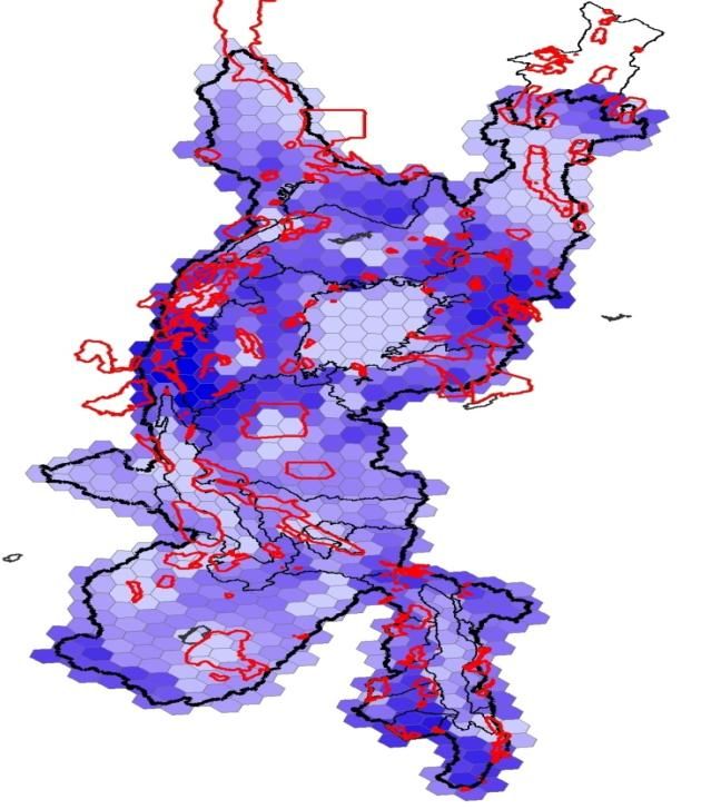
The various projects under the initiative are implemented by the secretariat based in Entebbe
through the shared vision program (SVP) and subsidiary action program (SAP).
Throughout the period of its existence and from experiences with the predecessors of the
initiative such as the Hydromet (1967 - 1992) and TECCONILE (1992 -1999), many lessons
were learnt in terms of better strategies to take in the management of transboundary water
resources. Among which, some come out more prominently such as the fact that excessive
“projectization” of activities without clear exit strategies cannot lead to longer-term impacts
and outcomes. In addition, it was learned that highly participatory process ensures relevance
to country needs and stakeholder buy-in.
Among the questions asked at the end of the presentation is included the concern over the
inconsistency in managing the fishing bans over transboundary water bodies such as Lake
Victoria where one country can impose the ban and the activity goes on in an adjacent
country hampering the intended results.
To this, Dr Tom Waako explained that the mandate of NBI doesn't allow it to invade
countries sovereignty but that they can advocate for harmonization of policies and fisheries
management practices whenever appropriate and possible.
You can access the full presentation and the lessons learned at this link:
https://dl.dropbox.com/u/98500120/GL%20Forum_Presentations/Tom%20Waako%2C%20N
BI_Cooperation%20on%20transboundary%20water%20resources.pptx

b) Overview of GL Strategy: KBAs, Biodiversity and Protection Status in the Great
   Lakes Region

This presentation by Dr Ian Gordon from BirdLife looked at the Key Biodiversity Areas
(KBAs) of the Great Lakes region as
identified throughout the GL conservation
strategy development process.

                                                                                                  9

  Terrestrial KBAs overlaid on freshwater service flow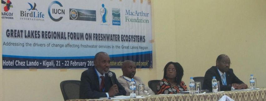
He gave a brief overview of their priority levels, protection status and discussed the new
concept of CRAGs.
The GL Region as defined in the Conservation Strategy for the Great Lakes Region of East
and Central Africa is comprised of the five basins namely: Upper Nile, Omo/Turkana, Lake
Victoria, Lake Tanganyika, and Lake Malawi or Nyasa.
The region overlaps the territories of the following 11 countries (North to South): Ethiopia,
Sudan, Kenya, Uganda, Tanzania, Rwanda, Burundi, DRC, Zambia, Malawi, and
Mozambique.
In the region, stakeholders identified 108 and 168 freshwater and terrestrial KBAs
respectively, and these KBAs represent various degrees of conservation priority due to their
biological importance (irreplaceability) and to which extent they are threatened
(vulnerability).
One of the interesting facts on the distribution of the KBAs in the region is their spatial
correlation with some main ecosystem services like freshwater services and biomass. This is
good news since it implies that the conservation and management of ecosystems in these
areas will be important not only for supporting the regional biodiversity, but also for ensuring
that ecosystem function and downstream delivery services are not impacted.

The presentation by Dr Ian Gordon can be accessed on the following link:
https://dl.dropbox.com/u/98500120/GL%20Forum_Presentations/Ian%20Gordon%2C%20Bi
rdLife_KBAs%2C%20Biodiversity%20and%20Protection%20Status%20in%20the%20Great
%20Lakes%20Region.pptx

Or you can download the full Great Lakes Conservation Strategy document here:
http://www.birdlife.org/community/wp-content/uploads/2013/02/AUTHORISED-GLR-
STRATEGY.pdf

c) Drivers of change affecting watersheds, wetlands and freshwater systems in the GL
   Region

The presentation prepared by Dr Musonda Mumba from UNEP and presented by Dr John
Owino looked at how some drivers of change like population pressure or climate change are
affecting ecosystem services and benefits and the work of UNEP in the mitigation and/or
adaptation to the effects of these drivers.
Dr John started by dividing the drivers of change into two broad categories: indirect drivers
(population pressure, change in economic activity, socio-political factors, cultural factors,
technological change, etc) and direct drivers (habitat change due overexploitation, invasive
alien species, pollution, climate change, etc).
Taking Climate Change as an example and using mountain ecosystems as case study, he went
on to show, using pictures comparison, the extent of change affecting these ecosystems
throughout the last six decades.

                                                                                                   10
Lastly, he explained the work of UNEP in this field of adaptation and insisted on the fact that
they take an Ecosystem-based approach and their focal ecosystems include mountains, rivers,
wetlands, drylands, and low-lying coastal zones.
Among the many questions that were asked following the presentation is included the
concern over the lack of coordination and synergy between the interventions of various
players involved in risk management (e.g. landslides in Uganda). To which, Dr John Owino
replied that advocacy is needed to involve all stakeholders in order to address such long-
standing issues that require long-term commitments.
The presentation by Dr Musonda Mumba/UNEP is downloadable here:
https://dl.dropbox.com/u/98500120/GL%20Forum_Presentations/Musonda%20Mumba%2C
%20UNEP_Drivers%20of%20change%20in%20GL%20Region.pptx
d) Integrated Water Resources Management in Rwanda
The presentation by Mr Kabalisa Vincent de Paul, Head of the Department of Integrated
Water Resources Department in the Rwandan Natural Resources Authority, outlined the
status of water resources in Rwanda and effort the country, through its Natural Resources
Authority, has deployed to manage sustainably these resources.
Rwanda’s territory is divided between the Congo River basin (33%) and the River Nile basin
(67%). The country considers water as central to its development and in terms of drinking
water; the target is to go from 74% of population accessing safe water now to 100% in year
2017.
Apart from drinking water, the resources are used also in the production of electricity (330
hydropower plants), irrigation and livestock husbandry.
Rwanda having a net outflow, the management practices it undertakes internally affects water
resources outside the country and regionally. Therefore, an integrated management approach
has been adopted which seeks to go beyond political and/or thematic boundaries and rather
focus on the river basins and bring together all stakeholders in the management and
development of water, land and all other related resources.
As for now, much has been achieved mainly in providing an enabling environment by
establishing a policy and legislative framework that support this paradigm.
The country now embarks on engaging in concrete on-ground actions that aim to materialize
the scheme. These include various interventions in terms of land husbandry and combating
lakes and rivers siltation.
At the end of this interesting presentation, some observations and comments were made and
these include among others the idea that Rwanda should become part of Lake Tanganyika
Authority since some of its waters are drained to the lake through Rusizi River and the fact
that the country’s water resources master plan should be put in place sooner than later since it
is too risky to engage in so many initiatives affecting water without such a plan.
The questions asked included the non-consideration of the many on-farm fishing projects
going on in Rwanda while they affect water usage and the water recycling issue.
To this, Mr Kabalisa replied that since the country has opted for the integrated approach, all
these aspects are included in the management plans in place.
The full presentation by Mr Kabalisa can be downloaded here:
11https://dl.dropbox.com/u/98500120/GL%20Forum_Presentations/Kabalisa%20Vincent%20d
e%20Paul%2C%20RNRA_IWRM%20in%20Rwanda.pptx
3. EXPERIENCE SHARING IN THE GL REGION: REGIONAL INITIATIVES
a) CEPF: Eastern Afromontane Hotspot
This presentation by Pierre François Simon CARRET, Advisor to the Executive Director of
the Critical Ecosystem Partnership Fund (CEPF), looked at the overview of the eastern
Afromontane hotspot and the CEPF program in this region.
The eastern Afromontane hotspots is one of the 34 hotspots worldwide and one of the seven
hotspots in Africa. It stretches over a curving arc of widely, scattered but biogeographically
similar mountains from Saudi Arabia to Mozambique and Zimbabwe covering an area of
more than 1 million square kilometres and running over a distance of more than 7,000
kilometres.
Globally, any region to qualify as a
hotspot has to meet these two criteria
namely: containing at least 1,500
species of vascular plants as endemics
and having lost at least 70 percent of its
original habitat.
In this regards, the eastern Afromontane
hotspot staggeringly exceeds the criteria
by presenting a highly level of
Pierre François Simon CARRET, speaking during the endemicity and its natural habitats being
forum extremely threatened. In fact, the
hotspot hosts 1,300 bird species (of
which 157 are endemics), 500 Mammal species (of which 100 are endemic), 350 species of
reptiles (of which 90 species are endemic), 323 amphibian species (of which more than 100
are endemic), and this adding to the less understood freshwater taxa and more new species
being discovered in the region.
All 15 countries of the region, with the exception of Saudi Arabia, are poor. Therefore, there
is a strong drive to invest in large development projects which are threatening to put even
more pressure on these sensitive and biologically important sites. The CEPF investment
strategy in the Eastern Afromontane Hotspot thus focuses on six priority corridors and 3
additional sites in the region and strives to enable civil society to have a more prominent role
in driving this development in a biodiversity-friendly direction.
Currently, $400 Million-worth of grants have been issued and though this may seem a big
achievement, one has to keep in mind that the amount represents less than 1% of the total
development aid received by the countries in this region.
Among the questions asked after the presentation, the most bulk concerned the Fund’s grant
making procedures and guidelines such as whether the private sector actors are eligible or
whether nature-based community organizations can access their funds.
12To these, Pierre directed the audience to CEPF grant making section in their documentation
especially under eligibility section.
You can read more about the Eastern Afromontane Hotspot and the CEPF’s grant making on
their website at:
http://www.cepf.net/where_we_work/regions/africa/eastern_afromontane/Pages/default.aspx
b) Mountain Partnership and Africa Water Towers Initiative
This presentation by Ms Rosalaura Romeo, Program Officer at the Mountain Partnership
Secretariat – FAO, looked at the Mountain Partnership Programme in promoting Africa
mountains agenda.
On 20th February 2013, representatives of the Mountain Partnership from Africa met in
Kigali in a meeting with the theme: Enhancing the mountain partnership in Africa for
Sustainable Development in African Water Towers. The aim of the meeting was to promote
the sustainable development of the African mountains and Water Towers and continue
building an African agenda and a strong Mountain Partnership constituency on sustainable
development of mountain ecosystems while also contributing to the climate change and water
discussions.
Two main outcomes were reached at the meeting namely the selection of the African
Mountain Partnership Champions Committee and the identification of priority areas for
action under the African Water Towers Initiative scheme.
During the presentation, Ms Rosalaura also explained the Mountain Partnership programme
and structure to participants who are not conversant with the institution’s operations.
c) Wetlands in the Great Lakes region of Eastern & Central Africa
This presentation by Ms Lucy Iyango, Assistant Commissioner for Wetlands, in Uganda’s
Ministry of Water and Environment, looked at the status of wetlands in great lakes region and
assessed their importance, challenges and conservation/opportunities. It also presented the
background of the Ramsar Centre for Eastern Africa (RAMCEA) and its role in supporting
the Eastern African Contracting Parties, Non-contracting parties and other institutions and
stakeholders to improve their capacity to implement the Convention.
Wetlands in the Great lakes Region perform unique invaluable ecosystem functions. They
provide habitats for unique aquatic biodiversity, store carbon, constitute a gene pool for
research and are a reservoir of our cultural heritage.
In addition, wetlands in this region constitute a major source of communities’ livelihood and
thus contribute to national development.
Despite this big importance attached to wetlands in the region, many gaps are still observed
in their management and these range from lack of wetland sector-specific laws and proper
enforcement to inadequate scientific knowledge to guide decision making.
The Ramsar Centre for Eastern Africa was founded in 2009 with the mission to strengthen
institutions and coordinate wetland management through resource mobilization and
experience sharing.
13So far, the centre has successfully conducted a capacity needs assessment for 5 contracting
parties, has held a regional collaboration meeting for administrative authorities and national
focal points, and has participatorly developed the RAMCEA strategic framework 2011-2020.
Currently, the centre’s secretariat operates through the Wetlands Management Department in
the Ministry of Water and Environment, Uganda.
During the discussion that followed the presentation, one of the issues that came out
prominently consists of the integration of the management of wetlands and their upstream
sections.
To this, Ms Lucy replied that they follow a “framework management plan” that supports,
among others, research to spot the impact of various interventions on such connected
systems.
The presentation by Ms Lucy Iyango can be downloaded here:
https://dl.dropbox.com/u/98500120/GL%20Forum_Presentations/Lucy%20Iyango%2C%20R
AMCEA_Enhancing%20Wetland%20Conservation%20in%20the%20GLR.ppt
d) Climate Resilient Altitudinal Gradients (CRAGs)
This presentation by Dr Julius Arinaitwe, Regional Director for BirdLife International-Africa
Partnership, looked at the concept of Climate Resilient Altitudinal Gradients; the origin of the
concept, its application and advantages. In addition, the presentation looked at the link of the
concept with Great Lakes Conservation strategy whose development was facilitated by
BirdLife and supported by MacArthur.
In the last 30 years, conservation in our region has been species and/or site based. This is
highlighted by the many KBAs (e.g. IBAs) and flagship species (e.g. Gorillas) that have
guided many conservation actors’ effort during this period.
The recent shift in the conservation strategy across the region stemmed from the need to
better integrate ecosystem services and human welfare in the outcomes of conservation
actions. Moreover, a landscape approach is needed to better address the increasingly intense
pressures faced by the GLR from global change and rapidly growing human populations
accompanied by accelerating economic development.
More particularly for this MacArthur-supported strategy which focused on freshwater
ecosystems, it was found that many of the freshwater KBAs in question were large indeed,
sometimes contained whole terrestrial KBAs and necessarily required a landscape approach
to be conserved effectively. Thus the idea of CRAGs was born, a new conservation paradigm
that focuses on multi-scale landscape units characterized by high biodiversity and ecosystem
service values with an altitudinal range of 1,000 meters or more.
By doing so, integrated watershed management is easily achieved and the impact of factors
like climate change is cared for seamlessly since the approach gives space for climate change
resilient KBA buffer zone management.
14By the purpose of the GLR strategy, a set of criteria has been defined for the selection of
CRAGs1 and some 7 CRAGs have been initially designated pending further refinement to
ensure inclusion of highest priority KBAs within the catchment and exclude areas that have
little added value.
Furthermore, possible initial actions to be carried out in the framework of CRAGs have been
identified and these include, ecosystem services valuation, climate change modelling, link
ecosystem services to livelihoods, etc.
To wrap up, it must be noted this concept of CRAGs has been developed in relation to the
Great Lakes Region. Therefore it remains to be confirmed whether it can be applied to other
regions as well especially in mountainous areas like the Andes, etc.
You can access the full presentation by Julius here:
https://dl.dropbox.com/u/98500120/GL%20Forum_Presentations/Julius%20Arinaitwe%2C%20BirdLi
fe%20International_Climate%20Resilient%20Altitudinal%20Gradients.ppt
e) Transboundary Ecosystem-Based Management of Fisheries and Oil Governance
Project
This presentation was given by Ms Christine Lain, DRC Country Adivisor for IUCN NL. It
consisted of the transboundary project IUCN NL is implementing to contribute to the
restoration and valuation of the highly valuable areas in the Western Albertine Rift Valley.
The project aims to empower local communities to influence governments and regional
bodies to respect human, social, economic and environmental needs and rights. Its specific
objectives include bringing local communities together and help them take a pro-active role
regarding the management and utilization of natural resources within and across borders for
the common good and establishing a coalition of civil society actors in the extractive sector,
ensuring oil security, social peace and protecting the region’s biodiversity and ecosystems to
ensure a sustainable development.
In its first phase, the interventions will consist of the introduction of an ecosystem based
fishery management approach in Lake Edward and the creation of a participatory
transboundary oil governance observatory in the African Great Lakes.
Though the project is still at its initial stages of implementation, a lot is expected to come out
of this interventions including the sustainable management of natural resources and
ecosystem services, improvement of people’s livelihoods and their empowerment to
influence government and regional bodies to appreciate their needs and aspirations, and the
restoration and valuation of highly valuable areas in the Albertine rift valley.
At the end of the presentation, the questions asked consisted mainly on the issue of
coordination of the interventions of many players involved in this area and working to
address the same issue. Moreover, it was estimated that the engagement of governments and
decision-makers would break the status-quo of having so many players in this area but still no
tangible change realized.
1
You can check for a full list of criteria of CRAGs in the full strategy document, pp 203
15To these, Ms Christine replied that part of the intervention will consist of empowering local
civil society actors to be able to engage their governments and she expressed her belief that
following this approach, tangible shift will be achieved.
You can access the full presentation here:
https://dl.dropbox.com/u/98500120/GL%20Forum_Presentations/Christine%20Lain%2C%20
IUCN_Transboundary%20Program.pptx
f) Lake Tanganyika Basin: Status, Challenges and Opportunities
As its title indicates it, this presentation by
Mr Gabriel Hakizimana, Director of
Environment at Lake Tanganyika
Authority, looked at the Lake Tanganyika
and its basin and gave a summarized
description of its status, challenges and
description.
In addition, a brief overview of the regional
integrated management and development
programme carried out by the Lake
Tanganyika Authority was given along with
its main achievements so far and current
issues.
Shared by four countries: Burundi (8% of
surface area), the Democratic Republic of
Congo (45%), Tanzania (41%) and Zambia
(6%); Lake Tanganyika is very is notable
for its diverse fauna and flora.
Altitude (surface) 773 m In fact, the Lake is home to more than 2,000
2
Surface area 32,600 km plant and animal species; and about 600 of
Volume 19 000 km3 these species exist nowhere else in the world
outside the lake’s watershed. The lake is the
Maximum depth 1,470 m second deepest in the world (1,470 m) and
Average depth 570 m the world’s second by volume (19,000 Km3).
Drainage area 223,000 km2 Despite this interesting profile, the lake and
its biodiversity are facing many challenges
Population density 45/km2
ranging from over-exploitation of the
in drainage area biological resources to climate change
Length of lake 670 km passing through pollution, siltation, and
Length of shoreline 1,900 km invasive species.
pH 8.6 – 9.2 Nevertheless, the basin abounds with
opportunities for development and these
Basic information about Lake Tanganyika include, among others, tourism, electric
power production, transport, etc.
16Beginning in the 1990s, the idea of cooperation and collaboration between the four Lake
Tanganyika riparian countries for sustainable management of Lake Tanganyika and its basin
was entertained. From then on, several studies aimed at understanding the basin’s natural
resource base with a focus to study biological production and potential of fisheries in Lake
Tanganyika were conducted which culminated in the elaboration of four important
documents: the Fisheries Framework Management (FFMP), Transboundary Diagnostic
Analysis (TDA), the draft Strategic Action Programme (SAP) and the draft Convention on
the Sustainable Management of Lake Tanganyika. Finally, the Lake Tanganyika Regional
Integrated Management and Development Programme (LTRIMDP) was developed as a
mechanism for implementation of the Convention, SAP, and FFMP.
It is in a bid to coordinate projects under this initiative that the Lake Tanganyika Authority
(LTA) was established. The institutional framework of LTA consists of the Conference of
Ministers from the four countries (each country represented by its minister of environment), a
management committee comprising of 4 people from each country and the Secretariat.
So far, many activities have been successfully achieved including the conduction of several
thematic surveys, the establishment of the secretariat, the holding of regular meetings of
ministers and management committee (5 times so far), workshops and trainings on climate
change, etc.
At the end of the presentation, questions asked consisted among others need to include all
countries in the Lake’s catchment (e.g. Rwanda) and not the riparian countries only. To this,
Mr Gabriel replied the initiative started looking at the riparian countries only but given the
integrated approach they have adopted, they look forward for the upstream countries to join
in as well.
The presentation by Gabriel Hakizimana can be accessed here:
https://dl.dropbox.com/u/98500120/GL%20Forum_Presentations/Gabriel%20Hakizimana%2
C%20LTA_Lake%20Tanganyika%20Basin.ppt
g) Lake Victoria Basin: Status, Challenges and Opportunities
This presentation by Telly Eugene
Muramira, Deputy Executive
Secretary at Lake Victoria Basin
Commission, looked at the Lake
Victoria and its basin, its
background, challenges and
opportunities in the basin and the
response by the Lake Victoria
Commission.
Lake Victoria is the largest among
the African Great Lakes (68,870
Km2).
17The lake straddles three countries: Tanzania (49%), Uganda (45 %) and Kenya (6%). Its
basin spans large parts of these countries and beyond (large parts of Rwanda and Burundi as
well), an area totalling 180,950 Km2 of surface and inhabited by over 40 Millions of people.
The Lake Victoria basin region is very rich in various natural resources. The lake itself is
very rich in fisheries and its vastness gives it a lead role as a key player in the interstate trade,
communication and transport which together contribute greatly in the overall development of
the region.
Country Lake surface area Catchment Lake shoreline
area
Km2 % Km2 % Km2 %
Tanzania 33,756 49 79,570 44 1,150 33
Uganda 31,001 45 28,857 15.9 1,750 50
Kenya 4,113 6 38,913 21.5 550 17
Rwanda 20,550 11.4 -
Burundi 13,060 7.2 -
Total 180,950 3,450
Total population: 40 million
Lake Victoria Basin characteristics
Despite this huge potential, the lake and basin face many challenges, some of which have
gone unabated for many years now. These include among others: widespread poverty and
social deprivation, poor land tenure and land use patterns, riverbank and lakeshore
degradation, pollution and extreme de-oxygenation, high rates of deforestation and the
ensuing siltation, eutrophication and water hyacinth, etc.
In a bid to take stock on the many opportunities that the region presents, the Lake Victoria
Basin Commission, formerly known as the Lake Victoria Development Programme, was
established as a mechanism for coordinating the various interventions on the Lake and its
Basin; and serving as a centre for promotion of investments and information sharing among
the various stakeholders. Its mandate is to promote equitable economic growth, measures
aimed at eradicating poverty, sustainable utilisation and management of natural resources,
environment protection and compliance on safety of navigation.
Lake Victoria Basin Commission develops and implements various projects through which
its objectives are achieved. The projects are very diverse in nature and scope. As an example
of this, more than 7 projects are currently running and their goals range from reducing HIV
and AIDS risks and vulnerabilities for mobile populations within the Lake Victoria Basin to
improving maritime safety and security on the lake.
One of the projects comes out prominently here. This is the Lake Victoria Environmental
Management Project (LVEMP) whose environmental objectives are to improve collaborative
management of the trans-boundary natural resources of Lake Victoria basin for the shared
benefits of the East African Community partner states; and to reduce environmental
degradation to improve the livelihoods of communities which depend on the natural resources
of the basin.
18In course of its existence, many experiences were gained and lessons learned. To be noted
now is the fact that a concerted and well coordinated leadership is needed if the economic
growth and social transformation we seek in this region is to be achieved.
The presentation by Telly Eugene can be accessed here:
https://dl.dropbox.com/u/98500120/GL%20Forum_Presentations/Telly%20Eugene%2C%20
LVBC_Lake%20Victoria%20basin.ppt
h) Lake Nyasa/Malawi Basin: Status, Challenges and Opportunities
This presentation by Mr Hyde Sibande, Principal Hydrologist at the Ministry of Water
Development and Irrigation, Malawi, looked at Lake Malawi, its fisheries and its
biodiversity.
Lake Malawi, Nyasa or Niassa is the southernmost lake of the African Great Rift Valley. Its
surface is at 474.9 metres of altitude and it covers an area of 29,600 km2. The lake is
bordered by Tanzania, Malawi and Mozambique. It is drained by the river Shire which
assumes the lake’s outlet to River Zambezi.
The lake’s catchment totals an area of about 100,500 km2, 7% of which is in Mozambique,
25% in Tanzania, and 68% in Malawi.
The average annual rainfall in the catchment is 996 mm and to slightly higher precipitations
in the Tanzanian side of the catchment, Tanzania contributes 52% of the total of inflow to the
lake. The lake’s Largest tributary is river Ruhuhu contributing approximately 20% of annual
river inflow. Other major rivers include south and north Rukuru, Bua, Linthipe, Songwe, and
Kiwira.
Lake Malawi hosts over 800 species of fish, 90% of which are endemic. Approximately 15%
of the total global freshwater species of fish are found in this lake alone and indeed, the lake
is reportedly the habitat of more species of fish than any other body of freshwater in the
world.
Though fish catches have remained relatively stable, catches of a number of larger and more
economically valuable species have declined considerably. The large fish species include
Chambo (Oreochromis), catfish (Bargus and
Bathyclarias), Mpasa (Opsaridium
microlepis) and Ntchila (Labeo mesops).
Most of these species are declining mainly
due to over-fishing (e.g Chambo & catfish)
and/or river and nearshore habitat degradation
(e.g. Mpasa & Ntchila).
The threats this lake is facing derive from
high population pressure in some parts, the
newly introduced water hyacinth,
disharmonized catchment management
policies across the riparian countries,
deforestation and poor agricultural practices
Chambo (Oreochromis), one of the large fish resulting and lake and rivers siltation, etc.
threatened by over-fishing in Lake Malawi.
19Above all, the most challenge the lake faces is an excessive fluctuation of its water levels. In
fact, based on continuous record starting in 1896, the lake has known periods of such low
water levels that no outflow was recorded for a period of over 22 years (1915-1937).
Afterward, the lake has been recovering culminating in the high record of 477.24 m.a.s.l2 in
1980. Unfortunately, trends have recently been towards decline since 1991 due the persistent
droughts that have been prevalent in the basin.
To try to keep the level within acceptable range, a barrage on Shire was constructed in 1965
by the government of Malawi and is being upgraded soon. However, it is apparent that such
projects can be done jointly and thus the need to have a Joint Basin Authority becomes very
clear. In addition, fundamental research is needed to determine which acceptable range of
levels is supported by the lake’s ecosystem.
You can access the presentation by Hyde Sibande here:
https://dl.dropbox.com/u/98500120/GL%20Forum_Presentations/Hyde%20Sibande%2C%20
Malawi_Lake%20Malawi%20Basin.ppt
i) Upper Nile Basin: Status, Challenges and Opportunities
This presentation by Minasona Lero Peter, Director for Wildlife Management and National
Parks in the Ministry of Wildlife Conservation and Tourism, South Soudan, looked at upper-
Nile basin. Its highlight features, status, challenges and opportunities.
Listed No 522 under the WWF’s freshwater of the world catalogue, the upper Nile basin is
situated mainly in Sudan with smaller areas in the Democratic Republic of Congo, Uganda,
and Ethiopia. The basin encompasses Lake Albert and White Nile sub-basins and the vast
swamps of the Sudd constitute the primary feature of this region.
Stating the importance of the region as related to freshwater biodiversity, Holland and
Darwall, 2011 reads: The freshwaters of the Upper Nile Basin host five crabs, 60 molluscs,
103 fish and 227 odonates (dragonflies/damselflies), making up 4%, 10%, 4% and 32%
respectively of the known species totals for Africa. Of these, one crab, four molluscs, eight
fish and two odonates are globally threatened.
In addition, the region is a critical movement corridor for African Eurasian bird migrations
and an important northern limit of the elephant range.
Opportunities in the region range from the high potential for oil extraction and electricity
generation to very diverse tourism prospects passing by very prolific fisheries and fertile
lands for agriculture.
Some of the challenges the basin faces stem from the unusual low population densities
observed in this part of the great lakes region. This combined to frequent tribal conflicts and
cattle rustlings gives free way to serious environmental crimes such as poaching. Pollution
from oil extraction and invasive species are also part of the environmental problem in this
area.
In short, it is very apparent that this basin if very potentially apt to develop quickly when its
innumerable oil, fisheries and tourism wealth are considered.
2
Meters above mean sea level
20However, there is need for a transboundary cooperation in order address more effectively the
threats that are affecting its ecosystems.
The presentation by Minasona Peter can be accessed here:
https://dl.dropbox.com/u/98500120/GL%20Forum_Presentations/Minasona%20Peter%2C%2
0South%20Soudan_Upper%20Nile%20Basin.pptx
j) The Turkana/Omo Basin: Status, Challenges and Opportunities
This presentation by William Oweke Ojwang, a senior researcher at Kenya Marine and
Fisheries Research Institute (KMFRI), was combined with another one on River Omo basin
by Sean Avery due to absence of William over travel issues. It intended to give an overview
of Lake Turkana and its basin looking at its status, recent evolution, threats and an outline of
various on-going or planned interventions to respond to these threats.
Lake Turkana, located in Arid and Semi Arid Land (ASAL) area of north western Kenya is a
unique ecosystem and the world’s largest desert lake.
A “Cradle of Mankind” the site was declared a UNESCO World Heritage in 1997.
Surface area 6,750 km2
Catchment area 130,860 km2
Volume 203.6 km3
Maximum depth 109 m
Mean depth 30.2 m
Residence time 12.5 years
Evaporation 2,300 mm/yr
Evapotranspiration 2,500 mm/yr
The lake region is one of the least developed in the country characterized by extreme aridity,
low rainfall and abject poverty levels. River Omo, with its source in the central Ethiopian
plateau contributes more than 90 % of freshwater influx into the lake. Other rivers including
Turkwel and Kerio are seasonal.
Although the lake is semi saline and unsuitable for agricultural activities, it is home to at least
60 species of fish, world’s largest remaining population of Nile crocodile and an endemic
Turkana mud turtle (Pelusios broadleyi) among other components of biodiversity.
21The challenges faced by the lake, especially the development of its fisheries include the
remoteness of the area and frequent conflicts which translates into high post harvest losses
and inaccessibility to high end market.
The ongoing climate change is also believed to have many effects including: lake level
changes beyond normal variability, increased salinity levels, increased temperatures and low
oxygen levels as well as the newly suspected increase of parasites loads in fishes. All these
lead to declining lake productivity for fisheries but also disturb the lake’s ecosystem function
as a whole.
The Lake Turkana riparian communities are basically pastoralists but due to frequent
droughts and frequent pasture right conflicts; they are slowly resorting to fishing as an
alternative source of livelihood. The lake has considerable fisheries resources and
socioeconomic potential that if well nurtured and managed could contribute considerably to
national food security, employment and general well being of communities.
Ironically Lake Turkana, which is the largest lake wholly in Kenya, has for a long time
generated the least interest and attention as compared to the other Great Lakes of Africa.
This is however bound to change as recent developments in the region which include
cascading construction of dams and irrigation projects along River Omo; the umbilical cord
of Lake Turkana, as well as oil discovery and ongoing exploration are believed to make the
region a new hub for regional development.
Amidst many concerns that these large-scale projects are likely to have adverse impacts on
long term viability of ecosystem benefits and therefore only exacerbate the condition of the
local communities, the construction of African largest wind power plant in the area attests to
the fact that the region is potential for many other environmental-friendly prospects as well.
You can access the presentation by William Ojwang here:
https://dl.dropbox.com/u/98500120/GL%20Forum_Presentations/William%20O%27jwang%
2C%20KMFRI_Lake%20Turkana%20Basin.pptx
k) Malagarasi River Basin: threats and opportunities for wetlands conservation
This presentation by Elias Bizuru, Head of Biology Department at National University of
Rwanda, aimed at highlighting the ecological and socio-economic importance of river
Malagalasi and share experience from the study that was conducted by Burundi Nature
Action to assess the pollution of the SOSUMO sugar cane factory and the role played by the
Papyrus vegetation to mitigate the pollution of water.
With a basin area of 130,000 square kilometres (50,000 sq mi), the Malagarasi has the largest
watershed of all of the rivers flowing into Lake Tanganyika. In its middle stages, the river
traverses the Muyobozi-Malagarasi wetland system which is a designated Rasmsar site since
2000.
Malagalasi river basin and its wetlands accommodate a very rich animal and plants diversity.
More than 20 fish species are found in the river among which 7 are on the IUCN red list.
22In addition, very rare mammals like the rare Sitatunga (Tragelaphus spekii), big and
endangered reptiles like the Nile crocodile (Crocodilus niloticus) and very rare birds’ species
like the Shoebill, waterbirds and migratory species are also found in the area.
The Malagarasi river basin presents a big potential for tourism (beautiful waterfalls,
hotsprings, and spectacular cliffs like the Nyakazu rift. However, many threats are felt by the
river and its ecosystem and these include uncontrolled resources use and water pollution from
various sources.
One of the findings from the study by Burundi Nature Action is the fact that the water of the
river is highly polluted by heavy metals like Chromium and Lead from the materials dumped
by the SOSUMO sugar cane factory and indeed some of these materials are highly hazardous.
You can access the presentation by Dr Bizuru Elias here:
https://dl.dropbox.com/u/98500120/GL%20Forum_Presentations/Elias%20Bizuru%2C%20N
UR_Malagarasi%20River%20Basin.ppt
4. ECONOMIC DEVELOPMENT, ENVIRONMENTAL CHANGE AND THEIR
IMPACT ON FRESHWATER ECOSYSTEMS
a) Fisheries of Lake Victoria: Current Status and Management Challenges
This presentation by Dr Oliva C.
Mkumbo, Senior Scientist at Lake
Victoria Fisheries Organization, looked
at the status and trends of fisheries of
Lake Victoria and the challenges to their
sustainability.
Lake Victoria Fisheries Organization is
an East Africa Community institution
with the objective to foster cooperation
among the contracting parties by
harmonizing national measures,
developing and, adopting conservation
and management measures for the
sustainable utilization of living
resources of Lake Victoria.
Lake Victoria fisheries are by far the
most important freshwater fisheries on
the African continent. In fact, with
around 1 million ton catch, the fishery
supports more than 200,000 direct
3 most commercially important fishes in Lake Victoria:
fishers and about 4 million people in the up-down Nile Perch, Tilapia and Dagaa
Lake Basin who indirectly depend on the
fisheries for their daily livelihoods.
23Currently, the fishery consists mainly of 3 commercially important fishes in their order of
commercial importance: Nile perch (Lates niloticus), Tilapia (Oreochromis niloticus), Dagaa
(Rastrineobola argentea).
The value of the fishery at beach level in 2011 was estimated at US $ 550 million with the
Nile perch accounting for 68% of this value. The latter was introduced in the mid 1950s and
spread all over the lake by the early 1960’s and blamed to have adversely affected the
biodiversity and thus the ecosystem stability. Now, the Nile perch stock and catches are
reducing and there is an indication that the endemic haplochromine species are on the rise
again. However, questions linger as to why not the same species composition is being
restored as before the introduction of the Nile Perch.
Currently, the main drivers of change in the fisheries are still debatable and two scenarios are
suspected: increasing fishing pressure or environmental driven changes (e.g. Eutrophication).
Whatever emerges as the cause, the solution is an ecosystem fisheries management approach
and this is what the Lake Victoria Fisheries Organization is trying to do.
Among the many question that followed the presentation were included the concern over use
of dynamite and poisons as fishing techniques, proliferation of hotel resorts around the lake
and their impact as well the governments’ response to the threats mentioned. To these, Ms
Oliva said that the use of dyanamite as a fishing technique is not so widespread but that that
use of poisons surely poses a real threat to the lake and its ecosystem and therefore needs to
be addressed. On the governments’ response, she assured that there is strong political will to
address the challenges and indeed some projects in this direction have already kicked in like
the one led by NBD to try to restore the lake and its catchment.
You can access the presentation by Oliva Mkumbo here:
https://dl.dropbox.com/u/98500120/GL%20Forum_Presentations/Oliva%20C.Mkumbo%2C
%20LVFO_Fisheries%20of%20Lake%20Victoria.ppt
b) Threats from invasive species in the Great Lakes Region
The talk by Leo Niskanen, on behalf of the IUCN Global Invasive Species Initiative, aimed
to outline the threats from invasive species in the freshwater ecosystems of the African great
lakes region. It gave a brief overview of the invasion theory in general and looked at how this
applies to this region. Finally, examples were given and recommendations for action were
drawn.
Biological invasions are caused by species that are introduced to an area or ecosystem (where
they were not previously indigenous) in which they establish, become naturalised, spread and
cause damage to biodiversity and/or peoples’ livelihoods.
Once established in an invasion, the species can be called an “invasive species”.
Damage caused by invasive species can result in reduction (or even extinction) of populations
of native species of animals and plants, of agricultural species, of ecosystem goods and
services and of human development and infrastructure. This damage is caused through
competition, predation, parasitism, exclusion of needed resources such as space, water, food,
light and movement.
All biological invasions result from the introduction of a species. The path that the offending
species used to start an invasion is termed the “Invasion Pathway”.
24You can also read