CANNINGTON NEIGHBOURHOOD PLAN 2016-2032
←
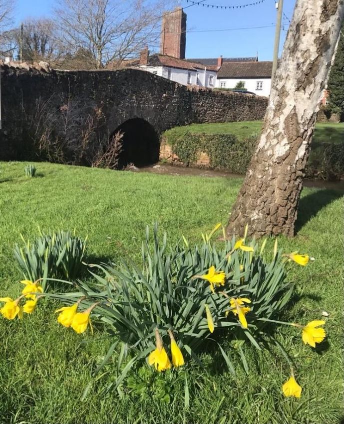
→
Page content transcription
If your browser does not render page correctly, please read the page content below
CANNINGTON NEIGHBOURHOOD PLAN

                       2016-2032

              REGULATION 14 (PRE-SUBMISSION)

            AND COMMUNITY CONSULTATION DRAFT

GUIDING THE FUTURE DEVELOPMENT, REGENERATION AND CONSERVATION OF
                          CANNINGTON

                            March 2021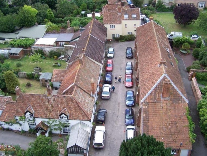
CONTENTS

1.     FOREWORD                                                                               2

2.     INTRODUCTION                                                                           3

3.     GLOBAL ISSUES WITH A LOCAL IMPACT                                                    22

4.     WHAT DOES THE NEIGHBOURHOOD PLAN AIM TO ACHIEVE?                                     25

5.     INTRODUCTION TO POLICIES                                                             28

6.     HOUSING AND DEVELOPMENT                                                              29

7.     THE NATURAL AND BUILT ENVIRONMENT                                                    39

8.     TRANSPORT                                                                            63

9.     BUSINESS & THE ECONOMY                                                               68

10.    EDUCATION & TRAINING FACILITIES                                                      74

11.    COMMUNITY PROJECTS & ASPIRATIONS                                                     79

12 & 13. APPENDICES                                                     SEE SEPARATE FILES

Photographs: we would like to thank Mr George Pope LRPS and Rose Allen for letting us use their images
of Cannington.

March 2021 | Cannington Neighbourhood Plan                                                         1
1.     FOREWORD

1.1    We (the Parish Council) began the journey of making a Neighbourhood Plan in 2016 with
       help from members of the local community who were not Parish Councillors. Since that
       time we held community consultation to help us understand and confirm the key issues
       of importance locally and sought to finalise a Plan by 2018 with 2-3 years being an
       average length of time that most Neighbourhood Plans seem to take to develop. During
       the process, we engaged consultants to help us move the Plan forward and sought the
       informal views of officers at Sedgemoor District Council on our draft policies in the Plan.
       However, with limited local volunteer, Councillor and Parish Clerk time to complete the
       Plan for consultation meant that we were not in a position to consult on our first full
       version of the Plan until the start of 2020.

1.2    We were “ready to go” when the Coronavirus pandemic hit us! We took the decision at
       that point to pause work on the Neighbourhood Plan with the Parish Council focusing on
       helping to support the community and getting used to working in a less than normal way.
       At the start of 2021 we took the decision to re-start the Plan and re-engaged consultant
       support again to update the Plan with almost a year having passed since we paused work.

1.3    We would like to thank all of those who have committed time and energy into developing
       this Plan and have got it to the point it has now reached. In particular we would like to
       thank Cannington Neighbourhood Plan Steering Group and Stuart Todd Associates for
       their invaluable help. We encourage residents to comment on this Plan and will welcome
       all comments. This consultation will also seek the views of various statutory consultees
       and other interested organisations, businesses and bodies.

                                                                                       Colin Allen

                                               Chairman, Cannington Parish Council, March 2021

March 2021 | Cannington Neighbourhood Plan                                                     2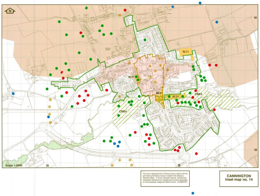
2.         INTRODUCTION

2.1        Neighbourhood Development Plans (Neighbourhood Plans) are planning documents
           introduced as part of the Coalition Government’s approach to planning which sought to
           give local people and communities more say about how their area changes and develops.
           These changes were defined by the Localism Act which was enacted in April 2012.

2.2        Neighbourhood Plans are a formal part of the planning system, are governed by a legal
           framework, and must comply with the “Basic Conditions”. They must:

           •   Have regard to national planning policies and guidance;

           •   Contribute to achieving sustainable development;

           •   Be in general conformity with the strategic policies of the development plan (the
               Sedgemoor Local Plan); and,

           •   Be compatible with European Law 1 and Human Rights obligations.

2.3        The Cannington Neighbourhood Development Plan (the Plan) seeks to guide the future
           development, regeneration and conservation of Cannington Parish, and presents a series
           of policies to do this. How these policies comply with the basic conditions is set out in the
           Basic      Conditions       Statement,        which       is    available       via     www.cannington-
           neighbourhoodplan.info.

2.4        A Consultation Statement provides an overview of the consultation undertaken during
           the preparation of the Plan2.

2.5        Together, the Consultation Statement and Basic Conditions Statement demonstrate that
           this Plan fully accords with the requirements of the Localism Act and of the Neighbourhood
           Planning (General) Regulations 2012.

1
    As transposed into UK law.
2
    A draft of the Consultation Statement is available to view on the Neighbourhood Plan pages of the Parish Council
website at http://cannington-neighbourhoodplan.info/evidence-base/consultation-and-engagement-backup/ . This
Statement will be updated following this Regulation 14 / Pre-submission and Community Consultation stage.

March 2021 | Cannington Neighbourhood Plan                                                                             3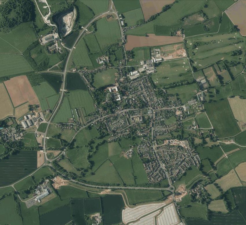
Structure of the Plan

2.6        The Plan is structured as follows:

           •   Chapters 1 to 4 outline the background to and vision for the future development of
               Cannington Parish;

           •   Chapters 5 to 12 present with the Neighbourhood Plan policies community, actions
               and other local guidance. The policies seek to guide and shape development and are
               used in the determination of planning applications by Sedgemoor District Council.
               Community actions are commitments by the Parish Council to respond to community
               ambitions. They will help support the Parish in its delivery of the wider strategic vision,
               but are not part of the Plan for the purposes of the formal legal process.

2.7        The Plan takes account of, and is informed by, supporting documents which together form
           the Plan’s evidence base3, such as land-use designations, policies, constraints and
           consultation responses.

2.8        When submitted for Public Examination, the Plan will be accompanied by a separate
           Consultation Statement which records the consultation process and results throughout
           the Plan’s preparation and a Basic Conditions Statement which sets out how we consider
           the Plan to meet the basic condition tests which will be applied by the independent
           Examiner during the Examination. We are also required to submit a statement of reasons
           for not undertaking a Strategic Environmental Assessment (SEA) given that we have been
           advised by Sedgemoor District Council that the Plan does not require such an assessment
           to be carried-out.

          How the Neighbourhood Plan relates to the Planning System

2.9        The Government wants to enable local people to have a greater say in the future
           development proposals for their area. However, the proposals must be in line with
           national planning policy as set out in the National Planning Policy Framework (NPPF) and
           the strategic policies contained within the Sedgemoor Local Plan.

3
    Our evidence base material can be found on our website at http://cannington-neighbourhoodplan.info/ and key parts
are also reproduced in this Plan where necessary.

March 2021 | Cannington Neighbourhood Plan                                                                        4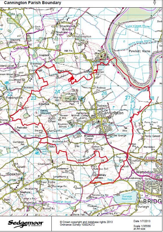
2.10       Neighbourhood Plans must also be in line with European Regulations 4 on strategic
           environmental assessment and habitat regulation issues.

2.11       The Plan enables local people to have greater power to decide the parameters for where
           new housing and employment development should go and how they want the parish to
           change. In the absence of the Plan, Sedgemoor District Council would make planning
           decisions with less local input.

2.12       The Neighbourhood Plan (once ‘made’, or adopted) together with Sedgemoor District
           Council’s Local Plan form what is known as the ‘development plan’ for our area.

          Determination of Planning Applications

2.13       The Sedgemoor Local Plan comprises ‘Strategic’ and ‘Development Management’ policies,
           both of which will continue to be used by Sedgemoor District Council in the determination
           of planning applications proposed within Cannington. Our Plan contains local planning
           policies specific to Cannington and once the Plan is 'made' these will also need to be
           considered when Sedgemoor District Council determine applications within Cannington.

2.14       Our policies build upon and dovetail with those of the Local Plan, but importantly they
           are tailored to address specific local issues which allow us to shape the character of our
           community. For example, the Plan emphasises the need to retain and enhance the natural
           environment and landscape around the village and seeks to address long standing traffic
           and transport issues.

          Developing the Cannington Neighbourhood Plan

2.15       An application for the designation of the Cannington Parish as a Neighbourhood Planning
           Area was made by Cannington Parish Council on 10 th July 2013 to Sedgemoor District
           Council. The application sought to designate the entire area of the Parish as the
           neighbourhood area. Cannington Parish Council considered the whole of the Parish to be
           the most appropriate area for designation in line with best practice guidance.

2.16       Sedgemoor District Council resolved to approve the designation of the whole of the
           Cannington Parish on 24th September 2013.

4
    Under the European Union (Withdrawal) Act 2018 they will translate into UK law when the UK leaves the European
Union

March 2021 | Cannington Neighbourhood Plan                                                                       5
Figure 1 – Cannington Neighbourhood Plan Area5

          Crown Copyright and Database right. All rights reserved (100054284) 2018

5
    Source: Sedgemoor District Council

March 2021 | Cannington Neighbourhood Plan                                           6
Consultation and Engagement

2.17       Consultation and engagement with parish residents and businesses has underpinned the
           formation of the plan, and has included surveys, questionnaires and drop-in events.
           ‘Hard-to-reach' groups were targeted separately, including children and young people
           and businesses. The detail of how consultation was undertaken and the responses given
           are set out in the consultation reports and analysis and summarised in the Consultation
           Statement6.

2.18       Views and ideas gathered during the consultation have formed the basis of the Plan. Key
           concerns expressed by parishioners centred on the potential impact of new dwellings and
           the need to improve parking and road safety in the village of Cannington. The objectives
           identified for the Plan, as set out below, have been developed in response to these and
           other concerns and opinions expressed during the consultation.

           Steering Group

2.19       An initial questionnaire was delivered to all homes in November 2013. The results collated
           and reported back to an open meeting in January 2014. Volunteers from that meeting
           were invited by the Parish Council to form the Neighbourhood Steering Group which has
           led to the production of this Neighbourhood Plan.

2.20       The Terms of Reference for the Steering Group were approved in February 2014 by the
           Parish Council.

           The Plan Process

2.21       During its development, the Plan will have gone through each stage illustrated in Figure
           2 below. Following the successful completion of each of these stages the Plan is ‘made’
           and becomes part of the ‘development plan’ for Sedgemoor. The policies it contains will
           be used when Sedgemoor District Council makes future decisions on planning applications
           within the Parish.

6
    A draft of the Consultation Statement is available to view on the Neighbourhood Plan pages of the Parish Council
website at http://cannington-neighbourhoodplan.info/evidence-base/consultation-and-engagement-backup/ . All
consultation analysis reports are available to view on the website via the same weblink.

March 2021 | Cannington Neighbourhood Plan                                                                             7
Figure 2 – Flowchart illustrating Neighbourhood Plan development

2.22   The Neighbourhood Plan covers the period 2016 to 2032 to correspond with the
       Sedgemoor Local Plan which runs until 2032.

       Cannington Parish

2.23   The Parish of Cannington lies within the County of Somerset and in the District of
       Sedgemoor. The Parish is located to the north west of Bridgwater and shares a border
       with the Parishes of Fiddington, Otterhampton, Spaxton and Bridgwater Without.

2.24   The area covered by the Plan is Cannington Parish, as shown by the map on page 5.
       Cannington Parish lies approximately 3 miles North West of Bridgwater in Somerset,
       stretching from the River Parrett in the north-east to the foothills of the Quantocks in the
       south. The village of Cannington, which lies roughly in the centre of the Parish, has a
       population of approximately 2,300. It is an attractive village with an historic core
       protected by a conservation area, together with areas of post-war housing.

2.25   For a village of its size it has a wide range of services and facilities, including (Doctor’s
       surgery, five public houses, convenience store, butcher’s, bakery, hairdressers and
       newsagents, builders’ merchant, landscaping business, garden machinery business and
       farm sales business). It is also home to Cannington Primary School, Brymore Academy,

March 2021 | Cannington Neighbourhood Plan                                                       8
a state agricultural school, and Cannington Centre for Land-Based Studies, which, as part
       of Bridgwater & Taunton College including the National College for Nuclear Studies, is one
       of the key further education facilities in Somerset.

2.26   Cannington is on the main route between Bridgwater and Hinkley Point, site of two
       existing nuclear power plants (A & B Stations) and one under construction (Hinkley Point
       C). As one of the closest sizeable villages to the new development, the impacts on
       Cannington are expected to be considerable. The need to manage these impacts for the
       benefit of the local population has been a key driver in the decision to develop a
       neighbourhood plan.

       The village is a short distance from the M5 and the associated strategic road network and
       is reasonably well located relative to Bridgwater railway station. However, as the village
       is only accessible via the A39 this is a significant constraint should accidents occur within
       that part of the network.

       Parish Socio-economic Profile

2.27   The total population of the Cannington Parish was 2,271 at the last census in 2011 which
       represents approximately 2% of the total population (114,588) of the District. The village
       of Cannington is by far the largest settlement in the Parish and accounts for 88% of the
       Parish population (2,002 based on 2011 census).

2.28   Table 1 below summarises the demographic profile of the Parish against the District,
       regional and national profile.

March 2021 | Cannington Neighbourhood Plan                                                       9
Table 1 Population summary7
Percentage
Age Group
Cannington Sedgemoor South West England
0-17 23 20.7 20 21
18-29 10.2 12.5 14.7 16.3
30-44 14.8 17.5 18.8 20.6
45-59 21.3 21.4 20.1 19.4
60-64 7 7.4 6.8 6.0
65-74 12.2 10.9 10.1 8.6
75-84 8.7 6.8 6.6 5.5
85-89 1.9 1.9 1.9 1.5
90+ 1.1 0.9 1.0 0.8
2.29 As can be seen be seen from the demographic profile contained within Table 1 above, the
profile for Cannington is broadly similar to that of both Sedgemoor and the wider South
West. However, there are some notable differences.
2.30 Cannington has a bigger percentage of its population within the age categories above 60
years of age when compared to Sedgemoor. By consequence it has a lower percentage
than Sedgemoor for the groups of working age 18-59.
2.31 One age group that is perhaps surprising is the percentage of school aged individuals
given the previous comments regarding other age categories. This demographic profile
should be considered when devising policies for the Plan.
7
Source: 2011 census, ONS
March 2021 | Cannington Neighbourhood Plan 10A History
2.32 The village of Cannington lies approximately three miles west of Bridgwater on the busy
A39 Bridgwater to Minehead road and is the gateway to the Quantock Hills.
2.33 The name of Cannington first appears in the Saxon Charters circa 880 as Cantuctone.
Cantuc was a British name for a ridge and ton a village so the meaning of the name is
Quantock Village (the Quantocks being the nearby range of hills). By Saxon times the
settlement had moved to the present village site. There are no Saxon structures
remaining, though it is possible the present church is on the site of a wooden Saxon
church. The spelling “Cannington” as it is today appeared around 1641.
2.34 The settlement in the Cannington area almost certainly first occurred on Cannington Hill
which is a limestone outcrop to the north of the present-day village which is now being
quarried and part of the area known as Cannington Park. On the top of the hill is an Iron
Age fort and there is also evidence of Romano-British occupancy. Much of the historical
information about the
village is found in the
Domesday Book, the
statistical survey of
England in 1086.
2.35 The Norman invasion
of England in 1066 by
William the
Conqueror led to
upheaval in the
country. The De
Courcy family, lords St. Mary’s Church
of nearby Stogursey,
established Cannington Priory (later Cannington Court). The manor and church were
given by Robert De Courcy in 1138 as the main endowment for a house of Benedictine
Nuns.
2.36 In the 14th Century there is some evidence of corruption in the Priory and by 1536 the
Nunnery was dissolved. The priory was one of the first in the area to be affected by the
dissolution of the monasteries. The lands were returned to the Crown until the land was
given to Edward Rogers one of Henry VIII favourites.
2.37 Edward later became a Member of Parliament for Somerset and both he and his
descendants were influential in Cannington life until the line died out. The last heir, Henry
March 2021 | Cannington Neighbourhood Plan 11Rogers, was instrumental in the building of The Almshouses in High Street which today
still play an important part in Cannington life.
2.38 In the early 1800’s there were many varied businesses suggesting that the village was
effectively self-sufficient. The businesses included grocers, bakers, florist, general stores,
blacksmith, wheelwright, saddle and harness makers, boot makers, a variety of mills as
well as a strong farming community.
2.39 The Parish Council was formed in 1899 and the village continued to develop throughout
the next century. During the 1920’s six council houses were allocated to Cannington by
the Rural District Council.
2.40 In 1931 the village had a Working Man’s Institute (the Village Hall), a golf club, the
Cottage Home for Children (Cannington House) and even had its own Tax Collector!
Businesses at the time included saddle and harness makers, wheelwright, seedsman,
Alvis car agent,
bicycle agent, farrier,
as well as a grocer
and shopkeeper.
2.41 At this time eight
council houses were
erected past the Rose
and Crown and
electric light was
brought to the
village. Houses were
built in Brymore Lane
Cannington House and War Memorial
(now known as
Withiel Drive) and a village by-pass was planned. Later in the 1930’s four council houses
were built on part of the allotment land at the end of East Street.
2.42 During the 1940’s further council houses were built in East Street and Southbrook and
areas of the village saw the introduction of streetlights. During the 50’s, 60’s and 70’s
the village saw increased development. Further Council houses were built in Gurney
Street, East Street and Brook Street. Crabtree’s Caravan Park opened in 1954 for
workers constructing the road to the new power station at Hinkley Point and the related
harbour improvements in Combwich.
March 2021 | Cannington Neighbourhood Plan 122.43 Houses were also built in Priory Close, Grange Close and Northbrook for the Hinkley Point
workers and houses were erected in Park Lane for staff at the Farm Institute (now part
of Bridgwater College).
2.44 Further Council houses were built in Church Street (Bowling Green) and further houses
were built at the bottom of Rodway Hill.
2.45 As a result of the increasing traffic to Hinkley Point discussions were held with Somerset
County Council over road improvements. Subsequently Rodway Hill and the road to
Combwich were widened and straightened. The properties on Lonsdale Road, Rydon
Crescent and Teals Acre were built during the 1960’s and the development of a large
estate of houses off Rodway Hill in the 70’s (Conway Road, Folly Close, Toll House Road).
Properties on Mill Close and Belverdere Close were also built.
2.46 A large estate of houses was built in the 1990’s off Main Road and Cannington Bypass
was built on the south side of the village. More recently a small development of housing
at Court Orchard. The most recent residential development was an affordable housing
scheme at Rose
Villas, Chads Hill. A
development of 16
houses off Main Road
and a scheme adding
2 (net additional)
dwellings in Gurney
Street have also
recently been
completed.
2.47 Although not itself
located within the
Parish, Hinkley Point
C (3200 MW nuclear
Church Street from the Church Tower
power station) was
granted a Development Consent Order (DCO) in March 2013. The DCO also allows for the
construction of a park and ride as well as a by-pass around Cannington.
2.48 At the end of 2015 a one-mile (1.6 km) road was opened which links the roundabout on
the A39 Cannington southern bypass with the C182 which leads to Hinkley Point.
March 2021 | Cannington Neighbourhood Plan 13National Planning Policy
2.49 The National Planning Policy Framework sets out planning policy to which all
neighbourhood plans must have regard. Its guiding principle is a 'presumption in favour
of sustainable development', and plans must show that they do not hinder development
provided that it is sustainable. Sustainable development is often defined as meeting the
needs of the present without compromising the ability of future generations to meet their
own needs. In the planning context, the Government defines a “presumption in favour
of sustainable development”8 which, for ‘plan-making’, means that:
a) plans should positively seek opportunities to meet the development needs of their
area, and be sufficiently flexible to adapt to rapid change;
b) strategic policies should, as a minimum, provide for objectively assessed needs for
housing and other uses, as well as any needs that cannot be met within neighbouring
areas, unless: i. the application of policies in this Framework that protect areas or assets
of particular importance provides a strong reason for restricting the overall scale, type or
distribution of development in the plan area ; or ii. any adverse impacts of doing so would
significantly and demonstrably outweigh the benefits, when assessed against the policies
in this Framework taken as a whole. The definition continues for ‘decision-making’.
The National Planning Policy Framework identifies three objectives necessary to achieve
sustainable development: economic, social and environmental. Each policy in the Plan
has been appraised against these sustainability objectives to help ensure that it
contributes to sustainable development.
Local Planning Policy and Key Constraints
2.50 The Plan also needs to be in general conformity 9 with the strategic policies of the
Sedgemoor Local Plan.
8
See National Planning Policy Framework, 2018, paragraph 11 at
https://assets.publishing.service.gov.uk/government/uploads/system/uploads/attachment_data/file/740441/National_
Planning_Policy_Framework_web_accessible_version.pdf
9
The Government’s definition of this can be seen on the following website -
https://www.gov.uk/guidance/neighbourhood-planning--2#General-conformity-with-strategic-policies
March 2021 | Cannington Neighbourhood Plan 142.51 The Local Plan identifies the village of Cannington as a ‘Tier 2’ settlement. Tier 2
settlements are considered “…to still have a good range of services that meet the needs
of both the settlement itself but also close neighbouring smaller settlements. Compared
to other rural settlements further down the hierarchy they are also relatively
unconstrained by key environmental constraints, such as flood risk.”10 Table 4.6 in the
Local Plan states that the scale of development in Tier 2 settlements should:
“Focus for housing and employment growth appropriate to the settlements scale and
character;
Retention of existing and provision of new key local services/facilities and retention of
existing employment opportunities;
Delivery of dwellings on existing committed sites with planning permission
(approximately 170 dwellings);
Maximising development opportunities within the existing settlement through
appropriate infill and redevelopment opportunities;
New strategic allocation(s) in sustainable locations outside but well related to
settlement boundaries (minimum of 570 dwellings across all 6 settlements), to be
identified through subsequent site allocations Development Plan Document or
Neighbourhood Plans;
Releasing small scale self-build and custom build schemes well related to settlement
boundaries that meet demand.”
2.52 Between 2011 and 2032, Tier 2 settlements 11 should accommodate a minimum of 816
dwellings, which, when commitments and completions to 2015 are counted, reduces to
a residual amount of 576 dwellings. In Cannington specifically, the Local Plan (in Policy
T2a) requires a minimum of 150 dwellings to be allocated, with a further 13 already
committed to be delivered. The Local Plan has made housing allocations for Bridgwater,
Burnham-on-Sea/Highbridge and Tier 1 settlements but has not done so for Tier 2
settlements where the Plan has an interim criteria-based policy (Policy T2a) to be used
to determine the appropriateness of housing sites until the Council prepares an additional
Site Allocations Local Development Document for the Tier 2 settlements for those places
where neighbourhood plans do not allocate sites. Part of the policy sets out criteria as
10
See Table 4.1, Local Plan, https://www.sedgemoor.gov.uk/LocalPlan
11
Which, as well as Cannington, include Axbridge, Nether Stowey, Puriton, Wedmore, and Woolavington
March 2021 | Cannington Neighbourhood Plan 15follows: “…In the interim until sufficient sites to meet at least the minimum levels of
growth set out in Table 5.1 either identified in a neighbourhood plan or allocated in a
subsequent allocations document, proposals outside of the settlement boundaries that
meet all of the following criteria will be supported: Sites should normally be identified as
opportunity sites within the Council’s Strategic Housing Land Availability Assessment
(updated annually); The scale of development should be appropriate to the size,
accessibility, character and physical identity of the settlement taking into account the
minimum levels of growth above; The development should be well related to and
complement the existing built form of the settlement, providing opportunities for walking
and cycling to local services and facilities; Development that is likely to have a significant
transport impact will be supported by appropriate assessments as referred to under Policy
D15; Support where appropriate access to local job opportunities, including retention of
existing local job opportunities as well as on-site provision; Contribute to local
infrastructure including education, service provision, accessible open space and
community facilities; Maintains and where appropriate incorporates enhancements to the
local environment, landscape, and historic environment, including where appropriate
habitat creation and community woodland planting. Provide affordable housing in
accordance with the Council’s requirements. Meaningful and robust engagement and
consultation with local stakeholders including Parish or Town councils will be encouraged.”
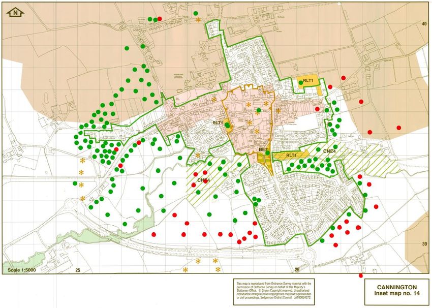
2.53 Figure 3 below is an extract from the Sedgemoor Local Plan (Inset Map 9) and shows
Cannington’s policy context with the development boundary edged in dark green.
2.54 The village also has a Conservation Area (edged in pink on Figure 4 below) which was
formally designated by Sedgemoor in 1991. The Conservation Area is focussed around
the historic core of the village. As noted within the history section below there is an
identified Iron Age hillfort at Cannington which was built around 2,500 years ago. There
is also a wider Area of High Archaeological Potential identified on the Local Plan Inset
Map.
March 2021 | Cannington Neighbourhood Plan 162.55 Other main designations of note for the village are the two areas of designated
“Countryside Around Settlements” (Policy D31), “Open Areas Protected from
Development” (Policy D32), “Informal Outdoor Space” (Policy D33) and “Formal Outdoor
Space” (Policy D33)
providing protections
for land-uses and
landscape value in
and around the
settlement. The
“Countryside Around
Settlements” areas
relate to open land
near the Cannington
Brook which make an
important landscape
character View of Cannington and its setting
contribution to the
settlement. The wedges are also accessible and well used as public footpaths and add to
the setting of the historic core and worthy of protection.
2.56 The other significant constraint for the village is that of flood risk and this is shown on
the Environment Agency extract at Figure 5 below.
March 2021 | Cannington Neighbourhood Plan 17Figure 3- Cannington Local Plan Policies Inset Map12
Crown Copyright and Database right. All rights reserved (100054284) 2019
12
Source: Inset Map 9, Adopted Sedgemoor District Council Local Plan 2011-2032,
https://www.sedgemoor.gov.uk/LocalPlan
March 2021 | Cannington Neighbourhood Plan 18Figure 4 – Cannington Conservation Area Extent and Listed Buildings
Crown Copyright and Database right. All rights reserved (100054284) 2018
Figure 5 – Environment Agency Flood Map Extract 201813
Crown Copyright and Database right. All rights reserved (100054284) 2018
2.57 The extract shows the watercourses identified in dark blue single lines. It also shows that
significant parts of the eastern and western ends of the village (shaded in dark blue) are
13
Source: Environment Agency, https://flood-map-for-planning.service.gov.uk/
March 2021 | Cannington Neighbourhood Plan 19located within Flood Zone 3 which is at a high probability from flooding. The lighter blue
indicates medium probability from flooding.
2.58 Cannington has a history of flooding which has led previously to the construction of an
earlier flood alleviation channel in 1984 as part of the southern by-pass scheme. Despite
this the village has seen significant flood events in 2000, 2002 and most recently in 2012.
It is understood that the events in 2012 affected approximately 50 homes and 1 business
internally causing damages of around £900,000 14.
2.59 Given the significance of the risk, the Environment Agency submitted an application
(13/15/00009) in March 2015 for the construction of a flood relief channel along the south
of the bypass. The scheme was given delegated approval on 12th June 2015 and was
completed in Autumn 2017.
2.60 The scheme includes a flow control structure to limit the flow of the Cannington Brook,
approximately 2km long flood diversion channel as well as raising land in selected
locations adjacent to the diversion channel.
2.61 Now completed the level of flood risk has been reduced to over 200 properties in the
Cannington area. 55 properties will move out of the significant or very significant flood
risk band and the A39 (part of critical road network) will be protected from flooding and
instances of sewer flooding will be reduced.
2.62 Clearly the implementation of this scheme will have a significant positive impact for the
village and reduce development constraint.
Cannington’s Future
2.63 While the Local Plan sets out the position in terms of the expectations of housing growth
in the period to 2032, the shape of Cannington’s future will continue to be heavily
influenced by the development of Hinkley Point C. A development of this size at Hinkley
Point will have significant implications for the village, in terms of opportunities but also
pressures. Despite the increased traffic and congestion issues associated with the build
operations, the rural village of Cannington remains a Tier 2 settlement where only a
relatively small scale of growth will be permitted.
14
Cannington Flood Defence Scheme: Planning, Design & Access Statement by Environment Agency 11 th March 2015
March 2021 | Cannington Neighbourhood Plan 202.64 As noted above the bypass associated with the Hinkley Point C development has already
been constructed and is now operational. The village is also hosting a park & ride which
is needed to support the construction phase. Figure 6 below shows the park and ride site
and alignment of the western bypass associated with Hinkley Point C.
Figure 6 – By-pass Alignment and Park & Ride Site
By-pass
Park & Ride
Crown Copyright and Database right. All rights reserved (100054284) 2018
March 2021 | Cannington Neighbourhood Plan 212.65 This neighbourhood plan seeks to add detail to Local Plan policies to manage development
in a way most appropriate to local circumstances and local opinion.
2.66 The Plan contains policies that are targeted at helping to shape development proposals
that come forward within the village. Equally the village has many aspects that are worthy
of protection including the rural approaches, the amount of greenspace within, some
noteworthy playing and sports pitches as well as a diverse housing stock. The village is,
as noted above, subject to constraints associated with transport infrastructure, flood risk
and landscape vulnerability. As such the proposed policies aim to steer development to
locations or require that proposals do not exacerbate or detract from the aforementioned
characteristics of the village.
3. GLOBAL ISSUES WITH LOCAL IMPACT
Climate Change
3.1 The planning system has a key role to play in sustainability, as set out above, and within
that context has a significant part to play in reducing our impact on climate change,
helping us mitigate impact and adapting to the changes which are already occurring.
3.2 While nationally, a target has been set for the country to be “net zero” in relation to
carbon emissions by 2050, in Sedgemoor, the target has been brought forward through
a climate emergency being
declared by Somerset
County Council and its
constituent District Councils,
including Sedgemoor, with
an aim of working towards
net zero carbon emissions
by 2030.15 At the national
level, legislation is being
introduced to “green” policy
and proposed changes to the
15
The Somerset Climate Change Strategy can be seen here - https://www.somerset.gov.uk/climate-
emergency/ The strategy, while not a Development Plan Document in the planning system, is nonetheless a
material consideration to be taken into account when consdiering planning applications.
March 2021 | Cannington Neighbourhood Plan 22planning system also follow this “direction of travel”.
3.3 These will all contribute at a strategic level or, in some cases, at a more local level, with
projects which are designed to have a positive impact or response. While a wide range
of measures (both “carrots” and “sticks”) will need to be introduced across society and
sectors, the planning system can play an important part in responding to the climate and
ecological emergencies.
3.4 This Plan can play its part in helping to reach targets set nationally to reduce carbon
emissions and also at the county and district levels through its local policies where those
policies can encourage development proposals to exceed standards set in planning and
building regulations. This means both encouraging the reduction of emissions but also
looking to mitigate and adapt to the changing climate, for example, in terms of a response
to flood risk or “greening” of the environment and increasing biodiversity, encouraging
local initiatives and enabling change which can be introduced outside of the planning
system, or helping to ensure that development does not exacerbate problems linked to
climate change.
3.5 While not an exhaustive list, in Cannington, the key issues of concern facing the Parish
at the local level in relation to climate change include the following:
• flood risk from increased rainfall and high intensity periods of rain;
• a need to increase the energy efficiency of older buildings; and,
• the impact of current levels of traffic on carbon dioxide emissions.
3.6 Rather than try to design a single planning policy about climate change and how
mitigation and adaptation measures can be supported (which would need to cover a long
and varied set of issues and criteria), we have sought to consider our policies (and
community actions and projects) through a “climate change lens” within each topic. This
means that the response to the changing climate, through the planning system and this
Plan, is a “golden thread” running through policies. As climate change is a “cross-cutting”
issue which affects and can be affected by so many topics, policies have been designed
to apply criteria, where relevant, to help mitigate impacts or adapt to our changing
climate.
Community Resilience
3.7 The current global Coronavirus Covid 19 pandemic has demonstrated that action within
the community at the local level are critical in helping us to cope with and manage our
way through unknown “shocks” which can impact on how we live and work. We cannot
March 2021 | Cannington Neighbourhood Plan 23guarantee that this type of event will not happen again in the short to medium term and
we see it as the planning system’s duty, alongside many other measures in other sectors
to try to draw positives from what has occurred, learn lessons and plan for a future which
could help to soften the impact, socially and economically, at the local community scale.
The pandemic profoundly changed our lifestyles and we need to recognise the
opportunities that the experience now gives us and the need for proactive measures to
be taken that it now presents. To not grasp these and act on them would be a failure to
learn to create better environments.
3.8 While there are limitations of our Plan in relation to the policies or measures we can
introduce which are either not already being set in train by changes to national planning
or other policies and regulations or are not within the remit of the planning system to
influence, our Plan seeks to introduce policies which can help our economy and
environment to adapt to changes where necessary.
March 2021 | Cannington Neighbourhood Plan 244. WHAT DOES THE NEIGHBOURHOOD PLAN AIM TO ACHIEVE?
Vision
4.1 The chief aim of the Cannington Neighbourhood Plan is to guide the future development,
regeneration and conservation of Cannington, in accordance with the following objectives.
4.2 This Neighbourhood Plan seeks to build upon the foundations laid down by the Cannington
Village Plan approved in 2005. New evidence has been collected and the views of
residents together with other stakeholders in the comprehensive consultations for Hinkley
Point C have been taken into account in the formulation of this Plan. We have developed
a Vision Statement for the Plan which reflects the keys issues in the parish identified
through consultation and what we would like the parish to be like by 2032.
Vision Statement
Cannington Parish is driven, and will continue to be driven, by the
community for the community.
By 2032 Cannington will achieve all the minimum targets as set out in the
Local Plan as a Tier 2 Settlement by successfully integrating the new
proposed developments to a high standard of design.
The rural characteristics and open spaces must be retained as a key
requirement of the community.
The existing infrastructure and utility infrastructure networks have been
greatly enhanced and the Parish will continue to respond to any other
requirements with equal commitment
March 2021 | Cannington Neighbourhood Plan 25Objectives
4.3 Following consultation with the community16 the following objectives were agreed by
the Parish Council:
1. To ensure that Cannington develops at an appropriate rate and scale based on its
role and function.
2. To revitalise and enhance existing open spaces and to help facilitate greater public
access to the countryside.
3. To safeguard the rural characteristics of the approaches to the village.
4. To support the delivery of new housing at a rate which meets local needs, minimum
targets and role and function of Cannington in the Local Plan as a Tier 2 Settlement.
5. To support the delivery of Affordable Housing to meet the needs of Cannington
residents.
6. To strengthen the resilience of the existing transport and utility infrastructure
networks.
7. To help sustain and improve village facilities for existing and future residents.
8. To protect existing greenspaces, the countryside setting and to support nature
conservation.
9. To require all new development to be of the highest design quality and to ensure it
respects the existing built form.
Topics and Policies
4.4 Within the context of these objectives, the Plan presents policies in several topics. In
summary these are as follows:
Housing and Development
Policy DEV01: Development in Cannington Village
Policy DEV02: Development Proposals on the Edge of the Settlement Boundary
Policy DEV03: Local Lettings of Affordable Housing
16
In 2014 and 2015, see http://cannington-neighbourhoodplan.info/evidence-base/consultation-and-engagement-
backup/ for further details.
March 2021 | Cannington Neighbourhood Plan 26The Natural and Built Environment
Policy ENV01: Landscape and Natural Environment
Policy ENV02: The Built Environment, Character and Heritage Assets
Policy ENV03: Protecting Community Facilities and Amenities
Policy ENV04: Proposals for New, Replacement or Extended Community Facilities and
Amenities
Transport
Policy TRANS01: Transport and New Development
Business and the Economy
Policy ECON01: Loss of Premises which Provide Employment and Conversion and Change
of Use of Buildings to Support Local Employment
Education and Training Facilities
Policy EDU01: Additional and Improved Education Facilities
Community Projects and Aspirations
Policy COM01: Community and Village Projects
March 2021 | Cannington Neighbourhood Plan 275. INTRODUCTION TO POLICIES
5.1 The Steering Group, through the consultation feedback17 and in the evolution of the nine
objectives identified in Section 3, realised that given the surrounding uncertainties the
preferable approach was to identify a series of policies which could be used to assess and
steer development proposals, as opposed to seeking to identify specific development
sites.
5.2 It is recognised by the Steering Group that recent development and growth of the village
has happened organically and at a very modest rate and all the policy indications at
present would suggest that there is not likely to be a step change in this regard.
Accordingly, policies contained in this Plan seek not to constrain development but to
ensure that it is delivered so as not to place undue pressure on known constraints within
the village particularly transport. parking and flooding.
5.3 With this in mind a criteria-based approach is proposed which seeks to establish a
sequential based assessment of development proposals. This policy accounts for; and
takes due account of; the qualities of the village and seeks to retain these and where
possible enhance them.
5.4 The following policies therefore seek to shape the future development of the
Neighbourhood Plan area. The proposed policies will ensure that any sites that are
developed within the village are developed sustainably with appropriate consideration
given to areas of green open space, limited landscape impact, the delivery of supporting
facilities and ensuring that the proposals do not result in any additional adverse impacts
in relation to transport (particularly highway safety and car parking).
5.5 These policies respond directly to concerns and issues raised during the community
consultation process and seek to deliver the identified plan Vision and associated
objectives.
17
In 2014 and 2015, see http://cannington-neighbourhoodplan.info/evidence-base/consultation-and-engagement-
backup/ for further details.
March 2021 | Cannington Neighbourhood Plan 286. HOUSING AND DEVELOPMENT
Context
6.1 The total number of dwellings within Cannington (as of 2011 Census) was 973. The
following table provides an analysis of household size and compares this to those of the
District as a percentage comparison.
Table 2: Household size
Number of Bedrooms Cannington (%) Sedgemoor (%)
1 Bed 7.5 8.3
2 Bed 23.9 25.8
3 Bed 47.6 41.8
4 Bed 17.2 18.5
5+ Bed 3.7 5.6
6.2 Table 2 shows that there are some noteworthy differences between the house size profiles
of Cannington and Sedgemoor, although these perhaps are not surprising. As can be seen
Sedgemoor has a larger percentage of houses with the smallest number of bedrooms
(i.e. 1 and 2 bedroom) whilst Cannington has bigger number of 3-bedroom properties.
6.3 The overwhelming majority of dwellings in Cannington (71%) are privately owned and
owner-occupied (as shown in Table 3). This is like the rest of Sedgemoor and slightly
higher than the average for England. There is a modest private rented sector at 13.9%,
while the affordable housing stock is slightly higher than the District average at just over
15%. This equates to 141 affordable homes, the majority of which are rented.
Table 3: Household Tenure Census 2011
Tenure Cannington % Sedgemoor % England %
Owner occupied 71.05% 71.30% 63.40%
Private rented 13.90% 16.00% 18.10%
Affordable 15.05% 12.70% 18.50%
6.4 A housing needs assessment undertaken in 2018 by Sedgemoor District Council identified
an affordable housing need for 32 households in Cannington (and there are a further 43
potentially in housing need which are identified on the Homefinder Somerset housing list
but who did not respond to the housing needs survey).
6.5 In 2018, Cannington, with an overall average purchase price of £228,777 was more
expensive than nearby Bridgwater (£181,289). The assessment report states that “Using
March 2021 | Cannington Neighbourhood Plan 29“real house price data” and taking a conservative view on the average sold price of houses
in the parish. [sic.] The price at which someone could buy a property (entry level at which
it would be feasible to get onto the housing ladder) has been taken to be circa £175,000
for a 2-bed property & circa £218,100 for a 3-bed property. These are average figures
based on sold prices from Rightmove and are only a guideline. A comparison of house
prices with neighbouring and the broader market area suggests Cannington is a relatively
expensive village. Prices are higher or in line with nearby villages and above the average
in the Sedgemoor District Council area. Data tends to be less robust for smaller areas as
it contains fewer records. This particularly applies to one-bedroom properties in rural
areas.”18 Despite the impact of coronavirus on the economy, at the time of issuing this
draft Plan for consultation (early 2021), the housing market seems to have remained
relatively buoyant in the local area19.
6.6 There is one small residential care home in the village which is Local Authority owned.
Bridgwater & Taunton College provide 116 onsite rooms for students at the Cannington
Centre. In addition, there is the Henry Rogers Almshouse which provides accommodation
for those individuals who cannot afford market housing but have a tie to the parish of
Cannington.
6.7 The unusual combination of the quarry, large educational establishments, a golf course
and the proximity of a Hinkley Point A & B as well as construction of C Station, together
with traditional farms have been influential factors in the way Cannington has evolved.
6.8 The location of the Parish, on the road network to the nearby nuclear power stations, is
of growing significance as plans for Hinkley Point C proceed.
6.9 The approved Village Statement, set out in the Cannington Parish Plan 2005 20, had eight
points, including the following five relating to housing development:
1. Affordable Housing is a requirement targeted at local people and at new and existing
employees in local jobs.
2. An in-depth study and survey should be planned for suitable site/sites for affordable
housing to be identified. This would enable the village youth to stay in the village where
they grow up, will sustain the economic growth of the village and will encourage local
businesses to stay in the area.
18
Cannington Housing Needs Assessment, 2018, p.4
19
Based on review of summary data on Right Move and Zoopla websites.
20
Can be found at http://cannington-neighbourhoodplan.info/wp-content/uploads/2019/04/Village-Statement-from-
Parish-Plan-2005.pdf
March 2021 | Cannington Neighbourhood Plan 303. No large-scale house building should take place.
4. Any future building development should have off-road parking facilities.
5. The visual presentation of the village should be improved without losing the rural
aspect.
6.10 Detailed work was undertaken at the time, by a dedicated group of local people to secure
affordable housing sites but this failed to result in the construction of any new affordable
homes.
6.11 The subsequent consultations for the third nuclear power station and its associated off-
site works lasted several years prior to the Development Consent Order receiving
approval in 2013.
6.12 The Parish’s preference expressed through representations to that process was that any
potential development near the village should be limited to a temporary use of land south
of Cannington Brook for a Park and Ride Site was accepted by the Secretary of State.
6.13 In 2014, consultation with the community on key issues to which the Neighbourhood Plan
should respond21 re-affirmed the preference of residents for Cannington to play its then
accepted role set out in the Sedgemoor Core Strategy 22 as a “key rural settlement”, with
residential development being allowed within the village’s Development Boundary and
with no allocation of large sites for residential development. Since that time, the role of
the village (in planning policy terms) has changed in the new Local Plan, as noted above,
to a Tier 2 settlement which will see a minimum of 163 dwellings delivered in the period
to 203223.
6.14 As noted above, this Neighbourhood Plan seeks to add detail to Local Plan policies to
manage development in a way most appropriate to local circumstances and local opinion.
It sets out criteria-based policies to help steer development to the most appropriate
locations. When work started on this Plan, Sedgemoor District Council had intended to
develop a Site Allocations Development Plan Document (DPD) to allocate housing sites.
However, as most Tier 2 settlements have seen sites come forward or allocated in
Neighbourhood Plans under Local Plan policy T2a and minimum housing numbers have
been reached in many Tier 2 settlements as a result, the District Council is no longer
21
See http://cannington-neighbourhoodplan.info/evidence-base/consultation-and-engagement-backup/ for further
details.
22
See https://www.sedgemoor.gov.uk/corestrategy
23
Or, when completions and existing commitments at April 2015 are excluded, 150 dwellings according to the Local
Plan.
March 2021 | Cannington Neighbourhood Plan 31going to produce this DPD. Cannington has not currently met this minimum with a recent
planning application being refused on a technical highways matter (although the applicant
has lodged an appeal)24.
6.15 Sedgemoor District Council is required to maintain a 5-year supply of potential housing
sites, based on a “call for sites” (where landowners can suggest sites which they consider
to be appropriate for development) and a technical assessment 25 which examines their
suitability for development. This does not give planning permission to the sites which
would still be necessary for houses to be built. The “call for sites” exercises in recent
years have produced an array of potential sites around Cannington and will be used to
inform Sedgemoor District Council’s allocation of a site or sites.
6.16 There are two additional factors which will influence the location of housing development
in the Parish:
• the new western by-pass opened in 2015; and,
• the Flood Alleviation Scheme which was constructed in 2016 on the southern side of
the village.
6.17 When comparing the number of new net housing commitments and completions in the
Parish to date, the remaining minimum number of dwellings that should be delivered in
the period to 2032 is currently 61 for the purposes of Local Plan policy T2a26. Of particular
note is outline permission granted for 73 dwellings on Land to the North of Grange Farm
(application reference 13/18/00040). While the proposal for 165 dwelling at Land off
Oaktree Way (reference 13/19/00043) has been refused, at the time of drafting this Plan
it was subject of a planning appeal lodged by the applicant.
Our Approach
6.18 The Local Plan does not seek to make any land allocations at Tier 2 settlements such as
Cannington and proposes what is considered to be only a modest level of additional
growth of approximately 11 dwellings per annum across the plan period (equating to the
minimum of 150 in the period to 2032, if the number of completions and commitments
at April 2015 are excluded from the Local Plan figure of a minimum of 163 dwellings). As
noted above, the Local Plan states that the Site Allocations DPD will allocate specific sites
(if required) and if our neighbourhood plan does not, where the minimum number of
24
Land off Oaktree Way (reference 13/19/00043)
25
The assessment is called the Strategic Housing Land Availability Assessment or SHLAA. See here for further details
http://www.sedgemoor.gov.uk/1274
26
Based on Sedgemoor District Council figures for completions and commitments at 10th March 2021.
March 2021 | Cannington Neighbourhood Plan 32dwellings has not been built or received planning permission by the time it is adopted.
However, it is understood that at the current time, that plans by the District Council to
produce a Site Allocations DPD may be revisited given the rates of delivery in the District.
6.19 The Neighbourhood Plan Steering Group spent some considerable time studying whether
it was appropriate to recommend a site allocation approach which would be specific about
the sites on which this growth should take place or to develop criteria by which potential
sites for residential development can be assessed to help guide development to
appropriate locations. It was considered that, from the technical information available at
the time, that it would be very difficult to decide which, from many possible sites with
development potential identified in the District Council’s strategic housing land availability
assessment (SHLAA), would be best suited to development over another. From the
information available, we could not determine the most favourable site or sites.
6.20 At the time of writing, there is continuing uncertainty about the likely long-term impact
on the local housing market of the construction of Hinkley C. However, most evidence
seems to indicate more impact in the private rented sector than on demand for owner-
occupied homes (for example, in the Sedgemoor Strategic Housing Market Assessment
201627). Given the uncertainty and the lack of evidence for any particular impact in
Cannington, the Neighbourhood Plan does not include policies specifically to deal with
this issue. However, the criteria-based policy below will help to mitigate the impacts of
any housing development, whatever the driver.
6.21 Parishioners believed that development should be in keeping with the existing built form
of the village which is almost exclusively either single or two storey development.
6.22 With the emergence, since our last consultation, of the new adopted Local Plan, we also
now consider that, alongside this Plan’s policies, the Local Plan’s interim criteria-based
policy T2a could provide sufficient protection from inappropriate scales and locations of
development until such time if and when the Sedgemoor DPD is adopted. However, to
give additional confidence, certainty and be locally specific, our policies below and those
in the Natural and Built Environment section set out criteria to guide the design of
development appropriate to Cannington should the DPD not deal with such issues, not
allocate a site or sites on the edge of Cannington village or the DPD not be produced.
6.23 There are various advice and guidance documents and standards that development
should take fully into account where feasible, relevant and viable which are referenced in
the Natural and Built Environment section.
27
See https://www.sedgemoor.gov.uk/shma
March 2021 | Cannington Neighbourhood Plan 33You can also read