COMPLETE STREETS THE 15 MINUTE CITY - IN FEBRUARY 2021
←
→
Page content transcription
If your browser does not render page correctly, please read the page content below
COMPLETE STREETS
          IN
THE 15 MINUTE CITY
      FEBRUARY 2021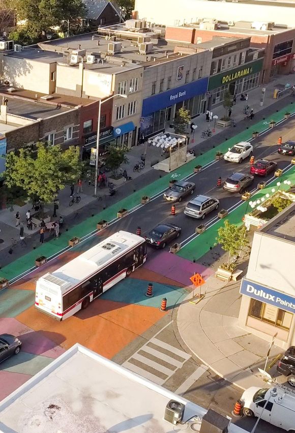
In February 2021, Elysia DeSandoli, an intern at The Centre for Active
     Transportation (TCAT) wrote this report to better understand the reciprocal
   nature of the urban planning concepts of Complete Streets and the 15 Minute
                                                                            City.

Clean Air Partnership (CAP) is charitable environmental organization that enables
       communities to improve air quality, advance active transportation, and take
    bold climate action. The Centre for Active Transportation (TCAT), a project of
    CAP, advances knowledge and evidence to build support for safe and inclusive
   streets for walking and cycling. Complete Streets for Canada is an online portal
         developed by TCAT featuring national best practice on streets redesigned
      to benefit pedestrians and cyclists and providing research, policy and design
                                             guidance for Canadian municipalities.

                                                           For more information:
                                                  www.completestreetsforcanada.ca
                                                                     www.tcat.ca
                                                      www.cleanairpartnership.org
                                                       Cover image source: The Centre for
                                                                    Active Transportaiton

                                                                                            1
2
CONTENTS

03   Complete Streets and The 15
     Minute City

05 Principles  of The 15 Minute City:
   Why is it Different?

08 The 15 Minute City in Canada: Ottawa
11 City: How They Can Help Each Other
   Complete Streets and The 15 Minute

12 Infrastructure: Safety
13 Context
   Infrastructure: Neighbourhood

14 Livability and Sociability
16 Increased Economic Activity
19 Critiques and Future Drawbacks
20 Ignoring the Suburbs
21 Gentrification Concerns
22 Conclusion: Today’s Context
24 Endnotes
26 References
                                          New York, NY. Source: NACTO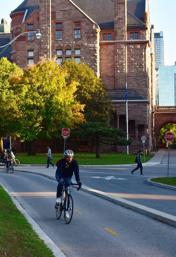
COMPLETE STREETS
AND
THE 15 MINUTE CIT Y
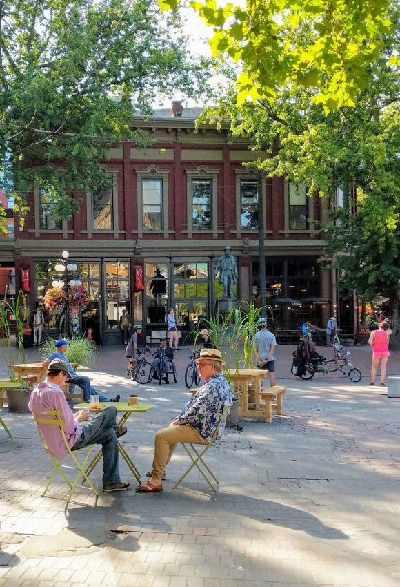
Toronto, Ontario. Source: TCAT
3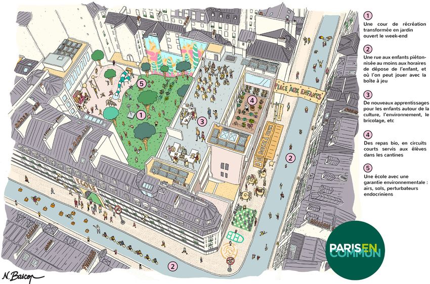
4

    A
           fter decades of automobile-centric               offer safe, healthy, and sometimes sociable options
           planning, recently cities have begun to          for travel when many fear the crowds of public
           reimagine and redesign their streets to          transit and are unable to gather socially indoors.
    be safer and more inviting for everyone, not just
    thoroughfares for cars. In articulating this more       Congruently, municipalities are now looking
    human-centric vision for cities, several different      to develop infrastructure that would support
    approaches have emerged that coalesce around            active modes of travel more suited to shorter
    similar goals: streets that are safer, more inviting,   trips around one’s neighbourhood. Along
    more accessible, and healthier for pedestrians          with bike infrastructure, this also includes
    and cyclists. Since 2010, The Centre for Active         developing    smaller,   more    self-sufficient
    Transportation      (TCAT)      has     championed      neighbourhoods      throughout    the       city.
    Complete Streets as streets that are safe for           This is where the 15 Minute City enters .
    everyone: people who walk, bicycle, take transit,
    or drive, and people of all ages and abilities.         This report intends to demonstrate the benefits
                                                            of the concept of the 15 Minute City, and how the
    The idea of the 15 Minute City is the latest urban      concept of Complete Streets is an effective and
    trend becoming increasingly popular in cities           necessary strategy for achieving the 15 Minute
    around the globe. To be clear, the 15 Minute City       City. Where the 15 Minute City offers a strategy to
    is not itself a new type of city, like the popular      create interesting places to go, Complete Streets
    garden city movement in the early 20th century or       provide policy and design tools to ensure that
    the development of the suburbs in the 1940’s and        the streets to get there are safe and comfortable.
    1950’s. Rather, the 15 Minute City is a collection
    of concepts already familiar in the urban planning In essence, streets that are safe, inviting, and
    realm packaged under an overarching idea of high accessible to walking and cycling (core concepts
    density, mixed use, and walkable neighbourhoods. behind Complete Streets) are a necessity
                                                       for the success of the idea of decentralized,
    In the wake of the COVID-19 pandemic these ideas diverse, and vibrant neighbourhoods that offer
    have increasingly shown their value. With global multiple needs to its residents close to their
    lockdowns, many urban citizens are now confined homes. The relationship between the two is
    to their homes in ways that have almost completely symbiotic: one needs the other to succeed.
    upended daily travel habits. Walking and cycling

                                                                                       Figure 1: Hallmarks of a
                                                                                       20-Minute Neighbourhood,
                                                                                       another term for the 15
                                                                                       Minute     City     Concept.
                                                                                       Source:    Victoria    State
                                                                                               Government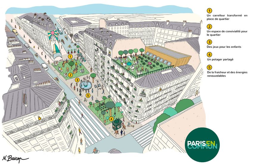
PRINCIPLES OF
                  T H E 1 5 M I N U T E C I T Y:
                  WHY IS IT DIFFERENT?

Toronto, Ontario. Source: 8 80 Cities

                                                   5
6

    WHY IS IT DIFFERENT?
    The idea of the 15 Minute City is fairly simple:     While the term 15 Minute City is relatively
    residents should be able to access their basic       new to the urban planning scene, its concepts
    needs of food, healthcare, work, green space, etc.   are not. They have been referred to as
    within a 15-minute commute from their home.          ‘complete communities’ or ‘the 20 minute
    Commuting here refers to walking or cycling;         neighbourhood’ in the past, and represent
    cars are largely absent from this discussion.        a trend of decentralizing urban life so that
    The most prominent advocate of this concept          neighbourhoods may meet multiple daily needs.
    is Mayor of Paris Anne Hidalgo and her advisor,      Many cities already have these elements
    Carlos Moreno. According to Moreno, our six basic    ingrained    in    their    urban      fabric.
    social functions of “living, working, supplying,
    caring, learning, and enjoying” should be met        After       systematically         reviewing       271
    closer to home to ensure happier citizens are more   studies on the quality of the built
    engaged in the well-being of their communities.1     environment and its value, Camora (2019)
                                                         found that qualities such as greenness
    C40,     an   international      coalition     of    in the built environment, walkability and
    97 cities dedicated to creating more                 bikeability, low levels of traffic, a mix of land uses,
    sustainable   urban      lifestyles,     outlines    more compact neighbourhoods, and convenient
    four core principles of a 15 Minute City:            connections to a good public transport network
                                                         have a very strong positive association with the
                                                         health, social, environmental, and economic value

     1    Residents of every neighbourhood               of a place. 2 Of all variables determined to bring
          have easy access to goods and                  ‘quality’ to a place, these are the most tangible
          services,  particularly groceries,             and objective and thus measurable qualities.
          fresh    food     and      healthcare
                                                         Camora describes four core components of
          Every neighbourhood has a variety              the 15 Minute City: transportation, density,
                                                         diversity, and proximity. Due to their tangibility
      2
          of housing types, of different
          sizes and levels of affordability,             and objectivity, and thus measurability, these
                                                         qualities are some of the most straightforward
          to accommodate many types of
                                                         strategies to include in urban policy, thus
          households and enable more people
                                                         being able to concretely improve the quality
          to live closer to where they work              of a place through future design governance.3

      3
          Residents of every neighbourhood               Active transportation plays a large part in this
          are able to breathe clean air, free of         idea. Reducing the time spent traveling to basic
          harmful air pollutants and there are           amenities, through the development of walking
          green spaces for everyone to enjoy             and cycling infrastructure, has the potential to
                                                         reduce car pollution and free up more time for
                                                         other activities.4 While the 15 minutes in the 15

      4
          More people can work close to home
                                                         Minute City is generally understood to represent
          or remotely, thanks to the presence
                                                         walking and cycling travel time, the core
          of smaller-scale offices, retail, and          principles lack the detail explaining how cities
          hospitality, and co-working spaces5            can successfully transition their neighbourhoods
                                                         into those that are attractive and safe for
                                                         pedestrians and cyclists, if they are not already.
Taken together with Complete Streets, the 15 neighborhoods’ where these uses can coexist in
Minute City can fill these gaps and become a the most accessible. and diverse way. See Figure
more wholistic and multidisciplinary strategy. 2 below for an example of a Paris street redesign.

In essence, these elements should be accessible
all within a 15 minute walk or bike ride from one’s
home. This encourages what some experts call
‘micro-mobility’ or ‘hyper-proximity’. The hope
here is to reimagine cities not as distinct zones
for living, working, or leisure, but as ‘mosaics of

     Figure 2: An example of Paris’ street redesign for the 15 Minute City vision. Headlines read: 1) An
     intersection transformed into a neighbourhood square. 2) A space for togetherness for the neighbourhood.
     3) Games for children. 4) A garden to share. 5) Freshness and renewable energy. Source: Paris en Commun

                                                                                                                7
8

                        THE 15 MINUTE CITY
                            IN CANADA:
                              O T TAW A

    Ottawa, Ontario. Source: Encyclopedia Britannica
T   he City of Ottawa is one of the first Canadian
    cities to explicitly include the 15 Minute
City in their planning documents. In their new
                                                        promote social and physical health, and sustainable
                                                        communities.”10 To accomplish this, the City
                                                        recommends “ensuring that housing is close to
Official Plan for 2021, Ottawa has proposed             local shops and services, with a street and pathway
five overarching policy changes entitled the            network that facilitates active transportation and
‘Five Big Moves.’6 Within these, the 15 Minute          discourages the local car trips, [to] promote the
City is mentioned under policies relating               health, sustainability and economic vibrancy of
to overall growth management focused on                 communities.”11 This, along with “appealing urban
intensification, growth management strategies           design and aesthetics”, ultimately contributes to
in the context of greenhouse gas emission               successful walkable communities that have the
reduction targets, urban and community design,          power to “foster social connections and mental
and climate, energy, and public health. Looking         health, reduce injuries and chronic diseases, and
at Ottawa’s context is a useful case study to           make them more resilient to climate change.
better understand the concepts of the 15                It will make healthy choices easier choices.”12
Minute City within a North American context.
                                                        Additionally, in one document supporting its
Similar to the direction of cities like Paris, Ottawa   newest Official Plan, Ottawa notes how focusing
emphasizes integrating ideas from the 15 Minute         growth management on intensification—in the
City into established communities, thereby              form of 15-minute neighbourhoods—supports
bringing these concepts into the evolution of pre-      “a strategy of distance reduction for the daily
existing neighbourhoods. A successful 15 Minute         needs of Ottawa’s future population.”13 The need
neighbourhood would ideally consist of“...a diverse     to travel, and the distance needed to travel,
mix of land uses, including a range of housing,         are “the two most direct sources of individual
shops, services, local access to food, schools,         ownership and use of private vehicles.”14
employment, parks, greenspaces and pathways.”7
Therefore, “planning for intensification must           Successful attempts to reduce private vehicle
therefore also consider the availability of these       use should not only target reducing spaces
services and amenities in order to be successful.”8     for cars; increasing alternative options for
                                                        transportation—and the street environments in
However, developing new neighbourhoods                  which they take place—also has the potential for
and communities from scratch has the most               success. As such, Ottawa states that “focusing
potential to successfully utilize concepts of the       urban growth on the creation or consolidation
15 Minute City. Ottawa understands this, as they        of 15-minute neighbourhoods is a fundamental
emphasize the importance of designing, from             strategy to structurally alter existing patterns.”15
the ground-up, neighbourhoods as complete,
15-minute communities to “allow suburban        Incorporating elements of the 15 Minute City
communities to be more complete from the        is likely to be a seamless addition to the city’s
onset” without having to later return to car-   active transportation planning given Ottawa’s
centric suburbs for retrofitting.9 Not only willcurrent active transportation guidelines and
this encourage higher intensification of uses,  policies. Most recent is the 2019 Designing
thereby creating more diverse neighbourhoods,   Neighbourhood Collector Streets, a comprehensive
but this also has the potential to create       policy guidance document with a “‘Complete
healthy transportation habits in its residents. Streets’ focus”.16 Interestingly, one of the
                                                principles guiding the design of Neighbourhood
Ottawa includes this strategy in their policy Collector Streets is compactness, wherein
document, stating that “walkable, 15-minute “The right-of-way width and distance between
neighbourhoods will help reduce car dependency, opposing building faces are minimized to help

                                                                                                               9
10
foster a sense of safety and community”.17 as well as outlining their vital role in the
The Multi-Modal Level of Service (MMLOS) transportation system.19 Within this plan are
Guidelines provide guidance to practitioners guidelines to adopt a Complete Streets policy
(City staff, consultants, etc.) on how to for road design, operation, and maintenance;
assess the various LOS for different modes of to update road design principles, standards
transportation and the specific target service and processes; and to use multimodal LOS to
levels of each mode given the location and assess road designs and allocate right of way.20
context of a transportation project.18 These
guidelines are a helpful tool in evaluating the These policies, which acknowledge the role
performance level of not just vehicular traffic of the transportation network in developing
but also that of cycling, walking, and transit. compact neighbourhoods that encourage active
transportation, provide a strong framework on
Section 7.1 of Ottawa’s Transportation Master which Ottawa’s 15 Minute City can be built.
Plan, entitled “Design and Build Complete
Streets”, touches on the role of Ottawa’s street
as “fundamentally important public spaces”COMPLETE STREETS
AND
T H E 1 5 M I N U T E C I T Y:
HOW THEY CAN HELP
EACH OTHER
Paris, France. Source: NY Mag
1112
INFRASTRUCTURE: SAFET Y
Complete Streets is a planning concept In an assessment of 37 Complete Streets
that emerged in municipal and provincial projects across the United States, Smart
government planning around 2009. The Growth America found that “the majority of
goal of Complete Streets is to redesign the roads with Complete Streets features had fewer
street for all road users, thereby including collisions and fewer injuries after their retrofits
pedestrians and cyclists into a conversation that than before” with around 70% of project areas
has long been dominated by vehicle drivers. experiencing a reduction in collisions and around
This can take the form of bike lanes, wider 56% experiencing a reduction in injuries.24
sidewalks, increased street greenery, and more. For example, the Seattle Department of
Transportation implemented Complete Streets
Complete Streets, as an urban planning concept, infrastructure—reducing number of travel lanes
is a complementary approach to building the from four to two, adding a centre turn lane, bike
15 Minute City. In essence, the 15 Minute City lanes, and new crosswalks—that saw a 75%
is an effort to enable everyone to be within percent decrease in speeding drivers and an 80%
a 15 minute walk or bicycle ride from their decrease in pedestrian-vehicle collisions along one
everyday needs. To do so, there needs to be street, and speeding falling by two-thirds with a
attractive, safe, and accessible infrastructure 23% decrease in total collisions along another.25
to encourage more walking and cycling. This is
where the concept of Complete Streets enters. Quality of infrastructure also matters for
there to be lasting and impactful change. For
Ontario’s provincial growth plan A Place to Grow: instance, bike lanes come with a wide range of
Growth Plan for the Greater Golden Horseshoe options that differ vastly in terms of safety and
includes Complete Streets under section 3 perceived comfort; a painted bike lane along
“Infrastructure to support growth”, stating that a busy corridor will not have the same impact
“In the design, refurbishment, or reconstruction as a lane separated by a green median. The
of the existing and planned street network, a City of Vancouver is one such municipality that
complete streets approach will be adopted that has introduced a series of design guidelines for
ensures the needs and safety of all road users are cycling routes that optimize safety and comfort.26
considered and appropriately accommodated.”21
Most recently, Winters et al. (2020) groups these
One of the main benefits of Complete options into the Canadian Bikeway Comfort
Streets infrastructure is added safety for and Safety (Can-BICS) classification system.27
all road users. Through the use of street Three tiers of classification are introduced: high-
design, Complete Streets strategies are able comfort, medium-comfort, and low-comfort
to reduce traffic-related deaths and injuries. bikeways. High-comfort bikeways can take the
In Complete Street Transformations in the Greater form of bike lanes completely separate from
Golden Horseshoe Region, nine projects were vehicle traffic, while low-comfort bikeways are
assessed where streets had been redesigned commonly painted lanes along a vehicle road.28 The
to make space for pedestrians, cyclists and/or introduction of Can-BICS, and other classification
transit users.22 Compiling evidence from before systems, is important in that it provides a
and after changes were made to each street, the standard nomenclature with which “comparisons
authors concluded that the Complete Street of the availability and infrastructure types across
redesigns were primarily successful in achieving settings and over time” can be made.29 This has
the goals of increasing the numbers of people the potential to help standardize and objectify
cycling and walking, and improving safety.23 the assessment process for Complete Streets.Cities with vague commitments to bicycle system. Cities may implement Complete Streets
and pedestrian safety need this level of detail strategies in tandem with an overarching
and specification in order to ensure their plan for a 15 Minute City in order to bring
developments meet the standards of comfort detailed elements of safety to their strategy.
and safety described by this classification
INFRASTRUCTURE: NEIGHBOURHOOD CONTEXT
Creating spaces for pedestrian and cycling taking public transit offer different catchment
activity is vital for fostering walkability and areas ranging from one to two kilometers, five
micro-mobility integral to the success of dense to seven kilometres, or ten to fifteen kilometres,
communities. In order to ensure everyday respectively (see Figure 3 for a visual example).32
amenities are within a 15 minute walk or bike Implementing Complete Streets designs into
ride of one’s home, there needs to be the right these catchment areas can help support the
infrastructure to enable those commutes. goals of the 15 Minute City in lasting ways.
Complete Streets infrastructure thus supports Simply implementing kilometres of cycling
the vision for 15 Minute Cities; these must infrastructure or widening sidewalks is not
coexist for them both to succeed. Indeed, the enough to increase rates of these modes. Yes, they
success of communities with ‘hyper proximity’ will likely see some increased rates of walking and
is not solely about an increase in urban density, cycling due to the more attractive street designs.
but also about being multimodal and having However, if there are no destinations along these
the quality of the infrastructure available routes then they will be unlikely to attract users
for these short walking and cycling trips.30 who were not walking or cycling along them before.
The 15 Minute City is essentially about active Figure 3 below demonstrates how the density
modes of transportation and “increasing an area’s (or lack thereof) of services within a 15
catchment of accessibility.” 31Walking, cycling, or minute catchment area makes the 15 Minute
Figure 3: Catchment areas differing by
travel mode with surrounding amenities.
Note the difference in density of services
and thus the feasibility of the 15 Minute
City idea in each context. Source:
Bloomberg
1314
City concept appear more or less attainable considers the street as a destination, referring to
in certain communities. The streets within “the ability of a street to support non-travel activities
that catchment area may be ‘complete’ in on or adjacent to the street, such as recreation.”34
that they have been designed for the safety Most Complete Street policies mainly address
of multiple road users, yet they may be the demand of ‘movement’, with secondary
underused due to a lack of nearby destinations. attention paid to ‘environment’ and ‘place’. The 15
Minute City attempts to fill the gap of a need for
This is a common critique of many Complete placemaking within Complete Streets policies.
Streets polices; that they do not consider the
wider urban context in which these streets lie. Indeed, “designing a complete street to fulfil
Hui et al. (2017) argue that the objectives of a the place function requires understanding
Complete Street “extend beyond the provision the relationships between the street and the
of safe transportation facilities for all users” buildings and spaces that frame it.”35 Ensuring
and go on to suggest an alternative definition in a rich diversity and density of services (The 15
which “the functionality of a street is dependent Minute City) around streets designed for safe
on the fulfilment of at least three competing active travel (Complete Streets) is a strategy
demands: movement, environment, and place.”33 allowing for both planning concepts to support
Here, movement refers to the mechanism of the each other. Creating these in tandem is thus a
street that facilitates travel, environment is the necessary step in creating truly complete streets.
aspect of street design that addresses a street’s
environmental impact, and place is that which
L I VA B I L I T Y A N D S O C I A B I L I T Y
COMPLETE STREETS: WALKABILIT Y
By accounting for road users beyond private invites human contact that automobile
vehicles, the concepts of Complete Streets and transportation precludes. People get to know
the 15 Minute City promote an urban street their merchants and their neighbors; from
life that is more attractive, and thus more among the many, the compatible few are able
livable for everyday people. Human-scale design to discover one another.” (Oldenburg, 1989, p.267)
treatments such as street furniture, trees and
wide pedestrian rights-of-way animate the Research conducted since Oldenburg’s work
public realm and encourage people to linger in 1989 have proven what he theorized: highly
in neighbourhoods and on the street.36 By walkable, mixed-use neighbourhoods are
way of these urban design policies, Complete better generators of social capital than car-
Streets help provide more opportunities to form dependent neighbourhoods.39 Neighbourhoods
networks and interactions that inspire trust and with good walkability have been proven to
reciprocity, otherwise known as social capital.37 increase the number of social interactions
between residents, with elements like the
Sociologist Ray Oldenburg, in his seminal work density of a neighbourhood and accessibility
on ‘third places’, notes how nearby accessibility to a variety of social and recreational facilities
of services helps foster social capital:38 influencing the quality of these interactions.40
Similarly, those who take more leisurely walks
“In using nearby facilities, in visiting them afoot in their neighbourhood tend to have higher
and regularly, the residents of an area effectively quality social interactions.41 Simply put, the
create a casual social environment and reap its more walkable a neighbourhood, the easier
benefits. The pedestrian mode of transportation it is to casually bump into one’s neighboursand to engage in conversation. It is exactly the contributes to this social isolation, wherein
casual nature of these interactions that is so opportunities for chance and casual social
important in fostering social capital. They breed interaction do not exist outside the home.
a sense of familiarity and predictability many find Relegating not only city blocks but entire
comforting, and over time “have been theorized neighbourhoods to a single function (residential)
to be of great importance for fostering ‘a web effectively ensures that “the privatization of life
of public respect and trust, and a resource in is no longer optional but spatially enforced.”43
time of personal or neighborhood need.’”42 Figure 4 below demonstrates an ideal redesign of
a Paris neighbourhood with examples of spaces
It is more likely in walkable neighbourhoods taking on multiple uses throughout the day and
for these casual encounters to occur rather week, such as an inner courtyard now open to
than in car-dependent environments where the public on the weekend. Integrating Complete
social interaction mostly occurs by invitation, Streets concepts—wide, attractive sidewalks,
not chance. This is due to the design of many well-defined bike routes, and designing streets
suburban communities: life has been built to with pedestrians in mind—into revitalization
occur in the home, the private backyard, and efforts or in the design of new neighbourhoods
in the private vehicle. The lack of diversity of could positively impact the livability and
uses within car-dependent communities also social cohesion found in those communities.44
Figure 4: An example of Paris’ street redesign for the 15 Minute City vision. Headlines read: 1) A courtyard
transformed into a garden open on the weekend. 2) A street for children pedestrianized at least during
children’s pick up and drop off times, where you can play with the playground. 3) New learning for children
about culture, the environment, crafts, etc. 4) Locally grown organic meals served to students in cafeterias.
5) A school with an environmental guarantee: air, soil, endocrine disruptors. Source: Paris en Commun
1516
T H E 1 5 M I N U T E C I T Y: D E N S I T Y A N D D I V E R S I T Y
Dense, mixed-use neighbourhoods have the mentioned, benefit from an urban form that
potential to positively impact people’s sense emerged prior to the dominance of the private
of livability and satisfaction. High density vehicle. As such, many European cities are already
neighbourhoods have been shown to have predisposed to the dense and pedestrian-friendly
a positive association with neighbourhood lifestyle that meets the requirements of the
satisfaction, as densely populated areas 15 Minute City. Nevertheless these examples
offer easy access to amenities, public remain useful for North American cities as they
transportation, and other areas of the city.45 demonstrate the benefits of this type of urban form.
North American planners and policy makers
Past research has found that high accessibility may draw upon these case studies when
has a positive effect on livability, and that designing or revitalizing their own communities.
high density should be accompanied by
other important elements such as access to A current example of this process already
wider urban networks, safety, the existence underway is in the Golden Mile in Scarborough,
of urban greenery, and access to public a suburban district in Toronto. A proposal
gathering places in order to increase livability.46 for this area seeks to transform the current
In a study conducted in Oslo, Norway, Mouratidis landscape of surface parking lots and big
(2018) found that “neighbourhood satisfaction box stores into a mixed-use community with
appears to be higher in compact areas” than in a new, pedestrian-friendly street grid.49
those characterized by sprawl.47 Van den Berg Increasing the quality of social life is an important
et al. (2017) found that in the Netherlands, strategy in the context of COVID-19, where
neighbourhoods that allowed for more people are more isolated than ever. Where the
walking and cycling saw a higher number of opportunity for socialization is severely limited for
important social interactions reported by its those cities still tackling the coronavirus, enabling
residents when compared with rural areas.48 social interaction at the local level through urban
design and policy may help to improve the mental
It is worth nothing that European examples like health of its citizens in a post-coronavirus world.
Oslo, the Netherlands, and Paris, as previously
INCREASED ECONOMIC ACTIVIT Y
Complete Streets and the 15 Minute City given community to become connected to a
have the potential to increase the livability wider network beyond one’s immediate area
of a neighbourhood—and by extension through the use of interconnected bike lanes,
the city. They also have the potential to longer distances of walkable streets, and so on.
increase economic vitality within and This has shown to match the attractiveness
adjacent to a revitalized neighbourhood. of an area, wherein properties located on
accessible roads, or those in well-connected
Dario Hidalgo, senior mobility researcher for World neighbourhoods, are more highly valued than
Resource Institute’s Ross Center for Sustainable their less connected counterparts.51,52,53
Cities, recently stated that increased walking and
cycling have the potential for “small businesses in Camora (2019), in his review of 271 studies
[a] neighbourhood to thrive.”50 Neighbourhoods on place value, found that almost 100 of the
with the infrastructure to support walking and studies reviewed presented evidence to the fact
cycling activity provide the opportunity for a that areas with high place value—attributed tofactors like urban greenery, open space provision, transit (see Figure 5).60 This can be attributed
and qualities of the built environment such as to the fact that “people on bikes, like people on
walkability, connectivity, and so forth—created foot, are mostly locally-based, and as a result
strong private as well as public economic benefits.54 they tended to visit more frequently and spend
He states that this evidence is “overwhelming” more per month than drivers or transit users.”61
with “remarkable confluence in the research, with
very little conflicting evidence.” 55How places are In essence, “spending was related to proximity,”
shaped can effectively deliver rising property valueswherein “visiting more results in more spending,
in the residential, retail, and office sector, reduced
and locally-based visitors were 2.6 times more
vacancies in the retail and office sector, viable likely to spend at least $100 per month.”62
investments and extended regeneration benefits, Behind this positive economic change was
reduced public expenditures, higher local tax take, the bike lane itself; the new infrastructure
lower costs of living, and higher productivity.56 encouraged more people to walk or cycle to their
destination, with cycling rates tripling from 7%
Implementing Complete Streets projects can also to 20% and walking rates remaining the most
cause employment and sales levels to rise—in popular mode at 48% along Bloor Street.63,64
some cases, significantly.57,58 This may be because
residents are more inclined to shop locally when This same phenomenon has been demonstrated
they may easily visit nearby stores on foot or by in the United States as well. In one case, when
bike.59 In a 2017 study of Bloor Street in Toronto’s a bike lane was added along a street in San
Annex and Koreatown neighbourhoods, The Francisco, nearby businesses saw sales increase
Centre for Active Transportation (TCAT) found by 60%, which merchants attributed to increased
that, after the implementation of a new protected pedestrian and bicycle activity.65 In another
bike lane, the number of customers and spending example in New York City, implementing a
increased for businesses, with customers arriving protected bike lane saw an increase in local
on foot or by bike reporting higher levels of retail sales of up to 49% along the same street.66
spending than those arriving by car or public
Figure 5: Changes in the Percentage of Visitors
Spending $100 or More, by Travel Choice on Bloor and
Danforth. Source: Smith Lea et al. (2017)
1718
Expanding public spaces also has a similar parking,and a center turn lane made the street safer
effect.67 The expansion of Union Square North in for both pedestrians and drivers, in turn making
Manhattan saw 49% fewer commercial vacancies the street a more desirable destination.71 As a
(compared to 5% more vacancies borough-wide) result, 77 net new businesses opened from 2008 to
in conjunction with a 74% approval rate for the 2015, creating 560 new jobs for the community.72
new expansion (see figure 6).68 Transforming
an underused parking area into a community While this relationship has not been extensively
gathering space saw a 172% increase in local researched, initial findings of positive economic
retail sales, compared to 18% borough-wide.69 trends along new Complete Streets corridors
Turning a curbed parking lane into a seating suggest that “Complete Streets made more
area saw a 14% increase in sales at fronting desirable places to locate and operate businesses.”73
businesses.70 As such, locating businesses on In order for more businesses to become integrated
easily accessible streets can be a concrete into new or pre-existing neighbourhoods so as to
strategy for increasing economic success. encourage shorter trips and accessibility around
one’s home, it is integral to concurrently implement
Additionally, communities reported increased Complete Streets for this effort to be successful.
net new businesses after Complete Streets
improvements. The case study of Edgewater Drive In the context of the COVID-19 pandemic, this
in Orlando, Florida showed that Complete Streets is especially pressing as many residents’ area
improvements of bicycle lanes, wider on-street of travel has reduced significantly to only the
immediate area around their home.
Increased anxiety around the safety
of crowded public transportation
has also made walking and cycling—
outdoor modes of travel—more
attractive. Capitalizing on this
trend, city planners could look to
encourage these travel modes in
order to benefit the public from
multiple angles. Encouraging denser
congregations of businesses along
the lines of the goals for a 15 Minute
Before, City has the potential to benefit both
2009 residents and business owners alike.
Figure 6: Union Square North
before and after street calming
projects, completed by New York
Department of Transportation.
Source: Google Maps
After,
2013CRITIQUES
AND
FUTURE
D R AW B A C K S
Vancouver, BC. Source: UBC News
1920
IGNORING THE SUBURBS
When speaking of urban density, conversations While COVID-19 has dramatically changed or
tend to ignore the suburban environments eradicated the commuting patterns of many
altogether. Discussions on the 15 Minute City workers, many still must attend work in-person. In
are no exception. Cities that have successfully this case, many low-income workers, who are often
implemented the 15 Minute City concept, like the lifeblood of the urban core, can only afford to
Barcelona and Paris, exist in Europe where live in the suburban periphery. As such, the 15
dense urban living has existed as part of the Minute concept will have to reckon with ideas
urban fabric for hundreds of years, built in of social equity, especially affordable housing.74
times when walking, cycling, and public transit
were the main modes of transportation. Indeed, the idea of reappropriating city roads
from vehicular traffic to pedestrian or cycling-
However, when applying this concept to cities only zones possibly creates another issue of
in North America or Australia, where the diverting congestion to other major roads.
convenience of cars saw a rise in sprawling This could require further investments in
suburban communities, the basic urban surrounding roads to deal with heavier traffic.75
function of density and having amenities
within walking distance is far out of reach. In Barcelona, this emerged as a concern with
the development of its Superblocks; there is a
What, then, about those who live in suburban possibility traffic may relocate to less desirable
communities but commute to the city’s core? areas of the city (see Figure 7 below).76 However,
The 15 Minute City concept largely ignores while this was brought up as a possible drawback to
suburban commuters, as it mainly advocates the Superblock model, there has been no evidence
for live, work, and play within close range that this has occurred thus far. Nevertheless,
of one’s home. Yet not everyone has the supplementary interventions to further
possibility of having jobs within 15 minutes. discourage private vehicle transport throughout
the city may still be necessary if this effect does
occur in other cities with heavier vehicle traffic.77
Figure 7: Barcelona’s Superblocks, while beneficial for its residents, might possibly reduce viable
throughfares and thus worsen traffic for the city’s outer residents. Source: Ajuntament de BarcelonaG E N T R I F I C AT I O N C O N C E R N S
Whenever a location becomes more desirable, Similarly, a survey of 15 real estate markets in
it inevitably leads to an increase in property the United States saw increased home values of
demand. Measures for sustainability, an additional $700 to $3,000 from just a one-
including access to green space, is one such point increase in walkability, as measured by
phenomenon that attracts interest to an area. WalkScore.com.85 Adding cycling infrastructure
or street greenery has similarly shown to
In recent years, the effect of green gentrification increase property values of a neighbourhood.86
has increasingly become the subject of
study. This is defined as “urban gentrification This increase is amplified when walkable
processes...facilitated in large part by the neighborhoods are near one another,
creation or restoration of an environmental demonstrating the value of a connected network
amenity.”78 Research has repeatedly found that of Complete Streets.87 Gentrification is a potential
access to green space is a positive driver of risk wherein neighbourhoods may become more
residential property values and strengthens the attractive for upper classes, leading to rising rents
identity of an area as attractive and desirable and the displacement of its original residents.88,89
to work, live, and visit.79 This can reasonably be
extended to encompass the effects of building However, this is not to say that cities should
more walkable and livable neighbourhoods. not invest in Complete Streets infrastructure.
Having access to green space within walkable
The inclusion of more pedestrian and cycling spaces and attractive communities should not only
can lead to increased property values, potentially be accessible to the wealthy. In order to keep
influencing gentrification and the displacement these features accessible to all income groups,
of a neighbourhood’s original residents.80 In a municipal governments should consider
study conducted in Boston, Diao and Ferreira developing anti-gentrification policy in tandem
(2010) found that property values were positively with the development of complete communities.
associated with accessibility to transit and jobs,
connectivity, and walkability.81 Households living When creating communities from the ground up,
in neighbourhoods within walking distance of building middle or mixed-income housing could
public transit end up paying a higher premium potentially help keep neighbourhoods affordable
for good accessibility to jobs, good walkability, for the middle and low-income households.90
and good connectivity to the rest of the city.82 Community land trusts, housing vouchers, or low-
income housing tax credits are other possibilities
This phenomenon has been further proven when in the effort to keep new neighbourhoods
looking at the aftereffects of newly implemented affordable. 91 For Toronto, mandatory inclusionary
Complete Streets projects. In a survey of zoning has the potential to help make space for
Complete Streets projects across the United affordable housing in newly built communities.
States, eight out of ten projects saw increased
property values along corridors with Complete
Streets improvements.83 One case study of a
main street in Orlando, Florida saw adjacent
property values increase by 80% after the
construction of Complete Streets infrastructure.84
2122
CONCLUSION:
T O D AY ’ S C O N T E X T
Paris, France. Source: BloombergF ollowing the outbreak of the COVID-19
virus in March 2020, cities around the
world are looking for new ways to embrace
C40 recommends that cities invest in walking and
cycling infrastructure to reallocate “road space to
cyclists and pedestrians to reap the full rewards
life and work on a neighbourhood scale. of job creation, physical distancing, cleaner air
and more.”98 This can “quickly help to revive high
With more people working from home, streets and deliver a raft of other benefits for
many people’s travel behaviours have shrunk local economies, as well as improvements in air
considerably. Many are now frequenting the stores pollution, equity and more.”99 It is important for
and services in their immediate neighbourhood, this infrastructure to be permanent and ingrained
meaning less usage of long-distance travel modes, in future urban policy so that these positive
like public transportation or private vehicle elements may be enjoyed by future generations.
use, and higher rates of walking and cycling.92,93
While not explicitly mentioning “Complete
Some cities have seen “street space previously Streets”, these concepts still effectively
dedicated to cars is freed up, eliminating advocate for the same result: streets safely
pollution and making way for gardens, bike designed with multiple users, uses, and
lanes, and sports and leisure facilities.”94 Building modes in mind. Crises like the COVID-19
cycling and pedestrian infrastructure is a way for pandemic present the unique opportunity of
cities to “leverage the moment and reposition “rediscovering proximity” in the context of what
[themselves] and focus on a sustainable future.95 neighbourhoods can do for their residents.100
C40, an international coalition of 97 cities, created
Active transportation plays a large part in this
a Global Mayors COVID-19 Recovery Task Force.
idea. Reducing the time spent traveling to basic
The Mayors Agenda for a Green and Just
amenities, through the development of walking
Recovery posited the 15 Minute City as a
and cycling infrastructure, has the potential to
framework for recovery from COVID-19 wherein
reduce car pollution and free up more time for
cities must “create a regulatory environment
other activities.101 While the 15 minutes in the 15
that encourages inclusive zoning, mixed-use
Minute City is generally understood to represent
development and flexible buildings and spaces.”96
walking and cycling travel time, the concept’s core
principles lack the detail explaining how cities
In a world after COVID-19, C40 envisions
can successfully transition their neighbourhoods
urban living where “all city residents will have
into those that are attractive and safe for
access to resilient, sustainable public services”
pedestrians and cyclists, if they are not already.
fostered by all residents living in “‘15-minute
Taken together with Complete Streets, the 15
cities’ where shops, workspaces and essential
Minute City can fill these gaps and become a
services are easily reached within a short cycle
more wholistic and multidisciplinary strategy.
or walk, surrounded by plenty of green spaces
where they can relax, exercise and play.” 97
The hope is to reimagine cities not as distinct
zones for living, working, or leisure, but as
The quality of the ‘short cycle or walk’, however,
‘mosaics of neighborhoods’ where these uses can
is only briefly touched upon in this report.
coexist with the utmost accessibilty and diversity.
Including Complete Streets in any COVID-19
recovery plans brings the benefit of a detailed
lens on the quality of active streets, not only
quantity. The presence of nearby amenities
and active transportation infrastructure is
necessary to ensure this successful transition.
2324
Endnotes a common naming convention for cycling
1 Reimer, J. (2020, March). “The 15-minute infrastructure.” Health Promotion and Chronic
infrastructure trend that could change public Disease Prevention in Canada: Research, Policy
transit as we know it.” Here360. and Practice, vol.40(9): 288-293
2 Camora, M. (2019). “Place value: place quality 28 Ibid.
and its impact on health, social, economic, and 29 Ibid., p.291
environmental outcomes.” Journal of Urban 30 Reimer, J., (2020, March)
Design, 24(1): 1-48, p.33 31 O’Sullivan, F., and Bliss, L. (2020, November).
3 Ibid. “The 15-Minute City—No Cars Required—Is
4 Reimer, (2020, March) Urban Planning’s New Utopia.” Bloomberg.
5 C40 Cities Climate Leadership Group. 32 Ibid.
(2020, July). “How to build back better with a 33 Hui, N., Saxe, S., Roorda, M., Hess, P., & Miller,
15-minute city.” C40 Knowledge Hub E. J. (2017). Measuring the completeness of
Reimer, (2020, March). complete streets. Transport Reviews, 38(1), p.2-3
6 City of Ottawa. (2019a). 5 Big Moves. City of 34 Ibid., p.3, p.15
Ottawa. 35 Ibid., p.15-16
7 Ibid., p.13 36 The Centre for Active Transportation. (n.d.).
8 Ibid., p.3 “What are Complete Streets?” Complete Streets
9 Ibid. for Canada
10 Ibid., p.17 37 Niagara Region. (n.d.). “Complete Streets for
11 Ibid. Niagara.” Niagara Region, p.16
12 Ibid. 38 Oldenburg, R. (1989). The Great Good Place:
13 City of Ottawa, (2019a), p.4 Cafes, Coffee Shops, Bookstores, Bars, Hair
14 Ibid. Salons, and Other Hangouts at the Heart of a
15 Ibid. Community. Cambridge: Da Capo Press. p.267
16 City of Ottawa. (2019b). Designing 39 Leyden, K. (2003). “Social Capital and the
Neighbourhood Collector Streets. City of Built Environment: The Importance of Walkable
Ottawa, p.1 Neighborhoods.” American Journal of Public
17 Ibid., p.2 Health, vol. 93(9): 1546-1551, p.1549
18 City of Ottawa. (2015). Multi-Modal Level of 40 van den Berg, P., Sharmeen, F., & Weijs-
Service (MMLOS) Guidelines. City of Ottawa Perrée, M. (2017). “On the subjective quality of
19 City of Ottawa. (2013). Transportation Master social Interactions: Influence of neighborhood
Plan. City of Ottawa, p.64 walkability, social cohesion and mobility choices.”
20 Ibid., p.64-66 Transportation Research, vol.106: 309-319.,
21 Ontario. (2006). Growth Plan for the Greater p.311
Golden Horseshoe. [Toronto] Ont: Ministry of 41 Ibid., p.317
Public Infrastructure Renewal 42 Leyden, (2003), p.1546
22 Smith Lea, N., Hess P., Quigley, B. & Loewen, 43 Oldenburg, (1989), p.207
N. (2016). “Complete Street Transformations in 44 National Complete Streets Coalition.
the Greater Golden Horseshoe Region.” Toronto: (n.d.). “Complete Streets Help Create Livable
Clean Air Partnership. Communities.” Smart Growth America.
23 Ibid. 45 Mouratidis, K. (2018). “Is compact city
24 Anderson, G., et al. (2015). “Safer Streets, livable? The impact of compact versus sprawled
Stronger Economies Complete Streets: project neighbourhoods on neighbourhood satisfaction.”
outcomes from across the country.” ITE Journal, Urban Studies, vol. 55(11): 2408-2430, p.2424
vol. 85(6): 29-36, p.7 46 Ibid., p.2421
25 Ibid., p.9 47 Ibid.
26 City of Vancouver. (2017, March). 48 van den Berg et al. (2017)
“Transportation Design Guidelines: All Ages and 49 Khouzam, I. (2020, October). “Density and
Abilities Cycling Routes.” City of Vancouver Mixed Use Coming to the Golden Mile.” Urban
27 Winters, M., Zanotto, M., and Butler, G. Toronto.
(2020). “The Canadian Bikeway Comfort 50 Sisson, P. (2020, July). “How the ’15-Minute
and Safety Classification System (Can-BICS): City’ Could Help Post-Pandemic Recovery.”Bloomberg City Lab 78 Connolly, J., and Anguelovski, I. (2017).
51 Savills Research. (2010, November). Spotlight Green Gentrification in Barcelona. Barcelona
on: Development Layout. London: Savills Laboratory for Urban Environmental Justice and
Research. p.2 Sustainability, p.4
52 Diao, M., and Ferreira, J. (2010). “Residential 79 Ibid., p.2
Property Values and the Built Environment: 80 Anderson et al., (2015)
Empirical Study in the Boston, Massachusetts, 81 Diao, M., and Ferreira, J. (2010)., p.147
Metropolitan Area.” Journal of the 82 Ibid.
Transportation Research Board, no. 2174: 138- 83 Anderson et al., p.21
147 84 Ibid., p.22
53 Anderson et al., (2015), p.21 85 National Complete Streets Coalition, (n.d.b),
54 Camora, (2019), p.20 p.2
55 Ibid. 86 Ibid., p.3
56 Ibid., p.20-28 87 Ibid., p.2
57 Anderson et al., (2015), p.v 88 Mueller et al. (2020), p.11
58 New York City, Department of Transportation. 89 Nanda, A. (2019, September)
(2013). The Economic Benefits of Sustainable 90 Price, D. (2014, May). “7 Policies That Could
Streets. New York City, Department of Prevent Gentrification.” Shelterforce.
Transportation 91 Kinder Institute Research. (2018, December).
59 Savills Research, (2010), p.3 “Mitigating Gentrification: How Several Sun Belt
60 Smith Lea, N., Verlinden, Y., Savan, B., Cities Are Responding.” Rice Kinder Institute for
Arancibia, D., Farber, S., Vernich, L. & Allen, J. Urban Research.
(2017). Economic Impact Study of Bike Lanes 92 TransitApp. (2020). “How coronavirus is
in Toronto’s Bloor Annex and Korea Town disrupting public transit.” TransitApp.
Neighbourhoods. Toronto: Clean Air Partnership, 93 The Canadian Press. (2020, May).
p. 4 “Coronavirus impact: Could Canadians end up
61 Ibid., p.39 using cars more, taking transit less?” CTV News.
62 Ibid. 94 O’Sullivan, F., and Bliss, L. (2020, November).
63 Ibid., p.40 95 Sisson, P. (2020, July)
64 Ibid., p.25 96 Ibid., p.30
65 National Complete Streets Coalition. 97 Ibid., p.2
(n.d.). “Complete Streets Stimulate the Local 98 C40 Cities. (2020, May). “Prioritising cyclists
Economy.” Smart Growth America., p.2 and pedestrians for a safer, stronger recovery.”
66 New York City, Department of C40 Knowledge Hub
Transportation. (2012). Measuring the Street: 99 Ibid.
New Metrics for 21st Century Streets. New York 100 O’Sullivan, F., and Bliss, L. (2020,
City, Department of Transportation. p.4 November)
67 New York City, Department of Transportation, 101 Reimer, (2020, March)
(2013)
68 New York City, Department of Transportation,
(2012), p.6
69 Ibid., p.7
70 Ibid.
71 Anderson et al., (2015), p.22
72 Ibid.
73 Ibid., p.20
74 Ibid.
75 Nanda, A. (2019, September)
76 Mueller et al. (2020). “Changing the urban
design of cities for health: The superblock
model.” Environment International, Vol. 134,
p.11
77 Ibid.
2526
References
1. Ajuntament de Barcelona. (2014). Urban Mobility Plan of Barcelona PMU 2013-2018. Ajuntament de
Barcelona. Retrieved from http://prod-mobilitat.s3.amazonaws.com/PMU_Sintesi_Angles.pdf
2. Anderson, G., et al. (2015). “Safer Streets, Stronger Economies: Complete Streets project outcomes from
across the country”. ITE Journal, Vol. 85(6): 29-36. Retrieved from http://bit.ly/1bqGAOW
3. C40 Cities. (2020, July). C40 Mayors’ Agenda for a Green and Just Recovery. C40 Knowledge
Hub. Retrieved from https://c40.my.salesforce.com/sfc/p/#36000001Enhz/a/1Q000000kVoY/
kuR1PLHMGR2K9eEbo8aivV.xPegZVTqwt.EjX.4a.hk
4. C40 Cities Climate Leadership Group. (2020, July). “How to build back better with a 15-minute city.” C40
Knowledge Hub. Retrieved from https://www.c40knowledgehub.org/s/article/How-to-build-back-better-
with-a-15-minute-city?language=en_US
5. C40 Cities. (2020, May). “Prioritising cyclists and pedestrians for a safer, stronger recovery.” C40
Knowledge Hub. Retrieved from https://www.c40knowledgehub.org/s/article/Prioritising-cyclists-and-
pedestrians-for-a-safer-stronger-recovery?language=en_US
6. Camora, M. (2019). “Place value: place quality and its impact on health, social, economic, and
environmental outcomes.” Journal of Urban Design, 24(1): 1-48. Retrieved from https://doi.org/10.1080/1
3574809.2018.1472523
7. City of Ottawa. (2019a). 5 Big Moves. City of Ottawa. Retrieved from https://engage.ottawa.ca/8204/
documents/18759
8. City of Ottawa. (2019b). Designing Neighbourhood Collector Streets. City of Ottawa. Retrieved from
https://documents.ottawa.ca/sites/documents/files/designing_neighbourhood_collector_streets_en.pdf
9. City of Ottawa. (2015). Multi-Modal Level of Service (MMLOS) Guidelines. City of Ottawa. Retrieved
from https://app05.ottawa.ca/sirepub/cache/2/tyq0likliycaeat3dvupw0wv/3150460119202106412688.PDF
10. City of Ottawa. (2013). Transportation Master Plan. City of Ottawa. Retrieved from https://documents.
ottawa.ca/sites/documents/files/documents/tmp_en.pdf
11. City of Vancouver. (2017, March). “Transportation Design Guidelines: All Ages and Abilities Cycling
Routes.” City of Vancouver. Retrieved from https://vancouver.ca/files/cov/design-guidelines-for-all-ages-
and-abilities-cycling-routes.pdf
12. Connolly, J., and Anguelovski, I. (2017). Green Gentrification in Barcelona. Barcelona Laboratory for
Urban Environmental Justice and Sustainability. Retrieved from http://www.bcnuej.org/outreach/green-
gentrification-report-diputacio-de-barcelona/
13. Copenhagen Green. (n.d.). “The Green Path.” Kobenhavengron. Retrieved from http://www.
kobenhavnergron.dk/place/den-gronne-stinorrebroruten/?lang=en
14. Diao, M., and Ferreira, J. (2010). “Residential Property Values and the Built Environment: Empirical
Study in the Boston, Massachusetts, Metropolitan Area.” Journal of the Transportation Research Board,
no. 2174: 138-147. DOI: 10.3141/2174-18
15. European Cyclists’ Federation. (2020, August). “Cycling towards the 15-minute cities.” European Cyclists’
Federation. Retrieved from https://ecf.com/news-and-events/news/cycling-towards-15-minute-cities
16. Hui, N., Saxe, S., Roorda, M., Hess, P., & Miller, E. J. (2017). Measuring the completeness of complete
streets. Transport Reviews, 38(1). Retrieved from http://dx.doi.org/10.1080/01441647.2017.1299815
17. Khouzam, I. (2020, October). “Density and Mixed Use Coming to the Golden Mile.” Urban Toronto.
Retrieved from https://urbantoronto.ca/news/2020/10/density-and-mixed-use-coming-golden-mile
18. Kinder Institute Research. (2018, December). “Mitigating Gentrification: How Several Sun Belt Cities
Are Responding.” Rice Kinder Institute for Urban Research. Retrieved from https://kinder.rice.edu/
urbanedge/2018/12/12/mitigating-gentrification-how-several-sun-belt-cities-are-responding
19. Leyden, K. (2003). “Social Capital and the Built Environment: The Importance of Walkable
Neighborhoods”. American Journal of Public Health, vol. 93(9): 1546-1551. Retrieved from https://www.
ncbi.nlm.nih.gov/pmc/articles/PMC1448008/
20. Mouratidis, K. (2018). “Is compact city livable? The impact of compact versus sprawled
neighbourhoods on neighbourhood satisfaction.” Urban Studies Journal, vol. 55(11): 2408-2430. DOI:
10.1177/0042098017729109
21. Mueller et al. (2020). “Changing the urban design of cities for health: The superblock model.”
Environment International, Vol. 134. https://doi.org/10.1016/j.envint.2019.105132,You can also read