Cycling Taiwan Great Rides in the Bicycle Kingdom - Peak-to-coast tours in Taiwan's top scenic areas Island-wide bicycle excursions Routes for all ...
←
→
Page content transcription
If your browser does not render page correctly, please read the page content below
Great Rides
                  in the
       Bicycle Kingdom
Cycling Taiwan
  Peak-to-coast tours in Taiwan’s top scenic areas
                   Island-wide bicycle excursions
                    Routes for all types of cyclists
                       Family-friendly cycling fun

        Tourism Bureau, M.O.T.C.
Words from
the Director-General
    Taiwan has vigorously promoted bicycle tourism in recent years. Its
efforts include the creation of an extensive network of bicycle routes
that has raised Taiwan’s profile on the international tourism map
and earned the island a spot among the well-known travel magazine,
Lonely Planet’s, best places to visit in 2012. With scenic beauty and
tasty cuisine along the way, these routes are attracting growing ranks
of cyclists from around the world.
   This guide introduces 26 bikeways in 12 national scenic areas
in Taiwan, including 25 family-friendly routes and, in Alishan, one
competition-level route. Cyclists can experience the fascinating
geology of the Jinshan Hot Spring area on the North Coast along the
Fengzhimen and Jinshan-Wanli bikeways, or follow a former rail line
through the Old Caoling Tunnel along the Longmen-Yanliao and Old
Caoling bikeways. Riders on the Yuetan and Xiangshan bikeways
can enjoy the scenic beauty of Sun Moon Lake, while the natural
and cultural charms of the Tri-Mountain area await along the Emei
Lake Bike Path and Ershui Bikeway. This guide also introduces the
Wushantou Hatta and Baihe bikeways in the Siraya National Scenic
Area, the Aogu Wetlands and Beimen bikeways on the Southwest
Coast, and the Round-the-Bay Bikeway at Dapeng Bay. Indigenous
culture is among the attractions along the Anpo Tourist Cycle Path in
Maolin and the Shimen-Changbin Bikeway, Sanxiantai Bike Route, and
Taiyuan Valley Bikeway on the East Coast. Visitors can also explore
the East Rift Valley via an extensive cycling route network formed
by the Ruisui Bicycle Path, Dapo Pond Bikeway in Chishang, Yuli
Bikeway, Liyutan Bikeway, Guanshan Town Encircling Bicycle Path,
and Longtian Bike Path, or experience the offshore-island charms of
Penghu along the Magong City and Huxi bikeways.
   I warmly welcome you all to grab your bikes and experience the
beauty of Taiwan!

                                                            Director General
             Tourism Bureau, Ministry of Transportation and Communications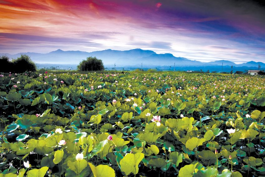
Map of Taiwan

  Yanshui

                   Wushantou Reservoir

                   Pingtung
                         Pingtung
                          County

   Little Liuqiu

                                   Kending

              Tourism Bureau, M.O.T.C.
                      Publication: February 2013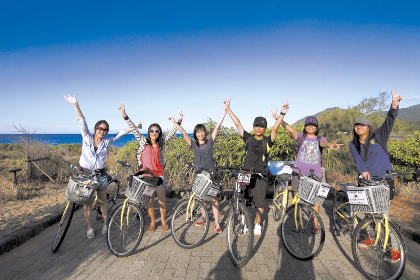
Words from the Director-General

               1   Map of Taiwan
    CONTENTS

               North Taiwan
               4
                 North Coast and Guanyinshan
                 National Scenic Area
               6   Fengzhimen Bikeway
               7   Jinshan-Wanli Bikeway

               8
                 Northeast and Yilan Coast National
                 Scenic Area
               10 Longmen-Yanliao Bikeway
               11 Old Caoling Circle Line Bikeway

               Central Taiwan
               12 Tri-Mountain National Scenic Area
               14 Emei Lake Bike Path
               15 Ershui Bikeway

               16	Sun Moon Lake National Scenic
                   Area
               18 Yuetan Bikeway
               19 Xiangshan Bikeway

               South Taiwan
               20 Siraya National Scenic Area
               22 Wushantou Hatta Bikeway
               23 Baihe Bikeway

               24	Southwest Coast National Scenic
                   Area
               26	Aogu Wetlands Bikeway
                   (Dongshi Farm Bikeway)
               27 Beimen Bikeway

2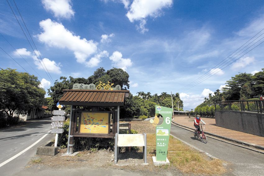
28 Maolin National Scenic Area
30 Anpo Tourist Cycle Path

32	Dapeng Bay National Scenic Area
34 Round-the-Bay Bikeway

East Taiwan
36	East Rift Valley National Scenic
    Area
38   Ruisui Bicycle Path
39   Dapo Pond Bikeway
40   Yuli Bikeway
41   Liyutan Bikeway
42   Guanshan Town Encircling Bicycle Path
43   Longtian Bike Path

44	East Coast National Scenic Area
46 Shimen-Changbin Bikeway
47 Sanxiantai Bike Route
48 Taiyuan Valley Bikeway

Challenging Route
49 Alishan National Scenic Area
	Provincial Highway 18 Competition Route

Offshore Islands
50 Penghu National Scenic Area
52 Magong City Bikeway
53 Huxi Bikeway

54 Visitor Information

                                             3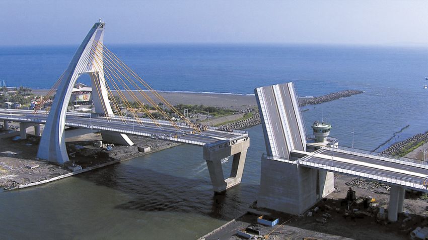
North Coast and
     Guanyinshan
     N at io      na l Sc en ic A re a

       The North Coast and Guanyinshan National Scenic
    Area welcomes visitors with distinctive landscapes and
    recreation resources. From the scenic North Coast Highway
    and geological wonders of Baishawan, Jinshan, and Yeliu
    to the Li Tien-lu Hand Puppet Historical Museum and
    Juming Museum, Taiwan's North Coast is well-endowed
    with attractions of both the natural and cultural kind. And
    there's no better way to enjoy it all than by cycling along the
    Fengzhimen and Jinshan-Wanli bikeways.

    Bikeway Information
    • Fengzhimen Bikeway:
     Datianliao➜Linshanbi Fishing Harbor        4.5km
    • Jinshan-Wanli Bikeway:
     Zhongjiao Beach ➜ Huanggang Bridge ➜ Jinshan Youth Activity
     Center ➜ Yuantan River Scenic Bridge ➜ Wetland wooden path ➜
     Beefwood Black Forest Area➜Taipower Second Nuclear Power Plant
        9.2km
    Public Transportation
    • Take the Kuo-Kuang Bus Jinshan line from Taipei Bus Station or the
       Royal Bus Yangmingshan-Jinshan line from the front of the Bureau of
       National Health Insurance building on Gongyuan Road. From Jinshan,
       you can take the Keelung Bus to Keelung or the Tamsui Bus to Tamsui
       and get off at scenic spots along the way.
    • From Tamsui MRT Station, take the Taiwan Tourist Shuttle's Crown North
       Coast Route to scenic spots en route to Keelung Railway Station.

    Bicycle Rental
    There are many bicycle rental shops in the Sanzhi and Jinshan areas.

4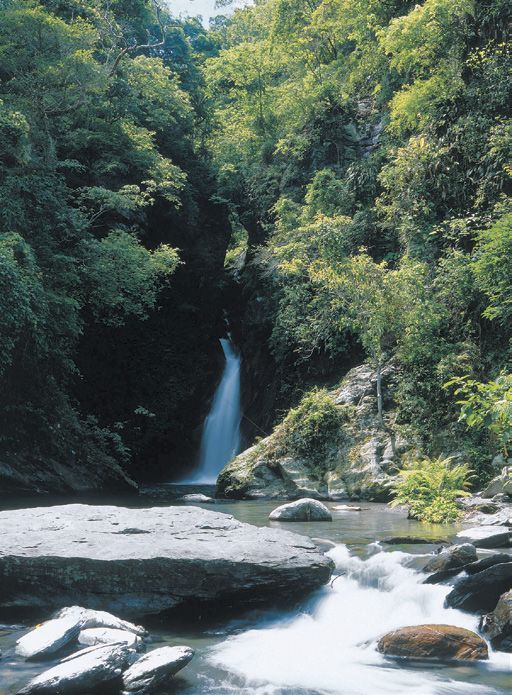
Visitor Information
• North Coast and Guanyinshan National Scenic Area Administration
    o. 33-6, Xiayuankeng, Shimen Dist., Demao Village, New Taipei City
   N
   (02) 8635-5100      09:00~17:00     www.northguan-nsa.gov.tw
 Sanzhi Visitor Center
    o. 164-2, Putoukeng, Puping Village, Sanzhi Dist., New Taipei City
   N
   (02) 8635-3640
 Jinshan Visitor Center
    o. 171-2, Huanggang Rd., Jinshan Dist., New Taipei City
   N
   (02) 2498-8980
 Yeliu Visitor Center
    o. 167-1, Gangdong Rd., Wanli Dist., New Taipei City
   N
   (02) 2492-2016
                                                                          5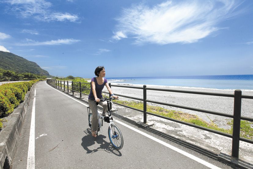
Fengzhimen Bikeway                                                           4.5
                                                                                 km

    Datianliao in Sanzhi   Linshanbi Fishing Harbor beside Baishawan in Shimen

    T    his bikeway is formed from a former country road and
         coastal wooden paths. The scenic route links Sanzhi and
    Shimen
    and passes
    by temples
    and natural
    attractions,
    including
    Linshanbi,
    Baishawan,
    algal reefs,
    and tidal
                  Qianshuiwan
    flats.

    Linshanbi
    This prominent cape is rich in lava andesite and ventifacts. It looks out
    to Baishawan and Fugui Cape and has sandy coasts and beefwood
    trees that lend a South Pacific feeling to the area.
    Baishawan Scenic Area
    Baishawan (“White Sand Bay”) earns its name from the fine seashell
    sand of its beaches. The bikeway here is lined by windbreak trees and
    commands expansive views of the ocean. In summer, the coastal
    sand here is delightfully adorned with the sun-like blooms of blanket
    flowers.

6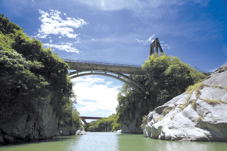
Jinshan-Wanli Bikeway

                           T   he Jinshan leg of the Jinshan-Wanli
                               Bikeway is a great choice for vigorous
                           seaside activity. In addition to beach and water
  Zhongjiao                recreation, visitors can enjoy seafood at Shuiwei
    Beach                  Fishing Harbor and tasty local snacks at Jinshan
 Huanggang
                           Old Street.
   Bridge
                           Shuiwei Fishing Harbor
Jinshan Youth              Shuiwei Fishing Harbor has the ambiance of a small
Activity Center            fishing village. Among the attractions here is the view
                           of the full moon reflected in the mirror-like waters of
Yuantan River
Scenic Bridge              the harbor. Known as the “floating moon of Shuiwei,”
                           this picturesque scene is counted among the eight
  Wetland                  scenic wonders of Jinshan. A trail ascends from the
wooden paths               harbor to Shitoushan Park, where visitors can enjoy
                           views of the Twin Candlestick Islets.
  Beefwood
 Black Forest              New Jinshan Beach
    Area
                           The golden beaches of crescent-shaped Jinshan Bay
   Taipower                attract a steady stream of visitors during the summer.
Second Nuclear             In addition to water recreation, you can enjoy a
 Power Plant               relaxing soak at the Jinshan Youth Activity Center hot
                           spring spa.
     9.2
        km                   No. 1, Qingnian Rd., Jinshan Dist., New Taipei City
                             (02) 2498-1190

                                                                                     7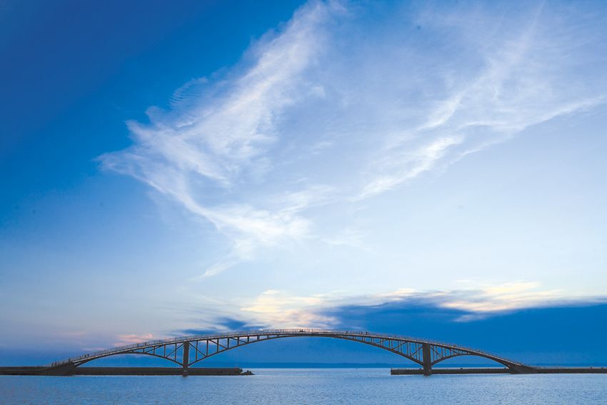
Northeast and
     Yilan Coast
     N at   io na l Sc en ic A re a

       Taiwan’s Northeast Coast is a portrait of geological beauty,
    with capes, bays, and sea-eroded rock formations speaking of
    nature’s sculptural mastery. Cyclists can get up close to these
    coastal wonders on the Longmen-Yanliao Bikeway and the
    Old Caoling Circle-Line Bikeway. The two connected routes
    also pass by Fulong, Sandiao Cape Lighthouse, Lailai Geo
    Area, the Old Caoling Tunnel Bikeway, and other visitor hot
    spots.

8
Bikeway Information
• Longmen-Yanliao Bikeway:
Fulong Railway Station➜Longmen Camp Site and Riverside Park➜
Longmen Suspension Bridge➜Yanliao Beach Park 4.5 km
• Old Caoling Circle Line Bikeway:
Fulong Railway Station➜Old Caoling Tunnel Bikeway➜Lailai Geo
Area➜Sandiao Cape Lighthouse➜Mao’ao Fishing Village➜Fulong
Railway Station 18.1 km
Public Transportation
• Take the Taiwan Railway to Fulong Station. Then take the Taiwan Tourist
Shuttle's Golden Fulong Route from Fulong Visitor Center to scenic
spots en route to Ruifang Railway Station.
• From Taipei Bus Station, take Kuo-Kuang Bus to Fulong; or from Keelung
Bus Station take the Keelung Bus to Fulong.
Bicycle Rental Service
There are several bicycle rental shops in front of Fulong Station, on
Fulong Street and Provincial Highway 2, and at the north entrance of the
Old Caoling Tunnel.
Travel Information
• Northeast and Yilan Coast National Scenic Area Administration
No. 36, Xinglong St., Fulong Village, Gongliao Dist., New Taipei City
(02) 2499-1115 08:30~17:30 www.necoast-nsa.gov.tw
Fulong Visitor Center
No. 38, Xinglong St., Fulong Village, Gongliao Dist., New Taipei City
(02) 2499-1210
9Longmen-Yanliao Bikeway
Fulong Railway Station Longmen Camp Site and Riverside Park Longmen 4.5
km
Suspension Bridge Yanliao Beach Park
T his bikeway goes from Fulong Railway Station to Yanliao
Beach Park, passing the camping area at Longmen
Riverside Park and Longmen Suspension Bridge on the
way. You can learn more about the coastal ecology from the
informative signs along the route. And from Yanliao, it is a
short cycle to the seafood mecca of Aodi Fishing Port.
Longmen Camp Site, Kayaking Area, and
Suspension Bridge
Longmen Suspension Bridge spans the Shuangxi River at a scenic
point where the river and ocean form a sand spit. The nearby
Longmen Camp Site is a well-provided camping area with facilities
for cycling, barbecues, and other recreation, Taiwan’s first large-scale
kayaking area is also located here.
No. 100, Xinglong St., Fulong Village, Gongliao Dist., New Taipei City
(02) 2499-1791 08:00~17:00
Yanliao Beach Park
The golden beach here stretches three kilometers and links with Fulong
Beach. The building at the park entrance was constructed in traditional
Fujianese-style with a trademark swallowtail roof. The Resistance Against
Japan Memorial is also located in Yanliao at the site where the Japanese
troops first landed in Taiwan after the island was ceded in 1895.
No. 45, Yanhai St., Gongliao Dist., New Taipei City (02) 2490-3991
09:00~18:00 (when water area is open)
08:30~17:30 (when water area is closed)
10Old Caoling Circle Line Bikeway T his bikeway passes through a railway
tunnel that was closed in 1986. The tunnel
was renovated and reopened as a cycling route
conceived as a “railway museum” with an old
world ambiance. The bikeway continues from the
tunnel along a loop route that brings the area’s
geological and scenic charms vividly into view.
Old Caoling Tunnel
Fulong Railway The Old Caoling Tunnel was the inspiration for the
Station
well-known Taiwanese folk song “Train Passing.” From
Old Caoling the entrance brickwork and train track design to coal-
Tunnel shaped lamps and train sound effects, the tunnel invites
Bikeway cyclists on a trip back in time to the earlier days of rail.
08:30~17:00
Lailai Geo Area
Sandiao Cape Lighthouse
Sandiao Cape Sandiao Cape Lighthouse looks out to the Pacific Ocean
Lighthouse
from the easternmost tip of Taiwan. This is a good spot
to take in the sea horizon and view of Turtle Island. The
Mao’ao Fishing
Village white tower of the lighthouse contrasts strikingly with
the blue sea, reminiscent of an Aegean scene.
Fulong Railway No. 38, Magang St., Fulian Village, Gongliao Dist., New
Station Taipei City
(02) 2499-1300 09:00~16:00 (closed on Mondays)
18.1
km
Fulong Beach
Fulong Beach is divided by the Shuangxi River into
inner and outer parts spanned by an arched bridge.
The beach is a good spot for kayaking, wind surfing,
surfing, and other water recreation.
No. 40, Xinglong St., Fulong Village, Gongliao Dist.,
New Taipei City
(02) 2499-2381 08:00~17:30
11Tri-Mountain
N at io na l Sc en ic A re a
The Tri-Mountain National
Scenic Area brings together
the Lion’s Head Mountain,
Baguashan, and Lishan
scenic areas. The area’s
lakeside charms come into
vivid view along the Emei
Lake Bike Path in the Lion’s
Head Mountain Scenic Area.
Visitors can also cycle along
the scenic Jiji Branch Line on
the Ershui Bikeway, located
in the Baguashan Scenic Area.
Bikeway Information
• Emei Lake Bike Path:
Lakeside Bike Path➜Ximaopu Suspension Bridge➜Maitreya Buddha/
Providence Maitreya Buddha Institute ➜ Shierliao Recreational
Agriculture Area➜Lakeside Bike Path 7 km
• Ershui Bikeway:
Ershuei Station/Train Display➜Yuanquan Railway Station ➜Mr. Lin’s
Temple➜Babaozhen Flood Gate 5.5 km
Public Transportation
• To get to the Lion's Head Mountain Scenic Area, take the Taiwan
Railway or THSR to Hsinchu Station and then take the Hsinchu Bus to
the various scenic sites. From Lion's Head Mountain Visitor Center, take
the Taiwan Tourist Shuttle's Lion's Head Mountain-Nanzhuang Route to
scenic spots en route to the Nanzhuang Visitor Center.
• Baguashan Scenic Area: Take the Taiwan Railway to Changhua Station or
Tianzhong Station and then take the Chang Hua Bus to the visitor sites.
Bicycle Rental
Bikes can be rented from the farms and tea plantations at Emei Lake.
There are also rental shops by Ershui Railway Station.
Travel Information
• Tri-Mountain National Scenic Area Administration
o. 738, Zhongzheng Rd., Wufeng Dist., Taichung City
N
(04) 2331-2678, 0800-012-118 (toll-free) Mon~Fri 08:30~17:30
www.trimt-nsa.gov.tw
• Lion’s Head Mountain Visitor Center
o. 60-8, Liuliao, Qixing Village, Emei Township, Hsinchu County
N
(03) 580-9296
• Songboling Visitor Center
o. 181, Sec. 2, Mingsong Rd., Mingjian Township, Nantou County
N
(049) 2580525
12Lion’s Head Mountain
Scenic Are
13Emei Lake Bike Path
7
km
Lakeside Bike Path Ximaopu Suspension Bridge Maitreya Buddha/Providence Maitreya
Buddha Institute Shierliao Recreational Agriculture Area Lakeside Bike Path
T he main part of Emei Lake Bike Path circles its scenic
namesake lake. This route offers vantages of the lake
and its surrounding mountains. The lake area is a habitat for
egrets and other waterfowl; and on summer nights, fireflies
light the air with their lantern dances here. The view is
especially captivating in April and May, when the snow-like
blooms of the tung trees adorn the landscape.
Ximaopu Suspension Bridge
The bike path
crosses over
the Ximaopu
Suspension
Bridge that
spans a finger
of the lake.
The bridge is
To Nanzhuang
a good place
to enjoy the
views of Emei
Lake and, in
the distance,
Lion’s Head
Mountain
and Wuzhi Mountain.
Maitreya Buddha • Providence Maitreya Buddha
Institute
The bronze Maitreya Buddha at Providence Maitreya Buddha Institute
towers 72 meters high, equal in height to a 24-story building. Six
hundred tons of bronze were needed to cast the statue, which has
become a new landmark at Emei Lake.
Shierliao Recreational Agriculture Area
Bordered by the Dapu Reservoir and Emei River, Shierliao Recreational
Agriculture Area includes organic farms with recreational facilities.
Visitors can enjoy the scenic lake and mountain surroundings, pick
vegetables and fruit, or relax with a cup of coffee.
14T his bikeway follows the Jiji Branch Line.
Seasonal coreopsis and sunflower blooms
add to the scenic rustic setting of this area.
Ershui Bikeway
Cyclists can also continue on to Jiji via the
Green Tunnel.
Babaozhen Flood Gate • Mr. Lin’s
Temple
Built in the early Qing period, Babaozhen is the biggest
irrigation canal system in Taiwan. The canal diverts
water from the Zhuoshui River for farming use in the
Changhua Plain. Mr. Lin’s Temple was built next to the
canal inlet in memory of a man who helped develop
the canal.
Ershui Station/
Train Display Ershui Railway Station • Old Train
Display Area
Yuanquan
Railway Two antique steam locomotives are on display by
Station the Ershui Railway Station. One is a Japanese-built
engine that was formerly used to carry senior officials.
Mr. Lin’s The other, made in Belgium, was known as the
Temple “Wufenzi” and used for transport by the Taiwan Sugar
Corporation.
Babaozhen
Flood Gate No. 1, Guangwen Rd., Ershui Township, Changhua
County
5.5 (04) 879-2027 06:00~24:00
km
15Sun Moon Lake
N at io na l Sc en ic A re a
Sun Moon Lake is a scenic jewel embraced by mountains
in the heart of Taiwan. Encompassing the Zhongming,
Toushe, and Shuili River recreation systems, this area
welcomes visitors with numerous attractions, from Checheng,
the Formosan Aboriginal Culture Village, Shuishe Great
Mountain, and Jiji Mountain to Mingtan Reservoir, Daguan
Power Plant, and the Shuili River. For cyclists, there are four
routes to enjoy at Sun Moon Lake and the surrounding area:
the Yuetan, Toushe, Xiangshan, and Zhongming bikeways.
You can also circle the lake along the round-the-lake highway.
The Yuetan and Xiangshan bikeways are the best choices for
enjoying the lake scenery.
16Shuishe Visitor Center
Entrance to Huantan Tunnel No. 1
Bikeway Information
• Yuetan Bikeway:
Xiangshan Visitor Center➜Toushe Dam➜Crescent Bay➜Entrance to
Huantan Tunnel No. 1 4km
• Xiangshan Bikeway:
Zhongxing Parking Lot in Shuishe➜Mingtan Legend Folk Museum ➜
Shuishe Dam➜Yongjie Bridge and Tongxin Bridge➜Xiangshan Visitor
Center 3km
Public Transportation
• Take the Taiwan Railway
or Taiwan High Speed Rail
to Taichung Station. Then
take the Taiwan Tourist
Shuttle Sun Moon Lake
Route (Nantou Bus) to Sun
Moon Lake.
• From Taipei Bus Station
take the Kuo-Kuang Bus to
Sun Moon Lake.
• From Taichung Bus Station
take the Nantou Bus or
Renyou Bus to Sun Moon
Lake.
Bicycle Rental
Rental shops are located
catty-cornered across from
Xiangshan Visitor Center
and near the Shuishe Visitor
Center.
Travel Information
• Xiangshan Visitor Center
o. 599, Zhongshan Rd., Yuchi Township, Nantou County
N
(049) 285-5668, (049) 234-1256 09:00~17:00
www.sunmoonlake.gov.tw
Shuishe Visitor Center
o. 163, Zhongshan Rd., Yuchi Township, Nantou County
N
(049) 285-5489; 0800-855-595 (toll-free) 09:00~17:00
17Yuetan Bikeway 4
km
Xiangshan Visitor Center Toushe Dam Crescent Bay Entrance to Huantan Tunnel No. 1
T he route from
Xiangshan
Administrative
Center passes
by the south
shore of Yuetan
(Moon Lake),
Toushe Dam, and
Crescent Bay to
the mouth of Huantan Tunnel No. 1. The section winding
along the south bank of Yuetan offers good vantages of the
Toushe Basin to the south, Qinglong Mountains to the north,
and checkerboard like fields of the surrounding farms.
Xuanguang Temple
This temple
was built on
the shore of
Sun Moon
Lake to hold
a relic of
the monk
Xuanzang,
returned by Xuanzang Temple
the Japanese
in 1958. The
relic was
later moved
to Xuanzang
Temple, but
Xuanguang Entrance to Huantan Tunnel No. 1
To Shuili
Temple has
retained its place among the must-visit attractions at Sun Moon Lake.
No. 338, Zhongzheng Rd., Riyue Village, Yuchi Township, Nantou
County
05:00~21:00
Xiangshan Visitor Center
Japanese architect Norihiku Dan designed the Xiangshan Visitor
Center as an extension to the landscape of Sun Moon Lake. The site
and building are cleverly integrated with the surrounding terrain. Two
old-style wooden boats occupy the center’s ring-shape pool. The
Xiangshan Café is another attraction here.
Sun Moon Lake Cable Car
The Sun Moon Lake Cable Car travels between Sun Moon Lake and
the Formosan Aboriginal Culture Village. The 1.87-kilometer journey
takes about seven minutes and offers stunning views of Sun Moon
Lake.
Cable car route: Formosan Aboriginal Culture Village to Sun Moon
Lake (in front of the Youth Activity Center near Ita Thao)
(049) 285-0666 Weekdays 10:30~16:00; Weekends 10:00~16:30
18Xiangshan Bikeway Y ongjie Bridge and Tongxin Bridge are
among the most visually arresting sites
along this route. The half-moon-shaped Tongxin
Bridge spans the water by a beautiful lakeside
park. The bikeway over the bridges passes by
the Xiangshan Visitor Center, where visitors can
enjoy a cup of Huisun Coffee and tea egg along
with the lakeside view. The route also links to
Shuishe Dam Park and Mingtan Legend Folk
Museum.
Maolan Mountain
Trail
Zhongxing
Parking Lot in
Shuishe
Mingtan
Legend Folk
Museum
Shuishe Dam
Yongjie Bridge
and Tongxin
Bridge Shuishe Pier
Shuishe Pier is one of the three main piers at Sun Moon
Xiangshan
Visitor Center Lake. Shueishe is packed with hotels, restaurants, and
souvenir shops. Boat tours also leave from this area. A
3 wood-plank trail next to the pier follows a tree-lined
km
route with cryptomeria, golden chicken ferns, and
other scenic attractions along the way.
Yongjie Bridge and Tongxin Bridge
Located along the Xiangshan Bikeway, these two
white spans have steel piers and wood-paved roads.
The bridges offer sweeping views of Sun Moon Lake.
On Tongxin Bridge there is also a ramp linking to a
bicycle rental station.
19Siraya
N at io na l Sc en ic A re a
The Siraya National Scenic Area spreads over the
topographically-rich eastern part of the Jianan Plain. Waterfalls,
seven reservoirs, Siraya indigenous culture, and specialty farm
products like mangoes, longans, and coffee all contribute to the
area’s rustic appeal. For cyclists, the Wushantou Hatta Bikeway
in Guantian District is a good choice for exploring the local
history, while nature and flower lovers will be well served by
the Baihe Bikeway in Baihe District.
Water and Fire Spring
20Bikeway Information
• Wushantou Hatta Bikeway:
Hushan Police Station ➜ Yoichi Hatta Memorial Park ➜ Longhu
Temple➜Viewing platform➜Jianan Canal Water Outlet➜Wushantou
Reservoir 6 km
• Baihe Bikeway:
Baihe Lotus Park➜Lotus Explorer Museum➜Zhumen Green Bikeway➜
Sheng’an Green Tunnel➜Baihe Pottery Shop➜Water and Fire Spring
20 km
Public Transportation
Take the Taiwan Railway to Xinying Station and continue on the Singing
Bus to Baihe or Liujia (Wushantou Reservoir).
Bicycle Rental Service
There are several bike rental shops near the Wushantou Scenic Area and
along the Baihe Bikeway.
Travel Information
• Siraya National Scenic Area Administration
No. 1-1, Xiancao, Xiancao Village, Baihe Dist., Tainan City
(06) 684-0337, 0800-580-762 08:30~17:30
www.siraya-nsa.gov.tw
• Lingding Information Station
Dacheng Temple, Lingding Park, Guanziling
09:00~17:00
21Wushantou Hatta Bikeway 6
km
Hushan Police Station Yoichi Hatta Memorial Park Longhu Temple Viewing platform
Jianan Canal Water Outlet Wushantou Reservoir
T his bikeway offers vantages of major hydraulic works in
Wushantou, including the Jianan Canal and Wushantou
Reservoir. The route links to Yoichi Hatta Memorial Park,
Lianzhan Pavilion Viewing Platform, Jianan Canal, and the
historic Longhu Temple. Cyclists can also enjoy the water
caltrops lining this scenic route from September to October.
Yoichi Hatta Memorial Park
This park
was created Liujia
in honor of District
Yoichi Hatta,
a Japanese
engineer who
designed
and built the
Wushantou
Reservoir
and Jianan
Canal system.
The park is
located at the
base of the
Wushantou
housing complex where Hatta lived. Four of the Japanese-style
buildings here have been restored along with the surrounding
garden and pond. There are also multimedia exhibition rooms in two
refurbished storehouses.
No. 68-2, Jianan Village, Guantian Dist., Tainan City
(06) 698-2103 Tues~Sun 09:00~17:00 (closed on Mondays)
Longhu Temple
Located on the edge of the Wushantou Reservoir, this well-known
300-plus-year-old temple is the religious center of Liujia District. The
temple is surrounded by water on three sides, giving it an island-like
feel. Due to its beauty, it is known as one of the eight scenic wonders
of Longhu.
No. 1, Lane 198, Shanhu Rd., Liujia Dist., Tainan City (06) 698-2205
22B aihe’s famous lotus flowers blossom into
a sea of color during the summer months
of June to August. The blooms and other local
Baihe Bikeway
sights can be enjoyed along several scenic
bikeways through the district, including the
Zhumen Green Bikeway, Sheng’an Green
Tunnel, and a route linking the Baihe Pottery
Shop to the Water and Fire Spring.
Baihe Lotus Park
Lotus Explorer
Museum
Zhumen Green
Bikeway
Sheng’an Green
Tunnel
Water and Fire Spring
Baihe Pottery
Shop
Baihe Lotus Park • Lotus Explorer Museum
Water and Fire The namesake blooms at Baihe Lotus Park blanket this
Spring four-hectare park with seasonal colors each summer.
20 Visitors can enjoy the floral tapestry from the park’s
km viewing pavilions and wooden walkways, or head to
the nearby Lotus Explorer Museum, Taiwan’s first lotus-
themed community museum, to learn more about the
local culture and ecology.
No. 22-10, Yufeng Village, Baihe Dist., Tainan City
(06) 685-2983
Zhumen Green Bikeway • Sheng’an Green
Tunnel
The Zhumen Green Bikeway links with the Sheng’an
Green Tunnel to form a cool tree-shaded route
stretching several kilometers. The scenery along the
route is especially beautiful during the dawn and dusk
hours, when the cool breeze and occasional scent of
lotus accompany the ride. 23Southwest Coast
N at io na l Sc en ic A re a
Spanning Yunlin County, Chiayi County, and Tainan City,
the Southwest Coast National Scenic Area combines cultural
richness with a wealth of scenic and natural resources. The
sandbars, dunes, lagoons, estuaries, and coastal wetlands
here are home to mudskippers, fiddler crabs, mangroves,
and the rare black-faced spoonbill. The area’s past as a center
of Taiwan’s salt industry also endures at the Jingzaijiao Tile-
Paved Salt Field in Beimen and the Qigu Salt Mountains. All
of these attractions and more await visitors along the Aogu
Wetlands and Beimen bikeways.
Bikeway Information
• Aogu Wetlands Bikeway (Dongshi Farm Bikeway):
Dongshi Ecological Museum➜Wetlands Bikeway 14.3km
• Beimen Bikeway:
Beimen Visitor Center➜Taiwan Black-foot Disease Socio-Medical
Service Memorial House➜Money Coming Grocery Store➜Beimen Old
Street➜Salt Pan Scenic Area➜Salt Flat Wetlands➜Salt Pan Restoration
Area➜Jingzaijiao Tile-Paved Salt Fields 2.4km
Public Transportation
• Take the THSR or Taiwan Railway to Chiayi Station. Then take the Chiayi
Bus (Puzi Line) to Puzi and continue by the tidal flat line to the Aogu
Wetland Forest Park.
• Take the THSR to Chiayi Station and then continue by the Taiwan Tourist
Shuttle (Southwest Coast Route) to Beimen Visitor Center.
24Jingzaijiao Tile-Paved
Salt Fields
Bicycle Rental
• A ogu Wetlands Bikeway: Bikes can be rented from the Sigu
Community Development Association.
• B eimen Bikeway: Bicycle rental service is provided by the Money
Coming Grocery Store located catty-cornered across from the
Southwest Coast National Scenic Area Administration.
Travel Information
• Southwest Coast National Scenic Area Administration
No. 119, Jiucheng, Beimen Village, Beimen Dist., Tainan City
(06) 786-1000. Customer Service Hotline: (06) 786-0000
08:30~17:30 www.swcoast-nsa.gov.tw
Beimen Visitor Center
No. 200, Beimen Village, Beimen Dist., Tainan City
(06) 786-1017 09:00~17:30
Budai Visitor Center
No. 61, Shun’an Rd., Budai Township, Chiayi County
(05) 3470051 09:00~17:30
25Aogu Wetlands Bikeway 14.3
km
(Dongshi Farm Bikeway)
Dongshi Ecological Museum Wetlands Bikeway
T he Aogu Wetlands are located at the confluence of the
Beigang and Liujiao Dapai rivers. The estuaries, fish
farms, and beefwood forests provide an ideal habitat for the
more than 200 species of birds that can be found here. Visitor
facilities here include a 900-meter wooden path, kilometer-
long trail, eight viewing platforms, and over a dozen
birdwatching areas.
Aogu Wetlands
The 1,470-hectare Aogu Wetland Forest Park is home to 243 species
of birds, including the rare black-winged kite, little tern, and black-
faced spoonbill. The wetland is an important stopping point on the
Asia-Pacific flyway, adding to the area’s reputation as the premier
birdwatching destination on the southwest coast. There are plenty
of cultural attractions to enjoy nearby as well, among them Gangkou
Temple, Dongshi Fishing Harbor, and the Dongshi Ecological Museum.
No. 54,
Sigu, Aogu
Village,
Dongshi Birdwatching
Township, spots
C h i a y i
County
(05) 360- Birdwatching Entrance to
1801 spots Aogu Farm
Birdwatching
spots
Birdwatching
spots
Birdwatching
Birdwatching spots
spots
26Beimen Bikeway T his bikeway links together the top visitor
sites in Beimen. Setting out from the Beimen
Visitor Center, the route passes Beimen Old
Street, Zhongzhou Salt Fields, Jingzaijiao Salt
Fields, and Beimen Lagoon. Visitors can also
experience the region’s fishing village culture
and get an up-close look at the rich ecology of
the Beimen Wetlands along the way.
Beimen Visitor Center
Beimen Visitor
Center
Taiwan Black-
foot Disease
Socio-Medical
Service
Memorial Jingzaijiao Tile-Paved Salt Fields
House
Money Coming
Grocery Store
Taiwan Black-foot Disease Socio-
Beimen Old
Street Medical Service Memorial House
This memorial house is located in a former clinic
Salt Pan Scenic donated by physician Wang King-ho. Dr. Wang
Area dedicated years of his life treating patients with black
foot disease, an affliction once prevalent in these
Salt Flat
Wetlands parts. The displays at the memorial house include
medical instruments and information on patients with
Salt Pan blackfoot disease.
Restoration No. 27, Yonglong Village, Beimen Dist., Tainan City
Area (06) 786-2012 Wed~Sun 09:00~17:00 (closed on
Mondays and Tuesdays)
Jingzaijiao
Tile-Paved Salt Jingzaijiao Tile-Paved Salt Fields
Fields
With a history dating back over 190 years, the
2.4 Jingzaijiao Tile-Paved Salt Fields are the oldest
km surviving salt fields of their kind in Taiwan. Visitors can
enjoy the eye-catching mosaic of tiles covering the
fields or experience first-hand the process of traditional
salt drying, raking, and gathering.
Beimen Visitor
Center
This visitor center occupies
a refurbished former
warehouse on the southwest
side of the Beimen Salt Works.
Among the visit-worthy
attractions here are paintings
by artist Hung Tung and
a sperm whale specimen
display.
27Maolin
N at io na l Sc en ic A re a
The Maolin National Scenic Area stretches from north
to south through a topographically rich region formed by
Alishan, Yushan, the Central Mountain Range, and three
major rivers. Butterflies, waterfalls, and indigenous traditions
contribute to the area’s natural and cultural diversity. The
local aboriginal culture is evident in the totem designs of
the milestone markers and rest stops along the Anpo Tourist
Cycle Path, southern Taiwan’s first mountain bikeway.
Pingtung County
Changzhi
Pingtung City Township
28Bikeway Information
Anpo Tourist Cycle Path:
Saijia Recreation Area➜Koushe➜Ma’er➜Anpo➜Qingshan➜County Hwy
185 12 km
Public Transportation
• Take the Taiwan Railway to Pingtung Station and then take the
Pingtung Bus Guanfu-Gaoshu route to the stop before Guangfu Bridge.
• Take the THSR to Zuoying Station and continue by train to Pingtung
Station. Then take the Pingtung Bus Guanfu-Gaoshu route to the stop
before Guangfu Bridge and walk about 15 minutes towards the Saijia
Recreation Area.
Bicycle Rental
There is no bicycle rental service in Sandimen Township, so cyclists need
to bring their own bikes.
Travel Information
• Maolin National Scenic Area Administration
o. 120, Saijia Lane, Saijia Village, Sandimen Township, Pingtung
N
County
(08) 799-2221; 0800-600-766 (toll-free)
08:30~17:30 www.maolin-nsa.gov.tw
Majia Visitor Center
o. 14-20, Liangshan, Neighborhood 1, Liangshan Village, Majia
N
Township, Pingtung County
(08) 799-1663
29Anpo Tourist Cycle Path T he bike path from Ma’er Village to Anpo
Village is a maple-lined route interspersed
with lush pineapple and papaya farms. The
path has several sloping sections of various
grades, and rest stops along the way.
Anpo Tourist Cycle Path
Ma’er
Pingtung County
Saijia
Recreation Koushe Village
Area This Paiwan community is located near the Shakalan
River. A stone monumental arch at the entrance is
Koushe mounted by statues of the chief with two hunters and
hounds, vividly presenting the village’s indigenous
Ma’er roots.
Anpo Ma’er Village
Ma’er Village is approached along a maple-lined street.
Qingshan
A statue depicting an aboriginal brave on horseback
County Hwy greets visitors at the entrance. The community’s
185 indigenous culture is also apparent in the totems that
can be found throughout the village.
12
km
Anpo Village
Anpo Village is located in a scenic valley steeped in
scenic charm. Many of the rocks in the valley have
been sculpted over the years into unusual shapes by
the erosive power of the river and waterfalls.
30Qingshan Village
Qingshan is home to a well-known picnic and water recreation area
known as “Poseidon’s Palace”: a name inspired by the area’s myth-
like landscape of strange peaks, gorges, and deep pools. Haishen
(Poseidon) Waterfall and Wenli Waterfall are among the other
attractions here.
31Dapeng Bay
N at io na l Sc en ic A re a
The Dapeng Bay National Scenic Area covers the coastal
lagoon area of Dapeng Bay and the Liuqiu Scenic Area.
The bay is almost entirely enclosed by a sand spit formed
by sedimentation from the Linbian and Donggang rivers.
Major scenic spots in the area include the Qingzhou Coastal
Recreation Area and Pen Bay National Leisure Zone. Visitors
can also enjoy the local lagoon and wetland ecology along the
Round-the-Bay Bikeway, or head out to Oyster Shell Island
for a glimpse of the area’s oyster industry.
Bikeway Information
Round-the-Bay Bikeway:
Dapeng Bay Visitor Center ➜Pen Bay National Leisure Zone ➜Datan
Wetlands ➜Common-use Reservoir ➜Right Bank Wetlands ➜Qifeng
Wetlands ➜ Bayside Park ➜ Oyster Shell Island ➜ Qingzhou Coastal
Recreation Area➜Dapeng Bay Bridge➜Mangrove Eco-park➜Sankong
Bridge➜Dapeng Bay Visitor Center 11.6 km
Public Transportation
• Take the Taiwan Railway to Kaohsiung Station and then take the Chung
Nan, Pingtung, Kaohsiung, or Kuo-Kuang bus Kending route (via
Donggang)
• Take the THSR to Zuoying Station in Kaohsiung. Then take the Kending-
bound (via Donggang) Chung Nan, Pingtung, Kaohsiung, or Kuo-Kuang bus;
or take the Taiwan Tourist Shuttle's Kending Express Line to Dapeng Bay.
• Take the Kuo-Kuang Bus Donggang route from Taipei Bus Station.
32Pingtung
County
Bicycle Rental
Bicycle rental service is available at the Pen Bay Cycle Station in the
Pen Bay National Leisure Zone. The station also provides bicycle repair,
roadside assistance, bicycle parts, and travel information services.
Travel Information
Dapeng Bay National Scenic Area Administration and Visitor
Center
No. 169, Datan Rd., Donggang Township, Pingtung County
(08) 833-8100 Mon~Fri 08:30~18:00 www.dbnsa.gov.tw
33Round-the-Bay Bikeway
T he Round-the-Bay Bikeway is a circular
path that takes about two hours to cycle.
Lagoons, fishing villages, and the sunset view
from the bay seawall are among the highlight
attractions on this route. Vast fish farms,
mangrove wetlands, and ocean views as far
as the eye can see further add to the scenic
tapestry that is Dapeng Bay.
Dapeng Bay Visitor Center
Dapeng Bay This eye-catching visitor center is built over a small
Visitor Center lagoon. Visitors can go rowing here or watch the
fiddler crabs, mudskippers, and other denizens of the
Pen Bay mangrove forest. The café at the center projects over
National the water and offers an excellent view of the bay.
Leisure Zone
No. 168, Datan Rd., Dapeng Village, Donggang
Datan Township, Pingtung County
Wetlands (08) 833-8100 Mon~Fri 08:30~18:00 www.
dbnsa.gov.tw
Common-use
Reservoir Pen Bay National Leisure Zone
Pen Bay has facilities accommodating a wide range
Right Bank of activities, from ultralight flying and lake tours to
Wetlands canoeing and windsurfing. The zone is home to
Taiwan’s first legal ultralight aircraft flying club, as well
Qifeng
Wetlands as an old military tunnel open for visitors to explore..
No. 53, Dapeng Rd., Donggang Township, Pingtung
Bayside Park County
(08) 833-9111, (08) 835-1788
Oyster Shell www.thepenbay.com.tw
Island
Qingzhou
Coastal
Recreation
Area
Dapeng Bay
Bridge
Mangrove
Eco-park
Sankong
Bridge
Dapeng Bay
Visitor Center
11.6
km
34Oyster Shell Island
This island was formed in Dapeng Bay by the discarded shells of
oysters cultivated in the area over a period of decades. A witness
to the area’s once-thriving oyster industry, the island is completely
submerged at high tide and can only be seen when the water ebbs.
Visitors can take a boat tour to the island and enjoy a seafood meal
during their stay.
Dapeng Bay Bridge
Taiwan’s first movable bridge for sailboat traffic, Dapeng Bay Bridge
is an asymmetrical cable-stayed single-tower span measuring 579
meters long. The bridge can be lifted to an angle of 75 degrees in
just two minutes. There is a bridge-opening show at 5:00 p.m. every
Saturday and Sunday.
Constructed Wetland Park
This park encompasses the Datan Wetlands, Pengcun Farm Wetlands,
Right Bank Wetlands, Left Bank Wetlands, Qifeng Wetlands, and
Mangrove Eco-park. The wetlands here have been constructed to
process wastewater from the surrounding fish farms. In addition to
the area’s dominant black mangrove, several nearly extinct mangrove
species, including the four-petaled mangrove, red mangrove,
and lumnitzera, are being restored at the wetlands, adding to the
ecological diversity of this area.
35East Rift Valley
N at io na l Sc en ic A re a
The green plains of the East Rift Valley extend along a
narrow corridor straddling Hualien and Taitung counties.
Verdant mountains and scenic farmland meet in a land as
varied in its topography of gorges, waterfalls, hot springs,
meanders, and river terraces as it is rich in culture, with a
history blending prehistoric, indigenous, and pioneer roots.
There are also several excellent cycling routes here to enjoy it
all.
36Bikeway Information
• Ruisui Bicycle Path:
Ruisui Railway Station ➜Ruibei Cycling Station ➜Malangou River
Bridge➜Fuyuan Railway Station 9.7 km
• Dapo Pond Bikeway:
Chishang Railway Station ➜Chishang Lunchbox Museum ➜Dapo
Pond➜Jinyuen Field Side Club➜Daguan Pavilion➜Fuzun Big Water
Wheel➜Dapo Pond➜Chishang Railway Station 8 km
• Yuli Bikeway:
Yuli Railway Station➜Yuli Bridge➜Antong Bicycle Stop➜Antong Hot
Spring Area➜Old Dongli Railway Station 9.5 km
• Liyutan Bikeway:
Liyu Lake Visitor Center➜Tanbei Water Park➜Liyutan Rest Stop➜Liyu
Trail head➜Tannan Guanyin Pavilion➜West Shore Leisure Wharf➜
Taiwan Fisheries Research Institute 5.2 km
• Guanshan Town Encircling Bicycle Path:
Guanshan Railway Station➜Start of the Guanshan Bicycle Path ➜
Guanshan Canal ➜Sun Moon Viewing Pavilion ➜Water Park South
Entrance➜Water Park Main Entrance 13 km
• Longtian Bike Path:
Luye Railway Station➜Longtian Elementary School➜Bunun Tribal
Leisure Farm 5.2 km
Public Transportation
• Take the Taiwan Railway to Hualien Station and then take the Taiwan
Tourist Shuttle's Taroko Gorge Route to the scenic spots along the way.
• From Hualien or Taitung you can take the mountain lines (Shoufeng, Fenglin,
Guangfu, Fuyuan, Ruisui, Yuli, Fuli, Chishang, Guanshan, or Luye routes) of the
Hualien or Diing Dong bus to scenic spots in Hualien and Taitung.
Bicycle Rental Service
1. Bike rental shops are located in front of Ruisui Railway Station and at
Liyutan Visitor Center.
2. There are several bike rental shops on Zhongshan Road (about 10
minutes from Chishang Railway Station).
3. You can rent bicycles from most area B&Bs and hotels as well as the
Wanan Community Rice Village Museum.
4. Bikes can be rented from the Niu’aohua Visitor Center at Yuli Railway
Station as well as at shops near the station and in town.
5. Bikes can be rented at the Old Station north of Guanshan Railway
Station and at the entrance to the Guanshan Bicycle Path.
6. Bike rental shops are located on Guangrong Road and Yongle Road in Luye.
Travel Information Service
East Rift Valley National Scenic Area Administration
No. 168, Sec. 2, Xinghe Rd., Neighborhood 17, Hegang Village, Ruisui
Township, Hualien County (03) 887-5306, 0800-000-115 (toll-free)
08:30~17:30 www.erv-nsa.gov.tw
Liyu Lake Service Station and Visitor Center
No. 100, Huantan North Rd., Chinan Village, Shoufeng Township,
Hualien County (03) 864-1691
Luoshan Service Station and Visitor Center
No. 39, Neighborhood 9, Luoshan Village, Fuli Township, Hualien
County (03) 882-1725
Dapo Pond Visitor Center
No. 1, Zhongyi Rd., Chishang Township, Taitung County
(089) 862-041
Luye Service Station and Visitor Center
No. 46, Gaotai Rd., Yong’an Village, Luye Township, Taitung County
(089) 551-637
37Ruisui Bicycle Path
Main Route: Ruisui Railway Station Ruibei Cycling Station Malangou River 9.7
Bridge Fuyuan Railway Station km
Main Route Extension: Ruisui Railway Station Tree-shaded Boulevard 11.3
Tobacco Barns Camphor Boulevard Hongye River Wall Ruisui Pasture km
Ruisui Railway Station
S etting out from Ruisui Railway Station, this bikeway
passes through a rustic landscape of hot springs, pastures,
tea farms, streams and historic tobacco buildings. In addition
to the main route, there are two branch routes about 10 to 12
kilometers long. The famous Ruisui Pasture and hot spring
area are also located along this route.
Ruibei
Cycling
Station
The typhoon-
damaged
Ruisui section
of the Eastern
Railway line 9.7km
was elevated,
idling the old
Ruibei Station
and ground-
level tracks.
The old
station has
since been
11.3km
repurposed
as the Ruibei
Cycling
Station and the retired track has been repurposed as the Ruisui Bicycle
Path.
Malangou River Bridge
This bridge spans the Malangou River linking the Ruisui area and
Fuyuan Butterfly Valley. This section of the bikeway is lined with cherry
trees and is especially eye-catching in the blossom season.
38Main Route: Chishang Railway Station Chishang Lunchbox
Museum Dapo Pond Jinyuen Field Side Club 8
Daguan Pavilion Fuzun Big Water Wheel Dapo Pond km
Chishang Railway Station
Dapo Pond Bikeway
Wan’an Branch: Jinyuen Field Side Club Wan’an Park 2.9
Wanxin Road (“Mr. Brown Avenue”) Daguan Pavilion km
Wanxin Branch: Fuzun Big Water Wheel Chishang Bridge
Chishang Canal Water Conservation Park Chishang eco 6.5
fish farms Chishang Pastoral Resort Hakka Cultural Park km
Chishang Township Farmers’ Association Tourist Rice Mill
Chishang Railway Station
C hishang is famous for its premium quality
r i ce a n d h e a r t y b ox ed l u n c h e s. Th e
township also invented the flat cocoon and is
a well-known producer of silk. Dapo Pond is
the town’s best-known scenic area. The pond is
circled by a bikeway that offers a good route for
enjoying the tranquility and pastoral landscape
of the area.
Hakka
Cultural Park
Dapo Pond
This fault-sag
pond is home to
an abundance
of plant and
animal life.
The lakeside
trail/bikeway
is a good route for bird watching, fishing, hiking and other leisure
activities.
Fuzun Big Water Wheel
This old-style water wheel looks like a miniature Ferris wheel. The
wheel is idled during the fallow period but spins and gurgles with
water during the farming season, adding to the area’s scenic charm.
Wanxin Road (“Mr. Brown Avenue”)
This small country road meanders through rustic country and, on
a clear day, offers vantages of the entrance to the Southern Cross-
Island Highway and distant peaks. The road earned its nickname as
“Mr. Brown Avenue” after it was prominently featured in a Mr. Brown
Coffee ad.
39Yuli Bikeway
Yuli Railway
Station Niu’aohua Visitor Center
Yuli Bridge
Antong Bicycle
Stop
Antong Hot
Spring Area
Old Dongli
Railway
Station
9.5
km
Y uli Bikeway follows the route of an old rail line. Although
the trains no longer run here, cyclists can still enjoy the
feeling of speeding along the tracks. Yuli’s scenic beauty and
the Antong Hot Spring Area are among the rewards of the trip.
Yuli Bridge
Yuli Bridge is located on Provincial Highway 9 near the bikeway
section crossing the Xiuguluan River between Yuli and Dongli. It is
tempting to speed along this arrow-straight part of the route, but
make sure to slow down to enjoy the views of the Xiuguluan River,
Central Mountain Range, and town.
Daylily fields on Chike Mountain
The daylilies on Chike Mountain blossom from August to September,
blanketing the fields here in reddish-yellow blooms. Every square inch
of rooftop in the area also seems to be covered with the flowers, set
out to dry.
Antong Hot Spring Area
Antong’s history as a hot spring destination dates back to 1930, when
the Japanese built a police guesthouse with baths here. After Taiwan’s
restoration to Chinese administration in 1945, the guesthouse became
the Antong Hot Spring Hotel, and since then several other spas have
sprouted up in the area.
40T he Liyutan Bikeway connects to Qixingtan
via the Two Lakes Bikeway, providing a
Liyutan Bikeway
convenient route for seeing the main visitor
sites in Hualien City (it takes about 30 minutes
to circle the lake). The fields along the route
come alight with fireflies on evenings from
April to June.
Liyu Lake
Visitor Center
Tanbei Water
Park
Liyutan Rest
Stop Wenlan
Elementary
School Liyu Trailhead
Liyu Trail head To Shoufeng
Tannan
Guanyin Tanbei Water Park
Pavilion This water-themed park brings together expansive
green areas with excellent facilities and attractions,
West Shore including 15 eye-catching sculptures. This is a good
Leisure Wharf
place to relax, enjoy the views, and have a picnic.
Taiwan
Fisheries
West Shore Leisure Wharf
Research West Shore Leisure Wharf is a good place to grab a bite
Institute to eat or catch a boat for a tour of the lake. There is a
three-story viewing pavilion at the wharf leisure area;
5.2
km to its south is a constructed wetland with wastewater
treatment and environmental protection functions.
Taiwan Fisheries Research Institute
Numerous species of native river fish and common
tropical and freshwater fish can be seen at this
institute. Other attractions include marsh and lake
ecosystems, outdoor breeding pools, and the view of
Liyu Lake from the institute’s second floor.
41Guanshan Town Encircling 13
Bicycle Path
km
Guanshan Railway Station Start of the Guanshan Bicycle Path Guanshan Canal Sun
Moon Viewing Pavilion Water Park South Entrance Water Park Main Entrance
T he Guanshan Town Encircling Bicycle Path traces a
riverside route through a scenic mountain setting. Riders
can enjoy the farmland views along the banks of Hongshi
River, follow the Guanshan Canal on a winding route through
the forests, and then head downhill along the Kanding and
B e i n a n
rivers to
Guanshan
Water Park.
If time
allows,
make sure
to visit
downtown
Guanshan
for the local
cuisine.
Guanshan Township Farmers’ Association Tourist
Service Center
Located in a former rice mill and granary, this center is good place
to learn about Guanshan’s rice industry. Visitors can listen to brief
introductions, tour the rice mill, enjoy a DIY boxed lunch, and
experience rice milling operations first-hand at this “School of Rice.”
No. 24-1, Changlin Rd., Guanshan Township, Taitung County
(089) 814-903 08:00~17:00
Guanshan Water Park
This eco-themed water park is well equipped for water recreation
and games. A bike path circles the park and can be cycled in about 30
minutes. There are also viewing pavilions and platforms, birdwatching
blinds, an artificial lake, eco island, and other facilities for learning
about environmental protection.
42Longtian Bike Path T his bikeway departs from Luye Railway
Station and follows Guangrong Road past
Longtian Elementary School. It then ascends a
long uphill section towards Luye Highlands,
with views of the terraced Luye Valley along
the way. The route then heads gently downhill
to Yong’an Community and the Green Tunnel.
After reaching the north end of the Green
Tunnel, you can backtrack a bit to Longtian
Village for a break and some local cuisine.
Main Route:
Luye Railway
Station
Longtian
Elementary
School
Luye Highlands
Bunun Tribal
Leisure Farm
5.2
km
Luye Highlands
Branch Located at the south side of the Luye tourist tea farms,
Route: the Luye Highlands rise 368 meters above sea level.
Longtian The 150-meter drop, sunny year-round weather, and
Village
moderate air currents all contribute to this area’s
Luye Service popularity as a paragliding destination. Visitors can
Station and watch the gliders or take a hot air balloon ride from
Visitor Center the platform between the two launching platforms.
Luye Highlands Longtian Village
Longtian Village is arranged in a chessboard-
Wuling Green like pattern of homes and farms and still retains a
Tunnel
strong Japanese feeling from its roots as a Japanese
15 immigrant community. Madagascar almond trees line
km
the village roads, forming lush green corridors. The
village is also a haven for butterflies, which can be
seen flitting along the country roads here from March
to October.
Luye Tea
A warm and humid climate, fertile soil, ample sunshine,
and hilly terrain with good drainage make Luye an
excellent spot for growing tea. There are nearly 400
hectares of plantations in the township growing
mainly spring and winter varieties of tea, with oolong
foremost in the mix. Visitors can taste and purchase
the local teas at teahouses and tea sales and exhibition
centers throughout the village.
43East Coast
N at io na l Sc en ic A re a
The East Coast National Scenic Area
occupies a narrow swath hemmed in by the
mountains and sea. Spanning the Tropic
of Cancer, it brings together tropical and
subtropical climates and a host of animal
and plant life. Whale watching, scuba diving,
bird watching, and rafting are among the
many activities to enjoy here. Cyclists can
pedal along the Coastal Highway (Provincial
Highway 11) or ride the scenic Shimen-
Changbin and Sanxiantai bikeways, both
with sweeping ocean views. And for a more
rustic escape, the Taiyuan Valley Bikeway leads one through
a unique landscape with paradisiacal charm.
Bikeway Information
• Shimen-Changbin Bikeway:
Shimen Recreation Area➜Shiti Fishing Harbor➜Shitiping Recreation
Area ➜ Yuedong Recreation Area ➜ Dagangkou Tribal Village ➜
Jingpu Tropic of Cancer Landmark➜Baxian Caves Recreation Area➜
Changbin 27 km
• Sanxiantai Bike Route:
109.8K point on Provincial Hwy 11➜Baishoulian Waterfront Park➜
Sanxiantai Recreation Area➜Chenggong Seashore Park➜Chenggong
Fishing Harbor (Xingang Marina) ➜Aquarium of Anemonefish ➜
Zhongshan Road (Chenggong Township) 9.7 km
• Taiyuan Valley Bikeway:
Donghe Community➜Donghe Bridge➜Xiaoma Tunnel➜Dengxian
Bridge➜Taiyuan Valley➜Taiyuan Community 12 km
Public Transportation
Take the Taiwan Railway's Hualien-Taitung Line to Taitung Station and
then take the Taiwan Tourist Shuttle's East Coast Route to scenic spots in
the area.
Bicycle Rental Service
Bike rental service is available next to the Sanxiantai Visitor Center.
Travel Information
East Coast National Scenic Area Administration / Duli Visitor
Center
o. 25, Xincun Rd., Xinyi Village, Chenggong Township, Taitung
N
County
(089) 841-520 08:30~17:30 www.eastcoast-nsa.gov.tw
Hualien Visitor Center
No. 5, Dakeng Rd., Yanliao Village, Shoufeng Township, Hualien
County (03) 867-1326
44Changbin
East Coast National Scenic Area
Administration / Duli Visitor Center
Shitiping Camping Area Service Station
No. 52, Shitiping, Gangkou Village, Fengbin Township, Hualien
County (03) 878-1452
Baxian Caves Visitor Center
No. 1-4, Shuimuding, Sanjian Village, Changbin Township, Taitung
County (089) 881-418
Sanxiantai Visitor Center
No. 74, Jihui Rd., Sanxian Village, Chenggong Township, Taitung
County (089) 854-097
45Shimen-Changbin Bikeway 27
km
Shimen Recreation Area Shiti Fishing Harbor Shitiping Recreation Area Yuedong
Recreation Area Dagangkou Tribal Village Jingpu Tropic of Cancer Landmark Baxian
Caves Recreation Area Changbin
T he Shimen-Changbin Bikeway follows the Coastal
Highway (Provincial Highway 11). Spectacular views
of the azure sea wait around every turn, making this route a
true “Blue Highway.”
Shitiping Recreation Area
The rock
formations
at Shitiping
Recreation
Area were
created Dagangkou
by tidal Tribal Village
erosion over
thousands
of years. Sea
troughs, sea Baxian Caves Recreation Area
cliffs, and
potholes are
among the
geological
wonders
found on this
kilometer-long marine abrasion platform.
Tropic of Cancer Landmark in Jingpu
This lighthouse-like monument straddles the Tropic of Cancer. A gap
bisects the white tower and is aligned to match the path of the sun at
the summer solstice.
Baxian Caves Recreation Area
The Baxian Caves were formed by crustal movement and tidal erosion
over the course of millennia. More than 10 variously sized sea caves
are located here, all of them connected by a wooden path. The caves
are home to the Changbin Culture prehistoric site, listed as a grade
one national historic site.
46T his bikeway starts at the Amis community
Sanxiantai Bike Route
of Baishoulian and heads south along the
East Coast to the Sanxiantai Recreation Area
and Xingang Marina. This is a good route for
enjoying the marine ecology and coral reefs.
109.8K point
on Provincial
Hwy 11
Baishoulian
Waterfront
Park
Sanxiantai Recreation Area
Sanxiantai Offshore sights and coral reef formations are the main
Recreation attractions at this recreation area. An eight-arch bridge
Area
and wooden paths bring the unique geology and rich
Chenggong
plant ecology of the area into view. The lighthouse
Seashore Park here offers a 360-degree panorama of one of the East
Coast’s most beautiful ocean views.
Chenggong
Fishing Harbor Chenggong Fishing Harbor
(Xingang Chenggong Fishing Harbor is the most important
Marina)
fishing port on the East Coast due to its proximity to
Aquarium of the confluence of the marine-life-rich Kuroshio and
Anemonefish Oyashio currents. Visitors can also take whale and
dolphin watching boat tours from the harbor (the
Zhongshan tours are about three hours long).
Road No. 1-5, Gangbian Rd., Chenggong Township, Taitung
(Chenggong
Township) County
9.7
km
47Taiyuan Valley Bikeway 12
km
Donghe Community Donghe Bridge Xiaoma Tunnel Dengxian Bridge Taiyuan
Valley Taiyuan Community
T he Taiyuan Valley Bikeway starts at Donghe Village
and follows the Mawuku River through the picturesque
Donghe Bridge Scenic Area and over the Dengxian Bridge, a
span often populated by groups of Formosan macaques. The
route continues through a scenic landscape to the beautiful
Taiyuan Valley. Make sure to visit Taiyuan Old Street for a
taste of traditional local fare.
Donghe Bridge
The new and old Donghe bridges cross the estuary of the Mawuku
River, connecting Chenggong Township and Donghe Township. Each
of the spans has a unique design that adds to the picturesque scene of
the blue sky and greenery of the Taiyuan Valley. Eco-tours in traditional
bomboo rafts are offered on the Mawuku River below the bridges.
Dengxian Bridge
Dengxian
Bridge is
East Coast National Scenic Area
located near Administration / Duli Visitor Center
D o n g h e
Bridge. The
geology here
is formed
mainly of
volcanic rock,
sedimentary
rock, deep-
sea clastic
rock, and
mudstone
strata. The
steep rock
cliffs here are covered with virgin forest and provide a good habitat
for monkeys. Formosan macaques can be seen foraging in this area
during the morning and twilight hours, making this one of the best
spots for monkey watching in Taitung.
Taiyuan Valley
Taiyuan Valley can be seen north of Donghe Village as one enters the
Coastal Mountains along the Donghe-Fuli Highway. This scenic valley
is embraced by mountains and water, with majestic cliffs and a river-
sculpted topography that earn it a place as one of the truly must-see
spots on the East Coast.
48You can also read