Digitally Transforming Field Data Capture to Save Sea Turtles
←
→
Page content transcription
If your browser does not render page correctly, please read the page content below
Digitally
Transforming
Field Data
Capture to
Save Sea
Turtles
By Nick Duggan

All five species found on Florida beaches—
loggerhead, green, leatherback, hawksbill, and
Kemp’s ridley—are listed as either threatened or
endangered under the Endangered Species Act.

For the past 40 years,              between   of Kemp’s ridley turtles, the smallest and     to sea turtles as extreme weather events in-
March and October, early risers along         most endangered sea turtle species, has        crease and the warming sand affects their
Florida’s coastline may see groups of         dropped from an estimated 42,000 in 1947       eggs. To ensure these beautiful creatures
people walking the beach, heads down,         to about 700 in 1985. The numbers began        don’t become extinct soon, the Florida Fish
and focused on the sand. They occasionally    to rebound in the 1980s. In 2003, the popu-    and Wildlife Conservation Commission
stop, kneel, point, and take notes. These     lation of Kemp’s ridley turtles was estimat-   (FWC) regularly takes an inventory of spe-
people are data collection teams purpose-     ed at about 8,200 adult females, that for-     cies’ numbers and nesting locations.
fully searching the beaches to find and       aged predominantly in the northern Gulf           This important work has been carried
identify evidence of sea turtle activity.     of Mexico.                                     out since 1979, when the FWC started the
   Over the past five decades, human ac-         In addition to negative impacts of com-     Statewide Nesting Beach Survey (SNBS)
tivity has caused sea turtles to become       mercial fishing and plastic waste, climate     program to document the total distribu-
endangered. For example, the population       change has also become a significant threat    tion, seasonality, and abundance of sea

66   au Spring 2021 esri.com/arcuser
End Notes
The Case for Digital
species—loggerhead, green, leatherback, The digital transformation began in 2017
Kemp’s ridley, and hawksbill—and record with Williams and his colleague, Leah
their activities. Until now, however, collect- Gerlock, a natural resource specialist with
ing this data has been a manual exercise BNCR and the statewide coordinator of sea
using pen and paper and manually input- turtle nesting data collection for the Florida
ting data into spreadsheets. Park Service (FPS). Having GIS backgrounds,
“With this time-intensive process, it could they both knew they could make the data
take several months to tabulate all the data collection and dissemination process more
and produce essential reports that allow streamlined and efficient with mobile devic-
managers to identify widespread trends es and Survey123 field data capture software.
or problems,” said Andrew Williams, a GIS “With a GIS-based data collection app,
technician in the Florida Department of we could capture data digitally as well as
Environmental Protection (FDEP) Bureau of visually and display the information through
Natural and Cultural Resources (BNCR) divi- the ArcGIS Online database, enabling spe-
sion, which compiles the collected sea turtle cialists and managers to identify risks or
information from the Florida State Parks issues in near real time,” said Gerlock. “We
beaches and provides it to the FWC. “We couldn’t provide that dynamic and timely
also didn’t consistently receive all the data data environment with paper and pen.”
acquired from the parks, and sometimes cer- Equally important in acquiring GIS-ready
tain data was missing to complete a report.” field data was enhancing that data with
That all changed in 2020 when the consistent and accurate GNSS positions.
SNBS went digital statewide. Instead of Location data wasn’t always captured in
the clipboards, pens, and paper, teams the past.
used Trimble handheld GNSS survey de- To cover the roughly 825 miles of beach-
vices and ArcGIS Survey123 software to es and 40 different state parks involved in
record sea turtle data. The change has the SNBS, BNCR would need from 50 to
not only given managers the opportu- 60 mobile devices for data capture. The
nity to visualize and analyze activity in near units would need to be rugged enough
real time, it led to an award made to the to cope with the weather, salt water, and a
FDEP (and BNCR) with a Florida TaxWatch rocky and sandy environment, and still be
Productivity Award, a distinction that high- powerful enough to run the Esri software
A green sea turtle swims toward the lights efficiency gains in work. efficiently and provide submeter GNSS
surface. Green turtle nesting in Florida
occurs primarily from June through late
September. (Photograph courtesy of
Pexels from Pixabay).
Park staff demonstrate how to use
the Trimble TDC100 to collect sea turtle
nesting data. (Photograph courtesy of
Leah Gerlock, BNCR.)
turtle nesting in Florida. Another program,
the Index Nesting Beach Survey (INBS), was
added in 1989 to survey a subset of SNBS
beaches. Designed to measure seasonal
nesting, the INBS collects additional data
such as nest inventories on 27 beaches
statewide to help monitor the success of
nests (or clutches) at each beach.
As a critical nesting ground for sea
turtles. Florida hosts nearly 90 percent
of the endangered Loggerhead spe-
cies. Survey teams focus on five different
esri.com/arcuser Spring 2021 au 67
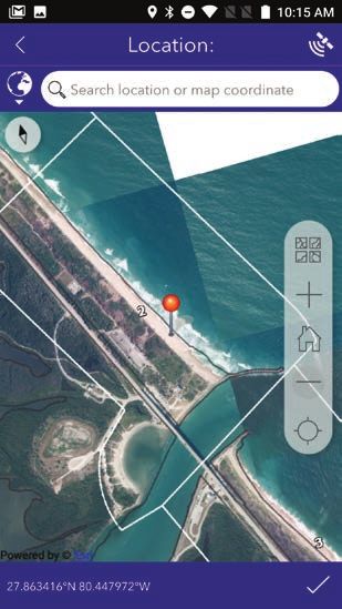
Field data was enhanced with consistent
and accurate GNSS positions.
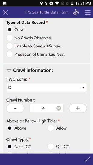
Survey teams documented details
with drop-down menus in the Survey123
application, which is more accurate and
saves time.
accuracy. In addition, the devices needed
to allow users to capture data offline to
cope with mobile connectivity issues.
After testing and narrowing down sev-
eral handheld devices and tablets, BNCR
launched a test in 2018 using a Trimble
TDC100 handheld GNSS data collector.
Working in conjunction with the FWC,
BNCR initially targeted only five parks.
However, the parks’ response was so en-
thusiastic, BNCR expanded the digital
trial to 12 parks. Confident that the new
digital survey app would provide the ef-
ficiency and precision expected, Williams
and Gerlock trained a significant roster of
individual park coordinators, staff, and vol-
unteers on the Trimble-Esri system for the
2019 sea turtle nesting surveys.
Proving the Concept
FDEP’s goal in 2019 was to survey as many data is gathered for these beaches.] In total, a highly accurate location to ensure that
state park beaches as possible using ArcGIS FWC had about 200 people involved in the the data collected met the required preci-
Survey123 and TDC100 devices. This includ- new digital surveys. sion. Walking or driving all-terrain vehicles
ed all 15 FPS index beaches. [Index beach- Once field teams determined their (ATVs) along the beach, surveyors searched
es are a smaller group of beaches within the areas of interest, they used the built-in the sand for signs of turtle activity, such as
larger group of beaches and more detailed GNSS receiver in the TDC100 to establish tracks known as crawl marks, left in the sand
or nest predation. When activity was found,
the location was recorded with 1-meter ac-
curacy, and the details were documented
using drop-down menus using ArcGIS
A loggerhead hatchling. Loggerheads Survey123. If surveyors observed no activ-
are the most common sea turtle found ity or were unable to conduct the survey
in Florida. Typically nesting from April to
September, females return to their nesting due to extreme weather events, they also
beach every two years laying about 114 recorded that in the application.
eggs in four different nests. (Photograph The ease and intelligence of the custom-
courtesy of Mike Brice from Pixabay.)
ized Survey123 form greatly assisted data
capture. Surveyors could confirm their lo-
cation using an offline basemap included
in the survey, and then choose the relevant
data—crawl, false crawl, predation—to
record. Based on the type of activity cap-
tured, Survey123 prompted users to provide
additional detail, ensuring comprehensive
attribute data. Preprepared customization
of forms enabled teams to capture informa-
tion more quickly ensure data collection
was consistent in quality and content.
As data was collected offline, the pro-
gram’s park coordinator reviewed each
68 au Spring 2021 esri.com/arcuser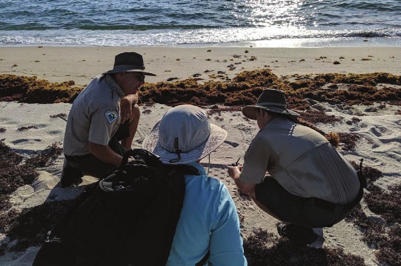
End Notes
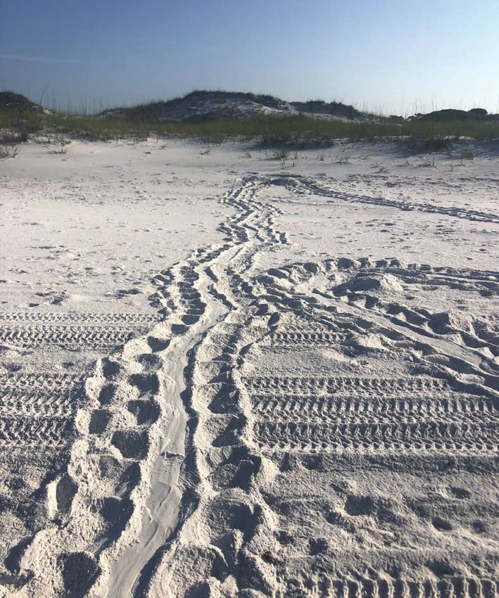
Loggerhead sea turtle tracks. (Photograph
courtesy of FDEP State Park staff).
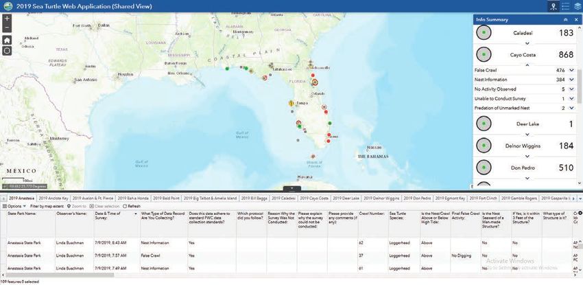
When park coordinators submit new data,
ArcGIS Online is immediately updated as
well as the web map for that specific park.
day’s data capture for quality control and
then submitted the information to the da-
tabase on ArcGIS Online for instant sharing
and spatial viewing.
“We developed a standardized data col-
lection form that met the needs of every
state park,” said Williams. “That allowed
staff and volunteers to use the same simple,
yet comprehensive interface and capture
accurate and reliable sea turtle activity
in just a few menu clicks. Paired with the
Trimble TDCs, we’re saving thousands of
hours, and the data is more accurate.”
Based on its success in 2019, BNCR ex-
panded the Trimble-Esri system statewide
for the 2020 season, equipping all 40 parks
with the means and knowledge to capture
data digitally. For the highest-density parks,
it acquired nine Trimble TDC600 handheld
devices to manage the vast data volumes.
For the 2020 surveys, several hundred
people surveyed 219 beaches, covering
approximately 839 miles of Florida’s coast-
line. For the state park beaches, teams
digitally collected 6,887 nests for all five
species combined.
esri.com/arcuser Spring 2021 au 69
In the Know
In addition to the efficiency and accu- the various formats needed for each park’s
Esri
racy gains provided by the mobile survey
app, the dynamic accessibility and data
monthly report to the FWC. This customi-
zation saves substantial time. For the FWC, Resources
analysis provided by ArcGIS Online sig- the responsiveness and completeness of
nificantly contributed BNCR’s success. the new data collection system has pro-
BNCR used ArcGIS Web AppBuilder to vided entirely new insight to help protect
develop 40 customized, individual web and support endangered sea turtles.
Esri Technical Support
maps for each of the 40 FPS parks. When “With our new survey app, once the re- esri.com/support
park coordinators submit new data, cords are synchronized with the database,
ArcGIS Online is immediately updated as it is possible to see the most recent nests Esri Desktop Order Center and
Software Information
well as the web map for that specific park. around the state and know when and where t 800 447 9778 (usa only)
This makes any new information available nesting is occurring,” said Gerlock. “We
as soon as it’s received or edited. can also identify when there has been an Esri Products
esri.com/products
Using other customized web applica- event involving a rare species in one of our
tions and widgets, park coordinators state parks, or where there may be issues Esri Store
and managers can quickly analyze data with predation. This has allowed FWC to esri.com/store
and offer specialized information, such stay more informed and provide assistance ArcGIS for Developers
as how many loggerhead nests have faster than ever before.” developers.arcgis.com
been reported to date or if a particular Customer Care Portal
rare species has been spotted. Data ed- About the Author my.esri.com
iting is much quicker and easier, and any Nicholas Duggan is a fellow of the Royal
Esri US Regional Offices
data can be exported to create reports. Geographical Society and a Chartered esri.com/about-esri/usa
It’s a level of data sharing and visualiza- Geographer specializing in GIS, a writer,
tion FOS has never had before. and an experienced user of Esri software. Esri Distributors
esri.com/distributors
The same is true for the BNCR and He has created solutions for national map-
the FWC. With support from Aaron ping agencies, renewable (offshore and on-
Koelker, a GIS systems project analyst shore) and nuclear, property technology, 3D,
with FDEP, Williams and his colleagues and 4D, With more than 20 years in the geo-
can use customized Python scripts to spatial industry, Duggan has a passion for Copyright © 2021 Esri.
quickly compile and convert data into innovation and exploring new technologies. All rights reserved.
Printed in the United States of America.
@esri.com, 3D Analyst, ACORN, Address Coder, ADF, AML, ArcAtlas,
ArcCAD, ArcCatalog, ArcCOGO, ArcData, ArcDoc, ArcEdit, ArcEditor,
The Florida sun rises on a beach that will be surveyed for signs of sea turtle activity, ArcEurope, ArcExplorer, ArcExpress, ArcGIS, arcgis.com, ArcGlobe,
ArcGrid, ArcIMS, ARC/INFO, ArcInfo, ArcInfo Librarian, ArcLessons,
nesting activity. ArcLocation, ArcLogistics, ArcMap, ArcNetwork, ArcNews,
ArcObjects, ArcOpen, ArcPad, ArcPlot, ArcPress, ArcPy, ArcQuest,
ArcReader, ArcScan, ArcScene, ArcSchool, ArcScripts, ArcSDE, ArcSdl,
ArcSketch, ArcStorm, ArcSurvey, ArcTIN, ArcToolbox, ArcTools,
ArcUSA, ArcUser, ArcView, ArcVoyager, ArcWatch, ArcWeb, ArcWorld,
ArcXML, Atlas GIS, AtlasWare, Avenue, BAO, Business Analyst,
Business Analyst Online, BusinessMAP, CityEngine, Community,
Community Analyst, CommunityInfo, Community Maps, Companion,
Database Integrator, DBI Kit, Drone2Map, EDN, Esri, esri.com,
Esri—Team GIS, Esri—The GIS Company, Esri—The GIS People, Esri—
The GIS Software Leader, Excalibur, FormEdit, GeoBIM, GeoCollector,
GeoEnrichment, GeoEvent, Geographic Design System, Geography
Matters, Geography Network, geographynetwork.com, Geoloqi,
GeoPlanner, Geoportal, Geostatistical Analyst, Geotrigger, GIS by
Esri, gis.com, GISData Server, GIS Day, gisday.com, GIS for Everyone,
Indoors, Insights, JTX, MapIT, Maplex, MapObjects, MapStudio,
ModelBuilder, MOLE, MPS—Atlas, Network analyst, Ortho Maker,
PLTS, Rent-a-Tech, Scene Viewer, SDE, See What Others Can’t, SML,
Sourcebook·America, SpatiaLABS, Spatial Analyst, Spatial Database
Engine, StoryMaps, Story Maps Basic, Story Maps Cascade, Story
Maps Crowdsource, Story Maps Journal, Story Maps Series, Story
Maps Shortlist, Story Maps Swipe and Spyglass, Story Maps Tour,
StreetMap, SURE, Tapestry, the ARC/INFO logo, the ArcGIS Explorer
logo, the ArcGIS logo, the ArcPad logo, the Esri globe logo, the
Esri Press logo, The Geographic Advantage, The Geographic
Approach, the GIS Day logo, the MapIT logo, The Science of Where,
The World’s Leading Desktop GIS, Velocity, Water Writes, and Your
Personal Geographic Information System are trademarks, service
marks, or registered marks of Esri in the United States, the European
Community, or certain other jurisdictions.
Other companies and products or services mentioned herein may
be trademarks, service marks, or other registered marks of their
respective mark owners.
70 au Spring 2021 esri.com/arcuser

You can also read