#discovercampbellriver - Destination Campbell ...
←
→
Page content transcription
If your browser does not render page correctly, please read the page content below
#discovercampbellriver
BUTTLE LAKE AREA Marble Meadows
Elevation change: 1250m
13km – round trip
hiking trails Trail starts at Phillips Creek Marine Campsite on Buttle
Lake. Access the trail head by boat from Auger Point (for
paddlers) or Karst Creek (for boats requiring a boat launch)
day use areas. Marble Meadows features viewpoints, alpine
Elk River 22km – round trip meadows and limestone formations. This trail provides
Elevation change: 600m access to many other mountaineering destinations.
Trail starts at Hwy 28 and follows
Phillips Ridge 12km – round trip
the generally moderate Elk
River Valley for 10km before Elevation change: 800m
turning up to Landslide Lake. This well graded trail starts from the trailhead just past
Campsites are available at Westmin Rd and leads to Arnica Lake. There is a camping
Butterwort Flats (6km) and the area at the north end of Arnica Lake.
upper gravel bar campsite (9km).
No camping at Landslide Lake. Flower Ridge 12km – round trip
Elevation change: 1250m
Trail starts on Buttle Lake Road. Notable for its open hiking
on the ridge and some striking viewpoints. Caution trail is
Bedwell Lake 12km – round trip steep and rough until you reach the open alpine ridge; water
can be scarce. You can continue hiking along the ridge for a
Elevation change: 600m
spectacular multiday hike.
Trail starts from Jim Mitchell Lake, a gravel road that
may require a 4x4. Camping in designated areas
only, no campfires are permitted. This hike includes
Crest Mountain 10km - 8 hours
some excellent viewpoints. Routes to Cream Lake and
Bedwell Sound depart from this area. Elevation change: 1250m
Trail starts at Hwy 28. Excellent views above 1,300 meters.
Upper Myra Falls 6km – round trip
Elevation change: 100m
Trail starts at trailhead just past Westmin Road follows gravel
road for 700m before turning into a forest trail. Features
include old growth forest and a picturesque waterfall.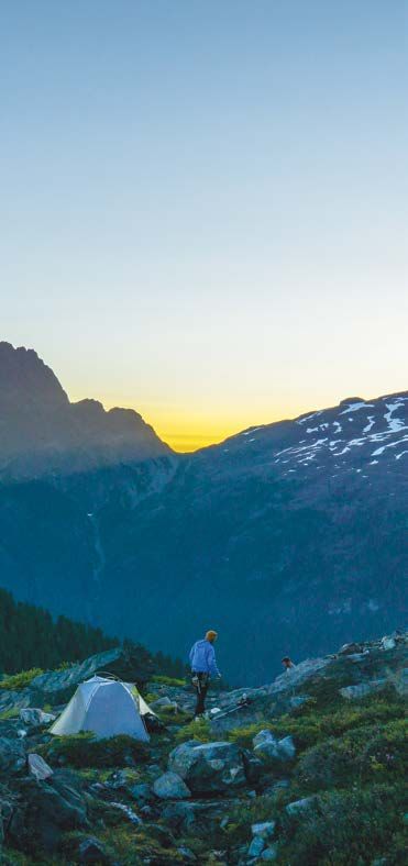
CAMPING
Vehicle Accessible Campsites
Campsites are $20.00 per party/ night
Buttle Lake- Operates April 1st-October 31st
Buttle Lake Campground offers 85 vehicle accessible
campsites set in a second growth Douglas fir forest. Buttle
Lake has developed a sandy beach; some sites are located
right on the lakeshore. Reservations must be made at least
two days in advance on the BC parks website. 50 campsites
are reservable while the rest are first come first serve.
Ralph River- Operates April 1st- October 31st
Ralph River Campground, located 35 km south of Buttle Lake
along the Buttle Lake (Western Mines Road) offers 75 vehicle
accessible campsites set amongst towering old-growth
Douglas fir. The campsites at Ralph River are first come first
serve with some reservable sites available.
Backcountry Camping
$10 per person per night
Permits can be obtained on the BC parks website.
Please be advised that there is no camping permitted in
any day-use area within Strathcona Park, including the
Crest Creek Crags and Crest Lake Day-use areas. Anyone
contravening this regulation is committing an offence
and is subject to Eviction and/or charges under the Park,
Conservancy, and Recreation Area Regulations.
There are designated backcountry sites located at Bedwell
Lake Trail, Elk River Trail, Della Falls Trail and the Forbidden
Plateau core area. (Lake Helen Mackenzie, Kwai Lake and
Circlet Lake campsites are accessed primarily from the
Paradise Meadows trailhead).
Camping fees are applicable in the following backcountry
sites only: Bedwell Lakes/Cream Lake Trail, Elk River Trail,
and the Forbidden Plateau core area.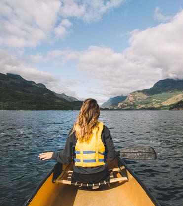
Wheelchair accessible
Other Park Paradise Meadows Barrier Free Centennial trail is an easily
accessible subalpine trail which is suitable for everyone.
Activities / Wheelchair accessible facilities are available at the
Driftwood Bay group site, Buttle Lake campground (pit
Information
toilets only), Elk Portal entrance (pit toilets only). The Crest
Creek day-use area offers wheelchair accessible picnic
tables and a pit toilet.
Canoeing
Swimming
Canoeing and kayaking is popular on Buttle and Upper
Good swimming is available in Buttle Lake, near the Buttle
Campbell Lakes. Buttle Lake is subject to strong afternoon
Lake and Driftwood Bay campgrounds. Buoys mark the
winds that may be very hazardous to small crafts. Canoeists
designated swimming areas. Although the water is cold,
swimming is permitted in all the lakes in the backcountry and kayakers should exercise caution at all times.
except for Kwai Lake. There are no lifeguards on duty at
provincial parks. Fires
Fires are not allowed in Strathcona Provincial Park except for
Rock Climbing in designated BC Parks fire rings.
Crest Creek Crags offers more than 150 climbing routes
for various skill levels. Please ensure you and your climbing
partner have the skills, equipment and experience to climb
safely. Crest Creek Crags is accessed via Hwy 28 from
Campbell River; approximately 11 km east of Gold River.
Pets
Pets/domestic animals must be on a leash and under control
at all times and are not allowed on the beach areas at Buttle
Lake and Driftwood Bay. Dogs must be on a leash at all times
in the Forbidden Plateau core area (Paradise Meadows).
During the winter season, dogs must be on a leash as well
and in addition, are not allowed on the groomed Nordic
Ski Trails. You are responsible for their behaviour and must
dispose of their excrement. Backcountry areas are not
suitable for dogs or other pets due to wildlife issues and the
potential for problems with bears.
Drinking Water
Drinking water hand pumps are located at the Buttle
Lake, Ralph River and Driftwood Bay campgrounds. In
the backcountry, drinking water comes from a variety of
sources. Boiling, treating or filtering surface water prior to
consumption is recommended.
NATURE WALKS
& SHORT TRAILS
Buttle Lake
Lady Falls 900m - 20 min Wild Ginger 15 min
This trail starts at Hwy 28 and follows through an old-growth This 15 minute loop through an oldgrowth forest begins
forest of cedar, Douglas fir and hemlock. A viewing platform across from the Ralph River campground. Large patches of
provides great views of Lady Falls. wild ginger and a wide range of forest flowers abound along
this trail.
Elk River Viewpoint 400m - 10min
This trail starts at Hwy 28 and follows along the BC Hydro
Shepherd Creek 1.5km - 45 min
power line. A viewing platform provides views across the Elk This loop trail begins across from the Ralph River
River and toward Roosevelt Elk habitat. Interpretive signs at campground and travels through a mix of open forest and
the trailhead and viewing platform educate visitors about marshy areas with minimal elevation change.
Strathcona Roosevelt Elk.
Auger Point 5 min
Karst Creek 2km - 45min
This trail starts off at the Buttle Lake/Westmin Road. This five
This trail starts off at Buttle Lake/ Westmin Road and passes minute loop leads through an oldgrowth Douglas fir forest
by a limestone area that includes sinkholes, disappearing that was devastated by forest fire in the mid 1980s. This trail
streams and a waterfall. provides views of nature as it reclaims and "greens up" the
burnt over landscape.
Lupin Falls Lower Myra Falls
800m - 20 mIN 1 km - 15 min
The trail to Lupin Falls starts The trail starts near the south
from the Buttle Lake/ Westmin end of Buttle Lake before
Mines Road. This is a short the NyrstarWestmin mine
loop trail through a cool old- site. This trail has one steep
growth forest featuring unique section. There are views of
saprophytes that include Ghost several beautiful cascades
Pipe, Candystick and Pine from a viewing platform at
Drops. Great views of Lupin Myra Falls, as well as access to
Falls can be had from the several creek side areas. Please
viewing area complete with a exercise CAUTION when
park bench. visiting the falls.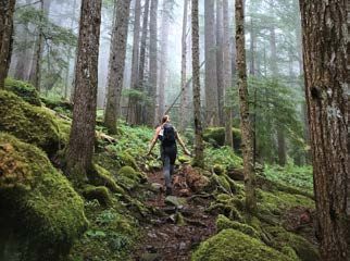
Paradise Meadows
FORBIDDEN
Loop Trail
4.2 km - 1.5 hours
PLATEAU
An easy walk through
sub-alpine meadows on
a wheelchair accessible
AREA TRAILS
boardwalk and gravel trail.
In season the meadows
are lushly carpeted
with lupines, heathers,
paintbrush, monkeyflowers
and violets. The trailhead
Helen MacKenzie-Battleship Lake Loop
is located at the parking
8km - 3 hours lot of the Mt Washington
Elevation gain: 70m Nordic Ski Area, 60km from
An easy hike on well developed trails through a mixture of Campbell River.
sub-alpine meadows carpeted with pretty flowers and forests
of Yellow cedar; Amabilis fir and Mountain hemlock.
Cruikshank Canyon Lookout
Helen MacKenzie-Kwai Lake-Croteau Lake Loop 1.5km past Kwai Lake (17km total) - 8 hours
14km - 6 hours Elevation gain: 250m
Elevation gain: 185m Trail passes Mariwood Lake and Lake Beautiful. Stunning
This trail offers hikers access to beautiful sub-alpine lakes and views of the valley and surrounding mountains.
mountain vistas. Designated camping is available at Kwai Lake
and represents an easy family destination. Circlet Lake
21 km - 8 hours
Elevation gain: 270m
From Lake Helen Mackenzie the trail follows forested slopes
over rougher terrain before rising to a rolling sub-alpine area.
The Hairtrigger Lake area provides spectacular mountain
views. Designated camping available at Circlet Lake.
Mount Albert Edward
31 km - 12 hours
Elevation gain: 1000m
This route begins as a trail, after the Moat Lake Trail the
route climbs steadily onto the ridge and continues to the
summit. This hike is best done as a two or three day trip
camping at Circlet Lake.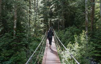
OTHER HIKING TRAILS Della Falls 16km - 7 hours Elevation change: 350 meters This trail starts at the west end of Great Central Lake and follows the old railway grade up the Drinkwater Valley to near the base of Della Falls. Access to this trail is by boat or canoe from the eastern end of Great Central Lake, Northwest of Port Alberni. Travel time by powerboat is 45min, or one day if canoeing. Paddlers should be aware that this area is subject to high winds and should exercise caution when crossing the lake. Access to the trailhead via floatplane is also an option. The notable features of this hike include Della Falls which at 440m is one of the 10 highest waterfalls in the world. Also of interest are historic sites from the early days of logging and mining. This trail provides access to Love Lake and Della Lake. Note: handrails are removed for the winter season on the narrow bridge over the Drinkwater River (12.5km from the trailhead). Comox Glacier 9km - 5hrs to the ridge Elevation change: 1600 m The glacier trail access is on the Comox Lake Logging road. Logging is active on this road please check in with Timberwest before going. Follow Comox Lake logging road to Cruickshank Canyon, continuing along the spur toward Comox Creek until the road ends where the bridge has been removed. Park here and follow the road on foot for 2-3km. A sign on the right hand side of the road marks the start of the trail. The trail climbs for approximately 1,000 meters before you reach the park boundary, then continues to climb to the ridge, where there are a number of camping locations. From the ridge the glacier is approximately a one day return trip. Water is scarce, bring everything you require. This trail is steep and unmaintained it is only suitable for advanced hikers and mountaineers. Road access to this trail follows active logging roads; these may be closed to the public during work hours. Logging trucks have the right of way at all times. Check latest access updates through TimberWest social channels.
All information in this booklet is taken from the
     BC Parks website. To find out more, including up
             to date trail reports, please consult:

  www.env.gov.bc.ca/bcparks/explore/parkpgs/strath

      CAMPBELLRIVER.TRAVEL/STRATHCONA
                 #DISCOVERCAMPBELLRIVER

This resource is a destination promotion tool only, and should not
be used as a sole source of information when exploring the area.
 Destination Campbell River and BC Parks are not liable for any
   personal injury resulting from information contained herein.
You can also read