Environmental Statement Volume 2 Technical Appendices Appendix 12.1 Natural England's National Character Area Profile 60_Mersey Valley - Burton's ...
←
→
Page content transcription
If your browser does not render page correctly, please read the page content below
Burton’s Biscuit Company Site

                                          Pasture Road, Moreton

                                                       Environmental Statement
                                                 Volume 2 Technical Appendices
Appendix 12.1 Natural England’s National Character Area Profile 60_Mersey Valley
                                                                  December 2013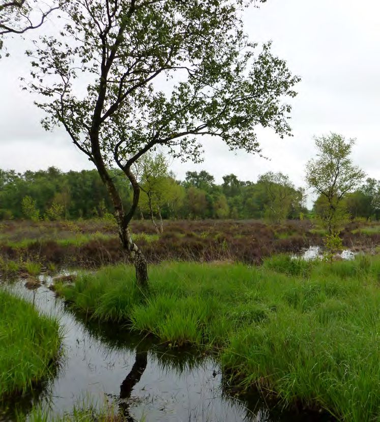
National Character        60. Mersey Valley
      Area profile:                                                                          Supporting documents

                                                                                 Key facts      Landscape           Analysis
                          Introduction & Summary   Description   Opportunities
                                                                                 and data       change

  www.naturalengland.org.uk

                                                                                                       1
National Character                 60. Mersey Valley
      Area profile:                                                                                                                                   Supporting documents

                                                                                                                                      Key facts            Landscape            Analysis
                                   Introduction & Summary         Description                     Opportunities
                                                                                                                                      and data             change

   Introduction                                                                           National Character Areas map

   As part of Natural England’s responsibilities as set out in the Natural Environment
   White Paper1, Biodiversity 20202 and the European Landscape Convention3, we are                                                                    North
   revising profiles for England’s 159 National Character Areas (NCAs). These are areas                                                                East
   that share similar landscape characteristics, and which follow natural lines in the
   landscape rather than administrative boundaries, making them a good decision-                                                                          Yorkshire
   making framework for the natural environment.                                                                                                            & The
                                                                                                                                                North      Humber
   NCA profiles are guidance documents which can help communities to inform their                                                               West
   decision-making about the places that they live in and care for. The information
   they contain will support the planning of conservation initiatives at a landscape                                                                            East
   scale, inform the delivery of Nature Improvement Areas and encourage broader                                                                               Midlands
   partnership working through Local Nature Partnerships. The profiles will also help                                                              West
                                                                                                                                                  Midlands
   to inform choices about how land is managed and can change.                                                                                                           East of
                                                                                                                                                                        England
   Each profile includes a description of the natural and cultural features that shape
   our landscapes, how the landscape has changed over time, the current key                                                                                           London
   drivers for ongoing change, and a broad analysis of each area’s characteristics
   and ecosystem services. Statements of Environmental Opportunity (SEOs) are                                                                                   South East
   suggested, which draw on this integrated information. The SEOs offer guidance                                                       South West
   on the critical issues, which could help to achieve sustainable growth and a more
   secure environmental future.

   NCA profiles are working documents which draw on current evidence and
   knowledge. We will aim to refresh and update them periodically as new                  1
                                                                                            The Natural Choice: Securing the Value of Nature, Defra
   information becomes available to us.                                                   (2011; URL: www.official-documents.gov.uk/document/cm80/8082/8082.pdf)
                                                                                          2
                                                                                            Biodiversity 2020: A Strategy for England’s Wildlife and Ecosystem Services, Defra
   We would like to hear how useful the NCA profiles are to you. You can contact the      (2011; URL: www.defra.gov.uk/publications/files/pb13583-biodiversity-strategy-2020-111111.pdf)
   NCA team by emailing ncaprofiles@naturalengland.org.uk                                 3
                                                                                            European Landscape Convention, Council of Europe
                                                                                          (2000; URL: http://conventions.coe.int/Treaty/en/Treaties/Html/176.htm)

                                                                                                                                                                    2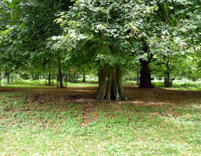
National Character 60. Mersey Valley
Area profile: Supporting documents
Key facts Landscape Analysis
Introduction & Summary Description Opportunities
and data change
Summary
The Mersey Valley National Character Area (NCA) consists of a wide, low-lying The habitats around the rivers and the estuary provide a natural defence against
river valley landscape focusing on the River Mersey, its estuary, associated flooding. Positive management of the area’s organic soils and wetlands such as
tributaries and waterways. It is a varied landscape that extends from the lowland raised bogs could result in significant gains in carbon sequestration.
mosslands near the Manchester Conurbation NCA in the east, to the Merseyside Local Nature Reserves and country parks offer opportunities for people to enjoy
Conurbation NCA and the wide estuary with intertidal mudflats/sand flats and the natural environment.
salt marsh in the west. The River Mersey is tidal from Howley Weir in Warrington.
The area encompasses a complex mix of extensive industrial development and Key challenges include integrating the development pressures associated with
urban areas, with high-quality farmland in between. the towns, industry and transport, with the protection and enhancement of the
landscape and the internationally significant habitats. Understanding, planning
Farmland in the north of the Mersey Valley NCA is predominantly arable, while for and adapting to climate change, particularly in the dynamic estuary and
in the south there is a mix of arable and pasture. Field pattern is regular and large river environment, is a further challenge. There are opportunities for providing
scale, often defined by degraded hedgerows with isolated hedgerow trees. In accessible greenspace and recreational provision, as well as improving habitat
the east, open, flat farmland is found on the rich, dark peaty soils of the former quality and distribution. Other benefits could include providing better water
mosses, with a complex network of drainage ditches. quality and storage, minimising soil erosion and increasing carbon storage. All
these can strengthen landscape resilience and adaptation to climate change.
Urban and industrial developments line the banks of the River Mersey. Industrial
infrastructure is often prominent, with large-scale, highly visible development NCA 60 boundary
Other NCA boundary
54
Manchester
including chemical works and oil refineries. The Manchester Ship Canal links the Area outside NCA 60
0 5km
32
Pennine Fringe
estuary to the heart of Manchester, perpetuating the industrial development
Lancashire & 56
Amounderness Lancashire
Plain Coal Measures
of the area. There is a dense communication network of major roads, railways,
canals and transmission lines. The urban and suburban areas provide housing for
those working in neighbouring conurbations, as well as in the industries of the 58
Merseyside
Mersey Valley. Conurbation
55
Manchester
The Mersey Estuary’s extensive intertidal mudflats/sand flats and fringing salt
Conurbation
61
Shropshire, Cheshire
marshes sustain internationally significant bird populations. There are remnant & Staffordshire Plain
pockets of lowland raised bog, including the Manchester Mosses Special Area 59
Wirral 62
Cheshire
Sandstone
of Conservation, centring on a once extensive area of mossland. Rixton Clay 61
Ridge
National Character Area 60
Shropshire, Cheshire Mersey Valley
Pits are a mosaic of pools and other habitats, with an internationally designated WALES & Staffordshire Plain
Note: In most instances, the NCA boundary is not
Click map to enlarge; click again to reduce.
Reproduced by permission of Ordnance Survey on behalf of HMSO. precisely mapped and should be considered as a
population of great crested newts.
c Crown copyright and database right 2013. All rights reserved.
Natural England OS licence number 100022021 zone of transition between NCAs.
3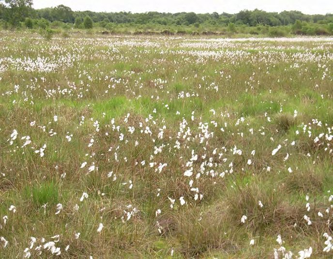
National Character 60. Mersey Valley
Area profile: Supporting documents
Key facts Landscape Analysis
Introduction & Summary Description Opportunities
and data change
Statements of Environmental Opportunity
SEO 1: Conserve and enhance the Mersey Valley’s rivers, tributaries and
estuary, improving the ability of the fluvial and estuarine systems to adapt
to climate change and mitigate flood risk while also enhancing habitats for
wildlife and for people’s enjoyment of the landscape.
SEO 2: Promote the Mersey Valley’s historic environment and landscape
character and positively integrate the environmental resource with
industry and development, providing greenspace within existing and
new development, to further the benefits provided by a healthy natural
environment, as a framework for habitat restoration and for public amenity.
SEO 3: Manage the arable and mixed farmland along the broad linear
Mersey Valley, and create semi-natural habitats, woodlands and ecological
networks, to protect soils and water, enhance biodiversity, increase
connectivity and improve the character of the landscape, while enabling
sustainable food production.
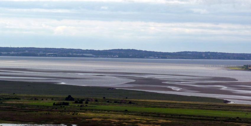
SEO 4: Manage and enhance the mossland landscape in the east,
safeguarding wetlands including the internationally important lowland raised
bogs, to conserve peat soils, protect and enhance biodiversity, conserve
archaeological deposits, contribute to landscape character and store carbon.
Part of a relict mossland on a farm in Glazebury, which has been restored under
environmental stewardship.
4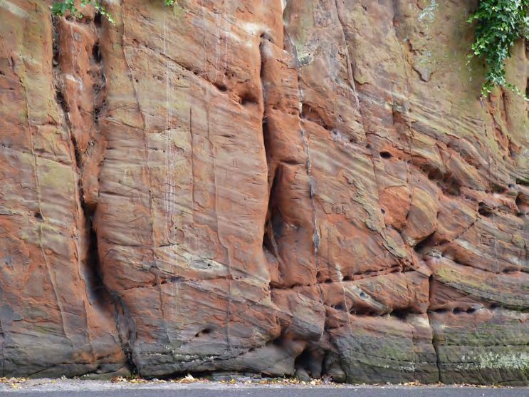
National Character                60. Mersey Valley
      Area profile:                                                                                                                               Supporting documents

                                                                                                                                  Key facts            Landscape           Analysis
                                  Introduction & Summary         Description                    Opportunities
                                                                                                                                  and data             change

   Description                                                                           The Mersey Valley and Merseyside Conurbation NCAs share a number of major
                                                                                         communication routes, with roads, rail and electricity power lines crossing the
                                                                                         area. Motorway and mainline railway networks are dominant features of the
                                                                                         landscape as major east–west and north–south infrastructure routes cross,
   Physical and functional links to other National                                       for example the M6, M56 and M62. There a number of significant waterways,
   Character Areas                                                                       including the Manchester Ship Canal. Many of the settlements provide housing
                                                                                         for those working in the Merseyside and Manchester conurbations, as well as in
   The Mersey Valley and Merseyside Conurbation National Character Areas (NCAs)          the industries of the Mersey Valley.
   lie within the same river basin and share a similar ecological character. The River
   Mersey forms a central, low-lying area and a corridor of movement for wildlife.
   The Mersey Estuary, an area of transition from marine to freshwater habitats,
   supports marine, subtidal and terrestrial maritime species. The significant mosaic
   of remnant mosses to the west of Manchester forms an important corridor of
   wetland habitats, linking with the Lancashire Coal Measures NCA in the north.

   The River Mersey starts at the confluence of the River Tame and the River Goyt
   in the Manchester Conurbation NCA. It flows west, passing through Warrington
   where the river becomes tidal. It widens to form the upper Mersey Estuary
   between Warrington and Runcorn. The Mersey Estuary continues towards the
   Merseyside Conurbation NCA, and flows into Liverpool Bay in the Irish Sea. The
   Mersey Estuary Special Protection Area (SPA) and Ramsar site crosses both the
   Mersey Valley and the Merseyside Conurbation NCAs.

   There are expansive views available from open and elevated land and the
   Mersey Estuary. In the west of the NCA, the Mersey is estuarine in character
   with intertidal mudflats/sand flats, salt marsh and low exposed cliffs. This
   creates an almost flat landscape with broad panoramic views. The vast industrial
   developments at Runcorn dominate views from across the Shropshire, Cheshire
   and Staffordshire Plain and the Cheshire Sandstone Ridge NCAs and from the
   M56 motorway. To the west of Runcorn, the valley widens out and intertidal              Expansive views from open and elevated land, including intertidal mud/sand flats and
                                                                                           saltmarsh in the Mersey Estuary. The vast industrial developments at Runcorn dominate
   areas, along with neighbouring NCAs, become more evident. In contrast, views
                                                                                           many views.
   from urban areas are typically limited by the relative flatness of the flood plain.

                                                                                                                                                               5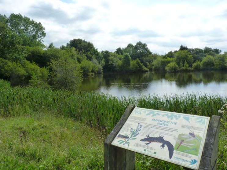
National Character                60. Mersey Valley
      Area profile:                                                                                                                       Supporting documents

                                                                                                                             Key facts        Landscape          Analysis
                                  Introduction & Summary          Description                  Opportunities
                                                                                                                             and data         change

   Key characteristics

    ■ The landscape is low-lying, focusing on the broad linear valley of the            ■ A range of important wetland habitats remain, including estuarine
      River Mersey; it is estuarine in the west and has extensive areas of                mudflats/sand flats and fringing salt marshes in the west, remnants of
      reclaimed mossland in the east.                                                     semi-natural mosslands and pockets of basin peats in the east, with
                                                                                          the broad river valley in between.
    ■ Underlain by Triassic sandstone, the surface geology is principally drift
      material: marine and river alluvium in the valley bottom, extensive areas of      ■ The predominant building material is red brick though some sandstone
      till, pockets of glacial sands and gravels, with peat in some drainage hollows.     construction remains, and some survival of earlier timber frame.

    ■ The Mersey Estuary is a defining element in the landscape, with                   ■ There are densely populated urban and suburban areas, with major
      expansive intertidal mudflats/sand flats and low exposed cliffs.                    towns particularly at the river crossings, including Runcorn, Widnes
                                                                                          and Warrington.
    ■ The River Mersey flows from east to west, joined by associated
      tributaries, although the Mersey itself is often obscured from view.              ■ There is large-scale, highly visible industrial development, with docks,
                                                                                          chemical works and oil refineries.
    ■ Trees and woodland are mainly associated with settlements, occasional
      parkland and isolated woodland blocks; and in recent years new                    ■ The river valley has a dense communication network with motorways,
      community woodlands have been planted.                                              roads, railways and canals running east–west, and power lines are also
                                                                                          prominent.
    ■ Large-scale, open, predominantly flat, high-quality farmland occurs
      between developments, with primarily arable farming to the north of
      the valley and a mixture of arable and dairying to the south.

    ■ The field pattern is regular and large scale, often defined by hedgerows
      with isolated hedgerow trees; many hedgerows are intermittent and
      have been replaced by post-and-wire fencing, while field boundaries on
      the mosses are marked by ditches.

                                                                                                                                                     6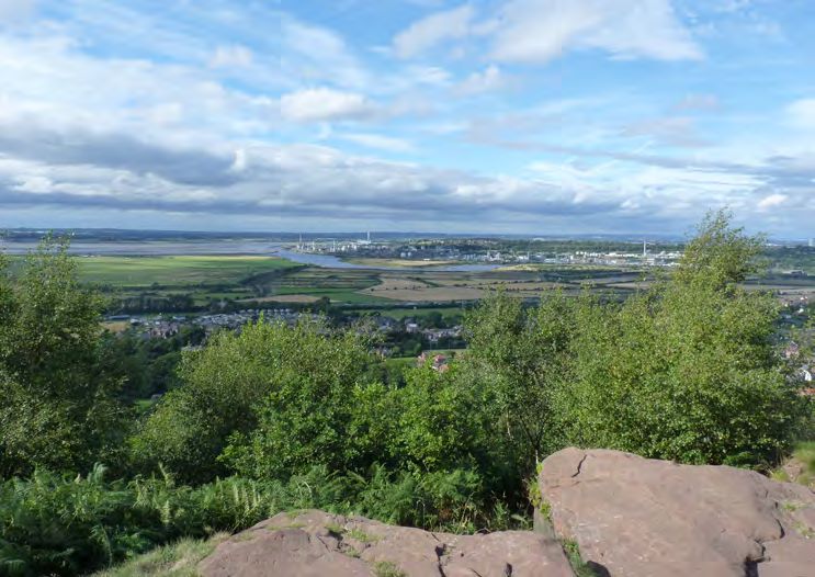
National Character                 60. Mersey Valley
      Area profile:                                                                                                                               Supporting documents

                                                                                                                                   Key facts           Landscape              Analysis
                                   Introduction & Summary         Description                   Opportunities
                                                                                                                                   and data            change

   The Mersey Valley today

   The Mersey Valley NCA consists of a wide, low-lying river valley landscape
   focusing on the River Mersey, its estuary, associated tributaries and waterways,
   although the Mersey itself is often obscured from view. It is a varied landscape
   that extends from the Merseyside Conurbation NCA and the wide Mersey
   Estuary in the west, to the flat mosslands near the Manchester Conurbation NCA
   in the east. The area encompasses a complex mix of extensive industrial
   development and urban areas, with high-quality farmland in between.

   This is an area defined largely by its generally low-relief topography, with an
   average elevation of just 23 m, rising locally to 144 m towards the Cheshire
   Sandstone Ridge NCA. The south side of the valley slopes more steeply than
   the north. The River Mersey flows from east to west, forming a central, low-
   lying area.

   The River Mersey is a defining element in the landscape, having created the valley
   landform and contributed to the area’s industrial and settlement history.
   Throughout the area the river is heavily controlled with high levee banks and
   course straightening. Downstream of Howley Weir in Warrington, the Mersey
   is tidally influenced, flowing into a large sheltered estuary on the Irish Sea coast.
   The Mersey Estuary has extensive intertidal mudflats and sand flats, which are
   exposed at low tide, and fringing salt marshes. The rising and falling of the
   tide make this a dynamic landscape, as the nature of views is constantly
   changing. The River Mersey itself, however, is often obscured, inaccessible, and
   blocked from view by industry. In Ellesmere Port, for example, it is barely obvious
   at all that the town is situated on the Mersey.                                         The Mersey Valley has a dense communication network, crossed by roads, motorways
                                                                                           and power lines.

                                                                                                                                                               7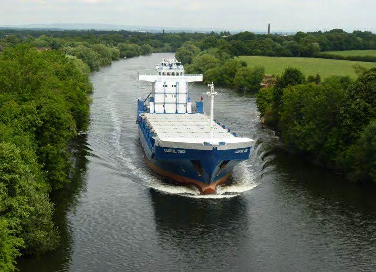
National Character                   60. Mersey Valley
      Area profile:                                                                                                                          Supporting documents

                                                                                                                               Key facts          Landscape         Analysis
                                     Introduction & Summary             Description             Opportunities
                                                                                                                               and data           change

   Areas of generally high-quality agricultural land are intermixed between urban        The field pattern is generally regular and large-scale, but within an inherited
   and industrial development. Two substantial bands of farmland follow the slopes       framework of earlier irregular boundaries. Fields are often defined by hedges
   of the Mersey Valley, though these are often fragmented at the periphery of           with isolated hedgerow trees. Many of the hedgerows are intermittent and have
   urban and industrial developments. To the north of the Mersey, the farmland has       been replaced by post-and-wire fencing. Ditches form the field boundaries on
   a large-scale, open character dominated by arable fields. To the south, the area      the mosses.
   is a mix of arable and dairying. In the east of the Mersey Valley, open, flat
   farmland occurs on the rich, dark peaty soils of the former mosses. A few small       Trees and woodland are mainly associated with settlements. There are some
   remnants of semi-natural mossland vegetation remain, but in general this is a         trees along field boundaries and watercourses, and isolated woodland blocks
   highly cultivated landscape dissected by a complex network of drainage ditches.       particularly in the east. In recent years new community woodlands have been
   The diversity of farmland provides a significant habitat for farmland birds.          created, adding to the greenspace resource for local people and improving
                                                                                         the image of the area. The area is covered by Mersey Forest and Red Rose
                                                                                         Forest community forests, together providing a network of green spaces,
                                                                                         woodlands and street trees and creating high-quality environments.

                                                                                         The Mersey Valley NCA is particularly important for the concentration of lowland
                                                                                         fens and lowland raised bogs. While most mossland has been converted to
                                                                                         agriculture or lost to development, several examples have survived as degraded
                                                                                         raised bog on the Mersey flood plain. This centres on the once extensive area of
                                                                                         mossland known as Chat Moss. Risley Moss, Astley and Bedford Mosses and
                                                                                         Holcroft Moss form the internationally recognised Manchester Mosses Special
                                                                                         Area of Conservation (SAC). The intertidal mudflats/sand flats, salt marshes and
                                                                                         rocky shores of the Mersey Estuary provide feeding and roosting sites for
                                                                                         internationally significant bird populations, with extensive areas designated as a
                                                                                         Ramsar site and an SPA. The Atlantic salmon has begun to return to the River
                                                                                         Mersey and its tributaries. There are large areas of flood plain grazing marsh
                                                                                         habitat in the area, notably at Frodsham, Helsby, Ince Marshes and Gowy
                                                                                         Meadows, providing habitats for wading birds, amphibians and mammals.
    Large-scale, open, predominantly flat farmland is interspersed between development
    and densely populated urban and suburban areas.

                                                                                                                                                         8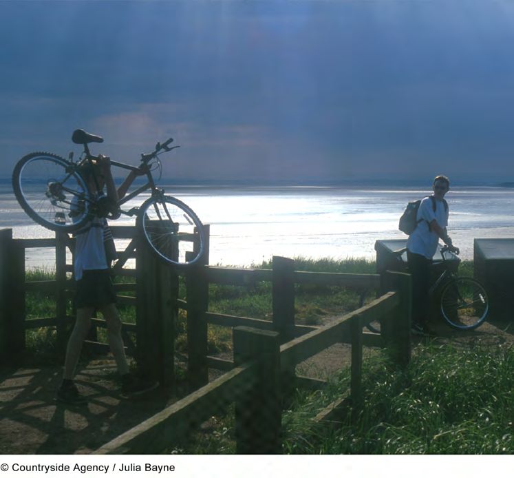
National Character                 60. Mersey Valley
      Area profile:                                                                                                                           Supporting documents

                                                                                                                                Key facts         Landscape          Analysis
                                   Introduction & Summary          Description                  Opportunities
                                                                                                                                and data          change

   Rixton Clay Pits are parts of an extensive disused brickwork quarry excavated in      development has created an overall disjointed character associated with a mix of
   glacially derived clay deposits. Extraction of clay has left a mosaic of pools        building styles.
   surrounded by diverse habitats including species-rich grassland, scrub and
   woodland. Here, among the amphibians common frog, common toad and                     The majority of the NCA has low levels of tranquillity, with the comparatively
   smooth newt, is an internationally important breeding population of great             highest tranquillity levels being found in the Mersey Estuary, and around the
   crested newts, and the area has been designated as an SAC. Other wetland sites        mosslands towards Manchester.
   include Woolston Eyes Site of Special Scientific Interest (SSSI), where lagoons set
   aside to receive dredging from the Manchester Ship Canal form large areas of          The Mersey Valley has a dense communication network running both east to
   open water, reedbed and scrub vegetation. The site is nationally important for        west and north to south, with major motorways, roads, railways and canals.
   wintering wildfowl and supports a diverse breeding bird assemblage.                   The Manchester Ship Canal runs roughly parallel with the Mersey from Eastham,
                                                                                         on the southern shore of the Mersey Estuary, almost to the centre of Manchester.
   The character of this landscape has been highly influenced by the urban and           The Bridgewater Canal crosses the Mersey Valley, creating a recreational link
   industrial developments lining the banks of the River Mersey. The high density        with the neighbouring urban areas of Manchester to the east and Leigh to the
   of urban areas has led to landfill developments appearing in the landscape.           north, and meets with the Manchester Ship Canal at Runcorn Dock. The
   Artificial deposit grounds are also visible, such as ash lagoons at Fiddlers Ferry.   Shropshire Union Canal and Leeds and Liverpool Canal also pass through this
   Industrial infrastructure is often prominent, with large-scale, highly visible        NCA, while the route of the former Sankey Canal runs through Warrington to
   development including docks, chemical works and oil refineries. Notable               the Mersey Estuary at Runcorn. The River Weaver is navigable in its lower
   landmarks are typically represented by infrastructure such as Runcorn Bridge,         reaches. The area is crossed by transmission lines such as those radiating out
   the Manchester Ship Canal, expansive industrial sites and Fiddlers Ferry Power        from Fiddlers Ferry Power Station. A number of major roads cross the area,
   Station. The cumulative effect is a complex mix of industrial and urban areas,        including the M6, M56 and M62 motorways. The West Coast Main Line crosses
   intermingled with high-quality farmland and the estuary.                              this NCA, while a large part of this area is occupied by Liverpool Airport.
                                                                                         Recreational trails also serve to connect people, including the long-distance
   The area is densely populated with the towns of Warrington, Widnes, Runcorn,          footpaths of the Trans Pennine Trail, Sandstone Trail and Mersey Way.
   Ellesmere Port, Frodsham and Irlam, as well as some extensive villages such as
   Culcheth and Lymm, often providing housing for commuters to Liverpool                 Recreation is supported by the area’s rights-of-way network. The large
   and Manchester. Urban areas are often interspersed with greenbelt. The                populations locally, both within the towns of the Mersey Valley and the two
   predominant building material is brick, although traditional red sandstone            adjacent conurbations, have access to the canal network, local nature reserves
   construction survives in limited areas, as well as extremely rare examples of         and country parks, as well as more formal facilities such as golf courses. There
   timber-framed construction. Welsh slate and clay tile roofs can be found. While       are also parklands such as Dunham Massey Park, Castle Park (Frodsham) and
   the older housing stock is characterised by red brick building materials, with        Walton Hall Gardens.
   some earlier timber frame, the proliferation of materials in more recent

                                                                                                                                                         9
National Character 60. Mersey Valley
Area profile: Supporting documents
Key facts Landscape Analysis
Introduction & Summary Description Opportunities
and data change
The landscape through time The Mersey Valley has historically formed a natural frontier zone with the
Mersey channel providing a natural barrier of water, tidal flats and marshland.
The solid geology of the Mersey Valley is dominated by red sandstones and The valley may also have formed a provincial boundary during the Roman
mudstones of Triassic age (248–205 million years old) that underlie virtually the period and possibly a tribal frontier even earlier. This frontier land once
entire area. To the south of the River Mersey, the landform is a series of low, contained many fortifications, most of which have been lost to modern
but prominent, sandstone ridges. These harder, coarse, red sandstones industrial development.
outcrop along the Mersey Valley between Lymm and Runcorn. They also form
prominent cuesta features that overlook the towns of Frodsham and Helsby.
Pebbles are scattered through the sequence and include the well-known
Chester Pebble Beds. Mudstones of the Triassic Mercia Mudstone Group
underlie much of the land to the north of the Mersey Estuary and east to
Warrington. The Permo-Triassic sandstone forms an important aquifer,
providing public and private water supplies to towns, farms and industry.
Surface outcrops of the underlying geology are rare and the majority of
the Mersey Valley is mantled by thick deposits of till and pockets of
Quaternary-age sand and gravel that formed in and beneath glaciers and ice
sheets. During the last glacial advance, ice deposited till, sands and gravels
over much of the Mersey area. Also associated with the glacial advance are
deposits of fine, wind-transported silt known as loess. Brick earth deposits
are a notable feature near Rixton. An important feature in the east of the
Mersey Valley is the occurrence of peat where mosslands developed in
drainage hollows in the early post-glacial period. They are most common on
the western fringe of Manchester and include areas such as Chat Moss.
Frodsham Road and Railway Cuttings Site of Special Scientific Interest; a sequence of
sandstones representing the upper part of the Triassic Helsby Sandstone Formation.
10National Character 60. Mersey Valley
Area profile: Supporting documents
Key facts Landscape Analysis
Introduction & Summary Description Opportunities
and data change
Prehistoric settlement appears to have been located close to the River Mersey, or Ancient enclosures are poorly represented, with scattered examples most notable
its tributaries, on minor promontories, which in the east avoided the areas of to the east, between Warrington and Urmston. For the most part, the area is
mossland. A Roman industrial settlement was established at Wilderspool, characterised by successive changes to the underlying pattern of ancient fields –
Warrington, at a convenient crossing point across the Mersey, and a Roman road improvements and modifications in the 18th, 19th and 20th centuries matched to
running between Northwich and Wigan crossed the Mersey Valley at this point. urban demands. The resulting pattern is predominantly arable to the north of the
River Mersey and mixed with dairying to the south. In the late 18th century and
During the medieval period, the route of the Roman road continued to be used 19th century, the regular pattern of enclosed fields, found to the south of the
and the area contained several medieval moated sites, while medieval towns Bridgewater Canal and extending south into the Cheshire Plain, resulted from
were established at Warrington, Halton, Hale and Widnes. estate improvements and the intensification of the cheese industry – a defining
feature of the Cheshire Plain. Agricultural expansion to feed the growing population
in Manchester started to have an impact on the mosses in the late 18th century.
The River Mersey was first made navigable between Manchester and Warrington
in the early 18th century. Sections of the River Weaver were also made navigable
in the 18th century. The earliest canals in the area were constructed from the
mid-18th century. The Bridgewater Canal was constructed to enable coal from a
mine at Worsley, along with other goods, to be transported efficiently and
cheaply to the rapidly expanding towns and cities.
In the 19th century, ports connected to the canal system were established
at Runcorn, Widnes and Ellesmere Port. The railway network linking
Manchester and Liverpool opened in 1830. The Manchester Ship Canal,
built between 1887 and 1894, allowed seagoing vessels to navigate from
Ellesmere Port to the newly constructed docks at Salford.
Also in the 19th century, the industrial development of ship-building, engineering,
tanning and the manufacture of soap and alkali were established at Runcorn; and
chemical factories at Widnes. The proximity of the Lancashire coalfields to the
north and the salt and ore deposits of the Cheshire Plain to the south allowed the
There are a number of significant waterways including the Manchester Ship Canal.
areas around Runcorn, Widnes and Warrington to become the focus for major
chemical industries, steel and wire works, textiles, tanning and breweries.
11National Character 60. Mersey Valley
Area profile: Supporting documents
Key facts Landscape Analysis
Introduction & Summary Description Opportunities
and data change
Many of the mosslands were reclaimed for arable land in the 20th century. When it In the 21st century, the area continues to be a focus for industrial and housing
became technically feasible to drain the bogs, peat cutting was carried out on a development, as well as new and upgraded transport routes. Liverpool Airport
larger scale and, with the addition of manure or fertiliser, conversion to arable has expanded, with the completion of a new passenger terminal in 2002.
farmland also became a viable option. By the early part of the 20th century, very Construction on the new 2 km-long Mersey Gateway crossing between
little peat bog remained unaltered. Elsewhere, hedgerows have suffered through Runcorn and Widnes starts in 2014. The loss and decline of mosslands
field expansion, neglect, and replacement with post-and-wire fencing. have largely halted and there have been significant areas brought into
conservation management.
During the 20th century, the manufacture of chemicals remained a significant
industry. The focus of the chemical industry became Runcorn, while at Widnes
many former chemical plants were redeveloped for new industrial uses. New
industries in light manufacturing, new technology and oil refining were also
established in the Mersey Valley. There is evidence of anti-aircraft gun sites
defending the Mersey Valley and the conurbations during the Second World War.
The ordnance works at Risley formed a large military establishment. Cold War
sites include nuclear bunkers and the vast US Army depot at Burtonwood.
In the 20th century, residential development saw significant expansion. The
populations of Runcorn and Warrington doubled in the latter part of the
20th century following the construction of new towns in both of these
settlements. The rapid expansion and industrial background of many of the
towns have limited the potential for historic character to influence the
appearance of urban areas. A network of motorways and large roads has
been constructed to serve the major towns and industrial areas and link
the neighbouring conurbations. Heavy industry declined in the 1970s
and 1980s but the growth of the new towns led to a great increase in
employment in light industry, distribution and technology.
Industrial infrastructure is often prominent, with large-scale, highly visible, development
including chemical works and oil refineries lining the banks of the Mersey.
12National Character 60. Mersey Valley
Area profile: Supporting documents
Key facts Landscape Analysis
Introduction & Summary Description Opportunities
and data change
Ecosystem services ■ Water availability: Surface water abstraction within the NCA is heavily
dominated by industrial abstraction, and to a lesser extent, agriculture.
There are no surface water abstractions for public water supply primarily
The Mersey Valley NCA provides a wide range of benefits to society. Each is
due to water quality issues. In contrast, the main abstraction from
derived from the attributes and processes (both natural and cultural features)
groundwater is for domestic water supply. The Triassic sandstone forms an
within the area. These benefits are known collectively as ‘ecosystem services’.
important aquifer.
The predominant services are summarised below. Further information on
ecosystem services provided in the Mersey Valley NCA is contained in the
Regulating services (water purification, air quality maintenance and
‘Analysis’ section of this document.
climate regulation)
■ Climate regulation: Large areas of soils with a high carbon content occur,
Provisioning services (food, fibre and water supply) reflecting the NCA’s soil types which contain organic-rich or peaty layers.
■ Food provision: To the north of the River Mersey, agriculture is dominated The peaty and organic soils of the NCA have an important role in carbon
by arable cultivation and to the south pasture becomes more frequent, sequestration and storage. Adopting management options that reduce the
with mixed farming (arable and dairying) predominating. On the dark, rich soil disturbance, erosion and oxidation is likely to result in retaining carbon
peaty soils of the former mosses, farming is mixed. Over 30 per cent of stores. Carbon storage and sequestration are provided by the NCA’s woodland,
this NCA is Grade 1 or Grade 2 agricultural land. Sustainable agricultural mudflats, salt marsh and marine sediments. Positive management of wetland,
practices can contribute to the production of high-quality food. woodland and estuarine habitats could result in carbon sequestration, and
woodland creation in suitable locations could further increase this.
■ Biomass energy: There may be some opportunities within the Mersey
Valley NCA for both short rotation coppice (SRC) and miscanthus to be ■ Regulating water quality: Water quality is variable, reflecting pollution
accommodated without significant landscape effects, due to the low- from the industrial heritage of the NCA, as well as other sources of
lying valley character, the complex land use pattern including arable and pollution. Significant improvements in water quality have occurred in the
mixed farmland, and the existing urban influence on the landscape. Power catchment area over recent years. In urban areas, the waterside is now seen
stations locally are exploring ways of achieving more energy production
as a positive focus for regeneration. Improvements to water quality mean
through use of renewable biomass sources, and their decisions may have
that salmon and sea trout have returned to the River Mersey. However,
an impact on the crops grown in close proximity. Provision of SRC and
there is still much to be done to address water quality issues. Habitats such
miscanthus as a source of renewable energy could contribute towards
addressing climate regulation. There are opportunities from arboricultural as woodlands, wetlands and grasslands can help to capture sediments and
arisings and waste wood as well as small amounts from existing woodland contaminants before they enter watercourses.
including the newer community woodlands.
13National Character 60. Mersey Valley
Area profile: Supporting documents
Key facts Landscape Analysis
Introduction & Summary Description Opportunities
and data change
■ Regulating water flow: The River Mersey flows west through the NCA ■ Regulating coastal flooding and erosion: Intertidal mudflats/sand flats and
and enters the Irish Sea at Liverpool Bay. The Mersey is tidally influenced salt marsh vegetation in the Mersey Estuary are subject to tidal flooding.
downstream from Howley Weir (Warrington). The catchment is largely low- Intertidal habitats such as mudflats/sand flats and salt marsh effectively
lying with a few steeper areas. The catchment has been heavily modified absorb the energy of waves, and thus provide a natural defence against sea
for industrial purposes, and this has affected the natural response of river level rise and flooding. These habitats are valuable for control of sea flooding
flows. The Manchester Ship Canal, which was built for navigation, reduces but are under threat due to sea level rise, and the consequent coastal
fluvial flood risk through Warrington. The response to rainfall is generally squeeze. The process of erosion and accretion on mudflats/sand flats and
slow but is much faster for some of the smaller tributaries flowing through salt marshes is necessary to maintain a succession of diverse habitats.
urbanised areas. Some properties are at risk of fluvial flooding, including
in Warrington. Where rivers discharge into an estuary, such as the River Cultural services (inspiration, education and wellbeing)
Weaver at Runcorn, there can potentially be either a fluvial or tidal flood ■ Sense of place/inspiration: Senses of inspiration and escapism may be
event or both at the same time. Wetlands, woodlands and other habitats provided by the broad panoramic views to the west across the Mersey
can alleviate speed of run-off. Estuary. The many views of the extensive industrial complexes and docks, lit
up at night, can also be dramatic and inspirational. The natural heritage of the
river valley is important, being close to where people live as well as providing
valuable wildlife corridors, and contributes to providing a sense of place and
inspiration. Communities also value their local green spaces as places of local
distinctiveness that provide opportunities to engage with nature close to
where they live and work, and that helps to encourage a sense of community.
■ Sense of history: The history of the landscape is largely associated with the
River Mersey and Estuary, including evidence of strategic crossing points
in the form of ancient fortifications at Warrington. Areas of peat have the
potential to preserve organic remains, such as pollen. There is extensive
industrial heritage, particularly linking to the development of the ports,
trade, industry, canals and railways. There is evidence of sites defending
the Mersey Valley during the Second World War as well as Cold War sites.
Other aspects of history likely to be particularly evident to the public are
the reclaimed mosslands and the Registered Parks and Gardens of Dunham
The Silver Jubilee Bridge crosses the River Mersey and the Manchester Ship Canal at Massey and Castle Park (Frodsham).
Runcorn Gap between Runcorn and Widnes.
14National Character 60. Mersey Valley
Area profile: Supporting documents
Key facts Landscape Analysis
Introduction & Summary Description Opportunities
and data change
■ Recreation: There are large populations locally, both within the towns of the
Mersey Valley and the two adjacent conurbations. Local woodlands and the
two Community Forests have generated local interest to increase woodland
and other habitats, create wildlife corridors and provide access for people.
Local Nature Reserves and country parks also provide opportunities for
people to enjoy the natural environment. Communities value their local
green spaces as places of local distinctiveness that provide opportunities to
engage with nature close to where they live and work, to improve physical
and mental health and encourage a sense of community.
■ Biodiversity: The Mersey Estuary is of international significance, with large
areas designated as a Ramsar site and as an SPA for its extensive intertidal
habitats such as mudflats and internationally important bird populations.
Examples of degraded raised bog habitat have survived on the Mersey
flood plain, including the Manchester Mosses SAC. The ponds at Rixton
Clay Pits SAC provide breeding sites for an important population of great
crested newts. Other wetland sites include Woolston Eyes SSSI, where
lagoons set aside to receive dredging from the Manchester Ship Canal form
large areas of open water, reedbed and scrub vegetation.
■ Geodiversity: Peat-forming bogs and the dynamic intertidal environments are Rixton Clay Pits are a mosaic of pools and other habitats, with an internationally designated
both examples of active geomorphological processes. Geological exposures, population of great crested newts. The site is also a Local Nature Reserve, providing
for example of sandstone sequences, make an important contribution to opportunities for people to enjoy and learn about the natural environment.
understanding of the origin and geological development of the NCA.
15National Character 60. Mersey Valley
Area profile: Supporting documents
Key facts Landscape Analysis
Introduction & Summary Description Opportunities
and data change
Statements of Environmental Opportunity
SEO 1: Conserve and enhance the Mersey Valley’s rivers, tributaries and estuary, improving the ability of the fluvial and estuarine systems to adapt to climate change and
mitigate flood risk while also enhancing habitats for wildlife and for people’s enjoyment of the landscape.
For example, by:
■ Maintaining and enhancing the Mersey Estuary Special Protection Area ■ Promoting opportunities to improve the natural functioning of the
(SPA) and Ramsar site; bringing habitats into and maintaining favourable Mersey Estuary and potentially reduce flood risks through providing
condition, such as the intertidal sediments and salt marshes to support space for intertidal habitats to develop and move in response to coastal
the internationally important populations of migratory bird species and change, to enhance estuarine habitats and create additional habitats by
assemblage of waterfowl. managed realignment at strategic locations.
■ Maintaining and enhancing the biodiversity of the Mersey Estuary, its ■ Working with key partners and landowners to identify suitable sites for
tributaries and its wider flood plain, including adjacent farmland and flood storage, as well as optimising design and implementation of future
wetland that provide habitats supporting wildlife. flood storage areas to create new wetland habitats, such as flood plain
■ Conserving the open and exposed character of the mudflats/sand flats grazing marsh, and creating links with existing semi-natural habitats.
and salt marshes along the Mersey Estuary, with its expansive estuary ■ Identifying river stretches for restoration (for example, re-connecting
views, and enhancing the estuarine habitats that contribute to landscape rivers to their flood plains) and taking opportunities to de-culvert and
character and support the wide range of wildlife. re-naturalise rivers and remove redundant weirs and other obstacles, to
■ Improving understanding of the many features and functions of the provide space for water storage and alleviate speed of run-off, as well as
Mersey Estuary, including its active geomorphological processes and providing connectivity and habitats for wildlife.
wildlife value, making provision for it to adapt to coastal change. ■ Maintaining and enhancing semi-natural grassland, flood meadows and
■ Ensuring the retention of mudflats and salt marshes where possible, and wet grasslands associated with river flood plains as feeding and breeding
allowing space for the continuing dynamic estuarine processes, to retain sites for wetland birds and for their botanical interest; maintaining and
biodiversity and geomorphological interest and provide a cost-effective enhancing the coastal and flood plain grazing marshes bordering the
defence against erosion/flooding. River Mersey and its tributaries, to attract wetland birds and as refuges
for estuarine species at times of severe weather.
Continued on next page...
16National Character 60. Mersey Valley
Area profile: Supporting documents
Key facts Landscape Analysis
Introduction & Summary Description Opportunities
and data change
SEO 1: Conserve and enhance the Mersey Valley’s rivers, tributaries and estuary, improving the ability of the fluvial and estuarine systems to adapt to climate change and
mitigate flood risk while also enhancing habitats for wildlife and for people’s enjoyment of the landscape.
... continued from previous page
■ Managing and enhancing habitats such as wetlands and grasslands to
capture sediments and contaminants before they enter watercourses;
and establishing buffers such as permanent grassland along
watercourses.
■ Enabling sustainable recreational and educational access for people to
sensitively enjoy access to the River Mersey and Estuary where appropriate,
for the benefits that contact with the natural environment brings.
■ Supporting management to ensure that the River Mersey continues
to improve as a clean and ecologically diverse river; seeking to re-
connect people, both physically and visually, with the River Mersey, and
protecting and enhancing these connections where they do exist.
■ Promoting the multiple benefits of a healthy waterside environment.
Remnant pockets of lowland raised bog, such as at Astley Moss, where the habitat
supports common cotton grasses and hairs tail cotton grass with occasional
sphagnum mosses, as well as birds and invertebrates.
17National Character 60. Mersey Valley
Area profile: Supporting documents
Key facts Landscape Analysis
Introduction & Summary Description Opportunities
and data change
SEO 2: Promote the Mersey Valley’s historic environment and landscape character and positively integrate the environmental resource with industry and development, providing
greenspace within existing and new development, to further the benefits provided by a healthy natural environment, as a framework for habitat restoration and for public amenity.
For example, by:
■ Capitalising on the strengths of the location, through conserving and ■ Creating tranquil areas of woodland and other habitats for people to enjoy
enhancing the Mersey River valley, parks and urban green spaces and and increasing opportunities for users to access, and to benefit from, the
enabling people to access and enjoy them. health and social rewards that their local environment affords them.
■ Carefully designing and integrating green infrastructure within housing, ■ Seeking ways to protect the sense of place and interpret the National
business, transport and industrial development, linking new developments Character Area’s (NCA’s) historic and cultural identity to ensure a better
with the wider countryside; looking for opportunities to provide access and understanding of past land use and retain evidence of the relationships
outdoor recreation, to retain and enhance landscapes, visual amenity and between features for the future.
biodiversity, or to improve damaged and derelict land. ■ Conserving open and expansive views of the landscape, such as views from
■ Developing networks of linear habitats, corridors and stepping stones the top of Runcorn Hill.
within housing and industrial development, linking developments with the ■ Developing sustainable urban drainage systems (SUDS) in new and existing
wider countryside, making a more permeable landscape to enable species development to improve infiltration and manage surface water.
movement and to enable urban populations to engage with the natural ■ Planning to manage over-abstraction from groundwater and rivers through
environment through better access provision. careful and efficient use of water.
■ Creating new woodlands and planting individual trees in appropriate urban ■ Conserving the NCA’s heritage assets, including archaeological sites, historic
and industrial areas and settlements, such as school playing fields, open buildings and the character of the parkland and villages and ensuring high-
spaces, streets, highway verges, institutional grounds, derelict land, on tipped quality design.
and industrial land and development sites for multi-purpose use as part of ■ Maintaining the wood-pasture management system at Dunham Park, and
the community forest initiative, including innovative wood fuel, timber and other parklands, making provision for eventual replacement of trees, while
forest industries, enhancement of recreation, landscape and biodiversity retaining moribund and dead standing timber.
interests, helping to assimilate new infrastructure, and providing benefits for
water quality, soil quality and flood risk management. Continued on next page...
18National Character 60. Mersey Valley
Area profile: Supporting documents
Key facts Landscape Analysis
Introduction & Summary Description Opportunities
and data change
SEO 2: Promote the Mersey Valley’s historic environment and landscape character and positively integrate the environmental resource with industry and development, providing
greenspace within existing and new development, to further the benefits provided by a healthy natural environment, as a framework for habitat restoration and for public amenity.
... continued from previous page
■ Promoting sustainable recreation and education opportunities linked to
biodiversity, for example at local nature reserves and country parks, and
providing interpretation for people to understand and enjoy wildlife and the
benefits of the natural environment.
■ Providing opportunities for users to access the natural environment
sustainably through conserving and enhancing recreational routes, including
long-distance footpaths and strategic green links, ensuring that paths are
maintained and that some surfaced paths are provided for use by all levels
of ability, to enable people to benefit from the health and social rewards that
their local environment affords them.
■ Deepening appreciation among landowners, industry and the public of the
links between geology, landscape and wildlife habitat and their relevance to
conserving biodiversity and to sustainable development; providing improved
interpretation and educational facilities to increase visitors’ understanding
and enjoyment of the NCA’s natural and historic features.
■ Maintaining and where possible enhancing all the existing rock exposures
and natural landforms, including Sites of Special Scientific Interest (SSSI), At Dunham Park a large number of the oak and beech trees are ancient, with
which make important contributions to an understanding of the origin and some dating back to the 17th century. The associated dead wood beetle fauna is
geological development of the Mersey Valley NCA. exceptionally rich and includes a number of rare species.
19National Character 60. Mersey Valley
Area profile: Supporting documents
Key facts Landscape Analysis
Introduction & Summary Description Opportunities
and data change
SEO 3: Manage the arable and mixed farmland along the broad linear Mersey Valley, and create semi-natural habitats, woodlands and ecological networks, to protect soils and water,
enhance biodiversity, increase connectivity and improve the character of the landscape, while enabling sustainable food production.
For example, by:
■ Conserving the character and wildlife habitats associated with the arable ■ Providing new educational access with interpretation of environmental gains
and mixed farming systems, and seeking opportunities to manage and that promote the re-connection between farming, food and the public.
create semi-natural habitats and ecological networks within the farmed ■ Exploring and promoting the marketing of quality local produce to
environment, which will protect soils and water and enhance biodiversity nearby extensive urban populations.
and the landscape. ■ Protecting woodlands, including ancient woodlands, and encouraging
■ Providing significant year-round habitats that will benefit farmland birds, the appropriate management of existing woodlands through measures
such as over-wintered stubbles, conservation headlands and buffer strips such as diversifying the age structure of tree populations and retaining
in arable fields. veteran trees and fallen timber; increasing the extent and continuity of
■ Planning to link and connect fragmented habitats into a more cohesive semi-natural woodland in appropriate locations, particularly through
whole, providing corridors and stepping stones for wildlife, enabling enlarging and linking existing woodland sites; and ensuring that any
movement of species, and enhancing the landscape. planting complements open habitats for ground-nesting birds.
■ Seeking opportunities to restore and enhance hedgerows, field boundary ■ Protecting and enhancing the quality of ponds, including those at the
trees and field margins to encourage a network of habitats to link internationally designated Rixton Clay Pits Special Area of Conservation
fragmented habitats, to act as a windbreak and bind/filter out the soil in (SAC), buffering infield ponds and wetlands and seeking to create new
times of flood. wetland habitats, thus creating strong habitat networks, improving water
■ Protecting historic parklands to enhance the landscape, and creating quality, and establishing stepping stones of wetland habitat.
succession plans to increase the age range of trees in parkland settings. ■ Encouraging opportunities to improve, maintain and expand habitats,
■ Improving water quality, through carefully managing nutrient inputs such as woodlands, grasslands and wetlands, which may increase the
and providing buffer strips adjacent to watercourses such as in the River sense of tranquillity.
Mersey, River Weaver and their tributaries.
20National Character 60. Mersey Valley
Area profile: Supporting documents
Key facts Landscape Analysis
Introduction & Summary Description Opportunities
and data change
SEO 4: Manage and enhance the mossland landscape in the east, safeguarding wetlands including the internationally important lowland raised bogs, to conserve peat soils, protect
and enhance biodiversity, conserve archaeological deposits, contribute to landscape character and store carbon.
For example, by:
■ Managing and enhancing the Manchester Mosses SAC and other important ■ Encouraging the restoration of lowland raised bogs and the mosaic of
lowland raised bog habitats. wetland habitats to conserve wildlife and retain the open character of the
■ Managing areas of lowland raised bog and adjacent land, restoring peat soils NCA’s mossland landscape.
to protect wildlife and increase the ability of habitats to actively store and ■ Improving people’s understanding and enjoyment of the mosslands and
sequester carbon from the atmosphere. the network of lowland raised bogs by providing access and interpretation
■ Restoring and improving the condition of lowland bogs by working with where possible.
landowners to manage and restore water table levels, and providing ■ Seeking opportunities to extend areas of wetland along rivers and in valley
hydrological buffer zones of fens, wet pastures or wet woodland to help to bottoms.
manage water. ■ Managing the ditch network to increase their contribution to biodiversity
■ Seeking opportunities to re-establish the geomorphological function of interest.
mosslands to safeguard the records of palaeo-environmental evidence and ■ Managing existing woodlands, while conserving mossland habitats, to
to prevent damage to potential buried archaeological remains. contribute to the character of the wider area.
■ Seeking opportunities for restoring, enhancing and linking fragmented
wetland habitats in former peat-cutting areas and farmlands to realise the
potential for restoration schemes and create a complex mossland landscape
capable of sustaining the full range of mossland habitats.
21National Character 60. Mersey Valley
Area profile: Supporting documents
Key facts Landscape Analysis
Introduction & Summary Description Opportunities
and data change
Supporting document 1: Key facts and data Area of Mersey Valley National Character Area (NCA): 44,718 ha
There are 83 local sites in the Mersey Valley covering 2,963 ha which is 7 per
1. Landscape and nature conservation designations cent of the NCA.
Source: Natural England (2011)
There are no protected landscape designations within the Mersey Valley NCA.
Source: Natural England (2011) ■ Details of individual Sites of Special Scientific Interest can be searched at:
http://www.sssi.naturalengland.org.uk/Special/sssi/search.cfm
1.1 Designated nature conservation sites ■ Details of Local Nature Reserves (LNR) can be searched at:
http://www.lnr.naturalengland.org.uk/Special/lnr/lnr_search.asp
■ Maps showing locations of Statutory sites can be found at:
The NCA includes the following statutory nature conservation designations: http://magic.Defra.gov.uk/website/magic/ – select ‘Rural Designations
Statutory’
Area % of
Tier Designation Name (ha) NCA
1.1.1 Condition of designated sites
International Ramsar Mersey Estuary 968 2
Percentage of NCA
European Special Protection Mersey Estuary SPA 968 2
Area (SPA) SSSI condition category Area (ha) SSSI resource
Special Area of Manchester Mosses 184National Character 60. Mersey Valley
Area profile: Supporting documents
Key facts Landscape Analysis
Introduction & Summary Description Opportunities
and data change
2. Landform, geology and soils 2.5 Designated geological sites
2.1 Elevation Tier Designation Number
The Mersey Valley elevation ranges from slightly above sea level to a maximum National Geological Site of Special Scientific Interest (SSSI) 2
height of 144 m. The mean elevation is relatively low at 23 m. National Mixed Interest SSSI 0
Source: Natural England 2010
Local Local Geological Sites 12
2.2 Landform and process
The Mersey Valley NCA consists of a broad linear valley with large-scale, open, There is a wide mixture of geological site types, but the majority are inland
predominantly flat farmland supporting substantial bands of mixed agriculture. outcrops, disused quarries, road sections and geomorphology sites. Frodsham
Source: Mersey Valley Countryside Character Area Description Railway and Road Cuttings SSSI, for example, shows a sequence of sandstones
representing the upper part of the Triassic Helsby Sandstone Formation.
Source: Natural England (2011)
2.3 Bedrock geology
The solid geology of the Mersey Valley is dominated by red sandstones and ■ Details of individual Sites of Special Scientific Interest can be searched at:
mudstones of Triassic age (248-205 million years old) that underlie almost the
http://www.sssi.naturalengland.org.uk/Special/sssi/search.cfm
entire area. To the south of the River Mersey the landform is a series of low, but
prominent sandstone ridges.
Source: Natural England 2010
2.6 Soils and Agricultural Land Classification
Small amounts of Grade 1 agricultural land occur to the north-east of Warrington
2.4 Superficial deposits with larger expanses of Grade 2 land found around the perimeter of the NCA.
The surface geology consists principally of superficial deposits. The valley Grade 3 soils more common in the south and to the north of Warrington.
Source: Natural England (2010)
bottom is underlain by estuarine and river alluvium bordered in places by
wind-blown sand. Much of the remainder of the area is mantled by glacial till
with pockets of sand and gravel. Brick earth deposits are a notable feature near
Rixton. Outcrops of Triassic sandstone bedrock poke through the superficial
deposits to the east and south of Runcorn. An important feature in the east
of the Valley is the occurrence of peat, covering 9 per cent of the NCA. These
mosslands developed in drainage hollows in the early post-glacial period.
Source: Mersey Valley Countryside Character Description, Natural England 2010
23You can also read