TOWARD INTEGRATED MANAGEMENT IN BAYNES SOUND - A Comparative Analysis - CANADA
←
→
Page content transcription
If your browser does not render page correctly, please read the page content below
CANADA

         TOWARD INTEGRATED
         MANAGEMENT IN BAYNES SOUND
         A Comparative Analysis

                            Prepared by Leah Sneddon
                                  and Kimberley Dunn
                                            May 2019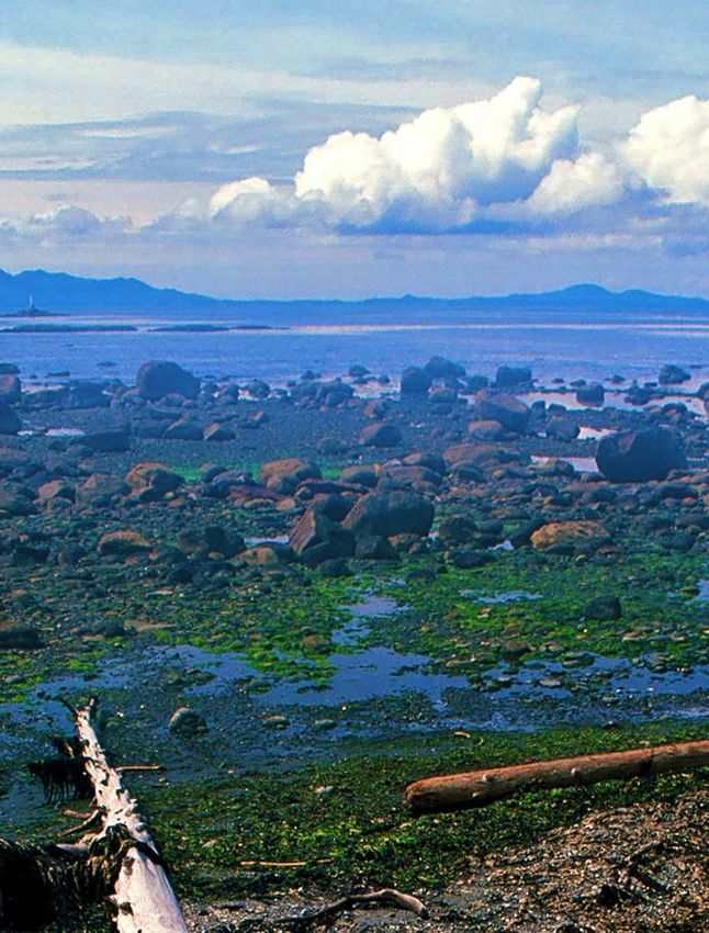
Table of Contents
     List of Abbreviations........................................ ii      4. Results and Discussion ............................. 18
                                                                                 4.1 Discussion of Results...............................30
     Executive Summary......................................... iii
                                                                           5. Opportunities and Challenges for Integrated
     1. Introduction.................................................. 1
                                                                              Management............................................... 40
           1.1 Integrated Management............................ 1
                                                                                 5.1 Opportunities...........................................40
           1.2 Baynes Sound/Lambert Channel.............. 3
                                                                                 5.2 Challenges.................................................42
                1.2.1 Ecological Overview......................... 3
                                                                                 5.3 Future Research and Next Steps............34
                1.2.2 Socio-Economic Overview............... 3
                1.2.3 Purpose of this Report.................... 4         6. Conclusion.................................................. 44

     2. Research Methodology................................ 5             Bibliography.................................................... 45

     3. Management Summaries............................ 8                 Appendix A: Regional Species.........................48
           3.1 Fisheries Management.............................. 9        Appendix B: Code List......................................49
           3.2 Aquaculture Management.......................10
                                                                           Appendix C: Management Plan Summaries...51
           3.3 Species Conservation...............................11
           3.4 First Nations Resource Management.....12                    Appendix D: Semi Quantitative Analysis..........61
           3.5 Land and Marine Use Planning...............13
           3.6 Land and Marine Conservation..............15

     List of Abbreviations
     BSCPSA: The Baynes Sound Coastal Plan for Shellfish Aquaculture       IGMF: Integrated Geoduck Management Framework
     CVRD: Comox Valley Regional District                                  IMAP: Integrated Management of Aquaculture Plan
     DFO: Fisheries and Oceans Canada                                      OCP: Official Community Plan
     EBM: Ecosystem-based Management                                       PNCIMA: Pacific North Coast Integrated Management Area
     EBSA: Ecologically and Biologically Significant Area                  PRWAP: Puntledge River Watershed Action Plan
     ECCC: Environment and Climate Change Canada                           RDN: Regional District of Nanaimo
     FWCP: Fish and Wildlife Compensation Program                          RGS: Regional Growth Strategy
     IBA: Important Bird Area                                              SARA: Species at Risk Act
     IFMP: Integrated Fisheries Management Plan                            Ocean SAMP: Ocean Special Area Management Plan

© 1986 Panda symbol WWF-World Wide Fund For Nature (also known as World Wildlife Fund).
® “WWF” is a WWF Registered Trademark.

ii
© Andrew S. Wright, WWF-Canada

EXECUTIVE SUMMARY
    This report assesses the current degree of integration among existing
    management plans for Baynes Sound/Lambert Channel, located on the eastern
    shore of Vancouver Island in British Columbia. The marine region is a source of
    significant ecological productivity as well as economic activity. It is the highest
    ranked cumulative and spawning area for herring in the Strait of Georgia and
    is a critical feeding and overwintering area for waterbirds. Baynes Sound also
    supports the highest density of intertidal shellfish aquaculture in British Columbia,
    producing over half of all the shellfish cultured in the province. The purpose of
    this report was to comparatively assess each of the existing management plans
    to determine the current degree of integration and to identify opportunities to
    advance an integrated approach to management of the Baynes Sound/Lambert
    Channel ecosystem.
    Prior to the analysis, a review of peer-reviewed literature was conducted to
    identify the key principles of ecosystem-based management. These principles,
    which related to spatial and temporal scales, management of human activity
    and ecosystem-level management, helped to provide a framework for the
    assessment. There were 29 documents selected in total, which included plans
    produced by various types of government (local, municipal, provincial, First
    Nations and federal) in various stages of implementation. A content analysis was
    used to comparatively assess the management plans, and management content
    was extracted using a coding system, based on key principles of ecosystem-based
    management, and comparatively examined via a semi-quantitative analysis.
    Grouped management summaries initially provide an overview of regional
    context as well as the current state of management. There are many governing
    bodies involved in Baynes Sound/Lambert Channel and although each has a
    distinct management role, there are overlapping boundaries, responsibilities and
    management considerations. Following this section, the results of the assessment
    are displayed in a comparative chart, which summarizes the purpose of each of
    the plans, the spatial and temporal scales, species-specific management as well

                         Toward Integrated Management in Baynes Sound: A Comparative Analysis I      iii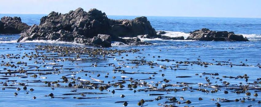
as ecosystem-level management objectives. Following the tabular presentation,
     results are examined in further detail to identify the opportunities and challenges
     for further integration of management moving forward.
     The results of the analysis indicate that the existing management plans have
     all been developed independently, and largely are not integrated. However,
     several common management elements emerged and were discussed as
     opportunities for improving integrated management going forward. The
     most prevalent of these opportunities stems from a near-universal interest
     in ecosystem-level health found in the plans. Many of the opportunity areas
     identified have strong management connections to each other, across sectors,
     spatial zones, and species, further strengthening the foundation for improved
     integration. The results also highlighted challenges for the further integration
     of management in the region, including the complexities of governance and
     the need for a shared vision for the region.
     As a region of significant ecological productivity and economic activity, the
     sustainable management and development of Baynes Sound/Lambert Channel
     suggests an integrated approach. Though this report identified the strongest
     opportunities for improving integrated management, a comprehensive
     integrated and ecosystem-based approach to management in Baynes Sound
     would weave management efforts across spatial zones, species, time and
     activities for the long-term benefit of all.

                                                                        © Kevin McNamee, WWF-Canada

iv
© Elaine Leung, WWF-Canada

1. INTRODUCTION
     1.1. Integrated Management
     The ability of the oceans to maintain their diversity and productivity is being
     increasingly compromised by a number of environmental threats, including
     over-exploitation, pollution from land-based and sea-based activities and
     the alteration and destruction of habitats and ecosystems (United Nations
     Environmental Programme (UNEP), 2011; Government of Canada (GOC), 2002).
     To achieve sustainable functioning, integrated management has been widely
     adopted as a strategy to conserve and protect ecosystems while continuing
     to provide opportunities to expand wealth in marine economic sectors
     and coastal communities (GOC, 2002). Integrated management is a holistic
     approach that aims to overcome the fragmentation of traditional single-sector
     approaches and diverse governance arrangements by integrating ecological,
     social, economic, and institutional perspectives (Leslie et al., 2015).
     Likewise, ecosystem-based management (EBM) is an integrated approach
     that goes beyond examining a single issue, species or ecosystem function
     and considers the ecosystem as a whole (UNEP, 2011). The core premise for
     EBM is that a healthy functioning ecosystem is better able to provide services
     that humans want and need than a degraded system (Leslie et al., 2015). EBM
     for marine and coastal areas aims to maintain, restore or improve marine
     ecosystems and associated coastal communities (Leslie et al., 2015). Though
     it is inherently a place-based approach, EBM extends beyond jurisdictional
     boundaries to manage each human activity on a scale that encompasses its
     impacts on marine and coastal ecosystem function (UNEP, 2011).
     Canada has made national commitments to pursue an integrated approach
     for the management of its ocean territory. In 1997, the Government of Canada
     adopted the Oceans Act, comprehensive legislation that provides a framework
     for an integrated ecosystems approach to the management of coastal,
     estuarine and marine environments. The Preamble of the Oceans Act states
     that conservation, based on an ecosystem approach, is necessary to maintain

                         Toward Integrated Management in Baynes Sound: A Comparative Analysis I     1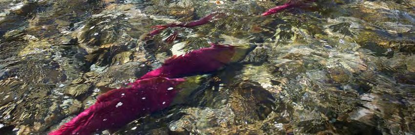
biological diversity and productivity in the marine environment (Oceans
    Act, 1996). In 2002, Canada’s Ocean Strategy was released in response to the
    legislative and policy requirements outlined in the Oceans Act (GOC, 2002).
    The Ocean Strategy is based on three principles: sustainable development,
    integrated management and the precautionary approach. The implementation
    of the strategy commits the Canadian government to ensuring that the Oceans
    Act principles guide all ocean management decisions (GOC, 2002). According
    to Canada’s Ocean Strategy, an integrated approach is key to implementing the
    principles of EBM to fulfill the mandate of the Oceans Act.
    Though there is no universal consensus on what principles should be included
    within EBM, a review of EBM literature has identified several key principles
    that appear most frequently, including (in descending order of importance):
    consideration of ecosystem connections; appropriate spatial and temporal
    scales; adaptive management of human activities; use of scientific knowledge;
    and integrated management (Long et al., 2015). EBM initiatives recognize the
    inherent linkages between ecosystem components, such as biotic and abiotic
    interactions, and incorporate these associations into management decisions
    (Arkema et al., 2006). Management decisions should also recognize the
    cumulative effectives of human activity and evaluate all sectors that impact or
    are impacted by the ecosystem (UNEP, 2011). Additionally, EBM management
    plans have spatially explicit boundaries and include long-term ecosystem-
    related objectives (Long et al., 2015).
    The Pacific North Coast Integrated Management Area (PNCIMA) plan, released
    in 2017, is a recent example of an integrated management initiative in Canada
    that explicitly incorporates key principles of EBM into a framework that guides
    goals, objectives and strategies (PNCIMA Initiative, 2017). The purpose of the
    EBM framework is to achieve integrity of the marine ecosystems in PNCIMA,
    support human well-being, promote collaborative, effective transparent and
    integrated governance, and to improve understanding of marine ecosystems
    (PNCIMA Initiative, 2017). Although national integrated management initiatives
    have primarily been applied to management of large ocean management
    areas, like PNCIMA, EBM approaches can be used to manage local-level marine
    systems. One such example is the Ocean Special Area Management Plan
    (Ocean SAMP), a regulatory tool created to manage the development and
    protection of Rhode Island’s marine resources within the study area (Rhode
    Island Coastal Resources Management Council, 2010). The Ocean SAMP was
    designed as an expression of EBM, aiming to promote a functioning marine
    ecosystem that is both ecologically sound and economically beneficial (Rhode
    Island Coastal Resources Management Council, 2010).

2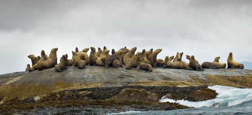
1.2. Baynes Sound/Lambert Channel
1.2.1. Ecological Overview
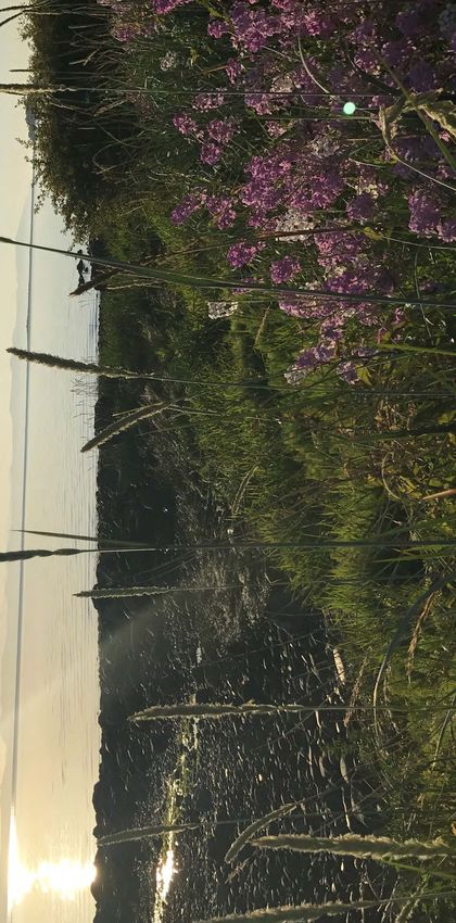
Baynes Sound/Lambert Channel, located on the east coast of Vancouver Island
in British Columbia, is an ecologically, economically and culturally significant
region that would benefit from a coordinated EBM approach. It is situated
within the internal marine waters of the Strait of Georgia ecoregion, the smallest
marine region in Canadian waters (Levesque & Jamieson, 2015). Baynes Sound
borders Vancouver Island to the west and Denman Island to the east. Lambert
Channel borders Denman Island to the west and Hornby Island to the east. The
waters comprise a highly productive ecosystem, characterized by thermally
stratified waters and soft substrate (Jamieson & Levesque, 2014).
This marine region has been recognized as an Ecologically and Biologically
Significant Area (EBSA) by the federal government, which means it is an area
that calls for enhanced management beyond the needs of individual species
(Jamieson & Levesque, 2014). Baynes Sound/Lambert Channel is the highest
ranked cumulative and spawning area for herring in the Strait of Georgia
ecoregion (Jamieson & Levesque, 2014). The region is also important for several
species of Pacific salmon. There are numerous salmon bearing streams that
enter the Sound and provide pathways for migration (British Columbia Ministry
of Sustainable Resource Management (BCMSRM), 2002). Baynes Sound/Lambert
Channel is internationally recognized as a critical feeding and overwintering area
for migratory birds (IBA Canada, n.d.). Marine birds flock to the waters during
the springtime when Pacific herring are spawning, to forage on the abundant
food source (Levesque & Jamieson, 2015). The Sound is home to numerous at-
risk species, including Great Blue Herons (special concern), Marbled Murrelets
(threatened) and Peregrine Falcons (special concern). The marine region has also
been identified as an important foraging area around haul-out sites for Steller Sea
Lions (special concern) and Pacific Harbour Seals (Jamieson & Levesque, 2014).
1.2.2 Socio-Economic Overview
The Baynes Sound/Lambert Channel area is located within the traditional
territories of several First Nations, including K’ómoks First Nation, Qualicum
First Nation, Tla’amin Nation, among others. Several communities populate
the coast of Baynes Sound/Lambert Channel, including communities on
Vancouver Island, Hornby Island and Denman Island. The region is affected
by an increasing number of socio-economic stressors, the most pressing of
which are resource development, urbanization, shellfish aquaculture and
harvesting of wild fish and marine plants (Stewarding the Sound, 2014). Due
to the high level of ecological productivity, the waters support a number of
fisheries, targeting several species of forage fish, Pacific salmon and intertidal
clams. Baynes Sound also supports the highest density of intertidal shellfish
Toward Integrated Management in Baynes Sound: A Comparative Analysis I 3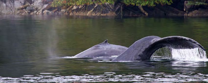
aquaculture in British Columbia, producing over half of all the shellfish
    cultured in the province (Murray and D’Anna, 2015). The industry has become
    a major employer in the area and is estimated to directly provide 100 local jobs
    (Fisheries and Oceans Canada (DFO), 2017).
    In recent years, there has also been an expansion in seaweed harvesting
    activities along the shoreline. Since 2012, the Ministry of Agriculture has
    permitted the harvest of a non-native species of red algae, Mazzaella japonica,
    along the shoreline from Deep Bay to Parksville (Birtwell et al., 2013). As
    the harvestable quotas permitted by the province have increased1, so have
    concerns about the potential impacts of this activity on the surrounding
    ecosystem (Stewarding the Sound, 2014).

    1.2.3. Purpose of this Report
    Baynes Sound/Lambert Channel is presently managed through a sectoral
    approach, whereby a large number of management initiatives produced by
    governments and stakeholders are in place to manage various geographic
    zones and human activities. This is due, in part, to the jurisdictional complexity
    of the region. There is also ecological interplay between the dominant
    economic sectors, which are primarily natural resource-based. The sectoral
    plans are not formally integrated and largely lack coordination, operating
    independently of one another.
    Today, there are nearly 30 management plans at various stages of
    implementation for Baynes Sound/Lambert Channel coastal and marine areas.
    Although these documents have the potential to contribute to long-term
    management of the area, most do not formally recognize one another, nor do
    they seek to manage in a coordinated manner to ensure ecosystem health. The
    purpose of this report is to compare and analyze the existing management
    plans for the Baynes Sound/Lambert Channel marine ecosystem, identifying
    opportunities and challenges to lay the foundation for the future progress
    of integrated EBM. The main objectives are to identify the extent to which
    the various management plans are already integrated, and to describe areas
    where integrated management could be improved.
    To achieve these objectives, this report assesses the degree of integration among
    each of the relevant management plans. Following a description of research
    methodology, grouped management summaries are provided for regional
    context and a general overview of current management. The results from
    the content analysis are then presented in a comparative chart, which details
    spatial and temporal scales, human activities, species-specific management and
    ecosystem-level management. Each of these management themes are then
    comparatively analyzed to identify common elements in current management
    initiatives as well as potential opportunities to enhance integrated EBM.

    1
        According to Holden et al. (2017), a 900-tonne quota was approved in 2014/2015 and was increased to 1500 tonnes for the 2015/2016 season.

4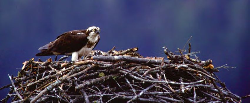
© Andrew S. Wright, WWF-Canada

2. RESEARCH METHODOLOGY
                       An assessment of peer-reviewed literature was conducted to determine
                       key principles of EBM that should be included in an integrated coastal plan
                       (Arkema et al., 2006; Long et al., 2015; PNCIMA, 2017; UNEP, 2011). Relevant
                       EBM principles considered specific ecological elements, human dimensions
                       and management criteria (Table 1). These principles were used as a framework
                       to evaluate current management practices for Baynes Sound/Lambert Channel,
                       identifying common elements between plans to lay the foundation for future
                       integrated management.

        Table 1         PRINCIPLE              DESCRIPTION
Key EBM principles      Ecosystem-Level        Planning considers ecosystem-level management, involving habitats
 identified in peer-    Management             and species interactions.
reviewed literature     Temporal Scale         The management plan forecasts long-term perspectives.
       assessment.
                        Spatial Scale          The spatial scale of the management area has defined boundaries.

                                               Management considers interactions among human activities, as well
                        Management of
                                               as between human activities and the environment, and are managed
                        Human Activities
                                               to minimize conflict.
                                               Plans are integrated vertically and horizontally, and across similar
                        Integration
                                               temporal and spatial scales.
                        Adaptive Management    Management is responsive to changing circumstances and conditions.

                       A content analysis was conducted to comparatively assess the management
                       documents. To obtain the documents, a broad Internet search was performed
                       to assemble documents relevant to the scope of the report. The geographical
                       scale of the planning area includes the marine ecosystem that comprises Baynes
                       Sound/Lambert Channel, including the intertidal and coastal environments
                       (encompassing Denman and Hornby Islands), as well as connected watersheds
                       (e.g. K’ómoks Estuary) and nearshore landward areas. Upland of Baynes Sound,
                       there is an active mining industry; however, the potential effects of run-off from
                       this industrial activity were not examined in this analysis.
                       After compiling the initial list of management plans, documents were then
                       further selected based on subject matter and structural organization. Eligible
                       plans were management oriented, and contained objectives and strategies
                       related to marine and coastal environments. For instance, Keeping It Living is
                       a vision document for K’ómoks Estuary with suitable geographic relevance;

                                              Toward Integrated Management in Baynes Sound: A Comparative Analysis I            5
however, it was excluded from the analysis because it does not directly
    manage the estuary. Additionally, management plans were included if they
    were the latest available from a particular agency, regardless of whether
    they were fully implemented. The publications selected for this analysis were
    downloaded from the official websites of various government and stakeholder
    interest groups, each of which is publicly accessible2. There were 29 documents
    selected in total, which included municipal development strategies, spatial
    management strategies and sectoral management strategies (Table 2).
    To search for relevant provincial and federal species management plans, it was
    first necessary to identify species at risk (Species at Risk Act (SARA), IUCN Red-
    and Blue-listed) with populations located in Baynes Sound/Lambert Channel
    (Appendix A). The inventory of species listed by Fisheries and Oceans Canada
    (DFO) in the Strait of Georgia ecoregion EBSA report and Important Bird Areas
    (IBA) Canada were collated, and each species run through provincial and federal
    databases: the BC Species & Ecosystems Explorer and the Species at Risk Public
    Registry (Data Centre, 2019; Government of Canada, n.d.). These databases
    provided the species management plans, if available. Though there may be
    additional at-risk species present in the area that were not listed in these
    documents, they were not included in the analysis.
    To compare existing management plans, data from the Baynes Sound/Lambert
    Channel management documents were assessed using content analysis
    (Krippendoff, 2013). This method applies a consistent set of criteria to code the
    texts, which are subsequently organized into broader categories. A code list was
    iteratively developed during the analysis (Appendix B). Coded texts were further
    organized into categories, which are based on key principles of EBM, to allow for
    direct comparison between and among the plans. Categories derived from EBM
    principles included spatial and temporal scales, ecosystem-level management,
    anthropogenic activities and policy aims/objectives. Since the scope of some
    of the documents was broader than the scope of this analysis, only relevant
    content that was related to management of coastal and marine environments
    was extracted. Coded data were extracted from each of the plans using a
    manifest analysis, relying on the explicit mentioning of a term or concept.
    Management plan analysis was done manually and without the use of computer
    assisted software. To do so, each of the management documents was converted
    to word processing format (docx), and passages of text were coded using the
    comment function in Microsoft Word (La Pelle, 2004; Knoch, 2018). The coded
    comments were then extracted using a macro extension and imported into
    Microsoft Excel. Following data extraction, the textual content was reorganized
    and categorized using a colour-coded methodology (Bree and Gallagher,
    2016). The colour codes corresponded to the following themes of integrated
    management: spatial and temporal scales; human activities; single-species
    management; and ecosystem-level management. Once content from each of the
    plans was sorted into these themes, it was comparatively assessed via a semi-

    2
        The full versions of some of the Integrated Fisheries Management Plans are available upon email request.

6
quantitative analysis. The analysis provided counts for each of the categories;
for example, determining how many plans referenced management objectives
related to shellfish aquaculture.
Table 2 PLAN TITLE YEAR
Management plans
Baynes Sound Coastal Plan for Shellfish Aquaculture 2002
selected for analysis
Baynes Sound/Lambert Channel-Hornby Island Waters Important Bird Areas
(n=29). 2001
Conservation Plan
Boyle Point Provincial Park Master Plan 1990
British Columbia and The Nature Trust Joint Conservation Land Management Program
2016
(West Coast)
Comox Valley Regional Growth Strategy 2010
Comox Valley Sustainability Strategy 2010
Courtenay River Estuary Management Plan. Volume 1. Integrated Management Plan.
2001
Working Draft.
Denman Island Official Community Plan 2008
Electoral Area ‘H’ Official Community Plan 2017
Fillongley, Tribune Bay, Helliwell and Sandy Island Provincial Parks Master Park Plan 1987
Growing Our Future Together – Regional District of Nanaimo Agriculture Area Plan 2012
Helliwell Provincial Park Ecosystem Based Plan 2001
Hornby Island Official Community Plan 2014
Integrated Fisheries Management Plan for Geoduck and Horse Clam (Pacific Region) 2019
Integrated Fisheries Management Plan for Intertidal Clams (Pacific Region) 2019
Integrated Fisheries Management Plan for Roe Herring (Pacific Region) 2017
Integrated Fisheries Management Plan for Salmon in Southern B.C 2018
Integrated Framework for Geoduck Management 2017
Islands Trust Conservancy Regional Conservation Plan 2018-2027 2018
K’ómoks First Nation Comprehensive Community Plan 2014
K’ómoks Marine Use Plan 2012
Management Plan for the Great Blue Heron fannini subspecies (Ardea herodias
2016
fannini) in Canada [Proposed]
Management Plan for the Peregrine Falcon pealei subspecies (Falco peregrinus pealei)
2017
in Canada
Management Plan for the Steller Sea Lion (Eumetopias jubatus) in Canada 2011
Puntledge River Watershed Action Plan 2017
Recovery Strategy for the Marbled Murrelet (Brachyramphus marmoratus) in Canada 2014
Regional Growth Strategy – Shaping our Future 2011
Rural Comox Valley Official Community Plan 2014
Shellfish Integrated Management of Aquaculture Plan 2017
Toward Integrated Management in Baynes Sound: A Comparative Analysis I 7© Frank Parhizgar, WWF-Canada
3. MANAGEMENT SUMMARIES
There are many governing bodies in Baynes Sound/Lambert Channel (Table
3). Although each has a distinct management role, there are overlapping
jurisdictional boundaries. For instance, the regional governments are
responsible for land-use planning within their District area, up to the low-water
mark on their coastlines, and the Islands Trust Conservancy has land-use
planning authority in the Islands Trust Area (i.e. Denman and Hornby Islands).
However, there is jurisdictional overlap in the marine waters of Baynes Sound/
Lambert Channel between the Islands Trust and regional, provincial, federal
and First Nations governments.
The following section presents grouped management summaries, to provide
regional context for each of the relevant agencies and management plans.
Individual summaries for each of the management plans can be found in
Appendix C.
Table 3 AGENCIES DESCRIPTION
Governing bodies Fisheries and • The lead federal authority for managing fisheries and aquaculture in
in Baynes Sound/ Oceans Canada British Columbia.
Lambert Channel. (DFO)
• DFO also manages specific species, habitats or ecosystems for
freshwater fish and marine species.
Environment and • Responsible for water quality monitoring and recommendations for
Climate Change shellfish advisories.
Canada (ECCC)
• ECCC also manages specific species, habitats or ecosystems for
migratory birds.
BC Ministry of • Responsible for the effective protection, management and
Environment and conservation of British Columbia’s air, land, water and living resources.
Climate Change
• Responsible for managing specific species, habitats or ecosystems
Strategy
for freshwater fish and most terrestrial species.
BC Ministry of • Responsible for managing Crown land, including the issuance of land
Forests, Lands, tenures for aquaculture.
Natural Resource
• Responsible for managing and licensing the wild harvest and culture
Operations and
of aquatic plants.
Rural Development
8AGENCIES DESCRIPTION
BC Parks • A division of the Ministry of Environment and Climate Change
Strategy, BC parks is responsible for the designation, management
and conservation of a system of ecological reserves, provincial
parks, conservancies, protected areas and recreation areas located
throughout British Columbia.
First Nations • Several First Nations have traditional territory in Baynes Sound/
Lambert Channel, including K’ómoks, Qualicum, Tla’amin and
Nanoose First Nations.
Comox Valley • A regional District that encompasses the Village of Cumberland, the
Regional District Town of Comox and the City of Courtenay, along with the electoral
(CVRD) areas of Baynes Sound, Lazo North and Puntledge-Black Creek.
• Carries out land-use planning in each of these areas (with the
exception of Denman and Hornby Islands, which are under the
jurisdiction of the Islands Trust).
Regional District of • A regional District that encompasses the City of Nanaimo, the City of
Nanaimo (RDN) Parksville, the Town of Qualicum Beach and the District of Lantzville,
along with seven electoral areas.
• Carries out land-use planning in each of these areas (with the
exception of Gabriola, DeCourcy, Mudge Island, which are under the
jurisdiction of the Islands Trust).
Islands Trust • A conservation land trust created to carry out the provincial mandate
Conservancy of the Islands Trust Act, which is to preserve and protect the Islands
Trust Area and its unique amenities and environment.
• Responsible for land-use planning in Islands Trust Area, which
includes Denman and Hornby Islands.
The Trust Fund of • A land conservation organization, which frequently collaborates
British Columbia with other agencies and various levels of government to manage
ecologically significant lands across British Columbia.
3.1. Fisheries Management
The Fisheries Act establishes DFO as the lead authority in managing all fisheries
in Canada’s ocean territory. Fisheries management is guided by the Sustainable
Fisheries Framework. The framework is a guide to implementing an ecosystem
approach to fisheries management. It also establishes a precautionary approach
to management by providing tools to monitor and assess sustainable initiatives
(DFO, n.d. a). Integrated Fisheries Management Plans (IFMPs) are the primary
management tool through which the Sustainable Fisheries Framework policies
are applied. IFMPs are used to guide the conservation and sustainable use of
marine resources and to support the management of sustainable fisheries
(DFO, n.d. b). The overarching purpose for each of the plans is to identify the
main objectives and requirements for each fishery, as well as the management
measures that will be used to achieve those objectives.
There are four relevant fisheries management strategies from DFO, which
are included in this analysis: the IFMP for Roe Herring; the IFMP for Salmon in
Southern British Columbia; the IFMP for Geoduck and Horse Clam; and IFMP
for Intertidal Clams. With the exception of the IFMP for Salmon, each of the
management plans encompasses fisheries across the Pacific Coast. The temporal
Toward Integrated Management in Baynes Sound: A Comparative Analysis I 9scope of the plans ranges from one to three years in duration. Each of the
IFMPs follows a template, which includes an overview of the fishery, the stock
assessment and status (describing ecosystem interactions, available information
on precautionary approach references, and stock trends), management issues,
short- and long-term fisheries objectives, management measures for the duration
of the plan and a performance review of previous objectives (DFO, n.d. a).
3.2. Aquaculture Management
In 2010, DFO and the Province of British Columbia signed an Agreement
on Aquaculture Management, which lays out the primary responsibilities
of the federal and provincial governments related to the management of
aquaculture (DFO, n.d. c). The agreement assigns DFO the role of the lead
federal department for issuing licenses and regulating most aspects of marine
finfish, shellfish and freshwater/land-based aquaculture operations in British
Columbia. The Province of British Columbia is responsible for issuing tenures
where operations take place, licensing marine plan cultivation, regulating
the business aspects of aquaculture (e.g. workplace health and safety) and
reporting on seafood exports (DFO, n.d. c).
Under the agreement, DFO is responsible for creating Integrated Management
of Aquaculture Plans (IMAPs). Although DFO has released IMAPs for each sector
of aquaculture (freshwater/land-based, marine finfish and shellfish aquaculture),
only the Shellfish IMAP was included in this analysis because it is the dominant
sector in Baynes Sound. As stated in the introduction, the planning area is the
most important area in British Columbia for shellfish aquaculture (IBA Canada,
n.d.). The purpose of the Shellfish IMAP is to identify the main objectives and
requirements for the management of shellfish aquaculture in British Columbia,
as well as the management measures used to meet these objectives.
To manage geoduck aquaculture in British Columbia, DFO created the
Integrated Geoduck Management Framework (IGMF), which provides a
harmonized framework to manage both wild and aquaculture geoduck
fisheries. The IGMF provides siting guidelines for new shellfish aquaculture
operations, to inform proponents about which criteria are likely to affect
application approval. Given that Comox Bar remains an active geoduck fishery,
the framework was also included in the analysis.
The Baynes Sound Coastal Plan for Shellfish Aquaculture (BSCPSA) is a
collaborative effort led by the provincial government to guide the sustainable
development and management of shellfish aquaculture in Baynes Sound
(BCMSRM, 2002). It is multi-agency provincial project, guided by advice from
DFO and the Canadian Wildlife Service. Created prior to the 2010 change in
management responsibilities, the plan has not been updated to reflect the
change in aquaculture authority. It is still listed on the provincial website as the
management plan for Baynes Sound and so was included in this analysis.
103.3. Species Conservation
3.3.1. Bird Conservation
Baynes Sound/Lambert Channel is a significant area for several species of
birds, including an exceptionally high concentration of waterbirds (IBA Canada,
n.d.). This is principally due to the variety of different habitats within the region,
including inshore and foreshore marshes, low gradient deltas and tidal flats,
which provide different sources of food for birds (IBA Canada, n.d.). One of the
most important sources of food is the high production of herring spawn that
occurs throughout the region; upwards of 60,000 birds feed on adult herring and
their eggs during peak season (IBA Canada, n.d.).
To focus conservation actions for this important ecosystem, Baynes Sound/
Lambert Channel has been designated as an Important Bird Area (IBA). IBAs
are sites that provide essential habitat for one or more species of breeding or
non-breeding birds (Booth, 2001). Now known as the K’ómoks IBA, the site is an
amalgamation of three formerly separate IBAs: the Comox Valley IBA, the Baynes
Sound IBA and the Lambert Channel/Hornby Island Waters IBA. The three IBAs
share common populations of waterbirds but were established separately
because they were nominated for designation independently (IBA Canada, n.d.).
The K’ómoks IBA is designated for four species at the global level (Trumpeter
Swan, Harlequin Duck, Thayer’s Gull, Glaucous-winged Gull); one species at the
continental level (Mew Gull); and two species at the national level (Great Blue
Heron and Peregrine Falcon) (IBA Canada, n.d.).
The management plan for this IBA, the Baynes Sound/Lambert Channel-
Hornby Island Waters IBA Conservation Plan, was created in 2001 prior to the
amalgamation and does not manage the additional area encompassed by the
current K’ómoks IBA (Booth, 2001). The purpose of this plan is to highlight the
wildlife values within the planning area, detail the key issues that may affect
those values, and to direct future conservation activities to address these issues.
Though the plan remains the most recent management document for the region,
this analysis has been supplemented with relevant updated information from IBA
Canada (IBA Canada, n.d.). Additional information regarding bird conservation
management for at-risk birds is found in the Species-at-Risk section below.
3.3.2. Rockfish Conservation
There are three Rockfish Conservation Areas (RCAs) within Baynes Sound/
Lambert Channel: Baynes Sound, Savoie Rocks-Maude Reef and Chrome.
According to monitoring data, inshore rockfish populations are particularly
low in the inshore waters of Vancouver Island (DFO, n.d. d). RCAs aim to
reduce population decline by protecting rockfish from all forms of mortality
associated with commercial and recreational fishing activities (DFO, n.d. d).
Toward Integrated Management in Baynes Sound: A Comparative Analysis I 11Fishing activities that are banned include commercial salmon fishing by seine
or gillnet; commercial herring fishing by gillnet, seine and spawn-on-kelp; and
recreational fishing of invertebrates by handpicking or diving (DFO, n.d. d).
3.3.3. Species at-Risk
The Species at Risk Act (SARA) requires the federal government to prepare
recovery strategies and recovery actions plans for SARA-listed extirpated,
endangered and threatened species within legislated timelines, and to prepare
management plans for species of special concern (SARA, 2002). There are
federal plans for several at-risk species that occur in Baynes Sound/Lambert
Channel, including management plans for the Great Blue Heron, the Peregrine
Falcon, and the Steller Sea Lion, and a recovery strategy for the Marbled
Murrelet. Management plans provide an overview of the species, including
status, distribution, key threats and needs, as well as management goals,
objectives and actions. Recovery strategies assess the feasibility of recovery for
at-risk species and identify critical habitat for species at risk.
The Government of British Columbia also collaborates with the federal
government to management and/or recover species at risk, as mandated
by the Accord for the Protection of Species at Risk in Canada (1996) and the
Canada-British Columbia Agreement on Species at Risk (2005). The agreement
established a framework within which both governments can exercise their
respective powers in a coordinated and focused approach, to deliver species-
at-risk legislation, policies and operational procedures (Government of British
Columbia, n.d. a). For instance, the federal management plan for the Peregrine
Falcon incorporates the entirety of the provincial management plan. Though
there are stand-alone provincial plans for the Marbled Murrelet and the
Western Screech Owl, these documents focus on terrestrial management
actions and were therefore outside of the scope of this report.
The Identified Wildlife Management Strategy is another provincial species
conservation initiative, undertaken by the Ministry of Environment and Climate
Change Strategy in partnership with the Ministry of Forests and Range (British
Columbia. Ministry of Environment and Climate Change Strategy, n.d.). The
purpose of the strategy is to manage the habitats of species at risk in British
Columbia, principally through the implementation of Wildlife Habitat Areas.
There are species accounts under this strategy for wildlife present in Baynes
Sound/Lambert Channel, including Great Blue Herons, Marbled Murrelets and
Western Screech Owls. However, since efforts guided by the Identified Wildlife
Management Strategy are focused on protecting terrestrial habitats from
forest and range practices, these initiatives were not included in this report.
3.4. First Nations Resource Management
Baynes Sound/Lambert Channel lies within the shared traditional territory
12of multiple First Nations, including K’ómoks, Qualicum, Tla’amin and
Nanoose First Nations. However, only the K’ómoks First Nation has produced
management plans for the marine region and therefore their role in
governance is the focus of this report. In 2011, the K’ómoks Marine Use Plan
was released, the purpose of which is to provide the overall strategic direction
for acceptable marine uses and activities within the traditional territory of the
K’ómoks First Nation.
The K’ómoks First Nation has also developed a Comprehensive Community
Plan, which sets out a vision for the future of the community, addressing lands,
governance, education, health, safety, environmental protection, cultural
values and sustainability. Although much of the content is beyond the scope
of this report, the Comprehensive Community Plan does include goals and
objectives focused on preventing the negative impacts of human activities on
K’ómoks First Nation’s marine and terrestrial territory.
3.5. Land and Marine Use Planning
3.5.1. Coastal Planning
Baynes Sound/Lambert Channel straddles the boundaries of two Regional
districts: the Comox Valley Regional District (CVRD) and the Regional District of
Nanaimo (RDN). Both districts have produced land-use planning documents
for their regions, including the provincially mandated Regional Growth Strategy
(RGS), which aims to promote coordination among the municipalities and
regional districts on issues that cross municipal boundaries. The other purpose
of the RGS is to inform the provincial government of local priorities and
objectives, so that it can align its own directives to support these priorities. The
regional strategies provide an overview of land-use recommendations as well
as an overarching direction to guide local-level planning documents, such as
official community plans (OCPs).
OCPs are produced by regional governing authorities (the CVRD, the RDN
and the Islands Trust Conservancy), and contain more detailed policies and a
regulatory framework that define land-use permissions. Although the CVRD
and the RDN have both produced agricultural plans, only the RDN Agricultural
Area Plan (AAP) was included in this report because it jointly manages intertidal
aquaculture operations alongside terrestrial aquaculture and explicitly
considers farming impacts on the marine environment. The Comox Valley
Agricultural Plan only addresses terrestrial agricultural and its impacts on
ground water and surface waters.
3.5.2. Estuarine Planning
The K’ómoks Estuary (also known as the Courtenay River Estuary) is part of
an extensive estuary ecosystem that extends from Comox Harbour through
Toward Integrated Management in Baynes Sound: A Comparative Analysis I 13Baynes Sound to Deep Bay and Mapleguard Point (IBA Canada, n.d.). K’ómoks
Estuary is one of only eight Class 1 estuaries in Canada, the highest ranking
of five Importance Classes (Ryder et al., 2007). K’ómoks Estuary is considered
to be valuable based on its intertidal size, estuarine habitat, intertidal species,
waterbird density and herring spawn (The Nature Trust, n.d.). Additionally, this
estuary is known to support all five species of Pacific salmon during multiple
life stages, as well as one of the largest populations of migratory birds within
the Salish Sea (K’ómoks First Nation, 2014).
However, the K’ómoks Estuary is also jurisdictionally complex, which has
hindered attempts to move forward with repeated collaborative management/
governance initiatives. The K’ómoks First Nation maintain their inherent
rights to govern the waters, shores and uplands, and are in the process
of negotiating the jurisdictional status of the estuary with the provincial
and federal governments (Estuary Working Group (EWG), 2009). The settler
populations around the estuary are governed by the Government of Canada,
the Provincial Government, the CVRD, and the municipalities of Courtenay,
Comox and Cumberland (EWG, 2009). All of these governments are responsible
for managing human activity within and around the estuary, as well as
conserving and restoring the natural ecosystem (EWG, 2009).
In 2000, the Draft Courtenay River Estuary Management Plan was produced
for DFO (DFO, 2000). Under the Oceans Act, DFO is mandated to lead the
development and management plans for all coastal and estuarine habitats.
The purpose of the plan was to provide a framework for habitat restoration,
economic development, protecting water quality and aquatic ecosystems.
It was intended to be an integrated management guide and to provide a
planning process for all users of the estuary. However, it was never adopted or
implemented by any of the governments (EWG, 2009).
In 2009, the Estuary Working Group, a sub-committee of the Comox Valley
Project Watershed Society, along with relevant governments and stakeholders,
produced a vision document for the estuary called Keeping It Living (EWG, 2009).
This document builds off the Draft Courtenay River Estuary Management Plan, but
provides an updated vision and guiding principles for the estuary. Following
the release of Keeping It Living, the CVRD took the lead in developing a new
management plan in collaboration with local governments. Although the revised
management plan is cited within multiple planning documents created by
K’ómoks First Nation and the CVRD, it is still undergoing First Nations review and
has yet to be publicly released (Project Watershed, n.d.).
The Fish and Wildlife Compensation Program (FWCP), a partnership
between BC Hydro, the Provincial Government and DFO, has produced
multiple planning documents to restore fish and wildlife resources in
the Puntledge River Watershed that have been adversely affected by the
development of hydroelectric facilities. The Puntledge River Watershed -
Watershed Plan, released on 2011, details priority topic areas (Salmonids,
14Riparian / Wetlands and Species of Interest) but does not specifically include
estuarine management objectives. In 2017, the FWCP released the Puntledge
River Watershed Action Plan (PRWAP), which includes threats and priority
management actions for the estuary.
3.6. Land and Marine Conservation
3.6.1. Provincial Parks
Provincial parks are implemented and managed by the Province of British
Columbia through BC Parks. The provincial department describes its mission
as protecting representative species and natural places within the province’s
Protected Areas System for conservation, outdoor recreation, education and
scientific study (BC Parks, n.d. a). There are a number of provincial parks located
along the coastlines of the Denman and Hornby Islands. Boyle Point, Fillongley
and Mount Geoffrey Escarpment Park are located on Denman Island, and
Tribune Bay, Sandy Island and Helliwell Park are located on Hornby Island. Both
Mount Geoffrey Escarpment and Helliwell Park contain nearshore components
that are managed as marine protected areas, with the following commercial
fishery closures that have been implemented by DFO under the Fisheries Act:
anchovy, surf perch, pile perch, sea cucumber, octopus, scallop, squid, red
urchin, Pacific oyster and green urchin (BC Parks, n.d. b).
Each of the parks are designated Class A, which means that they are managed
for the preservation of their natural environment for the use and enjoyment of
the public (BC Parks, n.d. c). The management plans detail zoning requirements
for the marine and terrestrial components of the parks, which are designed to
balance conservation and recreation. Only the management plan for Helliwell
Park was specifically designed to be an ecosystem-based plan (Balke et al., 2001).
3.6.2. Land Trusts
The Islands Trust Conservancy
The Islands Trust Conservancy (formally the Islands Trust Fund) was established
in 1990 by the Province of British Columbia. It is a conservation land trust
created to carry out the provincial mandate of the Islands Trust Act (1974), which
is to preserve and protect the Islands Trust Area and its unique amenities and
environment (Islands Trust Conservancy, n.d.). The Trust Area encompasses the
islands and waters between the mainland of British Columbia and Vancouver
Island, within Canada’s Salish Sea. The Islands Trust Act assigns the Islands
Trust Conservancy, through local area committees, the same land-use planning
authority as a regional district board under the Local Government Act (Hornby
Island Local Trust Committee, 2014).
The Islands Trust Area within the Baynes Sound/Lambert Channel region
includes Denman and Hornby Islands. The Islands Trust Conservancy Regional
Toward Integrated Management in Baynes Sound: A Comparative Analysis I 15Conservation Plan is a general planning document for marine and terrestrial
ecosystems within Islands Trust Area (Islands Trust Conservancy, 2018). The
most recent Regional Conservation Plan was released in 2018 and encompasses
a ten-year period. The purpose of the plan is to describe current land status
and land use, including key threats and priority conservation areas, and to set
goals and area of focus for the next ten years. There are also OCPs in place for
Denman and Hornby Islands, which contain broad goals and policies to guide
land preservation and development (Denman Island Local Trust Committee,
2008; Hornby Island Local Trust Committee, 2014). These plans must be
consistent with regional policies of the Comox Valley RGS as well as the Island
Trusts Policy Statement. The Local Trust Committee is responsible for adopting
and administering the OCPs.
The Nature Trust of British Columbia
The Nature Trust of British Columbia is a land conservation organization that is
dedicated to conserving biodiversity through the acquisition and management
of ecologically significant lands across British Columbia (The Nature Trust, n.d.
a). Key to the success of the program is collaboration with other agencies and
various levels of government; over half of the land parcels are leased to the
Province of British Columbia for joint management with the Nature Trust and
some are leased to local and federal governments (The Nature Trust, n.d. b).
On a three-year rotational basis, the Nature Trust submits a provincial
application detailing its Joint Conservation Land Management Program, the
most recent cycle encompassing 2016-2019. The management program
includes all parcels of lands on the Pacific Coast that are owned by the Nature
Trust and jointly managed with the Province of British Columbia. Relevant to
the scope of this document area are the parcels included within the Baynes
Sound Conservation Area and Courtenay Estuary Conservation Area. The
application document includes conservation and management related goals
and objectives for each conservation area, as well as short- and long-term
performance indicators.
16© Mike Ambach, WWF-Canada
Toward Integrated Management in Baynes Sound: A Comparative Analysis I 17© Andrew S. Wright, WWF-Canada
4. RESULTS AND DISCUSSION
The following table provides an overview the management analysis, comparing the purpose of the plans, spatial and temporal scales, human activities, species-specific management objectives and
ecosystem-level management objectives across each of the documents.
MANAGEMENT CATEGORY Aquaculture Management
Management
Planning Feature
Document Plan Purpose Spatial Scale Temporal Scale Human Activity Species-Specific Management Ecosystem-Level Management
Baynes Sound To provide guidance to • The Coastal Plan area is located between Denman • Completed in 2002, to be reviewed every • The management plan provides spatial • Areas deemed suitable for expanding shellfish • To assess the suitability of areas for industrial
Coastal Plan regulatory agencies and Island and Vancouver Island, and includes Comox three years. management recommendations, in the form of aquaculture operations considered potential expansion, the potential benefits and impacts of
for Shellfish proponents regarding the Harbour. • Intended to be useful for many years, the Management Areas, to guide the sustainable interactions with marine species, including species aquaculture to all near-shore waters, shoreline
Aquaculture sustainable development • It includes all near-shore waters, shoreline and but projected to evolve over time based expansion of shellfish aquaculture. at risk and fisheries resources. and intertidal ecosystems were measured via a
(BSCPSA) and management of the intertidal areas within Baynes Sound and Comox on new information and results from • Impacts to waterbirds, herring, salmon, geoduck, compatibility analysis.
Baynes Sound shellfish Harbour to the high tide mark. implementation and effectiveness seals, sea lions, eelgrass and kelp beds were all
aquaculture industry. monitoring. considered.
• Five-year timeline for phased plan
implementation (2002 to 2007).
Shellfish IMAP To identify the main • This plan was designed for the Pacific Coast and is • Completed in 2017, intended to remain in • The plan addresses all elements of aquaculture • The plan encompasses all cultivated species of • New licence applications may be subject to a
objectives and requirements “concerned with the cultivation of any shellfish within effect for an unspecified amount of time management, which can include the production shellfish within British Columbia, including oysters, thorough review, which may include an assessment
for the management of a marine environment, including the foreshore, • Management priorities will be “revised over or collection of seed, nursery rearing of juvenile clams, geoduck clams, mussels and scallops. of fish habitat, fish resources, species at risk,
shellfish aquaculture in intertidal, and deep water (suspended or on the time as work is completed and based on shellfish, grow-out, harvesting, harvesting, • It also includes aspects related to the culture of ecosystem effects, fisheries, and First Nations use of
British Columbia, as well as ocean floor) areas”. new science, monitoring and engagement transport and imports. molluscs, crustaceans, and echinoderms, but not land and resources for traditional purposes.
the management measures with various interests.” algae or marine plants. • A key objective is to maintain healthy and productive
used to meet these • Shellfish licences are issued on a multi-year aquatic ecosystems; a properly sited operation can
objectives. basis, most often for a period of nine years. significantly reduce impacts to fish and fish habitat.
Integrated To provide a harmonized • Applications for geoduck aquaculture considered for • Completed in 2017, to be reviewed at least • This IGMF guides the management of wild and • Licence conditions for aquaculture operations are • New licence applications will be subject to a joint
Geoduck framework to manage all areas in the Pacific Coast. 10 years following implementation, subject aquaculture geoduck commercial fisheries, and specific to the species being cultured and the type of review by applicable federal and provincial agencies.
Management both wild and aquaculture • The commercial fishery occurs coastwide within to broader policy changes or management applies to applications for new and/or amended operation. • The review will consider the application in the
Framework geoduck fisheries. spatial units called Geoduck Management Areas requirements. shellfish aquaculture licences, including geoduck context of First Nations food, social and ceremonial
(IGMF) (GMAs), designed to manage effort based on quotas. • -Though the schedule of GMA openings and hatcheries. fisheries, adjacent land use, impacts to all other
GMAs correspond with broader Pacific Fisheries closures may vary from year to year, the fisheries and habitat (including proximity to
Management Areas (PFMAs), which are used to fishery is intended to provide a year-round eelgrass, SARA species, intertidal stream channels,
manage all fisheries in the Pacific. supply of product to the market. and fish spawning areas), navigation, size of tenure,
• Baynes Sound/Lambert Channel is within GMA 14/ • -There is a three-year licensing rotation proximity to other tenures, shellfish contamination,
PFMA 14, in the Inside Waters (of Vancouver Island) period for the Total Allowable Catch for the transfer considerations, etc.
management region. fishery within most of the Inside Waters.
18 Toward Integrated Management in Baynes Sound: A Comparative Analysis I 19MANAGEMENT CATEGORY Fisheries Management
Management
Planning Feature
Document Plan Purpose Spatial Scale Temporal Scale Human Activity Species-Specific Management Ecosystem-Level Management
Integrated The overarching purpose • Manages the harvest of geoduck and horse clam • This IFMP covers the period from March 1, • This IFMP guides the management of First Nations, • The management plan considers interactions • This IFMP includes ecosystem objectives that
Fisheries for each of the IFMPs to is throughout the Pacific Coast. 2019, to February 28, 2020, and is renewed recreational and commercial Geoduck and Horse between Sea Otters, a depleted species that preys harvest and culture activities operate in a manner
Management identify the main objectives • First Nations and recreational fishing may occur annually. Clam fisheries. on invertebrate species, and the Geoduck and Horse that prevents impacts to eelgrass beds and other
Plan (IFMP) for and requirements for coastwide, however, openings are contingent upon • Open times in the fishery will be scheduled • The plan also discusses management of broodstock Clam Fishery. sensitive fish habitat.
Geoduck and each fishery, as well as the in-season closures (due to parks, marine reserves, to prevent conflict with herring fisheries and harvest for stock enhancement and aquaculture • Objectives to manage both includes the development • Geoduck and Horse Clam populations tend to
Horse Clam management measures that research, navigation, or sanitary and marine biotoxin herring spawning activity in the South Coast; purposes. of an EBM strategy that will allow a Geoduck fishery overlap with eelgrass beds, which provide critical
will be used to achieve those contamination). GMA 14 is normally closed February 15 to alongside the recovery of otter populations. Since habitat for many fish and invertebrate species.
objectives. • The commercial fishery also occurs coastwide within April 15. the fishery is selective, there are no concerns for • No commercial harvesting can take place in eelgrass
GMAs and is also subject to in-season closures. potential impacts on otters. beds and harvesters are advised to avoid beds when
• There is an annual Horse Clam fishery in Comox Bar anchoring or dragging air hoses.
(GMA 14B03) that has been in operation since 2003.
• Commercial harvest during 2019 to
IFMP for • Manages the harvest of salmon in tidal and non- • This IFMP spans from June 1, 2018, to May • This IFMP guides the management of First Nations, • Covers the management of Pacific salmon species, • DFO is shifting toward an integrated EBM approach
Salmon in tidal waters from Cape Caution south to the British 31, 2019, and is renewed annually. recreational and commercial Salmon fisheries. which include Sockeye, Coho, Pink, Chum and Chinook. to research and management.
Southern British Columbia/Washington border. • There are temporal and spatial closures in • The plan also lists each of the SARA-listed and • Management of Pacific salmon will require linking
Columbia • The commercial fishery is spatially managed through place to protect stocks, which vary according depleted species that may be encountered by salmon variation in salmon production with changes in
Pacific Salmon Fishing Areas (PSFA); Baynes Sound/ to species and region. Within Baynes fisheries, including the Marbled Murrelet and the climate and their ecosystems. Since salmon are
Lambert Channel is dually managed through Salmon Sound/Lambert Channel, the gillnet fishery Steller Sea Lion. anadromous species, they are particularly sensitive
Area D (gillnet) and Salmon Area B (seine). may be restricted to daylight hours if there • The presence of sea lions in PFMA 14 has negatively to changes in both marine and freshwater systems.
• There are beach boundaries (0-2.5 km) in effect are significant levels of non-target species impacted the fishery, reduced stream escapement and DFO conducts multiple programs to monitor and
within Area D to protect Coho and Chinook stock, as catch. altered migration and holding behaviour. These impacts study environmental conditions.
well as radius boundaries around Fillongley Creek and will be considered in future management of the fishery.
closures within Baynes Sound.
IFMP for • Manages the harvest of herring throughout the Pacific • Encompasses the period of November 7, • This IFMP manages the First Nations and • The plan states that there may be interactions • There is no information available on conservation
Herring Coast. First Nations and recreational fisheries occur 2017, to November 6, 2018. recreational harvest of herring, as well as four between the herring fishery and depleted species, limits for herring based on ecosystem
coastwide, subject to appropriate licensing and area • Although this IFMP is meant to be renewed commercial herring fisheries: Roe Herring, Spawn such as the Steller Sea Lion, and other marine considerations.
closures annually, the 2017 report is the latest on Kelp, Food and Bait Herring and Special Use mammals and seabirds. DFO and the fishing industry • More research is needed to better understand the
• The commercial fishery occurs coastwide within Major available on the federal website at the time Herring. collects information about these encounters. interplay of food supply and predation impacts
and Minor Stock Assessment Areas, as well as other of writing. on herring survival, as well as the role played in
management areas and subareas. maintaining the integrity and functioning of the
• Baynes Sound/Lambert Channel is located within the ecosystem.
Major Stock Assessment Area 14. • DFO attempts to mitigate environmental impacts
• There is a permanent closure in Comox Harbour (Sub- from gear types used in fishery; during the roe
Area 14-14). fishery, efforts are made to avoid impacts to
sensitive spawning habitat, such as eelgrass beds.
IFMP for • Manages the harvest of intertidal clams in the Pacific • This IFMP is in effect from January 1, 2019, • - This IFMP guides the management of First • Covers the management of four species of intertidal • In relation to ecosystem interactions, the plan states
Intertidal Clams Region. to December 31, 2021, and renewed every Nations, recreational and commercial intertidal clam: Manila clam, native littleneck clam, butter clam that intertidal clams have a much lower mortality
• First Nation and recreational fisheries may occur three years. clam fisheries. and varnish (savoury) clam. rate after they have settled on the ocean floor and
year-round throughout the coast, subject to in- • Intertidal clams are harvested during low • - Aquaculture operations are managed • - Since clams are harvested by hand and rake found protective habitat. Once settled, dominant
season closures (Parks, Marine Reserves, research, tide cycles by hand digging only. independently of the fishery, although tenure digging, by-catch of non-target species can be easily predators include crabs and sea stars and minor
navigation, or sanitary and marine biotoxin • CMA D is a summer fishery only, with an holders may access wild stocks for broodstock sorted out and is not a concern. predators include molluscs, marine mammals and
contamination). average of eight tides harvested annually. purposes. waterbirds.
• The commercial fishery is spatially managed through • The proposed opening for the commercial
Clam Management Areas (CMAs); Baynes Sound/ fishery in CMA D is from May through
Lambert Channel is located within CMA D. August, although specific openings will be
• The commercial fishery is also subject to closures. subject to consultation with industry.
• There is no commercial fishery in Comox Harbour. • Openings are reliant on market conditions,
water quality and weather.
20 Toward Integrated Management in Baynes Sound: A Comparative Analysis I 21You can also read