Baw Baw Municipal Fire Management Plan 2018 2021 - Version 4.0 October 2018
←
→
Page content transcription
If your browser does not render page correctly, please read the page content below
Baw Baw Municipal Fire Management Plan

              2018 - 2021

         Version 4.0 October 2018
Authorisation and Endorsement
Baw Baw Shire Council is the custodian of this Municipal Fire Management Plan (MFMP), as a sub
plan of the Municipal Emergency Management Plan (MEMP).

This MFMP has been produced by the Municipal Fire Management Planning Committee (MFMPC)
pursuant to Section 20 of the Emergency Management Act 1986 (EM Act) and will be deemed to fulfil
Section 55A of the Country Fire Authority Act 1958 (CFA Act).

1           Version 4.0      October 2018
Version Control
 Version         Date         Brief Description of Changes
 Version 1.0     31/10/2011   Document creation

 Version 2.0     11/04/2013   Inclusion of structural fire and fires involving chemicals. ABS and fire
                              history updates.
 Version 2.1     11/08/2015   Reviewed Plan updated.
 Version 2.2     05/11/2015 Reviewed Plan Adopted
 Version 2.3     10/11/2016   Reviewed Plan
 Version 3.0     29/11/2016   Plan endorsed by MEMPC
 Version 4.0     17/10/2018   Reviewed Plan

The Baw Baw MFMPC has made every effort to ensure the accuracy of the information contained
within this plan. Any inaccuracies or omissions should be notified to:
Dale Gilliatte
Acting Coordinator Emergency & Fire Management (MERO/MFPO)
Baw Baw Shire Council
Ph: 5624 2487
dale.gilliatte@bawbawshire.vic.gov.au
Postal Address:
PO Box 304
WARRAGUL VIC 3820

2              Version 4.0    October 2018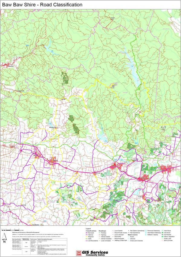
Contents
Authorisation and Endorsement ......................................................................................................... 1
Version Control .................................................................................................................................... 2
Part 1 – Introduction .................................................................................................................. 5
Introduction to Fire Management ....................................................................................................... 5
Bushfire ........................................................................................................................................................... 5
Structure Fire .................................................................................................................................................. 5
Fire Involving Chemicals .................................................................................................................................. 6
Planning Process .................................................................................................................................. 6
Period of Plan....................................................................................................................................... 6
Stakeholder Analysis, Community and Organisational Engagement Process ..................................... 6
Part 2 – Engagement and Communications ............................................................................... 7
Part 3 – Summary of Environmental Scan.................................................................................. 8
Location and Land Managers ............................................................................................................... 8
Economy .............................................................................................................................................. 9
Economic Infrastructure.................................................................................................................................. 9
Natural Resources................................................................................................................................ 9
Baw Baw Shire Community Profile .................................................................................................... 10
Climate ............................................................................................................................................... 10
The impacts of Climate Change ......................................................................................................... 10
Baw Baw Fire History Summary......................................................................................................... 11
Bushfire ......................................................................................................................................................... 11
Structure Fire ................................................................................................................................................ 12
Fires involving Chemicals .............................................................................................................................. 12
Planning Priorities (Values) ................................................................................................................ 12
Future Fire Management .............................................................................................................................. 12
Part 4 – Fire Management Objectives...................................................................................... 15
Plan Aim ............................................................................................................................................. 15
Plan Objectives .................................................................................................................................. 15
Plan Outcomes ................................................................................................................................... 16
Links to Other Plans ........................................................................................................................... 16
Links to Organisations........................................................................................................................ 17
Part 5 – Fire Management Risk Strategies ............................................................................... 18
Bushfire Treatments .......................................................................................................................... 18
Structure Fire Risk Treatments .......................................................................................................... 19
Photo courtesy of VicPol.................................................................................................................... 20
Essential Safety Measures Procedures and Building Inspections ................................................................. 20
Fires Involving Chemicals Risk Treatments ........................................................................................ 20
Part 6 – Improvement, Plan Reporting and Review Process ................................................... 22
Audit Plan........................................................................................................................................... 22
Plan Review and Update .................................................................................................................... 22
Part 7 – Attachments................................................................................................................ 23
Attachment A-1 Register of Assets at Risk - Bushfire ........................................................................ 24
Attachment A-2 Register of Assets at Risk – Structure Fire............................................................... 41
Attachment A-3 Register of Assets at Risk – Fires Involving Chemicals ............................................ 50
Attachment B-1 Hazard Trees Identification (Electricity Safety Act 1998) ........................................ 52
Attachment B-4 – Community Fire Refuges ...................................................................................... 59
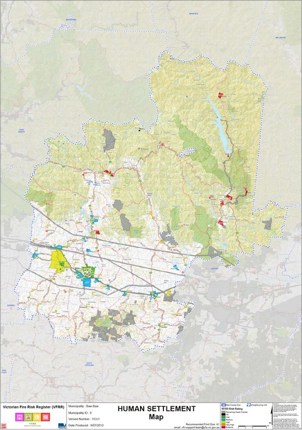
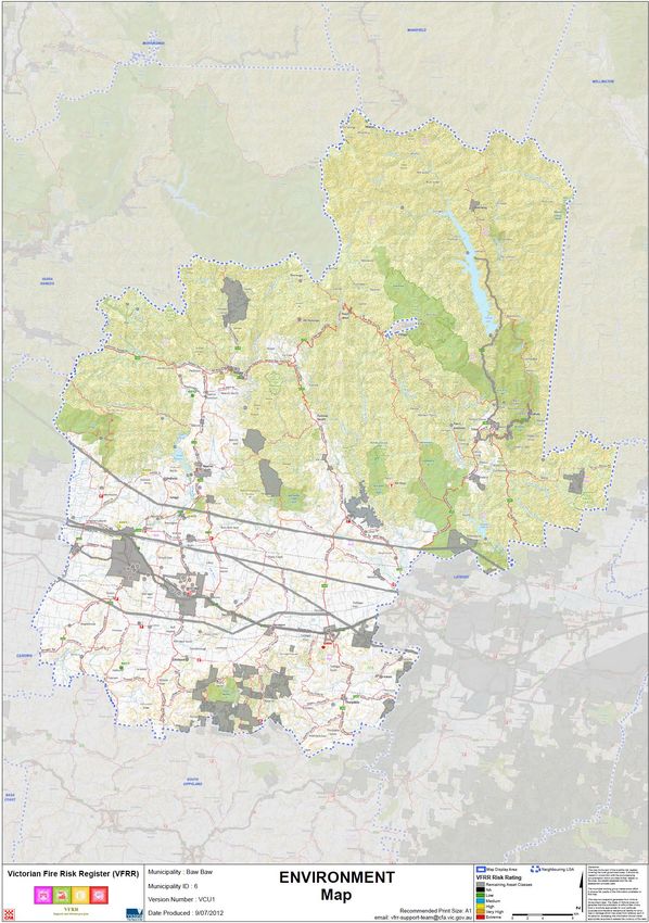
Attachment C – Maps.................................................................................................................................... 60
Attachment D – Links to other plans............................................................................................................. 68
Attachment E – Fire Access Roads ................................................................................................................ 70
Attachment F – Static Water Supplies .......................................................................................................... 71
3 Version 4.0 October 2018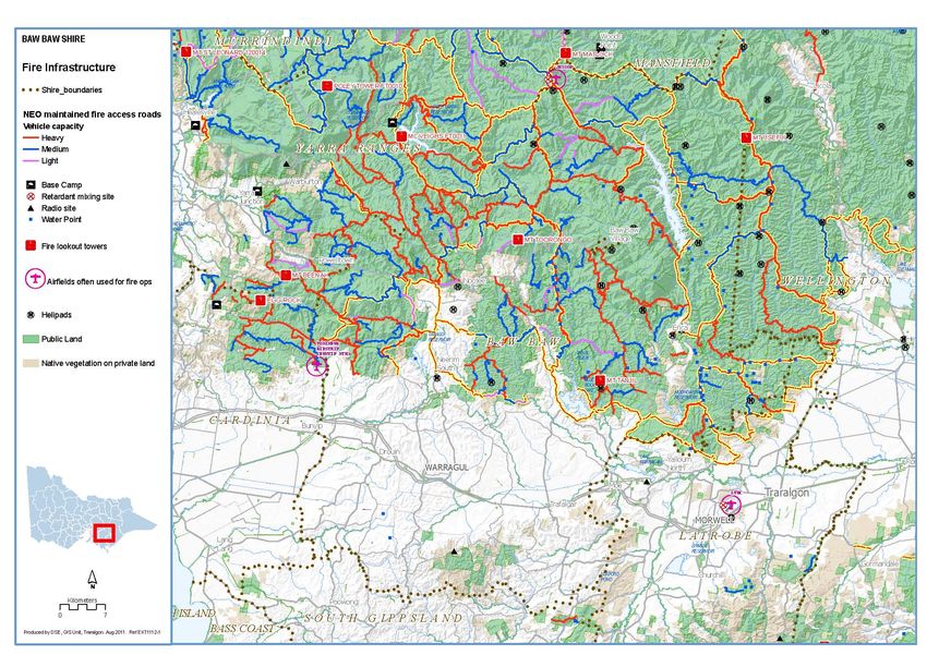
Attachment G – Fuel Management Break Systems....................................................................................... 72
       Attachment H – MFMPC Membership and Stakeholder Distribution List .................................................... 76
    Attachment I - Glossary ..................................................................................................................... 77
    Attachment J – Acronyms .................................................................................................................. 81
    Attachment K – References ............................................................................................................... 82

4                  Version 4.0               October 2018
Part 1 – Introduction
Introduction to Fire Management
The underlying basis of fire management is the protection and preservation of life, property and the
environment. Within this context there are three fire risk elements for communities in the Baw Baw
municipality;
    •      bushfire or grassland fire;
    •      structure fire; and
    •      fires involving chemicals.
The purpose of the MFMP is to articulate the planned and coordinated implementation of measures
designed to;
    • minimise the occurrence of fire;
    • mitigate the effect of fire; and
    • the planned use of fire for a variety of purposes.
An important aspect of implementing the MFMP is to engage the community to obtain a valid
influence in the fire management planning process. It ensures that the Baw Baw MFMP responds to
the community's needs, values and risks.
Bushfire
The Baw Baw municipality is a fire prone environment dictated by a climate of wet winters and hot
dry summers. Fire management needs to be conducted with an understanding of both the role fire
plays, the threats it can pose to life and property, in biodiversity maintenance and the management
of our parks and forests.
Bushfires are a vital part of our natural environment, driving regeneration and maintaining the health
of species and ecosystems. The combination of drought, climate change and unnaturally high fuel
loads have created an unprecedented bushfire risk. Recent times have seen a dramatic increase in
the number, size and severity of bushfires in Victoria.

                                                    Aberfeldy-Donnelley’s fire Friday18 January 2013 Photo: G Pike
Structure Fire
Structure fire is a hazard directly relating to surroundings that are manmade and provide the setting
for human activity. Structure fire can lead to impacts on the following building types:
    • residential
    • industry

5                Version 4.0         October 2018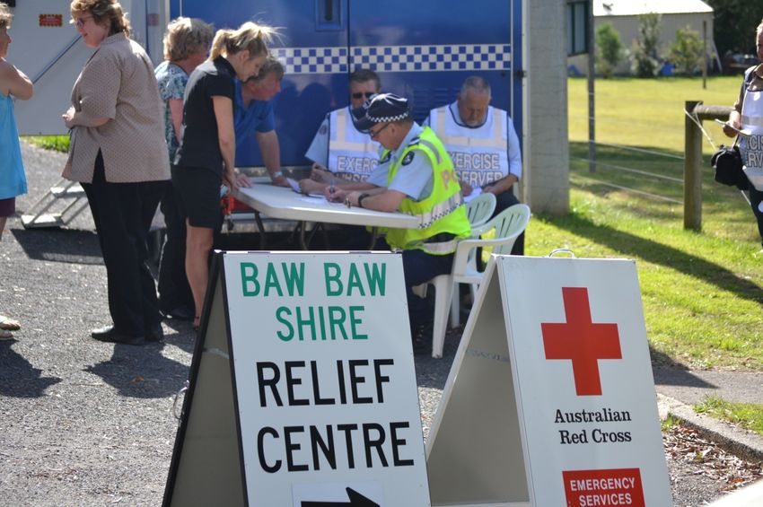
•   commercial
    •   infrastructure
    •   public assembly
    •   public accommodation
    •   healthcare and special accommodation
    •   agriculture
    •   marine
Structure fires occur regularly through the year with fires at residential properties being the most
common.
Fire Involving Chemicals
A chemical fire involves the actual ignition of a hazardous material in sufficient quantity to pose a
danger/threat to life, economy, environment and services to the community. A chemical fire may
occur during manufacture, use, handling, transport or storage.
Whilst there is little documented history of chemical caused fires in Baw Baw Shire, there have been
occurrences of fires involving chemicals. These fires are more complex to manage and control due to
the potential for toxic fumes, damaging environmental runoff, and the possibility of increased or
erratic fire behaviour.

Planning Process
This MFMP includes the other elements of fire risks, of structural fire and fires involving chemicals.
This plan addresses the mitigation of, response to and recovery from fire emergencies within the
municipality and has been development by the Baw Baw MFMPC.
The MFMP is not designed to be a duplication of existing plans, rather to consolidate and coordinate
the significant range of plans that exist within Baw Baw Shire that relate to fire.

Period of Plan
This plan has been endorsed by the Baw Baw Municipal Emergency Management Planning
Committee (MEMPC) on the recommendation of the Baw Baw MFMPC for a period of three years,
commencing as of the date of adoption by Baw Baw Shire Council.

Stakeholder Analysis, Community and Organisational Engagement
Process
Fire safety is a shared responsibility between individuals, the community, government agencies,
private sector and non-government organisations and requires a collaborative approach. All
stakeholders are given the opportunity to contribute to fire management planning and undertake
appropriate action to address the risk of fire.
Part 2 outlines the process undertaken in relation to community and stakeholder engagement.

6             Version 4.0      October 2018
Part 2 – Engagement and Communications
Version 1.0 of this plan was made available for comment via the Baw Baw Shire Council website for a
period of three months in early 2012 and was on display at the Lardner Park Farm World in February
that same year. No formal submissions were received.
Version 3.0 introduced the inclusion of structure and chemical fire hazards in the plan. This drove the
MFMPC to determine that a more rigorous process of engaging with communities, business and
organisations is to be undertaken. This being an important aspect of implementing a full MFMP so
that all stakeholders have a valid influence in the fire management planning process and that the
MFMP responds to the broader community needs, values and perceived risks.

             Noojee Evacuation Exercise 2011: Photo provided by the Fire Services Commissioner, Victoria

7            Version 4.0        October 2018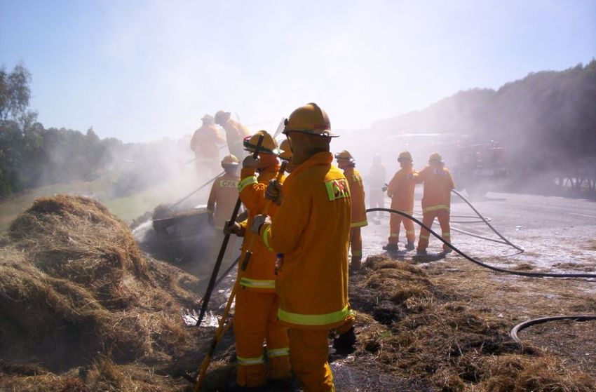
Part 3 – Summary of Environmental Scan
Location and Land Managers
Baw Baw Shire is located in West Gippsland, approximately 120 km east of Melbourne and covers
approximately 4,027 square kilometres of high quality farmland and woodlands and also has the
closest snow fields to Melbourne.
Table 1 Land Managers (Source: DELWP PLM25 GIS dataset)

 Land Managers                                       % of MFMP Area                   Area (ha)
 National Parks Act & Nature Conservation Reserves         6.94                         27,982
 Other Conservation Reserves                               1.13                           4,574

 State Forest                                             46.88                         189,008

 Other Public Land                                         2.69                          10,829

 Leased Plantation                                         1.28                           5,169

 Freehold                                                 40.96                         165,146
 Mount Baw Baw Alpine Resort (UNINC)                       0.11                             434

 Total                                                     100                          403,142

8           Version 4.0        October 2018
Economy
Baw Baw Shire is known for innovation in manufacturing, design and agribusiness. It is home to a
major dairy sector, some of Australia’s leading hydroponics and agribusiness companies, and
innovative food processing companies.
Industry sectors which contribute significantly to Baw Baw Shire's output include manufacturing,
construction and agriculture. The health care and social assistance, agriculture and education and
training industry sectors are the largest employers in the municipality.
Economic Infrastructure
Drouin is at the western end of a 190 km major population corridor. This corridor from Drouin,
through the Latrobe Valley to Sale and Bairnsdale is well serviced by a freeway link to Melbourne.
The significant growth being experienced in Baw Baw Shire, being among the fastest growing
municipalities in the State, is driving the need for upgrades to main transport corridors, particularly
in rural-urban interface areas where more people are moving for the lifestyle but still work in
metropolitan Melbourne.
Water Storage Facilities - There are two water storage areas located within the municipality. These
include the Tarago Reservoir and Thomson Dam. The Thomson Dam is currently used for water
harvesting operations for metropolitan Melbourne. Local water supply catchment areas include the
Blue Rock Dam and Moondarra Dam.
Road Transport - Milk tankers, timber logging trucks, trucks carrying dangerous/hazardous goods
and school and tourist buses traverse the many rural roads as well as the Princes Freeway/Highway.
Gas and Oil Transmission - Approximately 60% of Australia’s crude oil is transmitted from off shore
platforms via steel pipes through the municipality to Hastings. Pumping stations are located at
Westbury and Tanjil South.
Rail Transport - A regular passenger rail service operates between Melbourne and Traralgon. This is
augmented by a Melbourne – Gippsland bus service.

Natural Resources
Baw Baw Shire is located in undulating countryside between the Baw Baw Plateau and the Strzelecki
Ranges. The Shire varies in vegetation cover and comprises of well-developed fertile pasture land in
the central and southern areas and has extensive tracts of forest in the northern ranges.
Mount Baw Baw, the Tarago and Thomson Rivers, Blue Rock Dam, Toorongo Falls Reserve, Glen
Nayook, the Ada Tree, Mount Worth, Moondarra and Tarago Reservoirs are just some of the natural
wonders the Baw Baw Shire boasts.
A substantial forestry industry operates within the municipality and includes both plantation and
Crown Land production of hard and soft wood timbers which are used for both milling and paper
production.

                                                                                     Baw Baw Plateau

9            Version 4.0       October 2018
Baw Baw Shire Community Profile
Current statistics about the Baw Baw municipality demography is available at the Baw Baw Shire Council
website’s REPLAN page at https://www.communityprofile.com.au/bawbaw/trends/population.
Statistics include information on the;
• built environment;
• Socio-economic Indexes for Areas (SEIFA);
• population; and
• employment.
Climate
The climate of Baw Baw Shire is temperate and seasonal, where a high annual rainfall can be around
1070mm. Mean maximum temperatures in lower areas range from 24 °C in January to 15 °C in July.
In the highlands of the Baw Baw Plateau, temperatures range from a maximum of 18 °C to a
minimum of 8 °C. However, in winter, mean minima in these areas can be as low as -4 °C, leading to
snowfall between June and November.
The impacts of Climate Change
Baw Baw Shire sits within the Victorian Government’s ‘West Gippsland Region (Climate Change Profile)
and is known to be a part of Australia’s Southern Slopes (Victoria East).
Temperatures have increased over the past century, with the rate of warming higher since 1960. This
has seen over the past 100 years a global surface air temperature rise by almost 1°C. Our climate has
varied throughout history, although it is the long-term average that is changing. This is due to human
activity through our release of greenhouse gases from the burning of fossil fuels, land use change
and agriculture. Atmospheric concentrations of carbon dioxide are now more than 40% higher than
they were before industrialisation.
Changes in climate will have a range of impacts on our natural environment, tourism, water
resources, community health, infrastructure and primary production. The frequency and intensity of
bushfires will also increase, with the richness of our biodiversity and the health of our community
and landscapes being affected.
Natural environment impacts - The impacts climate change can have on the natural environment can
be quite extensive. It can amplify existing threats to flora and fauna, change habitat and change the
dynamics of invasive species.
Water - Decreases in rainfall and higher evaporation rates will mean less soil moisture and less water
for rivers. Our demand for water may also increase as a result of warmer temperatures and as our
population grows. Therefore, our need to use water more efficiently will be even greater. Greater
bushfire activity could temporarily contaminate water catchments with sediments and ash.
Farms and primary production - Climate change will have both positive and negative impacts on the
types of crops we grow and the productivity of our primary production systems. Any reduction in
rainfall will place most farms under stress, particularly when linked to higher temperatures. Some
impact studies have been carried out, and have identified;
• increased heat stress on dairy cattle, reducing milk production;
• increased frequency and duration of extreme drought;
• inadequate winter chilling for some fruit trees, which may reduce fruit yield and quality,
however, higher temperatures are likely to reduce the risk of damaging winter frosts for
other crops;
• in viticulture, higher temperatures are likely to reduce grape quality;
• less soil moisture, resulting in soil erosion; and
• habitat fragmentation, weeds and pest animals.
10 Version 4.0 October 2018• Variability on vector-borne diseases (see Bulletin of World Health Organisation 2000 78,
‘Climate Change and Vector-Borne Diseases: A regional analysis’, A Githeko, S Lindsay, U
Confalonieri, J Patz, World Health Organisation, p 1136-1147).
Other climate change impacts such as heavy rains and winds from storm events will also contribute
to crop damage and soil erosion.
Communities - There are many community health impacts that can arise from climate change. As
global temperature levels rise, it will increase the frequency and magnitude of heatwaves. These
heatwaves can lead to prominent fire weather, more stress on health and emergency services, more
heat-related deaths, particularly among the elderly and disadvantaged, it can lead to mental health
effects and changes in disease occurrence.
Climate change can also result is more extreme weather events such as flash flooding and bushfires.
These events have significant impacts on the community and community health. We need to
understand and consider these risks to be able to minimise the risk. The availability and cost of
insurance may also change as a result of extreme events.
Alpine - Climate change is expected to result in shorter, drier winters which have significant impacts
on Victoria’s unique alpine region and the plant and animal species that live there, many of which are
already endangered. Species, such as the Baw Baw Frog will have nowhere to retreat to as the
climate warms. Reductions in snow cover, increased risk of bushfires and invasion of weeds and
other pests will also have significant impacts. The alpine resort of Mount Baw Baw is an important
economic driver for the local region. Previous research by CSIRO indicates that alpine areas are likely
to experience shorter snow seasons and decreased natural snow cover, although with snowmaking
the alpine resorts will have enough snow for snow activities until at least 2020. Lower elevation
resorts like Mount Baw Baw are particularly vulnerable.
Tourism impacts - Climate change can increase threats to tourism infrastructure, can cause damage to
popular environmental sites and can cause risks to tourists who may be unfamiliar with conditions.
Baw Baw Fire History Summary
Bushfire
The majority of bushfires in Baw Baw occur in grass or low scrub (around 85.8%) with 43.1% of all
bushfires being contained to one hectare or less in size. The known top ignition factors are:
• Unattended and inadequate control of open fires 20.4%
• Deliberately lit fires 12.6%
• Lightning 13.2%
Approximately 59% of Baw Baw is made up of Public Land (including Mount Baw Baw Alpine Resort
and lease plantations), while some 41% is privately owned.
Significant bushfires in the last decade are detailed below:
Year Size Event
2003 750Ha Stolls Road fire.
2004 2,697Ha Blue Rock fire.
2006 15,000Ha Moondarra fire burnt State forest, National Park, private property and
plantations.
2006 600Ha more than 600 hectares were burnt south west of Erica.
2009 Black Saturday Fires. Heavy losses both life and property throughout the State.
2013 86,840Ha Aberfeldy- Donnelley’s fire. Losses included one person deceased, 21 homes,
54 sheds/outbuildings, 17 vehicles and 170 livestock.
2014 Westbury, Drouin West and Neerim South
11 Version 4.0 October 20182018 243Ha McDonalds Track, Seaview plantation/bushfire.
Structure Fire
During the financial year periods of 2000/2001 to 2010/2011, the average number of structure fires
was 31 per financial year, or 8.6 structure fires per 1,000 head of population. During this period
residential house and residential garage fires made up 66.2 % of all structure fires. For all other types
of structure fires (e.g. livestock production, general storage, manufacturing, commercial) each
recorded less than 20 incidents over the 11 year period.
A breakdown of estimated total loss from preventable residential fires in District 9 in 2017 amounted
to $643,5100.
Fires involving Chemicals
During the financial year periods of 2000/2001 to 2010/2011 no fires involving chemicals were
recorded by CFA in Baw Baw.
Planning Priorities (Values)
The priorities or “values” for fire management in Baw Baw Shire are:
• protection and preservation of life is paramount;
• protection of residential property as a place of primary residence;
• protection of critical infrastructure and community assets that support community resilience;
• protection of assets supporting individual livelihoods and economic production that supports
individual and community financial sustainability; and
• protection of environmental and conservation values that consider the cultural, biodiversity,
and social values of the environment.
These priorities are consistent with Gippsland regional and State fire management policies and plans.
1 2
Future Fire Management
An analysis of the environmental scan concluded the following context and future implications for
fire management:
1 IFMP strategy 2009
2 Building new foundations - Fire Services Commissioner, Victoria
12 Version 4.0 October 2018Context Implications for future fire management
Continuing population growth in Warragul and Drouin is “Tree change” trend to semi-rural lifestyles
driven by a number of factors including strong population means more lives and assets are at risk from
growth in Melbourne, housing affordability, and improved bushfires. The value of assets has also increased
transport infrastructure to major employment centres in dramatically with rising property values and
Melbourne. investment.
In balancing urban growth pressures surrounding towns Ongoing development of the urban rural fringe.
Council is taking action to manage growth including These interface areas are more vulnerable with
delivering an up-dated planning scheme, structure plans increased risk of ember attack. Need for buffer
for major towns, direction for urban and rural zones and preventative burning.
sustainability, subdivision guidelines and planning policy.
Bushfire planning provisions were implemented from 2012
onwards – with a focus on protection of human life.
Median age for residents’ is 40 with 30.1% of the Decreasing mobility and ability to prepare and
population being over 55 years. The prediction is that the defend properties against bushfire.
population will continue to age with people living longer Decreasing mobility also raises vulnerability in
and retirees moving to the area. structure fires.
Bushfires have immediate and long-term psychological Evacuation issues during a major bushfire:
impacts on individuals and communities, including anxiety, require designated roads protected to aid with
fatigue and financial stress. evacuation and emergency services access. CIGs
and NSP/PLR will all require a greater
commitment to community engagement.
Lower social economic population group less likely to look Disadvantaged less likely to have the capacity or
after themselves or to maintain fire safe properties, may resilience to live in higher risk areas, respond or
result in greater risk for occupant and fire services. Likely recover from a bushfire. Hence a greater
to increased level of dependency on EM agencies. demand for ‘targeted’ community engagement.
However, a range of communities are actively
engaged in community planning processes and
there is evidence that those communities have
developed higher levels of capacity and
resilience.
Structure fires predominately occur in “Residential year Continuation of CFA’s corporate and regional
round use” properties (59.6%) followed by “Residential home fire safety education programs. 3
garages” (6.6%)
In 2016 occupied private dwellings totalled 17,647
3 Fires in the home - CFA
13 Version 4.0 October 2018Context Implications for future fire management
The Shire has a major west-east transport corridor along It is a high priority to minimise any impact on or
the Princes Hwy of both road and rail; with the Princes disruption to the Princes Hwy during and after
Hwy being the main supply route to Melbourne in the west any bushfire event.
and NSW in the east.
In addition, much of the state’s infrastructure assets pass The maintenance of, or timely re-instatement of
through the municipality, including those related to water, essential services infrastructure is a high priority
power, gas and oil. in the event of a bushfire.
Tourism and its associated service industries and Require an integrated approach by owners and
agriculture are particularly vulnerable to the impact of managers for bushfire prevention,
bushfires. Loss or closure of tourism icons i.e. Mount Baw preparedness, response and recovery to ensure
Baw Alpine Resort will result in high economic losses – the preservation of essential services and safe
could be devastating for remote settlements. routes for supply, evacuation and emergency
services workers.
Most of the Shire’s biodiversity value is located in the Need to further improve the community’s
North due to the relatively intact nature of its native understanding of the role of fire in the
vegetation, ranging from foothill forests to alpine environment (DELWP FOPs) and increase shared
woodlands. While fire is vital for maintaining the health responsibility for risk, prevention and
and regeneration of our ecosystems, severe bushfires can preparedness for bushfire.
have devastating impacts on biodiversity, with few refuges
left for recovery of both plants and animals.
Fires in catchment areas have both immediate and long- Management of fuel loads must be a priority,
term impacts on water supply in terms of quality, erosion, which increases the workload on fires services
river health and yields. Air quality for the region and and municipalities.
beyond is also an issue to be managed.
Climate change in the Shire may have a range of impacts Minimise water use in a bushfire, replacement
e.g. on water resources, bushfire frequency and intensity, of water from private dams.
primary production and infrastructure. As well as the
direct environmental impacts of climate change it will
interact with other drivers of change such as population
growth.
14 Version 4.0 October 2018Part 4 – Fire Management Objectives
Plan Aim
For the MFMPC to collaboratively work together with the Baw Baw community, including
organisations and business, to develop a plan that is risk based and enables a whole of landscape
approach to fire management planning and to implement the plan in an integrated and coordinated
approach to benefit the community and those that adjoin it.
Plan Objectives
Municipal Objectives Gippsland Regional Objectives
Key Theme 1 Key Theme 1
Planning together Planning together
The Baw Baw Municipal Fire Management Planning The Gippsland Regional Strategic Fire Management
Committee (MFMPC) will consist of appropriate Planning Committee (RSFMPC) will consist of
representatives from relevant fire agencies, local appropriate representatives from government and
government and other agencies as appropriate. The other agencies as outlined in the IFMP framework,
committee will meet at least quarterly. will meet at least quarterly.
The Baw Baw MFMPC will: To support the development of Municipal Fire
Management Plans (MFMPs) for each Gippsland
municipality the Gippsland RSFMPC will:
• Carry out a municipal risk assessment and • Carry out a risk assessment for the
treatment analysis using an agreed Gippsland region which identifies Regional
consistent process i.e. Victorian Fire Risk and above risks and provide a list of risks
Register - Bushfire (VFRR-B) and recommended treatments to Gippsland
Municipal Fire Management Planning
Committees (MFMPCs) for consideration in
the development of their plans
• Use municipal environmental scan data to • Ensure each MFMPC has access to
inform the planning process. demographic, climate and population
statistics and forecasts for their municipality
to assist in the planning process
• Carry out a stakeholder analysis and • Carry out a stakeholder analysis and
develop a communications plan which develop a communications strategy which
takes into account existing channels of takes into account existing channels of
communication and the needs of communication and the needs of
stakeholder groups including communities. stakeholder groups and the broader
community.
Key Theme 2 Key Theme 2
Implementing collaboratively Implementing collaboratively
Member agencies of the Baw Baw MFMPC will Member agencies of the Gippsland RSFMPC will
actively support the municipal planning process actively support the municipal planning process
through the provision of appropriate staff, expertise through the provision of appropriate staff, expertise
and data. and data.
Member agencies of the Baw Baw MFMPC will Member agencies of the Gippsland RSFMPC will
contribute to the delivery of agreed works and contribute to the delivery of agreed works and
treatments through inclusion in their agency treatments through inclusion in their agency
business plans. business plans.
For bushfire the Baw Baw MFMPC will work with For bushfire the RSFMPC will evaluate and monitor
adjoining municipalities to ensure a seamless planning arrangements across municipal boundaries
approach to fire management across boundaries. and will provide expert advice and assistance to
15 Version 4.0 October 2018Municipal Objectives Gippsland Regional Objectives
ensure a seamless approach to fire planning across
the region.
The RSFMPC will work with adjoining regions and the
NSW fire services to ensure a seamless approach to
bushfire management across boundaries.
Key Theme 3 Key Theme 3
Building knowledge Building knowledge
The Baw Baw MFMPC will review municipal risks The RSFMPC will review regional risks annually and
and treatments annually and provide any provide any amendments to relevant MFMPCs for
amendments to the MEMPC and the Gippsland consideration.
RSFMPC.
The Baw Baw MFMP will be reviewed for currency The Regional Strategic Fire Management Plan
annually, after a major incident or as directed under (RSFMP) will be reviewed for currency annually, after
legislation. a major incident or after significant changes to the
environment, agency composition or responsibilities,
or regional infrastructure
Key Theme 4 Key Theme 4
Building capacity Building capacity
The Baw Baw MFMPC will actively seek The RSFMPC will actively seek opportunities for
opportunities for stakeholder collaboration to agency collaboration to improve outcomes for
improve outcomes for communities and to reduce communities and to reduce duplication and agency
duplication and agency workloads. workloads
Key Theme 5 Key Theme 5
Using fire Using fire
The Baw Baw MFMPC will actively encourage the The RSFMPC will actively encourage the use of
use of planned fire to achieve positive ecological planned fire to achieve positive ecological and
and community safety outcomes. community safety outcomes
The Baw Baw MFMPC will work with fire agencies in The RSMPC will work with fire agencies in the
the development of processes aimed at improving development of policies and strategies aimed at
fire management on private land for community improving fire management on private land for
safety, as well as ecological purposes. ecological as well as community safety purposes, and
to achieve integration of complementary works on
Private and Public land.
Plan Outcomes
• This Plan will assist in the coordination of fire mitigation works and treatments across all land
tenures, the community and all agencies.
• Identify and review existing fuel management breaks, control lines and fire access road
networks and then map to aid in the mitigation of bushfire.
• Enable agencies to identify the need for, and target structure fire mitigation
works/treatments.
• Identify locations with the potential for chemical involved fire to enable the assessment of
risk and treatment effectiveness.
• Providing informed advice to the MEMPC and the RSFMPC with respect to fire management.
• The MFMP is used to inform agency planning across the relevant components of Prevention,
Preparedness, Response and Recovery (PPRR).
Links to Other Plans
Primarily the ‘links to other plans’ table represents other agency/organisation plans relating to the
PPRR spectrum.
16 Version 4.0 October 2018Links to Organisations
Country Fire Authority:
Country Fire Authority
Department of Health and Human Services:
Department of Health and Human Services, Victoria, Australia
Department, Environment, Land, Water and Planning:
Department of Environment, Land, Water and Planning
Emergency Services Commissioner Victoria:
The Emergency Services Commissioner
HVP Plantations:
Hancock Victorian Plantations
Municipal Association Victoria:
MAV
Parks Victoria:
Parks Victoria
Baw Baw Shire Council:
Baw Baw Shire Council
VicRoads:
VicRoads
Tarago Reservoir
17 Version 4.0 October 2018Part 5 – Fire Management Risk Strategies
The underlying guiding principle that drives fire management objectives at all levels is protection and
preservation of life, property and the environment.
There are a range of standard fire management strategies and treatments that are applied across the
state, region or municipality, and as such will not be listed against each identified asset in the
Register of Assets at Risk or in the Multi Agency Works-plan. These standard fire management
strategies and treatments are listed in the following sections below.
In addition, the Register of Assets at Risk has been separated into the three fire risk elements.
Bushfire (or grassland fire), Structure and Chemical:
• Attachment A-1 Register of Assets at Risk - Bushfire
• Attachment A-2 Register of Assets at Risk – Structure Fire
• Attachment A-3 Register of Assets at Risk – Fire Involving Chemicals
Bushfire Treatments
A range of bushfire mitigation strategies and treatments exist that are applied consistently across the
State and Municipality, these include;
• provisions in the Victorian Planning Scheme;
• Bushfire Management Overlays/Bushfire Prone Areas;
• provisions in the Building Code of Australia (BCA);
• compliance and enforcement of legislation;
• declared Fire Danger Period/prohibited period 4 and restrictions;
• Total Fire Ban day declarations;
• community information and warnings;
• powerline hazard tree identification, management and reporting;
• Fire Hazard Inspection Program and issuing of Fire Prevention Notices;
• public awareness programs – multimedia communications;
• Roadside vegetation management by VicRoads, DELWP and municipal councils;
• Council patrols and inspections;
• emergency management signage;
• event management plans;
• routine asset maintenance; and
• Bushfire Attack Level (BAL) assessments for new buildings proposals.
Where the MFMPC has identified assets at risk from bushfire that require additional, specific
treatments, these are listed in Attachment A-1 Register of Assets at Risk - Bushfire. This attachment
identifies initial risk ratings using the Victorian Fire Risk Register - Bushfire (VFRR-B) data, with
current treatments, then taken into account to establish a level of residual risk.
Individuals also need to understand their personal level of bushfire risk and undertake their own
mitigation measures, including to prepare and plan for bushfire and act upon their plans when
required.
Recommendations from the Victorian Bushfire Royal Commission (VBRC) into the 2009 Fires have re-
focused on a number of existing strategies with enhanced activities such as;
• identifying hazard trees in relation to powerlines, refer Attachment C-1;
• Community Information Guides (CIG), refer Attachment C-2;
• Neighbourhood Safer Place - Place of Last Resort (NSP-PLR), refer Attachment C-3;
• Fire Refuges – none located in Baw Baw, refer Attachment C-4;
• increase of prescribed burning of public land; refer Multi Agency Works plan, Attachment B;
and
4 Forests Act 1958 - SECT 65 Enforcement of burning off etc. near State forest or national park
18 Version 4.0 October 2018• implement a systematic State-wide program of bushfire risk assessment for all roads and
provision to ensure conformity with the obligations in Section 43 5 of the CFA Act and with
the objectives expressed in the VicRoads 1985 Code of Practice.
Structure Fire Risk Treatments
Structural risk in the Baw Baw municipality consists of a mix of residential, commercial and industrial
premises, with the largest concentrations in the large towns of Warragul and Drouin. Smaller towns
such as Trafalgar, Yarragon, Longwarry and Neerim South contain mainly residential and commercial
properties.
A considerable number of residential properties exist in remote locations throughout the
municipality.
A range of strategies and treatments exist which are applied consistently across the state and
municipality to reduce the occurrence and impact of structure fires. These include;
• provisions in the Victorian Building Act;
• provisions the Victorian Planning Scheme;
• compliance and enforcement of legislation;
• Council Essential Safety Measures Procedures and audit inspections;
• industry guidelines;
• Standards (i.e. electrical safety);
• engineered controls;
• fire service response planning and training;
• staff training;
• event permits and event management plans;
• targeted education programs; and
• public awareness programs – multimedia communications.
Where the MFMPC has identified assets at risk from structure fire that require additional, specific
treatments, these are listed in Attachment A-2 Register of Assets at Risk – Structure Fire.
5 Country Fire Authority Act 1958 - SECT 43
19 Version 4.0 October 2018Photo courtesy of VicPol
Essential Safety Measures Procedures and Building Inspections
Baw Baw Shire Council is responsible under Section 212 of the Building Act 1993 6 for the
administration and enforcement of Parts 3, 4, 5, 7 and 8 of the Act and the Building Regulations 2006
in its municipal district. This includes the Building Commission’s Essential Safety Measures
Maintenance Manual.
Council’s role and obligations in ensuring essential safety measures are in place and operable is
twofold:
• Council as a compliance authority
o The Building Act 1993 and the Building Regulations 2006 require Council to audit
relevant buildings and to ensure appropriate essential safety measures are in place
and being maintained.
• Council as an asset owner and manager
o Council has the responsibility as a building and asset manager to ensure buildings
they manage have appropriate safety measures in place.
Fires Involving Chemicals Risk Treatments
A range of strategies and treatments exist that are applied consistently across the state and
municipality for the storage and transport of chemicals which may be involved in a fire. These
include;
• site specific plans;
• Australian Code for the Transport of Dangerous Goods by Road and Rail;
• Emergency Procedure Guides - Transport (AS 1678 series);
• Material Safety Data Sheets (MSDS);
• compliance and enforcement of legislation;
• industry guidelines;
• engineered controls;
• fire service response planning and training;
• staff training; and
• inspections.
Where the MFMPC has identified assets at risk from fires involving chemicals that require additional,
specific treatments, these are listed in Attachment A-3 Register of Assets at Risk – Fires Involving
Chemicals.
6 Building Act 1993
20 Version 4.0 October 2018Parks Victoria constructed new walking track at
Labertouche Bushland Reserve after the 2009 fires
21 Version 4.0 October 2018Part 6 – Improvement, Plan Reporting and Review Process
Baw Baw Shire Council has a legislative responsibility under the EM Act to develop a MEMP, and
under the CFA Act to develop and implement, as a sub plan of the MEMP, a Municipal Fire
Management Plan (MFMP).
Audit Plan
For councils wholly or partly within the Country Area of Victoria, the MFMP will be audited in
accordance with the requirements of the CFA Act 1958.
Plan Review and Update
The plan will be reviewed and updated annually by the MFMPC. This review will take into account
works completed, environmental changes and any additional risks. Significant changes must be
approved by the committee and articulated through the MEMPC to Council for adoption.
The plan may also be reviewed;
• following significant incidents if required;
• as directed by the State or Regional Fire Management Planning Committees; or
• as required by legislation.
The MFMPC will report quarterly to the MEMPC and the RSFMP.
22 Version 4.0 October 2018Part 7 – Attachments Attachment A-1 Register of Assets at Risk - Bushfire Attachment A-2 Register of Assets at Risk – Structure Fires Attachment A-3 Register of Assets at Risk – Fires Involving Chemical Attachment B-1 Hazard Trees Identification (Electricity Safety Act 1998) Attachment B-2 Community Information Guides - Bushfire Attachment B-3 Neighbourhood Safer Places/ Place of Last Resort Attachment B-4 Community Fire Refuges Attachment C Engagement and Communications Plan Attachment D Maps Attachment E Links to other plans Attachment F Fire Access Road Network Attachment G Static Water Supplies Attachment H Fuel Management Break Systems Attachment I MFMPC Membership and Stakeholder Distribution List Attachment J Glossary Attachment K Acronyms Attachment L References 23 Version 4.0 October 2018
Attachment A-1 Register of Assets at Risk - Bushfire
A number of generic treatments exist
Treatment Priority
Other Treatment
Likely Scenario based on which are applied across the state or
VFRR-B Asset ID
Raw Risk Rating
Required Y/N
the McArthur Forest Fire municipality, and as such are not listed
Bushfire Risk Category
Consequence
Medium Residual Risk
Description Danger Indices (FFDI) against each asset listed below but are Treatment Recommendations Detail/Comments
Unlikely Likelihood
Settleme Asset Type
rating of 100 listed in Part 5 of the MFMP
(refer page 50)
Existing Treatments
Human
Major
212 Routine asset site maintenance, DEECD
- SFP
6001 Tanjil South PS Fire impacting from external High No
nt
grasslands 407 EM Plan (site), DEECD
107 FRV, CFA
Fire impacting town from
external grasslands 209 Routine maintenance of rail line, Utility
- Residential
Moderate
Settlement
Bushfire
Unlikely
Human
205 Fuel haz mngt, Other
Low
6021 Drouin Low No
223 Roadside veg mngt, VicRoads. Princes Hwy,
full width cut Fence line to fence line.
404 FP & hyd installation & maintenance, LGA
107 FRV, CFA
Robin Hood Estate access & egress issues.
- Residential
Moderate
Settlement
Medium
Bushfire
Possible
205 Fuel haz mngt, Other
Human
6022 Drouin Interface Fire impacting from external High No
grasslands 209 Routine maintenance of rail line, Utility
404 FP & hyd installation & maintenance, LGA
100 Community education/engagement, CFA
Settlement
Medium
Bushfire
Unlikely
Fire impacting from external 212 Routine asset site maintenance, Other
Human
Major
- SFP
6030 Labertouche PS grasslands High No
407 EM Plan (site) DEECD
CFA Code Red Day School Closure
100 Community education/engagement, CFA
Settlement
Medium
Bushfire
Unlikely
Fire impacting from external
Human
Major
- SFP
6031 Drouin West PS grasslands High 212 Routine asset site maintenance, Other No
407 EM Plan (site) DEECD
100 Community education/engagement, CFA
Moderate
Settleme Settlemen Settlement
Bushfire
Unlikely
Human
- SFP
Low
6033 Drouin SC Fire impacting from external Low 212 Routine asset site maintenance, Other No Buffeted by Town
grasslands
407 EM Plan (site) DEECD
Medium Medium
212 Routine asset site maintenance, Other
Bushfire Bushfire
Unlikely Unlikely
Human Human
Chairo Christian School Fire impacting from external
Major
- SFP
6034 High No
t
- Drouin East Campus grasslands 407 EM Plan (site) DEECD
Chairo Christian School 212 Routine asset site maintenance, Other
Major
- SFP
6035 Fire impacting from external High No
nt
- Drouin Main Campus 407 EM Plan (site) DEECD
grasslands
100 Community education/engagement, CFA
an Settlemen Settlement
Medium
Bushfire
Unlikely
Fire impacting from external
Human
Major
- SFP
6038 Drouin South PS grasslands High 212 Routine asset site maintenance, Other No
407 EM Plan (site) DEECD
Med Medium
Bus Bushfire
Unli Unlikely
212 Routine asset site maintenance, Other
Hum Human
Maj Major
eme - SFP
6039 Ripplebrook PS Fire impacting from external High No
t
grasslands 407 EM Plan (site) DEECD
hfire
Settl
kely
ium
6040 Athlone PS High 212 Routine asset site maintenance, Other No Static water supply located at Athlone Hall
or
24 Version 4.0 October 2018A number of generic treatments exist
Treatment Priority
Other Treatment
Likely Scenario based on which are applied across the state or
VFRR-B Asset ID
Raw Risk Rating
Required Y/N
the McArthur Forest Fire municipality, and as such are not listed
Risk Category
Consequence
Residual Risk
Description Danger Indices (FFDI) against each asset listed below but are Treatment Recommendations Detail/Comments
Likelihood
Asset Type
rating of 100 listed in Part 5 of the MFMP
(refer page 50)
Existing Treatments
Fire impacting from external
407 EM Plan (site) DEECD
grasslands
405 Emergency water supply, LGA
212 Routine asset site maintenance, Other
Settlemen Settlement
Medium
Bushfire
Unlikely
Human
Drouin SC - Blackwood
Major
- SFP
6041 Fire impacting from external High 407 EM Plan (site) DEECD No
Annexe
grass & woodlands
CFA Code Red Day School Closure
212 Routine asset site maintenance, Other
Medium
Bushfire
Unlikely
Human
Major
- SFP
6042 Lardner and District PS Fire impacting from external High No
t
grasslands 407 EM Plan (site) DEECD
Fire impacting from external 100 Community education/engagement, CFA
Settlement
grasslands
Medium
Bushfire
Unlikely
212 Routine asset site maintenance, Other
Human
Major
- SFP
6044 Bona Vista PS High No
407 EM Plan (site) DEECD
CFA Code Red Day School Closure
107 FRV, CFA
100 Community education/engagement, CFA
113 Tourism Fire Awareness Program, LGA
Fire impacting town from 223 Roadside veg mngt, VicRoads. Main Neerim
Catastrophic
– Residential
Settlement
Rd from Drouin to Mount Baw Baw Tourist Rd.
Very High
external grasslands Personal evacuation plans
Bushfire
Possible
Human
High vulnerability. Potential life loss
6047 Noojee Extreme 231 Burn Program, DELWP Yes Community evacuation exercise 1
evacuation planning needed
Community Siren
404 FP & hyd installation & maintenance, LGA
405 Emergency water supply, CFA
416 Fire Access Rd & Trk, DELWP
420 CIG, CFA
106 CFG, CFA
Fire impacting town from 107 FRV, CFA
Human Settlement - Other
external wet & damp forest
113 Tourism Fire Awareness Program, LGA
Bushfire
Possible
Major
231 Burn Program, DELWP
High
6048 Tanjil Bren Extreme Yes Personal evacuation plans 3 Remote, high vulnerability.
404 FP & hyd installation & maintenance, LGA
405 Emergency water supply, Govt agencies
416 Fire Access Rd & Trk, DELWP
420 CIG, CFA
106 CFG, CFA
Human Settlement -
Fire impacting town from 107 FRV, CFA
Moderate
Residential
Bushfire
external dry & damp forest 109 Annual door knock with fire safety package,
Likely
High
6049 Erica and Rawson Extreme Yes Personal evacuation plans 3
CFA local brigade.
113 Tourism Fire Awareness Program, LGA
231 Burn Program, DELWP
25 Version 4.0 October 2018A number of generic treatments exist
Treatment Priority
Other Treatment
Likely Scenario based on which are applied across the state or
VFRR-B Asset ID
Raw Risk Rating
Required Y/N
the McArthur Forest Fire municipality, and as such are not listed
Risk Category
Consequence
Residual Risk
Description Danger Indices (FFDI) against each asset listed below but are Treatment Recommendations Detail/Comments
Likelihood
Asset Type
rating of 100 listed in Part 5 of the MFMP
(refer page 50)
Existing Treatments
404 FP & hyd installation & maintenance, LGA
405 Emergency water supply, Govt agencies
416 Fire Access Rd & Trk, DELWP
420 CIG, CFA
Caringal Scout Camp,
Settlement -
Moderate
212 Routine asset site maintenance, Other
Bushfire
Human
Telbit Rd, Tyres Fire impacting town from
Likely
High
6054 Extreme Yes 407 EM Plan (site) 1 Unaware of plan
SFP
Junction external dry forest
106 CFG, CFA
107 FRV, CFA
Human Settlement - Residential
109 Annual door knock with fire safety package,
CFA local brigade.
Bushfire
Possible
Fire impacting town from High vulnerability. Inadequate water.
Major
113 Tourism Fire Awareness Program, LGA
High
6055 Walhalla Extreme Yes Personal evacuation plans 2
external dry forest Economic loss/regional tourism strategies.
231 Burn Program, DELWP
209 Routine maintenance of rail line, Utility
405 Emergency water supply, LGA
416 Fire Access Rd & Trk, DELWP
106 CFG, CFA
Human Settlement - Other
Fire impacting town from 107 FRV, CFA
Moderate
Medium
Bushfire
113 Tourism Fire Awareness Program, LGA
Possible
Neerim Junction and external grasslands
6058 Medium 202 Burn Program, CFA/DELWP/LGA No Low vulnerability
Nayook
223 Roadside veg mngt, VicRoads. Main Neerim
Rd from Drouin to Mount Baw Baw Tourist Rd.
405 Emergency water supply, Govt Agencies
Rubicon Outdoor 113 Tourism Fire Awareness Program, LGA
Human Settlement - SFP
Centre – Nayook Camp,
610 Nayook- 231 Burn Program, DELWP
Moderate
Powelltown Rd 212 Routine asset site maintenance, Other
Medium
Bushfire
Possible
Fire impacting from external
6059 Glen Waverley High Extreme Yes 217 FMZ, DELWP 4
dry forest. 405 Emergency water supply,
School Camping
Ground, 530 Nayook- 407 EM Plan (site)
Powelltown Rd,
Nayook CFA Code Red School Closure
212 Routine asset site maintenance, Other
Moderate
Settlement
Forest Edge Camp,
Medium
Bushfire
Possible
404 FP & hyd installation & maintenance,
Human
Fire impacting from external
- SFP
6060 McKenzie’s Rd, Neerim High No Youth camp
dry forest in the south. 409 EM Plan (site), Other
East
407 EM Plan, DEECD
106 CFG, CFA
Moderat
Medium
Residenti
Bushfire
107 FRV, CFA
Possible
Settleme
Human
6061 Neerim South Fire impacting town from Medium No Low vulnerability
nt -
e
external grasslands 113 Tourism Fire Awareness Program, LGA
26 Version 4.0 October 2018You can also read