Guide to - Bottenviken.se
←
→
Page content transcription
If your browser does not render page correctly, please read the page content below

HAPARANDA • KALIX • LULEÅ • PITEÅ • SKELLEFTEÅ

    Your
   guide to     in the
    100 gems
     Both n ia n Bay!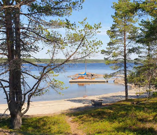
DID

                                                                                                                                                       at 37 metres, pite-rönnskär is sweden’s third highest lighthouse.
                                                                                             YO U K N O W…

               Welcome!                                               … the Bothnian Bay has the most northerly
                                                                      brackish water archipelago in the world.
We’re so glad that you want to explore Sweden’s most                  … the archipelago has more than 4,000 islands.
northerly archipelago! The coastline from Haparanda
in the northeast to Skellefteå in the south offers great              … roads are ploughed across the ice to many
opportunities for recreation and outdoor fun. We’ve                   islands in the winter.
chosen a bunch of fabulous places on the mainland
                                                                      … there are more than 100 stone labyrinths
and the islands to show you what’s available. They’re
                                                                      along the coast and in the archipelago.
all well worth a visit. Read about each of the places
and get tips on what to do, summer and winter alike.                  … there are free saunas in many places open
You’ll need your own boat to reach some of the                        to everyone.
places, and there are boat services to others.
                                                                      … Sweden’s most easterly point is on the island
                                                                      of Kataja in the Haparanda archipelago.
All of us here in the five archipelago municipalities
hope that our guide to 100 gems in the Bothinan Bay                   … The Baltic Sea’s most northerly point is located
encourages you to visit and enjoy great experiences.                  in Törefjärden in the Kalix archipelago.

                                                                      Cover photos: Boris Ersson, Helena Holm | Project Management: Lisa Lundstedt
                                                                      Graphic design: vinter | Map Luleå kommun, Geodatasamverkan,
                                              Photo: Lisa Lundstedt   Lantmäteriet 2021© | Print: Lule Grafiska May 2022 | Translation: Språkbolaget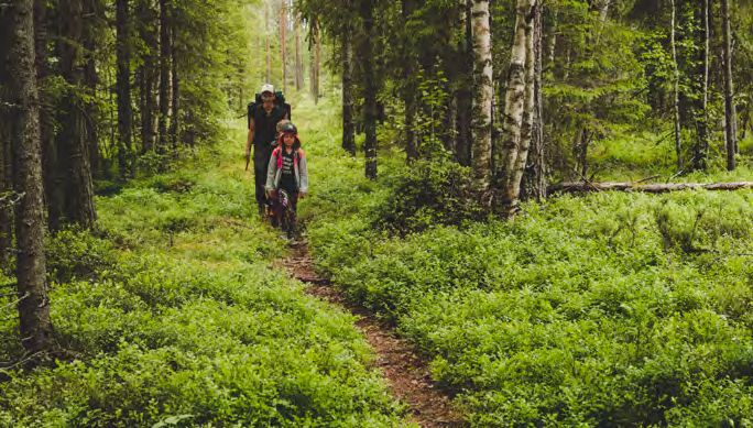
Haparanda Tornio
                           Kalix

                                                                 CONTENTS

              Luleå
                                                      a unique archipelago. . ........ pages 6–13

                                                      archipelago all
                                                      year round........................... pages 14–25

      Piteå                                           public acces / symbols. . ... pages 26–27

                                                      haparanda coast
                                                      and archipelago. . ............... pages 28–47

                                                      kalix coast
                          Bottenviken                 and archipelago. . ................ pages 48–71

                                                      luleå coast
                                                      and archipelago. . .............. pages 72–101

Skellefteå                                            piteå coast
                                                      and archipelago. . ............. pages 102–121

                                                      skellefteå coast
                                                      and archipelago. . ............ pages 122–149

                                                      contact us.......................... pages 150–151

                      0    25           50 km

4                                                                                                          5
he Bothnian Bay is the most norherly part of the
                      Gulf of Bothnia. The entire area is characterised
                      by the many large rivers that gush freshwater
              to mix with the saltwater sea to make water that is
              neither fresh nor salt. The brackish water and a climate
              with great seasonal changes has created environments

 A unique
              unique to these special conditions. The coastline is
              almost 1,800 km long, and with its more than 4,000
              islands the coast and archipelago form a unique part
              of the country offering rich and varied flora and fauna.

archipelago   The rich cultural history tells us how important fishing
              and seal hunting were from the Middle Ages onwards,
              and how their dwelling places were influenced by
              land uplift. In the summer, there’s daylight round-the-
              clock and it’s never too early or too late for a dip in
              the sea. Autumn, with its bright warm colours, has its
              own special charm. The winter’s frozen sea makes the
              archipelago easy to access, and spring-winter – many
              a person’s favourite season – provides a fascinating
              spectacle when the ice releases its grip.

6              Photo: Lisa Lundstedt                                      7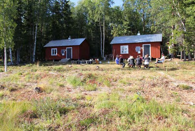
FAUNA
                                                                              The varied archipelago landscape is home to a rich wildlife.
                                                                              Seabirds, waterfowl and birds of the forest all make the archipelago
                                                                              their home. Along the beaches there are waders such as the ruddy
                                                                              turnstone and Common Ringed Plover, and in the woods you
                                                                              can come across the black grouse and Willow Ptarmigan. Black
                                                                              guillemots and razorbills nest among boulders on islands in the outer
                                                                              archipelago. There are also little gulls, the world’s smallest gulls,
                                                                              and the Caspian tern, the world’s largest tern. You might also see the
                                                                              white-tailed eagle and the osprey out on the hunt for fish. Moose are
                                                                              common in the archipelago. Reindeer are mainly winter visitors but
    Photo: Lisa Lundstedt                                                     can sometimes be seen in the summer. The Bothnian Bay is home to
                                                                              two species of seal, the ringed seal and grey seal. The grey seal can be
                                            Arctic bramble ’The berries
                                                                              up to three metres long and weigh 300 kilos, while the smaller ringed
                                            are superior to all European
                                            berries through their delicious   seal is barely half the size. The ringed seal is utterly dependent on ice
                                            aroma and taste,’ according to    in its habitat; low-ice winters mean pups have less chance of survival.
    Photo: Camilla Carlsson
                                            Carl von Linné.
                                                                              Reindeer round-ups Several Sami communities have winter grazing for their
                                                                              reindeer in the archipelago.
FLORA
The Bothnian Bay´s brackish water, climate and land uplift create
conditions for a special, richly varied vegetation on the islands.
Some species are endemic and can only be found here. Bothnian
wormwood and Bothnian eyebright are good examples. There are
also arctic seashore plants such as the endangered Siberian primrose
and East Bothnian Sedge that migrated in from the Arctic sea around
9,000 years ago. The barren, windswept settings on some islands are
reminiscent of the mountains with their heaths and creeper vegetation.
Other islands are home to woodlands with ancient pine trees that
have grown broad and gnarled. The rising islands gradually became
wooded, and some of them have never been affected by modern
forestry. You can still experience virgin forest out in the archipelago.
In the autumn there’s a wealth of berries and mushrooms to pick.
                                                                              Photo: Alf-Arne Harjo
Photo: Lisa Lundstedt
8                                                                                                                                                         9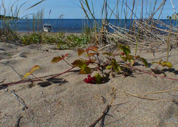
endangered Arctic marsh grass
                                                                                                   can still be found. The bottom
                                                                                                   vegetation in the shallow bays
                                                                                                   and lagoons is teeming with
                                                                                                   life. It’s home to the smallest
                                                                                                   creatures such as insect larvae
                                                                                                   and crustaceans, which serve
                                                                                                   in turn as food for fish and
                                                                                                   birds. These shallow areas
                                                                                                   are important for the entire
                                                                                                   archipelago. By providing
                                                                          Photo: Petra Pohjola
                                                                                                   protection for small fry, they
                                                                                                   are places where many fish
                                                                                                   species begin life. Salmon,
                                                                                                   herring, vendace, sea trout,
                                                                                                   whitefish, grayling, perch,
                                                                                                   burbot, pike and various carp
                                                                                                   fish all swim in the Bothnian
                                                                                                   Bay. About 90% of all wild
                                                                                                   Baltic Sea salmon hatch in
Photo: Dan Blomkvist
                                                                                                   the rivers that flow into the
Only in the Bothnian Bay Grayling and the vendace are utterly unique to                            Bothnian Bay. Baltic herring
the Bothnian Bay, as the species otherwise live in lakes and streams.                              and vendace are the source of
                                                                                                   two delicacies – surströmming
                                                                                                   and Kalix löjrom PDO, roe
BELOW THE SURFACE                                                                                  from vendace fished in Kalix
The Bothnian Bay’s archipelago is so singularly special it’s known –                               archipelago.
without exaggeration – as the world’s most northerly brackish water
archipelago. Its salinity of 2-4 per mille in combination with cold
winters mean life here must make special adaptations to survive.
Below the surface is a unique mix of freshwater and saltwater
                                                                                                   A Taste of Bothnia
species not found anywhere else. For example, the Baltic water                                     Kalix löjrom PDO has enjoyed protected
                                                                          Photo: Lennart Jönsson
plantain, which is endemic to the Baltic Sea, and in a few places the                              designation of origin (PDO) since 2010.

10                                                                                                                                 11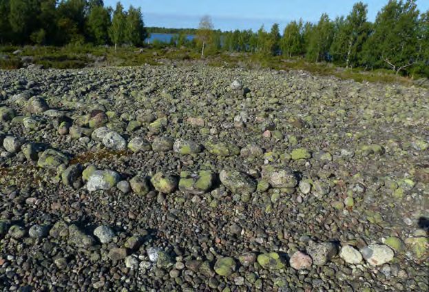
HISTORY                                                                          INLAND ICE
For thousands of years, people have been travelling among the islands            The last Ice Age had a major impact
in search of a livelihood and food, and we can follow the trail of the           on the Bothnian Bay’s coast and
settlements from the first time land arose from the sea to the present           archipelago. Abraded rocks and sand
day. Land uplift has forced people to move many times. Throughout                washed down from the glaciers have
the ages, fishing harbours moved with the shoreline, and it’s possible to        set their stamp on the entire area.
trace the fishing settlements of many generations on the islands. The            Moraines, which cover most of the
most common ancient remains are dwelling sites, boat landings, fishing           archipelago’s islands, were formed
settlements, carins from drying racks and labyrinths. The dwelling               from boulders and stones when the
sites are remains of temporary homes used during seasonal hunting or             inland ice melted. Glacial striations
                                                                                                                                Hamnskär. Photo: Lisa Lundstedt
fishing. Boat landings are places on the former shoreline cleared from           on rocky outcrops arose when
stones to allow boats to be brought ashore. The drying rack cairns laid          boulders and rocks firmly frozen into
out in lines once held poles in place from which nets were hung to dry.          the inland ices scored trails across the rock surfaces. The land is still
   Of Sweden’s more than 300 known labyrinths, around 100 are                    rising since the end of the last Ice Age. The land uplift here is around
located in the Bothnian Bay archipelago and their proximity to fishing           0.9 cm a year, which means an archipelago in constant change.
settlements and individual cottages is often manifest.                           When the land was at its lowest, today’s coastal cities would have been
                                                                                 submerged. During land uplift, the islands were exposed to the sea’s
                                                                                 wave and ice action and the loose material was pounded heavily.
Going round in circles meant good hunting and fishing Walking a labyrinth to
                                                                                 The result can be seen in the form of extensive cobblestone fields.
summon hunting and fishing success was likely one of several ways to use them.
Example of labyrinth rom the island Kluntarna.
                                                                                 BEDROCK
                                                                                 Bedrock in the Bothnian Bay consists of many types of rock. The
                                                                                 oldest, deep rock types are mainly gneiss, diorites, granodiorites and
                                                                                 granites, which were formed between 1,800 and 2,000 million years
                                                                                 ago. They have been exposed by erosion and are visible in many
                                                                                 different places. Granite and pegmatite in the form of quartz and
                                                                                 feldspar have been quarried in several places since the early 1900s.
                                                                                 In some parts of the archipelago there are greenstones, schists and
                                                                                 limestone – all rocks that contribute to a richer flora. The youngest
                                                                                 rocks, including kimberlite pipes, are found in the outer archipelago.
                                                                                 You can find Kallax gabbro, Norrbotten’s landscape stone, to the
                                                                                 south of Luleå. When crushed, it’s used for gritting our roads
Photo: Gunilla Edbom                                                             in the winter.

12                                                                                                                                                         13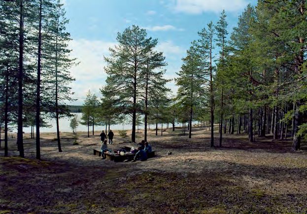
The coastline along the Bothnian Bay offers many possibilities          HIKING Pack your flora and bird books and discover nature on
for outdoor activities, relaxation and adventures.                      your terms! Many of the islands are ideal for hiking and there
                                                                        are many nature trails all around the archipelago. There are also
Throughout the year, visitors can take part in exciting
                                                                        excellent hiking trails along the coast, especially the Solander
activities under the shimmering northern lights or the rays
                                                                        trail, Furuögrund trail and the pasture footpath in Risböle.
of the midnight sun. We have glittering sounds, frozen seas,
beaches, sauna heat, arctic bramble, sea buckthorn and the              FISHING The Bothnian Bay provides many opportunities to
mystique of the labyrinths. Not forgetting roe of vendace               catch fish whether you prefer rod and line, spinning or fly fishing.
and surströmming. Here’s just a few of the activities we                In the archipelago, hand tackle is permitted for fishing e.g. a rod
                                                                        and line. Further out, grayling and whitefish are common catches
hope will inspire you.
                                                                        and in the inner sounds are fish such as perch, roach and pike.
                                                                        Visit svenskafiskeregler.se to see what applies when you want to
                                                                        go fishing.

Enjoy the archipelago                                                   BIRD WATCHING There are good opportunities on the islands

– summer and autumn                                                     and coast alike to watch the interesting bird life. Haparanda
                                                                        Sandskär is home to Sweden’s most northerly and easterly
                                                                        ornithology field stations. Visitors can both watch and ring
                                                                        birds. On Malören and Rödkallen you can generally see the
                                                                        same species as on Sandskär, and many migratory birds pass
                                                                        Bjuröklubb in the spring. Visit artportalen.se for information
                                                                        about birds and other things you might see.

                                                                        PICK BERRIES AND MUSHROOMS Toward autumn, tuft and
                                                                        tussock light up red and blue. The wild berries here are perceived
                                                                        as bigger and juicier than those on the mainland. Or so we
                                                                        imagine. You’ll find plenty of lingonberries and blueberries
                                                                        here. Among the stones the arctic bramble grows, Norrbotten’s
                                                                        heraldic flower. Sea buckthorn also grows on the islands, and the
                                                                        brilliant orange berries are packed with vitamin C. In the autumn,
                                                                        bucketsful of wild mushrooms are ready to pick. But if you asked
                                                                        where to pick chanterelles, it’s not certain you’ll get an answer. It’s
                                                                        usually a secret passed on down the generations….

14                                            Photo: Visit Skellefteå                                                                       15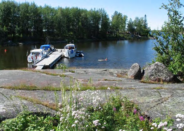
WHAT’S UNDER THE SURFACE?
                                                                              Go snorkelling in shallow bays
                                                                              and discover the jungle beneath
                                                                              the waves or go wading with an
                                                                              aquascope and watch snails and
                                                                              other creepy crawlies that live here.

                                                                              KAYAKING Discover the
                                                                              archipelago by kayak! There are
                                                                              waters for beginners and pros
                                                                              and many great landing places.
                                                                              Kayaks are available for rent. Get
                                                                              tips about where to go from the
                                                                              municipal tourist centres.
Photo: Linnea Isaksson                                                                                                    Photo: Mariell Vikström

SAY HI TO A SEAL Don’t be surprised if the sounds of the sea include                                                         BATHING AND SAUNA
weird barks, howls and grunts. Or if a curious seals suddenly pops out                                                          Along the Bothnian Bay
of the sea. There are several places where you can see seals as they rest                                                       coast and in the archipelago
on islets and rocks.                                                                                                            there’s bathing to suit every
                                                                                                                                taste. From Pite Havsbad’s
BARBECUE There are barbecue facilities throughout the entire area.                                                              extensive beach to small
For example, the municipalities have set out ’archipelago barbecues’ so                                                         coves between smooth
typical of the Bothnian Bay. These may be used by everyone and in many                                                          rocks. In many places, the
places there is usually an equally characteristic sauna.                                                                        municipalities have organised
                                                                                                                                saunas for the public free of
BY BOAT If you come by boat, there are plenty of guest harbours around                                                          charge and bookable on site.
the coast and archipelago. Visit bottenviken.se for information on e.g.                                                         There’s usually wood for
harbour entry and service. There is also information on launching                                                               you to saw and split yourself,
ramps along the coast for visitors exploring the archipelago with a trailer                                                     but at some places you must
                                                                                                                      Photo: Peter Rosén
boat. Eniro and gasthamnsguiden.se also have information about guest                                                            bring your own wood. Check
harbours. If you didn’t come by boat, boat services and water taxis are                                                         before you go. However,
available from several places along the coast. Make a habit of checking                                                         there’s plenty of water for
the weather forecast before setting out. Always wear a life jacket.                                                             washing in the sea.
                                                                              Photo: Piteå municipality
16                                                                                                                                                     17
WALKING LABYRINTHS Labyrinths may not be unique to the Bothnian
Bay, but there are plenty of them here. Both on the mainland and on
the islands. Improve your fishing fortunes and take a turn in a labyrinth
to be on the safe side. But don’t ’tidy up’ in the labyrinth; let the stones
stay where they are. Haparanda Sandskär, Rödkallen, Kluntarna,
Stor-Räbben and Bjuröklubb are some of the places where the
labyrinths will enhance the experience of your visit.

CLIMB A LIGHTHOUSE Lighthouses and their surroundings are
popular day trip destinations. The surroundings are often picturesque
and the lighthouses themselves offer fantastic views. The Bothnian
Bay’s oldest lighthouse can be found on Malören in the Kalix
                                                                               Photo: Lisa Lundstedt
archipelago, and Sweden’s highest Heidenstam lighthouse is located
on Pite-Rönnskär. Rödkallen, Jävre, Gåsören and Bjuröklubb have
                                                                                                       Småskär’s Chapel The chapel is from
lighthouses from the 1800s. Learn more about lighthouses on the                                        the beginning of the 1700s and services
Swedish Lighthouse Society’s website.                                                                  are still held here in the archipelago on
                                                                                                       a couple of occasions every summer.
OVERNIGHT STAYSThere are several ways to enjoy the archipelago life.
For example, the municipalities offer cottages for rent. Many of them
can also be rented in winter. There are many places to pitch a tent –                                  A MOMENT FOR REFLECTION
on camp sites and in the country on the mainland and islands. And                                      The chapels on the islands
of course, there’s a wide range of other types of accommodation, both                                  are part of the archipelago’s
in old lighthouses, pilot stations and hotels.                                                         cultural heritage. The chapels on
                                                                                                       Haparanda-Sandskär, Malören,
                                                                                                       Rödkallen, Småskären, Brändöskär
                                                                                                       and Pite-Rönnskär were all built
                                                                                                       in the 1700s. As memorials of
                                                                                                       times past, they give pause for a
                                                                                                       moment’s reflection. Services are
                                                                                                       held in some of the chapels during
                                                                                                       the summer. To learn more about
                                              Photo: Lisa Lundstedt                                    this, visit the Church of Sweden´s
  Guests at the Bjuröklubben lighthouse. Photo: Visit Skellefteå
                                                                                                       website for the diocese of Luleå.
                                                                               Photo: Lisa Lundstedt
18                                                                                                                                            19
Enjoy the archipelago The archipelago is not just a place for visiting in the summer.
– winter and spring Once the ice covers the sounds, fresh winter opportunities
open up for new excursions and fantastic experiences. Bear
in mind that new ice, spring ice, snow-covered ice and sea
SKATING ALONG Long-distance ice-skating is a glorious way to ice may be weak. Make sure the ice will bear your weight
enjoy the winter archipelago, but not entirely risk free. before you set off, and check the ice forecast. SMHI has
In the early winter, before the snow arrives, there are updated information on its website. Also, be sure to stay
sometimes fantastic ices for skating. The Swedish Outdoor well away from the ice-free fairways into the major seaports
Association arranges organised, safe long-distance ice-skating along the coast. And don’t forget your ice prods.
under the guidance of trained leaders.
GLIDING ALONG The vast white expanses invite you on long
ski trips, and when there’s a crust on the snow the possible
places to go are almost unlimited. The best skiing is usually in
February to April. Even when the ice has broken up, you can
ski in the archipelago on what is known locally as ’landkallen’.
There are several places in the archipelago where ski tracks are
prepared both privately and municipally.
WINTER BATHING The interest in winter swimming has
exploded in recent years, and in Skellefteå holds regular winter
swimming competitions. In several places, holes are sawn
in the ice by associations and private individuals, where the
prospective hero can take a dip.
BARBECUES AND SAUNAS Of course you can have a barbecue
in the winter, and some of the saunas are also open during the
winter.
Photo: Visit Skellefteå
20 21ICE FISHING In winter, ice fishing is a popular pastime. Take an auger
NORTHERN LIGHTS Aurora along and drill a hole in the sea ice. When fishing in shallow water one
Borealis – the magical, legendary exciting thing is looking down through the hole to actually see fish
northern lights. They form when circling your bait, will they take it or not. But be kind to the fish you
solar particles in space collide catch, the one you don’t want to keep, remove the hook carefully and
with the outer atmosphere in release the fish into the hole as quickly as possible. Immediately kill
conjunction with the way the the fish you want to keep.
solar winds move across the
firmament. The Bothnian Bay’s PACK ICE EXPERIENCES As spring approaches, pack ice begins to raft
archipelago offers excellent up far out in the archipelago. Wind and weather push together great
opportunities to see the northern piles of massive ice blocks. Getting up close to pack ice is an exciting
light’s as early as August. The experience and you can sense just how powerful the forces at work
archipelago’s open spaces are. One can imagine being in the wild Arctic, surrounded by huge
provide great photo opportunities icebergs and cold, blue water. Where you can experience this depends
for people seeking to immortalise on the wind and weather from year to year.
the experience.
Rödkallen’s lighthouse. Photo: Peter Rosén
KITE SURFING In kite surfing, you are propelled forward while
standing on a board using the wind to act on a kite. The sport has been
described as a combination of sailing and wakeboarding. It is usually
done on water, but it works just as well on snow and ice. All you need
is wind, open spaces and the right kit. Many people kite surf on the
waters around Luleå, but you can kite surf in many other places too.
CYCLE OUT TO AN ISLAND
Interest in cycling on ice is on the
increase and the pastime is growing
in popularity. Whether or not you
have your own fatbike or rent one,
unique experiences await. It’s safest
to stick to ploughed ice tracks and
ice roads, but when the crusted
snow supports your weight, you
can explore new places.
Photo: Dan Blomkvist Photo: Helena Holm
22 23ICE TRACKS Ice tracks are a popular attraction
for residents and visitors alike.
The ice tracks ploughed in Luleå and Piteå offer
several different ways of getting around, just a
stone’s throw from the city’s heartbeat. Feel the
slipstream on your face when you’re skating,
glide easily along on your kick sled or simply
enjoy a promenade or bike ride across the frozen
water. There are also ’kick sled lots’ where you
are welcome to borrow a kick sled for your trip.
SNOWMOBILES The most common form of
Gåsörens lighthouse. Photo: Visit Skellefteå
winter transport between the islands is still the
snowmobile. There are marked snowmobile
tracks across the sea organised by snowmobile
clubs, cottage associations etc. Note that it is not
permitted to ride snowmobiles on the islands in
the Bothnian Bay’s archipelago other than on the
shortest route to and from a cottage or on marked
trails. There is information about snowmobile
trails in the municipalities on the Piteå and
Skellefteå municipal websites.
MOTORING ON ICE ROADS In the winter, when
the ice along the coast outside Luleå is sufficiently
thick, a little over 30 kilometres of ice roads are
ploughed out to Hindersön, Storbrändön, Sandön
and Junkön. Driving a car on an ice road and
passing an ice-bound navigation buoy is a special
experience. Ice roads are ploughed when ice and
weather conditions permit. There is information
about the current status of the archipelago’s
The ice track in Luleå. Photo: Burban Studios winter roads at lulea.se/isvägar
24 25THE RIGHT TO ACCESS AND COMMON SENSE, SYMBOLS
DO NOT DISTURB, DO NOT DESTROY To make it easier for you to find information about the different places
of interest, we have labelled them with the following symbols:
The Swedish right of public access is a fantastic opportunity
for us all to enjoy nature. But don’t forget…
Boat taxi Guest Rental Lodging
landing Harbour cabin
… show consideration for plant, animal and bird life.
... observe local rules, prohibited access and codes of
conduct. Go to skyddadnatur.naturvardsverket.se for further Camping Beach Accessible Sauna
information.
... if you take your dog into a protected area, keep it on a
leash. Barbecue Wind shelter/ Dry toilet WC
area Public hut
… leave ancient remains, boulders and stones undisturbed; do
not make cairns in the in the cobblestone fields.
Drinking water Hiking trail Attraction Nature
conservation area
… only light camp fires where permitted; remember the fire
hazard – carefully put out your fire when you leave.
… respect residents and other visitors. Observation tower Outlook Café Restaturant/
Food service
… common areas are there for everyone; show consideration
by leaving the place clean and tidy.
Kiosk/Shop Fuel Defibrillator
… take your rubbish with you.
in case of emergency at sea always call 112
If you are a member of the Swedish Sea Rescue Society, you may call
0200-29 00 90 even when there is no emergency. There are Swedish Sea
Photo: Lisa Lundstedt
Read more about the right of public access on the Swedish Environmental Rescue Society boats in Luleå, Piteå and Skellefteå. You can learn more
Protection Agency’s website naturvardsverket.se, and about the protection about how preparation and the right equipment can enhance safety at
of ancient remains on the Swedish National Heritage Board’s website raa.se sea by visiting sjoraddning.se
26 27H A PA R A N DA
TORNIO
HAPARANDA AN ARC HIPE LAGO O N T HE BO RDER
Salmis
Säivis
Nikkala
Staffans
Fin erige
Sv
Haparanda
lan
Haparanda hamn
Santasaari Hanhinkari
d
Torne-Furö
COAST AND ARCHIPELAGO
Kataja
Stora hamnskär
Seskarö
The names of many of the islands bear witness to this being
Skomakaren a bordering archipelago. Islands here have both Swedish and
Finnish names. The archipelago is characterised by low lying
Enskär V. Knivskär islands with many sandy beaches. Why not visit Haparanda
Byskär Archipelago’s National Park – Sweden’s most easterly.
You can also experience coastal fishing right up close when
the fishing boats return to harbour. Sweden’s most easterly
Seskar-Furö
point is on the island of Kataja.
Hepokari
Mali
NUMBER OF ISLANDS. . .................................... . . . . . . . . 652
IN A NUTSHELL
LENGTH OF MAINLAND COAST . . ................... . . . . . 127 km
Country border
Haparanda- LARGEST ISLAND................................. Seskarö (21.8 km2)
Municipal boundary
Sandskär Nature conservation
LAND UPLIFT..............................................8.73 mm/year
LONGEST DAYLIGHT....................................... . . . . . . . . 24h
SHORTEST DAYLIGHT.................................... . . . . 2h 55m
0 2,5 5 km
28 29TORNIO
H A PA R A N DA
H A PA R A N DA
HAPARANDA
1 2
Salmis
Säivis
Nikkala
Staffans
Fin rige
Haparanda hamn
Sv
3
Santasaari
lan
e
d
4
Photo: Linnea Isaksson
Seskarö
The Coast 0 2,5 5 km
1 Sweden’s easternmost mainland point place in history. When Sweden lost
Sweden’s most easterly point is marked Finland and Tornio City, the Swedish
by a cairn in the mouth of the Torne River. government decided to build a new
city here – Karl Johan’s City. When a
2 Toranda is located on the Finnish governor reported that the city only
side of the Torne River estuary. There is had 23 inhabitants, all belonging to the
a large marina which, thanks to its good same family, the plans came to naught.
depth, is also accessible to sailing boats. In its place grew the little village of
Haapaniemi – today’s Haparanda.
3 Haparanda Harbour is Sweden’s
4 Seskarö Bridge. Seskarö bridge is one
most easterly guest harbour. It is also
the municipality’s largest marina and is kilometre long and together with a few
popular with boat and caravan owners. smaller bridges it connects Seskarö and a
In the old harbour storehouse, there string of smaller islands to the mainland.
is a museum dedicated to the village’s The bridge was opened in 1978 and
fishing industry. A little to the north is is a true landmark for people in the
Hillerströms Strand, which has its own archipelago.
Salmon fishing Photo: Boris Ersson
30 31H A PA R A N DA
H A PA R A N DA
Sverige
Finland
Kataja
National boundary cairn Photo: Tina Nilsson
Kataja Hamnskärsfjärden
1
SWEDEN’S EASTERNMOST POINT In Finnish, Kataja means Juniper Inakari
berry. Kataja is also an island shared by Sweden and Finland. The
border crosses the south-east part of the island and is marked with 1 Border
two cairns and a national boundary line. It is Sweden’s most easterly between Sweden
point. When the border was drawn in 1809, it was located in the and Finland.
Sweden’s
channel between Kataja and the even smaller island of Inakari.
easternmost
Due to land uplift, the islands have since grown together. On the point.
Swedish side there are three private cottages on the west of the
island. The Kataja shoreline consists mainly of rocky beaches and
Juniper berries Photo: Göran Wallin
water meadows with some beaches in places. The eastern headland is
predominantly deciduous woods, while the central and western parts
are mainly coniferous woodlands above the band of broadleaf trees.
0 0,5 1 km
Parts of the island are designated as Natura 2000 areas.
32 33
H A PA R A N DA
H A PA R A N DA
Välikari
Vasikka
1
Torne-Furö
naturreservat
2
Torne-Furö
Skomakarfjärden
View across Välikari. Photo: Lisa Lundstedt
0 0,5 1 km
Torne-Furö
NATURE AND BATHING Torne-Furö has slow-growing pine forests and
species that are rare in the Haparanda archipelago, which is why the island
has been made a nature reserve and a Natura 2000 area. The island is
popular with boating enthusiasts. Due to its proximity to both Haparanda
and Finnish Tornio, it’s popular among bathers during the sunny summer
months. Blueberries, raspberries, lingonberries and mushrooms grow in
Dwarf cornel. Photo: Lisa Lundstedt
profusion here. On the island’s north-east point is a sandy beach whose
good depth makes it easily accessible for boats. However, swimmers here
should be aware that the shallow water along the beaches becomes deep 1 Beach, jetties, shelter
from the wind and dry toilet.
suddenly. There is a fishing settlement on the north west of the island.
There are plenty of reindeer and moose on Torne-Furö all year round. Photo: First name, Last name 2 Fishing settlement.
Photo: Lisa Lundstedt
34 35H A PA R A N DA
H A PA R A N DA
1
2 0 0,25 0,5 km
3
4
5
Photo: Lisa Lundstedt Pahaluoto
Hanhinkari
Skomakarfjärden
6
Photo: Lisa Lundstedt
Välikari
Hanhinkari 1 Guest harbour with small floating jetty.
2 Haparanda Boat Club’s clubhouse, open
COTTAGE LIFE Hanhinkari is the most the most built up island of to the public during the summer. Barbecue area.
them all around Haparanda and enjoys a wealth of leisure activities 3 Haparanda Boat Club’s sauna, open to
with summer cottage owners and many visitors. Haparanda’s boat club the public during the summer.
clubhouse is located on Hanhinkari and open to all visitors during the
4 Main quay. Wheelchair accessible guest harbour,
summer. So too is the sauna, which is frequently used by visitors to shelter from the wind, dry toilet and barbecue area.
the island. There is a barbecue area next to the clubhouse. There is a Torne-Furö
5 Labyrinths.
floating jetty below the club house and a little further away is the main
quay, where visiting boaters usually put in for overnight stays. There is 6 Freshwater well.
a freshwater well on the island. There are also two stone labyrinths.
36 37
H A PA R A N DA
H A PA R A N DA
3
Töyrä
St. Hepokari
Paljas
2
Photo: Tina Nilsson
1 Inakari
Hepokari
LABYRINTHS AND CAIRNS FROM DRYING RACKS Around
five kilometres from the Finnish border, in the outer Haparanda
archipelago, lies Hepokari. On the western shore there are inlets with 0 0,25 0,5 km
landings for small boats. The inlets provide good shelter against the
wind. Hepokari is home to one of the Nordic region’s richest sources
of ancient remains in an archipelago setting. You can see the remains
1 Suitable landing for boats.
of an entire village complex together with the boat landings, a well-
Barbecue area.
preserved labyrinth and cairns from drying racks. The remains are
thought to date from medieval times or a little later. The island boasts 2 Ancient village complex with settlements.
interesting flora, including a species of the Siberian primrose, and it 3 Well-preserved labyrinth, settlements Siberian primrose.
has been listed as a Natura 2000 area thanks to beaches rich in species, and cairns from drying racks. Photo: Petra Pohjola
pristine land uplift woodlands and valuable marine environments.
38 39H A PA R A N DA
H A PA R A N DA
Skomakarfjärden
Norrviksgrundet
Norrviken 2
1
Skomakaren/Suutari
3
Photo: Tina Nilsson
Enskärsfjärden
Skomakaren/Suutari 1 Norrviken’s beach.
Barbeque area and
RICH IN ANCIENT REMAINS In Nikkala, just over five nautical dry toilets.
miles from Haparanda Harbour, is the island of Skomakaren (the 2 Beach. Barbeque
shoemaker). The island is called Suutari by the locals, which also areas and dry toilets.
means shoemaker in Finnish. This island is rich in ancient remains.
3 Fishing settlement.
A short walk will soon reveal drying yards, dwelling sites, compass
roses, a labyrinth, a tar kiln and a few stone ovens. The island is Photo: Lena Harila
popular thanks to its long sandy beaches, but people also come here
for its berries and mushrooms. Boaters like visiting Norrviken, which
provides good shelter from most winds. However, when northerly 0 0,5 1 km
winds blow, you will need to anchor in the lee of Norrviksgrundet.
40 41
H A PA R A N DA
H A PA R A N DA
Haru
Karminnokka
Puukkofjärden
1
2
Seskar-Furö
Photo: Tina Nilsson
Malifjärden
Seskar–Furö Haparanda skärgårds nationalpark
LONG SANDY BEACHES Seskar-Furö is part of the Haparanda 1 A beach with
Archipelago National Park and Natura 2000 area and is popular with dry toilets,
boaters. Nature here has hardly been influenced by man and it boasts information board,
fascinating diversity. There are young and old-growth coniferous and barbecue area.
woods, uncultivated beach woodlands, mixed forest, wooded 2 Fishing village.
meadows and lush water meadows. There are major sand dunes
inland of the northern headland’s western shore. There are fantastic Beach pea. Photo: Lisa Lundstedt
beaches on either side of the headland. However, the waters are
shallow and landing is difficult. There are ancient remains, including
a labyrinth, to the east of the fishing cottages. From here, a path leads
down to the inlet on the southern shore. 0 0,5 1 Kilometer
42 43Norra Sandudden
H A PA R A N DA
H A PA R A N DA
1 Björn
Malifjärden
Lilla Sandskäret
Haparanda skärgårds nationalpark
Östviken Korkea
Kajava
Västra Stadion 6
Sandskär 2
Baatilahti 5 Bird Protection Area
Landing prohibited 1/5–31/7
3 4
Islandet
Harbour in Kumpula. Photo: Alf-Arne Harjo Kumpula
0 1 2 km
Haparanda Sandskär 1 Norra Sandudden. Barbecue area, to the chapel is a small cemetery with a stone
dry toilet, bathing beach, designated camping marking the grave of Ölandish sailor Olof
AN ISLAND OF CONTRASTS Farthest seaward is Sandskär, the
area. Boat service stops here during the summer. Viktor Andersson, who died when the brig
largest island in the Haparanda Archipelago National Park. The Elvine was shipwrecked outside Sandskär in
2 Untouched virgin aspen woodlands.
area’s land and marine environments have great natural value. the autumn of 1886. The chapel sometimes
Sandskär is a major attraction and also a Natura 2000 area. Due to its 3 Kumpula. Sheltered harbour with guest celebrates the sacraments of baptism and
location, the island attracts many species of birds during the spring jetties, rental cabins, conference room and marriage.
and autumn migrations, and there are also plenty of moose. Sandskär ’The Council Cottage’, which can be rented. 5 Ornithology field station. Haparanda
Sauna, freshwater well, wheelchair accessible
has an exciting history with documented events from the 1500s Sandskär is home to Sweden’s most
dry toilet and barbecue areas. Boat service northerly and easterly ornithology field
when the Baltic herring fishery attracted a coastal population. stops here during the summer. Barbeque area. station. There are huts used by ornithologists
The many ancient remains testify to times past, such as the wreckage Defibrillator. when ringing birds. The field stations are
from a shipwrecked vessel and a small cemetery. The island is 4 Sandskär Chapel was built in the late manned from mid-July to mid-October
well-visited by cottage owners as well as boat tourists. Berry and 1700s. The building was shipped in from and receive visitors, time permitting.
mushroom picking are popular during the summer and autumn. Tornio, where it had served as a granary. Next 6 Fishing settlement on the island of Kajava.
44 45
H A PA R A N DA
H A PA R A N DA
Tervaluoto 1
Sorttis-
viken
Hällskär
2
Sammako- 3
viken 4
Kalkkikari
6 5 Haukkaniemi
Seskarö
Temmilahti Tromsöviken 7
Sekarö Bridge. Photo: Lisa Lundstedt
Puukkofjärden
Pihlajakari
Seskarö 0 1,5 3 km
ARCHIPELAGO COMMUNITY Seskarö is the largest and only island in
the Bothnian Bay with a year-round population and a land connection
via a road bridge. The island has a time-honoured sawmill history. Much 3 Leppäniemikajen. Guest harbour,
electricity, WC and sauna.
of the older built-up area is preserved, creating a picturesque impression.
It offers all the comforts of an archipelago community and great day 4 Sekarö village amenities include a school,
trips. There are also many smaller inlets with great bathing beaches. a shop, a petrol station and a cafeteria.
Visit Seskarö Havsbad with its modern cabins and a camping area 5 Seskarö Church, built 1929.
Photo: Lisa Lundstedt
beautifully situated in Tromsö inlet with its shallow-water bathing
6 Sammakkoviken is a beautiful natural harbour
beach. Sorttisviken is a popular inlet with excellent sand beaches, also 1 Sekarö Bridge. Bridge to the sheltered from winds from any direction
where
for boats with deeper draughts. There are five wind turbines here, and mainland. you put in directly to the sandy beach.
they give the island a characteristic silhouette when seen from the sea. 2 Sorttisviken. Natural harbour, 7 Tromsöviken and Sekarö Havsbad.
On the north side is Leppäniemi quay, which these days serves as a guest jetty, barbecue areas, Wheelchair accessible bathing beach, cabins,
guest harbour, and the village centre is not far from here. swimming and dry toilet. caravans and tents, barbecue areas.
46 47KALIX
HO M E O F KALIX LÖJRO M
Töre
Sangis
KALIX
Nordanskär
St. Trutskär
Granön
Kalix
Bergön Halsön COAST AND ARCHIPELAGO
Rånön Kallskär
Näverön
Tucked away at the very top of the Bothnian Bay is a
Hastaskäret
St. Huvön mix of rocky islands and low-lying sandy beaches. It’s
Getskär where you’ll find the highest peaks of the Bothnian
Renskär Likskär
Bay and the most northerly point of the Baltic Sea.
On its own far out to sea is Malören, a fishing settlement
dating back to the Middle Ages. The Kalix archipelago
produces an exclusive delicacy – Kalix löjrom PDO
Malören
(Protected Designation of Origin).
NUMBER OF ISLANDS................................................. 792
IN A NUTSHELL
LENGTH OF MAINLAND COAST........................... 329 km
LARGEST ISLAND.....................................Rånön (24.5 km2)
LAND UPLIFT................................................ 8.85 mm/year
Country border LONGEST DAYLIGHT. . ................................................. 24h
Municipal boundary
SHORTEST DAYLIGHT . . ..........................................2h 54m
0 5 10 km Nature conservation
48 49Töre
KALIX 1 Sangis
KALIX
KALIX
2
The Coast
3
1 Töre Hamn. The northernmost point
of the Baltic Sea is marked with a yellow
buoy in the bay at Töre. Every summer, Påläng Karlsborg
the Töre harbour festival coincides with
5
the end of the Midsummer Sail regatta, Nyborg
which starts in Wismar, Germany, the
most southerly point of the Baltic Sea. 4
Töre Hamn is the Töre boat club’s home
harbour, close to the Töre campsite. Ryssbält 6
2 Vassholmen is an island in the Kalix
River, and an old timber sorting area
from the days of timber floating. Today,
Storön
the island is a popular place to visit
with many cultural events. The island
is reached via a wheelchair accessible 0 2,5 5 km
bridge. The island also has a café and
a timber floating museum open in
summer.
3 Standängarna is picturesquely
5 Båtskärsnäs is an old sawmill community The most northerly point of the Baltic Sea.
situated on the banks of the Kalix River Photo: Agora direct Midsummer Sail
close to the centre of Kalix. Kalix camp with three marinas. During the autumn, the
site is here, as is the popular Strandäng village is one of many centres for vendace
bath with with temperate pools and and fishing and the preparation of Kalix vendace
a guest harbour with 12 guest berths roe. The archipelago outside Båtskärsnäs
and a boat service stop. offers excellent fishing. Båtskärsnäs is home
to Norrkust Marina and a guest harbour with
4 Marahamn is Kalix municipality’s
excellent service.
biggest marina with about 450 berths
and a number of guest berths. The 6 There is a scenic year-round camp site
harbour has two approaches, one from with activities and a restaurant in Frevisören.
the south-west and the other from the The amenity has a long beach and sea in
south-east, both with fairway markers. three directions.
50 51KALIX
KALIX
1 Malören’s fishing settlement with chapel served as a landmark for sailors
chapel, lighthouse and pilot station. before the lighthouse was built. At
The fishing settlement, which dates the end of the 1700s there was an
back to early medieval times, has observatory close to the chapel from
been very important for Swedish and which Kalix-born Professor Jöns Jacob
Finnish fisherfolk alike. In the 1700s Svanberg took measurements to
and 1800s there were no quays on the determine the shape of the earth.
island, so the boats were pulled up on
2 Derelict pilot harbour. Possible to
land. The characteristic jetty that exists
today was built in the 1940s. Today it put in to in calm weather.
is a jetty for visiting boats. Malören’s 3 Seaman’s grave from 1845
lighthouse was built in1851 and is 17.5 commemorating a captain who died
metres high. It is the first lighthouse when his vessel capsized in a heavy
designed by Gustav von Heidenstam. storm. There are several labyrinths
Photo: Kalix municipality It was electrified and made automatic next to it.
in 1910. There is a labyrinth next to the
lighthouse. Today the pilot’s cottage 4 The remains of a navigational aid
is a hostel with magnificent views. The erected in 1725 – a simple pole marker
Malören
chapel is often called the Cathedral that was converted into a beacon
of the archipelago as it is the only 10 years later.
maritime church with a cathedral’s
5 Here lies wreckage from the vessel
spire. The timber buildingis octagonal
Malören
’Jenoline’ from Åland, shipwrecked in 1935.
JEWEL IN THE CROWN Furthest out in the Kalix archipelago is and was consecrated in 1770. The
Malören. Malören means ’round stone’, which is thought to refer to the
round boulders the island consists of. People began settling the island
in the 1600s, but its heyday was during the second half of the 1700s, 2
when Baltic herring fishing was especially good. Fisherfolk came from Malören
Tornio and Karlö in Ostrobothnia, and in the summers as many as
1
Malörens
naturreservat
200 people lived on the island. In 1809, when Sweden lost Finland to
Russia, Malören became Swedish. Shipping grew in the early 1800s,
ships got bigger and sailings more frequent. This made pilotage
3
necessary from Malören to the coast. In 1932, Malören’s pilot station 4
was merged with Erikören’s, and no pilot has lived on the island since 0 0,25 0,5 Kilometer Malörens naturreservat
then. Malören is an important resting place for migratory birds and
seabirds of various kinds. The Malören Nature Reserve and Natura 5
2000 area were set up to protect the island’s quality as a breeding site
and resting place for birds and to conserve its typical topography.
0 0,25 0,5 Kilometer
52 53KALIX
KALIX
Västerskäret Mellerstskäret
Granön
Halsöfjärden
Halsön
Oxören Börstskäret
Bodskär
1
Photo: Patrik Fredriksson
Grundet
Kallskär
Halsön and Kallskär 0 1 2 km
VELVETY BEACH Far out in the Kalix archipelago lies Halsön, with only
a few small skerries beyond before the open sea begins. It is sparsely 1 Kallskär with its
beautiful beaches either
built on and consists mostly of mixed forests, rocky water meadows and
side of the isthmus.
pebble beaches. Along the narrow isthmus leading out to the southern Barbecue areas, wood
tip of Halsö known as Kallskär, there is a nice beach with pale, velvety store and dry toilets.
sand. On the other side of the isthmus on the west of the island, there is Photo: Linnea Isaksson
another sandy beach to discover. Its location allows wind and wave to
create the impressive sand dunes at Kallskär’s swimming area.
54 55KALIX
KALIX
Storhamnen
Stora Trutskär
Gammalhamnen
Repskärsfjärden
1
Photo: Alf-Arne Harjo
Frevisören
Stora Trutskär
Photo: Alf-Arne Harjo
1 Sjöborgen. Kalix Yachting
and Motor Boat Club’s
RENDEZVOUS FOR BOATING ENTHUSIASTS Stora Trutskär, in the clubhouse. It has jetties with
heart of the Kalix archipelago, is home to the Kalix Yachting and Motor guest berths, a rental cabin,
sauna, playhouse; there
Boat Club’s clubhouse, known as Sjöborgen. Boating enthusiasts from
are canoes and dinghies
all over the Bothnian Bay meet up here to relax, share experiences and to borrow. There are also
socialise. In addition to the club house and guest house, there is also a beaches and sandy dunes.
sauna, a barbecue hut, outdoor barbecue area, dry toilet and a children’s
playground. Stora Trutskär has sandy beaches and good bathing. You
can borrow canoes and Optimist dinghies. For visitors wishing to stay 0 0,25 0,5
overnight, there is a four-bed rental cabin.
56 57KALIX
KALIX
Ö Båtöholmen
Kalixälven
2
1
4 3 Nordanskär
Photo: Kalix municipality image archive
Nordanskär
Repskärsfjärden
BATHING AND SPA The island of Nordanskär is located in the mouth
of the Kalix River. In 1886, J. August Bergman founded the northernmost Svarthällan
spa and bathing resort on Nordanskär. That same year, stone-cutters,
construction workers, masons, painters, smiths and sheet-metal workers
began building. When they had finished, there was a church, twelve villas 0 0,251 Military bunker,
0,5labyrinth
km and
Blåbärsgrundet
for visitors, a servant’s cabin, a bath house with hot and cold water, a hotel, stone ship.
banqueting room, a games room, tennis court, boats, a telephone and
2 Bathing area and barbecue area
electricity. Guests were offered baths, mud baths and massages. Visitors
3 Rambling trail with relics from
to the spa, some of whom came all the way from Stockholm, arrived with Skötholmen
the spa period.
one of the steamboats that sailed daily from Haparanda or Luleå. People
came to Nordanskär to relax or take a cure. Among others, Selma Lagerlöf 4 The old steamboat jetty
was here. Bathing area,
was a visitor to the island. In 1918, everything was auctioned off. Many
guest jetty, barbecue area,
of the villas ended up in Luleå, and the church was moved to Björkfors. dry toilet. Boat service stops
Today, all that remains of the place are the foundations. here during the summer.
Stone ship. Photo: Kalix municipality
58 59KALIX
KALIX
Renskär was an important meeting point for fishermen and seal
hunters. The island bears traces of simple homes, perhaps built by
seal hunters when the islands were only small skerries. The foundations
of more recent fishing cottages, together with the cairns from the stands
used to dry fishing nets. There are labyrinths built from small boulders
on the islands. Renskär also houses the remains of an archipelago chapel
built in the 1700s but which was left to decay.
There are guest jetties in Getskärsviken along with a municipal four-bed
rental cabin, a sauna, dry toilet and barbecue area.
Likskär is a sparse, dry island. It has the character of a boulder ridge,
and a small part of it is wooded. There is rich ground vegetation,
and rich animal and bird life. There is an old fishing settlement
and a colony of breeding house martins. The pine crossbeak is a
characteristic bird, and you can sometimes see the magnificent
Likskär. Photo: Per Pettersson
swallowtail butterfly on the island.
Getskär, Renskär and Likskär
BRING YOUR BINOCULARS, GO BIRD-
WATCHING Likskär Nature Reserve,
which is also a Natura 2000 area, is a living
archipelago landscape and a typical exam-
ple of nature in the northern Bothnian Bay.
People come here for hiking, bird watching
and enjoying a summer dip at the beach.
The nature reserve comprises 25 islands
and smaller skerries. Getskär, Renskär and
Likskär are the largest islands, where land
Photo: Per Pettersson
uplift has caused the first two to merge. Photo: First name, Last name
Getskär. Photo: Alf-Arne Harjo
60 61KALIX
KALIX
Blackgrundet
Getskär
Getskärsviken Likskärsrevet
1 Grisselklubben 7
2 6
3 8
Likskär
Likskärs naturreservat
9
Renskär
4
10 Bird Protection Area
Storbådan Bastagrundet
Landing prohibited 1/5–31/7
5
0 0,5 1 km
Per-Jönsagrynnan
Lillbådan
Storbrottet
1 Stone jetty, floating jetty with 3 Labyrinth. 6 Fishing settlement. 9 Highest point on
guest berths. There is a Swedish Guest harbour, dry toilet Likskär. There are some
4 On the southernmost part of
Cruising Association mooring buoy and barbecue area. ancient remains here.
in the inlet. Rental cabin, sauna, dry Renskäret is a small, typical fishing
toilet, barbecue area and a beach. settlement from the late 1700s. 7 Labyrinth. 10 Labyrinths and fishing
settlement remains. Mellanbrottet
2 Remains of an old archipelago 5 There is an observation tower on 8 Beacon / navigational aid.
chapel dating from the 1700s. the southern point.
62 63
1
KALIX
KALIX
Bodön
2
Granskäret 3 Storöfjärden
Bockön Rånön
Kalix yttre skärgårds
naturreservat
Näveröns Kallskäret
naturreservat
4
Orrskatan
5
Granholmens
Stabbsanden naturreservat
6
Prayer house: Photo: Alf-Arne Harjo
7
St. Huvön
Dödmanvik- Berghamn
berget
Rånön
L. Huvön
0 2,5 5 km
Båtöfjärden
KALIX’S LARGEST ISLAND Rånön has a long history of hunting, fishing
and farming. The island was used as a fishing settlement as early as the
1600s, and in the 1700s there was a permanent population here. Much
1 Guest harbour, barbecue area, dry toilet.
of the forest was felled during the 1800s for the production of charcoal
Prayer house with outdoor services in thesummer.
as fuel for the ironworks in Töre and Strömsund. Wood tar was also
2 Bodöviken (inlet) has a good depth.
produced here, and the remains of tar kilns can still be seen today. In
1867, Rånön got its first school with 18 pupils. The last resident left the 3 There are great views from Rörmyrberget. There are
ravines and a small cave.
island at the end of the 1960s. Today, the island is a paradise for summer
cottagers and outdoor activities. Around the farms on the north side 4 Långviken. There is an old tar kiln here.
of the island are traces of the past such as old hay barns, pastures and 5 Stabbsandsberget offers views across Stora Huvön.
meadows. The old school, marina with guest berths and the renovated
6 Stabbsanden, small inlet with long beach.
prayer house, which holds services during the summer, are also found
here. The island boasts many small roads ideal for rambling. 7 Compass rose on Dödmanvikberget.
Photo: Alf-Arne Harjo
64 65KALIX
KALIX
2
4
1
3 5
Huvögrunden
Stora Huvön
Photo: Per Pettersson Photo: Per Pettersson Båtöfjärden
Lilla Huvön
Stora Huvön 0 0,5 1 km
Kastören
ONE OF SWEDEN’S MOST BEAUTIFUL ISLANDS Stora Huvön was
voted one of Sweden’s most beautiful islands. It has a magnificent natural
harbour, sea bathing and steep cliffs that drop straight into the sea. The 1 High, steep cliffs with great views.
natural harbour is well protected in a deep inlet on the north-east side of
2 Beach.
the island and has a water depth that allows sailing boats to put in. There
is a small beach next to the natural harbour. To the north, the dunes give 3 A broad, very deep ravine cuts right through
the rock. At its deepest point, the rock walls drop
way to a cobblestone field that stretches across the island. If you follow
25–30 metres to the bottom of the ravine. There
the path that crosses the stony field you will pass a small stone labyrinth. are also many smaller ravines nearby, so you need
On the north of the island there is a large beach and great places to pitch to watch your step carefully if you take a walk in
a tent. The west shore has a dramatic landscape with vertical rock cliffs the area.
and views across both the Kalix and Luleå archipelagos. A deep, wide 4 Roughly in the middle of the cobblestone field,
ravine with steep sides runs through the rock. There are smaller ravines which stretches across the whole island from
nearby, so you need to watch your step. There is a small beach at the the north-west to the south-east, there is a small
south end of the western shore. An opening between the rocks in the labyrinth that can be a little difficult to find.
water makes the place accessible by boat. 5 Natural harbour.
Photo: Per Pettersson
66 67
KALIX
KALIX
Näveröns naturreservat
2
Bockön
1
Näverön
Näverösundet
Näveröklubben
Bergön
0 0,5 1 km
Photo: Per Pettersson
Näverön 1 Sandy beach with a guest jetty,
barbecue area and dry toilet.
2 Näveröberget with views
POPULAR BEACH Näverön is a nature reserve located between Rånön across the Bothnian Bay.
and Bergön in the southern part of the Kalix archipelago. The top of
Näverön began rising from the sea around 5,000 years ago. Today, land
uplift has raised the highest point of the island, Näveröberget, to 40 metres
above sea level. There are steep cliffs and ravines in the rock, and there is
a glorious view from the top. The island’s nature varies with rocky pine
forest, spruce forests and small areas of marsh forest. On the west of the
island there is a rest area with a guest jetty, barbecue area, dry toilet and
a varied coastline. There is everything from smooth rocky outcrops to a
small inlet with fine sand, partly reeded. A beach with sandy dunes and
sparse pine forest extends all the way to Näveröberget.
Photo: Göran Wallin
68 69
Skags-Furuholmens
naturreservat
KALIX
KALIX
Dödman- 2
viken 1
3
Furuholmen
4
Holsterörarna
naturreservat
Bergöfjärden Storberget
5 Granskäret
Storviken Näverö- Rånön
Bergön sundet
6 8
Brändava-
klubben Bockön
Photo: Per Pettersson
7 Näveröns
naturreservat
Hällhamnskatan
Bergön
0 1,5 3 km
THE HIGHEST TOP OF BOTHNIAN BAY Bergön consists largely of
hilly terrain with old pine forest, and forestry has long been predominant 1 Site of old farm. 4 Holsterviken. Bathing area.
on the island. There was also a shipyard on Bergön in the 1700s, as the
2 Gårdsviken, where Töre Boat Club has its 5 Storviken. Swimming area.
wood from the slow-growing pine forest was extremely well suited to facilities, can accommodate both large and
boatbuilding. There were permanent residents on the island from the
small boats. There is a guest jetty, barbecue 6 Outlook.
middle of the 1600s to the middle of the 1900s. Today, the island is an areas, shelter from the wind and a dry toilet.
7 Bathing cove.
important place for boating and outdoor activities. Many of the old hiking The main building is open
to the public during
the summer and there is a rental cabin. The
8 Shipyard memorial dating
trails remain. Along them the remains of house foundations, tar kilns,
hexagonal sauna is considered to be one of the from the 1700s. Wreckage found
charcoal kilns and an old fishing settlement can be seen. Bergön has three best in the entire archipelago. Defibrillators. on Bergön
is believed to come
harbours on its north-east shore; Gårdsviken, Harabolviken and Kohamn. froma large sailing ship that was
3 Kohamn. Guest jetty, barbecue areas,
Kohamn (cow harbour) was so named as farmers used to release their dry toilet. Accommodates larger boats. wrecked in 1776 just 13 hours
cows here for summer grazing. A small part of the island is included in Harabolviken is suitable for small boats and after leaving the shipyard.
the Holsteröarna Nature Reserve, which is also a Natura 2000 area. has a guest jetty, barbecue area and dry toilet.
70
71
You can also read