IMPROVING FISHERIES CONSERVATION AND MANAGEMENT IN THE EASTERN GULF OF MEXICO
←
→
Page content transcription
If your browser does not render page correctly, please read the page content below
IMPROVING FISHERIES
 CONSERVATION AND MANAGEMENT
  IN THE EASTERN GULF OF MEXICO
              RESULTS FROM FIVE YEARS OF INVESTMENT
         IN FISHERIES MONITORING AND TECHNOLOGY . 2020

                                                                              Red snapper

      Prepared in conjunction with Florida Fish and Wildlife Research Institute,
Alabama Department of Conservation and Natural Resources, Marine Resources Division
                 and Mississippi Department of Marine Resources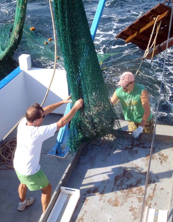
Fisheries scientists empty the contents of a trawl off the coast of Alabama. | Credit: ADCNR/AMRD
CONTENTS
EXECUTIVE SUMMARY . . . . . . . . . . . . . . . . . . . . . . . . . . . . . . . . . . . . . . . . . . . . . . . . . . 3

BACKGROUND. . . . . . . . . . . . . . . . . . . . . . . . . . . . . . . . . . . . . . . . . . . . . . . . . . . . . . . . . . 4

SUMMARY OF STATE EFFORTS. . . . . . . . . . . . . . . . . . . . . . . . . . . . . . . . . . . . . . . . . . . . 6

BENEFITS OF MONITORING . . . . . . . . . . . . . . . . . . . . . . . . . . . . . . . . . . . . . . . . . . . . . 11

        Informing Stock Assessment.  .  .  .  .  .  .  .  .  .  .  .  .  .  .  .  .  .  .  .  .  .  .  .  .  .  .  .  .  .  .  .  .  .  .  .  .  .  .  .  .  .  .  . 11

        Providing a data-driven framework
        to make rapid management decisions .  .  .  .  .  .  .  .  .  .  .  .  .  .  .  .  .  .  .  .  .  .  .  .  .  .  .  .  .  .  .  .  .  .  .  . 12

MONITORING LANDSCAPE AND RECOMMENDATIONS FOR THE FUTURE. . . . . . 14

        Fishery Independent Monitoring .  .  .  .  .  .  .  .  .  .  .  .  .  .  .  .  .  .  .  .  .  .  .  .  .  .  .  .  .  .  .  .  .  .  .  .  .  .  .  .  . 14

        Fishery Dependent Monitoring.  .  .  .  .  .  .  .  .  .  .  .  .  .  .  .  .  .  .  .  .  .  .  .  .  .  .  .  .  .  .  .  .  .  .  .  .  .  .  .  .  . 16

        Synthesizing existing data to answer important questions
        for fisheries management .  .  .  .  .  .  .  .  .  .  .  .  .  .  .  .  .  .  .  .  .  .  .  .  .  .  .  .  .  .  .  .  .  .  .  .  .  .  .  .  .  .  .  .  .  . 16

CONCLUSIONS . . . . . . . . . . . . . . . . . . . . . . . . . . . . . . . . . . . . . . . . . . . . . . . . . . . . . . . . 17

REFERENCES . . . . . . . . . . . . . . . . . . . . . . . . . . . . . . . . . . . . . . . . . . . . . . . . . . . . . . . . . . 18

DECEMBER 2019 WORKSHOP ATTENDANCE LIST. . . . . . . . . . . . . . . . . . . . . . . . . . . 20

                                                  Prepared in conjunction with Florida Fish and Wildlife Research Institute,
                                                  Alabama Department of Conservation and Natural Resources, Marine
                                                  Resources Division and Mississippi Department of Marine Resources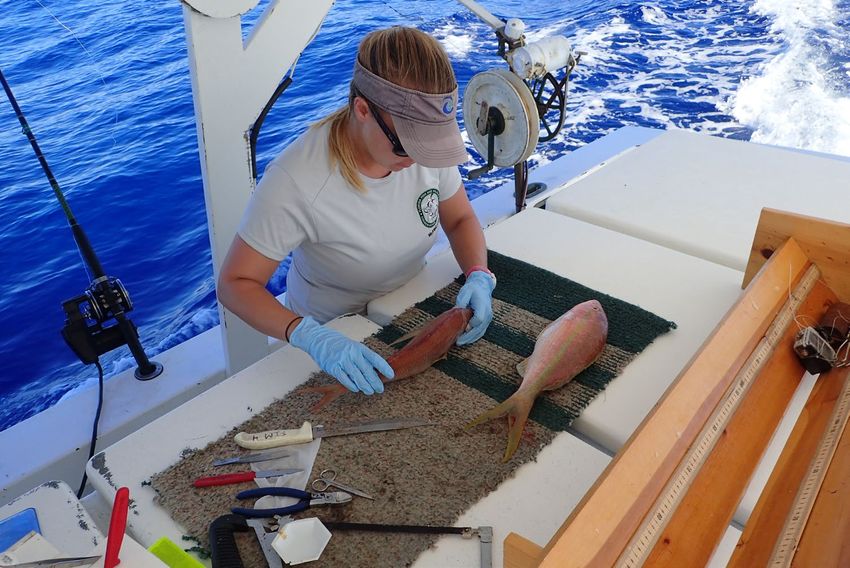
IMPROVING FISHERIES CONSERVATION AND MANAGEMENT IN THE EASTERN GULF OF MEXICO
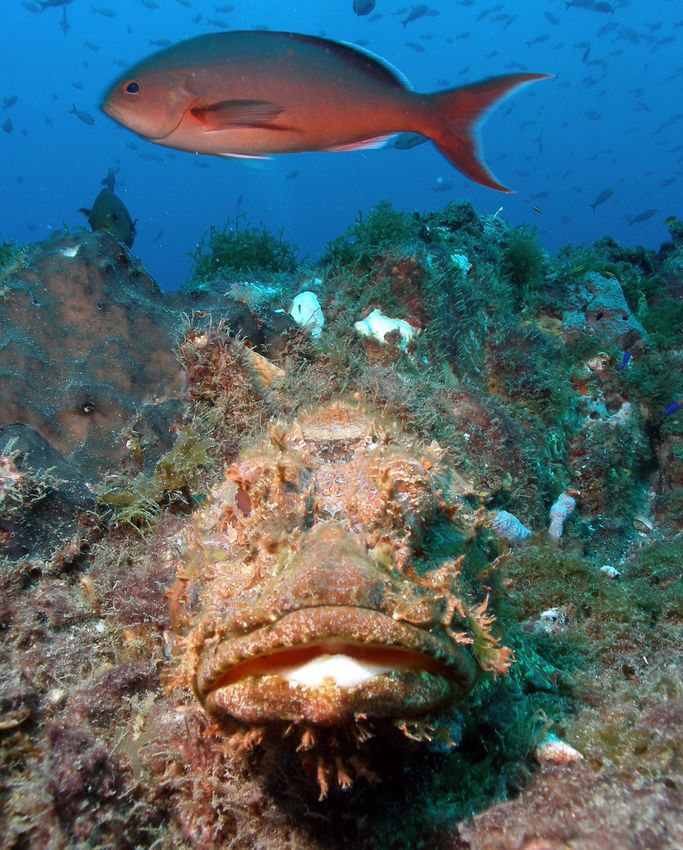
A creolefish swims behind a spotted scorpionfish in the Gulf of Mexico. | Credit: NOAA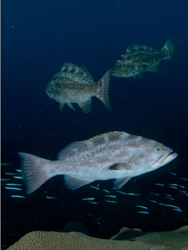
IMPROVING FISHERIES CONSERVATION AND MANAGEMENT IN THE EASTERN GULF OF MEXICO

                              A scientist extracts otoliths and other parts from yellowtail snapper off the coast of Florida. | Credit: FWC/FWRI

EXECUTIVE SUMMARY
The Deepwater Horizon Oil Spill resulted in an unprecedented injury to fishes in the Gulf of Mexico. It was estimated that
trillions of larval fishes died from exposure to oil and dispersants, resulting in a significant loss (DWH Trustees 2016). In 2013,
as part of the settlement to resolve certain criminal charges against BP and Transocean, $2.544 billion was directed to be paid
to the National Fish and Wildlife Foundation (NFWF) to conduct or fund projects that remedy harm or reduce the risk of future
harm to Gulf Coast natural resources of a type injured by the spill. NFWF subsequently established the Gulf Environmental
Benefit Fund (GEBF) to identify, fund, and administer these projects. Several Gulf States were particularly interested in
utilizing the GEBF to restore fishes impacted by the spill. Because fishing pressure is one of the most powerful drivers of fish
populations, improving the responsiveness and accuracy of management tools could have a meaningful impact on fishes in the
Gulf of Mexico.

The Gulf States Marine Fisheries Commission, in partnership with State resource agencies and NOAA, developed a proposal
for Gulf-wide fisheries monitoring in the aftermath of the Deepwater Horizon oil spill, which formed the basis for fisheries
monitoring work funded by GEBF in the eastern Gulf. Starting in 2013, NFWF’s GEBF provided a total of $45.5 million to
the states of Florida, Alabama, and Mississippi to enhance fishery independent and dependent monitoring and, in so doing,
improve management decisions that are expected to restore fishes.

As these projects neared their completion in 2019, NFWF and representatives from Florida, Alabama and Mississippi reviewed
project results, discussed successes, and explored opportunities to maintain and support these efforts into the future. A
Steering Committee consisting of representatives from the three eastern Gulf States worked with NFWF to convene a workshop
in December of 2019 to review project outcomes and discuss next steps with managers and fisheries scientists from NOAA,
the States of Louisiana and Texas, and the Gulf States Marine Fisheries Commission. This report captures the findings and
recommendations of that workshop.

                                                                                                                                              3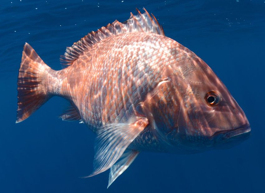
IMPROVING FISHERIES CONSERVATION AND MANAGEMENT IN THE EASTERN GULF OF MEXICO

Steering Committee members include:
• Kevin Anson, Alabama Department of Conservation and Natural Resources, Marine Resources Division (MRD)
• Sean Powers, University of South Alabama/ Dauphin Island Sea Lab (USA / (DISL)
• Luiz Barbieri, Florida Fish and Wildlife Conservation Commission, Fish and Wildlife Research Institute (FWRI)
• Ted Switzer, Florida Fish and Wildlife Conservation Commission, Fish and Wildlife Research Institute
• Paul Mickle, Mississippi Department of Marine Resources (MDMR)
• Robert Leaf, University of Southern Mississippi (USM)

Data, methodologies, and tools developed as a part of these efforts have promoted sustainable fisheries by informing stock
assessments and providing a data driven framework for rapid decision making between stock assessments. Data collected as a
part of these projects have already made substantial contributions to four completed federal stock assessments (gray snapper,
red snapper, red grouper, and vermilion snapper) and similar use of the data is expected to continue in stock assessments for
years to come. Tools developed and implemented as a part of these projects (e.g. Florida’s Gulf Reef Fish Survey, Alabama’s
Snapper Check, and Mississippi’s Tails ‘n Scales) have allowed each state to more accurately estimate recreational fisheries
catch and effort, improving their management of fishing season lengths. These projects have also provided status and trends
for southern flounder in coastal Alabama and red grouper in Florida, enabling fisheries managers to respond to previously
unknown species declines and evaluate the impacts of disasters like red tides.

These projects have made important advancements in fisheries science and substantially improved recent stock assessments
(Table 1), but further improvements could increase the long-term impact of these data. These projects have contributed
greatly to advancing video-based abundance surveys in the Gulf, with an FWRI-NOAA led survey (the combined video survey)
becoming a key part of Gulf stock assessments. Computer automated video analysis could ultimately reduce the cost and
increase the timeliness of video data, as video analysis is a time intensive process. All survey types examined (mapping, video,
hook and line) would benefit from standardization efforts (calibrations, building consistent protocols) and by improving
systems to store and share data.

Key aspects of these monitoring programs have secured long-term funding, but some important efforts could expire without
additional funding. Long-term funding has been secured for the FWRI video survey, Florida’s recreational fisheries survey
(State Reef Fish Survey), Alabama’s fishery independent surveys (partially funded), and Alabama’s recreational fishing effort
survey (Snapper Check). Mississippi will continue sampling through 2020 utilizing funds provided through the NFWF GEBF,
and the State’s efforts to secure long-term funding are ongoing. Notably, some abundance surveys that have proved useful for
stock assessment have not secured long-term (or future) funding. The end of funding for these monitoring programs may
preclude their use in future stock assessments and could complicate future stock assessment models.

These monitoring projects were a substantial effort that significantly advanced Gulf of Mexico fisheries management.
Recommendations identified at the workshop provide an opportunity to further advance fisheries management science to
ensure a robust and sustainable future for these important natural resources.

BACKGROUND
In 2013, the Gulf Environmental Benefit Fund (GEBF) was established to fund projects that remedy harm or reduce the risk
of future harm to the types of natural resources of the Gulf of Mexico that were impacted by the Deepwater Horizon oil spill
of 2010. GEBF has funded many projects to conserve and enhance coastal habitats, restore beach and dune habitats, protect
habitat important to coastal bird species, assess and restore fish populations, and increase the capacity of marine mammal and
sea turtle stranding networks.

GEBF awarded approximately $45.5 million to the states of Alabama, Florida and Mississippi for projects to address critical
gaps in reef fish science to improve the states’ ability to assess and manage fishery resources. These five-year awards were
for projects to enhance fishery monitoring to address information needs of vital importance to support science-based fishery
management.

The purpose of these investments in eastern Gulf of Mexico reef fish monitoring was to support activities that supplement
ongoing state and federal monitoring of fish and habitat resources. Ultimately, these investments would benefit fishes
by equipping fishery scientists and managers with better tools and data to sustainably manage these ecologically and
economically important natural resources. The goal of these projects was to demonstrate the benefits of enhanced monitoring

4
IMPROVING FISHERIES CONSERVATION AND MANAGEMENT IN THE EASTERN GULF OF MEXICO

     Table 1: Stock assessments for which GEBF data have been used or submitted for inclusion in the model.
     The status notes whether work on the assessment is complete or ongoing and the terminal year is the
     last year of data collection that was used in the assessment. Life history typically included age, growth,
     size, and reproduction data. GEBF data used notes the data used in stock assessment models for
     SEDARs where the status is complete, submitted data where status is ongoing, and data planned for
     submission for gag (SEDAR 72) and where the status is to be determined.

      Number      Species                      Status         Terminal     GEBF Data Used
                                                              Year
      1           gray snapper                 Complete       2015         Combined video survey, summer groundfish
                  (SEDAR 2018a)                                            survey, recreational discards by size class, life
                                                                           history
      2           red snapper                  Complete       2016         Recreational discards by size class, life history
                  (SEDAR 2018b)
      3           red grouper                  Complete       2017         Combined video survey, repetitive timed drop,
                  (SEDAR 2019)                                             summer groundfish survey, recreational
                                                                           discards by size class, life history
      4           vermilion snapper            Complete       2017         Combined video survey, summer groundfish
                  (SEDAR 2020a)                                            survey, recreational discards by size class

      5           scamp                        Ongoing        2017         Combined video survey, recreational discards
                  (SEDAR 2020b)                                            by size class, life history
      6           greater amberjack            Ongoing        2018         Combined video survey, recreational discards
                  (Thompson et al. 2020)                                   by size class, life history
      7           gag                          Ongoing        2019         Combined video survey, polyhaline seagrass
                                                                           survey, recreational discards by size class, life
                                                                           history
      8           red snapper                  Begin          TBD          Combined video survey, vertical long line,
                                               2021                        recreational discards by size class, recreational
                                                                           landings from calibrated state surveys, life
                                                                           history
      9           gray snapper                 Begin          TBD          Combined video survey, summer groundfish
                                               2021                        survey, polyhaline seagrass survey,
                                                                           recreational discards by size class, life history

and to facilitate improvements to reef fish monitoring programs in the eastern Gulf of Mexico states. While states consulted
with one another, monitoring programs were designed to accommodate unique conditions in each state, reflecting the great
diversity and variability of fish resources, habitats, and fishing practices from Key West, Florida to Bay St. Louis, Mississippi.

As these projects neared completion in 2019, NFWF and representatives from Florida, Alabama and Mississippi discussed
project successes and how to maintain and support these efforts into the future. The state representatives recommended
NFWF host a workshop, guided by a steering committee of the three eastern Gulf States, to identify long-term strategies for
implementing a coordinated monitoring program. While GEBF projects took place in the eastern Gulf of Mexico, the steering
committee invited Louisiana and Texas participation to ensure discussion of issues of Gulf-wide interest. This group met in
December 2019 and included representatives from all five Gulf States, the National Oceanic and Atmospheric Administration
(NOAA), and the Gulf States Marine Fisheries Commission (see attendance list in the Appendix). Workshop participants shared
their priorities, described project successes, pinpointed ongoing challenges and needs, and identified opportunities for greater
                                                                                                                   1
collaboration. The purpose of this report is to capture the major findings and recommendations discussed at the workshop.

                                                                                                                                     5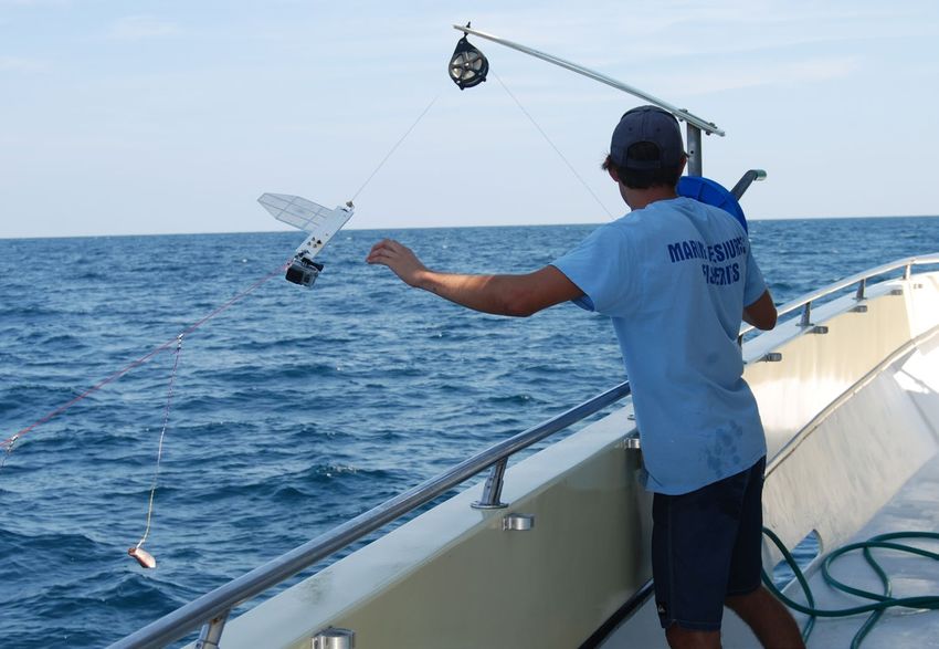
IMPROVING FISHERIES CONSERVATION AND MANAGEMENT IN THE EASTERN GULF OF MEXICO

                                                                                                 Figure 1: Example of catch from
                                                                                                 a vertical long line deployed off
                                                                                          Alabama’s coast. Left, A scientist holds
                                                                                              a mutton snapper captured off the
                                                                                             coast of Florida. | Credit: FWC/FWRI

SUMMARY OF STATE ACCOMPLISHMENTS
With support from GEBF, Florida, Alabama, and Mississippi addressed many facets of monitoring fish and habitat resources
including both fishery independent (e.g. sampling that does not rely on commercial or recreational fishing) and dependent (e.g.
landings and effort) monitoring. The states tailored monitoring programs to provide the most useful information to improve
the management of marine fishery resources. All three states conducted vertical longline sampling (VLL; Figure 1) and
developed and implemented tools to monitor and forecast recreational red snapper landings. The three distinct efforts were
coordinated across the states through venues such as the Gulf of Mexico Fishery Management Council (GMFMC), the Gulf States
Marine Fisheries Commission (GSMFC), and the National Marine Fisheries Service (NMFS).

Over a five-year period, which concluded in 2019, the Alabama Department of Conservation and Natural Resources Marine
Resources Division, in partnership with the Dauphin Island Sea Lab/University of South Alabama, used GEBF funding to
conduct the following monitoring activities:

•   Reef fish surveys for species distribution, abundance, size and age composition, reproductive characteristics, and feeding
    ecology. This work was conducted using standardized hook gears (vertical longline, bottom longline), offshore trawls, and
    remotely operated vehicles.

•   Trawl surveys in nearshore waters to characterize the distribution and abundance of juvenile red snapper, which do not
    generally occupy high-relief reef habitats where adults are found

•   Application of side scan sonar to better characterize the distribution and abundance of different benthic habitats

•   Use of fishery observers to characterize recreational discards

•   Implementation of a large-scale tagging program to characterize fishing pressure in different areas off Alabama’s coast.

6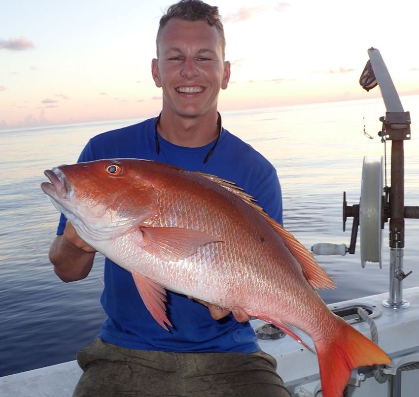
IMPROVING FISHERIES CONSERVATION AND MANAGEMENT IN THE EASTERN GULF OF MEXICO

    Figure 2: Video array used to estimate abundances and sizes of fishes off Florida’s coast. This array design is comparable to the one used by
                                                                                                 NMFS in the Gulf of Mexico. | Credit: FWC/FWRI

•   Implementation of Snapper Check, a tool used to estimate and forecast recreational catch of red snapper in the state and
    federal waters off Alabama’s coast

In Florida, GEBF funding was used for two projects. First, the Florida Fish and Wildlife Conservation Commission’s (FWC) Fish
and Wildlife Research Institute (FWRI) has completed five years of monitoring, which concluded in 2019, as follows:

•   Reef fish surveys for species distribution, abundance, size and age composition, reproductive characteristics, and feeding
    ecology. This work was conducted using standardized hook gears (vertical longline and timed repetitive drops), offshore
    trawls, stationary underwater cameras (Figure 2), and chevron traps (discontinued after year 2).

•   Trawl and seine sampling in shallow and nearshore areas for fish and invertebrates. This work targeted juvenile reef
    fishes that use seagrasses as a transitional habitat before their migration to reef habitats.

•   Application of hydro acoustics and side scan sonar (Figure 3) to better characterize the biomass of fishes sampled with
    stationary cameras and the distribution and abundance of different benthic habitats, respectively.

•   Use of fishery observers to characterize recreational discards.

•   Implementation of the Gulf Reef Fish Survey, a tool used to estimate and forecast recreational catch and effort of 10 species
    of reef fishes, including red snapper, red grouper, gag grouper, and gray triggerfish, in the State and Federal waters off
    Florida’s coast.

Second, the University of South Florida used towed video arrays to map benthic habitat in the West Florida Shelf area. The
primary objective of this work was to map important reef habitats that could be considered for additional protections
under the Magnuson-Stevens Fishery Conservation and Management Act. Most waters in the Gulf are considered Essential
Fish Habitat, and the fisheries management community has a strong interest in identifying areas that require additional

                                                                                                                                               7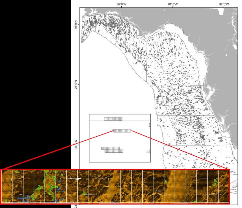
IMPROVING FISHERIES CONSERVATION AND MANAGEMENT IN THE EASTERN GULF OF MEXICO

Figure 3: Area covered by side scan sonar off Florida’s
coast from 2014-2019. The colored image towards
the bottom of the figure shows an example of
side scan sonar imagery that is used to
characterize habitat types. | Credit: FWC/FWRI
Above: Yellowmouth grouper over a hermatypic
reef in the Gulf of Mexico | Credit: NOAA

protection (e.g. Habitat Area of Particular Concern). GEBF funding was used to conduct:

•   Multi-beam acoustic surveys to characterize the distribution and abundance of various habitat types. Survey equipment
    also included towed cameras that were used to relate fish abundances to different habitat types.

•   Development of technologies to use machine learning for estimating fish abundances and habitat types. This technology
    could ultimately advance automated processing of underwater video for a variety of programs, including FWRI and NMFS,
    which would greatly decrease the cost and processing time associated with sampling protocols.

The Mississippi Department of Environmental Quality, in partnership with the Mississippi Department of Marine Resources
and the University of Southern Mississippi, has completed four of five years of monitoring funded by GEBF, with 2020 serving
as the final year of sampling. This includes:

•   Reef fish surveys for species distribution, abundance, size and age composition, reproductive characteristics, and feeding
    ecology. This work was conducted using vertical longline.

•   Extensive water quality sampling to better characterize the distribution and drivers of hypoxia off Mississippi’s Coast.

•   Use of fishery observers to characterize recreational discards in the federal for-hire fleet.

•   Implementation of Tails n’ Scales, a tool used to estimate and forecast recreational catch of red snapper in the state and
    federal waters off Mississippi’s coast.

While they did not receive GEBF funding to support fishery monitoring, the States of Louisiana and Texas attended the
workshop and shared information about their respective monitoring programs and their perspectives on the future of offshore
fisheries monitoring in the Gulf. Tables 2-4 include a comprehensive list of different monitoring programs throughout the Gulf
of Mexico. The Southeast Area Monitoring and Assessment Program (SEAMAP) provides the only source of long-term offshore
monitoring data in the western Gulf.

8
IMPROVING FISHERIES CONSERVATION AND MANAGEMENT IN THE EASTERN GULF OF MEXICO
Table 2: Offshore habitat mapping programs in the Gulf utilized by fisheries managers. Time series
highlighted in red were funded by GEBF following the kickoff of these projects (2014 in Florida, 2015 in
Alabama, and 2016 in Mississippi); other funding sources were sometimes used to support these
sampling programs before and after GEBF projects ended.
FL MS AL LA TX NMFS
-Multibeam-
Lead USF MDMR MRD NA NA NMFS
Time Series 2015- Long Term,
2014-2021 2020 NA NA
Length 2016 Ongoing
Seasonality Year Round Winter Year Round NA NA Year Round
-Side scan-
LDWF Artificial
Lead FWRI MDMR MRD/USA TPWD SEFSC
Reef Program
Time Series 2013- 2010- 2008-
2010-present 2011-2021 Unknown
Length 2017 present present
Year Round,
Seasonality Variable Summer Variable Variable Year Round
Opportunistic
Table 3: Offshore hook and line sampling programs in the Gulf utilized by fisheries managers. Time series
highlighted in red were funded by GEBF following the kickoff of these projects (2014 in Florida, 2015 in
Alabama, and 2016 in Mississippi); other funding sources were sometimes used to support these
sampling programs before and after GEBF projects ended. Superscript numbers following the time
series length correspond to the stock assessments in Table 1 where GEBF-funded data were used.
FL MS AL LA TX NMFS
-Vertical Longline-
Lead FWRI MDMR/GCRL MRD/USA LDWF TPWD SEFSC
Time Series Length 2014 - 2016- 2012- 2011- 2014- 2008-
20188 present8 present8 present present present
Seasonality May - March- March- March- May- Spring
October October October October October
-Bottom Longline-
Lead USF GCRL MRD/USA LDWF TPWD SEFSC
Time Series Length 2011-2018 2007-2019 2006- 2011- 2007- 1990-
present present present present
Seasonality NA March- March- March- April- Summer-
September October October October Fall
-Repetitive Timed Drop-
Lead FWRI NA NA NA NA NA
Time Series Length 2014 - NA NA NA NA NA
20183
Seasonality May - NA NA NA NA NA
October 2
9IMPROVING FISHERIES CONSERVATION AND MANAGEMENT IN THE EASTERN GULF OF MEXICO
Table 4: Offshore underwater video-based monitoring programs in the Gulf utilized by fisheries
managers. Time series highlighted in red were funded by GEBF following the kickoff of these projects
(2014 in Florida, 2015 in Alabama, and 2016 in Mississippi); other funding sources were sometimes used
to support these sampling programs before and after GEBF projects ended. Superscript numbers
following the time series length correspond to the stock assessments in Table 1 where GEBF-funded
data were used. VLL-mounted cameras are used for different purposes for each lead organization
(estimating depredation, habitat type, etc.).
FL MS AL LA TX NMFS
-Remotely Operated Vehicle-
Lead USF NA MRD/USA LDWF NA NOS, ONMS
Time Series 2014-2021 NA 2011- 2012-2017 NA Unknown
Length present
Seasonality Year Round NA March- Variable NA Variable
October
-Baited Remote Underwater Video-
Lead FWRI NA NA NA NA SEFSC
Time Series 2008- NA NA NA NA 1992-Present
Length present1,3-9
Seasonality May - NA NA NA NA Variable
October
-Vertical Long Line-Mounted Cameras-
Lead FWRI MDMR/GC MRD/USA LDWF NA NA
RL
Time Series 2014 - 2016-2019 2011- 2015- NA NA
Length 20188 present present
Seasonality May - Year Round March- July-Oct NA NA
October October
4
Red snapper and lionfish swim near a submerged chicken coop off the Florida Panhandle| Credit: FWC/FWRI
10IMPROVING FISHERIES CONSERVATION AND MANAGEMENT IN THE EASTERN GULF OF MEXICO
BENEFITS OF MONITORING
Enhanced fisheries monitoring contributed to the effective conservation and management of fishes by ensuring managers had
access to timely, more complete and accurate information to support management decisions. These investments conserved
fishes through two primary avenues: contributing to stock assessments and providing a basis for robust data-driven decision
making outside the stock assessment process.
INFORMING STOCK ASSESSMENT
Stock assessment models for fishes in the Gulf of Mexico are developed and reviewed through the Southeast Data, Assessment
and Review (SEDAR) process. Assessment models utilize large quantities and diverse types of data to analyze the status
and trends of fish populations. These models are critical for helping fisheries managers establish sustainable catch limits
and evaluate stock status. In the Gulf of Mexico, assessment models have relied heavily on fishery dependent data because
these data streams often constitute the longest time
series of available data. The fisheries management
community has long pushed for greater incorporation
of fishery independent data because it is difficult
to parse out whether changes in fishery dependent
data products (e.g., indices of relative abundance)
are driven by changes in the fish population, fishing
pressure, or management (e.g., fishing regulations).
SEAMAP is the primary source of long-term fishery
independent data in the Gulf, but budgetary
constraints [approximately $1.9 million for the entire
Gulf in FY19 (SEAMAP Subcommittee 2019)] have
acted as a barrier to augmenting collection of fishery
independent data for stock assessment.
Fishery independent data collected as a part of
these projects have already been utilized in four
completed SEDARs and will likely be used in future
Gulf reef fish SEDARs (Table 1). The SEDAR 61 red Figure 4: Red grouper relative abundance coefficients of variation (a
grouper assessment (SEDAR 2019) incorporated a measure of uncertainty) for the FWRI-NMFS combined video survey
large amount of data from the FWRI-led monitoring with and without GEBF funded sampling. Note that uncertainty is
program, including life history data (size/age decreasing over time, but GEBF funding has resulted in drastic reductions
structure, age and growth, reproduction), discard to uncertainty due to improved modeling approaches and additional data
mortality, and abundance data from both the collection. | Credit: FWC/FWRI
repetitive timed drop survey (hook and line), and
the FWRI video survey. The red grouper assessment
placed a large emphasis on the FWRI video survey, which was combined with the SEAMAP Reef Fish and NMFS Panama City
video surveys for the purposes of the analysis. With GEBF funding, FWRI has significantly expanded video work, which has
resulted in large reductions to the uncertainty of population estimates generated from analyses of survey data, including a ~50
percent reduction in uncertainty for red grouper (Figure 4). The SEDAR 61 red grouper assessment report took note of these
successes, attributing “major advances” in data streams as the reason for revising many model inputs (SEDAR 2019). It is
noteworthy that this new approach of combining and integrating video data has become the standard approach for recent reef
fish stock assessments.
Many of these monitoring efforts were funded with a specific goal of contributing and improving the red snapper stock
assessment. The SEDAR 52 red snapper assessment (SEDAR 2018b) used life history and recreational discard data that were
collected at the very beginning of these monitoring projects (prior to 2017). While including more sampling methodologies
may have broadened our understanding of red snapper size-class structure (Figure 5 and see Powers et al. 2018a), SEDAR
(2018b) notes that these new data only resulted in a minor update from the previous assessment. Relative abundance data
were not included in the SEDAR 52 red snapper assessment, which included data from 2016 and earlier, because the data
streams associated with these projects had just been established, and time series were of insufficient length (2018b). It is
expected that data collected as a part of these projects will play a larger role in the upcoming red snapper research track stock
assessment, which is scheduled to begin in 2021 (schedule available at http://sedarweb.org/), as all data streams will be fully
established at that point.
11IMPROVING FISHERIES CONSERVATION AND MANAGEMENT IN THE EASTERN GULF OF MEXICO
Figure 5: Different sizes of red
snapper sampled by trawls, video,
and hook and line methods in
Florida. Note that the combination
of all three gear types demonstrates
a broader size distribution than any
one technique. | Credit: FWC/FWRI
In addition to improved data streams that contributed to federal stock assessment (SEDAR 52), Alabama’s project created
capacity that allowed for a southern flounder stock assessment in Alabama’s coastal waters. Anglers and fisheries managers
alike have suspected a decline in southern flounder in Alabama’s coastal waters. Increased capacity associated with this
project allowed Alabama to perform a stock assessment, which corroborated this observed decline (Powers et al. 2018b).
The state responded by increasing the minimum size of southern flounder from 12 to 14 inches, reducing the bag limit by 50
percent, and closing fishing when adult southern flounder migrate from inshore waters to offshore waters during November
(Rainer 2019). Increasing the size limit alone will leave approximately 38 percent (>50,000 individuals) more fish in the
water every year, ensuring this important resource is available for future generations of Alabamians.
PROVIDING A DATA-DRIVEN FRAMEWORK TO MAKE RAPID MANAGEMENT DECISIONS
Fisheries managers are tasked with making management decisions that affect the conservation of marine fishes. These
decisions include adjusting season lengths in response to changes in fishing pressure, and unfortunately, often in response
to environmental disaster. Over the last five years, these projects have provided managers with a data-driven framework
when making these difficult decisions.
Tools implemented to monitor recreational effort and catch of reef fishes in the eastern Gulf have furthered the conservation
of red snapper. These three tools [Gulf Reef Fish Survey (FL), Snapper Check (AL), and Tails n’ Scales (MS)] are marked
improvements on their predecessors in terms of reduced uncertainty and the timeliness of the data. The utility of increased
timeliness of the data has already been demonstrated in Alabama. Exceptionally good weather during the summer of
2018 provided more offshore fishing opportunity than anticipated, and consequentially, forecasts using in-season data
from Snapper Check indicated recreational catch would exceed sustainable levels if the fishery had remained open for
the remainder of the original announced season. The state responded by reducing the season by more than 50 percent to
remain within their recreational catch limit of 984,211 pounds (the recreational fishery exceeded its allocation by 2,007
pounds). It is notable that Alabama has also extended the 2019 red snapper fishing season when Snapper Check data were
used to forecast that catch would not reach the limit by season close. These adjustments demonstrate to the public that
decisions are being made objectively based upon the best available science.
12IMPROVING FISHERIES CONSERVATION AND MANAGEMENT IN THE EASTERN GULF OF MEXICO
Red snapper, lionfish, and a school of juvenile vermilion snapper off the coast of Florida. | Credit: FWC/FWRI
During the Deepwater Horizon oil spill, managers struggled
with a lack of baseline data in determining real or potential
injuries to reef fish populations. These projects were
designed, in part, to ensure baseline data are available in
the unfortunate event of another disastrous environmental
event. To that end, fishery independent data from
several of these projects were used to support fisheries
management in response to the 2018 red tide in southwest
Florida. Red tide is known to have population-level impacts
on gag and red grouper (SEDAR 2014, SEDAR 2019),
and analyses indicated that the 2018 red tide had a large
impact on red grouper in particular. (GMFMC 2019). NMFS
ultimately reduced the catch allowed in both 2019 and
2020 by approximately 60 percent (4.78 million pounds/
year) to account for concerning declines in landings in
recent years as well as the anticipated loss of red grouper
associated with this disaster (NOAA 2019). The reduction
was based on analysis of past red tides, but the FWRI
repetitive timed drop and video survey provided important
supporting evidence for deeming this a severe mortality
event (Figure 6).
Figure 6: Video-Based relative abundance estimates of red grouper
in the nearshore and offshore zones of Florida. Note the steep drop
in nearshore abundance during 2018. Nearshore waters were those
most severely affected by red tide. | Credit: FWC/FWRI
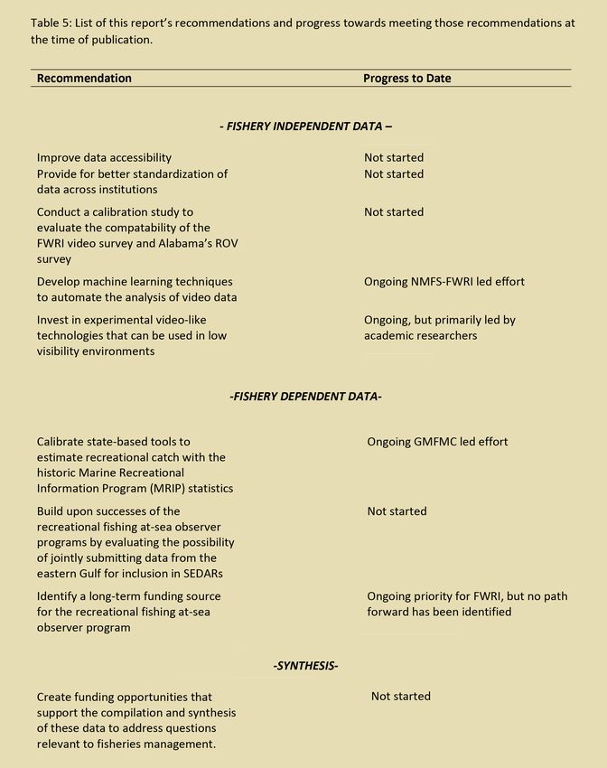
13IMPROVING FISHERIES CONSERVATION AND MANAGEMENT IN THE EASTERN GULF OF MEXICO MONITORING LANDSCAPE AND RECOMMENDATIONS FOR THE FUTURE FISHERY INDEPENDENT MONITORING Tables 2-4 (pages 9-10) summarize recent fishery independent monitoring efforts in the Gulf of Mexico. These tables are organized by theme: characterizing benthic habitats (Table 2), monitoring abundances and sizes of fishes using underwater video surveys (Table 3), and monitoring abundances and life history (age, growth, reproduction, diet) using traditional hook and line techniques (Table 4). These tables clearly demonstrate that sampling efforts varied state-by-state and that GEBF funding has played a large role in getting these efforts out to sea. Habitat mapping has become a cornerstone of fishery independent monitoring in recent years by guiding the design of sampling efforts. This focus, in large part, is driven by a desire to incorporate habitat characteristics into statistical analyses (e.g., indices of relative abundance) and, ultimately, stock assessment. The availability of habitat can have population-level impacts on fishes by influencing their survival, growth, and reproduction. Thus, inclusion of habitat in the stock assessment process can help reduce uncertainty. While knowledge of benthic habitats in the Gulf has improved drastically since the Deepwater Horizon Oil Spill, additional work is needed to improve the compatibility and accessibility of these data (Table 5). RECOMMENDATION: IMPROVE DATA ACCESSIBILITY. Mapping data are housed in a variety of external and internal repositories, making it difficult for those individuals who need this information to understand what is available and how to access it. Enhanced data availability could be accomplished through setting clear metadata standards and establishing a centralized repository for fishery scientists, managers, and other researchers. It may be appropriate to restrict access to these databases to protect locations of sensitive habitats and unpublished artificial reefs. RECOMMENDATION: PROVIDE FOR BETTER STANDARDIZATION OF DATA ACROSS INSTITUTIONS. Discrepancies exist in how habitat types are classified during data analysis. Different organizations use different habitat classification procedures (e.g. FWRI uses ~30 different habitat classifications, whereas USF only uses two), constraining the comparability of data. Additional work is needed to evaluate these various techniques and to determine how best to integrate classifications from multiple programs and promote greater compatibility. Lastly, a calibration study is needed for multi-beam and side scan sonar to determine if these methods could be used jointly. Underwater video surveys have transformed fisheries management, but techniques vary widely across programs. Stereo- baited remote underwater video (S-BRUV) is the most widely used video method for surveying reef fishes. A standardized S-BRUV protocol is used by the State of Florida (FWRI) and NMFS, which involves attaching cameras to a sturdy metal frame that is left on the seafloor for about one hour. USF also utilizes a towed camera array to characterize fish abundances on the West Florida Shelf. However, these surveys differ from randomized fishery independent surveys, as they are targeted at mapping hard bottom habitats and characterizing associated fish assemblages. The State of Alabama uses a remotely operated vehicle (ROV) to conduct video survey transects on and around reefs to survey fishes. Use of underwater video surveys in Mississippi, Louisiana, and Texas is considerably more difficult because of poor visibility associated with river outflows and muddy bottoms in this part of the Gulf. Nevertheless, these methods have been successfully used off Louisiana in surveys following the Deepwater Horizon Oil Spill and as a part of many academic studies off the coasts of Mississippi, Louisiana, and Texas. Additional work is required to increase the usability of video surveys in fisheries management, with the ultimate goal of incorporating video surveys into federal stock assessment models. RECOMMENDATION: CONDUCT A CALIBRATION STUDY TO EVALUATE THE COMPATIBILITY OF THE FWRI VIDEO SURVEY AND ALABAMA’S ROV SURVEY. FWRI’s video survey and Alabama’s ROV survey were used (along with data from other surveys) to estimate lengths for the SEDAR 52 red snapper stock assessment (SEDAR 2018b). Differences in these two techniques present challenges for using these separate surveys to jointly estimate abundance. This type of joint abundance estimation will require a calibration study where both methods are compared across a range of environmental and habitat conditions. FWRI and USF have already made some progress towards calibrating the S-BRUV and USF’s towed video array. Because of the similarity between the USF’s towed video array and Alabama’s ROV survey, this initial progress towards calibrating the two methods may provide a framework for calibrating the S-BRUV and Alabama’s ROV. 14
IMPROVING FISHERIES CONSERVATION AND MANAGEMENT IN THE EASTERN GULF OF MEXICO

                                                                           15
IMPROVING FISHERIES CONSERVATION AND MANAGEMENT IN THE EASTERN GULF OF MEXICO RECOMMENDATION: DEVELOP MACHINE LEARNING TECHNIQUES TO AUTOMATE THE ANALYSIS OF VIDEO DATA. Video survey methods are also constrained by the amount of time and level of effort required to analyze video. To date, these analyses have mostly been performed by people who “read” the video and record fish lengths, abundances, and habitat characteristics. NMFS and the University of South Florida have made recent advances in automating these analyses. Automating video processing will decrease the analysis time, allow for the computation of multiple abundance indices, make data rapidly available for management decisions, and will likely decrease high analysis costs associated with these survey methods. Automation of image analysis will also allow for the analysis of all cameras from an individual sample (historically, only one camera per sample is analyzed for fish relative abundances) and will increase the feasibility of using 360 degree camera arrays, which have been hampered by long processing times. RECOMMENDATION: INVEST IN EXPERIMENTAL VIDEO-LIKE TECHNOLOGIES THAT CAN BE USED IN LOW VISIBILITY ENVIRONMENTS. Equipment such as imaging sonar that converts sound echoes into digital images may facilitate surveying fishes in all types of visibility conditions. However, these technologies are still in development and it is currently not possible to make species- level fish identifications using these sonar imaging techniques, limiting their current utility for monitoring fish abundance. Hook and line methodologies, especially VLL, have been a mainstay of fishery independent monitoring. VLL and Bottom Longline (BLL) have been historically implemented through SEAMAP’s partnerships with the Gulf States. These projects resulted in drastic increases in VLL and BLL sampling. The repetitive timed drop survey (RTD) was an experimental method tested by FWRI. RTD proved to be extremely valuable, especially for the SEDAR 61 red grouper stock assessment (SEDAR 2019). However, FWRI elected to discontinue this survey after 2018 and to rely on video surveys for abundance estimates. VLL and BLL are known to have sampling biases towards certain species and sizes of fishes, but they provide important data on life history (age, growth, reproduction, diet) that cannot be derived from other survey methods, such as video surveys. These programs vary by footprint, timeline, and station distribution; however, sampling techniques have been well coordinated through SEAMAP. FISHERY DEPENDENT MONITORING The three fishery dependent monitoring programs implemented in Florida, Alabama, and Mississippi have been some of the most impactful investments made as a part of these projects. As discussed in section 3c, tools used for estimating recreational catch (Gulf Reef Fish Survey, Snapper Check, Scales n’ Tails) have driven fisheries management decision-making regarding bag limits and season lengths. However, additional work is needed to facilitate their application to federal stock assessments. RECOMMENDATION: CALIBRATE STATE-BASED TOOLS TO ESTIMATE RECREATIONAL CATCH WITH THE HISTORIC MARINE RECREATIONAL INFORMATION PROGRAM (MRIP) STATISTICS. The designs underlying all three of these tools have been certified by the MRIP, but there is an outstanding need to calibrate these surveys against MRIP’s national survey. Calibration of these surveys is ongoing and will continue in 2020. RECOMMENDATION: BUILD UPON SUCCESSES OF THE RECREATIONAL FISHING AT-SEA OBSERVER PROGRAMS BY EVALUATING THE POSSIBILITY OF JOINTLY SUBMITTING DATA FROM THE EASTERN GULF FOR INCLUSION IN SEDARS. Techniques for collecting observer-based estimates of discard mortality and size composition of discarded fish have been well coordinated, as the programs in Alabama and Mississippi were modeled on Florida’s program. Florida’s estimates of discard mortality have been included in ten federal Gulf of Mexico stock assessments. Because of the similarity in programs across the three eastern Gulf States, it may be possible to combine the outputs from these three programs into a single dataset for the eastern Gulf. RECOMMENDATION: IDENTIFY A LONG-TERM FUNDING SOURCE FOR THE RECREATIONAL FISHING AT-SEA OBSERVER PROGRAM. FWRI’s at sea observer program has been supported on short-term funding for over ten years. Given the widely recognized value of these data, which are the sole source of characterizing the sizes of fish discarded by the recreational fishery, securing long-term funding for recreational observer programs should be a priority. SYNTHESIZING EXISTING DATA TO ANSWER IMPORTANT QUESTIONS FOR FISHERIES MANAGEMENT Fisheries managers readily incorporated data produced by these projects into the fisheries management process; however, the data collected as a part of these expanded fisheries monitoring programs provide a unique opportunity to use an integrative (cross-program) approach to answer questions of critical importance to fisheries managers. For example, the expanded collection of growth, reproduction, and diet data on natural and artificial reefs across the eastern Gulf could likely provide fresh insights on the use of artificial reefs as a fisheries management tool. These data could also be used to model the distribution and abundance of various habitat types and better understand the drivers of fish assemblages in the Gulf. RECOMMENDATION: CREATE FUNDING OPPORTUNITIES THAT SUPPORT THE COMPILATION AND SYNTHESIS OF THESE DATA TO ADDRESS QUESTIONS RELEVANT TO FISHERIES MANAGEMENT. 16
IMPROVING FISHERIES CONSERVATION AND MANAGEMENT IN THE EASTERN GULF OF MEXICO

                                                   A scientist deploys a vertical long line off the coast of Florida. | Credit: FWC/FWRI

CONCLUSIONS
Restoration of marine fishes is an ambitious task. While ocean-scale ecological processes that influence fish populations are
unlikely to be influenced by local actions, ensuring sustainable fishing practices is achievable. This was the rationale for using
GEBF funds to equip fisheries managers with better tools and data.

These projects show that investments in fisheries monitoring are an effective way of restoring and conserving marine fishes.
These monitoring programs have contributed positively to every major Gulf reef fish stock assessment since the beginning
of these investments. These investments furthered stock assessment by improving the quality of model inputs, and the
conservation impacts can be seen in the management actions that take place after the stock assessment. For example,
GEBF-funded tools and data have driven the decision-making behind mid-season adjustments of fishing seasons to promote
sustainable catch and adjusting catch limits to account for the catastrophic 2018 Red Tide in southwest Florida. These
investments have also given fisheries managers increased flexibility with implementing stock assessments and updates.
The SEDAR 62 gray triggerfish stock assessment was scheduled for completion in the Spring of 2020, but unfortunately was
canceled and recommended for a more intensive “research track” assessment to resolve issues associated with data inputs and
assessment model configuration. In the meantime, the GMFMC noted they would base management recommendations, in part,
upon annual interim analyses, which will be based on gray triggerfish relative abundance using the combined FWRI-NMFS
video survey (GMFMC 2020).

The greatest benefits of these data may be in the future. All three states invested in enhanced collection of diet information
because they are critical for implementing ecosystem and multi-species stock assessments. These data have helped improve
ecosystem models and our understanding of trophodynamics and the productivity of managed and non-managed species.
While managers are not ready to implement these advanced stock assessment models at this time, these data could ultimately

                                                                                                                                     17
IMPROVING FISHERIES CONSERVATION AND MANAGEMENT IN THE EASTERN GULF OF MEXICO
Figure 7: Percentage of
intercepted anglers in
compliance with offshore
fishing regulations in
Mississippi waters. Taken from
“Office of Marine Fisheries.
2019. Mississippi Recreational
Red Snapper Season 2019.
Pp.1-7.”
serve as a cornerstone of future stock assessments. Despite the widely recognized value of these data, these programs have
not secured long-term funding.
Long-term funding has been secured for many aspects of these programs. The impact of FWRI’s video survey on stock
assessment and fisheries management resulted in a team of FWRI and NMFS scientists securing up to 10-years of
competitive funding (NOAA RESTORE Act Science Program) to implement a joint survey at a Gulf-wide scale
(https://restoreactscienceprogram.noaa.gov/projects/reef-fish-survey). The State of Florida has decided to use state
appropriations to fund an expansion of the Gulf Reef Fish Survey that covers the State’s Gulf and Atlantic coasts (Florida
Reef Fish Survey). The State of Alabama introduced a Saltwater Reef Fish Endorsement in 2020 that will provide limited
funding for their VLL, ROV and/or Snapper Check activities. While no long-term funding has been identified to support
Mississippi’s expanded fisheries monitoring efforts, the State’s project is funded with GEBF dollars through the 2020
sampling season.
The end of these investments will carry some unfortunate consequences for fisheries management in the Gulf of Mexico. The
end of abundance surveys that have proved useful for stock assessment (e.g. FWRI’s RTD survey) will likely preclude their
use in future stock assessments. This is especially true for the red snapper stock assessment, which historically includes a
rich assortment of abundance indices. The end of these investments could also mark the terminus of Florida’s discard size
data collected by the At-Sea Observer Program for the recreational fishery. These are often the only source of information
available to determine the sizes of fish discarded, which is important when estimating retention within stock assessment
models. The end of GEBF support for this data collection leaves the future of this data stream in doubt and could increase
model uncertainty by requiring more assumptions regarding discard mortality and retention.
While Mississippi has another year of available funding, the end of funding for the State’s program could also have
important consequences. Tails n’ Scales has enabled Mississippi to manage recreational red snapper catch under GMFMC’s
Amendment 50. It has also resulted in extraordinary improvements in compliance with recreational fishing rules (~50
percent compliance in 2015 and >90 percent compliance in 2019, Figure 7). A transition away from using Tails n’ Scales
could result in more conservative (shorter) season lengths that may undo some of the goodwill Mississippi fisheries
managers have earned from fishermen. Lastly, VLL sampling off Mississippi’s coast occurs in an area that was not
historically sampled by SEAMAP, so the expansion of this program represents the only fishery independent monitoring of its
kind happening off Mississippi’s coast.
These monitoring projects were a substantial effort that advanced Gulf of Mexico fisheries management. Further advances
are needed to support more complex stock assessment models (e.g. multi-species assessments) and ecosystem-based
fisheries management. Our hope is that future investments will continue to advance fisheries management science and
understanding and ensure a robust and sustainable future for these important natural resources.
18IMPROVING FISHERIES CONSERVATION AND MANAGEMENT IN THE EASTERN GULF OF MEXICO
REFERENCES
Deepwater Horizon Natural Resource Damage Assessment Trustees (DWH Trustees). 2016. Deepwater Horizon oil spill: final
programmatic damage assessment and restoration plan and final environmental impact statement.
http://www.gulfspillrestoration.noaa.gov/restoration-planning/gulf-plan
Gulf of Mexico Fishery Management Council (GMFMC). 2019. Modification of Gulf of Mexico Red Grouper Annual Catch Limits
and Annual Catch Targets: Framework Action to The Fishery Management Plan for Reef Fish Resources of The Gulf of Mexico.
https://gulfcouncil.org/wp-content/uploads/FINAL-Red-Grouper-2019-ACL-Modification-042919-1.pdf
Gulf of Mexico Fishery Management Council (GMFMC). 2020. January 2020 Council Update.
https://gulfcouncil.org/press/2020/january-2020-council-update/
National Oceanic and Atmospheric Administration (NOAA). 2020. Continuation of Reductions in Gulf of Mexico Red Grouper
Catch Levels. Fishery Bulletin. FB19-058.
https://gulfcouncil.org/press/2019/continuation-of-reductions-in-gulf-of-mexico-red-grouper-catch-levels/
Powers, S.P., J.M. Drymon, C.L. Hightower, T. Spearman, G. Bosarge, and A. Jefferson. 2018a. Distribution and Age Composition
of Red Snapper Across the Inner Continental Shelf of the North-Central Gulf of Mexico. Transactions of the American Fisheries
Society 147: 791-805. DOI: 10.1002/tafs.10081
Powers, S.P., M. Albins, and J. Mareska. 2018b. An Assessment of Southern Flounder in Alabama Coastal Waters.
Rainer, D. 2019. Advisory Board Approves Flounder, Seatrout Changes. Outdoor Alabama.
https://www.outdooralabama.com/node/2604
SEAMAP Subcommittee. 2019. Annual Report to the Technical Coordinating Committee, Gulf States Marine Fisheries
Commission, October 1, 2018 to September 30, 2019. https://www.gsmfc.org/publications/GSMFC%20Number%20293.pdf
Southeast Data, Assessment, and Review (SEDAR). 2014. SEDAR 33 - Gulf of Mexico Gag Stock Assessment Report. SEDAR,
North Charleston, South Carolina.
https://sedarweb.org/docs/sar/SEDAR%2033%20SAR-%20Gag%20Stock%20Assessment%20Report%20FINAL_
sizereduced.pdf
Southeast Data, Assessment, and Review (SEDAR). 2018a. SEDAR 51 - Gulf of Mexico Gray Snapper Stock Assessment Report.
SEDAR, North Charleston, South Carolina. https://sedarweb.org/docs/sar/S51_FINAL_SAR_0.pdf
Southeast Data, Assessment, and Review (SEDAR). 2018b. SEDAR 52 - Gulf of Mexico Red Snapper Stock Assessment Report.
SEDAR, North Charleston, South Carolina. https://sedarweb.org/docs/sar/S52_Final_SAR_v2.pdf
Southeast Data, Assessment, and Review (SEDAR). 2019. SEDAR 61 – Gulf of Mexico Red Grouper Stock Assessment Report.
SEDAR, North Charleston, South Carolina. https://sedarweb.org/docs/sar/S61_Final_SAR.pdf
Southeast Data, Assessment, and Review (SEDAR). 2020a. SEDAR 67 – Gulf of Mexico Vermilion Snapper Stock Assessment
Report. SEDAR, North Charleston, South Carolina. http://sedarweb.org/docs/sar/S67_Final_SAR.pdf
Southeast Data, Assessment, and Review (SEDAR). 2020b. SEDAR 68 – Gulf of Mexico and Atlantic Scamp Document List.
SEDAR, North Charleston, South Carolina. https://sedarweb.org/docs/supp/S68%20Doc%20List.pdf
Thompson, Kevin A., Theodore S. Switzer, Mary C. Christman, Sean F. Keenan, Christopher Gardner, Katherine E. Overly, Matt
Campbell. 2020. Indices of Abundance for Greater Amberjack (Seriola dumerili) Using Combined Data from Three Independent
Video Survey. SEDAR70-WP-07. SEDAR, North Charleston, SC. 21 pp.
https://sedarweb.org/sedar-70-wp-07-indices-abundance-greater-amberjack-seriola-dumerili-using-combined-data-three
19IMPROVING FISHERIES CONSERVATION AND MANAGEMENT IN THE EASTERN GULF OF MEXICO
DECEMBER 2019 WORKSHOP ATTENDANCE LIST
STATE NAME ORGANIZATION
Alabama. . . . . . . . . Kevin Anson . . . . . . . . . . . . . . . . . . . . . . . . . . . . . . . . . Alabama Department of Conservation
and Natural Resources, Marine Resources Division
Alabama. . . . . . . . . Sean Powers. . . . . . . . . . . . . . . . . . . . University of South Alabama/ Dauphin Island Sea Lab
Alabama. . . . . . . . . John Mareska. . . . . . . . . . . . Alabama Department of Conservation and Natural Resources,
Marine Resources Division
Florida. . . . . . . . . . . Ted Switzer. . . . . . . . . . . . . . . . . . . . . . . Florida Fish and Wildlife Conservation Commission,
Fish and Wildlife Research Institute
Florida. . . . . . . . . . . Beverly Sauls. . . . . . . . . . . . . . . . . . . . . Florida Fish and Wildlife Conservation Commission,
Fish and Wildlife Research Institute
Florida. . . . . . . . . . . Sean Keenan. . . . . . . . . . . . . . . . . . . . . . Florida Fish and Wildlife Conservation Commission,
Fish and Wildlife Research Institute
Florida. . . . . . . . . . . Kevin Thompson. . . . . . . . . . . . . . . . . . . Florida Fish and Wildlife Conservation Commission,
Fish and Wildlife Research Institute
Florida. . . . . . . . . . . Steve Murawski . . . . . . . . . . . . . . . . . . . . . . . . . . . . . . . . . . . . . . . . University of South Florida
Louisiana. . . . . . . . . Brett Falterman . . . . . . . . . . . . . . . . . . . . . . Louisiana Department of Wildlife and Fisheries
Louisiana. . . . . . . . . Jason Adriance. . . . . . . . . . . . . . . . . . . . . . . Louisiana Department of Wildlife and Fisheries
Mississippi . . . . . . . Paul Mickle. . . . . . . . . . . . . . . . . . . . . . . . . . . . Mississippi Department of Marine Resources
Mississippi . . . . . . . Trevor Moncrief. . . . . . . . . . . . . . . . . . . . . . . . Mississippi Department of Marine Resources
Mississippi . . . . . . . Jill Hendon . . . . . . . . . . . University of Southern Mississippi, Gulf Coast Research Laboratory
Mississippi. . . . . . . . Marcus Drymon. . . . . . . Mississippi State University, Coastal Research and Extension Center
Texas. . . . . . . . . . . . James Tolan . . . . . . . . . . . . . . . . . . . . . . . . . . . . . . . . . . Texas Parks and Wildlife Department
Texas. . . . . . . . . . . . Mark Fisher. . . . . . . . . . . . . . . . . . . . . . . . . . . . . . . . . . . Texas Parks and Wildlife Department
NA. . . . . . . . . . . . . . Roy Crabtree. . . . . . . . . . . . . . . . . . . . . . . . . . . . . . . NOAA National Marine Fisheries Service
NA. . . . . . . . . . . . . . Andy Strelcheck . . . . . . . . . . . . . . . . . . . . . . . . . . . . NOAA National Marine Fisheries Service
NA. . . . . . . . . . . . . . Jamie Reinhardt. . . . . . . . . . . . . . . . . . . . . . . . . . . . NOAA National Marine Fisheries Service
NA. . . . . . . . . . . . . . Skyler Sagarese. . . . . . . . . . . . . . . . . . . . . . . . . . . . . NOAA National Marine Fisheries Service
NA. . . . . . . . . . . . . . Matthew Campbell . . . . . . . . . . . . . . . . . . . . . . . . . NOAA National Marine Fisheries Service
NA. . . . . . . . . . . . . . Jeff Rester. . . . . . . . . . . . . . . . . . . . . . . . . . . . . . . . Gulf States Marine Fisheries Commission
NA. . . . . . . . . . . . . . Mike Sharp . . . . . . . . . . . . . . . . . . . . . . . . . . . . . . . . . . National Fish and Wildlife Foundation
NA. . . . . . . . . . . . . . Erika Feller . . . . . . . . . . . . . . . . . . . . . . . . . . . . . . . . . . National Fish and Wildlife Foundation
NA. . . . . . . . . . . . . . David Reeves . . . . . . . . . . . . . . . . . . . . . . . . . . . . . . . . National Fish and Wildlife Foundation
NA. . . . . . . . . . . . . . Elizabeth Gullett. . . . . . . . . . . . . . . . . . . . . . . . . . . . . . National Fish and Wildlife Foundation
NA. . . . . . . . . . . . . . George LaPointe. . . . . . . . . . . . . . . . . . . . . . . . . . . . . . . . . . . . . . . George LaPointe Consulting
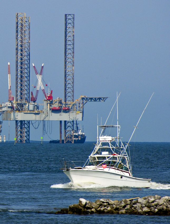
20Fishing vessel and oil rig in the Gulf of Mexico
Yellowmouth grouper
                             swimming over coral in the
                            Gulf of Mexico. Credit: NOAA

NATIONAL HEADQUARTERS,
NORTHEASTERN AND
SOUTHERN REGIONAL OFFICES
1133 15th Street, NW
Suite 1000
Washington, DC 20005
202-857-0166

CENTRAL REGIONAL OFFICE
8011 34th Avenue South
Suite 242
Bloomington, MN 55425
612-564-7284

ROCKY MOUNTAIN
REGIONAL OFFICE
1875 Lawrence Street
Suite 320
Denver, CO 80202
303-222-6482

WESTERN REGIONAL OFFICE
90 New Montgomery Street
Suite 1010
San Francisco, CA 94105
415-778-0999

nfwf.org
You can also read


