LAND USE 2 - The land use chapter sets a framework for the development and redevelopment of land within
←
→
Page content transcription
If your browser does not render page correctly, please read the page content below
2
            LAND USE

 The land use chapter sets a framework for the
development and redevelopment of land within
  the City’s jurisdiction over time. In addition to
defining future land use, this element also sets a
    vision for the character of future growth.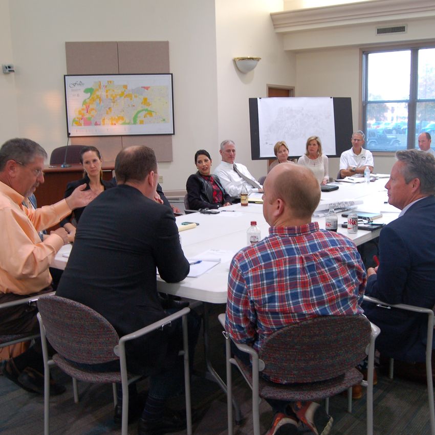
8   FISHERS 2040 Comprehensive Plan

    INTRODUCTION
    The future land use plan establishes and defines different land use classifications to be
    applied across the City of Fishers’ planning jurisdiction. In addition to defining the land
    uses that are most appropriate for each area of the city, the plan also integrates design
    elements that are most appropriate for each classification.

    Organization
    The future land use plan includes the following components:

    Goals, Objectives and Actions.          Future Land Use Map. The future        Land Use Category Definitions.
    Through the plan development            land use map was developed in          Each land use category has a
    process, overarching goals were         order to illustrate the geographic     separate description that defines the
    developed that define the overall       distribution of the various land use   purpose and character envisioned for
    intent of the future land use plan.     categories that is envisioned by       that particular land use.
    Action items detail how these goals     2040.
    will be obtained.

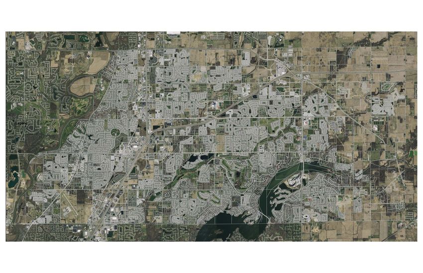
    2015 aerial of the Fishers                                                                          2021 aerial of the Fishers
    Nickel Plate District                                                                               Nickel Plate District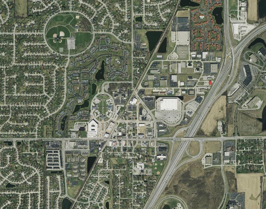
Land Use   9

Key Findings and Initiatives
The future land use plan establishes the desired development pattern
for the City of Fishers. It was created in a collaborative process that
sought input from stakeholders, policy makers, City staff and the
development community. As this plan was developed, the planning
team identified many ideas, trends, opportunities and constraints. The
key findings and initiatives from this process are listed below.

Land is a finite resource. The amount              Standards require updating. The City’s
of land left for greenfield development is         ordinances require a substantial update to
shrinking. The City must be wise with its          provide options for mixed-use development
approvals of developments on the remaining         and redevelopment. The standards also need
tracts of undeveloped land.                        to be brought into line with current market
                                                   expectations. In 2018, the City adopted
Redevelopment will intensify. Though
                                                   an update to the Unified Development
land is a finite resource, development will
                                                   Ordinance (UDO) which addressed many
continue in Fishers. This will be in the form of
                                                   recommendations in the plan. Additional
redevelopment of some existing areas.
                                                   code updates and changes to the zoning map
Previous land use plans lacked character           will be required to implement several of the
direction. Creating quality places is              plans ideas.
about more than land use alone. This plan
                                                   Areas Need Special Study. The City of
introduces future land use classifications
                                                   Fishers has areas of unique character, identity
that include direction on character. These
                                                   and possibility. As identified in this plan,
classifications describe types of places
                                                   there are areas in the city that will require
that are created by a mix of uses, building
                                                   extensive study so the land can be utilized to
scale, and transportation infrastructure. This
                                                   its greatest potential. In 2021, general land
approach provides more clear expectations
                                                   use recommendations on the future Land
and long-term flexibility for addressing
                                                   Use Map were prepared for these areas.
development trends and community
                                                   Some of these areas may require additional
needs such as mixed-use development,
                                                   detailed study.
redevelopment and employment centers.

  FIVE-YEAR UPDATE
  A Future Land Use Subcommittee was convened as part of the five-year update process to provide direction for the
  previously-defined Areas for Future Study and other recommendations for future land use citywide.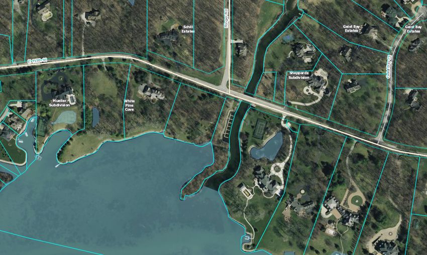
10   FISHERS 2040 Comprehensive Plan

     CURRENT STATE OF LAND USE
     Over the past 30 years, the City of Fishers has experienced tremendous
     growth. Fishers has grown from 7,000 residents in 1990 to nearly
     100,000 today. As Fishers looks to the future, the nature of this growth
     and the services required to support the community will continue to
     change. The policy and development decisions made now regarding
     growth management, development practices and fiscal planning will
     shape the long-term character of the community.                                                                              Forecasted increase
                                                                                                                                     in population
                                                                                                                                      2021-2040:

                                                                                                                                     30,675
                                                                                                                                        30%
     Population Forecast                                                                                          140,000

                                                                   Historic Growth                         131,525
     In 2014, the city partnered with Policy                       Growth Model                     128,044
     Analytics, LLC and the Corradino Group
     to prepare a Demand Forecasting and                                                     122,959
                                                                                                                   120,000
     Sustainability Analysis.
                                                                                        115,445
     The analysis forecasts continued high
     levels of population growth through
                                                                               104,604
     2025. In the first five years of the
                                                                                                                   100,000
     forecast, population continues to
     grow faster than 2.5 percent annually.                                                  100,850
     Beyond 2025, the population growth                                                      2021 estimate

     rate is expected to slow significantly                             87,085
                                                                                                                   80,000
     as the amount of developable land
     in Fishers diminishes. After 2030,                           76,794
     population is forecasted to grow at less
     than one percent annually. By 2040,
     the population of the Fishers’ planning                59,931                                                 60,000
     jurisdiction is forecasted to reach 131,500
     residents.
     The 2021 population estimate of 100,850
     (prepared by the city based on approved                                                                       40,000

     development) represents a growth rate of                 37,835
     growth of approximately 2.0 percent per
     year since 2015.
                                                         20,677                                                     20,000

                                              7,189
                                      5,181
                              2,008

                                  1980   1985   1990   1995 2000 2005 2010       2015    2020 2025 2030 2035 2040
                                                                                                  Source: Policy Analytics, LLC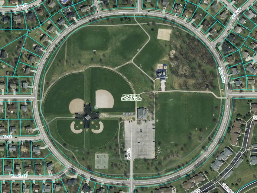
Land Use 11
Land Use
As the city grows and its demographics change, community values about the design of the built
environment will likely shift. To ensure that new development and redevelopment within the City’s
jurisdiction meets those values, new approaches to land use regulation are considered in the plan.
The future land use map sets a new framework for land use and development.
City Boundaries and Growth
Since 1971, the city limits of Fishers has LAND AREA CHANGE SINCE 2005
expanded with each decade. Originally acres
located within a few blocks west of 26,000
Interstate 69, the city limits have expanded
24,000
to the Marion, Hancock and Madison County 24,690 ac
22,000 24,159 ac
borders and the Carmel and Noblesville city 23,539 ac
limits. There are remaining unincorporated 20,000
tracts within the City’s planning jurisdiction 18,000
that may be annexed in the future. 18,169 ac
16,000
14,000
12,000
10,000
2005 2010 2015 2020
year
I
f
Seabiscuit Miles
R ed clif
ha
ANNEXATION
Ed
e n s ll HISTORY Sommerwood 23
8
0 0.5 1 2
r
ma
Gray lan
e
B ra 146Th
1000
146Th
Olio
Promise
Do
Mundy
ve
Howe
Sue r
e
T re
P r o v i d e nc e
Marilyn
141St
ry
er
ian
Ch
t a ge
on
Av
138Th
H ar riso n Fr
H a v erton
Cumberland
136Th 136Th 800
Prairie Baptist
Gray
37
Ivy Hill Fif B uffe
e tt
Pennington
vi lle
131St 69
Atlantic
on
l is
i
Ar
69
Al
Brooks School
le af
ne
37
126Th
to
126Th
River
d
Long
rs
Ly nn woo
he
at
O rch a
l D e ll
He
Olio
Su n b 23
Hoosier
rd
Florida
les t
121St lw ood 8 ek
ap e e
ze
t5 Ch Fal l C r
rynot
Ha
r l en
st e
i
Ex
o
R iv e r G
H
T ar
116Th
Us a
Lantern
n
i l to
Hague
138Th
113T h
Br i
am
ld
xt o n 25
H 10
Old fie
Riv er
Easy
Deering
t
i
Eller
cu
Lin ct
Po rtage ne
on
Fall
106Th C
Geist
Mu i
Hatherley
r 104Th
ne
Gray
st o
A
wa y
Georgia
101St Ohio
37
Driv e
Mollenkopf
ng
Alcott
i nt
a ter
Sp ri
po
ss
w
o
Cr
ge
d
Bri m
p
96Th
96Th Ra
S arg e n t
Mud Creek
Village
Masters
400
500
36
FjordAdded to City
Year
700
600
91St
Before 1971 1990-1994 2005-2009 N 0 .5 1 mile
1971-1984 1995-1999 2010-2014
1985-1989 2000-2004 2015-present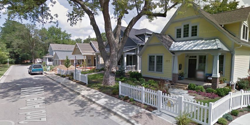
12   FISHERS 2040 Comprehensive Plan

     Existing Land Use
     Fishers has diverse land uses. The existing land use map                          Future Land Use
     on page 13 illustrates the distribution of land use types                         The future land use map helps guide
     throughout the city. The commercial core surrounds                                development and growth policies
     Interstate 69 and State Road 37 while the balance of                              throughout the city by defining preferred
     the city is primarily residential with nodes of commercial                        land uses, their attributes and geographic
                                                                                       distribution.
     development dispersed near major intersections.
     Existing land use categories differentiate between
     developed and undeveloped and include: residential (low,
     medium and high density), commercial (low, medium and
     high), industrial (light and high), mixed-use, institutional,
     public and private parks, agriculture and utilities. Currently,
     the mixed-use land use is located within the Nickel
     Plate District in downtown Fishers or select planned unit
     developments. The remaining agriculture use is located
     primarily in the eastern portion of Fishers.

                                                            Zoning
                                                            Properties within the Fishers jurisdiction are assigned a zoning
                                                            classification. Residents seeking to change the use of their property
                                                            often have to seek rezoning. Zoning districts are defined in Chapter
      Land Use v. Zoning
      Land use identifies how a property is
                                                            Three of the Unified Development Ordinance (UDO). Planned Unit
      actually being utilized. Zoning is a set              Development (PUD) Districts (also in Chapter 3) constitute roughly
      of laws that regulate land use including              half of all zoning within the city. PUDs are a mechanism to create
      types of structures that may be built, how            a custom, unique zoning district that responds to individual project
      they are to be built, where they are to be            concerns and constraints. These developments are often applied
      built and how they may be used. A zoning              to residential neighborhoods and commercial developments. Text
      district may allow for various land uses.             amendments are necessary when the standards of the PUD are to
      The existing land use does not necessarily            be changed and revised.
      reflect current zoning.

                                                            The City of Fishers has jurisdiction to regulate zoning and
                                                            development for the entire area east of the White River, north
                                                            of the Marion/Hancock County boundary, west of the Madison
                                                            County boundary and south of the City of Noblesville boundary,
                                                            even though not all these areas are annexed.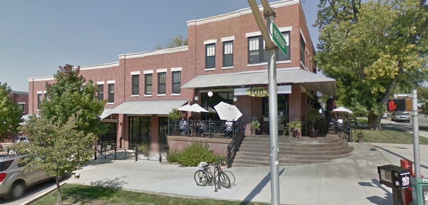
Land Use 13
Echo 650
Prairie Baptist
EXISTING e n sLAND B r a USE (JANUARY 2021)
l iff
ha l l
Allisonville
Boden
P o lk e ma 23
8
R e dc
Ed Pegasus
Win ds or
r
148Th
b ud
37
w
llo
Grayla n
Ho
700
Ros e
Bl ad s 146Th
e
1000
146Th
Olio
on
I
t
146Th
wn
Minn
Miles
Ly nn
ov Oran ge
Fa
D
Sue er B lo
s 0 0.5 1 2
Cyntheanne
o
e
Howe
T re
Mundy
w
e Belfry
P r o v i de n c
som
ry
141St
Sourwood
141St
er
Promise
Ch
D ee r Ridge ian Pla n t an a ge
Marilyn
69 69
Av
ta
n
Fr o
138Th
H ar ris on
Arap aho n
rt o 136Th 800
Cumberland
W a te r C 1 3 6 Th
Britton Park
136Th
ve
My rtle
Prairie Baptist
Re
Co
Ho
re
Ha
G
r iff ne min
Gray
st
n
in K noll
rn
r gto
Eastwood
Overview
bil
Ivy Hill n
Courage
l
Pennington
m a rine
ua Ely
e
Aq Longest 131St 131St
vil l
Cyntheanne
Ril
Atlantic
on
Sinclair
Do
ey
37
l l is
i
ub
Ar
A
leaf
Plu m C r Bills
Brooks School
le
Arv
e
Fuller
E agle
900
Lon g
126Th
a
ek
37A
126Th
da
River
126Th
Reynolds
a rus
p hy
C ir
B
hi
ll T ro
y
Orc ha
Olio
rd
D e ll
ke ip se 23
Co bb
o Ell 8
ro
Hoosier
D u va l Si lverst o ne
Florida
a rn
b 122Nd e l wood ek
Sp ring 121St
ze l
o l o gy 5 ap Fal l Cr
e
Ch
le s
to
Ha
n n
lb
G le
h er
er ch n
Co
t
r r ynot
a nd
E xi
t
os S Te
ew
a tc
e
u nb
Ri ver
H lest
Vi
ol l
nc
117Th
Ta
ic k
H
Su
116Th
tw
Home S pice Edgefield
Ga
Oak ara
d
En
Lantern
Teal
n
N ia g
ils
138Th
113Th
G a rr ic k
a
M
ilto
Moja v e
Tr
Br ir Pro 25
Ol dfield
ixt o n p er
m
Ha 10
dg e
Qu ail
ad
River
Easy
Florida
or
s b ri
Forest
Usa
Eller
Olio
ht
ig Portage G ei Lin t
Kn icu
Wildwoo d
108Th st t
er w a y Ri d
ec
Fall
no
ll Wat ge
Hague
n
ge
Ha
w t ho
106Th 106Th Oak K rn R on
id
Geist
C
cone rj a c 104Th
s tle Mu Ma
Bri ir e
re
s to n
ng
id
me
y pri Ohio
e wa
ca
101St
Willow View
r
Gray
e
Georgia
D r iv nd
t
K in
in
Alcott Wi
S
Mollenkopf
Stern
Soaring Eagle
Pa
po
e F a ll C re e k
rk w
ss
g
id
ro
98Th y
Oak l eaf
R r t
a
ate aa
C
Roberts ge w St
River
Brid 96Th 96Th 96Th
96Th 96Th
300
N orth
S arg e n t
Moorings
w ind Ca
3
Village
Masters
rd
it
i nal
400
Pr
500
Ex
A
36
600
37
Existing Land Use
om
r
ive
on to r y
R
700
91St
Low Density Residential Low Density Commercial Institutional N 0 .5 1 mile
Medium Density Residential Medium Density Commercial Parks
High Density Residential High Density Commercial Utility
Approved Undeveloped Residential Approved Undeveloped Commercial
Light Industrial Mixed Use
Industrial Agriculture
Land Use Classification Acres Percent of land area
Residential 16,786 65%
Low Density Residential 13,033 51%
Medium Density Residential 2,377 9%
High Density Residential 954 4%
Approved Undeveloped Residential 423 2%
Commercial 2,561 10%
Low Density Commercial 653 3%
Medium Density Commercial 279 1%
High Density Commercial 672 3%
Approved Undeveloped Commercial 861 3%
Mixed Use 96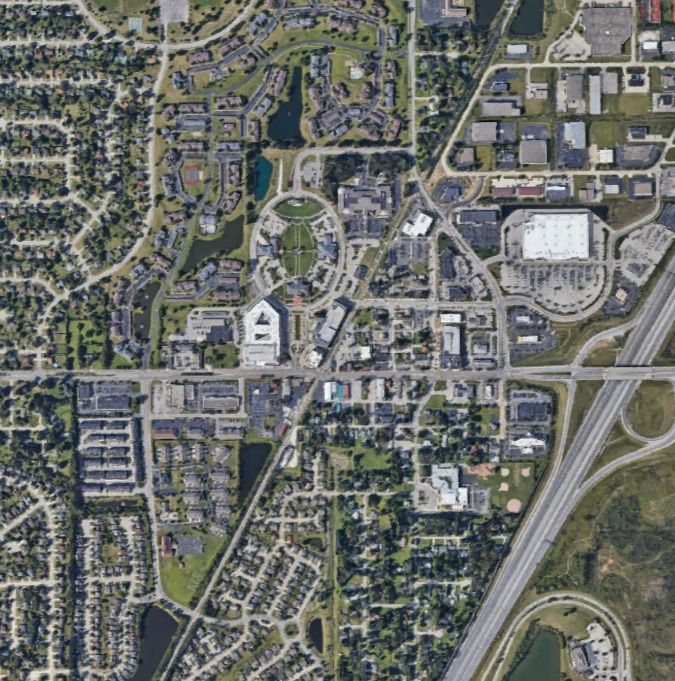
14   FISHERS 2040 Comprehensive Plan

     PLAN SUMMARY
     The future land use plan was developed through the involvement of key stakeholders, City
     staff, task forces and steering committee groups. The future land use map and associated
     land use categories are presented in this section and will shape the future of Fishers.

     Purpose                                          Goals
     The future land use plan that includes goals,    1.   SENSE OF PLACE - New development
     objectives, actions and the future land               and redevelopment incorporates all
     use map, which establishes the desired                the best practices of creating a sense
     development pattern for the City of Fishers.          of place and smart growth principles to
     This map is to be consulted whenever                  remain resilient and sustainable for the
     decisions are made regarding the change of            long-term.
     use for land in Fishers.                         2. ADAPTABLE - Commercial and
                                                         employment districts that allow
     Fiscal Sustainability                               employers and entrepreneurs to meet
                                                         the changing needs of modern business.       Steering committee and
     As Fishers continues to grow, the city must
     maintain a revenue and expense structure         3. SUSTAINABLE - Smart land use planning        task force members
                                                         that encourages fiscal, environmental        discuss the Fishers 2040
     capable of supporting the growing demand
                                                         and cultural sustainability.                 Comprehensive Plan
     for services. The potential for revenue growth
                                                                                                      (2015).
     is constrained by state statutes, local tax
     policy and economic conditions. The fiscal
     sustainability analysis was designed to
     evaluate Fishers’ long-term ability to fund
     public services and infrastructure given the
     forecasts of future growth.
     As the community matures over the next 15
     years, growth will slow and revenue sources
     which typically accompany development will
     decrease. Meanwhile, costs for maintaining
     aging infrastructure will likely rise.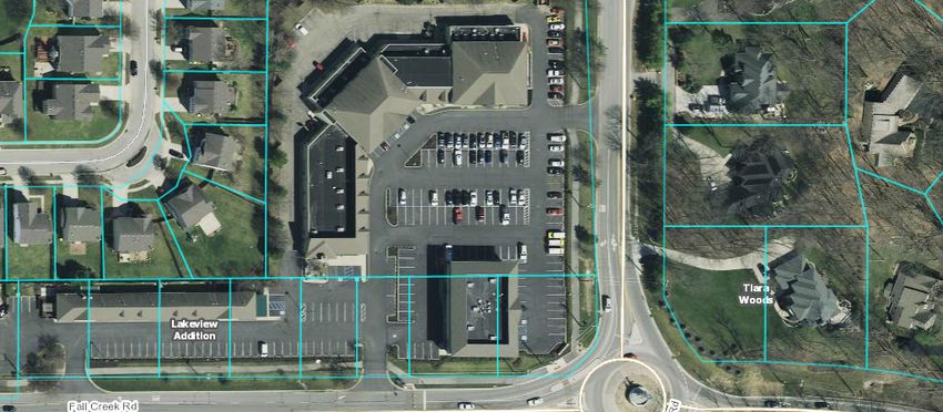
Land Use 15
GOALS, OBJECTIVES AND ACTIONS
FIVE-YEAR UPDATE All actions Underway (started, but not yet complete) Complete
were assessed and updated in Future (not started) New (Actions added during the 2021 update)
2021. The status of each action
is noted with an icon.
Future, then maintenance Maintenance (currently occurring on a
repeating basis)
Goal 1: Sense of Place
New development and redevelopment incorporates all the best
practices of creating a sense of place and smart growth principles to
remain resilient and sustainable for the long-term.
Objective 1.1 Create more opportunities for mixed use districts at key nodes
geographically distributed throughout the community. Status (as of June 2021)
1.1.1. Update the zoning map to create mixed use nodes that align with the
future land use map.
Objective 1.2 Create design standards for mixed use districts to set the vision for the
character of the new development.
1.2.1. Develop a strategy for regional mixed use and neighborhood mixed
use category in the City’s development standards to reflect the success of
areas such as Saxony and the Nickel Plate District.
1.2.2. Create a plan for the undeveloped land northwest of Allisonville Road
and 96th Street that incorporates a mix of uses.
1.2.3. Create a plan for future redevelopment of the Lantern Road corridor
between 116th Street and Fishers Point Boulevard to encourage reinvestment
that extends the character of the Nickel Plate District.
Objective 1.3 Provide a variety of housing types throughout the city to create a strong
sense of place
1.3.1. Update the UDO to define updated land use categories.
1.3.2. Develop a strategy to align the zoning map with the future land use
map.
1.3.3. Assess opportunities for future redevelopment at 131st Street and
Brooks School Road area.
1.3.4. Assess opportunities to integrate attached residential product within
a mixed use development at the northeast corner of Hoosier Road and 116th
Street.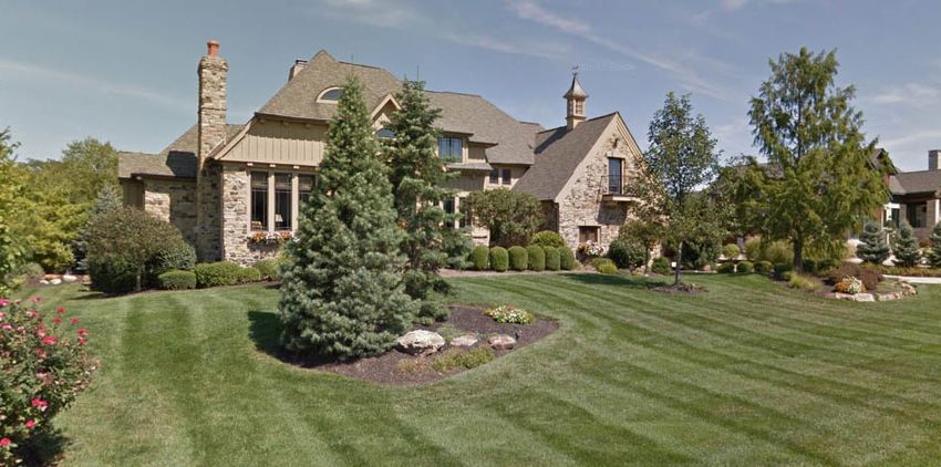
16 FISHERS 2040 Comprehensive Plan
Goal 2: Adaptable
Commercial and employment districts that allow employers and
entrepreneurs to meet the changing needs of modern business.
Objective 2.1 Encourage redevelopment that creates desirable location for
employment. Status (as of June 2021)
2.1.1. Update the UDO to define updated land use categories. removed (duplicate)
2.1.2. Develop a strategy to align the zoning map with the future land use
map.
2.1.3. Create a plan for the State Road 37 corridor to set a vision for future
redevelopment and attract future employment.
2.1.4. Create a plan for the airport property that incorporates a mix of uses
and increase opportunities for employment.
2.1.5. Create a plan for the area of land south of 126th Street between State
Road 37 and Interstate 69 to set a vision for future redevelopment and attract
future employment.
2.1.6. Create a plan for the areas of land south of Interstate 69 between Olio
Road and Atlantic Road to set a vision for future redevelopment and attract
future employment.
2.1.7. Identify future redevelopment areas and areas for special study.
Example: Area north of 113th Street, between Florida Road and Southeastern
Parkway.
Previously mentioned actions
> 1.3.1 and 1.3.2 UDO updates and Zoning Map alignmentLand Use 17
Goal 3: Sustainable
Smart land use planning that encourages fiscal, environmental and
cultural sustainability.
Objective 3.1 Provide nodes of commercial retail throughout the community to
balance growth over time and provide easier access from residential Status (as of June 2021)
neighborhoods to amenities and services.
3.1.1. Update the UDO to define updated land use categories. removed (duplicate)
3.1.2. Develop a strategy to align the zoning map with the future land use removed (duplicate)
map.
3.1.3. Assess opportunities for a future neighborhood mixed use node near
Southeastern Parkway and Atlantic Road.
Previously mentioned actions
> 1.3.1 and 1.3.2 UDO updates and Zoning Map alignment
Objective 3.2 Protect environmentally sensitive areas and natural corridors for
environmental health and recreational opportunities.
3.2.1. Update the UDO to include standards for protection of lands designated
on the open space overlay.
3.2.2. Assess potential locations for future public access to Geist waterfront.
3.2.3. Study new land use opportunities along the Nickel Plate Trail
3.2.4. Study land uses along waterway and other natural resources for
environmental protection
Objective 3.3 Routinely reassess development growth for continued fiscal sustainability.
3.3.1. Continue to conduct a yearly statistical analysis of development to
maintain accurate and up-to-date data on Fishers’ growth.
3.3.2. Periodically update the fiscal sustainability analysis to monitor the fiscal
impact of land use and development decisions.
3.3.3. Develop a policy for sunset dates in PUD so that when a development
does not occur within a specified period of time, the PUD expires and the land
returns to use identified by the future land use map.
Objective 3.4 (new) Promote sustainability and public health.
3.4.1. Identify potential changes to land use policies that would improve
environmental sustainability and public health.18 FISHERS 2040 Comprehensive Plan
FUTURE LAND USE
The future land use plan defines the various land use categories that
are envisioned for growth and development to 2040. Each category is
color-coded and displayed on the future land use map to illustrate how
the various categories work together and how they are geographically
distributed across the city. The future land use map is used as a
guide for future decision-making about development, zoning, or
infrastructure investments. Continued review and updates are expected
to occur on a regular basis.
Land Use Categories
The following land uses are defined in this chapter and assigned to geographic locations on the
future land use map.
> Estate Residential > Area Service Node
> Low Density Suburban Residential > Regional Center
> Suburban Residential > Employment Node
> Core Residential > Flex Employment/ Center / R&D
> Attached Residential > Parks and Open Space
> Regional Mixed Use > Civic/Institutional
> Neighborhood Mixed Use > Open Space Overlay
> Neighborhood Center > Areas for Special Study
Each land use category description contains the following information in order to define how
the land is intended to be used and developed.
Purpose. This section details the intent of the Development Features. This section details
land use category and explains the need for the standards necessary for subdivisions,
the category. planned unit development, or development
projects. For the purposes of the future land
Land Uses. This section outlines the type
use plan, this section is intended to list the
of uses that are intended to be permitted
important themes and policy considerations.
in each land use category. The UDO then
The UDO provides more detailed
establishes the specific land uses permitted
requirements.
in each zoning district.
Examples. This section provides
Intensity/Density. This section outlines
photographs and locations of land that
the desired intensity (typically in maximum
exemplifies each category.
square footage of building size for
commercial uses or dwelling units per acre
for residential uses). The UDO may add
further standards on density and intensity
and may utilize more than one zoning district
to regulate each land use category.Future Land Use Plan 19
FUTURE LAND USE 2040
146TH
146TH
BODEN
MARILYN
CA
M PU
S 141ST
141ST
136TH
HOWE
PROMISE
BAPTIST
PRAIRIE
CYNTHEANNE
131ST
131ST
PENNINGTON
SR 37
126TH
126TH
BROOKS SCHOOL
SO
121ST C
TI
U
N
TH
FLORIDA
LA
AT
E
E
FI V
AS
COM
TE
IT
RN
EX
ME R
116TH
CIA
116
TH
RINGER
L
A
HAWTHORN
IKE
HOO SIER
113T H
CUMBERLAND
LE
US
L
HAGUE
A
NVI
ELLER
111TH
ISO
N CLUB
OLIO
ALL
ER
NT T
LA CU
FA LL
TI
NEC
106TH N
CO
ID
104TH
CA
NT
KIN
I
GEIST
PO
MOLLENKOPF
SUNLIGHT
SS
101ST
WILLOWVIEW
O
GEORGIA
CR
EK
C RE
LL
FA
96TH
LL
T
96TH
O
SARGEN
CARR
Legend
I
Open Space Overlay Suburban Residential Neighborhood Mixed Use Area Service Node Employment Node Noblesville
0 0.25 0.5 1
Miles Estate Residential Core Residential Regional Mixed Use Regional Center Parks, Open Space
Low Density Suburban Res Attached Residential Neighborhood Service Center Flex Employment Center/R+D Institutional20 FISHERS 2040 Comprehensive Plan
Land Use    21

Estate Residential
PURPOSE                                                                                 EXAMPLES: Geist area
Establish and preserve land that is used for single-family homes on
large lots, less than one unit per acre. Uses may include residential
single-family development that is integrated with compatible
agricultural or ecological uses.

LAND USES                                      DEVELOPMENT FEATURES
> Single-family detached residential           > More pervious surface than in higher
> Agricultural uses                              density residential areas.             This aerial image of 113th Street at Geist is an example
                                               > Protects environmentally sensitive     of estate residential lots, typically much larger than one
                                                 areas.                                 acre in size.
DENSITY/INTENSITY
                                               > Accessory structures are permitted.
> Residential development less than            > Agricultural uses are permitted.
  one dwelling unit per acre.

                                                                                        The photo above is an example of an estate residential
                                                                                        home in Fishers, which typically have large front yards
                                                                                        and considerable natural areas.

Low Density Suburban Residential
PURPOSE                                                                                 EXAMPLES: Hamilton Proper, Hawthorn Ridge
Single-family, detached residential at low densities ranging from one
to two dwelling units per acre. For larger development, a variety of
densities within the permitted range is encouraged to allow for more
diversity in housing type.

LAND USES
> Single-family detached residential

                                                                                        This aerial image of residential lots in Hamilton Proper
DENSITY/INTENSITY                                                                       neighborhood is typical of low density suburban
> Residential development between one and two dwelling units per acre.                  residential lots.

DEVELOPMENT FEATURES
> A mix of housing types and architectural styles is desired.
> Development shall protect and enhance natural environment.
> Integrate with existing environmental features.
> Internal and external pedestrian and vehicular connectivity is required.
> Typically curvilinear streets.
                                                                                        The photo above of a home in Hawthorn Ridge is an
                                                                                        example of the typical setbacks and architecture found in
                                                                                        low density suburban residential neighborhoods.
22 FISHERS 2040 Comprehensive Plan
Suburban Residential
PURPOSE EXAMPLES: Sandstone, Silverton
Single-family detached residential at low densities ranging from two
to four dwelling units per acre. For larger development, a variety of
densities within the permitted range is encouraged to allow for more
diversity in housing type.
LAND USES > Curvilinear street layout is permitted,
however grid or modified grid street
> Single-family detached residential layout is also permitted to increase This aerial photo of residential lots in the Sandstone
connectivity with surrounding
neighborhood is an example of typical suburban
neighborhoods. Vehicular and
DENSITY/INTENSITY residential densities.
pedestrian connections to
> Residential development between neighboring parcels is required.
two and four dwelling units per acre > To provide opportunities for
affordable, sustainable housing,
smaller lots and smaller minimum
DEVELOPMENT FEATURES
home sizes may be appropriate
> Development shall protect and depending on the location, quality,
enhance natural environment. and character of the development
> Internal and external pedestrian and plan and homes.
vehicular connectivity is required.
> A mix of housing types and
architectural styles is desired. This photo of a home in the Silverton neighborhood is
typical of the architecture, size and front yard setbacks
typical to suburban residential neighborhoods.
Core Residential
PURPOSE EXAMPLES: Saxony
Residential neighborhoods that may incorporate a variety of single-
and multiple-family dwellings. The integration of a broad range of
housing within neighborhoods allows for greater housing choices
particularly for younger and older age groups. This classification is
intended to provide market flexibility for a wider range of housing
choices. This land classification is appropriate in areas close to the
downtown core or other mixed-use districts. Larger sites are expected
to incorporate a mix of housing types and to be designed to look, feel The aerial photo above shows townhomes in the Saxony
and function as a cohesive neighborhood. Smaller sites may include a area. The mix of a variety of housing types in a walkable
setting is what is envisioned for the core residential
single housing type, appropriately scaled to the surrounding context.
neighborhoods.
LAND USES DEVELOPMENT FEATURES
> Single-family detached residential > A mix of housing types and
> Townhomes or condominiums architectural styles is desired.
> Duplexes > Development shall protect and
enhance natural environment.
> A grid-like street layout that is well-
DENSITY/INTENSITY connected to neighboring parcels.
> Density is intended to be between > Internal and external pedestrian and
four to eight units per acre. Density vehicular connectivity is required.
The photo above is an example of cottage homes that fit
shall be further defined through the > On-street parking and use of alleys for
applicable development standards in the vision for the core residential areas.
garage access preferred.
the UDO.
> Features such as porches that support
street-level activity are encouraged.Land Use 23
Attached Residential
PURPOSE EXAMPLES: Fishers Point Boulevard, Princeton
Woods
Attached residential areas include housing types such as duplexes,
condominiums, townhouses and apartments. These areas add for
diversity in the housing stock for a variety of residents, such as young
professionals, empty nesters and families looking to be in a location
close to amenities. This land classification is intended to be used where
larger building footprints and a higher density of land use is appropriate.
LAND USES DEVELOPMENT FEATURES
> Townhomes, condominiums > A mix of housing types and This aerial image of Fishers Point Boulevard illustrates
> Duplexes architectural styles is desired. the land use pattern for attached residential. This
> Apartment units > Development shall protect and attached residential is in a preferred location between
enhance natural environment. commercial and lower density residential.
> Alleys for garage access preferred, no
DENSITY/INTENSITY front load products.
> Density shall be further defined > Front facades facing right-of-way.
through the applicable development > On-street parking.
standards in the UDO. > Grid or modified grid street layout.
> Internal and external pedestrian and
vehicular connectivity is required.
> Multiple exterior materials The condominiums on Fishers Point Boulevard reflect
and architectural elements are typical architecture for attached residential housing.
encouraged.
Neighborhood Mixed Use
PURPOSE EXAMPLES: Neighborhood mixed use is envisioned
at Olio Road and 116th Street, as well as Southeastern
Mixed use district that provides a neighborhood-sized node of services, Parkway and Cyntheanne Road.
amenities and gathering space in a pedestrian friendly environment.
Uses may be mixed vertically and horizontally. This designation
is intended to provide opportunities for smaller-scale mixed use
developments that are compatible with surrounding neighborhoods.
This designation is intended to be of smaller scale and lower density
than the regional mixed use category and have standards that are
sensitive to the scale and character of surrounding neighborhoods.
The rendering above is an example of a building-forward
LAND USES DEVELOPMENT FEATURES design that is typical in a walkable, neighborhood-scaled
mixed use center.
> Low intensity commercial retail > Development shall protect and
> Office enhance natural environment.
> Low intensity employment center > Internal and external pedestrian and
> Community center, open space vehicular connectivity is required.
> Upper floor residential > A mix of architectural styles with
minimal front setbacks and parking on
street or in rear.
DENSITY/INTENSITY
> Pedestrian accessible site and building
> May vary depending on proximity to design.
single-family residential areas. The
The example above of a neighborhood mixed-use center
UDO may include additional standards
and utilize more than one zoning is of a scale that is appropriate for this category. The
district to regulate this category. building-forward design has ground floor restaurants
and shops with condominiums above.24 FISHERS 2040 Comprehensive Plan
Regional Mixed Use
PURPOSE EXAMPLES: Nickel Plate District, Saxony
Mixed use district that provides a community hub, with higher densities
and intensities of commercial retail, employment centers, multi-
family, attached residential, public spaces and institutional uses in a
pedestrian friendly environment. The designation allows a broad range
of commercial and employment uses, public services and a wide range
of housing options. Development is pedestrian-oriented with a strong
emphasis on design and street level activity and will range from low- to
mid-rise in scale. The Depot at Nickel Plate is an example of a regional
mixed use district, with retail and residences in the same
LAND USES DEVELOPMENT FEATURES structure. The garage parking provides opportunity for a
building forward design and walkable streetscape.
> Commercial retail > Development shall protect and
> Office enhance natural environment.
> Employment center > Internal and external pedestrian and
vehicular connectivity is required.
> Community center, open space
> A mix of architectural styles with
> Upper floor residential
minimal front setbacks and parking on
street or in rear.
DENSITY/INTENSITY > Pedestrian accessible site and
> May vary depending on proximity to building design
Fishers District has examples of mixed use buildings with
single-family residential areas. The
UDO may include additional standards retail and office near a mix of attached and detached
and utilize more than one zoning housing. The development features building-forward
district to regulate this category. design with a walkable streetscape.
Neighborhood Service Center
PURPOSE EXAMPLES:
Neighborhood service centers are intended to provide daily retail uses,
personal services and community gathering space for the convenience
of neighborhoods in which they are located. These centers may also
draw from surrounding residential neighborhoods within a reasonably
short distance. Integrated residential uses may be appropriate and
neighborhood centers should be integrated to coordinate with
surrounding residential uses to provide support and pedestrian activity.
An aerial photo of the commercial buildings at the
LAND USES DEVELOPMENT FEATURES northwest corner of Fall Creek and Brooks School Road
demonstrate how the shops and restaurants offer a nice
> Commercial, retail preferred on ground > Architecture style and height should be
floor amenity to neighboring residents while also providing a
consistent with surrounding residential
neighborhoods. buffer from the arterial roads.
> Office, institutional
> Upper floor residential > Greater sensitivity to traffic circulation,
lighting, signage and hours of
> Community center, community open operation for compatibility with
space surrounding residential neighborhoods
> Development shall protect and
DENSITY/INTENSITY enhance natural environment.
> 40,000 square feet maximum per > Internal and external pedestrian and
building footprint vehicular connectivity is required.
> 80,000 square feet maximum The restaurants and shops at the northwest corner of
cumulative per center Fall Creek and Brooks School Road are an example of a
neighborhood service center.Land Use 25
Area Service Node
PURPOSE EXAMPLES: Kroger Center at 116th Street and Olio Road.
Area service nodes are larger in size than the neighborhood service
centers, allowing these nodes to serve the needs of a larger amount
of surrounding neighborhoods. Area service nodes include a grocery
anchor center with supporting retail and office uses.
LAND USES DEVELOPMENT FEATURES
> Grocery-anchored centers > Buffering between residential uses
> Retail, service, office, restaurant, where appropriate.
institutional > Screened and landscape parking areas. A grocery-anchored retail center, such as the Kroger
> Upper-floor residential units > Protection of environmental features. store above, is an example of an area service node.
> Careful attention to traffic circulation
and pedestrian connectivity both
DENSITY/INTENSITY
internally and externally.
> While intended to allow higher
densities and intensities than the
neighborhood service center, the
maximum densities and intensities
shall be limited by development
standards. The UDO may add further
standards and may utilize more than
one zoning district to regulate this
category. An example of an area service node offering retail,
restaurants and service uses.
Regional Center
PURPOSE EXAMPLES: Super Target Center and Walmart
Shopping Center are two areas marked as Regional
Regional centers include targeted areas near arterials or major collectors Centers on the future land use map.
that are intended to provide daily retail, major retail and grocers and
other conveniences to serve the community within a three to five-mile
radius. These areas act as a regional commercial node for surrounding
residential neighborhoods, office and commercial development, with
higher densities and intensities of commercial retail, employment
centers, multi-family, public spaces and institutional uses.
LAND USES DEVELOPMENT FEATURES
> Regional commercial and retail uses > Buffering between residential uses The aerial photo above is of the Walmart shopping
> Supporting retail and office where appropriate.
center on 96th Street. This area is categorized as a
> Hotel > Screened and landscape parking regional center on the future land use map.
> Entertainment areas.
> Outdoor lifestyle centers > Protection of environmental features.
> Careful attention to traffic circulation
and pedestrian connectivity both
DENSITY/INTENSITY
internally and externally.
> This category permits higher densities
and intensities than the area service
node. The maximum densities
and intensities shall be limited by
development standards. The UDO The photo above is an example of a regional center,
may add further standards and may
where a mix of retail amenities attract customers from a
utilize more than one zoning district
regional service area.
to regulate this category.26 FISHERS 2040 Comprehensive Plan
Flex Employment Center / R+D
PURPOSE EXAMPLES:
A mix of employment uses that includes office, research and
development (R&D) and components of light or flex-industrial
uses. R&D includes basic and applied research, application of such
knowledge to the production process, research facilities, clean
manufacturing and support services in a coordinated and high quality,
aesthetic environment and incubator facilities for start-ups and
growing tech/research companies. Campus settings with coordinated
buildings and pedestrian environments are strongly encouraged.
The Meyer Najem building in Fishers is an example of
Employment intensive uses which allow existing buildings to be
a modern office building that meets the needs of the
converted to high tech office and makers space are also encouraged. twenty-first century employer.
LAND USES DEVELOPMENT FEATURES
> Professional and business office > Development shall protect and
enhance natural environment.
> Research and development centers
> Connectivity to surrounding
> Manufacturing and makers space
neighborhoods via active
> Employment supporting commercial transportation is a priority.
(small-scale restaurants, office supply
> Buffering between residential uses
and the like)
where appropriate.
> Warehouse uses permitted for
> Screened and landscape parking
products made on-site
areas.
> Careful attention to traffic circulation The photo above is an example of the building scale
DENSITY/INTENSITY and pedestrian connectivity both and aesthetic that is envisioned in the Flex Employment
internally and externally. category. Buildings are encouraged to use innovative
> The maximum densities and
materials and construction methods that allow for
intensities shall be limited by
development standards. The UDO may adaptation to changing needs.
add further standards on density and
intensity and may utilize more than
one zoning district to regulate this
category.Land Use 27
Employment Node
PURPOSE EXAMPLES:
Establish areas for large office buildings providing regional
employment with opportunity to integrate employment-serving
mixed-use.
LAND USES DEVELOPMENT FEATURES
> Professional and business office > Development shall protect and
enhance natural environment.
> Makers space The Forum Conference Center is an example of an
> Connectivity to surrounding existing development in Fishers in an area where
> Medical offices
neighborhoods via active additional employment growth is envisioned.
> Employment supporting commercial transportation is a priority.
(small-scale restaurants, office supply
> Buffering between residential uses
and the like)
where appropriate.
> Ancillary uses
> Screened and landscape parking
areas.
DENSITY/INTENSITY
> Careful attention to traffic circulation
> The maximum densities and
and pedestrian connectivity both
intensities shall be limited by
internally and externally.
development standards. The UDO may
add further standards on density and
intensity and may utilize more than
one zoning district to regulate this
category. The rendering above is an example of an office park that
integrates walkable open spaces.
Parks and Open Space
PURPOSE EXAMPLES: Holland Park, Brooks School Park, Ritchie
Woods, Bee Camp Creek Greenway, Ironwood Golf
This designation is intended for lands that serve a recreational, Course
public open space or ecological function. Lands in this designation
are primarily publicly owned but can be in private ownership. Lands
intended for the open space designation include parks, public plazas,
natural areas, scenic lands, golf courses, cemeteries and large water
bodies. This classification may include portions of private lands
that have been identified for open space preservation as part of
future development projects, but not necessarily targeted for public
dedication or acquisition.
This aerial image of Holland Park shows how the park
LAND USES DEVELOPMENT FEATURES has been integrated into neighborhoods.
> Public and private parks > Development shall protect and
enhance natural environment.
> Recreation
> Connectivity to surrounding
> Greenways and linear parks or trail
neighborhoods via active
systems
transportation is a priority.
> Golf courses
> A mix of active and passive
> Areas suitable to remain natural, such recreational opportunities is desired.
as forested lands, stream corridors
and other environmentally sensitive
lands DENSITY/INTENSITY Brooks School Park has a popular playground that
> Not applicable attracts many visitors.28 FISHERS 2040 Comprehensive Plan
Civic/Institutional
PURPOSE EXAMPLES: Hamilton Southeaster Schools, City Hall,
Hospital campuses
Civic uses include public buildings and institutions owned and operated
by governmental or other public agencies, not including parks and
open space. This classification includes public schools, government
offices and other governmental activities. This classification can
also include institutional uses that are typically privately owned or
operated and include land and facilities occupied by private uses and
organizations such as hospitals, profit or non-profit facilities providing
continuous patient care, religious centers/activities, private schools,
Aerial photo shows the necessary landscaping, parking
private cemeteries, utilities, private educational facilities and other around Hoosier Road Elementary school.
similar uses. Intensity of development is determined based on use and
location.
LAND USES DEVELOPMENT FEATURES
> Schools > Buffering of adjacent residential
> Places of worship neighborhoods when appropriate.
> Hospitals > Accessory uses are permitted when
appropriate.
> Government facilities
> Development shall protect and
> Emergency services
enhance natural environment. Hamilton Southeastern middle school is an example of a
civic/institutional use.
DENSITY/INTENSITY
> Context sensitive
Open Space Overlay
EXAMPLES: Cheeney Creek Greenway, Bee
PURPOSE
Camp Creek Greenway
Some land identified for development or redevelopment on the future
land use map include environmentally sensitive areas, such as wood
lots, tree rows or stream corridors, or key connection points within the
city’s larger greenway network. The Future Land Use Map includes a
greenways overlay that conceptually illustrates open space preservation
and greenway connection opportunities throughout the planning area.
This overlay is not intended to identify public land acquisition or to
The above image demonstrates a typical trail
prohibit the development potential of individual properties. In many
development in a natural greenway.
cases, existing development regulations will result in the preservation of
certain portions of land as part of a larger development proposal. Public
access and ownership are determined through the development review
process on a case-by-case basis. Connections with the existing bike
and pedestrian network are essential.
LAND USES DEVELOPMENT FEATURES
> Greenways and trail systems > Development shall protect and enhance
natural environment.
> Areas suitable to remain natural, such
Cheeney Creek greenway trail offers an important
as forested lands, stream corridors and > Connectivity to surrounding
other environmentally sensitive lands neighborhoods via trail system. passive recreational opportunity while also maintaining
an important habitat corridor.
DENSITY/INTENSITY
> Not applicableLand Use 29
Area for Special Study
The areas designated for special study on the future land use map are areas where
a more detailed analysis of community needs and development potential should be
conducted in order to develop a site-specific concept plan. These areas are shown on the
future land use map.
FIVE-YEAR
AREAS UPDATE
DESIGNATED FOR SPECIAL STUDY
In the original adopted 2016 plan, the Future Land Use map did not include recommendations for these
Areas of Special Study. During the five-year update in 2021, these areas were analyzed and studied by the
Steering Committee and land use subcommittee. The Future Land Use Map was updated to include land use
designations within each of these areas. Future detailed study may still be useful in some locations.
1. State Road 37 Corridor 5. Airport Property
As the state road is redesigned and construction begins, The City of Fishers has been working closely with the
it will be important for the city to have a vision in place for Indianapolis Airport Authority to create a plan for the
the future land use and character of development along redevelopment of portions of the airport property.
the corridor. A plan for the area should be developed to
define the vision for new development along the corridor. 6. Northwest corner of Allisonville Road and 96th
Street
2. 126th Street Corridor The undeveloped land at the northwest corner of
The mostly undeveloped land south of 126th Street Allisonville Road and 96th Street has significant
between State Road 37 and Interstate 69 is an important potential to become an important gateway to the Fishers
area for future growth. A small area plan should be community. A plan should be developed that maximizes its
developed to determine what mix of employment potential as a gateway and amenity for the community.
or commercial uses are most appropriate here and
determine the desired development pattern. 7. Northeast corner of 116th Street and Hoosier Road
The undeveloped land at the northeast corner of 116th
3. Northeast Corner of 116th Street and Interstate 69 Street and Hoosier Road is unique in that it is in the center
The land just north of 116th Street and east of Interstate of the Fishers community. A plan should be developed
69 is a prime location for development. Further study that sets a vision in place for the best mix of uses on
should be conducted to determine the most appropriate this land. A large park feature should be integrated into
uses. the plan, with a mix of uses, including retail, office and
residential. Careful consideration should be given to
linking the development to nearby parks and pedestrian
4. Lantern Road Corridor between 116th Street and
Fishers Point Boulevard amenities in order to create a unique sense of place.
There has been considerable development and
investment along the Lantern Road corridor in the Nickel 8. Northeast corner of 131st Street and Brooks
School Road
Plate District, as well as considerable development along
Lantern Road south of Fishers Point Boulevard. A plan The existing residential development at the northeast
should be developed to determine the future of the area corner of 131st Street and Brooks School Road should be
along Lantern Road between 116th Street and Fishers studied for future redevelopment potential. Due to the
Point Boulevard. This area offers potential for future proximity to the growing Saxony development, medical
redevelopment that could better connect the Nickel Plate campuses and growing employment and retail area, the
District to residential and commercial districts to the land could be prime for redevelopment in the future to
south. incorporate an attached residential product.30 FISHERS 2040 Comprehensive Plan
9. 136th Street Corridor between Olio Road and 11. 116th Street and White River
Atlantic Road
The area near the White River at 116th Street is an
The largely undeveloped land north of 136th Street important gateway into the Fishers community. This area
and Interstate 69, between Olio Road and Atlantic is currently residential development, with portions in the
Road is prime for future employment and commercial floodplain. Thinking to 2040, there may be opportunity
development. A plan should be developed for this area to to redevelop this area and provide a unique development
further outline the character and design of future growth that offers a gateway to the community, while also
in this area. provide better access to the White River.
10. Area of land between Southeastern Parkway and
Atlantic Road
A key goal during the development of the future land
use map for the Fishers 2040 Plan was to develop key
mixed-use nodes throughout the city that would provide
amenities and services to surrounding neighborhoods.
Several mixed-use nodes were identified in the eastern
and central portions of the city, where growth has already
occurred. As growth continues in the eastern portion of
the city, amenities and services for the residences will be
critical to prevent strain on transportation infrastructure
and increase quality of life for residents. The area
of undeveloped land near Southeastern Parkway
and Atlantic Road was marked as a potential small
neighborhood-scale mixed use node to serve the many
homes in this area. A plan should be developed that
further studies the viability of a mixed use node in this
location in the future.
AREAS FOR SPECIAL STUDY
N 0 .5 1 mileYou can also read


