Livre des Résumés Abstract Book - Pockmarks et ...
←
→
Page content transcription
If your browser does not render page correctly, please read the page content below
Li
 vredes
Résumés
   -
Abstr
    act
 Book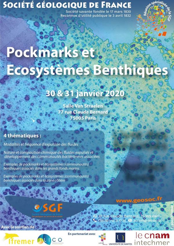
Overview of the conference of the conference :
           Pockmarks and Benthic Ecosystems

The « Pockmarks and associated benthic ecosystems » thematic days were held at the Société Géologique
de France (SGF) in Paris from 30-31 January 2020.
The global objective was to set up state-of-the-art knowledge on pockmarks and to improve interaction and
collaboration between geological and biological scientific communities. Since 1990, several studies have
focused on fluid circulation within the sedimentary column with a recent growing interest in pertaining global
warming aspects. Fluids (e.g. methane, marine and fresh water, liquid hydrocarbons) migrate upwards
possibly i) creating depressions on the seafloor: so-called « pockmarks » and ii) leading to fluid escapes in the
water column.
In the deep sea (hundreds to thousands of metres water depth), the presence and development of benthic
ecosystems have been largely investigated. These ecosystems remain closely constrained by the small
amount of organic matter that reaches the seafloor. However, seep and fluid expulsion sites are there
comparable to living « oases ». Associated with chemosynthetic organisms, these sites demonstrate the link
between fluid escapes and ecosystems. Conversely, in coastal areas (from shore to continental slope), the
multiplicity of nutrient sources makes the identification of benthic communities in association with fluid
expulsions much more complex. Shallow-water depth pockmarks are often less investigated.

Around 50 specialists including geologists, ecologists and micro-biologists attended the conference with four
invited speaker conferences, 17 communications on ongoing case studies and several multidisciplinary round
tables (sgf-pockmarks.sciencesconf.org) examined several questions:
   1. What is a pockmark?
   2. What are the present-day indicators of pockmark activity?
   3. How to investigate the past with regard to the history of pockmark formation and activity?

With regard to the implications of fluids in marine geo-hazards (e.g. slope instabilities) and in particular the
growing interest in global warming, pockmark investigation is crucial. A global agreement of the assembly
states that a pockmark must be defined not only by its morphology but also by its initiation and activity
processes. It was agreed to highlight the need to involve several disciplines, to recognize and study these
processes, both in their present state and in their past activity. We need to further explore their isotope
chemistry including foraminifera to assess past activity and the biological aspects to highlight fluid-seep
present-day activity. The community suggested a new (re)-investigation of the continuum land to deep-sea
geomorphological domains (coastal areas, shelf platforms, continental slope, abyssal plains), with a « process-
related view ».

At the end of the meeting, the idea emerged to create a Working Group, focused on pockmarks. The group
plans to organize biennial meetings to strengthen the synergy of national and European scientific
communities, and also participate in the international Gas in Marine Sediments (GIMS) congress.

                                                       1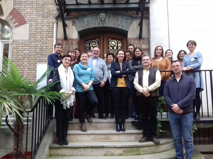
Group photo of some participants (31/01/2020 SGF, Paris) from top to bottom:
   1. L. Pastor, A. Baltzer, K. Olu, H. Niemann,
   2. F. Cesbron, A. Murat, J.-C. Dauvin, B. Férré, S. Gontharet, G. Gregoire, N. Baux, I. Poirier, M. Hubert
   3. G. Panieri, S. Dupré, D. Praeg, A. Gay

The « Pockmarks and associated benthic ecosystems » thematic days were organised by Agnès Baltzer,
Stéphanie Dupré, Gwendoline Grégoire and Anne Murat in collaboration with the University of Nantes and
the LETG - UMR6554, Ifremer and CNAM Intechmer. We would like to thank Ifremer and Ilico for their financial
support and the SGF for their assistance and organisation of the event, as well as all the participants, in
particular the keynote speakers, Aurélien Gay, Helge Nieman, Guiliana Panieri and Jean-Claude Dauvin.

How to cite this document: Baltzer A, Dupré S, Grégoire G, Murat A, Garnaud S, Grobois
S and all participants of the “Pockmarks and Benthic Ecosystems” SGF days (2020) Abstract book “Pockmarks
and Benthic Ecosystems” SGF days. Paris, 30-31 January 2020. pp. 32.

                                                       2
Table des matières - Table of contents
Overview of the conference Pockmarks and Benthic Ecosystems                                                1
1. Modalités et fréquence d’expulsion des fluides                                                           4
Le rôle des structures sur les échappements de fluides au sein d’une       Thibault Cavailhes et al.        5
plate-forme carbonatée : les pockmarks géants et abyssaux des
Bahamas
Cold seep hibernation in Arctic sediments during cold bottom water                                          6
conditions                                                                Bénédicte Ferré et al.
Dynamique d’expulsion des fluides dans les bassins sédimentaires           Aurélien Gay                      7
Positive-relief carbonate pavements on the central Nile deep-sea fan:     Daniel Praeg et al.               8
gas hydrate blisters or carbonate-filled pockmarks ?
Le Pliocène du Rio Stirone (Plaine du Pô Italie) et le Miocène de la                                        9
marge Hikurangi (Nouvelle-Zélande) : un même environnement à Cold         Renaud Toullec et al.
seeps, mud volcanoes, pockmarks en contexte de zone convergent
2. Nature et composition chimique des fluides expulsés et développement des                                 10
communautés bactériennes associées
Different pockmark systems and their potential importance for the         Adeline Cojean et al.            11
hydrological and biogeochemical balance of a peri-alpine lake
SUSANE, a device for sampling chemical gradients in the benthic           Joël Knoery et al.               12
water column
Caractérisation des communautés bactériennes associées au                                                  13
remplissage sédimentaire dans des zones côtières soumises à des
échappements de fluides (Baie de Concarneau et du Croisic) par             Anne Murat et al.
métagénomique
Microbes at cold seeps: how environmental factors determine their         Helge Niemann et al.             14
activity
Migration des fluides et réduction des sulfates en Baie de Concarneau      Livio Ruffine et al.             15
: Quelle influence sur la distribution des pockmarks?
3. Exemples de pockmarks et écosystèmes (communautés) benthiques associés dans les                         16
grands fonds marins
Fluid seepages associated with benthic communities along the              Eric Deville et al.              17
Zambezi Margin (Mozambique)
Spatial distribution and dynamics of chemosynthetic communities                                            18
contributed to characterize fluid flow regimes of a giant pockmark in       Karine Olu et al.
the deep Congo Basin
In situ explorations of pockmarks and theirs ecosystems on the Sonora     Hélène Ondréas et al.            19
transform ridge(Guaymas basin)
Pockmarks in the Arctic Ocean: Recent insights                            Giuliana Panieri                 20
Effect of pockmark environmental conditions on metazoan                   Nuria Sanchez et al.             21
meiofaunal community, the tiniest and most abundant benthic
component
Prospection inédite et récente d’une zone de Pockmarks lors d’une         Sébastien Thorin et al.          22
campagne océanographique menée au large du Liban
4. Exemples de pockmarks et écosystèmes (communautés) benthiques associés dans la                          23
zone côtière
Haploops settlements may be indicators of shallow pockmarks activity.     Agnès Baltzer et al.             24
The pockmarks-Haploops relationship in south-Brittany                     Jean-Baptiste Champilou et al.   25
First record of foraminiferal faunas associated to Haploops settlements   Jean-Baptiste Champilou et al.   26
on the French Atlantic coast
Review of the genus Haploops Liljeborg, 1856 (Amphipoda,                  Jean Claude Dauvin               27
Ampeliscidae): from taxonomy to dynamic of dense populations
The microbial methane fluid system of the Aquitaine Shelf                  Stéphanie Dupré et al.           28
Methane, pockmarks and Haploops: a bio-geochemical connection             Edouard Metzger et al.           29
Liste des Participants                                                                                     30
Programme                                                                                                  31

                                                      3
1. Modalités et fréquence d’expulsion des fluides

 1. Processes and frequency of fluid expulsion

                      4
Le rôle des structures sur les échappements de fluides au sein
   d’une plate-forme carbonatée : les pockmarks géants et
                    abyssaux des Bahamas
                            1                 1                         1                         1                     1
 Thibault Cavailhes , Hervé Gillet , Léa Guiastrennec , Vincent Hanquiez , Thierry Mulder
1
    Environnements et Paléoenvironnements Océaniques et Continentaux (EPOC) – CNRS : UMR5805 – Allée Geoffroy Saint-Hilaire
                                                -33615 Pessac cedex, France

         Les données sismiques et bathymétriques issues de la mission océanographique CARAMBAR 2.0 ont permis de
révéler l'existence de 29 pockmarks géants abyssaux jalonnant le pied du Blake Bahama Escarpement (BBE). Cet
escarpement sous-marin, ayant un dénivelé pouvant atteindre 4200 m, constitue la transition entre la plate-forme
carbonatée Bahamienne (-800 m) et la plaine de San Salvador (- 4900 m). Les pockmarks, pseudo-circulaires, sont observés
à des profondeurs d'eau comprises entre - 4584 m to - 4967 m, ont des diamètres compris entre 255 m to 1819 m et
montrent des dépressions centrales ayant des profondeurs décamétriques à hectométriques (30 m à 185 m). L'alignement
de pockmarks est parallèle au BBE, exclusivement entre 2200 m et 5000 m de l'isobathe -4000 m, exprimant sur la zone
d'étude le pied de l'escarpement. Un banc carbonaté sous-jacent, enfoui à l'aplomb des pockmarks a été clairement observé
et contient, à environ 1000 m sous les structures étudiées, une anomalie sismique de haute amplitude. La densité de
distribution des pockmarks est maximale dans la zone où les linéaments structuraux de la zone de Fracture de Sunniland
recoupent le BBE et lui impose une courbure morphologique caractéristique ; Cette zone de fracture est héritée des
épisodes de transtension à l'origine de la transition océan-continent.
L'ensemble des observations ci-dessus suggèrent une relation atypique entre la distribution spatiale des échappements de
fluides sous-marins (pockmarks), les structures tectoniques héritées recoupant la plate-forme et le banc carbonaté enfoui
en pied d'escarpement sous les hémipélagites et les contourites de la Plaine de San Salvador. Les entrées d'eaux
météoriques pendant les phases de bas-niveau marins dissolvant les anhydrites de la plate-forme, la convection thermique
dans cette dernière et les entrées salines d'eau de mer par l'escarpement sous-marin participent en proportion non
quantifiées à la circulation et la corrosion des carbonates dans la plate-forme. Ces mécanismes sont particulièrement
efficaces le long des hétérogénéités structurales du système (failles, fractures), se comportant comme des drains
hydrauliques voire des zones de fuites, notamment à l'endroit où les pockmarks de cette étude ont été décrits.

Oral presentation

                                                             5
Cold seep hibernation in Arctic sediments during cold bottom
                       water conditions
                        1                  1                      1                 1                       2
  Bénédicte Ferré , Pär Jansson , Manuel Moser , Pavel Serov , Alexey Portnov , Carolyn
         3                  1                    1                  4                 5
  Graves , Giuliana Panieri , Friederike Gründger , Christian Berndt , Moritz Lehmann ,
                                                     6
                                      Helge Niemann
   1                                           2                                                                3
   The Arctic University of Norway – Norway School of Earth Sciences, The Ohio State University – United States Centre for
                                                                                4
 Environment, Fisheries and Aquaculture Science [Lowestoft] – United Kingdom GEOMAR (GEOMAR) – Helmholtz-Zentrum für
                                                                                     5
  Ozeanforschung Kiel Gebäude 4 , Ostufer Wischhofstrasse 1-3 24148 Kiel, Germany Department of Environmental Sciences
                                            6
                       [Basel] – Switzerland Royal Netherlands Institute for Sea Research – Netherlands

    Large amounts of methane are trapped within gas hydrate in sub-seabed sediments in the Arctic Ocean, and bottom-
water warming may induce the release of methane from the seafloor. Yet, the effect of seasonal temperature variations on
methane seepage activity remains unknown, as surveys in Arctic seas are mainly conducted in summer. Here, we compare
the activity of cold seeps along the gas hydrate stability limit offshore Svalbard during cold (May 2016) and warm (August
2012) seasons. Hydroacoustic surveys revealed a substantially decreased seepage activity during cold bottom-water
conditions, corresponding to a 43 % reduction of total cold seeps and methane release rates compared to warmer
conditions. We demonstrate that cold seeps apparently hibernate during cold seasons, when more methane gas becomes
trapped in the subseabed sediments. Such a greenhouse gas capacitor increases the potential for methane release during
summer months. Seasonal bottom-water temperature variations are common on the Arctic continental shelves. We infer
that methane-seep hibernation is a widespread phenomenon that is underappreciated in global methane budgets, leading
to overestimates in current calculations.

Oral presentation

                                                            6
Dynamique d’expulsion des fluides dans les bassins
sédimentaires
∗1
Aurélien Gay – Keynote
1
Université de Montpellier (UM) – CNRS : UMR5243 – Place Eugène Bataillon -34095 Montpellier cedex 5, France
Depuis les années 80, l’exploration des marges continentales a révélé la remobilisation post-dépôt des matériaux à
travers des cheminées de migration de fluides qui alimentent des zones d’expulsion sur le fond de la mer : pockmarks (fluides
seuls), volcans de boue (fluides+boue) ou injectites (fluides + sable). L’arrivée dans le monde académique de la sismique 3D
a permis de préciser la source des fluides et les chemins suivis à travers la colonne sédimentaire. C’est donc un véritable
réseau de conduits interconnectés que l’on a appelé ” la plomberie ” des marges. Cela a induit l’idée que ces conduits
fonctionnent comme des tubes ouverts à travers lesquels les fluides circulent à des vitesses souvent largement surévaluées.
Pour des raisons évidentes de risque ces cheminées n’ont jamais été forées jusqu’à présent et encore moins monitorées.
L’absence de mesures in-situ limite très fortement l’intégration des processus échelle de la sortie de fluides (évolution à
l’évolution spatiale) ou au cours de sa vie (´temporelle. Quelle-que soit la méthode utilisée (imagerie géophysique,
prélèvements in situ etc...) les résultats ne fournissent finalement qu’un instantané actuel des migrations de fluides, une
sorte de photo qui fige la situation et conduit l’interpréteur `a glisser vers l’actualisme. L’un des moyens de palier `a ce
problème est de se tourner vers les analogues fossiles. C’est l`a aussi une photo de la situation mais une fois que toute
l’histoire de la migration a eu lieu, y compris celle de l’exhumation des séries hôtes. C’est un peu comme essayer de raconter
la vie d’un homme en n’ayant à sa disposition que 2 photos de lui `a deux instants différents de sa vie. Une approche couplant
expériences analogiques et numériques a permis de reproduire la formation de ces cheminées et de quantifier les
mécanismes `a l’origine de leur formation. Les premiers résultats montrent une évolution en 4 étapes depuis le régime de
surpression et fluidisation en profondeur jusqu’`a la mort supposée de la structure. Ce type d’approche, absolument indis-
pensable pour définir l’état d’une sortie de fluides et donc définir à quel stade de son évolution elle se trouve lorsqu’elle est
observée, est aussi d’une importance fondamentale dans l’évaluation des risques fond de mer car même si une zone de
sortie de fluides semble inactive (pas de manifestations sur le fond) cela ne signifie pas qu’elle n’est plus chargée en gaz
sous-jacent.
Oral presentation
7Positive-relief carbonate pavements on the central Nile deep-
sea fan: gas hydrate blisters or carbonate-filled pockmarks?
1 2 2 2
Daniel Praeg , Sébastien Migeon , Alexandre Dano , Jenny Trevisan , João Marcelo Ketzer
3 4 4 5
, Luiz Frederico Rodrigues , Adolpho Herbert Augustin , Stephanie Dupré
1 2
Géoazur, 250 rue Albert Einstein, 06560 Valbonne, FRANCE – CNRS : UMR7329 – France Géoazur, 250 rue Albert Einstein,
3 4
06560 Valbonne, FRANCE – CNRS : UMR7329 – France Linnaeus University, 391 82 Kalmar, SWEDEN – Sweden Pontifical
5
Catholic University of Rio Grande do Sul (PUCRS), Av. Ipiranga 6681, 90619-900 Porto Alegre, BRAZIL – Brazil Unité de recherche
Géosciences Marines, Ifremer, FRANCE – Institut français de Recherche pour l’Exploitation de la Mer – France
The Nile deep-sea fan is rich in fluid vents, including a Central Province of acoustically reflective patches that correspond at
seafloor to fractured carbonate pavements hosting chemosynthetic ecosystems. The backscatter patches (BPs) have been
referred to as pockmarks, but several studies have noted positive relief. We examine the BPs by integrating older multibeam
datasets (50-100 m DTMs) with sonar imagery of higher resolution acquired in 2010 (APINIL campaign) using a hull-mounted
multibeam (30 kHz, 10-25 m DTMs) and a deep-towed sidescan (180 kHz, 1.5 m pixels. We recognise at least 450 BPs in
water depths of 1550-2700 m, subcircular to elongate and 70-600 m wide, almost all of positive relief up to 7 m. The BPs
vary in backscatter intensity on both 30 kHz and 180 kHz imagery, and differ in character between them. We attribute this
to varying sediment penetration by the two systems, which respectively integrate impedance contrasts to depths of 3 m
and 0.1 m. At local deposition rates, this corresponds to timescales of 5-100 ka. In the absence of erosion, backscatter
variations and fractures observed on 180 kHz imagery suggest shifting patterns of carbonate growth and breakage over the
last 5 ka. Four water column gas flares observed in 2010 in high backscatter areas suggest on-going carbonate cementation.
Previous studies of the area indicate downward growth of carbonate pavements, at rates much less than those of burial,
and it has been proposed that self-sealing drives the outward growth of broad pavements. However, such a process does
not generate stress fields and should result in buried lenses of zero relief. We propose that the elevated and fractured
seafloor carbonates we observed as BPs record interactions with underlying gas hydrates. One possibility is that BPs are
‘hydrate blisters’, comprising thin carbonates above growing gas hydrate lenses; however, the lack of deflated features
(hydrate pockmarks) is puzzling. Another possibility is that fracturing in response to hydrate formation and dissolution
allows fluid migration through recurrently buried pavements, resulting in the upward growth of mixed carbonate-sediment
mounds that overfill hydrate pockmarks. We intend to test these hypotheses during the SEAGAL campaign of the RV
Pourquoi pas ?, scheduled for September 2020. This work has received funding from the European Union’s Horizon 2020
research and innovation programme under the Marie Sklodowska-Curie grant agreement No. 656821
Oral presentation
8Le Pliocène du Rio Stirone (Plaine du Pô, Italie) et le Miocène
de la marge Hikurangi (Nouvelle-Zélande) : un même
environnement à Cold seeps, mud volcanoes, pockmarks en
contexte de zone convergent
1 2 2 1 1
Renaud Toullec , Gillian Bethune , Sofia Monlauzer , Pascal Barrier , Julien Bailleul , Eric
3 4 5 6 7
Cauquil , Vincent Caron , Frank Chanier , Geoffroy Mahieux , Pierre Malié , Sébastien
1
Potel
1
EA 7511, Bassins-Réservoirs-Ressources (B2R), département Géosciences, UniLaSalle, Beauvais, France – Institut UniLaSalle
2 3
Beauvais – France UniLaSalle – Institut UniLaSalle Beauvais – France TOTAL-Scientific and Technical Center Jean Féger – TOTAL
4
FINA ELF – France EA 7511, Bassins-Réservoirs-Ressources (B2R), département Géosciences, UPJV, France – UPJV Université
5
Picardie Jules Verne – France Laboratoire d’Océanologie et de Géosciences (LOG) -UMR 8187 – Université de Lille, Centre
6
National de la Recherche Scientifique : UMR8187 – France EA 7511, Basins-Réservoirs-Ressources (B2R), département
7
Géosciences, UPJV, France – UPJV Université Picardie Jules Verne – France Géosciences Montpellier – Université de Montpellier
: UMR5243 – France
Cold seeps, mud volcanoes, pockmarks sont autant de manifestations superficielles de l'activité en subsurface d'un
système fluide impliquant éventuellement des hydrocarbures biogéniques ou thermogéniques. Ces structures diverses sont
souvent les seuls témoins du fugace phénomène d'expulsion de fluides dans le registre fossile. Leur étude, couplée à
l'analyse du contexte tectono-sédimentaire propre à chaque bassin, peut permettre de tracer l'origine des fluides jusqu'à
leur source.
Afin d'illustrer ces objets singuliers, deux cas d'études sont proposés en zone convergente : le Pliocène du Rio Stirone (Plaine
du Pô, Italie) et le Miocène de la marge Hikurangi (île nord, Nouvelle-Zélande). Le but de ces études est de préciser la nature
et la chronologie des évènements de circulations fluides enregistrées dans les structures d'expulsions ainsi que les premiers
résultats de travaux sur la production carbonatée chimiosynthétique dérivée du méthane, associée à ces expulsions.
A partir des données de terrain et des analyses sur lames minces des paragenèses (CL, MEB/EDX, δ13C, δ18O, analyses
élémentaires), des caractères communs apparaissent entre ces deux bassins : les cheminées, témoins fossiles des
circulations de fluides, concentrent localement sous forme de tubes bulbeux ou lisses de la calcite magnésienne, voire de la
dolomite dans certains cas. Leur mode de mise en place fait intervenir, du moins pour les tubes de grands diamètres, des
circulations de fluides per ascensum reliées à des accidents majeurs, dans un encaissant systématiquement constitué de
marnes peu carbonatées. Les données paléobathymétriques indiquent un milieu bathyal avec des assemblages biologiques
très peu diversifiés indiquant des conditions de stress. Enfin la pyrite fromboïdale est ubiquiste avec parfois des
concentrations sous forme de couches isopaques au sein des tubes.
Les productions carbonatées de Nouvelle Zélande se rencontrent sous la forme de lumachelles (avec entre autres des
lucinidae) parfois re-sédimentées et dont leur association avec des circulations de fluides est discutée.
En Italie, les macrofaunes sont représentées par des bivalves lucinoïdes associés à des coraux coloniaux. Une espèce
particulière (Solemya donderleini) vivant en symbiose avec des bactéries fixatrices du soufre y a été décrite. Ces terrains
pliocènes sont aujourd'hui affectés par des volcans de boue actifs, « Salse », comme à Spilamberto, à l'aplomb d'un des
gisements pétroliers de la plaine du Pô.
Oral presentation
92. Nature et composition chimique des fluides
expulsés et développement des communautés
bactériennes associées
2. Nature and chemical composition of fluids and
development of associated bacterial communities
10Different pockmark systems and their potential importance for
the hydrological and biogeochemical balance of a peri-alpine
lake
1 2 1 2
Adeline Cojean , Maciej Bartosiewicz , Jeremy Zimmermann , Moritz F. Lehmann , Katrina
3 1
Kremer , Stefanie B. Wirth
1 2
Centre for Hydrogeology and Geothermics, University of Neuchâtel, Rue Emile-Argand 11, CH-2000 Neuchâtel – Switzerland
3
Department of Environmental Sciences, University of Basel, Bernoullistrasse 30, CH-4056 Basel – Switzerland Swiss
Seismological Service (SED), ETH Z¨urich, Sonneggstrasse 5, CH-8006 Zürich – Switzerland
Pockmarks are crater-like depressions on the floor of oceans and lakes formed by the upward transport of fluids through
the unconsolidated sediment column. The fluid flow through marine pockmarks is considered to enhance hydrological and
biogeochemical exchanges between the sediments and the water body. While a similar relevance can be expected in lakes,
the importance of lacustrine pockmarks in this regard is virtually unexplored. Lake Thun (48.3 km2 surface area),
Switzerland, is an excellent system to study lacustrine pockmarks as it exhibits several sites with different geological and
biogeochemical settings. One of the pockmark sites is characterized by evident methane (CH4) ebullition and high CH4
concentrations from ˜2.4 to 8.9 mM within the sediments beneath. A large pockmark with a diameter of 110 m is located
adjacent to the rock wall of a karst system and might thus be associated with groundwater discharge into the lake. Finally,
spikes in electrical conductivity detected during a survey with a remotely operated vehicle (ROV) at a third pockmark site
suggest a hydrogeological connection with the groundwater system in the underlyingTriassic bedrock. This third pockmark
site we are studying more closely. We observed that the sediments inside the pockmark were clearly more liquified as
compared to those at a reference site (outside the pockmark), providing further evidence for groundwater discharge that
might presently be active. Further chemical analysis of porewaters and the water column above the pockmark as well as
molecular investigation (e.g. 16S rRNA) of the sediments will be performed at two different seasons of the year (in fall and
spring during the snowmelt season). All together, these results should help us to better assess the influence of groundwater
discharge via this pockmark site on the hydrological balance and on the biogeochemistry of the lake, as well as to expand
our limited knowledge on the mechanism of lacustrine pockmarks in general.
Oral presentation
11SUSANE, a device for sampling chemical gradients in the
benthic water column
1 2 3 4 5
Joel Knoery , Bastien Thomas , Agnès Baltzer , Daniel Cossa , Jean Pierre Donval , Sylvain
6
Rigaud
1
Laboratoire Biogéochimie des Contaminants Métalliques (LBCM) – Institut Français de Recherche pour l’Exploitation de la Mer
2
(IFREMER), Centre atlantique, Nantes – Rue de l’Ile d’Yeu, 44311 Nantes, France Laboratoire Biogéochimie des Contaminants
3
Métalliques / Nantes – Institut français de Recherche pour l’Exploitation de la Mer – France Littoral, Environnement,
4
Télédétection, Géomatique – Université de Nantes – France Institut des Sciences de la Terre – Université Grenoble Alpes –
5 6
France Laboratoire Géochimie et Métallogénie – Institut français de Recherche pour l’Exploitation de la Mer – France
Détection, évaluation, gestion des risques CHROniques et éMErgents (CHROME) / Université de Nîmes – Université de Nîmes –
France
In aquatic environments, the benthic water column may exhibit concentration gradients of various substances. They
result from transfers and chemical reactions that may occur both within this layer, and/or at the sediment–water interface
(SWI). Characterization of these gradients yields important information for the quantification of such processes and
transfers. However, it is difficult to actually sample these gradients in the field, since turbulence decreases their vertical
scale. We describe a sampler designed to collect simultaneously 16 discrete water column samples at a centimeter-scale
vertical resolution. This small device (40 × 40 × 60 cm) is reliable, safe to handle, and easily deployed from a small boat
using a cable or a Scuba diver. With small adaptations, it may be deployed using a ROV or autonomous submersibles, at any
depth. It is made of materials compatible with trace element and dissolved gases work, and simultaneously draws samples
from various heights above the SWI into 60 mL syringes. The altitude of the sample inlets is field-adjustable. Sampling
artifacts are minimized by in situ flushing of tubing dead volumes, by rapid and simultaneous sample collection, and by
sampling an undisturbed water-column. Thus, this device can contribute to the characterization of vertical concentration
gradients in benthic water-columns. Such gradients of various compounds and metals from two coastal sites (Quiberon Bay,
Berre Lagoon, Loire river Estuary) are shown, illustrating the sampler’s usefulness to describe and investigate processes in
the benthic zone. Susane may be loaned : let’s collaborate !
Oral presentation
12Caractérisation des communautés bactériennes associées au
remplissage sédimentaire dans des zones côtières soumises à
des échappements de fluides (Baie de Concarneau et du
Croisic) par métagénomique
1,2 1,2 1,2 3
Anne Murat , Gwendoline Gregoire , Isabelle Poirier , Marina Moletta-Denat , Agnès
4 5 6 6 6
Baltzer , Jean-Baptiste Champilou , Livio Ruffine , Dominique Birot , Emmanuel Rinnert ,
7 8 8
Axel Ehrhold , Elodie Marches , Patrick Guyomard
1 2
Institut des Sciences et Techniques de la Mer (INTECHMER) – Conservatoire National des Arts et Métiers [CNAM] – France
3
Laboratoire Universitaire des Sciences Appliquées de Cherbourg – Université de Caen Normandie : EA4253 – France INRA
Transfert Environnement (IT-E) – Institut national de la recherche agronomique (INRA) – UR 50, Avenue des étangs 11100
4
Narbonne, France Littoral -Environnement -Télédétection -Géomatique (LETG Nantes) – Université de Nantes, CNRS : UMR6554
5
– Campus Tertre BP 81227 44312 NANTES Cedex 3, France LPG-BIAF (Bio-Indicateurs Actuels et Fossiles) – Université d’Angers,
6
CNRS : UMR6112 – France IFREMER, Département Ressources physiques et Ecosystèmes de fond de Mer (REM), Unité des
Géosciences Marines et Unité des Etudes des Ecosystèmes Profonds, 29280 Plouzané – Institut Français de Recherche pour
7
l’Exploitation de la Mer (IFREMER), Institut Français de Recherche pour l’Exploitation de la MER -IFREMER – France Ifremer -
Laboratoire de Géodynamique et Enregistrements Sédimentaires (Ifremer -REM/GM/LGS) – Institut Français de Recherche pour
8
l’Exploitation de la Mer (IFREMER) – ZI pointe du Diable CS 10070 29280 Plouzané, France Service Hydrographique et
Océanographique de la Marine – Ministère de la Défense – France
Ce travail a d'abord été effectué grâce à des financements Action Marges (2016) et en collaboration avec IFREMER,
le SHOM, l'Université de Nantes et le CNAM-Intechmer/LUSAC. Le travail présenté correspond à une première analyse
métagénomique des communautés bactériennes de sédiments associés à la thématique des sorties de fluides et en
particulier des pockmarks. L'ADN génomique total a été extrait à partir de 0,3 g de sédiment grâce au kit d'extraction "
DNeasy PowerSoil Kit " (Laboratoires Mo Bio, USA). Pour chaque extrait, la région variable V4-V5 du gène bactérien codant
pour l'ARN ribosomique 16S a été amplifiée par PCR. Les amplicons ont ensuite été séquencés par séquençage haut débit
(séquenceur MiSeq (Illumina)) et les séquences présentant au moins 97% d'homologie entre elles ont été regroupées en
Unités Taxonomiques Opérationnelles (OTU). Le nombre d'OTU ainsi obtenu permet de rendre compte de la diversité de la
communauté bactérienne. Les séquences ont ensuite été analysées par bioinformatique afin de les comparer aux bases de
données internationales et d'identifier chaque OTU à différents niveaux taxonomiques : Domaine (Eubacteria et Archaea),
Phylum, Classe, Ordre et parfois Genre. Cette méthode permet également de quantifier le nombre de séquences par OTU
et donc de connaitre le pourcentage que représente chaque groupe taxonomique dans la communauté. Les échantillons
utilisés proviennent à la fois de sédiments (1) de surface, prélevés par plongeurs, au niveau de trois pockmarks et des zones
adjacentes, dominées par l'écosystème à Haploops sp. (Baies de Concarneau et du Croisic) et (2) de quatre carottages
Kullenberg (Baie de Concarneau). Pour traiter cette très grande quantité de données, une analyse statistique par ACP a été
utilisée. Les résultats montrent une différenciation claire de la zonation redox qui s'établit au cours de la diagenèse avec
l'enfouissement : zone aérobie, zone de sulfatoréduction, zone de transition sulfates-méthane (SMTZ) et zone méthane. Les
sédiments de la zone méthane étant très pauvres en matière organique, le gaz présent (masque sismique) pourrait provenir
également de zones plus profondes. La cheminée du pockmark, actif le plus récemment, présente une communauté
bactérienne particulièrement abondante (jusqu'à 42737 séquences à 5 cm de profondeur) et diversifiée (jusqu'à 3696 OTU).
Oral presentation
13Microbes at cold seeps: how environmental factors determine
their activity
∗ 1,2,3 1 4,5
Helge Niemann - Keynote , Tim De Groot , Lea Steinle
1 2 3
NIOZ Royal Netherlands Institute for Sea Research – Netherlands Utrecht University – Netherlands Centre for Arctic Gas
4 5
Hydrate, Environment and Climate, The Arctic University of Norway – Norway University of Basel – Switzerland CAGE -Centre
for Arctic Gas Hydrate, Environment and Climate, The Arctic University of Norway – Norway
Cold seeps such as pockmarks, mud volcanoes and gas seeps are fascinating geosystems where reduced compounds,
most dominantly methane, often together with geofluids migrate from greater depth to near surface sediments. There, a
substantial fraction of the uprising methane is oxidised with seawater-born sulphate as the terminal electron acceptor
through a process known as the anaerobic oxidation of methane – AOM’. AOM is typically mediated by methanotrophic
archaea in association with sulphate reducing bacteria, though alternative electron acceptors can also be used by some
anaerobic methanotrophs. The efficiency of the AOM filter system is dependent on several environmental factors such as
flow rates of methane but also the bioirrigation activity of macrofauna. Cold seeps often support tremendous amounts of
macrofaunal biomass which directly or indirectly, typically with the help of symbiotic microbes, can make use of methane
or hydrogen sulphide, one of the end-products of the sulphate-dependent AOM. At highly active seeps, methane may bypass
the AOM filter system and is then further oxidised by aerobic methanotrophic bacteria that may either occur in symbiosis
together with macrofauna, or as free-living organisms in sediments or the water column. The aerobic methane oxidation
(MOx) is thus an important final barrier, which can mitigate methane release from the ocean to the atmosphere where
methane acts as a potent greenhouse gas. Water column MOx is strongly influenced by oceanographic parameters, for
example current regimes and methane seepage activity, which can be influenced by tides and seasons. This presentation
will provide an overview on the biogeochemical processes and key (micro) organisms at cold seeps, and will highlight how
environmental factors determine their activity and efficiency to retain methane in sediments or the water column.
Oral presentation
14Migration des fluides et réduction des sulfates en Baie de
Concarneau : Quelle influence sur la distribution des
pockmarks ?
1 1 1 1 1
Livio Ruffine , Lucie Pastor , Vivien Guyader , Dominique Birot , Emmanuel Rinnert ,
1 1 1 1
Morgane Hubert , Jean Pierre Donval , Christophe Brandily , Gwenael Jouet , Vincent
1 1
Riboulot , Axel Ehrhold,
1
IFREMER, Département Ressources physiques et Ecosystèmes de fond de Mer (REM), Unité des Géosciences Marines et Unité
des Etudes des Ecosystèmes Profonds, 29280 Plouzané – Institut Français de Recherche pour l’Exploitation de la Mer (IFREMER),
Institut Français de Recherche pour l’Exploitation de la MER -IFREMER – France
La Baie de Concarneau est caractérisée par une morphologie de fond de mer très hétérogène (Ehrhold et al., 2006 ;
Baltzer et al., 2014). Certaines zones sont caractérisées par la présence de très nombreux pockmarks dont la taille varie
entre 2 et 30 m de diamètre. Ce sont des dépressions circulaires ou quasi-circulaires que l’on observe sur le fond marin, et
dont la formation et l’évolution résultent de la migration des fluides dans la couche supérieure du sédiment (Hovland, 2003).
Cette migration des fluides permet le transport d’espèces chimiques de leur zone source réactionnelles, permettant ainsi,
lorsque les conditions thermodynamiques à des zones sont favorables, la mise en place d’une succession de réactions
géochimiques (Berner, 1980). Dans le cadre de la mission SYPOCO, en avril et juin 2018, des carottes sédimentaires ont été
prélevées afin d’étudier les liens entre la structure du sous-sol, la migration des fluides, les processus géochimiques de
réduction des sulfates de l’eau de mer et la distribution des pockmarks. Les résultats préliminaires montrent que l’Oxydation
Anaérobique du Méthane (OAM) est le processus prédominant de la réduction des sulfates, avec un intervalle de transition
Sulfate-Méthane compris en 50 et 295 cm dans la colonne sédimentaire. Les profils de chlorures ont permis d’identifier une
zone alimentée en eau douce, conduisant à une dilution de plus de 10 % de la teneur en chlorures de l’eau interstitielle. En
parallèle de l’étude des fluides interstitiels, des anomalies positives en méthane dissout dans la colonne d’eau ont été
mesurée, suggérant un transfert de la colonne sédimentaire à la colonne d’eau.
Références :
Baltzer, A., Ehrhold, A., Rigolet, C., Souron, A., Cordier, C., Clouet, H., Dubois, S.F., 2014. Geophysical exploration of an active
pockmark field in the Bay of Concarneau, southern Brittany, and implications for resident suspension feeders. Geo-
Marine Letters 34 (2-3), 215-230.
Berner, R., 1980. Early diagenesis: A theoretical approach. Princeton University Press, Princeton, New Jersey.
Ehrhold, A., Hamon, D., Guillaumont, B., 2006. The REBENT monitoring network, a spatially integrated, acoustic approach
to surveying nearshore macrobenthic habitats: application to the Bay of Concarneau (South Brittany, France). ICES
Journal of Marine Science, 63(9), 1604-1615. https://doi.org/10.1016/j.icesjms.2006.06.010
Hovland, M., 2003. Geomorphological, geophysical, and geochemical evidence of fluid flow through the seabed. Journal of
Geochemical Exploration 78-9, 287-291.
Oral presentation
153. Exemples de pockmarks et écosystèmes
(communautés) benthiques associés dans les
grands fonds marins
3. Examples of pockmarks and associated benthic
ecosystems in deep sea domain
16Fluid seepages associated with benthic communities along the
Zambezi Margin (Mozambique).
1 2 2 2 1
Eric Deville , Carla Scalabrin , Gwenael Jouet , Antonio Cattaneo , Anne Battani , Sonia
3 3 3 2 2 4
Noirez , Hélène Vermesse , Martina Torelli , Lucie Pastor , Karine Olu , Laure Corbari ,
2 2 2 2 5
Marion Boulard , Tania Marsset , Delphine Pierre , Benoit Loubrieux , Maximo Dal’asta
1 2
IFP School – IFP Energies Nouvelles – France Ifremer – Institut Français de Recherche pour l’Exploitation de la Mer (IFREMER),
3
Institut Français de Recherche pour l’Exploitation de la MER -IFREMER – France IFPEN – IFP Energies Nouvelles, IFP Energies
4 5
Nouvelles – France MNHN – Muséum National d’Histoire Naturelle (MNHN) – France TOTAL – TOTAL, CSTJF, Pau – France
Evidences for active fluid seepages (water and gas) have been discovered along the Zambezi slope (offshore Southern
Mozambique). These active seepages are mostly associated with pockmarks which are aligned along a trend parallel to the
slope and running closely upstream of the head scrap of a wide zone of slope destabilization. The fluid seepages are
interpreted as triggering slope destabilization. Acoustic anomalies within the water column have shown the activity of
moderate bubble seepages. Punctually, acoustic anomalies in the water are interpreted as related to fluid seepages inside
the destabilization zone. Exploration with the SCAMPI towed camera system in the widest pockmark (diameter 200 m wide)
has shown fluid seepages associated to authigenic carbonate crusts and bacterial mats. These fluid seepages are also
associated to the presence of chemiosynthetic organisms (Vesicomyidae, Thyasiridae, Siboglinidae). The sampled gas in the
sediment correspond mainly to CH4 of microbial origin, generated by hydrogenation and reduction of CO2 from a substrate
of organic origin, i.e. a conventional process of genesis of microbial gas in the marine domain. No evidence for thermogenic
gas was detected. In all cases, d13C-CO2 values are indicative of an organic source consisting of solid organic matter and
not related to the biodegradation of liquid hydrocarbons. Another type of pockmarks has been observed within the core of
the slope destabilization zone. Most of these pockmarks are inactive in terms of fluid seepages at the present time and they
are associated to carbonate buildings forming chimney geometries. They probably correspond to diagenetic chimneys of
former fluid migration pathways that have been exhumed during the mass sliding and recurrent activity of strong lateral
slope currents which have scoured the sediments around.
Oral presentation
17Spatial distribution and dynamics of chemosynthetic
communities contributed to characterize fluid flow regimes of
a giant pockmark in the deep Congo Basin
1 2 3
Karine Olu , Hélène Ondréas , Yann Marcon
1
IFREMER -REM/EEP/Laboratoire Environnement Profond – Institut Français de Recherche pour l’Exploitation de la Mer
2
(IFREMER) – France IFREMER-REM/GM/ Laboratoire Cycles Géochimiques et ressources – Institut français de Recherche pour
3
l’Exploitation de la Mer – France MARUM – Center for Marine Environmental Sciences, University of Bremen – Germany
Deep-sea active pockmarks are colonized by benthic ecosystems typically sustained by methane-rich fluid emissions
(cold seeps) widely occurring along deep continental margins. Usually high biological production is based on methane and
sulfide oxidation by microorganisms, sulfide compounds being produced in the upper sediment layers from sulphate-
reduction. The invertebrate biomass is dominated by symbiont-bearing species, frequently siboglinid tubeworms, mytilid
and vesicomyid bivalves, in aggregations visible on the seafloor. As these symbiont-bearing taxa either depend on methane
and/or hydrogen sulfide for their nutrition, they are good indicators of fluid emissions distribution, characteristics and
dynamics. The Regab giant pockmark, located north of the Congo deep-sea channel at 3160 m depth, was investigated by
several ROV cruises, first in 2001 (Ondreas et al. 2005). This is an interesting case study, as colonized by diverse
symbiotrophic species distributed in several coalescent pockmarks. Ten years later, it was re-visited with the Victor 6000
ROV equipped with a multibeam providing high resolution bathymetry and backscatter, as well as photo-and video-
mosaicking from optical surveys.
All these data were combined to give a detailed view of the pockmark, resulting in defining different fluid flow regimes
(Marcon et al. 2014a). The comparative distribution of faunal associations 10 years apart also gave insights on the dynamic
of fluid emissions in the different zones of the pockmark (Marcon et al. 2014b). These studies deciphering relationships
between fauna and geological processes, contribute to assess the role of the benthic biological filter on methane emissions
through the seafloor to the water column.
Marcon, Y., Ondréas, et al. 2014a. Fluid flow regimes and growth of a giant pockmark. Geology 42, 63-66.
Marcon, Y., Sahling, H., et al. 2014b. Distribution and temporal variation of mega-fauna at the Regab pockmark (Northern
Congo Fan), based on a comparison of videomosaics and geographic information systems analyses. Mar. Ecol. 35, 77-95.
Ondréas, H., Olu, K., et al., 2005. ROV study of a giant pockmark on the Gabon continental margin. Geo-Mar. Lett. 25,
281.
Oral presentation
18In situ explorations of pockmarks and theirs ecosystems on
the Sonora transform ridge (Guaymas basin)
1 2 1 1 1
Hélène Ondréas , Karine Olu , Carla Scalabrin , Yves Fouquet , Germain Bayon , Anne
1 2
Sophie Alix , Anne Godfroy
1 2
Unité de recherche Géosciences Marines (Ifremer) – Institut français de Recherche pour l’Exploitation de la Mer – France Unité
Etudes Ecosystèmes Profonds – Institut français de Recherche pour l’Exploitation de la Mer – France
In the Guaymas basin along the Sonora transform ridge, multibeam bathymetry associated with acoustic anomaly
mapping, were used to identify possible cold seep sites. Where water column anomalies exist, the AUV was deployed to
produce fine scale bathymetry and backscatter maps of less than 2 m resolution. Based on these maps, the submersible
Nautile conducted in situ visual explorations which helped us to identify the accurate location and type of seepages on the
ridge and the dominant taxa associated with seeps (chemosynthesis-based, symbiont-bearing fauna).
-A pockmark 40 m in diameter and 3 m in depth was identified on the Madero site, where high-resolution data and in
situ explorations produced unprecedented views. The chemosynthetic fauna sampled show Vesicomyidae bivalves
(Phreagena soyoae and Calyptogena pacifica) with few bacterial mats within proximity. Gas and oil bubbles were observed
escaping from carbonate blocks. -The summit area comprises two active vent fields: Ayala, located on the north-east facing
wall and Juarez, on the south-west facing wall. The summit is constituted of massive carbonate outcrops reaching 5 to 7 m
high, with isolated hard and dark pieces of rock sometimes stuck in the carbonates (possibly consolidated sediments). In
situ investigations revealed the presence of a dense Vesicomyidae clam population at Ayala site (P. soyoae dominant, C.
pacifica, Archivesica gigas) and Siboglinidae polychaete tubeworms (Lamellibrachia barhami and Escarpia spicata), on the
Juarez area. -Two hundred meters west of the Vasconcelos site materialized by large white and grey bacterial mats and
numerous Vesicomyidae bivalves (A. gigas dominant, P. kilmeri), lies ”pockmark 4” 60 m in diameter and 2 m in depth. A
quick overview of this site shows localised white patches of bacterial mats, with scattered, empty Vesicomyid shells. -The
most western pockmark (950 m to the NW of Vasconcelos site), 100 m in diameter and 3 m in depth, is clearly identified on
the bathymetry and backscatter data. Unfortunately, it was not explored in situ and no water column acoustic anomalies
were reported at this site.
The discovery of several active fluid emission sites on the transform ridge of Sonora, highlights the different types of seeps
and emphasizes the pockmark structure as one of the main types present here. The in situ explorations also revealed the
diversity of chemosynthetic and symbiotrophic fauna that inhabit the seeps in this area
Poster presentation
19Pockmarks in the Arctic Ocean: Recent insights
∗1
Giuliana Panieri - Keynote
1
The Arctic University of Norway – Norway
Methane emissions from seafloor are phenomenon that occur globally and very often recognized by the presence of
morphological expressions like pockmarks. In the Arctic Ocean, pockmarks are found in fjords (< 150 m) and deep oceans
(1300 m), and the mechanisms for their formations are faults and fractures that act as a pathway for fluid migrations as well
as climate-change induced destabilization of gas hydrates. The Vestnesa Ridge, in the eastern Fram Strait west of Svalbard
(˜79◦N, 1200 m water depth), hosts a subsurface gas hydrate system that has been mapped via a widespread bottom-
simulating reflector (BSR), together with significant amount of trapped biogenic and thermogenic methane. The methane is
susceptible to seepage in response to tectonic stress. The crest of Vestnesa Ridge is pierced by active and inactive pockmarks
up to 700 m in diameter and as deep as 10 m, occurring above chimney structures. The active pockmarks exhibit episodic
seepage of gas at the seafloor that has been repeatedly documented as emanating from individual pits within the pockmarks
and imaged as hydroacoustic anomalies in the water column. The pockmarks host extensive chemosynthetic communities
that include filamentous sulfide-oxidizing bacteria and siboglinid tubeworms and carbonate deposits that represent a long
history of precipitation and/or exhumation of carbonate deposits are indicated by scattered blocks of various size,
pavements, and massive carbonate blocks.
This presentation will focus on recent investigations on micropaleontology and biomarkers, microfracture array, carbonates
and sediment cores collected with the deep-sea drill rig MARUM-MeBo70 which allow to better understand the sources,
migration pathways and carbon cycling processes at Vestnesa Ridge. This work is primarily funded by CAGE (Centre for Arctic
Gas Hydrate, Environment and Climate), through its Centres of Excellence funding scheme Grant 223259.
Oral presentation
20Effect of pockmark environmental conditions on metazoan
meiofaunal community, the tiniest and most abundant benthic
component
∗1 2 1 3 1
Nuria Sanchez , Elisa Baldrighi , Karine Olu , Diego Cepeda Gómez , Daniela Zeppilli
1 2
IFREMER-Département Etude des Ecosystèmes Profonds – Institut français de Recherche pour l’Exploitation de la Mer – France
3
National Council of Research (CNR) – Largo Fiera della Pesca, Ancona, Italy Universidad Complutense de Madrid [Madrid] –
Spain
Organisms inhabiting at pockmarks are able to cope with the extreme conditions that characterize this kind of cold seep,
such as high concentrations of reduced chemical compounds, low oxygen availability, high primary production, and habitat
heterogeneity. This fauna is usually particularly sensitive to changes in the environmental conditions, making them good
biological indicators. Particularly, meiofaunal component (organisms of small size, < 1mm) has several advantages for
benthic ecological studies because of its worldwide distribution, high abundance and diversity, fast metabolic rates, and its
extremely sensitivity to alterations due to the lack of pelagic larval dispersion. Despite meiofauna is the most abundant size
class in the benthos and one of the most diversified component of the marine realm, its study has been often neglected.
We investigated and compared several pockmarks to understand whether and how the environmental conditions
(concentration of reduced compounds, organic carbon, and dissolved oxygen) and the organism’s interaction affect
metazoan meiofauna. Despite the extreme conditions, meiofauna at pockmarks usually reaches high abundances compared
with the surrounding areas. Furthermore, we also explored the community structure of the dominant meiofaunal taxa, i.e.
the phylum Nematoda, which usually dominates meiofaunal communities, as well as the phylum Kinorhyncha, one of the
so-called rare meiofaunal groups that flourish at some pockmarks. Meiofauna assemblages, and particularly the referred
phyla, indicate a pronounced replacement of taxa between sites located inside and outside the pockmarks, with a high
percentage of exclusive taxa associated with the pockmarks. Therefore, gas emission seems to act as a key factor to
determine meiofauna diversity, abundance and community composition, as well as for the two investigated phyla.
Additionally, some taxa do not simply survive under the gas emissions and low oxygen availability at the pockmarks, but
profit from a habitat with a lower competition, enhancing their density. This is the case of the Nematoda genus Desmodora
and the Kinorhyncha Echinoderes hviidarum, which may be considered as potential bioindicator of seepages. Finally,
pockmarks provide significant contributions to the regional meiofauna diversity and thus the protection of this habitat is
highly important to the conservation of local biodiversity.
Oral presentation
21Prospection inédite et récente d’une zone de Pockmarks lors
d’une campagne océanographique menée au large du Liban
∗1 1 2
Sébastien Thorin , Romain Le Gall , Tatiana Gusachenko
1 2
CREOCEAN – CREOCEAN – France Total MS [Paris La Defense] – TOTAL FINA ELF – France
Une campagne océanographique au large des côtes libanaises a été menée par la société Créocéan. L'objectif de cette
mission était de caractériser la richesse biologique des fonds pour un état initial du milieu préalablement à des forages
offshores potentiels envisagés par la compagnie TOTAL pour le gouvernement Libanais. La campagne a été réalisée en mars-
avril 2019 à bord du Janus, navire océanographique de la COMEX, au pied du talus continental dans des profondeurs de
1480 à 1750 m. Le programme prévoyait des prélèvements d'eau, de plancton, de sédiment, de la macrofaune benthique
(29 stations d'échantillonnage), des vidéos transects au ROV et la surveillance de la fréquentation de la zone par les
mammifères marins.
La zone de prospection (bloc 4) d'une surface de 1.911 km² est située à 6 km (pour sa partie la plus proche) au nord des
côtes libanaises. Les fonds sont caractérisés par plusieurs monts sous-marins de 50 à 200 m de haut séparés par un système
complexe de canyons sous-marins d'orientation nord-ouest. Ils sont constitués de vase pure (96% de particules fines),
relativement pauvres en éléments organiques, azotés et phosphorés. Ils ne présentent pas de contamination chimique en
métaux, en hydrocarbures aliphatiques ou aromatiques, en BTEX ou en PCB, à l'exception de concentrations élevées en
arsenic, en cuivre et en nickel qui apparaissent de manière récurrente dans tout le bassin Levantin (CSA, 2016).
La faune benthique est très appauvrie : entre 4 et 15 espèces par station (0.3m² de surface de prélèvement) avec une densité
moyenne de 38 ind./m² aussi bien sur les zones de plaine que dans les canyons ou leurs bordures. Elle n'est pas plus riche à
proximité de la zone de pockmarks prospectée. La faune épigée observée au ROV est également réduite, essentiellement à
des crevettes (probablement Aristeus antennatus) et quelques rares poisons à l'exception du poisson tripode (Bathypterois
dubius) plus fréquent. Le seul site véritable atypique et biologiquement plus riche du bloc 4 est cette zone de pockmarks au
débouché d'un canyon et qui se présente sous la forme d'affleurements rocheux noirs, avec des reliefs de forme arrondies,
colonisés par des invertébrés sessiles (coquilles abondantes de bivalves, oursins blancs et crabes) et quelques poissons
(Diplocanthopoma cf brachysome, Lepidion sp.).
Un petit film vidéo des images prises sur la zone des pockmarks sera présenté lors de la communication.
Oral presentation
22You can also read