Low Impact Urban Design and Development: the big picture - An introduction to the LIUDD principles and methods framework - Landcare ...
←
→
Page content transcription
If your browser does not render page correctly, please read the page content below
Low Impact Urban Design and
Development: the big picture

An introduction to the LIUDD principles
and methods framework

         Marjorie van Roon and Henri van Roon
                 University of Auckland

         Landcare Research Science Series No. 37
Low Impact Urban Design and
Development: the big picture

An introduction to the LIUDD principles
and methods framework
Low Impact Urban Design and Development: the big picture

 An introduction to the LIUDD principles and methods framework

             Marjorie van Roon and Henri van Roon
                     University of Auckland

              Landcare Research Science Series No. 37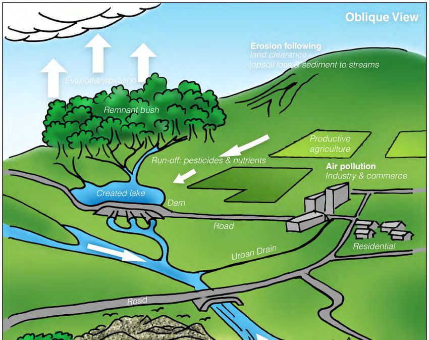
©The University of Auckland 2009

This report may be copied or reproduced and distributed to others provided that The University of
Auckland is acknowledged as the source of the information included in it, and provided that separate
tables or images from the report may not be reproduced without the written permission of the
original authors.

CATALOGUING IN PUBLICATION

van Roon, Marjorie, 1947-
        Low impact urban design and development : the big picture : an introduction to LIUDD principles and
methods framework / Marjorie van Roon and Henri van Roon. -- Lincoln, N.Z.: Manaaki Whenua Press, c2009.
         (Landcare Research Science series, ISSN 1172-269X ; no. 37)
         ISBN 978-0-478-34702-9 (print)
         ISBN 978-0-478-34703-6 (online)
         ISSN (online) 1172-269X

I. Title. II. van Roon, Henri Theodore. III. Series.
UDC 711.4(931):502.15

Edited by Shelley Trueman
Layout by Cherie Wilson
Graphic design assistance from Anouk Wanrooy and Caroline Miller

Published by Manaaki Whenua Press, Landcare Research,
P.O Box 40, Lincoln 7640, New Zealand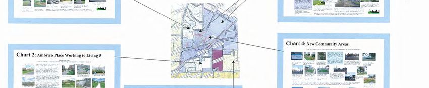
CONTENTS
Glossary ................................................................................................................................................... i
PART ONE................................................................................................................................................ 1
Introduction............................................................................................................................................ 1
What does Low Impact Urban Design and Development (LIUDD) mean?.......................................... 1
How does LIUDD help to fit human demands into environmental constraints? ................................ 2
Space, time and sustainability ............................................................................................................ 3
A matter of scale................................................................................................................................. 4
Resilient Development........................................................................................................................ 4
PART TWO............................................................................................................................................... 6
The LIUDD hierarchy of principles ...................................................................................................... 6
Primary Principle: Work with nature’s cycles on a catchment basis to maintain the integrity and
mauri of ecosystems........................................................................................................................... 8
Secondary principles: Select sites for minimal impact/adverse effect; use ecosystem services and
infrastructure efficiently; maximise local resource use and minimise waste................................... 10
Tertiary principles: Promote and support alternative development forms (natural space, efficient
infrastructure); 3-waters management; natural soil, water and nutrient cycles; minimum
earthworks; reduction and containment of contaminants; restoration, enhancement, and
protection of biodiversity; energy efficiency.................................................................................... 12
PART THREE .......................................................................................................................................... 18
Case studies ...................................................................................................................................... 18
Hauraki Gulf – developing the big picture: an ultimate receiving waters case study....................... 20
Okura – saving special sites: a catchment case study....................................................................... 22
Long Bay – planning vision: a catchment case-study........................................................................ 23
Glencourt Place – economies of scale: a neighbourhood and individual lot case study .................. 25
Project Twin Streams – flow on effects: a catchment case study..................................................... 26
Harbour View – treading lightly: a neighbourhood case study ........................................................ 27
Whau River and Estuary – community care: a catchment case study .............................................. 28
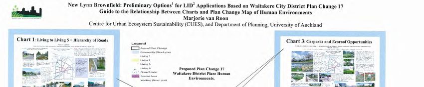
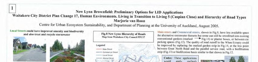
New Lynn Town Centre – urban constraints: a neighbourhood case study ..................................... 28
Tamaki Estuary – capturing catchments: a receiving waters case study .......................................... 30
Flatbush – greenfield palette: a catchment case study .................................................................... 31
Regis Park subcatchment of Flat Bush .......................................................................................... 33
Tiffany Close sub-catchment of Flat Bush..................................................................................... 34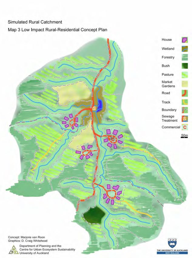
Mission Heights subcatchment of Flat Bush................................................................................. 34
   Landcare Research Sustainable Building practice: individual lot case study .................................... 35
   Sustainability features in a brownfield redevelopment at Talbot Park, Tamaki: an individual lot and
   neighbourhood case study ............................................................................................................... 36
Closing Comment.................................................................................................................................. 36
Appendix 1............................................................................................................................................ 39
Appendix 2............................................................................................................................................ 51
Authors and contact details.................................................................................................................. 61
Acknowledgements .............................................................................................................................. 61
Further Reading and References .......................................................................................................... 62
Glossary
Brownfields: areas that may be urban but landuse is changing, for example, from vacant commercial or industrial to
residential, with expanding transport nodes or existing urban areas becoming intensified.

Catchment: also known as a drainage basin or watershed, a catchment is an area of land that collects and drains surface
water runoff to a common outlet, such as a lake or the sea. Groundwater may also contribute to flow but it is not
necessarily confined within catchment boundaries. A whole range of biophysical processes operate between the soil, water,
air, plants and animals in the catchment as an ecosystem. Energy in the form of carbon based material as well as nutrients
and water all cycle within the catchment area.

Ecological carrying capacity: the limits within which the biosphere can regenerate resources and provide services
when exposed to human demands. See Mathis Wackernagel and William Rees, Our Ecological Footprint, New Society Press,
1996.

Green roof: roof area that is sealed, covered in substrate and vegetated; may range from partial to extensive or intensive

Greenfields: previously non-urban areas undergoing urban development.

Integrated adaptive management practice: a structured process of "learning by doing", where existing
interdisciplinary experience and scientific information is fitted into dynamic models to make predictions about the impacts
of alternative policies.

Less than 15% ‘effective’ impervious area: impervious surfaces that drain or discharge directly to waterways
without interception by porous surfaces. For instance, paved areas or roof runoff that drains to raingardens, swales,
biological filters or similar before discharging to waterways are not considered ‘effective impervious areas’. In contrast,
paved areas or roofs that discharge to channels, pipes or other impervious reticulation are ‘effective impervious areas’.

Life cycle costing: the calculation of manufacture, use, maintenance and disposal costs of a product, adjusted over the
expected life span of the product

Maatauranga Maori: traditional Maori knowledge

Mauri: the life force and unique personality of all things animate and inanimate

Rain garden: densely planted, deep porous garden bed which captures rain runoff and allows it to slowly drain away or
dissipate by way of evapo-transpiration, whilst trapping contaminants.

Rain tanks: holding tank for rain runoff from roof areas, from small rain barrels to large commercially made tanks.

Resilience: the capability of development to make on going adjustment to different development pressures or
unexpected events.

Retrofitting: urban areas undergoing landuse change in which new elements are introduced to the existing urban
framework, such as construction, roading and infrastructure modification and/or maintenance.

Riparian corridor: vegetation alongside waterways, typically planted to the water’s edge

Sequential learning: the transfer of learning by professionals and developers from one project or location to another,
resulting in increased knowledge and implementation with each transfer.

Stormwater runoff: the flow of rain water after it hits the ground

Swales and filter strips: engineered vegetated watercourses, usually shallow linear depressions which carry and filter
rain runoff.

Treatment trains: a series of devices linking sites in a catchment, to capture, slow and treat rain runoff.

SUMMARY                                                                                                                       i
SUMMARY ii
PART ONE

Introduction
The Low Impact Urban Design and Development (LIUDD) programme is a six-year programme within
the Sustainable Cities Portfolio, funded by the New Zealand
Foundation for Research Science and Technology from 2003.
                                                                           Applying LIUDD means looking at how
The idea of sustainable living emerged strongly in the late
                                                                          human activities affect the environment
1980s through international initiatives. Since then it has                both now and in the future, locally and
become embedded in the legislation and lifestyle of New                    further afield, and helps assess how to
Zealanders, from the Resource Management Act 1991 right                     work with nature’s cycles to maintain
through to community and cultural initiatives. A general                            ecological resources.

definition for sustainability is:

        Meeting the needs of the present generation without compromising the ability of future
        generations to meet their own needs.i
Throughout the text Roman numerals have been used to identify references which are listed with
further reading.

LIUDD looks holistically at the human impacts of
                                                             DEFINING LIUDD
development on the environment. The overriding
LIUDD principle is recognising ecosystems have               A formal definition of LIUDD, adapted from WP051
limitations and that human activity must work                in Appendix 1:
                                                             LIUDD is an integrated urban design and
within these to be sustainable. LIUDD considers
                                                             development process using nested scales within
the impacts of development on wide scales, not               catchments in urban and peri-urban environments.
only in area but over time. The primary document             LIUDD is focused on avoiding, at little or no extra
outlining LIUDD principles is attached in Appendix           cost, a wide range of adverse effects of a
1ii. Application of some of the principles at a local        physiochemical, biodiversity, social, economic and
                                                             amenity nature resulting from conventional
or neighbourhood level is shown in Appendix 2.
                                                             development. LIUDD aims to protect aquatic and
This three-part report offers explanation,                   terrestrial ecological integrity while allowing
                                                             urbanisation at all densities.
descriptions and examples of LIUDD principles.
Part One discusses the ideas in the LIUDD
programme; Part Two outlines LIUDD principles;
Part Three offers a wide-scale case study of the Hauraki Gulf and some of its catchments as an
example of LIUDD principles in action.

What does Low Impact Urban Design and Development (LIUDD) mean?
The term ‘Low impact’ introduces the idea of reducing the effects of human activities on natural
processesiii which link land, water, air, animal and plant life so that these resources are still available
for future use and enjoyment. LIUDD also considers the catchment context and LIUDD processes with
reference to wider scales. ‘Design and development’ refers to the ideas, methods and practices used
to ensure human activities do not damage or destroy natural processes.

LIUDD The big picture: PART ONE                                                                                    1
LIUDD applies the concept of ecological carrying capacity which is a key element of sustainable
development. The idea of an ‘ecological footprint’ will be introduced.
Ecological carrying capacity is basically a measure of the ability of an area or environment to
regenerate the resources which humans consume and to handle resulting waste.
The application of LIUDD involves looking at how human activities affect the environment both now
and in the future, locally and regionally, and helps assess how to work with nature’s cycles to
maintain ecological resources. LIUDD is a multi-dimensional decision-making process which considers
various scales, over time and space.
How does LIUDD help to fit human demands into environmental
constraints?
Humans have a history of changing landscapes without
understanding the consequences. The measurement of Humans have a history of changing their
ecological carrying capacity to allow for the effects of landscapes without understanding the
human activities is complex. Human needs go beyond consequences. Measuring ecological carrying
capacity to allow for the effects of human
basic requirements for food, shelter and space. There is a
activities is complex.
need to create cities that are centres of innovation and
economic growth, as well as cities that support social
wellbeing, quality of life and cultural identities. LIUDD considers the effects generated by humans
when using ecosystems and offers ways to accommodate human activities within ecosystem
limitations.
In order to understand the effects of human activities, LIUDD has involved specialist researchers
including scientists, engineers, planners, architects, economists, and sociologists. The aim of the
LIUDD programme has been to encourage the uptake of LIUDD so that the consequences of human
activity do not exceed ecological carrying capacity.
The involvement of those affected by design and
development, such as community, business, and cultural
By involving a variety of researchers,
groups, is critical for the success of LIUDD. Commitment government agencies, community and cultural
and investment by regulatory agencies as well as the groups, a range of activities can be accounted
private sector enables LIUDD visions to be realised. The and planned for in low impact urban design and
development
LIUDD process encourages specialists to move out of silo
thinking - to think beyond the conventional uses of their
work into wider contexts. Community driven initiatives also benefit from multidisciplinary input. By
harnessing the expertise and involvement of others, community groups extend their knowledge,
understanding and networks to realise their goals.
LIUDD The big picture: PART ONE 2Space, time and sustainability
As well as involving a wide variety of people, looking at the bigger picture is essential in the LIUDD
process. Careful design can produce benefits on a larger scale. Potentially negative effects may not
be immediately apparent - they may occur at various scales, cumulatively, or may be ultimately
catastrophic.1 These wider issues need considering, for instance, what will this development do to
the land, water and air surrounding it? How will this affect the use of the area in the future? It is
essential to think about these questions in the wider catchment scale.
Catchment management allows many factors to be
Catchment management allows many factors to
considered – not only the effects on water draining from be considered – not only the effects on water
the catchment but also on the plants, animals, soils, air draining from the catchment but also the effects
and on human activities within the catchment. Each is on plants, animals, soils, air and human
linked so that changes made to one will ultimately affect activities within the catchment.
the others.
More specific questions can then be posed: What is upstream of the proposed development? What is
downstream? What other developments or activities are planned for the catchment? What other
activities and land uses surround the development? Would it be better to shift this development
within the catchment to avoid particular issues? Is this development appropriate for this catchment
at all? What was the land used for in the past, does this still affect the land, water and soil resources
of the catchment, and what might that mean for development? These questions can only be thought
through when thinking in a catchment context.
Time becomes a relative concept when it comes to judging what effects and consequences human
activities may have on natural systems. Humans tend to judge the effects of time in terms of a
decade or so, whereas natural systems vary, often working within longer time scales. For instance,
groundwater may take 50 years or more to percolate to a point of extraction and can carry and
concentrate contaminants previously washed off
upstream land. Industries in the past such as timber Activities, past, present and future, affect
treatment or farming used practices that are now natural cycles in the long term as well as in our
recognised to be dangerous. Resultant contaminants lifetimes. Human impacts have to operate
within ecological constraints to make living
emerge over time accumulating in waterways and
sustainable.
groundwater. Landuses on these sites or downstream are
compromised due to this previous activity. Similarly,
forestry activity of over a century ago may still affect downstream waterways today through erosion
1
“The processes through which past societies have undermined themselves by damaging their environments fall into eight
categories, whose relative importance differs from case to case: deforestation and habitat destruction, soil problems
(erosion, salinization, and soil fertility losses), water management problems, overhunting, overfishing, effects of introduced
species on native species, human population growth, and increased per-capita impact of people.” p 5, Jared Diamond,
Collapse – how societies choose to fail or survive, Viking, 2005: Diamond offers an assessment of human environmental
impacts.
LIUDD The big picture: PART ONE 3from forest removal, creating silt layers in streams and outlets, changing harbour flows, encouraging
mangrove forests to establish at the mouth of inlets.
The results of human activity were not always fully and sometimes not at all apparent during the
lifetimes of those involved. Activities - past, present and future - affect natural cycles in the long term
as well as in our lifetimes. Human activities have to operate within ecological constraints to make
living sustainable.
A matter of scale
Human activities may be considered within a range of scales, from individual lot, to catchment, to
regional to national and beyond. As discussed, taking a catchment-wide view keeps options open for
innovation. LIUDD requires looking beyond the scale of a development to what may be affected in
the bigger picture. Table 1 and Figure 1 show a range of scales and gives examples of activities within
each scale that change in effect at other scales. Using a simplified example of rainwater, considering
managing this at an individual lot scale may be different from managing rain runoff for a
neighbourhood and for an entire catchment. The effects radiating from an individual lot depends on
whether rainfall is retained on site, for instance in tanks, rain gardens, ponds, or wetlands. If storm
water is discharged into the neighbourhood, the effects depend on whether it goes into closed pipes,
open channels or enters natural waterways. At a catchment scale, if all individual lots in an urban
neighbourhood are discharging rainwater to reticulated systems, storm flows may cause flooding of
properties and waterways, loss of soils, animal and plant life, through erosion and deposition. During
these processes vegetation may be smothered and replaced by other species (succession
replacement). Beyond the catchment, contaminants carried in rain runoff may build-up in the
receiving waters. The cumulative effects of even the smallest sites can have negative impacts at
larger scales. Undertaking LIUDD means, even at small scale developments, considering innovative
solutions to manage effects at the scale of the bigger picture.
Resilient Development
LIUDD is an example of integrated adaptive management
practice. This means as developments evolve they are
The learning and knowledge shared through
constantly refined and adapted to achieve long-term goals.
diverse participants during the LIUDD process
During planning and development unexpected outcomes feeds back to help make ongoing decisions
appear. These are resolved by responding appropriately, resilient and to outline goals more clearly.
taking opportunities, and using lessons learned to feed back
into the process. The learning and knowledge is shared by many people during the LIUDD process,
and this helps to make the decisions made during the process resilient and to clarify the definition of
goals. Resilient development is capable of on going adjustment to different development pressures
or unexpected events.
LIUDD processes consider various scales of time and space and inclusiveness, encouraging flexibility,
innovation, network building and learning opportunities.
LIUDD The big picture: PART ONE 4Table 1: showing a range of scales. The scales range from individual lot to ultimate receiving waters. The arrows are a reminder that decisions and activities at small scales have consequences at all larger scales. LIUDD The big picture: PART ONE 5
PART TWO

The LIUDD hierarchy of principles
The combination of catchment management with multidisciplinary and community input offers
multiple options for development and design. To
combine this, priorities and guidelines are helpful. The LIUDD principles set out a hierarchy of issues and
LIUDD principles set out a hierarchy of issues and        factors to consider within regional, catchment,
                                                                   neighbourhood and lot scales.
factors to consider within all scales, including
catchments (Figure 1). In the simplest terms, the
principles are:

    •   Primary principle: Work with nature’s cycles on a catchment basis to maintain the integrity
        and mauri of ecosystems.
    •   Secondary principles: Select sites for minimal impact/adverse effect; use ecosystem services
        and infrastructure efficiently; maximise local resource use and minimise waste.
    •   Tertiary principles: Promote and support alternative development forms (natural space,
        efficient infrastructure); 3-waters management; natural soil, water and nutrient cycles;
        minimum earthworks; reduction and containment of contaminants; restoration,
        enhancement, and protection of biodiversity; energy efficiency.

The LIUDD principles and implementation methods show how to go about the process of providing
for human activities within ecological carrying capacity while considering long-term consequences.
The primary reference originally outlining these principles is Working Paper 051 of the Centre for
Urban Ecosystem Sustainability. A condensed version of this paper with original diagram and table is
presented as Appendix 1.

                              Figure 1: Scales to consider for environmental effects

LIUDD principles require urban developers and designers to work within nature’s cycles. LIUDD
principles form a hierarchy. They interconnect, feeding back into one another. The LIUDD hierarchy
(Figure 2) consists of principles, sub-principles and implementation actions. This framework
illustrates how single LIUDD actions fit within the bigger LIUDD picture, and it consistently guides

LIUDD The big picture: PART TWO                                                                          6
comprehensive planning and the assessment of developments so that they work within their
ecological carrying capacities.
Good LIUDD practice considers all these principles when going through the process of planning,
implementing, managing and maintaining low impact urban design and development. Applying the
principles helps those initiating projects and those examining decision-making processes to
understand what is aimed for, and encourages innovative ways to get there.
Figure 2: LIUDD principles sit in an interconnected hierarchy with the ultimate aim of working within nature’s cycles and
processes. The width and colour intensity at each level in this diagram show the relative importance of the principles.
LIUDD principles can help identify goals and outcomes, and may be applied when undertaking design
processes and the development of land, structures or
infrastructure, during policy and planning activities, while Although LIUDD may result in physical
managing catchments and during ecological restoration. structures and devices, it also includes
The outcomes are not always visible - although LIUDD may behavioural change, collaborative learning,
knowledge sharing, capacity building and clear
result in physical structures and devices, it also includes
maintenance strategies.
behavioural change, collaborative learning, knowledge
sharing, capacity building and maintenance strategies.
Because these outcomes are wide ranging, they are often achieved in stages.
LIUDD The big picture: PART TWO 7Primary Principle: Work with nature’s cycles on a catchment basis to maintain the integrity and mauri of ecosystems This primary and overriding LIUDD principle requires human activities to support and work within cyclical ecological processes and their limits. Ecological carrying capacity needs to be respected. Designing and managing human activity in a catchment context enables impacts on processes affecting water, soil, plant nutrients, organisms and energy cycles to be minimised. The aim is to keep the unwanted effects of resource use to a minimum, and also to contain them within the catchment. This means managing demands on resources, and the retention of contaminants at source. Natural cycles can be long-term systems, and careful LIUDD planning, with long term results in mind, creates benefits for the physical and cultural wellbeing of the community and the environment. LIUDD is not a one-off application – it is a strategic approach. Scales wider than the catchment may need to be considered. Some developments may have regional consequences, there may be cumulative or edge effects outside the catchment boundaries (Figure 3). Changes in circumstances during and after development may change outcomes and goals, and adjustments will need to be made to continue incorporating LIUDD principles. By relating goals and outcomes to ecological carrying capacity, sequential learning can improve the process over time. LIUDD The big picture: PART TWO 8
Figure 3: LIUDD requires human activities to work within ecological carrying capacity and to consider effects beyond
immediate boundaries. Concept: Stephen Knight. Adapted from van Roon and Knight 2004. iv

LIUDD The big picture: PART TWO                                                                                        9
Secondary principles: Select sites for minimal impact/adverse effect; use
ecosystem services and infrastructure efficiently; maximise local resource
use and minimise waste.
These principles are closely tied to the primary principle, working with nature’s cycles on a
catchment basis to maintain ecosystems.

2.1 Select sites for minimal impact/adverse effect

When selecting sites for LIUDD, the long-term and bigger picture needs considering. There are
preferred places for development that can satisfy both human activity and environmental care.
Taking a ‘least regrets’ approach, eliminates difficult and sensitive sites. Precious places such as
significant cultural or natural areas, vulnerable ecological systems and unique landscapes are rarely
acceptable locations for development (Figure 4). Using every possible protection and mitigation
policy, plan or device will not replace a lost treasure. Sometimes the best LIUDD solution for a
development is to go elsewhere. By screening out inappropriate areas, costs as well as risks are
reduced, and unrealistic mitigation options eliminated.

When a site is appropriate for
development or a specific use, ecological
constraints virtually disappear and there
are a wider variety of LIUDD solutions
from which to choose. Nevertheless,
existing urban areas undergoing
intensification will still benefit from
LIUDD. Development in existing urban
areas can overstress the wider
environment, for instance by increasing
impervious flows and contaminants, and
by the loss of open spaces and natural
corridors. All development, whether
                                               Figure 4: The economic and ecological costs of developing some
greenfield, brownfield or the retrofitting     areas make them unlikely candidates. Photo: M. van Roon
of an existing area, can apply LIUDD
practices to reduce impacts.

LIUDD The big picture: PART TWO                                                                             10
2.2 Use ecosystem services and infrastructure efficiently
Existing ecosystems can offer excellent LIUDD opportunities. Natural ecosystems operate by
responding to conditions. Degraded or modified ecosystems lose this resilience and capacity to cope
with change, for example, to act as buffer zones, process wastes or adapt to uses such as water
extraction.
The wider catchment offers valuable resources. Natural waterways in the upper catchment act as a
reservoir for the replenishment of riparian and aquatic animals and plants in the lower catchment.
Areas of native vegetation including those in built- up areas (Figure 5), and along transport routes,
act as migration corridors and patches offering shelter and
food for animals.
Similarly, existing infrastructure is useful when developing
areas. LIUDD in brownfield and retrofit sites may modify
existing infrastructure by applying LIUDD practices and use
them alongside natural ecosystems to gain economic and
ecological efficiencies.
Figure 5: Urban landscaping in Newton,
The retention and enhancement of natural processes on-site Auckland creates visual identity as well as
and in the wider catchment provides valuable resources. For enhancing ecosystems by supporting
example, green corridors – waterways, shelter belts, planted biodiversity and providing evapotranspiration.
boundaries and transport verges, offer pathways for wildlife Photo: M. van Roon.
and plant dispersalv.
2.3 Maximise local resource use and minimise waste.
The design of developments should reduce the need to import and export resources. For instance,
from the smallest lot up to entire catchments, water and contaminants should be contained to
reduce both dependence upon external resources and effects upon those resources. There are many
ways of doing this. For example, the capture of runoff (Figure 6) and
the using of that runoff where appropriate instead of using
reticulated water supply. Another example is the restoration of
waterways by planting native riparian species to encourage natural
filtering systems. Rather than allowing the discharge of
contaminants, change how contaminants are disposed of, and
include education programmes and behavioural change, as well as
physical capture and treatment on site. During design and planning,
encourage clustering of activities to share resources and to deal
Figure 6: Using local resources
with negative effects as a whole rather than dealing with them in includes capturing and using
incremental, individual lots. rainwater where it falls. Photo:
Peter Nagels
Although outside the LIUDD programme, the reduction, reuse and
recycling of goods and materials locally, along with the capture of local employment and services, is
associated with other sustainability programmes. These actions reduce ecological demands and
energy inputs as well as keep effects within the catchment.
To achieve the principle in practice, the focussing of resource use within developments is required.
LIUDD The big picture: PART TWO 11Tertiary principles: Promote and support alternative development forms
(natural space, efficient infrastructure); 3-waters management; natural soil,
water and nutrient cycles; minimum earthworks; reduction and
containment of contaminants; restoration, enhancement, and protection of
biodiversity; energy efficiency.
The tertiary LIUDD principles encourage best development practices, methods and solutions to retain
or restore natural cycles while reducing contaminants and increasing the efficiency of infrastructure
and of water management. (Appendix 2, WP052, illustrates the implementation of many tertiary
principles.)
Although many tertiary principle solutions may involve physical outputs such as ecological
restoration work and the retrofitting of existing areas with innovative LIUDD devices and solutions,
they also depend on vital human outputs such as capacity building, collaborative learning, knowledge
and resource sharing, strategic infrastructure planning, as well as implementation and maintenance
programmes. The amalgamation of these outputs links tertiary principles with the primary and
secondary principles because the choice and application of tertiary principles depends on the
decisions made using primary and secondary principles. Applying tertiary principles without the
umbrella of the primary and secondary dominant principles cannot successfully address wider LIUDD
sustainability goals.
3.1 Alternative development forms (natural space, efficient infrastructure)
The maintainance, enhancement or creation of natural spaces
helps to maintain natural waterways and protect aquatic and
terrestrial life. Open spaces (Figure 7) provide for social
amenities and wellbeing, and food production, as well as
protecting cultural sites. Ecologically significant areas can be
identified and reserved prior to development. This can be
achieved through innovative LIUDD design of form (Figure 8)
as well as through regulatory devices. Examples of forms to
achieve this include:
• Clustering activities while delineating and protecting
Figure 7: LIUDD mixed housing forms differ
significant areas or land set aside for infrastructure from traditional New Zealand single lots,
enhancement. offering greater expanses of shared open and
• Encouraging mixed housing that includes apartments, amenity space and conserving natural areas
townhouses and compact single houses, intensifying by clustering homes and using vertical forms.
Photo: M. van Roon
vertically rather than horizontally, and creating
LIUDD The big picture: PART TWO 12Figure 8: Alternative development form helps conserve natural values and features, and increases infrastructure efficiency. Concept: M. van Roon. Graphics: C. Whitehead. LIUDD The big picture: PART TWO 13
natural areas from the resulting space.
•   Restoring and enhancing natural landscape quality and character and encouraging cultural design
    to support the LIUDD approach of working within natural processes and including appropriate
    cultural objectives.
(These are Principles 3.1A, B and Xs in WP051 Appendix 1.)

3.2 Three-waters management plus natural soil, water and nutrient cycles
Human activity affects ecosystem cycles – the water, soil and nutrient cycles as well as the plants and animals
depending on them. The effects of human activity can be modified to reduce impact on natural cycles, for
example by retaining natural water flows and supply; ensuring flows are not contaminated; keeping waterways
in natural states; encouraging recycling within natural cycles; and reducing external inputs and outputs.

Keeping cycles within catchments is also known as integrated three (or four) waters management, where
stormwater runoff, wastewater and water supplies are managed and recycled within a local catchment as far
as is practicablevi. Natural cycles can be restored, enhanced and protected using many solutions. The following
are examples of solutions for keeping cycles in the natural state for the three waters as well as for urban
earthworks.

Stormwater management can integrate LIUDD solutions by:

•   maintaining natural hydrology (water flows, volume
    and variations) by using alternatives to traditional
    stormwater engineering solutions (Figure 9). For
    example, avoiding piping and channelling of
    stormwater within and from catchments, instead
    diverting to natural waterways and flowpaths as well
    as to natural vegetated areas and porous soils, and
    creating treatment trains in the catchment.
•   reducing impervious areas in the catchment (to less       Figure 9: Addington, Christchurch. Alternative
    than 15% ‘effective’)                                     stormwater solutions - riparian restoration in
                                                              background and raingarden in traffic island in
•   keeping zinc coated roof surfaces painted                 foreground. Photo: M. van Roon
•   retaining runoff on site
•   avoiding kerb and channel road design where
    possible, instead, using swales
•   replanting riparian areas; keeping or restoring wetlands,
    springs, streams and forests
•   keeping runoff on site by reducing road width and using
    porous paving, a variety of vegetated areas and biofilter
    systemsvii
•   maintaining existing LIUDD stormwater devicesviii
•   using stormwater as a secondary water supply and to
    recharge groundwater, removing contaminants if necessary.
(These are listed as Principles 3.2A-E and Xs in WP051, Appendix 1)

Wastewater flows can be managed using LIUDD solutions to minimise
volumes, recycle and make use of nutrients. There are a variety of
innovative systems that allow recycling, reduce volumes and may better
account for cultural needs than conventional discharge and treatment
systems. Examples include:

•   strip nutrients out of sewage effluents
                                                                            Figure 10: Clivus Multrum compost
•   composting toilets (Figure 10)                                          toilet at Earthsong, Waitakere City.
                                                                            Photo: M. van Roon

LIUDD The big picture: PART TWO                                                                                14
• wetland treatment and effluent recycling systems such as grey-water reticulation
• behaviour changes such as the use of composting or of worm farms rather than the use of
wastemaster units, so that contaminants and nutrients do not enter the drainage system or
receiving waters.
(These are listed as 3.2F-H in WP051, Appendix 1)
Water supply can be redesigned to suit a variety of activities. For example, not all water uses require a potable
supply. Systems for collecting rainwater and using greywater can reduce wastewater discharges and their
conventional reliance on a potable water supply. A range of solutions may
include:
• water supply efficiency (low flow appliances and plumbing
fittings)
• recycling grey water (Figure 11)
• appropriate garden design and plant species selection
• collection and treatment of rainwater.
(These are listed as 3.2I-J in WP051 in Appendix 1)
Urban earthworks can put natural cycles at risk. From the smallest site to
the largest areas, good construction practice aims to maintain soil structure
and waterways and avoid sediment and erosion issues. The design of
Figure 11: Inkerman Estate,
earthworks and construction processes affect natural cycles as discussed
Melbourne. Innovative solutions
above in 3.1 Alternative Development Forms.
for grey water treatment. Photo:
M. van Roon.
Design should aim to minimise site disturbance using solutions such as:
• avoiding steep slopes and significant ecological areas
• avoiding soil compaction
• clustering buildings on suitable soils and slopes
• encouraging alternative building forms which maintain natural areas
• arranging subdivision work and construction simultaneously for efficient monitoring, compliance
and remedial work.
(This is listed as 3.2K in WP051 in Appendix 1)
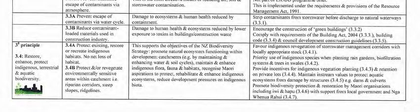
3.3 Reduce and contain contaminants
The most effective means of reducing contaminants, well beyond the
scope of the LIUDD programme, is to limit their generation through
alternative industrial practices or modes of transport. Good ecosystem
health and good human health depend on preventing contaminants from
entering natural cycles. Contaminants may be washed off during rain,
and there are excellent opportunities to apply LIUDD solutions to avoid,
reduce and treat contaminated stormwater (Figure 12) before it enters
natural waterways. Similarly, changes to construction practices can stop
contaminants from entering the atmosphere or being washed off by
runoff. (These are listed as 3.3A, B and Xs in WP051 Appendix 1). Figure 12: Biofiltration garden in
centre of road. Photo: M. van
3.4 Restore, enhance, protect biodiversity Roon.
Biodiversity helps natural ecosystems to self-regulate and respond to
changes. Local native species respond best in local natural soil, climate and water conditions. Retaining natural
habitats encourages biodiversity of native species, and in turn maintains natural ecosystems to support human
activities. Maori cultural aspirations to protect and enhance ecosystems often match the aims of this principle.
LIUDD The big picture: PART TWO 15Biodiversity depends on the whole catchment being healthy. Although natural environments adjust to fluxes,
those caused by urban activity within a catchment can reduce biodiversity. Keeping waterways natural, for
instance by leaving riparian cover, can provide food, habitat, temperature control and shade as well as slowing
flows, reducing erosion risks and filtering contaminants before they enter the waterway. The diversion of
waterways through pipes, straightening or channelling changes flow rates, affects the variety of aquatic plants
and animals which can live there. Sudden flashfloods can scour clean streambeds and habitats. Removal of
riparian areas within the catchment may increase erosion and sedimentation in waterways and prevent the
natural processes occurring where plants and animals recolonise downstream areas. Terrestrial areas of
planting are also critical, and link with riparian planting to form natural corridors and patches where species
spread and shelter.
Figure 13: Owhanake, Waiheke Island, after restoration of forest ecosystems as part of development plan.
Photo: M.van Roon.
The best methods for promoting biodiversity are those which maintain and enhance native vegetation,
features and waterways, both at development sites and within wider catchments. Environmentally sensitive
areas such as riparian corridors, steep slopes and ridgelines need particular recognition with respect to
restoration and protection (Figure 13). Some solutions include:
• retaining and enhancing riparian areas
• planting stormwater corridors, swales, rain gardens, biofiltration systems with locally sourced
indigenous species suitable for the conditions
• encouraging indigenous planting and maintenance on private lots
• keeping natural aquatic conditions intact for native species, for instance using alternative designs
mimicking natural forms for structures such as dams and culverts
• recognising and providing for aspirations by Maori groups for biodiversity protection and
enhancement
• balancing vegetation cover within and throughout a catchment
• limiting greenfield developments and maintaining less than 15% ‘effective’ impervious areas
• using covenants or planning provisions to protect headwater aquatic and terrestrial habitats and
riparian corridors.
(These are listed as 3.4A-B in WP051 in Appendix 1)
3.5a Reduce need for mobility of goods and people
Although outside the contractually-funded LIUDD programme, the need to reduce the mobility of goods and
people is acknowledged. Transport is a primary driver for urban site selection. LIUDD design should encourage
movement within local communities and promote public transport to reduce the dispersal of contaminants
associated with transportation into air and water. Similarly, promoting the local availability of goods and
services reduces transport demands. (This is listed at 3.5Xs in WP051 in Appendix 1.)
LIUDD The big picture: PART TWO 163.5b Minimise energy demands
LIUDD solutions for energy conservation may include efficient and compact urban design to reduce reliance on
vehicle use, and encourage the use of public transport, walking and cycling. LIUDD ‘green building’ design using
alternative solutions for light, heating, cooking and washing may be incorporated into alternative building
forms. (This is listed as 3.6A and 3.6Xs in WP051 in Appendix 1.)
The process of LIUDD is not linear – there are many methods or pathways to achieve LIUDD and
these feed back to one another through the principles described above. The LIUDD principles
hierarchy takes a holistic view, challenging urban development and design to set clear parameters,
and first and foremost to work within nature’s cycles. Working within these, LIUDD considers many
scales, looks to future needs (Figure 14) while providing for present needs, and harnesses knowledge
and participation from multiple parties.
Figure 14: LIUDD encourages clear, long term goals for a sustainable environment.
Photo: M. van Roon.
LIUDD The big picture: PART TWO 17PART THREE Case studies Within Part Three the Hauraki Gulf and associated catchments are used as a case study to show the application of LIUDD principles. A range of scales are used, working from the ultimate receiving environment of the Hauraki Gulf and moving up some of the tributaries feeding the Gulf to feature examples of LIUDD at the catchment, subcatchment, neighbourhood and individual lot scale (Table 2). Some of these examples, such as Twin Streams and Okura, show sustainable planning and methods put into place before the LIUDD programme came into being. LIUDD principles provide a clear framework within which these and other development or catchment management initiatives can work. This selection of examples demonstrates how LIUDD principles take a long term view, are applied holistically to include many groups and disciplines, and offer ongoing application and learning opportunities for central and local government agencies, developers and communities. The LIUDD Principles shown in full in Appendix 1 Figure 1 have been simplified in Figure 15 below. (Note that the tertiary principles for energy and mobility are combined into one box.) Figure 15: The Principles and Methods Hierarchy—simplified (adapted from van Roon and van Roon, 2005 Fig 1.) The following hierarchical graphic, based on Figure 15, is included adjacent to each case study and indicates, by the intensity of the red colour, light, medium or dark red, the degree to which the authors believe each of the principles has been implemented to date. Dark red indicates the best possible result. The order of the principles in this graphic is that shown in Figure 15. LIUDD The big picture: PART THREE 18
Table 2: Nested scales of LIUDD environments from Table 1 now listing the case studies at each scale that will be discussed in Part Three.

LIUDD The big picture: PART THREE                                                                                                            19
Hauraki Gulf – developing the big picture: an ultimate receiving waters case
study
Sheltered by the Coromandel peninsula, the Hauraki Gulf is a vast expanse of water which buffers the
eastern coast from the Pacific Ocean, supports fisheries, and offers
sanctuary to marine reserves and conservation islands. The Gulf stretches
along the eastern coastline, from near Pakiri beach in the north to the
Firth of Thames in the south, taking in islands (Figure 16) and the
Coromandel Peninsula, and cradling catchments that house over 1 million
people. Human activities on the land can threaten the ecology of the Gulf.
The Hauraki Gulf is the ultimate receiving environment for the effects of human activities in its
catchment. Multiple sub-catchments (Figure 17) feed into the Gulf, and deliver effects from a myriad
of human activities, including farming, and urban land uses. The greatest threat to the Gulf comes
from contaminants derived from those activities, and includes the bio-accumulation of toxins in the
fine sediments of the marine environment.

The Hauraki Gulf is shallow, and the sensitive enclosed
waters are at risk from pollution events and gradual
degradation resulting from human activities.

The Hauraki Gulf Marine Park Act 2000 emphasises the
links between the Gulf, its islands and catchments, and the
national importance of the ability of these
interrelationships to sustain the life supporting capacity of
the environment. The Park Act aims to achieve integrated      Figure 16: The Hauraki Gulf viewed from Motuora
catchment management of the Gulf by linking the land          Island. Photo: C. Whitehead.
and the sea. (Integration is achieved by implementation of requirements of the Resource
Management Act, the Auckland and Waikato Regional Policy Statements, and Regional Coastal Plans,
in particular.)

Managing the Gulf holistically involves many agencies working together. LIUDD principles are now
being applied in many of these catchments to change traditional urban forms and activities to those
that impact on the Gulf more favourably than in the past. In the sections which follow, the different
case studies (see Figure 18 for location) illustrate LIUDD principles at various levels of detail, and
show the cummulative impact of human activities and development in the wide context of receiving
environments. It should be emphasized that for local councils and communities the management
focus is on improvement of local environments such as beaches and local streams and that this in
turn serves the primary principle to manage the Hauraki Gulf holistically.

LIUDD The big picture: PART THREE                                                                      20
Figure 17: Map of Hauraki Gulf catchment

LIUDD The big picture: PART THREE           21
Figure 18: Map showing sites of case studies

Okura – saving special sites: a catchment case study
The Okura catchment lies just outside the northern edge of the Auckland
Metropolitan Area. The catchment features a four kilometre long
pristine estuary flowing to the Hauraki Gulf. The Okura Estuary (Figure
19) is part of the Okura-Long Bay Marine Reserve. The study of the
potential effects of urban development on this ecologically productive
catchment and estuary offers an example of the LIUDD Primary Principle
- the need to work within nature’s cycles on a catchment basis to maintain the integrity and mauri of
ecosystems – and more importantly, reinforces the LIUDD secondary principle of wise site selection
for minimal impacts from urban development.

The recent history of development plans for the Okura catchment reveals a range of issues. Although
the estuary was recognised as ecologically significant, the pressure to develop the greenfields of
North Shore City Council (NSCC) and Rodney District Council (RDC) grew as the population of the
Auckland Region expanded. Following an Environment Court decision in 1996 the Okura catchment
was zoned to remain rural, but urban development in the adjacent coastal Long Bay catchment was
allowed (discussed in case study below). Development in the Okura catchment hinged on what rural
development meant. Rural use could potentially mean lifestyle blocks of one hectare each, with the
construction of buildings and access-ways and the possible loss of riparian planting and natural
waterways which would all contribute sediment loads to the estuary.

The NSCC, RDC and the Auckland Regional Council (ARC) all realised any development - rural, urban
or of transport routes – could pose risks to the ecology of the estuary. To allow development within
the catchment, they needed to know what those risks might mean for the health of local streams and

LIUDD The big picture: PART THREE                                                                 22
other natural values, the estuary, and the marine reserve beyond.
By employing the expertise of the National Institute of Water and
Atmospheric Research (NIWA) to examine the sensitivity of the
estuary to sedimentation from various land use scenarios, the
regulatory agencies were given a better idea of the consequences
of development. NIWA ix reported that all activities generating
sediment posed a risk to the estuary, and although these risks
could be reduced using control strategies, the level of acceptable
risk should be defined. Engineering, planning and ecological Figure 19: The southern coastline of
consultants employed to study a range of development scenarios Okura Estuary. Photo: M. van Roon
to define risks reported a range of outcomes. These included managing risks within specific planning
and environmental controls, such as allowing limited development within defined areas while
protecting the most vulnerable areas of the catchment.
The Okura catchment requires ongoing comprehensive consultation and planning. The Okura
catchment has a variety of stakeholders, including residents, cultural groups, environmental groups,
developers and government agencies. The stakeholders actively support a range of interests, from
supporting the establishment of the Marine Reserve in 1995, to being heard at Council and
Environment Court hearings. In 2000 NSCC produced comprehensive catchment management plans
for the southern subcatchments of Okura including provisions aimed to protect the estuary on an
ongoing basis.
The Okura catchment shows how integrated catchment management can use analysis and scientific
research to demonstrate the ecological consequences of alternative development scenarios.
Scientific knowledge was sought and promptly responded to by Regional and District Councils with
positive ecological outcomes to date. Lessons learned, from this and the following case study,
illustrate good application of the LIUDD principle that prioritises site selection for positive ecological
outcomes. The management of the Okura catchment now goes well beyond the Environment Court
decision to allow rural development in the catchment, and is a good example of the application of
LIUDD primary and secondary principles.
Long Bay – planning vision: a catchment case-study
The coastal settlement of Long Bay abuts the Okura catchment, which is
discussed above. Long Bay contains highly valued and fragile ecological
areas, especially the upper reaches, which are still in bush cover with
waterways in natural states. The lower reaches are mostly in pasture
and include the Long Bay Regional Park on Long Bay beach (Figure 20). The catchment includes the
ecologically significant Vaughan and Awaruku streams which feed
the Okura-Long Bay Marine Reserve and the open waters of the
Hauraki Gulf. The urban design for this catchment demonstrates
examples of the implementation of many LIUDD principles and
methods.
The repositioning of the Auckland Metropolitan Urban Limits in a
1996 decision by the Environment Court, allowed for the urban
development of the 360 hectares of the Long Bay catchment. The Figure 20: A view from the centre of
pristine estuary of the adjacent Okura catchment, along with the Vaughans Stream catchment out to
sea off Long Bay. Photo: North Shore
City Council
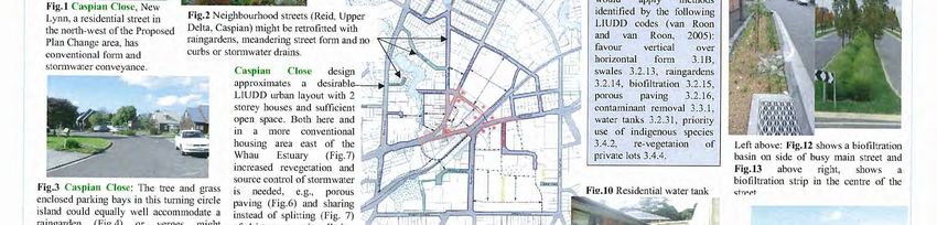
LIUDD The big picture: PART THREE 23ecological value of the Long Bay catchment itself, the establishment of the Long Bay-Okura Marine reserve in 1995, and the awareness of environmental issues brought about through the 1996 Environment Court decision meant development in this catchment could not occur in a piecemeal or ad hoc fashion. The interests of multiple parties, including community, cultural and environmental groups as well as industry and developers encourage all decision makers to carefully consider what will be lost and gained as urban development continues in this catchment. Key factors for stakeholders include the maintenance and restoration of water quality in streams and marine areas; landscape features; bush and stream habitats; and protection of cultural and historical features of this and the adjacent Okura catchment. NSCC has had the challenge of providing for residential development within the constraints of ecological, historical, cultural and amenity values of the catchment. From 1999, NSCC began devising a long term comprehensive plan for the catchment. Over the next seven years a structure plan was formulated using integrated catchment management planning. Using statutory planning tools to ensure public consultation, NSCC devised a comprehensive development plan which was incorporated into the District Plan and illustrates many LIUDD principles. The Interim decision from the Environment Court in 2008 has significant implications for LIUDD and it provides some important case law.x The overall goal of the District Plan Change (Figure 21) is to protect the Long Bay natural environment, while permitting residential development to meet anticipated growth in North Shore City. This matches the LIUDD primary principle of working within nature’s cycles to maintain ecosystem integrity, and providing decision makers with a specific goal to work towards. (It also matches the LIUDD definition of achieving ecological objectives while allowing for development at all densities – see LIUDD definition in Part One.) Figure 21 Proposed Plan Change 6 to the North Shore City District Plan. North Shore City Council LIUDD The big picture: PART THREE 24
You can also read