MAKING THE MOST OF LONDON'S WATERWAYS - Future of London
←
→
Page content transcription
If your browser does not render page correctly, please read the page content below
MAKING THE MOST OF
LONDON’S WATERWAYS
ABOUT FUTURE OF LONDON
Future of London helps build better cities through knowledge, networks and
leadership – across disciplines, organisations and sectors. We are the capital’s
independent network for regeneration, housing, infrastructure and economic
development practitioners, with 4,000+ professionals using FoL as a hub for
sector intelligence, connection and professional development, and a mandate to
prepare the next wave of cross-sector city leaders.

PROJECT TEAM
Amanda Robinson, Oli Pinch, Nicola Mathers, Aydin Crouch

Report written and designed by: Amanda Robinson
Report edited by: Charli Bristow, Nicola Mathers, Lisa Taylor

PROJECT PARTNERS
CORE PARTNERS
We are grateful to Arup, Avison Young, Pollard Thomas Edwards and Hadley
Property Group for supporting this work.

                           Arup is an independent firm of designers, planners,
                           engineers, consultants and technical specialists
                           offering a broad range of professional services.

                           Avison Young is the world’s fastest growing real
                           estate business.

                           Pollard Thomas Edwards specialises in the creation
                           of new neighbourhoods and the revitalisation of old
                           ones. Their projects embrace the whole spectrum
                           of residential development and other essential
                           ingredients which make our cities, towns and villages
                           into thriving and sustainable places.

                           Hadley Property Group is a developer which
                           specialises in progressive, sustainable approaches
                           to the delivery of much-needed housing in Greater
                           London and other major UK cities.

REPORT PARTNER                             EVENT PARTNER
The Canal & River Trust kindly             The Port of London Authority kindly
provided event and report support.         provided event support.

Published December 2019 © Future of London 2011 Ltd.
Cover photo of Packington Estate kindly supplied by Pollard Thomas Edwards © Tim Crocker.
All other photos by Future of London except where indicated.
Future of London 2011 Ltd is registered in England and Wales (No. 7575624).
CONTENTS
INTRODUCTION                      1

OVERVIEW OF LONDON’S WATERWAYS    2

CHANGING WATERWAYS                4

CHALLENGES                        8

SOLUTIONS                        15

RECOMMENDATIONS                  39

CONCLUSION                       42

APPENDICES                       44

REFERENCES                       46

ACKNOWLEDGEMENTS                 47
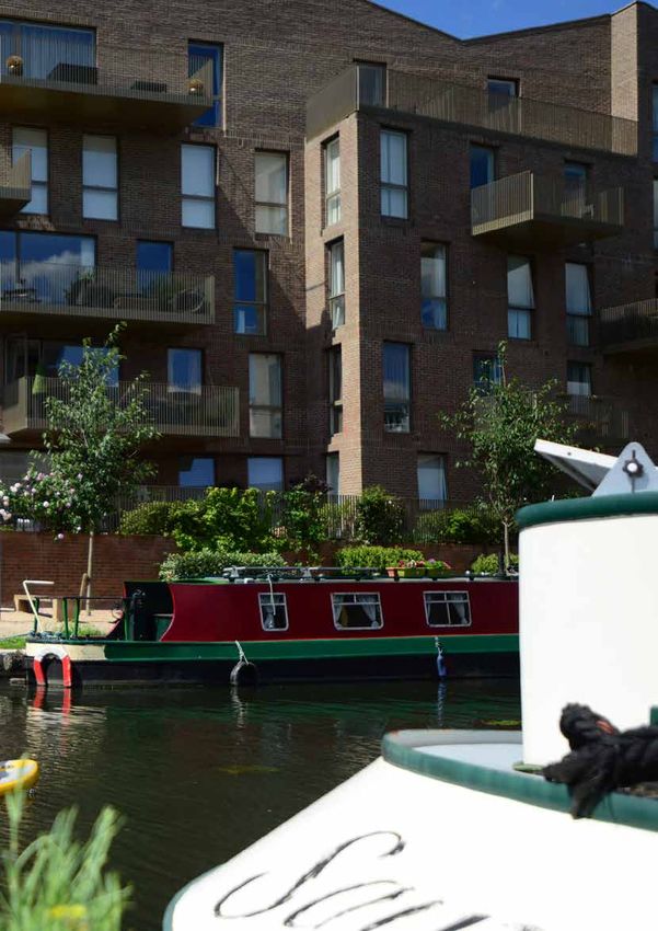
Photo © Muse Developments
INTRODUCTION
For a public space covering just 2.5% of London,1 waterways have an outsize
impact on the city and its residents. Rivers, canals, docks and other water bodies
permeate every London borough; an estimated half of Londoners live within a
five-minute walk of a waterway.2

Waterways powered London’s growth from settlement through industrialisation,
but post-industrial development often turned away from the water, cutting off
access for generations of Londoners.

Today, waterways are once again at the centre of London’s development, flowing
through most of the city’s largest Opportunity Areas. At the same time, interest in
water-based recreation and living, ‘rewilding’ waterways, waterborne transport
and the health benefits of water is on the rise.

This combination of circumstances brings unprecedented opportunity for
regeneration to reconnect people and the built environment with waterways. The
challenge is to work effectively across organisations and balance myriad uses
and activities within a limited public space.

Making the Most of London’s Waterways showcases projects, policies and
partnerships which are successfully coordinating activities on or near waterways
and using development to stitch waterways back into the urban fabric.

Running throughout 2019, this project brought together more than 300 people
from the public, private, and third sectors through seven field trips, a senior
roundtable, a design workshop, and a full-day conference. Their expertise and
experience, combined with desk-based research and interviews, forms the basis
of this report. It includes:

• An overview of waterways covered in the research and how Londoners’
  relationship with them is changing

• Challenges facing practitioners

• Case studies showing effective ways of delivering projects involving urban
  waterways

• Recommendations for policymakers and built environment practitioners

• Additional resources

Future of London is grateful to core project partners Arup, Avison Young, Hadley
Property Group, and Pollard Thomas Edwards for their support and content
contributions; to the Canal & River Trust for event and report support; and to the
Port of London Authority for event and conference support.

                                      Making the Most of London’s Waterways     1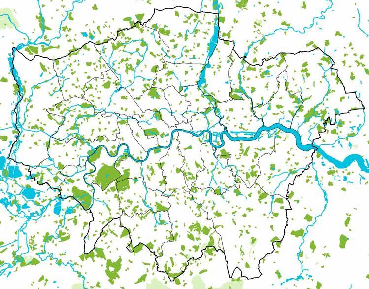
OVERVIEW OF LONDON’S
WATERWAYS
The waterways covered in this research – canals, rivers, docks, and other water
bodies – are diverse, but have broadly similar histories within the London context.
They are used as critical urban infrastructure, moulded to suit the needs of a
growing, industrialising city. They are swept aside during times of technological
change – making way for other uses, suffering dereliction and disuse, or
disappearing altogether. And increasingly, they are being rediscovered.

 London’s waterways
 (n.b. rivers and canals
 have been widened
 for visibility and are
 not to scale).
 Map © Mapbox
 © OpenStreetMap

 Photos L to R: The Thames; Regent’s Canal at King’s Cross; Royal Victoria Dock; Kingsland basin © Rictor Norton &
 David Allen (CC-BY 2.0/flickr); Walthamstow Wetlands; Southmere Lake © Peabody

2     Making the Most of London’s Waterways
RIVERS
                                      From the first Roman settlers along the Thames, London has grown up around
                                      its rivers – and its rivers have since been culverted, taken underground, and/or
                                      merged into the sewer system to accommodate growth.

                                      The Thames was critical for moving goods, especially from the 1800s through
                                      the 1960s, but its tributaries have also been important. Some form borough
                                      boundaries, such as the Roding, Lea, Colne, and Deptford Creek. All are important
Canalised rivers                      assets for biodiversity and flood risk management.
Some rivers, like the Lea and
Brent, were engineered in parts
to improve navigability (i.e. ease    CANALS
of movement for boats). These         London’s canals were built largely in the first half of the 19th century to
are ‘canalised’ rivers: part river,   accommodate demand for moving goods by water, as horse-drawn canal
part canal.                           boats could shift around 50 times more cargo than carts. Commercial canal use
                                      decreased from the mid-19th century with the spread of railways and, later,
                                      road-based transport.

                                      Today, 100km of canals stretch across north London, connecting Limehouse in
                                      the east to Uxbridge in the west. South London’s only remaining network is the
                                      7km of canals in Thamesmead.

                                      DOCKS
                                      London’s docklands cover a swathe of east London, with connections to the
                                      Thames, Lea, and Regent’s Canal. In the 1980s, maritime activity gave way to
                                      office and residential space as Canary Wharf and Rotherhithe regenerated. The
                                      Royal Docks – the most recent and eastern of the docks – are currently undergoing
                                      their own transformation. There are also several basins along the canal network
                                      which behave like small docks.

                                      WETLANDS
                                      In the mid-1800s, London’s various water companies began constructing
                                      reservoirs to serve a growing population. Many have been transformed into
                                      wetlands (e.g. Woodberry Down, Barnes, Walthamstow) or leisure spaces (e.g.
                                      Hampstead Ponds, Welsh Harp).

                                      OTHER BODIES OF WATER
                                      Smaller bodies of water like lakes, active reservoirs, and ponds are dotted
                                      throughout London. This research didn’t cover most of these water bodies,
                                      except where they form a significant part of a regeneration scheme, such as
                                      Thamesmead’s lakes.

                                                                           Making the Most of London’s Waterways     3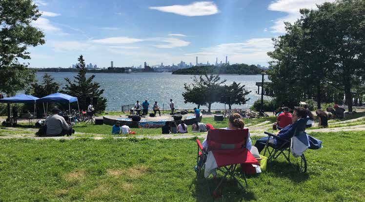
CHANGING WATERWAYS
As industrial and commercial uses of waterways have decreased, new activities
and interests are emerging across the network, fed by (and leading to) changing
perceptions. Waterways are becoming a focal point for development, living,
leisure, environment, and climate change. They have potential to increase
wellbeing and biodiversity; contribute to local economies; and address climate
change. How waterways are valued is also evolving beyond land value uplift.

CHANGING USES
Development
Whereas much mid-20th century development turned its back to waterways,
mixed-use and residential regeneration schemes over the last 30 years have
increasingly provided access to and views of the water.

Extensive waterside development will take place in London in coming years,
with many of the city’s biggest Opportunity Areas centred on or bordered by
waterways – bringing enormous potential to reconnect neighbourhoods and
local economies to water, manage flood risk, and enhance biodiversity.

London’s Opportunity Areas

                                                                                          Opportunity Areas are
                                                                                  brownfield land with significant
                                                                                        capacity for development,
                                                                                  shown to the left in yellow (n.b.
                                                                                     rivers and canals have been
                                                                                     widened for visibility and are
                                                                                                      not to scale.)

Opportunity Areas along waterways: in numbers

 HECTARES                          JOBS                        HOMES
 Map © Mapbox © OpenStreetMap. Icons credit: Map, Accountant, Technician,
 Architect, Police, Fire Fighter by Eucalyp from the Noun Project; Buildings by
 Made by Made from the Noun Project

4     Making the Most of London’s Waterways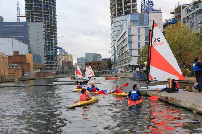
4500                                                                         Living
4000
                                                                             Waterside living isn’t the only form of housing on
3500
                                                                             the move in London: across the Canal & River Trust’s
3000
                                                                             London network, the number of people living on

                                                        1880
                                             1615

                                                               2050

                                                                      2208
                                    1225
2500

                             1036
                                                                             boats as continuous cruisers has quadrupled since

                      769
              638
2000                                                                         2010, driven by its relative affordability compared to
       522

1500                                                                         the traditional housing market.
1000
                                                                             Live-aboard (i.e. non-leisure) continuous cruisers own
       1615

              1688

                      1812

                             1928

                                    2030

                                             2047

                                                        2121

                                                               2048

                                                                      2066
 500
                                                                             their vessels (whether outright or through personal
   0                                                                         loans) but do not have a permanent mooring, meaning
       2010   2011   2012    2013   2014    2015    2016       2017   2018
                                                                             they must relocate every 14 days.
                     no home mooring       all others
                                                                       In London, a permanent mooring (which could be
Graph showing results from the             within the Canal & River Trust’s network or a private dock or marina) can cost
Canal & River Trust’s annual               up to £20,000 per year,4 and supply hasn’t kept up with demand. By contrast, a
boat count, accounting for all             cruising licence from the Trust in 2019/2020 costs up to £1,207.46 per year.5
boats on their London network.
In the last two years, the number
of boaters with no home mooring            Nature and environment
(shown in green) has comprised             Industrial pollution has left many water bodies contaminated or ecologically
just over half of boater tenures.          dead. Meanwhile, concrete channels for managing flood risk have fallen out of
                                           fashion in favour of sustainable urban drainage systems and natural floodplains.
                                           In response, projects to ‘rewild’ or renaturalise rivers have seen growing interest
                                           and implementation.

                                           Canals and docks weren’t built as ecology corridors, but vegetation, bats, birds,
                                           and other wildlife have often moved in, bringing opportunities to enhance and
                                           connect habitats.

                                           There is also growing interest in harnessing waterways as an alternative, natural
                                           energy source for heating and cooling buildings.

L to R: a narrowboat on Regent’s
Canal; angler and wildlife on the          Leisure
Lea © Loz Pycock (CC-BY-SA
2.0/flickr); sailing at Greenland          London’s waterways have long been important for recreation. The Thames has
Dock.                                      hosted races and regattas for centuries and west London saw a river tourism
                                           boom in the late 1800s. Today, boating clubs and activities like stand-up
                                           paddleboarding are a common feature of London’s waterways.

                                           Leisure boating on canals emerged in the mid-20th century and remains popular
                                           today, while activities like jogging, walking, and cycling are common along
                                           towpaths. London’s docklands also have a leisure industry, hosting events like
                                           the London triathlon and amenities like sailing and watersports centres, a small
                                           seasonal urban beach and a wakeboarding school.

                                           One ‘conservative estimate’ placed the value of sports and recreation associated
                                           with the Thames at £132m.6

                                                                                       Making the Most of London’s Waterways    5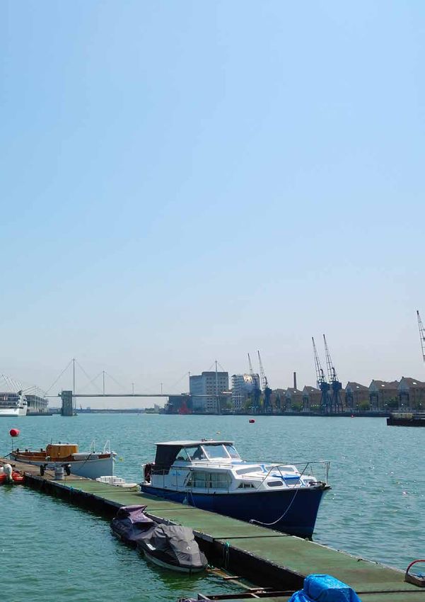
Wellbeing
As public health has risen up the urban agenda, waterways are increasingly
seen as assets for wellbeing. A handful of academic studies have found positive
correlations between time spent near water and an individual’s health,7 but more
work is needed to prove the link.

• A study from Hong Kong found that older people who had a view of harbours
  or coastlines, or regularly visited these areas, reported better health8

• An England-wide study found that living within 1km of the coast reduced
  likelihood of poor mental health among low-income residents9

• A study of users in a new park along Barcelona’s Besòs river suggested
  visitors’ increased physical activity could save €23m of public health spending
  per year10

The Canal & River Trust, having rebranded as a ‘waterways for wellbeing’
organisation and commissioned its own research into waterways and health,
is especially keen to promote the wellbeing aspects of its network. The Canal
& River Trust’s London network coincides with many of the city’s most deprived
neighbourhoods who could benefit from waterways if access to and awareness
of these spaces is improved.

Transport
For the Thames, freight remains an important part of the river economy, shifting
more than five million tonnes of cargo each year11 – with potential for more,
especially for construction materials, waste and consumer goods.

Public transport services, which operate between Putney and Woolwich, carry
around 10m passengers per year, on par with journeys through TfL’s Cycle Hire
scheme.12 New routes fill up fast, indicating strong demand for river travel.

Meanwhile, many of London’s cycling commuters have taken to towpaths as an
alternative to congested, unsafe or indirect roads.

                                                                                       Left: Thames Clippers is licenced
CHANGING VALUES                                                                        under TfL River Services to
                                                                                       provide passenger transport
Alongside changing uses and perceptions come changes to how water is valued.           between Putney and Woolwich.
Calculating impact on property prices is one way of understanding the value            Other licenced operators run
of water, but there’s strong appetite for new approaches that factor in broader        tourist and entertainment routes
social, economic, environmental and wellbeing outcomes – the problem is lack of        along the Thames. Right: an
guidance (see next chapter).                                                           entertainment boat and other
                                                                                       vessels docked in the Thames.
For example, what are the indirect impacts of improvements? What is the
‘proximity value’ for people who appreciate nearby waterways, even if they aren’t
regular visitors? What is the value of community amenities and businesses on/
near water? What role can qualitative data play in strategies and funding bids?
And how can valuation approaches account for different types of waterways or
characteristics (e.g. river vs dock; quiet section of canal vs busy canalside area)?

6     Making the Most of London’s Waterways
SHARING SPACE
London’s waterways support an incredible amount of activity, which will intensify
in coming years. While uses can coexist, tensions do occur. For example:
• Boaters, cyclists, joggers, amblers, anglers and other users vying for limited
waterfront space
• Safety and activation interventions, such as busy waterfront spaces and
towpath lighting, conflicting with ‘tranquil’ parts of waterways and the need
to offer darkness along wildlife corridors
• Disused wharves – which could provide much-needed space for moorings,
boater facilities, or waterborne transport and freight – being earmarked for
non-water uses
• Active wharves or high-security buildings preventing consistent riverside
access/walkways; active wharves being perceived as incompatible with
residential or other uses
• Waterside development casting shadows over boaters’ solar panels and/or
wildlife corridors – or missing opportunities to add facilities for waterway
users or to improve biodiversity
Uses and activities need balance. Getting it right requires an understanding of
what is appropriate for an area; co-locating uses through innovative design; and
coordinated execution across site boundaries and local authority borders. As
ever, there are several challenges to achieving this (see next chapter).
GROWING PRESSURES
In addition to the increasing and diversifying use
of London’s waterways, two other major changes
are impacting London’s relationship with water.
Firstly, the GLA projects London’s population to
reach 10 million by 2030, which will put pressure
on the city’s water supply. Londoners already
use around 13% more water than the national
average;13 pipes leak 25% of their water before
it reaches consumers; and the city faces a ‘water
resource gap’ of more than 100 million litres per
day by 2020.14 Improvements to infrastructure
and behaviour change are critical.
Secondly, the climate crisis is bringing higher
risk of river and surface water flooding. For
most of London, the Thames Barrier offers flood
protection from the Thames, but neighbourhoods
in the marshy lowlands beyond the barrier and
along the Thames’ tributaries need alternative
protection, as do those at risk of surface water
flooding throughout the city.
Both issues need urgent attention, but are
touched on only briefly in this report as they are
not part of its core remit. For more information,
refer to Future of London’s Managing London’s
Exposure to Climate Change report.
The Angel Canal Festival brings people to
Regent’s Canal in the summer. Photo © Canal &
River Trust.
Making the Most of London’s Waterways 7CHALLENGES
During this research, practitioners across London revealed barriers preventing
effective approaches to delivering successful development and activity around
water. Broadly, these comprise strategic, London-wide issues like working across
boroughs and with multiple stakeholders; technical complexities of working on or
near water; and funding arrangements.
STRATEGIC STRUGGLES
Organisations
Research and event participants often lamented the difficulty of knowing which
organisations to engage on matters relating to waterways – let alone finding the
right department or person.
For practitioners and the general public, ownership and management
responsibility of waterways is unclear. The organisations responsible for a
riverbed, infrastructure such as wharves or locks, moorings and marinas, and
adjacent footpaths might all be different. Some are easier to engage than others.
The consequences are that effective strategies may take a long time to develop
(if at all); that they don’t link up; or that waterways, especially those acting as
borders, are ignored altogether.
The Environment Agency, Canal & River Trust, and Port of London Authority
are recurring owners, but others come into play throughout the city. Within
organisations like boroughs, the GLA, and TfL, responsibility for waterways-
related issues could fall under planning, environment, transport, regeneration, or
a combination of these – if it’s assigned at all.
The Inland Waterways Association maintains a list of canal and river owners and
the PLA maintains a helpful public map of its own assets (see Thames Vision,
p. 38) but there is no single comprehensive pan-London resource.
To start filling this knowledge gap, a list of key organisations is provided in
Appendix B (p. 44). A comprehensive list linked to an interactive map would be a
more effective, long-term resource.
Policy
At the pan-London level, waterways are addressed to various extents in
London Plan (2016), Mayor’s Transport Strategy (2018), Environment Strategy
(2018), All-London Green Grid (2012) and London Rivers Action Plan (2009)
(see Appendix A, p. 44). The GLA also convenes a multi-stakeholder Thames &
London Waterways Forum.
The policies and forum skew towards areas where the GLA has influence and
oversight, such as freight and passenger traffic, water quality, and flood risk,
with a focus on rivers – especially the Thames. Argent and the Canal &
River Trust manage multiple
It falls to local authorities to determine policies for housing, recreation, accessibility ownership of waterways
and individual development sites around waterways. Policies may fall under at King’s Cross through an
Local Plans, Supplementary Planning Documents (see Ravensbourne River, Umbrella Agreement and
p. 36; Old Oak, p. 19), Conservation Areas (see Camden, p. 20) and masterplans a Maintenance Agreement,
(see Meridian Water, p. 28) – but dedicated waterways strategies are uncommon. which specify aspects such
as access rights, operation
Organisations responsible for waterways such as the Canal & River Trust and Port and maintenance details,
of London Authority publish visions, strategies and plans focused specifically on and Argent’s Canal Fund
waterways within their remit, but the link between these and borough or Mayoral Contribution towards canal
policies isn’t always clear. improvements.
8 Making the Most of London’s WaterwaysWith such complexity, there’s a risk of misaligned policies and siloed working.
A cross-sector forum and/or strategy for London’s waterways could help (see
New York City, p. 17), as could tapping into or creating regional organisations like
the Lee Valley Regional Park Authority or Catchment Partnerships (see Thames
Estuary, p. 16; Ravensbourne River, p. 36).
At a local level, dedicated staff could coordinate waterways strategies. For
example, Oxford City Council employs a Waterways Coordinator. In London, LB
Tower Hamlets and LB Newham, which share the River Lea as a border, jointly
employ a manager to oversee funding and regeneration of the river.
TECHNICAL DIFFICULTIES
Environment
In any waterways system, pollution is easy to spread, hard to remove, and
Plumbing misconnections occur devastating for the environment. From plumbing misconnections to oil spills to
when a property’s sewage is road runoff, pollution regularly makes its way into London’s water bodies. Only
connected to a surface water one of London’s water bodies is classed as ‘good’ quality under the EU’s Water
drain instead of a foul water Framework Directive.16
drain.
Cleaning requires patience and a coordinated network-wide approach. For
Thames Water estimates that
example, Copenhagen’s city-wide strategy to make its formerly polluted harbour
10% of households within
swimmable took around 15 years to complete (see also Meridian Water, p. 28).
its coverage (both new and
existing) are misconnected. Adaptations to manage surface water and river flooding are increasingly
Property owners are responsible important in a time of climate crisis. Those involved in new development need
for addressing misconnections to understand the flow of water during a flood and design the built environment
but enforcement is inadequate.15 to retain and discharge water appropriately. Better use of sustainable urban
drainage systems would help. Glasgow’s Smart Canal offers inspiration for
another approach: using technology to monitor flood risk and unlock canalside
land for development17 (see also Ravensbourne River, p. 36; Meridian Water, p.
28; Bristol, p. 26).
Access and awareness
Severance, disconnection and accessibility
Like roads and railways, waterways can both link and sever neighbourhoods.
Tackling severance through measures like bridges and new footpaths requires
funding and a joined-up approach (see Royal Docks, p. 31; Paddington, p. 33).
When it comes to transport, river passenger services are somewhat disconnected
from TfL’s network. They are on a separate fare structure (see Royal Wharf Pier, p.
37) and suffer from unclear or far interchanges with other modes. Piers managed
by TfL tend to have consistent branding, but others – even where they form part
of the TfL River Services passenger network – may not. TfL recognises room for
improvement, having published a Passenger Pier Strategy to address such issues
(see Appendix A, p. 44).
Inconsistent look and feel of
passenger piers. Right: Tower
Millennium Pier © N Chadwick
(CC-BY-SA 2.0/geograph.org.uk).
Left: Putney Pier © coconinoco
(CC-BY-NC 2.0/flickr).
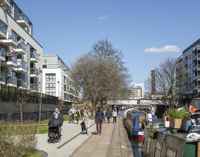
Making the Most of London’s Waterways 9Access to and across waterways is improving in London as waterside development
creates new links and improves paths, but there is some way to go. Parts of the LB Tower Hamlets’ Water
Thames path are blocked; neighbourhoods adjacent to water lack access routes; Spaces Study18 offers one
narrow or cobbled towpaths are inaccessible for some users, with limited space example of addressing
for expansion; wayfinding is lacking in some areas; and multiple ownership adds severance. It found that the
complexity. borough’s water bodies (the
Lea and Thames, canals, docks,
For conflicts among towpath users, it falls to behaviour change campaigns and basins) were often located
to encourage users to share space (see Paddington, p. 33). The Canal & River in areas otherwise lacking
Trust offers a planning and design toolkit for its network (see Appendix A); other parks or green space; with
waterways could benefit from something similar. better accessibility, waterways
could provide valuable open
Of course, context matters. Access isn’t necessary or desirable across the board. space for local people. The
Retaining tranquil areas is important to safeguard biodiversity and the character study’s recommendations
of waterways (see Old Oak, p. 19; Camden, p. 20). for improvements are being
Finally, the complex and ambiguous ownership mentioned above is particularly incorporated in the borough’s
impactful along rivers, where right of public access for on-water recreation isn’t forthcoming Local Plan.
written into law in England and Wales, meaning disputes can arise between
landowners and recreational users.
Top left: the 'Share the space, drop your pace' campaign reminds towpath users to be courteous, © Canal & River
Trust. Top right: private moorings block public towpath access.
Bottom: bridges provide important links across waterways, but need to avoid dark undercrofts with poor sightlines
(left) in favour of well-lit, well-maintained tunnels with unobstructed sightlines (right). Photos © Canal & River Trust.
10 Making the Most of London’s WaterwaysGeneral awareness
For all the increasing use of London’s waterways, research participants reported
many Londoners still aren’t aware of these valuable assets – even when they
live nearby. The consequence is people missing out on wellbeing benefits and
connections to place and local history.
In addition to improving physical accessibility, initiatives such as outreach
programmes, community-led river restorations, the National Park City project, and
highlighting local heritage aspects of waterways could help (see Thamesmead,
p. 25; Meridian Water, p. 28; Cody Dock, p. 30).
Safety
Although safety around water has improved, crime does remain a problem.
Standard ‘secure by design’ interventions for traditional streets – things like
lighting, bushes in front of windows and restricted access – can’t be applied to
some waterside spaces because they will impede wildlife or boater access.
A 2017 survey involving 400 boaters found that around 25% had been victim of
an attempted or actual break-in.19 The police log reported incidents, but public
maps only give approximate locations of crimes by road, not towpaths.
The Canal & River Trust maintains its own database of incidents and works
with police to identify crime hotspots. Live-aboard boaters and their neighbours
have also taken steps such as keeping a community database of towpath
incidents and organising Canal Watch London, which arranges regular nighttime
towpath walks to deter anti-social behaviour. New development or small-scale
placemaking projects can also improve feelings of safety (see Brentford, p. 21;
Harrow Road, p. 34; Ravensbourne, p. 36).
Lack of facilities
London’s exploding continuous cruiser numbers haven’t been matched by an
increase in amenities like waste disposal and water supply points. Despite the fact
that many are London residents, cruisers’ mobile nature and lack of permanent
address means they’re not residents of any given borough and lack access to
Left: as part of its Bream Street many council tax-funded services. However, under the Housing & Planning Act
Wharf development along the 2016, local authorities are required to undertake a housing needs assessment for
Lea, L&Q is providing a rebuilt boaters in their areas.
bin store for a nearby boat
servicing point. Right: growth In 2019, the Canal & River Trust published a Mooring Strategy for London,
in boating creates demand identifying opportunities to add amenities alongside waterside development (see
for repair and supply shops, Appendix A, p. 44). Engaging with the Canal & River Trust, live-aboard boaters
boosting local economies. Photo (see Brentford, p. 21) or representative organisations like the National Bargee
of Eel Pie boatyard © Robin Travellers Association or London Boaters would also help identify issues and
Jaffray (CC-BY-NC-ND 2.0/flickr). opportunities.
Making the Most of London’s Waterways 11FINANCIAL CHALLENGES
Value of waterways
Development in the last few decades has often treated water as a decorative average wellbeing benefit of
asset, its value associated with the opportunity to increase sale prices. Today, visiting a waterway 22
practitioners know water creates value beyond this, but guidance to prove it is
limited.
Waterways and property values
Academic research has attempted to quantify the effect of waterways on property
values. One literature review found a 2% to 5% value uplift near waterways per year
in Europe,20 while another UK-specific study suggested London’s canalside willingness to pay to improve
price premium is 2.8% and generally only applies within 100m of the water.21 recreation and navigation assets
Anecdotally, some developers reported being advised to add a 10% premium on the Thames to best condition
onto asking prices for residential units with water views. (actual maintenance cost £3.4m pa) 23
Organisations with a remit over waterways have also carried out research beyond
property values (see sidebar), but more work is needed to corroborate findings.
Valuation guidance
Treasury guidance for valuation and other national standards don’t always
account for local context or ambitions. For example, Housing Infrastructure
per year
Fund bids are appraised based on land value uplift. In one major regeneration value of sports and recreation
scheme, the bidders knew naturalising waterways would bring wider benefits associated with the Thames 24
for wellbeing, biodiversity, and climate change adaptation, but because central
government doesn’t factor these things into assessments they were left out of
the bid.
Natural Capital Accounting (or the ‘ecosystem services approach’) has been used
to value aspects like biodiversity, oxygen production, and health benefits and
has been applied to major UK waterways. An Arup study using this approach on
gva
Liverpool’s Mersey found the river’s value to be £348m to £400m per year across jobs
the city-region.26 Greater Manchester’s study of the Irwell indicated a value of
created by the Thames
£418m per year – including £157m per year in ‘avoided costs’ associated with for London 25
poor mental and physical health.27
Funding
Without better understanding of the value and wider benefits of water, there’s
a risk that waterways won’t receive suitable funding, especially for the ongoing
management and maintenance necessary to ensure waterways are seen as
per year
assets rather than liabilities. River Irwell’s value of avoided
costs associated with poor mental
Landowner service charges, mooring fees, Section 106 contributions, corporate and physical health 27
sponsorship and volunteer programmes can help, but come with limitations and
are insufficient on their own. Overloaded service charges and mooring fees will
get pushback or put off buyers/occupiers. Section 106 money isn’t always used
and tends to be earmarked for interventions seen as higher priority like schools,
public realm works, or community centres.
Existing policy is inadequate to help fill the gap. For example, projects like floating
homes and lidos, which could raise income, aren’t covered by planning guidance.
Short-term initiatives or pilot projects – with before and after monitoring to
measure impact – can help make the case for policy change or permanent
interventions (see Harrow Road, p. 34).
12 Making the Most of London’s WaterwaysTHE TRUE VALUE OF LONDON’S WATERWAYS
Contributed by Martyn Saunders
Director – Planning, Development & Regeneration, Avison Young
London’s waterways have traditionally been key arteries for trade, recreation
and enjoyment. Since the 1999 Urban Task Force they have been a focus for
development with high-end waterfront homes revitalising many forgotten
backwaters into exclusive places to live. Despite this renaissance, major questions
remain about whether the true value of London’s waterways is being realised.
At the base level, water is certainly valuable in development terms, with residential
values achieving up to a 30% premium, although this impact is highly sensitive to
location both between and within developments, where even one block back the
value benefit is significantly diminished or erased.
Value is less easy to understand in commercial property schemes but the likes
of More London, Paddington and Canary Wharf utilise water to create new
destinations and attract occupiers, often setting new headline rental levels.
Interestingly, the ‘quality’ of the water is a key factor in the value impact, with a
15% rise in value achievable if the water itself is ‘improved’ – meaning existing
property owners benefit if we clear up our rivers. Canals often have a lower impact
than ‘naturalised’ watercourses, suggesting we only really value the aesthetics of
our waterways.
This value is certainly needed if we are to successfully develop by water, as
projects are complex and therefore expensive. Upfront capital costs are high,
reflecting a need for major structural work as well as significant ‘risk’ in terms
of often difficult negotiations with those that manage the water – both of which
have to be borne before value can be realised.
Beyond these upfront costs, those delivering, managing and occupying waterside
developments face a series of ongoing maintenance and stewardship costs linked
to the presence of water – from cleaning and clearing through to maintenance
of flood protection. At present, the usual way to cover these costs is through an
(often high) service charge – which clearly creates issues for those seeking to
occupy space.
Sometimes, therefore, it can feel like the extra value may not be worth it, is lost
in the extra cost and time it takes to deliver, or the price we pay to inhabit these
spaces. But what if rather than thinking solely about financial value we factor in
the economic, community and health and well-being benefits proximity to water
is known to create?
If we turn our thinking from the view of water to the use of water, we could create
a different sense of value that could create different ways of addressing the cost
issue and ensuring value accrues to a wider group of stakeholders.
Across London, innovative thinking is being done around the economic proposition
to turn the conversation from liability to opportunity. The commercialisation of
moorings and activity is a key theme, creating rent opportunities. In the Royal
Docks the creation of ‘water leases’ shares the cost across all users to reflect
the wider value the waterside location can create. However, they still create a
financial burden to an ‘individual’ which inevitably comes under pressure when
there are other asks of development.
In the future we need to go further, encouraging greater community and leisure use
in our waterfront developments with wider community and well-being benefits.
This can translate into wider senses of value creation that can be captured and
used as a case for investment by a wider group of stakeholders.
This broadens the investment opportunity beyond traditional ‘development’
sources. From decarbonisation funds through to public health investments, the
demonstrable benefits of enhancing access to and use of London’s waterways
can provide a focal point for this cocktail of funding to be brought to bear to
support improvements to the water itself.
Making the Most of London’s Waterways 13SOLUTIONS
Examples from London and other cities illustrate solutions to many of the challenges
identified in the previous chapter. Case studies in this section are grouped by their
major theme – strategy and policy; design and access; engagement; activation;
environment; and transport – but all case studies address several themes and
challenges, especially around development and managing tensions arising from
different uses. The index below outlines themes and spatial scales of each case
study.
THEME SCALE TYPE
Strategy & policy
Design & access
On-water uses
Partnerships
Engagement
Environment
Activation
Transport
City-wide
Regional
Borough
Canal
Other
Local
River
Dock
Thames Estuary (p. 16)
New York City (p. 17)
Old Oak & Park Royal (p. 19)
Camden (p. 20)
Brentford (p. 21)
City Road Basin (p. 23)
Thamesmead (p. 25)
Bristol (p. 26)
Meridian Water (p.2 8)
Cody Dock (p. 30)
Royal Docks (p. 31)
Paddington Basin (p. 33)
Harrow Road (p. 34)
Walthamstow Wetlands (p. 35)
Ravensbourne River (p. 36)
Royal Wharf Pier (p. 37)
Thames Vision (p. 38)
Making the Most of London’s Waterways 15STRATEGY AND POLICY
Strategies to guide activities and development on waterways exist across all
scales. The Thames Estuary Growth Commission offers an example of regional
working with reach into central government. New York City shows how a major
multi-borough urban area can execute a cross-stakeholder, city-wide waterways
strategy.
At the cross-borough scale, Old Oak & Park Royal Development Corporation and
Canal & River Trust’s canal placemaking strategy offers inspiration. LB Camden’s
use of conservation area status for Regent’s canal is also replicable at the
borough level, and a waterways strategy for Brentford town centre shows how
to guide local development.
Thames Estuary Growth Commission Thames Barrier © Phil Dolby
(CC-BY 2.0/flickr)
Many organisations have different managerial roles on the Thames, including
the PLA, Environment Agency, Crown Estate, and Natural England. Fragmented
governance has led to difficulties addressing ecology, water and air quality, and
flood defence, as well as understanding the value of the landscape.
In 2016, central government convened the Thames Estuary Growth Commission
to develop a vision and delivery plan for the estuary from North Kent and South
Essex into London. The Commission appointed Arup to produce the vision.
Arup assessed and proposed infrastructure and development, and, along with the
Commission, identified potential for growth across the corridor. Arup’s stakeholder
engagement also included a public call for ideas, thematic workshops and study
tours with local authorities and local enterprise partnerships in the study area.
The resulting vision recommends three priority projects to the Commission:
• Great Thames Park: a new national park with a dedicated park authority to
improve access to and value of the landscape
• Thames East Line: a multi-modal, multi-functional bridge/flood barrier which
would also provide a crossing between Essex and Kent
• Celebrate the Thames: a programme of cultural events along the Thames to
promote the heritage of the area
The vision also suggests joint spatial plans for Kent and Essex and development
corporations to drive growth in key opportunity areas.
Central government via MHCLG has offered support, hiring a dedicated Estuary
Envoy to forge partnerships across the region and chair the new Thames Estuary
Growth Board, which will receive £1m towards economic growth plans.
16 Making the Most of London’s WaterwaysHunters Point, Queens, NY. New York City28
Image used with permission of
the New York City Department of Regulation: the Waterfront Revitalization Program
City Planning. All rights reserved.
Located where the Atlantic Ocean meets the Hudson River, New York is a city of
islands surrounded by 837km of coastline – roughly the same length as the entire
county of Devon.29
Since 1982, New York City has had a local Waterfront Revitalization Program
which sets broad policies for balancing waterfront economic development,
natural resources protection and public access. The Program aligns with state
and federal coastal management tools, ensuring a coordinated approach across
jurisdictions. Proposed discretionary projects along the city’s coastline are
evaluated through the Program’s 10 policy areas before they can be approved.
The Program is a regulatory tool which helps shape and improve coastal projects
by requiring that they reflect and are consistent with the city’s long-term policies
for waterfront planning, preservation and development.
Strategy: the Comprehensive Waterfront Plan
The city also has a Comprehensive Waterfront Plan, mandated through the city
charter since the 2000s and delivered by the NYC Department of City Planning
(DCP). It sits alongside the Waterfront Revitalization Program as a strategic
document which guides improvements along the city’s shore and within its water
bodies.
The first Comprehensive Waterfront Plan, published in 1992, emerged as New
York rediscovered its waterways; like London, development had historically
turned its back to the water. The plan introduced waterfront zoning to guide
development and recreate links to the water (e.g. requiring wide waterside
esplanades with certain development types).
The 2011 update evolved to encourage people ‘into’ and ‘onto’ the water,
promoting water-based transport, recreation and biodiversity in addition to
waterside parks, housing, economic development, and climate change resilience.
In addition to citywide planning and policy, the plan also made recommendations
for more targeted improvements along more than 20 distinct stretches of the
city’s waterfront.
As New York’s waterways are being reintegrated into the city fabric, a challenge
for the new edition of the Comprehensive Waterfront Plan, currently being
prepared, is to balance the wide range of interests and activities.
For example, NYC is the country’s largest east coast port; amid growing demand
for development and recreational uses near water, freight links need to be
maintained. The NYC Economic Development Corporation (EDC) – a quasi-
governmental organisation which manages the city’s maritime infrastructure and
Making the Most of London’s Waterways 17port operations – works closely with DCP on the comprehensive waterfront plan
and helps bolster the role of the maritime industry in the city’s economy.
Another major challenge is to address the equity of public access to the waterfront:
areas with investment in waterside parks and rapid growth have good access,
but neighbourhoods with slower growth and lower investment often don’t,
leaving many residents disconnected from the water. Climate change resilience
and updated flood plain zoning will also feature in the upcoming plan.
Delivery and funding
To help develop the plan, the city charter mandates a waterfront management
advisory board comprising 18 cross-sector representatives (e.g. council members,
officers from each of the five boroughs, real estate professionals, environmental
specialists). The board meets quarterly. DCP also engages other stakeholders like
not for profits, community groups, local people and development corporations to
shape the plan’s priorities and recommendations.
The 2011 Comprehensive Waterfront Plan was supported by a four-year capital
programme setting short- and long-term funding commitments. Funding sources
are diverse and vary across individual projects; past sources have included city
bonded capital, public-private partnerships, state or federal grants, and private
grants.
Kayaking on the Hudson
River. Photo © Dan Nguyen (CC-
BY-NC 2.0/flickr).
Baretto Point Park Fish
Parade 2019, Bronx, NY. Image
used with permission of the New
York City Department of City
Planning. All rights reserved.
18 Making the Most of London’s WaterwaysThe Grand Union Canal through Old Oak & Park Royal
Old Oak & Park Royal. Photos in
this case study © OPDC. This major west London Opportunity Area anticipates 65,000 jobs and 25,000
homes linked to High Speed 2, and the Old Oak & Park Royal Development
Corporation (OPDC) is creating strategies to guide development.
The Grand Union Canal cuts through the site. Recognising the importance of the
canal to local people and opportunities to integrate the canal into regeneration,
the OPDC received GLA funding for a Canal Placemaking Study. The study,
developed in partnership with the Canal & River Trust, sets out the OPDC’s vision
for the canal; it will inform a supplementary planning document for the area and
guide future projects.
Consultation & engagement
In early 2019, the OPDC carried out several canal-specific consultation events to
inform the study, inviting boaters, cyclists, joggers, residents, workers and more
to participate. The engagement programme involved:
• A narrowboat mooring at five sites to act as a community hub
• Brief towpath tours to encourage participants to reflect on what they like
about the canal, what needs to change, and what should happen in each area
• A large area map for participants to annotate in response to the above
• Interviews
People spoke fondly of the canal and appreciated its quiet, wild and industrial
character – but they lamented problems like litter, pollution, feeling unsafe,
and unconscientious cycling which would benefit from behaviour change.
Consultation outcomes were incorporated into the Study’s strategic aims and
published online.30
Balancing act
The strategy is structured across three themes which align with the area’s Local
Plan: civic and leisure; transport and movement; and ecology and heritage. The
OPDC had to strike a balance between different needs such as stimulating
activity while retaining calm areas; improving ecology while allowing space for
canal transport in the future; and maintaining a cycling link while encouraging a
broader range of users.
Furthermore, the Grand Union Canal’s journey through Old Oak & Park Royal
passes an extensive strategic industrial estate and brownfield land scheduled for
mixed use – two distinct areas with different challenges and opportunities.
Making the Most of London’s Waterways 19In industrial areas, there’s little space for big interventions. Instead, the OPDC will support smaller, tactical improvements. For example, landowners will be encouraged to create access routes, canalside space for employees to use during breaks, and small ecological corridors in spaces between sheds and the canal, potentially funded by a micro-grants scheme. The study proposes a multi-stakeholder Towpath Charter, which among other things would encourage business owners to supply and empty bins on the towpath. Long-term moorings could be also be installed, giving the quieter industrial areas more passive surveillance. In brownfield areas, it’s expected that the canal will be woven into the public realm, with activity areas clustered around bridges and other locations where the canal intersects with pedestrian or road networks. Bringing more activity to the canal will require initiatives to safeguard quieter areas, such as design techniques for reducing cycling speeds and preventing towpath overcrowding. Camden The Regent’s Canal Conservation Area In LB Camden, Regent’s Canal is covered by a single Conservation Area designation, linking the busy areas of Camden Town and King’s Cross by a quiet canal corridor. Having a single Conservation Area for the canal simplifies engagement with developers and assessment of proposed canalside schemes. Instead of focusing on physical details – things like materials, building heights, and architectural styles – the Conservation Area’s wording focuses on the experience of being near the canal to establish a sense of place.31 These values have been incorporated in recent projects at both ends of the canal. King’s Cross At King’s Cross, a two-teir canalside path between Granary Square and Gasholder Park (two major public spaces at the south and northwest of the site) ensures appropriate amounts of visitors along the waterfront. The towpath connecting the two public spaces is narrow; an alternative, wider path one storey up retains views of the canals and offers access to retail and commercial areas. The canal corridor The towpath linking King’s Cross and Camden Town is relatively narrow and calm, and LB Camden encourages development along the canal corridor to follow suit. For example, at the Urbanest student housing and incubator space on Camley Street, the development team initially wanted two courtyards opening directly 20 Making the Most of London’s Waterways
onto the towpath. Consultations with LB Camden, the GLA, and local residents
revealed a preference to retain the tranquillity of the towpath. The final scheme,
completed in 2014, has the courtyards but uses small gates to carefully restrict
access. The incubator space’s gate is closed to anyone without a fob and the
public gate is closed outside daylight hours.
Camden Lock
Anticipating growing numbers of visitors in coming years, the landowner behind
Camden Lock, market, and other nearby sites has developed Hawley Wharf,
which faces the canal. The development team worked with LB Camden and the
Canal & River Trust to manage towpath footfall through design.
For example, the scheme’s market and retail areas face the canal, but they are
located a storey above the towpath with a separate entrance and walkway. This
limits direct canal access and reduces market litter along the towpath, a concern
identified by the Canal & River Trust, which is due to receive ongoing Section 106
contributions for canal cleaning for the best part of a decade after the market
Tranquil space along Regent’s opens. Ground floor public spaces are located towards the centre of the scheme
rather than the canalside, with limited views towards the canal to prevent crowds
Canal
from overwhelming the towpath.
Hawley Wharf. Photo ©
George Rex (CC-BY-NC-ND 2.0) The landowner has also been involved in a pilot scheme to recycle food waste by
barge, with 17.5 tonnes per week taken from Camden Market to Park Royal for
processing.32
Brentford Lock West. Photo ©
Canal & River Trust. Brentford
Waterspace Strategy
Located at the confluence of the Rivers Thames and Brent (which is partly
canalised), Brentford town centre is undergoing regeneration. One of its major
sites, Brentford Lock West, covers more than six hectares of ex-industrial
waterside land.
Waterside Places, a joint venture between the Canal & River Trust and Muse
Developments, is developing the site with 750 homes and commercial space.
Development is guided by a Waterspace Strategy, created in 2010 by Canal
& River Trust precursor British Waterways at the request of LB Hounslow. The
strategy included:33
• Engagement events with residents and other stakeholders
• A review of boater facilities, walking and cycling routes (e.g. quality of paths,
signage, towpath accessibility), heritage assets, local ecology, flood risk, and
potential for freight
Making the Most of London’s Waterways 21• Waterway character areas to help ‘inform and balance the range of compatible
uses both on and beside the water’
• Recommendations for development, such as places to add short-term
moorings; improve visual and physical links between the high street and
canal; add greening or wetlands; and improve towpath access
Overall, the strategy recognises the canal’s ability to create a sense of place for
living, recreation, or developing a business.
Towpath improvements
The site is susceptible to flooding and a high flood defence wall was a major
obstacle between the waterway and wider neighbourhood. The first two phases
of development addressed this by moving the defence wall to create a wider
towpath robust enough to cope with flood water.
Along with natural surveillance from new residents and businesses overlooking
the canal, as well as improved boater facilities, the generous towpath space
provides a better experience for boaters, pedestrians, cyclists and other visitors.
Connecting to amenities and local history
Historical curios line the canal. Some of Brentford’s warehouses were built to
‘overhang’ the canal and towpath, allowing boats to load/unload in a sheltered
space. Many are disused and/or in disrepair and cannot be refurbished without
significant cost and aesthetic change,34 but local industrial history is reflected in
buildings across the site, such as by using sawtooth and pitched roofs.
In the third and final phase of development, Waterside Places will also carefully
recreate the frame of the westernmost warehouse, providing a backdrop for a new
public square. The square will act as a landing point for a new pedestrian and cycle
bridge across the canal, improving links to Brentford Station and communities to
the north and east. Within the warehouse frame, a new community facility will
provide a home for a local canoe club, enhancing Brentford’s recreational offer.
Overhanging warehouses
along the towpath previously
obstructed sightlines. Top photo
© Loz Pycock (CC-BY-SA 2.0/
flickr); bottom photo © Canal &
River Trust.
In 2011/2012, asbestos
cement cladding was removed
from the warehouses, which
were partially re-clad with
marine plywood to ‘open up’ the
structures (top, photo © Canal
& River Trust). This has inspired
plans to recreate the frame in
Phase 3 (bottom, CGI © Muse
Developments).
22 Making the Most of London’s WaterwaysDESIGN AND ACCESS
Designing public realm, architecture and accessibility with sensitivity to the
characteristics and histories of waterways makes for memorable local spaces.
The previous case studies on Camden and Brentford illustrate this. In Islington,
City Road Basin’s architecture highlights techniques for how buildings can
interact with water. In Thamesmead, an estate built around an early sustainable
urban drainage system and canals which are often inaccessible, opening access
to waterways through regeneration and community outreach is helping people
reconnect with history and nature. Finally, new development along the River
Avon in Bristol shows how schemes can create new neighbourhood links as well
as solve design issues related to flood risk.
Islington Boat Club © Pollard
Thomas Edwards
In 1994, architects Pollard City Road Basin
Thomas Edwards (PTE) moved In the 1960s, British Waterways filled in the southern end of City Road Basin and
to Diespeker Wharf, a former put forward plans to build over the remainder of this majestic urban water-space.
timber mill enjoying one of Local resident and activist Crystal Hale led a successful local campaign to save
London’s best waterside the basin, and in 1970 she founded the Islington Boat Club, filling the waterway
locations, where the Regent’s instead with young people in kayaks.
Canal meets City Road Basin. In
this case study, Senior Partner The Greater London Council eventually rejected the infill, and in the 1980s LB
Andrew Beharrell reflects Islington constructed the Wharf Road estate along the basin – one of many
on some of their completed schemes to come.
developments in the area and
how they illustrate different Canals traditionally have a towpath side and an ‘off-side’ where warehouses and
approaches to building next to factories rise directly out of the water. In new developments, PTE tries to reinstate
water. this contrast, rather than aiming for public access on both sides. Containment by
buildings is part of the character of urban canals.
Crystal Wharf, built in 2003, rises directly out of the water, curving around the
site boundary. It is cantilevered over a weir so that water gushes beneath it. Its
commercial studios are set two feet below the water line; sitting on the windowsill
is like being in a boat. The building is north-facing, and instead of having
balconies PTE created large flats (15% bigger than London Plan standards) with
wide-frontage, fully-glazed living rooms enjoying one of the best water views in
London.
Angel Waterside, by contrast, is set back from the canal to create a new public
park in an area otherwise lacking public open space. By giving up almost half the
site area, PTE was able to negotiate a taller building to frame the park, with 80%
of the apartments having direct views of the water.
Making the Most of London’s Waterways 23You can also read