Month Year - Metropolitan ...
←
→
Page content transcription
If your browser does not render page correctly, please read the page content below
Month Year

The Council’s mission is to foster
                efficient and economic growth for
                a prosperous metropolitan region

Metropolitan Council Members
Charlie Zelle              Chair                        Raymond Zeran                           District 9
Judy Johnson               District 1                   Peter Lindstrom                         District 10
Reva Chamblis              District 2                   Susan Vento                             District 11
Christopher Ferguson       District 3                   Francisco J. Gonzalez                   District 12
Deb Barber                 District 4                   Chai Lee                                District 13
Molly Cummings             District 5                   Kris Fredson                            District 14
Lynnea Atlas-Ingebretson   District 6                   Phillip Sterner                         District 15
Robert Lilligren           District 7                   Wendy Wulff                             District 16
Abdirahman Muse            District 8

                              The Metropolitan Council is the regional planning organization
                              for the seven-county Twin Cities area. The Council operates the
                              regional bus and rail system, collects and treats wastewater,
                              coordinates regional water resources, plans and helps fund regional
                              parks, and administers federal funds that provide housing
                              opportunities for low- and moderate-income individuals and families.
                              The 17-member Council board is appointed by and serves at the
                              pleasure of the governor.

                              On request, this publication will be made available in alternative formats to people with
                              disabilities. Call Metropolitan Council information at 651-602-1140 or TTY 651-291-0904.
Table of Contents
PLANNING OVERVIEW ...........................................................................................................................2
    Regional Planning .............................................................................................................................2
    Local Planning ...................................................................................................................................2
REGIONAL PLANNING ............................................................................................................................3
  Regional Development Guide ...............................................................................................................3
  System and Policy Plans .......................................................................................................................4
LOCAL PLANNING ...................................................................................................................................5
  Local Comprehensive Plans..................................................................................................................5
  Local Plan Reviews ...............................................................................................................................5
  Technical Assistance.............................................................................................................................6
PLAN ELEMENTS ....................................................................................................................................7
  LAND USE ............................................................................................................................................8
    Land Use Plan ...................................................................................................................................8
      FORECASTS AND COMMUNITY DESIGNATION ................................................................................. 8
      EXISTING LAND USE ........................................................................................................................9
      FUTURE LAND USE ........................................................................................................................10
      DENSITY CALCULATIONS ..............................................................................................................12
      STAGED DEVELOPMENT AND REDEVELOPMENT ........................................................................... 14
      NATURAL RESOURCES ..................................................................................................................15
      SPECIAL RESOURCE PROTECTION ...............................................................................................16
  MISSISSIPPI RIVER CORRIDOR CRITICAL AREA (MRCCA) .......................................................... 18
    MRCCA Plan ...................................................................................................................................18
      DISTRICTS ....................................................................................................................................18
      PRIMARY CONSERVATION AREAS .................................................................................................19
      PUBLIC RIVER CORRIDOR VIEWS ..................................................................................................19
      RESTORATION PRIORITIES ...........................................................................................................20
      OPEN SPACE AND RECREATIONAL FACILITIES .............................................................................. 21
      TRANSPORTATION AND PUBLIC UTILITIES ....................................................................................21
      SURFACE WATER USES/ BARGE FLEETING ...................................................................................22
      WATER-ORIENTED USES ...............................................................................................................22
  TRANSPORTATION ...........................................................................................................................24
    Transportation Plan .........................................................................................................................24
      TRANSPORTATION ANALYSIS ZONES ............................................................................................24
      ROADWAYS ...................................................................................................................................25
      TRANSIT ........................................................................................................................................27
      BICYCLING AND WALKING .............................................................................................................30
      AVIATION ......................................................................................................................................32
      FREIGHT .......................................................................................................................................33
      HEALTHY ENVIRONMENT ..............................................................................................................35
WATER RESOURCES ...........................................................................................................................36
  Wasterwater                 Surface Water                                             Water Supply........................................ 36
WASTEWATER ......................................................................................................................................37
    Wastewater Plan .............................................................................................................................37
      AREAS SERVED BY THE REGIONAL SYSTEM .................................................................................37
      AREAS SERVED BY LOCAL WASTEWATER TREATMENT SYSTEMS ................................................. 40
      COMMUNITY AND SUBSURFACE TREATMENT SYSTEMS ................................................................ 41
SURFACE WATER .................................................................................................................................43
    Local Water Management Plan .......................................................................................................43

Page - 1 | METROPOLITAN COUNCIL                                                                                     LOCAL PLANNING HANDBOOK
Print Date: 2/1/2021                                                                                                           Table of Contents
EXECUTIVE SUMMARY, WATER RESOURCE MANAGEMENT RELATED AGREEMENTS, AND
      AMENDMENT PROCESS .................................................................................................................43
      PHYSICAL ENVIRONMENT AND LAND USE .....................................................................................44
      EXISTING AND POTENTIAL WATER RESOURCE-RELATED PROBLEMS ........................................... 45
      LOCAL IMPLEMENTATION PLAN/PROGRAM....................................................................................46
WATER SUPPLY ....................................................................................................................................48
    Water Supply Plan ...........................................................................................................................48
      LOCAL WATER SUPPLY PLAN FOR MUNICIPAL PUBLIC WATER SUPPLIERS ................................... 48
      FOR COMMUNITIES WITHOUT MUNICIPAL PUBLIC WATER SUPPLIES ............................................ 50
      FOR COMMUNITIES WITH PUBLIC WATER SUPPLY SYSTEMS OWNED BY ANOTHER ENTITY .......... 51
      WATER CONSERVATION & REUSE .................................................................................................52
      ASSESSING & PROTECTING SOURCE WATER ................................................................................ 52
      SUB-REGIONAL COLLABORATION..................................................................................................54
PARKS AND TRAILS..............................................................................................................................56
    Parks & Trails Plan ..........................................................................................................................56
      REGIONAL PARKS AND TRAILS ......................................................................................................56
      LOCAL PARKS AND TRAILS ............................................................................................................57
HOUSING ...............................................................................................................................................59
    Housing Plan ...................................................................................................................................59
      EXISTING HOUSING NEEDS ...........................................................................................................59
      PROJECTED HOUSING NEED .........................................................................................................60
      IMPLEMENTATION PLAN ................................................................................................................62
RESILIENCE ..........................................................................................................................................64
    Resilience Plan ................................................................................................................................64
      INFRASTRUCTURE & ENVIRONMENT .............................................................................................64
      ENERGY INFRASTRUCTURE AND RESOURCES .............................................................................. 66
      HEALTHY COMMUNITIES ...............................................................................................................68
      ECONOMY & SOCIETY ...................................................................................................................69
ECONOMIC COMPETITIVENESS .........................................................................................................72
    Economic Competitiveness Plan .....................................................................................................72
      KEY INDUSTRIES/CENTERS OF EMPLOYMENT ............................................................................... 72
      REDEVELOPMENT .........................................................................................................................73
      EDUCATION AND WORKFORCE .....................................................................................................74
      BUSINESS DEVELOPMENT ............................................................................................................75
      ECONOMIC INFORMATION, MONITORING, AND STRATEGIC INITIATIVES ........................................ 75
IMPLEMENTATION ................................................................................................................................77
    Implementation Plan ........................................................................................................................77
      IMPLEMENTATION PLAN ................................................................................................................77
COMMUNITY PAGES ............................................................................................................................79
REVIEW PROCESS ...............................................................................................................................80
  Comprehensive Plan Updates.............................................................................................................80
  Comprehensive Plan Amendments .....................................................................................................80
COMPREHENSIVE PLAN UPDATES ....................................................................................................81
      BEFORE SUBMITTAL TO THE METROPOLITAN COUNCIL ................................................................ 81
      HOW TO SUBMIT YOUR COMPREHENSIVE PLAN TO THE METROPOLITAN COUNCIL ...................... 82
      REVIEW BY THE METROPOLITAN COUNCIL ...................................................................................83
      REQUEST AN EXTENSION TO THE 2018 DEADLINE ........................................................................ 83
      PLAN ADOPTION ...........................................................................................................................84
      AMENDING YOUR PLAN .................................................................................................................84
COMPREHENSIVE PLAN AMENDMENTS ...........................................................................................86
      WHEN TO AMEND YOUR PLAN .......................................................................................................86

Page - 2 | METROPOLITAN COUNCIL                                                                                      LOCAL PLANNING HANDBOOK
Print Date: 2/1/2021                                                                                                            Table of Contents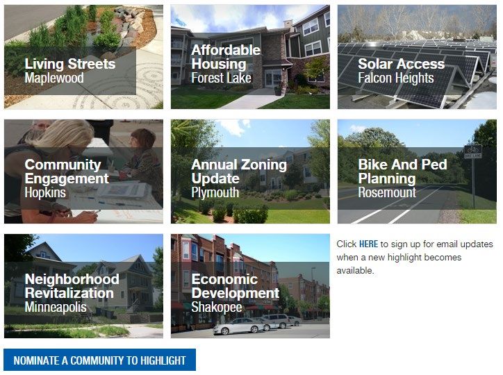
WHAT TO DO BEFORE AMENDING YOUR PLAN .............................................................................. 86
     CONTENT REQUIREMENTS FOR AN AMENDMENT .......................................................................... 87
     REVIEW TIMELINES .......................................................................................................................87
     HOW TO SUBMIT THE AMENDMENT ...............................................................................................89
     ADMINISTRATIVE REVIEW OF CERTAIN PLAN AMENDMENTS ......................................................... 90
     LOCAL WATER MANAGEMENT AND LOCAL WATER SUPPLY PLAN AMENDMENTS .......................... 90
LOCAL PLANNING HIGHLIGHTS ..........................................................................................................92
RESOURCES .........................................................................................................................................93
CONTACT US ........................................................................................................................................94

NOTE: This is a paper version of a web-based document. For the most accurate and up-to-date information,
please go online at http://www.metrocouncil.org/Handbook to access the most up to date resources, tools, and
links. The hard copy will be updated as necessary and reposted online with an updated print date.

Page - 3 | METROPOLITAN COUNCIL                                                                                   LOCAL PLANNING HANDBOOK
Print Date: 2/1/2021                                                                                                         Table of Contents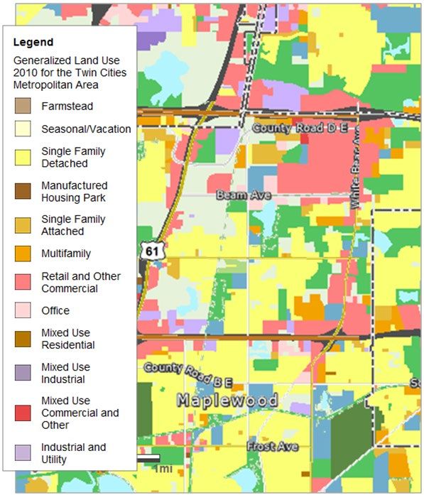
Welcome to the Local Planning Handbook! The purpose of the Handbook is to help communities
update their local comprehensive plans. The Handbook:

   •   Provides clear and specific direction on what the minimum requirements are and how to meet
       them.
   •   Provides tools, maps, and resources to make it easier to complete minimum requirements.
   •   Individualizes community information as much as possible.
   •   Connects communities with available resources, grants, and technical assistance.
   •   Helps communities understand the Council review process.
   •   Provides resources for value-added planning/planning beyond the minimum requirements.
   •   Highlights local planning efforts across the region.

Some of the new tools that you will find in the Local Planning Handbook include:
Community Pages – Each community has their own webpage full of checklists, maps, and resources
specific to them.

Individual Checklist of Minimum Requirements – Every community is unique. Each community has
different planning needs and requirements. Your checklist is specific to your community.

Interactive Mapping Tools and Individual Maps – Using the interactive mapping tool, you can
customize maps for your planning efforts or download existing maps of your community to use in your
plan. If you have GIS capabilities, shapefiles clipped to your community boundary are available for you
to download.

Affected Jurisdictions List – Trails, roadways, and other infrastructure often extend across municipal
boundaries. We’ve created a suggested list of affected jurisdictions for your community to help ensure
your plan is compatible with planning efforts in other jurisdictions.

Online Submittal – You can now submit your comprehensive plan update online! This includes
submitting your plan for informal review, sending in supplemental information, and requesting plan
amendments after your plan has been formally adopted.

Status Tracker - Check the status of your submitted plan update. Track your progress through the
Council’s review process and see what’s coming up next.

Page - 1 | METROPOLITAN COUNCIL                                                 LOCAL PLANNING HANDBOOK
Print Date: 2/1/2021                                                     Welcome to the Local Planning Handbook
PLANNING OVERVIEW
Planning in the Twin Cities Metropolitan Area is unique. This is in large part due to the adoption of
the Metropolitan Land Planning Act (§473) and the subsequent formation of the Metropolitan Council.
The Council is tasked with ensuring the orderly and economic development within the seven-county
metropolitan area. In addition, we have operational responsibilities related to our regional systems. The
statutorily-defined roles in regional policy and planning, as well as operational functions for regional
systems are unlike any other regional planning agency in the nation.
Regional Planning
Following each decennial census, the regional planning effort
starts with adoption of a regional development plan, Thrive MSP
2040. Thrive establishes a regional vision and adopts land use
development policies through 2040. The regional system and
policy plans follow and are adopted with policies that reflect
Thrive. The Council has a System Plan for Parks, Water
Resources, and Transportation. Policy plans are adopted for
Housing and Water Supply.
The Council is also responsible for reviewing local comprehensive plans and providing technical
assistance to communities as they work through their local comprehensive planning process.

Local Planning
The plans of each jurisdiction in the seven-county area build upon the regional planning vision. Local
comprehensive plans reflect regional policies at the same time as identifying important local goals and
objectives. This approach allows both the individual community and the region to succeed.

Using the Local Planning Handbook as a guide to write your plan will help when we review local
comprehensive plans for completeness. A complete plan addresses the issues outlined in
the Metropolitan Land Planning Act and contains all of the information necessary for the Council to
review a community’s plan for its conformance to regional systems, consistency with regional policies,
and compatibility with the plans of adjacent and affected jurisdictions.

Local plans are also required to include specific content areas. The Local Planning Handbook is
organized around these content areas called Plan Elements. Six Plan Elements reflect statutorily
required content areas. Two Plan Elements are identified as issues of regional importance and are
reflective of Thrive MSP 2040’s policies. All Plan Element pages in the Local Planning Handbook
outline minimum requirements, provide suggestions for value-added planning efforts, connect you to
resources specific to that Plan Element, and identify how we can help you with your planning efforts.

Page - 2 | METROPOLITAN COUNCIL                                                  LOCAL PLANNING HANDBOOK
Print Date: 2/1/2021                                                                       Planning Overview

REGIONAL PLANNING
The Metropolitan Council’s work originates from the
Metropolitan Land Planning Act (§473). There are
several responsibilities outlined in statute that the
Council must fulfill. They are:
• Develop a comprehensive development guide
for the metropolitan area.
• Adopt long-range comprehensive system plans
for transportation, wastewater treatment, parks,
and water resources.
• Carry out planning activities addressing the
water supply needs of the metropolitan area.
• Review comprehensive plans of local
governmental units.
• Provide services for and assistance with
comprehensive community planning.
All incorporated cities, counties, and townships within the seven-county metropolitan region must
prepare a comprehensive plan and update that plan every 10 years.
The regional planning process starts after the U.S. decennial census is complete. This information,
along with the most recently adopted local comprehensive plans, informs the regional development
guide which sets the vision and land use policies that are carried forward in the regional system and
policy plans.
Regional Development Guide
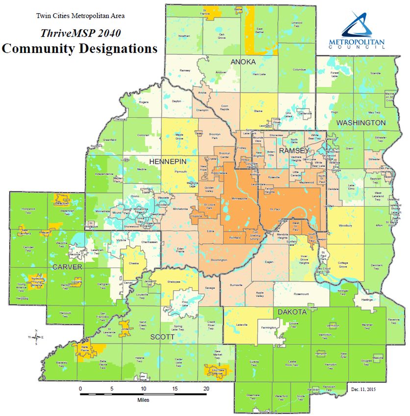
The Council adopted Thrive MSP 2040 as the new regional
development guide on May 28, 2014. Thrive identifies five
outcomes that set the policy direction for the region’s system
and policy plans. Building on our region’s history of
effective stewardship of our resources, Thrive envisions
a prosperous, equitable, and livable region that
is sustainable for today and generations to come. The Council
is directing its operations, plans, policies, programs, and
resources toward achieving this shared long term vision.
Three principles define the approach to implementing regional
policy: integration, collaboration, and accountability. The
principles define the Council’s approach to policy
implementation and set expectations for how the Council
interacts with local governments.
The land use policies in Thrive establish a series of commitments from the Council for local
governments and uses community designations to shape development policies for communities.
Community designations group jurisdictions based on Urban or Rural character for the application of
regional policies. Together, the land use policies and community designations help implement the
region’s vision by setting expectations for development density and the character of development
throughout the region.
Page - 3 | METROPOLITAN COUNCIL LOCAL PLANNING HANDBOOK
Print Date: 2/1/2021 Regional Planning
System and Policy Plans
The system and policy plans were adopted after Thrive throughout late 2014 and in 2015. The systems
plans include the 2040 Transportation Policy Plan, the 2040 Regional Parks Policy Plan, and the 2040
Water Resources Policy Plan. Statutes define these three areas as regional systems and direct the
Council to plan for them, as well as operate or fund the system. The System Plans lay out needs and
opportunities with respect to Council’s services, provide guidance in managing systems, and specify
fiscal implications of these policies.

The policy plans include the Housing Policy Plan and the Master Water Supply Plan. The policy plans
establish a shared vision for issues that are important regionally, but are not considered a regional
system. These plans include technical information and recommendations to establish a regional
direction and better address regional resources.

The system and policy plans identify strategies, policies, and methods designed to implement the
regional vision outlined in Thrive MSP 2040.

Page - 4 | METROPOLITAN COUNCIL                                                LOCAL PLANNING HANDBOOK
Print Date: 2/1/2021                                                                      Regional Planning
LOCAL PLANNING
While your community establishes a unique local vision, it must also reflect the adopted regional
policies outlined in the system and policy plans. Local plans contain much greater detail than regional
plans by identifying local street connections, neighborhood parks, residential development standards,
and phasing of utility extensions and improvements necessary for your individual community. But these
local planning efforts tie into the larger regional infrastructure of parks and trail systems, arterial road
networks, and wastewater infrastructure. It is the efforts of the 188 cities, townships, and counties
together that implement a shared regional vision.
Local Comprehensive Plans
Minnesota Statute requires certain topic areas to be included in local comprehensive plans. The Local
Planning Handbook is organized around these Plan Elements and provides guidance on how to meet
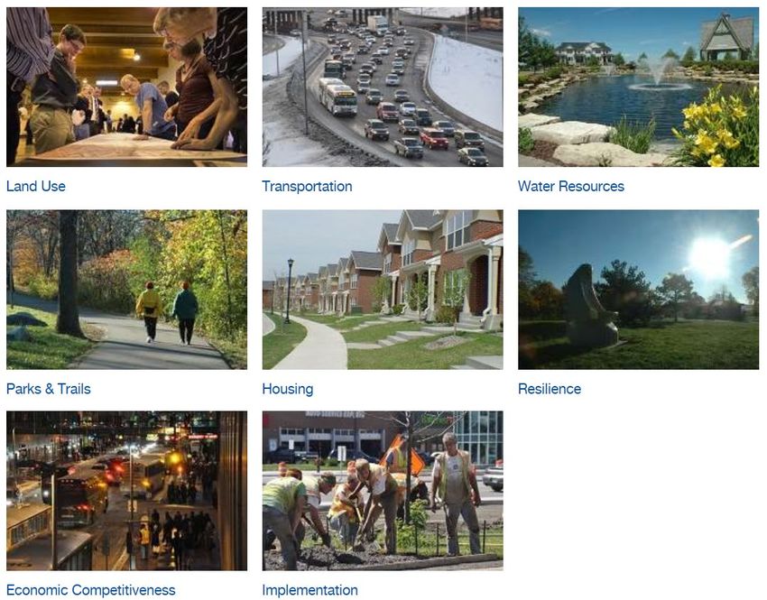
requirements within these planning areas. These Plan Elements in the Local Planning Handbook are:
• Land Use
• Transportation Land Use
• Water Resources (Wastewater, Surface
Water, Water Supply) Implementation Transportation
• Park and Trails
• Housing
• Plan Implementation
Resilience
Plan Water Resources
Other Plan Elements are identified as issues of Elements
regional importance and are reflective of Thrive
MSP 2040’s policies. These Plan Elements are:
Economic
Parks & Trails
• Resilience Competitiveness
• Economic Competitiveness Housing
Local Plan Reviews
Part of our statutory responsibility is to review the local comprehensive plans of local governmental
units. Similar to local development applications, the Council must review a plan for completeness
before initiating the review process for an update or an amendment. A plan is considered complete
when it includes the elements required by statute and contains sufficient information for the Council to
conduct its review. The Council’s review covers three primary areas:
• Conformance with metropolitan system plans.
• Consistency with adopted policy plans.
• Compatibility with plans of affected and adjacent jurisdictions.
The minimum requirements sections under each Plan Element provide you with the necessary
information to submit a complete plan to the Council for review.
If we find that your plan does not conform to our system plans and it either has the potential to have a
substantial impact on a metropolitan system or represent a significant departure from a system plan, we
can require you to modify your plan. Minnesota law defines the specific legal process for plan
modifications (MN Statute 473.175) and contesting a requirement for plan modification (MN Statute
473.866).
Page - 5 | METROPOLITAN COUNCIL LOCAL PLANNING HANDBOOK
Print Date: 2/1/2021 Local PlanningTechnical Assistance We offer several technical assistance programs to communities as part of the 2040 planning cycle. We have new, updated, and familiar resources. Click on the links below for more information. • Sector Representatives (ongoing) • Planning Assistance Grant Funds (updated) • Local Planning Handbook (new and updated) • Mapping Services Program (new) • Training and Workshop Courses (new) Page - 6 | METROPOLITAN COUNCIL LOCAL PLANNING HANDBOOK Print Date: 2/1/2021 Local Planning
PLAN ELEMENTS
We are an interconnected region. Our roads, jobs, natural resources, and residents cross community
borders. We each have a responsibility to consider the interaction of land use and transportation,
access to jobs and housing choices, and the effect we have on the environment and water resources.
Comprehensive plans provide an opportunity to prepare for growth and strengthen connections
throughout the region. These Plan Element pages identify minimum requirements, optional elements,
and connect you to resources to help you complete and implement your comprehensive plan update.

Page - 7 | METROPOLITAN COUNCIL                                             LOCAL PLANNING HANDBOOK
Print Date: 2/1/2021                                                                     Plan Elements
LAND USE
To maximize returns on the regional investment in
sewer, water, roads, parks, and other infrastructure, we
need to consider how land will be used. Existing and
future uses translate a community’s forecasted growth
into where, when, and how much development occurs
in the community. It is this effort that enables effective
planning for infrastructure. Other considerations
include housing needs, employment patterns,
recreational space, and commercial activities. The goal
is to create livable neighborhoods, easy access to jobs,
connected street patterns, and to protect our natural
resources.

The information found here will help you develop a land use plan that meets minimum requirements of
the Metropolitan Land Planning Act and is consistent with adopted Council plans and policies. We also
identify resources that can help you to meet minimum statutory requirements. This section also
includes optional ideas and examples that you may use to supplement your land use plan.
Land Use Plan
FORECASTS AND COMMUNITY DESIGNATION
Before starting your land use plan, become familiar with the Council’s population, household, and
employment forecasts for your community. You will also need to know your Community Designation so
you can better understand how (and which) regional policies affect your community. This information is
located on your Community Page.

    Minimum Requirements:
•   Include a table of forecasted population, households,
    and employment for 2020, 2030, and 2040, consistent
    with the Council’s forecasts.
•   Remember, Council forecasts must be used
    consistently throughout your entire comprehensive
    plan.
      •   Your transportation plan needs to allocate
          forecasts to transportation analysis zones
          (TAZs).
      •   Your water and wastewater plans need to reflect forecasts to plan for urban services.
      •   Your land use plan must reflect and be coordinated with your forecasts.
•   Include a map acknowledging your regional Community Designation(s) and acknowledge the
    overall density expectations for your Community Designation(s).
•   Each Community Designation identifies both Council and Community Roles in Thrive’s land use
    policy section. Plans must be consistent with Community Roles for your Community Designation(s)
    as well as Community Roles that apply to everyone.

Page - 8 | METROPOLITAN COUNCIL                                                LOCAL PLANNING HANDBOOK
Print Date: 2/1/2021                                                                            Land Use
Get More Out of Your Plan:
• Many communities use the discussion on forecasts as a jumping off point to discuss socioeconomic
conditions (including mix of age, race, and income groups) and analyze changes in their community
over time. This gives a good framework early in the plan to better understand your community’s
character.
• Some communities also show historical growth, particularly for population and households to
establish a better understanding of the community’s history and character.
We Can Help!
• We have pulled together these minimum requirements for you! Your forecast tables, Community
Designations map, and Community Roles are located on your Community Page.
• Thrive policy summaries by Community Designation are available under the Council Policy Tab on
your Community Page.
• There are several ways to request changes to your local forecasts. Read How to Request a Local
Forecast Change for information on the process that applies to you.
EXISTING LAND USE
An inventory of current land uses in your community is a great place to kick off the update to your 2040
land use plan. Review your current land uses. Show where existing residential, commercial, industrial,
institutional, and mixed uses are sited today. Identify where parks, open space, roadways, and water
features are located in your community.
Minimum Requirements:
• Provide an Existing Land Use Map with a land use
legend.
• Provide an Existing Land Use Table. Calculate total
acres and percent of total acres for each land use
category.
• Land uses categories on the map and in the table,
as well as any text references must all be consistent
with one another.
• Show existing regional parks, park reserves, and
special recreation features with a land use of “Park”
(or your equivalent) on your Existing Land Use Map.
Get More Out of Your Plan:
• Some communities use the existing land use as a
jumping off point to identifying vacant or
underutilized properties that might be available for
future development.
• Some communities incorporate a natural resource inventory into their existing land use
examination.
Page - 9 | METROPOLITAN COUNCIL LOCAL PLANNING HANDBOOK
Print Date: 2/1/2021 Land UseWe Can Help!
• We have pulled together these minimum requirements for you! We compile generalized land use
information using aerial photos and assessor’s parcel information in standardized land use
categories. Feel free to use our latest inventory to meet your Existing Land Use minimum
requirement. You can access your generalized land use map and table on your Community Page.
For communities that have their own GIS systems, you can map existing land use if you prefer.
• In an effort to make land use planning easier, the Council provides standardized land use
categories and definitions.
FUTURE LAND USE
Planning future land uses helps to identify where forecasted growth in population, households, and
employment will occur in your community over the next 30 years. Future land uses can also identify
where redevelopment opportunities exist, where changes along corridors and within neighborhoods will
happen, and where there are opportunities for the preservation of natural resources.
Minimum Requirements:
• The Future Land Use plan must be consistent with the
Council’s forecasts of population, households, and
employment and identify sufficient land to support your
community’s forecasted growth.
• Provide a Future Land Use Map and land use legend,
including density ranges for all land uses that allow
residential development.
• Provide a Future Land Use Table. Calculate total acres and
percent of total acres for each land use category for each 10-
year planning period (2020, 2030, and 2040).
• Define each land use category shown on the Future Land
Use Map. Land use categories must be used consistently
throughout your plan.
• Land use categories must include types of allowed uses and
the minimum and maximum densities (“the allowable density
range”) for all categories that allow residential uses. Allowed
uses should include a description of allowable housing types
such as single family, detached, duplexes, townhomes, etc.
• For each “mixed use” category, define an expected share of individual land uses and identify the
permitted density range for residential uses. For example, Mixed Use Downtown might have an
expectation of 30% commercial, 40% office, and 30% residential with a density of 10-15 units per
acre.
• Acknowledge Council-approved master plan boundaries of regional parks, park reserves, and
special recreation features by guiding the properties with a land use of “Park” (or your equivalent)
on your Future Land Use Map.
Page - 10 | METROPOLITAN COUNCIL LOCAL PLANNING HANDBOOK
Print Date: 2/1/2021 Land UseFor Communities within the Metropolitan Urban Service Area (MUSA) and Rural Centers:
• Identify employment locations and provide a measurement of intensity of planned employment.
Employment locations are typically the areas guided for commercial, office, industrial and
institutional uses. Acceptable measurements of intensity include Floor Area Ratio (FAR), building
footprint or impervious coverage. Ranges for measuring intensity are acceptable. See the We Can
Help Section below.
For Communities with Special Resources:
• In order for properties to be enrolled in the Agricultural Preserves Program, the Future Land Use
Map must reflect an Agricultural land use designation with a maximum density of 1 unit per 40 acres
at the time of plan adoption, as required by state law.
• Identify aggregate resources in your community on the Future Land Use Map.
• See the Special Resources section within the Land Use Plan Element for requirements for Critical
Area Plans, Historic Preservation, and others.
For Communities Impacted by an Airport:
• Address land uses around the airport. The Land Use Compatibility Guidelines have been prepared
to assist communities in preventative and corrective mitigation efforts that focus on compatible land
use.
• Ensure that land uses reflect requirements in the Aviation section of the Transportation Plan
Element.
Get More Out of Your Plan:
• Describe the purpose for each of your land use categories. This level of policy development can be
helpful when your community is making decisions about zoning ordinances and development
proposals. See the City of Rosemount’s 2030 Plan for an example of this format.
• Use pictures to help visualize expected density ranges. Illustrate what your density ranges (e.g.
your neighborhoods) should look like. Try looking through the U of M College of Design’s Digital
Content Library for images that might help you.
• Incorporate neighborhood planning into your Future Land Use Plan. It’s one way to identify specific
local issues and break down goals into smaller areas. See Roseville’s 2030 Plan for an example of
this idea.
• The City of White Bear Lake’s 2030 Land Use Plan included a table outlining future land use
changes that coincided with a map showing the same changes. These two elements of their land
use plan identified redevelopment areas and identified changing densities in a clear and easy to
understand format.
• Include Master Plans, Transit Station Area Plans, or Design Standards in your Land Use Plan to
provide clear development expectations.
• Some communities chose to include the expiration date for those properties currently in the
Agricultural Preserves Program and describe anticipated uses after expiration from the Program.
See the Special Resources section for specific requirements for properties in the Agricultural
Preserves Program.
Page - 11 | METROPOLITAN COUNCIL LOCAL PLANNING HANDBOOK
Print Date: 2/1/2021 Land Use• Include Source Water Protection maps in your Land Use Plan to help make decisions about
locations for new well sites. Land uses can protect drinking water sources.
• Understand land use compatibility and implications for human health; land uses are incompatible if
they create a nuisance or public health threat, including but not limited to pollutants, noise, dust,
odor and safety (Minnesota Healthy Planning: How-To Guide, page 49). For more information,
please visit the Minnesota Department of Health Healthy Places website.
We Can Help!
• Unsure about how to provide measurements of intensity for employment locations? Find guidance
in our resource “How to Identify Employment Locations and Measure Level of Intensity”.
• Some communities are eligible to receive free GIS mapping services to complete their Future Land
Use Map and update their Future Land Use Table. To see if your community is eligible, check out
the Grants Tab on your Community Page.
• Planning Assistance Grants are available to some communities that meet eligibility requirements.
Check out the Grants Tab on your Community Page to see if your community is eligible.
• MetroGIS has adopted a Planned Land Use classification system that is based on a consensus of
useful land use categories compiled from past comprehensive plans. This classification system is
used to create the Regional Planned Land Use dataset. Feel free to use these categories in your
individual Future Land Use Map.
• In an effort to make land use planning easier, the Council provides standardized land use
categories and definitions.
• Your Sector Representative is also available to provide technical assistance.
DENSITY CALCULATIONS
The intensity of development (density) is how a community accommodates forecasted growth and
plans for infrastructure. We review average net density for all residential areas planned for new
development or redevelopment across your entire community. This allows flexibility to have a mix of
higher and lower density ranges. There are minimum or maximum density level expectations set for
each Community Designation.
Minimum Requirements:
• Identify where forecasted residential growth will
happen on your Future Land Use Map. Show
expected new development and re-developed
areas.
• Identify what density range is expected for each
residential land use in your community.
• Identify when residential development or
redevelopment is anticipated to happen. See the
Handbook section on Staged Development and
Redevelopment.
• The average net residential density for your community must be consistent with the density
requirements for your community designation.
Page - 12 | METROPOLITAN COUNCIL LOCAL PLANNING HANDBOOK
Print Date: 2/1/2021 Land Use• Provide a minimum and maximum value for each residential density range. (Zero is not an
acceptable minimum. The maximum value must be a whole number.)
• Use the lowest allowed residential density from land use ranges in your calculations. For example,
a land use that permits a density range of 3-5 units per acre must use 3 units per acre in all density
calculations for this land use. This ensures that even at the lowest permitted density, the community
will be developing at densities that meet overall density expectations.
• Focus on areas of change. Show us which planned land uses have changed from your previously
approved plan and where new land uses (change or development intensity) are planned/expected.
• Provide the net developable acreage for each residential land use. It’s OK to exclude wetlands and
natural water bodies, public parks and open space, arterial road rights-of-way, and natural resource
lands protected by local plans and ordinances (i.e. steep slopes, wetland buffers, tree preservation)
from area calculations. Stormwater ponds, utility easements, local roads, and local rights-of-way
cannot be excluded from area calculations.
• The information you develop in your land use plan carries over to other elements of your
comprehensive plan. The areas and densities in the land use plan must be consistent across
elements related to forecasted growth, wastewater, water, housing, and transportation.
For Communities with Existing or Planned Transitways or High Frequency Bus Corridors:
• Minimum average net densities near transitway stations and high frequency bus corridors must
meet the standards in the 2040 Transportation Policy Plan (TPP). Refer to the Transportation Plan
Element.
For Communities with an Affordable Housing Allocation:
• Guide residential land at densities sufficient to create opportunities for affordable housing using one
of the following options outlined in the Housing Plan Element. Refer to the Projected Housing
Need section.
For Diversified Rural Communities with Flexible Development Ordinances:
• You must be consistent with the Flexible Development Guidelines adopted in August 2008. These
guidelines apply to Diversified Rural communities with staging areas for future urbanization
identified as Long Term Service Areas for regional wastewater services. You should review these
guidelines if you have local ordinances that allow densities greater than 1 unit per 10 acres (open
space ordinances, cluster developments, density bonuses etc.).
Get More Out of Your Plan:
• We track residential density and housing through plan amendments to ensure requirements
continue to be met. Using our density analysis format could help you understand how your
community can continue to meet minimum standards and better understand the information
reviewed when you submit an amendment.
We Can Help!
• We’ve put together a simple demonstration for you to explain the net residential density form.
Check out our example on how to calculate density.
Page - 13 | METROPOLITAN COUNCIL LOCAL PLANNING HANDBOOK
Print Date: 2/1/2021 Land UseSTAGED DEVELOPMENT AND REDEVELOPMENT
Identifying where a community will support forecasted growth is necessary to ensure that the timing of
growth lines up with land use plans and supports planned infrastructure investments. Staging plans are
especially important to sewer and local water supply plans in still developing communities, communities
with orderly annexation agreements, and communities that have areas of potential MUSA expansion.
Most developed areas will accommodate projected growth through redevelopment planning.
Minimum Requirements:
• Identify potential local infrastructure impacts for each 10-
year increment.
• Demonstrate that the municipality is capable of providing
services and facilities that accommodate its planned
growth.
• The staging plan or likely development phasing must be
consistent with the volume of anticipated sewer flow
identified in your community’s Local Sewer Plan.
• The staging plan or likely development phasing must
support and be consistent with your community’s share of the Region’s Need for Affordable
Housing for 2021 - 2030.
For Suburban Edge, Emerging Suburban Edge, Rural Centers, and Communities with
Orderly Annexation Agreements (OAAs):
• Map stages of development in 10-year increments (existing, 2020, 2030, and 2040).
• Provide a table of staged development in 10-year increments. The table must include future land
uses, area in acres, density ranges, and total residential units by each 10-year time increment.
For Urban Center, Urban, and Suburban Communities:
• Identify and map the land areas that are available or likely to be available for redevelopment, infill
development, or new development in your community.
• Provide a table of those areas identified that includes future land uses, acreages, density ranges,
and total residential units in 10-year increments. Use your professional judgment for estimating the
timing of development for areas that are uncertain or do not have plans in process.
Get More Out of Your Plan:
• ULI MN has developed a Redevelopment Ready Guide for local governments that helps
communities establish redevelopment policies and practices. This document provides a checklist of
eight best practices that help communities support redevelopment efforts.
• Include information about water supply system planning from the local water supply plan, and
maintain as a high priority the securing of the water sector’s critical infrastructure and key resources
(CIKR).
Minnesota Department of Health Tips:
Page - 14 | METROPOLITAN COUNCIL LOCAL PLANNING HANDBOOK
Print Date: 2/1/2021 Land Use• Consider utilizing traditional neighborhood development (TND). TND is characterized by
moderately high densities; diverse land uses and public spaces. TND mimics the compact
development of older neighborhoods prior to the automobile boom, ensuring walkability as the
primary mode of transportation. For more information, visit the Minnesota Department of Health
Healthy Places website and/or the Minnesota Healthy Planning: How-To Guide, page 40.
• Employ an environmental design approach to help deter crime. The first aim is to reduce
opportunities for crime that are inherent in the structure of buildings and the layouts of
neighborhoods. Second, is to promote changes in attitudes among the population at risk. By
reducing the apparent opportunity for crime, people should be less fearful in their environment.
For more information, visit the Minnesota Department of Health Healthy Places website and/or
the Minnesota Healthy Planning: How-To Guide, page 70.
• For more information, please visit the Minnesota Department of Health Healthy Places website.
We Can Help!
• We’ve provided some Plan Examples of staging approaches from the 2030 comprehensive plans
that might be helpful as you prepare this portion of your plan.
NATURAL RESOURCES
Natural resources - including lakes, rivers, wetlands, prairie, and woodlands - contribute to the livability
and sustainability of our region. These natural areas recharge our aquifers, provide plant and animal
habitat, and reduce air pollution. Stewardship of natural resources and balancing development with
conservation should be an important consideration in your
comprehensive plan.
Minimum Requirements:
• Describe your community’s goals, intentions, and priorities
concerning preservation, conservation, or restoration of
natural resources in your community.
Get More Out of Your Plan:
• Prepare a local natural resource inventory that
incorporates free-standing local natural resource areas as well as those that connect with larger
corridors.
• Include goals, priorities, and natural resource conservation strategies to protect and enhance
natural resources in your comprehensive plan.
• Adopt and implement ordinances for the conservation and restoration of natural resources within
your community.
• Collaborate with adjacent communities and other partners to identify, plan for, and protect natural
resource areas that cross boundaries.
• Establish and maintain conservation areas for plant and animal habitat management.
We Can Help!
• Download GIS data on a variety of Natural Resource topics from different agencies.
Page - 15 | METROPOLITAN COUNCIL LOCAL PLANNING HANDBOOK
Print Date: 2/1/2021 Land UseSPECIAL RESOURCE PROTECTION
Special Resources are identified as required plan elements in statute and include solar access, historic
preservation, critical area, agricultural preserves, and aggregate resources.
Minimum Requirements:
• All plans must include a protection element for historic sites.
• All plans must include policies for the protection and development of access to direct sunlight for
solar energy. Solar access is addressed in depth under the Resilience section.
For Communities with Agricultural Preserves:
• In order for properties to be enrolled in the
Agricultural Preserves Program, the Future Land
Use Map must reflect an Agricultural land use
designation with a maximum density of 1 unit per
40 acres, as required by state law.
For Communities with Aggregate Resources:
• Identify aggregate resources in your community
on the Future Land Use Map using the Aggregate
Resources Inventory.
• You must address and minimize potential land use
conflicts.
• Identify planning and regulatory measures to
ensure that aggregate resources are extracted
prior to urbanization of aggregate-rich sites.
For Communities in the Mississippi River Critical Area Corridor
• Please refer to the MRCCA Plan Requirements section.
Get More Out of Your Plan:
• A protection element for historic sites is required in all comprehensive plans, but the other special
resources vary. Refer to your Checklist to see if requirements apply to your community. Your
checklist can be found on your Community Page.
• The City of Stillwater’s Historic Resources Chapter of their 2030 Comprehensive Plan is a great
example of how to set goals and objectives, establish policies and programs, acknowledge
preservation efforts, identify design guidelines, establish special districts, and inventory resources.
The City has several programs, ordinances, and guidelines that work to implement preservation
plans.
We Can Help!
• Agricultural Preserves annual data is available for GIS users. Access this data by using our new
interactive mapping tool or downloading the data from our website.
Page - 16 | METROPOLITAN COUNCIL LOCAL PLANNING HANDBOOK
Print Date: 2/1/2021 Land Use• We have compiled an Aggregate Resources data set for GIS users that reflects existing
unrestricted Aggregate Resources. Access this data by using our new interactive mapping tool or
downloading the data from our website.
• The Minnesota State Historic Preservation Office website has many helpful tools, preservation
plans, programs, and resource inventories that may help you identify and plan for preservation of
historic resources in your community.
• The Department of Natural Resources has information and resources available related to
Mississippi River Critical Area Program on their website.
Page - 17 | METROPOLITAN COUNCIL LOCAL PLANNING HANDBOOK
Print Date: 2/1/2021 Land UseMISSISSIPPI RIVER CORRIDOR CRITICAL AREA (MRCCA)
The Mississippi River Corridor Critical Area (MRCCA) is
a land corridor along the Mississippi River in the 7-county
metro area where there are special land use regulations
that guide development activity. The corridor was
designated a Critical Area in 1976. Local governments in
the corridor must complete a MRCCA plan (a required
chapter in the comprehensive plan) that complies with
state rules (MR 6106.0010 – 6106.0180). For more
information:
• On the MRCCA, see Background and History of
the MRCCA
• On how to write your MRCCA chapter, see the sample outline
• On the submittal and review process, see MRCCA Plan Review Process
• On submittal information for counties, see MRCCA Plan Minimum Requirements for Counties.
• On submittal information for cities and townships, see the minimum requirements under each of
the following eight MCCRA Plan elements.
MRCCA Plan
DISTRICTS
Six districts are defined in the MRCCA rules. The districts are based on the natural and built character
of different areas of the river corridor. Structure setbacks from the OHWL and bluffs, building height
limits, and the amount of open space required for subdivisions/redevelopment vary by district.
Minimum Requirements:
• Map and describe districts and specify policies and
implementation actions to carry out the minimum plan
requirements related to MRCCA districts. See the
MRCAA Districts Requirements document for specific
information on minimum requirements.
Get More Out of Your Plan:
• Use photos or diagrams to show examples of the
intended character of each district to communicate
expectations of development and vegetation
management.
• Summarize the local ordinance implications of the MRCCA rules for property owners in the plan or
as an Appendix.
We Can Help!
• We have developed a district map on your Community Page.
• Download GIS data for MRCCA districts to create your own district maps. Contact DNR staff with
questions on this GIS data.
Page - 18 | METROPOLITAN COUNCIL LOCAL PLANNING HANDBOOK
Print Date: 2/1/2021 TransportationYou can also read