(Re)configuration of Water Resources Management in Mongolia
←
→
Page content transcription
If your browser does not render page correctly, please read the page content below

ICDD Working Papers | Paper No. 13 | Nov. 2014

Sisira S. Withanachchi, Annabelle Houdret,
Soninkhishig Nergui, Elisabet Ejarque Gonzalez,
Ankhbold Tsogtbayar and Angelika Ploeger

(Re)configuration of
Water Resources
Management in Mongolia:
A Critical Geopolitical Analysis

The International
Center for Development
and Decent Work
Sisira Saddhamangala Withanachchi (MA) is a research fellow in the Department of
Organic Food Quality and Food Culture at the University of Kassel, Germany.

Annabelle Houdret (PhD) is working as a senior researcher in the Department of
Environmental Policy and Management of Natural Resources at the German
Development Institute (GDI), Bonn, Germany.

Soninkhishig Nergui (PhD) is the professor and the head of the Botany Department in
the School of Biology and Biotechnology at the National University of Mongolia.

Elisabet Ejarque Gonzalez (PhD) is a research fellow in the Department of Ecology,
Faculty of Biology, University of Barcelona, Spain.

Ankhbold Tsogtbayar (BA) worked as a research assistant on the project
“Environmental Flow Assessment in Orkhon River – Mongolia”.

Angelika Ploeger (PhD) is the professor and the head of the Department of
Organic Food Quality and Food Culture at the University of Kassel, Germany.

Editorial Board
Khayaat Fakier (University of the Witwatersrand, South Africa)
Béatrice Knerr (University of Kassel, Germany)
The ICDD Working Papers are peer-reviewed.

Contact Address
Prof. Dr. Christoph Scherrer
ICDD – University of Kassel, Germany
Mailing address: Mönchebergstr. 19, D-34109 Kassel
Visitors’ address: Kleine Rosenstr. 3, D-34117 Kassel
Contact: felmeden@icdd.uni-kassel.de

Design / Layout: Nina Sangenstedt, gestaltvoll.de

ICDD Working Papers
ISBN: 978-3-86219-860-3 (print)
ISBN: 978-3-86219-861-0 (e-book)

© International Center for Development and Decent Work. All rights reserved.

The material in this publication may not be reproduced, stored or transmitted without
the prior permission of the copyright holder. Short extracts may be quoted, provided the
source is fully acknowledged. The views expressed in this publication are not necessarily
the ones of the ICDD or of the organization for which the author works.

First published 11 / 2014 in Kassel, Germany

Publishing House:
kassel university press GmbH
www.upress.uni-kassel.de
Sisira S. Withanachchi, Annabelle Houdret,
Soninkhishig Nergui, Elisabet Ejarque Gonzalez,
Ankhbold Tsogtbayar and Angelika Ploeger

(Re)configuration of
Water Resources
Management in Mongolia:
A Critical Geopolitical Analysis

This research study was presented at the Human Ecology Forum
on 15th October 2013 at the College of Atlantic, United States of America.
ICDD | (Re)configuration of Water Resources Management in Mongolia: A Critical Geopolitical Analysis

Contents

        Acknowledgements .................................................................................... 3
        Abstract ........................................................................................................... 4

 1      Introduction ................................................................................................... 5

 2      Climate Condition and Water Availability ........................................... 7

 3      Political System ............................................................................................ 9

 4      Theoretical Framework ............................................................................ 10
        a) Manifestation and delimitation: who produces scale? ............................. 11
        b) Scale as a constituency of power relations and discursive practices:
            how are scales produced? ........................................................................... 11
        c) Scale as a terrain of interests: for what purposes are scales produced? ... 12

 5      Materials and Methods ........................................................................... 13

 6      Results and Discussion ........................................................................... 16
        6.1 River basin as a scale of assessment ...................................................... 16
        6.2 Defining and demarcating water basins in legal
              and policy documentations ...................................................................... 17
        6.3 Geopolitical dynamics in political parties:
              manifestation and mobilization ............................................................... 19
        6.4 Institutionalization of water basin management .................................... 20
        6.5 Spatial mobility: mining industries in water management .................... 23
        6.6 Challenges in management: oscillation between scales ........................ 32

 7      Conclusion .................................................................................................... 35

        References .................................................................................................... 36
        Figures, Tables, Pictures .......................................................................... 42

        ICDD Working Paper Series .................................................................... 43

                                                             2
ICDD | (Re)configuration of Water Resources Management in Mongolia: A Critical Geopolitical Analysis

Acknowledgements

This research project is facilitated by the International Center for Development and
Decent Work (ICDD) at the University of Kassel, Germany and the Integrated Water
Resource Management in Central Asia: Model Region Mongolia project (MoMo). Also,
this research study was conducted in collaboration with the multidisciplinary research
“Environmental Flow Assessment in Orkhon River – Mongolia”, funded by the
Mongolian Academy of Sciences from July 2012 to January 2014. Our sincere thanks are
given to all members at ICDD, the MoMo project in Germany and Mongolia, and the
Mongolian Academy of Sciences. We express our sincere appreciation to Professor
Dr. Christoph Görg for his reviews and critical commentaries from the beginning of the
study that were absolutely crucial in determining the standard and quality of this
research study. Our special gratitude goes to Chimegsaikhan Altangerel in the MoMo
Project and Azzaya Boldbaatar, Tumur Sodnom, Jérome-Olivier and Oyunmonh Byambaa
for their enormous support. We would like to express special thanks to: Dr. Alice Aureli
and Dr Engin Koncagul from UNESCO-IHP, Prof. Dr. Christoph Scherrer and Prof. Dr.
Andreas Bürkert from the University of Kassel, Germany, Prof. Kenneth Scott Cline,
College of Atlantic, USA, Prof. Jay O’ Keeffe, Rhodes University, South Africa, Dr. Ines
Dombrowsky, GDI, Germany, Prof Miguel Alonso from Spain and Prof Scott Kenner,
South Dakota School of Mines and Technology, USA. The authors gratefully acknowledge
Amanda W. Schimunek, Damien Frettsome, Siyat Gaye, Florian Dörr and Timm Benjamin
Schützhofer for their feedback and language editing support. We extend our humble grat-
itude to all interviewees in the field who dedicated their time and allowed us to partici-
pate in their meetings. Without their contributions, it would have been impossible to
complete this field research study. We highly appreciate the opportunity to present this
research study at the Human Ecology Forum in October 2013 at the College of Atlantic,
United States as well as all praiseworthy comments and critiques for the final manu-
script of the research paper. Last but not least, we would like to thank anonymous
reviewers and the editorial board of the ICDD for their constructive comments.

                                                          3
ICDD | (Re)configuration of Water Resources Management in Mongolia: A Critical Geopolitical Analysis

Abstract

In Mongolia 'water' as a concept is constructed by local people based on the values and
norms in which it was rooted in the past. Rivers and its resources are considered gifts
from “Naga” who is believed to be the snake lord for pure water resources, lakes,
springs, waterfalls and rivers. However, the expectation to have “pure water” has been
challenged. Stress over water resource has gradually increased. Therefore, water
resource management has been one critical theme in politics and policies in Mongolia
with respect to climate conditions and socioeconomic impacts. With what scale and level
water resources should be governed and managed has been a focal point in the water
policy reform process. Mongolia as a transformative country after the decline of the
socialist regime in 1990, has been experiencing neoliberal political economic changes.
Consequently, new stakeholders have emerged and advanced into more powerful and
influential settings in politics and policies in Mongolia. Under the new endeavor to
implement the IWRM, the water basin has been submitted as the appropriate scale for
water resource management. The selection of water basins as the hydrological scale in
water management and institutionalization of water resource management attach with
complex power dynamics to a transitional county with rapid institutional changes, polit-
ical and policy reforms, and economic alterations. The research examines how stake-
holders engage or disengage in water resource management in Mongolia and what the
competing demands for accessing water resource are. The embedded design in the
mixed research method with the interpretative approach was applied by conducting
interviews, focus group discussions and water quality and quantity data analysis. The
field research was mainly conducted within the multidisciplinary research project,
Environmental Flow Assessment in Orkhon and Tuul Rivers Basins. The key analyses that
can be derived from the research are as follows: scale (re)configuration connects with
contextual power relations and political implications can be observed by analyzing the
engagement of stakeholders in different steps with different competencies. Furthermore,
these findings may assist to appropriately formulate the competing socioeconomic
demands for sustainable water in future policy implementation of Mongolian water
resource management.

Keywords: Scale (re) configuration, stakeholders, power dynamics, Integrated Water
Resource Management (IWRM), Water Basin, Environmental Flow Assessment

                                                          4
ICDD | (Re)configuration of Water Resources Management in Mongolia: A Critical Geopolitical Analysis

 1        Introduction                                                     “ус бол чандмана эрдэнэ”
                                                                              Water is Wish Granting Jewel
                                                                                              (Mongolian Proverb)

Mongolia, as a landlocked country situated in the north of the central Asian plateau, is
experiencing severe climate conditions (Batimaa et al., 2011; UNDP, 2011). According to
estimates, 78% of areas are under vulnerable conditions of medium to high rates of
desertification (Batjargal, 1998; UNDP, 2011:28). Due to climate change, severe drought
in summer and a harsh winter called “Dzud” is more frequent (Batimaa et al., 2011).
These extreme climate conditions reduce water availability in Mongolia (Natsagdorj et
al., 2011; Batimaa et al., 2011; UNDP 2011). Simultaneously, socioeconomic activities also
effect a reduction in water availability from surface and groundwater resources (MNEGD,
2012). The water demand is rapidly increasing due to rising industrial and agricultural
activities, and urbanization. Water stress and maltreatment of water resources is an
intensifying concern over water resource management in contemporary policy discourse
(Tortell, 2008; Batimaa et al., 2011).

Mongolia is considered as to be a country with a transformed political situation from a
socialist political background to a liberal democratic system after the decline of the com-
munist regime in 1990 (Horlemann et al., 2011). Transitional countries are experiencing
rapid institutional changes, political reforms and economic alterations (Ekiert, 2003;
Tamilina and Tamilina, 2012). These political economic implications transfer into instan-
taneous institutional changes and complex political dynamics (Grothe, 2009; Horlemann
and Dombrowsky 2011). Neoliberal economic changes after 1990 – that include price and
trade liberalization, financial liberalization, adopting open market principles, privatiza-
tion, deregulation and decentralization of power and responsibilities (Shagdar, E. 2007)
could relatively establish liberal values such as good governance, democracy and free-
dom in Mongolia. Meanwhile, communist political influences could still play an impor-
tant role in socio-political behaviors and institutional practices of transitional countries
(Ekiert, 2003; Grothe, 2009). With these complexities, new trends in the political econo-
my of Mongolia lead to the emergence of new stakeholders and their influential role in
politics and policies. With the economic liberalization and political democratization
process in Mongolia, new internal stakeholders are emerging and the impact of external
stakeholders in Mongolia is also being reinforced. Also, new power alliances between
stakeholders can be observed (Horlemann and Dombrowsky 2011).

                                                          5
ICDD | (Re)configuration of Water Resources Management in Mongolia: A Critical Geopolitical Analysis

Water, a resource which is connected with multi-stakeholder interests, is highly politicized
(Budds and Hinojosa-Valencia, 2012). In Mongolia, water resources management cannot
be detached from complex political and socioeconomic process. The Integrated Water
Management National Assessment Report II (2012) by the Ministry of Nature, Environment,
and Green Development (MNEGD) in Mongolia stated that the Integrated Water Resources
Management (IWRM) model came into operation in Mongolia as the new governance and
management approach based on these considerations (MNEGD,2012). Significantly, the
introduction of the IWRM into water governance in Mongolia constitutes water basins as
the hydrological scale in water management. The demarcation, selection and reconfigura-
tion of water basins as the appropriate hydrological unit in water resource management
have political implications (Howitt, 1998).

The research paper examines how stakeholders engage or disengage in water resource
management in Mongolia and what the competing demands for accessing water
resources are. The explanatory question has three elements: “who produces scale, how,
and for what purposes?” It was promulgated by James McCarthy (2005) and applied to
analyze power dynamics in water resource management in Mongolia. This research
paper is organized as follows. The next section provides a brief overview about the cli-
mate condition of Mongolia by examining water availability. The following section turns
to a theoretical framework for the research analysis on the politics in scale (re)configu-
ration based on the explanatory question posed by James McCarthy (2005) to critically
understand the different engagement of stakeholders in scale configuration, especially
in water resource management. The third section will analyze and address the posed
research questions. The research paper concludes with a brief summary of the findings
and future research possibilities in this area.

                                                          6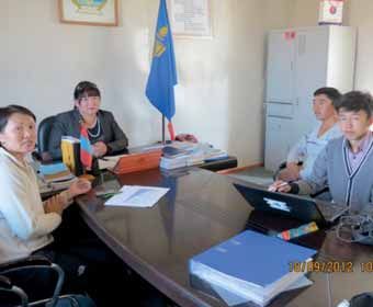
ICDD | (Re)configuration of Water Resources Management in Mongolia: A Critical Geopolitical Analysis

 2        Climate Condition and Water Availability

According to the Geographic Coordinate System, Mongolia is located between 41º 35’
– 52º 06’ north latitude and 87º 47’– 119º 57’ eastern longitudes. Mongolia is a landlocked
country which is in the north of the central Asian Plateau and is surrounded by China and
Russia. In relation to sea level, the average height is between 900 m to 1500 m. The total
area of the country is 1 566 500 km² (Basandorj and Singh, 2009: 10; MHDR, 2011:8).
Mongolia belongs to the intermediate transitional climate region between the great
Siberian taiga and the Central Asian desert (Batsukh et al, 2008). As a land-locked country,
Mongolia has a harsh climate and is threatened by severe and moderate desertification.
Approximately 23.4% of Mongolia is covered by the Gobi desert. The rest of the country
contains semi-arid or arid areas (Batsukh et al, 2008). There is an uneven distribution of
natural zones in terms of climate, aridity and geological variation (Figure 1).

                                         Figure 1. Natural zones of Mongolia
              (Source: Integrated Water Management National Assessment Report, volume 1, WA, 2012)

                                                          7
ICDD | (Re)configuration of Water Resources Management in Mongolia: A Critical Geopolitical Analysis

Generally, Mongolia experiences short, very hot and dry summers and long and very cold
winters. Most days are passing with the unclouded sky which intensifies the evaporation
(Batsukh et al, 2008). The people and livestock are affected by severe drought in summer
and harsh winter called “Dzud” (Batimaa et al, 2006). The climate change harshly impacts
the ecosystem in Mongolia. Concerning the temperature, it is estimated that annual mean
temperatures have increased by 2.14 °C since the 1940s (Batimaa et al. 2011). As a result
of climate change, Mongolia experiences extremely cold weather. In the winter period,
annual precipitation increases between 12.6% and 119.4%. In the summer period it has
warmer weather by which annual precipitation declines from 11.3% to 2.5%. Also in sum-
mer, most of its regions experience 13% to 90.9% increase in evapotranspiration (Batimaa
et al. 2011). It is estimated that 78% of areas in Mongolia are affected by medium to high
rates of desertification (Batjargal, 1998; MHDR; 2011). These extreme climate conditions
reduce water availability in Mongolia. According to the National Statistical Data analysis
in 2011, the data illustrate that surface water resources such as rivers, lakes and streams
are exsiccating in a considerable amount. Because of the lack of surface water availability,
80% of drinking water has to be pumped from groundwater sources (Batimaa et al. 2011).
Groundwater is considered as a major water source in terms of industries (especially for
mining industries in the Gobi region) and urban water usage.

Mongolia has uneven distribution of surface and groundwater. The high mountain range
which includes Altai, Khangai, Khuvsgul and Great Khyangan produce 70% of surface
water (Batsukh et al, 2008). These mountain ranges constitute the catchment areas for
main rivers. Orkhon, Eroo, Selenge, Tuul, Kharaa, Khov, Onon,Bulgan, Khanui, Ider and
Herlen rivers can be noted as the main rivers and tributaries in Mongolia. According to
Miguel Alonso (2012), lakes are one main surface water source as well as recharge source
for groundwater in Mongolia. In the North Eastern, Western and Central parts of the coun-
try, the landscape is covered with big and small lakes, including Khuvsgul Lake in the
Southern slopes of the Altai-Sayan mountain range, Bayan Lake in the North watershed
of Khangai mountain range and Sharga Lake in Bulgan region (Interview, 2012.08.22 and
2014.02.22 and the Liminological research database)1. However, 54% of lakes are located
in the Gobi region, but most of them are small, shallow or salinized (WWAP, 2006).
Glaciers in the North-West and South-East region which are located 2750 m above sea
level are also another water source in Mongolia, such as Potanin’s glacier (Batimaa et al.
2011). According to the National Water Committee report “Water resources of Mongolia”,
hydro-geologists define four physical-geographical zones, namely Khangai-Khenti moun-
tain region, Altai mountain region, Mongolian Dornod region and Gobi region. There are
133 groundwater basins identified through the hydrological research (NWC, n.l).

1 Please refer to the research data base on “Limnological catalog of Mongolian lakes” (Prof. Miguel
  Alonso) for further information on http://oslo.geodata.es/mongolian_lakes/index.php (Accessed 2nd
  of January 2014)

                                                          8
ICDD | (Re)configuration of Water Resources Management in Mongolia: A Critical Geopolitical Analysis
3 Political System
In 1992, the coalition government ratified the new constitution. On the basis of the con-
temporary governing structure, this constitution brought several changes into Mongolian
politics including a parliamentary democratic system (Article 20), separation of powers
between Executive, Judicial and Legislature layers (Chapter III), and self-governing powers
vested to local government units into three tiers as administrative bodies (Article 59)
(Parliament of Mongolia, 1992). The political governance system in the 1992 constitution
is identified as a dual governance system which facilitates lower administrative units to
organize their functionalities and responsibilities with supervision by the central govern-
ment (Horlemann and Dombrowsky 2011). Constitutionally, this process is powered by the
principle of subsidiarity, which allows direct solutions to local scale issues where they can
be easily resolved at the administrative level (Article 62; Parliament of Mongolia, 1992).
As Article 57 is ratified, Mongolia is divided into 21 main administrative units at the provin-
cial level called Aimag along with a special system in the capital city, Ulaanbaatar (Parlia-
ment of Mongolia, 1992). The Aimags were then further divided into Soum as the local level
government and administrative body. There are 340 Soums, which are even further subdi-
vided into Bhags as the lowest administrative level (village level). There are 1592 Bhags in
Mongolia. In Ulaanbaatar, there are nine districts called Duregs and 152 small administra-
tive units called Khoroos (Figure 2) (National Statistical Office of Mongolia, 2013).
National level Central Government
Ulanbaatar Capital City
Provincial level Aimag (21)
Government
Local level Soum (340) Duregs (9)
Grassroots level Bhag (1592) Khoroos (152)
Figure 2: Governance System in Mongolia
9ICDD | (Re)configuration of Water Resources Management in Mongolia: A Critical Geopolitical Analysis
4 Theoretical Framework:
“who produces scale, how, and for what purposes?”
The theoretical discussion about scale is determined by recent attention to socio-economic
transformation and new dimensions about the environmental phenomena. Clark C Gibson
et al (2000) define scale as the spatial, temporal, quantitative, or analytical dimensions that
are used to measure and study any phenomenon (Gibson et al, 2000). However, critical
political geographers explore further about the construction and application of scale in dif-
ferent contexts, including natural resource management. Scales are identified are socially
constructed and politically mobilized (Marston, 2000; Budds and Hinojosa-Valencia, 2012).
As a pioneer of this debate, Neil Smith (1992) theorizes, “construction of scale is a social
process, […] scale is produced in and through societal activity which in turn produces and
is produced by geographical structures of social interaction” (Smith, 1992:62).
Stakeholders’ involvement in scale (re)configuration is shaped by the process of organizing
knowledge, assessments, data interpretation, mapping, decision-making process, agenda
setting, framing, policy implementation, institutionalization and lobbying interests (Lebel,
2006). In this research study, scale (re)configuration is identified with these different process-
es of involvement. Concerning scale (re) configuration and environmental phenomena, the
production of socio-nature and the scaled social spatialities cannot be detached (McCarthy,
2005). According to Louise Lebel et al., (2005), scalar (re)configuration is a joint process of
social and biophysical processes (Lebel et al., 2005). At a glance, the choice of scale in a sci-
entific scaling of assessments is observed based on biophysical diagnostics; they are
defined in a political context by specific stakeholder interests (Lebel, 2006). Accordingly, a
scale is a production of social interactions and power struggles (Smith, 1992; Görg, 2007).
What would be the appropriate scale to manage natural resources is one of the main entry
points in natural resources management (Pahl-Wostl, 2007; Termeer et al., 2010). In the
IWRM approach, the river basin is submitted as the hydrological scale to manage water
resources (Agarwal et al., 2000: Grover and Cruickshank, 2012). In the IWRM literature,
furthermore, river basins are articulated as a “natural” and a “rational” unit for the plan-
ning and management of water resources on the basis of biophysical characteristics
(Warner et al., 2008; Venot et al., 2011). However, defining and demarcating a river basin
as a scale of water resource management and further process in scale (re) configuration
such as ratifying legislation and policy documents and setting up the institutional frame-
work is not a neutral process, nor does it only consist of biophysical characteristics
(Mollinga, 2008; Saravanan et. al, 2008; Molle, 2009). A river basin consists of a multiplex
of several biophysical, socioeconomic and political-administrative scales.
10ICDD | (Re)configuration of Water Resources Management in Mongolia: A Critical Geopolitical Analysis
a) Manifestation and delimitation: who produces scale?
Within this socio-political construction, it is important to identify who the stakeholders
are that are strategically involved in the scale (re) configuration across spatial, temporal
and jurisdictional levels (Label 2006). According to McCarthy (2005), the analysis of this
particular inquiry needs to go beyond the state and capital centric perspective.
Furthermore, environmentalist intervention, behaviour non-government organization and
social movements in scale (re) configuration are to be examined in the context of envi-
ronmental governance (McCarthy, 2005). Various stakeholders are involved in scale con-
figuration such as the epistemic community, political parties, donor agencies, interna-
tional organizations, civil organizations and local government bodies and communities
in water resource management (Miranda et al., 2011). Thus, opening the black box of
power in water resource management is a vital factor to recognize whether each stake-
holder’s engagement in the scale (re)configuration process is equal or not.
b) Scale as a constituency of power relations:
how are scales (re) configured?
In the critical geographic literature, power relations are identified as a decisive factor in
scale (re) configuration (Swyngedouw 2004a; Brenner, 2001; Marston, 2000). In the context
of water resource management, power relations could appear through polices and politics
at different levels, such as international, national, regional and local. Erik Swyngedouw
(1997, 2004a and 2004b) analyzes scale configuration as a result of the continuous moment
of socio-spatial power relations (Swyngedouw 2004a; Swyngedouw 2004b). Thus, analyz-
ing the power relation and the different locus of stakeholders would assist to trace the
alliances or estrangement in water resource management.
11ICDD | (Re)configuration of Water Resources Management in Mongolia: A Critical Geopolitical Analysis
c) Scale as a terrain of interests:
for what purposes are scales (re) configured?
Scale (re) configuration in a particular context stands for the spatial modality of problem
solving (McCann, 2003). When a certain scale does not address the issues that it should
solve, the shifting of a scale can be observed in policy-making processes. The application
of river basins as a hydro-political scale is aimed to address complex issues of water
resource utilization and ecological conditions. Thus, many countries are restructuring
their national and international water management policies with the IWRM principles.
In this policy adaptation, river basins are applied to design water resource management
(Moss and Newig, 2010). According to the technical interpretation in the IWRM, the river
basin functions as the terrain of stakeholder integration through the process of a partic-
ipatory problem solving mechanism (Agarwal et al., 2000; Jaspers, 2003). However,
some scholars critically question this proposition due to the complexities and dynamics
of power under real world conditions (Saravanan et al., 2008; Mollinga et al., 2007). V.S.
Saravanan et al. (2008) argue that the positions of stakeholders in the water manage-
ment process are configured by the intrinsic interests of water usage (Saravanan et al.,
2008). This may be defined by historical reasoning, economic factors or culture or polit-
ical manifestation. Some interests are articulated more than others. Peter P. Mollinga et
al. (2007) emphasize that particular interests have considerably more political power
than others who are thus able to manipulate the water management or governance
process in their favor. The functionality of each stakeholder depends on their position
and interests that correlate with the social relation of power, not only in the water realm
but also in the general social system (Mollinga et al., 2007). Thus, the river basin or water
basin is a site where stakeholders contest and negotiate based on their competing inter-
ests (Houdret et al., 2013; Moss and Newig, 2010). John Dore and Louis Lebel (2010) ana-
lyze scales and level as the terrain of competition, conflict and cooperation of stakehold-
ers based on their contemporary and future interest and impacts on water resource man-
agement (Dore and Lebel, 2010).
The aim of this theoretical discussion is to create an analytical framework to study the
different way of stakeholder involvement in scale (re)configuration of water resource
management in Mongolia. This framework may facilitate identifying the governance and
management of problems critically.
12ICDD | (Re)configuration of Water Resources Management in Mongolia: A Critical Geopolitical Analysis
5 Materials and Methods
The embedded design in the mixed methods research approach (Creswell and Clark,
2007; Hesse-Biber, 2010) is applied. Qualitative and quantitative research approaches
were applied as the data gathering method in the field research. Qualitative methods in
the data collection process included primary and secondary data, semi-structured inter-
views, focus group discussions and community observation. Expert and official levels
interviews (N=49) have been conducted in several government institutes, research foun-
dations, international organizations, donor agencies, political parties, civil organizations
and universities. Moreover, the focus group discussions (N=3) and individual interviews
with local people (N=20) were conducted at community level (Table 1). The interview and
focus group discussion questions were slightly altered based on locational and position-
al factors, but always fixed with the main thematic area of the research. Furthermore,
analyses of legal documents, policy papers and technical reports were other methods.
Most of this study is enriched by the field research data analyses within the Environ-
mental Flow Assessment (EFA)2 in Orkhon River from July 2012 to January 2104. Tech-
nical analyses of stream flow changes in the Orkhon River (Picture 1) and its tributaries,
as well as water quality and quantity were examined through physical and chemical
experiments. These quantitative analyses were only applied in this research paper as
supportive data to the qualitative analyses. As this research based on a critical geo-
political question of scales in
water resource management, the
gathered data has been analyzed
by applying the interpretative
approach within the embedded
design of the mixed methods
research.
Picture 1: Orkhon River Basin
2 The Environmental Flow Assessment assesses the sustainable use of rivers by measuring the
adequate flow requirements of a river to maintain ecological condition and the ability to continue
the socioeconomic demands (O'Keeffe, 2012).
13ICDD | (Re)configuration of Water Resources Management in Mongolia: A Critical Geopolitical Analysis
Table 1. Interview partners in the field study (2012 – 2014)
Category Name of institution / agency / Soum (number of interviews in brackets)
Government
Ministry of Environment and Green Development – MNEGD (1)
• Division of Cadastre on Forest Conservation and Reforestation Area (1)
• Division of River Basin Management (1)
• Division of Water Resources (1)
National Water Authority (Before terminating) (2)
National Water Committee (1)
Institute of Geo-ecology (1)
National Agency for Metrology and Environment Monitoring (1)
The Government Implementing Agency of Mongolia (1)
Orkhon River Basin Council Secretariat (1)
Tuul River Basin Council Secretariat (1)
General Agency for Specialized Inspection (GASI) (1)
Selenge Aimag Office
• Sustainable Living Project (1)
• Forest Section (1)
Political representatives in Soum and Bhag level governments (6)
• Governor and Deputy Governor in Bat-Olziy Soum
• Deputy Governor and the citizen representative Olziyt Soum
• Deputy governor of Orkhon-Tuul Soum 3rd Bhag 3rd Bhag
• Governor of Orkhon Soum
Water Security Officers at Soum level (3)
• Olziyt Soum
• Kharkhorin Soum
• Orkhon Soum
Environmental Officers (2)
• Shammeer Soum
• Kharkhorin Soum
• Orkhon Soum
Orkhon River Basin Natural Park Research Office (1)
Soum level hospitals – Luun Soum (1)
14ICDD | (Re)configuration of Water Resources Management in Mongolia: A Critical Geopolitical Analysis
Political Party
Civil Will Green Party – CWGP (1)
International Organization / Donor agency
United Nation Development Program (UNDP) – Mongolian branch (1)
World Health Organization – Mongolian branch (1)
German Development Cooperation (GIZ) (3)
Royal Haskoning Enhancing Society (1)
Dutch-Mongolian IWRM Project (2)
World Wild Fund (2)
UNESCO-IHP Paris Headquarters (2)
MoMo Project (3)
WATERCOPE Project-ICDD (1)
Research Institute /University
The National University of Mongolia – NUM (2)
Mongolia Research Centre for Economic
and Financial Policy – MRCEFP (1)
Civil organization / local consultant
Water Forum in Mongolia (1)
Eco-Trade consultant agency (1)
Focus group discussion (3) / Individual interviews with locals (20)
• Olziyt Soum
• Luun Soum
• Orkhon-Tuul Soum 3rd Bhag
• Erdenet Soum
• Kharkhorin Soum
• Bat-Olziy Soum
• Orkhon Soum
• Shammeer Soum
• Tsenkher Soum
15ICDD | (Re)configuration of Water Resources Management in Mongolia: A Critical Geopolitical Analysis
6 Results and Discussion
6.1 River basin as a scale of assessment
The first blueprint of a river basin oriented assessment and management plan was initi-
ated from 1971 to 1975. It was called the “General scheme of integrated use and conser-
vation of water resources of the People’s Republic of Mongolia” with the Ministry of Water
Affairs and the Institute of Water Expedition and Research (Batsukh et al., 2008). Even
though the main scale for water resource management was the political-administrative
system at the national and local level in Socialist Mongolia, the General Scheme was
conducted with mainly Orkhon, Kherlen, and Selenge river basins with a focus on tribu-
taries of the Kherlen River (1980 –1981), Ikh Nuur Hollow (depression of Great Lakes)
(1983 –1984), and small rivers in the Gobi region (1987), as well as the Onon, Ulz and
Khalkh rivers (1989). The river assessment and management plan particularly focused on
preserving water resources for socioeconomic sectors (Batsukh et al., 2008). Among the
driven interests of this General Scheme were water distribution and allocation for the
mining industry as significant factors (Interview, National Water Authority, 2012.08.08 and
2012.08.16.). Though there was limited space for plurality in the political society, the
impact or engagement of some specific external and internal stakeholders can be noted.
For example, the Central Committee of the Mongolian People’s Revolutionary Party
(MPRP) was the most decisive political body in governance (Radchenko, 2008). Policies
and planning were designed based on the party agenda and its political economic inter-
ests (Landman et al., 2005; Basandorj and Singh, 2009). As the key external stakeholders
before the 1990s, different engagements of the Union of Soviet Socialist Republics
(USSR) can be observed in water resource management. For example, the presence of
USSR experts in the General Scheme and other river basin assessments is accentuated
(Interview and group discussion, National Water Authority, 2012.08.08 and 2012.08.31).
16ICDD | (Re)configuration of Water Resources Management in Mongolia: A Critical Geopolitical Analysis
6.2 Defining and demarcating water basins
in legal and policy documentations
The recent development of water legislation and policies has directed Mongolian water
resource management toward a particular hydrological scale. The Water Law in 2004, as
a major legislative amendment in the water sector, has been ratified with the water basin
as the model hydrological unit for water governance and management in Mongolia and
the water basin council (WBC) as the authority at the level of local water management
(Article 19.1) (The Parliament of Mongolia, 2004). However, the adoption of the Water
Law of 2012 advanced some main components and re-modifications of subjects within
the law, including: comprehensively acknowledging the IWRM as the model for future
water resource management (Article 4) and water basins are identified as the optimal
scale for water resource management based on the IWRM principles (Article 4.7) (the
Parliament of Mongolia, 2012). In a document dated 10th November 2009, the Water
Authority in collaboration with Strengthening IWRM in Mongolia, a project funded by
the Dutch government, defined 29 water basins in Mongolia primarily on the basis of
hydrological data and socioeconomic considerations (WA, 2009). This report document
was accredited by the Ministry of Nature, Environment and Tourism (MNET)3 in 2009 as
the 332nd policy order on “River catchment areas of Mongolia” (Altansukh, 2012).
Orkhon and Tuul rivers in Orkhon-Selenge River basin (Picture 2) are gained more focus
within the project “Strengthening IWRM in Mongolia” and is upgraded as a manage-
ment body within the Orkhon River Basin Administration system (Water Forum of
Mongolia, 2013). Figure 3 illustrates the 29 water basins and Aimag boundaries.
Administratively, a water basin
should consist of two entities,
a water basin council (WBC)
as the governance entity and a
water basin organization (WBO)
as a professional and technical
authority of water management.
Picture 2: The confluence of the
Orkhon River and Tuul River at the Orkhon-
Tuul Soum
3 Consequently with the new ministerial changes from September 2012, the Ministry of Nature,
Environment and Tourism (MNET) has been replaced with the Ministry of Environment and Green
Development (MNEGD). The Civil Will Green Party leader, S. Oyun, was appointed as the Minister
of Nature, Environment and Green Development (MNEGD).
17ICDD | (Re)configuration of Water Resources Management in Mongolia: A Critical Geopolitical Analysis
Figure 3. Water basins/River basins in Mongolia
(Source: Integrated Water Management National Assessment Report, volume 1, Water Authority, 2012)
The research recommendations, assessments and estimations of the epistemic commu-
nity (individual and institutions) have a relatively considerable influence in the process
of defining and demarcating water basins. Particularly the use of the term “water basin”
instead of river basin in legal documentation has been articulated by these experts. On
the basis of the Southern Mongolian hydrological conditions, completely dependent on
groundwater resources, some experts argue that the use of water basin in legal docu-
ments would allow expansion to the institutionalization process in regions that fully
depend on groundwater sources (Interview, National Water Authority, 2012.08.16 and
UNDP, 2012.10.01).
18ICDD | (Re)configuration of Water Resources Management in Mongolia: A Critical Geopolitical Analysis
6.3 Geopolitical dynamics in political parties:
manifestation and mobilization
Political parties have been a decisive factor in the scale (re)configuration process in
water governance and management in Mongolia. Mongolian political parties are mobi-
lizing public or individual opinions into a certain political agenda based on party mani-
festations. Hence, the role of political parties can be observed through party manifesta-
tions, election campaigns and also governance polices. The environmental protection
and the application of natural resources into socioeconomic development could be
examined as anchors in political a party’s vision.
The importance of water and sanitation and the protection of riparian areas from harmful
mining activities were some themes related to environmental governance that political
parties focused on in the last parliament election campaigns in 2012. Furthermore, the
interviews and the field research findings illustrate that the water issue was one priority
for local people. The Tuul River Basin, the Orkhon River Basin, and the Gobi area water
issues are highlighted in politics. In this situation, the theme of water converts to “politics”
rather than “policies” (Interview, CWGP, 2012.09.26 and UNDP in Mongolia, 2012.10.01).
The recent changes in the political system in Mongolia are another significant political
dynamic in environmental governance. Among the dynamics of political parties, the Civil
Will Green Party (CWGP) demonstrates more concern over environmental protection in
the party’s manifestation as one coalition partner in the government, (Interview, CWGP,
2012.09.26). The Ministry of Nature, Environment and Green Development (MNEGD) is
headed by the CWGP in the new government. The impact of the global green develop-
ment discourse in Mongolian governance strategies can be observed through the
renaming of the Ministry with green development. Also, some popular opinion about
politics says that the impact of the green party is especially visible in the government,
for instance the prioritization of green policies.
Concerning the water sector, the new government policy demonstrates priority over
river headwaters and protected zones of water reservoirs within a comprehensive water
management policy (The coalition government platform, 2012). Under the new institu-
tional changes, water management is one priority of the MNEDG with reforestation and
pollution eradication (Byambadorj, October 5th, 2012 UBPOST). As a thematic area of
policy implementation under the new manifestation of the CWGP, three divisions have
been established for water related areas in the Department of Policy Implementation,
namely the Division of Water Resources, the Division of Water Monitoring, and the
Division of River Basin Management. Significantly, the Water Authority has been termi-
nated. The power of General Agency for Specialized Inspection (GASI) regarding the
inspection of water resource utilization has been shifted to the Division of Forest, Water
19ICDD | (Re)configuration of Water Resources Management in Mongolia: A Critical Geopolitical Analysis
and Protected Areas in the Department of Environment and Natural Resources as well
as the WBCs and WBOs under the new institutional changes (Interview, MNEGD
2012.09.28). With these new institutional changes, most of the power and responsibility
concerning natural resource management were brought into the ministry.
6.4 Institutionalization of water basin management
The Ministry of Nature, Environment and Green Development (MNEGD) has more interest
in advancing the new scale for water resource management based on water basins
(Interview, CWGP 2012.09.26; Interview, MNEGD, 2012.09.28). For example, the establish-
ment of a special division for river basin management and more policy drafting on water
basin management can be examined. The projected institutionalization of water basin
management was to establish 7 water basins in 2012. However, 19 WBCs and WBOs want-
ed to be instituted at end of 2013 according to the new ministerial plan. 2014 is the target
year to establish WBCs and WBOs in all 29 water basins (Division of River Basin Manage-
ment in the MNEGD). However, these aims are challenged by a lack of internal financial
capacities, contesting power and responsibilities between cross-scale institutions (will be
further discussed in Section 6.6), and the other competing interests of stakeholders. The
institutional changes and political dynamics led to a shift of power relations, new roles of
stakeholders and conflicts of interest with new policy formation and implementation in
the IWRM in Mongolia. In the process of institutionalization of water basins, the engage-
ments of different external and internal stakeholders are more significant in Mongolia. The
IWRM as the international application for the local level water resource management, the
international organizations and donor agencies play a considerable role in national-policy
implementation in water resource management. They engage through consultations, pol-
icy advising and conducting and facilitating research and financial aid. The lack of internal
funds for facilitating WBCs may cause particular dependence on foreign financial sources.
Mongolia is a highly donor-dependent country (Landman et al., 2005). WBCs are designed
to be financed by projects, donations and aid (7.4 in the policy document, unpublished,
MNEGD). Thus, the connectivity to donor agencies and international organizations may be
a vital factor in the functioning of the river basin management system in Mongolia. Table 2
illustrates some key engagements of international organizations and donor agencies in
the institutionalization process of IWRM in Mongolia.
The World Bank has planned to start a project to improve groundwater resources in the
Gobi region with AusAID funding. Under this World Bank- AusAID funding project, it is
planned to establish one WBC and three WBOs in the three Aimags of Dornogovi,
Omnigovi and Dundgovi (World Bank, 2012). This engagement can be theorized as a new
alliance among stakeholders in favoring the establishment of a certain hydro-scale in
water resource management.
20ICDD | (Re)configuration of Water Resources Management in Mongolia: A Critical Geopolitical Analysis
Table 2. Some key engagements of international organizations and donor agencies in the IWRM implementations
and river basin managements (Source: Authors’ own compilation)
World Wildlife Fund (WWF): Funds from WWF Netherlands
1. National workshop on IWRM (2003)
2. Khar Lake – Khovd River and Buyant River basin project (from 2008)
3. Onon River basin project (from 2011)
IWRM MoMo project
Kharaa River basin project (2006 – 2013)
Dutch-Mongolian IWRM Project, Royal Haskoning Consultancy Agency
and Deltares Research Institute
1. Project ‘Strengthening Integrated Water Resources Management in Mongolia’
(2007 – 2012)
2. Tuul River basin, Orkhon river basin program (from 2008)
World Bank – AusAID
Gobi Region Water Basin Council (expected from 2013) one water basin council and
three water basin authorities in the three Aimags of Dornogovi, Omnigovi and
Dundgovi1
WATERCOPE project
Conducts research and testing of improved water management practices in the
transboundary Central Asian Altay-Dzungarian Basin (China-Mongolia, from 20122)
UNDP
1. Several policy studies and direct engagement in water resources management in
Mongolia
2. Project based on “Adaptation Fund” facilitating the MNEGD for water basin man-
agement system – the Altai Mountain / Great Lakes Basin (Khuvsgul Lake) and the
Eastern Steppe basin areas
1 Refers to the Project Design Document for AusAID Funding to
Strengthen Groundwater Management in Southern Mongolia (February 10, 2012).
2 Refers to WATERCOPE-ICDD program 2013.
21ICDD | (Re)configuration of Water Resources Management in Mongolia: A Critical Geopolitical Analysis
There are several non-government organizations (NGOs) and community based organiza-
tions (CBOs) in the water sector lobbying for water and sanitation issues in the policy mak-
ing process (Livingstone et al., 2009) or participating in the policy implementation process
in water basin management system as stakeholders. Neoliberal economic changes and
liberal values after the 1990s afforded space to establish civil society organizations
(Horlemann and Dombrowsky, 2011). In the basin council system, civil society organiza-
tions are engaged as representatives of civil society, for example “Ariun Suwraga” in the
Orkhon Basin Council (Orkhon Basin Council A- 456 report, 2011). In the WWF supported
Khar Lake / Khovd River and Buyant River basin management, the participation of citizen
representatives and local community groups could be observed in the establishment of
WBC and WBO in the Bayan-Olgii, Khovd, and Uvs provinces (WWF, 2008; WWF, 2011).
The civil society engagement in water basin management can be observed as a lobby
or surveillance group (Horlemann et al., 2011). Some are linked with international civil
society networks or function as local branches. At the national level, NGOs are engaged
in the policy making process as well as the lobbying process. The water basin manage-
ment system, water and sanitation issues, urban water supply, and the IWRM application
are the main scope of the NGOs. They maintain connections with government, interna-
tional organizations, donor agencies, media and communities. Some national level
NGOs in the water sector could mobilize social views through their community based
programs, media and lobbying programs. The Tuul Goloo Hamgaalay is one environ-
mental civil society organization which advocates for the protection of the Tuul River
basin. Ongi River Movement, Gobi Soil NGO, Oyu Tolgoi Watch NGO, and Citizen Alliance
Centre can be considered as powerful civil society organizations which stand for protec-
tion of river and basin areas from gold mining activities.
22ICDD | (Re)configuration of Water Resources Management in Mongolia: A Critical Geopolitical Analysis
6.5 Spatial mobility: mining industries in water management
In Mongolia, the mining industries are one of the powerful stakeholders in politics and poli-
cies. The multinational mining companies and their locally-owned franchised companies
can be identified as key stakeholders within the mining conglomerate. The mining industry
has substantial lobbying power in the policy making process and research and develop-
ment (R&D) where certain expert reviews may be moderated for their interests (Interview,
Water Authority, 2012.08.08, GASI, 2012.09.28 and UNDP, 2012.10.01). Also, some pro-min-
ing lobby groups are funded by these companies to promote their ideas in the public arena.
The mining industries have shown interests in a particular spatial mobility for water
resource management. The geopolitical and political economic importance of the South
Gobi region in Mongolia mingles with mineral resources. The Oyu Tolgoi Limited Liability
Company4 plans to launch an Undai River diversion project to install a pit mine and waste
rock dump. Due to this river diversion, the Bor-Ovoo spring, which is used by local com-
munities, is intended to be closed (Factsheet Undai River Diversion-ESIA, 2012). However,
civil society organizations have expressed their disagreement with the Undai River diver-
sion project (Mine Watch Mongolia, 2013). Members of powerful civil society organizations
such as Gobi Soil NGO, Oyu Tolgoi Watch NGO, Citizen Alliance Center, Steps without
Borders, Centre for Human Rights and Development, Federation of Trade Unions, and Eco-
Asia Institute are lobbying the issue of the proposed Undai River diversion.
With a focus on rich mining resources in the South Gobi region, the demanding chal-
lenge is a shortage of water for industrial production process. Based on this competing
demand, there are two proposed water diversion projects to South Gobi, namely the
Orkhon-Gobi and Kherlen-Gobi water transaction projects. The World Bank supported
project, called “Mining Infrastructure Investment Support Project (MINIS) for Mongolia”
is the framework to launch these water diversion projects (World Bank, 2014). The pro-
posed Orkhon-Gobi water diversion project is illustrated in Figure 4. The deliberate
engagement of stakeholders for common and shared interests (Dore and Lebel, 2010)
could be observed among donor agencies and mining industries in Mongolia in water
resource management. Based on the hydro-engineering feasibility studies and water
demand of multinational mining companies in the Gobi area, the water diversion project
is possible to be launched. The government interest on this project is powerfully lobbied
and supported by mainstream construction engineers and mining conglomerates
4 The Oyu Tolgoi mining project is a recent and large investment project which will contribute thirty
times in Mongolian GDP (Lenz, 2012). It is one of the biggest copper-gold mining projects in
Southern Mongolia.
23ICDD | (Re)configuration of Water Resources Management in Mongolia: A Critical Geopolitical Analysis
(Interview, NUM, 2014.2.20). Concerning the Orkhon-Gobi, The proposed projects will
construct a dam in the middle reach of the Orkhon River and divert water through a
pipeline to the South Gobi region. The tendency to scale (re) configuration of water man-
agement toward a new hydro-political scale could cause the emergence of fragmented
policy implementation, policy gaps or clash of interests which form disproportionate
opportunities among stakeholders in accessing water resources. According to Olivier
Graefe (2011), this shift can be theorized as water resource management beyond a water-
shed towards a problem-shed. There are internal and external pressures or indications
about this mega and multi-purpose dam project. Firstly, the research findings from EFA
are analyzed.
Figure 4: The proposed Orkhon-Gobi water diversion project
Source:- Terms of Reference for Environmental and Social Impact Assessment on Flow Regulation of
Orkhon River and Construction of Water Reservoir Complex Project (With permission)
24ICDD | (Re)configuration of Water Resources Management in Mongolia: A Critical Geopolitical Analysis
a) Ecological consequences
The research findings of “Environmental Flow Assessment in Orkhon River (2012 – 2014)
(EFA)” conclude that the river flow is highly vulnerable to extreme climate changes and
weather patterns which impact the environmental flow of the river. If the Orkhon River is not
able to maintain its environmental flow in the downstream area, the ecological integrity of
the downstream ecosystems will be seriously threatened. Table 3 shows the results of the
water quality assessment performed at 18 sites along Orkhon River. According to the
Mongolian National Standards (3rd attachment to the Joint Directive of MNE and the
Ministry of Health, No. 143/a/352 of 1997), the whole main stem had an ecological status
between “less polluted” and “polluted”. Especially the upstream of Orkhon River (in Tsenkher
Soum, Arkhangai Aimag) demonstrated noticeable water pollution mainly due to mining
activities such as untreated waste water discharge into the river flow (picture 3 and 4).
Picture 3: Untreated waste water discharge into a tributary of Picture 4: Contaminated water mixing into Orkhon River
Orkhon River from a mining site in Tsenkher Soum in Tsenkher Soum (upstream)
25ICDD | (Re)configuration of Water Resources Management in Mongolia: A Critical Geopolitical Analysis
Moreover, considerable reduction of river flow could be observed at the Orkhon-Orkhon
water monitoring site of the Orkhon River from 1978 to 2008 (Figure 5). This analysis
counts the long term variability of environmental flow. This highlights the current
vulnerability of the water quality and the limited dilution capacity of the river. Therefore,
if the environmental flows of Orkhon River are not preserved, there might be serious
ecological repercussions in the downstream areas.
Table 3. Water quality classification of the Orkhon River based on nutrient concentrations.
Sampling site Km from Phosphate Nitrate Nitrite Ammonium Average
source mg/L mg/L mg/L mg/L category
Olziyt Teel source 0.05 10.19 0.01 0.04 Less polluted
Ikh Teel source 0.05 9.74 0.05 0.08 Polluted
Headwaters source 0.04 7.97 0.02 0.03 Less polluted
Bat-Olziy 46 0.03 6.20 0.02 0.03 Less polluted
KharBalgas 113 0.04 6.20 0.01 0.03 Less polluted
Orkhon-Tamir 180 0.14 3.99 0.01 0.08 Less polluted
Tamir 183 0.07 7.53 0.02 0.08 Less polluted
Olziyt 223 0.79 7.53 0.01 0.39 Polluted
Shuvuut 408 0.14 0.44 0.01 0.05 Less polluted
Orkhon 414 0.08 7.09 0.05 0.06 Polluted
Orkhon-Khangal 581 0.10 9.74 0.02 0.04 Less polluted
Khangal 583 0.03 9.74 0.02 0.05 Less polluted
Tuul 600 0.32 8.41 0.03 0.20 Polluted
Orkhon-Tuul 604 0.08 4.43 0.06 0.05 Polluted
Khara 751 0.07 4.43 0.05 0.06 Polluted
Eroo 759 0.06 6.64 0.11 0.09 Polluted
Orkhon-Eroo 775 0.08 7.09 0.01 0.08 Less polluted
Cells are colored according to the categories defined by the Mongolian National Standards for Surface Water(3rd
attachment to the Joint Directive of MNE and the Ministry of Health, No. 143/a/352 of 1997, accessed from
(AATA,2008): Dark green = Very clean, Light green = Clean, Yellow = Less polluted, Orange = Polluted and Red = More
polluted. Water sampling and measurements were performed in September 2012, within the framework of the
“Environmental Flow Assessment of the Orkhon River” project.
26You can also read