Restoring the Mississippi River Delta for People and Wildlife: Recommended Projects and Priorities
←
→
Page content transcription
If your browser does not render page correctly, please read the page content below
Restoring the Mississippi River Delta for People and Wildlife:
                        Recommended Projects and Priorities
                                                          1
Photos by Ashley Peters                                  Photo by Derek Brockbank   Photo by Gerry Ellis

                         Table of Contents
                                                                          Our Vision                1

                                       A Healthy Mississippi River Delta,                           3
                                                         A Healthy Gulf
                                                   Louisiana’s 2012 Coastal Master Plan

                                                             A Scale That Will Advance
                                                                  Gulf-Wide Restoration

                                                   Restoring a Naturally Functioning and
                                                   Sustainable Delta and Gulf Ecosystem

                                Restoring a Naturally Functioning and                               5
                                Sustainable Delta and Gulf Ecosystem

                                            Using a Full Suite of Restoration Solutions

                                                          The 19 Priority Projects                  8

                               Pontchartrain-Maurepas Basin Projects

                                        Breton-Chandeleur Basin Projects                            10

                                                         Barataria Basin Projects                   11

                                Terrebonne-Atchafalaya Basin Projects                               16

                                                           Chenier Plain Projects                   17

                                                                        Project Map                 19

                                              Abridged Project Descriptions                         20

                                                                         Conclusion                 23

Photo by Ashley Peters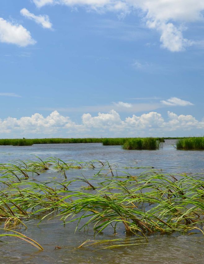
A PROJECT PORTFOLIO FOR RESTORATION OF THE                                                            The Restore the Mississippi River Delta Coalition (Coalition) has
                                                                                                          identified 19 priority projects in the Mississippi River Delta that,
    MISSISSIPPI RIVER DELTA AND COASTAL LOUISIANA                                                         if underway in the next five years, will signal the beginning of
                                                                                                          an era of stewardship and set us on a path to healthy recovery
                                                                                                          for not just the delta, but for the entire Gulf Coast.

                                                                                                          The 19 near-term, priority Louisiana projects will begin restoration
                                                                                                          of Louisiana’s ecosystem and best meet goals outlined in the
                                                                                                          RESTORE Act, the Gulf Coast Ecosystem Restoration Council’s
                                                                                                          Initial Comprehensive Plan, the National Fish and Wildlife
                                                                                                          Foundation’s requirements and the goals of the Natural Resource
                                                                                                          Damage Assessment. We concentrate here on the Louisiana
                                                                                                          coast, while acknowledging the need and appropriateness of
                                                                                                          projects in other Gulf states that benefit the region as a whole.

                                                                    Photo by Ashley Peters

                     OUR VISION

                     To restore a healthy Gulf of Mexico ecosystem – starting with
                     prompt restoration of the Mississippi River Delta – to ensure
                                                                                                                                                                                                         The Delta is an
                     the ecological, cultural, social and economic benefits of the
                     Gulf are experienced for generations.                                                                                                                                               Economic Driver

                     The Gulf Coast ecosystem is a unique and varied landscape that offers an                                                                                                            $8 billion
                     array of benefits to Gulf Coast states and the nation. The ongoing Gulf oil                                                                                                         annual economic impact of
                     disaster is the latest act in a longer-running tragedy: the continuing loss of the                                                                                                  recreational saltwater fishing
                     Gulf’s wetlands. The greatest losses have occurred in Louisiana around the
                     Mississippi River Delta. Coincidentally, the largest oil impacts from the Gulf
                     oil disaster were to the remaining marshes and beaches of the Mississippi                                                                                                           $2.85 billion
                     River Delta, further damaging an already fragile ecosystem.                                                                                                                         annual economic impact
                                                                                                                                                                                                         of Louisiana’s commercial fisheries
                     However, with tragedy often comes hope and opportunity. By law, the parties          The nation is enriched by the bounty of the Mississippi River Delta and
                     responsible for the Gulf oil disaster must pay to replace, restore and/or            will benefit from its revitalization. 97 percent of the entire Gulf region’s
                     compensate for damages to wetlands, beaches, fisheries, wildlife and                 commercial fish and shellfish population is dependent on coastal wetlands.
                     habitats. The RESTORE Act, federal legislation passed in 2012, requires              Nicknamed “Sportsman’s Paradise,” Louisiana is home to world-class
                     that Clean Water Act fines stemming from the Gulf oil disaster go to the Gulf        freshwater and saltwater fishing; up to 9 million wintering ducks and
                     Coast states to be used for restoration. Those funds and others present an           geese; vast nesting colonies of terns, herons, egrets and ibis; and 100
                     opportunity to both rehabilitate specific locations affected by the oil spill,       million birds which either reside year-round, spend the winter or migrate
                     as well as improve the overall functioning of the Gulf of Mexico system and          through the region. Wildlife-related tourism generates more than $19 billion
                     set one of America’s greatest ecological treasures on a transformative path          annually across the Gulf Coast, with $2 billion of those revenues coming
                     toward health.                                                                       from Louisiana.

                     Restoration of the Mississippi River Delta can jumpstart and provide far-
                     reaching and long-term benefits to the entire Gulf system. One of the most
                     important contributors to the ecological health of the Gulf of Mexico, the
                     Mississippi River is the largest river in North America and provides more
                     fresh water, sediment and nutrients to the Gulf of Mexico than all of the
                     other U.S. rivers entering the Gulf combined. This blend of fresh water,
                     sediment and nutrients mix with the salty Gulf waters creating expansive
                     estuaries that are the biological engines for the abundance of life found in
                     the northern Gulf.                                                                   What is the Mississippi River Delta?
                                                                                                          On hearing the phrase “Mississippi River Delta” many people think of a small area of land at the mouth of the Mississippi River, also
                                                                                                          known as the “Bird’s Foot Delta.” In actuality, the land built by the Mississippi River in recent geological times is far more extensive.
1                                                                                                         Herein, we include the entire coastal plain of Louisiana, from the border with the state of Mississippi west to (and including) the
                                                                                                          Atchafalaya Basin. West of the Atchafalaya is an area of coastal marsh extending to the Texas border, known as the Chenier Plain,
                                                                                                          also built indirectly with Mississippi River sediments, which is included as part of “coastal Louisiana.”
Unfortunately, coastal Louisiana is home to another statistic: since the            compared. A river delta is not a static landscape – it includes very different
                                       1930s, 1.2 million acres of land have disappeared into open water,                  regions. In areas dominated by the influence of the Mississippi River, land
                                       and more than 10,000 acres continue to vanish annually. Without swift,              builds; in areas dominated by the influence by the sea, land erodes. The
                                       decisive action and bold, large-scale restoration efforts, this coastal land        future without large-scale restoration in Louisiana is victory by the sea and
                                       loss crisis will persist, and Louisiana could lose an additional 1,800 square       the near complete loss of its ecologically and economically vital coastal
                                       miles in as little as 50 years. Along with threats to critical components of        wetlands.
                                       healthy estuarine habitat and a vibrant tourism economy, the loss poses a
                                       growing threat to some of the nation’s most critical energy infrastructure,         We evaluated projects against this bleak baseline to determine the relative
                                       largest ports, busiest shipping corridors, leading commercial seafood               scale of their contribution to improving conditions compared to that possible
           The Heart of the            producers and other important business sectors. But even in its current state       watery future, as well as their effective interaction with other projects to
                                       of ongoing collapse, the Mississippi River Delta remains one of America’s           maximize overall benefits. We placed an emphasis on river reintroduction
       Injury, the Heart of            great landscapes.                                                                   where river resources of fresh water, sediment and nutrients are available
                                                                                                                           because of the potential to both build new land and maintain existing
                  the Remedy           A Healthy Mississippi River Delta, A Healthy Gulf                                   wetlands, as well as the benefits to the long-term health of the surrounding
                                                                                                                           estuarine environment.
        Louisiana, due to its close    The anticipated funding from the fallout of the Gulf oil disaster is substantial,
                                       but it will not be enough to finance all the projects necessary to restore the
                                       Gulf Coast. For this reason, we must focus our attention on the projects with
      proximity to the Deepwater
                                       the greatest potential to provide the greatest benefits. Since restoration of
                                       the Mississippi River Delta has the greatest potential for large-scale and
Horizon explosion and leaking          expansive benefits to the entire northern Gulf of Mexico, our Coalition
                                       reviewed and evaluated projects based on the following questions:
               well, accounted for
                                               1. Is the project included in Louisiana’s 2012 Comprehensive
        61 percent of the total                   Master Plan for a Sustainable Coast?
                                               2. Is the scale of the project’s benefits sufficient to advance
        oiled shoreline of the Gulf               Gulf-wide restoration?

    Coast states. Four years after             3. Does the project restore a naturally functioning and sustainable
                                                  delta and Gulf ecosystem?
      the spill, Louisiana accounts
                                       Louisiana’s 2012 Coastal Master Plan
for 52 percent of shoreline            The state of Louisiana has developed a blueprint of projects to restore and
                                       sustain the estuaries of the Mississippi River Delta. The 2012 Comprehensive
    still showing traces of oil, and   Master Plan for a Sustainable Coast (Coastal Master Plan) used a thorough
                                       and transparent science-based process, with extensive public outreach, to
       94 percent of the oiled         recommend 109 restoration and protection projects to be implemented over
                                       the next 50 years that maximize land building and reduce flood risk. Our
      shoreline classified as more     team has reviewed all of the restoration projects proposed in the Coastal
                                       Master Plan slated for the first implementation period, years 0-20.
               than “trace” oiling.
                                       We chose restoration projects that were part of the Coastal Master Plan
                                       because of its adherence to a strong science-based project selection method
                                       and because of its robust and diverse public and stakeholder participation          Louisiana’s 2012 Coastal Master Plan,
                                       process. With a long list of needs and limited funding, it is critical that every   a 50-year blueprint laying out coastal
                                       available dollar be leveraged by selecting projects that maximize overall           restoration solutions, predicts a grim
                                       benefits to the Gulf. Given limited funds and many restoration needs, we            future if no action is taken. The red
                                                                                                                           areas in this map represent potential
                                       chose projects that address multiple priorities and goals.                          future land loss if restoration plans are
                                                                                                                           not implemented.

                                       A Scale That Will Advance Gulf-Wide Restoration
                                       We emphasize comprehensive restoration actions that tackle large-scale
                                       issues and have the potential to provide multiple long-term benefits and
                                       services over the long term. We recognize that “large-scale” is a relative
                                       term that requires a baseline against which progress can be measured and

3                                                                                                                                                                                                                                    4
                                                                                                                                                                                                            Photo by Ashley Peters
continued and expensive maintenance, but that does not mean that other
restoration projects are not essential to our success. In addition, some
areas of the Mississippi River Delta are now completely cut off from the
river, and diverting sediment and nutrients from the river is an immensely
difficult challenge.
Barrier islands and barrier headlands are an essential first line of defense
against tropical storms and work synergistically with sediment diversions
to capture sediment in the basin. Marsh creation provides a mechanism
to build small areas of wetlands in critical areas, such as protective marsh
land-bridges, or in areas that cannot be easily reached with a sediment
diversion. Sediment diversions can work together with marsh creation by
Photo by Erik Johnson
Restoring a Naturally Functioning and Sustainable Delta extending the lifespan of these projects. Ridges in the basins are a key
and Gulf Ecosystem feature to reduce saltwater intrusion and protect from storm surge. Restoring
these natural features will not only provide key habitats, but will also protect
Estuaries are typically found where a river meets the sea and fresh water
from storm surge and help retain sediment and fresh water in the basin from
mixes with salt water. The estuary where the Mississippi River meets the Gulf
sediment diversions.
of Mexico is one of the most productive in the world.
Barrier island restoration, ridge restoration and marsh creation projects
A productive and healthy estuary consists of a range of habitat types and
all involve mechanically dredging sediment and transporting it through
100 million landscape features. Habitat types tend to shift from the fresher areas in the
large pipes or in barges to project locations, often many miles from
landward parts of an estuarine basin (swamps, bottomland hardwoods and
the source. Once sediment is transported and in place, sea level rise,
birds live in or pass fresh marsh) to the intermediate and more salt water dominated habitats
subsidence and erosion by wind and waves will gradually overtake
closer to the Gulf (intermediate marsh, brackish marsh, saline marsh and
such projects, and many will erode and subside. Despite these long-
through the delta mangroves). Higher elevation habitats, such as ridge forests and beach
term limitations, we are in a crisis and need immediate actions to reduce
dunes, are also important to healthy estuaries in Louisiana.
future losses.
each year.
Landscape features, such as natural levees, ridges, distributaries, barrier
Hydrological restoration projects help to re-establish something closer to the
islands and land-bridges, also help dictate how habitat types are distributed
historical distribution of fresh water and salt water by building barriers to
throughout the basin and can be key to maintaining the integrity of the
saltwater intrusion or enhancing freshwater flows into targeted areas. While
estuarine wetlands. For instance, barrier islands in Barataria Basin
these projects don’t directly build land, we have prioritized hydrological
provide protection to the marshes from erosion by tides and storm waves.
restoration projects in targeted areas where there is no prospect of significant
Without these key features, wetland loss rates in the basin would increase Photo by Melanie Driscoll
near-term sediment re-introduction and in areas where salinity imbalances
dramatically. Therefore, we must look at restoration as a system of estuarine
are best treated by structural modifications to man-made channels.
function and productivity.
What is a basin?
Finally, in our choice of shoreline protection project sites, we have looked A basin is an area that is hydrologically
We evaluated each basin for the suite of projects best suited to ensure
for areas where the principal threat is erosion, where no sandy barriers connected, such as a river basin, lake
long-term benefits and favored projects that improve the overall health and
existed historically and where intervention now could have significant
natural function of ecosystems. As with the Coastal Master Plan, we judged basin or drainage basin. In the Mississippi
mid-term benefits – in other words, where subsidence is not a dominant factor
that a keystone to basin-wide health is restoring or reestablishing natural River Delta, large basins are separated
driving land loss. Our preference is for use of artificial oyster reef structures,
processes or conditions that once existed for the overall health of the wetlands by hydrologic barriers, or landscape
where salinities will support them, either alone or in combination with other
and all other restoration projects. An example is sediment diversions, which
tested techniques, such as building sediment-capturing breakwaters parallel features that do not allow water to cross
mimic nature by using the power of the river and the sediment, fresh water
to the shoreline, rather than perpendicular. These parallel breakwaters have from one side to the other. For example,
and nutrients it carries to restart deltaic processes to build new marsh and
proven highly effective on various segments of the Louisiana coast. Oyster the Mississippi River and its levee system
Photo by Gerry Ellis to help sustain the existing wetlands that would otherwise disappear. By
reefs have the advantage of long-term sustainability, since they can continue
harnessing the power of the river to move sediment, sediment diversions create a hydrologic barrier between
to grow vertically to offset relative sea level rise while providing significant
are less energy-intensive and more sustainable than other major wetland- the Breton Sound Basin on the east and
fisheries habitat and wildlife value. Oyster reefs existed for vast distances
building restoration tools. the Barataria Basin on the west. Other
along our coast before European settlement, and we should strive to
re-establish them today. major basins in the Mississippi River
Using a Full Suite of Restoration Solutions
Delta include the Pontchartrain Basin,
Restoration that restarts natural processes, such as deltaic land building, Terrebonne Basin and the Atchafalaya-
is inherently preferable to engineered man-made restoration that relies on
Vermilion Basin.
Restoring the Delta: An Investment in Our Future
The RESTORE Act created a Gulf Coast Restoration Trust Fund, which will receive 80 percent of any Clean Water Act civil and administrative penalties
The RESTORE Act paid by BP and other liable companies for their roles in 2010 Gulf oil disaster. The Trust Fund will support a variety of ecological and economic
As the entire nation – and spectators from all over the world – watched the 2010 oil spill unfold, Congress began work to direct financial resources restoration and recovery projects in the Gulf. The RESTORE Act also created the Gulf Coast Ecosystem Restoration Council (Council), which is composed
flowing from the spill to the states affected. Gulf Coast members of Congress led a two-year landmark effort to craft and win broad support for the of high-ranking federal and state officials and is responsible for Gulf-wide ecosystem restoration. Depending on the outcome of the trial, penalties could
RESTORE Act, formally called the “Resources and Ecosystem Sustainability, Tourist Opportunities, and Revived Economies of the Gulf Coast Act of 2012.” range between $4.5 and $17.6 billion.
The RESTORE Act passed the House and Senate with bipartisan support, and the President signed the bill on July 6, 2012.
Our 19 priority projects encompass a wide variety of project
types, including:
• sediment diversions to build and sustain marsh;
• freshwater diversions to sustain swamps;
• pipeline sediment delivery systems for marsh creation;
• barrier island and headland reconstruction;
• ridge restoration;
• shoreline protection, and
• hydrological modifications to alleviate salinity intrusion into 67 percent
vulnerable marshes and swamps.
of waterfowl in the
Restoration Space and Resources The 19 Priority Projects
What do we mean when we discuss “space” and “resources or opportunity”? We mean that you can complete bigger Central and
projects using more of the available natural resources – sediment, fresh water and nutrients – in the Mississippi River Delta These projects are grouped within five distinct basins across coastal
than anywhere else in the Gulf of Mexico. Because of decades of land loss and the fact that land loss continues, coastal Louisiana and address a range of restoration priorities that both complement Mississippi flyway
Louisiana offers space for wetland restoration on a scale not present elsewhere in the Gulf. The sheer size of the area of land and enhance one another.
lost provides unequaled space for restoration. And because we can project future land loss, it provides a “future-without- spend part of their year
action” baseline against which progress can be measured. Restoration will prevent the encroachment of the Gulf of Mexico, Pontchartrain-Maurepas Basin Projects:
thereby maintaining wetlands in the Mississippi River Delta and a range of salinities from fresh water to salt water that provide
• West Maurepas Freshwater Diversions in the delta.
estuarine space for the entire Gulf. Estuarine space equals nursery space for estuarine species, which means more fish to catch
and thriving populations of dolphins and birds for us and our children to enjoy. Simple as that. Nowhere else provides the • Central Wetlands Diversion and Wetland Restoration
space to accomplish restoration on such a scale. • Golden Triangle Marsh Creation (via Sediment Conveyance
Pipeline East)
In addition to the physical space available for restoration, the Mississippi River could provide the resources needed for • New Orleans East Land-Bridge Restoration by Marsh Creation
massive restoration. As currently managed, most of the millions of tons of sand and mud carried by the Mississippi River every
year are unavailable to build new land and maintain existing wetlands – but they could be. What this means is that in the delta The Pontchartrain-Maurepas Basin is dominated by three large estuarine
we not only have the space, but we also have the sediment resources to build the wetlands needed to sustain the delta’s robust lakes that are connected by tidal passes, with a gradient that runs from
estuarine – and therefore Gulf-wide – fisheries and wildlife production. The opportunity provided by the sediment load of the fresh to salt, running roughly west to east. Coastal habitats in the basin
Mississippi River also provides an unrivaled long-term economical and sustainable source for the material needed to refill include bottomland hardwood forest, freshwater swamps and marshes and
some of that space. Additionally, in an era of accelerating sea level rise, annual riverine inputs provide a clear and defined brackish and saltwater marshes. In the upper basin, the swamps are cut off
means to sustain those rebuilt wetlands. from the nourishing fresh water, nutrients and sediment of Mississippi River
by levees installed for flood protection and navigation. As a result, these
We need only change the way we manage the river and its sand and mud to restore the delta. swamps are sinking and converting to marsh and open water. Marshes in
the lower part of the basin are suffering from similar problems, exacerbated
by the construction of the Mississippi River Gulf Outlet shipping channel,
levees and other navigation canals. These marshes are rapidly becoming
open water. The freshwater swamps once found in the lower basin have
almost completely disappeared.
The priority projects chosen for this basin restore freshwater flows into the
upper basin swamps (West Maurepas) and lower basin marshes (Central
Wetlands Diversion), coupled with marsh and swamp restoration. They also
restore or sustain two marsh or swamp land-bridges: one between lakes
Maurepas and Pontchartrain, and one between Pontchartrain and Borgne.
These projects help to prevent these three lakes from becoming a single arm
of the Gulf. The built or sustained marshes will not only provide important
habitats to birds, fish and wildlife - they will also help buffer the new surge
barrier on the east side of Lake Borgne (Golden Triangle). The first two
diversions are necessary for the long-term success of the latter two projects.
West Maurepas Freshwater Diversions Ascension, Livingston,
St. James, St. Charles and Tangipahoa Parishes
This diversion project encompasses as many as three individual freshwater
conduits from the Mississippi River in the vicinity of Hope Canal, Convent/Blind
River and the Bonnet Carré Spillway. It would benefit the western Maurepas
7 8
Photo by Ashley Peters
swamps, the land-bridge between Lakes Maurepas and Pontchartrain and             Madisonville, Mandeville and Slidell.
                           the LaBranche wetlands. Dominated by baldcypress and water tupelo trees,
                           this swamp complex is one of the largest forested wetlands in the nation.        Breton-Chandeleur Basin Projects:
                           However, levees constructed along the river and the closure of Bayou                     •   Mid-Breton Sediment Diversion
                           Manchac have isolated the area from spring floods and the vital fresh                    •   Lower Breton Sediment Diversion
                           water, nutrients and sediments they bring. This isolation coupled with rising            •   Bayou la Loutre Ridge Restoration
                           salinities throughout the Pontchartrain Basin has left the swamp in a state of           •   Biloxi Marsh Oyster Reef Restoration
                                                                                                                                                                                              $19+ billion
                           rapid decline – trees are dying, and young trees are not growing to replace
                           them. The West Maurepas Freshwater Diversions will benefit the swamp             The Breton-Chandeleur Basin is a large, open sound bordered on the east by
                           by reconnecting it with the river, preventing further loss and the conversion    remnants of a barrier island chain and on the west by the Mississippi River       in Gulf wildlife-related
                           to open water, as well as helping to temper rising salinities throughout the     flood-protection levee system. Habitats in the basin range from freshwater to
                           entire Pontchartrain Basin.                                                      saltwater marshes. To the north is the Biloxi Marsh, which is among the most      tourism – nearly
                                                                                                            stable marsh platforms remaining in coastal Louisiana. However, wave-
                                                                                                            induced erosion along the marsh edge has contributed to significant land          $2 billion
                           Central Wetlands Diversion and Wetland Restoration                               loss. Marshes in the mid-part of the basin have been starved of sediment
                           Orleans and St. Bernard Parishes                                                 for almost a century and have some of the highest recent marsh loss rates         from Louisiana
                                                                                                            along the coast. In contrast, marshes in the lower basin periodically receive
                           This diversion and restoration project will benefit the Central Wetlands Unit    fresh water and sediment from the river during high flows and have much
                           in eastern Orleans and St. Bernard parishes, including the Bayou Bienvenue       lower rates of loss.
                           Triangle. The area was once primarily a freshwater system, dominated by
Photo by Karen Westphal
                           baldcypress swamp and freshwater marsh, but today deteriorating brackish         The priority projects selected for this basin reintroduce sediment and
An example of an oyster    marsh is the predominant habitat type, and much of what was swamp is             freshwater flows from the river to slow the rate of land loss, strengthen soils
reef restoration project   now open water. The destruction of the swamp habitat was caused by               and build new land in the mid-basin (Mid-Breton Sediment Diversion) and
                           saltwater intrusion into this system through the Mississippi River Gulf Outlet   in the lower basin (Lower Breton Sediment Diversion). Two projects – the
                           navigation channel. This project will help sustain remaining marsh and           Bayou la Loutre Ridge Restoration and the Biloxi Marsh Oyster Reef – will
                           swamp in the Central Wetlands and will facilitate restoration of marsh and       provide natural structural protection by reducing wave and tidal energy, thus
                           swamp in areas that are now open water by utilizing dredged sediment             prolonging the life of the marshes while providing habitats for neotropical
                           through the project. Additionally, fresh water from this project could help      migratory birds on the ridge and fish on the reef.
                           maintain optimum salinities for oysters and other estuarine organisms in the
                           nearby Lake Borgne and Biloxi marshes.
                                                                                                            Mid-Breton Sediment Diversion
                                                                                                            Plaquemines Parish
                           Golden Triangle
                           Orleans and St. Bernard Parishes                                                 To be located along the east bank of the Mississippi River, perhaps in the
                                                                                                            vicinity of White Ditch, this sediment diversion will convey fresh water
                           This marsh creation project is located near the confluence of the Mississippi    and sediments into deteriorating marshes that drain into Breton Sound.
                           River Gulf Outlet shipping channel and the Gulf Intracoastal Waterway.           The brackish marshes in the influence area have disappeared due to a
                           Dominated by brackish marsh, this area was badly damaged by saltwater            combination of changes in the supply and distribution of fresh water, rapid
                           intrusion and erosion following the dredging of the Mississippi River Gulf       subsidence, saltwater intrusion, sediment starvation and storm events. This
                           Outlet. This project will use a sediment conveyance pipeline to create and       project will reconnect the influence area with the river and divert sediment
                           restore marsh. The restored marsh will help buffer the newly constructed         and fresh water during flood pulses, building new land and sustaining
                           surge barrier and eventually provide important estuarine habitat for Lake        existing marsh.
                           Borgne.

                                                                                                            Lower Breton Diversion
                           New Orleans East Land-Bridge Restoration                                         Plaquemines Parish
                           Orleans and St. Tammany Parishes                                                 This sediment diversion project is planned for lower Breton Sound along
                           This project consists of marsh creation located in eastern New Orleans           the east bank of the Mississippi River, in a location to be determined. The
                           on a narrow land-bridge separating Lake Pontchartrain from Lake Borgne,          brackish and salt marshes in the influence area have low rates of loss relative
                           where local subsidence and canals have raised salinities. This, combined         to many other parts of the coast, which may be attributed to the sediment
                           with the exposure to high wave energy, has resulted in rapid retreat of the      and fresh water it periodically receives when the river overtops the natural
                           shoreline and the expansion of ponds and lakes within the marsh. This            levee during high flows. This project will divert sediment and fresh water
                           project will create and restore marsh via a sediment conveyance pipeline.        into the basin to build new land, maintain existing marshes and increase the
                           The project area is a critical landscape feature that includes the Bayou         resiliency of the influence area to sea level rise and storm events.              Photo by Derek Brockbank

                           Sauvage National Wildlife Refuge, the largest urban refuge in the nation.
                           It separates Lake Pontchartrain from the Gulf, providing estuarine habitat. It
                           is also a crucial line of defense from storm surge for more than 1.5 million
9                          people in eight parishes, including the cities of New Orleans, Laplace,                                                                                                                       10
Photo by Ashley Peters

     Bayou la Loutre Ridge Restoration                                                 variety of coastal habitats, including bottomland hardwood forests, cypress
     St. Bernard Parish                                                                swamps, marshes ranging from fresh to saltwater, bays and barrier islands.
                                                                                       The basin also contains the Barataria Preserve, which is the only natural
     This project will restore the Bayou la Loutre Ridge, which stretches from the
                                                                                       area on the Louisiana coast that is part of the National Park System. Starved
     southwestern side of the Mississippi River Gulf Outlet to the Biloxi Marsh.
                                                                                       of sediment, habitats throughout the estuary system are collapsing. In the
     The Bayou la Loutre Ridge is actually two parallel natural levees flanking old
                                                                                       upper basin, cypress trees stand in stagnant waters, too deep for new trees
     Bayou la Loutre (Otter Bayou), which is part of the structural underpinning of
                                                                                       to sprout, while freshwater marshes are converting to floating peat in the
     the Biloxi marshes. Construction of the Mississippi River Gulf Outlet breached
                                                                                       absence of a sediment source. The sediment-starved brackish marshes in
     the ridges, dramatically altering the hydrology of the area and leading to
                                                                                       the mid-basin have all but disintegrated. Barrier islands, with no supply of
     saltwater intrusion and extensive wetland loss. The ridge has suffered from
                                                                                       sand from the river, are rapidly eroding, offering little protection from salty
     subsidence, saltwater intrusion and canal breaches. The purpose of this
                                                                                       Gulf waters that will eat away what remains of the upper estuary habitats.
     project is to re-establish the ridge by adding soil and elevation, improve
     hydrology, provide storm surge protection, decrease saltwater intrusion and
                                                                                       The priority projects chosen for this basin include two sediment diversions
     provide important resting habitat for migratory birds.
                                                                                       (Mid and Lower Barataria), two large-scale barrier island restoration projects
                                                                                       (Barataria Pass to Sandy Point and Belle Pass to Caminada Pass) and the
     Biloxi Marsh Oyster Reef
                                                                                       rebuilding of a key marsh land-bridge (Barataria Marsh Restoration). These
     St. Bernard Parish
                                                                                       projects can work in concert to protect the upper basin freshwater wetlands,
     This project will build an oyster barrier reef along the eastern shore of the     re-establish a barrier to Gulf intrusion, enhance storm surge protection and
     Biloxi Marsh. The Biloxi Marsh platform is relatively stable geologically as      reintroduce annual infusions of freshwater, sediment and nutrients to build
     it has a fairly low rate of subsidence. However, erosion on the marsh edge        land and sustain existing wetlands.
     by wave action has resulted in significant loss of this productive habitat. Re-
     establishment of vertical oyster reefs in conjunction with the reintroduction     Mid-Barataria Diversion
     of small amounts river water via West Maurepas and Central Wetlands               Jefferson and Plaquemines Parishes
     diversions will help slow marsh deterioration. In addition to providing
                                                                                       This sediment diversion project into mid-Barataria Bay is located along the
     protection against waves and storm surge, oyster reefs also provide a broad
                                                                                       west bank of the Mississippi River, near Myrtle Grove. The brackish and
     range of other ecosystem and economic benefits. Once established, these
                                                                                       freshwater wetlands in the influence area are highly degraded due to a
     reefs are naturally self-maintaining.
                                                                                       combination of saltwater intrusion, decreased fresh water supply, alterations
                                                                                       to the natural hydrology of the area and a lack of sediment input. This
     Barataria Basin Projects:                                                         project will reconnect the river to the influence area and divert sediment
             • Mid-Barataria Sediment Diversion                                        and freshwater to build new land, maintain existing marshes and increase
             • Lower Barataria Sediment Diversion                                      habitat resiliency to sea level rise and storm events.
             • Barataria Land-Bridge, Large-Scale Marsh Creation via
             • Sediment Conveyance Pipeline (West)
               Barataria Pass to Sandy Point Barrier Island Restoration
             • Belle Pass to Caminada Pass Barrier Island Restoration

     The Barataria Basin is one of the nation’s most productive estuaries. The basin
     is bounded on the north and east side by the man-made Mississippi River           The Clean Water Act and the National Fish and Wildlife Foundation
     levees, to the west by Bayou Lafourche and to the south by a barrier island
                                                                                       Following the 2010 Gulf oil disaster, BP and Transocean pled guilty to criminal charges under the Clean Water Act. As a result, more than $2.544 billion
     chain. The Barataria Basin is a vital buffer to storm surge for communities       in fines are now on their way to the Gulf Environmental Benefit Fund, administered by the National Fish and Wildlife Foundation (NFWF). Of these
     on the West Bank of the river and in Plaquemines Parish. The basin hosts a        funds, $1.272 billion has been designated specifically for sediment diversions and barrier island restoration in Louisiana, with an equal funding amount
11                                                                                     to be shared among the other Gulf States.
Lower Barataria Diversion
                            Jefferson, Lafourche and Plaquemines Parishes

                            This is a sediment diversion into what used to be marsh but is now lower
                            Barataria Bay. Remaining marshes in the project’s influence area are
                            rapidly becoming open water due to high rates of subsidence and erosion,
                            without the benefit of new sedimentary inputs from the river. This project
                            will reconnect the river to the influence area by diverting sediment and
                            fresh water to build new land, provide a sediment source to the Barataria
                            Basin barrier islands, restore historical salinities in the basin and help buffer
                            communities in lower Plaquemines Parish from storm surge.

                            Barataria Land-Bridge, Large-Scale Barataria Marsh Creation
                            West Jefferson, Lafourche and Plaquemines Parishes

                            This marsh creation project is in mid-Barataria Bay in the vicinity of Lafitte.
                            Historically, there was a limited hydrological connection between the fresher
                            upper basin and the saltier lower basin. Canal networks, erosion and
                            subsidence have eaten holes through natural barriers, exposing wetlands
                            in the upper basin to saltwater intrusion and increased wave energy. Long
                            identified as a critical landscape feature, this project will build on projects
          2.6 million       that are already in place or under construction to strengthen the Barataria
                            Land-bridge. Sediment conveyed from the river through a pipeline will be
     tourism-related jobs   used to build new marsh, nourish existing marsh in the area, help restore
                            historic salinities in the upper basin and help protect the nearby community
      generated – nearly    of Lafitte from storm surge and tidal flooding.

     83,000 in Louisiana    Barataria Pass to Sandy Point Barrier Island Restoration
                            Jefferson and Plaquemines Parishes

                            This barrier island restoration project is located on the southeast side of
                            Barataria Bay and stretches from Barataria Pass to Sandy Point. These
                            barrier islands have retreated and been eroded through a combination of
                            waves, storm surge, rising sea level, subsidence, and an increasing tidal
                            range due to the expansion of interior bays, canals and navigation channels
                            within the Barataria Basin. This has resulted in loss of barrier island habitat,
                            exposed interior bay marshes to increases in salinity and wave action and
                            increased the vulnerability of the entire interior of the basin to storm impacts.
                            This project will use sediment to restore important migratory and shore bird                                                                                                Photo by Ashley Peters
                            habitat and improve the ecosystem function of the barrier island system,
                            preventing the wholesale loss of the lower estuary.                                 An example of an oyster reef restoration project

                            Belle Pass to Caminada Pass Barrier Island and Headland
                            Restoration Jefferson and Lafourche Parishes
                                                                                                                Alternative Projects
                            This barrier island and headland restoration project is located on the
                            southwestern side of Barataria Bay from west Belle Pass to Caminada                 Are these the only projects we would support? The answer is no. One of the triumphs of the
                            Pass. Increasing tidal forces caused by ever-growing interior bays, canals,         Coastal Master Plan is the development of a Planning Tool that can re-evaluate project selection
                            navigation channels, subsidence, wave action and sea level rise have
                            all contributed to the erosion and retreat of the Caminada Headland                 as conditions change. Further, the state’s Coastal Master Plan process requires revision every
                            and Elmer’s Island. This sandy barrier system serves as critical habitat,           five years. We embrace that flexibility. We also recognize that some funding sources, such as
                            helps protect the important shipping and navigation infrastructure at Port
                            Fourchon and shelters interior marshes from salt water, waves and storm             NRDA, may require projects targeted to specific resources, such as wildlife or fish species.
                            events. This project will use sediment to restore these barrier islands and         Though such projects may not be part of the Coastal Master Plan, they are consistent with it.
                            provide protection to Caminada and Timbalier Bays by diminishing wave
                            and storm surge energy.

13                                                                                                                                                                                                                   14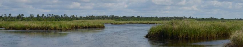
Natural versus Man-Made Restoration
Terrebonne-Atchafalaya Basin Projects
Why is marsh created by natural processes preferable to man-made marsh? What advantages • Increase Atchafalaya Flow into Terrebonne Marshes
do diversions have over dredges? • Isles Dernieres Barrier Island Restoration
• Timbalier Islands Barrier Island Restoration
We will leave aside some common questions when comparing these two restoration techniques, • Houma Navigation Canal Hydrologic Restoration
including whether there is enough bed load in the river and enough money available to build
sufficient new land mechanically, as well as how we will sustain marshes that are created with The Terrebonne and Atchafalaya Basins occupy the central coast of
a dredge long-term. Louisiana. The area is bordered to the east by Bayou Lafourche, a former
outlet of the Mississippi River, and to the west by the Chenier Plain. It includes
the growing deltas of the Atchafalaya River – the largest remaining natural
distributary of the Mississippi River. Habitats include bottomland hardwood
forests; baldcypress swamps; barrier islands; and freshwater, brackish and
saltwater marsh. In Atchafalaya Bay, on the western side of the basin, the
Atchafalaya River and its Wax Lake Outlet are building new land. However,
in Terrebonne Bay, on the eastern side of the basin, wetlands are collapsing
and becoming open water as the sediment-starved land sinks and salt water
intrudes into freshwater wetlands. $2.5 billion
The priority projects selected for this basin focus on stabilizing the barrier annually in state and
island system (Isles Dernieres Barrier Island and Timbalier Islands Barrier
Island Restoration) and re-establishing a balance of fresh and salt water local tax revenues from
as well as sediment and nutrient distribution. To accomplish that, two of
the proposed projects will use the existing network of navigation canals. Gulf wildlife-related
One project (Increase Atchafalaya River Flow into Terrebonne Marshes)
will take advantage of the Atchafalaya River to the west and the existence tourism – more than
of the Intracoastal Waterway to move fresh water and sediment eastward.
To increase the effectiveness of the project and the retention times of the $201 million from
fresh water within the basin, a gate (Houma Navigation Canal Hydrologic
Modification) is needed to block salt water that currently penetrates deep Louisiana
into the estuary. In the future, oyster reef restoration will play an important
Photo by Ashley Peters role in protecting remaining and newly created marshes and providing
key habitat.
The fundamental question is: “do man-made marshes differ from underwater plants, sheltering fish and feeding hordes of ducks that
natural marshes?” The answer is yes.” The difference is in the migrate south in the winter. Increase Atchafalaya Flow into Terrebonne Marshes
interaction between the marsh and the water. A man-made marsh is Lafourche, St. Mary and Terrebonne Parishes
created by moving sediment and water through a dredge pipe that Natural marshes have more diversity of plants growing in them,
may stretch for miles. The man-made marsh is built to an elevation more types of animals and produce more sheer weight of plants and
This hydrologic diversion project stretches from the Atchafalaya River to the
often two to five feet higher than the nearby natural tidal marsh wildlife each season. They have a wider variety of habitats because Houma Navigation Canal, which is part of the Gulf Intracoastal Waterway
in order to lengthen the lifespan of the project by offsetting the the sediments settle out differently – sands build up higher banks, system. The marshes in the influence area are nearly equidistant between
sinking expected due to the compaction of the pipeline-delivered silts fall on a gradient away from the channel and the finest clays fall the Mississippi and Atchafalaya Rivers and are blocked from significant
sediment. The sediments are moved around the site mechanically to out in the slack water, often captured miles away by existing marsh. amounts of river water and sediment. As a result of saltwater intrusion
provide a flat and level surface. Adding features that mimic natural, This produces ranges of elevations, soils and salinities as the river and sediment starvation, these marshes have been rapidly converted to
meandering tidal flows adds cost. The result is a leveled platform water mixes with the sea. You get a delta, continuously growing open water. This project would dredge and deepen the Gulf Intracoastal
of sediment perched high above the reach of the tide, and thus out and changing, with its branching tree-like pattern of channels Waterway to increase the flow of fresh water from the Atchafalaya River, to
of reach of fish or aquatic species. The reason for this construction and islands. help sustain Terrebonne Marsh.
method is that eventually the platform will subside to the elevation of
nearby natural marsh, but that can take years after construction. Rain So why do we support marsh creation projects? Why should we do
and tidal movement will eventually recontour the platform so that marsh creation at all? Because they have strategic and near-term
tidewater can flow through and over the marsh surface, providing a value, and although they don’t provide all the ecological benefits of
way for marsh creatures to swim in and out. Yet subsidence and sea natural marsh, they still provide an important function in reducing
level rise will continue, so eventually the plants drown and the area storm surges. There are many places on our coast, built when the
reverts to open water once again. river occupied different channels than it does today, that are out of
reach of sediment diversions. There are other places that need repair
Now consider a natural marsh built by sediment-rich water. By its quickly because they protect vital areas or vulnerable communities. In
very nature, it begins life by emerging from water, giving fish and those instances marsh creation with dredging is the right answer. But
wildlife immediate access to the plants that establish on the emerging marsh creation projects (along with barrier island projects, shoreline
marsh platform. As the ground subsides or the sea rises, the moving protection projects, ridge restoration projects and hydrological
water brings in new sediment to the marsh to build upon the old. And projects) will be most effective when coupled with river diversions,
the plants, fed by nutrients in the water, do a better job of adding because cyclically flowing fresh water and sediment – even the finest
peat to the soil and capturing sediment from the moving water. Even clays that can be transported many miles away – along with nutrients,
15 land emerges, the river water sustains a rich community of
before can add decades to the life of man-made projects. 16Isles Dernieres Barrier Island Restoration that are fed by the Vermilion, Mermentau, Calcasieu and Sabine rivers. It
Terrebonne Parish is being overwhelmed by saltwater intrusion due to navigation features,
such as the Calcasieu Ship Channel, Sabine Waterway, the Mermentau
This project will restore the Isles Dernieres barrier islands located on the Navigation Channel and the Freshwater Bayou Canal. These channels
western end of the Terrebonne Basin barrier shoreline. Storm-induced allowed salt water from the Gulf to penetrate deeply into formerly fresh
breaching and erosion, sediment starvation, sea level rise, tidal increases water marshes, leading to widespread marsh loss, while the jetty systems
caused by interior land loss, subsidence and canal-induced hydrological interrupted the flow of sediment from east to west.
changes have reduced the size of these islands. This loss directly impacts the
fish and wildlife of the region and leaves the marshes and infrastructure in The priority projects chosen in this basin focus on increasing sustainability
the interior of Terrebonne Bay vulnerable to saltwater intrusion, higher wave of the basin by reducing tidal action in Calcasieu Lake (Calcasieu Ship
energies and storm surge. This project will restore the Isles Dernieres barrier Channel Hydrological Modification) to help reduce interior salinity. In
islands, providing dune, beach and back barrier marsh habitat, which will addition, shoreline protection (Freshwater Bayou to Southwest Pass) will
help reduce the impact of storm surge and waves in the Terrebonne Basin. reduce shoreline retreat on the critical southeast corner of the Chenier Plain.
Timbalier Islands Barrier Island Restoration Calcasieu Ship Channel Salinity Control Measures
Lafourche and Terrebonne Parishes Calcasieu, Cameron, Jefferson Davis and Vermilion parishes
This project will restore the Timbalier Islands located on the eastern end of This project is located in the Calcasieu Ship Channel which connects the
the Terrebonne Basin barrier shoreline. Sediment starvation, sea level rise, Gulf to Calcasieu Lake. The Chenier Plain was once a stable platform, but
tidal increases and storm events have driven migration of the islands to the dredging of navigation canals dramatically changed the hydrology of the
northwest and severely reduced their length and width. This has diminished system. Saltwater intrusion led to the extensive loss of freshwater marshes
important barrier island habitat in the area and increased the vulnerability of and increased the threat of storm surge to communities in the lake’s interior.
interior Terrebonne Bay marshes to high-energy waves and storm surge. This This project will build structures that will limit saltwater intrusion through the
project will restore dune and beach habitat as well as reduce the impact of Calcasieu Ship Channel and into adjacent marshes and could also provide
storm surge and waves in the Terrebonne Basin and lower Lafourche Parish. minor storm surge protection in the ship channel.
Photo by Karen Westphal
Houma Navigation Canal Hydrologic Restoration Gulf Shoreline Protection: Freshwater Bayou to Southwest Pass
Terrebonne Parish Vermilion Parish
This project will construct a lock on the Houma Navigation Canal located This project will be located on the eastern side of the Chenier Plain, near
in western Terrebonne Bay. The Houma Navigation Canal is a significant Vermilion Bay, extending from Freshwater Bayou to Southwest Pass. Chenier
conduit for salt water into Terrebonne’s rapidly disappearing marshes. Plain beaches are a critical landscape feature and protect highly productive
Construction of this project would help control salinities in the navigation wetlands from erosion. The project will use shoreline parallel structures,
canal and increase the effectiveness of the Increase Atchafalaya Flow into possibly including man-made oyster reef, to reduce wave energy and trap
Terrebonne Marshes project by retaining and enhancing the distribution of sediments, slowing shoreline retreat and anchoring the critical southeast
fresh water in the wetlands to the north of the lock. corner of the Chenier Plain.
Chenier Plain Projects
• Calcasieu Ship Channel Salinity Control Measures
• Freshwater Bayou to Southwest Pass Shoreline Protection
The Chenier Plain coast was built by sediment drifting westward over the
last seven thousand years from the changing active arms of the Mississippi Risk Reduction – Multiple Lines of Defense
River, including the Atchafalaya. Cycles of shoreline erosion and sediment
deposition built ridges, or cheniers, running east-west between wide The Coastal Master Plan combines projects that build or maintain coastal wetlands with projects
expanses of marsh. The sediment transport west along the coastline from the
that provide enhanced storm risk reduction for coastal communities. Analyzing the relationship
Atchafalaya River has been interrupted by coastal infrastructure. The interior
Chenier Plain is characterized by fresh to brackish marshes and interior lakes between restoration and risk reduction projects is ongoing, but we encourage restoration project
design that maximizes risk reduction, and we believe this suite of projects lends itself to that
goal by where they are sited within the landscape. This approach to storm protection is known
as “Multiple Lines of Defense.”
The Oil Pollution Act and the Natural Resource Damage Assessment
Under the Oil Pollution Act, passed by Congress in response to the 1989 Exxon Valdez spill, the parties responsible for the Gulf oil
disaster are required to pay for direct remediation of the environmental harm done by the oil through a process called the Natural
Resource Damage Assessment (NRDA). The NRDA evaluation is still underway, and the final cost may not be known for years, but BP
17 18
has already agreed to a $1 billion down payment specifically for NRDA projects, some of which have already begun in Louisiana and
other states.PROJECT MAP Abridged Project Descriptions
Baton Rouge
Bay St. Louis
Slidell
Lafayette
Lake Charles
5 15 19
New Iberia 14
Abbeville New Orleans
6 17
9 Thibodaux Hopedale
Morgan City
7 3 1
18 Houma Larose 16 Pointe à
la Hache 2
8 4
10 Venice
Grand Isle
11
12 13
FULL LIST OF PROJECTS (see REVERSE)
PONTCHARTRAIN-MAUREPAS BASIN
BRETON-CHANDELEUR BASIN
BARATARIA BASIN
TERREBONNE-ATCHAFALAYA BASIN
CHENIER PLAIN
Abridged Project Descriptions Continued...
19 20Abridged Project Descriptions
21 22
Photo by Karen WestphalThe Mississippi River Delta Restoration Coalition includes the Environmental Defense
Fund, National Audubon Society, National Wildlife Federation, Coalition to Restore
Coastal Louisiana and Lake Pontchartrain Basin Foundation, working with partners
in The Nature Conservancy of Louisiana, the Louisiana Wildlife Federation and
Restore or Retreat. The coalition is made up of scientists, policy experts, economists and
outreach professionals working together to advance long-term solutions for Louisiana’s
coastal ecosystem by reconnecting the Mississippi River to its wetlands to protect
people, wildlife and jobs. The ultimate goal of our coalition is a sustainable future for
coastal Louisiana. Our members advocate for:
1) A science-based comprehensive plan to restore the Mississippi River Delta;
2) The establishment of a governance team with the authority, capacity and
Photo by NRDA
leadership to implement meaningful restoration;
3) The commitment of dollars necessary to implement projects that will stave
off continuing land loss and restore the natural processes of land building;
CONCLUSION
4) Education and outreach to connect communities, scientists, economists and
policymakers in an effort to expand the understanding of what is possible
With coastal wetlands in Louisiana disappearing at the rate of a football
for restoration.
field an hour, now is the time for the public, businesses and policymakers to
rally behind specific projects that are most essential to the long-term success
of coastal restoration. Any delay in using the available funding for the most
important projects will continue to put coastal cities, communities and vital
ecosystems at increased risk from hurricanes and rising sea levels.
The damage from continued wetland loss in Louisiana has Gulf-wide
repercussions. The rewards of restoration in the Mississippi River Delta
region will not be confined to Louisiana. Continued deterioration of the i Shorelines and Coastal Habitats in the Gulf of Mexico
Louisiana coast threatens the very ecosystems that support regional ii Watermarks, 2007
communities and cultures, both in Louisiana and across the Gulf. iii 15 Great Places to Hunt Waterfowl
Ecosystems do not recognize political boundaries and neither do fish, birds iv Saving Important Bird Areas
or marine mammals. Thus, restoration of the Mississippi River Delta will v Wildlife Tourism and the Gulf Economy
have far-reaching benefits throughout the Gulf Coast states. For instance, vi U.S. Department of the Interior, U.S. Fish and Wildlife Service, and U.S. Department of Commerce, U.S. Census Bureau. 2011
it will enhance the productivity of the adjacent Mississippi Sound. And by National Survey of Fishing, Hunting, and Wildlife-Associated Recreation.
improving the health of federal waters off the delta, seafood landings in the vii Couvillion, B.R.; Barras, J.A.; Steyer, G.D.; Sleavin, William; Fischer, Michelle; Beck, Holly; Trahan, Nadine; Griffin,
other Gulf states will be sustained. Brad; and Heckman, David, 2011, Land area change in coastal Louisiana from 1932 to 2010: U.S. Geological Survey
Scientific Investigations Map 3164, scale 1:265,000, 12 p. pamphlet.
The 2010 Gulf oil disaster compounded the injury of coastal wetland loss in viii Louisiana’s Comprehensive Master Plan for a Sustainable Coast
Louisiana. Only five years after Hurricanes Katrina and Rita ravaged New ix Wildlife Tourism and the Gulf Economy
Orleans and much of the already- weakened coast, the deadly explosion of x U.S. Department of the Interior, U.S. Fish and Wildlife Service, and U.S. Department of Commerce, U.S. Census Bureau. 2011
the Deepwater Horizon oil rig – followed by months of oil spewing from the National Survey of Fishing, Hunting, and Wildlife-Associated Recreation.
depths of the Gulf – constituted the largest man-made marine oil disaster in xi Watermarks, 2007
our history. While the full extent of the damages are not yet understood, the xii Saving Important Bird Areas
known impacts to the coastal ecosystems of Gulf states will require tens of xiii Michel, J.; Owens, E.H.; Zengel, S.; Graham, A.; Nixon, Z.; Allard, T.; Holton, W.; Reimer, P.; Lamarche, A.; White, M.; Ruth-
billions of dollars in restitution, remediation and restoration. erford, N.; Childs, C.; Mauseth, G.; Challenger, G.; Taylor, E. 2013. Extent and degree of shoreline oiling: Deepwater Horizon
oil spill, Gulf of Mexico, USA. PLOS ONE vol. 8.
This list of priority projects was identified as the most urgent and most
compliant with applicable funding criteria. Equally important, these 19 xiv Wildlife Tourism and the Gulf Economy
projects are a central part of the Coastal Master Plan, which was developed xv Quarterly census of employment and wages
after months of comprehensive scientific research, modeling and stakeholder xvii Wildlife Tourism and the Gulf Economy
input. By expediting funding and construction of these projects, we have a
historic opportunity to both restore the health of our coastal wetlands and
23 protect the thousands of businesses and jobs that depend on a healthy Gulf.
24
Photo by Ashley Peters25
You can also read