Revised Natural Heritage Impact Study - 4050 Yonge Street, Toronto FEBRUARY 2020
←
→
Page content transcription
If your browser does not render page correctly, please read the page content below

Revised Natural Heritage
Impact Study
4050 Yonge Street, Toronto

FEBRUARY 2020
Revised Natural Heritage Impact
Study
4050 Yonge Street, Toronto

REPORT PREPARED FOR
Yonge Park Plaza Inc.
3100 Steeles Avenue East, Suite 601
Markham, ON
L3R 8T3

REPORT PREPARED BY
Savanta Inc. – A GEI Company
118-450 Bronte Street South
Milton, ON
L9T 8T2

FEBRUARY 2020

SAVANTA FILE: 2000526
Revised NHIS: 4050 YONGE STREET, TORONTO

TABLE OF CONTENTS

1.0     INTRODUCTION                                                                                                                     1

  1.1         DESCRIPTION OF PROPOSED DEVELOPMENT .......................................................................... 1

  1.2         NATURAL FEATURES WITHIN AND ADJACENT TO SUBJECT LANDS ............................................... 1

2.0     STUDY APPROACH                                                                                                                   2

  2.1         BACKGROUND REVIEW & SCOPING ...................................................................................... 2

  2.2         BACKGROUND RESOURCES ................................................................................................ 2

  2.3         VEGETATION AND VASCULAR PLANTS ................................................................................... 3

      2.3.1      Vegetation Communities and Vascular Plants........................................................... 3

      2.3.2      Tree Inventory and Preservation Plan ...................................................................... 3

3.0     SUBJECT LANDS CHARACTERIZATION                                                                                                   4

  3.1         PHYSICAL BASELINE CONDITIONS ....................................................................................... 4

      3.1.1      Geology and Soils .................................................................................................... 4

      3.1.2       Hydrology and Hydrogeology .................................................................................. 4

  3.2         BIOLOGICAL BASELINE CONDITIONS .................................................................................... 5

      3.2.1      Natural Heritage Information Centre Database ........................................................ 5

      3.2.2      Vegetation Communities.......................................................................................... 5

      3.2.3      Vascular Plant Species ............................................................................................. 7

      3.2.4      Bottom and Top of Slope Limits ...............................................................................12

      3.2.5      Fish Habitat............................................................................................................12

  3.3         ASSESSMENT OF SIGNIFICANCE AND SENSITIVITY ...................................................................13

      3.3.1      Significant Wetlands ...............................................................................................14

                                                                                                                     Table of Contents i
Revised NHIS: 4050 YONGE STREET, TORONTO

      3.3.2      Habitat of Endangered Species and Threatened Species...........................................14

      3.3.3      Fish Habitat............................................................................................................14

      3.3.4      Significant Woodlands ............................................................................................14

      3.3.5      Significant Valleylands ...........................................................................................15

      3.3.6      Significant Wildlife Habitat .....................................................................................15

      3.3.7      Significant Areas of Natural and Scientific Interest (ANSI) ........................................17

      3.3.8      Summary of Ecological and Natural Heritage Significance .......................................17

4.0     POTENTIAL IMPACTS AND EFFECTS                                                                                                   18

  4.1         SUMMARY OF POTENTIAL IMPACTS .....................................................................................18

      4.1.1      Forested Slopes of the West Don River System .........................................................18

      4.1.2      Fish Habitat of the West Don River System ...............................................................19

5.0     NET ECOLOGICAL EFFECTS AND MITIGATION                                                                                           21

  5.1         WEST AND NORTH SLOPE STABILITY ...................................................................................21

  5.2         DRY-FRESH SIBERIAN ELM FOREST ....................................................................................22

  5.3         FISH HABITAT................................................................................................................24

6.0     NATIVE VEGETATION RESTORATION WORKS                                                                                             25

7.0     SEQUENCE OF CONSTRUCTION                                                                                                        26

8.0     SUMMARY                                                                                                                         27

REFERENCES AND BACKGROUND MATERIAL                                                                                                      28

APPENDICES                                                                                                                              32

                                                                                                                     Table of Contents ii
Revised NHIS: 4050 YONGE STREET, TORONTO

APPENDICES
Appendix A   Figures
Appendix B   Ecological Land Classification Data Cards (Savanta)
Appendix C   Botanical Inventory

FIGURES
Figure 1     Location of Subject Lands
Figure 2     Natural Heritage Features
Figure 3     Proposed Development Footprint
Figure 4     Opportunity for Restoration/Enhancement of Natural Heritage Features     (Ravine
             Stewardship Plan)

TABLES
Table 1      Ecological Land Classification - Vegetation Type Present
Table 2      Exotic Species Recorded on Subject Lands and their Invasiveness Potential
Table 3      Estimated Plant Densities for Restoration Areas

                                                                            Table of Contents iii
Revised NHIS: 4050 YONGE STREET, TORONTO

1.0 INTRODUCTION

1.1       Description of Proposed Development

Savanta Inc. (Savanta) was retained by Easton’s Group of Hotels to revise a Natural Heritage Impact
Study (NHIS) that had originally been completed in 2016. Savanta’s NHIS was part of a complete
application that was submitted to appropriate agencies including the Toronto and Region
Conservation Authority (TRCA). The NHIS was approved by the TRCA in 2017 in support of a draft
plan for a nine-storey office/hotel building with five levels of underground parking on the Subject
Lands. However, the recent updates to the draft plan require a complete resubmission of the
application.

The current draft plan is for a 21-storey hotel and 35-storey residential building to be constructed at
the northwest corner of Wilson Avenue and Yonge Street, in Toronto, Ontario as shown on Figure 1
(Appendix A). The proposed building also includes a five-level underground parking and a connection
to the Toronto Transit Commission (TTC) York Mills Subway Station. The property is currently in use as
a TTC commuter lot. West of the parking lot the land slopes steeply down to the Lower West Don
River. To the north there is a shallower slope and an area of landscaped grass and trees. Field
studies of the forested north and west slopes, as well as the western limits (west bank of the West
Don River) of the Subject Lands were completed in 2010 as input to this NHIS (Figure 2, Appendix A).

Active localized bank erosion (~2 m) is present on the east side of the West Don River (west side of
parking lot), and slope stabilization is required to prevent further undercutting which would threaten
proposed infrastructure stability on the Subject Lands. A Bank Restoration Plan was completed in
2012, through collaborative efforts amongst Riggs Engineering Ltd. (Riggs), Savanta, NAK Design
Strategies (NAK) and Alston Associates Inc. (Alston). This Bank Restoration Plan is still considered
appropriate and is part of the application for the revised Draft Plan.

TRCA regulates development within shorelines, watercourses and wetlands (O. Reg. 166/06); they
administer the Generic Regulation (O. Reg. 97/04) and oversee permitting under their “City Policies
for Planning and Development in the Watersheds of TRCA” (LCP), including works required for the
proposed slope stabilization.

1.2       Natural Features Within and Adjacent to Subject Lands

A number of natural features occur on and adjacent to the Subject Lands, (Figure 3, Appendix A),
including:
      •   Forested slopes associated with the West Don River (Subject Lands and adjacent lands);
      •   Tolerant Warmwater Fish Habitat associated with the West Don River; and
      •   Urban wildlife habitat

Project No. 2000526                          February 2020                                   Page 1 of 32
Revised NHIS: 4050 YONGE STREET, TORONTO

2.0 STUDY APPROACH

2.1       Background Review & Scoping

The Terms of Reference (TOR) for an NHIS on the Subject Lands were submitted to and approved by
the TRCA in 2010. Savanta has reviewed these TOR and believe they remain appropriate for the
current revised application.

This NHIS includes:

      •   A vegetation community and botanical inventory of the north and west slope forest
          communities;
      •   Summary information regarding all ecological features and functions present on and
          immediately adjacent to the site;
      •   Impact assessment analyses of ecological features on proposed development;
      •   Detailed mitigation commentary; and
      •   A discussion regarding the potential for an ecological net gain associated with the proposed
          development.

2.2       Background Resources

A variety of background resources were consulted to assist in the characterization of the Subject Lands
and its ecological significance, including:

      •   City of Toronto Official Plan (February 2019);
      •   City of Toronto botanical survey (May 2010);
      •   City of Toronto ESA Study (June 2012);
      •   Kuntz Forestry botanical survey (in association with Savanta) (May 2010);
      •   Federal and Provincial Species at Risk websites;
      •   NHIC Heritage Information Centre (NHIC) database;
      •   Ministry of Natural Resources and Forestry – (Provincially Significant Wetlands, deer wintering
          areas, Areas of Natural and Scientific Interest, fisheries data);
      •   TRCA Terrestrial Natural Heritage System Strategy (2007);
      •   TRCA (ELC and fisheries data for West Don River); and
      •   Various provincial wildlife atlases (i.e., amphibians, breeding birds, mammals, reptiles).

Additionally, detailed site-specific studies of soils, geology, hydrology and hydrogeology were
reviewed and incorporated, including:

      •   Don River Watershed Plan Beyond Forty Steps (TRCA, 2009);
      •   Don River Watershed Plan Terrestrial Natural Heritage – Report on Current Conditions and
          Refinement of a Target System (TRCA, 2009);

Project No. 2000526                            February 2020                                   Page 2 of 32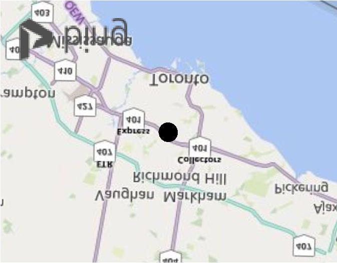
Revised NHIS: 4050 YONGE STREET, TORONTO

      •   Don River Watershed Plan Geology and Groundwater Resources – Report on Current
          Conditions (TRCA, 2009);
      •   Don River Watershed Plan – Report on Aquatic Conditions (TRCA, 2009);
      •   Don River Watershed Implementation Guide (TRCA, 2009);
      •   Hydrogeological Investigation for 4050 Yonge Street, Toronto, Ontario (EXP., 2020);
      •   Functional Servicing and Stormwater Management Report (Schaeffer Engineering, 2020);
      •   Lower West Don River Bank Restoration. 4050 Yonge Street, Toronto Ontario (Riggs
          Engineering et al., 2012);
      •   Slope Stability Analysis Proposed Mixed-Use Development. 4050 Yonge Street, Toronto,
          Ontario (McClymont and RAK Engineers (MCR, 2016); and
      •   Landscaping Plan (NAK Design Group, 2020).

2.3       Vegetation and Vascular Plants

2.3.1     Vegetation Communities and Vascular Plants

Vegetation community boundaries were mapped using the Ecological Land Classification (ELC) system
developed by Lee et al. (1998). A field survey to delineate and describe ELC communities was
completed between April and May 2010 (Savanta Consulting Inc., Kuntz Forestry). To determine if
there were any changes to the landscape since the previous surveys conducted in 2010, the Subject
Lands were revisited by Savanta on February 5, 2020. Vegetation types were modified from those in
the first approximation of the ELC manual to account for variations in species dominance to better
reflect the variability of the site. The completed Ecological Land Classification, Community Description
and Classification, Plant Species List data and the Management/Disturbance cards from 2010 can be
found in Appendix B.

A botanical inventory was conducted in 2010 as part of the ELC, as well by a site visit by the City of
Toronto. The plant species list for the Subject Lands is provided in Appendix C. The provincial status
of plant species is based on Newmaster et al. (1998), with updates from the databases of the Natural
Heritage Information Centre (MNRF, 2019). Latin and colloquial names of plant species follow
Newmaster et al. (1998).

2.3.2     Tree Inventory and Preservation Plan

Kuntz Forestry has conducted a tree health assessment study for the trees within the west and north
forested slopes. Their work is summarized in a Tree Inventory and Preservation Plan Report (2019),
in accordance with City of Toronto planning requirements. Savanta consulted with Kuntz Forestry
regarding the health/integrity of the trees found along these slopes.

Project No. 2000526                           February 2020                                  Page 3 of 32
Revised NHIS: 4050 YONGE STREET, TORONTO 3.0 SUBJECT LANDS CHARACTERIZATION 3.1 Physical Baseline Conditions The physical baseline conditions described below were summarized from the EXP Hydrogeological Report (2020) and the various Don River Watershed Plan reports (TRCA, 2009). 3.1.1 Geology and Soils Generally, the Subject Lands are located in the South Slope (till) physiographic region on modern river deposits containing sand, silt, some gravel and little organic matter. Beneath this layer is the Leaside Till (sandy silt till), underlain by the Thorncliffe Formation (two layers, sand silt and silt and clay). The Thorncliffe Formation supports both shallow and deeper water deposits, in each of the two layers and is one of the three significant aquifers in the Don River Watershed. Geotechnical studies by EXP found a thick layer of fill (up to 5.5 m) immediately underneath the asphalt parking lot, prior to reaching native soils. It is believed that fill was placed on the Subject Lands to raise the grade above normal flood levels. Fill includes concrete, wood, brick pieces and some native soils. Beneath the fill, sandy silt to sand soils were present, with sandwiched layers of clayey silt to silty clay. The 100-year floodline (based on TRCA’s hydraulic model) is completely below the fill area. 3.1.2 Hydrology and Hydrogeology Through previous geotechnical investigations conducted by others, the groundwater table is estimated to be 5 m to 7 m below the surface, and given the soil type, can fluctuate up to 1.5 m upwards during seasonally higher water levels. West of the existing parking lot is the west arm of the Don River, which flows south under Wilson Avenue, and east under Yonge Street where it is channelized to prevent flooding. The southeast corner of Yonge and York Mills Road (outside of the Subject Lands) is designated by TRCA as a “Special Policy Area” for flood control. The river eventually empties into Lake Ontario through the Keating Channel. Bank erosion is present on the west and east banks of the West Don River, in the vicinity of the Subject Lands, and exposed banks are an active sediment source to the river. Currently, the only bank protection is a random mixture of broken concrete and asphalt. There is little vegetation cover on the bank, limited to the occasional leaning tree. Erosion analysis by MCR (2016), and Riggs (2012) determined that without bank stabilization (i.e., rip-rap protection) the existing channel might shift as far as 7 m into the east bank (within 100 years), placing the Wilson Avenue Bridge at risk. Project No. 2000526 February 2020 Page 4 of 32
Revised NHIS: 4050 YONGE STREET, TORONTO

3.2       Biological Baseline Conditions

3.2.1     Natural Heritage Information Centre Database

The Natural Heritage Information Centre (NHIC) database (MNRF 2019) was searched for records of
provincially significant plants, vegetation communities and wildlife on, and in the vicinity of the Subject
Lands. The database provides occurrence data by 1 km2 area squares, with one square overlapping
at least a portion of the Subject Lands (17PJ2844) Within this square, the search revealed four records,
seven of which had an element occurrence rank considered to be ‘Historical’ (greater than 50 years
old) and are not addressed as current occurrences in this reporting. The following records are
considered as current occurrences in this reporting:

      •   Species listed as Threatened or Endangered on the Species at Risk in Ontario (SARO) list:
             o Butternut (Juglans cinera) – Endangered in Ontario;

      •   Species of Conservation Concern (i.e., listed as Special Concern on the SARO list, or
          identified as an S1-S3 species):
              o Old-field Toadflax (Nuttallanthus canadensis) – S1 in Ontario;
              o Black Snakeroot (Actaea racemosa) – S2 in Ontario.

Although Butternut specimens have recently been recorded in the general vicinity of the Subject Lands,
the original detailed site surveys by Savanta and Kuntz Forestry in 2010 (Section 3.2.2 of this report),
and supported by Savanta’s recent February 5 2020 survey, have confirmed that Butternuts are not
present on the Subject Lands.

3.2.2     Vegetation Communities

A site visit was conducted on February 5, 2020 to assess the present condition of the woodland
immediately adjacent to the parking lot. The valley slopes were originally surveyed by Savanta in
2010, and the forest community was determined to be dominated by Siberian Elm in the overstorey,
with several exotic and invasive shrub and herb species in the understorey.

Broadly speaking, two forest community types dominate the Don River watershed landscape. See
Table 1 below. These are sugar maple forests with hardwood associates (i.e., beech, ash and oak)
and a mixed forest community comprised of a mixture of hemlock, white pine, sugar maple and oak
(TRCA, 2009). Neither the Subject Lands nor adjacent areas have been defined as Environmentally
Significant Areas in the City (North-South Environmental, 2012).

Based upon site surveys completed by Savanta and Kuntz Forestry, one ELC community was defined
in the wooded portions of the valley slopes on the edges of and adjacent to the Subject Lands. A
non-native, Dry-Fresh Siberian Elm Forest occurs along both the west and north slopes (Figure 2,
Appendix A). The Siberian Elm canopy extends over the edges of the existing parking lot. All
vegetation height classes (canopy, subcanopy, understorey, groundcover) were dominated by non-
native species, many of which are aggressive invasives.

Project No. 2000526                            February 2020                                    Page 5 of 32
Revised NHIS: 4050 YONGE STREET, TORONTO
At the western limits of the Subject Lands, along the west bank of the West Don River a Fresh-Moist
Sugar Maple forest is present. The canopy is co-dominated by Sugar Maple and Eastern Cottonwood.
Some invasive species are present in the understorey (Common Buckthorn, Tartarian Honeysuckle)
and Garlic Mustard (an aggressive invasive) dominates the groundcover.
The 2020 survey generally confirmed that the Siberian Elm continues to form the tree canopy, and the
exotic shrubs (e.g., Common Buckthorn, Tartarian Honeysuckle) were still present. One change, not
directly related to vegetation but likely impacting it, was a significant increase of the amount, and
resulting thickness, of trash on the woodland slope. This accumulated layer may now be preventing
germination and establishment of new species, whether tree, shrub or herb, as the seeds may not be
able to reach the mineral soil underneath. To prevent structural deterioration of the woodland,
removal of this waste layer is strongly recommended.
Table 1. Ecological Land Classification - Vegetation Type Present
ELC TYPE DESCRIPTION S-RANKS
DECIDUOUS FOREST (FOD)
*Dry-Fresh Siberian • The main tree canopy is composed almost exclusively of this N/A
Elm Forest non-native elm, with a minor occurrence of weeping willows
along the base of the north slope
• The secondary canopy is composed of occasional Manitoba
maple and Norway maple
• The shrub layer consists of Siberian elm and maple saplings,
along with abundant common buckthorn and some Tartarian
honeysuckle
• The ground cover is relatively well developed, but dominated
by garlic mustard
• The entire slope is significantly disturbed and contains large
amounts of woody debris and trash
Fresh-Moist Sugar • Located beside the west bank of the West Don River, at the
Maple Deciduous western limit of the Subject Lands
Forest
• The canopy is dominated by Sugar Maple and Eastern
(FOD6) Cottonwood, with Manitoba Maple, American Basswood,
Siberian Elm and Green Ash as common associates
• Active management of Eastern Cottonwood was evident, as
noted by felled species resulting in gaps in the canopy
throughout the community
Project No. 2000526 February 2020 Page 6 of 32Revised NHIS: 4050 YONGE STREET, TORONTO
ELC TYPE DESCRIPTION S-RANKS
• Understory species is comprised of some invasives (Common
Buckthorn and Tartarian Honeysuckle) and native species
(Choke Cherry and Alternate leaved Dogwood).
• Garlic mustard dominates the groundcover, and interspersed
in low cover values are a mixture of native woodland species.
• The invasive, Celandine, is also present in the ground cover in
low numbers
*Not listed in Southern Ontario’s ELC
Provincial Status
Provincial ranks are used by the NHIC to set protection priorities for rare species and natural
communities. These rankings are based on the total number of extant Ontario populations and the
degree to which they are potentially or actively threatened with destruction. The ranks are:
S1: Extremely rare in Ontario; usually fewer than 5 occurrences or very few remaining individuals,
often especially vulnerable to extirpation.
S2: Very rare in Ontario; usually between 5-20 occurrences or with many individuals in fewer
occurrences, often susceptible to extirpation.
S3: Rare to uncommon in Ontario; usually between 20-100 occurrences; may have fewer occurrences,
but with a large number of individuals in some populations; may be susceptible to large-scale
disturbances.
S4: Uncommon to locally common in Ontario and apparently secure; usually more than 100
occurrences.
S5: Very common in Ontario and demonstrably secure.
3.2.3 Vascular Plant Species
Non-native species dominate the Siberian Elm community located on the west and north forested
slopes. Thirty of the 50 species recorded were exotic, with 52% of these considered moderately to
highly invasive (weediness index). Four of the top five City of Toronto’s widespread invasives are found
in the Siberian Elm community (Common Buckthorn, Garlic Mustard, Manitoba Maple and Norway
Maple). The Siberian Elm stems are mature with some stems displaying signs of crown dieback. Refer
to Kuntz Forestry’s Tree Preservation Plan for details on individual stem health assessment.
In the Fresh-Moist Sugar Maple Forest on the west bank of the West Don River an additional 23
species were observed, which included native trees and shrubs, woodland ephemerals (White Trillium)
and some exotic species (Celandine, European Stinging Nettle, Forget-me-not, Guelder Rose, Herb-
Robert, Hybrid Willow) not present in the Siberian Elm Forest.
Project No. 2000526 February 2020 Page 7 of 32Revised NHIS: 4050 YONGE STREET, TORONTO
A total of 73 species were observed within the Subject Lands. One S4 species (apparently secure in
Ontario), Black Walnut was observed. No locally, provincially or federally significant species were
present.
A list of all the exotic species inventoried across the Subject Lands, along with MNRF weediness
rankings and Urban Forest Associates (2002) “Invasive Exotic Species Ranking for Southern Ontario”
are outlined in Table 2 below.
Urban Forest Associates (2002) groups invasive species into four categories (similar to CVC’s invasive
species list). They are:
Category 1: Aggressive Invasive Exotic. These species dominate, due to large range of
reproductive means, and exclude other native species from establishing. Control
measures have limited success and eradication is often necessary.
Category 2: Highly invasive exotics that occupy specific habitats or niches and are slow to colonize
areas outside of where they are abundant. Control where necessary to limit spread.
Category 3: Moderately invasive exotics that can dominate local areas, when suitable conditions
are present. Control where necessary to limit spread.
Category 4: Exotic species that only pose a threat to direct native competitors; and do not impact
overall diversity to natural area. Native species may successfully replace these exotics
over time with appropriate management measures. Control is required to limit their
spread.
Within the Siberian Elm community there are eight Category 1 species present where eradication is
the best option to re-establish natural cover (see the Ravine Stewardship Plan, 2015 for detailed
discussion on invasive species management, which includes Category 1 and 2 species). Long-term
invasive species monitoring within the ravine stewardship plan area will be the responsibility of the
TRCA. The 2020 survey confirmed that these exotic species are still present.
Table 2. Exotic Species Recorded on Subject Lands and Their Invasiveness Potential
Invasive Exotic Species
Common Name Latin Name Weediness Ranking
Index For Southern Ontario
(Urban Forest Assoc., 2002)
Awnless Brome Bromus inermis ssp. -3 No information
inermis
Project No. 2000526 February 2020 Page 8 of 32Revised NHIS: 4050 YONGE STREET, TORONTO
Invasive Exotic Species
Common Name Latin Name Weediness Ranking
Index For Southern Ontario
(Urban Forest Assoc., 2002)
Bitter Nightshade Solanum dulcamara -2 Category 3 (invades forests and
wetlands)
Black Locust Robinia pseudo-acacia -3 Category 2 (invades meadows)
Butter-and-eggs Linaria vulgaris -1 Category 4 (invades meadows)
Canada Thistle Cirsium arvense -1 Category 1 (invades, prairies,
meadows and forest edges)
Celandine Chelidonium majus -3 No information
Chicory Cichorium intybus -1 No information
Common Buckthorn Rhamnus cathartica -3 Category 1 (invades prairies,
meadows and forests)
Common Burdock Arctium minus -2 No information
Common Plantain Plantago major -1 No information
Common Yarrow Achillea millefolium ssp. -1 No information
millefolium
Dame’s Rocket Hesperis matronalis -3 Category 1 (invades forests and
meadows)
Dandelion Taraxacum officinale -2 No information
Project No. 2000526 February 2020 Page 9 of 32Revised NHIS: 4050 YONGE STREET, TORONTO
Invasive Exotic Species
Common Name Latin Name Weediness Ranking
Index For Southern Ontario
(Urban Forest Assoc., 2002)
English Rye Grass Lolium perenne -1 Category 4 (invades prairies and
meadows)
European Stinging Urtica dioica ssp. dioica -1 Category 3 (invades forests)
Nettle
Field Forget-me-not Myosotis scorpioides -1 Category 4
Field Sow-thistle Sonchus arvensis ssp. No information
arvensis
Filiform Fescue Festuca filiformis No information
Garlic Mustard Alliaria petiolata -3 Category 1 (invades forests)
Goutweed Aegopodium -3 Category 1 (invades forests)
podagraria
Guelder Rose Viburnum opulus -1 Category 4
Herb-robert Geranium robertianum -2 No information
Hybrid Willow Salix x. pendulina No information
Lady’s Thumb Polygonum persicaria -1 No information
Manitoba Maple Acer negundo Category 1 (invades forests)
Motherwort Leonurus cardiaca -2 No information
Project No. 2000526 February 2020 Page 10 of 32Revised NHIS: 4050 YONGE STREET, TORONTO
Invasive Exotic Species
Common Name Latin Name Weediness Ranking
Index For Southern Ontario
(Urban Forest Assoc., 2002)
Norway Maple Acer platanoides -3 Category 2 (invades forests)
Orchard Grass Dactylis glomerata -1 Category 3 (invades prairies and
meadows)
Quack Grass Elymus repens -3 Category 3 (invades prairies and
meadows)
Siberian Elm Ulmus pumila -1 Category 2 (invades prairies)
Spindle Tree Euonymus europaea -1 Category 3 (invades forests)
Swallow-wort Cyannchum rossicum Category 1 (invades meadows
and forests)
Tall Fescue Festuca arundinacea -1 Category 3 (invades prairies and
meadows)
Tartarian Lonicera tatarica -3 Category 1 (invades meadows
Honeysuckle and forest edges)
Timothy Grass Phleum pratense -1 No information
Weeping Willow Salix cf babylonica No information
Wild Carrot Daucus carota -2 No information
Wood Avens Geum urbanum -1 No information
Note: Weediness Index value quantifies the potential invasiveness of non-native plants. A value
of -1 is low potential to invade to invade and -3 is a species that has a high potential to invade.
Project No. 2000526 February 2020 Page 11 of 32Revised NHIS: 4050 YONGE STREET, TORONTO
3.2.4 Bottom and Top of Slope Limits
Discussed within the biological baseline section of reporting, these limits relate to woodland cover
and aquatic habitat. The existing bottom and top of the west and north slopes were surveyed and
staked by the proponent along with TRCA and the City of Toronto in March 2010. See Figure 2,
Appendix A. Riggs and MCR have determined the long-term stable top of slope, including toe erosion
allowance, and that limit reflects their proposed slope stabilization works on the west boundary and
the existing top of slope on the north boundary. See Figures 3 and 4, Appendix A.
Although the original staking and survey efforts are dated (i.e., completed in 2010), the valley slopes
and wooded edge are well-defined, and Savanta is of the opinion that the previous staking limits
remain valid.
3.2.5 Fish Habitat
The Lower West Don River is located in a highly urbanized environment with limited stormwater
management and combined sewer overflows. The Subject Lands occur in the “Area 5” Fish
Management Zone (TRCA, 2009f), and is described as a tolerant warmwater fishery. The aquatic
habitat (fish and benthics) is rated as poor under the Indices of Biotic Integrity scoring system and
pollutant tolerant benthic families dominate. The fishery includes common native (i.e., creek chub,
longnose dace, black nose dace, fathead minnow, blunt nose minnow and white sucker) and invasive
species (common carp and goldfish). Water quality is poor with high levels of bacteria (E. coli),
nutrients, and sediment.
TRCA’s Aquatic Systems Analyst of the day (Mr. David Lawrie) provided fisheries sampling data for
both TRCA and Ministry of Natural Resources and Forestry (MNRF) monitoring stations located closest
to the Subject Lands (TRCA station DN015WM) as well as above and below the Subject Lands (MNRF
stations Don 10, Don 16, Don 34, Don 528, and Don 553). At the closest monitoring station to the
Subject Lands, four species were recorded between 2002-2008:
• White Sucker (Catostomus commersoni);
• Fathead minnow (Pimephales promelas);
• Blacknose Dace (Rhinichthys atratulus); and
• Creek Chub (Semotilus atromaculatus).
All of the species recorded at the TRCA and MNRF stations are expected in a tolerant warmwater
fishery.
Savanta completed fish habitat assessments (January 14, 2011 and July 17, 2012) to determine existing
conditions along the entire toe of slope proposed for protection. The proposed bank stabilization
plan was then reviewed for potential impacts on fish habitat. The proposed stabilization works result
in no net loss in wetted width, prevent further erosion and sedimentation into the river, and rip-rap
will provide an increase in interstitial habitat. No negative impacts to fish habitat are expected.
Project No. 2000526 February 2020 Page 12 of 32Revised NHIS: 4050 YONGE STREET, TORONTO
Details regarding existing fish habitat and impact assessment of the bank stabilization on this habitat
are provided in the Bank Erosion Plan (Riggs et. al, 2012).
3.3 Assessment of Significance and Sensitivity
The most recent Provincial Policy Statement (PPS) was issued under Section 3 of the Planning Act. It
came into effect on April 30, 2014 and it replaces the PPS issued March 1, 2005. The PPS provides
direction on matters of provincial interest related to land use planning and development and
”…supports a comprehensive, integrated and long-term approach to planning…” The PPS is to be
read in its entirety and land use planners and decision-makers need to consider all relevant policies
and how they work together.
This NHIS addresses those policies that are specific to Natural Heritage (section 2.1) with some
reference to other policies with relevance to this study (e.g., those related to Efficient and Resilient
Development and Land Use Patterns, section 1.1; Sewage, Water and Stormwater, section 1.6.6;
Water, section 2.2; Natural Hazards, section 3.1).
Eight types of significant natural heritage features are defined in the PPS, as follows:
• Significant wetlands
• Significant coastal wetlands;
• Significant woodlands;
• Significant valleylands;
• Significant wildlife habitat;
• Fish habitat;
• Habitat of endangered and threatened species; and
• Significant areas of natural and scientific interest (ANSIs).
The PPS states the following:
Development and site alteration shall not be permitted in significant wetlands,
or in significant coastal wetlands.
Development and site alteration shall not be permitted in significant
woodlands, significant valleylands, significant wildlife habitat or significant
ANSIs, unless it is demonstrated that there will be no negative impacts on the
natural features or their ecological functions.
Development and site alteration shall not be permitted in the habitat of
endangered and threatened species or in fish habitat, except in accordance
with provincial and federal requirements.
Development and site alteration may be permitted on lands adjacent to fish
habitat provided it has been demonstrated that there will be no negative
impacts on the natural feature or their ecological functions.
Project No. 2000526 February 2020 Page 13 of 32Revised NHIS: 4050 YONGE STREET, TORONTO In order to assess how natural heritage features are defined and how they relate to land development proposals, the MNRF has prepared a technical guidance document, the Natural Heritage Reference Manual (NHRM) (MNRF 2010). Sections 3.3.1 through 3.3.8 of this report provide a detailed discussion regarding criteria for designation as the above-noted features. Section 3.3.8 provides a summary of the natural features found on and adjacent to the Subject Lands and their ecological functions. 3.3.1 Significant Wetlands Within Ontario, Significant Wetlands are identified by the MNRF or by its designates. Other evaluated or unevaluated wetlands may be identified for conservation by the municipality or the conservation authority. There are no Significant Wetlands identified on or within 120 m of the Subject Lands. 3.3.2 Habitat of Endangered Species and Threatened Species Endangered and threatened species are identified by the MNRF using procedures established by the Committee on the Status of Species at Risk in Ontario (“COSSARO”). No federally, provincially or threatened plant or wildlife species were observed during the fieldwork completed for this project, including Butternut, which was listed as having potential for being on this site (NHIC, 2019). 3.3.3 Fish Habitat Fish habitat, as defined in the federal Fisheries Act, c. F-14, means spawning grounds and nursery, rearing, food supply, and migration areas on which fish depend directly or indirectly in order to carry out their life processes. Fish, as defined in S.2 of the Fisheries Act, c. F-14, includes parts of fish, shellfish, crustaceans marine animals and any parts of shellfish, crustaceans or marine animals, and the eggs, sperm, spawn, larvae, spat and juvenile stages of fish, shellfish, crustaceans and marine animals (Department of Fisheries and Oceans, 2013). There is one watercourse, the West Don River, along the western portion of the Subject Lands. The Lower West Don River Subwatershed is entirely within the built-up urban environment of Toronto. A tolerant warmwater fishery is present, comprised of common native and a few invasive species. This fishery receives nutrients, chemicals and sediment from the surrounding urban environment and is highly tolerant of these conditions. 3.3.4 Significant Woodlands Significant woodlands should be defined and designated by the planning authority, typically at a regional level. The Natural Heritage Reference Manual (NHRM; MNR 2010) is a document that was developed (and released in a first version in 1999) by the Province to provide technical guidance for Project No. 2000526 February 2020 Page 14 of 32
Revised NHIS: 4050 YONGE STREET, TORONTO

implementing the natural heritage policies of the Provincial Policy Statement, 2014. “Recommended
Significant Woodland Evaluation Criteria”, are outlined for application in association with local
materials to assess woodland significance. The four recommended criteria in the NHRM (Woodland
Size, Ecological Functions, Uncommon Characteristics and Economic and Social Functional Values)
were reviewed as they relate to the woodlands associated with the Study Area.

A Dry–Fresh Siberian Elm Forest is present along the west and north slopes of the Subject Lands and
immediately adjacent lands. This community itself is predominantly non-native and it is habitat to eight
highly aggressive invasive species (Category 1). The removal of this community and the reintroduction
of native species would provide an ecological net gain to the Lower West Don River Subwatershed.
In its current form, this community does not reasonably meet tests of woodland significance.

A Fresh-Moist Sugar Maple Forest is located along the west bank of the West Don River, at the western
limit of the Subject Lands. While narrow and disturbed by the adjacent golf course activities (i.e., the
Don Valley Golf Course), this wooded unit is relatively contiguous with other native woodlands in the
valley and should be deemed to be significant.

3.3.5    Significant Valleylands

Significant valleylands should be defined and designated by the planning authority. General
guidelines for determining significance of these features are presented in the NHRM for Policy 2.1 of
the PPS. Recommended criteria for designating significant valleylands include prominence as a
distinctive landform, degree of naturalness, and importance of its ecological functions, restoration
potential, and historical and cultural values.

The West Don River valley meets tests to be defined as a significant valleyland.

3.3.6    Significant Wildlife Habitat

Significant wildlife habitat (SWH) is one of the more complex natural heritage features to identify and
evaluate. There are several provincial documents that discuss identifying and evaluating SWH: the
NHRM (MNR, 2010), the Significant Wildlife Habitat Technical Guide (MNR, 2000), and the SWH
Ecoregion Criterion Schedule (MNRF, 2015). Currently, the MNRF consults this last reference (MNRF,
2015) when determining the presence of candidate SWH and confirmed SWH. The Subject Lands are
located in Ecoregion 7E and were therefore assessed using the 7E Criterion Schedule (MNRF, 2015).

There are four general types of significant wildlife habitat: seasonal concentration areas, rare or
specialized habitats, habitat for species of conservation concern, and animal movement corridors. In
summary, the Subject Lands do not meet the definition for Significant Wildlife Habitat. Discussions
regarding the potential occurrence of SWH on the Subject Lands are presented below.

Project No. 2000526                           February 2020                                 Page 15 of 32
Revised NHIS: 4050 YONGE STREET, TORONTO

Seasonal Concentration Areas

Seasonal concentration areas are those sites where large numbers of a species gather together at
one time of the year, or where several species congregate. The following is a partial list of numerous
examples: deer yards, snake and bat hibernacula, waterfowl staging areas, raptor wintering areas,
bird nesting colonies, shorebird stopover areas, and colonial nesting bird habitats. Areas that support
a species at risk, or if a large proportion of the population may be lost if the habitat is destroyed, are
examples of seasonal concentration areas which should be designated as significant.

The Subject Lands are located within an urban setting in the City of Toronto; the bulk of the Subject
Lands are already developed and almost all undeveloped portions are dominated by non-native and
aggressive plant species. The general absence of natural features from these lands precludes the
presence of seasonal concentration areas for wildlife.

Rare or Specialized Habitats

a)     Rare Vegetation Communities

Rare habitats are those with vegetation communities that are considered rare in the province.
SRANKS are rarity rankings applied to species at the ‘state’, or in Canada at the provincial level, and
are part of a system developed under the auspices of the Nature Conservancy (Arlington, VA).
Generally, community types with SRANKS of S1 to S3 (extremely rare to rare-uncommon in Ontario),
as defined by the NHIC, could qualify. It is assumed that these habitats are at risk and that they are
also likely to support additional wildlife species that are considered significant.

All vegetation communities identified, delineated and assessed within the Subject Lands are
considered common in Ontario (Appendix M, MNR, 2000).

b)     Specialized Habitat for Wildlife

Specialized habitats are microhabitats that are critical to some wildlife species. Potential examples
include woodland raptor nesting habitat, turtle nesting areas or amphibian breeding habitats.

A detailed review confirms that the Subject Lands do not provide suitable habitat for any specialized
wildlife.

Habitat for Species of Conservation Concern

Species of conservation concern includes four types of species: i) those that are rare; ii) those whose
populations are significantly declining; iii) those that have been identified as being at risk to certain
common activities; and iv) those with relatively large populations in Ontario compared to the
remainder of the globe. Habitats of species of conservation concern do not include habitats of
endangered or threatened species as identified by the ESA, 2007. Endangered and threatened
species are discussed in Section 3.3.2.

Project No. 2000526                           February 2020                                   Page 16 of 32
Revised NHIS: 4050 YONGE STREET, TORONTO

Based on the information collected to date, the Subject Lands do not provide suitable habitat for
species of conservation concern.

Animal Movement Corridors

Animal movement corridors are areas that are traditionally used by wildlife to move from one habitat
to another. This is usually in response to different seasonal habitat requirements. Some examples are
trails used by deer to move to wintering areas, and areas used by amphibians between breeding
and summering habitat.

Based on information collected, the Subject Lands provide localized and limited functions in this
regard, and do not meet the standard tests of significance.

3.3.7    Significant Areas of Natural and Scientific Interest (ANSI)

ANSIs are identified by the MNRF as areas of land and water containing natural landscapes or
features that have been identified as having life science or earth science values related to protection,
scientific study or education (MNR, 2010).

There are no ANSIs identified on or adjacent to the Subject Lands.

3.3.8    Summary of Ecological and Natural Heritage Significance

Of the eight types of significant natural heritage features defined in the PPS, the following occur in
part, upon the Subject Lands:

•   Significant woodlands (i.e., Fresh-Moist Sugar Maple Forest);
•   Significant valleyland (West Don River); and
•   Fish habitat.

Project No. 2000526                           February 2020                                 Page 17 of 32
Revised NHIS: 4050 YONGE STREET, TORONTO

4.0 POTENTIAL IMPACTS AND EFFECTS

4.1       Summary of Potential Impacts

The proposed 21-storey hotel and 35-storey residential building will be Gold Standard Leed Certified,
and along with the associated underground parking and landscaping, will be constructed entirely within
historic and current paved parking areas. No development is proposed within the wooded tableland,
slopes or bottomland as described previously in this NHIS report. Schaeffers Engineering has prepared
the FSR for this site and provides the detail for the stormwater management plan for this application. All
storm water from the building (i.e., the roof) is proposed to outlet into the existing storm sewer system.
Precipitation received on the landscaped areas, including permeable and non-permeable pavers, will
be directed to bioswales. The landscaped area, including bioswales is comprised of native species. A
Permit to Take Water (PTTW) will be required for the belowground structure work of the building. Details
of these proposed improvements are contained within supporting reports in the Site Plan Applications.
The building envelope or footprint for this structure is illustrated on Figure 3 (Appendix A).

There are various potential direct and indirect impacts on the ecological features including:
      •   Short-term loss of forest canopy cover (non-native) along the east slope of the West Don River
          and the north slope of the Subject Lands, with re-grading and slope stabilization;
      •   Potential localized water table lowering during underground parking construction and shoring;
      •   Fish habitat effects associated with in-stream erosion control activities;
      •   Construction impacts on the wooded edges of the slopes;
      •   Noise and vibration impacts on wildlife; and
      •   Ornamental planting impacts on native systems.

These potential indirect impacts are discussed in the sections below, according to either the forest system
or fish habitat present.

4.1.1     Forested Slopes of the West Don River System

The adjacent Dry-Fresh Siberian Elm Forest is non-native and provides reduced ecological functions in
respect to biodiversity. Ecological functions include maintaining slope stability through the rooting system
and contributing locally to a wildlife corridor along the West Don River. Vegetation removal is required
along the slope of the west boundary for slope stabilization. Slope stabilization is not required on the
north boundary. The short-term impacts of forest removal include minor and localized reductions in
local microclimatic and air quality conditions, and the temporary removal of limited and localized
urban wildlife habitat. This wooded community is not dependent upon the water table and any
temporary construction changes in the water table will have no impact on the woodland. Having said
that, there is an opportunity to positively affect these slope forests. An objective of restoring native forest
cover with a complement of native flora and fauna on these slopes would yield an overall benefit or net

Project No. 2000526                              February 2020                                     Page 18 of 32
Revised NHIS: 4050 YONGE STREET, TORONTO ecological gain for the natural areas on the Subject Lands. This is discussed further in Section 5.2 of this report. The proposed building and associated infrastructure will likely lead to some increased level of noise and lighting effects on adjacent natural areas (i.e., wooded slopes). The degree of existing wildlife function in these forested areas is expected to be limited given the poor quality of adjacent habitat and the proximity to urban lands and busy transportation routes. While effects are expected to be limited, there are opportunities to further mitigate potential lighting effects (e.g., best practices for directional lighting). On the west bank of the West Don River, a Fresh-Moist Sugar Maple Forest is present along the western limits of the Subject Lands. This native community is on the adjacent bank to the proposed east bank stabilization works and no direct impacts are expected. Indirect impacts from the east bank stabilization include potential sedimentation; an Erosion and Sediment Control plan will be developed to mitigate any indirect impacts by the project engineer. 4.1.2 Fish Habitat of the West Don River System The West Don River supports a tolerant warmwater fishery comprised of common native species and a few invasive species (i.e., common carp and goldfish). Currently, stormwater from the Subject Lands drain south to a 600 mm storm sewer on Yonge Street, and southeasterly via overland flow into a catchbasin, which is connected to a 450 mm concrete storm sewer on Wilson Avenue that ultimately drains west and outlets in the West Don River. Schaeffers Consulting Engineers has completed a Functional Servicing and Stormwater Management Report (2020), which details two drainage areas for the proposed development, one for the building and the other for the surrounding landscaped area. A green roof and controlled rooftops are planned with drains to an underground storage tank where roof runoff will be collected and used as irrigation supply for landscaping maintenance. At the 100-year water level the storage tank will discharge into the city storm sewer. For the landscaped area around the building, bioswales are proposed to run parallel to the top of bank but beyond the ToB 10 m setback to intercept overland flow. These bioswales will use vegetation and surface roughness to trap various parameters through mechanical settling, adsorption and uptake. This will enhance surface water quality. Native, non-aggressive graminoid species that are tolerant of wet and dry conditions (e.g., Canada wild rye, big blue stem, Indian grass, switch grass) should be planted to maximize treatment properties of the bioswales. See the Landscaping Plan drawings for details on bioswale locations and plant species (NAK 2020). There will be no direct impact on fish habitat associated with the proposed development; the proposed stormwater management infrastructure (as described in Schaeffer’s FSR) is expected to reduce contributions to the amount of total suspended solids, PAH’s, nutrients and surface water runoff (and erosion) currently discharging into the West Don River. Proposed slope stabilization along the slope of the west boundary will mitigate current erosion and resulting sediment transport into the West Don River. Project No. 2000526 February 2020 Page 19 of 32
Revised NHIS: 4050 YONGE STREET, TORONTO

Savanta acknowledges that EXP will be required to apply for a PTTW, and plan to direct water to the
west Don River. No details have been provided to support the application process at this point in time,
however; Savanta will likely provide input to assessing potential effects when the proposed construction
plan is finalized.

Project No. 2000526                           February 2020                                 Page 20 of 32
Revised NHIS: 4050 YONGE STREET, TORONTO

5.0 NET ECOLOGICAL EFFECTS AND MITIGATION

Beyond the prediction of potential effects, this NHIS proposes ecological mitigation measures to
avoid/minimize impacts associated with proposed development, based on an understanding of the
natural features and functions present and how they interact.

5.1      West and North Slope Stability

TRCA’s Living City Policies for Planning and Development in the Watersheds of the Toronto and Region
Conservation Authority (LCP) (2014) provide guidance for development within the regulation area.
Section 7.3.1.4 of those policies stipulates that valley corridors have a minimum 10 m setback from
the greater of the long-term stable top of slope/bank, stable top of slope, regulatory floodplain,
meander belt, and any contiguous natural features or areas. Within a valley corridor, the policy
recommends that new urban development include the “establishment of woody vegetation adjacent
to valleylands to discourage encroachment” as well as providing consideration for the use of fencing.
In addition, Section 7.2.3 b) of the LCP recommends “that development and redevelopment
incorporate restoration and remediation of degraded areas of the Natural System to improve the
level of ecosystem services provided by the Natural System.”

The Hydrogeological Investigation Report (EXP 2020) determined that in some locations, fortification
of the base of the slope would be needed to maintain slope stability to prevent soil slumping and
subsequent sedimentation inputs into the West Don River. A Bank Erosion Plan (Riggs et. al 2012) has
been developed to stabilize the west slope. It is not expected to have any negative impacts on fish
habitat (Figures 3 and 4, Appendix A). MCR has determined the long-term stable top of slope,
including toe erosion allowance, and it reflects the proposed bank stabilization works on the west
boundary and the existing top of slope on the north boundary. Vegetation removal is required to
stabilize the west slope, and to eradicate non-native flora (west and north slope). The Ravine
Stewardship Plan (2020) details the vegetative restoration planned and invasive species management
for the west and the north slopes (Figure 4, Appendix A).

A variable 3 m to 5 m shrub vegetated buffer is suggested to protect the new vegetative restoration
area along the long-term stable top of slope (west slope) from the proposed development (Figure 3,
Appendix A). Along the north slope, a 10 m wide buffer is planned. The shrub buffer will protect the
future forests of the north and west slope from indirect impacts (e.g., windthrow, sunscald, and invasion
of exotic species). Bioswales for overland flow are proposed to be located outside of the shrub
setback. Pedestrian pathways around the building are also proposed outside of the shrub setback.

Indirect effects associated with potentially increased urban lighting effects on wildlife can largely be
minimized through the direction of lighting away from the adjacent forested slopes.

As described in this NHIS, the proposed bank restoration works could involve instream activities, and
Savanta will engage with DFO to determine the requirements for permitting.

Project No. 2000526                           February 2020                                  Page 21 of 32
Revised NHIS: 4050 YONGE STREET, TORONTO

5.2      Dry-Fresh Siberian Elm Forest

Limited Ecological Function

Along the north and west slope is a Dry-Fresh Siberian Elm forest. This forest community is non-native
and harbours several invasive species, which can be transported by wildlife and the West Don River
across the Don River Watershed. Extensive garbage and litter is found throughout the groundcover,
and a significant increase in the amount of debris was observed during Savanta’s recent site visit
conducted in 2020. This accumulated layer may now be preventing germination and establishment of
new species, limiting seeds from reaching the mineral soil underneath. To prevent structural
deterioration of the woodland, removal of this waste layer is strongly recommended. Ecological
functions are limited to the tree rooting system providing some slope stability and the community
contributes locally to a broad wildlife corridor along the West Don River valley.

Removal of Community and Restoration of Native Species

The restoration of the Dry–Fresh Siberian Elm forest through the replanting of native vegetation is
supported by the Don River Watershed Plan overall principles and the specific objective to “regenerate
the health of natural areas and the whole urban landscape to improve their quality, biodiversity and
ecological function”. The quality of the terrestrial system in the Lower West Don River is currently ranked
by the TRCA as poor (L4), based on existing habitat patch size, shape and matrix influence scores. The
restoration of this non-native community and replanting of native species would improve the local
terrestrial system in “Hogg’s Hollow” and would reduce the local contribution of invasive seeds/vegetative
growth dispersed into other parts of the Don River watershed.

TRCA’s Terrestrial Natural Heritage System Strategy (TNHSS) (2007) objective of “increasing the quality,
distribution and quantity of natural cover to promote and sustain natural processes across the region”
supports the proposed action of restoring the non-native forest community and planting with native
species. The Subject Lands are located within the “built up area” of the TNHS, where the priority is to
actively manage terrestrial natural cover to maintain quality through the control of non-native and
reintroduction of native species. Currently, the majority of the built up area is rated as poor quality habitat
with only 10% noted as fair habitat. TRCA has targeted an increase of fair quality habitat (to 30%); the
restoration of the Dry–Fresh Siberian Elm Forest and reintroduction on native species will contribute
towards meeting this target.

The Subject Lands occur entirely within the City of Toronto’s Ravine and Natural Features Regulation
Area. Slope stabilization along the west edge of the Subject Lands is required. This work is described
in the Bank Erosion Plan (Riggs et al 2012); Savanta has reviewed the design and has determined
that no negative impacts to fish habitat are expected.

The canopy cover of the Siberian Elm Forest Community was calculated for the Tree Inventory and
Planting Plan (TIPP) (Kuntz, 2020). The non-native forest canopy extends over the current parking lot

Project No. 2000526                              February 2020                                     Page 22 of 32
You can also read