SuperAI on Supercomputers - Haohuan Fu High Performance Geo-Computing (HPGC) Group
←
→
Page content transcription
If your browser does not render page correctly, please read the page content below
SuperAI on Supercomputers

                   Haohuan Fu
            haohuan@tsinghua.edu.cn
   High Performance Geo-Computing (HPGC) Group
              http://www.thuhpgc.org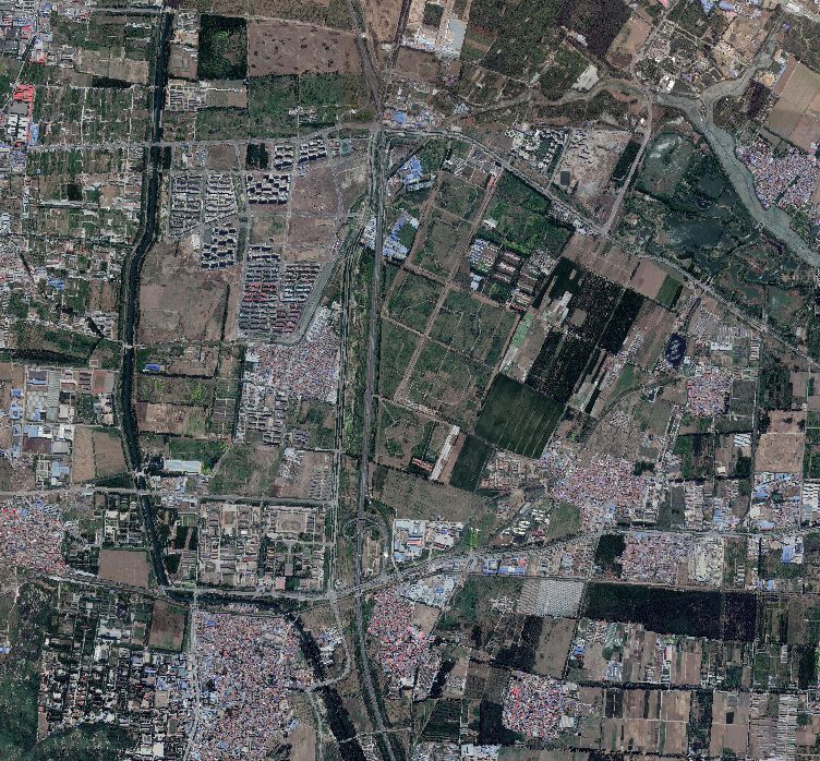
Earth Science and Supercomputers

                                                 nCreate a digital earth,
                                                 so as to:
                                                     p   simulate
                                                     p   analyze
                                                     p   understand
                                                     p   predict and mitigate

           figure credit: Earth Simulator, JPN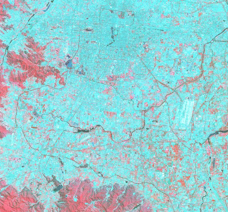
Two Major Functions

Simulation        Data Analysis

                                  3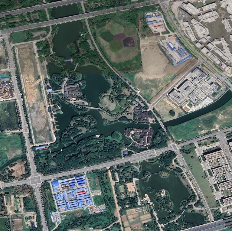
Two Major Functions

To design highly efficient and    To develop intelligent data
  highly scalable simulation       mining methods for the
         applications            analysis of BIG scientific DATA

                                                                   4
Two Major Functions

To design highly efficient and    To develop intelligent data
  highly scalable simulation       mining methods for the
         applications            analysis of BIG scientific DATA

                                                                   5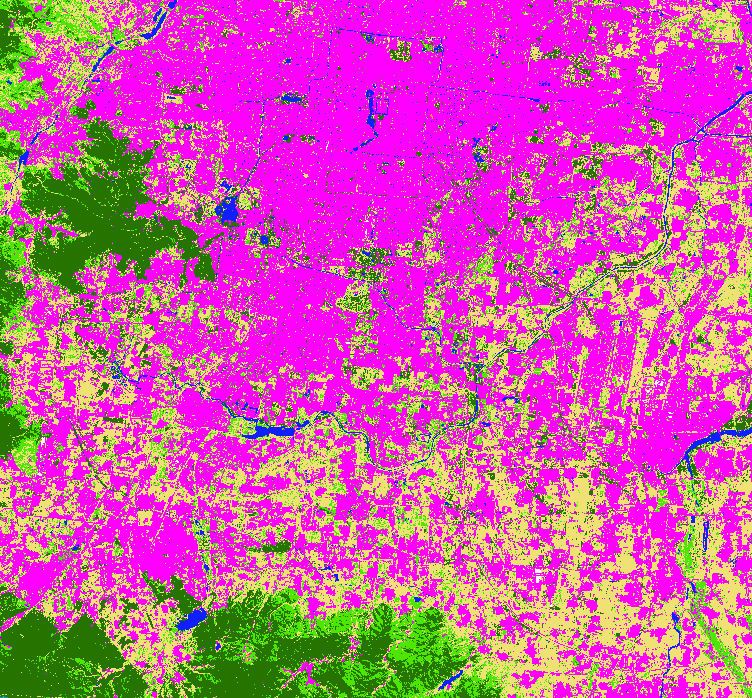
2015-now: The CESM Project on Sunway TaihuLight

      CAM5.0                               POP2.0

                         CPL7

     CLM4.0                             CICE4.0

                                                                       • Four component models, millions lines of code
                                                                       • Large-scale run on Sunway TaihuLight
                      CESM1.2.0                                               • 24,000 MPI processes
                                                                              • Over one million cores
                                                                       • 10-20x speedup for kernels
Tsinghua + BNU 30+ Professors and Students                             • 2-3x speedup for the entire model

                  Haohuan Fu, Junfeng Liao, Wei Xue, Lanning Wang and et al., “Refactoring and Optimizing the Community
                  Atmosphere Model (CAM) on the Sunway TaihuLight Supercomputer”, The International Conference for High   6
                  Performance Computing, Networking, Storage and Analysis (SC), Salt Lake City, Utah, US, 2016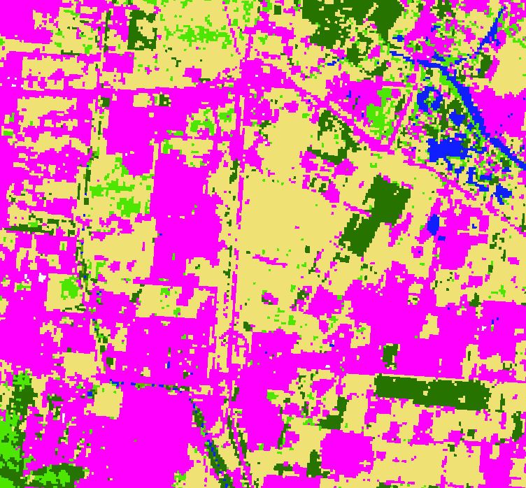
2017: Non-Linear Earthquake Simulation
        Dynamic Rupture Source Generator
             (Based on CG-FDM)
Fault Stress        Friction         Wave Eqn
   Init            Law Ctrl            Solver
                                                  3D Vel/Den Model

        Source Partitioner               3D Model Interpolator

      Seismic Wave Propagation                  Snapshot/Sesimo
        (Based on AWP-ODC)                         Recorder
    Velocity
                     Stress Update
    Update
Next Timestep                                      Restart
       Stress
                        Source                    Controller
  Adjustment For
      Plasticity       Injection

  LZ4 Compression, Group I/O, Balanced I/O Forwarding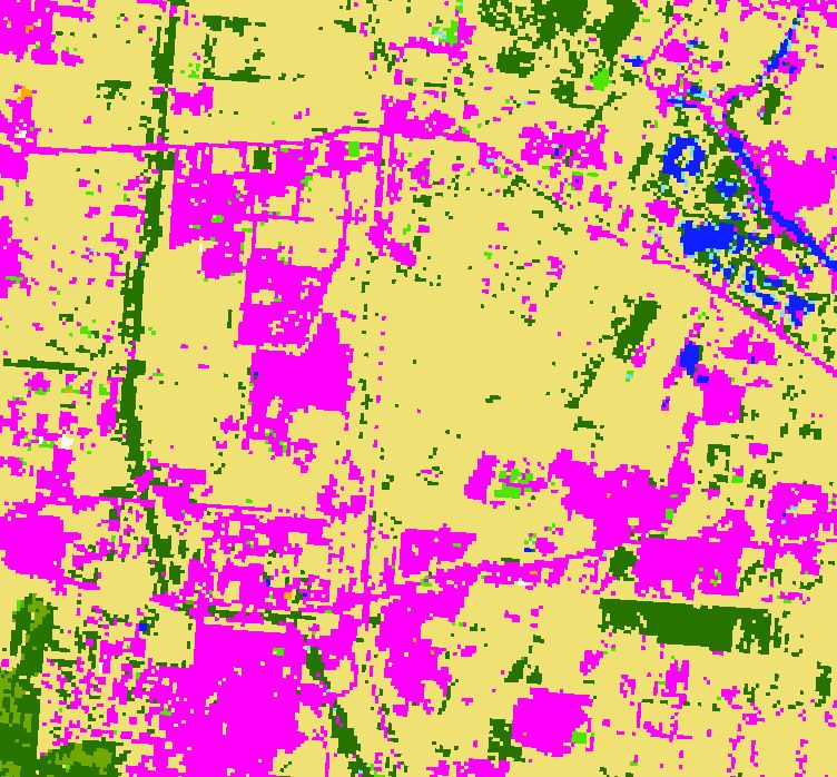
2018: Simulating the Wenchuan Earthquake with
         Accurate Surface Topography
                (a)                       (b)
                          Sunway (2017)                              Sunway (2018)
                          Tangshan                                   Wenchuan
  Surface      5km
  Topography

                      z                                          '                   &            −T-
                                                y
                                                                                            −T.
                                                    ! = !($, &, ')
                                                    ) = )($, &, ')
                                                    * = *($, &, ')                                      T.

                                                                                         /& = 0
                                                                                                  T-
                                                x                                    $
                                                       (1)                                        (2)
Two Major Functions

To design highly efficient and    To develop intelligent data
  highly scalable simulation       mining methods for the
         applications            analysis of BIG scientific DATA

                                                                   9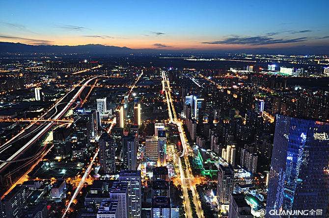
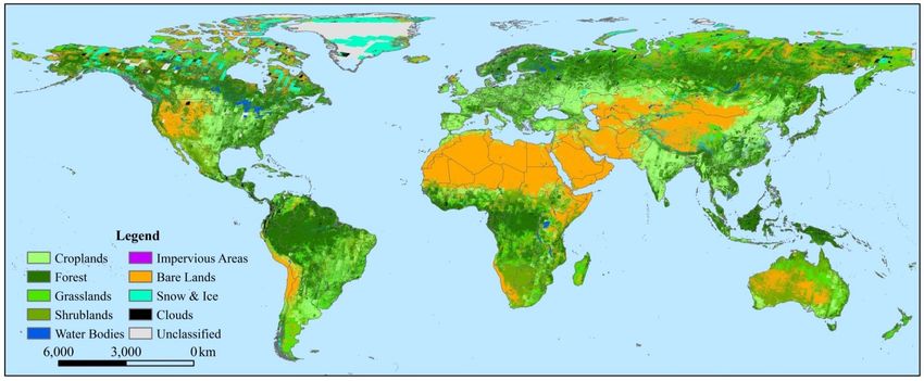
Data Challenge for Climate Scientists

                 • Over 100 PB just for
                   climate change studies

                 • A Challenge but also
                   a huge opportunity

                   Climate Data Challenges in the 21st Century,
                   Overpeck et al., Science , 331 (6018): 700-702
Remote sensing data
Satellite Google earth images High-resolution image
1984-2018
UAV UAV image
- Recording what is happening on the earth for decades
- What issues can we solve based on these data? 11Look Ahead: Data-Driven Modeling and Prediction
city
migration
green land
of birds
ecology
protection waterbody
zone
Land Remote
Cover Sensing sea-level
Mapping Data SetsDeep learning in computer vision
Image Classification
Cat
Object Detection
Semantic Segmentation
Sky Trees
Cat
Grasses
13Deep learning + remote sensing data
Challenges:
- Few public labeled
datasets in RS domain
- Difference between RS
images and CV images
- Real-world applications
(small size, imbalance)
More accurate More intelligent More reliable
land cover mapping oil palm monitoring urban land use mapping
Major issues:
- How to select and
build the RS datasets?
- How to select the
most suitable method?
- How to improve the
method for our tasks?
14Case 1: More Accurate Land Cover Map
First 30 m resolution global land cover maps

Running SVM on 8900 Landsat scenes on a supercomputer, achieved result in one day.   Gong et al., 2013, IJRS
FROM-GLC (Accuracy: 63.72%)

                    Gong et al., 2013. IJRS
A Starting Point: Direct Application of Stacked AutoEncoder
Landsat Image RF Image SAE Image
RF SVM ANN SAE
Overall Accuracy 76.03% 77.74% 77.86% 78.99%
Mapping Time 33.605 ± 0.183 16344.188 4.014 ± 0.003 13.250 ± 0.042
18Integrating Google Earth Image
Spatial features from 0.5-m images
Google Earth
Predicted
Result 1 Land cover map
Predicted
SVM Result 2
CNN
Spectral features from 30-m images
Predicted
SVM
Surface reflectance, NDVI, DOY Result 3
Longitude and Latitude
Elevation and Slope
Surface reflectance of max NDVI, DOY Predicted
RF
Result 4
24
Landsat + DEM
19Integrating Google Earth Image
20Integrating Google Earth Image
21Integrating Google Earth Image
22Integrating Google Earth Image
Slight increase using Great increase using
30-meter resolution images Multi-resolution images
23Integrating Google Earth Image
Google Earth image Results of RF Results of SVM Results of Ours Legend
Impervious
Forest
Cropland
Water
Grassland
Bare land
Shrubland
Cloud
Fewer confusions among various land cover types in the results of our proposed method. 2430m to 10m
Gong P., et al., 2019. Stable classification with limited sample: transferring a 30-m resolution sample set
collected in 2015 to mapping 10-m resolution global land cover in 2017,Science Bulletin. 2510m to 3m
26削弱部分时相或局部区域厚云遮盖影像 City of Changsha
Case 2: Detection of Oil Palm Trees
Case 2: Intelligent monitoring of oil palm trees

  Mapping of oil palm trees using    Detection of oil palm trees using    Detection and classification of
  high-resolution satellite images   high-resolution satellite images    oil palm trees using UAV images

                                                                                                 29
CNN based large-scale oil palm tree detection
30Semantic segmentation based oil palm plantation extraction
• We proposed the first semantic segmentation based approach for large-scale oil palm plantation extraction from
QuickBird Satellite images in 0.6-m spatial resolution.
• The enhanced pixel-wise dataset contains 36,000 images in 256×256 pixels located in southern Malaysia, including
four categories of samples: oil palm, other vegetation, buildings and the others.
• We present an end-to-end deep convolutional neural network based on the SegNet model, which has a symmetrical
encoder-decoder architecture based on the convolutional layers of the VGG-16 model.
• Our proposed approach combines the SegNet model with the Conditional Random Fields and integrates the post-
processing results with the outputs of SegNet to improve the localization of boundaries.
Fully connected
CRF
conv+BN+ReLU pooling
Input upsampling Softmax
Decoder
Segmentation
Encoder
conv-BN-ReLU-pooling upsamling-conv-BN-ReLU
31CNN based large-scale oil palm tree detection
Multi-level CNN training and optimization
• The first CNN is used for land cover classification to locate the oil palm plantation area, including three types of samples (oil palm plantation
area, other vegetation / bare land, and impervious/cloud).
• The second CNN is used for object classification to identify the oil palms, including for types of samples (oil palm, background, other
vegetation / bare land, and impervious/cloud).
• The two CNNs are trained and optimized independently based on 17,000 training samples and 3000 validation samples.
CNN-1: Land cover classification CNN-2: Object classification
32Transfer Learning One Source Domain to One Target Domain One Source Domain to Multi Target Domain
Case 3: Urban Land Use Map
Case 3: More accurate urban land use map
                                                     GIS Map data                   Satellite imagery                Predicted buildings
• A building extraction method based on
  the U-Net semantic segmentation model.

• A data fusion method combining the
  multispectral satellite images with the
  public GIS map datasets.

• This work won the fifth place in the
  Building Extraction Track of DeepGlobe
  - CVPR 2018 Satellite Challenge.

                                                                                   16×16×512
                                                                       32×32×256                  32×32×256
                                                           64×64×128                                          64×64×128

                                                  128×128×64      Convolution + Batch Normalization + Activation          128×128×64

                                                                   Upsampling       Max-pooling      Concatenation
                                            256×256×32                                                                       256×256×32
                                                                                                                                     35 256×256×1
Case 3: More accurate urban land use map
Deep Convolutional
Neural Network
Rescaled images
Deep Convolutional
Satellite images Neural Network
Sliced images
Deep Convolutional
Neural Network
Rescaled images
Deep Convolutional
Neural Network
Satellite images
GIS Map images Sliced images Augmented Semantic Segmentation Probability Post-processing Predicted
images maps Ensembling buildings
36Case 3: More accurate urban land use map
Results of the proposed method • Some examples of the building extraction results.
Index Vegas Paris Shanghai Khartoum
TP 27526 3097 11323 3495
Precision 0.9441 0.8459 0.7470 0.6398
Recall 0.8437 0.6825 0.5396 0.4694
F1-score 0.8911 0.7555 0.6266 0.5415
F1-scores obtained after each strategy
Method Vegas Paris Shanghai Khartoum
Vegas Paris
Baseline 0.8611 0.6774 0.5342 0.4544
Enhanced 0.8730 0.7181 0.5471 0.4935
Postprocess 0.8866 0.7383 0.5897 0.5210
Add-map 0.8911 0.7555 0.6266 0.5415
• Our method improves the F1-scores by 3%-9% compared
with the baseline, depending on the situation of each city.
• Combining the GIS Map datasets with satellite images
improves the results for all cities, even for places with Shanghai Khartoum
few building information on the map. 37AI for City
n Intelligent City Brain:
p Detection
p Understanding
p Modeling
p Planningn Li, Weijia and Dong, Runmin and Fu, Haohuan and Wang, Jie and Yu, Le and Gong, Peng, "Integrating Google Earth imagery with Landsat
data to improve 30-m resolution land cover mapping", Remote Sensing of Environment, vol. 237, pp. 111563, 2020.
n Zheng, Juepeng and Li, Weijia and Xia, Maocai and Dong, Runmin and Fu, Haohuan and Yuan, Shuai, "Large-Scale Oil Palm Tree Detection
from High-Resolution Remote Sensing Images Using Faster-RCNN", Proc. IEEE International Geoscience and Remote Sensing Symposium
(IGARSS), pp. 1422-1425, 2019.
n Dong, Runmin and Li, Weijia and Fu, Haohuan and Gan, Lin and Yu, Le and Zheng, Juepeng and Xia, Maocai, "Oil palm plantation mapping
from high-resolution remote sensing images using deep learning", to appear in International Journal of Remote Sensing, pp. 1-25, 2019.
n Xia, Maocai and Li, Weijia and Fu, Haohuan and Yu, Le and Dong, Runmin and Zheng, Juepeng, "Fast and robust detection of oil palm trees
using high-resolution remote sensing images", Proc. Automatic Target Recognition XXIX, vol. 10988, pp. 109880C, 2019.
n Dong, Runmin and Li, Weijia and Fu, Haohuan and Xia, Maocai and Zheng, Juepeng and Yu, Le, "Semantic segmentation based large-scale
oil palm plantation detection using high-resolution satellite images", Proc. Automatic Target Recognition XXIX, vol. 10988, pp. 109880D,
2019.
n Li, Weijia and He, Conghui and Fu, Haohuan and Zheng, Juepeng and Dong, Runmin and Xia, Maocai and Yu, Le and Luk, Wayne, "A Real-
Time Tree Crown Detection Approach for Large-Scale Remote Sensing Images on FPGAs", Remote Sensing, vol. 11, no. 9, pp. 1025, 2019.
n Gong, Peng and Liu, Han and Zhang, Meinan and Li, Congcong and Wang, Jie and Huang, Huabing and Clinton, Nicholas and Ji, Luyan and
Li, Wenyu and Bai, Yuqi and others, "Stable classification with limited sample: transferring a 30-m resolution sample set collected in 2015 to
mapping 10-m resolution global land cover in 2017", Science Bulletin, vol. 64, no. 6, pp. 370-373, 2019.
n Li, Weijia and He, Conghui and Fang, Jiarui and Zheng, Juepeng and Fu, Haohuan and Yu, Le, "Semantic Segmentation-Based Building
Footprint Extraction Using Very High-Resolution Satellite Images and Multi-Source GIS Data", Remote Sensing, vol. 11, no. 4, pp. 403, 2019.
n Li, Weijia and Dong, Runmin and Fu, Haohuan and Yu, Le, “Large-scale oil palm tree detection from high-resolution satellite images using
two-stage convolutional neural networks”, Remote Sensing, vol. 11, no. 1, pp. 11, 2019.You can also read