The Snow and Ice Research Group Workshop - 9-13 FEBRUARY 2021 HAERE-ROA UNIVERSITY OF CANTERBURY - Antarctica ...
←
→
Page content transcription
If your browser does not render page correctly, please read the page content below
The Snow and
                       Ice Research
                       Group Workshop
                       UNDERSTANDING MOUNTAIN CLIMATE II

9-13
FEBRUARY
2021
                  Proudly supported by:

HAERE-ROA
UNIVERSITY
OF CANTERBURY
www.sirg.org.nz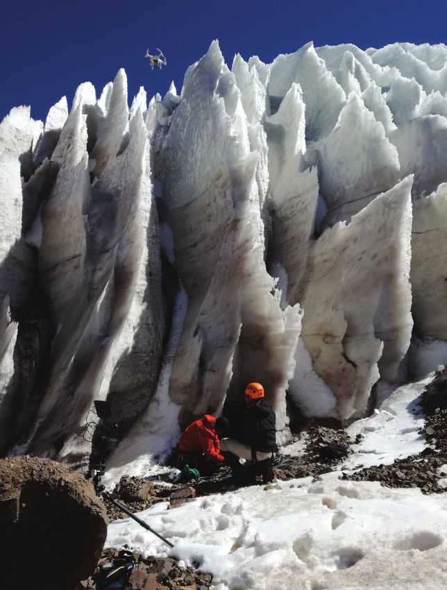
CONTENTS

Welcome letter............................................................................................ 2

Keynote Speaker........................................................................................ 3

Field Trips................................................................................................... 6

Programme................................................................................................. 8

Glacier-climate connections..................................................................... 12

Alpine hydrology, hazards and ecosystems............................................. 23

                                                                                         Brewster Glacier, Todd Redpath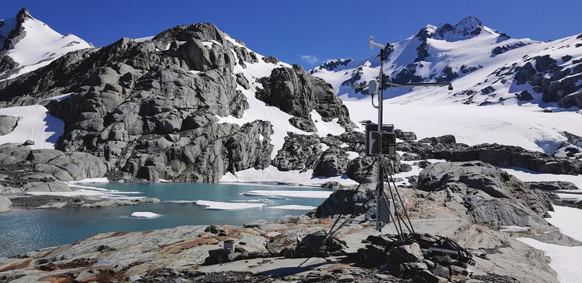
WELCOME
   Nau mai, haere mai to the 18th annual Snow and Ice Research Group (SIRG)
   annual workshop
                              Connecting Through Change
                              Waiho te toipoto, kaua i te toiroa
                         (Let us keep close together, not far apart)
   In the spirit of our chosen whakataukī, the University of Canterbury SIRG group
   decided to connect and collaborate with Antarctic Science Conference and
   the 2nd Understanding Mountain Climates workshop, to provide a week-long
   celebration of snow and ice research. Given the various challenges of the
   previous year, and that as a group we study the effects of climate change, the
   UC organising committee decided that connecting and working with Antarctica
   New Zealand and NIWA would not only deliver a great week of science, but
   also lessen our carbon-footprints by reducing travel.
   This week you will find the Antarctic SIRG community presenting their research
   during the first part of the week and those SIRG members who conduct
   research in alpine environments presenting their work in the later part of the
   week. The combined nature of the workshop has also freed up some space
   for SIRG members to once again have opportunity for discussion around key
   topics. For example, thinking about how as a community we can best support
   key long-term monitoring programmes, and what role our science plays in the
   hazard and hydrology spaces?
   This year we also introduce a plenary that celebrates the contribution to
   our discipline by Professor George Denton through the voice of one of his
   mentees Associate Professor Aaron Putnam. In keeping with our theme of
   connecting though time Aaron will take us on a journey demonstrating the
   how the connection between supervisors and students is fundamental to the
   progression of our knowledge.
   So on behalf of the UC-NIWA SIRG organising team we welcome you to this
   workshop and look forward to inspiration that comes from sharing research.

   Heather, Gemma, Drew & Wolfgang

2 | The Snow and Ice Research Group Workshop 2021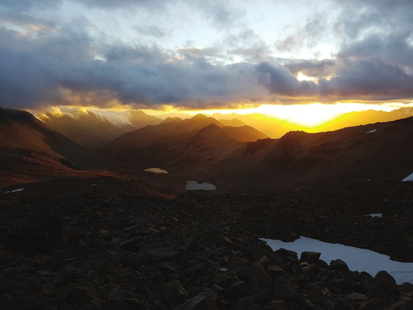
GEORGE DENTON PLENARY

                         AARON PUNTMAN
                         ‘Mercer's Paradox’

In 1984, John H. Mercer stressed a problem that “defies satisfactory
explanation” by classic Milankovitch ice-age theory, which rests on the effect
of summer insolation intensity on ice fields. From radiocarbon-dating of glacial
tills in the Chilean Lake District of South America and along the former southern
margin of the Laurentide Ice Sheet in central North America, Mercer noted
that the last glacial maximum and the last glacial termination were broadly
synchronous in the middle latitudes of the Americas in both polar hemispheres,
despite opposing summer insolation. If the Milankovitch theory is correct, then
why was there synchrony of glacier behavior on the orbital timescale between
the hemispheres when the summer orbital signals were anti-phased? Broecker
and Denton (1989) later observed that not only was the timing of the last glacial
maximum broadly synchronous between hemispheres, but that the severity
of interhemispheric cooling deduced from snowline lowering in the American
cordillera was of similar magnitude. They concluded that “If glacial climates
are driven by changes in seasonality, then another linkage must exist.” We
refer to this conundrum as ‘Mercer’s Paradox’. Broecker called it the “fly in the
orbital ointment”. The search for a satisfactory orbital-climate linkage remains a
fundamental problem of ice-age theory.
We explore Mercer’s Paradox further by comparing surface-exposure
chronologies of moraines deposited by climatically sensitive mountain
glaciers in both polar hemispheres. We focus on an Asian/Australasian
transect of mountain glacier reconstructions, underpinned by 10Be surface-
exposure chronologies of moraines in the Southern Alps of New Zealand
and in the mountains of interior Asia. Our primary observation is similar to
that obtained earlier in the Americas and thus reinforces Mercer’s Paradox.
Namely, we found that the last glacial maximum, and its termination, occurred
synchronously between the outer edge of the Southern Ocean and the
interior of Earth’s largest continent – despite the opposing signatures of

                                                  Understanding Mountain Climate II | 3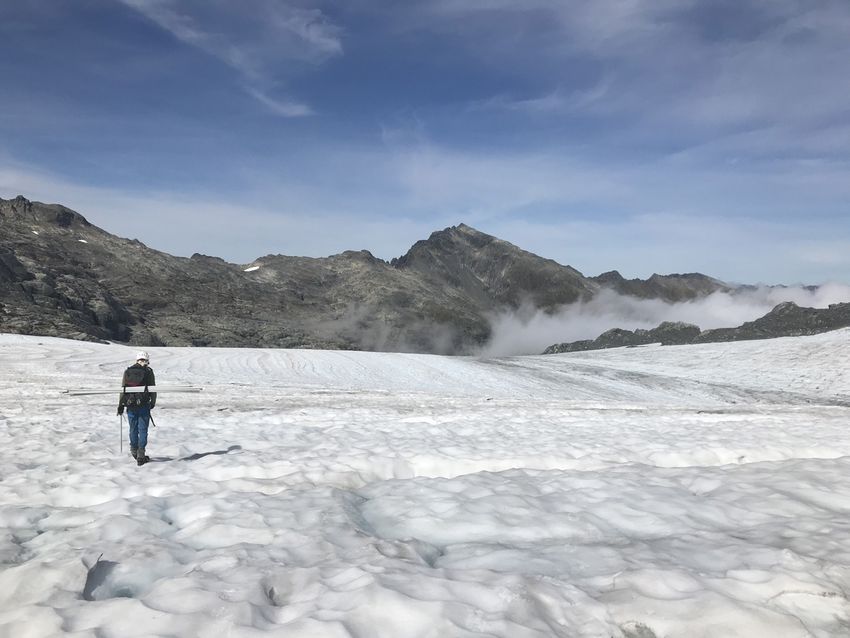
summer insolation that were employed by Milankovitch to drive glaciation.
   Furthermore, the switch between glacial and interglacial climate modes was
   rapid – beginning close to 18,000 years ago and occurring in a millennium
   or two. We interpret the moraine chronologies to indicate that the switch from
   glacial to interglacial climates was big, fast, and global, therefore requiring a
   physical mechanism capable of producing widespread and rapid change in
   the energy content of the atmosphere. We suggest that such a mechanism,
   and hence a solution to Mercer’s Paradox, may lie in southern and tropical
   latitudes. From the moraine chronologies and from simulations with a GFDL
   earth system model, we posit a mechanism by which non-linear changes in the
   latitude and strength of Southern Hemisphere westerly winds, paced by orbital
   forcing, elicit global changes by their influence on Pacific subtropical gyres
   and the heat engine of the planet in the Pacific Warm Pool. We suspect that
   the continent of Zealandia, a large topographical obstruction to austral ocean-
   atmosphere circulation, may be a primary source of non-linear behavior of the
   ocean-atmosphere system. Southern Hemisphere circulation may therefore be
   fundamental to driving glacial cycles and abrupt climate change on a global
   scale.

   Aaron Puntman
   Aaron Putnam is an assistant professor at the University of Maine, where he
   studies the geologic record of Earth’s mountain glaciers and ice sheets to gain
   insights into the dynamics of past global changes, such as ice ages and abrupt
   climate change. Aaron is also interested in climate drivers and feedbacks
   responsible for the industrial-age worldwide retreat of mountain glaciers and
   shifting global rain belts. Since participating in a scientific cruise to study the
   dynamics of Arctic sea ice in high school, Putnam has logged over 200 weeks
   conducting fieldwork in remote glacial environments, such as in Antarctica, the
   Southern Alps of New Zealand, the southern Andes, and the mountain chains
   of Asia. His research focuses on charting the demise of Earth’s terrestrial ice
   masses during the termination of the last ice age, with an aim toward identifying
   the climatic mechanisms that drove massive and rapid changes in the global
   energy budget. An overall goal of his is to improve knowledge of climate
   dynamics and ice melt in a warming world.

   George Denton
   George Denton is Libra Professor and Distinguished Maine
   Professor in the School of Earth and Climate Sciences and
   Climate Change Institute at the University of Maine, USA.
   He earned his Ph.D. at the Yale University in1965, and was
   the first scientist from the University of Maine elected to the

4 | The Snow and Ice Research Group Workshop 2021
National Academy of Sciences. George’s primary interest is the geological
history of large ice sheets and smaller mountain glaciers, and in particular
the role of these ice sheets in Quaternary and late-Tertiary ice ages. He also
focuses on the abrupt ocean-atmosphere reorganizations in glacial cycles.
He has researched the Quaternary and late Tertiary history of the Antarctic
Ice Sheet, with a focus on using late Quaternary glacial deposits to elucidate
the role of the Antarctic Ice Sheet during the last few ice ages. His work on
late Tertiary deposits bear on fundamental climatic changes that preceded
Quaternary ice ages. His other projects have also focused on reconstruction
of Northern Hemisphere ice sheets during the last ice age and the alpine
glacier history of the Chilean Andes and New Zealand Southern Alps. Denton
has been widely acclaimed for his research in glacial geology and the Denton
Glacier and the Denton Hills in Antarctica were named in his honor. In 1990,
he received the prestigious Vega Medal (Gold) from the Swedish Society for
Anthropology and Geography and in 1996 he was elected to the Royal Swedish
Academy of Sciences. Denton’s research has inspired several generations of
students, many of whom have picked up researching in Earth Science.

                 Irishman Stream, Ben Ohau Range, Todd Redpath

                                                Understanding Mountain Climate II | 5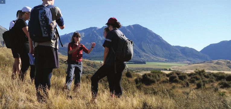
FIELD TRIPS
   2021 SIRG FIELD TRIP: AN EXPLORATION OF THE GLACIAL
   HISTORY IN THE WAIMAKARIRI AREA

   Saturday 13th February, 8:30am to 6pm
   Hosted by the University of Canterbury Te Whare Wānanga o Waitaha, School
   of Earth and Environment Te Kura Aronukurangi.
   The Waimakariri is a braided river system that flows from Kā Tiritiri-o-te-moana
   (The Southern Alps) to Te Moana-nui-a-Kiwa (the Pacific Ocean). Today,
   glaciers are only found at the very top of the catchment perched on the highest
   mountains. But during the Pleistocene, ice filled this valley system, leaving
   behind an impressive landscape that tells a story of past climate variability.
   Built in 1915, the University of Canterbury’s Cass Research Station is nestled
   in amongst this geomorphological haven, and for over a century, staff and
   students from the university have been exploring this landscape.
   Professor Jamie Shulmeister and Dr Heather Purdie will lead a one-day field
   excursion of their ‘back-yard’. Be prepared for a great mix of geomorphology,
   cultural history, and ever evolving research narrative.

   Itinerary
   We will have an 8:30 am departure from University of Canterbury, Ilam Road
   carpark, travelling in mini vans directly to the Cass Field Centre, arriving at
   around 10:30 am. After a short comfort stop at the field centre, we will head out
   into the field on foot, finding a good spot for a picnic lunch as we explore the

                                                    Field teaching at Cass, Andrew Fletcher

6 | The Snow and Ice Research Group Workshop 2021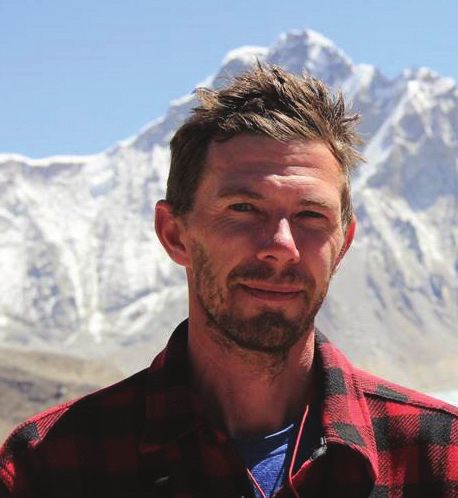
landscape. We aim to be out in the field for approximately 4-5 hours (weather
dependent), with a planned departure at approximately 4pm, arriving back in
Christchurch by 6pm.
What to bring
Please bring you own packed lunch and drink bottle (although drivers may
also be persuaded to stop at the world-famous Sheffield Pie Shop!). Wear
good sturdy footwear for hiking over untracked ground, and be sure to have
‘layers’ to accommodate inclement weather, as well as sun protection (hats,
glasses, sunscreen). In the event that the weather on the day is not conducive
for walking, then the trip will be modified to a more ‘driving’ tour of the regions
geomorphology. But please be prepared for a good days walking – as Heather
and Jamie believe this is by far the best way to explore the landscape.
Number are limited, and spaces will be allocate to registered conference
participants on a first-in-first-served basis. Any questions please contact
Heather at heather.purdie@canterbury.ac.nz.
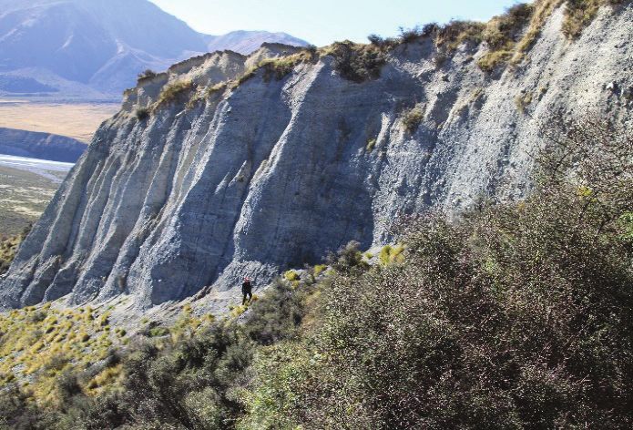
Glacial geology, Heather Purdie (left), University of Canterbury, Cass Field Centre (right)
Understanding Mountain Climate II | 7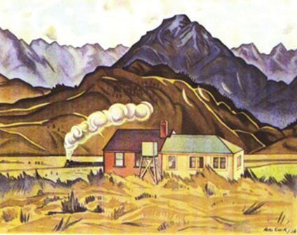
PROGRAMME
Thursday 11 February
1330 Welcome and housekeeping Bentleys
1340- Session – Alpine hydrology, hazards, and Bentleys
1420 ecosystems
Simon Cox – Accelerated slope response in a
destabilized alpine landscape
Aubrey Miller – Snow avalanche hazards in Aotearoa
New Zealand: Using extreme events from the past to
plan for the future
1420- Session -Glacier -climate connections Bentleys
1530 Todd Redpath – Monitoring the presence and
persistence of particulate impurities on New Zealand
Glaciers using VENμS satellite imagery
Oliver Wigmore – Mapping debris thickness over
Haupapa/Tasman Glacier with thermal drone and
satellite imagery.
Shaun Eaves – Holocene climate change as told by
New Zealand glaciers
1530- Afternoon tea Ti Kouka
1630
1630- The George Denton Plenary Presentation (by Ngaio Marsh
1730 Aaron Putnam). Introduced by David Barrell
(GNS)
1730 SIRG Icebreaker Bentleys
8 | The Snow and Ice Research Group Workshop 2021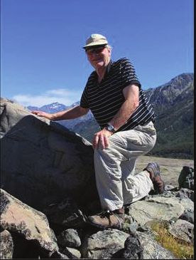
Friday 12 February
0850 Welcome and housekeeping Bentleys
0900- Session - G
lacier-climate connections contd. Bentleys
1000 Jono Conway – Cloud forcing of surface energy
balance in diverse mountain glacier environments
Heather Purdie – Rolleston Glacier: First decade of
mass balance measurement and the implications of
climate change on mass balance monitoring
Nariefa Abrahim – An examination of the surface
energetics controlling the recent and dramatic loss
of ice on Brewster Glacier
1000- Morning tea Upstairs
1030 foyer
1030 Session Glacierclimate connections contd. Bentleys
Keynote: Lauren Vargo – Measuring New Zealand
glacier change from aerial images
Ruzica Dadic – Wind Driven Snow Distribution on
Brewster Glacier, NZ
Pascal Sirguey – Going, going, gone!
Reconstructing the reconstruction of Brewster
Glacier mass balance record 1977–2018
Discussion: Glacier observations and monitoring
1200- Lunch Upstairs
1300 foyer
1300- Session - Alpine hydrology, hazards, and Bentleys
1350 ecosystems
Keynote: Warren Chinn – Tracking the snow line:
Responses to climate change by New Zealand
alpine invertebrates
Rasool Porhemmat – Rain–on‑Snow in the Southern
Alps: hydrometeorolgy and impacts
1350- Session -Glacier-climate connections contd. Bentleys
1500 Jim Salinger – The impacts of the 2017/18 and
2018/19 heatwaves on Southern Alps glaciers
Brian Anderson - Projections of future glacier volume
changes for the New Zealand region
Discussion: Impacts and Extremes
Understanding Mountain Climate II | 91500- Afternoon tea Upstairs
1530 foyer
1530- Session -Alpine hydrology, hazards, and Bentleys
1730 ecosystems contd.
Tim Kerr – Winter Snow storage is a poor predictor
of spring streamflow: two case studies from the
Southern Alps.
Joanna Borzecki – The impact of glacier retreat
on long–term water availability in the Waitaki
Catchment, New Zealand
Shelley MacDonell – The hydrological role of rock
glaciers in an Andean desert
Shane Bilish – Managing water resources in
marginal snow environments
Christian Zammit – Climate change impacts on snow
and ice resource to support decision making: How
precise do we need to be?
1730- Closing remarks
1800
1800- BBQ Dinner
2000
10 | The Snow and Ice Research Group Workshop 2021Saturday 13 February
0830- 2021 SIRG field trip Cass
1800 An exploration of the glacial history in the
Waimakariri area
Tapado Glacier penitents, Chile, Shelley MacDonell
Understanding Mountain Climate II | 11Glacier-climate
connections
The impacts of the 2017/18 and 2018/19 heatwaves on
Southern Alps glaciers
Jim Salinger1, Blair Fitzharris2
1
University of Tasmania, Hobart.
2
University of Otago, Dunedin
Abstract
The back to back heatwaves of 2017/18 and 2018/19 warm conditions caused
massive ice loss in South Island glaciers. The two summers were the first and
third warmest over the 150-year period, with the average combined average air
and sea surface temperatures being 2.1 and 1.2 °C for 2017/18 and 2018/19
respectively above the 1981-2010 normal. They produced the estimated
largest annual losses of glacier ice in four decades of records for the Southern
Alps back to 1977. Satellite data from end-of-summer snowline measurements
at the Tasman Glacier suggest that the Southern Alps lost 22% of glacier ice
during last summer alone from 2017 values. The total ice volume loss was
8.9 km3, reducing total Southern Alps ice volume from 41 km3 in 2017 to 32
km3 in 2019. The warming was a result of several atmospheric and oceanic
teleconnections. Both were caused by very positive phases of the Southern
Annular Mode (SAM) which suppress the troughs and promotes many more
anticyclones in the Tasman Sea extending across the South Island to the south
east. The light winds in the 2017/18 and 2018/19 events allowed the ocean
surface and atmosphere to warm rapidly in the New Zealand region.
12 | The Snow and Ice Research Group Workshop 2021Going, going, gone! Reconstructing the reconstruction
of Brewster Glacier mass balance record 1977-2018
Pascal Sirguey1, Tobias Brunk1,2, Nicolas J. Cullen3, Aubrey Miller1
1
School of Surveying, University of Otago, Dunedin, New Zealand.
2
University of Heidelberg, Heidelberg, Germany.
3
School of Geography, University of Otago, Dunedin, New Zealand
Abstract
Brewster Glacier has been the centre of attention for New Zealand glaciology
and a proxy for the behaviour of many glaciers in the Southern Alps/Kā Tiritiri
o te Moana. Sixteen years of in-situ glaciological measurements, 20 years of
satellite monitoring of surface albedo, and 43 years of photos documenting the
end-of-summer snowline has yielded one of the longest mass balance series in
the Southern Hemisphere.
Using geodetic mass balance over the 1986-2018 period derived from
photogrammetric reanalysis, we calibrated and validated the mass balance
series to reveal a new picture of the glacier demise. The long-term ELA over
the period was found to be 165 m higher than previously thought, with a growth
period in the 1980s and 1990s merely subduing a pronounced negative trend.
The calibrated series shows a three-fold increase in the rate of ablation since
2008, while surface elevation changes reveal strong ablation in the glacier’s
highest regions and the loss of the long-term ELA. The unabated retreat since
2008 culminates with the loss of -5.3 ±1.1 Mt during the unprecedented 2018
heatwave, and establishes the trend for a disappearance of Brewster Glacier
by mid-century.
Understanding Mountain Climate II | 13Measuring New Zealand glacier change from aerial
images
Lauren Vargo1, Brian Anderson1, Ruzica Dadic1, Huw Horgan1, Andrew Lorrey2,
Andrew Mackintosh3
1
Antarctic Research Centre, Victoria University of Wellington, Wellington.
2
NIWA, Auckland. 3Monash University, Melbourne
Abstract
Measuring glacier fluctuations is important for understanding how the
cryosphere responds to climate variability and change. New Zealand has a
unique record of glacier change: aerial photographs of over 50 glaciers, taken
annually since 1978. These images document changes in glacier length, area,
and snow cover at the end of summer, which is a proxy for mass balance. In
2015, the survey evolved, taking more (20 - 200) images of each glacier and
collecting location data for each image.
Using the historic and modern images, location data, and the photogrammetry
method Structure from Motion, we can better measure New Zealand glacier
change. We are able to quantitatively measure past glacier fluctuations from
historic images. We also use the modern images, taken since 2015, to develop
high-resolution and high-accuracy orthophoto mosaics and digital elevation
models (DEMs) of the glaciers. We use the DEMs and orthophotos to measure
changes in snowline elevation, length, and geodetic mass balance. Application
of these methods to Brewster Glacier show that the glacier retreated 422 ±
12 m from 1981 - 2020, had a maximum snowline elevation of 2311 m a.s.l.
in 2018, and geodetic mass balance of -6.8 ± 1.3 m w.e. from March 2016 -
March 2019.
14 | The Snow and Ice Research Group Workshop 2021An examination of the surface energetics controlling
the recent and dramatic loss of ice on Brewster Glacier
Nariefa Abrahim1, Nicolas Cullen1, Jono Conway2, Pascal Sirguey3
1
School of Geography, University of Otago, Dunedin.
2
National Institute of Water and Atmospheric Research, Lauder.
3
School of Surveying, University of Otago, Dunedin
Abstract
A revised mass balance time series calibrated and validated by a recent
geodetic survey has revealed a shift to significant mass loss on Brewster
Glacier since 2008. The ablation has been widespread and has led to changes
in the mass balance gradient, compromising the glacier’s ability to store mass.
This provides a unique opportunity to assess in detail what components of the
surface energy balance have been responsible for the dramatic shift towards
negative mass balance. To do this we use a physically-based surface energy
and mass balance model run in a fully spatially distributed mode. The model
computes the mass balance as the sum of solid precipitation, melt, sublimation,
surface deposition and englacial accumulation due to refreezing of meltwater.
Our initial modelling period uses in situ meteorological observations collected
from two weather stations on and next to Brewster Glacier to determine mass
balance, which is compared to glaciological observations for calibration
and validation. The modelling challenges, including the configuration of the
parameter set and input variables used will be discussed and compared to
previous work in the Southern Alps and elsewhere, before providing insights in
to the surface energetics responsible for the strongly negative mass balance
on Brewster Glacier.
Understanding Mountain Climate II | 15Wind-Driven Snow Distribution on Brewster Glacier, NZ
Ruzica Dadic1, Lauren Vargo1, Nora Helbig2, Rebecca Mott2, Brian Anderson1
1
Antarctic Research Centre, Victoria University of Wellington, Wellington.
2
WSL Institute for Snow and Avalanche Research, SLF, Davos
Abstract
Snow accumulation is a crucial part of the water balance - both on seasonal
time scales and, in the case of glaciers, annual to decadal time scales.
Previous work shows that some catchments have a very high contribution of
snow melt to stream flow, but also that snow accumulation variability is key
for stream flow simulations, as deep, late lying snow significantly influences
the hydrograph in late summer. Snow melt is reasonably well understood,
but there are large deficiencies in modelling snow accumulation. The high
spatial variability in snow accumulation results from two processes - firstly
preferential deposition and redistribution of snow by wind, and secondly
avalanches. These processes interact, and it is ultimately the wind-driven
distribution of snow accumulation that may influence avalanching. To improve
snow accumulation models, usually at least 2D wind speed and direction data
are needed. Until recently it has not been possible to derive wind-speed data
in steep mountain terrain without high-resolution atmospheric modelling, but
we here we present a new empirical wind downscaling scheme in combination
with an existing parameterization of preferential deposition of snow. We show
the effects that snow distribution may have on glacier mass balance and runoff
for Brewster glacier in New Zealand.
16 | The Snow and Ice Research Group Workshop 2021Cloud forcing of surface energy balance in diverse
mountain glacier environments
Jono Conway
NIWA, Lauder
Abstract
Glaciers are iconic features of mountain landscapes with significant cultural,
environmental, scientific, and economic value. While we know that glaciers
are sensitive to changes in their local climate, the extent to which cloud
cover will amplify or reduce the melting of a glacier in response to warming
is uncertain. Clouds alter the solar and infrared radiation available for glacier
melt and can enhance or dampen the influence of surface meteorology, albedo
feedbacks and subsurface processes (e.g. refreezing) on melt. However,
how these processes interact in different mountain glacier environments and
climate regimes has not been well established. To address this knowledge
gap, published surface energy and mass balance datasets from 15 mountain
glaciers around the world haves been collated and analysed in a common
framework. The framework seeks to understand which processes are more
important for determining how cloud cover modifies melt. For example,
does cloud radiative forcing dominate the effect of clouds on melt, or is the
relationship between clouds and other meteorological forcing more important
in different environments? By unravelling the interacting effects of clouds and
other atmospheric processes on glacier melt in diverse mountain locations,
we hope to add fundamental understanding of the processes determining
mountain glacier response to climate change.
Understanding Mountain Climate II | 17Monitoring the presence and persistence of particulate
impurities on New Zealand Glaciers using VENμS
satellite imagery
Todd Redpath, Pascal Sirguey
National School of Surveying, University of Otago, Dunedin
Abstract
The Austral spring and summer of 2019/2020 saw an unprecedented Australian
bushfire season, as well as several significant dust storms in the south east of
Australia. Such events provide a source for airborne particulates that, when
deposited on snow and ice surfaces, modify the surface energy balance by
reducing albedo and enhance ablation of snow and ice. This study set out
to assess the potential of high spatial and temporal resolution imagery from
the Vegetation and Environment monitoring on a New Micro-Satellite (VENμS)
mission to detect and monitor a snow impurity signal in New Zealand’s central
Southern Alps over spring and summer of 2019/2020. A band rationing
approach, leveraging the blue (490 nm) and near-infrared (865 and 910 nm)
bands allowed the efficient segmentation of discoloured snow, clean snow
and exposed ice on the accumulation areas of Tasman, Franz Josef and
Fox glaciers. This analysis revealed that widespread areas of discoloured
snow occurred as early as November 24, 2019, and that the spatial extent
of discoloured snow varied throughout the ablation season. These findings
support a working hypothesis that particulate impurities are deposited during
precipitation events, and exhumed as snow melts, resulting in the observation
of strongly discoloured snow.
18 | The Snow and Ice Research Group Workshop 2021Mapping debris thickness over Haupapa/Tasman
Glacier with thermal drone and satellite imagery.
Oliver Wigmore, Brian Anderson, Matthew Tankersley, Huw Horgan
Antarctic Research Centre Victoria University of Wellington, Wellington
Abstract
Debris-covered glaciers are common in steep mountainous terrain. Debris
cover is often highly heterogeneous and can enhance or reduce glacier melt
depending on its thickness. Thus understanding the thickness and distribution
of glacier debris is critical to accurately model how these glaciers will respond
to rising temperatures. Debris thickness can be measured manually at the point
scale or with ground penetrating radar. Debris distribution can be estimated
empirically from thermal satellite imagery, or modelled via energy balance
inversion. However, both methods require measurements for validation,
and there is often a significant spatial mismatch between the estimates
and validation measurements. Furthermore, important patterns of spatial
heterogeneity are often missed with point and coarse satellite/model estimates.
Here we develop a method to estimate debris thickness at sub-metre spatial
resolution by combining intraday drone-borne thermal maps with topographic
indices and statistical analyses. We apply this methodology to a ~10 ha
area on the lower Haupapa/Tasman Glacier. Statistical models are trained
and validated on a set of point measurements that match the pixel footprint.
Observed patterns of spatial heterogeneity in debris thickness are assessed.
Finally, our thickness estimates are aggregated to Landsat pixel size and used
to estimate debris thickness over the entire Haupapa/Tasman glacier.
Understanding Mountain Climate II | 19Holocene climate change as told by New Zealand
glaciers
Shaun Eaves
Victoria University of Wellington, Wellington
Abstract
The Holocene Epoch (~12,000 years ago to present) is Earth’s current
interglacial and is characterized by relative climatic stability following the end
of the last glacial period. Climate proxy records from this interval thus offer
the opportunity to establish baselines of natural climatic and environmental
variability, against which, we can better evaluate ongoing anthropogenic
modification of the climate system. Mountain glaciers are hyper sensitive
to climate variability and effective agents of landscape change. Geological
records of past glacier extent thus yield useful insights to past climate change.
In this presentation, I will synthesize new and emerging results from
cosmogenic surface exposure dating, glacier modelling, and transient climate
modelling, which informs climate variability over the last 12,000 years. Key
findings include: (i) the disparate nature of Holocene moraine systems (ii) a
dichotomy between biological climate proxy reconstructions and the mountain
glacier record; and (iii) low probability of past glacial minima akin to present-
day.
20 | The Snow and Ice Research Group Workshop 2021Rolleston Glacier: First decade of mass balance
measurement and the implications of climate change on
mass balance monitoring
Heather Purdie1, Tim Kerr2, Wolfgang Rack1, Andrew Lorrey3
1
School of Earth & Environment, University of Canterbury, Christchurch. 2Rainfall NZ, Christchurch.
3National Institute of Water and Atmospheric Science, Auckland
Abstract
Rolleston Glacier is a small glacier located near Arthurs Pass. It is one of
only two NZ glaciers at which mass balance is directly measured. After the
first decade of monitoring (2011-2020), the cumulative mass balance is -6.8
m w.e., or -0.7 m w.e. per year. Rolleston Glacier is also photographed each
year as part of NIWA’s end-of-summer snowline monitoring program. There is
a statistically significant relationship between measured annual mass balance
and the position of the EOSS (R2 0.89, p=0.0001). However, neither method
accurately records ice volume loss in strongly negative years, and sometimes
the only remaining mass input on the glacier is derived from snow avalanche
off Mt Philistine. This secondary snow input is estimated to be approximately
25% of winter snow accumulation; but the actual volume gained by this
process is yet to be determined. A recent purchase of a Riegl VUX-240 laser
scanner (pers. comm., J. Brasington), provides new opportunity to supplement
the existing field program with geodetic mass balance measurement. Such
an approach will not only be more robust in extremely negative years, but
will improve understanding of spatial variability in accumulation and ablation
processes, and increase our ability to estimate future changes to alpine
hydrology.
Understanding Mountain Climate II | 21Brewster Glacier, Lauren Vargo 22 | The Snow and Ice Research Group Workshop 2021
Alpine hydrology,
hazards, and ecosystems

Snow avalanche hazards in Aotearoa New Zealand:
Using extreme events from the past to plan for the
future
Aubrey Miller1, Pascal Sirguey1, Nicolas Cullen2, Yves Bühler3
1
 School of Surveying, University of Otago, Dunedin, New Zealand.
2
 School of Geography, University of Otago, Dunedin, New Zealand.
3
 WSL Institute for Snow and Avalanche Research SLF, Davos, Switzerland

Abstract
Aotearoa New Zealand (NZ) is a dynamic island nation. Natural hazards such
as volcanic eruptions, earthquakes, landslides, flooding, glacial thinning and
avalanches constantly reshape landscapes across a multitude of temporal
and spatial scales. One natural hazard in need of further investigation in NZ
is the snow avalanche, which poses risks to NZ alpine region visitors and key
infrastructure, such as roads, tracks, and backcountry huts that help sustain
NZ’s economy.
With relatively sparse observational records in NZ compared with alpine
regions in some northern hemisphere countries, investigation is needed on
avalanche dynamics to support extreme-event planning and preparedness.
This project leverages the latest advances in geospatial science, including
ongoing efforts to measure alpine topography with satellites (Matariki Project
at Otago) and the remote sensing of snow avalanches (research at WSL-SLF
in Switzerland), to calibrate dynamic models and simulate extreme avalanche
events in NZ.
Uncertainty around possible changes to avalanche frequency and magnitude
from climate change poses challenges to avalanche preparedness. This
project will link past events with future climate scenarios to simulate possible
effects on extreme avalanche events in NZ.
This presentation will detail the project aims and initial results of analysis.

                                                           Understanding Mountain Climate II | 23
Accelerated slope response in a destabilized alpine
landscape
Simon Cox1, Pascal Sirguey2, Clare Lewis2
1
GNS Science, Dunedin.
2
University of Otago, Dunedin
Abstract
An inventory of landslides and quantification of landscape change in the
Aoraki/Mount Cook National Park between 2008 and 2017 has been derived
from photogrammetric digital surface models and orthoimages. Over 570
instances of landslide, rock avalanche, rockfall, debris flow or gulley erosion
were mapped using change models and feature tracking. Large-scale
mountainside failures are associated with snowfield retreat and trunk glacier
down-wasting. Ice-loss is interpreted to remove rock-slope support, generate
elastic and stress response and changes in groundwater pressure, which in
turn cause loss of frictional strength, creep, dilation and velocity weakening
of hillslopes. Primary, large, slow, creep-dominated disturbances involving
kilometre-scale movements ~2 m/yr, appear responsible for many secondary,
hazardous, rapid rockfalls and catastrophic rock avalanches. The new
photogrammetrical products and 3D change detection enable environmental
monitoring at a precision and scale never previously achieved. They highlight
that rock collapses are commonly linked to larger-scale slope movements
that can be observed. The next challenge is to link observations to underlying
physics of processes, particularly the transition from creep to triggered
collapse. High-resolution change detection improves the quantification of the
magnitude and frequency of geological hazards in the Southern Alps of New
Zealand, and landscape destabilization as climate changes.
24 | The Snow and Ice Research Group Workshop 2021Winter Snow storage is a poor predictor of spring
streamflow: two case studies from the Southern Alps.
Tim Kerr
Rainfall.NZ, Christchurch
Abstract
The amount of seasonal snow that accumulates in a catchment will melt and
augment stream flows during spring. This indicates knowledge of the size of
the seasonal snow storage provides a predictor of the upcoming stream flow.
Seasonal flow forecasts using winter snow storage have been investigated in
two catchments in the Southern Alps. The skill of the forecasts are very low.
Efforts to improve the forecast skill by considering specific aspects or periods
of the seasonal hydrograph has provided little improvement. The cause of the
poor forecast skill appears to be related to the high variability in the occurrence
of large rainfall events. The seasonal snow-melt signal in the hydrograph seems
to be dwarfed by the flow impact of these rainfall events. The occurrence of
large rainfall events at any time of the year is a distinguishing feature of the
Southern Alps when compared to many other mountain ranges of the world.
The findings of these seasonal flow forecasting investigations are described
and contrasted to similar forecast efforts undertaken in other mountain climates
of the world.
Understanding Mountain Climate II | 25The hydrological role of rock glaciers in an Andean
desert
Shelley MacDonell1, Ben Robson2, Álvaro Ayala1, Rémi Valois1, Nicole Schaffer1,
Mike McCarthy3, Giulia de Pascuale1, Eduardo Yáñez1, Camilo Guzmán1,
Gonzalo Navarro1, James McPhee4, Francesca Pellicciotti3
1
CEAZA, La Serena, Chile.
2
University of Bergen, Bergen, Norway.
3
WSL, Birmensdorf, Switzerland.
4
University of Chile, Santiago, Chile
Abstract
In high altitude areas vulnerable to climatic change, rock glaciers act
increasingly as important sources of water, especially during summer and
dry periods. In arid and semi-arid mountain regions, these cryoforms are
often considered to be long term water reservoirs that support efficient water
storage and slow delivery. In the semi-arid Andes, rock glaciers are more
abundant than glaciers, but their role in the wider hydrological system is
little known, which is the driving impetus for this study. As water resources
become increasingly scarce, and demand increases, there is a need for
improved understanding of existing sources, and changes within the context
of a warming climate. This study uses a multi-method approach, combining
glaciological, geomorphological, geophysical, geochemical, remote sensing
and modelling techniques to better elucidate the role of rock glaciers within
the wider hydrological system in a semiarid catchment. We will highlight new
methods and results for inventorying rock glaciers, modelling the energy
balance, distinguishing hydrological sources and as well as quantifying
possible hydrological contribution. We will finish by providing a roadmap for
future work.
26 | The Snow and Ice Research Group Workshop 2021Tracking the snow line: Responses to climate change by New Zealand alpine invertebrates Warren Chinn Department of Conservation, Christchurch Abstract We review and test ecological paradigms that suggest alpine invertebrate communities may shift upslope with climate warming. Our model couples the end of summer snow line (EOSS) elevation with invertebrate populations in New Zealand’s Southern Alps, using a forty-year data set, from fifty index glaciers. We show the snow line has risen an average 3.7 m a−1. This is equivalent to raising alpine isotherms by almost 150 m and presents alpine biotic populations with four possible scenarios: upslope tracking, stasis, horizontal dispersal, or local adaptation. We characterize the alpine invertebrate biota (AIB) and present two case studies that show that high-elevation taxa have tracked the snow line within a narrow range (
Managing water resources in marginal snow
    environments
    Shane Bilish1, Nik Callow2
    1
     Snowy Hydro Ltd, Cooma, NSW, Australia.
    2
     The University of Western Australia, Perth, WA, Australia

    Abstract
    Seasonal snowpacks in marginal snow environments play an important role in
    the availability of water resources. While marginal features are likely to become
    more widespread among snow-affected regions in a warmer climate, there are
    significant challenges to accurately measuring and modelling these resources.
    Many of the tools commonly employed are based on generalised relationships
    and assumptions that are applicable to colder and more persistent snowpacks
    but become less valid with the high spatial and temporal variability found in
    marginal settings.
    Here we describe the physical and dynamical properties of the snowpack
    in the Australian Alps, and show how these limit the accuracy of traditional
    approaches to water resource management. The spring peak snowmelt season
    accounts for the largest and most reliable component of annual catchment
    inflows, though rainfall and snowmelt are common throughout the snow season
    and winter inflows make a greater contribution to annual variability. In such
    environments there is an increasing need to explicitly consider the dynamic
    nature of snowpack water storage and variability within the system.

28 | The Snow and Ice Research Group Workshop 2021
The impact of glacier retreat on long-term water
availability in the Waitaki Catchment, New Zealand
Joanna Borzecki1, Lauren Vargo1, Ruzica Dadic1, Brian Anderson2, Christian
Zammit3
Victoria University of Wellington, Wellington.
1
Victoria University of Wellington, Christchurch.
2
NIWA, Auckland
3
Abstract
As climate change reshapes our water resources, long-term water security
is becoming increasingly important. Glaciers can act as a significant water
resource in regions with seasonal snowfall, specifically for hydroelectric power
generation and water supply. The Waitaki basin, where some of the largest
glaciers in the New Zealand are located, is one of the country’s primary
sources of hydroelectricity and water storage. Contributions to glacier runoff,
namely ice melt, snow melt and rainfall, are particularly sensitive to climate
change because small changes in temperature or precipitation can lead to
large changes of seasonal water storage. We aim to understand how ice loss
will affect runoff in future climate scenarios and how this relates to overall long-
term water availability in the Waitaki.
Glacier mass balance for the Waitaki basin will be simulated using local climate
data. Glacier geometry and extent will be sourced from digital elevation models
and outline surveys completed in 1978 and 2016, respectively. Future mass
balance will then be calculated using global climate models and annual glacier
geometry projections to the year 2099 for four climate scenarios. The impact on
runoff from seasonal changes to ice melt and total changes to the catchment’s
glacier volume will be determined.
Understanding Mountain Climate II | 29Climate change impacts on snow and ice resource to
support decision making: How precise do we need to
be?
Christian Zammit1, Brian Anderson2, Jono Conway1
1
NIWA, Christchurch. 2Victoria University, Wellington
Abstract
As climate change impacts the state and source of our water resources, water
security and sustainability at across time horizons is becoming increasingly
important. In mountainous catchments, snow and ice provide a critical
resource that could buffer climate change impacts on downstream water users
(electricity generation, tourism, environment, agriculture, cultural).
Climate change projections on snow and ice resources are available in New
Zealand through the combination of climate projections and an ensemble
of cryospheric models (DSC- Frozen water project) representing the whole
spectrum of model structure (simple conceptual model to fully distributed high-
resolution energy balance model). However, the current sparse observational
network in New Zealand result in large uncertainties in those projections.
Using the example of the issue faced by regional council water managers in
regard to the implementation of the newly update National Policy Statement
for Freshwater Management, this paper is aiming to answer the question of
on the level of model complexity to support policy decision making process.
Analysis and model intercomparison at regional and catchment scales on
snow resources and associated relevant hydrological fluxes is carried out and
supported by a case study on the Waitaki basin for which local calibration is
available.
30 | The Snow and Ice Research Group Workshop 2021Rain-on-Snow in the Southern Alps: hydrometeorology
and impacts
Rasool Porhemmat1, Heather Purdie1, Peyman Zawar-Reza1, Tim Kerr2,
Christian Zammit3
1
University of Canterbury, Christchurch.
2
NZ RAINFALL, Christchurch.
3
NIWA, Christchurch
Abstract
Rain-on-snow (ROS) events are important hydrometeorological phenomenon
in alpine catchments. Despite the frequent occurrence of ROS in the Southern
Alps, the hydrometeorological characteristics of these events remain poorly
understood. Of particular interest is understanding the characteristics of water
vapour transport and its role in providing moisture and warm temperatures
during the days leading to ROS events. Mid-latitude Southern Alps have been
found to be largely influenced by frequent landfalling atmospheric rivers (ARs).
The aim of study was to identify the role of ARs in producing winter- and spring
-time ROS events by analysing integrated vapour transport (IVT). The climate
variables from Mueller Hut automatic weather station located near the Main
Divide of the Southern Alps were used to identify rain-on-snow events. In order
to characterise the general patterns of moisture transport during major ROS
events the 10 topmost ROS events with the highest daily accumulated rain were
selected during the periods when snow was on the ground and a decrease in
snow depth occurred. Our findings showed that all ten identified events were
associated with strong fluxes of tropical water vapour travelling over Tasman
Sea within a north-westerly airflow. Using an AR detection method, it was found
that out of these 10 ROS events, nine were associated with ARs.
Understanding Mountain Climate II | 3132 | The Snow and Ice Research Group Workshop 2021
You can also read