AND NSDI 6TH REGIONAL STUDY ON CADASTRE - Vukan Ogrizović
←
→
Page content transcription
If your browser does not render page correctly, please read the page content below
6TH REGIONAL STUDY ON CADASTRE
            AND NSDI

          Vukan Ogrizović

            Belgrade, 2013
6th Regional Study on Cadastre and NSDI

Table of Contents

2
6th Regional Study on Cadastre and NSDI

Table of Contents
 1 INTRODUCTION............................................................................................5

 2 ABBREVIATIONS AND DEFINITIONS......................................................7
     2.1 Used abbreviations..............................................................................7
     2.2 Definitions.............................................................................................. 8

 3 BACKGROUND..............................................................................................9
     3.1 Participants from the region ..............................................................9
     3.2 The Data prepared for the study ....................................................10
     3.3 Regional Conference.........................................................................11

 4 CADASTRE AND CORS............................................................................15
   4.1 Progress on the establishment of up-to-date cadastre ...............15
   4.2 Development and implementation of electronic information
   services.......................................................................................................... 19
    4.3 Status of the implementation OF GNSS services .......................26
    4.4 Status of digital maps.......................................................................28
    4.5 Status of existing orthophoto maps ...............................................31

5 REAL ESTATE APPRAIS AL ........................................................................35
     5.1   Apllied appraising method ................................................................35
     5.2   Licenses...............................................................................................36
     5.3   Mass appraisal....................................................................................37
     5.4   Legislative considering mass appraisal ........................................38

6 STATUS OF REFERENCE SYSTEMS .......................................................41
   6.1 Coordinate reference systems ...........................................................41
    6.2 Height datum.......................................................................................43
    6.3 Gravimetry............................................................................................43
       6.3.1 Absolute gravimetry..................................................................43
       6.3.2 Relative gravimetry...................................................................45

7 LEGAL FRAMEWORK OF NATIONAL MAPPING AND CADASTRE
ORGANIZATIONS (NMCO).............................................................................47
     7.1 Laws regulating activities of NMCO's ............................................47
     7.2 Legalization of informal buildings and settlements ..................51

8 STATUS OF KEY REGISTERS...................................................................55
    8.1 Completeness of key registers ........................................................55
    8.2 Implementation of key registers concept ......................................59
    8.3 Main issues describing the process of updating the key
   registers......................................................................................................... 60

9 STATUS OF THE ESTABLISHMENT OF NSDI AND ADAPTATION TO
THE INSPIRE DIRECTIVE...............................................................................63
     9.1   Status       of the overall NSDI strategy and policy ..........................63
     9.2   Status       of the NSDI development ...................................................65
     9.3   Online       status of geographical information ...................................67
     9.4   Status       of Web Services.....................................................................70

 REFERENCES................................................................................................. 77

                                                                                                                      3
6th Regional Study on Cadastre and NSDI

Index of Figures
Figure 3.1: Participants from the region.......................................................9
Figure 4.1 :Increase of a number of properties covered by the up-to-date
and harmonized cadastre and land book...................................................15
Figure 4.2: Increase of the area covered by a digital cadastre map...........15
Figure 4.3: Annual NMCOs' budgets for 2013 and sources (in 000 €):......16
Figure 4.4: Status of Geoportal establishment...........................................19
Figure 4.5: Geographic coverage and completeness of the technical textual
data............................................................................................................ 20
Figure 4.6: Geographic coverage and completeness of the cadastral maps
.................................................................................................................. 20
Figure 4.7: Geographic coverage and completeness of the legal textual
information.................................................................................................21
Figure 4.8: Web site of the Real Property Directorate of the Republic of
Montenegro...............................................................................................23
Figure 4.9: Web site of Kosovo Cadastral Agency.....................................23
Figure 4.10: Web site of Surveying and Mapping Authority of the Republic
of Slovenia.................................................................................................24
Figure 4.11: Web site of the Republic Geodetic Authority of the Republic of
Serbia........................................................................................................ 24
Figure 4.12: Web site of ZG Geoportal......................................................25
Figure 4.13: SK Web-cadastre portal.........................................................25
Figure 5.1: Real estate appraisal method..................................................35
Figure 6.1 Status of the absolute gravimetry in the region.........................44
Figure 6.2: FG5 absolute gravity meter......................................................45
Figure 6.3: Status of the relative gravimetry in the region..........................46
Figure 8.1: Percent of registers completeness...........................................56
Figure 9.1: AREC Web-GIS.......................................................................66
Figure 9.2 Level of INSPIRE Directive relevancy.......................................69
Figure 9.3 Status of INSPIRE Directive transposition................................69

4
6th Regional Study on Cadastre and NSDI

    1 INTRODUCTION
This is the 6th regional study on cadastre and SDI. It summarises the
improvements and the results of the participating institutions during the
period from the last year.

The cooperation between the organizations participating in this study
started in Opatija, in 2008. After the successfull conference and the
conclusions drawn from the fruitful work, the cooperation continues in the
following years. The next conferences was held Ohrid, (2009), Bečići
(2010), Bled (2011). and Banja Luka (2012). This year, 6th Regional
Conference on Cadastre and SDI was held in Belgrade.

Analysing the aims and the achieved results, it is obvious that the all
institutions from the region develop their legislative, technical procedures
and data manipulation tools regarding cadastre and SDI.

CORS services are established in all participating countries. From year to
year the number of CORS users increases. The reference systems are
improved.

However, the work is not finished. There are a lot of issues that should be
resolved in the future. Some of the problems cannot be overcome
separately, but only within a high level of regional cooperation. The regional
conferences, the meetings between the participating institutions and the
achieved results show that the cooperation is getting better and better. This
leads the whole region towards a sustainable development.

One of the indicators of the successfull cooperation is also a fact that the
number of participating institutions is increased. The new pariticipant is
Bulgaria, who has joined the program.

                                                                            5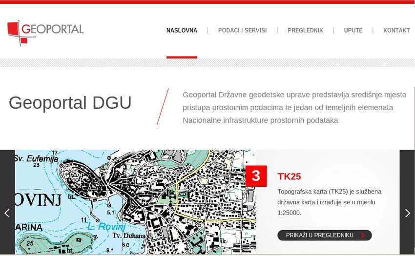
6th Regional Study on Cadastre and NSDI

6
6th Regional Study on Cadastre and NSDI

    2 ABBREVIATIONS AND DEFINITIONS
            2.1 Used abbreviations

AREC  Associate Real Estate Council
BA    Banja Luka
BG    Belgrade
CORS  Continuously Operating Reference Stations
DOF   Digital orthophoto
EC    European Commission
ELF   European Location Framework
ETRS  European Terrestrial Reference System
EU    European Union
FGI   Finish Geodetic Institute
GNSS  Global Navigation Satellite System
ISI   Infrastructure for Spatial Information
ITRF  International Terrestrial Reference Frame
KCA   Kosovo Cadastral Agency
LM    Landmateriet, Sweden
LJ    Ljubljana
LMO   Legally Mandated Organization
MSCS  Macedonian State Coordinate System
NCP   National Contact Point
NMCO  National Mapping and Cadastre Organization
PG    Podgorica
PIN   Personal Identification Number
PPK   Post-processing Kinematic
PR    Pristina
PS    Positioning Service
PTC   Permanent Technical Committee
RGA   Republic Geodetic Authority (BG)
RGARS Republic Authority for Geodetic and Property Affairs of the
      Republic of Srpska
RS    Republic of Srpska
RTK   Real-Time Kinematic
SA    Sarajevo
SDS   Spatial Data Service
SGA   State Geodetic Authority (ZG)
SK    Skopje
SO    Sofija
TA    Tax Authority
TI    Tirana
TOC   Table of Concordance
UTM   Universal Trasversal Mercator
ZG    Zagreb

                                                                    7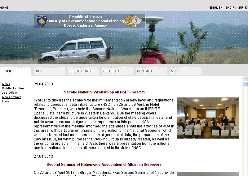
6th Regional Study on Cadastre and NSDI

            2.2 Definitions

Coordinate reference systems: Systems for uniquely referencing spatial
information in space as a set of coordinates (x, y, z) and/or latitude and
longitude and height, based on a geodetic horizontal and vertical datum
(European Commission, 2007)

CORS network: Continuously Operating Reference Stations (CORS) are
defined as GPS (GNSS) receivers located permanently at sites having very
accurately pre-determined coordinates. A CORS tracks GPS (GNSS)
satellites continuously 24 hours a day. A CORS may be an individual
receiver or may form part of a group of receivers strategically located
across a region. Groups of CORS are referred to as CORS networks. Such
networks may span areas of several tens of kilometres in dimension, or be
regional, continental or even global in scale

Legally Mandated Organisations: LMOs are all the Member States’ public
authorities, institutions and bodies who already have or will get a legal
mandate to set up and run one or some of the components of national and
regional SDIs, and which are eligible to become the MS’ contributors to the
INSPIRE for a particular component. These components cover all fields of
activity targeted by INSPIRE and can be either of a technical nature, or of a
policy and organisation related nature.

Member State Contact Points: Each member state must designate a
Contact Point, usually a public authority, to be responsible for contacts with
the Commission in relation to INSPIRE.

Spatial data services: means the operations which may be performed, by
invoking a computer application, on the spatial data contained in spatial
data sets or on the related metadata.

8
6th Regional Study on Cadastre and NSDI

    3 BACKGROUND
            3.1 Participants from the region

                  Figure 3.1: Participants from the region

Comparing to the last year, the list of the participants is extended. Among
the nine countries participating in the 5th Study, Bulgaria joined the project,
so the complete list of the participating institutions is as follows:

        •   Agency for Immovable Property Registration of the Republic of
            Albania,
        •   Agency for the Real-estate Cadastre of the FYR of Macedonia,
        •   Bureau for Geodetic and Property Relations of Republic Srpska,
        •   Federal Geodetic Administration of the Federation of Bosnia and
            Herzegovina,
        •   Geodesy, Cartography and Cadastre Agency, Bulgaria,,
                                               *
        •   Kosovo Cadastral Agency, Kosovo ,
        •   Real Property Directorate of the Republic of Montenegro,
        •   Republic Geodetic Authority of the Republic of Serbia,
        •   State Geodetic Administration of the Republic of Croatia, and
        •   Surveying and Mapping Authority of the Republic of Slovenia.

*   Whenever Kosovo* is mentioned in this report, this designation is without
    prejudice to positions on status, and is in line with UNSCR 1244 and the ICJ
    Advisory Opinion on the Kosovo Declaration of Independence. Therefore
    Kosovo in this report is always marked with an asterisk (*) meant at making
    reference to the above statement.

                                                                              9
6th Regional Study on Cadastre and NSDI
The participating institutions are represented by their corresponding
members of the Permanent Technical Committee (PTC):
• Tomislav Ciceli, Croatia,
• Saša Đurović, Serbia,
• Violeta Koritarova, Bulgaria,
• Lidija Krstevska, FYRM,
• Mirjana Ljumović, Montenegro,
• Xhevair Llakay, Albania,
• Dragan Macanović, Republic Srpska,
• Tomaž Petek, Slovenia,
• Muzafer Qaka, Kosovo*, and
• Antonija Sikimić, Federation of BH.
3.2 The Data prepared for the study
All data regarding the cadastral, geodetic and spatial data presented
throughout this study were obtained with courtesy of the participating
institutions. The members of the Permanent Technical Committee filled out
the questionnaire, prepared for the purpose of the study. The content of the
questionnaire is in line with the conclusions of the meeting of the PTC, held
on 27 March 2013 in Belgrade. Besides the updates regarding the topics
th
covered in the 5 Regional Study, the members of the PTC expressed their
interest in development of the reference networks in the countries and
organizations they represent, specifically, horizontal/vertical networks,
gravimetry, and the establishement of the new reference systems.
The questionnaire contains six main chapters:
• Cadastre and CORS,
• Real estate appraisal,
• Status of reference system,
• Legal framework of National mapping and cadastre
organizations (NMCO),
• Status of key registers, and
• Status in the establishment of NSDI and adaptation to the
Inspire directive.
It was an exhaustive work all the members of the PTC and their institutions
have done, in order to complete the provided forms. The requested data are
available neither at the glance, nor within the single institution. Having that
in mind, the author of this study wishes to thank all the institutions and the
persons responsible for collecting such huge amount of data.
106th Regional Study on Cadastre and NSDI
3.3 Regional Conference
th
The 6 Regional Conference on Cadastre and NSDI was held in Belgrade,
th th
from 3 to 4 June 2013. The topics discussed at the conference
followed the conclusions of the meeting of the PTC:
• Eurogeographics (policy, products, benefits...),
• Gravimetric measurements,
• Moving to the new reference system,
• Membership in which association is most suitable for regional
institutions,
• Real Estate Mass Appraisal,
• Problem of the objects build without the permission, etc.
The programme of the Conference:
3rd of June 2013
Opening
9:30 Welcome speech / Velimir Ilić, Minister of Construction and Urban
Planning
9:45 Welcome speech / Zoran Krejović, Director of Republic Geodetic
Authority
Eurographics
10:00 Eurographics - Your Association: Together We are Stronger and
Achieve More / Dave Lovell, Eurographics Executive Director,
Patricia Sokacova, Membership Relations and Communications
Manager
10:40 Eurographics: The More We Put In, the More We Get Out / Tomaž
Petek, The Surveying Authority of Republic of Slovenia
11:00 Round table: Benefits of the Membership; E.L.F. Project;
Importance of the members' Contribution to the Pan-European
products
11:40 Coffee break
Eurographics Workshop
12:00 Workshop on Eurographics Products / Nathalie Delattre, IGN
Belgium, Marcus Bruehl, BKG Germany
13:30 Lunch break
14:30 Workshop on Eurographics Products, continued
16:00 Cofee break
16:20 Discussion
17:00 Closing of the first conference day
17:15 Visit to Sremski Karlovci and dinner at Salaš 137
116th Regional Study on Cadastre and NSDI
4th of June 2013
SDI - INSPIRE - INSPIRATION
9:30 Regional study on Cadastre and Spatial Data infrastructure /
Vukan Ogrizović, University of Belgrade, Faculty of Civil
Engineering, Department for Geodesy and Geoinformatics
9:50 Current Results from the INSPIRATION Project / Fritz Krois,
INSPIRATION project
10:10 INSPIRE Implementation;: Current Status and Next Steps / Vlado
Cetl, EC Joint Research Centre
10:30 Introducing NSDI Law / Tomislav Ciceli, State Geodetic
Administration, Croatia
10:50 e-Cadastre and Services / Goce Gruevski, Agency for Real Estate
Cadastre, Macedonia
11:10 Coffee break
Improving of Land Registers and Legal Solutions
11:20 Implementation of the World Bank Projects in Southeast Europe /
Gavin Adlington, The World Bank
11:50 The Law on Special Conditions for Registration of Property Rights
on the Objects Build without a Building Permit / Miljana
Kuzmanović Kostić, Republic Geodetic Authority, Serbia
12:10 Implementation of the Law on the Proceedings of Illegaly
Constructed Buildings / Darko Markovinović, State Geodetic
Administration, Croatia
12:30 Establishing of Real Estate Cadastre in the Republic of Srpska
with the Support of International Projects / Darko Mišković,
Republic Administration for Geodetic and Property Affairs,
Republic of Srpska, Bosnia and Hercegovina
12:50 Establishing of Real Estate Cadastre on the Part of Territory of the
Montenegro where Survey is not Done / Mirjana Ljumović,
Snežana Rakočević, Real Estate Administration, Montenegro
12:10 Round table: EULIS Project
13:30 Lunch break
IT Improvement of Cadastral Systems, Geodesy and Gravimetry
14:20 Digitalization of Cadastral Maps and MAKedit / Elizabeta
Dukadinovska, Agency for Real Estate Cadastre, Macedonia
14:50 Implementation of the Software for Real Estate Cadastre in
Federation of Bosnia and Hercegovina / Nedžad Pašalić, Federal
Geodetic Administration, Federation of Bosnia and Hercegovina
15:10 Quality and Informatics Improvement of Cadastre in Slovenia /
Roman Novšak, The Surveying and Mapping Authority of Republic
of Slovenia
15:30 The Balkan Geodynamics by permanent GNSS Sites - results of 5
Years Data Analysis / Ivan Georgiev, National Institute of
Geophysics, Geodesy and Geography at Bulgarian Academy of
Science, Bulgaria
15:50 Establishing Gravimetric Networks in the Republic of Serbia /
Miroslav Starčević, Republic Geodetic Authority, Serbia
16:10 Coffee break
16:30 Regional Geoportal Pilot project / Ivica Skender, INSPIRATION
126th Regional Study on Cadastre and NSDI
Project
16:50 Project for Implementation of the Integrated Land Administration
System Financed from Pre-Accession Fund IPA 2010 / Sanja
Zekušić, State Geodetic Administration, Croatia
17:00 Conclusions of the Conference
17:30 Closing of the 6th Regional Conference on Cadastre and SDI
The participants of the 6th Regional Conference on Cadastre and SDI
agreed about the following conclusions:
1. Participants express the satisfaction with the well organized 6th
Regional Conference on Cadastre and Spatial Data Infrastructure,
with special gratitude to the Republic Geodetic Authority of Serbia
and director Zoran Krejović
2. Participants of the Conference express satisfaction with the
cooperation on the regional level, that should be further developed
and upgraded
3. Cooperation is needed in the implementation of mutual projects of
regional interest
4. The accent should be put on further mutual exchange of experience
and knowledge related to Cadastre, particularly in the field of Spatial
Data Infrastructure in INSPIRE environment
5. The support is given to the current active role of regional NMCA at
the cadastral, mapping and other international institutions, as well
as jointly agreed actions, and further coordination and joint position
is recommended
6. All NMCA in the region agree in opinion that the current
implementation of INSPIRATION project is at satisfactory level and
will give their maximum contribution in the preparation and
implementation of the future joint project INSPIRATION 2
7. We emphasize the need for further strengthening of the legal
framework, educational activities and public awareness in the field
of land administration
8. All countries in the region agree on joint participation in the following
projects and recommend data exchange through the authorized
services
9. Mutual cooperation and exchange within the technical and human
resources is agreed
10. Next Regional Conference on Cadastre and Spatial Data
Infrastructure will be held in Albania (Bulgaria)
136th Regional Study on Cadastre and NSDI 14
6th Regional Study on Cadastre and NSDI

    4 CADASTRE AND CORS
       4.1 Progress on the establishment of up-to-date
          cadastre
The current status of the cadastral data is given in Fig. 4.1. SK,
PG, BG, and LJ maintain their cadastral data 100% up-to-date.
Other institutions are working on their data, where BL, at the
moment, keeps only 5% of their cadastral data up-to-date.

       100%
        90%
        80%
        70%
        60%
        50%
        40%
        30%
        20%
        10%
         0%
                TI   SK    BL   SA    SO   PR    PG    BG   ZG    LJ

 Figure 4.1 :Increase of a number of properties covered by the up-to-
             date and harmonized cadastre and land book

Digitizing the cadastral maps is a long-term job. Having in mind the
variocity of existing graphical data, their quality, availability and
inconsistence, all institutions engaged significant resources for this task.
Currently, only LJ and ZG have all cadastral data digitized. BG converted
47% of its graphical plans into digital form. Graphical representation of the
status of the conversion process is depicted in Fig. 4.2.

       100%
        90%
        80%
        70%
        60%
        50%
        40%
        30%
        20%
        10%
         0%
                TI   SK    BL    SA   SO    PR   PG    BG    ZG   LJ

  Figure 4.2: Increase of the area covered by a digital cadastre map

                                                                          15
6th Regional Study on Cadastre and NSDI
The sources of financing NMCOs with the amounts in 000 € are given in
Table 4.1. The largest budget has BG, 39 M€, and the lowest budget is in
SA, approximately 2 M€. The budget structues differ between the
institutions. While BG and SO use only their state budgets, some
institutions, for example, SK, BL, or LJ uses four of five available sources.
Table 4.1: Annual NMCO budget for 2013 and sources (in 000 €):
Inst. own revenues state budget co-financing loan annual
budget
TI 3,500 16,000 19,500
SK 3,783 5,500 1,923 11,206
BL 8,000 35 200 8,235
SA 900 380 102 652 2,034
SO 5,430 5,430
PR 1,034 300 1,300 2,634
PG 150 2,300 2,450
BG 39,000 39,000
ZG N/A
LJ 300 20,402 200 20,902
Graphical representation of institutions budgets is depicted also in Fig. 4.3.
The budgets of the institions are likely to be limited to everyday tasks. That
makes very important the possibility of obtaining financial support through
loans or projects provided by international institutions/bodies. Tabular
summary of the new or on-going projects is given in Table 4.2. As it can be
seen, sources of the support vary, from the EC, WB, to Japan Government.
However, some countries do not have at the moment such projects (BG
and ZG, for example). With the exception of PG and its one-year project,
other projects are designed for two or more years.
166th Regional Study on Cadastre and NSDI
Table 4.2: New or on-going projects with the foreign support
Inst. Project name Support Status From To
inst.
TI Land Administration & WB
Management Project
TI TWINING LM
SK Real Estate Cadastre and WB Under 2009 2013
Registration Project - additional implementation
finansing
BL Real Estate Registration Project WB Applied for 2013 2018
SA INSPIRATION project EU Under 2011 2013
implementation
SA CILAP project LM Under 2013 2016
implementation
SA RERP WB Under 2013 2019
implementation
SO Provision of electronic and EU & Under 2011 2013
administrative services Bulgaria implementation
SO Upgrade of existing IS and EU & Planning 2012 2014
development of e-services in Bulgaria phase
GCCA
PR Topographic maps 1:25000 JICA/ Under 2013 2015
Government implementation
of Japan
PG INSPIRATION project – EC Under 2012 2013
continuation implementation
LJ European Location Framework EC Under 2013 2016
implementation
The project activities of BL focus on the cadastre and land registry data
updating and harmonization.
PG project aims to promotion of the SDI and coordination of its its
implementation in the Western Balkans with a view to prepare beneficiaries
to meet the objectives of the EU INSPIRE Directive. INSPIRATION will
contribute to a favourable environment for accurate, up-to-date, high-
quality, well structured and accessible spatial data in local, regional and
state administrative bodies in the region.
LJ implements the E.L.F. project, which will foster the wider use of geo-
information in order to enable the creation of innovative value-added
services. The purpose of this project is to deliver the E.L.F. required to
provide up-to-date, authoritative, interoperable, cross-border, reference
geo-information for use by the European public and private sectors. The
versatile cloud and cascade supporting architecture provides a platform of
INSPIRE compliant geo-information, harmonised at a cross-border and
pan-European level.
176th Regional Study on Cadastre and NSDI
BG implements a project focused on provision of electronic and complex
administrative services by GCCA through development and implementation
of software in compliance with the Law of e-government. The main project
outcomes are development of internal rules for the document turnover of
electronic and paper documents and development of an e-system for
processing of grievances, proposals and signals. In the planning phase, the
project aims at upgrading the existing information systems and
development of the e-services in GCCA for better administrative servicing.
The contributing institutions prepared the information regarding
development and implementation of electronic information services to the
public, specifically the services providing Internet access to technical
textual information, cadastral maps, and legal textual information.
SK's project should provide the addional financiall support to the Real
Estate Cadastre and Registration Project. It assumes the activities focused
towards completing the digital cadastre maps and creating a web-based
geographic information system (web-GIS) platform for sharing and
exchanging the data. This will provide a complete coverage of the whole
territory of the country with basic digital spatial data sets. New activities will
also support additional policy development for AREC and the government
to develop a strategy for a NSDI and to meet the requirements for the
INSPIRE Directive (No. 1205/2008) of the EU.
The Project Development Objective of the RECRP remains unchanged: to
build an efficient and effective real estate cadastre and registration system,
contributing to the development of efficient land and real estate markets. Of
the existing four components of the Project, Component 1: Establishing the
REC is completed. New activities will be added to Components 2 and 3;
and Component 4 (Project Management) will continue unchanged. The bulk
of the new activities are included under new Components 5 and 6.
The Additional Financing would support the following:
a) Component 2: Institutional Strengthening,
b) Component 3: Development of Land Policy,
c) Component 5: Digital Cadastre Map and Web-GIS would support
the digitization and vectorization of the existing maps and
associated quality control; upgrading the digital cadastre map
database and software for maintenance and associated training;
development of the platform for data sharing and exchange with the
public, private sector and other government institutions; and
upgrading the national geodetic reference infrastructure, and
d) Component 6: Support to the Authority for Legal and Property Affairs
186th Regional Study on Cadastre and NSDI
4.2 Development and implementation of
electronic information services
Establishment of e-government solutions and services is one of the issues
that is treated in all countries. Cadastral and survey data are essential for
implementation of such services. We collected data from the contributing
institutions regarding technical textual information, cadastral maps and
legal textual information, in order to estimate the level of availability of the
services via Internet.
Status in establishment of Geoportals giving access to cadastral and land
register data is presented in Fig 4.4.
Considering technical textual information, BG, PG, SK, and LJ own the
operational services. Others are in the process of establishment.
Geographic coverage and completeness in percent is given in the Fig. 4.5.
196th Regional Study on Cadastre and NSDI
100%
80%
60%
40%
20%
0%
TI SK BL SA SO PR PG BG ZG LJ
Figure 4.5: Geographic coverage and completeness of the technical
textual data
Geoportal data should be always available to the users. The contributing
institutions have developed different methods of data access and pricing.
Regarding the technical textual data, with the exception of SK and LJ, all
other institutions provide the users with the limited data access. PR
charges everyone, while BG, BL, PG, and BL allow free access to the
governmental bodies. BL does not provide a web-site with the price list.
Payment is mostly available following the ad-hoc principle, while in most
cases, apart from electronic form, the users can perform the payment in the
classical manner, paper form. Paper and electronic application forms
depend on availability type of the service. In the case of the mode of data
access, only LJ offers full, not limited view and explore functions, while
other institutions define different kinds of limitations.
100%
80%
60%
40%
20%
0%
TI SK BL SA SO PR PG BG ZG LJ
Figure 4.6: Geographic coverage and completeness of the cadastral
maps
206th Regional Study on Cadastre and NSDI
100%
80%
60%
40%
20%
0%
TI SK BL SA SO PR PG BG ZG LJ
Figure 4.7: Geographic coverage and completeness of the legal
textual information
Geographical coverage with the cadastral maps shows (Fig. 4.6) that only
SK and LJ provided the 100% availability of cadastral maps via their
geoportals.
Finally, collecting and providing of the legal textual information is completed
in PG, BG, and LJ (Fig. 4.7).
Detailed information about the data access policy and pricing for the
technical textual information and cadastral maps is showed in Tab. 4.3.
Regarding technical textual information in BG, there are fees for the
unlimited set of data based on a monthly contract with the users, while the
basic dataset is free for everyone. Legal textual information are available
only to legal entities with which RGA has signed the contract. The
customers receive invoices every month for the legal and textual
information.
PG provides the users with several access modes: data preview with free
access is available for everyone while service use needs an authorization.
Currently, only state institutions and local institutions have access to the
data.
In the case of the legal textual information, the only difference from the
Table 4.3 is the mode of access for LJ. Here LJ provides limited data
access regarding using and delivering personal data, according to the Law
for personal data protection.
BL has engaged a private service provider in IT system operations and data
dissemination, Digit d.o.o. Banja Luka, with the role of maintenance of
software and hardware. Other institutions did not make any contracts with
the private bodies, within this context.
216th Regional Study on Cadastre and NSDI
Table 4.3: Pricing policy and data access for technical textual
information and cadastral maps
inst. Pricing policy Payment Web-site Mode of
access
TI free for government Subscription Yes limited
bodies, pricing for
everybody
SK free Ad-hoc Yes limited
payment
BL free for government paper and limited
bodies electronic
form
SO free for government http://www.icadastre.bg limited
bodies /index.aspx?
ReturnUrl=%2f#
PR pricing for everybody Ad-hoc http://www.kca-ks.org
payment
PG free for government http://www.uzn.me combined
bodies
BG free/payment contract http://www.geosrbija.rs, limited
http://katastar.rgz.gov.r
s/KnWebPublic/
ZG free for government Yes limited
bodies
LJ free Ad-hoc www.gu.gov.si no limit
payment
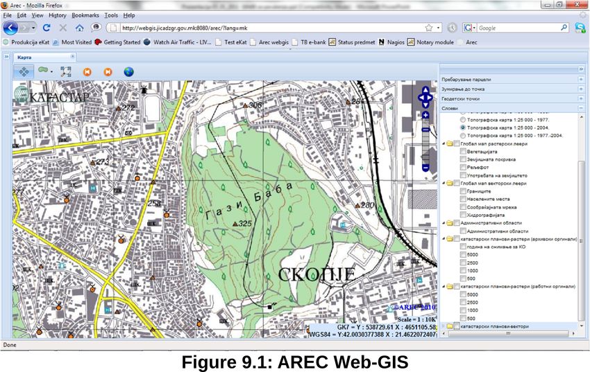
The home-page screenshots of working geoportal web sites for PG, PR, LJ,
BG, ZG, and SK are given in Fig. 4.8, 4.9, 4.10, 4.11, and 4.13,
respectively.
226th Regional Study on Cadastre and NSDI
Figure 4.8: Web site of the Real Property Directorate of the Republic
of Montenegro
Figure 4.9: Web site of Kosovo Cadastral Agency
236th Regional Study on Cadastre and NSDI
Figure 4.10: Web site of Surveying and Mapping Authority of the
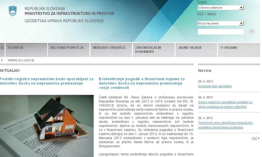
Republic of Slovenia
Figure 4.11: Web site of the Republic Geodetic Authority of the
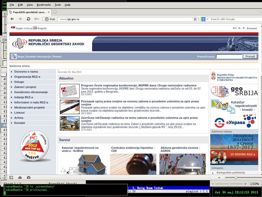
Republic of Serbia
246th Regional Study on Cadastre and NSDI
Figure 4.12: Web site of ZG Geoportal
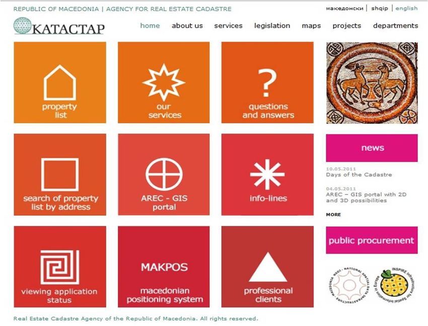
Figure 4.13: SK Web-cadastre portal
256th Regional Study on Cadastre and NSDI
4.3 Status of the implementation OF GNSS
services
All participants operate CORS networks on their territories. Acquired data
arising from those services is used for positioning and cadastral services.
Several modes of operation are provided, from decimeter to millimeter
accuracy level, depending on the purpose of the specific mode. CORS
networks are designed appropriate to the covered territories. The number
and disposition of the CORS stations follow the geographical
characteristics of the territories. In Tab. 4.4 there are number of CORS
stations within the countries, including the basic data, such as official
names, acronyms and the bodies in charge for the CORS maintainance.
Table 4.4 List of CORS networks
inst. Acronym Full name Agency Stations #
TI ALBPOS Albanian Positioning 3 experts 16
Service System
SK MAKPOS Macedonian Positioning Agency for Real Estate 14
System Cadastre
BL SRPOS Mreža permanentnih Republic Authority for 17
stanica Republike geodetic and property
Srpske affairs of the Republic
of Srpska (RGARS)
SA BIHPOS Bosnia and Hercegovina FGA and RGURS 34
Positioning System
SO BAS GNSS network, Bulgarian academy of 85
NAVITEQ network- science, private
licensed, GEONET company
network-licensed,
BULiPOS SMARTNET
network
PR KOPOS Kosovo Positioning Kosovo Cadastral 8
System Agency
PG MONTEPOS Montenegro Positioning Real Estate 9
System Administration
BG AGROS Active Geodetic Republic Geodetic 43
Reference Network of Authority - Control
Serbia Center
ZG CROPOS Croatian Positioning State Geodetic 30
System Administration
LJ SIGNAL SIGNAL Surveying and 15
Mapping Authority
It is assumed that four standard positioning services (PS) are available:
differential, real-time kinematic (RTK), post-processing kinematic (PPK=
and geodetic post-processing. Differential service is capable of delivering
decimeter accuracy to the customers. This is applied, primaly, in GIS
applications, where centimeter level accuracy is not necessarry. Surveying
applications assume centimeter accuracy, so RTK and PPK are the most
266th Regional Study on Cadastre and NSDI
used services in the region. Geodetic post-processing PS is available for
the users needing the highest accuracy, primarily for establishing control
networks.
All institutions provide their users with RTK. Differential mode and geodetic
PS are available everywhere, except PR. PPK can be used in SK, BL, PG,
BG, and LJ, while PPK is available in SK, BL, and BG.
Basically, three models of usage fees are available: prepaid, postpaid and
flat access. SK, BL, BG, and ZG offer all three methods; PG and LJ offer
prepaid model, while the users in PR pay their fees according to the flat
access method (Tab. 4.5). The last three columns of Tab. 4.5 present the
number of minutes in the last three years, that the users spend for their
positioning purposes. All institutions show the increasing trend of the CORS
minutes, which is an indicator of the introduction of the satellite positioning
methods in all areas of surveying. The statistics of the usage was not
available for PR, since CORS is established in November 2012.
BG serves 280 organizations with 378 uses in total. LJ has 220 active
users (out of 585 in total).
All institutions provide their users with the pricelists for using CORS. They
are everywhere available via web-pages of the body maintaining CORS.
Everyone, except PR, send the pricelists via e-mail and in the paper form.
Table 4.5 Usage of CORS networks
inst. Model # of Min(2010) Min(2011) Min(2012)
users
TI prepaid,
postpaid, flat
SK prepaid, 125 259620 677760 682680
postpaid, flat
BL prepaid, 60 N/A N/A N(A
postpaid, flat
SA prepaid, 90 50 70
postpaid, flat
PR flat access 30
PG prepaid 40 25 30 35
BG prepaid, 378 5499760 13837544 20128652
postpaid, flat
ZG prepaid, 568 5024058 5024058 5900300
postpaid, flat
LJ prepaid 585 20808 (DPS), 10200 (DPS),
2185107 (RPS) 923300
(geodeticPS),
2521200(RPS),
276th Regional Study on Cadastre and NSDI
4.4 Status of digital maps
BL based its map production on vector maps. There are three cadastral and
one topographic map finished (Table 4.6). Only the topographic map in
1:25000 scale covers the whole territory, while others vary from 60% to
80%.
Table 4.6: BL digital maps
Scale 1: Type Title Year of production Coverage[%]
1000 Vector Cadastral map 1996 - 2013 80
2500 Vector Cadastral map 1996 - 2013 70
5000 Vector Cadastral map 1996 - 2013 60
25000 Vector Topographic map 2004 100
PR is currently working on its 1:25000 vector topographic map. It is planned
to be finished in 2014. At the moment, 90% of the work is completed.
PG produced a line of vector and raster maps, with different degree of
coverage. The most recent products are 1:25000 vector and raster digital
topographic maps, produced in last six years. Also, extended data are
2
available, regarding LIDAR data with the resolution on 1 pt/m and the
vector map of contour lines with equidistances of 25 m, 5 m and 1 m (Table
4.7).
Table 4.7: PG digital maps:
Scale 1: Type Title Year of Coverage[%]
production
25000 Vector Digital topographic maps 2007-2013 100%
25000 Raster Digital topographic maps 2007-2013 100%
5000 Raster Base State Map 1968-1985 15%
10000 Raster Base State Map 1953-1970 45%
25000 Raster Topographic maps 1970-1985 100%
50000 Raster Topographic maps 1970-1986 100%
100000 Raster Topographic maps 1970-1987 100%
200000 Raster Topographic maps 1970-1988 100%
300000 Raster Topographic maps 1970-1989 100%
500000 Raster Topographic maps 1970-1990 100%
1pt/m2 Vector LIDAR data 2010-2011 100%
25m/5m/1m Vector contuor line 2010-2012 100%
LJ produced two vector and two raster maps. Three of them cover 100% of
the territory, with plans for updating 60% of two of them during 2013.
Topographic database (DTK5) in scale 1:5000 covers 60% of the territory.
286th Regional Study on Cadastre and NSDI
Tabular data are presented in Table 4.8.
Table 4.8: LJ digital maps
Scale Type Title Year of production Coverage[%]
1:25.000 Raster Topographics maps 1998-1999 100
(DTK25)
1:50.000 Vector State Topographic maps 2000-2005, 2008- 100
(DTK50-V) 2013 (60%
updating)
1:50.000 Raster State Topographic map 2000-2005, 2008- 100
(DTK50) 2013 (60%
updating)
1:5.000 Vector Topographic database 2006-2013 60
(DTK5)
Table 4.9: BG digital maps
Scale 1: Type Title Year of Coverage[%]
production
5000 3D vector National Base Map (urban 2012/2013 14
database areas)
20000 3D vector Topographic Map (territory of 2012/2014 2
database the Republic of Serbia)
Table 4.10: SK digital maps
Scale 1: Type Title Year of Coverage[%]
production
25000 Raster Topographic maps in scale 2006-2011 100%
1:25000
25000 Vector Topographic maps in scale 2006-2011 100%
1:25000
50000 Raster Topographic maps in scale '70-ties 100%
1:50000
100000 Raster Topographic maps in scale '70-ties 100%
1:100000
200000 Raster Topographic maps in scale '70-ties 100%
1:200000
500000 Raster Topographic maps in scale '70-ties 100%
1:500000
1000000 Vector Global Map Macedonia 2012 100%
1000000 Raster Global Map Macedonia 2012 100%
BG is working on two vector maps, one for urban areas in scale 1:5000 and
the other for the territory of the whole country, in scale 1:20000 (Table 4.9).
296th Regional Study on Cadastre and NSDI
SK produces a line of raster and vector maps. All of the cover the whole
territor of the country (Tab. 4.10).
SO maintaines four raster maps, with different coverage (Tab. 4.11).
Table 4.11: SO digital maps
Scale 1: Type Title Year of Coverage[%]
production
5000 Raster 1970 80
5000 Raster 1950 65
10000 Raster 1970 100
10000 Raster 1950 45
With the exception of SO and SK, all institutions maintain spatial
databases. In the case of BG, PosgreSQL with PostGIS extension is used,
while PG uses ArcGIS.
PR, PG, BG, ZG, and LJ have the on-going programs of production of the
new maps.
PR is working on its topographic maps 1:25000 within the 2013-2014
program.
PG runs a program according to the Law on State Surveying and Cadastre
of Immovable Property. Following its annual work plans, two maps are
pointed: 1:25000, and 1:500000. which are selected for updating, together
with the topographic and the cartographic database.
SA produces a wide scope of vector topographic maps in different scales.
The program started in 2004 and up to now 25% of the state area is
covered.
BG has a mid-term programme of producing the National Base Map for the
urban areas in the scales 1:5000 and 1:10000. The program is started in
2010, and should be completed in 2014. Also, there is another mid-term
programme in BG, which is dedicated to the whole territory of the Republic
of Serbia and the 1:20000 topographic map. The realization of the program
comprises the period 2010-2014.
ZG works on TK25, the topographic map in 1:25000 scale. The program
started in 2011 and will be finished in 2016.
LJ has the updating program for topographical maps, which is run regularly.
306th Regional Study on Cadastre and NSDI
4.5 Status of existing orthophoto maps
In the period 2003-2011 BL produced DOF in resolutions 0.10 m, 0.25 m,
and 0.50 m within the projects of the new survey. The purpose of DOF is
the support for establishing the real estate cadastre. Locations covered with
DOF are the regions of Bileća, Han Pijesak, Čajniče, and Šipovo.
PR is working on its three resolutions of digital orthophoto (DOF) maps:
0.08, 0.20, and 0.40 m that will be used in the urban planning and cadastral
purposes. All three DOFs will cover the whole territory in the jurisdiction of
Kosovo Cadastral Agency.
PG prepared a line of DOFs, in resolutions 0.2 m to 2.2 m, for a number of
the municipalities. The DOF OrthophotoMNE05, which is completed in
2007, covers the whole territory of Montenegro. Periodical updating of the
0.2 m resolution orthophoto is also performed for the whole territory. The
specification of the produced DOFs is presented in Table 4.12. Orthophoto
is also used in cadastral survey. The result of this application are eight
orthophoto maps, for the parts of the municipalities Plav, Berane,
Andrijevica, Podgorica, Berane, Žabljak, Cetinje, and Nikšić.
Table 4.12: PG orthophoto maps
Title Res. Purpose Location Productio
[m] n year
OrthophotoMNE02 0.2 periodically whole country 2010-2011
recording the
territory of
Montenegro
OrthophotoMNE05 0.5 topographic whole country 2007
survey
OrthophotoPLAV 0.2 cadastral survey part of the 2011
municipality
OrthophotoBERANE 0.2 cadastral survey part of the 2007-2012
municipality
OrthophotoANDRIJEVICA 0.2 cadastral survey part of the 2007-2012
municipality
OrthophotoPODGORICA 0.2 cadastral survey part of the 2007-2012
municipality
OrthophotoBERANE 0.2 cadastral survey part of the 2010-2011
municipality
OrthophotoZABLJAK 0.2 cadastral survey part of the 2010
municipality
OrthophotoCETINJE 1.2 cadastral survey part of the 2008
municipality
OrthophotoNIKSIC 2.2 cadastral survey part of the 2008
municipality
316th Regional Study on Cadastre and NSDI
From 2010, LJ is working on its 0,25 m resolution DOF of Slovenia
(DOF025), which consists of 3261 map sheets available in digital format
(TIFF).
In 2010, BG completed the data acquisition for three DOF maps, in
resolutions 0.1 m, 0.2 m, and 0.4 m, respectively. DOF in 0.1 m covers 166
urban areas. Another 194 cadastral municipalities got their orthophoto
maps in 0.2 resolution, while the widest area is covered by 0.4 m DOF. The
target of 0.2 DOF are the areas with the old coordinate system, which are
primarely located in Vojvodina (Tab. 4.13).
ZG created its DOF5, a digital orthophoto map in 0.3 resolution for the
whole territory of Croatia. The map is finished in 2011.
There are also on-going programs on producing new orthophoto maps. BL
plans to establish a DOF for BiH Territory within an IPA Project in 0.25 and
0.50 resolution. The program is performed during 2012-2013. The
resolution 25 cm will cover 20% of the RS, and 50 cm the whole territory of
the RS.
Accordng to the Law on State Surveying and Cadastre of Immovable
Property and its annual work plans, PG updates its 0.2 m and 0.1 m DOF
every five years, in order to update the orthophoto data for the urban areas.
BG runs a mid-term programme for the territory of the Republic of Serbia,
except the area of Kosovo and Metohia, intended for producing a 0.4 m
orthophoto. The program started in 2010 will be completed in 2014.
ZG works on a 0.3 m resolultion orthophoto map for the whole territory of
Croatia, within a 1-year program (2013-2014).
Table 4.13: BG orthophoto maps
Title Res. Purpose Location Production
[m] year
Digital 0.1 Maintenance of spatial 166 urban areas of the 2007-2010
orthophoto registries, urban and Republic of Serbia
spatial planning,
geostatistics etc.
Digital 0.2 Maintenance of spatial 194 cadastral 2008-2010
orthophoto registries, transformation municipalities whose
of data projection, land data are not in official
consolidation urban and state coordinate
spatial planning, system (primarily
geostatistics etc. located in Vojvodina)
Digital 0.4 Maintenance of spatial Territory of the 2007-2010
orthophoto registries, land Republic of Serbia,
consolidation urban and except area of Kosovo
spatial planning, and Metohia, areas of
geostatistics etc. 0.2 m DOFs and
urban area of
Belgrade city;
326th Regional Study on Cadastre and NSDI
SO has two orthophoto maps, in 0.5 m resolution, produced in 2007. and
0.4 m resolution, completed in 2011.. The whole territory of Bulgaria is
covered with those two orthophoto maps.
SA owns a FBIH DOF, orthophoto map covering the whole territory of FBIH,
completed in 2008. The map is been updating within the on-going program
which started in 2011. Finally, LJ runs the regular updating program for the
orthophoto maps.
336th Regional Study on Cadastre and NSDI 34
6th Regional Study on Cadastre and NSDI

5 REAL ESTATE APPRAISAL
            5.1 Apllied appraising method
In this chapter, an analysis of the methods of real estate appraisal is
performed. We asked the contributing institutions which method of the real
estate appraisal they use:

   •   Income Approach: This method evaluates how much income a
       property would produce if it were rented as an apartment house,
       store, office, for manufacturing, etc. For commercial properties, the
       assessor must consider operating expenses, taxes, insurance,
       maintenance costs and the return most people would expect to
       receive on your kind of property.
   •   Cost Approach: This method is based on how much money it would
       take, at current material and labor costs, to replace the existing
       construction with one similar. If the construction is not new, the
       assessor must also estimate how much a parcel like this would be
       worth if it was vacant.
   •   Sales Comparison Approach: This method compares a property to
       others that have sold recently. Sales prices are very carefully
       analyzed in order to get the true picture. When using this approach,
       the assessor must always consider such over pricing or under
       pricing and analyze many sales to arrive at a fair valuation for the
       property. Size, quality, condition, location, and time of sale are also
       important factors to consider.

                                                                           35
6th Regional Study on Cadastre and NSDI
Fig. 5.1 shows the commonly used real estate appraisal methods in the
contributing countries. LJ, BG, PR, and PR use the sales comparison
method, while BL uses the cost method. SK still does not define the
preferable appraisal method, and for other countries no data is available at
the moment.
In PR, the body that estimate the real estate values is the Responsible
Authority Tax Department within the Ministry of Finances. A number of
evaluated properties is only available for LJ. In the last year, 100 properties
are evaluated. For other countries, there is no data.
5.2 Licenses
The users of real estate appraisaing are banks, private surveying
companies, notaries, and executives, in the case of SK. Tax administration
is interested in this kind of data in BL. Municipalities that collect property
taxes are the bodies that use the results of appraising in PR. Besides the
tax administration, in BG, banks, investors, private appraisers and other
interested bodies and institutions need data about the value of the
properties. In LJ, generalised market value to be ascribed to all real estate
that is entered in the Real Estate Register. The models of the mass
valuation of the real estate are managed and publically available online in
the updated Real Estate Valuation Database. This data are used in the
procedures of social aid, mortages law, scholarship, taxation purpose etc..
Table 5.1: Licences for real estate appraising
inst. Licence Licence name Responsible body # of
exists experts
TI Yes Licence for valuation Ministry of Public Works ~500
immovable properties
SK Yes License appraiser of real Ministry of Transport and 115
estate Communications
SA Yes N/A (not under FGU N/A (not under FGU 0
jurisdiction) jurisdiction)
PG Yes Licence from Association Association of appraisers 150
of appraisers
BG Yes License for an individual Appraisers National
assessment Association of Serbia and
Association of Court
Experts
LJ Yes Only for individual real Ministry of justice for cort 400
estate valuators assesors (300) and
Slovenian Revision Instirut
based on public
appointment (100)
366th Regional Study on Cadastre and NSDI
A tabular review of licence types for the real estate appraisal is given in
Tab. 5.1. In the case of SK and LJ, resposible ministries issue the licenses,
while in PG and BG, that work is done by professional associations of the
appraisers. The largest number of licensed appraisers own LJ, 400, while in
other countries (where applicable) is below 200.
5.3 Mass appraisal
Market value for assessment purposes is generally determined through the
application of mass appraisal techniques. Mass appraisal is the systematic
appraisal of groups of properties as of a given date using standardized
procedures and statistical testing. Determination of a parcel’s value is a
process where assessing officers must rely upon valuation equations,
tables, and schedules developed through mathematical analysis of market
data. Values for individual parcels should not be based solely on the sale
price of a property; rather, valuation schedules and models should be
consistently applied to property data that are correct, complete, and up-to-
date.
According to the available data, mass appraisal is used in all contributing
countries, except in PG.
Main problem in mass appraisal in BL is that the mass appraisal is
conducted by the tax administration office, without the influence of the
geodetic administration.
The problem could be, also, lack of qualitative data, which is the problem
recognized in BG, which correspondents with the issue noticed by LJ,
regarging the lack of detailed and updated data about the real estate, which
is an important condition for realistic and accurate evaluation.
Table 5.2 gives the information about the institutions/bodies collecting data
necessary for the mass appraisal.
Table 5.2 Bodies responsible for data collecting for the mass appraisal
instl. Responsible body
SK Agency for Real Estate Cadastre
BL Tax Administration
PR Tax Department (Ministry of Finance), Municipalities (Defartment of
Finances)
BG Republic Geodetic Authority Tax Administration
LJ Surveying and Mapping Authority
The valuation of the real properties registered in the real estate cadastre in
SK is performed on the basis of a model for mass valuation. The mass
valuation of the real properties can be used or taken under consideration
during the determination of the amount of the property tax in compliance to
the law. Tax Administration of BL collects data from citizens for the fiscal
376th Regional Study on Cadastre and NSDI
register of property. in PG, Real Estate Administration performes
evaluations according the claims of the state bodies or the municipalities.
Regarding BG, RGA receives the data from the TA, updates that data and
binds them to data from the database of the real estate cadastre. The
resulting data is used to analyze the market.
In the case of LJ, the real estate transactions were reviewed and processed
for the purpose of making a model of the Slovenian real estate market and
determining a valuation model of individual types of real estate. The
Government of the Republic of Slovenia determined real estate valuation
models by adopting the Real Estate Valuation Models Determination
Decree (Official Gazette of the Republic of Slovenia, no. 95/11). Pursuant to
this Decree, the application for ascribing values to the real estate was
upgraded. This allowed a generalised market value to be ascribed to all
real estate that is entered in the Real Estate Register. The models of mass
valuation of real estate are managed and publically available online in the
updated Real Estate Valuation Database.
5.4 Legislative considering mass appraisal
In BL and PR, there are no laws that treat the question of the mass
appraisal. Other contributing institutions solve the question of the mass
appraisal as follows:
• BG: Law on State Survey and Cadastre, Official Gazette No.
72/2009 and 18/2010.
• LJ: Real Property Mass Appraisal Act – ZMVN (Official Gazette of
the Republic of Slovenia, nos. 50/06 and 87/11),
• SK: Law for real estate cadastre, Official Gazette 55/13,
Mass appraisal issues are mentioned in three laws in PG:
• Law on state survey and real estate cadastre, RCG 29/07 and
Official Gazette CG 32/11 and 40/11 2007,
• Law on state property, Official Gazette, CG 21/09, and
• Law on expropriation.
In BG and LJ, mass appraisal is still does not used in taxing purposes. LJ
has no law about the real estate taxation on place and the proces is still
based on payment of the substittution of the urban land usage.
In SK, establishment and collection of the property taxes shall be
performed by the municipality administration, the administration of the
municipalities in the city of Skopje and the administration of the City of
Skopje on the area of the municipality where the property is located. Base
of the property tax shall be the market value of the immovables. The
determination of the market value of the immovables shall be made by an
appraiser employed in a local self-government unit, and upon a request of
the local self-government unit, it may be made by an authorized appraiser.
386th Regional Study on Cadastre and NSDI
The Methodology for Determining Market Value of Immovables shall be
prescribed by the Government of the Republic of Macedonia, on a proposal
of the Minister of Finance.
PR uses the mass appraisal for calculation of the taxes on the properties.
Local municipalities in PG use it for regular yearly real estate taxation.
396th Regional Study on Cadastre and NSDI 40
6th Regional Study on Cadastre and NSDI

6 STATUS OF REFERENCE SYSTEMS
       6.1 Coordinate reference systems

Countries belonging to former Yugoslavia shared the common
Gaus-Krüger projection on Bessel ellipsoid. Due to the
inhomogenous trigonometric networks and, therefore, low quality
of survey data, relevant institutions in the region started to
upgrade their reference systems. Most of the countries now use
ETRS89 as their reference systems, while their reference frames
are based on ITRF/ETRF, with different reference epochs. In
most cases, they still keep Gauss-Krüger projection, while
several of them are in the process of transfering to UTM. The
complete list of applied CRSs and their implementations is
showed in Tab. 6.1

Table 6.1 List of CRSs used by the countries
inst. CRS                                 Implementation Projection
 TI   ETRS89                              ETRF2000       Gauss-Kruger, UTM
                                                         for small scale
 SK Macedonian State Coordinate ITRF94/ETRF19 Gauss-Krüger
    System based on Bessel Ellipsoid 89 and ITRF
    (MSCS) - in official use - ETRS89 2008 / ETRF
                                      2000
 BL Bessel 1841, and ETRS89               Ongoing        Gauss-Kruger
 SA Bessel 1841 inherited from the ex                    Gauss-Kruger
    Yugoslavia, ETRF2000 (CS of
    CORS network stations)
 SO ETRS89                                ETRF2000       UTM, Gauss-Krüger,
                                                         Lambert      conic
                                                         conformal
 PR ETRS89                                KosovaRef01    Gauss-Krüger
 PG ETRS89                                ITRF96         Gauss-Kruger, UTM
 BG ETRS89                                ETRF2010       UTM, GaussKruger
 ZG HTRS96 (ETRS89)                       ITRF1996,      Transverse-Mercator
                                          1995.55        Projection
 LJ   D48GK      and     D96TM      in ETRF00            Gauss Kruger and in
      establishment                                      new CRS it will be
                                                         used TM - transferzal
                                                         Mercator projection

MSCS dated from 1930-ies, while ETRS89 is introduced in SK in 2010. Its
new reference system PR adopted in 2003, and PG in 2012. BG introduced
its ETRF2010 in 2011, and ZG its projection based on Transversal Mercator
projection in 2004.

                                                                           41
You can also read