Bayou Bartholomew Watershed Plan 2009 Update - Arkansas ...
←
→
Page content transcription
If your browser does not render page correctly, please read the page content below
Bayou Bartholomew
  Watershed Plan
   2009 Update

                    1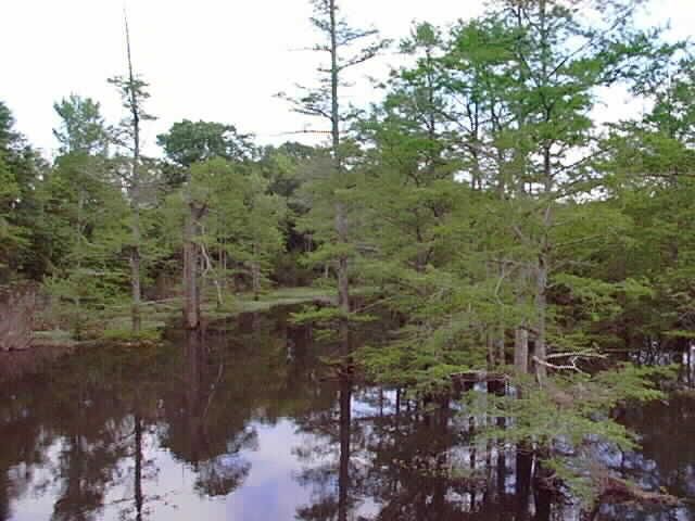
Table of Contents

Watershed Description ........................................................................................ 3
   Location and Physical Setting ................................................................................ 3
   Landscape and Topography .................................................................................. 3
   Geomorphology ................................................................................................... 4
   Hydrography........................................................................................................ 4
   Hydrology............................................................................................................ 5
   Groundwater ....................................................................................................... 6
   Soils.................................................................................................................... 7
   Vegetation ........................................................................................................... 7
   Wetlands ............................................................................................................. 8
   Fish and Wildlife Resources ................................................................................... 9
   Demographic and Socioeconomic Characteristics .................................................. 10
   Water Quality .................................................................................................... 12
Element 1: Identification of Causes and Sources ............................................. 12
Element 2 & 3: Proposed Management Measures & Estimated Load
Reductions ......................................................................................................... 15
Element 4: Technical and Financial Assistance Needs ..................................... 18
   Technical Assistance ........................................................................................... 19
Element 5: Information, Education, and Public Participation .......................... 20
Element 6 & 7: Schedule and Milestones .......................................................... 20
Element 8: Performance Criteria ....................................................................... 22
Element 9: Monitoring Component .................................................................. 22
Literature Cited and/or Reviewed ............................................................................ 24

                                                                                                                            2
Watershed Description

Location and Physical Setting

The Bayou Bartholomew Watershed is located in the southeastern Arkansas and
northeastern Louisiana. The Bayou Bartholomew is the main stream found within the
watershed. It flows for 269 miles through six counties in Arkansas and Morehouse
Parish in Louisiana. Counties in Arkansas through which the stream flows include
Jefferson, Lincoln, Drew, Ashley, Desha, and Chicot Counties. Small portions of the
                           latter two counties are within the watershed. The extreme
                           northeastern corner of Cleveland County is within the
                           watershed; however, the stream does not flow through that
                           county (Figure 1).

                          The western edge of the watershed, to the west of the Bayou
                          Bartholomew, lies within the West Gulf Coastal Plain Natural
                          Division. The eastern side of the watershed is within the
                          Mississippi Alluvial Plain Natural Division. The Bayou
                          Bartholomew lies on the boundary between these two
                          ecoregions, thus comprising a diverse ecotone as related to
 Figure 1. Bayou
 Bartholomew
                          the aquatic community, which it harbors. Consequently,
  Watershed.              differences in stream characteristics, land use, vegetation, and
wetland types are found between east and west portions of the watershed. Flat
farmlands characterize the eastern watershed while rolling forested hills predominate in
the western part of the watershed.

Landscape and Topography

Land formations within the watershed are the result of the
actions of both wind and water, both of which contributed to
cyclic soil erosion and deposition. Alluvial deposits of the
Mississippi and Arkansas Rivers were the predominant
causes of soils found in the eastern portion of the
watershed. Slopes of less than one percent characterize this
area while elevations range from 100 to 400 feet above sea
level (USDA 1975, 1976, 1979, 1980). In the southwestern,
south central, and to some degree the center portion of the
watershed extending far northward in the watershed, soils
originated from loess (windblown) deposits. Usually these
areas also have slopes of less than one percent though
some ridges occur with up to eight percent slopes.
Elevations where loess occurs are from 150 to 500 feet
above sea level. Ancient marine deposits are also found in the     Figure 2. Elevations range up to
northwestern portion of the watershed with slopes ranging          439 feet above sea level in the
from one to eight percent and occasionally up to 12 percent        watershed.

                                                                                            3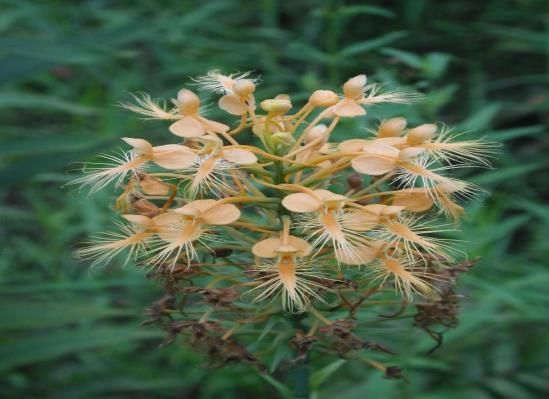
(Figure 3).

Geomorphology

Melt waters from glaciers greatly influenced the topography of the watershed. Glacial
flows deposited sediments from north and west of the watershed into the area known as
the Lower Arkansas River Alluvial Valley. Between Little Rock, Arkansas and the
Mississippi, some six meander belts of the Arkansas River have been identified (Saucier
1994). The Bayou Bartholomew in its
present-day location occupies one of these
meander belts. Most of the oxbow lakes
found along the Bayou Bartholomew were
formed when the Arkansas River occupied
the present day Bayou Bartholomew
channel. This is thought to have occurred
some 2,000 years before present.

Many sandy and silty soils were deposited
as point bars and natural levees by this
prehistoric river channel. Areas outside the
initial deposition zone, but still within the
floodplain, referred to as back swamps, had
silt, clays, and other fines deposited as a
result of overland flooding.

These late Pleistocene and Holocene alluvial
features were deposited in areas where the
higher and older Prairie terraces had been          Figure 3. The surface soils found in the Bayou
                                                    Bartholomew watershed are placed in three
eroded away. The Prairie Terrace consists           categories based on their method of deposition.
of glacial melt and alluvial deposits laid
down earlier in the Pleistocene, and overlain with windblown loess deposited by
prevailing winds (Saucier 1994). This terrace is higher than the late Pleistocene and
Holocene alluvial terraces, and still exists in the watershed in the form of isolated
patches within the alluvial plain, and in the silty uplands west of the alluvial plain.

The coastal plain lies to the west of the silty uplands and encompasses portions of the
northwestern portion of the watershed. It is composed of ancient marine deposits little
affected by rivers except for more recently formed flood plains of small streams.

Hydrography

A network of streams, bayous, ditches, oxbow lakes, and-made reservoirs is found
within the watershed (Figures 4 and 5). Dendritic stream patterns occupy the western
coastal plain portion of the watershed while meandering stream patterns are found in
tributaries to the Bayou Bartholomew entering from the delta. The Bayou Bartholomew
retains its sinuosity in a somewhat natural state while some of its tributaries on the
eastern side have seen extensive channel alteration. Major tributaries to the Bayou

                                                                                                      4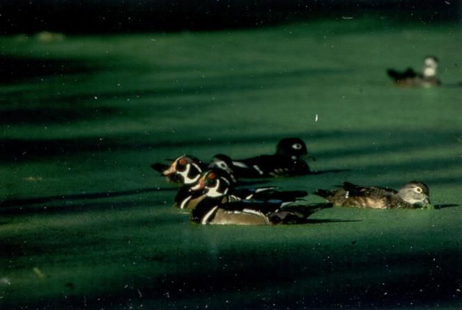
Bartholomew include Deep Bayou, Cousart Bayou, Ables Creek, Cutoff Creek, Bearhouse
Creek, Chemin-a-Haut Creek and
Overflow Creek.

The majority of lakes found within
the watershed are oxbow lakes that
were formed by the meandering of
the Arkansas River during its
occupancy of the Bayou
Bartholomew Meander Belt. A
number of man-made lakes, both
public and private, are used for
fishing and waterfowl hunting. Cane
Creek Lake is a man-made
impoundment on a tributary of the
Bayou Bartholomew. Seasonal
impoundments are found on state
and federal lands used principally for
hunting and include Seven Devils
Wildlife Management Area (WMA),
Cutoff Creek WMA, and the Overflow
National Wildlife Refuge. The
Arkansas Game and Fish
Commission own or leases several
naturally formed oxbow lakes
managed primarily for fishing.
These include Lake Wallace, Lake
Grampus, Wilson Brake, and Lake
Enterprise. Lakes range from 150 to
300 acres in size (AGFC 2001).                Figure 4. A network of streams interlaces the Bayou
                                              Bartholomew Watershed. The Bayou Bartholomew follows the
                                              eastern side of the watershed, essentially separating the Gulf
Hydrology                                     Coastal Plain and the Delta Ecoregions.

A number of activities both within and outside of the watershed have altered the
hydrology of the watershed in the past century and a half. Dams, weirs, levees,
channelization, draining and filling of wetlands, and removal and/or addition of water to
stream channels have resulted in hydrological changes.

Streams and aquifers in the watershed are intimately connected. Changes in stream
flow or stage of a stream result in changes in the head, or flow, in related aquifers
(Broom and Reed 1973). The natural sinuosity of the Bartholomew is pointed out by its
length, traveling some 279 miles to the Louisiana border, an actual straight-line distance
of 90 miles. Channel slopes average approximately one-half foot per mile. Most
streams occurring in the Mississippi River Alluvium are described as gaining streams.
USGS (1969) determined during dry periods, the Bayou Bartholomew gained 45.5 cubic
feet per second between Pine Bluff in its upper end to the Louisiana border. Seventy-
five percent of that gain occurred downstream of McGehee far to the south. Spring and

                                                                                               5
fall potentiometric maps of aquifers in the
                                              area indicate that the Bayou Bartholomew is
                                              primarily a drain for groundwater flow from
                                              the west and a recharge source for aquifers
                                              to the east. The Arkansas River at high flows
                                              is also a recharge area for the aquifers to the
                                              east of the Bartholomew, thusly affecting
                                              water levels in the Bayou Bartholomew.

                                              The Bayou Bartholomew and its tributaries
                                              carry their highest flows during the months of
                                              January through May, due to higher rainfall
                                              events during those times. Minimum flows
                                              usually occur during the period from August
                                              to October (ASWCC 1987, 1988). Natural
                                              flow regimes have been drastically altered by
                                              removal of water for irrigation, with some 87
                                              percent of the available surface water in the
                                            stream being removed during summer
 Figure 5. Many natural and man-made water
 bodies are found throughout the watershed.
                                            (ASWCC 1987). Layher and Phillips (2000)
                                            calculated minimum flow values needed at
points in the Bayou Bartholomew to maintain historical levels of fisheries based on
existing hydrological records for the stream. The majority of the watershed has been
declared a critical surface water area (ASWCC 1990).

More farmers in the area have turned to surface water in the watershed as a result of
aquifer declines in the area. This has further reduced surface water flows in the
Bartholomew. The U. S. Army Corps of Engineers is currently studying the feasibility of
pumping Arkansas River water into the Bayou Bartholomew to augment flows to supply
farmers in Southeastern Arkansas with irrigation water. This action will further affect
hydrology of the watershed. Layher and Phillips (2001) further emphasize that potential
benefits of the proposed alteration should be evaluated with regard to any potential
negative impacts and recommend examining more efficient irrigation methods, dry crop
alternatives, and off stream reservoirs as well as reducing cropped acreage through CRP
and WRP as more viable long term water supply solutions for the watershed.

Groundwater

Groundwater supplies have been declining throughout eastern and southeastern
Arkansas for decades. Geology of the watershed consists of unconsolidated strata
composed of clay, silt, sand, and grave. Some of the sand and gravel layers function as
high yield aquifers. The aquifer that lies under the Mississippi Alluvial Plain has been
used extensively for irrigation for row crop agriculture. Wells typically produce 1,000 to
2,000 gallons per minute (Broom and Reed 1973). The deeper Sparta aquifer produces
500 to 1,500 gallons per minute and is used primarily by industries such as paper mills
or for municipal water supplies.

                                                                                            6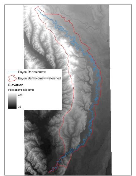
Ninety-three percent of all groundwater used in Arkansas in 1985 was for agricultural
purposes (ASWCC 1987). Four percent of the groundwater pumped was from the
Sparta formation. Combined withdrawals from these aquifers have resulted in wells
exhibiting saltwater intrusion and high chloride levels have rendered some wells unfit for
producing irrigation water for crop production. This has further forced farmers to rely
on stream flow from the Bayou Bartholomew. Additionally, withdrawals from aquifers
exceeded recharge by 17 percent in 1985. Currently portions of Ashley, Drew, Lincoln,
Cleveland, Jefferson, Desha, and Chicot counties have been declared critical
groundwater areas. One of the greatest challenges facing natural resource managers in
the watershed is to balance the use of surface and groundwater to provide for drinking,
industrial, agricultural needs of people while still maintaining critical aquatic fish and
wildlife habitats.

Soils

Soils in the watershed can be placed in three general categories based on their method
of formation. Soils along the eastern portion of the watershed were deposited by the
Arkansas River. These soils are characterized as excessively drained to poorly drained,
loamy and clayey soils that formed on natural levees and in back swamps.

West of the alluvial deposits, soils of the Southern Mississippi Valley Silty Uplands can
be found. These depositional features are found in narrow strips in the northern portion
of the watershed and over most of the western two-thirds of the watershed in its
southern one-half (see figure 3).

Soils in the northwestern watershed are composed of sediment deposited from the Gulf
of Mexico. These loamy soils are moderately to poorly drained soils.

VegetationError! Bookmark not defined.

Vegetative composition in the watershed has been altered drastically since settlement
began in an intensive manner in the 19th century. Prior to settlement water-tolerant
hardwood species dominated the landscape throughout the flood-prone bottomlands.
Elevated, well-drained uplands contained forests that were composed of mixed pine and
hardwood species. Nearly all of the original forest has been removed. Bottomlands
were converted to row crop agriculture while uplands have been planted to intensively
managed forests to produce forest
                                                                 Other
products, especially fast growing pines.
                                                                  3%
The only pre-settlement vegetation that
remains today is bands of cypress that      Transitional (presumed to
grow in the channel or along banks of             be clearcuts)
the Bayou Bartholomew and its                          1%
tributaries or in isolated brakes.            Ag Land (small
                                                grains+row
Forest types found today that are not        crops+pastures)
intensively managed are dictated by                35%
topography, soil type, and frequency                                                Forest Land
and duration of flooding. The eastern                                                  61%

                                              Figure 6. Forest types in the Bayou Bartholomew
                                                                                              7
                                              watershed as calculated from Arkansas and Louisiana
                                              GAP analyses datasets.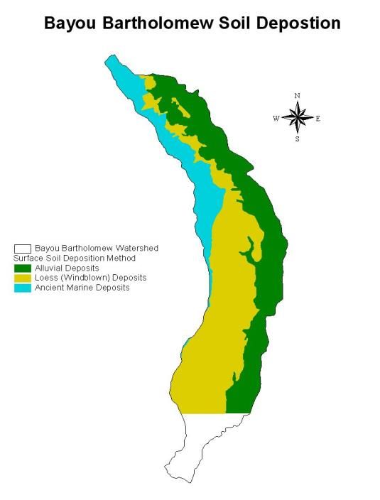
portion of the watershed lies in the flood plain of the Bayou Bartholomew and contains
species which can tolerate having roots inundated by flood waters for months at a time.
The higher elevations in the western portion of the watershed support forests and tree
species which are less tolerant of flooding.
Forests in the western portion of the watershed are primarily mixed hardwoods and
pines with stands of pure pine on recently disturbed or managed areas (Arkansas GAP
1992). Dominant upland species include shortleaf and loblolly pine, white oak, red oak,
and hickory. Streams in the upland portion of the watershed have small flood plains
with narrow riparian corridors. These areas may be subject to short term flooding, and
contain some hardwoods more characteristic of bottomlands such as water oak, willow
oak, overcup oak and bitter pecan. Immediately adjacent to the water in these areas
one may also find bald cypress, water tupelo, cottonwood, and sycamore.
Species in the eastern portion of the watershed are those typical of flat terrain, and
found on alluvial soils. The species are distributed based on their ability to withstand
long periods of submergence. Common bottomland oak species include Nuttall oak,
water oak, willow oak, and overcup oak. Also found are typical bottomland hickories,
bald cypress, and water tupelo. Numerous cypress/tupelo “brakes” occur along the
Bayou Bartholomew and its tributaries. These brakes are remains of oxbow lakes that
have silted in and allowed the colonization of these species.
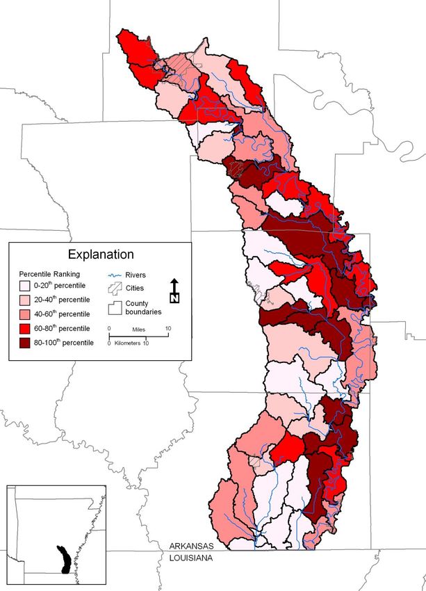
Wetlands
The Bayou Bartholomew watershed contains some existing wetlands. These occur
primarily along the northern portion of the watershed in Jefferson and Lincoln Counties.
The northern one-half of Lincoln County contains significant wetland tracts. Some
259,000 acres of wetlands are found in the
Bayou Bartholomew Wetland Planning Area
as defined by the Arkansas State Multi-
agency Wetland Planning Team (MAWPT)
(Layher and Phillips 2000). The wetland
planning area however contains some land
area outside of the actual watershed, and so
the acreage in wetlands within the watershed
is somewhat less than that cited above.
The watershed contains a number of wetland Many rare plants can be found in wetlands of
the watershed including this yellow-crested
types as organized in a classification scheme orchid.
developed by the MAWPT and based on the Hydrogeomorphic Classification developed
by the U.S. Army Corps of Engineers Waterways Experiment Station (WES) (Klimas
1998, 1999; Brinson1993; Smith et al. 1995). The classification system includes three
hierarchical classification levels to describe wetlands: Class, Subclass, and Community
Type. Geomorphic setting is used to group wetlands into one of five Classes:
Depression, Flat, Fringe, Slope, and Riverine wetlands. Hydrologic environments further
divide these classes into Subclasses that reflect considerations such as the connection of
the wetland to upstream or downstream systems, the energy of water flowing through
the wetland, and the acidity or alkalinity of the water. Finally, these subclasses are
8
divided into community Types based on unique vegetation types, geology, and soils.
Representatives of all five HGM wetland classes are present in the watershed. A
complete description of wetland classes, subclasses, and community types along with
typical plant communities occurring in each can be found in Layher and Phillips (2000).

Layher and Phillips (2000) included maps depicting hydric soils, vegetative covers, and
existing wetlands within the watershed. Areas which are highest and high priority areas
for restoration have also been identified in that source and plotted. MAWPT identified
three goals as a starting point for a strategy to restore wetlands in the watershed: 1)
rebuild forested riparian corridors along the rivers, streams, and bayous of the
watershed where they have been cleared to the channel; 2) widen the riparian corridor
where possible; and 3) protect and expand the larger existing blocks of bottomland
hardwood forest for wetland areas outside the corridor.

Fish and Wildlife Resources

The Bayou Bartholomew watershed contains a rich diversity of both plant and animal
species. The Nature Conservancy has compiled a list of species which are known to
occur in the watershed (Appendix I, Table I). Additionally the Bayou Bartholomew
Alliance has conducted surveys of fish species at thirteen locations since 1992. They
have recorded 117 fish species in the Arkansas portion of the Bayou Bartholomew
(Appendix I, Table II). Other surveys of fishes have been conducted by Thomas (1976)
and Hutchins (1988). The Nature Conservancy has funded several mussel surveys and
                                                    found 31 species of freshwater
                                                    mussels in the Bayou Bartholomew.
                                                    These mussels and fishes combine to
                                                    make the Bayou Bartholomew the
                                                    most diverse aquatic habitat in the
                                                    southeastern United States (Ulmer
                                                    personal communication 2005) and
                                                    one of the most diverse sites in North
                                                    America (TNC 2001). The Arkansas
                                                    Natural Heritage Commission lists
                                                    thirteen animal species and 18 plant
                                                    species as sensitive in the watershed
  Wood ducks resting.
                                                    (Layher and Phillips 2000) (Appendix
I, Table III). Two federally endangered mussel species, the pink mucket and the fat
pocketbook mussels, have been found in the Bayou Bartholomew (Layher and Phillips
2000). Fish distributions and mussel distributions based on collections funded by the
Nature Conservancy have been plotted to determine areas of concentration (Appendix I,
Figures 1-8). Some 31 species of mussels have been found in the Bayou Bartholomew
which together with the large number of fishes also occurring there makes this stream
one of the most diverse stream systems on the North American continent. The federally
endangered red-cockaded woodpecker is found in the watershed. Both the American
alligator and the bald eagle occur in the watershed. Bald eagles are now known to nest
in both Lincoln and Ashley Counties along the Bayou Bartholomew. Even small areas of
wetlands or riparian habitats support an amazing array of wildlife. Local birding
enthusiasts have recorded 108 species of avian fauna (Appendix I, Table IV) at the

                                                                                          9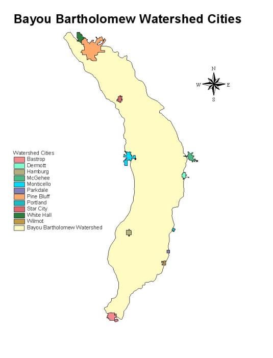
newly constructed William G. Layher Nature Trail in Pine Bluff. That trail, 1.78 miles in
length traverses wetlands, floodplain hardwoods, and mixed forest habitats.

A variety of migrating and resident waterfowl utilize wetland resources in the watershed.
These areas provide food, resting places, areas to form pair bonds, and in some cases
to reproduce. In winter moist soil units, wildlife management areas, seasonally flooded
hardwoods, oxbow lakes, and cypress/tupelo brakes become havens for migrating and
wintering waterfowl. Mallards and wood ducks utilize recently flooded hardwoods as a
source of acorns and invertebrates. Shallow wetlands provide a source of seed that is
produced by herbaceous plants. Waterfowl also utilize rice fields and other artificially
flooded crop fields. Seasonally flooded forests, beaver ponds, lakes and brakes provide
crucial resting areas and areas for courtship activity to occur. Wood ducks and hooded
mergansers nest in hollow cavities of cypress, oak and other trees in riparian zones.

Wetlands and upland sites provide for many wildlife species in the watershed. Whitetail
deer, fox and gray squirrels, cottontail and swamp rabbits, wild turkeys, a variety of
raptors and song birds can all be found throughout the watershed depending on species
specific habitat requirements. Beaver, mink, otter, muskrat, raccoon, opossum, striped
skunk, red fox, and gray fox are found commonly throughout the watershed and are
often associated with forested areas close to water bodies and streams. Many reptiles
and amphibians occur in the watershed, including alligators, which are dependent on
water bodies and associated habitats.

Demographic and Socioeconomic Characteristics

The watershed is characterized by large tracts of agricultural or timber production lands
interspersed with small rural communities. Cities that occur in the watershed include
Pine Bluff with a population of over 50,000
people and located at the upstream end of the
Bayou Bartholomew. Other cities within the
watershed include Monticello (9,146); White
Hall (4,732); Star City (2,471); Dermott
(3,292); and Hamburg (3,039) (U.S. Census
Bureau 2000). The former two cities have
boundaries which include areas outside of the
watershed.

Jefferson County and Ashley County have
shown decreases in population since 1990 by
1.4 percent and 0.5 percent, respectively.
Drew and Lincoln Counties have experienced
some population growth, though small. For
instance, in the ten year period Drew County
gained 1,354 individuals which is the largest
growth of any county within the watershed.
                                                  Figure 7. Cities within the Bayou
Ninety-seven percent of the land within the       Bartholomew watershed.
watershed boundary is under private

                                                                                        10
ownership (Arkansas GAP 1992). Individual ownership ranges in size from residential
lots to tens of thousands of acres. Large tracts of timberland are owned by paper and
timber companies. Many large farms are under the management of land trusts and are
operated by tenant farmers. The majority of agricultural lands in the watershed are
devoted to growing row crops such as cotton, soybeans, winter wheat, and sorghum.
Rice is also grown extensively. The value of crops sold in 1997 for Lincoln County alone
exceeded 80 million dollars. Confined animal operations are few; however poultry
production is growing especially in Lincoln County.
State land holdings include Wildlife Management
Areas which are managed by the Arkansas Game
and Fish Commission. These areas include Cut-Off
Creek WMA (9,080); Seven Devils WMA (4,445
acres); and the Little Bayou WMA (1,284 acres)
(Arkansas GAP 1992; AGFC 2001).
The Arkansas Natural Heritage Commission owns
the Byrd Lake Natural Area (144 acres) and the
Taylor Woodlands (137 acres) which are both
located in Jefferson County. Additionally the
agency holds 900 acres of land within the Seven
Devils WMA discussed above. Cane Creek State
Park in Lincoln County contains a lake formed by
impounding Cane Creek and covers some 1,675
acres. The Park includes 378 acres of surrounding
lands (ASP 2001).
Figure 8. Public lands in the Bayou
Federal ownership is limited to Overflow National Bartholomew watershed.
Wildlife Refuge in Ashley County. This 12,247 acre
refuge preserves bottomland hardwood forest along Overflow Creek which is a tributary
to the Bayou Bartholomew.
While agriculture and silviculture are the predominant land uses in the watershed, a
relatively small work force is associated with those industries. For instance agriculture
employs less than six percent of the workforce in all counties except Lincoln where it
represents 11.3 percent (U.S. Census Bureau 1990). Some manufacturing occurs in
especially Pine Bluff and Monticello.
The percent of
individuals at or below Misc. Restricted
poverty level is Natural Areas
0.02%
relatively high Privately Managed
National Wildlife
throughout the Lands
Refuges
96%
watershed. Layher and Other
State Parks
1.0%
Phillips (2001) report 4.6% 0.3%
nearly 25 percent of the State Scenic Rivers
Figure 9. Land ownership within the Bayou Bartholomew
0.2%
watershed (UARK 2004 and LSU 2004 as cited in Winrock 2005).
State Wildlife
Management Areas
State facilities3%
0.001% 11
Wetland Reserve
Programs
0.04%population in all counties in the watershed to live below poverty levels. Median family
income is over $10,000 below the national average and median income in all cases
averages less than $9,800.
Water Quality
ADEQ has designated the following beneficial uses for the Bayou Bartholomew: (1)
primary and secondary contact recreation; (2) domestic, industrial, and agricultural
water supply; and (3) seasonal and perennial Gulf Coastal Plain fishery and perennial
Delta fishery. ADEQ assesses 359.4 stream miles in the watershed. This includes the
entire channel length of the Bayou Bartholomew, in Arkansas. Also included are Cutoff
Creek and Deep Bayou.
Of the 359.4 miles of stream assessed, all meet the primary contact use, secondary
contact use, drinking supply use, and the agricultural and industrial use categories. Two
hundred and ninety-nine and seven tenths miles meet the fish consumption use.
Mercury levels preclude fish consumption in 59.7 miles of the lower Bayou Bartholomew
and Cutoff Creek below Seven Devils WMA. This includes 16.8 miles of Cutoff Creek and
42.9 miles of the Bayou Bartholomew. The source of mercury contamination is not
known, although similar problems exist in other watersheds throughout southern
Arkansas.
The aquatic life use is only fully supported in Cutoff Creek. It is not supported in the
entire length of the Bayou Bartholomew in Arkansas according to ADEQ (2002). Aquatic
life use is also not supported in Deep Bayou. The aquatic life use is not supported due to
siltation and turbidity (Layher and Phillips 2001; ADEQ 2002). Silt loads and turbidity
are consistently high in these streams (ADEQ 2002). ADEQ’s 2008 305(b) report
indicates that the entire length of the Bayou Bartholomew still does not meet aquatic life
uses.
Element 1: Identification of Causes and Sources
12The ADEQ recently prepared a 2008 303 (d) listing of streams in Arkansas that are
impaired. All segments monitored in the Bayou Bartholomew are listed as impaired,
those listed as 4a, have completed TMDL. ADEQ also prepared the “2008 Integrated
Water Quality Monitoring and Assessment Report” which combines the requirements
from the 305 (b) reporting, and 303 (d) listings.
Use Support Not Support
Fish Consumption 429.6 mi 88% 59.7 mi 12%
Aquatic Life 22.7 mi 5% 466.6 mi 95%
Primary Contact 396 mi 81% 93.3 mi 19%
Secondary Contact 482.3 mi 99% 7 mi 1%
Drinking Supply 474.7 mi 97% 14.6 mi 3%
Agriculture & Industry 354.8 mi 73% 134.5 mi 27%
Table 1. Shows type of use and the portion of the stream length that
supports/does not support its use.
Of the twenty-one segments impaired, 8 have TMDLs, 5 for siltation/turbidity, and 2 for
Mercury, and 1 for mercury and siltation/turbidity. The remaining 13 segments are
impaired for one or more of the following: zinc, dissolved oxygen, mercury, pathogens,
lead, copper, beryllium, chlorine, and total dissolved solids. Sources are a combination
of unknown, urban and agriculture.
Two TMDLs, one for turbidity and the other for mercury, were prepared by FTN &
Associates (2002). The TMDL for mercury does not identify the cause while the TMDL
for turbidity assumes the cause is primarily agriculture, citing sources from the Bayou
Bartholomew Alliance (1996) and ADEQ (2001a). The TMDL states that estimated load
in to the entire basin at 296,960 lbs/day December –June and 59,887 lbs/day July-
November. The estimated reductions for these periods are 29-37% December-June and
0-3% July-November.
The Bayou Bartholomew Alliance (BBA) also reported that other potentials sources of
siltation include cropland, riparian disturbance, stream banks, construction, bed load,
silviculture, and county roads. The BBA has concluded that stream bank erosion may be
a large contributor of siltation and turbidity in the watershed due to the large numbers
of logjams. These logjams fill with silt and become plugged by litter and trash, thus
blocking stream channels entirely, causing the stream to erode around the logjams and
create new channels. The primary causes of turbidity listed above have been reiterated
throughout a number of state, federal and nonprofit organization reports.
Construction erosion and associated filling of wetlands within the City of Pine Bluff in the
past two years has resulted in recent high turbidity levels in the Bayou Bartholomew.
Large land areas uncovered without any sediment controls resulted in large movements
of clay soils into the Bayou. Other construction activities included the positioning of new
sewer lines longitudinally through stream channels causing massive erosion, filling of
wetlands, and large silt loads to the Bayou Bartholomew (Layher 2005).
13Figure 10. SWAT Model Data for Sediment (U of A 2002)
Figure 10 was created using the Soil and Water Assessment Tool (SWAT) to identify the
sub-basins or sub-watersheds, which are contributing the most sediment throughout the
entire watershed. Thirteen sub-basins are identified as the major sources; these basins
fall within the 12-digit HUC in the following table.
14Sub-watershed Name 12-digit HUC
Upper Deep Bayou 080402050303
Ables Creek- Panther Creek 080402050402
Ables Creek- Bayou Bartholomew 080402050405
Four Mile Creek 080402050406
Cutoff Creek-Wolf Creek 080402050508
Lake Wallace 080402050509
Upper Overflow Creek 080402050803
Lower Bearhouse Creek 080402050603
Cutoff Creek- Seven Devils Lake 080402050505
Piney Creek 080402050503
Lower Cutoff Creek 080402050501
Village Creek Flat Creek 080402050403
Spring Branch 080402050205
Table 2. Watersheds which are the in 80th-100th Percentile for sediment
according to SWAT model data
Element 2 & 3: Proposed Management Measures & Estimated
Load Reductions
As previously mentioned the TMDL proposed load reduction December –June is 29-37%,
from 296,960 lbs/day to a maximum 199,555 lbs/day. While the load reduction July-
November is proposed to be reduced 0-3%, TMDL data shows current load 59,897
lbs/day with maximum at 71,815 lbs/day.
Land Use Percent of
Type Total 1481 mi2
Forest 54.3%
Cropland 21.2%
Transitional 11.0%
Grassland 8.4%
Water 2.8%
Suburban 1.6%
Urban 0.4%
Barren 0.3%
Table3. Shows the Land Use of Bayou
Bartholomew Watershed from 2006 (CAST)
Sub-watersheds that exhibit significant erosion problems or contributions to
sedimentation identified by data, knowledge of conservation personnel, or modeling,
should be targeted for BMP installation and focus. An evaluation of sub-watersheds
should occur while work begins on those known to have significant problems related to
soil loss. Using SWAT Modeling data (U of A 2002), there are 13 sub-basins or sub-
watersheds, identified to be in the 80th-100th percentile for load into the entire
15watershed. These sub-basins cover nearly 190,000 acres, and where implementation of
BMP’s should be installed, as the priority, to reduce sediment load.
Each sub-watershed should be evaluated to determine the location of areas, which are
not buffered. These areas should be enrolled in appropriate conservation programs
such as the Conservation Reserve Program including either grass filter strips or
hardwood tree plantings. Landowners should be encouraged to establish riparian buffer
strips, stabilize stream- banks, and restore riparian forests.
Landowners in sub-watersheds exhibiting the highest rates of erosion or areas that are
eroding should be targeted first. Conservation planning should be accelerated in those
areas to assist landowners with both technical and monetary resources to address
erosion problems. Conservation plans should address BMP’s that are known to be most
effective in reducing sediment detachment and transport to receiving waters. Such
practices as no-till, conservation till, and drop outlets for agricultural lands. Additionally,
areas suffering from gulley erosion should be examined to determine the possibility of
using drop-pipes and land smoothing to reduce significant gulley erosion.
Riparian protection in areas currently forested should be addressed through the
continuation of a conservation easement program to prevent erosion and stream-bank
disturbance. Forestry practices which address riparian protection should be encouraged.
Fencing of livestock should be encouraged through EQIP programs or others to prevent
bank denuding and subsequent erosion.
Practice Description Unit Estimated Load
Code Reduction
329A No Till/ Strip Till (ac) 20,000 950 tons/year
382 Fence (ft) 12,000 17 tons/year
391 Riparian Forest Buffer (ac) 15,000 30 tons/year
410 Grade Stabilization 20,000 6,300 tons/year
Structure (ft)
512 Pasture and Hay Planting 7,000 380 tons/year
(ac)
528 Prescribed Grazing (ac) 7,000 380 tons/year
587 Structure for Water Control 25,000 8,000 tons/year
(ft)
612 Tree/Shrub Establishment 20,000 40 tons/year
(ac)
393 Filter Strips (ac) 15,000 9,900 tons/year
Total 25,997 tons/year
Table 4. Proposed BMPs with anticipated load reduction
Table 4 shows the proposed BMPs needed to achieve the recommended TMDL. These
values are the result of using the STEPL and Region 5 EPA Models. There is no
16specification in these models for the time of year and its relation to the load reduction.
With this in mind, the total reduction of 25,997 tons/year translates to 142,449lbs/day,
which certainly attains the reduction of 29-37%, to a maximum of 195,555lbs/day.
In addition to the implementation of BMPs, the continued removal of logjams and illegal
dumps should be carried out. While it is not part of the proposed BMP implementation
for reduction of sediment, it is thought that logjams cause major in-channel erosion. A
geomorphic analysis of the impact of logjams on stream bank erosion should be
conducted. Litter often plugs logjams and causes more severe bank erosion.
These proposed BMPs are a part of the current plan for sediment reduction to Bayou
Bartholomew. As new information and technology becomes available, this plan will
adapt to meet the needs of the watershed, with that may come an increase or reduction
of proposed BMPs.
17Element 4: Technical and Financial Assistance Needs
Finances needed to complete the required reduction in sediment load go beyond the
cost of BMP implementation. This will include public outreach and education, technical
assistance, and additional water quality sampling. To give an idea of the “total” cost,
Table 5 shows the approximated cost over a 5-year period. Due to the unforeseeable
future, limiting this implementation to 5 years may not be feasible or reasonable.
Items Amount
Additional Water Quality Monitoring $1,200,000
BMP Implementation $15,798,000
Public Outreach and Education $522,000
Technical Assistance $650,000
EST. TOTAL COST for 5 Years $18,170,000
Table 5. Proposed total cost for 5 years
Practice Description Unit Cost/Unit Total Cost
Code
329A No Till/ Strip Till (ac) 20,000 $25 $500,000
382 Fence (ft) 12,000 $2 $24,000
391 Riparian Forest Buffer (ac) 15,000 $120 $1,800,000
410 Grade Stabilization Structure 20,000 $50
(ft) $1,000,000
512 Pasture and Hay Planting 7,000 $200
(ac) $1,400,000
528 Prescribed Grazing (ac) 7,000 $7 $49,000
587 Structure for Water Control 25,000 $45
(ft) $1,125,000
612 Tree/Shrub Establishment 20,000 $120
(ac) $2,400,000
393 Filter Strips (ac) 15,000 $500 $7,500,000
$15,798,000
Table 6. BMP practices with associated costs
The following are funding sources that are available to implement this plan.
Clean Water Act, Section 319(h) Grant Funds: Federal grant program carried out
through states to reduce or abate non point source pollution. Funds can be used for
BMP implementation, technical assistance, assessment, water quality monitoring, and
education/outreach.
18Conservation Reserve Program (CRP): This program was established as a conservation
provision of the Farm Bill to encourage and assist producers who are willing to set aside
highly erodable, riparian, and other environmentally sensitive lands from crop production
for a 10 or 15-year period. Producers enroll in the program according to USDA program
rules. If a landowner’s CRP bid is accepted, a Conservation Plan of Operation is
developed. In addition to an annual CRP payment, USDA will provide a 50% cost-share
to establish the selected conservation practice. Landowners may receive a maximum of
$50,000 annually in CRP payments.
Wetlands Reserve Program (WRP): This voluntary program for restoring wetlands is
administered by NRCS with technical assistance from the Fish and Wildlife Service
(FWS). Participating landowners can establish conservation easements of either
permanent or 30-year duration or can enter into restoration costshare agreements
where no easement is involved. The NRCS and FWS assist private landowners with site
selection and development of restoration plans. Up to 100% of the cost of restoring the
wetland is provided by USDA.
Environmental Quality Incentives Program (EQIP): This USDA program works primarily
in conservation priority areas where there are significant natural resource problems.
High priority is given to areas where state or local governments offer financial, technical,
or educational assistance and to areas where agricultural improvements will help meet
water quality objectives. Landowners can apply for assistance in addressing animal
waste management, erosion, and other problems. EQIP will provide up to 60%
costshare for restoration. A landowner may receive up to $50,000 annually in EQIP
payments.
Wildlife Habitat Incentives Program (WHIP): This is a voluntary program for landowners
who want to develop and improve wildlife habitat on private lands. Participants work
with NRCS to prepare a wildlife habitat development plan. USDA provides technical
assistance, and cost-share up to 75% of the cost of installing the wildlife habitat
practices. USDA and the participant enter into a cost-share agreement that usually lasts
a minimum of 10 years.
Grassland Reserve Program (GRP): This is a voluntary program that helps landowners
and operators restore and protect grassland, pastureland, and certain other lands while
using the areas for grazing. The program supports plant and animal biodiversity, and
grasslands and lands containing shrubs and forbs under the greatest threat of
conversion.
Technical Assistance
The local county conservation districts, USDA-Natural Resources Conservation Service
(NRCS), the University of Arkansas Cooperative Extension Service, and the Arkansas
Natural Resources Commission (ANRC) are able to provide technical information and
assistance. The NRCS can provide BMP plan and technical assistance, and develop
conservation and animal waste management plans. Others entities such as Ducks
Unlimited can also provide assistance through the NRCS Technical Service Provider
(TSP) Program. Responsibility for monitoring water quality in Arkansas abides with the
19Arkansas Department of Environmental Quality (ADEQ). The Arkansas Forestry
Commission (AFC) can provide expertise dealing with silviculture practices.
Element 5: Information, Education, and Public Participation
The Bayou Bartholomew Alliance should strive to provide opportunities for the public to
participate in efforts to maintain the Bayou, to provide for public input into those
activities and to keep the public advised of activities being implemented.
As part of this effort, the BBA should coordinate with the City of Pine Bluff, the
University of Arkansas at Pine Bluff, the Cooperative Extension Service in Jefferson
County, and the City of White Hall to insure that information and workshops they
disseminate and hold for home builders, construction companies, and the general public.
Under their municipal separate storm sewer systems (MS4) contains information
targeting the importance of decreasing siltation in the Bayou Bartholomew.
The BBA should provide workshops for county road departments to address county road
building and maintenance. Additional opportunities would be provided for volunteers to
assist with clean-up of illegal dump sites, trash and litter. Logjam removal operations
are high profile events, which often provide for public participation. The BBA should
continue work with news media including newspapers, magazines, TV, and radio
stations to keep the public abreast of activities and accomplishments. Tours of the
Bayou, distribution of the popular BBA newsletter, and presentations to civic groups and
schools are also necessary to continue public education and garner support for the
restoration of the watershed.
The University of Arkansas Cooperative Extension Service also promotes environmental
stewardship through promotion of effective and economically achievable best
management practices. Extension agents offer conferences, workshops, seminars,
environmental quality programs, and fish and wildlife programs. Assistance activities
also include newsletters, bulletins, information sheets, and research reports on the
website http://www.uaex.edu/.
Element 6 & 7: Schedule and Milestones
This management plan supports watershed-partnering efforts. It seeks to enhance
watershed protection by fostering stakeholder input into the watershed decision-making
processes. It seeks to identify NPS problems and to work cooperatively with
stakeholders to resolve them. This plan is a critical component of federal, state, and
local watershed protection efforts. It addresses effective and efficient mechanisms to
obtain the greatest watershed benefits from limited funding. The schedule for
implementation in Table 7 below shows a description of interim, measurable milestones.
However, it is acknowledged that some activities and practices may change or be
revised as the plan is implemented, as new or additional data and information is
obtained, or funding becomes available.
20Activities and Practices Timeline Possible Entities
Complete Watershed Plan for Bayou July 1, County Conservation Districts,
Bartholomew Watershed 2009 NRCS, Bayou Bartholomew
Alliance, Landowners, ANRC, any
Interim Measures: other stakeholders
- Incorporate stakeholder inputs Continuous
and concerns into the plan
- Revise plan if water
quality/other data indicates goal
is not being achieved
Implement Watershed Plan BMP’s ASAP County Conservation Districts,
NRCS, ANRC
Interim Measures: Continuous
- Identify sites, types, and
number of BMPs to be installed
based on available funding
- Coordinate implementation of
BMPs with appropriate partners’
capabilities and expertise
- Implement appropriate BMPs to
address TMDL sources and
causes
- Adapt implementation of BMPs
identified in this plan based on
new/better information or new
funding
Provide Education and Outreach to ASAP County Conservation Districts, U
Landowners and Stakeholders of A Cooperative Extension
Service, ANRC
Interim Measures: Continuous
- Coordinate partnership
opportunities/resources
Continue to Conduct Supplemental Ongoing Ecological Conservation
Water Quality Monitoring Organization, University of
Arkansas
Interim Measures: Continuous
- secure funding for future
monitoring
- Compile and report analyses
results
Table 7. Schedule and Milestones
21Element 8: Performance Criteria
Management Plan implementation success evaluation will be based on:
- Achievement of Milestones
- Achieving state water quality and use standards
- Achieving TMDL standards
If the above evaluation criteria are not being incrementally achieved in a timely manner,
or for the resources available/expended, a review of the plan will be conducted. The
plan may be revised if different watershed issues are identified during the plan review,
this management plan will be updated to address that concern. Watershed
management plan assessment and monitoring will also be designed to be flexible so that
load reduction targets and BMPs can be easily revised if monitoring or professional
judgment indicates water quality standards are not being achieved.
Element 9: Monitoring Component
The Arkansas Department of Environmental Quality has operated monitoring stations on
the Bayou Bartholomew for some time. Various types of monitoring activities have
occurred. Sampling stations for water quality are given in Figure 11. Long term
monitoring sites have been in operation near Ladd, Arkansas (OUA33) and near Jones,
Louisiana (OUA13). Other stations are sampled bimonthly for a two-year period as part
of a roving network implemented by ADEQ. These sites then remain un-sampled for a
ten-year period when the roving system returns to the watershed. Sites included in this
latter category are BYB01 at Highway 82, BYB02 on Highway 4 near McGehee, and
BYB03 at Garrett Bridge in Lincoln County. Two tributaries also are monitored as part of
the roving network. These include COC01 and COC02 on Cutoff Creek near Boydell and
Monticello respectively, and OUA01151, Deep Bayou south of Grady. Some special
study sites also are sampled by ADEQ for other information such as fish communities
(ADEQ 2001).
22Figure 11. Monitoring stations located on the Bayou Bartholomew. (Figure from 2007 Final
Report for Project 07-111.
Part of the ANRC core program contains monitoring supplemental to the ADEQ
monitoring, and currently is using the Ecological Conservation Organization (ECO). ECO
conducts water quality sampling, analysis, and developed a trend hypothesis for the
Bayou Bartholomew Watershed by taking automated and grab samples.
ECO’s upstream site, BB1, is in the Reach ID 08040205-013 and downstream site, BB2,
is in the Reach ID 08040205-002, following data is from Eco’s 2007 Project 07-116 Final
Report to ANRC. The TMDLs BB1 are 3,496 lbs/day (July-Nov) and 14,478 lbs/day (Dec-
June). At BB1, ECO results show daily loads exceeded these 86 and 171 times
respectively. The TMDLs BB2 are 30,629 lbs/day (July-Nov) and 66,836 lbs/day (Dec-
June). At BB2, ECO results show daily loads exceeded these 131 and 149 times
respectively.
This supplemental monitoring with continue in this watershed to provide additional
information on the state of the load entering the system. It is hoped that this data will
show evidence of improvement as BMPs are implemented in the watershed.
23Literature Cited and/or Reviewed
Arkansas Department of Environmental Quality (formerly ADPCE). 2000. Water Quality
Inventory Report.
Arkansas Department of Environmental Quality (formerly ADPCE). 2008. Water Quality
Inventory Report.
Arkansas Department of Environmental Quality. 2001. Physical, chemical and biological
assessment of the Bayou Bartholomew Watershed: Ashley, Chicot, Cleveland, Desha,
Lincoln and Jefferson counties, Arkansas. Little Rock, AR.
Arkansas Department of Environmental Quality. 2002. Integrated water quality
monitoring and assessment report prepared pursuant to Section 305 (b) and 303 (d) of
the Federal Water Pollution Control Act. Little Rock, AR.
Arkansas Department of Environmental Quality. 2008. Integrated water quality
monitoring and assessment report prepared pursuant to Section 305 (b) and 303 (d) of
the Federal Water Pollution Control Act. Little Rock, AR.
Arkansas Department of Natural Heritage. 2001. Inventory of Natural Areas.
http://naturalheritage.com/system/
Arkansas Department of Pollution Control and Ecology (currently ADEQ). 1979. Water
Quality Plan (208), Nonpoint Source Pollution Assessment Summaries.
Arkansas Department of Pollution Control and Ecology (currently ADEQ). 1996. Water
Quality Inventory Report.
Arkansas Game and Fish Commission. 2001. May/June Arkansas Wildlife Magazine,
Table of Wildlife Management Areas.
Arkansas Game and Fish Commission. 2001b. Arkansas Lakes and WMAs.
http://www.agfc.state.ar.us/lakes-wmas/default.htm
Arkansas GAP. 1992. GIS Analysis of Arkansas GAP Data. Analysis completed 2001 by
Layher Biologics RTEC, Inc., Pine Bluff, AR.
Arkansas Highway and Transportation Department. 1998.
Arkansas Soil and Water Conservation Commission. 1987. Arkansas State Water Plan,
Lower Ouachita Basin. 289 pp.
Arkansas Soil and Water Conservation Commission. 1988. Arkansas State Water Plan,
Arkansas River Basin. 154 pp.
24Arkansas Soil and Water Conservation Commission. 1990. Arkansas Water Plan,
Executive Summary. 82 pp.
Arkansas Soil and Water Conservation Commission. 1996. Assessment Update of
Arkansas Nonpoint Source Pollution Assessment Report.
Arkansas Soil and Water Conservation Commission. 1998. Nonpoint Source Pollution
Management Program, 1998 through 2002.
Arkansas Soil and Water Conservation Commission. 1999. Watershed restoration action
strategy (WRAS) for the Bayou Bartholomew Watershed. ASWCC. Little Rock, AR.
Arkansas State Parks. 2001. Cane Creek State Park.
http://www.yournet.com/canecrk.html
Arnold, M.S. 1991. Colonial Arkansas 1686-1804. Fayetteville: University of Arkansas
Press.
Ashley County Conservation District. 2004. Bayou Bartholomew Watershed Non-Point
source pollution abatement project. Completed for the Arkansas Soil and Water
Conservation Commission.
Ashley County Ledger. 1997. November 5.
Baskett, Jr.,T. 1990. The Arkansas Delta: A Landscape of Change. The Delta Cultural
Center. Helena, AR.
Bayou Bartholomew Alliance. 1996. Short and long term strategies for protecting and
enhancing natural resources in the Bayou Bartholomew Watershed. Bayou Bartholomew
Alliance Technical Support Group: Pine Bluff, AR.
Bayou Bartholomew Alliance. 2003. Timber management and landowner workshops.
Final report project 01-2000. Pine Bluff, AR.
Broom, M.E. and J.E. Reed. 1973. Hydrology of the Bayou Bartholomew Alluvial
Aquifer-Stream System, Arkansas. Progress report prepared for the US Department of
the Interior, Geological Survey.
Commissioner of State Lands. 2000. Original General Land Office Survey Notes and
Plats for the State of Arkansas, 1815-present. Charlie Daniels, Commissioner of State
Lands.
Environmental Protection Agency. 2002. TMDLS for turbidity for Bayou Bartholomew,
Arkansas. Prepared by FTN Associates, Ltd. Contract No. 68-C-99-249, Work
Assignment #2-109. EPA Region VI Watershed Management Section: Dallas, TX.
Dahl, T.E. 1990. Wetlands losses in the United States, 1780’s to 1980’s. U.S.
Department of the Interior, Fish and Wildlife Service, Washington, D.C.
25Daniels, M. B., W. Kinkaid, and T. L. Riley. 2000. Bayou Bartholomew Water quality
technical transfer project. Final report project 800. The University of Arkansas,
Cooperative Extension Service.
Daniels, M. B., W. Kinkaid, and T. L. Riley. 2003. Transfer of conservation technology
to agricultural land managers. Final Report Project 00-1300. The University of
Arkansas, Cooperative Extension Service.
DeArmond-Huskey, R. 1996. Beyond Bartholomew: The Portland Area History.
Conway: River Road Press.
DeArmond-Huskey, R. 2001. Bartholomew song: a Bayou History. Heritage Books,
Inc., Bowie, Maryland. 645 pp.
Ferguson, J.L and J.H. Atkinson. 1966. Historic Arkansas. Arkansas History
Commission. Little Rock.
Goodspeed Publishing Company. 1889. Bibliographical and Historical Memoirs of
Pulaski, Jefferson, Lonone, Faulkner, Grant, Saline, Perry, Garland, and Hot Springs
Counties, Arkansas. Goodspeed Publishing Company. Chicago, IL.
Hammond, W.R. 1945. An Abstract of Economic History of Transportation on Ouachita-
Black River of Northeast Louisiana.” Ph.D. dissertation, George Peabody College for
Teachers.
Hanley, S.G. 2000. Arkansas at Work, 1900-1925. Arcadia Publishing. Charleston, SC.
Hanson, G.T. and C.H. Moneyhon. Historical Atlas of Arkansas. Norman: University of
Oklahoma Press, 1989.
Holland, T.W. 1999. Water Use in Arkansas, 1995. US Geological Survey, Open-file
report 99-188, Little Rock, AR.
House, J. 2001. Personal communication. State Archaeological Society. Pine Bluff, AR.
Hubbel, K. and J.K. Lunon. 1990. The Arkansas Delta: A Historical Look at Our Land
and People.
Kressse, T.M. and J. A. Fazio. 2002. Reprot WQ02-05-1: Pesticides, water quality and
geochemical evolution of ground water in the alluvial aquifer, Bayou Bartholomew
Watershed, Arkansas. Arkansas Department of Environmental Quality: Little Rock, AR.
Kresse, T., E. Van Schaik, J. Wise, and T. Huetter. 1997. Report WQ97-10-1:
Occurrence of pesticides in alluvial aquifer of Eastern Arkansas. Arkansas Department of
Environmental Quality: Little Rock, AR.
26Layher, W. G. 2003. Assessment of fish populations of Byrd Lake. Prepared for the
Arkansas Natural Heritage Commission. Layher BioLogics RTEC, Inc., Pine Bluff, AR. 9
pp.
Layher, W. G. 2003. Changes in fish community structure in the Bayou Bartholomew of
southeast Arkansas as a result of watershed improvements made through 319 grant
initiatives. Layher BioLogics RTEC, Inc., Pine Bluff, AR. 41 pp.
Layher, W.G. and J.P. Phillips. 2000. Determination of instream flow recommendation
for the Bayou Bartholomew based on historic flow information. Contract No. 0019868
for the Arkansas Game and Fish Commission. Layher BioLogics RTEC, Inc. Pine Bluff,
AR. 48 pp.
Layher, W.G. and J. W. Phillips. Bayou Bartholomew Wetland Planning Area Report.
Prepared for the Arkansas State Multi-agency Wetland Planning Team. Little Rock, AR.
Lenzer, J.P. Unknown Date. Geology and Geomorphology of a Portion of the Arkansas
River Alluvial Valley East of Star City, Arkansas.
Leslie, J. 1974. Saracen’s Country “Some Southeast Arkansas History.” Rose Publishing
Company, Little Rock, AR.
Michael Baker Jr., Inc. 2001. Draft Environmental Impact Statement: Southeast
Arkansas I-69 Connector. State Job No. 001851; Federal Project: HPC-0018(3).
Mooney, J. 2001. Personal communication. Archaeologist. Michael Baker Jr., Inc.
Pine Bluff, AR.
Multi-Agency Wetland Planning Team. 1997. Arkansas Wetland Strategy.
National Agricultural Statistics Service. 1997. Census of Agriculture, Ashley County, AR.
http://www.nass.usda.gov/census/census97/highlights/ar/arc002.txt
National Agricultural Statistics Service. 1997. Census of Agriculture, Drew County, AR.
http://www.nass.usda.gov/census/census97/highlights/ar/arc022.txt
National Agricultural Statistics Service. 1997. Census of Agriculture, Jefferson County,
AR. http://www.nass.usda.gov/census/census97/highlights/ar/arc035.txt
National Agricultural Statistics Service. 1997. Census of Agriculture, Lincoln County, AR.
http://www.nass.usda.gov/census/census97/highlights/ar/arc040.txt
National Agricultural Statistics Service. 1997. Census of Agriculture, Pulaski County, AR.
http://www.nass.usda.gov/census/census97/highlights/ar/arc060.txt
Natural Resources Conservation Service. 1999. Unified Watershed Assessments and
Restoration Priorities, Arkansas. US Department of Agriculture.
27You can also read