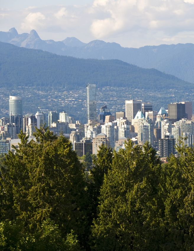
Climate Projections for Metro Vancouver
←
→
Page content transcription
If your browser does not render page correctly, please read the page content below
METHODOLOGY

Climate Projections
for Metro Vancouver
Acknowledgements
Metro Vancouver gratefully acknowledges the contribution of Pacific Climate Impacts Consortium, who
conducted climate modelling, analysis, and data interpretation, and provided valuable suggestions for the
report. Metro Vancouver thanks Pinna Sustainability for their assistance in writing the report.

ii   Climate Projections for Metro Vancouver REPORT
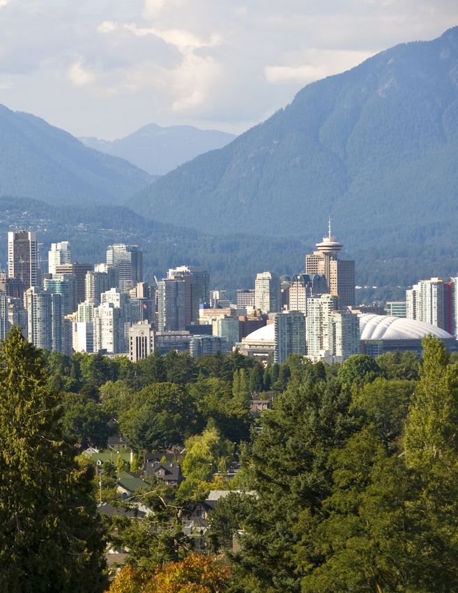
Table of Contents
Acknowledgements_________________________________________________________________________________________ii
Executive Summary________________________________________________________________________________________ vi
Introduction___________________________________________________________________________________________________ 1
    Climate Scenario Selection______________________________________________________________________________ 2
Methodology_________________________________________________________________________________________________ 2
    Climate Model Selection_________________________________________________________________________________ 3
    Indicator Derivation________________________________________________________________________________________ 4
    How to Read the Figures and Tables__________________________________________________________________ 4
    A Note on Interpretation_________________________________________________________________________________ 5
General Climate Projections for Metro Vancouver ___________________________________________ 7
    Warmer Temperatures____________________________________________________________________________________ 8
    Wetter Winters, Drier Summers_______________________________________________________________________ 12
Precipitation Indicators_________________________________________________________________________________ 15
    Snowpack __________________________________________________________________________________________________ 15
    Dry Spells___________________________________________________________________________________________________ 18
    Single-Day Maximum Precipitation _________________________________________________________________ 18
    Five-Day Maximum Precipitation_____________________________________________________________________ 18
    95th Percentile Wettest Days Precipitation________________________________________________________ 19
    99th Percentile Wettest Days Precipitation________________________________________________________ 19
    1-in-20 Wettest Day______________________________________________________________________________________ 20
Summer Temperature Indicators____________________________________________________________________ 22
    Summer Days______________________________________________________________________________________________ 23
    Tropical Nights____________________________________________________________________________________________ 24
    Heat Days__________________________________________________________________________________________________ 24
    Hottest day_________________________________________________________________________________________________ 24
    1-in-20 Hottest day_______________________________________________________________________________________ 25
    Growing Season Length _______________________________________________________________________________ 26
    Growing Degree Days __________________________________________________________________________________ 27
    Cooling Degree Days___________________________________________________________________________________ 29
Winter Temperature Indicators______________________________________________________________________ 31
    Warmest Winter Day_____________________________________________________________________________________ 31
    Coldest Night_____________________________________________________________________________________________ 31
    1-in-20 Coldest Night___________________________________________________________________________________ 32
    Frost Days _________________________________________________________________________________________________ 32
    Ice Days ____________________________________________________________________________________________________ 34
    Heating Degree Days ___________________________________________________________________________________ 34
Regional Impacts of Climate Change_____________________________________________________________ 35
    Water Supply and Demand ___________________________________________________________________________ 36
    Sewerage and Drainage________________________________________________________________________________ 37
    Ecosystems_________________________________________________________________________________________________ 38
    Agriculture_________________________________________________________________________________________________ 39
    Air Quality and Human Health________________________________________________________________________ 40
    Buildings and Energy Systems _______________________________________________________________________ 41
    Transportation, Recreation, and Tourism___________________________________________________________ 41
Summary and Recommendations__________________________________________________________________ 42
Appendix 1: RCP4.5 and RCP2.6 Tables and Figures______________________________________ 43
Appendix 2: RCP8.5 Supplementary Maps_____________________________________________________ 55

                                                                                                Climate Projections for Metro Vancouver REPORT   iii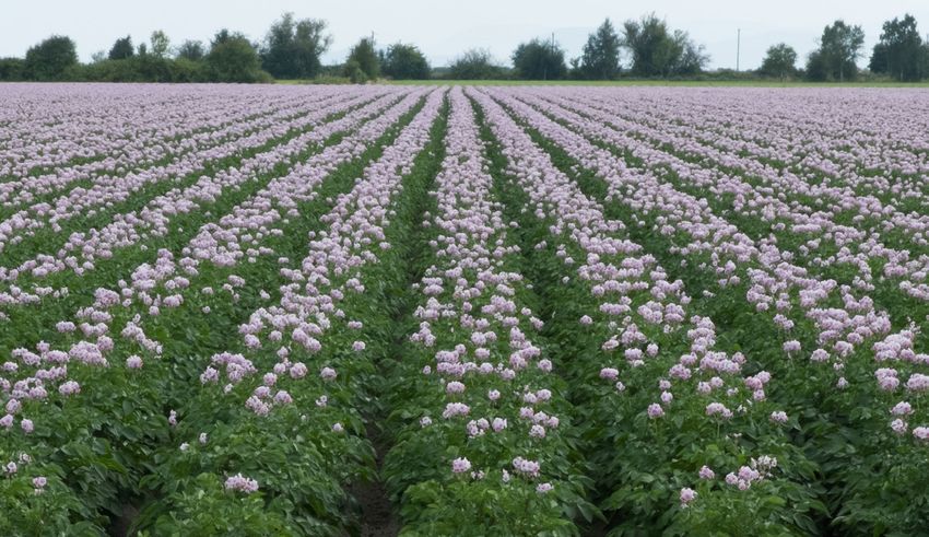
List of Tables
                           Table 1:        Average Daytime High Temperature__________________________________ 8
                           Table 2:        Average Nighttime Low Temperature_________________________________ 8
                           Table 3:        Total Precipitation over Seasons and Year ____________________________ 12
                           Table 4:        Seasonal Snowpack Depth (Watershed Average)______________________ 16
                           Table 5:        April 1 and May 1 Snowpack in the Watersheds________________________ 16
                           Table 6 :       Annual Dry Spells_________________________________________________ 18
                           Table 7:        Extreme Rainfall___________________________________________________ 19
                           Table 8:        1-in-20 Wettest Day________________________________________________ 20
                           Table 9:        Hot Summers Indicators____________________________________________ 25
                           Table 10:       Growing Season Length____________________________________________ 26
                           Table 11:       Growing Degree Days_____________________________________________ 27
                           Table 12:       Cooling Degree Days______________________________________________ 29
                           Table 13:       Warmer Winter Days_______________________________________________ 32
                           Table 14:       Frost Days________________________________________________________ 32
                           Table 15:       Ice Days__________________________________________________________ 34
                           Table 16:       Heating Degree Days______________________________________________ 34

                           List of Figures
                           Figure 1:       Winter Nighttime Low Temperature – Past____________________________________________ 9
                           Figure 2:       Winter Nighttime Low Temperature – Future (2050s)_______________________________ 9
                           Figure 3:       Monthly Daytime High Temperature – Past, 2050s, and 2080s__________________ 10
                           Figure 4:       Monthly Nighttime Low Temperature – Past, 2050s, and 2080s________________ 11
                           Figure 5:       Fall Precipitation – Past___________________________________________________________________ 13
                           Figure 6:       Fall Precipitation – Future (2050s)______________________________________________________ 13
                           Figure 7:       Monthly Total Precipitation – Past, 2050s, and 2080s______________________________ 14
                           Figure 8:       April 1 Snowpack – Past _________________________________________________________________ 17
                           Figure 9:       April 1 Snowpack – Future (2050s) _____________________________________________________ 17
                           Figure 10:      1-in-20 Wettest Day – Past_______________________________________________________________ 21
                           Figure 11:      1-in-20 Wettest Day – Future (2050s)__________________________________________________ 21
                           Figure 12:      Summer Days – Future (2050s)__________________________________________________________ 23
                           Figure 13:      Growing Degree Days – Past____________________________________________________________ 28
                           Figure 14:      Growing Degree Days – Future (2050s)_______________________________________________ 28
                           Figure 15:      Cooling Degree Days – Past_____________________________________________________________ 30
                           Figure 16:      Cooling Degree Days – Future (2050s)________________________________________________ 30
                           Figure 17:      Frost Days – Past___________________________________________________________________________ 33
                           Figure 18:      Frost Days – Future (2050s)______________________________________________________________ 33

iv   Climate Projections for Metro Vancouver REPORT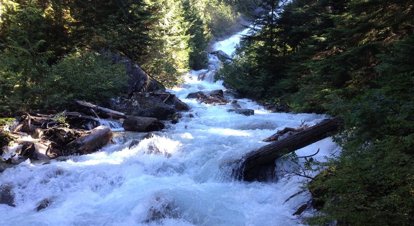
List of Acronyms
BCCAQ	Bias Correction/Constructed Analogues with
       Quantile mapping reordering
CMIP5   Coupled Model Intercomparison Project 5
ENSO    El Niño-Southern Oscillation
ETCCDI Expert Team on Climate Change Detection and Indices
GHG     Greenhouse Gas
HVAC    Heating, Ventilation and Air Conditioning
IPCC    Intergovernmental Panel on Climate Change
PCIC    Pacific Climate Impacts Consortium
PDO     Pacific Decadal Oscillation
RCP     Representative Concentration Pathway

                                                             Climate Projections for Metro Vancouver REPORT   v
Executive Summary
Temperatures in Metro Vancouver are warming.             November are expected to see the greatest increase
Global climate models project an average increase        in precipitation, with precipitation expected to fall
of about 3°C in our region by the 2050s. Metro           increasingly during extreme events. Approximately
Vancouver’s ability to adapt to climate change           30% more precipitation can be expected to fall on
requires specific information on how changes in          the 95th percentile wettest days, and approximately
temperature and precipitation will play out locally,     60% more on the 99th percentile wettest days.
how expected changes may vary throughout the             The amount of rain falling in a 1-in-20 event could
seasons, and about new climate extremes. Work            increase by 30% by the 2050s. Despite the projected
has been completed by the Pacific Climate Impacts        increased intensity of wet events, the amount of
Consortium (PCIC) to understand the details of how       rain in summer is expected to decrease by 20%,
our climate may change by the 2050s and 2080s.           lengthening dry-spell duration by about 20%, from 21
                                                         consecutive days to 26 days.
High-level changes for temperature and precipitation
for the 2050s indicate that as our climate warms,        Most of the projected climate changes described
our region can expect more than a doubling in            in this report will be felt more or less uniformly
the number of summer days above 25°C, from an            throughout the region. Certain impacts, however,
average of 22 days per year to 55 days per year. The     may differ substantially between low-lying areas
1-in-20 hottest temperature (i.e., a temperature that    where the majority of the population is situated,
has a 5% chance of occurring in any year) is projected   and high elevations such as the slopes of the North
to increase from 34°C to 38°C by the 2050s. This         Shore. In particular, the wettest areas in the local
projected warming has implications for future energy     mountains will become even wetter. However, with
supply, as heating demand for buildings will decrease    warmer temperatures and more precipitation falling
by 29%, while cooling demand will increase to nearly     as rain, the April 1 snowpack depth in the watersheds
6 times what is currently required. This warming also    is projected to decrease almost 60% by the 2050s.
translates into changes that are important to our        The most dramatic regional differences are for
ecosystems, including a 20% increase in the length       frost days and growing-season length, where high
of the growing season and a 45% increase in growing      elevations show about double the change of low
degree days. Warmer winters mean the region will         elevations, because temperatures will rise above
experience a 60% decrease in the number of frost         thresholds that were rarely experienced in the past.
days, affecting ecosystems, infrastructure, and our
                                                         The projected changes to climate will have
economy.
                                                         multiple impacts in our region. This report provides
A modest 5% increase in annual precipitation             information to support our region to adapt to the
is projected in our region by the 2050s, though          changes ahead.
indications of when that precipitation will occur are
projected to change in important ways. October and

vi   Climate Projections for Metro Vancouver REPORT
Introduction
Today, new information is available for producing      This work offers information on multiple indicators
high resolution regional climate projections. This     that represent key properties of our climate system,
report provides our region with an improved            which together tell a story of how our climate
understanding of projected local climate change        is expected to change over time. Cross-cutting
trends in temperature, precipitation, and related      themes emerge that demand attention from those
indices of extremes. While sea level rise is an        charged with planning for the future. These include
important aspect of climate change with significant    the provision of services to support safe human
regional impacts, it is not addressed in this report   settlements, the health of our population, substantial
as it does not require the same type of regional       shifts to our ecosystems, and the related economic
downscaling.                                           impacts of those shifts.

Information provided in this document is intended      In the following sections, you will find a broad,
to describe a probable future and enable our           general description of our changing climate,
region’s planners, engineers, and policy makers to     followed by detailed descriptions of specific climate
make better-informed decisions on how to plan and      indicators. This is followed with a thematic discussion
adapt to changes ahead. This information could         of potential impacts of climate change that we can
support development of design guidelines for future    expect to experience in our region in years to come.
planning.

                                                                              Climate Projections for Metro Vancouver REPORT   1
METHODOLOGY

Methodology
Climate Scenario Selection
Various future trajectories of greenhouse gas (GHG)                    global warming below 2°C above pre-industrial
emissions are possible, and depend directly on                         temperatures. The projected global temperature
global political initiatives and socio-economic                        change for each pathway is illustrated below.
changes that will occur over the coming years.
This report presents the internationally recognized                      Representative Concentration Pathways (RCPs)
“business as usual” greenhouse gas emissions
scenario, known as Representative Concentration                          RCPs describe potential 21st century scenarios
Pathway 8.5 (RCP8.5). Additional information from                        of GHG emissions, atmospheric GHG
lower emissions scenarios (RCPs 4.5 and 2.6) is                          concentrations, air pollutant emissions, and
available for sensitivity analysis and to illustrate the                 land use. These RCPs are used for making
relationship between adaptation and greenhouse gas                       projections, and are based on the factors that
emissions reductions, or mitigation (see Appendix 1).                    drive anthropogenic GHG emissions: population
                                                                         size, economic activity, lifestyle, energy use, land
In general terms, RCP8.5 corresponds to “business                        use patterns, technology adoption, and climate
as usual” GHG emissions for the remainder of                             policy. Each of the RCP emissions pathways is
the century. The RCP4.5 “medium stabilization”                           achievable, and directly relates to the choices
scenario represents mitigation efforts that result in                    made by global society.
about half of the emissions compared to the RCP8.5
scenario. Substantial and sustained reductions in                      While recent commitments, including the 2015 COP21
GHG emissions—for example, extensive adoption                          Paris Agreement, correspond with RCP2.6, to date
of biofuels and vegetarianism, along with carbon                       public policy continues to reflect the RCP8.5 pathway.
capture and storage—would be required to achieve                       It is prudent to plan for an RCP8.5 future until global
RCP2.6, which is the only pathway that would keep                      mitigation actions begin to catch up with commitments.

                                                                                                                 Mean over
                                                                                                                 2081-2100
        temperature change (°C)
         Global average surface

                 Figure SPM.6(a) from IPCC’s Climate Change 2014: Synthesis Report shows modeled global average surface
                 temperature change relative to 1986-2005. The mean of the projections (lines) and a measure of uncertainty
                 (shading) are shown for RCP8.5 (red) and RCP2.6 (blue). The number of climate models used to calculate the
                 mean is indicated.

2   Climate Projections for Metro Vancouver REPORT
METHODOLOGY

Climate Model Selection
Many different, highly sophisticated models are used    The results in this report are based on a subset of
to simulate how the earth’s climate will respond to     climate models selected from the Coupled Model
changes in greenhouse gas concentrations, each          Intercomparison Project 5 (CMIP5). The CMIP5
with different strengths and weaknesses. To manage      climate models were first screened according to their
the uncertainty associated with modelling, it is best   ability to replicate historical data, and from them, the
practice to apply an ensemble approach that uses        ensemble of 12 models was chosen to provide the
several models to describe the bounds of projected      widest range of projected change for a set of climate
climate change.                                         parameters.

                                                        Information from the large-scale global climate
  About Climate Models
                                                        models was translated into predictions at local scales
  More information about climate models is              using a procedure called downscaling. The model
  available from the Pacific Institute for Climate      projections were downscaled to a 10 km grid
  Solutions’ Climate Insights 101 course.               by making use of a historical daily time series
                                                        (ANUSPLIN) in conjunction with the climate model
  •	Global climate models: http://pics.uvic.ca/        projections. BCCAQ statistical downscaling
     insights/module1_lesson4/player.html               was used, which is a hybrid climate analogue/
                                                        quantile mapping method. Daily temperature and
  •	Regional climate modelling and impacts
                                                        precipitation observations and future projections at
     in British Columbia: http://pics.uvic.ca/
                                                        10 km resolution were then draped over an 800 m
     education/climate-insights-101#quicktabs-
                                                        grid (PRISM) of 1971–2000 average temperature or
     climate_insights_101=1
                                                        precipitation to generate high-resolution maps.

                                                                               Climate Projections for Metro Vancouver REPORT   3
METHODOLOGY
Indicator Derivation How to Read the Figures and Tables
The historical baseline period used for all indicators The following methods were used when developing
in the report is 1971–2000. Values are averaged over the values shown in the tables, maps, and plots in
this 30-year period to smooth out annual variability. this report:
The future projections are for the 2050s (which is
Values for each time period (past, 2050s, and 2080s)
an average of modelled values over the 2041–2070
are averaged over each 30-year period. The 30-
period) and 2080s (2071–2100). The three RCP
year period used to calculate past values is 1971–
scenarios have somewhat similar greenhouse gas
2000; the 2050s refer to 2041–2070, and the 2080s
concentrations in the 2050s, but diverge considerably
refer to 2071–2100.
by the 2080s. Indicators of climate change take a
similar divergent pattern by the 2080s. Seasons are presented as winter (December-
January-February), spring (March-April-May),
Many of the indicators of extreme events used summer (June-July-August), and fall
in this report are derived using the definitions (September-October-November).
recommended by the Expert Team on Climate
In tables throughout the document, projected
Change Detection and Indices (ETCCDI), known as
change is given for the mean of the model
the CLIMDEX indices1. The indicator names used in
ensemble along with the range (10th to 90th
this report have been translated into plain language,
percentile) of the model ensemble. The 10th to
with the original CLIMDEX names provided in the
90th percentile range describes the uncertainty
tables for reference. Some indicators are defined by
among the models and natural climate variability.
ETCCDI on a monthly basis only such as TXx (monthly
maximum daytime high temperature). In some
cases, we consider seasonal and annual versions Average or mean 10th percentile of 90th percentile of
of CLIMDEX indices by taking the corresponding of model ensemble model ensemble model ensemble
maximum (or minimum) from the highest (or lowest)
Past (°C) 2050s Change (°C)
month in that season or year.
Average (Range)
Sea level rise, which does not require the same Winter 5 2.4 (1.3 to 3.0)
downscaling to examine regional impacts, was not
Spring 12 2.9 (1.7 to 4.7)
included in this study. Projections of rising ocean
levels are addressed by provincial guidelines.2
Values in tables are averaged over the entire region
Some adaptation planning will require detailed
(within the regional boundary shown on the maps),
assessments of sea level rise in combination with
unless labelled as low elevation or high elevation.
other local conditions such as subsidence and wave
effects. In this report, lower-elevation values are averaged
within the geographic boundaries of the City
of Vancouver, while higher-elevation values are
averaged within the boundaries of the District
of North Vancouver. These municipalities were
being analyzed for other studies, and were used to
represent lower- and higher-elevation areas of the
region.
1
http://www.climdex.org/indices.htm
2
http://www.env.gov.bc.ca/wsd/public_safety/flood/pdfs_word/
guidelines_for_mgr_coastal_flood_land_use-2012.pdf
4 Climate Projections for Metro Vancouver REPORTMETHODOLOGY
Maps show only the mean values of the model This report provides several box-and-whisker plots to
ensemble. Maps are provided in the body of illustrate year-to-year and model-to-model variability
the report when they add meaning to data over time. The diagram below illustrates how these
interpretation, with additional maps for remaining plots are to be interpreted.
indicators presented in Appendix 2.
For the 1-in-20 events described in this report,
Individual values with a distance
the “5% chance of occurrence” is based on an from the median greater than
average over each 30-year period. To be precise, 1.5 times the total height of the box
since climate change will occur throughout that (also called the interquartile range)
time, there is slightly less than a 5% chance of 90th percentile
such an event occurring at the beginning of the
period and more than 5% chance at the end of
the period, with an average 5% chance over the 75th percentile
period.
Median, or 50th percentile of all
monthly average values from the
12 models over the 30 year period.
25th percentile
10th percentile
A Note on Interpretation
This report tells the story of how we can expect For some indicators, values for specific geographic
temperature and precipitation to change in the areas may be more appropriate than the regional
Metro Vancouver region. When reviewing the averages presented in the tables. These values can
data provided in the tables and figures below, it is be obtained by looking at the maps presented in
important to note the following: the report body and in Appendix 2.
The 10th to 90th percentile values projected
by the ensemble are important for adaptation
planning, as they take into account the range of
uncertainty when projecting future climate change.
Risk managers may find it appropriate to consider
90th percentile values when planning critical
infrastructure investments.
Climate Projections for Metro Vancouver REPORT 5GENERAL CLIMATE PROJECTIONS FOR METRO VANCOUVER 6 Climate Projections for Metro Vancouver REPORT
GENERAL CLIMATE PROJECTIONS FOR METRO VANCOUVER
General Climate Projections
for Metro Vancouver
The Metro Vancouver region can expect changes These changes will not always happen consistently
to our climate in the coming years. At a broad over the region or over time as seasonal and
level, this will mean: yearly variations will occur. For most variables,
projected change appears somewhat different
warmer temperatures, from the past by the 2050s, and by the 2080s,
a decrease in snowpack, projections indicate substantial changes, resulting
longer dry spells in summer months, in a very different lived experience than the Metro
Vancouver of today. This is particularly true for the
more precipitation in fall, winter, and spring, and,
temperature related variables.
more intense extreme events.
This section of the report presents general
projections, and is followed by sections with more
detailed climate indicators including indices of
extremes for precipitation, summer temperatures
and winter temperatures. Each section includes
a definition of the indicator and a summary of
projected values.
Climate Projections for Metro Vancouver REPORT 7GENERAL CLIMATE PROJECTIONS FOR METRO VANCOUVER
Warmer Temperatures
ABOUT THESE INDICATORS Nighttime lows are also projected to rise by
Daytime high and nighttime low temperatures are approximately 3°C in all seasons by the 2050s,
averaged over each month, each season, or annually resulting in an average winter low of 2°C, compared
in the tables and plots below. to an average winter low below zero in the past. The
winter nighttime low can be expected to increase
PROJECTIONS to 4°C by 2080s. Summer nighttime lows are also
All models project daytime high and nighttime projected to increase dramatically, from 10°C in the
low temperatures to rise. While temperature can past to 16°C by the 2080s.
be expected to increase year round, the greatest Maps indicate that warming can be expected
increases will occur in the summer months. By uniformly throughout the region, with the warmest
the 2050s, daytime high temperatures will be areas expected in the valleys and low-lying areas.
substantially warmer (an increase of 3.7°C) in summer. In the future, only the tops of mountains will have
By the 2080s, we can expect summer daytime highs temperatures below zero in the winter, on average.
to increase by 6°C.
table 1: AVERAGE DAYTIME HIGH TEMPERATURE
Past (°C) 2050s Change (°C) 2080s Change (°C)
Average (Range) Average (Range)
Winter 5 2.4 (1.3 to 3.0) 4.4 (2.8 to 5.7)
Spring 12 2.9 (1.7 to 4.7) 4.7 (2.8 to 7.3)
Summer 21 3.7 (2.4 to 5.2) 6.0 (3.7 to 8.4)
Fall 13 2.8 (1.3 to 3.9) 4.5 (2.9 to 6.2)
Annual 13 2.9 (1.6 to 4.2) 4.9 (3.0 to 6.6)
table 2: AVERAGE NIGHTTIME LOW TEMPERATURE
Past (°C) 2050s Change (°C) 2080s Change (°C)
Average (Range) Average (Range)
Winter -1 2.9 (1.8 to 3.5) 4.9 (3.6 to 5.7)
Spring 3 2.9 (2.0 to 3.8) 4.6 (3.2 to 6.0)
Summer 10 3.2 (1.9 to 4.7) 5.2 (3.5 to 7.7)
Fall 5 2.8 (1.7 to 4.0) 4.5 (3.1 to 6.0)
Annual 4 2.9 (1.9 to 4.0) 4.8 (3.3 to 6.3)
8 Climate Projections for Metro Vancouver REPORTGENERAL CLIMATE PROJECTIONS FOR METRO VANCOUVER
49.8
49.6
LATITUDE (ºN)
49.4
49.2
49.0
-123.5 -123.0 -122.5 -122.0
LONGITUDE (ºN)
Figure 1: WINTER NIGHTTIME LOW TEMPERATURE – PAST
49.8
49.6
LATITUDE (ºN)
49.4
49.2
49.0
-123.5 -123.0 -122.5 -122.0
LONGITUDE (ºN)
Figure 2: WINTER NIGHTTIME LOW TEMPERATURE – FUTURE (2050s)
Climate Projections for Metro Vancouver REPORT 9GENERAL CLIMATE PROJECTIONS FOR METRO VANCOUVER
Seasonal Variability in Temperature
The box-and-whisker plots below of monthly high The daytime high temperature plot (Figure 3) shows
and low temperatures show that the new normal that the median monthly average daytime high in the
for the region may be very unlike the past. In these 2080s will be hotter than the 90th percentile of monthly
plots, the larger spread in future boxes could indicate averages in the past, notably in July, August, and
that some years may be quite warm when others are September. In the 2080s, most September temperatures
not, or could mean there is more uncertainty in how will be hotter than August temperatures would have
the climate will respond to increasing atmospheric been in the past. In the 2080s, average daytime highs in
greenhouse gas concentrations. January will be similar to those of March in the past.
Figure 3: MONTHLY DAYTIME HIGH TEMPERATURE – PAST, 2050s, AND 2080s
Boxes from left to right in each month indicate past, 2050s, 2080s. Further explanation
of how to read the box-and-whisker plots is provided above in the Methodology section.
10 Climate Projections for Metro Vancouver REPORTGENERAL CLIMATE PROJECTIONS FOR METRO VANCOUVER
In terms of nighttime lows (Figure 4), about 75% from hot days. By the 2050s, over 90% of monthly
of past January average temperatures were below average nighttime lows are hotter than the hottest
freezing for the region as a whole. By the 2050s, 90% 10% in the past, for April through October. These
of January and December average nighttime lows projections indicate a future that has little in common
are expected to be above freezing. In past summers, with our current climate in terms of nighttime low
cooler nighttime temperatures offered relief temperatures.
Figure 4: MONTHLY NIGHTTIME LOW TEMPERATURE — PAST, 2050s, AND 2080s
Boxes from left to right in each month indicate past, 2050s, 2080s. Further explanation
of how to read the box-and-whisker plots is provided above in the Methodology section.
Climate Projections for Metro Vancouver REPORT 11GENERAL CLIMATE PROJECTIONS FOR METRO VANCOUVER
Wetter Winters, Drier Summers
ABOUT THIS INDICATOR PROJECTIONS
Total precipitation is all precipitation summed over Projections indicate that our region will experience
a month, season, or year, including rain and snow an increase in total annual precipitation of a modest
water equivalent. This is a high-level indicator of how 5% by the 2050s, and a more substantial increase of
precipitation patterns are projected to change. 11% by the 2080s. While these increases alone are
not a dramatic departure from the past, the increase
in precipitation will be distributed unevenly over the
seasons.
In our region, most rain falls over the winter months,
and this will continue to occur in the future. The
largest percentage increase in rainfall will occur in
the fall season, increasing 11% by the 2050s and 20%
by the 2080s. Winter and spring precipitation will
both increase as well. Summer, already our region’s
driest season, will experience a decline of 19% by
the 2050s, and a decline of 29% by the 2080s. While
the models indicate a range of possible change, they
mostly agree about the direction of change for each
season.
table 3: TOTAL PRECIPITATION OVER SEASONS AND YEAR
Past 2050s 2080s 2050s Percent Change (%) 2080s Percent Change (%)
(mm) (mm) (mm) Average (Range) Average (Range)
Fall 580 642 693 11 (-1 to 24) 20 (10 to 38)
Winter 683 714 780 5 (-3 to 12) 14 (2 to 27)
Spring 400 430 447 8 (-4 to 15) 12 (3 to 25)
Summer 206 168 147 -19 (-41 to 1) -29 (-53 to -6)
Annual 1869 1953 2068 5 (-1 to 9) 11 (2 to 17)
12 Climate Projections for Metro Vancouver REPORTGENERAL CLIMATE PROJECTIONS FOR METRO VANCOUVER
The maps below show the amount of precipitation that is projected to fall and indicates that the wetter
areas are expected to experience the largest increases in precipitation.
49.8
49.6
LATITUDE (ºN)
49.4
49.2
49.0
-123.5 -123.0 -122.5 -122.0
LONGITUDE (ºN)
Figure 5: FALL PRECIPITATION – PAST
49.8
49.6
LATITUDE (ºN)
49.4
49.2
49.0
-123.5 -123.0 -122.5 -122.0
LONGITUDE (ºN)
Figure 6: FALL PRECIPITATION – FUTURE (2050s)
Climate Projections for Metro Vancouver REPORT 13GENERAL CLIMATE PROJECTIONS FOR METRO VANCOUVER
Seasonal Variability in Precipitation
When examining monthly precipitation values in the Pacific Decadal Oscillation (PDO) and the El
the plot below (Figure 7), we see that increases Niño-Southern Oscillation (ENSO). PDO has varied
in precipitation amounts within a season are not between warm and cool phases a few times over
uniform across months. For example, the fall the last century. ENSO varies between three phases:
months show a divergent pattern: September neutral years, El Niño events that typically mean a
shows a reduction in precipitation, while October warmer and drier winter and spring, and La Niña
and November show the largest increases in events that are cooler and wetter. The magnitude
precipitation. December and January show the of the natural variability of PDO and ENSO cycles is
largest increases in winter precipitation. comparable to the projected changes due to climate
change in some cases.The effects of ENSO and PDO
The plot also indicates the potential for much drier tend to cancel out in the projections shown in the
summer months than we have ever experienced. tables and maps of this report, since those values are
September is projected to get drier over time, averaged over 30 years.
extending the dry season into the fall. The models
illustrate that we can expect more precipitation in the In the future, the decadal and year-to-year variability
already wet seasons, less precipitation in already dry of the PDO and ENSO patterns will be felt on
summers, and considerably more rain falling in some top of the “new normal” reflected by the future
years, while other years will experience droughts. projections. The ranges in the box-and-whisker plot
below illustrate year-to-year variability including
In southwestern BC, year-to-year precipitation contributions from ENSO within each 30-year period.
variability is regulated by two global climate patterns:
Figure 7: MONTHLY TOTAL PRECIPITATION – PAST, 2050s, AND 2080s
Boxes from left to right in each month indicate past, 2050s, 2080s. Further explanation
of how to read the box-and-whisker plots is provided above in the Methodology section.
14 Climate Projections for Metro Vancouver REPORTPrecipitation Indicators
Metro Vancouver’s drinking water comes from three mountain reservoirs supplied by rainfall and snowmelt in
the watersheds. Changes in precipitation patterns will have impacts on water supply.
Drainage and stormwater infrastructure in the region is designed to withstand extreme weather events. As the
climate warms, more moisture is held in the atmosphere and released during precipitation events, resulting
in more intense future storm events. New thresholds for extreme weather events will challenge regional
infrastructure, such as sewage and drainage systems.
Snowpack
ABOUT THIS INDICATOR PROJECTIONS
Snowpack refers to the depth of snow on the ground, Snowpack is projected to decrease significantly over
either daily depths averaged over a season, or in time. Our region’s snowpack is typically highest in the
the case of the April 1 and May 1 snowpack, the spring months, after snow has accumulated over the
snow depth on that specific date. This indicator winter and early spring, with past spring snowpack
is measured within the boundaries of the three depth measuring 266 cm. In the winter months,
watersheds that supply the majority of Metro projections indicate a 56% decrease in snowpack
Vancouver’s drinking water. In this context, the by the 2050s, resulting in much lower spring and
snowpack indicator provides a measure to assist in summer snow levels. This trend is expected to
determining how much snowmelt will be available in magnify by the 2080s with a 77% decrease in winter
the watersheds to flow into our region’s reservoirs. snowpack and 84% decrease in spring snowpack,
averaged across the three watersheds.
Climate Projections for Metro Vancouver REPORT 15PRECIPITATION INDICATORS
table 4: SEASONAL SNOWPACK DEPTH (WATERSHED AVERAGE)
2050s 2080s 2050s Percent Change (%) 2080s Percent Change (%)
Past (cm)
(cm) (cm) Average (Range) Average (Range)
Winter 208 93 49 -56 (-63 to -45) -77 (-86 to -59)
Spring 266 102 43 -62 (-72 to -51) -84 (-94 to -67)
Summer 73 11 3 -86 (-94 to -80) -97 (-99 to -92)
Fall 37 10 5 -75 (-82 to -65) -87 (-94 to -77)
Looking more closely at spring snowpack in the watersheds, the April 1 snow depth will decrease by 58% by
the 2050s, from 292 cm to 123 cm, and by 82% by the 2080s, to 56 cm. The May 1 snow depth will diminish
even more—a decrease of 66% by the 2050s, and 87% by the 2080s. The following table shows the changes
for each of Metro Vancouver’s three watersheds (Capilano, Seymour, and Coquitlam). The boundaries of these
watersheds are illustrated on the maps below.
table 5: APRIL 1 AND MAY 1 SNOWPACK IN THE WATERSHEDS
Past 2050s 2080s 2050s Percent Change (%) 2080s Percent Change (%)
(cm) (cm) (cm) Average (Range) Average (Range)
Watersheds
292 123 56 -58 (-71 to -46) -82 (-94 to -61)
average
April 1
Capilano 256 105 45 -59 (-73 to -47) -83 (-95 to -64)
Seymour 274 115 47 -59 (-73 to -46) -84 (-96 to -63)
Coquitlam 336 144 71 -57 (-70 to -44) -80 (-92 to -57)
Watersheds
264 93 37 -66 (-78 to -54) -87 (-96 to -73)
average
May 1
Capilano 229 77 29 -67 (-80 to -56) -88 (-97 to -76)
Seymour 244 81 28 -67 (-81 to -56) -89 (-98 to -76)
Coquitlam 308 114 51 -64 (-76 to -52) -84 (-94 to -69)
The maps below illustrate the snowline moving up the mountains as the spring snowpack diminishes into the
future. The values presented in the tables above are calculated within the boundaries of the watersheds shown
on the maps. Note that the white areas on the map represent areas where snowpack is nearly permanent, i.e.,
at or near glaciers. The snowpack model does not apply in these locations. Snow depths in these locations are
omitted from the calculation of values in the tables above. However, the area of permanent snow (glaciers) are
shown to decrease over time.
16 Climate Projections for Metro Vancouver REPORTPRECIPITATION INDICATORS
49.8
49.6
LATITUDE (ºN)
49.4
49.2
49.0
-123.5 -123.0 -122.5 -122.0
LONGITUDE (ºN)
Figure 8: APRIL 1 SNOWPACK – PAST
49.8
49.6
LATITUDE (ºN)
49.4
49.2
49.0
-123.5 -123.0 -122.5 -122.0
LONGITUDE (ºN)
Figure 9: APRIL 1 SNOWPACK – FUTURE (2050s)
Climate Projections for Metro Vancouver REPORT 17PRECIPITATION INDICATORS
Dry Spells
ABOUT THIS INDICATOR PROJECTIONS
Dry spells is a measure of the number of consecutive The past average longest period of consecutive days
days where daily precipitation is less than 1 mm. without rain (under 1 mm) in our region is 21 days.
The value denotes the longest stretch of dry days Dry spells on average are expected to increase to
in a year, typically in summer. This indicator reflects 26 days by the 2050s, and 29 days by the 2080s.
times of the year when reservoirs are not recharged
by rainfall. This number does not indicate extreme
droughts, as it is averaged over the 30-year period.
table 6: ANNUAL DRY SPELLS
CLIMDEX Past 2050s 2080s 2050s Percent Change (%) 2080s Percent Change (%)
index: CDD (days) (days) (days) Average (Range) Average (Range)
Dry Spell
21 26 29 22 (3 to 40) 37 (16 to 65)
duration
Single-Day Maximum Precipitation
ABOUT THIS INDICATOR PROJECTIONS
Single-day maximum precipitation describes the As noted previously in the General Climate
largest amount of rain that falls on any single day in Projections section, a modest increase (5%)
the year. This value is used to understand how extreme in total annual precipitation is expected by the 2050s.
precipitation will change over time. Models project that the increase will be concentrated
into the wettest days. The wettest single day of the
year will see 17% more rain by the 2050s, and 32%
more by the 2080s.
Five-Day Maximum Precipitation
ABOUT THIS INDICATOR PROJECTIONS
Five-day maximum precipitation describes the largest Again, as noted earlier, a modest increase (5%)
amount of rain that falls over a period of 5 consecutive in total annual precipitation is expected by the
days in the year. 2050s, with models projecting the increase will be
concentrated into the wettest days. The amount of
rain in the wettest 5-day period will increase by 12%
by the 2050s, and 25% by the 2080s.
18 Climate Projections for Metro Vancouver REPORTPRECIPITATION INDICATORS
95th Percentile Wettest Days Precipitation
ABOUT THIS INDICATOR PROJECTIONS
The 95th percentile wettest days precipitation The wettest periods in our region are projected to
indicator points to the total amount of rain that falls become wetter. The wettest days that exceed the
on the wettest days of the year, specifically on days baseline 95th percentile threshold will produce 32%
when precipitation exceeds a threshold set by the more rain by the 2050s, and 62% more rain by the
annual 95th percentile of wet days during the baseline 2080s.
period (1971–2000). This measure indicates how much
total annual precipitation falls during these heavy
events, which is a combination of both how often
these events occur that exceed the 95th percentile
threshold amount, and the size of these events.
99th Percentile Wettest Days Precipitation
ABOUT THIS INDICATOR PROJECTIONS
The 99th percentile wettest days precipitation The 99th percentile wettest days that exceed the
indicator points to the total amount of rain that baseline 99th percentile threshold are projected to
falls on the wettest days of the year, specifically on produce 61% more rain by the 2050s, and 127% more
days when precipitation exceeds a threshold set by rain by the 2080s than in the past. These projected
the annual 99th percentile of wet days during the large increases mean that we can expect more
baseline period (1971–2000). This measure indicates frequent and more intense storms in the future.
how much total annual precipitation falls during
these heavy events, which is a combination of both
how often these events occur that exceed the 99th
percentile threshold amount, and the size of these
events.
table 7: EXTREME RAINFALL
CLIMDEX Past 2050s Percent Change (%) 2080s Percent Change (%)
index (mm) Average (Range) Average (Range)
Single-day maximum
Rx1day 69 17 (6 to 31) 32 (16 to 43)
precipitation
Five-day maximum
Rx5day 159 12 (4 to 20) 25 (13 to 35)
precipitation
95th percentile wettest
R95pTOT 398 32 (6 to 58) 62 (37 to 89)
days precipitation
99th percentile wettest
R99pTOT 122 61 (24 to 119) 127 (79 to 200)
days precipitation
Climate Projections for Metro Vancouver REPORT 19PRECIPITATION INDICATORS
1-in-20 Wettest Day
ABOUT THIS INDICATOR PROJECTIONS
The 1-in-20 wettest day is the day so wet that it has Significantly more precipitation is expected to
only a one-in-twenty chance of occurring in a given fall during the 1-in-20 (or 5% chance) wettest day
year. That is, there is a 5% chance in any year that a extreme storm events in the future. Larger 1-in-20
one-day rainfall event of this magnitude will occur. wettest day events could mean up to 36% more
This indicator points to what we can expect in terms rain in low-lying areas by the 2050s, and 59%
of extreme one-day precipitation events in our by the 2080s. In the past, on average, 154 mm
region. of precipitation fell during the entire month of
January—by the 2080s, there will be a 5% chance
that this amount of rain could fall in a one-day event.
In addition to more precipitation during future 1-in-
20 events, these findings also indicate that what
was previously characterized as a 1-in-20 event will
happen more often.
table 8: 1-IN-20 WETTEST DAY
Past 2050s Change (mm) 2080s Change (mm)
(mm) Average (Range) Average (Range)
Region 105 30 (7 to 43) 46 (24 to 70)
Low elevations 89 31 (8 to 50) 51 (30 to 86)
High elevations 121 23 (7 to 38) 38 (16 to 60)
The maps below indicate that the greatest change in 1-in-20 wettest day rainfall will occur where heavy rain
already falls. The biggest changes are in the mountains between Coquitlam Lake and Pitt Lake, and other
high points to the east of the region.
20 Climate Projections for Metro Vancouver REPORTPRECIPITATION INDICATORS
49.8
49.6
LATITUDE (ºN)
49.4
49.2
49.0
-123.5 -123.0 -122.5 -122.0
LONGITUDE (ºN)
FIGURE 10: 1-IN-20 WETTEST DAY – PAST
49.8
49.6
LATITUDE (ºN)
49.4
49.2
49.0
-123.5 -123.0 -122.5 -122.0
LONGITUDE (ºN)
FIGURE 11: 1
-IN-20 WETTEST DAY – FUTURE (2050s)
Climate Projections for Metro Vancouver REPORT 21Summer Temperature Indicators The downscaled outputs from the climate models Descriptions of these indicators are offered below, project increases in average summer (June-July- and values for these projections are given in August) daytime high temperatures that suggest Table 9: Hot Summers Indicators. Vancouver would be warmer than present-day San Diego by the 2050s, and even warmer by the 2080s. While warmer temperatures may have benefits and be welcomed in some ways, they will also need careful consideration when planning for a growing population in the region 22 Climate Projections for Metro Vancouver REPORT
SUMMER TEMPERATURE INDICATORS

                      Summer Days
                      ABOUT THIS INDICATOR                                   PROJECTIONS
                      Summer days tells us how many days reach               In the past, our region experienced 22 summer days
                      temperatures over 25°C in any one year. This           a year, and we can expect significantly more summer
                      measure indicates how often we can expect              days in the future. Models project more than double
                      “summer weather” to occur in the future.               the number of summer days by the 2050s, and more
                                                                             than triple by the 2080s. This means that future
                                                                             summers may have 55 days above 25°C by the 2050s,
                                                                             and 79 days by the 2080s.

                                                                             The maps for summer days included below show that
                                                                             the number of hot days will be highest in the eastern
                                                                             reaches of the Fraser Valley, though the greatest
                                                                             change will be in Metro Vancouver, where the
                                                                             number of summer days was lower in the past.
                   49.8
                   49.6
			LATITUDE (ºN)

                   49.4
                   49.2
                   49.0

                          -123.5                    -123.0                       -122.5                               -122.0
                                                                     LONGITUDE (ºN)

                           FIGURE 12: SUMMER DAYS – FUTURE (2050s)

                                                                                                  Climate Projections for Metro Vancouver REPORT   23
SUMMER TEMPERATURE INDICATORS
Tropical Nights
ABOUT THIS INDICATOR
Tropical nights refers to the number of days in
a year when the nighttime low temperature is
greater than 20°C. This measure is important when
designing cooling systems for buildings, as nighttime
temperatures will not aid in indoor cooling on these
nights.
PROJECTIONS
In the past, our region experienced no nighttime
lows warmer than 20°C, or tropical nights, on
average. By the 2050s, it is expected that lower
elevations in our region may experience 4 tropical
nights a year (projections range from 0 to 10 nights,
depending on the model), and by the 2080s, that
number will increase to 19 (range of 2 to 48 nights).
Heat Days Hottest day
ABOUT THIS INDICATOR ABOUT THIS INDICATOR
Heat days refers to the number of days where the Hottest day refers to the highest daytime high
daytime temperature exceeds 30°C. This indicator temperature of the year, usually experienced during
is useful to show “heat zones” for plants, because the summer months. The annual high for each
some plants experience physiological stress at year is an indicator of extreme temperatures and is
temperatures above 30°C. averaged over a 30-year period here.
PROJECTIONS PROJECTIONS
In the past, our region experienced 2 heat days The past hottest day temperature was 31°C for the
per year, or days with temperature above 30°C, on region. This will increase to about 35°C by the 2050s,
average. By the 2050s, we can expect 14 heat days and to 37°C by 2080s. Like summer days (shown in
per year. This is projected to increase to 29 heat days Figure 10) the highest increases can be expected
per year by the 2080s. in our region’s valleys and in locations further
from the ocean.
24 Climate Projections for Metro Vancouver REPORTSUMMER TEMPERATURE INDICATORS
1-in-20 Hottest day
ABOUT THIS INDICATOR PROJECTIONS
1-in-20 hottest day refers to a day so hot that it As temperatures increase, so will extreme heat
has only a one-in-twenty chance of occurring in a events. Our past 1-in-20 hottest day temperature
given year. That is, there is a 5% chance in any year is 34°C. By the 2050s we can expect this value to
that temperatures could reach this magnitude. This increase to 39°C, and to 41°C by the 2080s. The
indicator points to what we can expect in terms of range in models suggests that temperatures may
extreme temperature highs in our region. even rise to 43°C by the 2080s. This is a significant
departure from what the region is accustomed to
experiencing.
The 1-in-20 hottest day temperatures will affect the
entire region, and like other hot summer indicators,
will most affect our region’s valleys and other areas
furthest from the cooling effect of the ocean.
table 9: HOT SUMMERS INDICATORS
CLIMDEX Past 2050s 2080s 2050s Change 2080s Change
index Average (Range) Average (Range)
Summer days
SU 22 55 79 33 (20 to 46) 57 (34 to 80)
(# of days >25°C)
Tropical nights
TR 0 2 11 2 (20 to 46) 11 (1 to 30)
(# of nights >20°C)
Heat days
2 14 29 12 (0 to 5) 27 (14 to 46)
(# of days >30°C)
Hottest day
1-yr TXx 31 35 37 3.9 (5 to 18) 6.4 (4.4 to 8.5)
(°C)
1-in-20 hottest
34 39 41 4.6 (2.5 to 4.8) 6.9 (4.2 to 9.1)
day (°C)
Climate Projections for Metro Vancouver REPORT 25SUMMER TEMPERATURE INDICATORS
Growing Season Length
ABOUT THIS INDICATOR PROJECTIONS
Growing season length is an annual measure that In the past, our region had an average of 252 days in
counts the number of days between the first span the growing season. In lower elevations 45 days will
of at least 6 days with a daily average temperature be added to the growing season by the 2050s, and
greater than 5°C, and first span after July 1 of 6 days 56 days by the 2080s, resulting in nearly a year-round
with a temperature less than 5°C. It indicates the growing season of 357 days on average. In forest
length of the growing season for typical plants or ecosystems at higher elevations, the growing season
crops in our region. will lengthen by more days as higher temperatures
creep up the mountains and more days tip over the
5°C threshold. By the 2080s, we will see a growing-
season length of 325 days at higher elevations, which
is more than we saw in the past at lower elevations.
table 10: GROWING SEASON LENGTH
CLIMDEX Past 2050s 2080s 2050s Change 2080s Change
index: GSL (days) (days) (days) (days) (days)
Average (Range) Average (Range)
Region 252 304 331 52 (38 to 62) 79 (66 to 87)
Low elev. 301 346 357 45 (39 to 52) 56 (50 to 62)
High elev. 217 281 325 64 (43 to 82) 108 (90 to 123)
26 Climate Projections for Metro Vancouver REPORTSUMMER TEMPERATURE INDICATORS
Growing Degree Days
ABOUT THIS INDICATOR PROJECTIONS
Growing degree days are a measure of heat In the past, there were 1738 growing degree days in
accumulation that is useful for agriculture and our region. Projections indicate increases in growing
horticulture. Growing degree days calculated here degree days throughout the region. By the 2050s, we
by how warm daily temperatures are compared to can expect 47% more growing degree days, and 82%
a base temperature of 5°C (although different base more growing degree days by the 2080s. The lower
temperatures may be useful for different crops). elevations will experience a larger absolute change
For example, if a day had an average temperature in growing degree days, while mountain areas show a
of 11°C, that day would have a value of 6 growing larger percentage change.
degree days. Annual growing degree days are
accumulated this way for each day of the year and
then summed. This measure is a useful indicator of
opportunities for agriculture, as well as the potential
for invasive species to thrive.
table 11: GROWING DEGREE DAYS
Past 2050s 2080s
2050s Change 2080s Change
(degree (degree (degree
(degree days) (degree days)
days) days) days)
Average (Range) Average (Range)
Region 1738 2532 3157 824 (462 to 1182) 1419 (883 to 1922)
Low elev. 2122 3051 3689 929 (548 to 1300) 1567 (1002 to 2096)
High elev. 1467 2228 2801 761 (411 to 1114) 1334 (814 to 1829)
Climate Projections for Metro Vancouver REPORT 27SUMMER TEMPERATURE INDICATORS
49.8
49.6
LATITUDE (ºN)
49.4
49.2
49.0
-123.5 -123.0 -122.5 -122.0
LONGITUDE (ºN)
FIGURE 13: GROWING DEGREE DAYS – PAST
49.8
49.6
LATITUDE (ºN)
49.4
49.2
49.0
-123.5 -123.0 -122.5 -122.0
LONGITUDE (ºN)
FIGURE 14: GROWING DEGREE DAYS PAST– FUTURE (2050s)
28 Climate Projections for Metro Vancouver REPORTSUMMER TEMPERATURE INDICATORS
Cooling Degree Days
ABOUT THIS INDICATOR PROJECTIONS
Cooling degree days is a measure of how hot it Historically there has been very little cooling demand
gets and for how many days. More specifically, it is in our region. This is reflected in the baseline average
a total of the number of degrees above 18°C that of 49 cooling degree days in the past. It is projected
occur daily, summed over each day of the year, that there will be a 380% increase in cooling degree
and provides an indication of when cooling might days by the 2050s, and a 784% increase by the 2080s.
be required in buildings. Cooling degree days are The large relative increases are partly the result of the
useful indicators of energy demands for mechanical fact that the historical baselines are so small. These
cooling. This information is important when planning increases represent a considerable departure from
heating, ventilation, and air conditioning (HVAC) the past.
systems, building design, energy systems, and
related infrastructure. Areas of lower elevation, where most buildings
are located, will have more cooling demand than
present-day Kamloops by the 2050s, and a higher
cooling demand than present-day San Diego
by the 2080s.
table 12: COOLING DEGREE DAYS
Past 2050s 2080s 2050s Change 2080s Change
(degree (degree (degree (degree days) (degree days)
days) days) days) Average (Range) Average (Range)
Region 49 235 433 186 (81 to 295) 385 (184 to 606)
Low elev. 58 300 535 242 (106 to 374) 477 (243 to 742)
High elev. 36 177 346 141 (58 to 229) 310 (137 to 496)
Climate Projections for Metro Vancouver REPORT 29SUMMER TEMPERATURE INDICATORS
The maps below indicate that warmer areas are getting warmer, particularly on south facing slopes and
furthest from the ocean.
49.8
49.6
LATITUDE (ºN)
49.4
49.2
49.0
-123.5 -123.0 -122.5 -122.0
LONGITUDE (ºN)
FIGURE 15: COOLING DEGREE DAYS – PAST
49.8
49.6
LATITUDE (ºN)
49.4
49.2
49.0
-123.5 -123.0 -122.5 -122.0
LONGITUDE (ºN)
FIGURE 16: COOLING DEGREE DAYS – FUTURE (2050s)
30 Climate Projections for Metro Vancouver REPORTMETHODOLOGY
Winter Temperature Indicators
Future climate projections suggest our region will see warmer winter months. These indicators provide insight
into the “new normal” for winter temperature in our region.
Warmest Winter Day
ABOUT THIS INDICATOR PROJECTIONS
Warmest winter day is the highest temperature By the 2050s, we can expect to see the warmest
recorded during the winter months, in an average winter temperature rise from 12°C to about 15°C.
year. When considered in combination with the This value may increase to about 18°C by the 2080s.
coldest night, this indicator is useful to describe the
projected “new normal” for winters in our region.
Coldest Night
ABOUT THIS INDICATOR PROJECTIONS
Coldest night refers to the lowest temperature of In the past, the coldest night had a temperature of
the year, in an average year, usually experienced -13°C. Models project annual lows to increase by
at nighttime during the winter months. This roughly 5°C by the 2050s, to -8°C, and by 8°C by the
indicator points to the lowest threshold of winter 2080s, to -5°C.
temperatures, and when considered along with the
warmest winter day, helps describe the projected
“new normal” for winters in our region.
Climate Projections for Metro Vancouver REPORT 31WINTER TEMPERATURE INDICATORS
1-in-20 Coldest Night
ABOUT THIS INDICATOR PROJECTIONS
1-in-20 coldest night refers to a nighttime low The 1-in-20 coldest night across the region will
temperature so cold that it has only a one-in-twenty increase by 5°C by the 2050s to -15°C, and 8°C by
chance of occurring in a given year. That is, there is a the 2080s to 12°C. The winter nighttime low (-13°C)
5% chance in any year that a minimum temperature that in the past occurred roughly once per year will,
of this value will occur. This indicator is a marker of by the end of the century, be experienced roughly
extreme winter cold temperatures. once every 20 years.
table 13: WARMER WINTER DAYS
2050s Change 2080s Change
Climdex Past 2050s 2080s (ºC) (ºC)
index (ºC) (ºC) (ºC)
Average (Range) Average (Range)
Warmest
TXx 12 15 18 2.8 (0.6 to 4.0) 5.7 (2.0 to 10.1)
winter day
Coldest
TNn -13 -8 -5 5.1 (3.5 to 6.6) 8.1 (6.6 to 9.6)
winter night
1-in-20
coldest
-20 -15 -12 4.9 (3.0 to 7.5) 8.0 (4.7 to 10.4)
nighttime
low
Frost Days
ABOUT THIS INDICATOR PROJECTIONS
Frost days is an annual count of days when the daily In the past, Metro Vancouver had 79 frost days a year.
minimum temperature is less than 0°C, which may Lower elevations experienced only 39 frost days,
result in frost on the ground. This indicator is useful while higher elevations had 92 frost days. Future
when predicting how pests and invasive species may projections indicate conditions where the “new
thrive in our shifting ecosystems. normal” is a climate that is almost entirely frost-free
in lower elevations. The region may expect 33 frost
days by the 2050s, and 17 by the 2080s. The maps
below illustrate that the loss of frost days will be most
dramatic at higher elevations.
table 14: FROST DAYS
2050s Change 2080s Change
CLIMDEX Past 2050s 2080s (days) (days)
index: FD (days) (days) (days)
Average (Range) Average (Range)
Region 79 33 17 -47 (-54 to -37) -63 (-68 to -52)
Low elev. 39 11 4 -28 (-33 to -23) -35 (-38 to -30)
High elev. 92 34 16 -58 (-68 to -46) -76 (-83 to -63)
32 Climate Projections for Metro Vancouver REPORTYou can also read