Gio ay 2 - Department of ...

Page created by George Blake
 
CONTINUE READING
Gio ay 2 - Department of ...
l i s t e
                    t u    r a
              in-Na   rat e g y
      e u w      l S t
Le b-regio    na
 Su   2 019
  May
Gio ay 2 - Department of ...
Amendment 1:
               The Leeuwin-Naturaliste Sub-regional Strategy was amended by
                resolution of the Western Australian Planning Commission
                  on 22 January 2020.

                              The Department of Planning, Lands and Heritage acknowledges the traditional owners
                               and custodians of this land. We pay our respect to Elders past and present, their
                                descendants who are with us today, and those who will follow in their footsteps.

                                    Disclaimer

                                      This document has been produced by the Department of Planning, Lands and Heritage on
                                       behalf of the Western Australian Planning Commission. Any representation, statement, opinion
                                        or advice expressed or implied in this publication is made in good faith and on the basis that
                                          the Government, its employees and agents are not liable for any damage or loss whatsoever
                                           which may occur as a result of action taken or not taken, as the case may be, in respect
                                            of any representation, statement, opinion or advice referred to herein. Professional advice
                                              should be obtained before applying the information contained in this document to
                                               particular circumstances.

                                                   © State of Western Australia

                                                      Published by the
                                                       Western Australian Planning Commission
                                                        Gordon Stephenson House
                                                         140 William Street
                                                          Perth WA 6000

                                                             Locked Bag 2506
                                                              Perth WA 6001

                                                                 Published May 2019
                                                                  Amended March 2020

                                                                     website: www.dplh.wa.gov.au
                                                                      email: info@dplh.wa.gov.au

                                                                        tel: 08 6551 8002
                                                                         fax: 08 6551 9001
                                                                            National Relay Service: 13 36 77

                                                                              The Department of Planning, Lands and Heritage owns
                                                                               all photography in this document unless otherwise
                                                                                stated.

                                                                                  This document is available in alternative formats
                                                                                   on application to the Department of Planning,
                                                                                    Lands and Heritage Communications Branch.

ii   Leeuwin-Naturaliste Sub-regional Strategy
Gio ay 2 - Department of ...
Chairman’s foreword
                      The Leeuwin-Naturaliste sub-region in Western Australia’s south west
                      is renowned as much for its unique natural environments and stunning
                      landscapes, as it is for its world class wineries and notable settlement
                      and tourism amenity.

                      It is important to maintain the overall attractors of this part of the South
                      West to ensure the long term viability of the local communities in a way
                      that will benefit and protect the environmental elements of the region as
                      well as the amenity needs of future generations of Western Australians
                      and visitors to the region.

Since publication of the Western Australian Planning Commission’s State Planning Policy
6.1 Leeuwin-Naturaliste Ridge (SPP6.1) in 1998, the sub-region has experienced substantial
growth that has led to new challenges emerging. Current planning issues include managing
urban growth and tourism, responding to coastal and bushfire hazards, and protecting
biodiversity, agricultural uses and landscape values.

The Leeuwin-Naturaliste Sub-regional Strategy presents directions and actions to help meet
these challenges and balance economic, social and environmental considerations over the
next 20 years.

The Strategy provides guidance to the City of Busselton and the Shire of Augusta-Margaret
River on strategic issues and will support the preparation of new local planning strategies and
local planning schemes. Its strategic rationale will also be used in the review of SPP6.1.

The Strategy provides a greater level of detail for actions outlined in the South West Regional
Planning and Infrastructure Framework and should therefore be read in conjunction with that
document.

I commend the collaborative approach taken in the preparation of the Strategy and I extend
my appreciation to the City of Busselton and Shire of Augusta-Margaret River, the South West
Development Commission, and all other stakeholders who participated or made submissions
during the course of its preparation.

David Caddy
Chairman
Western Australian Planning Commission

                                       Leeuwin-Naturaliste Sub-regional Strategy                     iii
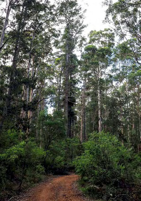
Gio ay 2 - Department of ...
Contents
     EXECUTIVE SUMMARY                       vii   PART A: STRATEGY                        11
     INTRODUCTION                             1    3   Vision                              12
     1   Scope                                2    4   WAPC strategic directions           12
         1.1 Strategy area                    2    5   WAPC actions                        15
         1.2 Purpose                          2
                                                   6   Settlement hierarchy                15
         1.3 Key planning issues              3
         1.4 Methodology                      4    7   Investigation areas                 17
         1.5 Principles                       5    8   Townsite strategies                 18
     2   Governance and context               6        8.1 Dunsborough
         2.1 Planning                         6            townsite strategy               18
             2.1.1    State planning                   8.2 Vasse townsite strategy         19
                      policies                6    9   Strategy plan                       20
             2.1.2    Regional planning
                                                   10 Timeframe, monitoring
                      and infrastructure
                                                      and review                           22
                      frameworks              7
             2.1.3    Local planning
                      strategies and               PART B: PROFILE                         23
                      schemes                 8    11 Settlement                           24
         2.2 Regional development                     11.1 Population                      24
              and context                     8             11.1.1 City of Busselton       25
             2.2.1    South West Regional                   11.1.2 Shire of Augusta-
                      Investment Blueprint    9                      Margaret River        26
                                                      11.2 Settlement and growth           26
                                                            11.2.1 Settlement pattern      26
                                                            11.2.2 Busselton               26
                                                            11.2.3 Margaret River          27
                                                            11.2.4 Dunsborough             28
                                                            11.2.5 Augusta                 28
                                                            11.2.6 Cowaramup               29
                                                            11.2.7 Vasse                   29
                                                            11.2.8 Villages                29
                                                            11.2.9 Tourist nodes           31
                                                            11.2.10 Carbunup
                                                                     and Metricup          32
                                                            11.2.11 Holiday homes          33
                                                            11.2.12 Rural residential      33
                                                            11.2.13 Housing diversity
                                                                     and affordability     34
                                                      11.3 Aboriginal heritage
                                                            and native title               34
                                                      11.4 Historic heritage and culture   35

iv       Leeuwin-Naturaliste Sub-regional Strategy
Gio ay 2 - Department of ...
12 Environment                        36    15 Utilities and services          53
   12.1 Climate                       37       15.1 Water supply               53
   12.2 Biodiversity                  37       15.2 Waste water                54
        12.2.1 Remnant vegetation     38       15.3 Electricity                54
        12.2.2 Native fauna           38       15.4 Gas                        54
        12.2.3 Landscape              39       15.5 Telecommunications         54
   12.3 Water resources               39       15.6 Waste management           55
        12.3.1 Improving water                 15.7 Public health and
                 quality              40               adaptive technologies   55
        12.3.2 Wetlands               40       15.8 Health and
        12.3.3 Dams                   41               education services      55
   12.4 Coastal planning              41    Profile maps                       58
   12.5 Flood                         42
                                            References                         67
   12.6 Bushfire                      42
   12.7 Marine environment            43    Appendix 1
                                            – Local government planning        69
13 Economy                            44
   13.1 Employment                    44
   13.2 Tourism                       45
   13.3 Mining and gas extraction     46
   13.4 Basic raw materials           47
   13.5 Agriculture                   48
   13.6 Forestry                      49
   13.7 Industrial land supply        49
14 Transport                          50
   14.1 Roads                         50
        14.1.1 Caves Road             50
        14.1.2 Busselton
                Outer Bypass          50
        14.1.3 Vasse
                Dunsborough Link      51
        14.1.4 Margaret River
                Perimeter Road        51
        14.1.5 Bussell highway
                duplication
                - Capel to Sabina     51
        14.1.6 Bicycle and
                walking routes        52
   14.2 Rail                          52
   14.3 Busselton-Margaret River
        Airport                       52

                                    Leeuwin-Naturaliste Sub-regional Strategy       v
Gio ay 2 - Department of ...
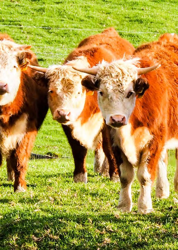
PLANS, FIGURE,                           Map 1  Context                    10
     TABLES and MAPS                          Map 2  Settlement and transport   58
                                              Map 3  Native Title settlement
     Plan 1   Strategy Plan
                                                     proposal                   59
              - Leeuwin-Naturaliste      21
                                              Map 4 Historic and
     Plan 2   Strategy Plan
                                                     Aboriginal heritage        60
              - Geographe Bay (detail)   22
                                              Map 5 Natural Environment         61
     Figure 1 Western Australian State        Map 6 Agriculture                 62
              Planning Framework         6    Map 7 Coastal Planning            63
                                              Map 8 Bushfire prone areas        64
     Table 1 Settlement hierarchy        16   Map 9 State Planning Policy 6.1   65
     Table 2 Investigation areas         17   Map 10 Basic raw materials        66
     Table 3 Investigation areas
             - key considerations        17

vi     Leeuwin-Naturaliste Sub-regional Strategy
Gio ay 2 - Department of ...
Executive summary
The Leeuwin-Naturaliste sub-region is well known locally and internationally for its unique
lifestyle, landscape values, environmental assets and overall amenity.

These attributes, together with the sub-region’s proximity to Bunbury and Perth, make it
a key tourist destination and attractive place in which to live or invest. The sub-region’s
attractiveness has resulted in significant change over the past two decades. Demand for
change in the area will continue and it is vital change is managed appropriately to maintain
and enhance the values that make it special.

The Leeuwin-Naturaliste Sub-regional Strategy is an overarching strategic land use planning
document outlining the Western Australian Planning Commission’s (WAPC) approach to future
planning and development within the City of Busselton and the Shire of Augusta-Margaret
River over the next 20 years.

The Strategy provides guidance to help the respective local governments implement State
strategic priorities, and inform local planning strategies and schemes so that robust planning
decisions are made.

It also provides background for the proposed review of State Planning Policy 6.1 Leeuwin-
Naturaliste Ridge, which covers the area west of Bussell Highway plus the full extent of the
townsites located on Bussell Highway.

In particular, the Strategy plans for population and visitor growth to be accommodated
through a combination of urban infill, already-planned greenfield development and potential
new expansion areas. A number of sites throughout the sub-region are identified as Planning
Investigation Areas, which will require further detailed investigation by the WAPC to determine
their suitability for a potential change of use.

                                       Leeuwin-Naturaliste Sub-regional Strategy                  vii
Gio ay 2 - Department of ...
Balancing the challenges of climate change, namely bushfire risk and changing coastal
       processes; conservation values, in particular retaining ecological corridors and linkages, and;
       the demands of a growing population and economy is a key challenge that the Strategy
       addresses.

       Long term plans considered by this Strategy need to acknowledge and be sufficiently flexible
       to accommodate fundamental elements that will change over time. These include technology,
       communities, visitor and investor views and expectations, the climate and sea level, the
       economy, and the demand for and availability of natural resources.

       With appropriate planning and implementation, and the consideration of cumulative impacts,
       the Leeuwin-Naturaliste sub-region will continue to be a unique and bio-diverse environment
       enjoyed by thriving and resilient local communities and appreciative visitors.

viii     Leeuwin-Naturaliste Sub-regional Strategy
Gio ay 2 - Department of ...
Introduction
The Leeuwin-Naturaliste Sub-regional Strategy            Strategic planning is the cornerstone of the
(the Strategy) has been prepared for the Leeuwin-        planning system. The Strategy is a part of the
Naturaliste sub-region, which comprises the land         Western Australian Planning Commission’s
and coastal waters within the City of Busselton          (WAPC) intention to ensure a strategic planning
and the Shire of Augusta-Margaret River.                 system that is legible, transparent, efficient and
                                                         delivers smart growth. The Strategy takes a
The sub-region is renowned for its unique lifestyle,     long-term view to planning for the sub-region.
landscape, environmental values and amenity.
These attributes are linked with a stable and            It provides guidance to assist local governments
diverse economic base and proximity to Bunbury           implement State strategic priorities, and to inform
and Perth, making the sub-region a key tourist           local planning strategies and schemes so that
destination and attractive place to live. The sub-       robust planning decisions are made.
region is now experiencing pressure to change
due to a number of factors.                              This Strategy comprises two parts:
The purpose of the Strategy is to manage this
                                                         Part A: Strategy
change by guiding growth and development
to achieve positive social, economic and                 Articulates the strategic directions and actions to
environmental outcomes.                                  achieve the vision for the sub-region.

                                                         Part B: Profile
                                                         Contains an overview of the study area’s
                                                         economy, environment and infrastructure to
                                                         provide a general context for Part A.

                          The sub-region has experienced strong and ongoing urban growth over the
                          past 20 years, and population forecasts indicate a continuation of that trend.
Planning Issues

                          The sub-region has valued natural landscapes that include recognised
                          biodiversity values. Bushfire hazard is a risk that is of particular relevance to
                          the sub-region. Changing coastal processes are expected to require active
                          management and adaptation planning of coastal hazard risk into the future.

                  $
                          The sub-region has a strong and diverse economy. Agriculture and tourism
                  $   $   are critical to the sub-region’s ongoing economic performance. The natural
                          and rural landscapes of the sub-region underpin its economy.

                          An efficient regional road network is critical to the economic and social
                          viability of the sub-region. The Busselton-Margaret River Airport is
                          regionally significant.

                                              Leeuwin-Naturaliste Sub-regional Strategy                        1
Gio ay 2 - Department of ...
1. Scope
    1.1 Strategy area                                      The primary purpose of this Strategy is to manage
                                                           and plan for growth in the sub-region and to
                                                           inform a review of State Planning Policy 6.1 -
    The Leeuwin-Naturaliste Sub-regional Strategy
                                                           Leeuwin-Naturaliste Ridge. Other purposes are:
    area is the extent of the City of Busselton and
    Shire of Augusta-Margaret River areas.                       •   integrate local and regional land use
                                                                     planning to provide for population and
                                                                     economic growth

    1.2 Purpose                                                  •   respond to environmental and coastal
                                                                     landform change and
                                                                 •   guide planning for the development of
    The Western Australian Planning Commission
                                                                     urban, industrial and rural land uses
    (WAPC) has identified a range of issues that are
                                                                     and associated infrastructure.
    widely experienced within the City of Busselton
    and Shire of Augusta-Margaret River. These             The Strategy provides a greater level of detail for
    include urban growth pressure, coastal erosion         actions previously outlined in the WAPC’s State
    and inundation, protection of biodiversity, tourism,   Planning Strategy and the South West Regional
    agriculture and landscape values, and bushfire         Planning and Infrastructure Framework. By doing
    planning.                                              so, it provides a clear line of sight between the
                                                           WAPC’s high order planning strategies and the
    The WAPC will assist the City of Busselton and
                                                           more detailed local planning strategies of the City
    Shire of Augusta-Margaret River to implement
                                                           of Busselton and Shire of Augusta-Margaret River.
    State strategic issues in a sub-regional context
    by guiding decision-making, and informing local        The Strategy forms a part of the WAPC’s State
    planning documents, including local planning           Planning Framework (Figure 1).
    strategies and local planning schemes.

2            Leeuwin-Naturaliste Sub-regional Strategy
1.3 Key planning issues                                    •      Potential loss of valued natural and
                                                                  rural landscapes, and remnant
                                                                  vegetation, including when viewed from
Key planning issues evident in the sub-region are:                prominent coastal landforms and inland
                                                                  tourist routes.
Settlement
                                                           •      Increasing competition and demand for
      •   The need to review the settlement                       coastal access for recreation, industry
          hierarchy prescribed in State Planning                  and tourist use.
          Policy 6.1 Leeuwin-Naturaliste Ridge
                                                           •      The need to address impacts on the
          (SPP6.1) with particular focus on the
                                                                  coastal and marine environment from
          growth and development of hamlets
                                                                  coastal processes and climate change
          and enclaves since 1998 with view to
                                                                  including rising sea levels.
          their future over the next 20 years and
          beyond.                                          •      The adverse impacts of increased
                                                                  human activity along the coast on the
      •   Population forecasting indicates
                                                                  marine environment.
          the trend towards an increasing
          population, and accordant demand for
                                                      Economy
          employment, infrastructure, services
          and housing.                                     •      The increasing demand of tourist and
                                                                  visitor numbers on the provision of
      •   The high cost of developing and
                                                                  infrastructure and services.
          maintaining infrastructure to support
          rural living subdivision.                        •      The need to protect the sub-region’s
                                                                  strong tradition of producing a diverse
      •   The adverse impacts of rural
                                                                  range of high quality agricultural and
          living subdivision on agricultural,
                                                                  food products.
          environmental and landscape values.
      •   The need to provide for housing             Transport
          diversity, including affordable housing.         •      An efficient regional road network is
      •   The influence of ‘holiday homes’                        critical to the economic and social
          on local community cohesion and                         viability of the sub-region.
          development.                                     •      The expansion of the regionally
      •   The need to retain each settlement’s                    significant Busselton-Margaret
          distinct sense of place, community and                  River Airport will provide significant
          lifestyle.                                              opportunities for the sub-region.

Environment
      •   Balancing growth with the protection of
          areas with high biodiversity significance
          and other recognised natural assets.
      •   The heightened risk of bushfire
          hazard due to climate change and
          the outcomes of the publication of
          State Planning Policy 3.7 Planning in
          Bushfire Prone Areas (SPP3.7) and its
          guidelines.

                                             Leeuwin-Naturaliste Sub-regional Strategy                      3
1.4 Methodology                                    Submissions related to various topics and specific
                                                       sites across a range of locations about issues
                                                       including:
    The Strategy was prepared by the Department
                                                             •   development implications of proposed
    of Planning, Lands and Heritage on behalf of the
                                                                 differences to the draft Strategy’s
    WAPC. A steering group was established to guide
                                                                 settlement hierarchy and the settlement
    the preparation of the Strategy and included
                                                                 hierarchy set out in SPP6.1;
    representation from:
                                                             •   restricting further rural living lots
          •    Western Australian Planning
                                                                 beyond those already identified in local
               Commission (WAPC)
                                                                 planning strategies and schemes;
          •    Department of Planning, Lands
                                                             •   tourism development and urban
               and Heritage
                                                                 settlement opportunities relating to the
          •    South West Development Commission                 sub-region’s unique attractions such as
          •    City of Busselton                                 rural landscapes, wilderness areas and
                                                                 agri-business;
          •    Shire of Augusta-Margaret River
                                                             •   the loss of biodiversity and broad
          •    An independent planning professional
                                                                 environmental impacts due to urban
    The Steering Group met on seven occasions                    expansion and damaging recreational
    in Busselton and Margaret River, and was also                activities;
    informed by relevant experts from:                       •   approaches to improving housing
          •    Department of Planning, Lands and                 affordability; and
               Heritage                                      •   Aboriginal heritage, native title and
          •    Department of Transport – Marine                  historic heritage.

          •    Main Roads WA                           Infrastructure projects identified within the
          •    Tourism WA                              Strategy are based on indicative information from
                                                       State government agencies and are subject to
          •    The Office of the Environmental
                                                       change. Unless otherwise stated, they should not
               Protection Authority
                                                       be taken as a funded Government commitment,
          •    South West Development Commission       and are subject to Treasury budget processes.
          •    City of Busselton
          •    Shire of Augusta-Margaret River

    The draft Strategy was advertised from
    September to December 2017. In response, 63
    submissions were received concerning a range of
    matters identified in that draft.

4             Leeuwin-Naturaliste Sub-regional Strategy
1.5 Principles                                             •   balance the development pressures
                                                               of the sub-region in a manner that
                                                               will retain and enhance landscape
Guiding principles for the Strategy are:                       character, remnant vegetation and
      •    promote growth in accordance with                   manage coastal access and the
           sustainable development principles;                 increasing pressure on key coastal
                                                               sites;
      •    acknowledge the cumulative impacts
           of development within rural and                 •   promote existing and new industries
           landscape areas on the environment,                 and the efficient use of land and
           agricultural productivity, tourism                  infrastructure;
           attractions and other employment                •   facilitate improved transport and
           generators, and ensure planning                     infrastructure for the sub-region; and
           decision makers take this into account
                                                           •   manage the opportunities that will
           when considering future development;
                                                               retain and enhance the sub-region’s
      •    focus development in the larger                     unique landscape, environment
           settlements in a manner that will                   and important agricultural and food
           support existing facilities, services and           production areas.
           infrastructure and minimise low-density
           urban sprawl and environmental
           impacts of new development;

                                              Leeuwin-Naturaliste Sub-regional Strategy                 5
2. Governance                                              The Leeuwin Naturaliste Sub-regional Strategy
                                                               provides strategic direction based on the

       and context                                             fundamentals prescribed in relevant State
                                                               planning policies.

                                                               The following State planning policies have
    2.1 Planning                                               particular relevance to the sub-region:

    The context for this Strategy within the State             State Planning Policy 1 State Planning
    Planning Framework is shown in Figure 1. The               Framework (SPP1) intends for sub-regional
    Strategy is intended to be more detailed than              strategies to guide change and to establish a
    the regional strategies, such as the South West            basis for cooperative action to be taken by State
    Regional Planning and Infrastructure Framework,            and local governments on land use change.
    and provides guidance on matters that form part
                                                               State Planning Policy 2 Environment and
    of a local planning strategy.
                                                               Natural Resources (SPP2) seeks to integrate
                                                               environment and natural resource management
    2.1.1        State planning policies                       with land use planning, protect, conserve and
                                                               enhance the natural environment and promote
    State planning policies provide the highest level of       and assist in the wise and sustainable use and
    planning policy control and guidance in Western            management of natural resources.
    Australia. They are prepared by the Western
    Australian Planning Commission (WAPC) under                State Planning Policy 2.5 Rural Planning
    Part 3 of the Planning and Development Act                 (SPP2.5) provides the basis for planning and
    2005, and are applied at all levels of planning            decision-making for rural and rural living land in
    decision-making including strategic planning, local        Western Australia, and for basic raw materials
    planning strategies and schemes, structure plans,          outside of the Perth and Peel regions.
    subdivision, and development.

           LEVEL               STRATEGIC           STRUCTURE             STATUTORY                   POLICY
                                                     PLANS

                              State                                     State
           STATE              Planning                                  Planning Policy
                              Strategy                                                            Strategic and
                                                                                                  Operational
                                                                                                  Policies
                              Regional
           REGIONAL           Framework/                                Region
                              Strategy                                  Mechanisms
                                                  Sub-regional
                                                  and District          Including
                                                                        - Region Scheme
                                                  Structure Plans
                                                                        - Planning Control Area
                              Sub-regional                              - Improvement Plan
           SUB-REGIONAL       Strategy

                              Local               Local                 Local Planning            Local
           LOCAL              Planning            Structure Plan(s)     Scheme                    Planning Policy
                              Strategy

           Figure 1: Western Australian Planning Framework

6            Leeuwin-Naturaliste Sub-regional Strategy
State Planning Policy 2.6 State Coastal Policy         State Planning Policy 6.1 Leeuwin-Naturaliste
(SPP2.6) provides guidance for land use and            Ridge (SPP6.1) sets out the principles and
development decision-making within the coastal         considerations for land use and development
zone, including requiring that coastal hazard risk     decision-making on the Leeuwin-Naturaliste
management and adaptation is appropriately             Ridge. The policy was published in 1998 and
planned for.                                           amended in 2003 to include statements regarding
                                                       development at Smiths Beach. SPP6.1 has
State Planning Policy 2.7 Public Drinking              provided a strategic and statutory planning
Water Source (SPP2.7) seeks to protect and             framework for Cape Naturaliste to Cape Leeuwin
manage public drinking water sources from              and the land west of Bussell Highway, including
incompatible land uses and pollution in order to       the settlements on Bussell Highway.
maintain the quality of the drinking water.

State Planning Policy 2.9 Water Resources              2.1.2       Regional planning and
(SPP2.9) seeks to protect, conserve and enhance                    infrastructure frameworks
water resources, ensure that suitable water
resources are maintained to meet requirements          Planning and infrastructure frameworks have been
for human and all other biological life; and achieve   prepared for each of Western Australia’s non-
sustainable use and management of water                Perth and Peel planning regions.
resources.
                                                       The frameworks provide guidance to government
State Planning Policy 3 Urban Growth and               agencies and local governments on land use,
Settlement (SPP3) sets out the principles and          land supply, land development, environmental
considerations which apply to planning for urban       protection, infrastructure and for the delivery
growth and settlements in                              of physical and social infrastructure for each
Western Australia.                                     region. They also provide the framework for the
                                                       preparation of sub-regional and local planning
State Planning Policy 3.5 Historic Heritage            strategies and inform decisions made by the
Conservation (SPP3.5) sets out the principles          WAPC.
of sound and responsible planning for the
conservation and protection of Western Australia’s     The South West Regional Planning and
historic heritage.                                     Infrastructure Framework (2015) provides the
                                                       regional strategic context to planning for the
State Planning Policy 3.7 Planning in Bushfire         Strategy area. The Framework outlines the
Prone Areas (SPP3.7) seeks to guide the                WAPC’s position on planning for population
implementation of effective risk-based land use        growth, transport, agriculture, community
planning and development to preserve life and          infrastructure, climate change and major
reduce the impact of bushfire on property and          infrastructure requirements for the South West
infrastructure.                                        region for a 20 year timeframe.

                                                       The Leeuwin-Naturaliste sub-region is one of
                                                       three sub-regions in the South West, along with
                                                       the Bunbury-Wellington and Warren-Blackwood
                                                       sub-regions. The Framework provides significant
                                                       direction for this Strategy.

                                              Leeuwin-Naturaliste Sub-regional Strategy                   7
2.1.3        Local planning strategies               2.2 Regional
                 and schemes
                                                             development
    The City of Busselton and the Shire of Augusta-
    Margaret River each have a local planning
                                                             and context
    scheme that governs land use and development
                                                         The Leeuwin-Naturaliste sub-region is one of the
    in their respective local government areas.
                                                         three planning sub-regions in the South West
    The Shire of Augusta-Margaret River Local            Region. The sub-region has a diverse economy
    Planning Strategy was endorsed by the WAPC           that contributes significantly to the South West
    in 2011, and sets out the long term planning         Region’s strong economic growth.
    direction for the Shire. The Shire is currently in
                                                         The vision for the South West Region, as set
    the early stages of updating the Local Planning
                                                         out in the South West Regional Planning and
    Strategy.
                                                         Infrastructure Framework (2015) is for a region:
    The City of Busselton published a draft Local           ‘that generates high standards of social
    Planning Strategy for public consultation in            amenity, diverse economic activities and
    March 2016 and subsequently sought WAPC                 high quality food, supported by effective
    endorsement. Further consideration of the Local         and efficient infrastructure and at the same
    Planning Strategy, by the WAPC, is delayed              time preserving and enhancing the natural
    pending the finalisation of this sub-regional           environment.’ (p.6).
    strategy.
                                                         The sub-region has very strong economic and
    An overview of current local planning strategies     social connections with the Perth metropolitan,
    and schemes is provided in Appendix 1.               Peel and Greater Bunbury regions (Map 1). The
                                                         opening of the Forrest Highway in 2009 reduced
    This Strategy is intended to provide direction       the time and demands of travel between Perth
    and support to local governments to deal with        and the sub-region, creating both opportunities
    issues of State and regional significance. The       and challenges to the Leeuwin-Naturaliste
    local schemes and strategies may need review         communities. Federal and State Government
    to ensure consistency                                                         funding for the Bunbury
    with the direction of this                                                    Outer Ring Road was
    Strategy.                                                                     announced in May 2018
                                                                                  and its construction will
                                                                                  further reduce travel time
                                                                                  between the sub-region
                                                                                  and Perth, possibly
                                                                                  amplifying the need to
                                                                                  address the key planning
                                                                                  issues outlined in this
                                                                                  Strategy.

8            Leeuwin-Naturaliste Sub-regional Strategy
2.2.1        South West Regional
             Blueprint
The South West Regional Blueprint (2015)
outlines a guide for future development of the
South West Region to 2050. The Blueprint
takes an aspirational view on how the South
West Region can grow, create new jobs, build
prosperity and provide the kind of lifestyle that is
important to living in the region. The Blueprint was
jointly produced by the South West Development
Commission and Regional Development Australia
South West.

                                              Leeuwin-Naturaliste Sub-regional Strategy   9
Leeuwin-Naturaliste Sub-regional Strategy
                                                                                       River

                                                                                                                                                                                         N

                                                              n
                    Kalbarri

                                                          is o
                               !

                                                       rch
                               #                                                                                                                                      0        25        50        75          100

                                                     Mu
                                 o
                                                                                                                                                                                     kilometres

                                                                                                                                                                      Produced by Data Analytics,
                                                                                                          River
                                                                                                                                                                      Department of Planning, Lands and Heritage,
                                                                                                                                                                      on behalf of the Western Australian Planning
                                           tt R
                                         Hu iver                                                                                                                      Commission
                                                     Northampton                                     MID WEST                                                         Copyright © May 2019

                                               !
                                               #

                                                                                h
                                                                              ug
                                                                            no
                                                                                                                                                                      \\Nts-bun\cartog\Projects\SouthWest\

                                                                          ee
                                 Oakajee

                                                                       Gr
                                                                                                                                                                      Leeuwin_Naturaliste\Map01_ContextLN.mxd

                                         nk
                                         |                                                                                                                            Base information supplied by

                                         |$
                                         n
                                 Geraldton!        o                                  Riv
                                                                                         e   r
                                                                                                                                                                      Western Australian Land Information Authority
                                                                                                                                                                      SLIP 1096-2018-1

                                                                                                                                                                      DBCA Managed Lands and Waters supplied by
                                                                                              r                                                                       Department of Biodiversity, Conservation and
                                                                                            ve
                                                                                          Ri                                                                          Attractions
                                                                          in         kier
                                                                       Irw     Loc

                                               Dongara
                                                           !
                                                           #                                                                                                          Gas pipeline data supplied by Department of Mines,
                                                                                                                                                                      Industry Regulation and Safety

                                                                                                                                                                      Native title data supplied by National
                                                                                                                                                                      Native Title Tribunal

                                                                                                                                                                      * Settlement hierarchy outside of the Strategy area is
                                                                                                                                                                        indicative only.
                                                                                                                                                                        See Strategy Plan for settlement hierarchy.
                                                                                                                                                                        Limited centres shown within the Strategy Area, for
                                                                                                                                                                        illustrative purposes.

                                                                  #
                                                                  !
                                                                  o

                                                   Jurien Bay

     Legend                                                                                      Moora
                                                                                                          #
                                                                                                          !
                 Existing/proposed strategic                                                      River
       k         industrial estate                                                   Mo
                                                                                       ore

                 Dampier to Bunbury natural
                 gas pipeline                                                                                                                        WHEATBELT
                                                                  Guilderton

                                                                                                                                                                            #
                                                                                                                                                                            !

                                                                                                                                                                              o
                 Major river
                                                                                                                             Northam
                 Agriculture land of State                                                                k            #k
                                                                                                                       !
                                                                                                                                                                                    Merredin

                 and regional significance               Indian
                                                                                                                         o

                 Village

                                                                                        n
                                                                                        |
                                                                                                     o

                 Geraldton Alternative

                                                                                        |k
                                                                                        n
                                                                      PERTH                                                          Avon
                 Native Title Settlement
                 South West Native Title
                                                                                                                                                    Riv
                 Settlement                              Ocean                                                                                         er

     Settlement hierarchy *

      $
      !          Regional city
                                                                       PEEL

                                                                                                                                       #
                                                                                                                                       !
                                                                                                                                            Narrogin
                                                                                                                                    o

                                                                                                                                                r
                                                                                                                                            Rive
      $
      !          Regional centre
                                                                      Bunbury                    k                k
       #
       !         Sub-regional centre

                                                              Busselton
                                                                                |$
                                                                                n!                    Collie
                                                                                                              #
                                                                                                              !
                                                                                                                         Arth ur

     Transport
                                          Cape Naturaliste
                 International airport                                   $
                                                                         !                                                                          #
                                                                                                                                                    !
                                                                               o

                                                                                                                                                            Katanning
      o o

                                                                                                              SOUTH WEST
                                                                                                                                      #
                                                                                                                                      !     Kojonup
                                                                                                                                                                            GREAT
                 Regional airport
                                            Margaret River
                                                                   #
                                                                   !                                                                                           Pal
                                                                                                                                                                     linu SOUTHERN
                                                                                                                                                                         p

       n
       |
                                                                                                                  Manjimup
                 Regional port
                                                                                                             #
                                                                                                             !                                                                  Riv
                                                                                                                                                                                   er

       |
       n         Regional port (proposed)           Cape Leeuwin
                                                                                                                                                              Mt Barker

                                                                                                                                                    k!
                                                                                                                                                     #
                 Strategic road corridor

                 Both passenger and freight
                 railway
                                                                                                                                            # k$
                                                                                                                                            !  !
                                                                                                                                                            o

                 Current freight railway              DBCA Managed Lands and Waters                                                Denmark
     Administrative boundaries                                      National park/Reserve                                                      |
                                                                                                                                               n                      Albany

                 Planning region boundary                           Marine conservation reserve                                    Southern                   Ocean

 Context
  Map 1: Context                                                                                                                                                                                                 Map 1

10               Leeuwin-Naturaliste Sub-regional Strategy
Part A: Strategy
3. Vision                                   4.          WAPC strategic
                                                         directions
 The vision for the Leeuwin-Naturaliste
 sub-region is:
                                             To support implementation of the State Planning
                                             Framework, including the State planning policies
 The Leeuwin-Naturaliste
                                             outlined in section 2, the Western Australian
 sub-region to continue to                   Planning Commission (WAPC) will undertake the
 develop and be managed in                   strategic directions listed below, in its decision-
 a manner consistent with the                making for the sub-region.

 character, amenity and value of             Where possible, the strategic directions are
 the natural and built environments,         spatially represented on the strategy plan. Bolded
 and the efficient use and equitable         text denotes where a strategic direction is directly
                                             referenced on the strategy plan.
 distribution of resources.
                                             Settlement
                                                     1. Adopt the settlement hierarchy as
                                                        defined in Section 6.
                                                     2. Promote the growth of Busselton
                                                        townsite through consolidation of
                                                        existing urban areas and urban
                                                        expansion in the land bounded by
                                                        Bussell Highway/Busselton Bypass,
                                                        Queen Elizabeth Avenue and the
                                                        proposed Busselton Outer Bypass.
                                                     3. Designate the Abbey Planning
                                                        Investigation Area over land to the
                                                        south west of the intersection of Caves
                                                        Road and Bussell Highway for detailed
                                                        investigation by the WAPC on the
                                                        suitability of this land for potential uses
                                                        including tourism, aged care, mixed
                                                        use and/or medium density residential.
                                                        The Abbey Planning Investigation
                                                        Area comprises of the following land
                                                        parcels: Lot 12 on Diagram 43998, Lot
                                                        4 on Diagram 46285, Lot 402 on Plan
                                                        252489, Lot 14 on Diagram 96590 and
                                                        Lot 15 on Diagram 96590.

12       Leeuwin-Naturaliste Sub-regional Strategy
4. The possible growth of Dunsborough               10. Designate the Margaret River
   requires detailed analysis of its                    Planning Investigation Area over
   economy, society and environment                     land to the south of Margaret River for
   to inform consideration of any future                detailed investigation by the WAPC on
   strategic directions, and that this                  the suitability of this land for a potential
   analysis is to take the form of a                    change of use.
   Dunsborough Townsite Strategy.
                                                    11. Adopt a presumption against the
5. Designate the Dunsborough Planning                   creation of new urban and rural living
   Investigation Area over land to the                  areas beyond those identified in
   south-east of Dunsborough for detailed               existing local planning strategies or
   investigation by the WAPC on the                     local planning schemes.
   suitability of this land for a potential
                                                    12. Support the character and identity
   change of use.
                                                        of Busselton and Dunsborough
6. The possible growth of Vasse requires                by protecting the natural and rural
   detailed analysis of its economy,                    landscapes between them.
   society and environment to inform
   consideration of any future strategic       Environment
   directions, and that this analysis is            13. Adopt a presumption against planning
   to take the form of a Vasse Townsite                 proposals within areas identified to be
   Strategy.                                            affected by coastal hazards.
7. Designate the Vasse North Planning               14. Adopt a presumption against planning
   Investigation Area over land to the                  proposals that may impact on
   north of Vasse for detailed investigation            matters of national or international
   by the WAPC on the suitability of this               environmental significance that require
   land for a potential change of use. The              referral under the Environmental
   Vasse North Planning Investigation                   Protection and Biodiversity Act.
   Area comprises of the following land
                                                    15. Balance bushfire risk, biodiversity
   parcels: Lot S19 and Lot S20 on Plan
                                                        conservation and economic growth.
   230941, Lot 9001 on Plan 69783 and
   Lot 9010 on Plan 409834.                         16. Protect landscapes that are of
                                                        high value and are viewed from the
8. Designate the Vasse South Planning
                                                        coastline, coastal bays, tourist routes
   Investigation Area over land to the
                                                        and tourism activity sites.
   south of Vasse for detailed investigation
   by the WAPC on the suitability of this           17. Support identification in planning
   land for a potential change of use.                  instruments of regional ecological
                                                        corridors for biodiversity and wildlife, to
9. Promote the growth of the Margaret
                                                        connect environmental assets.
   River townsite through consolidation
   of existing urban areas and urban                18. Identify and retain habitat and enhance
   expansion consistent with the East                   ecological linkages within Busselton
   Margaret River District Structure Plan               and Dunsborough urban areas to
   (2017), generally in the area bounded                support critically endangered species,
   by the Margaret River, Bussell Highway               including the Western Ringtail Possum.
   and the Margaret River Perimeter
   Road.

                                      Leeuwin-Naturaliste Sub-regional Strategy                        13
Economy                                                   23. Support the intent and alignment of the
                                                               Busselton Outer Bypass, as shown
      19. Designate the Bunker Bay Tourism
                                                               on the Strategy Plan.
          Investigation Area over land abutting
          the eastern and southern boundaries of           24. Support the intent and alignment of the
          the existing Pullman Bunker Bay Resort               Vasse-Dunsborough Link, as shown
          for potential tourism use, subject to                on the Strategy Plan.
          detailed investigation to be led by the
                                                           25. Support the intent and alignment of the
          proponent/s on the suitability of the
                                                               Biddle Road extension and upgrade,
          land for such a use. The Bunker Bay
                                                               as shown on the Strategy Plan.
          Tourism Investigation Area comprises
          of the following land parcels: Lot 50 on         26. Support the upgrade of Bussell
          Plan 29164 and Lot 203 on Plan 28563                 Highway from Capel to Busselton.

      20. Balance the protection of high value             27. Support the intent and alignment of the
          rural landscapes with the need for                   Margaret River Perimeter Road, as
          agricultural land uses to adapt and                  shown on the Strategy Plan.
          evolve.
                                                     Utilities and infrastructure
 Transport                                                 28. Support and encourage fit for purpose
      21. Recognise Caves Road as a tourist                    technology to deliver innovative waste
          route and support the retention of its               management and other local services.
          visual landscape and environmental
          values.
      22. Support planning for land uses in the
          Busselton-Margaret River Airport
          Precinct that are compatible and
          complementary to the Airport and
          surrounding land uses.

14      Leeuwin-Naturaliste Sub-regional Strategy
5.        WAPC actions                                6. Settlement
                                                         hierarchy
To support implementation of the State Planning
Framework, including the State planning policies      The Strategy’s Settlement Hierarchy (Table
outlined in section 2, the Western Australian         1) varies from that set out in the South West
Planning Commission (WAPC) will undertake the         Regional Planning and Infrastructure Framework
actions listed below in its decision-making for the   and the State Planning Policy 6.1 Leeuwin-
sub-region.                                           Naturaliste Ridge. Several of the hierarchy tiers
                                                      have been changed to more appropriately reflect
      1. Review State Planning Policy 6.1
                                                      the current role of the settlements within each tier,
         Leeuwin-Naturaliste Ridge (SPP6.1).
                                                      and a number of settlements have changed tiers
      2. Undertake a strategic Bushfire Hazard        within the hierarchy.
         Level assessment for the sub-region as
         part of the review of SPP 6.1.               In addition, this Strategy does not recognize
                                                      Carbunup and Metricup as settlements, a
      3. Undertake a study of the supply and
                                                      departure from the settlement hierarchy in
         demand of basic raw materials within
                                                      State Planning Policy 6.1 Leeuwin-Naturaliste
         the sub-region and the opportunities
                                                      Ridge. The context and background for this
         for alternative building construction
                                                      determination is in Part B of the Strategy.
         techniques to reduce demand from the
         building and construction industries.
      4. Work collaboratively with the City
         of Busselton to prepare townsite
         strategies for Dunsborough and Vasse,
         for consideration by the WAPC.
      5. Undertake detailed planning
         investigations to explore the suitability
         of the following areas for a possible
         change of use:
          –– Dunsborough Planning Investigation
             Area
          –– Margaret River Planning Investigation
             Area
          –– Vasse North Planning Investigation
             Area
          –– Vasse South Planning Investigation
             Area
          –– Abbey Planning Investigation Area
      6. Assist local governments to implement
         options for planned or managed
         coastal retreat, where identified
         as appropriate under a relevant
         coastal hazard risk management and
         adaptation planning (CHRMAP).

                                             Leeuwin-Naturaliste Sub-regional Strategy                    15
Table 1: Settlement hierarchy

     Tier             Settlement       Description

     Regional         Busselton        Regional centres typically offer a diverse range of high-order services
     centre                            and functions, but to a lesser degree than a Regional city. They are also
                                       distinguished from regional cities as they generally service a smaller
                                       population.
                                       Regional centres are significant centres of economic activity,
                                       employment and population and form important hubs for regional
                                       industry, commerce and civic administration functions, including
                                       government offices and services. They generally provide comparative
                                       retail as well as higher-order education, recreation and health services.

     Sub-regional     Margaret River   Sub-regional centres support the population and economic activities
     centre                            within their surrounding hinterlands through the provision of goods and
                                       services.
                                       The catchment areas of sub-regional centres usually extend beyond the
                                       immediate centre to include surrounding centres and districts and as
                                       such their services are utilised by a broader population.
                                       Sub-regional centres often provide local government administrative
                                       functions and a range of social infrastructure and services, including
                                       local recreation, health services and secondary education.

     Major Town       Dunsborough

     Town             Augusta
                      Cowaramup
                      Vasse            Settlements within these three tiers offer a level of service that generally
                                       deals with the daily needs of their service population. Three separate
     Village          Witchcliffe      tiers allows for distinction to be made where particular settlements
                      Karridale        service a larger population catchment and/or offer a greater number
                      Kudardup         of services relative to others. How settlements are assigned to the
                      Prevelly/        respective tiers is considered within the context of that particular region.
                      Gnarabup
                      Yallingup
                      Gracetown
                      Eagle Bay

     Tourist Node     Hamelin Bay      Tourism nodes contain a negligible population base and as such the
                      Bunker Bay       functions they provide cater exclusively for the needs of tourists; and
                      Smiths Beach     like tourism centres they experience significant seasonal population
                                       fluctuations.
                                       Tourism nodes primarily accommodate overnight visitors and generally
                                       contain the necessary infrastructure to facilitate this function. They
                                       can also offer some basic retail facilities that are secondary to the core
                                       function of accommodation

16             Leeuwin-Naturaliste Sub-regional Strategy
7.         Investigation
                                                           In addition to the above universal key
                                                           considerations, specific key considerations for the

           areas
                                                           designated investigation areas are at Table 3.

                                                           Table 3: Investigation areas
The Strategy (section 4 Strategic Directions)              - key considerations
designates some areas of land that require
further investigation as part of the strategic              Site           Key considerations
reconsideration of land use in the sub-region.                          Provision of land for employment
These are defined in Table 2.                                           generating activities
                                                                        Land assembly (possible diversity
                                                            Dunsborough
Table 2: Investigation areas                                            of owners)
                                                                        Planning Investigation Area extent
Type            Description                                             definition
Planning        Land that will be subject to further                       Provision of land for employment
Investigation   planning investigation/s to consider                       generating activities
Area            its suitability, and the area of land                      Agricultural use protection
                to be identified, for a possible            Margaret
                                                            River          Land assembly (possible diversity
                change of use.
                                                                           of owners)
Tourism         Land that may be suitable for                              Planning Investigation Area extent
Investigation   tourism development but requires                           definition
Area            further investigation to determine                         Agricultural use protection
                its suitability and/or refine its area.                    Flood risk
                                                                           Basic raw materials demand (land
                                                                           fill to raise ground level)
These investigations will determine whether it is           Vasse South
                                                                           Land assembly (possible diversity
possible and/or appropriate to rezone the land.                            of owners)
The investigations are required to be undertaken                           Planning Investigation Area extent
prior to any related local planning scheme                                 definition
amendment process.
                                                                           Biodiversity values (wetlands on
                                                                           Lots S19 and S20)
The designation of an Investigation Area should
                                                                           Regional road access (Bussell
not be construed as WAPC support for a change                              Highway and Busselton Bypass)
from the existing zoning, as this will depend on            Vasse North    Flood risk
the outcome of further investigations.                                     Basic raw materials demand (land
                                                                           fill to raise ground level)
Universal key considerations for all investigation                         Visual landscape separation
area sites include:                                                        between Vasse and Busselton
       •   Biodiversity value protection                                   Biodiversity values (adjacent
                                                                           wetlands to south)
       •   Bushfire risk
                                                                           Provision of land for employment
       •   Drainage                                         Abbey          generating activities
       •   Landscape value protection                                      Transition/interface with adjacent
                                                                           tourist uses (caravan park to west,
       •   Protection of significant environmental                         boutique uses to east)
           values                                                          Coastal hazard risk management
       •   Utility services capacity                                       and adaptation
                                                            Bunker Bay     Public access to beach
       •   Water source impact (groundwater and
                                                                           Transition/interface with Pullman
           surface water)                                                  Bunker Bay Resort

                                                   Leeuwin-Naturaliste Sub-regional Strategy                     17
8.         Townsite
                                                                  –– development potential and
                                                                     constraints of land adjacent to

            strategies
                                                                     Butterworth Springs Avenue and
                                                                     Gibson Drive, Dunsborough (the
                                                                     residential area informally known
                                                                     as ‘Cape Rise’, west of Cape
 8.1 Dunsborough                                                     Naturaliste Road)

     townsite strategy                                        3. Plan for:
                                                                  –– economically, socially and
 Strategic direction 4 requires the preparation of a                 environmentally sustainable urban
 Dunsborough Townsite Strategy.                                      growth
                                                                  –– improving the town centre, including
 The Dunsborough Townsite Strategy is to set out
                                                                     pedestrian and vehicle permeability
 a vision for the future of Dunsborough. That vision
 is to be supported by consideration of relevant                  –– increasing residential densities in
 social, economic and environmental matters.                         existing areas
                                                                  –– improving traffic movement and road
 The Dunsborough Townsite Strategy should                            network efficiency
 include consideration to:
                                                                  –– land requirements to support
       1. Forecast:                                                  economic activities
            –– economic activity                                  –– coastal hazard risk management and
            –– employment patterns                                   adaptation
            –– tourism activity patterns, including
                                                        The Dunsborough Townsite Strategy may also
               visitation volumes and peaks
                                                        include associated supporting plans, such as a
            –– demographic and population               town centre Activity Plan. This may be useful in
               patterns                                 consideration of the growth and development of
       2. Analyse:                                      the Dunsborough town centre.
            –– bushfire hazard
                                                        Strategic direction 5 designates the Dunsborough
            –– flood risk                               Planning Investigation Area over land to the
            –– stormwater management                    south-east of Dunsborough. Consideration of the
            –– drinking water quality                   merits or otherwise of expanding Dunsborough
                                                        to the south-east is to inform the Dunsborough
            –– landscape protection
                                                        Townsite Strategy. Investigation of the
            –– basic raw materials demand
                                                        Dunsborough PIA will be undertaken concurrently
            –– residential demand                       with the preparation of the Dunsborough Townsite
            –– education facilities demand              Strategy ensuring that both bodies of work
            –– open space and recreational facilities   inform each other and the townsite strategy is
               demand                                   considered by the Department of Planning, Lands
                                                        and Heritage/WAPC prior to key stages and
            –– development potential and
                                                        finalisation of the PIA investigation.
               constraints of land on east of
               Ridgeway Drive, Dunsborough

18        Leeuwin-Naturaliste Sub-regional Strategy
8.2 Vasse townsite                                               –– education facilities demand
                                                                 –– open space and recreational facilities
    strategy                                                        demand
                                                                 –– residential demand
Strategic direction 6 requires the preparation of a
                                                                 –– aged care facility demand
Vasse Townsite Strategy.
                                                                 –– road network improvements
The Vasse Townsite Strategy is to set out a                  3. Plan for:
vision for the future of Vasse. That vision is to be
                                                                 –– economically, socially and
supported by consideration of relevant social,
                                                                    environmentally sustainable urban
economic and environmental matters.
                                                                    growth
The Vasse Townsite Strategy should include                       –– land requirements to support
consideration to:                                                   economic activities
       1. Forecast:                                              –– land requirements to support
           –– economic activity                                     regional activities

           –– employment patterns                                –– improving traffic movement and road
                                                                    network efficiency
           –– demographic and population
              patterns                                 Strategic directions 7 and 8 designate the
       2. Analyse:                                     Planning Investigation Areas over land to the
                                                       south and north of Vasse. Consideration of
           –– bushfire hazard
                                                       the merits or otherwise of expanding Vasse
           –– flood risk                               to the south and north is to inform the Vasse
           –– stormwater management                    Townsite Strategy. Investigation of the Vasse
                                                       North and Vasse South PIAs will be undertaken
           –– drinking water quality
                                                       concurrently with the preparation of the Vasse
           –– landscape protection                     Townsite Strategy ensuring that both bodies of
           –– basic raw materials demand               work inform each other and the townsite strategy
                                                                                is considered by the
                                                                                Department of Planning,
                                                                                Lands and Heritage/
                                                                                WAPC prior to key
                                                                                stages and finalisation of
                                                                                the PIA investigations.

                                               Leeuwin-Naturaliste Sub-regional Strategy                 19
9.              Strategy plan
 The strategy plan is a spatial representation of the
 Western Australian Planning Commission (WAPC)
 strategic directions and actions; however, not all
 are able to be represented in this manner.

 Background and contextual spatial information is
 in the Strategy’s Part B: Profile.

 The land use designations are defined in Table 4.

 Table 4: Strategy plan designations

     Designation              Colour        General description

                                            Land that is:
                                            within the extent of an established townsite that is used for a range
                                            of uses typically undertaken within a town, including: residential,
                                            industrial, commercial, tourism, public and private institutions, and
     Urban                    Tawny
                                            public purposes use including recreation, open space, utilities,
                                            emergency services, and cemeteries; and
                                            adjoining land already zoned in a local planning scheme for ‘Future
                                            Development’ or similar and/or that has structure planning in place.
                                            Land that is:
     Industry                 Purple        zoned ‘Industry’ or similar in a local planning scheme; and
                                            not within an ‘urban’ area as defined above.
                                            Land that is zoned ‘Rural Living’ (includes all zone types sitting
     Rural Living             Brown
                                            under the Rural Living umbrella)
                                            Land that is:
                                            used for agriculture; and/or
     Rural and Landscape
                              Light green   identified for landscape protection; and/or
     Protection
                                            remote from established townsites and used for other purposes,
                                            such as tourism and public purposes.

     Conservation             Dark green    All State forests and National parks.

                                            The extent of land defined as a ‘Tourism Node’ in the settlement
     Tourism                  Dark blue
                                            hierarchy.
     Busselton-Margaret                     The extent of land defined as the Busselton-Margaret River Airport
                              Yellow
     River Airport Precinct                 Precinct by this Strategy.
                                            The Ngari Capes Marine Park is gazetted as a Class A Marine Park.
                                            Its approximate extent is shown on the Strategy plan, broadly being
     Ngari Capes Marine                     the seaward boundary of the marine park and is congruent with the
                              Light blue
     Park                                   seaward limit of Western Australian waters (three nautical miles from
                                            the territorial baseline). The park is the subject of the Ngari Capes
                                            Marine Park Management Plan 74 (2013-2023).

20              Leeuwin-Naturaliste Sub-regional Strategy
Leeuwin-Naturaliste Sub-regional Strategy

                                                                                                                                                                                                                                          N
                                                                                     Indian                                                                                                                      0                5       10            15      20
                                                                                                                                          Ocean
                                                                                                                                                                                                                                       kilometres
    Cape Naturaliste                                                                                                            Further detail shown on Geographe Bay (detail)
                                 Bunker Bay
                            !                                                                                                                                                                                            Capel
                               _
                               ^                !
                                                !
                                                  Eagle Bay
                                                                                                                                                                                                                                      Shire of
                                                                                                                                                                                                                                       Capel
                                                                                                       Geographe                      Bay

                                                                                                                                                                                                    I VE
                                                                                                                                                                                                  DR
                                                                                                                                                                                              T
                                                                                                                                                                                            AR

                                                                                                                                                                                                            AY
                                                                                                                                                                                          TU                HW
                                                                  ! Dunsborough
                                                                  P                                                                                                                                  H IG
                                                                                 CA V
           Yallingup                                                                    ES                                                                                                   L
                                                                    _
                                                                    ^                                                                 Busselton                                            EL
                           !
                                                                                                                                                       $
                                                                                                                                                       !                                 SS
                           !
                                                                                                                 R OA                                                               BU
                                                                                                                        D
Smiths Beach                               BIDDLE ROAD                                                                        _
                                                                                                                              ^
                       !
                                                                                                                             _
                                                                                                                             ^          BUSSEL
                                                                                                                                                 TON     BY
                                                                                                                                                            PAS
                                                                                                                                                               S
                                                                                                                                                                                     BUSSELTON-MARGARET RIVER

                                                                                                                                                                         o
                                                                              VASSE                                          R
                                                                                                                             !                                                           AIRPORT PRECINCT

Cape Clairault
                                                                           DUNSBOROUGH
                                                                               LINK
                                                                                                                            _
                                                                                                                            ^ Vasse
                                                                                                                             BUSSELTON
                                                                                                                            OUTER BYPASS                                                  VAS
                                                                                                                                                                                              SE
                                  CAVE S

                                                                                   AY

                                                                                                                                                 City of
                                                                                GHW

                                                                                                  er

                                                                                                                                                Busselton                                                               HI
                                                                                              Riv

                                                                                                                                                                                                                           G   HW
                                                                                HI

                                                                                                                                                                                                                                 AY

                                                                                                                                                                                  SUES
                                                                                                                                                                                                                                                Jarrahwood
                                                                                     Ca r banup

                                                                                                                                                                                                                          Legend

                      C OWAR A MUP BAY ROAD                       !
                                                                  R                                                                                                                                                       Settlement Hierarchy
Gracetown                                                          Cowaramup
                 !
                                                                                                                                                                                                                                $
                                                                                                                                                                                                                                !
                 !
                                                                                                                                                                                                                                      Regional centre
                                                        BUSSELL
                           RO
                            AD

                                                                  MARGARET RIVER
                                                                                                                                                                                                                                !
                                                                                                                                                                                                                                #
                                                                                                                                      Ri v er

                                                                  PERIMETER ROAD                                                                                                                       ROAD                           Sub-regional centre
                                                                                                                                                                   N
                                                                                                                                                             MO WE
                                                                                     rg   aret
                               Margaret                                           Ma
                                                                                                   BR
                                                                                                        OO
                                                                                                             K                R OAD                                                                                              P
                                                                                                                                                                                                                                 !    Major town
                               River                                                                                                                                                               Shire of

                               L IF
                                      FE
                                                   !
                                                   #
                                               ROA D
                                                                          R O SA
                                                                                                                                                                                                   Nannup
                                                                                                                                                                                                                                  !
                                                                                                                                                                                                                                  R   Town
                          LC
                                                         _
                                                       AD

   Prevelly !
                       WA                                ^
                                                  RO

            !                                                                                                  Shire of                                                                                                           !
                                                                                                                                                                                                                                  !   Village
  Gnarabup                                                                                              Augusta-Margaret River
                                                  P
                                              IDU
                                           DJ

                                                                                                                                                                                                                                      Tourist node
                                                                                                                                                                         RO A D
                                       OO

                                           B
                                                                                                                                                                                                                                  !

                                                                   ! Witchcliffe
                                                                   !
                                                                                                                                                                                                                          Strategic Directions
                                                                                                                                                                                                                                      Busselton-Margaret
                                                                      BUSSELL

                                                                                                                                                                                                                                      River Airport Precinct
                                                                                                                                      River
                                                                                                                                                                                                                                      Dunsborough Planning
                                                 C AV
                                                                                                                                                                                                                                 _
                                                                                                                                                                                                                                 ^    Investigation Area
                                                       ES

                                                                                                        od
                                                                                                                                                                                                                                      Margaret River Planning
                                                                                                        wo

                                                                                                                                                                                                                                 _
                                                                                                                                                                                                                                 ^
                                                                                                  Blac k

                                                                                                                                                                                                                                      Investigation Area
                                                                                                                                                            HIGH WAY                                                                  Vasse North Planning
        Indian                                                                                                                                                                                                                   _
                                                                                                                                                                                                                                 ^    Investigation Area
                                                                                                       AN
                                                                                                  KM
                                                                                       OC                                                                                                                                             Vasse South Planning
                                                                                     BR
                                                                                                                                                                                                                                 _
                                                                                                                                                                                                                                 ^    Investigation Area
                                                                   ! Karridale
                                                                   !                                                                                               Transport
                                                                                                                                                                                                                                      Abbey Planning
          Hamelin Bay                                                                                                                                                                                                            _
                                                                                                                                                                                                                                 ^
                                                                                                                                                                          o

                                       !                                                                                                                                                                                              Investigation Area
                                                                   HI G

                                                                                                                                                                                     Regional airport
                                                        ROA

                                                                      HW

                                                                                                                                                                                                                                      Bunker Bay Tourism
                                                       D

                                                                         AY

                                                                                ! Kudardup
                                                                                                                                                                                     Primary distributor road                    _
                                                                                                                                                                                                                                 ^    Investigation Area
                                                                                !
                                                                                                                                                                                     Regional distributor                             Future transport
                     Cape Hamelin
                                                                                                       Hardy Inlet                                                                   road                                             infrastructure
                                                                                                                                                                   Administrative Boundaries                                          Tourist route
                                                                                              !
                                                                                              R
                                                                        Augusta                                                                                                      Local government
                                                                                                             Flinders                                                                                                     Land Use
       Ocean                                                                                                   Bay                                                                   boundary
                                                                                                                                                                                     Ngari Capes Marine                               Urban
                                                                                                                            Southern                                                 Park
                                                            Cape Leeuwin                                                                                                                                                              Industry
                                                                                                                                   Ocean                           This is a conceptual representation of broad
                                                                                                                                                                   planning intentions within the sub-region. Further                 Rural living
                                                                                                                                                                   planning processes and decision-making under
 Produced by Data Analytics,                                                                                                                                       relevant legislation will need to be undertaken,
 Department of Planning, Lands and Heritage,                                     Base information supplied by                                                      including with reference to amendment of statutory                 Rural and landscape
 on behalf of the Western Australian Planning Commission.                        Western Australian Land Information Authority
 Copyright © March 2020                                                          SLIP 1096-2018-1
                                                                                                                                                                   instruments and detailed planning.                                 protection
                                                                                                                                                                   Amendment 1: Amended by resolution of the WAPC
 \\Nts-bun\cartog\Projects\SouthWest\LeeuwinNaturaliste                          Marine park supplied by Department of                                             on 22 January 2020.                                                Conservation
 SubRegionalStrategy\Plan1_StrategyPlanPRE.mxd                                   Biodiversity, Conservation and Attractions

Strategy    Plan
 Strategy Plan      - Leeuwin-Naturaliste
               - Leeuwin-Naturaliste

                                                                                                                                      Leeuwin-Naturaliste Sub-regional Strategy                                                                                      21
Leeuwin-Naturaliste Sub-regional Strategy
                                                                                                                                                    Legend
                                                                                                                                                                                                     Land Use                                             Strategic Directions                                                 Future transport
                                                                                                                                                    Settlement Hierarchy                                                                                                                                                       infrastructure
                                                                                                                                                                                                                Urban                                                  Busselton-Margaret

                                                                                                                                                              $
                                                                                                                                                              !                  Regional centre
                                                                                                                                                                                                                Rural living
                                                                                                                                                                                                                                                                       River Airport Precinct
                                                                                                                                                                                                                                                                       Bunker Bay Tourism
                                                                                                                                                                                                                                                                                                                   Transport
                                                                                                                                                                                                                                                                                                                               Tourist route

                                                                                                                                                                P
                                                                                                                                                                !                Major town                                                                            investigation area
                                                                                                                                                                                                                Rural and landscape

                                                                                                                                                                                                                                                                                                                        o
                                                                                                                                                                                                                protection                                             Dunsborough Planning                                    Transport
                                                                                                 Indian                                                         !
                                                                                                                                                                R                Town                                                                        _
                                                                                                                                                                                                                                                             ^         Investigation Area
                                                Cape Naturaliste
                                                                                                                                                                                                                Tourism
                                                                                                                                                                                 Village                                                                               Vasse North Planning                                    Primary distributor road
                                                                        Bunker Bay
                                                                                                                                                                 !
                                                                                                                                                                 !
                                                                                                                                                                                                                Conservation
                                                                                                                                                                                                                                                             _
                                                                                                                                                                                                                                                             ^         Investigation Area
                                                                    !
                                                                                                                                                                                                                                                                                                                               Regional distributor
                                                                                                                                                                 !               Tourist node                                                                          Vasse South Planning                                    road
                                                                                                 Eagle Bay
                                                                                                                                                                                                                                                             _
                                                                                                                                                                                                                                                             ^         Investigation Area
                                                                                                                                                    This is a conceptual representation of broad planning intentions within the sub-region.
                                                                                          !!
                                                                                                                                                    Further planning processes and decision-making under relevant legislation will need to
                                                                                                                                                                                                                                                                                                                               Local distributor road
                                                                                                                                                                                                                                                                       Abbey Planning
                                                                            CA P E

                                                                                                                        Ocean
                                                                                                                                                    be undertaken, including with reference to amendment of statutory instruments and
                                                                                                                                                    detailed planning.
                                                                                                                                                                                                                                                             _
                                                                                                                                                                                                                                                             ^         Investigation Area                                      Local road
                                                                                     N ATUR A
                                                                                             L                                                      Amendment 1: Amended by resolution of the WAPC on 22 January 2020.
                                                                                               IS
                                                                                                                                                                                                                                                                                                                   Administrative Boundaries
                                                                                                 TE     R
                                                                                                             O
                                                                                                                                                                                                                                                                                                                               Ngari Capes Marine

                                                                                                             AD
                                                                                                                                                                                                                                                                                                                               Park

                                                                                                                      Dunsborough
                                                                                                                  P
                                                                                                                  !
                                                                                               AD

                                                                                                                                                                                              Geographe       Bay
                                                                                          RO

                                                Yallingup                                                              _
                                                                                                                       ^
                                                                !
                                                                !                                                                                                                                                                      Busselton
                                                                                                                                                  CAV

                                             Smiths                                            BIDDLE ROAD
                                                                                                                                                      E   S

                                                                                                                                                                                 R OA
                                                                                                                                                                                        D
                                                                                                                                                                                                                                                               $
                                                                                                                                                                                                                                                               !                                       HIG HWA Y
                                              Beach                                                                                                                                                                                                                                   ELL
                                                                                                                                                                                                                                                                               BUSS
                                                     !                                                                                                                                               ^
                                                                                                                                                                                                     _
                                                                                                                                                                                                     _
                                                                                                                                                                                                     ^

                                                                                                                                                                         River
                                                                CAVES

                                                                                                                                       VASSE
                                                                                                                                    DUNSBOROUGH                                                                                BUSSELTON   BYPASS
                                                                                                                                                                                                     !
                                                                                                                                                                                                     R

                                                                                                                                                                                                                                                                                                                     SUES
                                                                                                                                        LINK

                                                                                                                                                                                                                                           AVENUE
                                                                                                                                                                                                      Vasse

                                                                                                                                                                     p
                                                                                                                                                                   nu

                                                                                                                                                                                                                                                                                                         o
                                                                                                                                                              Carba
                                                                                                                                                                                                _
                                                                                                                                                                                                ^

                                                                                                                                                                                                                                                                                            VASS
                                                                                                                                                                                                                                                                                                 E
                                                                                                                                                                                                                                              ELIZABETH
                        Cape Clairault
                                                                                                                                                                                                                                                                                                     IG
                                                                                                                                                                                                                                                                                                       HW

                                                                                                                                                                                                                                                                                                 H
                                                                                                                                                        Y
                                                                                                                                                      WA

                                                                                                                                                                                                                                                                                                         AY
                                                                                                                                                     GH                                                                  BUSSELTON
                                                                                                                                                   HI                                                                   OUTER BYPASS                                       BUSSELTON-MARGARET RIVER
                                                                                                                                                                                                                                                                               AIRPORT PRECINCT

                                                                                                                                                                                                                                                                                                                       ROAD
                                                                                                                                                                                                                                                QUEEN
                                                                N
                                                                                                                                     SELL

                                            0        1      2           3       4     5
                                                                                                                                    BUS

                                                           kilometres

  Produced by Data Analytics,
  Department of Planning, Lands and Heritage,                       Base information supplied by
  on behalf of the Western Australian Planning Commission.          Western Australian Land Information Authority                                                                                                                                           City of
                                                                                                                                                                                                                                                           Busselton
  Copyright © March 2020                                            SLIP 1096-2018-1

  \\Nts-bun\cartog\Projects\SouthWest\LeeuwinNaturaliste            Marine park supplied by Department of
  SubRegionalStrategy\Plan2_StrategyDetail.mxd                      Biodiversity, Conservation and Attractions

 Strategy Plan
   Strategy    - Geographe
            Plan           Bay
                 - Geographe   (detail)
                             Bay (detail)

 10. Timeframe,
                                                                                                                                                                                            The Western Australian Planning Commission
                                                                                                                                                                                            (WAPC) will be responsible for monitoring the

     monitoring and
                                                                                                                                                                                            implementation of this Strategy and determining
                                                                                                                                                                                            the scope and nature of any updates or reviews

     review                                                                                                                                                                                 such as:
                                                                                                                                                                                                          •         resolution of the South West Native
 The Strategy takes a long-term view to planning                                                                                                                                                                    Title Settlement (see Part B for
 for the sub-region. The Strategy document has                                                                                                                                                                      further details).
 a 20 year time horizon, after which it will require                                                                                                                                                      •         WAPC validation of relevant townsite
 thorough review.                                                                                                                                                                                                   strategies (see Strategic Directions and
                                                                                                                                                                                                                    Actions for further details).
                                                                                                                                                                                                          •         WAPC validation of relevant planning
                                                                                                                                                                                                                    or tourism investigation areas (see
                                                                                                                                                                                                                    Strategic Directions and Actions for
                                                                                                                                                                                                                    further details).
                                                                                                                                                                                                          •         changes to WAPC policy and positions
                                                                                                                                                                                                                    on relevant issues.
                                                                                                                                                                                                          •         WA Tomorrow forecasts and Australian
                                                                                                                                                                                                                    Bureau of Statistics data.

22                          Leeuwin-Naturaliste Sub-regional Strategy
Part B: Profile

Photo courtesy MRWA
11. Settlement                                          11.1 Population
 Land use planning in the Leeuwin-Naturaliste            Since publication of the draft Leeuwin-Naturaliste
 sub-region will encourage growth in appropriate         Sub-Regional Strategy in September 2017, data
 locations, within or contiguous to, existing larger     from the 2016 Australian Bureau of Statistics
 settlements. This growth must be carefully              (ABS) Census has become available. This has
 managed to encourage the development of                 enabled the population and housing figures from
 efficient, inclusive communities that support a         the Western Australian Planning Commission’s
 high level of social amenity while maintaining the      regional land supply assessments for both the
 values that attract people to live in the sub-region.   sub-region as a whole and the City of Busselton
                                                         and Shire of Augusta-Margaret River to be
                                                         updated.

                                                         In line with unprecedented rates of growth
                                                         throughout Western Australia in recent times,
                                                         particularly for 2011-14, the rates of growth in the
                                                         Leeuwin-Naturaliste sub-region have been greater
                                                         than those set out in the forecasts in the most-
                                                         recent WA Tomorrow (WAPC, 2015). However,
                                                         the rates of population growth have slowed
                                                         year-on-year from 2012 to 2017, in line with the
                                                         general slowdown across the whole State.

                                                         A fundamental characteristic of the sub-region
                                                         is the high proportion of unoccupied dwellings,
                                                         reflecting the strong demand for secondary or
                                                         holiday homes throughout much of the area. The
                                                         proportion of second homes reached a peak of
                                                         28 per cent at the 2011 Census. At the following
                                                                                   2016 Census, the
                                                                                   proportion had dropped
                                                                                   back to 25.7 per cent.
                                                                                   This decline may be due
                                                                                   to the general economic
                                                                                   downturn.

24        Leeuwin-Naturaliste Sub-regional Strategy
You can also read