International Partnership Programme - Call 1 Projects - Gov.uk
←
→
Page content transcription
If your browser does not render page correctly, please read the page content below
International
Partnership
Programme
Call 1 Projects
CONTENTS
Introduction                 4      IPP Stakeholder Landscape                      7

IPP Goals                    5      UK Aid Strategy Overview                      8

IPP Mechanism                5      Measuring Impact                              10

IPP Projects                 14

    Deforestation / land use

    Ecometrica               Forests 2020                       Brazil,Mexico,    18
                                                                Indonesia,
                                                                Colombia,
                                                                Ghana, Kenya
    Vivid Economics          Land-use interventions             Peru              22

    Airbus Defence & Space   Property database for Dakar City   Senegal           24

    Astrosat                 Forestry Management And            Guatemala         26
                             Protection (FMAP) system
    Vivid Economics          Deforestation prevention           Côte d’Ivoire     28

    Agriculture

    CAB International        Pest Risk Information Service      Kenya, Zambia,    30
                             (PRISE)                            Ghana

    Rezatec                  Crop Observation, Management       Mexico            32
                             & Production Analysis Services
                             System (COMPASS)

    Environment Systems      EO4cultivar                        Peru, Colombia    34

    Disaster resilience

    Satellite Applications   Earth And Sea Observation          Malaysia          36
    Catapult                 System (EASOS)

    Airbus Defence & Space   Flood and Drought Resilience       Ethiopia, Kenya   38

2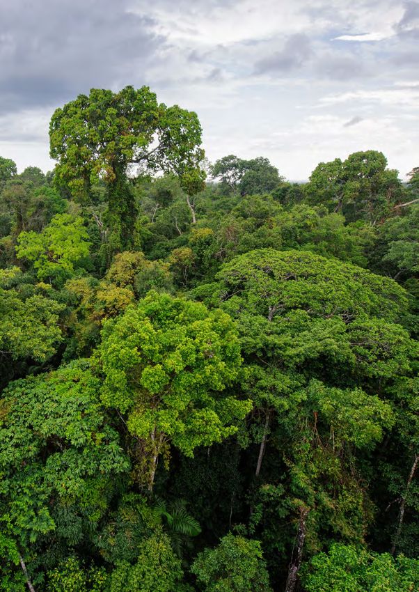
UK SPACE AGENCY INTERNATIONAL PARTNERSHIP PROGRAMME (IPP): CALL 1 PROJECTS

Clyde Space               FireSat                                         South Africa,            40
                                                                          Kenya, Namibia

Astrosat                  Recovery and Protection In                      Vietnam                  42
                          Disaster (RAPID) system

Rheatech                  Drought and Flood Mitigation                    Uganda                   44
                          Service (DFMS)

Inmarsat                  Natural disasters relief                        Philippines              46
                          by using Satcom

Maritime

Satellite Applications    Satellite Enabled Maritime                      Chile                    48
Catapult                  Domain Awareness (SEMDAC)

exactEarth                South Africa Safety Initiative for              South Africa,            50
                          Small vessels’ Operational                      Madagascar
                          Take-Up (OASIS-TU)

Inmarsat                  Sustainable fishing practices                   Indonesia                52

Satellite Oceanographic   Coastal Risk Information Service                Madagascar,              54
Consultants (SatOC)       (C-RISe)                                        Mozambique,
                                                                          South Africa

Education

Avanti Communications     iKnowledge                                      Tanzania                 56

Renewable Energy

Institute for             Renewable Energy Space                          Seychelles               58
Environmental Analytics   Analytics Tool (RE-SAT)

Health

Inmarsat                  Maternal health pilot programme                 Nigeria                   60

Inmarsat                  Satellite connectivity                          Nigeria                   62
                          for healthcare

                                                                                                             3
1. INTRODUCTION
The International Partnership Programme (IPP)1 is
a five year, £152 million programme run by the UK
                                                            IPP seeks to use space solutions to
Space Agency. IPP focuses strongly on using the UK
                                                            make a positive and practical impact
space sector’s research and innovation strengths to
                                                            on the lives of those living in emerging
deliver a sustainable economic or societal benefit to
                                                            and developing economies through
emerging and developing economies around
                                                            partnerships with end users in the target
the world.
                                                            countries to increase their capacity to
                                                            respond to specific challenges.
IPP is part of and is funded from the Department
for Business, Energy and Industrial Strategy’s              IPP will also contribute to the continued strength
(BEIS) Global Challenges Research Fund                     of the UK’s space sector, building on the unique
(GCRF): a £1.5 billion fund announced by the UK            strengths that the sector can offer through services
Government, which supports cutting-edge research           and technology to help with aid effort. The projects
and innovation on global issues affecting developing       within IPP span a variety of themes, including
countries. It harnesses the expertise of the UK’s world-   reducing deforestation, disaster response, land-
leading researchers, focusing on:                          use monitoring, reducing maritime problems and
                                                           renewable energy.
• funding challenge-led disciplinary and
  interdisciplinary research;                              22 projects have been commissioned to date
                                                           run by a large variety of organisations across
• strengthening capability for research, innovation        industry, academia and non-profit entities.
  and knowledge exchange in the UK and                     UK and international organisations are involved
  developing countries through partnership with            in the project consortiums.
  excellent UK research and researchers;
                                                           Contacts
• providing an agile response to emergencies where
  there is an urgent research or on-the-ground need.       For any information about IPP and the projects
                                                           within it, please contact the IPP team at:
The GCRF forms part of the UK’s Official                   IPP@ukspaceagency.bis.gsi.gov.uk
Development Assistance (ODA) commitment, which
is monitored by the Organisation for Economic
Cooperation and Development (OECD). ODA-funded
activity focuses on outcomes that promote long-
term sustainable growth of countries on the OECD
Development Assistance Committee (DAC) list2 and
is administered with the promotion of the economic
development and welfare of developing countries as
its main objective. IPP is fully ODA compliant, being
delivered in alignment with UK aid strategy and
the United Nations’ (UN) Sustainable Development
Goals (SDGs).

1    https://www.gov.uk/government/collections/uk-space
-missions-case-studies-and-programmes
2 http://www.oecd.org/dac/stats/daclist.htm

4
UK SPACE AGENCY INTERNATIONAL PARTNERSHIP PROGRAMME (IPP): CALL 1 PROJECTS

2. IPP GOALS
IPP aims to make a positive, practical impact on           Secondary aims
the lives of those living in developing countries.
Set goals have been agreed by the UK Space                 • Develop valued and sustainable partnership
Agency Steering Board, the Department for                    arrangements which lead to growth opportunities
International Development (DFID), and aligned                for the UK space sector;
with BEIS GCRF Strategy.
                                                           • Demonstrate the additionality that space-enabled
                                                             solutions and applications have over terrestrial
  Primary aim of IPP: to deliver a space-                    systems;
  enabled ODA-compliant programme that
  provides a measurable and sustainable                    • Use the space sector’s unique expertise to lead in
  economic or societal benefit to its                        delivering overseas aid or work with others in their
  beneficiaries.                                             programmes to complement existing ODA efforts.

3. IPP MECHANISM
IPP delivers aid through the provision of grants           A series of calls will be launched during the course of
of 50-100% (depending on the size and type of              IPP to create a well-rounded programme targeting a
establishment) for organisations to run projects which     range of themes and regions focused on sustainable
meet the aims of the Programme over the course of          economic and societal benefit in emerging nations.
five years (2016-2021).
                                                           Eligible nations must be part of the OECD DAC List
This booklet showcases the 22 selected projects in         of ODA Recipients. The DAC List shows all countries
the first IPP call. The majority started in December       and territories eligible to receive ODA funding.
2016, providing solutions for local issues in countries    It consists of all low and middle-income countries
across Africa, Asia and Central and South America.         based on gross national income (GNI) per capita
The first call comprised the following elements:           as published by the World Bank, with the exception
                                                           of Group of Eight (G8) members, European Union
• Scoping study call – run prior to the close of the       (EU) members, and countries with a firm date for
  Open call, this allowed organisations to create          entry into the EU. The List also includes all of the
  partnerships in readiness to submit to Call 1;           Least Developed Countries (LDCs) as defined by
                                                           the UN. Due to the advanced nature of their space
• Open call – applications could be submitted              programmes, IPP has excluded China, India and
  on any theme;                                            Pakistan from the list of countries available to work
                                                           with under IPP. We are also unable to fund any work
• Tactical call – three tactical calls whereby three       in countries which are involved in active conflict.
  countries (Malaysia, Guatemala and South Africa)
  defined specific problems which had
  to be addressed by the applicant;

• Strategic call – DFID defined a theme for
  applicants to address: ‘The use of satellite data
  and technologies in disaster risk management’.

                                                                                                                     5
Internal IPP Governance

The IPP Steering Board ratifies decisions and provides   Projects within IPP are closely monitored by the UK
assurance to the UK Space Agency on the running of       Space Agency team, specifically via monthly reports,
the programme. IPP reports upwards, both internally      quarterly review meetings and at milestone events,
to UK Space Agency teams, and to the GCRF teams          but also by ad hoc support regarding any risks,
within BEIS; GCRF then reports upwards to DFID.          issues or opportunities that may arise.

Official Development Assistance (ODA)
Compliance and UK Policy

    IPP must comply with UK untied aid                   Therefore all projects/programmes approved
    policy3 such that all procurements must              under IPP must be ODA compliant and meet four
    be fully compliant, open to bidders                  basic checks4:
    worldwide, and the aid outputs cannot
    be tied to provision from UK suppliers.              1. Does it meet DAC directives?
    This is in accordance with the
    International Development Act 2015                   2. Is it consistent with international best practice?
    which specifies that UK aid must be
    spent in an ODA-eligible country on the              3. Is it a credible use of ODA money?
    approved DAC list.
                                                         4. Does it meet the official UK approach and UK
                                                            Government’s aid strategy?
3

                                                         All proposals received into IPP are checked
                                                         for compliance against these criteria through
                                                         independent scrutiny, including by IPP’s qualified
                                                         Monitoring and Evaluation and ODA Subject
                                                         Matter Experts.

3     UK International Development Act 2002
4     UK ODA assessment guidelines: Jane Casey, DFID Statistics Adviser

6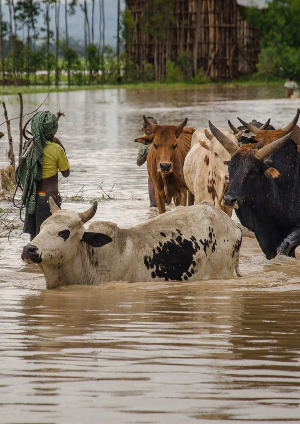
UK SPACE AGENCY INTERNATIONAL PARTNERSHIP PROGRAMME (IPP): CALL 1 PROJECTS

4. IPP STAKEHOLDER
   LANDSCAPE
Stakeholder Map

The following Stakeholder Map shows the key stakeholders and their interrelationships in IPP:

                  Data Flow           BEIS                      OECD

                               Global Challenges                              Space & ODA/
                                                                DFID
                                Research Fund                               Development Sectors

                                                      IPP

                               Grantee 1           Grantee 2       Grantee 3        Grantee 22

                              International    International      International    International
                                 Partner          Partner            Partner          Partner

International Partners
International partnerships are a crucial part of the           All projects must have a clearly identified
original assessment of projects. These go on to                international partner from a country on the OECD
be cemented throughout an IPP projects lifetime                DAC list in place. This could be with overseas
through various official agreements such as agreed             Government organisations, research institutes or
requirements documents and implementing                        local private sector companies, or with international
arrangements. IPP also strives to involve local                organisations operating in an overseas market,
partners as much as possible by using mechanisms               e.g. Non-Government Organisations (NGOs).
such as joint project boards and maximizing the                The background qualification of international
interaction with UK embassy staff where possible               partners will be assessed for suitability during the
to ensure coherence with other in-country projects             application phase, and all partners must either be,
and initiatives.                                               or aligned to, the projects end users.

                                                               The international partner must be involved in the
 All participants recognise that strong
                                                               project and confirm in-kind commitment of funding,
 partnerships are key to a successful
                                                               people resource, equipment, facilities, etc. to the
 project to ensure that the right service
                                                               project from the outset.
 is delivered for the right people and
 will continue after the life of the project,
 i.e. providing a sustainable economic or
 societal benefit to the recipient country.

                                                                                                                       7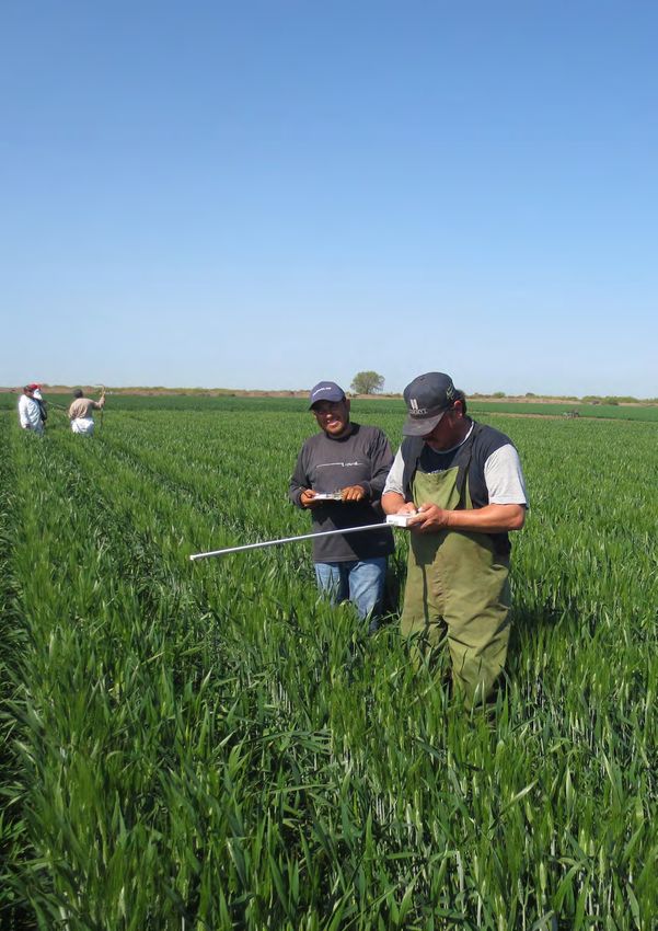
5. UK OVERSEAS AID
   STRATEGY
UK Aid Strategy Strategic Objectives

Advancing economic development in the poorest               GCRF mobilises the UK’s world-leading research
countries is a hallmark of building Global Britain.         and innovation base to address key challenges such
It is an essential part of how Great Britain is helping     as: threats to the sustainability of natural resources;
make globalisation work for all and furthering our          flooding and famine resulting from climate change;
national interests by playing a leading role on the         environmental degradation; population growth and
international stage.                                        rapid urbanisation; fragile states, growing inequality,
                                                            and violence; threats to animal and plant health; and
The UK aid strategy is outlined in ‘UK aid: tackling        global health challenges, including the development
global challenges in the national interest’ with the        of vaccines and viral threats.
strategic objectives of:
                                                            ODA-funded activity focuses on outcomes that
1. Strengthening global peace,                              promote the long-term sustainable growth of
   security and governance                                  countries on the OECD DAC list. GCRF funding
                                                            is awarded in a manner that fits with official
2. Strengthening resilience and response to crisis          ODA guidelines.

3. Promoting global prosperity                              GCRF and its delivery partners work in union with
                                                            other UK ODA funds. We specifically work alongside
4. Tackling extreme poverty and helping the world’s         the Newton Fund6, ensuring join up where possible.
   most vulnerable                                          The Newton Fund works in specific countries on the
                                                            DAC list and covers 3 broad categories of activity:
5. Delivering value for money
                                                            • people: improving science and innovation
The IPP Call 1 portfolio strongly aligns to priorities 2,     expertise (known as ‘capacity building’), student
3, 4 and 5.                                                   and researcher fellowships, mobility schemes and
                                                              joint centres;
Global Challenges Research Fund (GCRF)
                                                            • research: research collaborations on development
GCRF5 is a £1.5 billion fund which supports cutting-          topics;
edge research and innovation on global issues
affecting developing countries.                             • translation: innovation partnerships and
                                                              challenge funds to develop innovative solutions
GCRF forms part of the UK Government’s ODA                    on development topics.
commitment. It is overseen by BEIS and delivered
through 17 delivery partners,which include the UK
Research Councils, the UK Academies, and other
funding bodies. IPP, run by the UK Space Agency,
is part of this fund.

5 https://www.gov.uk/government/publications/global-challenges-research-fund/global-challenges-
research-fund-gcrf-how-the-fund-works
6 https://www.gov.uk/government/publications/newton-fund-building-science-and-innovation-capacity-
in-developing-countries/newton-fund-building-science-and-innovation-capacity-in-developing-countries

8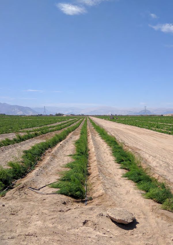
UK SPACE AGENCY INTERNATIONAL PARTNERSHIP PROGRAMME (IPP): CALL 1 PROJECTS

United Nations’ (UN) Sustainable Development Goals (SDGs)

The UN SDGs were adopted by world leaders in 2015. Over the next 15 years, with these new Goals that
universally apply to all, countries will mobilise efforts to end all forms of poverty, fight inequalities and tackle
climate change.

The 17 SDGs are as follows:

                                                            The UN SDG framework has been used because:

                                                            • It is a globally-agreed set of development priorities
                                                              across 193 Member States, global civil society,
                                                              and the development community;

                                                            • It is globally-agreed language that IPP
                                                              international partners will recognise;

                                                            • It is stable over a very long time period to 2030;

All projects were assessed on their applicability to        • The UN is investing significant resources in
the SDGs to ensure alignment of IPP with the SDGs.            establishing teams, processes and systems to
Of these 17 goals, IPP has so far aligned with nine; of       track progress towards achieving the goals;
those, four are represented by multiple projects and
four by a single project. In future calls, we expect        • All Member States are required to report to
projects to support more.                                     the UN their domestic contribution to achieving
                                                              the UN SDGs.

                                                            Throughout this brochure, the SDGs which match
                                                            the project are displayed in the bottom left corner.

                                                                                                                       9
6. MEASURING IMPACTS
As the GCRF funding for IPP is classified as ODA, a    The ODA and M&E assessment criteria used are:
rigorous Monitoring & Evaluation (M&E) function is
key to measure and communicate the benefit and         • Alignment of project to ODA definitions
impact of IPP on developing countries.                   and criteria;

Rigorous M&E activities are executed within the        • Development need and impact of the project;
IPP programme and also within every individual
project by their respective consortiums. The IPP M&E   • Project demonstrable success criteria and benefits;
methodology follows HM Treasury’s ‘The Magenta
Book: Guidance for Evaluation’, which provides         • Sustainability of project benefits;
guidance on what to consider when designing an
evaluation for UK Government-funded programmes         • Applicability of the project to UN SDGs;
and policies.
                                                       • M&E adequately planned and resourced
M&E support and ongoing ODA compliance is                throughout the project.
carried out by Caribou Digital. Caribou Digital is
an M&E specialist with extensive knowledge on          A key part of the M&E function is supporting the
use of ODA within the space sector, and is part of     projects to ensure long-term financial sustainability.
the IPP team. This expertise provides the necessary    All grantees have included work packages focused
independent advice to the UK Space Agency to           on ensuring sustainability, they develop detailed
ensure that all proposals recommended as suitable      sustainability plans, and subsequently assess their
for funding meet OECD standards for ODA eligibility    projects sustainability in their evaluations.
and M&E compliance, and continue to comply
throughout the life of each project.

10
UK SPACE AGENCY INTERNATIONAL PARTNERSHIP PROGRAMME (IPP): CALL 1 PROJECTS
IPP Theory of Change
Vision of Outcomes (Why) Outputs/Deliverables Activity
Success (What) Workstream
(Impact) (How)
Deliver £152M ODA compliant projects, ODA compliant bid selection ODA
ODA compliant with development as the priority, Compliance
funding for in eligible countries & Fund
projects by 2021 Management
Earth Observation, satellite Strategic, tactical and open
communications and vessel calls
tracking used to address
development challenges
SDGs addressed: disasters, Grantee outputs
forestry, agriculture, marine/
fishing, education, health, clean
energy, water & tax
To create Space expertise improves lives Evaluations assessing Evaluation
sustainable development impact Reporting
economic &
Quantified cost-effectiveness of Economic evaluation on
societal benefit
space expertise and economic developing economies &
by addressing
impact on space sector space sector
UN SDGs
Developing countries understand Evaluations assess capacity
the capability of space expertise building
Space sector has M&E skills to M&E Quality Assurance to M&E Quality
measure impact & utilise ODA grantees Assurance &
funding Alignment
Knowledge sharing enables Conferences, workshops, Replication
replication across industry research reports, IPP case through
amplifying impact study, working groups Knowledge
Sharing
Sustainable impact by Market opportunity
highlighting the proven strategic, reports for space expertise
commercial approach for the addressing development
space sector sectors
Developing countries are aware Supplier and product
of suppliers and solutions driving catalogue
future demand
And partner Sharing of knowledge and Engagement with space Collaboration
space formation of partnerships with agencies and development
expertise with other similar initiatives organisations
governments
Increased academic knowledge Collaborations with UK
in developing
in UK using space for Research Councils
countries by 2021
development challenges
Effective trading links with Collaborations with
emerging space economies international partners
11Benefits Realisation
Monitoring occurs regularly throughout the IPP
To ensure measurable benefit is made lifecycle, whilst evaluations occur at the beginning
in the target country, the grantee (baseline), middle (midline) and end (endline) of the
is responsible for monitoring and lifecycle. M&E will take place within each project and
evaluating the effects of their projects for the programme as a whole.
and must build this activity into their
work packages.
Evaluation of the programme will focus on three key areas:
• Process Evaluation – How was IPP delivered?
• Impact Evaluation – What difference did IPP make?
• Economic Evaluation – Did the outcomes and impacts justify the costs?
Evaluation and key interviews and/or programme end
Ongoing, Periodic Monitoring
Baseline Midline Endline
Start Project Timeline End
12UK SPACE AGENCY INTERNATIONAL PARTNERSHIP PROGRAMME (IPP): CALL 1 PROJECTS
Knowledge Sharing
All grantees have included a work package/
Knowledge sharing will promote activities focused on knowledge sharing whereby
good practice across the wider sector, they will use their own communication channels to
maximising the impact from ODA funds. share the results, findings and learning from their
project to the wider space and ODA/development
There are multiple routes to good practice, including: sector. Knowledge sharing activities typically include:
case studies, research reports, academic papers,
• Knowledge sharing driving replication across workshops, conference presentations, infographics,
other organisations within the space and ODA/ and web and social media promotion.
development sectors;
• Grantees offering the same solution to new
customers and in new markets;
• Grantees developing new technologies and
products from learning from the IPP grant;
• Organisational capacity building for use of space
expertise in developing countries.
Amplification:
Industry, academia
and donors drive
amplification of impact Impact
Replication:
Knowledge sharing to
Encourage replication
wider industry
across industry
•
Replication by grantees
to new customers
•
New technologies and
products developed
Co-investment: •
Add up to £1 match Capacity building in
partner funding developing countries
£1 £2
Seeding & Testing:
For every £1 invested
by UKSA IPP
137. IPP PROJECTS
The IPP projects are being run in partnership with developing countries across the globe, working with
in-country experts to ensure alignment with their needs. The following breakdown shows which project
is located in which region:
Africa
exactEarth South Africa Safety Initiative for Small South Africa,
vessels’ Operational Take-Up (OASIS-TU) Madagascar
Satellite Oceanographic Coastal Risk Information Service (C-RISe) Madagascar,
Consultants (SatOC) Mozambique,
South Africa
Vivid Economics Deforestation prevention Côte d’Ivoire
Airbus Defence & Space Property database for Dakar City Senegal
Institute for Renewable Energy Space Analytics Tool Seychelles
Environmental Analytics (RE-SAT)
CAB International Pest Risk Information Service (PRISE) Kenya, Zambia,
Ghana
Rheatech Drought and Flood Mitigation Service Uganda
(DFMS)
Airbus Defence & Space Flood and Drought Resilience Ethiopia, Kenya
Inmarsat Maternal health pilot programme Nigeria
Inmarsat Satellite connectivity for healthcare Nigeria
Avanti Communications iKnowledge Tanzania
Ecometrica Forests 2020 Brazil, Mexico,
Colombia, Ghana,
Kenya, and
Indonesia
Clyde Space FireSat South Africa,
Kenya, Namibia
14UK SPACE AGENCY INTERNATIONAL PARTNERSHIP PROGRAMME (IPP): CALL 1 PROJECTS
Senegal
Ghana Nigeria Ethiopia
Côte d’Ivoire
Uganda
Kenya
Seychelles
Tanzania
Mozambique
Zambia
Namibia
Madagascar
South Africa
15Vietnam
Philippines
Malaysia
Indonesia
Mexico
Guatemala
Colombia
Brazil
Peru
Chile
16UK SPACE AGENCY INTERNATIONAL PARTNERSHIP PROGRAMME (IPP): CALL 1 PROJECTS
South East Asia
Astrosat Recovery and Protection In Disaster Vietnam
(RAPID) system
Satellite Applications Earth And Sea Observation System Malaysia
Catapult (EASOS)
Inmarsat Natural disasters relief by using Satcom Philippines
Inmarsat Sustainable fishing practices Indonesia
Ecometrica Forests 2020 Indonesia
(also Brazil, Mexico,
Colombia, Ghana,
Kenya)
Central America
Astrosat Forestry Management And Protection Guatemala
(FMAP) system
Ecometrica Forests 2020 Mexico
(also Brazil, Indonesia,
Colombia, Ghana,
Kenya)
Rezatec Crop Observation, Management & Mexico
Production Analysis Services System
(COMPASS)
South America
Ecometrica Forests 2020 Brazil
(also Mexico, Indonesia,
Colombia, Ghana,
Kenya)
Vivid Economics Land-use interventions Peru
Environment Systems EO4cultivar Peru, Colombia
Satellite Applications Satellite Enabled Maritime Domain Chile
Catapult Awareness (SEMDAC)
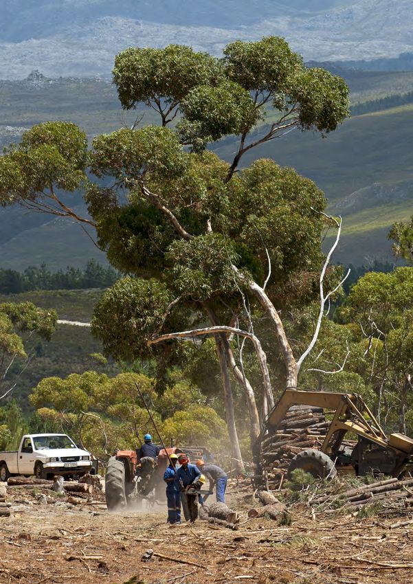
17Protecting and restoring
forests across the world
Project lead
Ecometrica
Target country(s)
Brazil, Colombia, Mexico, Ghana, Kenya,
Indonesia
Project consortium
University of Edinburgh (NCEO), University
of Leicester (NCEO), Carbomap
18DEFORESTATION / LAND USE
Forests 2020 – Improving
forest monitoring systems
through better application
of satellite data
International partners Pronatura Sur: Mexican NGO recognised for its
contribution to the conservation of areas of high
Indonesia ecological value.
Bogor Agricultural University (IPB): one of the
leading universities in Indonesia that focuses on Ambio: Mexican NGO promoting rural development
agriculture and forestry. from the participation of communities.
PT Hatfield Indonesia: a pioneer in the field of State Forestry Development Programme
environmental services in Indonesia. (FIPRODEFO): autonomous government institution,
which serves as the technical and operational body
World Resources Institute: works with leaders in on issues of relevance in the state of Jalisco’s forests.
business, government and civil society to address
climate change, forest restoration, forest governance, Colombia
and access to information. Meteorology and Environmental Studies of
Colombia (IDEAM): part of the Colombian Ministry
Daemeter: a leading independent consulting of the Environment and Sustainable Development.
firm promoting sustainable development through
responsible and equitable management University of Andes (UniAndes): leading the
of natural resources. Colombian Data Cube project for more than a year
at IDEAM.
Brazil
National Institute of Space Research (INPE): linked Ghana
to the Ministry of Science, Technology and Innovation Kwame Nkrumah University of Science and
in Brazil, aims to provide science and technology in Technology (KNUST): promotes the proper
space and the terrestrial environments. management of sustainable utilisation of forests
through teaching, research and dissemination
Institute of Environmental Research of the Amazon of information.
(IPAM): non-profit research institute, focusing on
the ecological limits of land use/cover and climate Resource Management Support Centre (RMSC)
change to Amazon forest ecosystems. of the Forestry Commission Ghana: is the technical
wing of the Forestry Commission of Ghana.
KeyAssociados: helps clients integrate
Environmental, Social and Corporate Governance Kenya
(ESG) management into their business strategies, Kenya Forest Service: mandated to enhance
products and services in Brazil. It is a well connected development, conservation and management
organisation in Brazil, working closely with private, of Kenya’s forest resources base.
public and civil society organisations.
Mexico
El Colegio de la Frontera Sur (ECOSUR): leading
the study of forest resources using geographic
information systems and remote sensing tools.
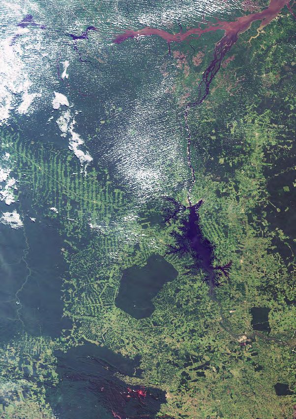
19Project summary Satellite solution
Forests provide vital services including livelihoods, This project is using EO imagery from satellites
water and habitats for millions of species, and are to improve forest monitoring across six partner
essential for combating climate change. Despite countries. It works with leading experts from the
frameworks to help developing countries protect and National Centre for Earth Observation (NCEO) in
restore their forest resources, inadequate monitoring leading universities in the UK and with international
systems remain a barrier to effective implementation. partners to test new forestry monitoring methods in
Earth Observation (EO) is widely acknowledged as the following areas:
the only effective way to monitor forests at regional
and national levels; however accuracy, frequency, • detecting change in forests (deforestation and
speed, and delivery of EO data products degradation) from both optical and radar imagery
remain a challenge. from satellites like the European Space Agency’s
(ESA) Sentinel-1 and Sentinel-2;
Forests 2020 is a 40-month project from a
consortium of UK experts and international partners • incorporating these observations into risk models
led by Ecometrica, which aims to address these for mapping risk of deforestation and forest fires,
technical barriers to improve forest monitoring and mapping suitable areas for restoration;
systems in six developing countries to support
REDD+7 , FLEGT8 and other aspects of forest • improving digital infrastructure to manage and
governance and biodiversity conservation. disseminate forest-related data.
The project will focus on three areas of forest These new methods will enable our partner countries
monitoring systems: to use more frequent, better quality data, quicker,
improving the national forest monitoring systems.
• Improved detection of forest changes, particularly
in challenging ecosystems and land use situations; Project impact
• Improved mapping of risks and priority areas, Protection and restoration of up to 300 million
particularly ways in which local organisations hectares of tropical forests by improving national
and district or state-level forest authorities can forest monitoring systems in six partner countries
input and interact with the forest maps and forest through better applications of satellite data.
change detection;
• Digital infrastructure for managing and distributing
EO-derived and related information to ensure
robustness, consistency, continuity and availability
of data products to end-users.
7 Reducing emissions from deforestation and forest degradation, forest carbon stock conservation,
the sustainable management of forests, and the enhancement of forest carbon stocks in developing countries
are activities commonly referred to as REDD+.
8 FLEGT stands for Forest Law Enforcement, Governance and Trade. The EU’s FLEGT Action Plan
was established in 2003. It aims to reduce illegal logging by strengthening sustainable and legal forest
management, improving governance and promoting trade in legally produced timber.
20DEFORESTATION / LAND USE
21Reducing poverty and net deforestation
of primary forest in Peru
Project lead
Vivid Economics Ltd
Target country(s)
Peru
Project consortium
Remote Sensing Applications Consultants
Ltd (RSAC).
International partners
Ministry of Agriculture and Irrigation: the governing
body of the National System of Forestry and Wildlife.
Ministry of Environment: responsible for ensuring
the environmental sustainability of the country
and preserving, protecting, restoring and ensuring
ecosystems and natural resources.
Amazon Interregional Council: seeks to contribute
to public policies, programmes and projects of
common interest between the five Amazon regions,
with special emphasis on initiatives relating to
natural resources and the environment.
Alternative Mechanisms for Development: seeks
to promote sustainable development through
strategic partnerships between government,
the private sector, local people and local and
international organisations.
22DEFORESTATION / LAND USE
Remote mapping and
socio-economic valuation
tools to support planning
and implementation in
land-use interventions in Peru
Project summary This will integrate the land-use inventory with other
economic information to map the value of land
The project addresses two of Peru’s most acute under different uses and the risk land faces of
development challenges: reducing the rural unauthorised exploitation.
population in poverty (currently 3 million), and
preventing deforestation from its current rate of • Plot-level mapping and technical specifications
250,000 hectares per year. The two challenges are to improve titling, enforcement of land-use rules,
closely linked in a number of ways. Unregulated supporting programmes and technical assistance.
land use is a major cause of both, facilitating This will map areas identified as high-risk in greater
encroachment on forests by the subsistence farmers detail using Unmanned Aerial Vehicle (UAV)
who are responsible for 75% of losses, while also surveys, providing information on forest thinning
stemming flows of investment that could improve their needed to enforce restrictions on deforestation and
productivity and incomes. However, solutions to the support certification of sustainable production.
problems often require balancing trade-offs between
them: for example, new infrastructure that can improve Satellite solution
livelihoods might also accelerate deforestation.
The land use inventory will be developed using newly-
The overall objective of this project is to contribute available data from the Copernicus Sentinel satellite
to efforts to reduce poverty and protect forests by that offers higher resolution and revisit frequency
developing satellite-based data tools that help policy- than Landsat, which has been used for mapping in
makers to understand and address these linkages. the past, supplemented by even higher-resolution
information from the RapidEYE and SPOT satellites.
The tools developed by the project, and the
engagement with government in the adoption and Project impact
application of the tools, will assist decision-making in
four key areas of policy activity: land use (‘zoning’) • Reduce net deforestation of primary forest;
regulation; infrastructure provision; land permitting;
and sustainable production and irrigation. • Improve ecosystem quality by reducing degradation
and improving connectivity of forest areas;
The project tools will support these aims by providing
three layers of information: • Increase agricultural productivity of targeted small
producers without increasing agricultural lands;
• Land use inventory that classifies and differentiates
physical surface cover types. • Increase the proportion of producers with secure
land ownership rights;
• Economic-ecosystem valuation tool that improves
zoning rules and regulations, prioritises planned • Increase the proportion of farms who are
investments, and focuses enforcement and sustainably certified, with resulting impact on the
incentive mechanisms to improve effectiveness. income they are able to generate.
23Improving property tax revenue
for Dakar city, Senegal
Project lead
Airbus Defence and Space
Target country(s)
Republic of Senegal
Project consortium
N/A
International partner
New Africa Consulting, Dakar: a specialist in
developing public-private partnerships in Senegal.
New Africa Consulting lead on the interaction
with Dakar’s Mayor’s Office and the National
Tax Authority.
24DEFORESTATION / LAND USE
Satellite image analysis for
operational maintenance
of a property database
for Dakar City
Project summary Satellite solution
The Dakar City government has a requirement to This project is designed to develop an operational
generate revenues for developing and maintaining system for creating and maintaining a parcel
city infrastructure and services. The legal framework reference map, whose accuracy can be further
for property taxation is already in place, but the improved through Global Positioning System (GPS)
city lacks the resources to collect and maintain the based field survey, and mapping new buildings and
information needed to calculate the tax due. The changed building heights through 3D monitoring
Airbus system links specific textual information such based on satellite imagery.
as ownership and address with location and building
characteristics, including size and value; all essential Project impact
data for generating municipal revenues based on
property taxation. Using very high-resolution satellite • Evidence that property tax collection can
data, the land and building extents (and heights) can be improved;
be effectively monitored through a combination of
image analysis and field data collection. • Identification of how improved revenue
Change detection through satellite imagery collection could be used for enhanced planning,
analysis can greatly improve the efficiency development and maintenance of service
of the monitoring process. infrastructure in key target areas, including water
and drainage, citizen security, and maintenance of
This system will provide the framework for field open spaces;
teams to collect and maintain accurate property
characteristics enabling tax calculations to be • Projected increase in job opportunities and
made within a fully operational system to support roles created in local government by up to 20%
sustainable and transparent revenue generation for for property data maintenance and ongoing
Dakar City. Focusing on training and knowledge tax collection, as well as service provision and
transfer will ensure that future operations can be fully infrastructure maintenance by 2019.
implemented by a local technical team.
The system will therefore be self-financing and could
be rolled-out to other cities in a similar position. Local
authorities are working with the National Revenue
Authority to ensure that the city and its citizens
will benefit from enhanced services and
economic opportunities.
25Decreasing illegal forestry
activities in Guatemala
Project lead
Astrosat Ltd
Target country(s)
Guatemala
Project consortium
Earth Observation Ltd, Deimos,
Telespazio Vega
International partners
National Forestry Institute (INAB): a public entity
responsible for the agriculture public sector in the
forestry domain. An Implementing Agreement was
signed in February 2017 between the UK Space
Agency and INAB.
National Council of Protected Areas (CONAP):
a government agency responsible for the
conservation, rehabilitation, and protection of
Guatemala’s natural resources and its biodiversity.
Guatemala Environmental Police Force
(DIPRONA): the division of the National Civil
Police that oversees the prevention of
environmental crimes.
Ministry of Agriculture (MAGA): in charge
of creating the policies to ensure growth and
development in the areas of agriculture, livestock
and hydrology resources.
Public Ministry: in charge of attending to direct
victims and collateral victims of crime.
ARCAS Guatemala: a non-profit Guatemalan
NGO formed in 1989 by a group of Guatemalan
citizens who became concerned as they saw their
precious natural heritage – especially their wildlife
– rapidly disappearing.
26DEFORESTATION / LAND USE
Forestry Management And
Protection (FMAP) system for
tackling illegal logging
Project summary • Upgrade and improve existing traceability systems
through the addition of satellite-derived data
The illegal exploitation of the forest environment is a and GNSS mobile applications to support better
real concern to the Guatemalan government. Illegal forestry management and enforce prosecutions.
removal and transit of valuable trees, change of land FMAP will reduce costs of measurement, reporting,
use, and other such illegal and unregulated activities verification and prosecutions through the
are having huge impacts – both environmentally and concessions system;
socio-economically – throughout the country. The
Guatemalan government has made efforts to tackle • Increase the efficiency, impact and scalability of
this problem by embracing digital technologies, the forestry incentive programmes by reducing
improving its processes and by pooling information the costs of monitoring and land-use verification
between all stakeholder agencies, but the problem is in the current systems. This will utilise GNSS
persistent due to the forests of Guatemala being too mobile applications and space-based data to
big to be effectively monitored and managed using improve INAB’s ability to track land management,
conventional, terrestrial, techniques. increasing capacity and supporting efforts to
reduce deforestation.
The FMAP project aims, through the use of space
technologies and satellite-derived data, to solve this Satellite solution
issue by improving the capabilities of the agencies
responsible for forestry governance. It will provide With over 3.7 million hectares of forests in
a centralised platform, utilising satellite remote Guatemala, EO tools offer the most effective
sensing and Global Navigation Satellite Systems way of monitoring activities which would not be
(GNSS) technologies that will enable intelligence-led possible from the ground. The FMAP system utilises
governance and interventions which have the largest EO data from various sources to provide periodic
impacts on tackling this problem. data acquisition of land use and land change. The
TreeTAG system uses GNSS technology to greatly
The project’s objectives are to: increase the efficiency of locating trees, reducing the
time it takes loggers to locate trees to harvest.
• Reduce the incidence of deforestation in
Guatemala by creating a space-technology driven Project impact
forestry management tool;
• Increased capacity of Guatemalan Government
• Reduce land crime through increased land- Agencies to conserve Guatemala’s
use change detection with a higher temporal forestry environment;
resolution to provide intelligence for DIPRONA
enforcement officers. DIPRONA will be able to • Reduce the rate of deforestation in the Mayan
arrest or prosecute parties guilty of illegal activities Biosphere Reserve;
due to the increased knowledge and situational
awareness provided by FMAP; • Increase the total area of ecosystems under
sustainable management;
• Increase the number of detections of illegal
forestry activities.
27Preserve and expand forests
to the benefit of rural communities
in Côte d’Ivoire
Project lead
Vivid Economics Ltd
Target country(s)
Côte d’Ivoire
Project consortium
Remote Sensing Applications Consultants
Ltd (RSAC), Impactum
International partners
Ministry of Planning and Development
(Cote d’Ivoire): The Ministry of Planning and
Development is responsible for the implementation
and monitoring of the Government’s policy
on development planning and programming.
The Ministry has its own projects but also serves
as a liaison body between the various ministerial
departments involved in development policy.
A Memorandum of Understanding has been
signed for the project.
Society for Forest Development (SODEFOR):
Office in charge of managing commercial forest
plantations.
The Office of Parks and Reserves (OIPR):
Office in charge of managing the national parks
and natural reserves.
REDD Permanent Executive Secretariat (SEP-
REDD): Office in charge of all the REDD activities
in Côte d’Ivoire.
28DEFORESTATION / LAND USE
Deforestation prevention with
land-use monitoring and
valuation in Côte d’Ivoire
Project summary development of sustainable supply chains and PES
schemes in the country.
The project aims to alleviate two key development
problems in Côte d’Ivoire: rural poverty, which Satellite solution
afflicts more than half of the rural population; and
deforestation for economic development, which has The land use inventory will be developed using newly
led to the loss of 80% of the country’s natural forests. available data from the Copernicus Sentinel satellites
It will contribute to efforts to reduce poverty and protect that offer higher resolution and revisit frequency
forests by developing tools that help policy-makers than Landsat, which has been used for mapping in
preserve and expand forests to the greatest benefits the past, supplemented by even higher-resolution
of rural communities, and to integrate relatively information from SPOT satellites.
unproductive smallholders into more valuable global
supply chains. Three tools will be created: The forest disturbance early warning system will
make use of a technique developed by RSAC for the
• Land use inventory that classifies and differentiates rapid detection of forest disturbances using radar
physical surface cover types; time series from satellites.
• Natural capital valuation framework that informs Project impact
national reforestation and forest protection
strategies, and supports the extension of Contribute to achieving 20% of national forest cover
sustainable supply chains. This will integrate by 2030:
the land-use inventory with other economic
information on the value of production and • Zero forest degradation in existing protected areas
eco-systems services to map the value of land in the region by 2020, and all of Côte d’Ivoire’s
under different uses, recorded in a natural capital remaining 3-4 million hectares of forest by 2023;
accounting balance sheet;
• 60,000 hectares of natural forest regeneration
• Forest disturbance early warning system to tighten and 60,000 hectares of gazetted forests annually
enforcement of land-use rules. by 2020, expanding to a combined total of
180,000 hectares annually by 2023.
These will drive two key outcomes: improved
monitoring and enforcement efforts that prevent Improve supply chain sustainability:
forest loss and prioritise afforestation; and better
targeted support to local economic development • 100% deforestation-free production for cocoa,
and sustainable supply chains through Payment for rubber, and palm oil in targeted region by 2020,
Ecosystem Services (PES) schemes. and nationally by 2023;
All three tools represent substantial improvements • creation of new markets for ecosystem services
upon what is currently available, but the real (for example through PES mechanisms) that
benefit of the project lies in their combination enable the commercialisation of preservation and
and close integration into policy and regulatory restoration activities;
activity. The tools will cover an area in the south
west of Côte d’Ivoire covered by the Emissions • broad delinking of agricultural production and
Reduction Programme (ERP) initiative. The ERP region deforestation through greater productivity per
was chosen as it contains much of the country’s hectare of production.
remaining natural forest and is the focus of the
29Increasing food security by reducing
crop losses from pest outbreaks
Project lead
CAB International
Target country(s)
Ghana, Zambia, Kenya
Project consortium
Assimila; Kings College London; Centre for
Environmental Data Analysis
International partners
Plant Protection & Regulatory Services Directorate
(PPRSD, Ghana): Ghana’s national institution
with the mandate and capacity to organise,
regulate, implement and coordinate the plant
protection services.
Kenya Agricultural & Livestock Research
Organisation (KALRO): Government institute with
the mandate to promote, streamline, coordinate
and regulate all aspects of research in agriculture
and livestock development.
Kenya Ministry of Agriculture, Livestock
and Fisheries (MOALF): Ministry responsible
for supporting agricultural research,
and developing regulation and information
on the agriculture sector.
Zambia Agriculture Research Institute (ZARI): The
Zambian government department responsible for
agricultural research.
30AGRICULTURE
Pest Risk Information Service
(PRISE)
Project summary This early-warning system unites the capability of
the UK partners to: collect and combine disparate
An estimated 40% of the world’s crops are lost to datasets; manipulate data using computational and
pests (including insects, mites and plant pathogens), modelling expertise; and leverage well-established
impacting on the ability of smallholder farmers to international development networks. Commitment
feed their families and also affecting international from Ministries of Agriculture in Zambia, Ghana
trade and food supply chains. By alerting them to and Kenya ensures their engagement and active
the potential presence of pests, this project aims participation. In-country data collected from the field
to enable farmers to manage outbreaks more will be fed into the system, to be used in line with the
effectively using Integrated Pest Management computational results. Appropriate communication
methods. These techniques have many advantages, methods will deliver risk messages and mitigation
such as the reduction of the use of inappropriate measures to users as well as collect their feedback.
pesticides that lead to human and environmental
benefits as well as reducing spend on PRISE will improve the livelihoods of smallholder
unnecessary spraying. and larger scale farmers by reducing crop losses
caused by pests across three sub-Saharan African
Innovation is essential to provide new solutions to countries and to be active in six countries by the end
the problem of pest outbreaks, and this project of the project.
combines novel EO technology, satellite positioning,
plant health modelling, and on-the-ground real-time Satellite solution
observations to deliver a science-based Pest Risk
Information SErvice (PRISE) for sub-Saharan Africa. PRISE will use a range of satellite data at different
The solution is also developed through: scales to provide pest risk models with environmental
information they need, of which surface temperature
• Risk forecasts that will be integrated into existing is the most important variable. Effective modelling
plant health systems; on a country-wide scale requires data that accurately
represents local weather conditions for agricultural
• Crowd-sourcing observations that will be zones. To meet these needs, data from satellite
established to strengthen and validate the system; technology such as Meteosat SEVIRI, Terra/Aqua
MODIS and Sentinel-3 SLSTR will be fused to
• Using existing networks in current projects to produce a seamless service which will be used
trigger appropriate action to deliver alerts, advice to drive pest risk models.
and inputs to farmers;
Project impact
• A service that will be developed and sustained
by building in-country technical capacity and By enabling farmers to reduce crop losses from pest
interrelated business plans that engage the outbreaks in the target countries, the project will:
private sector (e.g. agro-dealers and
insurance companies); • Contribute to reduction in hunger;
• Involving the Ministries in the countries to • Increase food security;
encourage them to develop policies to strengthen
crop protection by the demonstration that an • Increase farmer incomes.
effective pest forecasting service can be scaled
to regional and national levels.
31Improving productivity in wheat and
sugar cane for smallholder farmers
in Mexico
Project lead
Rezatec Ltd
Target country(s)
Mexico
Project consortium
Booker Tate Ltd, The University of
Nottingham
International partners
International Wheat and Maize Improvement
Centre (CIMMYT): prioritises research relevant to
ensuring global food security and a decrease
in poverty.
College of Postgraduates (COLPOS): Mexican
public institution of higher education with
international recognition that prepares students for
a globally competitive world in which knowledge
is the most important asset.
32AGRICULTURE
Mexican Crop Observation,
Management & Production
Analysis Services System
(COMPASS)
Project summary There are about 30 site-specific parameters grouped
by soil, management, inputs and environment that
The project consortium is working with CIMMYT can determine the production efficiency of wheat
and COLPOS in Mexico to help smallholder farmers and sugar cane crops, e.g. soil type, harvest date,
growing sugar cane and wheat to improve crop disease control and temperature. The theoretical
management. Mexican farmers need to improve crop effect of these parameters on production is
productivity and stabilise their incomes to facilitate understood. However, there are no practical,
rural community economic development. The tool evidence-based, management decision tools that
developed by this project will help farmers to identify support smallholders and larger growers by targeting
factors that cause the yield gap between crop production efficiency per specific field.
potential and actual field performance.
Project impact
The project will provide seven customer-specific
decision support tools to help growers, including • Improved productivity, particularly for smallholder
smallholders, improve their technical, environmental farmers, in two of Mexico’s major crops, wheat
and financial performance. The project will also and sugar cane;
provide commercial information support, following
the trials that are underway, to advisory services, • Improved resource-use efficiency and hence lower
agribusiness, farmer cooperatives, crop insurers and emissions (for example, of fertiliser nitrogen and
governments to create a long-term income stream greenhouse gases);
to support Rezatec’s provision of these services.
• Improved market function as farmers, traders,
Satellite solution government and other stakeholders will have
improved information on likely crop yields,
This project is using EO data from ESA’s Sentinel allowing much better planning of crop marketing,
constellation and commercial satellites in combination which helps to stabilise incomes;
with in-field measurements and computer modelling.
The overall challenge for the crops is to transform • Through improving technical and market
both traditional extensive as well as modern intensive performance, the project will assist rural economic
systems into sustainable systems producing more development in Mexico, improve food security
crop output with better use of resources. This requires (wheat) and generate increased export
better management of the interacting parameters earnings (sugar cane).
controlling yield.
33Contributing to sustainable food
production systems and resilient
agricultural practices
Project lead
Environment Systems Ltd
Target country(s)
Peru and Colombia
Project consortium
Barfoots, Geoseren, Joint Nature
Conservation Committee (JNCC),
EDINA, a centre for digital expertise at
the University of Edinburgh, The Open
University and Aberystwyth University;
Wavehill is engaged as a subcontractor
International partners
Peru
ITP CITE Agroindustrial Ica and CITE
Chavimochic: regional government organisations
that improve the competitiveness of local
agricultural businesses through research,
development, and technological transfer.
Danper and DM Agrícola: established exporters
of fruit and fresh asparagus from Peru.
Colombia
Geits: a consultancy and services company
based in Bogota. They develop EO solutions for
agriculture and bring experience of monitoring
potato crops.
34AGRICULTURE
EO4cultivar
Project summary Three PhDs will be hosted at UK universities to enable
knowledge transfer and capacity building to the
By developing the ability to easily disseminate and target countries.
incorporate EO data for use in decision making in
agricultural supply chains, EO4cultivar will have real Satellite solution
impacts on supporting crop production, improving
yield for key growers, and managing risk in Both radar and optical data from ESA’s Sentinel
agricultural supply chains in Peru and Colombia. satellites will be used to provide up-to-date
EO can provide timely field-scale crop observations information on crop status (e.g. health, growth
at regional scales into the high-value South American stage or vigour) throughout the growing season.
agricultural market. Better information from EO Commercial growers and farmer advisory services
data services and capacity building will strengthen will use secure data services to access ‘analysis-
business operations by increasing the range of ready’ maps, images and data that they can use in
evidence and management tools available to the office or on portable devices. This might be for
grower organisations, leading to improved economic individual fields, farms or regional areas and will
outcomes. Improving crop management will improve reflect the demand for timely information to improve
sustainable farming practices. crop production, support sustainable farming
practices and manage risk.
There are sources of free and commercial satellite
imagery, but currently no capability to process Project impact
the data necessary to deliver national agricultural
data services in South America. EO4cultivar will • To make a positive contribution towards
work with commercial and government stakeholders sustainable food production systems and the
in Peru and Colombia to deliver information implementation of resilient agricultural practices;
frequently and rapidly within the growing season
via trusted channels. • To increase productivity and manage risk in
agricultural supply chains;
Cloud-based processing and storage infrastructure
will be developed to deliver services, such as a • To support inclusive and sustainable economic
time series of imagery at the field level to monitor growth in target agricultural sectors;
crop performance and target management, as well
as for crop identification to support biosecurity, • To help maintain ecosystems and ensure
resource planning and market intelligence needs. smallholder farmers benefit from project activities.
Case studies will help organisations make best use
of data products and services, alongside existing
local knowledge, to inform activities that support
sustainable livelihood development.
35You can also read