Low river discharge of the Meuse - A Meuse River basin water management modelling study using RIBASIM
←
→
Page content transcription
If your browser does not render page correctly, please read the page content below
RIWA-Meuse

Low river discharge
of the Meuse

A Meuse River basin water
management modelling study
using RIBASIM

RIWA - Vereniging van Rivierwaterbedrijven
RIWA-Meuse

Colofon                                                                              Foreword
  Client                RIWA Meuse
                                                                                     Background and research objective
  Contact               Maarten van der Ploeg (RIWA-Meuse)
                                                                                         The river Meuse is the source of drinking water for 7 million people living in the Netherlands and Belgium.
  Author(s)             Wil van der Krogt (Deltares)                                     In order to guarantee the supply of safe drinking water, it is indispensable to safeguard the supply of
                        Bernhard Becker (Deltares)                                       sufficient water of good quality in the Meuse.
                        Hélène Boisgontier (Deltares)
                                                                                         Deltares knowledge and research institute has – on behalf of RIWA-Maas (in representation of its Dutch
  Reviewer              Ron Passchier (Deltares)                                         members Dunea, Evides, and WML) and Rijkswaterstaat Zuid-Nederland - developed the RIBASIM model
                                                                                         which serves as a tool to predict and further understand water availability in the Meuse catchment. Based
  Approver              Bianca Peters i.a. (Deltares)                                    on this collaborative project, this research study arose out of a dual concern, on the one hand on the low
                                                                                         discharge levels of the Meuse in recent years, and on the other hand on the negative impacts that climate
  Design                Make My Day, Wormer                                              change will have on (water) discharge in the river (as predicted by the Intergovernmental Panel on Climate
                                                                                         Change (IPPC) amongst others). This research has the objective of implementing the model to shed
  Photography           Evides drinkwater bedrijf                                        light on the impacts that climate change can have on water supply in the international river basin of the
                        WML Limburgs Water                                               Meuse. Therefore, the research shows the projected impacts on future water availability in Meuse as
                        RIWA-Meuse                                                       a result of climate change.
                        Shutterstock.com
                        Heinsdorff Jularlak, Shutterstock.com
                        Para Ti, Shutterstock.com                                    Design and results of the study

  Infographics          Studio Ilva, Angeren                                             For the purpose of this study, Deltares developed a RIBASIM water balance model for the entire Meuse
                                                                                         catchment. Deltares analysed historical discharge data of the last 40 years from four important locations
  Use of content        The content of this publication may be used or made public       along the river Meuse in France, Belgium and the Netherlands. The changes in low water discharge in
                        by making reference to the source Deltares/RIWA-Meuse            moderate, average, and extreme climate scenarios for the years 2050 and 2085 were simulated with the
                                                                                         model. The results of the model present a clear trend: in almost all investigated climate scenarios and for
  ISBN/EAN              9789083075969                                                    all locations considered, the model predicted longer periods of low discharges in summer periods. The
                                                                                         model also revealed that the tributaries that feed the Meuse in the Netherlands, such as the Roer and the
  Date of publication   June 2022                                                        Niers, play a major role in the water availability for the Netherlands.

                                                                                     Result interpretation

                                                                                         The results of this study present a worrying condition for drinking water companies: lower water discharge
                                                                                         levels in the Meuse will occur more frequently and for longer periods of time in the entire river basin.
                                                                                         Climate change will have adverse consequences for the Dutch drinking water that is extracted from the
                                                                                         Meuse: during periods of low water discharge the river will be exposed to more contamination incidents or
                                                                                         (industrial) discharges as it will lose its capacity to dilute pollutants. This can lead to situations whereby
                                                                                         drinking water companies are forced to temporarily stop the intake of water from the Meuse more frequently
                                                                                         in the future. A prolonged interruption of water intake endangers the drinking water supply of 7 million
                                                                                         people. Furthermore, the drinking water sector is currently already facing several challenges, such as an
                                                                                         anticipated growth in the demand for drinking water due to population growth as well as an increased
                                                                                         concentration of in harmful substances in the Meuse water that also threatens the quality of drinking water.
                                                                                         Lastly, extended periods of low water discharge in the Meuse will also affect many other sectors, such
                                                                                         as shipping, agriculture and industry located along the catchment, as well as vulnerable and protected
                                                                                         ecological areas that depend on the Meuse.

                                                                                                                                                                                                              3
RIWA-Meuse

    Petition of the members of RIWA-Meuse                                                                               Summary
        This study ultimately confirms the trend of longer periods of low water discharge in the Meuse during             Insight into current and future water availability in the Meuse River basin is important to be able to anti-
        summertime, as we have already witnessed in recent years. This disturbing trend can lead to major                 cipate future socio-economic and climatic changes, especially during the summer period when low flows
        problems in the drinking water supply. However, it is not too late to translate the insights from this report     occur. The possible impact of water extraction of various socio-economic sectors on low flows in the Meuse
        into tangible actions and solutions. To some extent, drinking water companies can solve these problems            River basin, in combination with decreasing water availability due to climate change, is crucial for the drinking
        themselves. For example, they are already actively investigating and commissioning additional drinking            water companies that use the Meuse as source for the public water supply of 7 million persons in the
        water sources.                                                                                                    Netherlands and Belgium. Therefore, RIWA-Meuse initiated two research projects, in cooperation with
                                                                                                                          drinking water companies Dunea, Evides, WML and Rijkswaterstaat Zuid-Nederland: one looking into
        Despite these advancements, the Deltares report has prompted members of RIWA-Maas to call on all                  the contribution of different tributary rivers of the Meuse River flow during periods of drought (research
        parties that make use of the Meuse to work together and identify the best solutions to use and manage             project A), and one looking into future changes of water availability and demand (research project B).
        river’s water in a robust and sustainable way. The RIBASIM water balance model of the Meuse, which was
        developed jointly with this study, is a valuable tool to explore and identify different solutions. Moreover,      Research project A deals with the contribution of the inflow from tributaries to the discharge for the Meuse
        an important reason behind the development of this model was to encourage and start a dialogue to                 during low-level water conditions based on historical flow time series. Research project B deals with the
        take measures to tackle prolonged periods of water scarcity, as well as to calculate the effects of these         usage and distribution of available Meuse water during periods of low river discharge based on historical
        measures at the level of the entire river basin.                                                                  flow time series generated by a rainfall-runoff model, and under various climate change scenarios.

                                                                                                                          This report describes the results of sub-project B. The two products of this project are an inventory list
                                                                                                                          of water users and other human interventions in the Meuse river basin and a detailed water demand- and
                                                                                                                          allocation (water balance) model of the whole Meuse River basin starting off from the open global
                                                                                                                          datasets. This Meuse002 model was implemented in the RIBASIM river basin modelling software. RIBASIM
                                                                                                                          is a generic model package for simulating the behavior of river basins under various hydrological,
                                                                                                                          socio-economic, agriculture, climate change and water quality scenarios. The Meuse002 model covers the
                                                                                                                          whole Meuse River basin from its source in France to the Haringvliet in the Netherlands. The existing and
                                                                                                                          potential water users and major water storage infrastructure like dams, reservoirs and natural lakes
                                                                                                                          are considered. The hydrological boundaries (runoff, rainfall, evaporation) were generated with the
                                                                                                                          rainfall-runoff model of the Meuse (Wflow). The Meuse002 model simulates multiple year time series with
                                                                                                                          time steps of one decade (10 days).

                                                                                                                          The model has been validated against measured discharges from gauging stations along the Meuse. The
                                                                                                                          validation shows a good match between the measured and simulated discharge for the locations along
                                                                                                                          the mainstream. For gauging station Megen this could not be achieved without adding an additional time
                                                                                                                          series that accounts for unknown water usage and water losses during the exceptional dry years of 2018,
                                                                                                                          2019 and 2020.

                                                                                                                          Eleven simulation cases were run: the base case of the present situation and ten future scenarios that
                                                                                                                          correspond with the inflow (runoff) change of the five KNMI climate change scenarios GH, GL, WL, WH and
                                                                                                                          WHdry for the target years 2050 and 2085. Model results have been evaluated for the observation points
                                                                                                                          Chooz, Monsin, Borgharen and Megen. Indicator plots show that under climate change conditions critical
                                                                                                                          thresholds of low flow discharge will be reached more often and for a longer period during the summer
                                                                                                                          months. Chooz shows bottle necks already for the base case, which represents the current and historic
                                                                                                                          situation. For Monsin, mainly the W-scenarios show significant bottle necks. The bottle necks shown for
                                                                                                                          Monsin translate to Borgharen, where the Meuse water is divided between the Common Meuse and the
                                                                                                                          Juliana Canal. At Megen the Meuse has received additional inflow from tributaries, with the Rur and the
                                                                                                                          Niers as the two largest. The percentages of time steps below threshold indicators at Megen are smaller
                                                                                                                          than for Monsin.

        1
            RIBASIM – River Basin Planning and Management.

4                                                                                                                                                                                                                                                 5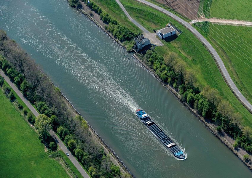
RIWA-Meuse

    This is because of the additional inflow from the Rur, but also because of the threshold values that have          Abbreviations
    been applied here for the calculation of the indicators. In the W-scenarios, however, the discharge falls
    below the thresholds for a significant period as well.                                                             DPZW     Delta Programma Zoet Water

    The dependable flow is the flow value assigned to a specific time in a year (a decade) that is exceeded            IMC      International Meuse Commission
    by 70 % or 90 % of the simulated years. Dependable flows are thus a measure for the discharge one can
    rely on throughout the year. Practically all future scenarios show lower dependable flows than the base            KA       Kläranlage (German for Wastewater treatment plant)
    case for the summer months.
                                                                                                                       LDD      local drain direction
    In terms of low flow, it is very likely that low flow periods become more critical in the future. The dependable
    flows reach their lowest values during August and September. Note that in the wet months the depend-               LHM	Landelijk Hydrologisch Model is an integrated nationwide ground- and surface
    able flow can reach higher values than in the base case, because with climate change more extreme storm                 water model of the Netherlands consisting of the coupled models:
    events in winter and more severe droughts in summer are expected.                                                       • MODFLOW (verzadigde zone),
                                                                                                                            • MetaSWAP (onverzadigde zone)
    With the Meuse002 model a planning tool is now available that can be used to simulate the behavior                      • MOZART (regionaal oppervlaktewater)
    of the Meuse River basin under various scenarios. Scenario runs that account for the effect of climate                  • Distributiemodel (DM, landelijk oppervlaktewater)
    change on the hydrological inflow have already been carried out. Beside the climate changes, also                       • WOFOST (gewasgroei)
    economic developments, land use changes and intervention in the Meuse and her tributaries can affect                    • TRANSOL (Zoet-zout-modellering)
    the water balance and can be simulated. In similar projects, the scenarios are commonly developed
    in consultation with the stakeholders in the policy domain and water system experts in the basin.                  Mcm      Million cubic metre, 106 m³
    The integration of provided data by the riparian countries, model simulation and scenario analysis will
    deliver new insights and increase our joint integrated knowledge about the Meuse River Basin. The                  MLNBK	Midden Limburg Noord Brabantse Kanalen, a canal system that comprises Wilhelminakanaal,
    reliability of the model will grow each time more local knowledge and expertise will be transferred into                  Zuid-Willemsvaart, Maximakanaal, Noordervaart and Kanaal Wessem-Nederweert.
    the tool. It is recommended to further develop the model coming year based on the guiding principles of
    participative approach, integration and exchange of data and co-creation of knowledge.                             NWM      Nationaal Watermodel (National water model of the Netherlands)

                                                                                                                       RIBASIM River basin simulation model

                                                                                                                       RIWA     Vereniging van Rivierwaterbedrijven, Sectie Maas

                                                                                                                       RIZA     Rijksinstituut voor integraal zoetwaterbeheer en afvalwaterbehandeling

                                                                                                                       RWS      Rijkswaterstaat the Netherlands

                                                                                                                       RWZI     Wastewater Treatment plant, Dutch: rioolwaterzuiveringsinstallatie

                                                                                                                       sbm      A hydrological modelling concept in Wflow (Wflow_sbm)

                                                                                                                       STEP     Waste water treatment plant, French: station d’épuration des eaux usée

                                                                                                                       WML      Waterleiding Maatschappij Limburg (Dutch drinking water supply company)

6                                                                                                                                                                                                                           7
RIWA-Meuse

    Inhoud

                                                                                                                                                  5
     Foreword                    3

                                                                                      3                                                 Model application
                                                                                                                                                                                               7
                     Summary                   5
                                                                               River Basin                                            5.1 Model reliability      78                       References 108
                                                                            Simulation model                                          5.2 Base case and future   87
                                      Abbreviatons            6
                                                                                RIBASIM                                                   scenarios

                1                                    2
                                                                          3.1 Introduction             28

                                                                                                                                                                          6
                                                                                                                         4
                                                                          3.2 The modelling process 29
                                                                              with RIBASIM

                                                                          3.3 Principles of river      30
          Introduction                                                        basin schematization                                                                   Summary,
                                           Study area and                 3.4 Interactive schemati-     30                                                        conclusions and
    1.1 Background              12            inventory of                    zation of the river basin        The river basin                                   recommendations
                                           water users and                3.5 Scenarios, measures      30     water management
    1.2 Research project         14
        “Low river discharge              water infrastructure                and strategies
                                                                                                                   model for                                  6.1 The river basin water 100
        of the Meuse” and
        structure of this report
                                             in the Meuse                 3.6 River basin simulation 34           the Meuse                                       management model
                                               catchment                                                                                                      6.2 Scenario runs          101
                                                                          3.7 Evaluation of results    34

                                                                          3.8 Additional features      34    4.1 Introduction            40                   6.3 Uncertainty in model   102
                                         2.1 The study area:         18
                                                                                                                                                                  data
                                             the Meuse river basin                                           4.2 The Meuse Wflow         41
                                                                                                                 hydrological model                           6.4 Future use of the      103
                                         2.2 The inventory of        18
                                                                                                                                                                  model and possible
                                             water users and water                                           4.3 The Meuse002            48                       extensions
                                             infrastructure                                                      RIBASIM water
                                                                                                                 management model
                                         2.3 Rivers, canals          20

                                                                                                                                                                                               8
                                             and streams

                                         2.4 Infrastructure          20

                                         2.5 Water usage             23

                                         2.6 Water exchange
                                             across the catchment
                                                                     25
                                                                                                                                                                                         Appendices 112
                                             boundary and points
                                             of interest

8                                                                                                                                                                                                              9
RIWA-Meuse

         1
     Introduction

10                      11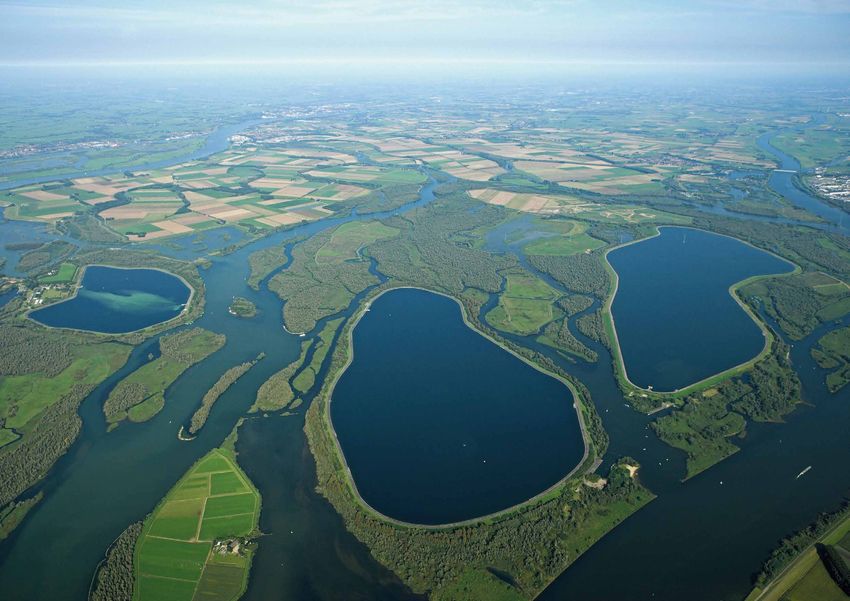
RIWA-Meuse
1.1 Background
Figure 1 The Meuse, major tributaries and the Meuse catchment, divided into sections according to
The Meuse originates in France and flows to sea via Belgium and the Netherlands. On its way through De Wit 2008; Berger & Mugie 1994
France, Wallonia, Luxembourg, Germany, Flanders, and the Netherlands, many large and small tributaries
Kaart met de zijrivieren van de Maas
feed into it (Figure 1). By the time the water from the Meuse flows into the North Sea, it has been of
Noordzee Nederland
service to various users for domestic use, navigation, industry, and energy provision, nature, agriculture, Rotterdam
and recreation. The Meuse is an important source of drinking water: 7 million people in Belgium and the
Netherlands are provided with drinking water that originates from the Meuse (Bannink et al. 2019). In Den Bosch
order to safeguard the continued supply of drinking water, a minimum inflow of good quality water is Aa
Dieze
required. This principle is endangered in times of long-term drought – not only because during droughts MAAS
Zuid-
the water availability decreases and the demand increases at the same time, but also because less water Willems
means less dilution of pollutants. Problem substances are no longer washed away following an emission/ Vaart
Eindhoven Venlo Niers
discharge incident. Additionally, it is generally expected that, due to climate change, periods of low water Antwerpen Swalm
Dommel
levels will occur with greater frequency and severity. It is therefore important to gain good insight into Roermond
present and future water availability, combined with current and future usage. Albert-
België kanaal Geleen- Roer
Beek Duitsland
The Meuse discharge is composed of discharges from various tributaries. To improve insight into Brussel
Maastricht Geul
the question of where Meuse water originates from in times of low river discharge, RIWA-Meuse
Aachen
commissioned Deltares for an in-depth study into a period of low-level Meuse discharge (August 2018) in Jeker
Mehaigne
2019 (Bannink et al. 2019). The results show that in August of 2018, both the Sambre in Wallonia and the Luik
Vesdre
Rur in Germany were relatively large tributaries to the Meuse. The largest contribution to Meuse water in Namen Hoyoux
Charleroi
August 2018 came from France and may be attributed to outflowing groundwater. For the sake of compa- Amblève
Bocq
rison, a period of high-level river discharge was also reviewed (February 2019). For this period, a larger Molignee
Dinant
Sambre
number of major rivers and tributaries was found to have contributed to the main flow of the Meuse. Hermeton
Maubeuge Ourthe
Lesse
The analysis of low Meuse discharges shows that the low flow discharge is characterized by the contri- Viroin Houille
bution of a small number of tributaries (Kramer 2021; Bouaziz 2020a). The main contributors are the
Chiers, the Sambre and the Rur; another major flow component comes from the upstream reach of the Semois
Frankrijk Luxemburg
Meuse. The contribution of each tributary can vary with the year (Kramer 2021). This indicates that Charleville- Sedan
the river system of the Meuse is vulnerable during periods of low river discharges. As the discharge Mézières Arlon
distribution may vary from any period of high or low water to the next, a better understanding of the Chiers
Bar
discharge distribution of the Meuse over time is important. So far, the most extreme low flow situations
have been observed in summers that were the preceded by a dry winter (De Wit 2008) with less ground-
water recharge than average. The Meuse is a true rain-fed river, making discharges erratic by nature.
Climate models indicate that future summer periods will be drier, thereby directly affecting Meuse
Verdun
discharge. Simultaneously, the demand for water from various users is expected to increase. Therefore,
RIWA-Meuse initiated further research into the sources of the Meuse River flow during periods of drought,
and into potential future changes of water supply and demand.
Neufchateau MAAS
Source RIWA-Meuse
12 13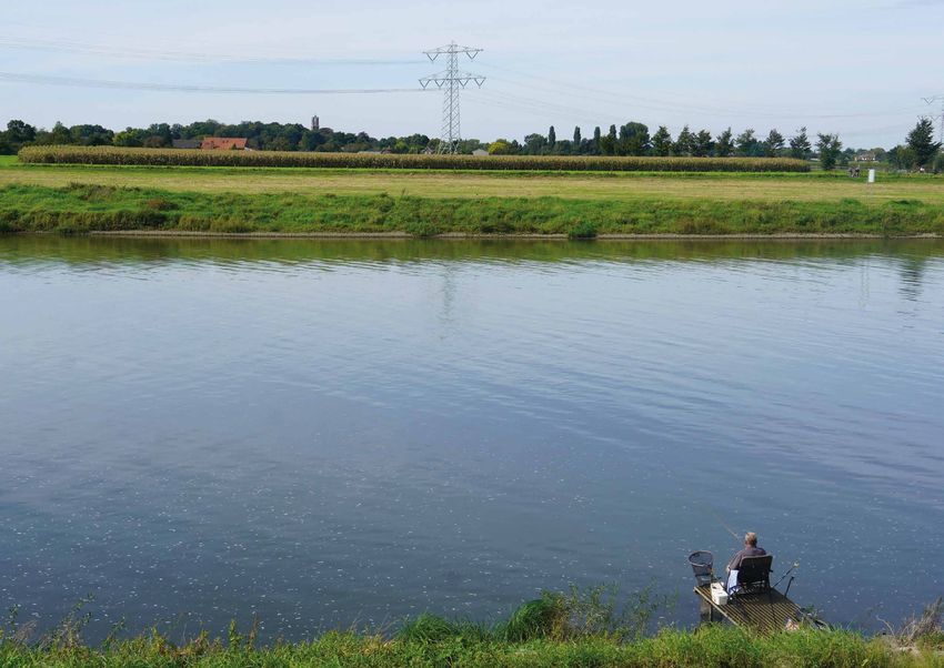
RIWA-Meuse

     1.2	Research project “Low river discharge of the Meuse”
          and structure of this report

         The research project “low river discharge of the Meuse” addresses two research questions:
         1	What is the contribution of the inflow from tributaries to the discharge of the Meuse during
            low-level water conditions based on historical flow time series? (Kramer 2021)
         2	What is the usage and distribution of available Meuse water during periods of low river discharge
            based on historical flow time series?

         This report describes the results of sub-project B. The objective of the study is to gain insight into:
         • The volumes of water available (during low water level),
         • The source of the water (historical data-based study into main rivers and tributaries in the basin),
         • Identification of the water users in the basin,
         •	Quantitative amounts of abstracted and returned water and the impact of low water level water
            on these users.

         The two products of sub-project B are:
         1 An inventory list of water users and other human interventions in the Meuse River basin.
         2	A river basin water management model of the whole Meuse River basin. The model is powered by
            the rainfall-runoff modelling software Wflow (https://www.deltares.nl/en/software/Wflow-hydrology/)
            and the water demand and allocation modelling software RIBASIM (https://www.deltares.nl/en/
            software/ribasim/).

         We have named the RIBASIM model Meuse002, because a first RIBASIM model Meuse001 has been
         developed earlier as part of a Master’s thesis (Johnen et al. 2021; Johnen 2020). The Meuse001 model
         covers the Meuse River basin downstream from the border between France and Belgium, while the current
         model Meuse002 covers the whole catchment of the Meuse.

         The RIBASIM modelling software is introduced in Chapter 3, after the study area and an inventory of
         water users and infrastructure has been introduced in Chapter 2. Chapter 4 describes the Meuse002
         model and Chapter 5 the illustrative model applications. Finally, in Chapter 6 some conclusions are drawn
         and the outlook of potential use of the model is outlined. The annexes contain a list of the project meet-
         ings and more details on the developed Meuse002 RIBASIM model.

14                                                                                                                        15
RIWA-Meuse

          2
     Study area and inventory of water users and
     water infrastructure in the Meuse catchment

16                                                     17
RIWA-Meuse
2.1 The study area: the Meuse river basin
Figure 2 The inventory of water
Figure users and
21+22: thewater
Meuseinfrastructure
network schematization
The source of the Meuse is located in France and on its way to the North Sea the Meuse flows through
Belgium and the Netherlands. The catchment has an area of about 36 000 km². The majority of the basin
is located in France, Belgium and the Netherlands, and small parts also in Germany and Luxembourg.
We have adopted the division of the Meuse into four sections, as suggested by De Wit 2008 and Berger
& Mugie 1994:
MAAS
Zuid-
• The upper reach reaches from the source at Pouilly-en-Bassigny to the mouth of the Chiers tributary. Willems
In the upper reach the Meuse flows over high permeable ground and has a small slope. Rainfall can Vaart
easily percolate into the soil, consequently there are not many creeks in this region. Niers
• In the Ardennes the Meuse cuts through hard rock and has developed a high slope. Water cannot
easily infiltrate into the low-permeable rock, in the Ardennes swampy areas have developed.
Major tributaries are the Semois, Viroin, Lesse and the Ourthe Roer
Albert-
• The middle reach covers the areas between the cities of Namur, Liège, Dinant, Maastricht and Aken. kanaal
Like in the upper reach, the soil is highly permeable, and the Meuse has developed a comparatively
small slope here. 1
• The lower reach begins at Maasbracht and ends at the moth in the North Sea. Here the Meuse is
controlled with large weirs. 5 6 3 2
Vesdre
4
8 9
7
2.2 The inventory of water users and water infrastructure Amblève
Sambre 11 Ourthe
The inventory of water users and water infrastructure of the Meuse catchment has produced a list of water
Lesse 10
use functions and infrastructure along the Meuse and its tributaries. The inventory is primarily carried out 12
13
as preparation for the model development, but it has also a value by itself, because it helps to gain
Viroin
insight in the functioning of the Meuse catchment in general, and in particular into the different water use
functions in the catchment.
14 Semois
15
We see this inventory as a dynamic product – the inventory data will be completed, refined and changed
in the future – consequently we have set up this inventory as a spreadsheet which is accompanied by
maps files to be displayed in geographic information systems and stored in a repository (see Appendix B Chiers
for more details). The inventory has been compiled from literature sources, including reports on earlier Existing and potential reservoirs
studies, interviews with stakeholders and experts and internet resources. The inventory contains the 1. Wehebachtalsperre
following items with the corresponding GIS filenames in brackets: 2. Rurtalsperre
3. Urftalsperre
Meuse 4. Oleftalsperre
Rivers and streams
• River Meuse and tributaries with names in different languages 5. Les barrages de la Gileppe
tributary
6. Les barrages de la Vesdre
Infrastructure Meuse
canal 7. Coo-Trois-Points
• Weirs, locks and pump station (Weirs.shp)
domestic water use 8. Les barrages de Robertville
• Reservoirs (Reservoirs.shp)
9. Les barrages de Bütgenbach
Water users, categorizes in water use for
drinking water utilities 10. Barrage de Nisramont
• Agriculture
11. Les barrages de Eau d'Heure
• Drinking water supply cooling water
12. Lac du Val du Joly
• Energy production, including cooling water
locks (and canals) 13. Barrage du Ry de Rome
• Industrial water use MAAS
14. Potential: Dohan
• Ecology 1 reservoirs 15. Lac de la Vierre
• Wastewater treatment plants (WastewaterTreatmentPlants.shp)
Source Deltares, edited by RIWA-Meuse
18 19RIWA-Meuse
Minimum flow requirements
• General minimum flow requirement Table 1 Rivers and streams in different languages
• Minimum flow for cargo ship navigation
Water exchange across the catchment boundary. Name (English) Name (Nederlands) Name (Français) Name (Deutsch)
Other points of interest (PointOfInterest.shp) Aa Aa
Albert Canal Albertkanaal Canal d’Albert Albertkanal
The water network and the infrastructure form the basis of the model schematization. For the other item Amblève Amblève Amblève Amel
groups not only the location is of interest, but also corresponding discharge values for water extraction, Canal Briegden-Neerharen Kanaaal Briegden-Neerharen
discharge or minimum flow requirements. The inventory contains the corresponding values as constant or Canal Dessel-Kwaadmechelen Kanaal Dessel-Kwaadmechelen
time-dependent information. Canal Dessel-Turnhout-Schoten Kanaal Dessel-Turnhout-Schoten
Canal Bocholt-Herentals Kanaal Bocholt-Herentals Maas-Schelde-Kanal
We will not repeat the content of the inventory here in detail and refer to the inventory files instead. Canal Wessem-Nederweert Kanaal Wessem-Nederweert
The following sections summarize the content of the inventory, main data sources and assumptions. Chiers Chiers Chiers
The inventory items with the highest uncertainty are the water exchange across the catchment boundary Dieze Dieze
and water usage for agriculture and industry. If possible, these items should be addressed with priority Geleenbeek Geleenbeek
for future updates. Geul Geul Göhl
Grote Molenbeek Grote Molenbeek
Inde
2.3 Rivers, canals and streams Jeker Jeker Geer
Juliana Canal Julianakanaal Julianakanal
Table 1 lists rivers, canals and streams in the Meuse catchment with their names in different language, Kempen canals Kempische Kanalen: • Kanaal Bocholt-Herentals • Zuid-Willemsvaart
sorted in alphabetical order by the name that is commonly used in English. • Albertkanaal • Kanaal Dessel-Turnhout-Schoten • Kanaal naar Beverlo
• Kanaal Dessel-Kwaadmechelen • Kanaal Briegden-Neerharen
Lateraal Canal Lateraalkanaal
2.4 Infrastructure Lesse Lesse Lesse
l’Helpe Majeure l’Helpe Majeure
The inventory contains 53 weirs in the Meuse and tributaries. The impact of weirs on the water Meuse Maas Meuse Maas
balance for the catchment scale and the time resolution of the river basin water management model Meuse (Common Meuse) Grensmaas Meuse commun Grenzmaas
is neglectable, so they do not appear explicitly in the model. Canals in Midden Limburg Midden Limburg Noord Brabantse Kanalen (MLNBK): • Wilhelminakanaal
and North Brabant (MLNBK) • Zuid-Willemsvaart • Maximakanaal • Noordervaart • Kanaal Wessem-Nederweert
Mouzon Mouzon Mouzon
Larger weirs are often combined with hydropower units and locks. Beside the weirs, the lock “Ecluses de
Nete Canal Netekanaal
Lanaye” / “Sluizen Ternaaien” and the pump station “Gemaal van Sasse” are listed.
Nette Nette Nette
Niers Niers Niers
The reservoirs in the Meuse catchment are summarized in Table 2. The inventory contains the following
Noordervaart Noordervaart
information if available: the name of the lake in different languages (where applicable), the reservoir
Ourthe Ourthe Ourthe Urt
volume, the reservoir surface area, the full supply level, years of construction, dam height and the river
Rur Roer Rur
that flows into the reservoir.
Salm Salm
Sambre Sambre Sambre
Schwalm Zwalm Schwalm
Semois Semois Semois
Vair Vair Vair
Vence Vence Vence
Vesdre Vesdre Weser
Vierre Vierre
Viroin Viroin Viroin
Wilhelmina Canal Wilhelminakanaal Wilhelminakanal
Zuid-Willemsvaart Zuid-Willemsvaart
20 21RIWA-Meuse
2.5 Water usage
Table 2 Reservoirs in the Meuse catchment
Country Name of the lake Water users are grouped in the following categories:
Belgium Bütgenbacher See • Agricultural
Belgium Lac de Coo • Cooling water
Belgium Lac de Falemprise • Drinking water
Belgium Lac de Féronval • Energy
Belgium Lac de la Gileppe • Industrial
Belgium Lac de la Plate Taille • Nature Navigation
Belgium Lac de la Vierre • Lock leakage losses
Belgium Lac de l’Eau d’Heure • Wastewater treatment plants
Belgium Lac de Nisramont • Minimum flow Canal leakage losses
Belgium Lac de Robertville • “Maasplassen” evaporation losses
Belgium Lac des Doyards
Belgium Lac du Ry-Jaune Where available, we have collected the following parameters:
Belgium Les lacs de l’Eau d’Heure • Water user name
Belgium Wesertalsperre, lac d’Eupen, Vesdre-reservoir, Eupener Talsperre • Country
France Basin de Whitaker • Location
France Bassin des Marquisades • River Literature reference
France Lac de Bairon • A discharge value:
France Lac des Vieilles Forges - Expected abstraction (sink) or discharge (source)
France Lac du Val-Joly - Licensed abstraction (sink) or discharge (source)
Germany Dreilägerbachtalsperre - Minimum flow
Germany Kalltalsperre
Germany Olefstausee Expected and license abstraction or discharge apply for withdrawal from or release into the river or stream,
Germany Perlenbachtalsperre while a minimum flow applies in the river or stream. Most discharge values are only available as a
Germany Rursee constant abstraction or discharge, but agricultural use and water demand for regional water management
Germany Stauanlage Heimbach is implemented as time-variant over the year.
Germany Staubecken Obermaubach
Germany Uftstausee Water extractions for agriculture is mainly present in Flanders and in the Netherlands, but agricultural
Germany Wehebachtalsperre water extractions are also present along the Rur between Linnich and the Dutch-German border. The
Netherlands Cranenweyer amount of extracted water is very uncertain, because farmers usually do not report the extracted amount,
and unlicensed extractions may take place also. The main source for data related to agricultural water use
is Raadgever 2004 and the National Water Model (Rijksoverheid 2021). In France (Terrier et al. 2018) and
in the Belgian Ardennes irrigated agriculture is hardly present and not documented.
In the French part and the Walloon part of the Meuse the drinking water is mainly supplied from ground-
water resources, because groundwater usually has a better quality than water from other sources. Con-
sequently, there are only a few drinking water abstraction points from the Meuse in France and Wallonia.
With Heel, Brakel and Bergse Maas in the Meuse and the extraction points in the Albert- and Netekanaal
Flanders and the Netherlands have large extraction points for drinking water supply. The city of Brussels
extracts at Tailfer in the Walloon region water from the Meuse to supply water to the metropolitan area
of Brussels. Drinking water is also one of the use functions of multi-purpose reservoirs in the Vesdre and
in the Rur reservoirs.
22 23RIWA-Meuse
As mentioned above, weirs in Belgium and in the Netherlands are equipped with turbines and water is Wastewater treatment plants (short: WWT, RWZI for Dutch: rioolwaterzuiveringsinstallatie, STEP for
used for hydropower generation, but this water usage has no impact on the water balance. A couple of French: station d’epuration, KA for German: Kläranlage) release water into a river or stream after it has
thermal and nuclear power plants use water from the Meuse as cooling water, with the nuclear power been used by public households and industry connected to the sewer system.
plants at Chooz in France and Tihange in Belgium and thermal plants in Awirs, Seraing and Angleur in
Belgium as well as the Clauscentrale near Maasbracht in the Netherlands. Cooling water is released back During low flow the release of treated waste water can contribute significantly to the total discharge of
into the river after use, but a certain percentage is lost by evaporation. The power plant Weisweiler is rivers and streams. Discharge from wastewater treatment plants has been estimated by the following data:
located in Germany and is cooled with drainage water from the lignite mines, and the cooling water is • Last reported inflow to the wastewater treatment plant (Netherlands)
discharged via the Inde into the Rur (Becker 2018). • Population equivalent with an average water consumption of 120 l/day (France, Wallonia)
• Hydraulic dry weather load (Trockenwetterzufluss, Germany)
Water from the Meuse and tributaries is used by industry. In the upstream part of the Meuse the
industrial water use is comparatively low, while Belgium and the Netherlands have larger industrial use Discharge from waste water treatment plant originates either from groundwater or from surface water
along the Albert Canal and Meuse. The industrial water use is quite divers, and the extraction and extraction. In case of the latter it is like a return flow from a drinking water extraction; if the public water
discharge data comes with a high degree of uncertainty. More details can be found in the inventory files. use is supplied from groundwater it appears like a base flow in the water balance. Hydrologic models
usually account for the contribution from wastewater treatment plants implicitly, because they are calibrated
Ecological motivated abstraction is located around the nature areas Groote Peel, Mariapeel, Deurnese on a total discharge. For this reason, only larger wastewater treatment plants with a discharge of
Peel and the Peel remains. The water is needed to maintain certain ecological target water level in these 0.05 m3/s and those that are located at the Meuse itself or a Meuse tributary that is part of the RIBASIM
areas. Beside this abstraction, there are some nature-conservation requirements for a minimum discharge. model were considered in the inventory.
Regional water authorities in the Netherlands use water to maintain a certain water level during the
summer. This water use is at least partly motivated by ecological reasons, but it is difficult to separate it Minimum flow requirements apply to the Rur river. With a discharge of 5 m3/s the Rur is considered to be
from agricultural water usage. The source of water demand for water management in the Netherlands is able to supply local industrial and public water demand without ecological damage. Consequently,
the National Water Model (Rijksoverheid 2021). the minimum release from the Rur reservoirs is 5 m3/s. A discharge of 7.5 m3/s allows canoeing below
Heimbach. Minimum flows apply for the Dutch lock pounds to feed fish ladders and to compensate lock
losses. Navigational water demand is also applied as minimum flow. The minimum flow value corresponds
to a minimum water depth for cargo ships.
2.6 Water exchange across the catchment boundary and points of interest
Water exchange with other catchments is given by the following canal connections:
• Water supply for the Canal de la Marne au Rhin
- le Vidus
- Troussey
• Water supply for the canal des Ardennes et le lac de Bairon at la Bar
• Outflow from Meuse to the Waal via
- the Maas-Waal-Kanaal through the sluice compound Heumen
- the Kanaal van Sint Andries through lock Sint Andries
- the Afgedamde Maas via lock Andel
- Water supply for the canal Charleroi-Brussel
- Water supply for the Canal De La Sambre á l’Oise
- Water supply for the Nete Canal
The amount of water exchange is unknown in most cases, so we made assumptions based on the literature.
A point of interest is the Crossing Meuse - Canal de la Marne au Rhin-Ouest. This crossing has no effect
on the water balance.
24 25RIWA-Meuse
3
River Basin Simulation model RIBASIM
26 27RIWA-Meuse
3.1 Introduction
An integrated approach to the water system and its surroundings is the basis for long-term sustainable RIBASIM is a WINDOWS-based software package and includes a range of Delft Decision Support Systems
management of the environment. Multi sector planning to allocate scarce resources at the river basin level Tools. More info about RIBASIM can be found on the website www.deltares.nl/en/software/ribasim.
is increasingly needed in the water sector, as water users and governmental agencies become more
aware of the trade-offs occurring between quantity, quality, costs and reliability. The RIBASIM (RIver
BAsin SIMulation) model package provides an effective tool to support the process of planning and Figure 4 RIBASIM training
resource analysis. Since 1985 RIBASIM has been applied in more than 30 countries world-wide and is used
by a wide range of national and regional agencies. Examples are the RIBASIM model of the Ganga river
(India) and the RIBASIM model of the Nile (Figure 3). Figure 4 shows a photograph from a RIBASIM
workshop where local experts were instructed in the usage of the RIBASIM software.
Figure 3 RIBASIM network schematization of the Nile River basin
Source Deltares
3.2 The modelling process with RIBASIM
The main RIBASIM user interface is presented as a flow diagram of blocks representing the steps in the
modelling process. The interface guides the user through the analysis from data entry to the evaluation
of results. The blocks change colour on the computer screen to show the user which steps have already
been finished, which are in progress, and which still have to be done. The results of various simulation
cases can be analysed together. The user does not need to work with the underlying file and directory
Source Deltares, edited by RIWA-Meuse
structures nor with file management.
RIBASIM is a generic model package for simulating the behaviour of river basins under various hydrological
conditions. The model package is a comprehensive and flexible tool which links the hydrological water Figure 5 The user interface of RIBASIM presented by block flow diagram
inputs at various locations with the specific water-users in the basin. RIBASIM enables the user to
evaluate a variety of measures related to infrastructure, operational and demand management and to see
the results in terms of water quantity, water quality and flow composition. RIBASIM can also generate flow select edit network analysis
specify
patterns which provide a basis for detailed water quality and sedimentation analyses in river reaches and scenario’s, 3 and 4 river basin 5 of basin
1 measures
2 simulation
data base simulation simulation
reservoirs. control data
and strategies on map results
Source Deltares, edited by RIWA-Meuse
28 29RIWA-Meuse
3.3 Principles of river basin schematization
Figure 6 Interactive design of river basin network schematization for Samon River basin - Dry Zone, Myanmar
A core element of a RIBASIM model is a network schematization of the basin. The schematization contains
all the necessary features of the basin as nodes, and nodes are connected by links. Such a model
schematization is a translation – and a simplification – of the “real world” into a format which allows the
actual simulation. There are four main groups of elements to be schematized:
1 Infrastructure (surface and groundwater reservoirs, rivers, lakes, canals, pumping stations,
pipelines), both natural and man-made;
2 Water users (public water supply, industry, cooling water, agriculture, hydropower, aquaculture,
navigation, nature, recreation), or in more general terms: water related activities;
3 Management of the water resources system (reservoir operation rules, allocation methods);
4 Hydrology (river flows, runoff, precipitation, evaporation) and geo-hydrology
(groundwater flows, seepage).
These groups are each schematized in their own way. The result of the schematization is a network
of nodes and links which reflects the spatial relationships between the elements of the basin, and the
data characterizing those nodes and links. Details on the various types of nodes and links can be found
in Annex B.
3.4 Interactive schematization of the river basin Source Deltares, edited by RIWA-Meuse
A RIBASIM schematization can be prepared interactively from a map. The user can select from nodes for Figure 7 Spreadsheet based interactive entry of reservoir node model data
reservoirs, dams, weirs, pumps, hydro-power stations, water users, inflows, man-made and natural
bifurcations, intake structures, natural lakes, swamps, wetlands, etc. The branches transport water
between the different nodes. A RIBASIM network represents all of the basin’s features which are signi-
ficant for its water balance and it can be adjusted to provide the required level of detail. An example is
shown in Figure 6.
The boundary of the river basin is presented as a map over which the network schematization is super-
imposed as a separate map layer. The background map can be produced by any Geographical Information
System. The attribute data of the network elements are entered interactively (Figure 7) and linked to the
map of the river basin and its network schematization. Data consistency tests are an integral part of the
RIBASIM software.
3.5 Scenarios, measures and strategies
RIBASIM is setup by a model data base of the river basin network schematization and a hydrological data
base of time series, see Figure 8. The model data base contains the data that describes the network
schematization of the existing and the potential (inactive) infrastructure and water users, the node and
link characteristics, the source priority list and the water allocation priorities.
Source Deltares, edited by RIWA-Meuse
The hydrological data base contains historical and alternative hydrological time series of runoff, flow,
groundwater exfiltration, rainfall and evaporation stored in one or more hydrological scenarios.
Different future and potential situations and system configurations can be modelled by defining scenarios
and management actions (strategies, interventions).
30 31RIWA-Meuse
Water Balance Model for the Meuse
Figure 7: input- and output structure of the RIBASIM with Delwaq water quality model
Figure 8 Input- and output structure of the RIBASIM with Delwaq water quality model
A model to gain insight into the current and future
water availability in the river Meuse basin: Composition of the Meuse
discharge along the river
Delwaq
• Understanding the hydrological system [July-September 2020]
Delwaq
including all tributaries. nt Upp land-use and
me er waste load
tch
population
a c alternative data data
crop plan process
• Instrument for dialogue and exchange
at
c
agriculture data
ch
er
data
between users and countries.
Lo w
scenarios
me
Ch
Roer
iers
nt
• Insights into the impact of low river discharge socio-economic waterquality
Keizersveer scenarios scenarios
Middl
on water availability:
historical
hydrological
e
br
e
time series data
ca
Sam
tc h
m 1900-2015
hment en s
ca tc t nne
e Arde
dl RIBASIM / Delwaq
d
Mi
hydrological
Up
water demand,
pe r
scenarios -allocation RESULTS
and quality
Chiers
catchmen
Heel
model data
Sa base for
t
mb base year 2014
de re
Ar
nn interventions,
climate change
es management
scenarios
le catchment actions
idd measure and
M change of
hydrological strategy
Up
data data
pe
rc
200
atchment
Source Deltares, edited by RIWA-Meuse
Chiers
Liège
Sa m
150
br The following options are available:
Ard
e
1 Hydrological scenarios. This scenario type covers multiple years and annual time series of runoff,
en
es
n
Discharge (m3/s)
flow, rainfall, groundwater exfiltration and evaporation;
100 2 Climate change scenarios. This scenario type contains the percentage change of the hydrological
variables defined in the hydrological scenarios due to climate changes;
3 Land-use and population scenarios. This socio-economic scenario type contains the percentage
50 Total sum
change in irrigated area, population numbers and industrial demand per catchment of base year
Upper catchment
Ardennes (stored in the model data base) for future demand years;
Middle catchment 4 Agriculture scenarios. This scenario type contains the alternative future crop plans per catchment;
0 Lower catchment
2000 2005 2010 2015 2020 5 Water quality scenarios. Depending on the run mode one of the following scenarios are used:
A Basic water quality scenario. This scenario type is used in the run mode without the water
Discharge of different tributaries per area and per summer (July-Aug-Sept) in the period 1998-2020.
quality module “Delwaq” and contains the definition of substances and associated waste
load lookup tables;
B Delwaq water quality scenario. This scenario type is used in the run mode with the Delwaq
STEPS for analysis and modelling water quality module and contains the waste load related data like emission factors and
treatment efficiency, and chemical and biological process data. The data is used by the waste
1.1 Selection of hydrological and water quality scenarios
load estimation model to compute the industrial, domestic and agriculture waste loads;
2
2. Specify the data simulation and control 6 Measure and strategies. One or more management actions (strategies, interventions) can be defined.
Each management action consists of a combination of defined potential measures. A large variety
3
3. Edit the catchment’s network and database on the map
of measures are valid. Measures can also be labelled with a time stamp to specify when the measure
4
4. Simulate the catchment area must become active or can be site specific then the measure becomes active when a certain site
condition occurs.
5
5. Analyze the results of the simulation
Source Deltares, edited by RIWA-Meuse
32 33RIWA-Meuse
3.6 River basin simulation
Figure 9 Flow composition of water in Massira reservoir from 1940-1949
Simulations are usually made over long time series (multiple years) that include dry as well as wet (Oum Er Rbia River basin, Morocco)
periods. The simulation time steps used are variable and are defined by the user. Within each time step
RIBASIM determines the water demand by evaluating targets for water releases from reservoirs, aquifers,
lakes, weirs and pumping stations. Then, the water is allocated to the users according to the release
targets, water availability, operation rules and water allocation priorities.
The underlying modelling concept is a water balance equation. No flow routing is taken into account,
water can reach any location within the same time step. The time step size must be chosen accordingly
in order to avoid instabilities and unexpected results. This approach allows for very fast simulations, an
advantage that comes to bear especially for simulations with a large time horizon.
Water allocation to users can be configured in several ways: at its simplest, water is allocated with a “first
come, first served” principle along the natural flow direction. More complex allocation schemes include
rules which take into account priorities of the different water users, threshold values, or water allocation
as a proportional function of the demand.
3.7 Evaluation of results
Using a set of simulations, usually made for a range of alternative development or management strategies,
the performance of the basin is evaluated in terms of water allocation, water shortages, firm and secondary
Source Deltares, edited by RIWA-Meuse
hydropower production, overall river basin water balance, flow composition, crop production, flood
control, water supply reliability, groundwater use, etc. Figure 10 Change in flow composition in downstream direction over several years of simulation
(wet / dry cycle visible)
The user can select how the output data will be shown and in which format: graphs, thematic maps,
tables or spreadsheet. A wide range of functions are available to provide insight into the behaviour of
large and complex river basins. For instance, it is possible to make an animation of the basin in which
flow is indicated with arrows and the size of the flow is shown in different colours and/or line thickness.
In a similar way, other output parameters, can be shown. By clicking the item on the map and then selecting
the desired output parameter, time diagrams can be presented. Moreover, all output data can be simply
exported into other formats.
3.8 Additional features
RIBASIM has several additional features that can be very useful for the advanced use of the software, and
the analysis of the behaviour of a river basin. Such features include:
3.8.1 Source analysis
RIBASIM supports a default and user-defined source analysis (fraction computation) that gives insight in
the water’s origin and residence time at any location of the basin and at any time within the simulation
period. As an example, in Figure 9 the change in composition of the water is shown for a surface water
reservoir over a number of years, expressed in fractions (0,0 – 1,0). This representation allows to assess
the residence time (indicated by red arrow), i. e. the time needed for the original water content of the
Source Deltares, edited by RIWA-Meuse
reservoir to be entirely renewed.
34 35RIWA-Meuse
With the source analysis water from different sources can be tracked, and this makes it possible to follow
the changes in the source of the water in time, e. g. the percentage of water coming from glacier melt in Figure 11 Interactive graphical design tool of a crop plan for the North Citarum irrigation area (Indonesia)
Switzerland or from certain tributaries in different seasons and in wet / dry years. An example of such
a tracking activity is shown in Figure 10, where the inflow from a tributary, and the return flow from
irrigation and waste water, slowly takes over the original uniform composition (red colour from top
source). This is a very strong tool for analysis of the system behaviour of a river basin and can be used
in the future to show the change in behaviour due to development scenarios and climate change.
3.8.2 Advanced irrigation simulation
RIBASIM has an integrated agriculture water demand, water allocation, crop yield and production costs
model based on crop and soil characteristics, crop plan, irrigation and agriculture practise, expected and
actual rainfall, reference evapotranspiration, seepage, actual field water balance, potential crop yield and
production costs. RIBASIM has a fully graphical user interface for designing the river basin network but
also for crop cultivation planning, see Figure 11 for an example.
In the Meuse002 model, this advanced irrigation option has been used as it allows for a sophisticated
assessment of the water demand for irrigated agriculture.
3.8.3 Source priority list
The source priority list is an important input data item for the water allocation in the model. The network
schematization contains the following demand node: Fixed irrigation, General district, Public water
supply, Industrial use and Cooling water. For each of those nodes a list must be prepared containing all
Source Deltares, edited by RIWA-Meuse
nodes which are a (potential) source for the supply of water. This list is the source priority list. Those
potential sources can be:
• Inflow / runoff: Variable inflow, Snow melt and Glacier melt 00The water allocation priority outlines the order in which the various water users or water demands get
• Drainage / return flow: Public water supply, Industrial use and Cooling water the available water from the various sources specified in the source priority list. In case that the available
• Drainage: Fixed irrigation water is less than the water user demands also considering return flows from upstream users then the
• Discharge: General district shortages will occur at the user demands with the lowest water allocation priorities.
The order of the source nodes in the list is the order in which the nodes are chosen by the model to fulfil 3.8.5 Miscellaneous features
the water demand. So, the order of the nodes in the list is important. The model initially generates • RIBASIM includes a basic water quality component which allows for the simulation of the
a default source priority list when the network was designed and setup on the map. The order in which concentration of any number of user-specified substances. Waste loads are connected at
the different node types are included in the default list is defined in the fixed data of RIBASIM. In the various user- and boundary nodes. Natural and artificial retention of substances are introduced
Meuse002 model only variable inflow node types are used. The generated list is in most of the situations at any location in the network schematization. Substances are routed thru the network based
correct and no additional checking and updating is needed. However, it can be overruled by the user, on the simulated water distribution assuming complete mixture;
using the source priority list editor, e.g. in case the user decides that a certain source should be avoided • For most basin planning purposes, the RIBASIM basic water quality modelling is sufficient.
for a specific water user. If detailed simulation of chemical and biological processes is required, then RIBASIM can be
linked with the water quality process model DELWAQ;
3.8.4 Water allocation priority • Groundwater can be modelled as separate source for various users with its own characteristics
By default, the RIBASIM model allocates water in downstream direction, which is called ‘first come, first and water management;
serve’. There are, however, situations that this leads to undesirable consequences, e. g. in case a city • Extreme long simulation periods for example of synthetically generated time series of 5000
is located downstream from an irrigation area. In order to force the model to give priority to the city, or more years can be simulated;
despite its location, the standard order of allocation can be overruled by changing the priority settings • RIBASIM offers various flow routing procedures like Manning, 2-layered multi-segmented
and e.g. give a higher priority to public water supply. For this option, it is possible to use priority settings Muskingum, time-delayed Puls method, Laurenson non-linear “lag and route” method.
from 1 (highest) to 99 (lowest) priority. It is also possible to assign different priorities to a percentage
of a water demand in a demand node, e.g. giving a higher priority to the first 50% of the demand of a For more information on RIBASIM see the user manual (van der Krogt 2019; van der Krogt & Boccalon 2013)
public water supply, and a much lower priority to the remaining 50% of that demand. and technical reference manual (van der Krogt 2008).
36 37RIWA-Meuse
4
The river basin water management
model for the Meuse
38 39RIWA-Meuse
4.1 Introduction
A completely new water management model of the Meuse River basin has been set up with the RIBASIM The Wflow rainfall-runoff model computes with a daily timestep. RIBASIM simulates with simulation time
software: the Meuse002 model. The model accounts for water demand, water allocation and flow compo- steps of ten days (a decade) and an internal daily computational time step. Decade means that each
sition. It can be extended to water quality modelling in a later stage. The model covers the whole Meuse month is split into 3 timesteps, which makes total 36 timesteps per year. For water balance modelling of
river basin from its source in France to the outflow to the North Sea at the Haringvliet in the Netherlands. the Meuse river basin the time step should not be smaller than 10 days. The reason is that water should
The hydrological inflow (boundary condition) has been taken from the Wflow rainfall-runoff model for the pass the whole system within one time step. If the travel time through the system is larger than the time
Meuse catchment. This model was already in place and covers the entire Meuse river basin from its source step size, the modelling concept of a water balance no longer holds. Other hydrological or hydraulic
in France up till the recording station Mook in the Netherlands. modelling concepts that account for flow dynamics are necessary in this case.
The Meuse002 model includes all major storage capacity at reservoirs in the Meuse river basin. The The maximum simulation time period is 41 years of historical time series from January 1980 till December
demands are lumped into a demand per water user type based on the inventory of water users (see chapter 2020. This can be extended in the future when additional years of measurement become available.
2). The aim is to improve and extend the modelling of the infrastructure and the demands in new versions
of the model. The simulation period of the model is set by the length of the simulations in the Wflow The Wflow model has been chosen here as source for the hydrological input for reason of consistency,
hydrology model and runs from 1980 to 2020. because the Wflow model covers the whole Meuse catchment. In principle, the hydrological inflow data
from the Wflow model can be replaced by results of other hydrological model sources, e. g. the national
The development of the Meuse002 model was carried out in two steps, as outlined in Figure 12. The first rainfall-runoff models from the Meuse River riparian countries.
step is the design of a catchment schematization of Meuse River basin based on the location of dams,
irrigation area intakes, towns/cities, flow monitoring stations and specific desired boundaries. This
schematization forms the basis for the input simulated by the hydrological model Wflow, which computes 4.2 The Meuse Wflow hydrological model
daily runoff series for each catchment, as well as rainfall and evaporation/evapotranspiration. These time
series are input of RIBASIM. The second step is the design of a node-link network schematization, as 4.2.1 Introduction
outlined in Chapter 3.3.
4.2.1.1 The hydrology of the Meuse river basin
Figure 11: interaction between the Wflow hydrological model
The Meuse river basin covers approximately 35 000 km2. It is a transboundary river basin extending over
and the RIBASIM water balance model
Figure 12 Interaction between the Wflow hydrological model and the RIBASIM water management model. Belgium, France, Germany, Luxembourg and the Netherlands, with a South-North orientation. It originates
in France, where it crosses wide floodplains with gentle slopes, and flows through the Ardennes in Belgium
with steeper slopes in its central part, before finally reaching the Dutch lowlands and the North Sea via
atmosphere the Rhine-Meuse delta.
unsaturated
zone Hydrologically, the Meuse has a pluvial regime, with a distinct seasonal behaviour of the discharge, with
watershed
boundary
mantle
high values in the winter and low flows in the summer, due to seasonal variations of the evaporation. It
surface
concentrated
is also characterized by small response time and travel time in the basin. Flash floods can occur in the
overland flow
basin where the Meuse tributaries have very high and coincidental response time due to the basin’s
N
topography (de Boer-Euser et al. 2017). In the Netherlands, the Meuse crosses then the more controlled
saturated zone
Dutch lowlands and then mixes with the Rhine and Waal rivers in the delta.
+ overland flow
Catchment Node - link network The hydrological model of the Meuse River basin used in the Wflow model comprises the Meuse upstream
schematization schematization
of recording station Mook in the Netherlands and of the Maas-Waal canal. The corresponding basin is
approximately 28 000 km2 and ends before the lowland and delta influenced areas of the basin (Figure 13).
RIBASIM Decade simulation
Daily Wflow Water demands per sector time step,
time step rainfall - runoff (RR) Infrastructure operation daily computational
Time series of:
surface- and groundwater allocation time step
• runoff
• rainfall and
Available water • evaporation Water use
catchment area
Source Deltares, edited by RIWA-Meuse
40 41You can also read