PARKHILL WOODLAND PLAN 2011-2021 - Clyde Muirshiel
←
→
Page content transcription
If your browser does not render page correctly, please read the page content below
PARKHILL WOODLAND PLAN
2011-2021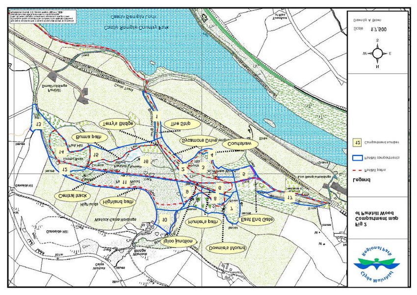
Contents
1.0 Introduction 2
1.1 Consultation 2
1.2 Issues Raised 2
1.3 Regional Park Charter Aims 3
1.4 The importance of Woodlands 4
1.5 Biodiversity 5
2.0 General Aims 6
2.1 The conservation aims will be achieved through 6
2.2 Co-operation will be encouraged through 6
2.3 Recreational access to Parkhill wood 6
2.4 Education and interpretation will be achieved through 7
2.5 Historical information 7
3.0 Identification of important features 8
4.0 Proposals for management action 8
4.1 Compartments 1-17 8 - 16
5.0 Appendix 1 17
5.1 Appendix 2 18
Table of Figures
. Front cover: View looking towards East End Gate
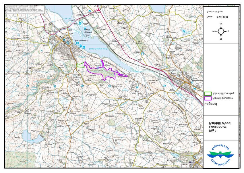
Figure 1: Location Map 19
Figure 2: Compartment Map 20
Figure 3: Entrance Sign 9
Figure 4: Unclear way marking 9
Figure 5: Proposed Environmental Works 21
Figure 6: Proposed Recreational Works 22
Figure 7: Rumble Strip 11
Figure 8: Gap in the old estate wall from the Johnshill field into Parkhill
wood 14
1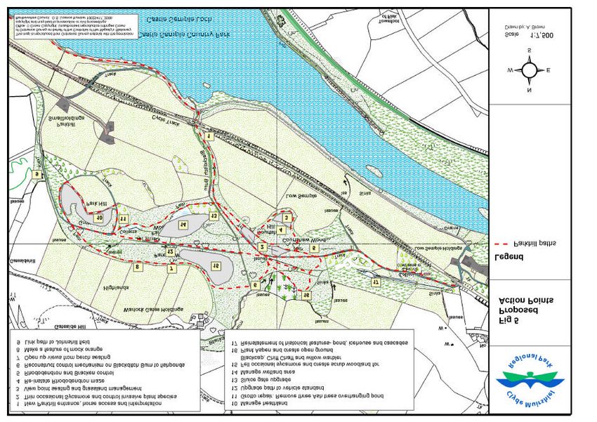
Parkhill Woodland Plan 2010-20

1.0   Introduction

      Parkhill Wood is the policy woodland of the former Castle Semple Estate and covers
      30 hectares of ground situated within Clyde Muirshiel Regional Park. Parkhill wood
      is part of the Castle Semple Country Park and is easily accessible from the village of
      Lochwinnoch. The woods are an important resource for local people and visitors to
      the area. Clyde Muirshiel Park Authority is looking to draw up a management plan
      to improve the woodland for visitors and wildlife. Following public consultation the
      woodland plan incorporates the public’s perception on the condition of the woods
      and their aspirations for the future.

1.1   Consultation Process

      A Parkhill Wood leaflet was distributed to invite public comment on a potential
      management plan for the woodland. The Park aims were briefly stated and
      comments by post or e-mail were sought. This was followed up by a flyer informing
      the public of four Ranger led walks around Parkhill wood, over the period of a year,
      where the public could comment on any issues about the woods. There was also an
      indoor meeting in November 2008 at the Castle Semple Visitor Centre to request
      comments from the public. A link on the front page of the Clyde Muirshiel Regional
      Park web site and a notice on the external information board at Castle Semple
      Centre asking for any thoughts on Parkhill wood were also used to gain responses
      from the public. In conjunction with Clyde Muirshiel Park Authority public
      consultations were also undertaken by the South Renfrewshire Access Network
      Initiative (SRANI) to gain views on improving the path network, interpretation and
      cultural heritage throughout the former Castle Semple Estate.
      In October 2009 the Park’s Consultative Forum considered a draft plan entitled
      “Consultation Draft” and this document was once more put out to wide consultation.
      This consultation document contained a summary of public comments up to that
      date for each compartment. Subsequent responses have been considered in the
      preparation of this, the final draft Parkhill Woodland Plan 2011 - 21. Some of the
      most recent comments are noted beside the changes from the original proposal.
      Following approval by the Park Authority it is proposed to submit an application for
      funding to the Scottish Rural Development Programme.

1.2   Issues raised through the Public and SRANI consultations

      Access - Separate mountain bike trails, the completion of the Johnshill link path,
      improvements made to path surface and drainage to remove standing water on
      paths. The development of bridal (sic) route within Parkhill wood.

      Signage and Interpretation - There were conflicting views on this issue with some
      advocating interpretation within the woods while others preferred the interpretation to
      be based mostly at Castle Semple Visitor Centre. All were agreed that within the
      woods the feeling of wildness should be retained and waymarking and interpretation
      kept as unobtrusive as possible.

                                                                                            2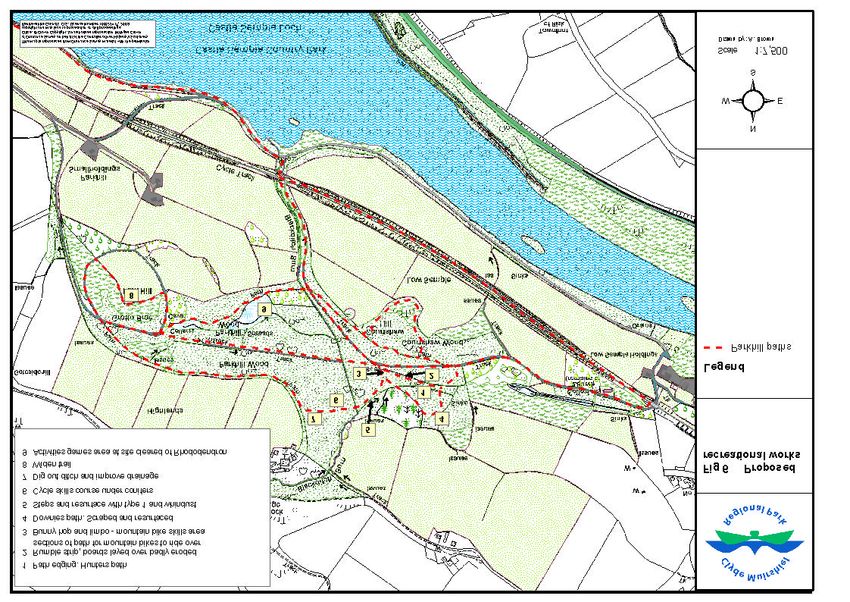
Biodiversity – The identification of key habitats to target specific species such as an
      increase in scrub woodland for Badger and bird species along with a larger wetland
      area for the benefit of Water Voles, amphibians and insects.
      The control of non-native or invasive plant species Rhododendron ponticum
      (Rhododendron) and Pteridium aquilinum (Bracken). Limited felling of Acer
      pseudoplantus (Sycamore) and mostly through the removal of seedlings or saplings.

      Historical Features – The reinstatement/repair of the Grotto, Cascades, Ponds and
      Ice Houses were mostly welcomed by all.

      Other issues – The natural look of the woods to be retained. Not too artificial.
      The condition of the boundary fence, the need for more seating and concerns over
      using bark chippings for resurfacing on very the muddy sections of paths.

      SRANI Public Comments
      A passive interest in Built Heritage from the public. The woods seen more as a
      resource for leisure and recreation.
      A need for the Johnshill link path.
      A desire for the wood not to loose its character through the restoration of features.

      Other Proposed Points
      The planting of ornamental specimen tree/shrubs may be undertaken to retain the
      look of the historic estate.
      Installing children’s play structures (SRANI).
      In certain areas the use of contractors to control Bracken/Rhododendron may be
      used.
      To retain cover for wildlife, Rhododendron removal to be gradual.

1.3       The Clyde Muirshiel Park Authority’s Charter Aims are:

      •   To conserve and enhance the natural beauty, biodiversity and cultural heritage of
          Clyde Muirshiel Regional Park.

      •   To encourage and enable learning, understanding and enjoyment of Clyde
          Muirshiel Regional Park

      •   To promote and foster environmentally sustainable development for the social
          and economic well-being of the people and communities within the Clyde
          Muirshiel Regional Park area.

                                                                                              3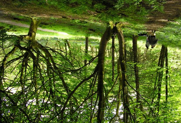
1.4   The importance of Woodlands
      Trees and woodlands are of great importance, both as wildlife habitats and in terms
      of their contribution to landscape character and quality. Compared with the
      European Union Scotland only has half the average amount of woodland coverage.
      Clyde Muirshiel Park Authority wishes to develop Parkhill wood to create greater
      opportunities for people to enjoy this environment. The main trails within Parkhill
      wood and the proposed Johnshill link path into Parkhill wood are part of
      Renfrewshire’s core path network (Appendix 1). The woods are easily accessible
      from the villages of Lochwinnoch and Howwood and via the National Cycle Route 7
      from communities between Glasgow and Irvine.
      The benefits associated with woodlands can be social, economic and environmental.
      The social benefits of woodlands are improved physical and mental health.
      Recreation in the woods can take the form of tranquil walks, energetic runs, cycling,
      family days out, or watching wildlife. This increase in physical activity can help to
      fight many health issues. Research has shown woodlands also benefit our mental
      wellbeing by reducing stress and anxiety. Woods are also proving to be an ideal
      setting for environmental volunteering and other group activities; this fosters
      community togetherness and a feeling of ownership for the community.
      Volunteering also develops skills and employability.
      The economic benefits from woodlands, in addition to employment, include positive
      influences on inward investment, increased property values, timber and tourism.
      At present the Regional Park’s Ranger Service provides an environmental education
      schools programme in Parkhill wood. Learning outdoors is a stimulating experience
      for children and helps to develop citizenship as well as delivering part of the formal
      school curriculum.
      The woods are regularly used by the rangers for local walking/community groups
      and natural and local history walks are run throughout the year.
      Volunteer groups and work experience placements also help the rangers with many
      practical tasks within the woods.
      Outdoor Activity Staff based at Castle Semple Centre use the woods to teach
      orienteering and mountain biking to youngsters from schools and community groups
      The Park is a significant contributor to community and lifelong learning. Through its
      volunteering and consultation opportunities the Park is developing and enabling
      community engagement and active citizenship.
      Increasingly the benefits delivered by the park’s aims and objectives are recognised
      as making a positive contribution to wide national and local agendas in the areas of
      health improvement, active lifestyles, community engagement, economic
      development, learning, environmental justice and inclusion.
      The Scottish government have outlined five strategy objectives and fifteen national
      outcomes (Appendix 2) to focus Government and public services on creating a more
      successful country, with opportunities for all of Scotland to flourish and the
      continuing development. Community involvement in Parkhill wood and
      implementation of its woodland plan are seen by the Park Authority to be a
      significant contribution to achieving the government’s aims.

1.5    Biodiversity
       In June 1992 the Prime Minister and over 150 other heads of state or governments
      signed the Convention on Biological Diversity at Rio de Janeiro. They did so to
      express a shared belief that action must be taken to halt the worldwide loss of

                                                                                           4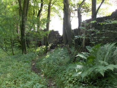
animal and plant species and genetic resources. They recognised that each country
has the primary responsibility to save and enhance biodiversity within its jurisdiction.
At the same time they agreed to draw up national plans and programmes and to
share resources to help implement them. The publication of the UK Biodiversity
Action Plan (UKBAP) was in response to this signing and national strategies for the
conservation of biological diversity and the sustainable use of biological resources
were developed. UKBAP recommend the best way to conserve UK biodiversity was
to produce Local Biodiversity Action Plans (LBAPs). LBAPs work to determine local
priorities and determine the contribution they can make to the national species and
habitat plans. This along with the Nature Conservation act of 2004 puts a duty on the
Park Authority to further the conservation of biodiversity and enhancement of natural
features within the regional park. The LBAP has identified species and habitats key
to ensuring that local biodiversity is retained.
Parkhill wood is designated as a Site of Importance for Nature Conservation (SINC)
and contains five of the seven key LBAP habitats.

•       Dwarf shrub heath
•       Unimproved grassland
•       Rivers and streams
•       Standing open water
•       Broadleaf and mixed woodland

Though these habitats are small in area within Parkhill wood, it is expected that the
new woodland management plan will conserve and enhance local biodiversity.
Within the proposed woodland plan are recommendations to increase the amount of
scrub woodland, restore heath and grassland areas from invasive species and
expand the amount of wetland and ponds.

This habitat creation should improve the biodiversity and target three Renfrewshire
LBAP species in the action plan

•   Spignel
•   Otter
•   Pipistrelle Bat

The Internationally important native Bluebell is found extensively within Parkhill
wood. Britain is home to half the world’s total population of this iconic plant that has
been in serious decline over the last 50 years. The Parkhill woodland plan aims to
conserve this plant.

                                                                                       5
2. General Aims
The Parkhill woodland plan aims to maintain or enhance the character, heritage,
nature conservation and landscape value of Parkhill wood while encouraging its
recreational use.
The woodland plan’s main functions are:
• To foster co-operation and understanding between the various users of Parkhill
wood.
• To encourage recreational access to Parkhill wood.
• To use Parkhill to further the educational and interpretive understanding of
visitors.
• To create a biological habitat that is suitable for a diverse flora and fauna.
• To ensure that habitats relating to key species are maintained so that the
conservation of such species is assured.
2.1 The conservation aims will be achieved through:
• the restoration of the woodland by planting mainly native mixed broadleaved
trees to improve the habitat.
• The control of invasive/non-native species will assist in the creation of a diverse
woodland.
• the enhancement of specific habitats such as areas of wetland, heathland,
grassland and scrub woodland.
2.2 Co-operation will be encouraged through:
• participation in guided walks, attending events and providing information through
the Regional Park’s Website.
• Creation of volunteering opportunities
2.3 Recreational access to Parkhill wood
• will be promoted through improved facilities for mountain bikes. This may result
in some redesigning of trails or separate areas to avoid conflict with other users.
• Improved print materials and web based information
• improved waymarking.
62.4 Education and interpretation will be achieved through
• the planting of, only where appropriate, exotic ornamental species to retain an
estate theme that will form part of the interpretive experience.
• Improved educational materials
• Co-operation with the SRANI project that aims to provide interpretation in the
wider Semple Trail area.
• An activity programme involving the Ranger service, outdoor instructors and
others.
2.5 Historical information
Parkhill wood has, possibly in a smaller form, been in existence since the middle of
the 1400’s. It was during the late 1400’s that the Semple (or Sempill) family moved
from their ancestral seat, Elliston Castle at Howwood, to the shores of Loch Winnoch
where they built a Castle and claimed the land that included the woodland as part of
their estate. From that time on, the woodland was extensively planted with many
different species of tree, including many exotic species.
In 1729 Colonel William MacDowall took over Castle Semple Estate and in 1735
demolished the old Castle and built a Mansion House designed by Robert Adam
(designer of the extensions to Culzean Castle in Ayrshire). Colonel MacDowall drew
up estate plans, which included the Fishponds and Cascades, the Rhododendron
maze on Courtshaw Hill, extensive plantings of trees including a starburst effect on
Parkhill and laying down tracks and footpaths through the site.
The MacDowall family vacated the estate in 1908, the estate then passed to the
Harvey family who resided there until the Mansion House was destroyed by fire in
1924. The estate fell into ruin and with the outbreak of World War II a great
percentage of the woodland was cut down for the “greater cause”.
After the war ended, the Ministry of Agriculture and Fisheries took over the estate
and some of the surviving estate buildings, such as the West Gates were
reoccupied. Many smallholdings were built throughout the estate and it was
eventually subdivided into small farms. Parkhill wood was used as a winter shelter
area for livestock and Courtshaw Hill and Parkhill were used for summer grazing. In
the 1960’s the area known as Black Wood (adjacent to Downie’s Mount) was used
as commercial woodland consisting of Scots Pine and Sitka spruce.
Castle Semple Country Park was formed in 1973, which encompassed Castle
Semple Loch and the surrounding shoreline. Later in 1978, Parkhill wood was
included within the Country Park and improvements for public access and
conservation work have been undertaken since this time.
In the early 1990s the field at the head of Johnshill was acquired and it is included
within the Parkhill woods management plan (Fig 1).
73.0 Identification of important features
The priorities for species, habitats and cultural heritage within the woodland are
noted below:
• Badger (Protected species)
• Spotted Flycatcher (Red listed)
• Blackcap
• Willow Warbler (Amber listed)
• Chiff Chaff (Amber listed)
• Bluebell (Species of conservation concern)
• Greater Tussock Sedge
• Rhododendron maze & grassland field
• Parkhill Heathland
• Central Wetlands
• Downie’s Mount
• Grotto & Pond
• Fishponds, Cascades and Icehouses.
• Footpaths (Renfrewshire Core Paths and wider network)
A range of birds have been recorded regularly within the site and this includes
Buzzard, Tawny Owl, Yellowhammer, Bullfinch and Whitethroat. In particular,
Parkhill wood has a good population of Blackcaps and in some years there have
been up to nine singing males.
During the summer of 2009 the Ranger service at Clyde Muirshiel Regional Park
started monitoring Parkhill Wood for Water Voles.
4.0 Proposals for management action
Parkhill wood is sub-divided into 17 compartments for proposed work (Fig 2). Each
compartment is given a brief description and an outline of work proposed within a
ten year plan.
Proposed action plans take into account consultation comments and give more
detail on how the proposed work is to be undertaken.
COMPARTMENT INFORMATION
4.1 Compartment 1
This compartment, known as the strip (Fig 2), consists of many mature trees such as
Alder, Ash, Oak and Beech. There are mature Hawthorn bushes lining the path and
boundary fence as well as Birch, Dog Rose, areas of regenerating Ash and also
Ash/Oak that were planted in 1994. This compartment contains the Blackditch Burn
and the main entrance footpath, the strip track.
.
84.2 Final consultation amendments
To facilitate multi use of recreational activities, interest from horse users and Clyde
Muirshiel Regional Park’s commitment to Active Lifestyle, Recreation and Access a
bridle path within Parkhill wood is to be implemented. Horse access will be
encouraged from the entrance gate in compartment 1, along the strip, sycamore
drive, past east end gate and the collegiate church and back onto the Sustrans cycle
path. Riders will be asked to call at Castle Semple Visitor Centre and request the
combination for the padlocked gates. Other
paths within Parkhill are not designed to
withstand horse riding. Concerns over horse
riders, mountain bikes and walkers/dog walkers
on the same path will be monitored and health
and safety issues may result in changes to this
access.
4.3 Proposed Actions
New access gate to woods (bicycle and
wheelchair friendly). Fig 3: Present Parkhill si gn
New Parkhill sign and interpretation board.
Current sign noted (Fig 3).
The Strip path improved to easy access standard
i.e having a good surface, an easy slope and no stiles or difficult gates.
Resting point for wheel chairs with defined safety edge.
A new fence line at Blackditch Burn placed further into
field to avoid bank erosion with a Hawthorn hedge
planted to stabilise bank and provide habitat for wildlife.
Turkey Oak made into a feature.
Some Beech trees to be removed and small scale
planting of native tree species
The interpretation within the woodland will mainly be at
Castle Semple Visitor Centre or by leaflets, and
potentially by use of digital technology. This along with a
new Parkhill entrance sign (Fig 5, Action point (AP) 1)
and improved way marking (Fig 4) would ensure that the
aesthetic qualities were maintained and the ‘wildness’
element retained. Fig 4: Unclear way marking
4.4 Compartment 2
A great deal of this compartment consists of Sycamore that was thinned in 1992, but
this species is still predominant. There is a great intrusion of Rhododendron which
has extended down the steep hill from the neighbouring compartment 3. Other trees
within this area include Birch, Goat Willow, Elder, Beech, mature Hawthorn, four
Norway Spruce, one European Larch and planted Oak and Ash (1994). This
compartment has two footpaths, the maze access path and the track known as
Sycamore Drive (Fig 2).
4.5 Final consultation amendments
9Management to improve biodiversity will include limited felling of sycamore to benefit
the ground flora. In these small gaps oak, birch, rowan, holly and hazel will be
planted and regeneration of sycamore and ash will be controlled by seedling or
sapling removal (Fig 5, AP 2).
4.6 Proposed Actions
The removal of a small amount of immature Sycamore and the long term removal of
seedling or saplings to lessen the biological impact on the woodland.
Small scale planting of native tree species.
As vehicle access is along this track will be scalpings and whindust. This path will be
designated as Easy Access having a good surface, an easy slope and no stiles or
difficult gates. Horse riders will be encouraged to use the lower track (AP 1)
4.7 Compartment 3
Located high on Courtshaw Hill, the maze is made up of Rhododendron bushes. It is
still used as a maze, but anecdotal evidence suggests it contains fewer routes than it
had two centuries ago. The Rhododendron has encroached into other
compartments, such as the grassland in neighbouring compartment 4 and onto
footpaths. Trees and shrubs within this compartment include Sycamore, Oak, Birch,
Ash, Yew and Hawthorn.
4.8 Proposed Action
Rhododendron re-growth will be controlled to maintain present size of the maze and
any new paths kept open (Fig 5, AP 4).
Interpretation on the maze is to be at Castle Semple Centre, no directional signage
is proposed within the maze.
Paths in the maze area to be topped up with bark where appropriate and the
condition of those left un-surfaced will be monitored.
4.9 Compartment 4
This compartment contains a small amount of grassland which includes species
such as Blaeberry. Around the edges of the grassland there are Sycamore, Birch
and an encroachment of Rhododendron. This compartment is also one of the main
viewpoints within the woodland.
4.10 Proposed Action
Management of the area will mean that it changes its present appearance of Birch
and scrub species to open grassland to improve the woodland’s overall biodiversity
(Fig 5, AP 3).
Work will include: Thinning out Birches at the viewpoint (brush cut), removing
Rhododendron re-growth, controlling the Bracken and mowing the grassland area.
The area of Brambles will be kept as a food source for birds.
Two simple bench seats have been installed (Fig 5, AP 3).
Fence work has been completed to prevent livestock entering the woodlands.
4.11 Compartment 5
This compartment is the East Buffer zone.
10The compartment contains Sycamore, Willow, Rhododendron, Oak, Ash, Elder,
White Poplar and a Bitternut. Also within this compartment is the vehicular access
track to the Cascades, pond area and the Collegiate Church.
4.12 Proposed Action
Rhododendron and Bracken control will be undertaken along with a phased removal
of Sycamore to open up areas for greater biodiversity, the open areas will be planted
up with scrub species (Fig 5, AP 5).
Signage and way marking to be kept low key, the majority of information on the new
leaflets.
Easy access path.
4.13 Compartment 6
The two main woodland species within this compartment are Sycamore, which
extends from the neighbouring compartment 2, and Rhododendron, which provides
cover for Roe Deer that frequent this compartment and the maze area (compartment
3). There are also a few Norway Spruce trees and Birch and Willow in the wetter
areas towards Poacher’s gate. Within this compartment is the burn that supplies the
cascades.
4.14 Proposed Action
Hunter’s path has been resurfaced with
scalpings and a whindust surface to withstand
erosion from mountain bikes (Fig 6, AP 1).
Rumble strips (off cuts of logs) have been
placed across sections of Hunters path as part
of skills course for mountain bikers (Fig 7).
The opening up of the ditches will allow a
greater flow of water to the cascades and pond.
This should in turn help reduce the amount of
water lying on the path. Fig 7. Rumble strip on Hunter’s
The mountain bike skills area sighted near Igloo path
junction (Fig 6, AP 3) is to be screened off and
natural looking obstacles are to be used where
possible.
This skills area should help separate walkers and cyclists to some extent. Although
no separate routes for mountain bikes are planned, the longer direct downhill paths
will be closed and replaced with curving routes to help reduce cycling speeds.
4.15 Compartment 7
This substantial compartment, also known as Black Wood was used as a
commercial woodland area during the 1960’s and is now largely over-run with
Bracken. Within the open area, close to Downie’s Mount, a few planted Oaks are
well established and a solitary Scots Pine stands at the boundary fence. Within other
areas Sycamore, Elder, Hawthorn, a few Sitka Spruce and a small amount of
Rhododendron can be found.
4.16 Proposed Action
The Management of this grassy area would involve extensive Bracken removal.
Aspen (in tree tubes) are to be planted to assist in the control of bracken with some
11open ground left for scrub and wildflower species to become established (Fig 5, AP
16)
4.17 Compartment 8
This area of the woodland has a small mound known as Downie’s mount, or
Downie’s Castle. This mound is topped by a circle of Yew trees and it may have
been a site of historical importance, but its archaeological significance is unknown.
Rhododendron is well established with many of the bushes being of a mature age
and height, giving an ornamental appearance. The Rhododendron extend through
Downie’s Mount as well as into the wetland area. The main species include
Sycamore, Elder, Birch, a few Norway Spruce, Beech, Willow and Bracken. This
compartment is bordered by a small path, which has had its course around the base
of Downie’s Mount altered over the years with the expansion of growth from
Rhododendron.
4.18 Proposed Action
Improved drainage to remove path surface water and scalpings and whindust
applied where necessary.
Rhododendrons around the Yew tree to be removed to reveal one of Scotland’s
three native conifer tree species.
Low key way-marking.
4.19 Compartment 9
This small section of wetland has a small but fine example of Birch woodland and
stands of Willow. It is a compartment that is also becoming over-run with
Rhododendron, which threatens the ground flora of the Birch areas.
4.20 Proposed Action
Re-construction of the mechanism on Blackditch Burn is planned to control water
flow to the cascades (Fig 5, AP 6).
Rhododendron removal and Beech regeneration control is to be undertaken.
4.21 Compartment 10
This compartment comprises of the North Buffer zone, also known as North wood,
between Parkhill woodland and the farmed ground.
4.22 Proposed Action
The area is to be maintained as a quiet spot for wildlife.
124.23 Compartment 11
This large compartment makes up the whole of the central slope area, which is
largely covered with Bracken. There are many different tree species within this
compartment including Syc amore, Elder, planted Hawthorn, Rhododendron, one
Yew, Scots Pine, Willow, Beech, Birch, Alder, one Field Maple, planted Ash and
Oak, as well as Balsam Poplar. There are also areas of open ground and an area of
wetland.
4.24 Proposed Action
A small mountain bike skills area has been set up in conifers near the top of the
slope (Fig 6, AP 6). Some lower branches have been trimmed back to allow cyclists
to pass under. Any damage to the ground surface under the conifers is to be
assessed as group usage increases.
The path down from Highland to Ranger Bridge at present is too steep and water is
causing erosion. Activity staff are improving the drainage and putting in a series of
small steps to lessen erosion of the slope from mountain bike use (Fig 6, AP 7). The
path route is be altered to create a series of ‘S’ bends to reduce the steepness of the
slope and to prevent the erosion of water flowing downhill.
Drainage and path work on the Highland track is required.
To improve the view from the perches it is proposed to take out a few Sycamore
trees and remove a 40 metre stretch of Rhododendron, with new viewpoint seating
installed near the Mock Orange shrub (Fig 5, AP 7 & 8).
Control Bracken and plant Hawthorn/Blackthorn scrub species to encourage birds
such as Blackcap, Whitethroat, Chiff-Chaff and Willow Warblers (Fig 5, AP 15).
4.25 Compartment 12
This small area of the site is low lying and reasonably damp with predominately
Alder trees, but also some Sycamore, Birch, Willow and Elder. Bracken, Hawthorn,
and Rhododendron found alongside the boundary fence area.
4.26 Proposed Action
Improve drainage ditches to keep water off path, scrape path surface to remove mud
and replace with scalpings and whindust.
The Alder woodland is to be kept as it attracts a large number of insects and is host
to many species of lichen. Goldfinches are also attracted to the cones in winter.
13Fig 8: Gap in the old estate wall from the Johnshill field into Parkhill wood
4.27 Compartment 13
This compartment comprises of the West End Buffer zone and the steep west slope
of Parkhill. Species include Sycamore, Beech, Birch, Balsam Poplar, Holly, Bracken
and a Hawthorn hedge with Alder and Willow in the wetter areas. The footpath
within this compartment requires upgrading and rebuilding work will be necessary on
the old Estate boundary wall.
4.28 Proposed Action
The construction of this circular link is a high priority in the proposed Parkhill
Woodland management plan (Fig 5, AP 9).
There is a gap in the dilapidated estate wall and the public gain access to the woods
at this point. It is planned to reconstruct part of the wall with an access gap
incorporated and the sides of the wall lowered (Fig 8). The Johnshill field has
potential for use by mountain bikes to cater for activity groups and visitors to the
Castle Semple Visitor Centre. Some path erosion in Parkhill wood is from mountain
bike use.
The route would go north and connect with the old bridle path and then join with the
central track to Igloo junction and then south to the Sustrans cycle track (Fig 2).
A six to seven metre bridge will be required over a ditch with a smaller structure for
the ha-ha and a two metre bridge or culvert at the north end of the path.
A separate desire line from the corner of the fence line goes directly up through the
woods and may benefit from installing a number of steps near the top end.
Some Sycamore is to be removed and this may be incorporated into the bridge
construction, Sycamore regeneration should be controlled and scrub species such
as Hawthorn and Blackthorn planted to provide habitat/food for birds.
Ring barking of several suitable trees (away from paths) to create standing dead
wood for insects is proposed.
4.29 Compartment 14
This compartment has a basaltic outcrop rising to a height of 90m. The highest point
affords an excellent view of Castle Semple Loch and the surrounding countryside.
The steep north and east facing slopes are well wooded with mature Oak, Ash and
Sycamore, with a selection of Elder, Birch and Rowan. The Western slope of the hill
is covered in Bracken, Bramble and occasional Hawthorn, whilst the crown of the hill
is a grassy-heath with Heather and Blaeberry.
144.30 Proposed Action
A management regime to encourage dwarf shrub regeneration is planned. This
would include tree felling and removal of all material. Bracken control may be
through fern specific spraying in the summer when at the height of growth or
physically bashing or pulling out by the roots in smaller problem areas. It may also
include the removal of previous years of Bracken material to allow heather to
regenerate, the flailing of Heather to improve the age range and increase
biodiversity and the control of invasive Rhododendrons and scrub species would be
needed (Fig 5, AP 10).
To improve drainage the removal of Willows from the ditches would be required and
the paths then scraped and resurfaced.
Install viewpoint-seating.
The path on the upper section of Parkhill is to be widened for cyclists (Fig 6, AP 8).
4.31 Compartment 15
This narrow compartment contains a small but good example of mature birch
woodland. Other species are Sycamore, Beech, Oak, Willow, Elder, Hawthorn, a few
Rhododendron, some planted Rowan (1993) and large areas of Bracken. Within this
compartment are the Grotto, the Pond and a wooden footbridge known as Terry’s
Bridge.
4.32 Proposed Action
SRANI has identified the potential for restoration and adaptation of the Grotto (Fig 5,
AP 11). The plan is to ensure the stability of the structure, enhance it through proper
use of materials and in conjunction with the woodland plan establish key views
through landscape design and planting. Re-roofing the grotto is not thought
desirable due to potential problems with anti-social behaviour.
The recent small cairn has been removed and a dry stane seating has been
installed.
The density of Alder is to be reduced and the removal of some Ash to lower the
amount of leaf litter entering the pond is proposed (Fig 5, AP 11).
4.33 Compartment 16
This large compartment contains the main wetland area of the wood. Willow, Birch,
Oak and Sycamore are all present as well as a great deal of Rhododendron, one
Sitka Spruce, areas of open ground and Bracken on drier ground. Within the
wetlands, species such as Greater Tussock Sedge can be found. A small sluice
located close to Terry’s Bridge controls the level of water that is retained within the
site.
4.34 Proposed Action
The establishment of a wetland area would require the construction of a larger sluice
gate on Black Ditch burn (Fig 5, AP 13).
Rhododendron control is likely to be by mechanical means in the boggy areas.
The resulting wetlands habitat creation (Fig 5, AP 14) would improve the biodiversity
of the woodland. Species that would benefit include Greater Tussock Sedge,
amphibians, dragonflies and damselflies and potentially Water Voles.
It is intended that more ponds will be created in this compartment.
The Central track will be upgraded to vehicle standard (Fig 5, AP 12).
15Ash will be coppiced to the north of Central track to supply material for green
woodworking.
An area of Rhododendron has been cleared and is being used by activities staff as a
team games area and is screened form the Burma path (Fig 6, AP 9).
4.35 Compartment 17
This compartment comprises the three fishponds, and their cascades, and the two
icehouses. The compartment contains Sycamore, Willows, Rhododendron, Oak,
Ash and Elder.
The Clyde Bat Group have erected a Bat Hibernaculum and several Bat boxes in
this compartment.
4.36 Proposed Action
The restoration/maintenance of the historic features within this compartment is
proposed by SRANI and they are considering its interpretation in conjunction with
the Parkhill woodland plan (Fig 5, AP 17).
Access to the ice house will require some clearance and path work.
16Appendix 1
Renfrewshire's Core Paths Plan
The Council has adopted its Core Paths Plan. This was one of the duties that the Council
had to carry out under the Land Reform (Scotland) Act 2003. The plan has been developed
over a number of years and has been led largely as a result of public consultation. It
identifies the paths and routes that the public feel are the most important in the area for
providing access by non motorised means.
The plan shows routes that are surfaced paths, dirt tracks, grass paths, pavements and
minor roads. Access points have been shown to the National Cycle Network and to rivers
and lochs in the area. Over the whole network there are routes for walkers, cyclists, horse
riders and people with disabilities. Not every route is suitable for everyone, the plan also
includes information about each route that will help you to decide whether a route is suitable
for you or not. Please remember that your access rights only apply if you are behaving
responsibly. You can get more details about your rights and responsibilities by reading the
Scottish Outdoor Access Code.
Some of the Core Paths need some improvement to make them more useable. This work
may include cutting back overgrown vegetation, altering or removing gates to make a route
easier to use, drainage works, resurfacing or sign posting the route. We cannot make all
these improvements at once but will work over the next two to three years to achieve these.
The final round of public consultation on the Renfrewshire Core Paths Plan took place
between the 7 th April and 17th October 2008 and the Plan was adopted by Renfrewshire
Council on 25th February 2009.
The Core Paths Plan is available for viewing at libraries or at the Council Offices. You can
obtain a paper copy of the plan, at a cost of £5.00, by contacting the planning department at
corepaths.pt@renfrewshire.gov.uk.
17Appendix 2
Scottish Government :Strategic Objectives
One of the Government's first actions on taking office in May 2007 was to streamline the
resources of government in order to focus on creating a more successful country.
We aligned the Scottish Government around five Strategic Objectives that underpin our
Purpose and describe the kind of Scotland we want to live in - a Scotland that is Wealthier
and Fairer, Smarter, Healthier, Safer and Stronger and Greener. We created a smaller,
more effective Ministerial team, and matched this with a simpler and more efficient structure
for the Scottish Government.
We believe that success lies in focusing all of Government and public services on the
achievement of our Purpose. By working together across all of these strategic objectives,
we can increase sustainable economic growth so that all of Scotland can flourish.
Safer and Stronger
Wealthier and Fairer
Enable businesses and people to increase their Help local communities to flourish,
becoming stronger, safer place to live,
wealth and more people to share fairly in that
wealth. offering improved opportunities and a
better quality of life.
Smarter Greener
Expand opportunities for Scots to succeed from Improve Scotland's natural and built
nurture through to life long learning ensuring environment and the sustainable use and
higher and more widely shared achievements. enjoyment of it.
Healthier
Help people to sustain and improve their health,
especially in disadvantaged communities,
ensuring better, local and faster access to
health care.
National Outcomes
Fifteen National Outcomes describe what the Government wants to achieve over the next
ten years, articulating more fully this Government's Purpose. They help to sharpen the focus
of government, enable its priorities to be clearly understood and provide a clear structure for
delivery.
By achieving these outcomes together, we will make Scotland a better place to live and a
more prosperous and successful country.
We live in a Scotland that is the most attractive place for doing business in Europe.
18We realise our full economic potential with more and better employment opportunities
for our people.
We are better educated, more skilled and more successful, renowned for our research
and innovation .
Our young people are successful learners, confident individuals, effective contributors
and responsible citizens.
Our children have the best start in life and are ready to succeed.
We live longer, healthier lives .
We have tackled the significant inequalities in Scottish society.
We have improved the life chances for children, young people and families at risk.
We live our lives safe from crime, disorder and danger.
We live in well-designed, sustainable places where we are able to access the amenities
and services we need.
We have strong, resilient and supportive communities where people take responsibility for
their own actions and how they affect others.
We value and enjoy our built and natural environment and protect it and enhance it for
future generations.
We take pride in a strong, fair and inclusive national identity.
We reduce the local and global environmental impact of our consumption and production.
Our public services are high quality, continually improving, efficient and responsive to
local people’s needs.
1919
20
21
22
You can also read