Southernmost Weather Reporter - National Weather Service Weather Forecast Office Key West, FL
←
→
Page content transcription
If your browser does not render page correctly, please read the page content below
Southernmost Weather
      Reporter

   National Weather Service
   Weather Forecast Office
         Key West, FL
Southernmost
Weather Reporter
National Weather Service ~ Key West, FL
Welcome to 2017 Winter Report
Farewell letter from Matt Moreland, Meteorologist-in-Charge (MIC) at NWS San Diego.
By: Matt Moreland DEC 2017
F
or my final letter for the “Southernmost Weather Reporter”, I wanted to share a
few thoughts on Hurricane Irma. I never could have imagined that during the last Inside this Report:
four weeks of my time at the Florida Keys National Weather Service (NWS), that I
would work the biggest event of my career. I am so proud of how our team came Welcome 1-2
together and handled this event. We sent our first text notifications to emergency Support to NOAA
3
management on Aug. 30, and sent our first official briefing on the storm out on Friday, Research Vessel
Sep. 1 – eight days before the storm impacted the Keys. Jon Rizzo, the Warning Staff Recognized at
Coordination Meteorologist (and current Acting Meteorologist-in-Charge), deployed on- Regional and National 3
Level
site with Monroe County Emergency Management (MCEM) for nine days beginning
Thursday, Sep. 7. This on-site deployment for a tropical cyclone was a first for the office – Q&A with
4-5
a practice that will continue in the future. The NWS worked to support many of the Stephen Chesser
critical decisions in the Keys: for example MCEM’s decision to initiate evacuation a day Support During
earlier than the normal time frame, and the decision to relocate the Emergency 5
Hurricane Harvey
Operations Center to a more secure facility in Ocean Reef during the storm.
Major Hurricane Irma 6
Thanks to the leadership efforts of Forecaster Bill South, the Florida Keys NWS
participated in a wide scale of local, national, and international interviews. These History of Irma 7
interviews included all the major national networks, WGN, TMZ, and from countries as far Media Interaction
8
ranging as Canada, Ireland, the UK, and New Zealand. In social media, the audience During Irma
impressions on the Florida Keys NWS Twitter account increased from 477,000 in Aug. to 9-
47.6 *million* in Sep. A single tweet issued by the office on Sep. 8 garnered an audience Insertion Team
10
impression of 13.2 million, and was shared by Chelsea Clinton.
Gratitude to Our
11
We had 17 employees from the Florida Keys NWS and three visiting from other offices, Office
who hunkered down during the storm in our facility on White Street in Key West. This
Hurricane Flags 11
group continued to issue forecasts and warnings and stay in constant contact with media
and emergency management as the storm crossed the Keys. On the morning of the 10th, Preliminary Observa- 12-
several of the the Florida Keys NWS team watched radar knowing that the eyewall of tions from Irma 13
Irma was impacting their properties, and persevered anyway. With power out across the Special Guest from
Keys, most of our group remained at the office for five days, working hard with little 14
NWS Corpus Christi
sleep. One of our forecasters, Krizia Negron, provided support for our office from NWS
15-
Tampa and NWS Miami through Continuity of Operations (COOP). Our administrative Photos After Irma
16
assistant, Laura Kasper, did the same from Miami, ensuring that employees and their
families were reimbursed for evacuations and hotel stays. 2017 Hurricane
17
Continue to Page 2 Season SummaryWelcome to 2017 Winter Report cont.
Many from the Florida Keys NWS office sustained damage to their properties from the hurricane, and had extended
stays in hotel rooms after the storm. The meteorologists whose homes were damaged banded together and dubbed
themselves the “Insertion Team”. This group spent the days following the storm going house to house, helping each
other do cleanup and make critical repairs. This teamwork was an example for our whole agency to follow!
The day of Irma’s impact (Sep. 10), our communications slowly went down as they did with other agencies/offices in
the area. However, we soon discovered that our older, rarely used, analog phone lines stayed up through and after
the storm: our NOAA weather radio alarm line and
our spotter and conference room phones. The NWS
facility on White Street became a critical hub for
decision making in the days to come. We provided
hosting space for meetings for the City of Key West,
the FAA, airports, FEMA, and other partners, and
the twice daily county calls as well (as pictured on
the right). A lot of key decisions were made during
this period, including when to open the Lower Keys
back to residents. We also provided decision
support on the other storms that had formed in the
wake of Irma (namely Jose and Maria). The Florida
Keys NWS was very proud to have supported our
partners in this way.
I want to give a special thanks to some other folks in the NWS that voluntarily came down for a period to help our
office either to work operations for the storm itself, or afterwards to support recovery efforts: Monty Davis
(Electronic Technician, NWS Oklahoma City), Keith DeArmas (Facilities Engineering Technician, NWS New
Orleans/Baton Rouge), Ken Graham (Meteorologist-In-Charge, NWS New Orleans/Baton Rouge), Greg Heavener
(Forecaster, NWS Corpus Christi), William Hill (Electronic Technician, NWS Dallas/Fort Worth), Heath Jordan
(Facilities Engineering Technician, NWS Southern Region HQ), Jonathan Kurtz (Forecaster, NWS Oklahoma City),
Mike Samuelson (Electronic Technician, NWS Lubbock), and Paul Schaafsma (Electronic Systems Analyst, NWS
Brownsville). Also, a special thanks to NWS Austin/San Antonio, NWS Miami, and NWS Melbourne who each
provided service backup for our office for a period following Irma’s landfall as critical restoration work was done at
our office. Thanks to the teamwork of those listed above, the Florida Keys NWS office was able to take back full
operations on Sep. 19, only nine days after Irma had struck the area, and ensured a smooth transition in leadership
once I departed for San Diego on Sep. 28.
I will forever be proud of the work that the Florida Keys NWS did in support of our decision makers, residents, and
tourists of the Keys, keeping them informed on
Hurricane Irma. You all were like family – and I will
miss working with you. I completed my move out to
California in mid-Oct., and am settling into my new
position in NWS San Diego. In the final days that I
was down there, it broke my heart to see the
devastation that the hurricane had wrought on
portions of the Keys. But I know that the Keys are
recovering fast, and will come back stronger than
ever. I’m going to miss a lot of things: the sunsets,
the food, the festivals, and most importantly, the
people – and promise to be back to visit!
Southernmost Weather Reporter ~ National Weather Service Key West, FL ~ Dec 2017 2Florida Keys NWS Provides On-Site Weather Support for the
NOAA Research Vessel Nancy Foster
By: Christopher Rothwell
Before Hurricane Irma impacted the Florida Keys in early September, and before a deployment to the NWS Corpus
Christi for Hurricane Harvey in late Aug., Forecaster Chris Rothwell deployed in early Aug. to the NOAA Research
Vessel (R/V) Nancy Foster for its annual survey of the Florida Keys National Marine Sanctuary. Rothwell gave daily
shipboard marine weather briefings to support safety of life at sea and weather-sensitive decision making, pertain-
ing to ship and small boat voyage planning and execution, and dive operations. This is the second year in a row the
Florida Keys NWS supported the Foster’s research
team, which carried out scuba and small-boat
operations, and a variety of research missions,
collecting data necessary for management deci-
sions within the Sanctuary.
After the 10 day cruise, Rothwell provided a guided
tour of the Florida Keys NWS office to portions of
the Foster’s crew. In the same vein as oneNOAA,
Florida Keys NWS plan to support the Foster next
year during its 2018 research cruise in the
Sanctuary.
From left: Survey Technician Sam Martin and
Electronics Technician Keith Martin, both from the
NOAA Research Vessel Nancy Foster, and Forecaster
Chris Rothwell, from the Florida Keys NWS.
Florida Keys NWS Recognized at Regional and National Level
By: Krizia Negrón
In our last edition, we highlighted a group of our staff that was recognized for their work and efforts with a local
Isaac M. Cline Award. The winners were then forwarded to region and national level for consideration. In total, four
forecasters received recognition with a 2016 Isaac M. Cline Award and are listed below with the award description.
Congratulations to all four!
Brandon Fling - Data Acquisition (regional) for leadership of the COOP, upper air, and climate programs and the
WFO Observation Team, developing innovations in production and quality control to benefit multiple offices.
Kennard Kasper and Christopher Rothwell - Leadership (regional and national) for advancement of the NWS
marine program through mission-critical customer service, developing a whole-office approach to DSS, and the
completion of projects and research.
Krizia Negrón Hernández - EEO and Diversity Management (regional and national) for Spanish translation of
warning/preparedness information for offices throughout the NWS which has furthered the mission and provided
improvements in customer support.
Southernmost Weather Reporter ~ National Weather Service Key West, FL ~ Dec 2017 3Meet One of Our Meteorologists, Stephen Chesser
By: Christopher Rothwell
Q&A with Stephen Chesser, Meteorologist (pictured
on the right)
You work the Data Acquisition Desk at the Florida
Keys NWS. So, your only duties are to gather data?
No, I also quality control the immense quantities of
data I acquire via the weather instruments aboard
launched balloons. This means I selectively edit the
data that is beyond proven scientific tolerances. Data
entry duties include: monitoring various websites
tracking daily rainfall and temperatures; emailing
daily high and low temperatures and rainfall totals for
compilation into statewide products; radar checklists
for tracking technical aspects of the radar perfor-
mance data; proofreading and editing routine text
products; performing weekly tests of the NOAA
weather radio; posting and monitoring social media
platforms (Facebook and Twitter); and during tropical season, update advisories and outlooks.
Your career is in meteorology? Have you always been a meteorologist?
No, I have had several other jobs before I was a meteorologist. After I left the USAF, I worked as a part-time adjunct
professor at a local junior college. Later, I worked as an over the road commercial truck driver, delivering cargo all
over the continental U. S.
So, you spent some time in the military as a meteorologist. What countries have you worked in, that you can tell us?
While in the USAF, I was either temporarily stationed or stationed long term in the following countries: the Republic
of Korea, the United Kingdom, Kingdom of Saudi Arabia, Islamic Republic of Afghanistan, Emirate of Kuwait, the
Republic of Djibouti, Republic of Honduras and Republic of Colombia.
How is meteorology different in the military vs the National Weather Service?
Military meteorology is either associated with synoptic scale weather for logistical and staff briefing purposes, or
very local for the five mile terminal radius surrounding airbases around the world. I’ve forecasted for airbases
thousands of miles away using only satellite and scant surface data.
What types of Decision Support Services (DSS) have you provided during your time in the military?
As a recently commissioned USAF weather officer, I was assigned to the Southwest Asia Weather Cell, just before
the invasion of Iraq. I was working the overnight shift and suddenly the classified phone rang. It was a soldier calling
my office for an update for their planned jump into northern Iraq the night of the invasion. I wasn’t too sure what he
needed, so I asked my closest Master Sergeant, who calmly instructed me to look for the thresholds that the soldier
needed for his jump to be successful. I looked over the data and briefed the soldier that all weather factors were
good to go. He gave me his initials and I gave him mine, just as if it was any other casual weather briefing.
Later, I dwelled on the immense importance of what had transpired that night. I had literally the fate of over a 100
lives hanging in the balance of my judgement call. But, this is just one example of the kind of DSS we performed
regularly during my 12 years as a weather officer in the USAF. Whether it was in a Joint service weather cell, fore-
casting for the invasion of Iraq all the way over in South Carolina, embedded with special operations forces in the
remote mountains of Afghanistan, Command Staff briefings for Combined Forces in Kuwait, or planning weather for
Continue to Page 5
Southernmost Weather Reporter ~ National Weather Service Key West, FL ~ Dec 2017 4Meet One of Our Meteorologists, Stephen Chesser cont.
the surge out of Iraq and into Afghanistan, DSS is just another day at the job for a commissioned USAF weather
officer.
Where do you want to be in 10 years?
Not sure, I could either be a lead forecaster somewhere else in the NWS, or move over to work at either NHC or
TAFB using my MS in tropical meteorology. I still have aspirations for a PhD.
Florida Keys NWS Forecaster Deploys to NWS Corpus Christi to
Assist During Hurricane Harvey
By: Christopher Rothwell
On Aug. 23, Forecaster Chris Rothwell deployed to the NWS Corpus Christi, Texas, to support their office during trop-
ical operations. At the time of Rothwell’s flight out of Key West on the morning of the 23 , Harvey had just emerged
rd
into the Bay of Campeche and was only classified as a tropical depression. The official National Hurricane Center
forecast expected Harvey to make landfall somewhere along the Texas coastline, and based on the favorable condi-
tions across the western Gulf of Mexico, hurricane watches were issued for much of the Texas coast, including all of
NWS Corpus Christi’s coastline. Harvey would end up rapidly intensifying into a Category 4 hurricane, making landfall
near Port Aransas, Texas, just northeast of Corpus Christi. Just like the Florida Keys NWS during Hurricane Irma, NWS
Corpus Christi needed all hands on deck to support their partners in southeastern Texas.
It is common for offices across the NWS to use personnel from neighboring offices to supplement the labor force
during tropical operations. Rothwell was joined by two other deployed forecasters from across the region, and they
were tasked with radar, aviation, social media, and EM partner briefings during their five day deployment at NWS
Corpus Christi. Rothwell’s experience during Harvey’s landfall included the issuance of two Extreme Wind Warnings,
support of first responders during the eye’s passage over Rockport, a fire alarm evacuation during hurricane-force
winds, and emergency Shop-Vac duties to prevent water from damaging the server room. Rothwell returned to Key
West on Aug. 28th, just two weeks before an almost unbelievable landfall from another Category 4 hurricane, Irma.
Panoramic view of the operational floor at NWS Corpus Christi before Hurricane Harvey’s landfall.
Southernmost Weather Reporter ~ National Weather Service Key West, FL ~ Dec 2017 5Major Hurricane Irma
On Sunday, Sep. 10, 2017, Major Hurricane Irma made landfall over Cudjoe Key, in the Florida Keys at 9:10
am EDT.
Next, you’ll find a summary of the storm’s history, reports, and some of the stories as told by the staff
that stayed and worked this event from the Florida Keys NWS building in Key West, FL.
GOES-16 visible imagery (GeoColor) of Major Hurricane Irma on Sep. 10, 2017 approaching the Florida Keys.
Image from CIRA. Disclaimer: NOAA's GOES-16 satellite imagery is non-operational and preliminary.
Southernmost Weather Reporter ~ National Weather Service Key West, FL ~ Dec 2017 6The History of Irma
By: Bill South
At 8 pm EDT, Sunday, Aug, 27, 2017, a tropical wave was located near the west coast of Africa. This tropical wave
was producing a large area of disorganized showers and thunderstorms. The National Hurricane Center pronounced
that environmental conditions were favorable for the tropical wave to gradually develop during the next five days as
it moved to the west. This tropical wave developed into Tropical Storm Irma at 11 am, Aug. 30 about 420 miles west
of the Cabo Verde Islands. Tropical Storm Irma rapidly intensified into a Category 2 hurricane, with maximum sus-
tained winds near 100 mph, in just 24 hours. At 5 pm, Aug. 31, 2017, Hurricane Irma strengthened into a major hur-
ricane of Category 3 intensity about 720 miles west of the Cabo Verde Islands. Irma fluctuated in intensity from a
Category 2 to a Category 3 for the next several days as it progressed to the west-northwest.
On Sep. 4, Hurricane Irma
began to steadily strength-
en and at 5 pm, Irma
reached Category 4 inten-
sity about 490 miles east
of the Leeward Islands.
Irma strengthened into a
Category 5, with maximum
sustained winds near 175
mph, about 270 miles east
of Antigua at 7:45 am on
Sep. 5. At that point, Irma
was the most intense easternmost Atlan-
Track of Hurricane Irma as of Sep. 5, 2 pm (red squares) and official forecast tic basin hurricane on record, surpas-
track (clear squares) from National Hurricane Center. Image from Hurrevac. sing Hurricane David in 1979. At 2 am on
Sep. 6, Hurricane Irma reached its peak
intensity, with maximum sustained winds near 185 mph and a minimum central pressure of 914 millibars. At that
point, Irma was tied as the second strongest Atlantic basin hurricane on record by maximum sustained winds,
surpassed by only Hurricane Allen in 1980, which produced maximum sustained winds near 190 mph. Shortly there-
after, Hurricane Irma made landfall on the islands of Barbuda, Saint Martin, Ginger Island, and Tortola at peak inten-
sity. Irma is the first recorded Category 5 to impact the northern Leeward Islands. Hurricane Irma retained maximum
sustained winds near 185 mph for about 37 hours. Irma is the only tropical cyclone worldwide to produce maximum
sustained winds that high for so long, surpassing the previous record of 24 hours set by Typhoon Haiyan in 2013.
Irma continued to move to the west-northwest and made landfall in Cuba as a Category 5 on Sep. 9. Land interaction
with Cuba caused Hurricane Irma to weaken to a Category 3 later that day. Irma strengthened into a Category 4 at 3
am on Sep. 10 about 65 miles southeast of Key West, Florida. Hurricane Irma wobbled to the north and made land-
fall on Cudjoe Key at 9:10 am on Sunday, Sep.10 as a Category 4, with maximum sustained winds near 130 mph and
a minimum central pressure of 929 millibars. Irma is tied as the seventh most intense hurricane, by lowest central
pressure, to make landfall in the United States since reliable records began in 1851. Four of the 10 most intense
hurricanes, by lowest central pressure, to make landfall in the United States struck the Florida Keys: The Labor Day
Hurricane in 1935, The Florida Keys Hurricane in 1919, Hurricane Donna in 1960, and Hurricane Irma in 2017.
Irma weakened to a Category 3 prior to making its second United States landfall in Marco Island, Florida, at 3:35 pm
on Sep. 10. Later that afternoon, Hurricane Irma weakened to a Category 2 near Naples, Florida, and weakened to a
tropical depression about 95 miles south-southwest of Atlanta, Georgia, the evening of Sep. 11., before eventually
dissipating.
Southernmost Weather Reporter ~ National Weather Service Key West, FL ~ Dec 2017 7“I’m a meteorologist. I’m staying behind in the Florida Keys to
help save lives”
Before and during Hurricane Irma’s landfall over the Florida Keys, our office conducted many phone, TV and radio
interviews with local, regional, and national media. After one of the interviews, one of our forecasters, Bill South,
was reached to share his thoughts with the Washington Post. You can read his article at
https://www.washingtonpost.com/news/posteverything/wp/2017/09/09/im-a-scientist-im-staying-behind-in-the-
florida-keys-to-help-save-lives/.
This article was originally published on Sep. 9, 2017, a day before Hurricane Irma’s landfall. Bill South is the Tropical
Weather Program and Social Media manager at our office.
Left: CNN’s Anderson Cooper interviews Forecaster Bill
South the night before Irma’s landfall over the Florida
Keys.
Right: Forecaster Chip Kasper during a live phone
interview with The Weather Channel.
Left: Forecaster Chris Rothwell (in blue shirt)
broadcasts hourly observations through the VHF
marine radio during the peak of the hurricane.
Southernmost Weather Reporter ~ National Weather Service Key West, FL ~ Dec 2017 8Insertion Team
By: Sean Daida
In the day following the landfall of Major Hurricane Irma in the Lower Florida Keys, one of our forecasters, Chris
Rothwell, came up with the idea to band together and do what we can for our coworkers’ homes as a team, the
Insertion Team. The idea was everyone together, focusing on one house at a time, will be much more efficient and
encouraging than everyone individually hauling out one branch at a time at their own separate homes. The commu-
nications at the Florida Keys NWS office were down so we were operating in a limited capacity, allowing most of our
staff time to tackle household cleanup. It’s been awhile since many of us have had to endure anything resembling
hard labor, but we were all game. In the weeks following Irma’s landfall, we visited at least seven residences and
aided in whatever capacity was needed. We cleared storm debris, opened driveways, cut down and hauled trees,
shoveled mud, tarped three roofs , hauled out shattered fences, cleared out drywall, took down storm shutters, jury
rigged a window A/C, and even mopped flooded floors and baseboards. One person even helped me clean out a
week old, warmed over fridge. We are all now in a little better shape, with a few callouses on our hands.
Four days after the storm, we
ran into an individual on Big Pine
Key who was without water,
electricity, radio, or communica-
tion. He was covered in a num-
ber of bloodied bandages. Out-
side of a neighbor “way over
there”, and another one “way
the other way”, he said he’s
seen nobody and that it was nice
to talk to someone. He said he
felt he was going crazy talking to
himself. He said his door explod-
ed during the storm and things
started flying everywhere, hence
the superficial nicks and
scratches. He said he was ok and
had supplies, but still looked
shell shocked. At that time,
there was not much we could
do except give him the news we
have heard so far about the Part of the Insertion Team helping in the cleanup at a staff’s house.
storm, where it hit, what the
broader damage was like, and most importantly, what the broader damage wasn’t. We gave him a cold bottle of
water, a promise that the cavalry is on its way, and took down and relayed a message to his loved ones that he was
alive and well.
Truth be told, we knew going in that the Insertion Team was little more than a quick shot of first responder aid and
encouragement for every colleague whose homes were significantly impacted by the storm. We knew we didn’t
have the skills, endurance, nor the equipment to do even close to what we wanted or needed to be done, in the
short time allowed. However, the Insertion Team kick start helped usher everyone onward towards recovery. A long
road remains ahead for those, like me, who require significant rebuilding, which involves insurance agencies, con-
tractors and adjusters. But, in the immediate aftermath, the Insertion Team helped individuals keep their spirits and
energy up.
Continue to Page 10
Southernmost Weather Reporter ~ National Weather Service Key West, FL ~ Dec 2017 9Insertion Team cont. Not everyone in the office could be a part of the team. But, I have no doubt everyone that was physically able, volunteered their time where and when able. In total, 12 staff members were involved, two of whom were on loan to help work the storm. It was a tiring and inspiring operation, one we hope to pass along to other offices in the NWS with similar disaster circumstances. Below: A staff’s house in the Keys. Right and bottom: More cleanups at two other staff’s yard in Key West and Big Pine Key, FL. Southernmost Weather Reporter ~ National Weather Service Key West, FL ~ Dec 2017 10
You’re Welcome, Florida Keys

We want to thank those of you whom have taken the time
                                                                      “Dear NWS Key West, Thanks for staying on the
to thank our staff either via email, social media, and even
                                                                        air and providing updates during the storm.
post cards. Here are a few of your messages...
                                                                          You are rock stars!” ~ Lisa D. and Rob B.

    “Be safe and
   thank you for
   your service.”
     ~ Peggy J.

            “Good job on much
            clearer communication.
            Thank you way to go…”
            ~ Nicole V.

“Thank you for hanging in there                   “Thank you so much for your fantastic work and your courage.
and providing great updates. Much                 So comforting to know you are all there, in KW, to see the pic-
appreciated” ~ Carlo A.                           ture of the night shift, and to read your tweets...I'll keep read-
                                                  ing your tweets. Such a long night…” ~ Christiane T.

Hurricane Flags at Florida Keys NWS

                                           By: Laura Kasper
                                           Dating back to a Signal Corp tradition from 1875, the Florida Keys NWS
                                           flew hurricane flags from their flagpole during Hurricane Irma. This is the
                                           second time hurricane flags have been flown at the building since it was
                                           completed in
                                           Sep. 2005. All the
                                           dedicated fore-
                                           casters, meteor-
                                           ologists, and
                                           support staff
                                           signed the flags,
                                           which are now
                                           on display in the
                                           lobby of the
                                           building.

  Southernmost Weather Reporter ~ National Weather Service Key West, FL ~ Dec 2017                                11
Preliminary Observations from Hurricane Irma
Preliminary observations for Hurricane Irma across the Florida Keys. For more information, visit
http://www.weather.gov/media/key/Tropical/PSH_Irma2017.pdf. Graphics created by Dave Ross.
Southernmost Weather Reporter ~ National Weather Service Key West, FL ~ Dec 2017 12Preliminary Observations from Hurricane Irma cont.
Preliminary observations for Hurricane Irma across the Florida Keys. For more information, visit
http://www.weather.gov/media/key/Tropical/PSH_Irma2017.pdf. Graphics created by Dave Ross.
Southernmost Weather Reporter ~ National Weather Service Key West, FL ~ Dec 2017 13From Harvey to Irma: My Experience at Florida Keys NWS
Greg Heavener is a forecaster at NWS Corpus Christi. He was deployed to the Florida Keys NWS office before Hurricane Irma to
provide assistance to the office and staff.
By: Greg Heavener
When I volunteered to deploy to help one of
the Florida offices before Hurricane Irma
would wreak havoc, I never thought in my
wildest dreams I would head to Key West,
FL. I had never been to the Keys and knew
very little about the area. What I did know
however, a landfall somewhere in the Keys
could lead to weeks of no electricity and
running water, or being cut-off from the
mainland for weeks to months.
Living in Corpus Christi, TX and having just
gone through Hurricane Harvey two weeks
prior, I had a very unique perspective. I could
easily relate to the staff who live and work in
the Keys, I knew what was going through
their minds, and could empathize. I was sent
to Key West with one goal in mind: to make
the situation just a little more bearable and
From left, Forecasters Greg Heavener from NWS Corpus Christi and Jon
do whatever I was asked to do to help. Kurtz from NWS Norman, which were deployed to Florida Keys NWS
While deployed to the Key West office, I ahead of Hurricane Irma’s landfall to assist the office.
mostly worked on the Social Media side,
Twitter and Facebook, but also helped to
generate several of the hurricane text products. Generating the content was rather easy in that the hurricane spoke
for itself. What was tougher to do was to simplify the messaging so that people clearly understood the dangers of
Irma and heed the warnings. I saw first-hand how using a personal plea/connection with the public can cause a post
to go viral.
The office staff was very inviting and appreciative of the extra help with everyone working 12-hour shifts, while con-
stantly coordinating the forecast and messaging with NWS Miami and the National Hurricane Center. I spent a total
of eight days working in the office, five of the nights were spent on an air mattress in the conference room. Being in
close quarters for a lengthy period of time allowed me to bond with the local staff and we tried to make the best of
the situation as possible.
I will definitely never forget the friends I made while at the office and the fantastic work done by all. Key West and
the staff of the NWS office will always have a special place in my heart. I wish them all well during the lengthy
recovery process.
Southernmost Weather Reporter ~ National Weather Service Key West, FL ~ Dec 2017 14Photos Along the Florida Keys After Hurricane Irma
Clockwise from top left (credit in parenthesis)
Uprooted tree in Key West (NWS Key West); aerial
assessment of Bahia Honda State Park (Florida Keys
Mosquito Control District), Key Deer taking refugee
inside a destroyed house in Big Pine Key (Mike
Brennan/NHC); car pushed into a drive way in Big Pine
Key (NWS Key West); and aerial assessment over the
Lower Keys (Monroe County).
Southernmost Weather Reporter ~ National Weather Service Key West, FL ~ Dec 2017 15Photos Along the Florida Keys After Hurricane Irma cont.
Clockwise from top left (credit in parenthesis): Forecaster
Chip Kasper (on the right) providing after-storm updates at
the US-1 Radio station in Sugarloaf Key (NWS Key West);
observation of 72 inches, or 6 feet, of storm surge in Big Pine
Key (Mike Brennan/NHC); total loss of a house in Big Pine Key
(NWS Key West); debris in the middle of US-1 road; and storm
surge mark on the wall at a house in Big Pine Key (Mike
Brennan/NHC).
Southernmost Weather Reporter ~ National Weather Service Key West, FL ~ Dec 2017 162017 Hurricane Preliminary Season Summary
By: Melody Lovin
The 2017 hurricane season will be one for the record books, as the Atlantic Basin was quite active, and several major
hurricanes made landfall. As of Dec. 1, 17 named tropical cyclones formed, and 10 of those became hurricanes. Of
those 10, six became major hurricanes (Category 3 or higher). Three of these major hurricanes reached Category 5
strength – the highest wind speed classification possible of a tropical cyclone, requiring sustained winds of at least
155 mph on the Saffir-Simpson Hurricane Wind Scale.
This amount of activity was well above average. See the table below for comparison.
In terms of ACE (Accumulated
Cyclone Energy), which, accord-
ing to the National Hurricane
Center, measures the combined
strength and duration of tropical
storms and hurricanes, the 2017
season is the 7th most active on
record to date.
Those in the United States, Puer-
to Rico and the US Virgin Islands will best remember three storms – Harvey, Irma, and Maria, which all made landfall
in US territory as major hurricanes during Aug. and Sep. Harvey hit Rockport, TX head-on with wind speeds of 130
mph, and the lingering cyclone produced life-threatening flash flooding across the metropolis of Houston, TX. Irma
made landfall near Cudjoe Key in the Florida Keys near 130 mph, and in Marco Island, FL hours later with winds near
115 mph, and
continued to
shift northward
up the Florida
peninsula
affecting most of
the state. Maria
made landfall
near Yabucoa,
Puerto Rico with
winds near 155
mph, with wide-
spread flooding
affecting much of
the island, and
destroying 95%
of the power
grid.
Preliminary tracks
of all named
storms of the
2017 Atlantic
Hurricane Season.
Southernmost Weather Reporter ~ National Weather Service Key West, FL ~ Dec 2017 17National Weather Service
Weather Forecast Office
1315 White Street,
Title Text Key West, FL 33040
Tel: (305) 295-1316
Subtitle Text
Fax: (305) 296-2011
Contact Us:
Email:
Web: www.weather.gov/key
sr-key.webmaster@noaa.gov
Facebook: NWSKeyWest Twitter: @NWSKeyWest
3rd Edition Editors
Krizia Negrón, Forecaster, Editor
Christopher Rothwell, Forecaster, Assistant Editor
Jon Rizzo, Acting Meteorologist-in-Charge/Warning Coordination Meteorologist
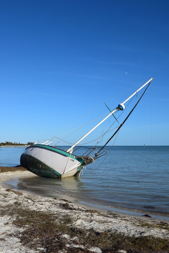
Cover photo:
Stranded boat on Smathers Beach, Key West, FL,
taken Nov., 2017 by Krizia Negrón.
Southernmost Weather Reporter ~ National Weather Service Key West, FL ~ Dec 2017 18You can also read