"The Project on Topographic Mapping for Peace and Development in Mindanao" - JICA
←
→
Page content transcription
If your browser does not render page correctly, please read the page content below
Republic of the Philippines
                     FY2016 Ex-Post Evaluation of Technical Cooperation Project
    “The Project on Topographic Mapping for Peace and Development in Mindanao”

                                                 External Evaluator: Tokiko Ito, Octavia Japan Co., Ltd.
0. Summary
     The topographic map at a scale of 1:50,000 of Mindanao was not updated since the printed
maps 1 was produced in the 1950's. This project updated the information gathered by new
satellite imageries and field identification and developed digital topographic maps 2. For the
overall goal, the project aimed for the development projects in the Mindanao area to be
implemented in the future by utilizing the maps in planning the development of the region.
     This project is fully consistent with the development policies and development needs of the
Philippines and Japan's ODA policy, and thus, the relevance is high. By this project, new
information required for production of the digital topographic maps was collected by satellite
imagery and field identification. However, as a result of the verification of the data for printing,
the data for GIS applications and the printed maps from the data for printing (hereafter referred
to as “updated printed maps”) by National Mapping and Resource Information Authority
(hereafter referred to as “NAMRIA”) after the completion of the project, NAMRIA judged that
the digital topographic maps as final products have not reached the level acceptable as
completed products. Moreover, although the map users, mainly Local Government Units
(hereinafter referred to as “LGU”), received information on how to utilize the digital
topographic maps, it cannot be judged that the knowledge and skills for utilization had been
conveyed. Furthermore, regarding the recommendation for the environment of utilization of the
digital topographic maps, the recognition and ownership of the implementing agency and others
are low, and so, it cannot be judged that the knowledge for improvement of environment for
utilization was conveyed. Thus, the project purpose has not been achieved. Regarding the
overall goal, after the completion of the project, among the digital topographic maps, the data
for printing was corrected and approved and all the map sheets of the updated printed maps
were printed. But, the awareness among the users about the issued maps is low and the actual

1
  “Printed Map” is a topographic map that is printed.
2
  “Digital Topographic Maps” include “Data for Printing” (PDF and TIFF) and “Data for Geographic Information
System (hereinafter referred to as “GIS”) Applications” (Shapefile). Shapefile is composed of a set of plural files
having roles such as graphic information and attribute information (for example, the extension
is .shp, .shx, .dbf, .sbn, .sbx etc.), and consists of layers of many files with different information. (Source:
http://www.pasco.co.jp/recommend/word/word028/: Accessed on June 1, 2017). Spatial information has various
forms of expression. In this project, vector data drawing points, lines, and planes are used as the data for GIS
applications. (Source: https://www.esrij.com/gis-guide/gis-datamodel/gis-datamodel/: Accessed on June 1, 2017)

                                                        1
utilization is limited. The data for GIS applications has been corrected and has not been
distributed except for a few cases, and so, actual utilization is very limited and it was difficult to
confirm the status of utilization at some provided locations. Thus, the effectiveness and impact
are low because the realization of the effect from the project implementation was not confirmed.
The project cost was within the plan. Although the project period was extended based on the
change of the plan, it cannot be judged that the data for GIS applications was completed at the
time of completion of the project. Accordingly, the efficiency is fair. Regarding sustainability,
there are no major problems in terms of the policy background and technical aspects. With
respect to the organizational and financial aspects of the implementing agency and others, it
cannot be judged whether or not it will be directed to promotion of the utilization as the data for
GIS applications has not been utilized. Therefore, the sustainability of the project effects is fair.
In light of the above, this project is evaluated to be unsatisfactory.
1. Project Description
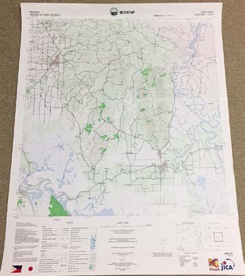
Completed Updated Printed Map of
Project Location
the Topographic Map
1.1 Background
Before the project, the Government of the Republic of Philippines (hereinafter referred to
as “GOP”) advocated reconstruction and development in conflict affected areas for the peace
and stability of the nation in Philippine Development Plan 2004-2010. It was expected to
efficiently formulate development plans in Mindanao, the southern region of the country, and to
effectively develop projects and promote implementations based on the development plans. The
topographic maps provide the basic geospatial information essential for development, but the
2topographic maps of Mindanao at that time was only the old printed maps produced in the
1950s. Therefore, renewal of the topographic maps was required. The GOP requested the
Government of Japan for a study on the digital topographic maps at a scale of 1:50,000. In
response to this request, the Japan International Cooperation Agency (JICA) has designated
NAMRIA as a counterpart organization (hereafter referred to as “C/P organization”) and
Mindanao Development Agency (hereinafter referred to as "MinDA") as a relevant organization,
signed the Implementation Arrangement (hereinafter referred to as "I/A") in January 2010, and
the project was implemented from March 2010 until March 2013.3
1.2 Project Outline 4
By utilizing the digital topographic maps in the development
Overall Goal planning of the Mindanao area, development projects in the
Mindanao area will be implemented in the future.
The digital topographic maps at a scale of 1:50,000 of the Mindanao
area, which can be utilized for development plan of the province /
Project Purpose region level in the Mindanao area, are updated, and stakeholders
utilizing the maps recognize the methods of utilizing the topographic
map.
Satellite Imagery at the appropriate scale covering the area shown in
Output 1
Attachment I of I/A shall be acquired.
Existing conditions relevant to the project including organization
Output 2 set-up, mapping system, facilities management and ground control
Outputs points shall be reviewed.
Map production shall be undertaken using digital mapping
Output 3
technology in accordance with Survey Operation Manual of JICA
Recommendation for the wide and effective use of the topographic
Output 4
maps produced under the project shall be prepared.
Total Cost 1,143 million yen
(Japanese Side)
March 2010 - March 2012
Period of Cooperation
(Extended Period: April 2012 - March 2013)
Implementing Agency NAMRIA
MinDA, LGUs: Region, Province, City, Municipality, Barangay in
Other Relevant
Mindanao. 5 Regional Offices of National Government Agencies:
Agencies /
Development of Environment and National Resources (hereinafter
Organizations
referred to as “DENR”), National Economic and Development
Authority, hereinafter referred to as “NEDA”), Department of
3
After signing I/A, the responsibility was handed over to MinDA from the Mindanao Economic Development
Council (hereinafter referred to as “MEDCo”) in 2010.
4
Based on the ex-ante evaluation sheet, I/A, and final report, summary and indicators are organized and re-set for
ex-post evaluation, changes are stated in the attachment.
5
Under the central government in the Philippines, there are 17 regions (Region) and there is a hierarchical structure
of local administration beneath. It is a three-layer structure of (1) Province and highly urbanized city, (2) City
(Constituent City) and Municipality, and (3) Barangay (Minimum administrative unit).
3Transportation and Communication, Department of Agriculture
(hereinafter referred to as “DAR”) etc.
Supporting N/A
Agency/Organization in
Japan
【Technical Cooperation】
- Study for Mapping Policy and Topographic Mapping for Integrated
Related Projects National Development Plan (February 2006 – March 2008)
- Comprehensive Capacity Development Project for the Bangsamoro
(hereinafter referred to as “CCDP”) (July 2013 – July 2019)
1.3 Outline of the Terminal Evaluation
This project is the Technical Assistance related to ODA Loan, but because the project set a
product, the digital topographic maps, as the project purpose, the terminal evaluation was not
conducted.
2. Outline of the Evaluation Study
2.1 External Evaluator
Tokiko Ito, Octavia Japan Co., Ltd.
2.2 Duration of Evaluation Study
This ex-post evaluation study was conducted with the following schedule.
Duration of Study: August 2016 – November 2017
Duration of Field Study: January 11 – 29, 2017 and April 20 – 29, 2017
2.3 Constraints during the Evaluation Study
As for the project summary and indicators of this project, the content of the ex-ante
evaluation sheet, I/A, the final report were slightly different from each other as shown in the
attached history of changes of PDM. In this ex-post evaluation, based on each of these
documents, log frames and indicators were arranged and reset for evaluation. In addition, the
information collected before the field survey was limited. The fact that NAMRIA did not
acknowledge the digital topographic maps, final products, as completed products, was found out
at the time of the survey and survey items had to be added on the spot. The product, digital
topographic maps, was set as the project purpose in this project as mentioned earlier, so the
evaluation of the impact and sustainability was judged with reference to the concept of
4“Technical Cooperation for Development Planning”.
3. Results of the Evaluation (Overall Rating: D 6)
3.1 Relevance (Rating: ③ 7)
3.1.1 Consistency with the Development Plan of Philippines
At the time of planning, the GOP put “peace and stability of the state: reconstruction and
development in conflict-affected areas” in policy through the Philippine Development Plan
(2004-2010). Among them, by updating and digitizing the topographic maps of the Mindanao
area, efficient formulation of the development planning for the region and effective promotion
of development and implementation of development projects were expected. At the time of
completion of this project, the GOP continued to promote peace and stability that supports
national development through Philippine Development Plan 2011-2016 (hereinafter referred to
as “PDP 2011-2016”). In “PDP 2011-2016”, the GOP furthermore offers, a) to mainstream
support system that can contribute to an objective decision-making, b) empower the local
governments with new capacities that can improve their service delivery, and c) provide a
means for citizens to access vital information.
In MinDA's Mindanao 2020 Peace and Development Framework Plan (hereinafter
referred to as “Mindanao 2020”) on the development of Mindanao for 20 years from 2011,
strengthening the capabilities of the LGUs, regional offices of national government agencies,
and academic and research institutions for utilization of GIS and mapping is identified as a
strategy to activate stakeholders for the regional development planning. In other words, from the
start of the project to the completion, in the country, the development of the geospatial
information management environment for development by the local government was promoted.
From the above, this project was highly consistent with the development policy of the GOP.
3.1.2 Consistency with the Development Needs of Philippines
At the time of the start of the project, the topographic map at a scale of 1:50,000 of the
Mindanao area was only the printing version and was made about 60 years ago. Recent years,
changes in geospatial information due to natural disasters, etc., were large, and it was urgent to
formulate the land use plan, hazard map etc., in the area. The needs for the renewal of
topographic map, especially the needs for the topographic data for GIS applications, were very
6
A: Highly satisfactory, B: Satisfactory, C: Partially satisfactory, D: Unsatisfactory
7
③: High, ②: Fair, ①: Low
5high. Furthermore, at the time of ex-post evaluation continuously from the time of project
formulation, the officer of the Mapping and Geodesy Branch (hereinafter referred to as “MGB”)
of NAMRIA, the officer of Knowledge Management Division of MinDA, and the provincial
level of planning and development officer at Region XI considered the topographic map at a
scale of 1:50,000 as important information for development planning (geospatial planning and
project planning) and decision making for private and academic sectors in addition to
governmental agencies. According to the MinDA officials, planning for a specific area requires
a topographic map at a scale of 1/10,000 for the town level and development partners of
Mindanao, but the topographic map of 1:50,000 scale by NAMRIA should be used as the base
map information 8 by government agencies and LGUs according to the guidance of NEDA.
Therefore, it can be said that updating the topographic map and producing the data for printing
and data for GIS applications by this project were consistent with the development needs.
After the start of the project, it was agreed that the Basilan Island and the southern islands
of the Autonomous Region in Muslim Mindanao (hereinafter referred to as “ARMM”), which
had been excluded from the initial plan of topographic map area, were added to cover the entire
Mindanao area. 9 This was because there were security problems due to conflict affected areas
and hampered development, and as the situation had been improved somewhat before the
project was implemented, as a result, the change was agreed. Also from the viewpoint of
Peacebuilding Needs and Impact Assessment (hereinafter referred to as “PNA”), the change of
the target site contributes to the reduction of the instability factors and is recognized as
reasonable 10.
3.1.3 Consistency with Japan’s ODA policy
At the time of ex-ante evaluation, the Ministry of Foreign Affairs’ Country Assistance Plan
for the Philippines (2008) set three priority areas. One of which was “peace and stability of
8
Various geospatial information is being developed according to each purpose by various stakeholders such as the
national government, local governments, and private business operators, etc. Although such geospatial information
secures a certain degree of precision, it will cause deviation within the range of accuracy, so it is necessary to use a
common position criterion when preparing geospatial information. “Base map information” refers to information that
serves as a reference for position in a digital map. (Source: http://www.gsi.go.jp/kiban/towa.html: Accessed on July 3,
2017)
9
Regions in Mindanao are as follows: Zamboanga Peninsula (Region IX), Northern Mindanao (Region X), Davao
Region (Region XI), Soccsksargen (Region XII), Caraga (Region XIII) and ARMM.
10
At the time of ex-post evaluation, at the interview, several departments of ARMM also expressed high
expectations to the updated topographic map. According to the consultant, MinDA was concerned about dealing with
the exclusion of the islands in ARMM. If the area had been excluded from the targeted area, there was a possibility
that discontents could have come out from ARMM, and the official of MGB of NAMRIA also stated that as the
topographic map is for peace, it was impossible to exclude some areas in Mindanao. It cannot be denied that there
was a possibility that the reconciliation process could have been affected if ARMM disagreed with the treatment of
areas being excluded from the topographic map targets.
6Mindanao”. The priority was given to the support for the goal of withdrawing Mindanao from
the poorest areas and consolidating the peace of Mindanao. In addition, based on Support
Package for Peace and Stability in Mindanao announced in 2002 by the Ministry of Foreign
Affairs, a) support for policy formulation and implementation targeted at the ARMM
government, b) improvement of basic human needs, and c) peace-building were clearly stated as
priority areas. JICA stated “Peace and Development of Mindanao” as a cooperation program in
the Country Assistance Strategy for the Philippine at the time of ex-ante evaluation. This project
contributes to the implementation of development projects in the Mindanao area, as the peace
agreement between the GOP and the Moro Islamic Liberation Front progresses, and is judged as
highly consistent with Japan’s ODA policy.
Accordingly, this project was highly relevant to the Philippines’ development plan and
development needs, as well as Japan’s ODA policy. Therefore, its relevance is high.
3.2 Effectiveness and Impact 11 (Rating:①)
3.2.1 Effectiveness
Upon this evaluation, based on the description of the ex-ante evaluation sheet, I/A and final
report, the project purpose, outputs and each indicator are re-organized as attached,
effectiveness and impact are analyzed, and level of achievement is judged 12.
3.2.1.1 Achievement of Project Purpose
In this project, as shown in Table 1, four outputs were set in order to achieve the project
purpose, “the digital topographic maps at a scale of 1:50,000 of the Mindanao area, which can
be utilized for development plan of the province / region level in the Mindanao area, is updated,
and stakeholders utilizing the maps recognize the methods of utilizing the topographic maps”.
At the time of completion of the project, the Output 1 and 2 on the acquisition of information
required for the production of the digital topographic maps were generally achieved and it was
confirmed that Output 3 on the production and the Output 4 on the utilization of the topographic
maps were partially achieved.
11
The sub-rating for Effectiveness is to be considered together with Impact.
12
As stated in the attachment, the ex-ante evaluation sheet has one project purpose, but at the stage of I/A attached
with the final report, there are two project purposes and no indicators are stated. In addition, the Project Purpose 1
and Output 3 and Project Purpose 2 and Output 4 stated at the time of the final report are similar.
7Table 1 Achievement of Output
Output Indicator Actual
Gross area of acquired New ALOS 13 satellite image data of almost the
Output 1 satellite imaginary same area as target area of the topographical map
(100,500km2) changed in June 2010 was obtained.
Number of ground control Survey data at 315 ground control points (in which
points and products 220 points was quantity of the contract) required
for aerial triangulation using satellite images was
acquired by December 2010. The project
implementation consultant (hereafter referred to as
“the Consultant”) verified that the products of each
survey were sufficiently accurate.
Number of pricking Data of 220 pricking points required for aerial
(leveling) points and triangulation of satellite image were acquired. The
products Consultant verified the products according to
SPECIFICATION 2008 14 and the work was
Output 2
completed by December 2010.
Gross area of field The field identification survey of totally about
identification 100,500km2 which was the target area of
topographic map agreed with the GOP was
conducted and the Consultant verified the outcome
according to SPECIFICATION 2008 etc. In
addition, field completion work was conducted, but
it was impossible to conduct surveys in 2% of the
area due to entry restrictions for security reasons. It
was agreed to supplement with secondary data and
interviews.
Orthophoto data The orthophoto data at a scale of 1:50,000 is stored
Output 3 in the DVD as a final product and submitted at the
time of completion of the project.
13
Abbreviation for Advanced Land Observing Satellite. ALOS was one of the world’s largest land observation
technology satellites at the time, launched by the Japan Aerospace Exploration Agency (JAXA) in January 2006.
(Source: http://jp.alos-pasco.com/alos/, http://www.sed.co.jp/sug/contents/satellite/satellite_alos_avnir2prism.html:
Accessed on June 1, 2017)
14
It was agreed that the topographic mapping work of this project conforms to the SPECIFICATION 2008: 1:50,000
scale topographic map specification, the symbolization specification, orthophoto creation manual, prepared in the
“Study for Mapping Policy and Topographic Mapping for Integrated National Development Plan” (February 2006 -
March 2008). Similarly, “Overseas Survey and Mapping (Basic Maps)” designated by JICA in 2006 and the operation
manual of 2007 by JICA have been used. For orthophotography, in aerial photography, distortion occurs as it covers
from high buildings and mountainous areas, and from the center of the picture to the outer periphery. In such a state,
it cannot measure nor overlap with the actual map. Therefore, correcting this distortion is called orthorectification,
and the aerial photograph applied with this correction is called orthorectified image (orthophoto). (Source:
http://www.pasco.co.jp/recommend/word/word058/: Accessed on June 1, 2017)
8Produced topographic maps By the time of completion of the project, NAMRIA
confirmed and signed the contents for the draft of
the updated printed maps as a C/P organization
before delivery. NAMRIA received data for
printing and data for GIS applications from JICA
which JICA regarded as final products. But
NAMRIA had not completed to check the contents
by this time. As a result of the verification after
that, there were map sheets of which data for
printing and for GIS applications were not with
satisfactory accuracy for NAMRIA and have not
been approved by NAMRIA as completed
products. Thus, the digital topographic maps were
produced but it cannot be said that they were
completed.
Contents of realistic In order to utilize the topographic maps, the study
recommendation for on topographic map utilization to members of
implementation and method Technical Coordinating Committee (hereinafter
of recommendation referred to as “TCC”) 15 was conducted, and based
on the results, recommendations for utilization
Output 4
were summarized. It was reported through the
Technology Transfer Seminar and the Final Report.
However, the implementing agency and others do
not recognize the positioning of the contents of the
final report to be so important.
Table 2 shows the achievement of the project purpose at the time of project completion.
Table 2 Achievement of Project Purpose
Project
Indicator Actual
Purpose
“The digital The topographic maps Information from field identification in accordance
topographic are composed with the with JICA “Kaigai sokuryo sagyo kitei (Heisei 24
maps at a information by field nen)(Overseas Field Identification Operation
scale of identification according Regulations (2012 Edition))” and the specification
1:50,000 of to the survey standard for the Philippines SPECIFICATION 2008 was
the Mindanao and updated information collected, new ALOS satellite images of the target
area, which based on the latest area and existing archive data of ALOS and SPOT
can be utilized images. satellite images were acquired, and the topographic
for maps were produced. The digital topographic maps
development (data for printing and data for GIS applications)
plan of the were officially received at the time of project
15
TCC is composed of LGU representatives in the target area. The consultant decided the members. TCC members
cooperated with field identification and the topographic map utilization study, participated in the technology transfer
seminar, and conducted verification of the topographic maps, etc. The actual members were not confirmed at the
ex-post evaluation because the implementing agency and others have kept no record.
9province / completion. However, by the verification after the
region level in completion of the project, problems such as
the Mindanao inconsistencies of the terrain were confirmed. This
area, are is considered to be a problem of quality control
updated, and (accuracy) other than the work process described in
stakeholders the specification. It is judged that the digital
utilizing the topographic maps (data for printing and data for
map recognize GIS applications) updated with the latest
the methods of information cannot be said to be completed at the
utilizing the time of project completion.
topographic The necessary Through the technology transfer seminar and the
maps.” knowledge and skills for final report, the recommendations mainly about the
updating and utilizing use of digital topographic maps and arrangement of
the topographic maps conditions such as required technical and
are conveyed to the organizational aspects: GIS related software and
stakeholders knowledgeable personnel, were explained to
NAMRIA, MinDA and LGUs etc., the users of the
maps. Both NAMRIA and MinDA recognize that
the contents of the seminar were comprehensive
and there were points in the recommendations that
can be agreed by the implementing agency and the
related agency, but the contents of the
recommendations of the report were made mainly
by the Consultant and participation of the
Philippine side was limited. MinDA also considers
that there is no signature of the Philippine
government in the final report and the report is not
officially positioned. For these reasons, the
implementing agency and others are not well aware
of the contents of the recommendations except for
the strengthening of the utilization capacity of
users, which has been the identified issue by
themselves since the beginning of the project.
Regarding the Indicator 1 of the project purpose, “The topographic map is composed with
the information by field identification according to survey standard and updated information
based on the latest images”, the digital topographic maps (data for printing and data for GIS
applications) were submitted to NAMRIA at the completion of the project. The ALOS satellite
image data of almost the same area as the project target area (100, 500km2) was acquired by the
Consultant during the project implementation. As the amount of the clouds photographed in the
images exceeded the standard for 20% of the area, archive data of existing ALOS and SPOT 16
16
Abbreviation for Satellite Pour l'Observation de la Terre. SPOT is the earth observation satellite of the National
Space Research Center of France developed in 1986. From the time of the start and during the implementation of the
project, SPOT 1 to 5 were developed. (Source: http://www.sed.co.jp/sug/contents/satellite/satellite_spot.html,
10satellite images was adopted after consultation between the Consultant and JICA (Output 1).
The field identification study was conducted according to Gomanbun no ichi chikeizu zushiki
(Heisei gannen ban)(Diagram of Topographic Map at a Scale of 1:50,000 (Heisei 1 version)) by
Geographical Survey Institute, the Ministry of Construction of Japan, Overseas Field
Identification Operation Regulations (2012 Edition) by JICA, and SPECIFICATION 2008, the
specification of the Philippine, in Central Mindanao, Northern Mindanao, and South Mindanao
by three subcontractors in the Philippines. Regarding the contents, the number of designated
ground control points, the number of pricking (leveling) points and the actually implemented
area of this field survey (field identification and field completion), NAMRIA acknowledged that
it was a comprehensive study of information for both contents and volume required for the
digital topographic map production at the time of ex-post evaluation (Output 2). However, it
was judged that there was a problem in accuracy of the some of the map sheets of the digital
topographic maps (data for printing and data for GIS applications) which were produced from
those information and confirmed and submitted to NAMRIA as final products by JICA at the
time of completion of the project as a result of verification by NAMRIA afterwards (Output 3).
After the completion of the project, upon request from NAMRIA to JICA, the digital
topographical maps (data for printing and data for GIS applications) were corrected by the
Consultant. By the time of ex-post evaluation, the updated data for printing was approved by
NAMRIA, in June 2014. However, NAMRIA considers that there was still a problem with
accuracy in data for GIS applications and continues the correction work on its own. By the time
of ex-post evaluation, the correction of 52 map sheets out of all 227 map sheets of the Mindanao
area was completed. It was said that it would take several more years to complete all.
In relation to the Indicator 1 of the project purpose, regarding Output 3, “Map production
shall be undertaken using digital mapping technology in accordance with Survey Operation
Manual of JICA”, judged to be partially achieved, because final verification was carried out by
NAMRIA and LGUs mainly based on the print charts from just before the project completion,
November 2012, until after the completion of the project, November 2013. As a result,
inconsistencies such as mismatches of name of locations, position of roads and bridges and
points of interest, etc., were found among the orthophoto data, the data for printing and the data
for GIS applications in some of the map sheets and NAMRIA did not approve the maps. It was
also confirmed that some of the map sheets were produced seemingly based on the old
information and not on the latest information. In NAMRIA, it is required for its projects to be
http://www.intelligence-airbusds.com/en/143-spot-satellite-imagery: Accessed on June 1, 2017)
11approved by the Administrator who is the chief executive officer. With regard to the
topographical maps, the manager of the department, the Director of MGB, approves. At the time
of ex-post evaluation, NAMRIA still could not determine that the data for GIS applications was
completed although there was pressure from government agencies etc. Based on this
circumstance, it cannot be said that a part of map sheets of the digital topographic maps (data
for printing and data for GIS applications) were made up of utilizable updated information at the
time of completion of the project. From the above, it is judged that the Indicator 1 of the project
purpose was not achieved by the time of completion of this project.
The verification of the topographic maps was carried out step by step even before the final
verification. The Consultant conducted a confirmation of legends and things to be deleted, etc.
in accordance with the specification agreed with NAMRIA before the compilation work that
was performed in Japan. In the middle of drafting work, verification by the TCC was carried out,
and at the final stage, from December 2012 to February 2013, the opportunities of verification
by NAMRIA staff in Japan were set up. At the stage of final draft, all pages of the printed maps
of the topographic maps were signed by NAMRIA for the confirmation of receipt. However,
according to the Director of MGB, NAMRIA, the area of verification by the TCC consisting of
only some representatives was limited and the time for verification by NAMRIA was
insufficient, but inconsistencies were pointed out. Inconsistencies of the data were more widely
confirmed by NAMRIA even after the completion of the project. In the Director’s opinion, it
was possible for NAMRIA staff to quickly make verifications and corrections from time to time
if the compilation work was carried out in the Philippines. Furthermore, NAMRIA assumed that
the Consultant would continue to respond to the correction even after the completion of the
project and, before the final products were submitted, signed the draft of updated printed maps
for confirmation of contents and receipt as a formality. This perception of NAMRIA is an
understanding based on verbal communication with the Consultant, and there is no agreement
by written document. There has been a business relationship between the local affiliate of the
company of the Consultant and NAMRIA, although the affiliate was not involved in this project.
So, it is possible that the relationship affected NAMRIA to think that it might be possible to
keep correspondence even after the completion of the project and affected NAMRIA’s
perception of the completion of the project. According to the official of MGB, NAMRIA,
NAMRIA had actually contacted the local affiliate for the correction work of data for GIS
applications since 2014.
According to the Consultant, there are usually errors such as inconsistency of the name of
12place or the position of the specific target when the topographic maps are produced. When they
responded to a request based on the evaluation report of the verification result by NAMRIA, in
November 2013, they have corrected the points that they judged necessary. To that effect,
according to the Consultant, they explained to NAMRIA and agreed upon the actions that were
taken, in February 2014, but there is no agreement by written document. On the other hand,
according to NAMRIA's Deputy Director of MGB and the section manager for verification, etc.,
there were still points to be corrected by the Consultant, and there was no remark that they had
agreed not to request additional amendment. In this way, there are differences in opinions
between NAMRIA and the Consultant concerning the verification process and the accuracy of
the final product.
Next, regarding the Indicator 2 of the project purpose, “the necessary knowledge and skills
for updating and utilizing the topographic maps are conveyed to the stakeholders”, according to
NAMRIA and the Consultant, NAMRIA has skills to update topographic maps. By a
self-evaluation, MinDA has improved the knowledge of geospatial data management and
understood the needs for cooperation with stakeholders and for improvement of the
environment for coordination needs through this project.
In relation to promotion of utilization, a study on map utilization to grasp the knowledge,
environment and the needs for utilization of the digital photographic maps of the concerned
users was implemented in this project. By the technology transfer seminar and the final report,
the techniques required, the use and the improvement of environment for utilization of the
topographic maps were recommended to the users of NAMRIA, MinDA and LGUs 17 (Output
4). Although the data for GIS applications with accuracy that NAMRIA can approve was not
completed by the time of the ex-post evaluation, at the user interview 18 for ARMM and the
planning development personnel of provinces and cities in Region XI, it was confirmed that
they recognized the use of the topographic maps and the needs to utilize the data of GIS
17
The main recommendations of the final report are as follows: 1) Basic information: base map, theme map, scale,
GIS, explanation of GIS analysis; 2) Direction for using topographic maps in Mindanao: management based on the
project cycle management, planning of a framework plan by cooperating between sectors and administrative levels,
improvement of the ability of regions and provincial officials to utilize maps and GIS and thematic maps to be
updated/produced at each local administrative level, MinDA’s coordination ability required for updating GIS data,
thematic maps to be updated in ARMM, utilization and improvement of NAMRIA’s GeoPortal site.
18
The user interviews were implemented to those as below; Regional offices of national government agencies of
Region XI: DAR, DENR and Mines and Geosciences Bureau; Planning and development office of 5 Provinces:
Davao del Norte, Davao del Sur, Davao Oriental, Davao Occidental and Compostela Valley, and 2 cities: Davao and
Tagum; ARMM: DAR, DENR, Department of Agriculture and Fisheries, Department of Interior and Local
Government, Department of Tourism, Department of Public Works and Highways, Technical Management
Services-Office of the ARMM Regional Governor; Planning and development office of ARMM and Cotabato city;
Davao Integrated Development Progrm supporting LGUs; 1 banana export and plantation company in Davao city;
and 1 conflict monitoring NGO in Davao city. Moreover, information other than Region XI was interviewed to the
officials of Four Area Management Offices (East, West, South and North) of MinDA.
13applications was high. The seminar seems to have played the role of PR of the digital
topographic maps. But it is possible that the recognition of the data for GIS applications spread
wider due to the government policies and dissemination of free GIS software from the time of
project completion to the ex-post evaluation. On the other hand, at the time of ex-post
evaluation, according to the implementing agency and others, it was said that additional
practical training was necessary for the users such as LGUs to acquire knowledge and skills for
production of thematic maps. Even at the interview with the map users, it is also apparent that
the environment of acquiring techniques, GIS related software and human resources, has not
necessarily been improved. One of the reasons for this may be because there is no data for GIS
applications for utilization.
With regard to the Indicator 2 of the project purpose, the Output 4, “Recommendation for
the wide and effective use of the topographic maps produced under the project shall be
prepared”, which is partly achieved, NAMRIA and the Consultant became lecturers, and the
technology transfer seminars were held in two places for half a day each in November 2012.
Participants were each 197 and 171 people from the regional office of national government
agencies, LGUs from regions, provinces, cities, municipalities and Barangay, NGOs and others
of all the regions in Mindanao. In the half-day program, the contents of the project, the study
results, digital topographical maps, operation method of GIS software, the uses of thematic
map 19 etc. were introduced. In addition, a CD of PowerPoint documents and videos etc. used in
the seminar were distributed to the seminar participants. According to officials of MGB,
NAMRIA and MinDA, the contents of the seminar was comprehensive to a certain extent and
appropriate, but the time duration was short and the session was only by a lecture style and there
was no session of an on-site training. Compared with the software operation, the time for the
use of data for GIS application, production of thematic maps etc., was limited. Thus, there was a
difference in the degree of comprehension depending on participants. The implementing agency
and others acknowledged the lack of the user's ability of techniques to utilize the digital
topographic maps and initially requested the capacity building within the project, but it was not
implemented. In addition, the license of the introduced GIS software, ArcGIS, was expensive
19
The thematic map is “a map drawn with emphasis on a specific subject”. On the map, there are “a map
representing specific theme on a general map such as a topographic map as a base map and a map produced by field
identification survey for a certain purpose from the beginning”, and “representative of the former one are geological
maps and land classification diagrams and the latter are cadastral maps and navigation charts, etc.”. “There are
various kinds of thematic maps such as urban planning charts, disaster prevention diagrams, various statistical maps,
etc.” “Urban maps and road maps”, “cultural property distribution map” and “evacuation center map” are kind of
thematic maps. (Source: https: //rnavi.ndl.go.jp/research_guide/entry/theme-honbun-601004.php: Accessed on June 1,
2017)
14although it was the standard GIS software and there was no other software with the same
functions at that time. During the interview at the ex-post evaluation, it was also heard that it
was not yet realistic for many LGUs to obtain the software although the necessity of improving
the environment for GIS utilization was recommended. Even at the time of ex-post evaluation,
the conditions for the digital topographic map utilization: GIS related software, techniques and
human resources, were not necessarily arranged.
It is said that the implementing agency and others were not involved in the creation of the
recommendations subjectively, and the contents of the seminar and the recommendation of the
final report were created and presented by the Consultant. At the time of ex-post evaluation,
MinDA officials said that the contents of the recommendations of the final report were checked
and generally agreed. However, there was no high motivation to implement and coordinate as
recommended in the report as it is understood that the report was not the one approved by the
GOP officially. The Director of MGB, NAMRIA has no particular opinion on the contents. After
the completion of the project, there was a low recognition for the position of the
recommendations by the implementing agency and others responsible for promoting and
coordinating the utilization.
In this project, the purpose of the Technology Transfer Seminar was thought to be to
disseminate the digital topographical maps to the stakeholders, the main users, and it is
considered that the final report was for the implementing agency and others. The prepared
Technology Transfer Seminars and the contents of the recommendations were comprehensive
and useful referring to the techniques and system arrangement for utilizing the digital
topographic maps towards NAMRIA, MinDA and the users. It is important that the digital
topographic maps are actually utilized after they are issued. However, the perception and
ownership of the implementing agency and others are low regarding the contents of the
recommendations about the utilization environment for the digital topographic maps which
were thought to be necessary for promoting those utilization. From the above, it is difficult to
judge that consideration for feasibility about the recommended contents and the methods for
having common opinions with and getting recognition of recommendation from the
implementing agency and others were appropriate. Thus, the indicator of the output 4 is
considered to be partially achieved. It cannot be judged that the knowledge and technique for
utilization had been conveyed to the stakeholders. Therefore, it is judged that achievement of
the Indicator 2 of project purpose is fair.
As described above, the project did not satisfactorily achieve its project purpose because
15the digital topographic maps, the data for printing and the data for GIS applications, with
accuracy that NAMRIA could approve were not completed at the time of completion of the
project and because it cannot be judged that the stakeholders who were to utilize the maps were
conveyed with the knowledge and technique for utilization although they received information
on the use of the maps.
3.2.2 Impact
3.2.2.1 Achievement of Overall Goal
Regarding the overall goal, “by utilizing the digital topographic maps in the development
planning of the Mindanao area, development projects in the Mindanao area will be implemented
in the future”, between the project completion and the ex-post evaluation, the data for printing
has been completed. NAMRIA is on the process of correcting the data for GIS applications at
the time of ex-post evaluation. By March 2016, NAMRIA printed out all the map sheets of the
data for printing and the map sales offices of NAMRIA in DENR of all regions sell them.
According to the sales officer of Region XI in Davao City, mainly private enterprises have
purchased the printed maps. The topographic maps are available free of charge for the
government agencies through an application to NAMRIA. It is not free for private enterprises
and organizations etc. Distribution of data for printing (PDF) is started on a request basis. 20 It is
said that a part of the map sheets can also be referenced in the GeoPortal on NAMRIA’s
website 21. Because the data for GIS applications did not satisfy the accuracy which NAMRIA
can accept, it has not been distributed in general. There were some cases that NAMRIA has
confirmed the usages and provided the data for GIS applications in exchange for payment or
free of charge after notifying that the data was still being corrected. 22 According to the JICA
Philippine office, which holds the intellectual property rights of the digital topographic maps of
this project together with NAMRIA based on the agreement in I/A, the data for GIS applications
is shared to CCDP of JICA and is utilized. 23
Both NAMRIA and MinDA have not carried out public relations activities on the updated
printed maps map yet. At the time of ex-post evaluation, according to MinDA officials, the
usage of printed maps are a material for presentation, an attachment of materials and a reference
20
NAMRIA has distributed the data for printing to the Philippine National Police, Philippine Institute of
Volcanology and Seismology, LGUs, etc. The utilization purposes could not be confirmed through the ex-post
evaluation.
21
The data for printing posted on the GeoPortal can be browsed but cannot be downloaded.
22
It is used for humanitarian assistance and disaster response. It is utilized for JICA “Davao City Infrastructure
Development Plan and Capacity Building Project” (January 2017 – implemented at present).
23
The purpose of utilization could not be confirmed through ex-post evaluation.
16for planning. However, in the user interview mainly for regional offices of national government
agencies and LGUs, the completion of the updated printed maps, the sale at the NAMRIA map
sales office, free of charge provision to government agencies, and the location of the sales office
were unknown. Cases of utilization of updated printed maps were not confirmed. In January
2017 during the field survey of the ex-post evaluation, at the Mines and Geosciences Bureau of
Region XI, the updated printed maps attached to the application for permission of the mining
investment plan of one company submitted in the same month was observed. At the bureau,
usually a printed map is attached to the application form in order to indicate the investment
location. Until then, they had only seen the old version of the printed maps, and it was the only
case that the updated printed maps were attached. With regard to this case, it was not possible to
confirm whether the user utilized it because it was an updated printed map or not. According to
the NAMRIA’s map sales officer in Region XI, there was an impression that the purchasers
often purchased the updated printed maps upon introduction by the officers rather than those
seeking them. Since the sales volume of the old version of printed maps before updating could
not be compared with, it has not been confirmed whether or not the sales amount and utilization
have increased after the update. According to the MinDA official, MinDA would carry out PR
and distribution when all the digital topographic maps were completed. Some LGUs, NGOs and
companies, etc. which have participated in the technology transfer seminar and answered the
interview possess the skills to utilize the data for GIS applications and have been awaiting
issuance of the data with large expectation. There are inquiries about purchasing the digital
topographic maps to NAMRIA and MinDA from LGUs, companies and other donors.24
Although high expectations on the digital topographic maps from LGUs, NGOs and
private enterprises were acknowledged, the data for GIS applications accompanied by the
accuracy that NAMRIA can approve and distribute is incomplete. The utilizations of data for
printing and the updated printed maps have been started. However, in the Mindanao area, at the
interviews with the planning and development personnel of the region, province and city level
in Region XI including relatively developed Davao City in Mindanao area and ARMM, there
were not any information of seeing or obtaining the topographic maps. It was said that the use
of the printed maps was limited. These stakeholders are also subjects of the technology transfer
seminar as the users of the digital topographic maps. From this, it is considered that the current
awareness of the completed updated printed maps and the data for printing within the Mindanao
area is still low. It is considered that it is hardly utilized for creating theme maps utilizable for
24
Under such circumstances, there was a LGU which inevitably processed data that seemed to be the PDF data for
printing that was distributed at the seminar, and used it as project planning materials.
17planning. From the above, the utilization of the digital topographic maps is limited, and it
cannot be said that the overall goal has been achieved.
Table 3 Achievement of Overall Goal
Overall Goal Indicator Actual
By utilizing Actual utilization record Although the data for printing is completed, the
the digital of digital topographic utilization record is limited as the data for GIS
topographic maps: name of project, applications is incomplete, and distribution of the
maps in the name of plan and use, digitized materials is limited. The draft version of
development recognition and data for GIS applications is used for humanitarian
planning of referenced situation. relief and disaster response. For the updated
the Mindanao printed maps, 300 copies of 227 map sheets each
area, were printed. The sales started after July 2015 and
development by the end of February 2017, total 1,139 sheets of
projects in the 420 map sheets in total were sold at map sales
Mindanao offices in DENR in the nation. At the sales office
area will be of Region XI in Davao city, main purchases were
implemented by companies. Although the above is the sales
in the future. performance, the purposes of usage or the degree
of utilization cannot be confirmed, and the basis
for differentiating the degree of utilization as the
updated version compared with the old version
cannot be confirmed. Among LGUs which are the
assumed topographic map users, it is assumed that
there are many LGUs that are not informed of the
issuance of updated printed maps within those
interviewed during ex-post evaluation study, and
their expectation for “digital” topographic maps is
high for development planning. So, it is considered
that the utilization example is limited. Therefore, it
cannot be judged that the impact of this project was
explicitly demonstrated from the confirmed cases
of utilization of the updated printed maps.
At the time of ex-post evaluation, NAMRIA continues the correction work to solve the
problems of the accuracy of the data for GIS applications which were found after the project
completion. NAMRIA has not approved the data as completed products. The awareness of the
stakeholders of the regional offices of national government agencies and LGUs about the data
for printing and updated printed maps was low, and their utilization records could not be
confirmed. Although map purchases of the updated printed maps by the companies were
confirmed, the reasons for utilization unique to the updated printed maps or the cases of
purposes of usage were not confirmed. Thus, the effectiveness of this project implementation is
18limited compared to the plan. Therefore, effectiveness and impact of the project are low.
3.3 Efficiency (Rating: ②)
3.3.1 Inputs
Table 4 shows the plan and actual results of inputs.
Table 4 The Plan and Actual Results of Inputs
Inputs Plan Actual (Project Completion)
(1) Experts Long-Term:Not listed Short-Term: 7 pax (Team Leader/
Short-Term:Not listed Field Identification/ Field
Local consultant:Employed Completion, Map Utilization, Control
Point Survey 1 & 2, Field
Identification/ Field Completion 1 &
2, Project Coordination/Field
Identification, Field Completion)
Local consultant: 3 companies,
numbers of people unknown (Control
points, pricking (leveling), Field
survey and Field completion)
(2) Trainees Not listed The Consultant’s own expense
received
(3) Equipment Mapping work in Japan Equipment for mapping work in
Japan: 4 million yen
(4) (others) Not listed 0.6 million yen (the local cost)
Japanese Side Total 1,300 million yen Total 1,143 million yen
Total Project Cost
Philippines Side Total cost: Not listed Total cost: Unknown
Operational 1. Counterpart Allocation: Not 1. Counterpart Allocation:
Expenses listed NAMRIA and MinDA (Counterpart),
Counterpart personnel expenses: 50 pax and above: TCC members
Not listed from regional offices of national
2. Equipment purchase: Not government agencies, provincial
listed planning and development
3. Facilities: Not listed department, City planning and
4. Local cost: A part of training development office, ARMM, and
and development cost and Bangsamoro Development Agency
implementation cost, utilities etc. Counterpart personnel expenses:
Unknown 25
2. Equipment purchase: None
3. Facilities: Office for experts (1
room each in NAMRIA and MinDA)
4. Local cost: Travel and
25
Although NAMRIA and MinDA could answer some expenses, the total amount was unable to answer.
19transportation of staff (NAMRIA:
About 0.8million PHP 26, MinDA:
About 0.3million PHP, meetings, a
part of training cost and
implementation cost, utilities,
internet. (NAMRIA: Amount
unknown, MinDA: about 0.5 million
PHP)
Source:JICA, NAMRIA and MinDA
3.3.1.1 Project Cost
The target area of the topographic maps and the project period were changed (see “3.3.1.2
Project Period” below). The actual project cost was 1,143 million yen against the planned
amount of 1,300 million yen and was within the planned amount, 88% of the planned amount.
Not all the information on the input amount could be obtained from the Philippines side. By the
time of ex-post evaluation, the Consultant additionally carried out a correction work with its
own expenses. NAMRIA also continues correction work with their own expenses, mainly
personnel expenses. The cost to complete the digital topographic maps is expected to increase in
the future. Since the increased amount is unknown, it is not considered in the judgment of the
efficiency.
3.3.1.2 Project Period
The planned period took 25 months from March 2010 to March 2012, and the actual
project period took 37 months from March 2010 to March 2013. That was longer than planned
(148% of the planned duration). This is due to the extension of the project period by 12 months
attributed to the completion of the field identification during the project implementation.
Because the target area includes a conflict affected area and the presidential election was
scheduled in 2011, due to security concern, there was a period during which entry for the field
identification was not possible. According to the Director of MGB, NAMRIA and the MinDA
official, it was thought that the influence of deterioration of security could be mitigated by
dialogue with the concerned people, but in fact, it was affected. The implementing agency and
others also agreed to change the project period. The entry restrictions caused by security
problems are difficult to forecast in advance, and it is recognized that the circumstances of the
extension of the project period were reasonable.
26
At the time of the final report. 1 Philippine peso (PHP)= 2.244 yen. Exchange rate as of February 2013.
20The digital topographic maps, data for printing and the data for GIS applications,
submitted at the time of completion of the project was not approved because the data was not
with satisfactory accuracy for NAMRIA. The data for printing was completed 15 months after
the completion of the project, June 2014, after correction work by the Consultant. However,
even by the time of the ex-post evaluation, 46 months after the project completion, it cannot be
judged that the data for GIS applications was completed and that the project was completed
within the project period.
3.3.2 Outputs
In relation to the outputs, during the project implementation, the target area and the
specification of the topographic maps were changed as follows. Firstly, based on the request of
the GOP, the target area of the digital topographic maps at a scale of 1:50,000 was changed to
include the Basilan Island and the southern island areas and the total became area of
100,500km2 at the discussion for the Inception Report in June 2010. In the initial plan by JICA,
it was figured out that it would be difficult to enter the Basilan Island and the southern island
areas from the security point of view. However, the security improved somewhat by the start of
the project and it became possible to enter by requesting cooperation to the relevant LGUs from
the implementing agency and others. Eventually in fact, the project could not obtain entry
permission from LGUs in about 2% of the target area for the field completion work. JICA and
the Consultant agreed in December 2011 to prepare the topographic maps with the secondary
data in addition to the data collected during the field identification and field completion
conducted by August 2012. Regarding the missing information, it was planned that NAMRIA
also conduct additional survey and collect information including information from LGUs for the
topographic maps as much as possible.
Furthermore, as a result of the request from the GOP, in February 2011, and consultation
and examination of technical specifications with the Consultant, it was agreed to include
58,000km2 of Bathymetric data to the target area of the topographic map in October 2011.
According to NAMRIA, the Bathymetric data was included in the old version of the
topographic maps produced in the 1950s. It should not be excluded in the updated version.
Changes in the project target area are fully considered based on the provision of NAMRIA’s
existing Bathymetric data and secondary data, the coordination and consultation for entry
permission to the ARMM area, and the implementation ability based on the experience of the
Consultant. It is judged that the change was necessary to achieve the outputs. It was more
21You can also read