Monitoring the effects of stock access and weed invasion on a vegetation unit within the Billeranga System Threatened Ecological Community
←
→
Page content transcription
If your browser does not render page correctly, please read the page content below
DEC Nature Conservation Service
Biodiversity

Monitoring Protocol

Monitoring the effects of stock access
and weed invasion on a vegetation unit
within the Billeranga System
Threatened Ecological Community

Prepared by:

   Monica Hunter, Ecologist, Species and Communities Branch, Department of Environment and
   Conservation, Dick Perry Avenue, Kensington WA
   Carolyn Harding, Senior Project Officer, Species and Communities Branch, Department of
   Environment and Conservation, Dick Perry Avenue, Kensington WA

Prepared for:

    Significant Native Species and Ecological Communities – Resource Condition Monitoring
    Project

Version 1.0 (June 2009)
Billeranga System Threatened Ecological Community Monitoring Protocol Revision History Log Version # Revision Date Author Changes Acknowledgments Advice for compiling the content of this monitoring protocol was sought from Ms Valerie English, Ms Vanessa Clarke and Ms Alanna Chant. Ms Alanna Chant, Ms Josie Dean and Ms Jenny Borger participated in the establishment of the monitoring detailed in this protocol. Suggested Citation This monitoring protocol may be cited as: Hunter, M. and Harding, C. (2009). Monitoring Protocol: Monitoring the effects of stock access and weed invasion on vegetation unit within the Billeranga System threatened ecological community. Version Number 1.0 (June 2009). Prepared for the Resource Condition Monitoring - Significant Native Species and Ecological Communities Project, Department of Environment and Conservation.
Billeranga System Threatened Ecological Community Monitoring Protocol

Table of Contents

1        Introduction............................................................................. 4

2        Protocol Constituents............................................................ 4

3        Background and Objectives ................................................. 4

3.1      Background and history .......................................................4

3.2      Rationale for selecting this resource to monitor ..................5

3.3      Measurable objectives .........................................................6

3.4      Benchmarks.........................................................................6

4        Sampling Design .................................................................... 7

4.1      Rationale for selecting this sampling design over others ....7

4.2      Site Selection .......................................................................7

4.2.1    Criteria for selection.............................................................7

4.2.2    Procedures for selecting sampling locations .......................7

4.3      Sampling replication ............................................................8

4.4      Recommended number and location of sampling sites ......8

4.5      Recommended frequency and timing of sampling ..............8

4.6      Level of change that can be detected for the amount/type of
         sampling being instituted .....................................................8

5        Field Methods.......................................................................... 9

5.1      Field season preparations and equipment setup ................9

5.2      Sequence of events during field season ...........................10

5.3      Details of taking measurements, with example field forms10

5.4      Post-collection processing of samples ..............................11

5.5      End-of-season procedures ................................................12

6        Data Handling, Analysis and Reporting............................ 12

6.1      Metadata procedures.........................................................12

6.2      Overview of database design ............................................12

6.3      Data entry, verification and editing ....................................13

6.4      Recommendations for routine data summaries and
         statistical analyses to detect change .................................13

6.5      Recommended reporting schedule....................................14

6.6      Recommended methods for long-term trend analysis ......14

                                                                                                       Page - 2-
Billeranga System Threatened Ecological Community Monitoring Protocol
6.7 Data archival procedures...................................................14
7 Personnel Requirements and Training ............................. 14
7.1 Roles and responsibilities..................................................14
7.2 Qualifications .....................................................................15
7.3 Training procedures...........................................................15
8 Operational Requirements.................................................. 16
8.1 Annual workload and field schedule ..................................16
8.2 Facility and equipment needs............................................16
8.3 Startup costs and budget considerations ..........................16
9 References ............................................................................ 16
10 Appendix................................................................................ 17
Appendix A. TEC occurrence report form
Appendix B. Bushland Plant Survey recording sheet (Keighery, 1994)
Appendix C. Example transect data recording sheet
Appendix D. Metadata statement for Billeranga System
Page - 3-Billeranga System Threatened Ecological Community Monitoring Protocol
1 Introduction
This monitoring protocol provides information and procedures for surveying and monitoring the effects
of stock access and weed invasion on the plant assemblages of the Billeranga System threatened
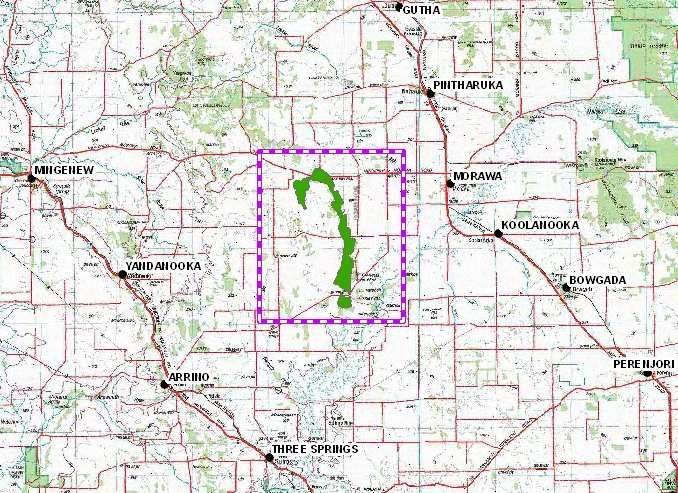
ecological community in Morawa, Western Australia (Figure 1).
Figure 1 Location of the Billeranga System, Morawa, Western Australia.
2 Protocol Constituents
This protocol consists of this Protocol Narrative and the following Standard Operating Procedures
(SOPs):
SOP 4.1: Setup of the SokkiaTM Axis3 Differential GPS
SOP 4.2 Using an Optical Square
SOP 6.1: Establishing vegetation quadrats
SOP 6.2: Establishing vegetation transects
SOP Collection of Herbarium Specimens (in draft)
3 Background and Objectives
3.1 Background and history
The Billeranga System is located within the Shire of Morawa, an agricultural district approximately 370
km or three and a half hours drive north of Perth. The Billeranga System is a very distinct, small,
localised vegetation system restricted to the ridgeline landscape west of Morawa. The threatened
ecological community (TEC) is currently ranked as vulnerable (endorsed by the Minister in 2001) and
Page - 4-Billeranga System Threatened Ecological Community Monitoring Protocol
the TEC boundary is based on mapping by Beard (1976). The mapped TEC boundary covers the
outcropping of the Billeranga group of Proterozoic rocks and includes five different vegetation units.
The TEC is defined by the following description:
“Melaleuca filifolia – Allocasuarina campestris thicket on clay sands over laterite on slopes and ridges;
open mallee over mixed scrub on yellow sand over gravel on western slopes; Eucalyptus loxophleba
woodland over sandy clay loam or rocky clay on lower slopes and creeklines; and mixed scrub or
scrub.”. The “Melaleuca filifolia – Allocasuarina campestris thicket on clay sands over laterite on
slopes and ridges” vegetation unit is the subject of monitoring established and detailed in this
document.
Threats listed for this TEC include: clearing; weed invasion; drought; high intensity and/or too frequent
fires; and impacts of stock, such as grazing and trampling. Only 4% of this TEC occurs in
conservation reserves (Mt Nunn Nature Reserve).
A 1997 community bushland survey (Australian Trust for Conservation Volunteers, World Wide Fund
for Nature and Department of Conservation And Land Management (True and O’Callaghan 1998))
established seven 10 x 10 metre quadrats on private properties across the Billeranga System. The
survey was intended to report on the flora and fauna of the area and for the data to be provided to
land managers. The data were designed for use as a reference guide by landowners within the study
sites. True and O’Callaghan (1998) noted that the data collected are integral to establishing an
ongoing monitoring program to determine the impact of on-ground nature conservation works as they
are implemented.
Some baseline data have also been collected for the Hidden Treasures project (a joint Department of
Environment and Conservation (DEC) and Northern Agricultural Catchment Council (NACC) project)
where seven transects (not permanently marked) were set up in the southern portion of the Billeranga
System on private property. Additional fieldwork and transects are planned for the southern portion of
the range during 2008 by the Hidden Treasures team (E. O’Connor DEC pers. comm.).
3.2 Rationale for selecting this resource to monitor
The Billeranga System TEC has been selected for the establishment of monitoring as part of the
Resource Condition Monitoring - Significant Native Species and Ecological Communities Project.
Additional baseline floristic survey was also undertaken within the TEC during field work for the
project.
The Billeranga System TEC was prioritised for survey as it provides a good example of a vegetation-
based TEC that is subject to grazing, for which some baseline floristic survey information exists.
However, comprehensive floristic data from systematic survey of the TEC is lacking and monitoring
data have previously only been collected within two of the five occurrences of this TEC, and
monitoring sites were not permanently marked.
The TEC was also prioritised for development of monitoring as, in addition to having areas subject to
grazing, it contains vegetation both within private property and in conservation reserves, and provides
an opportunity to monitor across tenures with varying levels of management (fenced and unfenced
private property). The TEC also contains a nature reserve, however at present this is only fenced on
three sides.
Although boundaries of the vegetation units within the Billeranga System TEC have not been mapped,
it appears that the “Melaleuca filifolia – Allocasuarina campestris thicket on clay sands over laterite on
slopes and ridges” unit forms a majority of the system. For this protocol, monitoring has only been
established within this unit. Baseline survey quadrats have been established in other vegetation units
within the TEC.
The perceived impacts of stock and weed invasion on community structure and plant diversity will be
monitored. Grazing is thought to have caused alterations to the species composition of much of the
TEC by selective grazing of edible species, the introduction of weeds and nutrients, and trampling and
general disturbance (Hamilton-Brown 2000). Weed levels have been observed to be quite high in all
occurrences of the TEC except one (Hamilton-Brown 2000).
Statistical analyses will be undertaken on the monitoring data, which over time, should indicate if the
species dominance and composition is changing. It may then be determined whether these changes
Page - 5-Billeranga System Threatened Ecological Community Monitoring Protocol
are in response to the actions undertaken to manage the identified threats.
The mixed scrub (Acacia acuminata, Allocasuarina campestris and Dodonaea inaequifolia) and
Dodonaea inaequifolia dominated scrub are restricted to the red loamy soils of the slopes and
summits of the southern portion of the Billeranga system, and the latter is thought to occur nowhere
else in Western Australia (S.Hamilton-Brown 2000, Beard 1976). These plant communities will be
included in baseline floristic survey.
The monitoring proposed for the “Melaleuca filifolia – Allocasuarina campestris thicket on clay sands
over laterite on slopes and ridges” community within the Billeranga System TEC seeks to answer the
following questions:
• is stock access affecting the plant community composition and structure?;
• are weeds more prevalent in unfenced occurrences?; and
• do transects in the fenced occurrences have greater species diversity than occurrences
in similar vegetation types on unfenced occurrences?
Although there are currently no programs for weed control in place in the TEC, it is possible that weed
control will be undertaken in the future. If weed control work is initiated, the effectiveness of such a
program could be determined by developing monitoring that investigated the following monitoring
question:
• are weed control activities effective in reducing the density of weed species in transects
within the community?
If such monitoring revealed that the weed control was effective in reducing the cover of weeds along
transects, it would indicate that the particular weed control measures being used could be continued.
However, if the weed control was determined to be ineffective, alternative management measures
would need to be employed.
3.3 Measurable objectives
This protocol has the following objectives:
• to establish permanent monitoring transects within the “Melaleuca filifolia – Allocasuarina
campestris thicket on clay sands over laterite on slopes and ridges” to determine the
effectiveness of on-ground management (fencing) in reducing the impacts of stock access
and weed invasion on vegetation structure and plant composition in the TEC;
• to provide baseline data that will allow the effectiveness of future management such as
weed control to be determined; and
• to establish quadrats for systematic floristic survey of vegetation units communities within
the Billeranga system TEC, for which limited information is currently held by the
department.
The monitoring will be designed to provide data that can be analysed:
• to determine if weed species are increasing in transects in vegetation where stock are not
excluded; and
• to determine if weed species are causing significant change to vegetation structure and
plant community composition.
3.4 Benchmarks
Significant changes in plant community composition, dominance and community structure over the
longer term may be indicative of adverse effects from stock access and/or weed invasion or may
instead be related to other factors, such as climatic factors (for example drought, or current fire
regimes).
A benchmark for an acceptable degree of change to this TEC should provide guidance to nature
conservation staff in implementing and adapting management. Several vegetation types
Page - 6-Billeranga System Threatened Ecological Community Monitoring Protocol
(communities) are encompassed within the Billeranga Hills TEC. This project has involved the
establishment of monitoring transects within the “Melaleuca filifolia – Allocasuarina campestris thicket
on clay sands over laterite on slopes and ridges” vegetation unit, from which transects in areas of
vegetation in the best condition will be used as a benchmark for acceptable degree of change to the
community. Floristic data obtained from the 1997 community bushland survey within this vegetation
unit will also be used when defining benchmarks for native species diversity in the community.
Monitoring transect data will be entered into an ordination analysis program (for example Primer) to
analyse trends with reference to native and weed species diversity. Analysis will allow any differences
in diversity in vegetation between variables (fenced/unfenced) to be assessed, in order to determine
whether the fencing appears to be influencing diversity.
Data from survey quadrats established for this project in remaining vegetation units within the
Billeranga System TEC may serve as benchmarks for future monitoring of other vegetation units
within the TEC. The quadrat data can also be collated and analysed using PATN, and if required may
be analysed with data collected for other surveys in the region.
At this point in time there is insufficient baseline information to indicate the time period, or degree of
change that should be used as a trigger for management intervention. However, with continued
monitoring and discussion of the first round of data analysis with a biometrician, benchmarks for
management intervention will be established, and any requirements for further replication of
monitoring sites will be determined.
4 Sampling Design
4.1 Rationale for selecting this sampling design over others
For the monitoring detailed in this protocol, transects have been selected as the appropriate method to
provide monitoring data relating to plant diversity and responses to perceived threats. Transects are
often used to estimate cover and the techniques are well established in vegetation sampling (Elzinga
et al. 1998).
With reference to the floristic survey undertaken as part of this project, the use of floristic quadrats is
considered to be an appropriate tool for sampling floristics, and quadrats are commonly used in
Western Australia (EPA 2004). DEC has used 20 x 20 metre quadrats for surveys of the banded
ironstone formation that occur in reasonably comparable habitat, and it is therefore appropriate to use
the same sized quadrats for this survey.
4.2 Site Selection
4.2.1 Criteria for selection
Monitoring transects were placed within the “Melaleuca filifolia – Allocasuarina campestris thicket on
clay sands over laterite on slopes and ridges” vegetation unit within the Billeranga System TEC and
stratified to encompass the following variables:
• fenced from stock on private property; and
• unfenced private property;
Floristic survey quadrats were placed within vegetation in best condition in the various vegetation units
within the TEC.
4.2.2 Procedures for selecting sampling locations
The procedure for selecting monitoring transects and floristic survey quadrats involved an initial
desktop study. An A0 sized map displaying colour aerial photography at a high resolution was printed
at a scale of 1:200 000. Areas for survey sites which appear to have intact vegetation of suitable size
were delineated on the printed map.
Page - 7-Billeranga System Threatened Ecological Community Monitoring Protocol
Monitoring transect sampling locations were based on the need to establish adequate replicates of the
’management variables’ (fenced and unfenced private property) to ensure sufficient power in statistical
analysis. Suitable transect sites were marked out on the printed map.
A field reconnaissance visit to sites to confirm suitability for survey and monitoring was undertaken.
Sites for the floristic survey quadrats were chosen to target vegetation in best condition on properties
owned by land managers willing to participate in the survey and monitoring project, and in vegetation
within the nature reserve.
4.3 Sampling replication
Sampling replication was limited to site variables (fenced and unfenced private property).
Monitoring transects are 20 metres in length and are sampled at 50 centimetre intervals starting at 50
cm and ending at 2000 cm. Eight transects were established within the “Melaleuca filifolia –
Allocasuarina campestris thicket on clay sands over laterite on slopes and ridges” vegetation unit.
The floristic survey of the Billeranga Hills System TEC involved the establishment of 15 quadrats
throughout the various vegetation units.
4.4 Recommended number and location of sampling sites
Quadrats and transects need to be placed in areas which cover most of the variability in the
vegetation being sampled (Elzinga et al. 1998).
Eight monitoring transects have been established and permanently marked with two plastic dumpy
pegs within the Melaleuca filifolia – Allocasuarina campestris thickets, based on the monitoring site
variables (fenced and unfenced private property). An adequate number of transects needs to be
established to ensure that conclusions are based on data that are statistically valid. Data collected
from the transects will be analysed and discussed with a biometrician to determine whether further
transects will be required to collect sufficient data.
For the floristic survey, 15 quadrats have been established and permanently marked with one metal
and three plastic dumpy pegs in vegetation in best condition across the range of vegetation units
within the TEC.
4.5 Recommended frequency and timing of sampling
Monitoring should be conducted during peak flowering, which for this bioregion is spring, and then
repeated at the same time of year at an interval of no greater than 5 years. Sampling during the peak
flowering period enables the maximum number of taxa to be recorded and offers the best opportunity
to fully identify all plants recorded. Monitoring should occur immediately prior to and after any major
management action is initiated (such as weed control).
The floristic quadrats established for the floristic survey should be sampled during the peak flowering
period.
4.6 Level of change that can be detected for the amount/type of sampling being
instituted
Due to the paucity of baseline data for the Billeranga System TEC and the low level of sampling
proposed in this monitoring protocol, the level of change that can be detected is likely to be negligible
for a number of years. Other monitoring in WA has indicated that at least 20 years of monitoring is
required to obtain useful data (M. Lyons pers. comm.).
The data collected in the first round of monitoring will be analysed through a statistical package (eg.
Primer), which should indicate whether the number of replicates installed will provide enough power in
analysis to detect significant changes in the data. Discussions with a biometrician may reveal that
further monitoring transects are required in order to detect the desired changes.
Page - 8-Billeranga System Threatened Ecological Community Monitoring Protocol
5 Field Methods
5.1 Field season preparations and equipment setup
Field work must be scheduled and organised prior to the start of each field season. Contact needs to
be made with DEC Regional and District staff to schedule field trip dates and access arrangements.
Additionally, contact needs to be made with land mangers to access private property occurrences.
Prior to working in the field, staff must complete a field advice form and review safety protocols and
this protocol.
Observers should familiarise themselves with species (native and weeds) previously recorded for the
monitoring and survey sites, by using herbarium specimens, keys, and photographs. Review of GPS
navigation and compass use may be necessary prior to fieldwork.
The following are required to undertake the desktop study prior to field reconnaissance:
• digital data including aerial photography, vegetation mapping and tenure information;
• a printed A0 sized map displaying the digital data;
• detailed maps with sites selected;
• species lists and other relevant survey information; and
• management and fencing information.
The following equipment is required to undertake the field component of the reconnaissance visit and
the spring survey and monitoring.
• The printed A0 sized map with directions and proposed sites delineated;
• Smaller detailed maps for use in the field and for discussions with landholders;
• Plant collection permits (refer SOP Collection of Herbarium Specimens (in draft));
• Secateurs;
• Plant tags;
• Small paper bags/envelopes;
• Newspaper and cardboard corrugates;
• Plants presses;
• Pens, pencils, permanent thick black marker pens;
• Survey recording sheets (if not using PDA);
• TEC Occurrence Report Forms (Appendix A);
• Bushland Plant Survey recording sheets (Appendix B);
• Transect data recording sheet (Appendix C)
• Digital camera, memory card, batteries;
• PDA with GPS (note if using PDA, electronic data sheets should be loaded);
• GPS (ideally DGPS);
• Survey pegs (1 metal and 3 plastic for quadrats, 2 metal for transects);
• Hammer;
• 2 x 50m measuring tapes;
• Optical square;
• Small blackboard and chalk;
Page - 9-Billeranga System Threatened Ecological Community Monitoring Protocol
• Point intercept device (long metal pin);
• Plant specimen books (for the collection of small pieces of plant material for each
quadrat/transect); and
• 3M ‘breathable’ sticky tape for specimen books.
Preliminary preparations
Prior to the field season a field reconnaissance visit to potential sites was undertaken to identify the
broad plant communities and discuss the project with landholders.
Plant collection licences (including Permit to Take Declared Rare Flora (DRF)) should be organised at
least one month prior to field reconnaissance. Accommodation in close proximity to the Billeranga
System needs to be booked as soon as field dates are determined and a full list of groceries and meal
planning should be prepared prior to field reconnaissance. Shared vehicles and equipment should
be booked in advance on the relevant field equipment booking sheets.
5.2 Sequence of events during field season
The following will be undertaken during the field season:
• prior to visiting the sites, the landholders and DEC district staff will be contacted and the
Northern Agricultural Catchment Council (NACC) may be contacted;
• a field advice form will be completed and copies sent to the relevant people;
• all equipment required for sampling will be assembled and checked and observers trained
• the vehicle will be checked and packed with the relevant equipment;
• sufficient travel time will be allowed to reach accommodation destination and to unpack;
• sufficient time will be allowed for meetings with landholders if necessary and to undertake field
work;
• quadrats and transects will be visited and all necessary observations recorded;
• plant specimens will be correctly pressed on return to the vehicle or accommodation; and
• the vehicle will be rechecked and packed for return trip to Perth.
The following needs to be completed on return to the office:
• all data from the PDA, GPS and digital camera downloaded;
• label, back-up data and store safely;
• check all Bush Survey Recording sheets and transect recording sheets for legibility and
completeness;
• complete data verification and validation checks on data;
• scan Bush Survey Recording sheets and transect recording sheets to a central drive and file
the originals;
• enter the relevant information from Bush Survey Recording sheets, transect recording sheets
and occurrence report forms into the TEC/PEC database;
• data to be analysed needs to be processed into a usable format to be analysed (either into
Site Species Database or an excel spreadsheet which as been correctly set up for input into
analysis software); and
• new maps created using ARCGIS 9 after the initial site visit to reflect the vegetation mapping,
quadrat sites and transect sites.
5.3 Details of taking measurements, with example field forms
At each sampling site, the quadrat should be set out using an optical square and two 50m measuring
tapes. For each quadrat, every plant species will be recorded and a sample collected from outside the
quadrat and pressed into a permanent collecting book with a full sized specimen collected for
lodgement with the WA Herbarium. Collection and lodgement of specimens should be discussed with
the WA Herbarium prior to field work. Herbarium and collection book specimens will be labelled with
collecting number, date, location and field identification name. The Bushland Plant Survey recording
sheets (Keighery 1994) will be used to record information for each quadrat.
For each transect the point intercept method will be used, which involves recording every plant
species intercepting the transect line at pre-determined points. As with the survey quadrats,
Page - 10-Billeranga System Threatened Ecological Community Monitoring Protocol
specimens will be collected outside of the transect line for identification purposes for lodgement with
the WA Herbarium, and for collecting books. Transects were established using SOP 6.2: Establishing
Vegetation Transects.
The following is required for the monitoring transects:
1. Locate each transect and mark it out with the measuring tape;
2. Provide a general description of the vegetation along each transect including form and
estimated height range;
3. Identify all live plant species that intercept the transect line at 50cm intervals along the line
beginning at 50cm; and.
4. Take photographs from the start point and the end point. Record the photograph numbers
and times on the recording sheet, or the quadrat/transect number on a blackboard that will
be visible in the photograph.
For the floristic survey, quadrats were established using SOP 6.1: Establishing Vegetation Quadrats,
and the following was undertaken at each site:
1. Locate the quadrats and mark them out with the measuring tapes and optical square;
2. Fill in site information on page 1 of the recording sheet;
3. Identify all tree, shrub, herb, sedge, grass and introduced species within each quadrat and
record on page 3 of the recording sheet;
4. Record vegetation structure, cover class and dominant species as per page 2 of the
recording sheet; and
5. Take photographs from the North West corner of the quadrat using a standard lens.
Record the photograph numbers and times on the recording sheet, or the quadrat/transect
number on a blackboard that will be visible in the photograph.
If any species cannot be identified with confidence in the field, two samples with key identification
features such as flower, fruit, rhizomes etc will be taken. One sample will be taped with botanical tape
into a collecting book and the other will have a labelled jewellers tag attached and pressed as soon as
possible (preferably within a few hours of collecting) to be identified and lodged with the herbarium
(see SOP: How to collect Herbarium Specimens (in draft)). Every specimen collected needs to have
the following information recorded:
• a unique identification number;
• a general descriptive name;
• date;
• collectors name; and
• site location.
5.4 Post-collection processing of samples
The procedure for post-collection of plant specimens includes:
• newspapers changed every fortnight;
• drying of specimens (i.e. placed in freezer or microwave);
• preliminary plant identifications to be undertaken using reference collection and keys;
• Rare Flora Report Forms (RFRF) to be completed for DRF and priority taxa;
• details for each specimen collected entered into the MAX database;
• labelling of photographs taken of the specimens;
• collecting details for all specimens, either as printed or handwritten labels, inserted into each
specimen’s newspaper sheet or as a MAX file on CD (with the specimens tagged using
numbers that match the specimen records); and
specimen and associated photograph batches sent by post or delivered in person to the
Western Australian Herbarium and addressed to the Collections Manager. If a batch contains
a number of specimens they should be protected in a cardboard box of suitable size. If a batch
Page - 11-Billeranga System Threatened Ecological Community Monitoring Protocol
contains a small number of specimens, they should be tied into a bundle between cardboards
and posted safely.
5.5 End-of-season procedures
The following tasks are to be undertaken at the end of the field season:
• plant specimens processed, mounted, boxed and sent to the WA Herbarium;
• equipment has been cleaned, stored and is ready for the next season;
• data stored appropriately in a central corporate location;
• quadrat and transect data collated and input into an ordination analysis program (eg. Primer);
and
• report preparation.
6 Data Handling, Analysis and Reporting
Data collected as per this monitoring protocol will be handled, analysed, stored and reported on
according to the methods prescribed below. The Natural Resource Management - Regional Spatial
Information Management Toolkit (2008) (the NRM Toolkit) states that it is important that data is
collected and managed according to agreed industry standards. The benefits of doing this include
(modified from NLWRA 2003):
• improved data consistency;
• higher quality data;
• greater opportunity for data integration and aggregation;
• increased opportunities for sharing data;
• improved documentation and understanding of data and information resources;
• improved control over data updating; and
• improved data security.
6.1 Metadata procedures
Metadata is “data about data”. That is, a statement about a dataset which describes the content,
quality, currency and location and custodianship of the data.
The Australia New Zealand Land Information Council has developed guidelines for the collection of
metadata (ANZLIC 2001). Metadata collection under this protocol will be compliant with these
guidelines.
The data custodian should develop the original metadata record. Metadata records can be created in
a Word document or text file and should be saved in the same directory as the dataset. See Appendix
D for the metadata collected for this project.
Metadata for this project will be for the data collected from both the survey and monitoring
components of this protocol. The DEC TEC Database and regional databases will be the repository
for the metadata statements.
6.2 Overview of database design
DeBacker et al. (2004) recognise that biodiversity monitoring creates large numbers of files and
folders to store various databases; reports; GIS data; etc. and the organisation and linkages increase
in complexity as data accumulates through time. The authors also note that foresight in database
design is integral to ensuring data quality.
The DEC Threatened Ecological Communities Database (Microsoft Access) is the primary software
environment for threatened ecological community data. ESRI ArcGIS 9 serves as a tool for viewing
spatial data residing in this Microsoft Access database. The Microsoft Access database Site Species
(by T.Griffin) has been designed on “a vision that through using an organised and standardised
system, data can be compiled across the botanical sector to benefit the sector and the community. It
is designed to manage the capture of, manipulation of, and reporting on information related to
collections of plants in a systematic manner.” Monitoring data collected according to this monitoring
protocol can therefore be stored in Site Species, with copies stored in the regional DEC database.
Page - 12-Billeranga System Threatened Ecological Community Monitoring Protocol
6.3 Data entry, verification and editing
Data entry involves transporting raw data from field sheets/notebooks into an electronic form such as
a database. Quality assurance and control are important during the data entry process. DeBacker et
al. (2004) suggest that where electronic data forms and databases are used for data entry, features
such as drop-down lists and value limits may ensure minimal errors. Only valid names or measures
should be allowed to be entered and spelling mistakes must be eliminated. Databases should be
capable of receiving updates from the WA Herbarium to ensure name changes are addressed.
Data collected according to this monitoring protocol was entered as soon as possible after data
collection into the TEC database and Site Species database by people familiar with the data. This
helped to minimise errors as and allowed errors to be detected and easily corrected. Where edits to
data were required, information was crossed out and replaced with the correct information on the
hardcopy datasheets, in order to document decisions made about the data.
GPS points for quadrat and transects locations were entered into the TEC database and converted
into a GIS layer for use in ArcMap9 using the linking tool available. Additional GPS data not suitable
for the TEC database were transferred into ArcMap9 following the procedure detailed in second link
below. Location data were verified for accuracy in relation to survey area boundaries.
For using GPS co-ordinates to create shapefiles in ESRI ArcMap 9.1/9.2 using the “Add XY data” tool,
the link to the ESRI online is:
http://webhelp.esri.com/arcgisdesktop/9.2/index.cfm?id=202&pid=200&topicname=Adding_x,y_coordi
nate_data_as_a_layer.
For extracting/clipping data such as orthophotos in ESRI ArcMap 9.1/9.2 for use in ArcPad on a PDA,
the link to the ESRI online is:
http://webhelp.esri.com/arcgisdesktop/9.2/index.cfm?id=5597&pid=5593&topicname=Getting_data_for
_ArcPad.
As noted in DeBacker et al. (2004), data verification should immediately follow data entry and involve
checking the accuracy of electronic records against the original source (eg. paper field records). Once
the electronic data have been verified as accurately reflecting the original field data, the paper forms
can be archived (according to section 6.7 of this monitoring protocol) and the electronic version used
for all subsequent activities.
6.4 Recommendations for routine data summaries and statistical analyses to detect
change
A critical component of any long-term monitoring protocol is a consistent and systematic way of
analyzing (sic) and reporting on information (data) collected (DeBacker et al., 2004, p. 33). DeBacker
et al. (2004) also note that data summaries and statistical analyses need to describe the current
condition, or status, of the subject being monitored and be robust enough to detect community
changes through time. The information provided in data summaries must be complete, descriptive and
easily interpreted.
Monitoring transect data will be entered into an ordination analysis program (for example Primer) to
analyse trends with reference to native and introduced species diversity. Analysis will allow any
differences in diversity in vegetation between variables (fenced/unfenced) to be assessed, in order to
determine whether the fencing appears to be influencing diversity. Analysis of the first round of data
collected will be discussed with a biometrician, and benchmarks for management intervention and
requirements for further replication of monitoring sites investigated.
Data summaries and statistical analyses for this project need to detail information about changes in
native and introduced species composition, and densities. Any management interventions (i.e.
fencing) that may influence these indicators need to be noted in the data summaries.
Data summaries will be undertaken at the end of each monitoring occasion. Given monitoring is
recommended on a five-yearly basis, data summaries at this interval should not be too laborious. As
Page - 13-Billeranga System Threatened Ecological Community Monitoring Protocol
additional data are collected, appropriate analyses will be undertaken to detect temporal trends in the
monitoring data.
Data from survey quadrats established in vegetation units within the Billeranga System TEC can be
collated and analysed using PATN, and if required may be analysed with data collected for other
surveys in the region.
6.5 Recommended reporting schedule
Reports will be prepared and distributed within the same year as data collection and include maps,
graphs, figures and other visuals to facilitate comprehension of findings. DeBacker et al. (2004)
suggest that more extensive summary reports, including trend analysis, should be completed every
five to ten years depending on the rate of change in the monitoring data and the need for summary
information to guide resource management. Summary reports may be used in place of annual reports
for that year.
6.6 Recommended methods for long-term trend analysis
Simple data analyses may include comparisons of total cover of weeds and native taxa over time for
the different monitoring variables (fenced/unfenced private properties). Analyses offered through
Primer (Clarke, K.R., Gorley, R.N., 2006) are currently being considered.
A repeated measures ANOVA and/or regression analyses could be employed to estimate rates of
change or the trajectory of change (i.e., linear or nonlinear). Because sites will only be sampled every
five years, however, statistical analyses will only be undertaken after enough data points are obtained
to ensure sufficient statistical power.
6.7 Data archival procedures
The Natural Resource Management - Regional Spatial Information Management Toolkit (2008) states
that data must be copied and stored separately from the original dataset to ensure availability for other
uses such as on-going monitoring, natural resource assessments or as agreed by the data custodian.
The NRM toolkit also emphasises the importance of appropriate security and continuing recoverability
of archived data as well as the inclusion of metadata and/or other relevant supporting documentation
to enable use of that data and other information. See the WALIS Data Management Guidelines
(WALIS 2006) for more information on appropriate archival procedures.
Long-term archives of the Billeranga System TEC data (both electronic and hardcopy materials) will
be stored at the DEC Species and Communities Branch in Kensington. The data will be stored on the
DEC server and the TEC/PEC database. Hard copy materials may also be stored at the DEC
region/district headquarters. In this case, copies of all materials will be made and sent to the DEC
Species and Communities Branch archive.
7 Personnel Requirements and Training
7.1 Roles and responsibilities
General roles of the project team leader include:
- liaision with managers and other stakeholders;
- co-ordination of field visits;
- determination of team logistics (delegation);
- preparation of survey reports (EPA, 2004)
- overseeing review of reports; and
Page - 14-Billeranga System Threatened Ecological Community Monitoring Protocol
- finalisation of protocols.
General requirements of a team botanist or ecologist include:
- ability to undertake floristic surveys as per Section 3.2.3 of the EPA’s “Guidance for the
Assessment of Environmental Factors Western Australia (in accordance with the
Environmental Protection Act 1986) No. 51 (June 2004)”.
- the ability to identify plant specimens;
- writing up statistical methods in liaison with a statistician; and
- analysing and interpreting findings in liaison with a statistician.
A Biometrician is required to:
- assist in statistical design;
- run analyses; and
- assist in interpretation of findings.
A project/field officer is required to:
- use GIS applications such as ArcMap 9;
- enter data into the relevant database applications such as the TEC Database;
- organise field visits (accommodation, equipment etc);
- undertake field work with suitably qualified botanist/ecologist; and
- write up reports in liaison with botanist/ecologist and statistician.
It is important to note at this stage that the EPA expects that “persons engaged in flora and vegetation
surveys will act as scientific advocates and bring to the scientific, government and public arenas, new
information arising from surveys” (EPA, 2004, p. 20).
7.2 Qualifications
This monitoring program includes vegetation surveys; therefore the following recommendation is
relevant.
The EPA’s Guidance for the Assessment of Environmental Factors Western Australia (2004
recommends the following:
Flora and vegetation surveys should be coordinated and led by botanists who have had
training, mentoring and experience in flora and vegetation survey. It is expected that they will
have specific training and/or experience in ecology and taxonomy of the Australian flora and
would normally have had a wide exposure to WA’s flora and vegetation, preferably with
knowledge and experience in the region being surveyed.
It is recognised that some surveys may be done by survey teams that include members with
less experience. These members should be supervised and mentored by the specialists
mentioned above. This is seen as useful in training new practitioners. (p. 12)
7.3 Training procedures
Training is essential for developing competent observers. A refresher on species identification, GPS
navigation, compass use, and foliar cover estimation may be necessary for observers. Observers will
need to be trained to undertake all SOPs relevant to this protocol.
Page - 15-Billeranga System Threatened Ecological Community Monitoring Protocol
An experienced user of the monitoring protocol can provide some information and training to others in
their team. Discussions and instruction in the field about the use of techniques is valuable in building
the capacity of an observer in the use of the monitoring protocol. This on-ground application
strengthens the formalised use of training materials focused on specific skills.
8 Operational Requirements
8.1 Annual workload and field schedule
Monitoring will require at least one team of two people for each site visit. One visit every five years
may take up to one week to complete. The time required may vary depending on logistics, weather
and team skill level.
The field schedules for site visits need to be prepared in consultation with district DEC staff and
landholders a number of months prior to field work.
8.2 Facility and equipment needs
• Meals and accommodation in close proximity to the Billeranga System TEC need to be
organised for field staff.
• The equipment listed in this document under “Field season preparations and equipment
setup” needs to be gathered together, and missing items borrowed or purchased. Equipment
needs should be amended accordingly if more than one team undertake monitoring during a
field visit.
• The appropriate computer hardware and software need to be purchased and/or loaded onto
field computers. This should include computers with Microsoft Office for all staff, ArcMap9 for
some staff, and Primer.
• Storage space for equipment needs to be organised.
8.3 Startup costs and budget considerations
The following costs need to be considered in the budget set aside for this monitoring project:
• staff and consultant wages;
• purchase and hire of field equipment;
• accommodation and meals during field trips; and
• vehicle hire and running costs.
Limitations such as project duration and financial year constraints need to be considered.
9 References
Personal communications
Mr Michael Lyons – Science Division, Department of Environment and Conservation, Woodvale, WA.
Australia New Zealand Land Information Council (2001). ANZLIC Metadata Guidelines: core metadata
elements for geographic data in Australia and New Zealand, Prepared for ANZLIC by the
ANZLIC Metadata Working Group, ACT, Australia.
Beard, J. S. 1976. Vegetation of the Perenjori Area. Map and Explanatory Memoir. 1;250,000 series.
Vegmap Publications. Perth, Western Australia.
Clarke, KR, Gorley, RN, 2006. PRIMER v6: User Manual/Tutorial. PRIMER-E, Plymouth
DeBacker, M.D., A.N. Sasseen, C. Becker, G.A. Rowell, L.P. Thomas, J.R. Boetsch, and G.D. Willson
(2004) Vegetation Community Monitoring Protocol for the Heartland I&M Network and Prairie
Page - 16-Billeranga System Threatened Ecological Community Monitoring Protocol
Cluster Prototype Monitoring Program. National Park Service, Heartland Inventory and
Monitoring Network and Prairie Cluster Prototype Monitoring Program, Wilson’s Creek National
Battlefield, Repubic, Missouri. 40 p. plus appendices.
Elzinga, C.L., Salzer, D.W. and Willoughby, J.W. 1998 Measuring and Monitoring Plant Populations.
Bureau of Land Management, Colorado, United States of America.
English, V.J. and Blyth, J.1997Identifying and Conserving Threatened Ecological Communities in the
South West Botanical Province. Final report in Project Number N702 to Environment Australia
by the Department of Conservation and Land Management.
English, V. and Blyth, J. 1999 Development and application of procedures to identify and conserve
threatened ecological communities in the South-west Botanical Province of Western Australia.
Pacific Conservation Biology, 5:124-138.
Environmental Protection Authority 2004. Guidance for the Assessment of Environmental Factors.
Terrestrial Flora and Vegetation Surveys for Environmental Impact Assessment in Western
Australia. Guidance Statement No. 51. June 2004.
Gibson, N., Keighery, B., Keighery, G., Burbidge, A. and Lyons, M. 1994. A floristic survey of the
southern Swan Coastal Plain. Report prepared by the Department of Conservation and Land
Management and the Western Australian Conservation Council for the Australian Heritage
Commission.
Hamilton-Brown, S. 2000. Plant assemblages of the Billeranga System, 2000-2003. Interim
Recovery Plan 71.
Keighery, B. 1994. Bushland Plant Survey: A Guide for Community Surveys. Wildflower Society of
Western Australia, Perth WA.
Meissner, R. and Caruso, Y. 2006. Flora and vegetation of banded ironstone formations of the
Yilgarn Craton: Koolanooka and Perenjori Hills. Unpublished report prepared by the Department
of Environment and Conservation.
Morrison, L. W. 2008. The use of control charts to interpret environmental monitoring data. Natural
Areas Journal, 28:66-73
True, D. and O'Callaghan, A. 1998. Community Bushlands Surveys. Report to the Gordon Reid
Foundation for Conservation.
Western Australian Land Information System (WALIS) Data Management Guidelines (2006).
http://www.walis.wa.gov.au/policies/assets/WALIS%20Data%20Management%20Guidelines%20v01.
00.pdf
10 Appendix
Field data forms should be printed onto write-in-the-rain paper or stored electronically on a field
computer and taken into the field. The relevant databases have data entry screens that coincide with
the fields in these forms.
(a) TEC occurrence report form
(b) Bushland Plant Survey recording sheet
(c) Example transect recording sheet
(d) Metadata statement
Page - 17-Appendix A. TEC occurrence report form
Appendix B. Bushland Plant Survey recording sheet (Keighery, 1994)
Appendix C. Example transect data recording sheet

TEC Name:
Transect Id:
                                             Date:
   Location:
                                            Notes:
Recorders
Photos:                                     Time:
Datum:
                         Latitude                  Longitude
Soil Depth                                  Soil
                                                                Soil Colour
(cm)                                        Type
Start of
transect:
End of
transect
                                                                 Voucher
     Point              Field name           Strata        Ht
                                                                   No.
               cm
               cm
               cm
               cm
               cm
               cm
               cm
               cm
               cm
               cm
               cm
               cm
               cm
               cm
               cm
               cm
               cm
               cm
               cm
               cm
               cm
               cm
               cm
               cm
               cm
               cm
               cm
Appendix D. Metadata statement for Billeranga System
Category Element Comments
Title: Monitoring of the Billeranga System The ordinary name of the dataset.
Threatened Ecological Community
Dataset
Custodian: Department of Environment and
The organisation responsible for the
Conservation, Species and Communities
dataset.
Branch
Abstract: Scanned Bushland survey
datasheets, electronic Microsoft excel
transect sheets and ESRI shapefiles from
baseline floristic surveys and monitoring of A short description of the contents of
the effects of stock access and weed the dataset.
invasion on the plant assemblages of the
Billeranga System Threatened Ecological
Community
Search Word(s): Billeranga; Belleranga;
Words likely to be used by a non
monitoring; survey; quadrats; transects;
expert to look for the dataset.
plots
Description A list of geographic extents such as
• map sheets;
Geographic Extent Name(s): Shire of
• local government areas;
Morawa. Bound by Mingenew Morawa Rd,
• catchments;
Yamma Pool Rd, Old Three Springs Rd and
Morawa Three Springs Rd. • IBRA regions; and
• latitude/longitude co-ordinates
Top left co-ordinate: -29.19 S; 115.81E for the top left and bottom right
Bottom right co-ordinate: -29.36 S; 115.90E corners of the area covered,
that reasonably indicate the spatial
coverage of the dataset.
Geographic Extent Polygon(s) An alternate way of describing
TEC/PEC boundary polygon geographic extent if no pre-defined
tecpolys_gcs_gda94 available to TEC area is satisfactory. Provide polygon
database administrator. title and location/directory address.
Commencement date (of field
Commencement date: 1/09/2008
Date work/data collection)
Currency Completion date: 8/09/2008 – shapefile
Last date of information in the dataset.
created
What is the current status of the
Status: Ongoing database? Ongoing/Completed/Under
Dataset development/Planned.
Status Maintenance and Update Frequency
Frequency of changes or additions
made to the dataset
Every 5 yearsThe format or formats in which the
Stored Data Format: Microsoft Access TEC dataset is stored by the custodian. Eg.
database, Microsoft Excel Spreadsheets, Microsoft Access database, Microsoft
ESRI shapefiles, scanned pdf sheets. Excel Spreadsheets, ESRI shapefiles
etc.
Location/Directory address:
TEC database – maintained by Species and
Communities Branch on shared drive
Spreadsheets, shapefiles and scanned pdf
sheets stored in Species and Communities
shared T drive Where can the data be found
Currently in:
T:\147-Wildlife Administration\Shared
Data\SP_AND_COM\RCM\SurveyAndMonit
oringComponent\TEC\Monitoring\2008_Mon
itoring_Established
The formats in which the dataset is
Access Available Format Types: Both digital and available, showing at least, whether
non digital the dataset is available in digital or non
digital form.
Reports/Publications:
Hunter, M. (2008). Monitoring Protocol:
Monitoring the effects of stock access and
weed invasion on the plant assemblages of
the Billeranga System threatened ecological
What reports and publications have
community. Version Number 1.1 (December
been produced using the dataset?
2008). Prepared for the Significant Species
and Communities component of the State-
wide Resource Condition Monitoring (RCM)
project.
Access Constraint: Access to dataset Any restrictions or legal prerequisites
available only through request to TEC applying to the use of the dataset, eg.
database administrator or Principal Licence required. Access and
Ecologist, Species and Communities Branch reliability.Lineage: Data collected during September
2008 field trip was entered into the TEC A brief history of the source and
database and shapefiles were created processing steps used to produce the
during the week immediately following data dataset.
collection by the data collectors.
Positional Accuracy: A differential global A brief assessment of the closeness of
positioning system (DGPS) was used to the location of spatial objects in the
record all markers for quadrats and dataset in relation to their true position
transects set up. on the Earth.
How accurate are the values in the
Attribute Table of this spatial data in
Attribute Accuracy: Should be complete. respect to the real world values? Eg.
‘complete’ = all tables are correctly
Data Quality labelled in the dataset.
A brief assessment of the logical
relationships between attributes and
spatial objects in the dataset. Eg.
‘consistent’ = attribute values have
Logical Consistency: Should be complete. been checked and validated for
consistency; logic checked in relation
to attribute names; and all attributes
that require values have values
assigned.
Completeness: Data covers all sites that
A brief assessment of the
have been visited during September 2005
completeness of coverage,
and data should be correctly classified and
classification and verification.
verified.
Contact Organisation: Department of Ordinary name of the organisation
Environment and Conservation, Species from which the dataset may be
and Communities Branch obtained.
Contact Position: TEC database The relevant position in the Contact
ecologist/administrator Organisation.
Postal Address:
Locked Bag 104
Contact Bentley Delivery Centre 6983 Postal address of the Contact Position.
Information
Telephone Number: 9334 0116 Telephone of the Contact Position.
Facsimile: 9334 0300 Facsimile of the Contact Position.
Electronic Mail Address: Electronic Mail Address of the Contact
Monica.Hunter@dec.wa.gov.au Position.
Metadata Date that the metadata record for the
30/12/2008
Date dataset was created.
Reference to other directories or
Additional
systems containing further information
Metadata
about the dataset.You can also read