Workshop on Use of Unmanned Aerial Vehicles (UAV) for Operational Meteorology - WMO Library
←
→
Page content transcription
If your browser does not render page correctly, please read the page content below
Commission for Basic Systems
                             and
     Commission for Instruments and Methods of Observation

Workshop on Use of Unmanned Aerial Vehicles (UAV) for
              Operational Meteorology

    Météo-France Conferences International Centre Toulouse, France

                            2-4 July 2019
WMO Workshop on Use of Unmanned Aerial Vehicles (UAV) for Operational Meteorology Report
                                                                                                                                                                              p. 2

Contents
EXECUTIVE SUMMARY ......................................................................................................................................................3
WORKSHOP REPORT .........................................................................................................................................................4
   1. Workshop Opening ........................................................................................................................................................... 4
   2. Workshop Programme...................................................................................................................................................... 4
   3. Key Outcomes, Recommendations and Future Activities............................................................................................... 14
   4. Close of the Workshop .................................................................................................................................................... 14
ANNEX-l Summary Table of Applications from UAV Data ................................................................................................15
ANNEX-ll Workshop Programme .....................................................................................................................................20
ANNEX-lll List of Participants ..........................................................................................................................................23
ANNEX-IV Summaries of Presentations...........................................................................................................................25
WMO Workshop on Use of Unmanned Aerial Vehicles (UAV) for Operational Meteorology Report
p. 3
EXECUTIVE SUMMARY
In cooperation with the French national meteorology service, Météo-France, the World Meteorological
Organization (WMO) workshop on Unmanned Aerial Vehicles (UAV) was held from 2 to 4 July 2019 at the
Météo-France International Conference Centre in Toulouse, France. This was the first WMO workshop held
exclusively on UAVs for operational meteorological application.
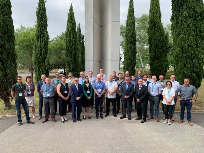
Thirty-four participants attended the workshop including: National Meteorological and Hydrological Services
(NMHS) observing system and Aircraft Meteorological Data Relay (AMDAR) Observing System experts,
researchers and UAV users; representation from the International Air Transport Association (IATA); Industry
manufacturers and developers; and other invited experts. The primary purpose of the workshop was to
consider and discuss the potential of UAVs to meet requirements sufficiently to be considered operational for
meteorology and also to consider the challenges of regulatory requirements.
The WMO Integrated Global Observing System (WIGOS) aims to provide a standardized framework for all
observing systems and enables the provision and availability of observations based on the requirements of
the 14 Application Areas of WMO. The requirements for observations are established and maintained through
the WMO Rolling Review of Requirements (RRR). From the WMO international perspective, an observing
system could be considered to be operational when the data derived is available on the WMO Information
System and has the capability to meet the requirements for one or more Application Area.
The benefits of using AMDAR data are supported by many scientific studies that illustrate the positive impact
of aircraft observations on the accuracy of meteorological forecasts and services. UAVs equipped with
meteorological sensors meeting observation requirements have the potential to greatly increase the number
of vertical profiles at the planetary boundary layer and fill gaps in data sparse areas. The workshop
participants were informed that larger more expensive high-altitude UAVs would be most useful for global
Numerical Weather Prediction (NWP) models, while smaller platforms, reporting at high frequency, with a
boundary layer focus and lower costs would have the greatest impact on regional and storm scale NWP. The
challenge to WMO member nations is to determine how best to implement UAV systems efficiently and
effectively while overcoming the challenges of meeting airspace regulatory requirements and limited
resources available to NMHSs.
The workshop presentations included research organizations and NMHS experts discussing the challenges and
successes experienced using UAVs in field campaigns collecting data in support of environmental and
meteorological applications. The challenges included airspace use regulations and technical capabilities of the
UAVs. UAV industry representatives spoke to the workshop audience on the types and capabilities of UAVs and
about their collaboration in field campaigns with research organizations and NMHS represented at the
workshop. IATA and other experts informed the workshop audience of the various national and international
airspace regulations.
The plenary sessions focused on the potential and requirements for operational use of UAVs and whether
NMHS would operate UAVs or form partnerships with private/public companies and organizations to acquire
the UAV data. The WICAP financial framework of cost sharing amongst multiple countries in one or more
WMO regions was presented as a model for cost sharing if UAV data was purchased from private companies.
The workshop closed after identifying key outcomes, recommendations, and future activities.WMO Workshop on Use of Unmanned Aerial Vehicles (UAV) for Operational Meteorology Report
p. 4
WORKSHOP REPORT
1. Workshop Opening
The World Meteorological Organization (WMO) Workshop on Use of Unmanned Aerial Vehicles (UAVs) in
Operational Meteorology was held 2 to 4 July 2019 at the Météo-France International Conference Center,
Toulouse, France.
The workshop was opened by Mr. Yann Guillou, Deputy-Director of the Observation Department, Météo-
France. Mr. Guillou welcomed all participants to the workshop and to Toulouse and discussed the importance
Météo-France placed on finding solutions to various technical issues with UAVs to help bring these emerging
in-situ observation platforms into use within operational meteorology.
Mr. Dean Lockett of the WMO Secretariat welcomed all participants to the workshop on behalf of the WMO
Secretary-General, thanking Météo-France for hosting the event, the presenters, and, in particular, Mr. Bruno
Piquet, of Météo-France for his excellent support and coordination of the event in Toulouse.
Mr. Lockett pointed out that the theme of the workshop was mutual understanding of how UAVs are used
currently by research organizations and National Meteorological and Hydrological Services (NMHS) and how
UAV data can be brought into the operations of the NMHS to support Numerical Weather Prediction (NWP)
and other applications. Mr. Lockett introduced Dr. Curtis Marshall, and Mr. Stewart Taylor, the Chair and
Vice-Chair of the WMO Inter-Programme Expert Team for Aircraft Based Observations (IPET-ABO) and
informed the workshop participants that the WMO Aircraft-Based Observations Programme (ABOP) would be
expected in the future to expand its scope to include activities related to UAV development and operational
implementation.
2. Workshop Programme
The workshop programme consisted of a series of presentations and panels by WMO-invited speakers from
national and regional AMDAR and upper-air programmes, international research organizations, UAV industry
representatives and other experts, over seven sessions and interspersed with periods for questions and open
discussion. While WMO recognizes that some countries and organizations use the term Unmanned Aerial
System (UAS) interchangeably with UAV, throughout this report the term UAV will be used to indicate both
UAS and UAV.WMO Workshop on Use of Unmanned Aerial Vehicles (UAV) for Operational Meteorology Report
p. 5
Day 1, Session 1
Session 1 included four presentations on the topics of the WMO role with observing systems, the benefits of
AMDAR, upper air requirements, and potential for use of UAVs in operational meteorology. The presenters’
names are listed below followed by a summary of the content and key points of the session.
Mr. Dean Lockett, WMO Secretariat, Introduction to WMO, WIGOS and ABO Programme
Dr. Curtis Marshall, Chairman of the IPET-ABO, Benefits and use of Aircraft Based Observations in Operational
Meteorology
Mr. Lars Isaksen, European Center for Medium-Range Weather Forecasts (ECMWF), Requirements for Upper-
Air Data to support Operational Meteorology and Current Gaps
Dr. Debbie O’Sullivan, United Kingdom Met Office, Opportunities and Potential for UAV’s in Operational
Meteorology
Session 1 Summary
The primary purpose of the workshop was to consider and discuss the potential of UAVs to meet
requirements sufficiently to be considered operational for meteorology and to consider the challenges of
regulatory requirements. The role of the WMO in international meteorology is to facilitate worldwide
cooperation in the establishment of networks of stations for the making of meteorological observations The
WMO role includes supporting the establishment and maintenance of national and global centres charged
with the provision of meteorological and related services, coordinating the establishment and maintenance of
systems for the rapid exchange of meteorological and related information, and developing and promoting
standardization of meteorological and related observations to ensure the uniform publication of
meteorological, hydrological and climate-related observations and statistics. From the WMO international
perspective, an observing system could be considered to be operational when the data derived is available on
the WMO Information System and has the capability to meet the requirements for one or more application
areas The WMO Integrated Observing System (WIGOS) provides a standardized framework for all observing
systems and enables the provision and availability of observations based on the requirements of the 14
Application Areas of WMO. The requirements for observations are established and maintained through the
WMO Rolling Review of Requirements (RRR) process.
The benefits of using AMDAR data in Numerical Weather Prediction (NWP) have proven to have a positive
impact which, consequently, resulted in more accurate forecasts and improved meteorological services in a
diverse number of applications including climatology, meteorology/NWP. When considered operational for
meteorological applications UAVs will be another component of the WIGOS ABOP and data should be derived
according to WMO standards. During research campaigns using UAV data, it has been demonstrated that the
benefits to NWP are similar and consistent with those benefits observed and measured from use of AMDAR,
especially in high resolution mesoscale NWP. It was suggested that Larger more expensive high-altitude UAVs
could be most useful for provision of data to support global NWP while smaller UAV platforms, reporting at
high frequency, with a boundary layer focus and lower costs would likely have a significant positive impact on
regional and storm scale NWP. The challenge to WMO member nations is to determine how best to implement
UAV systems efficiently and effectively while overcoming the challenges of meeting airspace regulatory
requirements and limited resources available to NMHSs.
UAVs have the potential to bridge the gap between land surface networks and satellite data to support high
resolution NWP and other meteorological applications. NMHS do not yet use UAV’s operationally, however
aircraft-based observations are used both operationally and for research to great effect, and research isWMO Workshop on Use of Unmanned Aerial Vehicles (UAV) for Operational Meteorology Report
p. 6
currently being undertaken to ascertain how to make better use of UAV’s. UAV’s offer a very promising way of
collecting data for many application areas and filling in some of the gaps in existing observing systems. UAV’s
offer a cost-effective alternative for atmospheric measurements compared to aircraft and satellites.
It can be summarized that observation impact in NWP depends on data volumes and how an observation
system complements and fills in gaps in the existing observing system. ECMWF believes UAVs could be a
valuable gap filler with accurate in situ measurements from the Planetary Boundary Layer (PBL) and/or the
stratosphere. It is also believed that crowd-sourced data and via the “Internet-Of-Things” will be important
observations data sources for NWP in the coming years.
Day 1 Session 2.1
Session 2.1 included four presentations on the topic of meteorological and climate research activities and
campaigns. The presenters’ names are listed below followed by a summary of the content and key points of
the session.
Captain Phil Hall, National Oceanic and Atmospheric Administration (NOAA), UAV for Meteorological and
Atmospheric Science.
Dr. Jamey Jacobs, Oklahoma State University (OSU), Swarming small UAVs for ABL Observations and
Development of the 3D Mesonet
Mr. Konrad Bärfuss, Technische Universität Braunschweig, contribution to the WMO UAV workshop on UA
Meteorology
Dr. James Pinto, National Center for Atmospheric Research (NCAR), Impact of assimilating UAV data on fine-
scale weather prediction
Session 2.1 Summary
The mission of NOAA’s UAV Program is to facilitate UAV applications and utilization in NOAA and accelerate
the transition of UAV capabilities from research to operations by providing expertise and resources for UAV
research and development. To meet NOAA meteorological and atmospheric science data requirements, the
NOAA UAV Program has completed field experiments to demonstrate the capabilities of UAVs for various
applications.
Swarming involves the control of multiple unmanned aircraft in formation without direct pilot input, in which
each can adapt to observations of the current conditions autonomously to optimize the observation strategy
parameters, for example, grid spacing. OSU is currently working on utilizing the capabilities of UAVs to
develop a “3D Mesonet” to demonstrate extending the conventional surface mesonet concept to include
vertical profiling capabilities by the addition of small, instrumented, profiling UAV platforms to existing
mesonet sites as a proof of concept for the entire network. The long-term vision is to autonomously operate
UAVs at the sites to provide atmospheric profiles at scheduled intervals to be used by forecasters in
operational meteorology, and to send the data to a central facility for dissemination.
At the Institute of Flight Guidance, the whole observing system is considered, which includes the design and
implementation of the mission, the aircraft, the sensors, the field work operation and the data processing.
Besides other UAV applications, meteorological research with UAV has been carried out including
meteorological investigations of the boundary layer, pollution and new particle forming.WMO Workshop on Use of Unmanned Aerial Vehicles (UAV) for Operational Meteorology Report
p. 7
It is expected that the assimilation of UAV observations, once widespread enough, will result in improved
mesoscale analyses and predictions. UAV data assimilation studies have shown that localized UAV
measurements can be used to improve fine scales predictions at relatively short lead times. Various examples
were provided that have shown advanced data assimilation methods have significant impact on mesoscale
modeling.
Day 1 Session 2.2
Session 2.2 included seven presentations on the topic of current use of UAV for operational meteorological
purposes and issues with transitioning from research to operations by National Meteorological and
Hydrological Service (NMHS). The presenters’ names are listed below followed by a summary of the content
and key points of the session.
Ms. Dörthe Ebert, Deutscher Wetterdienst (DWD), UAV at Deutscher Wetterdienst:Use in Meteorological and
Climate research activities and Campaigns
Dr. Bruce Baker NOAA Air Resources Lab, The work of the NOAA Air Resource Laboratory towards the
operational utilization of UAVs
Mr. Greg Roberts, Météo-France, Deploying UAV for Atmospheric Research
Dr. Debbie O’Sullivan, United Kingdom Met Office, Current use of UAVs at the Met Office, and Issues of
Transition to Operations.
Ms. Anne Hirsikko, Finnish Meteorological Institute (FMI), View on the Drone: Activities in FMI
Mr. Marin Mustapic, Croatian Meteorological and Hydrological Service, Measuring Air Pollution in Zagreb using
UAV
Mr. Lars Isaksen ECMWF, Use of UAVs in Meteorological Activities and Campaigns at ECMWF discussing the
use of UAVs in NWP research and operations at ECMWF.
Session 2.2 Summary
It was a clear outcome of the session that the primary barrier to the operational use of UAVs for meteorology
is the overcoming of regulatory issues associated with the use of regulated airspace in a way that would enable
the required meteorological data to be collected. Other perceived and current barriers are the costs of either
buying a service from a private company or the development and maintenance costs if done in house.
Additionally, the current level of automation in UAV operation is not yet advanced enough to allow
predominantly human-free operations, which is perceived to be a requirement to make such operations viable
and efficient, particularly in remote locations where many gaps in observations exist. The automated refueling
and the maintenance of fuel levels in UAVs is also considered an important requirement to be able to meet
operational standards for use. While several NMHS are clearly endevouring to develop or obtain UAVs for
operational purposes and applications, these issues are yet to be fully resolved satisfactorily.
It is evident that UAVs have the potential to provide a useful supplementary platform for in-situ
measurements adding value to and complementing existing operational sounding and remote sensing
systems. They especially have the potential to close the data gap in the boundary layer, improving the results
of data assimilation, thus leading to improved numerical weather prediction accuracy and skill.
UAVs are well-suited to complement ground-based measurements, to obtain measurements in remote or
dangerous locations and to study physical processes in the lower part of the atmosphere. In-situ observationsWMO Workshop on Use of Unmanned Aerial Vehicles (UAV) for Operational Meteorology Report
p. 8
are often ground-based, and UAV offer an important synergy with ground-based measurements to access the
vertical dimension of the atmosphere, particularly within existing networks of atmospheric monitoring
stations. The use and application of UAVs for research are wide and range from shorter-term atmospheric
process studies, to their long-term use in campaigns and the monitoring of various meteorological parameters
and phenomena. Such research can range from the use of a single UAV only, up to the use of coordinated
fleets operating in a single contained area, or in distributed networks. Equipped with appropriate sensors, the
UAVs can offer a new approach for research opportunities into air pollution and emissions monitoring, as well
as for studying atmospheric trends. UAVs have great potential as a new observations platform for monitoring
atmospheric state, which, for some applications, require detailed, fine scale weather information.
The position of the instrument payload on the UAV is a critical factor for the accuracy of the measurements.
For international data centres to be able to use UAV data efficiently and easily, it is very important to
implement and use well-defined data formats (e.g. WMO BUFR). Near-real-time availability (within 3 hours of
measurement time) is highly desirable for the optimal use of data in operational NWP systems. Availability and
open access to data will increase the likelihood that NWP centres can justify the effort to assimilate and
monitor and evaluate data sources such as those from UAVs.
There is a need for a full demonstration of small UAV capabilities using a testbed, with should have the aim to
develop a robust set of protocols to assess the costs and operational feasibility of UAVs for routine
applications using various combinations of aircraft and sensors. The testbed could also be used to design and
develop processes and protocols to support the transition of UAVs from research to operations, including
such aspects as data processing and transmission, validation and integration into data user applications and
systems.
Day 2 Session 3
Session 3 included eight presentations on the topic of UAV capability, manufacture and availability. The
presenters’ names are listed below followed by a summary of the content and key points of the session.
Mr. Chris Flynn, Flyht Aerospace, TAMDAR-Edge: UAV Weather Sensor Technology
Dr. Jack Elston, Black Swift Technologies, Types and Capabilities of UAS for Meteorology
Mr. Christian Schluchter, Meteomatics, Meteodrones
Mr. Luis Carillo, Singular Aircraft, Singular Aircraft FLYOX1
Mr. Chris Mazel, DroneXsolutions, The ReNovRisk UAV campaigns and the BOREAL drone,
Mr. Jean-Francois Vinuesa, Airbus, Improving Service Coverage with High Altitude Pseudo Satellite,
Mr. Stewart Taylor, EUMETNET for Zipline, High Volume Operations with Drones
Dr. Thomas Wetter, Deutscher Wetterdienst, Application and Use Generally Provision of Meteorology for the
operations of UAS
Session 3 Summary
While not currently used operationally to support traditional meteorological weather forecast applications,
UAVs are already being used operationally for several different atmospheric applications including volcanic
monitoring, plume detection and dispersion measurement, in situ thermodynamics, soil moisture
measurement and snow water equivalent measurement, among others. Critical to the value of theWMO Workshop on Use of Unmanned Aerial Vehicles (UAV) for Operational Meteorology Report
p. 9
contribution of these systems is the ability to routinely collect the measurements in a safe and reliable
manner. This depends largely on the capabilities of the UAV.
Among the characteristics to consider when selecting a UAV platform for use in meteorology, some of the
main areas of focus should be ease of use, robustness, and capability to be integrated within the national
airspace system. Use of UAVs for operations will require higher-altitude flights, beyond visual line of sight
(BVLOS), and possibly within close proximity to buildings and challenging terrains. Such meteorological user
requirements, along with those of other UAV applications, will mean that the regulatory requirements of
airspace will continue to change and adapt, and UAV systems will need to provide the necessary interfaces,
onboard systems and autonomy to safely operate with other traffic and within challenging and varying
regions.
FLYHT has developed the TAMDAR-Edge™ system for unmanned aerial vehicles (UAVs). It is a low-power,
miniaturized version of the commercial TAMDAR sensor and provides the same key weather parameters
including relative humidity, temperature, winds as well as icing conditions
Meteomatics manufacturers and operates Meteodrones, which are designed for profiling the lower
atmosphere up to 3000m altitude, measuring temperature, relative humidity, dew point, pressure, wind speed
and direction. These data are sent to Meteomatics servers in real time and are then assimilated into a high-
resolution weather model. The MeteoBase is a fully autonomous ground station that can be controlled
remotely. This allows a drone operator to remotely control several drones from one control center instead of
being at the flight site.
The mission of Singular Aircraft is to manufacture UAVs that are reliable, efficient, safe and of low cost.
Singular produces the FLYOX1 UAV which while capable of operating in fully-automated mode, requires a pilot
onboard to meet airspace regulations. The High-Altitude Pseudo Satellite or HAPS. HAPS offer benefits of
persistence and flexibility to complement satellites and (un-)manned aviation. HAPS has a strong potential for
complementary, layered services including meteorology.
Météo-France collaborated with DroneXsolutions, utilizing the BOREAL drone, during a field campaign studying
cyclogeneses in the southwest Pacific. In order to achieve its mission, the fixed-wing BOREAL drone was
equipped with avionics embedding automatic flying, multiple C2link capabilities for short and long range
communication, remote identification with a transponder mode S / ADS-B out, visual anti-collision with strobe,
and support for traffic separation with a real-time, front video sensor.
The Zipline UAV flies at 30 m/s below 500ft above ground level with a 50 min average flight duration, 100 km
average flight distance and have meteorological sensors which include 2x redundancy on pressure,
temperature and humidity sensors and 1hz+ sampling cellular communications uploaded to a cloud site every
15 minutes. This data supplements the very sparse NMHS reporting locations in Rwanda and Ghana.
Some of the challenging tasks for future considerations related to UAV operations is how to prepare weather
briefings and consultations for beyond visual line of sight (BVLOS) operations, and the provision of longer-
range forecasts to support long-range and long-term UAV operations to conduct in-flight weather detect and
avoidance (DAA) of hazardous weather.
Day 2 Session 4WMO Workshop on Use of Unmanned Aerial Vehicles (UAV) for Operational Meteorology Report
p. 10
Session 4 included six presentations on the current status relating to regulations for use of UAVs
and potential regulatory issues with operational use of UAVs. The presenters’ names are listed below followed
by a summary of the content and key points of the session.
Mr. Manfred Mohr, IATA, Use of Airspace the Regulatory Aspects and the Airline View
Mr. Chris Mazel, DroneXsolutions, Current Status relating to Regulations for use of UAVs
Dr. Debbie O’Sullivan, United Kingdom Met Office, Potential Regulatory Issues with the Use of Airspace for
Operational Meteorology
Captain Phil Hall, NOAA, US Aviation Policy and Challenges for Meteorological Operations for NOAA.
Dr. Thomas Wetter, Deutscher Wetterdienst, Use of Airspace and Regulatory Aspects
Mr. Stewart Taylor, EUMETNET, Issues with Use of Airspace
Session 4 Summary
It is important that there is a comprehensive approach to UAV integration into the wide family of air space
users aligned with international and global recommendations. The European Union (EU) drone regulation, EU
commission delegated regulation 2019/945, was adopted in June 2019 and it will progressively replace the EU
individual national rules over a transition period of 2 to 3 years. The harmonization of the rules is aiming to
regulate and support what is expected to be a big European market for drone services. The European drone
regulations address UAVs ranging from toy drones to High Altitude Long Endurance (HALE) UAVs and
encompassing both current and envisaged future operations.
A large level of flexibility is provided to EU member states to implement the new regulations at the national
level and the individual EU national aviation authorities (NAA) will still play a key role in delivering
authorization and defining airspace zones with specific limitations/requirements, such as, no-fly zone, altitude
restriction, requirement for remote identification, etc. A mutual recognition of the authorizations delivered by
the NAA of the member state will be valid throughout the EU (after coordination with the relevant NAA).
The EU regulations will also incorporate related law enforcement, including privacy rights, and will contribute
to address security risks by enforcing registration of all UAVs heavier than 250 gram or operating above 120
meters of altitude. The EU regulations have identified three categories of operations with varying degrees of
operator risk, so as to cover from visual line of sight (VLOS) operations, through to instrument flight rules (IFR)
operations with different regulatory approaches.
In Europe, there is a requirement to keep UAVs within direct unaided visual contact during operation visual
line of sight operations. There is however a general exception where UAVs can be piloted using the view from
an on board camera, known as first person view (FPV) flying, provided there is a competent observer
maintaining unaided visual contact with the UAV. It is an added complication that most useful UAV
meteorological flights will require beyond visual line of sight (BVLOS) operations. In order to maximise the
potential of UAVs for operational meteorology there needs to be a mechanism in place to allow for routine
BVLOS operations
The United States (U.S.) Federal Aviation Administration (FAA) classifies all UAVs as aircraft and small UAV (55
pounds or less) are regulated under FAA Part 107 of codified U.S. law. Challenges to the transition of UAV to
meteorological operations include these Part 107 regulatory requirements to keep the UAS within visual line of
sight, which prevents flights above 3,500 feet and prohibits flights in clouds. Additionally, it is challenging to
train NOAA personnel to be proficient as UAV operators as an addition to conducting their normal duties.WMO Workshop on Use of Unmanned Aerial Vehicles (UAV) for Operational Meteorology Report
p. 11
International regulations on UAVs are categorized by UAV type and risk of the mission, these regulations are
supported by the Joint Authorities for Rulemaking of Unmanned Systems (JARUS). Major aspects of
regulations relating to UAV are safety (Air risk & Ground risk), security (sabotage, terrorism), privacy (cameras
and other recording payloads) and airspace capacity (integration of UAV into existing airspaces).
Day 3 Session 5
Session 5 was a plenary session with 4 panel discussions on the potential and requirements for operational use
of UAV data. The panel leader names are listed below followed by a summary of the content and key points of
the session.
Mr. Dean Lockett, WMO, Panel discussion on the definition of “Operational” in the WIGOS context for UAV
systems
Mr. Dean Lockett, WMO, Panel discussion on UAV Data Communication, and Data Management
Dr. Curtis Marshall, IPET-ABO, Panel discussion on Public Sector Partnering.
Dr. Curtis Marshall, IPET-ABO and Dr. Debbie O’Sullivan, United Kingdom Met Office, Panel discussion on
Implementation and use for Operations
Session 5 Summary
For WMO WIGOS observing systems to be considered operational, the data must meet the WMO WIGOS
requirements for one or more of the application areas, including its provision to end users in a timely manner
and in standardized formats. It is clear that UAVs have great potential to meet requirements and fill
observations gaps in support of the range of NWP applications. Their suitability for monitoring a wider range of
atmospheric variables also suggests that they could have the potential to meet operational requirements for
health and safety and environmental-related applications, including weather, pollution and aviation hazard
monitoring and prediction.
There is a general lack of information on UAVs and their capabilities available to the wider NMHS community
and there is clearly a need to develop guidance and advice on the value of UAVs to the operational
community. WMO guides, technical reports and news bulletins can serve as authoritative sources for the
provision of such information.
Before UAVs can be widely implemented for operational use, there are several actions that need to be
undertaken to facilitate their acceptance in this role. It was suggested that a first action could be to undertake
well-planned and coordinated cost/benefit analyses based on the establishment and use of UAV test beds to
demonstrate their capabilities over a suitable period of time and perhaps even coordinated at the
international level. Such demonstrations along with analysis of performance and efficiencies, could provide a
business case to help NMHS determine where UAVs add the most value, assist manufacturers in tailoring their
products and also allow data users to prepare for the availability of such data in the future. Potentially, WMO
could coordinate and support international efforts in this regard through its Infrastructure commission,
possibly including the organization of a dedicated inter-comparison of UAV systems.
It was suggested and agreed that when there is a convenient and standardized way to share data, operators
and data providers will do it, and data users will make use of such data. For it to be optimally usefulWMO Workshop on Use of Unmanned Aerial Vehicles (UAV) for Operational Meteorology Report
p. 12
operationally, UAV data needs to be gathered centrally, processed, quality controlled and then disseminated,
whether at the national, regional or global level. There needs to be standards agreed and established for data
collection and redistribution, including for relay from instrument to collection centre and also for exchange of
data at the regional and international level. Another important aspect of data management is data policy and
licensing for use. WMO Aircraft Meteorological AMDAR (AMDAR) data, provided in partnership with
commercial airlines, conforms to WMO Resolution 40 and is therefore available for use by all NMHS members
via the WMO Information System (WIS). In the case that UAV data becomes available to NMHS via 3rd party
partnerships and arrangements, efforts should be made to ensure that such data is also compliant with WMO
Resolution 40 and able to be shared on the WIS.
It is evident that there will exist opportunities for NMHS to form partnerships with public sector organizations
and entities and individuals to derive meteorological data from UAV systems. This might include systems
deployed for dual or multi-purpose application or deployed solely for meteorological application under
voluntary or paid service. While perhaps not strictly “operational” by definition, this means for obtaining data
in partnership is an important consideration, particularly for modern meteorological applications which have a
requirement for a high density of observational data and for which data quality is either less important or is
facilitated and managed by the application. For example, there are opportunities in the developing and
expanding industry of delivery drones that could potentially provide large volumes of data under a suitable
cost sharing model. The management of such data obtained or provided under such partnerships require the
consideration of a range of issues, including data quality management and control, data security, privacy issues
and metadata management. It was agreed that WMO might consider how to facilitate and coordinate the
advancement of such partnerships through initiatives such as demonstration projects, the development of
public voluntary data provision programs and the development of standards and mechanisms for data
collection and sharing.
Over the next few years in the EU, every drone over 250 grams must have an e-signature and have the
capability to transmit required metadata (height/course/speed). Every drone over 900 grams will have to carry
an ADS-B transponder and could potentially transmit weather data automatically. This could potentially be an
additional source of meteorological data if coordinated and advocated with the corresponding regulatory
bodies.
In general and in summary, the significant existing barriers and challenges to operational implementation with
UAVs by NMHSs include: access to airspace and complying with airspace regulations, attainment of required
levels of system automation (including fuel/energy management), and data quality for some variables (e.g.
wind speed and direction).
However, it is likely that there are a range of options available to NMHS to be able to make use of UAVs for the
production or provision of useful meteorological data and it may be possible to employ more than one of
these options to meet the range of requirements. While it may be necessary in some cases to purchase,
operate and maintain systems internally for some applications, it should also be possible to establish
partnerships with private entities to provide voluntarily or sell data more efficiently and effectively. In some
cases, UAV operations NMHSs may be best facilitated through a private partnership resulting in a UAV “data
buy” for meteorological applications.
Day 3 Session 6WMO Workshop on Use of Unmanned Aerial Vehicles (UAV) for Operational Meteorology Report
p. 13
Session 6 was a plenary session with three panel discussions on the topic of key outcomes, recommendations
and actions. The panel leader names are listed below followed by a summary of the content and key points of
the session.
Dr. Thomas Wetter, DWD. Panel discussion on Recommendations for UAV Manufacturers.
Mr. Stewart Taylor, EUMETNET, Panel discussion on UAV Operational Demonstration Project
Mr. Dean Lockett, WMO, Panel discussion on WMO Upper Air Intercomparison
Session 6 Summary
There were several important recommendations and ideas that were suggested throughout the course of the
workshop.
It was agreed that there is a need for a white paper on UAVs that describes the current status of their
capabilities and their potential to fill gaps in the global observing system. The development of such a paper
should be coordinated by WMO, possibly though its expert team on aircraft-based observations, which would
benefit from the addition of several experts from the UAV community. It should address both the benefits and
current issues with UAV systems associated with their transition to operation and outline possible solutions
and requirements for their advancement and improvement, for example, through the establishment and
operation of test beds and the holding of UAV intra-comparisons. It should address key future requirements in
the areas of data quality, data formats, regulatory issues and operating costs. The paper should outline a
roadmap for UAVs to become a well-defined and integrated component of global observing system.
The future integration of UAVs into the national and international airspaces presents new challenges for
NMHSs in their role as service providers for public and private aviation operations. In particular, NMHSs will
need to work towards the capability to be able to meet requirements for services associated with operational
safety including support for detect and avoid measures for weather events
It was recognized that regulatory requirements for UAVs may also offer the opportunity to implement
regulations for the automatic and mandatory collection of weather data to support their operation. For
example, where UAVs are required to transmit ADS-B or ADS-B-like information, it might be conceivable to
regulate or strongly recommend to provide weather information if and when possible.
It was suggested that, given the potential and likely benefits and impacts of UAVs to NMHS, weather and
forecast-related application, and the flow-on benefits to clients of NMHS through resulting improvements to
products and services, a possible mechanism for advancing their transition to operation might be achieved
through a large-scale demonstration of UAV capabilities. The purpose of the demonstration would be to assess
the viability of the utilization of UAVs to collect and share meteorological data on an “end-to-end” basis and
would therefore potentially require the involvement of manufacturers, operators/data providers and data
users from a range of application areas. A plan for this activity should first be developed with the aim of
beginning the demonstration later in 2020 or early in 2021.
An inter-comparison of UAV systems, potential also involving comparison with relevant upper-air systems and
standards, would be another means for demonstrating the capabilities and potential of these systems to meet
requirements for their operational implementation and integration.WMO Workshop on Use of Unmanned Aerial Vehicles (UAV) for Operational Meteorology Report
p. 14
In 2021, WMO will coordinate and hold an Upper-Air (UA) inter-comparisons to test and characterize the
performance of operational radiosonde systems and other upper-air remote and in situ observing systems in
use. The inter-comparison serves to assess and validate the performance of the various systems and assist
WMO members in selecting radiosonde systems according to their requirements. It is possible that AMDAR
and UAVs might be included in this inter-comparison, in which case, the participants agreed efforts should be
made to encourage manufacturers and operators to do so.
3. Key Outcomes, Recommendations and Future Activities
• 3-4 workshop participants to become IPET-ABO associate members to provide expertise on UAV systems
to WMO and the team to:
o Work with IPET-ABO leadership to develop WMO UAV guidance materials.
o Provide input to the WMO Integrated Global Observing System (WIGOS) vision for observing
systems evolution to 2040 and the subsequent implementation plan for the evolution of
WIGOS.
o Develop a white paper on UAV systems which should include:
Assessment of current status of UAVs.
Benefits and impacts.
Roadmap for UAV integration in operational meteorology.
Recommendations to manufacturers and regulators.
• IPET-ABO to assess requirements for development of a data model for international exchange of UAV
meteorological data.
• IPET-ABO to advise and coordinate any involvement of UAVs in the next WMO upper-air inter-comparison.
• WMO to investigate the possibility to collaborate with ICAO and national civil aviation authorities
regarding the possibility to request approvals and appropriate regulations for use of dedicated airspace for
operational vertical atmospheric profiling for meteorological applications.
• IPET-ABO to assess the possibility for it to coordinate the establishment of dedicated test bed sites for UAV
capability and testing for operational meteorology, including an organised demonstration program.
• WMO and the IPET-ABO to consider how to promote wider implementation and use of UAVs in
meteorological observations, including the publication of articles in relevant forums.
• The IPET-ABO to develop Specific Operations Risk Assessment (SORA) standard scenarios for use of UAVs
for meteorological purposes to facilitate their approval in accordance with national and international
regulations.
• Workshop participants to develop a summary table of the status of known UAV applications in
meteorology to be included in this report.
4. Close of the Workshop
Following the completion of the workshop programme of presentations and discussions, Mr. Dean Lockett and
Dr. Curtis Marshall thanked all presenters and participants for their input to the workshop, and also thanked
Météo-France for their support in hosting the event and for their generous hospitality to all participants.WMO Workshop on Use of Unmanned Aerial Vehicles (UAV) for Operational Meteorology Report
p. 15
ANNEX-l Summary Table1 of Applications from UAV Data
Country Organization & Contact Type of UAV Application Payload on UAV Status of
from use of development/operation
UAV ; Current UAV operating
restrictions/limitations
Croatia NMHS N/A Air pollution 5 kg initial phase of the
The UAV is monitoring
project with the Faculty
property of
of Transportation
Faculty of
Transportatio Sciences for measuring
n sciences of traffic-generated air
pollution in Zagreb city
USA Black Swift Technologies - Black Swift Soil moisture wind probe, Operational, limited to
Jack Elston Technologies measurement temperature, FAA part 107
(elstonj@bst.aero) S2 UAS (Fixed , plume pressure, operations, but has
Wing) monitoring, humidity, trace been allowed high
volcanic gas, altitude flights, flights at
monitoring, nephelometer, night and beyond line of
wildland fire radiometer, sight flights through
observation, thermal camera, waivers and a TFR
atmospheric multi-spectral
profiling camera, RGB
camera
(swappable
payload)
France DroneXsolution Fixed Wing / Maritime Multipurpose COTS product BOREAL,
cmazel@dronexsolution.com UAS BOREAL surveillance, and Modular regulatory restriction of
earth payload bay for use because of the
observation, the drone MTOM (up to 25kg) and
technical BOREAL. the Long Range/Large
inspection Various Endurance capabilities
configuration
options from
optronics gimbal,
photogrammetry
, LiDAR or
customized set of
sensors (such as
Met.)
Nether- KNMI DJI-Matrice 600 Boundary layer Vaisala RS41 Status: single experiment.
lands Marijn de Ha Pro profiles radiosonde Performed in summer
2017, reported here: BAMS
1
Additional information may be added to this tableWMO Workshop on Use of Unmanned Aerial Vehicles (UAV) for Operational Meteorology Report
p. 16
Country Organization & Contact Type of UAV Application Payload on UAV Status of
from use of development/operation
UAV ; Current UAV operating
restrictions/limitations
article.
Restrictions:
Desired range up to 700m
was not feasible in the
short term.
Requires a comprehensive
flight plan due to nearby
air traffic (~3500ft) and
road traffic.
Maximum altitude reached
235 m by company with
RPAS Operator Certificate
(national regulations by
Dutch Human Environment
and Transport
Inspectorate)
UK Met Office Meteorological DGI S900 Multi Boundary layer FP07 fast tip Currently being used for
Research Unit (MRU), Copter fog research / thermistor, boundary layer fog
Cardington, other boundary Vaisala HMP 110 research. Operated within
Jeremy Price, Debbie O’Sullivan layer studies humidity/ restricted airspace at
temperature Cardington, up to 6000 ft
probe, HYT-271 (1 mile radius around the
humidity/ MRU site)
temperature
sensor, BMP 280
This UAV is used in profiles
pressure sensor,
up to 500 m
BMP055 9-axis
sensor to calculate
pitch, roll and
direction
UK Met Office Meteorological Yuneec H520 Boundary layer FP07 fast tip About to be used for
Research Unit (MRU), multi-copter fog research/ thermistor, research. Will enable
Cardington, other boundary Vaisala HMP 110 profiles up to the top of
Jeremy Price, Debbie O’Sullivan layer studies humidity/ the Cardington restricted
temperature airspace in theory – 6000
probe, HYT-271 ft. yet to be tested to that
humidity/ altitude
temperature
sensor, BMP 280
pressure sensor,
BMP055 9-axis
sensor to calculate
pitch, roll and
direction
, and probably
room for a few
more things too
UK Met Office Meteorological Bormatec Maja Fixed wing
Research Unit (MRU), capability with
Cardington, Pixhawk
Jeremy Price, Debbie O’Sullivan autopilot, could
be used forWMO Workshop on Use of Unmanned Aerial Vehicles (UAV) for Operational Meteorology Report
p. 17
Country Organization & Contact Type of UAV Application Payload on UAV Status of
from use of development/operation
UAV ; Current UAV operating
restrictions/limitations
cloud studies/
and fluxes using
horizontal runs
and profiles
Germany Working Group “Airborne Fixed Wing UAS, Research on T/RH/Wind/Solar Operational for research
Meteorology and Measurement 25 kg MTOW, atmospheric irradiance/Surface campaigns, applied to
Techniques”, Institute of Flight 3.6 m particle Temperature campaigns in Europe,
Guidance, TU Braunschweig Wingspan, formation and Sensors, black Svalbard, West Africa up to
iff-mmt@iff.ing.tu- electrically small-scale ABL carbon sensor, 2x 1500 m, VLOS, needs
braunschweig.de powered processes condensation grass/ice/sand/concrete
Group Leader: Dr. Astrid particle counter, 1x runway (50x200m)
Lampert, astrid.lampert@tu- optical particle
braunschweig.de counter
Germany Working Group “Airborne Rotorcraft UAS, Research on Air sampling, Operational for research
Meteorology and Measurement 25 kg MTOW, trace gases T/RH/Solar campaigns, applied in
Techniques”, Institute of Flight electrically (methane etc.) Irradiance Sensors, Europe and the Arctic from
Guidance, TU Braunschweig powered and small-scale surface research vessel Polarstern
iff-mmt@iff.ing.tu- ABL processes temperature up to 1000 m, VLOS
braunschweig.de
Group Leader: Dr. Astrid
Lampert, astrid.lampert@tu-
braunschweig.de
Germany Working Group “Airborne Fixed Wing UAS, Operational at least T/RH/Wind Design studies, ceiling ~12
Meteorology and Measurement ~3 kg, ~1.2 m Meteorology, Sensors km AMSL
Techniques”, Institute of Flight Wingspan, NWP
Guidance, TU Braunschweig electrically
iff-mmt@iff.ing.tu- powered
braunschweig.de
Group Leader: Dr. Astrid
Lampert, astrid.lampert@tu-
braunschweig.de
Switzer- Meteomatics AG, Christian Meteodrone Boundary layer Sensors for In operational use at
land Schluchter, Classic, soundings up to humidity, Meteomatics for data
cschluchter@meteomatics.com Quadrocopter 3km above temperature, dew assimilation into numerical
, info@meteomatics.com ground; regular point, pressure, weather forecasts and on
soundings wind speed and sale
several times an direction;
hour; emergency rescue Max. ascent speed: 10m/s
mobile system; Max. wind speed: 60km/h
soundings e.g. redundant energy Max. flight altitude: 3000m
for storm and Max. flight endurance:
chasing; vertical communication ~20min
soundings & links; Max. payload: ~150g
alternative Additional optional
flight paths; payload: ~150g
VLOS/BVLOS/E-
VLOSWMO Workshop on Use of Unmanned Aerial Vehicles (UAV) for Operational Meteorology Report
p. 18
Country Organization & Contact Type of UAV Application Payload on UAV Status of
from use of development/operation
UAV ; Current UAV operating
restrictions/limitations
Switzer- Meteomatics AG, Christian Meteodrone Boundary layer Sensors for In operational use at NOAA
land Schluchter, SSE, Hexacopter soundings up to humidity, and other organizations
cschluchter@meteomatics.com 1.5km above temperature, dew
, info@meteomatics.com ground; regular point, pressure, Max. ascent speed: 19m/s
soundings wind speed and Max. wind speed: 75km/h
several times an direction Max. flight altitude: 1500m
hour; Max. flight endurance:
mobile ~12min
soundings e.g.
for storm
chasing; vertical
soundings &
alternative
flight paths;
VLOS
Switzer- Meteomatics AG, Christian Meteodrone XL, Boundary layer Sensors for In operational use at
land Schluchter, Quadrocopter soundings up to humidity, Meteomatics for
cschluchter@meteomatics.com 3km above temperature, dew atmospheric pollution
, info@meteomatics.com ground; regular point, pressure, measurements and on sale
soundings wind speed and
several times an direction; Max. ascent speed: 6m/s
hour; emergency rescue Max. wind speed: 40km/h
mobile system; Max. flight altitude: 3000m
soundings e.g. redundant energy Max. flight endurance:
for storm and ~40min
chasing; vertical communication Max. payload: ~1kg
soundings & links;
alternative Additional optional
flight paths; payload: ~ 1kg
Applications
using payload,
e.g.
atmospheric
pollution
measurements,
custom sensor
package etc.;
VLOS/BVLOS/E-
VLOS
Switzerland Meteomatics AG, Christian Meteodrone Boundary layer Sensors for On sale in Q1 2020
Schluchter, v2.0, soundings up to humidity,
cschluchter@meteomatics.com Hexacopter 6km above temperature, dew Max. ascent speed: 20m/s
, info@meteomatics.com ground; regular point, pressure, Max. wind speed: 100km/h
soundings wind speed and Max. flight altitude: 6000m
several times an direction; Max. flight endurance:
hour; emergency rescue ~40min
mobile system; Max. payload: ~2kg
soundings e.g. redundant energy Anti-Icing system
for storm and
chasing; vertical communication
soundings & links;
alternative Additional optional
flight paths; payload: ~2kgWMO Workshop on Use of Unmanned Aerial Vehicles (UAV) for Operational Meteorology Report
p. 19
Country Organization & Contact Type of UAV Application Payload on UAV Status of
from use of development/operation
UAV ; Current UAV operating
restrictions/limitations
VLOS/BVLOS/E-
VLOS
Germany Deutscher Wetterdienst Multi-rotor- Meteorological max 5 kg Currently we do not own
(DWD), copter drone and air quality or operate an UAV, but we
Department Climate and measurements intend to purchase a
Environment Consultancy , in various suitable UAV system off-
contact: environments the-shelf or custom-built.
Lutz.Plueckhahn@dwd.de (including The UAV shall have a
cities) from transponder to enable air
ground level to traffic control.
max 3 km Restrictions/limitations for
above ground. UAV operation have not
Measurement been clarified so far.
results will be
analysed to
study and
document
atmospheric
processes and
will be used for
the evaluation
of local climate
and urban
climate
computer
simulation
models.WMO Workshop on Use of Unmanned Aerial Vehicles (UAV) for Operational Meteorology Report
p. 20
ANNEX-ll Workshop Programme
Day 1 (2 July)
Session Time Topic or Item Presenter / Chair / Panel
0930 Welcome and Aims of workshop Mr. Yann Guillou, Météo-France
10 min Mr. Dean Lockett, WMO
0940 Workshop Schedule & Practical Arrangements Mr. Bruno Piquet, Météo-France
5 min Mr. Steve Pritchett, WMO
0945 Introduction to WMO, WIGOS and ABO Programme Mr. Dean Lockett, WMO
25 min
Session 1 1010 Benefits and use of ABO in operational meteorology Mr. Curtis Marshall, NOAA & IPET-ABO
25 min Chair
Introduction, Aims,
ABO Benefits and 1035 Coffee/Tea Break
Application 15 min
1050 Requirements for upper-air data to support operational Mr. Lars Isaksen, ECMWF
40 min meteorology and current gaps
1130 Opportunities and potential for UAVs in operational
30 min meteorology Ms. Debbie O’Sullivan, UK Met
1200 Session 1 Discussion Mr. Curtis Marshall
15 min
End Session 1 1215 Lunch break
1320 Use in Meteorological and Climate Research Activities and Mr. Phil Hall, NOAA
20 min Campaigns:
Session 2.1 1340 Mr. James Pinto, UCAR
• Use in operational meteorology
20 min
Summary of Current • Current issues with transitioning from research
Use of UAV for 1400 to operations Mr. Jamey Jacobs, Ok. State University
General and 20 min
Meteorological 1420 Mr. Konrad Bärfuss, TU Braunschweig
Purposes 20 min
By Research
Organizations 1440 Session 2.1 Group Discussion with Q&A Mr. Stewart Taylor
20 min
1500 Coffee/Tea break
1515 Use in Meteorological and Climate Research Activities and Ms. Doerthe Ebert, DWD
15 min Campaigns (continued):
1530 Mr. Bruce Baker, NOAA
Session 2.2 • Use in Operational Meteorology
15 min
• Current Issues with transitioning from research
Summary of Current 1545 to operations Mr. Greg Roberts, MeteoFrance
Use of UAV for 15 min
General and 1600 . Debbie O’Sullivan, UK Met Office
Meteorological 15 min
Purposes
By NMHS 1615 Ms. Anne Hirsikko, Finland Met Ins.
15 min
1630 Mr. Marin Mustapić, Croatia Met
15 minWMO Workshop on Use of Unmanned Aerial Vehicles (UAV) for Operational Meteorology Report
p. 21
1645 Mr. Lars Isaksen, ECMWF
15 min
1700 Session 2.2 Discussion Mr. Dean Lockett
30 min
End Session 2 1730 End Day 1
Day 2 (3 July)
Session Time Topic or Item Presenter
0930 Summary Day 1, Questions, Introduction to today’s Mr Dean Lockett, WMO
15 min programme and topics.
0945 Types and capabilities of UAVs: Mr. Chris Flynn, Flyht
25 min
• Application and Use Generally
1010 Mr. Jack Elston, Black Swift
• Application for operational meteorological
25 min Technologies
observations
1035 • Costs and Issues Mr. Christian Schluchter, Meteomatics
25 min
Session 3
1100 Coffee/Tea/Break
UAV Capability, 1115 Types and capabilities of UAVs (continued): Mr. Louis Carillo, Singular Aircraft FLYOX
Manufacture and 25 min
Availability • Application and Use Generally
1140 Mr. Chris Mazel, DroneXsolutions
• Application for operational meteorological
20 min
observations
1200 • Costs and Issues Mr. Jeff Vineusam, Airbus
25 min
1225 Mr. Thomas Wettle, DWD
15 min
Mr. Steward Taylor, for Zipline
1240 Session 3 Group Q&A Mr. Curtis Marshall
20 min
End Session 3 1300 Lunch Break
1430 Issues with use of airspace: Mr. Manfred Mohr, IATA
30 min
• Current status relating to regulations for use of
1500 Mr. Chris Mazel, DroneXsolution
UAVs
30 min
• Potential regulatory issues with met. operational
1530 use Ms. Debbie O’Sullivan
20 min UK Met Office
Session 4 1550 Coffee/Tea/Break
Use of Airspace and 1605 Issues with use of airspace (continued) Mr. Stewart Taylor, EUMETNET
Regulatory Aspects 20 min
1625 Mr. Phil Hall, NOAA
20 min
1645 Mr. Thomas Wetter, DWD
20 min
1705 Session 4 Group Discussion and Q&A Mr. Stewart Taylor
25 minYou can also read