California Water Boards Symposium - Beyond Open Data: Radical Inclusivity for Water Data Equity
←
→
Page content transcription
If your browser does not render page correctly, please read the page content below
California Water Boards
6th Annual Water Data Science
Symposium
Mono Lake, Photo Credit: Mick Haupt
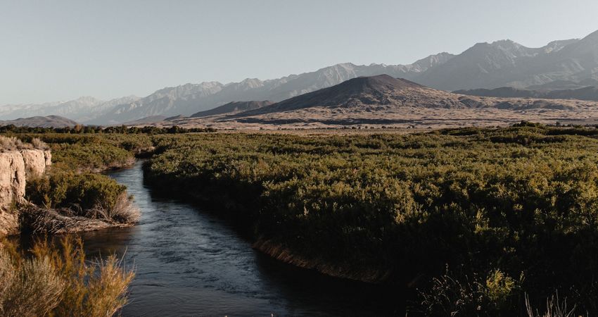
Owens River, Photo Credit: Dane Deaner
Beyond Open Data:
Radical Inclusivity for
Water Data Equity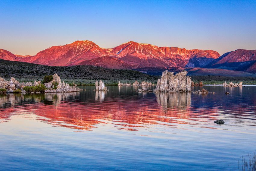
California Water Boards
     6th Annual California Water Data Science Symposium
     Beyond Open Data: Radical Inclusivity for Water Data Equity
                        June 28 – 30, 2021

Symposium Program
Event Partners ............................................................................................................................................... 1
Presenter Acknowledgements ...................................................................................................................... 2
Agenda .......................................................................................................................................................... 4
Welcome and Keynote Speakers ................................................................................................................ 12
Monday, June 28 ......................................................................................................................................... 13
   Paya: The Water Story of the Paiute ....................................................................................................... 13
Tuesday, June 29 ......................................................................................................................................... 16
   Session 1: From Data to Insight .............................................................................................................. 16
   Session 2: From Insight to Action............................................................................................................ 18
   Session 3: From Prediction to Protection ............................................................................................... 21
Wednesday, June 30 ................................................................................................................................... 23
   Session 1: California Chapter of the Society for Freshwater Science ..................................................... 23
   Session 2: Using Data to Address Water and Racial Inequities .............................................................. 26
   Bay-Delta Data Sandbox Workshop ........................................................................................................ 27
Presenter and Panelist Index ...................................................................................................................... 28
About The 2021 Mascot .............................................................................................................................. 41
Thank you for joining the 2021 California Water Data Science Symposium! ............................................. 41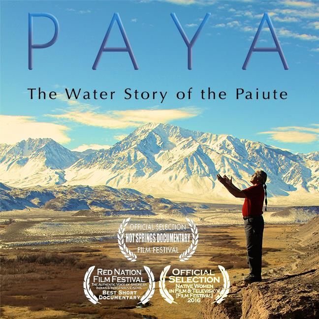
Event Partners

                 1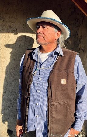
Presenter Acknowledgements

2
3
Agenda
                                    California Water Boards
                      6th Annual California Water Data Science Symposium
                   Beyond Open Data: Radical Inclusivity for Water Data Equity
                                     Monday, June 28, 2021

                                Paya: The Water Story of the Paiute
                                 Film Screening & Panel Discussion

                  Please register to attend this film screening and panel discussion.
    After registering, you will receive a confirmation email containing instructions on how to join
                                               the webinar.
                Virtual Attendance for Non-registered Viewers: YouTube Live Stream

        Time        Topic
     3:45 - 4:00    Sign-on using information provided via your customized confirmation email
                    Welcome & Logistics
     4:00 - 4:05    Greg Gearheart
                    State Water Resources Control Board
                    Film Screening
     4:05 - 4:45
                    Paya: The Water Story of the Paiute
                    Panel Discussion
                    Panelists: Teri Red Owl 1, Paul Huette1,2, Monty Bengochia1,3
                    Moderators: Kyndall Noah1, Amanda Ford4
     4:45 - 5:30
                    (1) Owens Valley Indian Water Commission, (2) Big Pine Paiute Tribe of the
                    Owens Valley, (3) Bishop Paiute Tribe Board Representative, (4) State Water
                    Resources Control Board

4
California Water Boards
                   6th Annual California Water Data Science Symposium
                Beyond Open Data: Radical Inclusivity for Water Data Equity
                                  Tuesday, June 29, 2021

Please register to attend this event. After registering, you will receive a confirmation email
                     containing instructions on how to join the webinar.
           Virtual Attendance for Non-registered Viewers: YouTube Live Stream

                                      Plenary Session

    Time        Topic
 8:45 - 9:00    Sign-on using information provided via your customized confirmation email
                Symposium and Webinar Logistics
 9:00 - 9:05    Greg Gearheart
                State Water Resources Control Board
                Welcome
 9:05 - 9:20    E. Joaquin Esquivel
                State Water Resources Control Board
                Keynote Conversation
9:20 - 10:00    Ebony Harper
                California TRANScends
10:00 - 10:05   Break

                             Session 1: From Data to Insight
                Examples of data visualization, exploration, and application

    Time        Topic
                Bay-Delta data sandbox: a web-based analytics and visualization
                environment for accessing and experimenting with integrated Bay-Delta
                data
10:05 - 10:25
                Emily Richardson, Jeffrey A. Hansen, Jeniffer Soto Perez, Tom Bergamaschi,
                Brendan F. Wakefield, Brian Bergamaschi
                United States Geological Survey

                                                                                                 5
Time        Topic
                    DELVE: a cloud-based data management and visualization system for
                    standardization, exploration, and collaboration
    10:25 - 10:45
                    Mike Leech1, Laura Nickelhoff2
                    (1) Environmental Science Associates, (2) Sitka Technology Group
                    Untangling the multi-variable microplastics toxicity issue with an interactive
                    data exploration application
    10:45 - 10:55
                   Scott Coffin1, Leah Thornton Hampton2
    Lightning Talk
                   (1) State Water Resources Control Board, (2) Southern California Coastal
                   Water Research Project
                   Groundwater Quality Map
    10:55 - 11:15   Hung Bui
                    State Water Resources Control Board
                    Advancing sustainable groundwater management with open-source
                    technology: from vision to reality
    11:15 - 11:35
                    Christina Babbitt1, John Burns2
                    (1) Environmental Defense Fund, (2) Sitka Technology Group
                    gspdrywells.com: an open-source tool to estimate impacts to vulnerable
                    wells and support gsp development
    11:35 - 11:55   Rich Pauloo1, Darcy Bostic2, Amanda Monaco3, Kaylon Hammond3
                    (1) Water Data Lab, (2) Pacific Institute, (3) Leadership Counsel for Justice
                    and Accountability
    11:55 - 12:30   Lunch

                               Session 2: From Insight to Action
                     Example tools that support data-driven decision making

        Time        Topic
                    Unnatural water balance and biological beneficial uses: a data driven
                    framework to support flow management decisions
    12:30 - 12:50
                    Amanda Aprahamian1, Aaron Poresky2
                    (1) Orange County Public Works, (2) Geosyntec Consultants

6
Time         Topic
                 Water budget development: putting data to work
 12:50 - 1:10    Paul Shipman, Abdul Khan
                 California Department of Water Resources
                 OC stormwater tools: an open-source platform for stormwater asset
                 inventory and performance modeling
 1:10 - 1:30
                 Austin Orr1, Eric Rademacher2
                 (1) Geosyntec Consultants, (2) Orange County Public Works
                 Waste discharge requirement data management: past, present, future
               TJ Middlemis-Clark1, Kristina Olmos2, Stephanie Torres3, Laurel Warddrip3
  1:30 - 1:40
Lightning Talk (1) Lahontan Regional Water Quality Control Board, (2) Central Coast
               Regional Water Quality Control Board, (3) State Water Resources Control
               Board
               Open-source dashboards for operational control at wastewater facilities
                 Ryan Shepherd1, Patrick McGrath2
 1:40 - 2:00
                 (1) Databrook LLC, (2) San Luis Obispo Water Resource and Reclamation
                 Facility
                 Beach water quality data in the County of San Diego and the future
                 directions
 2:00 - 2:20
                 Farnaz Farhang
                 County of San Diego
 2:20 - 2:35     Break

                          Session 3: From Prediction to Protection
                Using machine learning to improve California's water resources

    Time         Topic
                 Identifying meaningful water quality parameters for resource constrained
                 local government’s data collection using large open access state datasets: a
                 Clear Lake case study, Lake County, CA.
 2:35 - 2:55
                 Liam Healey, Angela De Palma-Dow
                 Lake County Water Resources Department

                                                                                                7
Time        Topic
                  A day at the beach: enabling coastal water quality prediction with high-
                  frequency sampling and data-driven models
    2:55 - 3:15
                  Ryan T. Searcy, Dr. Alexandria Boehm
                  Stanford University
                  Leveraging big data to predict microplastics toxicity for aquatic organisms
                  Scott Coffin1, Leah Thornton Hampton2, Bart Koelmans3, Merel Kooi3, Win
                  Cowger4
    3:15 - 3:35
                  (1) State Water Resources Control Board, (2) Southern California Coastal
                  Water Research Project, (3) Wageningen University, Netherlands, (4)
                  University of California, Riverside
                  Detecting cigarette butts from an eye in the sky
    3:35 - 3:55   Lorenzo Flores
                  San Francisco Estuary Institute
                  Daily wrap-up and adjourn
    3:55 - 4:00   Greg Gearheart
                  State Water Resources Control Board

8
California Water Boards
6th Annual California Water Data Science Symposium
Beyond Open Data: Radical Inclusivity for Water Data Equity
Wednesday, June 30, 2021
Please register to attend this event. After registering, you will receive a confirmation email
containing instructions on how to join the webinar.
Virtual Attendance for Non-registered Viewers: YouTube Live Stream
Plenary Session
Time Topic
8:45 - 9:00 Sign-on using information provided via your customized confirmation email
Welcome and Webinar Logistics
9:00 - 9:05 Greg Gearheart
State Water Resources Control Board
Session 1: California Chapter of the Society for Freshwater Science
Time Topic
Introduction to Cal-SFS: the future of freshwater facilitated through Cal-SFS
Fellowships
9:05 - 9:15 Angela De Palma-Dow1, John Olson2
(1) Cal-SFS Chair/President; County of Lake Water Resources, (2) Cal-SFS
Treasurer; California State University, Monterey Bay
What is a “natural” river? Understanding ecological opportunities and
cultural values as flows decrease in Southern California urban rivers
9:15 - 9:30
Melissa von Mayrhauser
University of California, Berkeley
Ecological racism: seeking equity and justice via social and cultural
competency
9:30 - 9:45
Robin López
University of California, Berkeley
9Time Topic
Thermal vulnerability in Sierra Nevada streams: spatial scales and drivers
9:45 - 10:00 Kyle Leathers
University of California, Berkeley
Using functional flows to establish flow criteria in California's South Fork Eel
River watershed
10:00 - 10:15
Alyssa Obester
California Department of Fish and Wildlife
The Santa Ana River: opportunities from working in an extremely disturbed
system
10:15 - 10:30
William Ota
University of California, Riverside
Cal-SFS follow-up and upcoming events
10:35 - 10:45 Angela De Palma-Dow
Cal-SFS Chair/President; County of Lake Water Resources
10:45 - 11:00 Break
Session 2: Using Data to Address Water and Racial Inequities
Time Topic
Welcome, panelist introductions and panel objectives
11:00 - 11:05 Panel Moderator: Greg Gearheart
State Water Resources Control Board
Indigenous data sovereignty: how researchers can empower data
governance
11:05 - 11:35
Lydia Jennings
University of Arizona
10Time Topic
Brief panelist presentations and panel discussion
Panelists: Anna Holder1, Jaimie Huynh2, Lydia Jennings3, Tara Moran4, Walker
Wieland5
11:35 - 12:40 Moderator: Greg Gearheart1
(1) State Water Resources Control Board, (2) CalRecycle, (3) University of
Arizona, (4) California Water Data Consortium, (5) California Office of
Environmental Health Hazard Assessment
Symposium wrap-up and upcoming events
12:40 - 12:50 Greg Gearheart
State Water Resources Control Board
Bay-Delta Data Sandbox Workshop
Please register to attend this workshop. After registering, you will receive a confirmation email
containing instructions on how to join the webinar.
Time Topic
Bay-Delta data access: a how-to workshop for accessing and analyzing
environmental data in the U.S. Geological Survey Bay-Delta Data Sandbox
1:30 - 4:00 Brendan F. Wakefield, Jeffrey A. Hansen, Emily Richardson, Jeniffer Soto
Perez, Tom Bergamaschi, Brian Bergamaschi
United States Geological Survey
11Welcome and Keynote Speakers
E. Joaquin Esquivel, Chair, State Water Resources Control Board
E. Joaquin Esquivel was appointed to the State Water Resources Control
Board by Governor Jerry Brown in March 2017 and designated by Governor
Gavin Newsom as Chair in February 2019. Previously, he served as Assistant
Secretary for federal water policy at the California Natural Resources Agency
in the Governor’s Washington, D.C. office, where he facilitated the
development of policy priorities between the agency, the Governor’s Office,
the California Congressional delegation, and federal stakeholder agencies. For
more than eight years prior to that he worked for U.S. Senator Barbara Boxer
of California, most recently as her legislative assistant covering the agriculture, Native American, water,
oceans, and nutrition portfolios, in addition to being the director of information and technology. He was
born and raised in California’s Coachella Valley. He holds a B.A. from the University of California, Santa
Barbara in English.
Ebony Harper, Director, California TRANScends
Ebony is the Director and founder of California TRANScends. She's the
recipient of the 2019 Stonewall Four Freedoms Award, the first-ever trans
person to host the 2019 State Capitol Tree Lighting ceremony with Governor
Gavin Newsom, and served as the 2019 Grand Marshal of Sacramento's Pride
Parade, and recognized by the California legislature for her work.
Harper has been a speaker and facilitator at the Global Alliance for Banking on
Values Summit in Vancouver, written articles for Forbes and other news
sources, been highlighted on NBC and other media outlets, sits on the board
of Mirror Memoirs, and serves as the newest board member for the Transgender Law Center.
12Monday, June 28
Paya: The Water Story of the Paiute
Film Screening & Panel Discussion Presented By:
Owens Valley Indian Water Commission
& California Water Boards
4:00 pm – 5:30 pm
Please register to attend this film screening and panel discussion in advance.
After registering, you will receive a confirmation email containing instructions on how to join
the webinar.
Virtual Attendance for Non-registered Viewers: YouTube Live Stream
Paya: The Water Story of the Paiute tells
the untold story of America’s longest lived
water war between the Owens Valley
Paiute and the city of Los Angeles. Using
in-depth interviews, 2-d animation,
archival footage and photography, Paya
documents the history of the Owens
Valley Paiute who constructed and
managed sixty square miles of intricate
irrigation systems for millennia, long
before Los Angeles diverted the Owens
River through the Los Angeles Aqueduct,
220 miles across the Mojave Desert. After
the Indian War of 1863, surviving Paiute
returned to the valley from the Eastern
Sierra and White Mountains to find their
ancient waterworks taken over by white
settlers. Over 150-years later, the Paiute continue the fight to save their waterworks, which are
remnant in the Owens Valley landscape. Using archival maps from 1856, the filmmakers spent
four years working with Paiute elders to locate and map their remnant irrigation systems using
GIS technology, ultimately laying the foundation for a ‘first use’ water rights case now
underway. Paya is currently being used by the Owens Valley Paiute and the Native American
and academic communities nationally to mobilize tribes.
13Panelists:
Teri Red Owl, Executive Director of Owens Valley Indian Water Commission
Teri Red Owl is an enrolled member of the Bishop Paiute Tribe. She lives
in Bishop, California with her husband and children. Teri has worked for
the Owens Valley Indian Water Commission, a Tribal Consortium that
provides water, environmental, and agricultural services to its member
Tribes, for 26 years and has served as the Executive Director for the past
22 years. Teri is at the forefront of efforts to negotiate tribal land and
water for the Bishop, Big Pine, and Lone Pine tribes and advocates for
environmental protection and policy change in Payahuunadü, in Los
Angeles, and at the state and federal levels.
Teri has extensive experience in grant management and oversight and has two business
degrees. Teri has successfully managed and implemented a variety of projects and grants while
maintaining sound financial management. Teri has served on numerous boards, committees,
and commissions including Bishop Paiute Gaming Corporation, Inyo County Water Commission,
Inyo/Los Angeles Standing Committee, California Indian Manpower Consortium, U.S.
Environmental Protection Agency Region 9 Regional Tribal Operations Committee, California
Department of Water Resources – Water Plan Update Committee, Contributing Author
Committee for 4th California Climate Change Assessment Indigenous Communities Report,
Bishop Indian Utility Organization, Red Nation Celebration Institute, and Bishop Paiute
Development Corporation. Teri is a licensed Tribal Court Advocate and in her spare time she
volunteers as the Secretary for the local Cub Scouts and a youth cheerleader head coach.
Paul Huette, Big Pine Paiute Tribe of the Owens Valley Board Representative and Vice-
Chairman for the Owens Valley Indian Water Commission
Paul Huette is an enrolled member of the Big Pine Paiute Tribe of Owens
Valley. He understands the interconnectedness Native American leaders
needs to have in their community. Paul is Big Pines water and
wastewater operator and takes pride in the tribe’s award-winning water
quality which can be symbolic to the essential nature of leadership as it
relates to addressing people’s needs. He continues to be an advocate in
the Owens Valley water rights struggles through his role as Vice-Chairman
of the Owens Valley Indian Water Commission. He has been vocal about
the impacts of Los Angeles groundwater pumping in the valley through his role on the Big Pine
Environmental Protection Committee. Paul’s dedication to public service extends to all parts of
the water system, from regional environmental stewardship and valley wide water
management to tribal water rights and water supply systems. He also sits on multiple boards to
ensure these decision-making forums are inclusive to Indigenous voices and needs.
14Monty Bengochia, Bishop Paiute Tribe Board Representative and Chairman for the Owens
Valley Indian Water Commission
Monty Bengochia has been working on tribal land and water rights issues
in Payahuunadü for more than three decades. He was involved in the
water rights negotiations with Los Angeles during the 1990s and has
advocated on those ongoing issues ever since. Today he is the Chairman
of the Board of Water Commissioners for the Owens Valley Indian Water
Commission and is also the Tribal Historic Preservation Officer for the
Bishop Paiute Tribe. Monty has served multiple terms as a tribal council
member and chairman for the Bishop Paiute Tribe and has been an
advocate for tribal youth programs and tribal food sovereignty. In
meetings, Monty is known for helping people see the big picture, drawing
connections between the past and the present and between environmental and human
wellbeing. He reminds us that all of California’s water comes from Indigenous territories, that
public lands are also ancestral homelands, and that there is much we can learn from Indigenous
stewardship practices.
Moderators:
Kyndall Noah, Communication Specialist/Project Coordinator for the Owens Valley Indian
Water Commission
Kyndall Noah is a member of the Choctaw Nation of Oklahoma. He graduated from Haskell
Indian Nations University (HINU), the only fully federally funded Tribal College University in the
United States with a degree in Indigenous American Indian Studies. While studying there he
interned as an ecoAmbassador working on a variety of environmental issues such as assisting
with the stewardship of the Haskell Wetlands and leading the development of a sustainable
composting program. Kyndall received his master’s degree in American Indian/Alaskan Native
Social Work from the Brown School of Social Work at Washington University in St Louis. He has
a strong background in community engagement and working with communities to address
social issues. Kyndall works as the Communication Specialist/Project Coordinator for the Owens
Valley Indian Water Commission to ensure the story of Owens Valley is inclusive and told from
the perspective of the Indigenous people.
Amanda Ford, State Water Resources Control Board
Amanda Ford is the program manager for the Water Board’s Office of
Public Participation SAFER Drinking Water and Tribal Affairs units. She has
an M.A. in Sustainable International Development and Environmental
Peacebuilding from Brandeis University, and 20 years' experience working
with environmental justice and indigenous communities worldwide. You
can find her enjoying the nearest body of water with her family and dogs.
15Tuesday, June 29 Session 1: From Data to Insight Examples of data visualization, exploration, and application BAY-DELTA DATA SANDBOX: A WEB-BASED ANALYTICS AND VISUALIZATION ENVIRONMENT FOR ACCESSING AND EXPERIMENTING WITH INTEGRATED BAY-DELTA DATA, Emily Richardson A multitude of scientific efforts collect ecological and water quality data to improve our understanding of the Bay-Delta, often at great effort and financial cost. The value of these data sets grows as more results are published, allowing future comparisons and analyses. However, a perennial problem with integrating data from different sources is that time scales, geospatial alignments, types, formats, and units are often incompatible for immediate analysis, leaving data integration to programming experts or forgone entirely. The U.S. Geological Survey California Water Science Center is piloting a data integration effort to combine diverse sources of Bay-Delta data in an interactive, open-sourced, web-based portal. The visualizations in this ‘data sandbox’ are integrated spatially and temporally across projects, agencies, and scientific disciplines, allowing users to obtain data from multiple sources, view and filter those data in an interactive environment, and download the filtered dataset as a single, flat file. Our common geospatial framework relates nearby data, allowing the user to dynamically assign varying resolutions or meaningful locations to their visualization. The accessibility of the portal means that users of varying backgrounds can obtain diverse, compatible data sets, improving access for both Delta scientists and ecosystem managers. DELVE: A CLOUD-BASED DATA MANAGEMENT AND VISUALIZATION SYSTEM FOR STANDARDIZATION, EXPLORATION AND COLLABORATION, Mike Leech The California Department of Water Resources Operations and Maintenance staff are supporting the development of a new cloud-based data management and visualization system called DELVE that will serve as the long-term repository for existing and future datasets including fisheries, biotelemetry, hydrodynamic, water quality and other constituents. In addition to complying with the AB 1755 Open and Transparent Water Data Act requirements, the system centralizes storage of environmental data collected by DWR to increase accessibility and promote data use. DELVE’s intuitive web interface allows users to explore, visualize and aggregate data that was previously inaccessible. DELVE enforces best practices for data management by applying data standards through automated data validation and data transformation functionality in data publishing workflows. DELVE supports a range of data visualizations, including charts, graphs, and interactive maps to assist with quality control and quality assurance of uploaded data and allow for visual exploration of data across projects. Overall, DELVE is intended to guide users through more standardized, accessible, and effective data collection processes, while increasing collaboration between project teams. The system 16
will improve data access through integration with the CA Open Data Portal and enhance
communication directly to project partners.

UNTANGLING THE MULTI-VARIABLE MICROPLASTICS TOXICITY ISSUE WITH AN INTERACTIVE
DATA EXPLORATION APPLICATION, Scott Coffin
Assessing threats of microplastics to ecosystems and humans is challenging due to the multi-
factorial nature of the emerging contaminant suite. Included in the microplastics universe are
particles composed of thousands of unique polymers with known and unknown associated
chemicals, ranging in size from 5 millimeters to single nanometers, along with a diversity of
additional characteristics such as shape, color, charge, and more. To visualize these complex
relationships and develop health-protective thresholds for regulatory use, we mined data from
all peer-reviewed microplastics toxicity studies and build an interactive RShiny web application
which dynamically visualizes toxicity relationships based on the user's filtering of the dataset.
This tool, the Toxicity of Microplastics Explorer (ToMEx), provides deeper understandings of the
complex relationships between microplastics and humans and ecosystems for regulators,
policymakers, researchers, and students alike.

GROUNDWATER QUALITY MAP, Hung Bui
Groundwater Quality Map is a webpage that allows users to view the latest detections of any
chemicals in any district, section, or in entire state of CA. These chemical detections are the
latest water quality data from the DDW's water quality database and can be reviewed visually
on the webpage or downloaded to user computers.

ADVANCING SUSTAINABLE GROUNDWATER MANAGEMENT WITH OPEN-SOURCE
TECHNOLOGY: FROM VISION TO REALITY, Christina Babbitt
In 2019, Environmental Defense Fund (EDF) began working with water managers and
landowners in the Rosedale-Rio Bravo Water Storage District (Rosedale) with the goal of
creating the first open-source water accounting and trading platform in California. From the
start, Rosedale and EDF envisioned expanding the platform to meet the needs of water districts
across the state.
The Water Accounting & Trading Platform helps water managers and landowners develop more
accurate water budgets, simplify water trading, and more efficiently manage water usage. In
2020, the platform tracked over 120,000 acre-feet of water usage on 674 billing accounts across
1,107 separate parcels. This scale of water usage tracking is made possible through remotely
sensed estimates of water usage provided by OpenET, a web platform being developed by
NASA, EDF, and the Desert Research Institute that uses satellite-based data to calculate
evapotranspiration. The open-source platform integrates with OpenET, providing users with
near-real-time access to basin-wide water usage metrics.

                                                                                                  17
The presentation includes representatives from EDF and the platform developer, Sitka
Technology Group. Attendees will gain insight on how what started as a visionary idea for
groundwater management in California is now available for landowners and water managers
across the state and beyond.
GSPDRYWELLS.COM: AN OPEN-SOURCE TOOL TO ESTIMATE IMPACTS TO VULNERABLE WELLS
AND SUPPORT GSP DEVELOPMENT, Rich Pauloo
Drought and unsustainable groundwater use threaten vulnerable groundwater wells, yet many
Groundwater Sustainability Plans (GSPs) lack adequate well protection programs. Designed to accelerate
vulnerable well protection planning, gspdrywells.com is an open-source tool that allows users to
interactively explore how groundwater level changes (including minimum thresholds set by GSPs) may
impact domestic well failure in California. The site provides interactive maps of active and failing wells,
cost estimates, and downloadable well failure data and model output for further analysis. The
methodology and code to reproduce the analysis and website are provided via GitHub. Currently, only
critical priority basins are supported. Estimates of domestic well failure count, percentage, and cost
agree with two recent studies (Bostic, et. al. 2020 and EKI 2020) and suggest failure on the order of
thousands of wells in critical priority basins if groundwater levels fall to minimum threshold levels
specified in GSPs. Unlike other studies, gspdrywells.com is web-based, and allows users to run adaptive
management scenarios in a web browser to plan for differing amounts of well failure. To democratize
data and model access, and to reduce friction in incorporating domestic well protection measures into
GSPs, a “Data” subpage is provided with downloadable datasets and model output. This project is
supported by funding from Microsoft's AI for Earth grant.
Session 2: From Insight to Action
Example tools that support data-driven decision making
UNNATURAL WATER BALANCE AND BIOLOGICAL BENEFICIAL USES: A DATA DRIVEN
FRAMEWORK TO SUPPORT FLOW MANAGEMENT DECISIONS, Amanda Aprahamian
The South Orange County Water Quality Improvement Plan identifies unnatural water balance
and flow regime as key stressors for biological integrity. Similarly, the local MS4 Permit
prohibits many sources of dry weather runoff. However, outfall discharges and streamflows are
composed of both groundwater and urban runoff, with proportions that vary in space and time
(and may change in the future). This necessitates a careful approach to ensure that MS4 actions
are supportive of riparian ecosystems and consistent with regional water management
strategies.
To help inform flow management decisions, the MS4 Permittees have conducted two related
studies:
1) The Flow Ecology Study is developing ecologically-based environmental flow
recommendations for waterbodies across the South OC. It has included hydrologic
model calibration (considering flow sources and magnitudes), scenario evaluation
18(including future water conservation and climate change scenarios), and ecological
synthesis.
2) Detailed outfall studies have combined several lines of evidence to assess flow sources,
magnitudes, and pathways, including flow monitoring, stable isotopes, pharmaceuticals
and personal care products, ionic chemistry, and human DNA markers.
We will discuss the utility of these monitoring and assessment methods and how this data-
driven framework can support decision making for near- and longer-term actions in these
urbanized stream systems.
WATER BUDGET DEVELOPMENT: PUTTING DATA TO WORK, Paul Shipman, Abdul Khan
Total water budgets are critical tools to advance water resilience in California. This presentation
illustrates the value of data to build total water budgets using concepts in the "Draft Handbook
for Water Budget Development: With or Without Models," which is a single-volume, technical
reference that systematically presents existing information on methods and data sources for
developing water budgets. This presentation will also demonstrate how the use of water
budget data can bring better understanding, improve communications, and inform decision
making for water managers.
OC STORMWATER TOOLS: AN OPEN-SOURCE PLATFORM FOR STORMWATER ASSET INVENTORY
AND PERFORMANCE MODELING, Austin Orr, Eric Rademacher
Thousands of structural stormwater assets exist in the watersheds of Orange County. These
features are critical for water quality improvement; however, the previous data systems used
to track these assets did not adequately support emerging needs for watershed plan
implementation including:
1) to provide transparency and visibility about assets and their conditions, and
2) to quantify the performance of these assets relative to water quality improvement
goals.
In response, the Orange County stormwater permittees built an open-source, cloud-based
platform to enhance asset inventory efforts and quantify the performance of these assets for
stormwater capture and pollutant load reduction. The OC Stormwater Tools platform provides
features and workflows to perform asset inventory, watershed delineations, inspections, and
maintenance tracking. Combining user-entered data with enterprise GIS resources, the system
prepares modeling inputs and performs calculations on the full network of BMPs, including
automatic updates when the inventory changes. Modeling results are returned to the user for
individual BMPs and summarized in PowerBI at watershed and jurisdiction scales.
In this presentation, we will describe the system architecture and components used to achieve
this functionality and how Permittees are using the system to increase transparency and
streamline workflows for watershed plan implementation.
19WASTE DISCHARGE REQUIREMENT DATA MANAGEMENT: PAST, PRESENT, FUTURE, TJ Middlemis-Clark, Kristina Olmos, Stephanie Torres, Laurel Warddrip Open and accessible data is critical to evaluating a program's effectiveness in protection of water quality. The Statewide Waste Discharge Requirement program is working on a collaborative effort to re-envision the program's data management with the goal of increasing efficiency, consistency, and transparency. Learn from the project leads about the challenges and rewards along the project's journey and next steps! OPEN-SOURCE DASHBOARDS FOR OPERATIONAL CONTROL AT WASTEWATER FACILITIES, Ryan Shepherd The City of San Luis Obispo’s Water Resource Recovery Facility was looking for a tool to help focus resources and prioritize operational activities. They collaborated with local data science company Databrook to create a tool to consolidate the facility’s key performance indicators (KPIs), calculate “Health Scores” for plant processes, and visualize these parameters in a dashboard. These scores have helped front-line operators prioritize the day’s activities: if their unit’s score is 95% or more, they know their core duties are met and they are available for general operational support. Conversely, if their unit’s score is sub-optimal, they review additional dashboard metrics to determine the root cause and whether it requires action. The system works as follows: Existing software generates a report on a nightly basis. The report is sent to a cloud function, which processes it and stores the results in a time series database. A second function analyzes the data, compares parameters to upper and lower control limits, and assigns points based on pre-configured weights. The algorithm calculates scores for each process at the plant (primary, secondary, and tertiary treatment) as well as overall facility health. The scores are visualized alongside other metrics using an open source dashboard tool. BEACH WATER QUALITY DATA IN THE COUNTY OF SAN DIEGO AND THE FUTURE DIRECTIONS, Farnaz Farhang Beach and Bay Water Quality Monitoring Program, County of San Diego will share information about the program and how they aim to protect public health through the daily water quality sampling. 20
Session 3: From Prediction to Protection
Using machine learning to improve California's water resources

IDENTIFYING MEANINGFUL WATER QUALITY PARAMETERS FOR RESOURCE CONSTRAINED
LOCAL GOVERNMENT’S DATA COLLECTION USING LARGE OPEN ACCESS STATE DATASETS: A
CLEAR LAKE CASE STUDY, LAKE COUNTY, CA, Liam Healey
Clear Lake is the largest natural freshwater lake located entirely within California and provides
drinking water for approximately 38,000 Lake County residents, including multiple tribal and
disadvantaged communities. Clear Lake has notoriously suffered from harmful algal blooms, fire
impacts, droughts, and historic mining. From 1964-2019, Clear Lake ambient water quality
(WQ) was consistently sampled by the California Department of Water Resources (DWR). At the
termination of this large state-funded program, local managers were left wondering what
specific WQ data parameters should be maintained considering limited local resources. Using
the historical DWR dataset, available on the open access Water Data Library, we will
summarize, organize, and pre-preprocess data in R, using the caret package. The caret package
provides functions for training and plotting data, including correlation testing. By identifying
highly correlated variables, using multiple defined constraints, we can streamline which
parameters to include in future sampling efforts, in addition to considering temporal and spatial
factors. We aim to identify the most useful and meaningful WQ data to continue collecting in
Clear Lake, to both maximize limited resources and effectively best manage this valuable
aquatic resource.

A DAY AT THE BEACH: ENABLING COASTAL WATER QUALITY PREDICTION WITH HIGH-
FREQUENCY SAMPLING AND DATA-DRIVEN MODELS, Ryan T. Searcy
To reduce the incidence of recreational waterborne illness, fecal indicator bacteria (FIB) are
measured to assess water quality and inform beach management. Recently, predictive FIB
models have been used to aid managers in making beach posting and closure decisions.
However, those predictive models must be trained using rich historical data sets consisting of
FIB and environmental data that span years, and many beaches lack such data sets. Here, we
investigate whether water quality data collected during discrete short duration, high-frequency
beach sampling events (e.g., samples collected at sub-hourly intervals for 24–48 h) are
sufficient to train predictive models that can be used for beach management. We use data
collected during six high-frequency sampling events at three California marine beaches and
train a total of 126 models using common data-driven techniques. Tide, solar irradiation, water
temperature, significant wave height, and offshore wind speed were found to be the most
important environmental variables in the models. We validate the predictive performance of
models using withheld data. Random forests are consistently the top performing model type.
Overall, we find that data-driven models trained using high-frequency FIB and environmental
data perform well at predicting water quality and can be used to inform public health decisions
at beaches.

                                                                                              21
LEVERAGING BIG DATA TO PREDICT MICROPLASTICS TOXICITY FOR AQUATIC ORGANISMS, Scott Coffin Microplastics is one of the most diverse and complicated contaminant suites- encompassing 6 orders of magnitude in size (nanometer to millimeter), hundreds of unique polymer types, a continuum of shapes, densities, associated contaminants, and more. Despite there being >200 independent toxicity studies on >150 unique species, many fundamental questions remain regarding how microplastics affect organisms, such as: What drives toxicity? How important is size? What dose metric best predicts toxicity (i.e. mass, particle count, or volume)? A critical barrier to answering these questions and extrapolating laboratory studies to the environment is that nearly all laboratory studies are done with monodisperse (i.e. single shape, size, polymer type) particles, whereas microplastics occur as a polydisperse mixture in the environment. To answer these questions, a variety of models were built to predict the toxicity of microplastics. A training database including >6,000 monodisperse microplastics toxicity measurements was used to predict toxicity of an environmentally realistic polydisperse mixture of microplastics. While random a forest model most accurately predicts toxicity (~92%), binomial logistic regression (~72% accuracy) was found to be more generalizable and interpretable. This novel approach provides critical understanding of how microplastics affect aquatic organisms and directly informs decision making worldwide. DETECTING CIGARETTE BUTTS FROM AN EYE IN THE SKY, Lorenzo Flores With the advent of the State Water Board’s Trash Amendments in 2015, cities, counties, and state agencies have set their sights on a target of zero waste escaping into our receiving waters. Most recognize, however, that this progress will take work. And that work will require evidence. For many municipalities interested in monitoring their management actions designed to reduce the release of trash, automation is an attractive proposition. After all, monitoring trash over broader areas with greater frequency is challenging and often costly. With funding from the Ocean Protection Council and the California Department of Public Health, the San Francisco Estuary Institute and Southern California Coastal Water Research Project developed two new publicly available machine learning algorithms that can advance the detection of trash in general and cigarette butts in particular. The team leveraged both aerial imagery and coordinated fieldwork to measure the effectiveness of the algorithms in identifying the target items. The results are very promising and have been featured in a Trash Monitoring Playbook, issued by the Ocean Protection Council, which provides guidance for the adoption of trash monitoring methods to complement programmatic objectives. During development, the team shared information and approaches with colleagues conducting similar work in West Sacramento, the Central California Coast, and across the state. This sharing of approaches from the State Water Board, 2ndNature, and Caltrans has opened the field of artificial intelligence to new audiences as public agencies seek to implement solutions that can benefit from these technological advances. 22
The team will also share the results of the specific trash studies while also discussing the
implications for the refinement and operationalizing of this work on trash monitoring in the
Bay-Delta region and beyond.

Wednesday, June 30
Session 1: California Chapter of the Society for Freshwater Science
INTRODUCTION TO CAL-SFS: THE FUTURE OF FRESHWATER FACILITATED THROUGH CAL-SFS
FELLOWSHIPS, Angela De Palma-Dow, John Olson
The California Chapter of the Society for Freshwater Scientists (Cal-SFS) has a clear purpose: to
promote a better understanding of freshwater ecosystems like rivers, lakes, and wetlands in
California and in adjacent western deserts and mountains. Understanding the structure and
function of these ecosystems and their connection to watersheds and landscapes will lead to
improved assessment, conservation, and restoration of these important environments and
natural resources. Cal-SFS encourages and facilitates the use of biota (fish, invertebrates, and
algae) in assessing the condition of freshwater aquatic resources and natural resource
management. One of the goals of SFS and the California chapter is to promote, encourage,
support, and provide for the next generation of freshwater scientists. To help achieve that goal,
this year Cal-SFS leadership started a Fellowship Program with funds and support from the
Parent SFS Long Range Planning Committee. This Fellowship Program is meant to foster and
support the next generation of dedicated Cal-SFS members and satisfies several chapter values
and goals, including the promotion and development of students and early career freshwater
scientists and practitioners through specific programs and actions. In this session, these Fellows
present on their current activities, research, policies and applications, as well as their
experiences so far as a fellow and member of SFS.
More information about Cal-SFS, including previous or upcoming activities can be found on the
Cal-SFS website or in our most recent newsletter. Learn how to become a member of SFS and
the California Chapter, and be sure to follow us on Twitter! @CalSFSsocial

WHAT IS A “NATURAL” RIVER? UNDERSTANDING ECOLOGICAL OPPORTUNITIES AND CULTURAL
VALUES AS FLOWS DECREASE IN SOUTHERN CALIFORNIA URBAN RIVERS,
Melissa von Mayrhauser
Streamflow in the Los Angeles River, San Gabriel River, and Santa Clara River has been
dominated by wastewater effluent since the mid-to-late 20th Century. However, water
reclamation plant operators plan to increase water recycling to fulfill drought-inspired water
conservation mandates along these rivers starting as early as 2022. Greatly diminished effluent
discharges may mean significant segments of these rivers will run dry for most of the year,
affecting these novel ecosystems, people’s relationships with them, and revitalization efforts.
Particularly in urban and suburban settings, dry river ecosystems are poorly understood in

                                                                                                23
California and public perceptions of them remain under-studied. I will present about the first year of my Ph.D. research and plans for upcoming research, as I seek to combine aquatic- terrestrial invertebrate monitoring, iNaturalist data analysis, remote sensing, and community partnership building to address gaps in understanding of intermittent river restoration potential. ECOLOGICAL RACISM: SEEKING EQUITY AND JUSTICE VIA SOCIAL AND CULTURAL COMPETENCY, Robin López While robust research in freshwater science is focused on predicting and assessing ecological integrity, much less attention has focused on the nuanced dynamics of social and cultural integrity in freshwater research. In particular, equity and justice have remained at the periphery of freshwater science research agendas. Ecological racism in freshwater research, restoration, and community engagement is seldom acknowledged due to a lack of representation and decision-making power not equitably afforded to Black, Indigenous, Latinx, and Asian (BILA) people. Ecological racism refers to ecosystems largely occupied and utilized by BILA people that are exploited, extracted, or restored without regard to impacted BILA communities. Consequently, these critical identities and voices are missing from the spaces of Environmental Science. Therefore, there is a need for addressing issues of ecological racism via social and cultural competency. We present approaches to increasing competency, including education and training of rising scholars in freshwater science, that can catalyze change in the field. Just as freshwater ecology recognizes that biological and functional diversity underpins ecological integrity, sustained meaningful effort to advance justice, equity, diversity, and inclusion has the potential to bring integrity to our research community. THERMAL VULNERABILITY IN SIERRA NEVADA STREAMS: SPATIAL SCALES AND DRIVERS, Kyle Leathers Climate change threatens thermal regimes in Sierra Nevada streams, but the spatial scales and environmental drivers controlling vulnerability are uncertain. Many regional scale modeling projects have predicted stream temperature, but few studies have examined temperature across spatial scales. Elevation, channel morphology, and air temperature are regarded as possible drivers of water temperature, but studies disagree on their importance. This study investigates the temporal, spatial, and environmental drivers of stream temperature in a Sierra Nevada watershed using Dynamic Linear Model (DLM), Multivariate Auto-Regressive State- Space (MARSS), and Spatial Stream Network (SSN) models. We deployed 52 temperature sensors over July and August in Bull Creek during a low snowpack year in combination with historic data to answer these questions. Air temperature significantly impacts water temperature throughout most of the year, peaking in influence during spring snowmelt. We found that the reach scale (~50 m) best predicts water temperature metrics and incorporating air temperature improved models. Elevation reduced temperature while conductivity increased temperature because of its relationship with snowmelt. Headwaters at low elevations may be 24
the most vulnerable to warming maximum water temperatures, as they have reduced thermal
buffering. Climate change threatens Sierra Nevada stream thermal regimes due to predicted
increases in air temperature and declines in discharge and snowmelt. Managers and modelers
should consider the reach scale as the spatial unit of temperature variation to distinguish
thermal refugia for the future.

USING FUNCTIONAL FLOWS TO ESTABLISH FLOW CRITERIA IN CALIFORNIA'S SOUTH FORK EEL
RIVER WATERSHED, Alyssa Obester
In California, variable hydrology, climate change, and water demand have created complex
challenges for aquatic ecosystem management. A key piece of water management is the
development of quantitative instream flow criteria that protect aquatic ecosystem health.
However, lack of resources has limited the number of streams in California that currently have
instream flow protections. In addition, many existing methods may only produce criteria for a
portion of the year or for a single species and life stage, and these criteria typically do not
specify the required timing or duration of flows. The recently established California
Environmental Flows Framework (CEFF) provides guidance and a set of hydrologic tools for
developing ecological flow criteria statewide using functional flows, or flows that perform
important ecological and geomorphic functions. Examples of these flows include winter peak
flows, the spring recession, and summer baseflows. Tools associated with the Framework also
quantify expected magnitude, timing, duration, frequency, and rate of change of these
functional flows under unimpaired conditions. The California Department of Fish and Wildlife is
using functional flows to establish instream flow criteria for watersheds throughout California.
Here, a case study is presented that uses functional flows for locations within the South Fork Eel
River watershed. Functional flow metrics are compared with additional data to develop flow
criteria. This case study demonstrates a process for integrating functional flows with traditional
methods to identify broadly protective flow criteria.

THE SANTA ANA RIVER: OPPORTUNITIES FROM WORKING IN AN EXTREMELY DISTURBED
SYSTEM, William Ota
The Santa Ana River is an effluent-dominated managed urban river. Within the Santa Ana River
live two threatened native fishes, Santa Ana sucker (Catastomus santaanae) and Arroyo Chub
(Gila orcutti). Threats to these fish include habitat loss due to modification and fragmentation,
water quality degradation, the introduction of nonnative species, and large-scale water removal
for municipal purposes. These threats are driven by the ongoing urbanization and human
population growth in Southern California. I am examining freshwater community structure,
trophic interactions, and feeding within this system through collaborations with local agencies.
This work has demonstrated current differences between the wastewater channels that
maintain flow in the urban Santa Ana River and key shifts within the invasive committee. Future
work will further demonstrate how urbanization is altering the freshwater community and its
function.

                                                                                               25
Session 2: Using Data to Address Water and Racial Inequities INDIGENOUS DATA SOVEREIGNTY: HOW RESEARCHERS CAN EMPOWER DATA GOVERNANCE, Lydia Jennings Indigenous land management practices result in higher species richness, less deforestation, and land degradation than non-Indigenous strategies. Many environmental researchers, data repositories, and data service operations recognize the importance of collaborating with Indigenous nations, supporting their environmental stewardship practices, and aligning land stewardship mechanisms with Indigenous rights. Yet these individuals and organizations do not always know the appropriate processes to achieve these partnerships. Calls for government agencies to collaborate with Indigenous land stewards require an increasing awareness of what Indigenous data are and how to manage these data. Indigenous data sovereignty underscores Indigenous rights and interests and can provide a structure for data practices. In this talk, Dr. Lydia Jennings will introduce what constitutes Indigenous data, how to apply an Indigenous data sovereignty framework to environmental research, examples of Indigenous data governance, and how environmental scientists can co-create with Indigenous communities to answer community-driven research questions. BRIEF PANELIST PRESENTATIONS AND PANEL DISCUSSION Racial equity work is data driven and this Symposium’s Water Data Community is all about using water data to drive better outcomes. This panel will explore some recent work being done throughout the state related to water data equity, data sovereignty, and insights into the intersection of systemic racism and environmental outcomes. After the presentations we will conduct an experiment - can we develop a roadmap to figure out where we go from here and how we - the Water Data Community - can work together to achieve racial equity in our work? All participants are welcome and encouraged to contribute to the discussion! We will plan on reporting back on this experiment at next year’s Symposium. Panelists: Anna Holder, State Water Resources Control Board Jaimie Huynh, CalRecycle Lydia Jennings, University of Arizona Tara Moran, California Water Data Consortium Walker Wieland, California Office of Environmental Health Hazard Assessment (OEHHA) Moderator: Greg Gearheart, State Water Resources Control Board 26
Bay-Delta Data Sandbox Workshop
                                       Presented By:

          U.S. Geological Survey California Water Science Center
                        & California Water Boards
                              Wednesday, June 30, 2021
                                1:30 pm – 4:00 pm

Please register to attend this workshop. After registering, you will receive a confirmation email
                       containing instructions on how to join the webinar.

BAY-DELTA DATA ACCESS: A HOW-TO WORKSHOP FOR ACCESSING AND ANALYZING
ENVIRONMENTAL DATA IN THE U.S. GEOLOGICAL SURVEY BAY-DELTA DATA SANDBOX,
Brendan F. Wakefield, Jeffrey A. Hansen, Emily Richardson, Jeniffer Soto Perez, Tom
Bergamaschi, Brian Bergamaschi
The U.S. Geological Survey (USGS) California Water Science Center is working to expand the
availability and interoperability of San Francisco Bay Delta environmental data by providing
harmonized data sets from multiple sources through a unified source and portal. Several
government, nonprofit, and university research efforts currently collect and compile ecological
and water-quality data throughout the state, but often times data sets are disparate and
challenging to relate across space, time, and differing measurement units. The USGS has been
working with several technologies to relate data sets in the Bay Delta and develop a web-based
“Bay-Delta Data Sandbox,” which will provide access to harmonized data sets and web services
for processing and visualization. We are hosting a workshop to demonstrate how users can
access data through the sandbox portal for their own analyses and visualizations and to ask for
feedback on ways to improve the state of data access and analysis in California.

                                                                                              27
Presenter and Panelist Index
Aprahamian, Amanda; Orange County Public Works
Amanda Aprahamian is an Environmental Resources Specialist with the
County of Orange. She works with the South Orange County Watershed
Management Area’s Stormwater Program to incorporate monitoring,
assessment, public education, and Integrated Regional Water
Management concepts into their Water Quality Improvement Plan
implementation. Her focus is the Unnatural Water Balance highest priority
water quality condition in South Orange County. She received her B.S. in
earth system science from the University of California, Irvine while
minoring in civic and community engagement.
Babbitt, Christina; Environmental Defense Fund
Christina Babbitt is a Senior Manager for the California Groundwater
Program, Environmental Defense Fund. Christina works to advance and
scale groundwater sustainability policies and practices across the Central
Valley. In these efforts, Christina focuses on building partnerships among
NGOs, agencies, water districts and agricultural partners in ways that
enhance collective impact. She currently serves on the steering
committee of the California Water Data Consortium and on the board of
the Aquaya Institute, a nonprofit research and consulting organization
dedicated to advancing global health through universal access to safe water and sanitation.
Christina has a Ph.D. in natural resources from the University of Nebraska – Lincoln.
Bui, Hung; State Water Resources Control Board
Hung Bui is a registered civil engineer with B.S. degrees in civil engineering
and construction engineering management and a MBA degree from
California State University, Long Beach. His professional career of 30 plus
years spans various industries such as construction, transportation, and
water. He joined the State Water Resources Control Board’s Division of
Drinking Water, Santa Ana District in 2004 (then Department of Health
Services) as an associate sanitary engineer.
Hung is also a self-trained programmer who is passionate about coding.
Since 2009, he has been helping to program the Division’s Drinking Water Watch websites
where he takes pride in making the websites more relevant and useful to staff and the public.
28You can also read