TOWARD AN EARTH OBSERVATION ECOLOGICAL SECURITY SYSTEM FOR CANADA WORKSHOP PROCEEDINGS
←
→
Page content transcription
If your browser does not render page correctly, please read the page content below
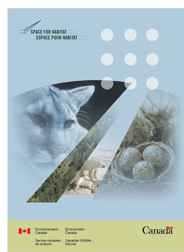
TOWARD AN EARTH OBSERVATION
ECOLOGICAL SECURITY SYSTEM
FOR CANADA
WORKSHOP PROCEEDINGS
MARCH 2, 3, 2005 – OTTAWA
2

                         SPACE FOR HABITAT WORKSHOP
            TOWARD AN EARTH OBSERVATION ECOLOGICAL SECURITY SYSTEM FOR CANADA

                           MARCH 2, 3, 2005 – OTTAWA CONFERENCE CENTRE

Today, eighty percent (80%) of wildlife species declines can be attributed to habitat loss and
degradation in some way. The resilience of ecosystems to withstand natural and human-induced
events is critical to the survival of species and, ultimately, of humanity. In order to face the challenge
of preserving global biodiversity, which provides for that resilience, there is a need to improve our
understanding of systems and structures of wildlife habitat across the landscape. Existing monitoring
approaches do not provide the ability to understand the state of habitat across Canada’s vast
landscapes. The Space for Habitat project thus aims to improve monitoring and information systems
supporting habitat conservation with the use of Earth Observation technologies, focusing on forested
landscapes and Canadian Wildlife Service protected areas. Rather than undergoing the cost of
building an independent system, the Canadian Wildlife Service would like to work with Federal
Departments, Provincial and Territorial agencies, industry, non-government organizations, and other
countries to build on existing initiatives and knowledge. The goal is to improve wildlife habitat
monitoring systems and decision-making capabilities and, over the longer term, help provide for
improved ecological security in Canada. Workshop participants represent the diversity of Canadian
stakeholder groups mentioned above. Guest speakers also attended from Brazil, Mexico and the
United States, to share their respective country’s experiences with Earth Observation technologies
and wildlife habitat monitoring.
3
TABLE OF CONTENTS
A WORKSHOP OBJECTIVES & CONTEXT….……………………………..…..…… Pg.4
THE GLOBAL CONTEXT FOR EARTH OBSERVATION..…..….…………..…… Pg.5
B INTERNATIONAL PROFILES AND EXPERIENCES………………………….…...Pg.8
ROUNDTABLE - INTERNATIONAL PROFILES AND EXPERIENCES…..…….. Pg.11
C CANADIAN PROFILES AND EXPERIENCES…………..……..……………….… Pg.12
D WORKING TOGETHER - DEVELOPING A VISION FOR AN EARTH OBSERVATION-
SUPPORTED ECOLOGICAL SECURITY SYSTEM IN CANADA…………………… Pg.18
ROUNDTABLE - PARTNERSHIP AND INTEGRATION POTENTIAL
IN CANADA……………………………………………………………………………... Pg. 18
DEVELOPMENT & IMPLICATIONS OF THE VISION…..………………………. Pg. 19
E THE PATH FORWARD……………..………………………………….………...….. Pg. 204
SPACE FOR HABITAT WORKSHOP
TOWARD AN EARTH OBSERVATION ECOLOGICAL SECURITY SYSTEM FOR CANADA
Report of Proceedings
WORKSHOP OBJECTIVES
To discuss the possibilities for an Earth Observation (EO) ecological security system for Canada by:
• Sharing and clarifying EO systems and experiences from countries outside of Canada.
• Exploring domestic and international partnership possibilities, and building on existing success.
• Developing elements of a vision, short and long term, for an EO ecological security system for
Canada.
PARTICIPANTS: Al Hanson (Canadian Wildlife Service - Environment Canada), Andrea Norris
(University of British Columbia), Andrew Devries (Forest Products Association of Canada), Anne
Bachinski (Hegyi Geomatics International), Bob Dams (Atlantis Scientific), Brenda McAfee (Canadian
Forest Service), Brenda Morehouse (Canadian Wildlife Service), Bruce Pendergast (independent
expert), Carey Gibson (Ontario Ministry of Natural Resources), Charles Costello (State of
Massachusetts), Charles Francis (National Wildlife Research Centre - CWS), Dominique Blain
(Greenhouse Gas Division - Environment Canada), Don Leckie (Canadian Forest Service), Francisco
Oliveira Filho (IBAMA - Brazil), Francisco Takaki Takaki (INEGI - Mexico), Frank Hegyi (Hegyi
Geomatics), Genevieve Béchard (Canada Centre for Remote Sensing), George Stanclik (Abitibi-
Consolidated), Greg Jones (Province of BC), Ian Olthof (Canada Centre for Remote Sensing), Jean-
Marc Chouinard (Canadian Space Agency), Joao Raposo Pereira (IBAMA - Brazil), Ian Moss (Tolko
Forest Products), Jason Duffe (National Wildlife Research Centre - CWS), Jon Pasher (Carleton
University), Kenneth Markowtiz (Earthpace LLC), Leigh Edgar (Canadian Wildlife Federation), Les
Whitney (Canada Centre for Remote Sensing), Mark Walker (Department of National Defence), Mike
Norton (Canadian Wildlife Service - Environment Canada), Richard Labossière (Canadian Wildlife
Service - Enforcement), Robby Bemrose (Carleton University), Robert Gauthier (Canada Centre for
Remote Sensing), Sonya Banal (Environment Canada – Centre St Laurent), Ted Huffman (Agriculture
& AgriFood Canada), Wayne Turpin (Aquatek Inc), Yvan Lafleur (Canadian Wildlife Service -
Enforcement), Yves Crevier (Canadian Space Agency).
A. CONTEXT FOR THE WORKSHOP
WELCOME & OPENING REMARKS
Brenda Morehouse, National Coordinator of Enforcement Issues and leader of the Space for
Habitat project, briefly welcomed guests from near and far and introduced Yvan Lafleur for some
opening remarks.
Yvan Lafleur, Director, Wildlife Enforcement, Canadian Wildlife Service.
On behalf of Trevor Swerdfager, Director General of the Canadian Wildlife Service (CWS), Yvan
Lafleur opened the workshop by explaining why the CWS and the Wildlife Enforcement program have5 an interest in Earth Observation (EO) technologies. Mr Lafleur foresees that satellite technologies and remotely-sensed data can become important tools for the protection of wildlife habitat and the enforcement of wildlife laws. He briefly reviewed the evolution of information sources and tools used for wildlife conservation and enforcement purposes in Canada. Mr. Lafleur further commented on the importance of this particular workshop in providing an opportunity to share information, experiences and approaches to using EO technologies toward the goal of more effective implementation of wildlife habitat conservation in Canada. A more solid basis of information, made possible with satellite monitoring, can provide for a better understanding of wildlife conservation processes, and ultimately, for better decision-making and improved results from conservation efforts. Brenda McAfee, Senior Science Advisor, Canadian Forest Service, Natural Resources Canada. On behalf of Paul Addison (Director General of the Pacific Forestry Centre), Brenda McAfee, explained that an important part of the Canadian Forest Service (CFS) mandate is to promote the sustainable development of Canada's forests and to ensure a healthy, competitive Canadian forest industry. As a result of the shared management of natural resources in Canada, the CFS works in close partnership with Canadian Provinces and Territories. They also consult with First Nations, industry, non-governmental organizations and other forest community interests in Canada and abroad. The CFS facilitates and coordinates, for the forest sector, national commitments made in the Canadian Biodiversity Strategy to the Convention on Biological Diversity of 1992. The CFS also focuses on activities that improve sustainable forest harvesting capabilities. For example, the National Forest Inventory uses remote sensing and Earth Observation in combination with a series of ground monitoring plots to provide for improved consistency, timeliness and cost-effectiveness over the longer term. Ms. McAfee expressed support for the ability of technologies to assist in achieving global environmental sustainability and to provide better information for decision making. THE GLOBAL CONTEXT FOR EARTH OBSERVATION Gèneviève Béchard, Director of Applications Division, Canada Center for Remote Sensing. GEOSS: Towards a comprehensive, coordinated and sustained EO system of systems. Gèneviève Béchard provided the context for Canadian participation in the Global Earth Observation System of Systems (GEOSS) initiative. The overall vision for GEOSS is to realize a future wherein decisions and actions taken for the benefit of humankind are informed by coordinated, comprehensive, and sustained Earth Observation and information. GEOSS is a ten-year plan providing a conceptual and organizational framework for countries to build towards integrated Earth Observation to meet important global needs in areas such as disaster management, energy, weather, climate, water, ecosystems, agriculture, biodiversity, and health. Gèneviève mentioned that several themes are relevant to the mandate of the Canadian Wildlife Service and the Space for Habitat project goals, particularly the biodiversity and ecosystems themes. GEOSS will primarily focus on issues at regional and global scales and cross-sectoral applications. Instead of introducing completely new initiatives, GEOSS aims to build on existing local, national, regional and international systems, focusing on their integration. In this way, GEOSS supports the achievement of global sustainable development. The GEOSS framework recognizes the importance of capacity building and inter- operability of systems and provides support for these kinds of initiatives.
6

Discussion

Q: What resources has Canada specifically committed to GEOSS?
R: Until recently, Canadian participation in the GEOSS has been predominantly an effort centralized
in the Canada Centre for Remote Sensing at Natural Resources Canada (NRCan), the Meterological
Services of Environment Canada (EC) and the Department of Fisheries and Oceans (DFO). Now that
the basic strategy has been devised, there is an opportunity for wider involvement including initiatives
such as the Space for Habitat project. While there were no new dollars specified in this fiscal year’s
budget, the plan is to build on existing resources. There is a need to work together and integrate
approaches and methodologies from a number of players and partnerships.

Q: Given that there is a need for freely- and openly-available data in order to achieve national goals
effectively without duplicating efforts, how will the GEOSS framework overcome the limitations of the
existing data policy in Canada?
R: Geneviève responded that, while the mechanisms to share information within Federal Departments
exist, the users of GEOSS will have to clarify and decide if information should be available to outside
partners such as the university community or non-government organizations. There is no requirement
as of yet to make such data available.
It was acknowledged that the data policy should be clarified in order to facilitate open sharing of
information, and apparently, efforts are underway to update the policy.

Q: Were industry stakeholders consulted in the process of developing the GEOSS framework?
R: A federal meeting was held in the autumn of 2004 to seek feedback on the draft Canadian
strategy. A web survey was held in December 2004 to help gain an understanding of some of the
needs of provinces and territories. However due to delays in the preparation of the strategy,
consultations with other stakeholders had to be cancelled. Though the decision is still pending, the
intent is to elaborate on the Canadian Space Strategy and to provide for wider consultation again by
sometime in 2006.

Brenda Morehouse: National Coordinator, Enforcement Issues, Canadian Wildlife Service.
Space for Habitat Project: Concepts, Partnerships and Key Objectives.

Brenda started by providing some background on the Canadian Wildlife Service (CWS) legal mandate
and the rationale for creating the Space for Habitat project. Initiated in fall of 2004 with funding from
the Canadian Space Agency, the project aims to improve decision-making capacity in support of
wildlife habitat conservation research, management and compliance programs. The project is working
with partners to design a national system to monitor wildlife habitat. The Space for Habitat Project’s
key objective is to modernize and improve monitoring capabilities for wildlife habitat in active forest
landscapes, and in CWS protected areas. By working in partnership with stakeholders, the CWS
hopes to create transparency for efficient implementation of Regulatory requirements and a clear
incentive for compliance. The project aims in part to address issues raised by the complaint by a
group of Canadian non-government organizations to the Commission for Environmental Cooperation
about the enforcement of nest protection provisions in the Migratory Birds Convention Act with respect
to logging activities in Ontario. Space for Habitat promises to build on existing monitoring programs
and other EO initiatives in order to maximise synergies and efficiencies in the creation of a national
wildlife habitat monitoring system. At the end of fiscal year 2006-07, the Space for Habitat project will
deliver an implementation strategy for the optimal use of EO technologies to monitor wildlife habitat in
Canadian forests and CWS protected areas. The goal of this particular workshop is to begin a
dialogue on how we can work together toward these ends. The resulting vision and advice from
participants will guide the implementation of the Space for Habitat project.
7

Discussion

Q: Brenda was asked to define the concept of ecological security being considered in the context of
the workshop.
R: She responded that security is being considered in a broad sense, referring to the ability of
ecosystems to provide for the health and well-being of wildlife. The focus for the Space for Habitat
project is on the ability to provide habitat requirements for wildlife over time.

General comments: A caution was issued on using the term ‘security’ due to its ambiguities in
today’s political context. Another comment was added that it is important not to let security concerns
restrict information sharing for national interests such as environmental protection. Instead, it is
important to look for ways to share information with others and thus, build on pre-existing knowledge.

Q: A question was raised on the applicability of the project approaches to effectiveness monitoring, in
addition to compliance monitoring.
R: Brenda agreed that improving the ability to monitor effectiveness of conservation actions, and the
potential to provide for adaptive management, are important aims of the Space for Habitat project.

Q: A question was asked about how compliance regimes, which are static, could be enforced in a
dynamic and changing natural environment, when coupled with an adaptive management framework.
R: Kenneth Markowitz responded that compliance is, by definition, a behavioural response to a
defined set of rules, which provide the measure for compliance. So compliance monitoring is
measuring the behaviour according to the established rules.

Jean- Marc Chouinard, Head, Earth Observation Applications and Commercialization,
Canadian Space Agency.

Mr. Chouinard presented the Canadian Space Agency (CSA) perspectives on fostering greater use of
Earth Observation (EO) technologies in support of important Canadian Government policy goals. He
explained that the CSA, which reports to Industry Canada, has a strong mandate to support industry
activities. CSA programs therefore encourage partnerships with industry stakeholders. Mr. Chouinard
further explained that the CSA also has the objective of helping federal government departments
make use of EO data in their day-to-day operations as a way to ensure that Canadian citizens benefit
from Government investments in space. Toward these ends, Mr. Chouinard oversees two important
application programs, including the Government Related Initiatives Program (GRIP) and the Earth
Observation Application Development Program (EOADP), which provide funding for federal
government departments and industry groups, respectively. These programs enable the CSA to assist
other organizations in sharing ideas and approaches, and to begin to work together toward the
delivery of key national priorities.

The EOADP and GRIP funds strive for integration and horizontality among CSA-supported initiatives
such at the Space for Habitat project. The CSA would like to see EO projects that go beyond the
mandate of one specific federal department and that can help address the complementary mandates
of several departments. Mr. Chouinard focused on the need to achieve a true integration of EO
approaches, where departments can truly work together and collaborate toward the joint
implementation of national goals. True integration could be defined as a situation where, instead of
having five federal departments trying to find solutions to different issues separately, common goals
would be identified collaboratively, along with mechanisms capable of delivering multiple benefits for
the relevant agencies using EO technologies. Mr. Chouinard sees this true integration as the next
phase in the evolution of EO approaches for Canada, something toward which participants at the
8

workshop can strive. He also emphasized the importance of standardized protocols and processes as
being necessary both to satisfy federal government policy requirements and to ascertain progress
toward meeting key project objectives.

Discussion

Q: Given that, with the Constitutional division of powers in Canada, Provincial Governments are
responsible for the vast majority of natural resources in Canada, does the CSA plan to provide
funding for Provincial activities?
R: Jean-Marc responded by clarifying that the CSA’s mandate is to foster the development of EO
systems among industry and federal departments. The CSA relies on other federal departments to
partner with provinces and other agencies, depending on the needs at hand. The CSA cannot directly
address the needs of every user group.

Q: Given that radar and optical data complement each other nicely and together can provide for
complete monitoring coverage, are data sharing agreements between the CSA and other international
partners possible? For example, using RADARSAT data along with LANDSAT and Advanced
Spaceborne Thermal Emission and Reflection Radiometer (ASTER) data can deliver powerful results.
R: Mr. Chouinard explained that yes, this is possible. The CSA has been a member of the European
Space Agency (ESA) for the last 25 years and through this partnership Canada does benefit from
access to some of the EO data produced in Europe. With the very large datasets to be generated with
the launch of RADARSAT II, funded in the last federal budget, the CSA is hopeful or their ability to
barter some of this new data with the ESA and other international EO players such as NASA. Based
on the existing data policy in Canada, there are some limitations to bartering freely.

           B. INTERNATIONAL PROFILES AND EXPERIENCE

Francisco de Oliveira Filho, Enforcement Coordinator, IBAMA (Brazil’s Environment Ministry).

IBAMA manages and implements environmental policies at national and regional levels and has an
integrated system for forest monitoring and law enforcement activities. Mr. Filho provided a fulsome
presentation on Brazil’s integrated forest monitoring, information management, communications and
enforcement response system. Protecting against illegal logging in the rainforest is a large focus of
IBAMA’s EO monitoring system. Francisco elaborated on the scale of the deforestation problems in
Brazil and the violence that is often associated with it. Due to the severity of their problems, Brazil has
responded in-kind with the development of a highly effective, integrated EO monitoring and response
system. In Brazil’s experience, making monitoring information publicly available as it is obtained is an
important deterrent to corruption and has helped to ensure that compliance monitoring information
can be supported with enforcement actions. While the scale of deforestation activities being
experienced in Brazil is much larger than in Canada, due to the existence of similarly remote areas
and the large expanse of Canadian forests, the Brazilian approach offers potential benefits to the
development of a Canadian wildlife habitat monitoring system. Similar to the point made by the CSA
about the need for greater integration of EO initiatives, Mr. Filho introduced the concept of
transversality — an important concept used in developing IBAMA’s programs — defined by the
integration of public policies and implementation efforts within government agencies to achieve
national goals.
9 Joao Raposo Pereira, Fire Monitoring Coordinator, IBAMA. Fire Monitoring in Brazil and Remote Sensing to meet the needs of managers Mr. Pereira followed with a presentation on Brazil’s forest fire monitoring program which is also based on EO technologies and the ability to detect hot spots early. IBAMA uses hot spot data for field inspections based on different alert levels (green, yellow and red). The provision of almost real-time data to the users through internet, fax, phone, combined with innovative use of remote sensing tools such as vehicles mounted with satellite communication capabilities, facilitates forest fire response. This is another way that IBAMA helps to protect forest habitat and wildlife biodiversity. Discussion Q. Mr Filho was asked if satellite imagery has indeed provided a deterrent effect in the Amazon. R. Francisco explained how Brazil’s EO monitoring program and satellite imagery help IBAMA to catch criminals while in the act of illegal logging. When able to act quickly, officers sent out to perform ground validation of the satellite imagery in the area of interest may find that the illicit logging activities, which often include the construction of illegal sawmills and access roads, is still ongoing. With this capability for rapid response, Francisco believes that IBAMA’s EO monitoring capabilities do provide an important deterrent against illegal logging in the Amazon. Q. Francisco was asked to quantify the annual budget for data management and law enforcement activities at IBAMA. R. Francisco responded that IBAMA has a special data acquisition agreement with LANDSAT and that MODIS data is available to them free of charge. Nonetheless, IBAMA spends approximately $500,000 USD annually to run its monitoring operations, and another $15 million USD per year is spent on integrated law enforcement activities with military and state police operations. Q. Mr Pereira was asked if aircraft sensors are also used in the mapping process. R. Joao answered that large aircraft sensors are used in mapping and surveying some parts of the Amazon. Smaller aircraft are also used frequently for a variety of purposes: to monitor smaller areas, conduct research and perform ground validation, for example. Francisco Takaki Takaki, Director General, Instituto Nacional de Estadistica Geografia e Informatica (INEGI) [Mexican Geographic Information Ministry]. INEGI: Instituto Nacional de Estadistica Geografia e Informatica. Francisco Takaki provided a brief discussion on the richness and diversity of Mexico’s natural resources and how INEGI is undertaking to provide mapping services in support of national policy implementation. Mr. Takaki explained the usefulness of satellite imagery in mapping land and vegetation resources and land use changes to benefit planning and sustainable development of Mexico’s natural resources. INEGI uses a three-tier classification system that has been continuously improved since its inception in the 1980s. All of Mexico is mapped at a scale of 1:250,000. More detail supported by a series of plots for forest monitoring purposes is gathered by the forest ministry, CONAFOR. Mr. Takaki concluded his presentation by stressing that institutions producing spatial data must be working on shared management of data and the rational distribution of information to end users.
10

Kenneth Markowitz, President, EarthPace LLC.
Legal Issues Associated with the Use of Remote Sensing Information as Evidence.

Mr. Markowitz provided a brief overview of the benefits and challenges of using satellite data for
environmental monitoring and prosecution purposes. Information from satellites and other remote
sensing technologies can be powerful tools for enforcement, as they can serve as a witness to
violations of environmental laws and regulations. Mr. Markowitz cautioned, however, that the
technologies must be used appropriately and supported by a robust information management system
in order to be effective tools in court. He identified the potential vulnerabilities involved in different
stages of the information management chain. Furthermore, remote sensing should not be used as an
only tool to monitor compliance, as there are legal complications that can arise. Validation by
additional means is essential. In overcoming some of the legal challenges that remote sensing may
face in a court of law, evidence must provide facts consequential to the case and should be
authenticated by an outside expert. With remote sensing, for example, extracted data should be
cross-referenced with ground data, aerial photographs, and other cartographical maps for both
reasons of accuracy and new knowledge. Developing partnerships and networks within and between
both government agencies and private sector groups is essential in developing Earth Observation
applications. Mr. Markowitz concluded that communication is the key to developing effective
applications and avoiding extra incidental costs.

Discussion

Q. Mr. Markowitz was asked if he knew the tally of the wins versus losses in U.S. court rooms; and if
the Department of Homeland Security has accepted the use of remote sensing technologies and
information.
R. Mr. Markowitz replied that while remote sensing has been an effective piece of evidence, courts
often have not made the data determinative and it is therefore difficult to quantify wins versus loses.
The US Department of Homeland Security has, since September 11th 2001, expressed concern over
the availability of data to the public internet and has taken actions to remove potentially sensitive
maps and other information from many government Web sites. Since then, measures have been put
in place to ensure that information that could compromise national security is not publicly distributed
through the Web.

Charles Costello, Director of Wetlands Conservation, State of Massachusetts, Department of
Environment.
Massachusetts Wetlands Mapping and Monitoring Program.

Mr. Costello opened by explaining the important value of wetland habitats to the ecosystem and
followed with a description of the difficulties involved in protecting these habitats. Important issues to
address include: encroachment by both commercial developments and urban expansion, and
inappropriate waste disposal. Mr. Costello believes that remote sensing and Earth Observation (EO)
technologies are powerful tools for monitoring the health and well-being of wetland habitats, a belief
that is supported by more than ten years of experience in monitoring and enforcing wetland protection
provisions in the State of Massachusetts. Mr. Costello described the Massachusetts Wetlands
Change Project — an initiative that has incorporated the use of satellite imagery and EO technologies
into assessing wetlands changes in the state of Massachusetts. Data derived from satellite imagery
was helpful in identifying potential enforcement cases. The project determined that over 800 acres of
protected wetlands had been lost in a seven to ten year period. This knowledge enabled the State of
Massachusetts to follow up with those responsible for the wetlands alterations and to take appropriate
enforcement actions where needed. Mr. Costello feels that one of the most beneficial results of using
11
EO technologies in monitoring environmental requirements is the deterrent effect that is provided. For
example, the EO system in Massachusetts clearly put the commercial development community on
notice about the State’s ability for legal recourse, as evidenced in media attention at the time. Mr.
Costello emphasized the need for a monitoring system capable of enabling agencies to assess any
damages to the environment, as well as remediation efforts to address the damage (i.e. There is a
need for effectiveness monitoring as well as compliance monitoring).
Discussion
Q. Charlie was asked what minimum mapping size was used in the wetlands change project.
R. He replied that one tenth of an acre is the minimum mapping size.
Q. What percentage of wetlands loss was attributed to permitted development?
R. The Massachusetts Wetlands Change Project found that about 40% of wetlands loss was through
valid construction and development project permits, leaving 60% of destruction as being potentially
illegal.
DAY 1 ROUNDTABLE SESSION – INTERNATIONAL PROFILES & EXPERIENCES
Participants were asked to discuss international profiles and experiences, focusing on two key
questions:
A) What are the lessons learned from the presentations provided that can be applied in Canada?
B) What are the international partnership possibilities to support wildlife habitat monitoring using EO?
A) Working Together in Canada - Lessons Learned
Some of the main lessons learned that can apply in Canada relate to the importance of achieving
federal integration of EO monitoring activities across departments in order to meet user needs for
information. Key design themes for an integrated federal EO system that emerged from the break-out
discussions are as follows:
1. Multi-jurisdictional in Scope
Canada‘s departmental needs are met by an integrated national EO system or series of
systems that recognizes jurisdictional issues.
EO should be integrated with the use of other tools in order to achieve ecological goals.
2. Flexibility in addressing Scales in Time and Space
A hierarchical monitoring system is designed so that users can extract and extrapolate
information according to their needs.
Large and small spatial scales are integrated, enabling the use of a variety of real time
information for activities on the ground.
Time scales are also flexible, depending on user needs.
Information from EO sources, aerial and other monitoring activities should be available in a
centralized system for easy user access.
3. Predictive Capabilities
The monitoring system should have predictive qualities to assist with risk identification and
provide for the ability to predict and manage issues affecting wildlife.12
It should improve the ability to understand habitat and life cycles of organisms in order to avoid
damage to priority habitat, to improve habitat where necessary, and to help keep common
wildlife species common.
4. Ability to provide Cause for Action
Monitoring and related information must be managed in such a way as to provide accurate
data that is credible in courts and that can support enforcement activities.
The monitoring and information system should provide the ability to target research,
management and enforcement activities to where they are needed most (i.e. to make it easier
to find the needle in the haystack).
Managers should have access to information needed in order to make sound decisions,
contributing to improved ecological security over time.
5. Adaptability over Time
The monitoring and information program must provide for adaptability and innovation, in order
to benefit from future technologies and developments.
The system should be updated on regular basis, to meet user needs most effectively.
B) International partnership Possibilities
Some opportunities identified as potential foundations for international cooperation included:
First, recognize that there is an opportunity for real-time operational programs, internationally.
Obtain satellite information from other countries regardless of language barriers, and
cooperate between national agencies, for example through data bartering.
Build on the CSA membership in the European Space Agency and strengthen these linkages
Leverage and build on migratory bird conservation initiatives, including technologies,
methodologies and current projects.
Work with countries who share wildlife common to Canada (approach partnerships from a
species perspective).
Work with the Commission on Environmental Cooperation to assist with coordinated mapping
opportunities among NAFTA countries. For example, Mexico is also working on cartography of
wetlands.
Work with the Earth Science data partnership in the United States, which brings together
activities to help create partnerships. See www.esipfed.org.
Refer to opportunities with the Open GIS Consortium at www.opengis.org.
Take advantage of training available through the Ramsar Secretariat.
Conclusion of Day 1 of the Space for Habitat Workshop – International profiles & experiences.
DAY 2 C. CANADIAN PROFILES & EXPERIENCE
Wayne Turpin, Vice-President, Aquatek Environmental Inc. [former Chief, Enforcement,
Canadian Wildlife Service, Atlantic Region].
Integrated Satellite Tracking of Polluters (I-STOP).
Mr. Turpin began by explaining some of the detrimental effects of marine oil pollution on birds and
their habitats. This serious issue prompted the CWS to explore the use of satellite imagery as a
potential deterrent to chronic ship-source oil pollution through the creation of the Integrated Satellite
Tracking of Oil Polluters (ISTOP) initiative. I-STOP is a partnership of several federal departments13 working in collaboration to help increase and improve surveillance of Canada’s three coasts. The integration of resources and approaches of mandated agencies helps provide additional deterrent to illegal discharges of oil at sea. As a direct consequence of ISTOP, which allows for the early detection of oil spills, the landmark case of the TecamSea resulted. Enforcement actions and ensuing media attention set a precedent in environmental compliance monitoring for Canada. Attention that was thus brought to bear on some important weaknesses in the Migratory Bird Convention Act has resulted in the Act being brought to Parliament for strengthening and modernization. The Act has been passed by the House and is now in the final stages in the Senate. If passed, the renewed Act would allow for more effective protection of Canada’s marine environment. Mr. Turpin pointed out the following areas still requiring work in Canada: there is a need for more freely available data at little or no cost, the ISTOP methodology needs to be improved to eliminate or false positives; and there is an important gap in data archiving and data retrieval support and services. Wayne also underlined the need to learn how to more effectively use remote sensing data in the court system and to establish better coordination and cooperation between federal departments toward common goals. Commander Mark Walker, Space Capability Directorate, Department of National Defense. Polar Epsilon: Joint Space-based wide Area Surveillance and Support Capability. Commander Walker discussed the need for improved Domain Awareness for Canada’s land, sea and air space, focusing on the ability of satellite monitoring to safeguard Canadian sovereignty in the Atlantic, Pacific and Arctic regions. Through the Polar Epsilon initiative, which includes plans for a next-generation satellite constellation system, the Department of National Defense (DND) will gain the knowledge and capabilities necessary to take advantage of emerging satellite technologies to build on our surveillance capabilities. Commander Walker offered that DND surveillance activities have strategic relevance for the Space for Habitat Project in that they can refer important environmental impact and wildlife habitat related information to the Canadian Wildlife Service and Environment Canada. The DND system can contribute to continental ecological security by providing consistent monitoring in all-weather, day/night, and including satellite sensor capabilities, particularly for areas where reconnaissance capabilities are limited. The DND initiative is aiming for a fifteen-minute delivery time in order for satellite information to reach the necessary client for follow-up action (i.e. reconnaissance or otherwise). The DND project is also considered transformational as it creates new uses for Canada’s RADARSAT I and II data, in partnership with other federal departments, agencies, and allies. Dr. Ian Olthof, Remote Sensing Analyst, Canada Center for Remote Sensing. Northern Landcover Mapping at the Canada Centre for Remote Sensing. Dr. Olthof demonstrated how the Canada Centre for Remote Sensing (CCRS) is addressing the unique challenges of monitoring land-use and land-use changes in Canada’s North. The vastness of Canada’s geography and lack of suitable reference data limit the ability to validate satellite information. Calibration and validation are also limited by fewer image acquisitions being possible and due to the low sun angle, which causes shadowing. Thus, while existing data and products are still somewhat limited in detail, satellite technologies provide the capability to map areas that are remote and in harsh climates. In Canada’s North, where conventional monitoring techniques might not be feasible, satellite monitoring is an important mapping technique that can also be quite economical. Dr. Olthof also discussed some results of work being done jointly with Parks Canada using the 90m Landsat ETM and encouraged the Space for Habitat project to link with the ecological integrity project
14
at Parks Canada. [Brenda assured him that the link has been established with Parks Canada for the
protected areas component of the Space for Habitat project.]
Frank Heygi, President, Hegyi Geomatics International.
Wildlife Habitat Inventory: Canadian Overview and Provincial Initiatives.
Mr. Hegyi first defined wildlife habitat as simply the physical location or type of environment in which
an organism or biological population lives or occurs. Furthermore, Mr. Hegyi explained that Canada’s
natural landscape, which encompasses diverse ecosystems across its forests and plains, and in the
Artic and the sea, makes for a wide variety of wildlife habitats. The forest landscape is dominant in
approximately 60% of Canada’s total land area. Laws and regulations have been put into place to
maintain and enhance the health of these ecosystems and hence sustain the diversity of Canada’s
wildlife. Effective enforcement of these laws requires knowledge of a baseline wildlife habitat inventory
and the ability to monitor changes over time. Forest Inventories (FI) use aerial photographs and field
sample plots to create geo-spatial information on forest resources. The National Forest Inventory
(NFI) provides a standardized approach to describing Canada’s forests.
Mr. Hegyi’s briefly described some habitat monitoring initiatives in Canadian Provinces:
In British Columbia, the wildlife habitat inventory includes key habitat descriptions for important
wildlife species, wildlife habitat ratings and an assessment of the capability of broad
ecosystems to support wildlife based on habitat availability.
The Alberta Vegetation Inventory is a photo-based digital inventory developed to identify the
type, extent and conditions of vegetation—where it exists and what changes are occurring.
The AVI provides detailed information to assist in the decision-making process for forest
management planning, forest protection, wildlife habitat classification and integrated resource
management activities.
The Saskatchewan Forest Vegetation Inventory is based on interpretation of stereo-paired
black and white infrared aerial photographs normally produced at a scale of 1:15,000.
Manitoba Conservation has adopted a province-wide inventory of forest resources to
determine volumes and distribution of productive timber, growth rates and depletion through
extraction and natural events.
The Forest Resource Inventory in Ontario is an extensive, large-scale survey of the forest
resources of Ontario that allows for general characterization of the forest.
The Ministère des Resources Naturelles, de la Faune et des Parcs, Québec conducts
systematic, standardized forest inventories, based on digital eco-forest mapping and
temporary and permanent forest surveys. Surveys of essential habitats delimit areas that are
critical for certain species that require specific conditions to meet their needs.
For New Brunswick’s Department of Natural Resources, the most recent inventory began in
1993 where aerial photographs revealed data on tree species, height, density, diameter, and
other factors. All data is stored on a computerized geographic information system for rapid
retrieval and analysis.
In Nova Scotia, the Department of Natural Resources monitors forests through forest
inventories designed to measure changes to the resources as well as reports on primary and
secondary forest products.
In Newfoundland, the Provincial Forest Inventory includes songbird surveys, measurement of
all dead and dying trees in permanent sample plots, identification of indicator plants, of
ecosystem productivity, soil profiles and chemical analyses, and records of wildlife use.
Mr. Hegyi concluded that there is a need for standardization of approaches to monitoring wildlife
habitat and specifically, in the use of remote sensing and field sample plots across Canada.15 Discussion with Canadian Panel members Q: Wayne Turpin was asked to identify if, with the frequency of data acquisition possible through the I- STOP project, the number of oiling incidents had declined since its inception. R: Mr. Turpin responded that the time interval for taking images varies on a 28 day cycle; however one can expect to receive different images from different mode angles a number of times each day in an area of interest. With respect to a decline of incidents of birds oiled at sea, it is too early to know. Bill C-15, strengthening the enforcement powers of the Migratory Birds Convention Act in response to this issue, is now at second reading before the Senate and has been referred to the Senate Committee on Energy, Environment and Natural Resources. Q: Commander Mark Walker was asked if RADARSAT 2 data was going to be made available to other federal departments. R: Jean-Marc Chouinard of the Canadian Space Agency clarified the answer by mentioning that the raw data would be free but departments would have to incur the costs for processing. Canadian Panel (continued) Dr. Alan Hanson, Wetlands Ecologist, Canadian Wildlife Service. Developing a Canadian Wetland Inventory The primary objective of the Canadian Wetland Inventory (CWI) project is to provide for a national wetland inventory and monitoring system. The approach is a coast to coast wetland mapping exercise based on satellite-based data that takes advantage of higher spatial resolution data where it exists, by using a standard wetland classification system. The project will integrate with national, regional and provincial earth cover plans which in turn will provide opportunities and funding for extensive trend analyses to monitor habitat change, and the effects on wildlife in wetland ecosystems. The CWI initiative aims to support the conservation and sustainable management of wetlands for environmental and social benefits by providing easy access to digitally delineated and classified wetlands data. The CWI project is based on standardized data structure and management protocols. Dr. Hanson clarified that there are different data requirements for mapping land-cover compared to monitoring wildlife habitat. For wildlife habitat monitoring, the functional aspects of how wildlife species use various habitat features is added to land-cover information. Dr Hanson stated that an operational wetland inventory monitoring system, implemented through regional and non- governmental partnerships, could be achieved as early as 2010. Dr Hanson elaborated further on the usefulness of remote sensing, while explaining the decline of eelgrass in Antigonish Harbour. The eelgrass issue clearly demonstrates the need for integration between organizations in order to protect wildlife, with the Department of Fisheries and Oceans being an important partner in this case. Jason Duffe, Space for Habitat Technical Lead, National Wildlife Research Centre - CWS. Wildlife Habitat Modeling and Monitoring. Mr. Duffe proposed a potential Canadian Approach for Wildlife Habitat Modeling and Monitoring being considered by the Space for Habitat project. Space for Habitat aims to partner with other organizations in order to benefit from unique opportunities for wildlife habitat research, and to provide for optimal use of satellite data for wildlife habitat monitoring. The Space for Habitat project focuses
16
on active forest landscapes and CWS protected areas. The project deliverables that are to be fulfilled
by March 2007 include:
A business case and a detailed implementation strategy for a national system using Earth
Observation (EO) data to support wildlife habitat monitoring.
Series of protocols for the optimal utilization of EO data for wildlife habitat monitoring.
Methodologies for detecting change in wildlife habitat with Synthetic Aperture Radar data.
Capacity building at the Canadian Wildlife Service for the continued use of EO data in support
of improved decision making and enforcement capabilities.
The pilot project has two key components, Protected Areas and Active Forest landscapes. The
Protected Areas component has been the focus of most of the initial analysis work since Canadian
Space Agency funding was received in December 2004. Using high resolution satellite imagery and a
series of validation steps, preliminary change detection methodologies have been developed for a
sample of protected area test sites. The active forest landscapes component also saw some important
strategies developed and Mr. Duffe shared the proposed methodology. The field season of 2005 will
be important in providing data for the project and testing the proposed approach. A Space for Habitat
Technical Working Group planning session to elaborate on the implementation plan for field activities
follows this workshop, on March 4, 2005.
Discussion
Q: Mr Duffe was asked to explain how he sees EO monitoring being implemented for protected areas.
R: He responded that he thinks it will be most useful and most cost effective in the northern areas that
are difficult to monitor by conventional monitoring approaches. EO might also be of limited use for
more subtle habitat impacts like grazing, and for certain small NWAs.
Q: Is there is a way to build on existing data that has already been accumulated in past years, and
merge it with newer data being acquired through the Space for Habitat project?
R: Mr. Duffe responded that not all data was available yet, but that work to gather necessary data for
the project was ongoing. A Gap Analysis approach is being proposed because of its ability to deal
with a wide range of data quality and quantity. The aim is to make use of any existing data that are
applicable to the questions at hand.
Don Leckie, Research Scientist, Canadian Forest Service (CFS), Natural Resources Canada.
EOSD for Forests and Other Monitoring Activities of the Canadian Forest Service and Partners.
Dr. Leckie presented the CFS strategy to monitor and provide for the sustainable development of
forests in Canada. The Next Generation Forest Measuring and Monitoring System now includes: the
National Forestry Inventory, provincial data, Earth Observation for Sustainable Development of
Forests (EOSD), deforestation information, and forest health data. The EOSD for Forests is a
collaborative initiative with the Provinces, Territories and others sponsored by the Canadian Space
Agency. CFS is currently completing a mapping of Canada’s forest with Landsat imagery and is also
developing change monitoring and biomass estimation methods. The National Forest Inventory will
report in 2005, with a 5-10 year overall re-measurement cycle but with major changes being reported
each year. Photo plots providing the basic attribute data are 2x2 km large units on 20 km grid located
at network points. Aerial monitoring is used for the southern areas and satellite data is used for
northern regions. Deforestation mapping methods appropriate for national reporting of greenhouse
gas emissions for the Kyoto Protocol are being developed.17
Dr. Leckie explained briefly how different satellite platforms are used in combination to provide a
complete Earth Observation monitoring coverage of Canada’s forests. Landsat type imagery is the
primary tool used to detect changes on the forest landscape. Higher resolution satellites add evidence
to occurrences of change observed by Landsat and add greater ability to characterize forest type.
Unlike the optical sensors, radar satellites, such as Canada’s RADARSAT 1, can pierce the clouds to
provide coverage even under cloudy conditions. Lower resolution satellites cannot be used to track all
the changes needed, but are useful for confirming some changes and improving the ability to
determine when disturbance events have occurred. The overall monitoring system being developed
uses a variety of EO platforms and contributes to the ability to ensure accuracy of information
products.
Ted Huffman, Research Scientist, Agriculture and Agri-Food Canada (AAFC).
Agricultural Land Use and Land Management Data.
Dr. Huffman presented an overview of Agriculture Canada’s needs for and their activities in collecting
agricultural land use and management data, and provided a specific example related to monitoring
biodiversity. The Agricultural Policy Framework (APF) is a Federal, Provincial and Territorial
agreement designed to move the government approach to the agricultural industry away from “crisis
management” and toward “managing for results”. It is comprised of five elements:
Business risk management
Food safety and quality
Innovation and renewal
Environment
Markets and trade.
In Agriculture Canada’s experience with implementing the APF, the integration of environmental
impact assessments into the policy-making process is essential to ensure the realization of
environmental targets.
From an environmental context, AAFC has engaged in the development of the National Agri-
Environmental Health Analysis and Reporting Program (NAHARP) which is designed to develop
science-based agro-environmental indicators, along with tools to integrate these indicators into policy
development. These indicators measure the change, or risk of change, in the state of environmental
resources used or affected by farming activities. Six groups of national indicators have been
developed, each with several components that account for specific regional issues. The groups of
indicators include: Farm resource management, soil degradation risk, water contamination risk, agro-
ecosystem biodiversity (including measures of wildlife habitat availability and species diversity), and
agricultural efficiency and productivity. Of particular interest to the Space for Habitat project, AAFC
has developed habitat matrices for 493 species of mammals, birds, amphibians and reptiles, and has
ranked each agricultural land use type according to its capacity to provide the critical needs of each
species. Dr. Huffman concluded with the comment that he believes that meeting the current demands
for EO-derived land use and land management data will help to generate important new
environmental health initiatives for the future.
Dominique Blain, Project Officer, Greenhouse Gas Division, Environment Canada (EC).
Canada’s International Reporting Obligations on Land Use and Land-use Change.
Ms. Blain shared Canada’s international reporting obligations on Land Use and Land-Use Change
(LU-LUC) under the Kyoto Protocol and the United Nations Framework Convention on Climate
Change (UNFCC). Greenhouse gas emissions and removals are required to be reported. In the last18
ten years, Canada has fulfilled its international reporting requirements under the UNFCCC by
reporting an annual inventory of greenhouse gas emissions and removals in the Land Use, Land Use
Change and Forestry (LULUCF) sector. The Kyoto Protocol also requires mandatory reporting of
forest-related LUC, i.e. afforestation, reforestation and deforestation, for the period 2008-2012.
Recent Guidelines and good practice reports prepared by the Intergovernmental Panel on Climate
Change provide the methodological support for inventory preparation.
In order to meet these increasing reporting needs, Environment Canada has established with key
federal partners the Monitoring Accounting and Reporting System (MARS) framework. MARS
partners ensure that the Government of Canada’s LULUCF monitoring, accounting and reporting
requirements under the UNFCC and the Kyoto Protocol are met, through coordinated work plans and
activities in the area of carbon and greenhouse gas accounting in LULUCF. MARS has a steering
committee, and three working groups: Agriculture, Land Use Change, and Forestry. The National
GHG Inventory system thus relies on the collaboration of organizations to deliver on international
reporting requirements for climate change.
D. WORKING TOGETHER – DEVELOPING A VISION FOR AN EARTH OBSERVATION-SUPPORTED
ECOLOGICAL SECURITY SYSTEM IN CANADA
Bob Dams, Business Development Manager, Atlantis Scientific International.
Summary of Canadian Profiles and Experiences.
Mr. Dams briefly outlined some of the many partnership and integration possibilities available inside
and outside of Canada. He reviewed the GlobWetlands project in Creston Valley, BC., for example,
which had the objective of performing audits and recognizing access and protocol. He explained that
there are also many legal applications for EO data, provided that standardized methodologies and
formal documentation protocols are followed. One of the important benefits of using EO technologies
is the understanding of what is at risk from certain actions. Mr. Dams closed by offering that there is a
real opportunity for end users who can share risks by building partnerships to incorporate EO data
and finally enhance environmental decision making.
ROUNDTABLE – PARTNERSHIP & INTEGRATION POTENTIAL IN CANADA
Participants formed five small groups to brainstorm on integration and partnership possibilities within
Canada in order to strengthen ecological security using EO technologies. They were asked to focus
on key Canadian programs and organizations. The overall conclusion of participants is that Canada
needs a national, unified approach in order to effectively monitor for biodiversity and sustainability
using EO technologies. Below is a list of ideas developed by participants, in no particular order.
1. Create linkages for the Space for Habitat initiative with departments and agencies who
are responsible for sustainable development implementation and/or reporting, for
example Provincial natural resource agencies, industrial partners, Agriculture & Agri-
Food Canada (specifically, the National Agri-Environmental Health Analysis and
Reporting Program – NAHARP), National Resource Canada, Canadian Space
Agency, Fisheries & Oceans, Parks Canada, and with other parts of Environment
Canada.19
2. Seek funding opportunities and integration potential through GEO Connections
(NRCan).
3. Identify a single Canadian authority to deal with land use and development. There is a
need for a strategic, unified approach for Government of Canada to replace the
Canada Land Cover Initiative (CLCI).
4. Recognize that partners bring real money and risks to the table.
5. Work within the hierarchy of types of land classifications and the capabilities of the
different EO platforms.
6. Build on and create common definitions for partners to use. Find ways to bridge the
differences between federal and provincial standards and to work towards an
integrated EO monitoring system with common national standards.
7. Work with the GEO base and the Center for Topographic Information (CTI) in
Sherbrooke, which helps to develop national mapping standards for Canada.
8. Look to examples provided by other countries to aid in the development of
methodologies, standards, and the renewal of Canada’s data policy.
9. Be somewhat cautious about partnerships also: participants encouraged the
development of partnerships at the technical level, which can be simpler to devise and
more specific (eg an MOU to exchange data) than partnerships developed at higher,
policy levels; some participants also suggested starting with developing domestic
partnerships before looking at international partnerships.
10. Develop a list of contacts and program information at the Government of Canada for
those people and projects using EO technologies and data in order to facilitate
integration and synergies at the federal level (i.e. a clearing house of people and
projects is needed).
DEVELOPMENT & IMPLICATIONS OF THE VISION
The final session of the workshop encouraged participants to imagine a better future. The five tables
were asked to refine a vision for an Earth Observation-supported ecological security system for
Canada, focusing on the questions: What do we aspire to be? What do we want to create? And To
what degree should we collaborate? That working session generated the following ideas:
Preamble
Canadians deserve the best information available to be brought to bear on government
decision-making, whether by ground-, air-, or space-based technologies.
We want to create decision support for people on the ground.
We want an integrated system based on the best tools available, capable of identifying and
extrapolating the best possible answers for Government needs.
By integrating all departmental monitoring needs, and by pooling federal costs for satellite data
so that departments have free access to the data, greater efficiencies can be achieved and
ecological security can be improved.
The Vision
The roundtable session resulted in refinement of this Vision for the design of an Earth Observation-
supported ecological security system for Canada. Such a system should be:
Multi-jurisdictional & Nationally Integrated: Canada has a departmentally-integrated national
system that recognizes jurisdictional issues and has the ability to respond accordingly.
Flexible in Time and Space Scales: Canada has a spatially- and temporally-dynamic system
that will respond to user needs and accommodate a variety of monitoring technologies.You can also read