D4.1 Report on the selection of case studies in the target countries - BIOPLAT-EU
←
→
Page content transcription
If your browser does not render page correctly, please read the page content below
Promoting sustainable use of underutilized lands for bioenergy
        production through a web-based Platform for Europe

                                    D4.1
Report on the selection of case studies in the
             target countries

              This project has received funding from the European Union's Horizon 2020
              research and innovation programme under grant agreement No 818083.
Project no.                       818083
Project acronym:                  BIOPLAT-EU
Project title:                    Promoting sustainable use of underutilized lands for bioenergy
                                  production through a web-based Platform for Europe
Call:                             H2020-LC-SC3-2018-RES
Start date of project:            01.11.2018
Duration:                         36 months
Deliverable title:                D4.1 - Report on the selection of case studies in the target
                                  countries
Due date of deliverable:          30 October 2020
Project Coordinator:              WIP Renewable Energies
Organisation name of lead contractor for this deliverable: Food and Agriculture Organization of
                            the United Nations (2)

                         Name                                        Organization
                     Marco Colangeli
                       Raul Koehler
                 Rainer Schlepphorst
                       Peter Gyuris
                                                                            FAO
                       Dóra Leitner
                                                                            FIB
                  Oleksandra Tryboi
                                                                            GEO
                 Manuela Hirschmugl
                                                                           SECB
                       Carina Sobe
                                                                             JR
                     Giuseppe Pulighe
                                                                           CREA
                      Guido Bonati
                                                                          ENERO
                     Stefano Fabiani
                                                                           UCLM
                      Tiziana Pirelli
                       Nicoleta Ion
                 Christian Tantareanu
                     David Cifuentes
                      Alfonso Calera

                                                                                                   1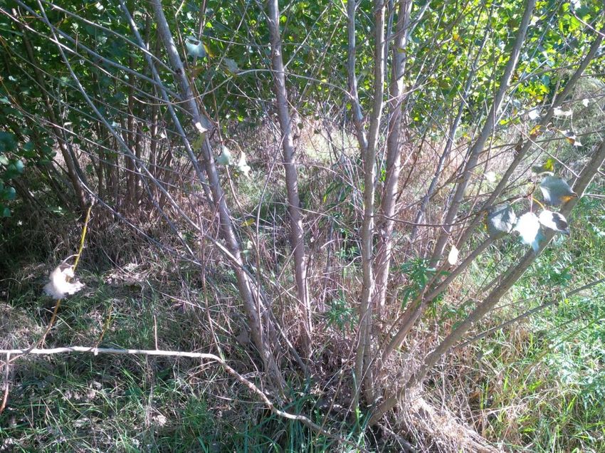
Dissemination level
PU           Public                                                           X
CO           Confidential, restricted under conditions set out in Model
          Grant Agreement
CI           Classified, information as referred to in Commission Decision
          2001/844/EC

                                      History
Version               Date                         Reason                Revised by
01                    26/10/2020                   Completed             FAO
02                    28/10/2020                   Revision              WIP
03                    30/10/2020                   Final Version         FAO

                                                                                      2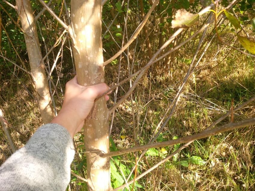
Table of Contents
List of acronyms ............................................................................................ 4
Executive Summary ....................................................................................... 5
1     Introduction ........................................................................................... 7
2     Case studies selection: methodology ..................................................... 9
    2.1   Germany ............................................................................................................... 13
      2.1.1      Case study 1 .................................................................................................. 13
      2.1.2      Case study 2 .................................................................................................. 20
      2.1.3      Case study 3 ................................................................................................. 27
    2.2   Hungary ................................................................................................................ 32
      2.2.1      Case study 1 .................................................................................................. 32
      2.2.2      Case study 2 .................................................................................................. 44
    2.3   Italy ....................................................................................................................... 52
      2.3.1      Case study 1 .................................................................................................. 52
      2.3.2      Case study 2 .................................................................................................. 55
      2.3.3      Case study 3 .................................................................................................. 61
    2.4   Romania................................................................................................................ 66
      2.4.1      Case study 1 .................................................................................................. 66
      2.4.2      Case study 2 .................................................................................................. 71
    2.5   Spain ..................................................................................................................... 76
      2.5.1      Case study 1 .................................................................................................. 76
      2.5.2      Case study 2 .................................................................................................. 79
    2.6   Ukraine ................................................................................................................. 82
      2.6.1      Case study 1 .................................................................................................. 82
      2.6.2      Case study 2 .................................................................................................. 89

                                                                                                                                        3
List of acronyms
  BPP      Biomass Processing Plant
  BPS      Biomass Processing Site
  CLC      Corine Land Cover
  EU       European Union
  FAO      Food and Agriculture Organization of the United Nations
  GAEZ     Global Agro-Ecological Zones
  GBEP     Global Bioenergy Partnership
  GHG(s)   Green House Gases
  GIS      Geographic Information System
  GSI      GBEP Sustainability Indicators
  IIASA    International Institute for Applied Systems Analysis
  iLUC     Indirect Land Use Change
  JR       Joanneum Research
  JRC      Joint Research Centre EU
  LUC      Land Use Change
  MAGIC    Marginal lands for Growing Industrial Crops
  MUC      Marginal, Underutilized and Contaminated
  RED II   Renewable Energy Directive II
  SEEMLA   Sustainable exploitation of biomass for bioenergy from marginal lands in
           Europe
  SRC      Short rotation coppice
  SRTM     Shuttle Radar Topography Mission

                                                                                  4
Executive Summary
    The aim of Work Package 4 is to support the development of the Web-GIS platform of
BIOPLAT-EU through a series of case studies to test the model, the STEN engine, its user
interface and functionalities before publication. This operation is key to identify possible bugs,
flaws and inefficiencies of the system and solve them, thus it is important to dedicate a specific
work package and collaborative efforts to ensure that additional perspectives and viewpoints
are considered when testing the tools developed under WP3. In order to make sure that the
testing is effective, a set of representative case studies is a necessary attribute. Moreover, they
will serve as a mean to bridge the expertise internal to the BIOPLAT-EU Consortium with that
of local stakeholders as the case studies represent the basis for the work under WP5. Clearly
then, the role of the selection of representative case studies is pivotal to the successful testing
of various potential scenarios of use for the WebGIS platform and it must be a participated
process by all relevant Consortium partners. Such process has indeed seen the outstanding
contribution of partners in each of the case study countries.
    In this report, we analyse the defining characteristics of the selection of case studies, the
selection process itself, and present each of the selected cases in the test countries, namely
Germany, Hungary, Italy, Romania, Spain and Ukraine.
    The results of this exercise returned a broad representation of the various contexts in which
the webGIS platform will operate. Specific integrations to each case study selection have been
made to accommodate the need for further representativity of the testing (inclusion of multiple
scenarios for the testing of bioenergy pathways based on the same case study and feedstock
selected) but these will be the subject for further Deliverables of the project.
    Summarizing, in all six countries marginal and underutilized lands have been selected.
Contaminated sites are found in Italy, Hungary, and Romania and abandoned agricultural lands
have been selected as test case in Germany, Hungary, Spain and Ukraine. The simulations will
interest all major agricultural feedstocks produced in Europe with a predominance of short
rotation coppice (SRC) and other lignocellulosic crops (miscanthus, giant reed, as well as straw)
for direct combustion or, to a lesser extent, advanced ethanol production. Oil crops for
biodiesel and other vegetable oil-derived bioenergy pathways are also very well represented in
the case studies as it is biogas production from dedicated crops such as maize or sorghum.
    In the selection process, national project partners had the prominent role of scouts and
proponents based on their knowledge of local conditions. Among the features considered for
the selection that was an at least indicative information concerning the MUC status of these
lands, which was confirmed by a site visit by members of the Consortium, and a set of socio-
economic or environmental parameters to support the condition of marginality of the areas
selected.
    In order to verify the aforementioned indications and map with the highest accuracy these
lands, project partners collected different EU-wide and national datasets as a basis for further
processing into high definition (TIER II) maps within BIOPLAT-EU. These datasets were used to
select potentially interesting areas and/or to exclude areas not usable for bioenergy use due to
different reasons.

                                                                                                 5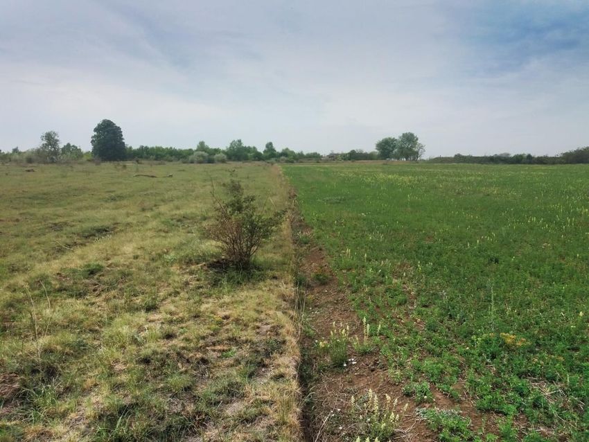
To carry out this task, EU-wide/Copernicus data sets were collected and pre-processed. The
preparatory steps included downloading, selecting relevant classes (CLC, LUCAS), thresholding
(forest - tree cover density product, imperviousness) and calculating additional features (e.g.
slope from SRTM digital elevation model). This precision work required the employment of
extensive resources, particularly from JR, as several aspects needed correction and calibration
through reiterated discussions with local partners, local stakeholders and landowners.

               Figure 1. Distribution of BIOPLAT-EU case studies across Europe.

   The map above gives a graphical representation of the geographical distribution of the case
study sites across Europe and Ukraine.

                                                                                             6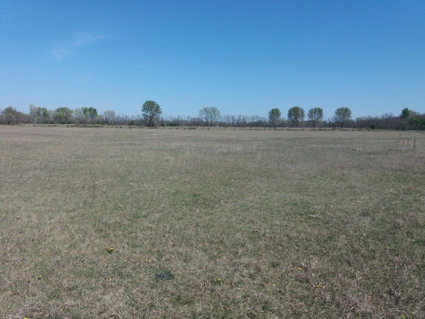
1 Introduction
    The primary aim of WP4 is to test the characteristics and functionalities of the webGIS
prototype before its public release. The identification of representative case study sites is
therefore a first step towards understanding and benchmarking the capabilities of the software
developed in BIOPLAT-EU. Moreover, a further - but not less important - use of the outcomes
of the testing will be directly employed in the context of the project to build up a multi-
stakeholder working group that locally will further analyse the options available for developing
a bioenergy value chain. Thus, this WP and its tasks have a two foci type of relevance: A) they
are needed to provide testing bed for the webGIS platform and to backstop its results with real-
world data, and B) to represent the stepping stone for a more detailed feasibility assessment
which includes economic and financial considerations that are strictly case-specific.
    The priority for an effective testing is representativeness of the sample to match the various
scenarios users can ultimately run. Since the webGIS platform considers an array of possible
biomass feedstock and related bioenergy pathways, one aim was to look for potentially the
broadest set of biomass-bioenergy combinations to cover most (if not all) the combinations
that future users may simulate. In the context of BIOPLAT-EU we refer to Biomass Production
Site (BPS) to identify the Marginal, Underutilized or Contaminated (MUC) land in Europe and
Ukraine mapped in the project that represents an existing surface of land that can be employed
for the production of biomass for bioenergy purposes. A user can carry out simulations and
related assessments assuming that the BPS is under his/her control. In order to calibrate the
model and software on the webGIS platform to run such analyses, real BPS have to be identified
and used as samples for BIOPLAT-EU. The case study selection took into consideration the need
to test both small as well as large continuous BPSs in the various locations tested. Concerning
the type of feedstock that could be grown on those BPSs, the actions behind Task 4.1 looked at
including the following:
        •   Starchy crops
        •   Lignocellulosic crops
        •   Oil crops

   At least one of each category of crops should be selected as possible test biomass for the
BIOPLAT-EU case studies.
   Additionally to crop type, the selection has carefully looked at including each of the most
representative bioenergy pathways diffused in Europe. Again, in order to ensure
representativeness of the testing based on the case studies, partners received guidance to
propose suitable bioenergy pathways among the list of most common ones in Europe:
    •   Ethanol
    •   Straight Vegetable Oil (SVO)
    •   Biodiesel
    •   Hydrogenated Vegetable Oil (HVO)
    •   Biogas
    •   Solid biofuels (e.g. wood chips, pellets, briquettes)
    •   Biomass to Liquid (BtL)
    •   Gasification/Pyrolysis

                                                                                                7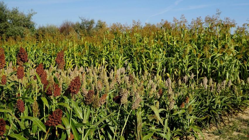
Especially for advanced biofuel pathways, there has been little receptivity among local
stakeholders in favour of traditional, “safer” technologies (and infrastructures) which have
been selected in virtually every case study. To make up for this apparent lack of interest towards
advanced biofuels, the case studies where suitable feedstocks have been identified will be
tested for both traditional (e.g. solid biofuels) and advanced bioenergy pathways (e.g.
lignocellulosic ethanol) based on the same biomass type.
    It is expected that during the activities under WP5, particularly those led by local partners,
the stakeholders are also sensitized towards the potential of advanced biofuel developments
in Europe and neighbouring countries also in light of the RED II and other supporting policies.
   The selection of the case studies took the mapping of Marginal, Underutilized and
Contaminated lands to a higher level, through the combined use of Copernicus, Corine Land
Cover and LUCAS points information and the resulting products are identified as TIER II maps.
These represent the highest possible accuracy maps of MUC lands available to date in Europe
and were produced by Johanneum Research (JR) in collaboration with the case study partners.
    The exercise, however, was not free of hurdles. As expected when dealing with MUC lands,
in fact, the opportunity to get on the ground and double check with local stakeholders the
actual status of surfaces of land that by definition are neglected (being underutilized) or whose
status remains controversial (contaminated) for an array of reasons did not equally materialize
in all case study countries. The identification of the second case study in Romania for instance,
took longer than originally planned but in the end this site was officially confirmed, and its
selection consolidated. In Spain, on the other hand, a first case study has been quickly identified
in the region of Albacete, where underutilized lands are found and where the local partner has
vast knowledge of the landscape and its features. A second site was investigated in the
Northern side of the country (former mining site) following a desk research put forward by FAO,
but unfortunately no ground-truthing was possible within the timeframe of this task, partially
because the travel restrictions applied during the first outbreak of the COVID-19 pandemic
hindered the opportunity of staff from UCLM to physically verify this site and above all get in
touch with local stakeholders. Due to these difficulties, the second case study site has been
identified within the region of Cuenca and will test the use of similar crops in a comparable
setting as in the province of Albacete.

                                                                                                 8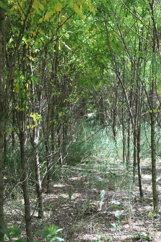
2 Case studies selection: methodology
    In the selection process, national project partners had the prominent role of scouts and
proponents based on their knowledge of local conditions for the sites to take into consideration
for the final selection. As per project proposal, a minimum of two case study sites in each
country was necessary. Where needed, further so-called “backup” case study sites were
proposed, in case the mapping would not produce sufficient or accurate MUC lands. However,
the remote sensing-based results of mapping underutilized lands for the selected case study
areas (TIER-2) show sufficient potential areas with adequate accuracies, decreasing the
probability that an integration of the backup areas will be necessary. Among the features
considered for the selection of the case studies, the indicative information concerning the MUC
status of these lands was the primary step of the methodology. This was confirmed by one or
more site visits carried out by members of the Consortium, and a set of socio-economic or
environmental parameters to support the condition of marginality of the areas selected.
    In order to verify the aforementioned indications and map these underutilized lands with
the highest accuracy, project partners collected different EU-wide and national datasets as a
basis for further processing into high definition (TIER II) maps within BIOPLAT-EU. These
datasets were used to select potentially interesting areas and/or to exclude areas not usable
for bioenergy use due to different reasons.
    To carry out this task, EU-wide/Copernicus data sets were collected and pre-processed. The
preparatory steps included downloading, selecting relevant classes (CLC, LUCAS), thresholding
(forest - tree cover density product, imperviousness) and calculating additional features (e.g.
slope from SRTM digital elevation model).
    Among the available data sets, the following ones were found to be most useful for the
selection of the case study areas:
   - Corine Land Cover (CLC): CLC data was used to identify classes, which are potentially
underutilized, e.g. 321 Natural grasslands; 323 Sclerophyllous vegetation; 324 Transitional
woodland/shrubs; 333 Sparsely vegetated areas.

   -   LUCAS points hinting at specific aggregation of underutilized areas, e.g. in Spain

For the exclusion of unsuitable areas, the following layers were employed:

   -   Copernicus High Resolution Layers Forest, Water&Wetlands, Imperviousness

   -   SRTM Slope map with threshold of 15°: Previous projects focusing on identification of
       marginal and underutilized lands (e.g. MAGIC) identified large areas in mountainous
       regions. While these mountainous areas with steep slopes might be well useful for
       bioenergy production from forest, they are usually not suitable for more intensively
       cultivated energy crops. Within BIOPLAT-EU, areas steeper than 15° were therefore
       excluded as cultivation of energy crops is difficult under such conditions.

                                                                                              9
- Protected areas: all European protected areas (Natura2000) were excluded from the
potentially useful case study areas. This led for example to removing an initially foreseen
case study area in Hungary, as large parts of that specific area are under protection.
- Open Street Map (OSM) settlement layer was specifically useful to exclude settlement
areas in Ukraine, where no Copernicus HR layer exists.
Further, the collection of national datasets also greatly assisted the selection of case study
areas. Through their national agencies, statistical data (as for example in the case of Ukraine)
supported the selection of specific areas. In other words, if two areas were considered as
potentially interesting, the one with higher amount of potentially underutilized lands in the
statistics was chosen for further investigation/verification on the ground. In other countries,
national data search revealed maps of contaminated lands other than the heavy metal
contamination in top soils, which is instead used at pan-European level. Using such national
maps, contaminated areas suffering from other pollutants could also be taken into account, as
for example in Italy for the Val Basento region or the reserve case study area of Umbria.
Last, but not least, the review of existing project results also revealed potentially interesting
areas. As a pre-cursor project, FORBIO results identified interesting areas where bioenergy
value chains could take off, such as the Brandenburg area in Germany or Sulcis region in
Sardinia, Italy. Results of the SEEMLA project also informed this work about several potentially
interesting sites finally selected as case study areas, e.g. the Ukrainian case study area of
Chmelnyzky and the Sulcis area as well.
In Romania, the use of Google Earth historic data revealed previous mining areas in the case
study area of Gorj. Some of these former mining areas (both excavation and deposit plants) are
overgrown with vegetation and thus no longer distinguishable using satellite imagery alone. To
validate areas abandoned for long enough to be undistinguishable from the satellite, local
BIOPLAT-EU partners made a series of site visits in various locations and documented from
ground level the status of the land. Subsequently they reported to the BIOPLAT-EU colleagues
in charge of the mapping exercise to complete the high accuracy TIER II maps for the case study
sites.
Such precision work required extensive human resources deployment, particularly from JR,
as several aspects needed correction and calibration through reiterated discussions with local
partners and local stakeholders. The final product of this work is a solid set of case studies that
will be employed for the testing of the WebGIS platform but that will provide a consolidated
starting point for the multistakeholder discussions to set the basis for the development of
biomass value chains in any of these areas.
Dense high spatial resolution time series data from Sentinel-2 were employed to map
underutilized lands in the twelve selected case study areas (see Figure 1A). With the above-
mentioned available pan-European and national data sets a set of training data was generated
to perform the classification as well as a set of reference data was compiled to make sure that
unsuitable areas are excluded from the MUC map. The results show a very good overall
performance despite the very different condition in the case study areas throughout different
bio-geographical regions of Europe. More information on the TIER-2 approach to map of
underutilized lands in selected case study areas can be found in Deliverable 2.4.
10For contaminated lands, project partners from the respective case study countries have
been investigating the use and availability of national data sets to replace the TIER-1 result. To
be in line with the TIER-2 approach, also additional acquired contaminated lands were refined
with the cut-out mask. As many countries do not have national map of contaminated lands, we
decided to merge the TIER-1 results with the results gathered by the case study partners. The
figures in Table 1 thus represent the combined amounts. For all details and limitations of these
contaminated land layer, please see D2.3.
Table 1 further provides an overview of the results of the remote sensing-based TIER-2
approach to map underutilized lands in the selected case study areas. Statistics correspond to
the whole mapped area per case study region (polygons in Figure 2). However, case study
partners were free to choose the whole mapped area, a larger administrative unit or only parts
of the mapped areas. For that reason, area statistics provided in Table 1 may deviate
significantly from the numbers of statistical analyses on available MUC lands in the descriptions
of case study area selections in Chapters 2.1 – 2.6. Further reasons for deviations are the date
and source of statistical data used or different definitions of underutilized land.
Table 1. Result of remote sensing-based mapping of MUC lands for selected case study areas
Country Case Study Area Area [ha] Underutilized land Contaminated land
[ha] [ha]
(TIER-1+ nat. data)
Germany Dahme-Spreewald 228,188 899 0
Spree-Neiße 166,274 2,725 316
Hungary Bács-Kiskun and 1,192,070 1,968* 105
Csongrád county
Hungary Northwest 1,219,271 10,028* 2,445
(Balaton Uplands
region: Veszprém
County and Fejér
County)
Italy Sulcis area 35,802 2,220 8,284
Val Basento area 1,218,812 7,625 3,731
Romania Bacău County 530,235 5,332* 0
Gorj County 92,760 3,567 0
Spain Albacete & Cuenca 2,304,810 4,393* 37,352
Ukraine Khmelnytskyi and 1,254,216 32,788 NA
Ternopil regions
Kyiv and Chernihiv 581,309 44,795 NA
regions
(*Preliminary result)
11Figure 1a. Overview of the areas mapped with the remote sensing-based TIER-2 approach
122.1 Germany
2.1.1 Case study 1
Location (area name): Spree-Neiße
MUC status: underutilized (lignite mining reclamation sites)
BPS Approx surface (ha): up to approx. 2,100 ha in total, field size from 6 to 175 ha
Potential crop(s): Sorghum (Sorghum bicolor, S. bicolor x S. sudanense), Black locust (Robinia
pseudoacacia)
Potential bioenergy pathway(s): biogas/biomethane (Sorghum), solid biofuels for
heat/electricity (Black locust)
Existing BPP: Several biogas power plants as well as CHP and heating plants within a 100 km
radius from the potential BPS
Selection process
The case study area 1 – the district Spree-Neiße – is situated in the Lusatian Lowland in the
southeastern part of the Federal State Brandenburg. The landscape is shaped by sediments of
the Lusatian glacial period, which cover lignite bearing Tertiary strata from the Upper and
Middle Miocene. The area is influenced by a western sub-atlantic to eastern sub-continental
climate. The regional climate situation (climate normal period 1971-1990) can be described as
moderate dry to dry lowland climate. The mean annual temperature ranges from 7.0 to 9.5 °C
and the average annual precipitation varies between 580 and 660 mm yr-1, with half of the
rainfall in the vegetation period. The climatic water balance in the growth period is strongly
negative – it varies between -50 and -200 mm.
Currently four opencast lignite mines are still in operation within the Eastern German lignite
district (Lusatia), two of them in the selected case study area. The potential biomass production
sites (BPS) are located in the reclaimed area of the running opencast mines. Approximately 90%
of abandoned mine land are sands and loamy sandy substrates with a rather low plant available
water storage capacity - usually limiting plant growth. There are two basic types of loose rocks,
according to the stratigraphic sequence: Tertiary sediments (carboniferous and pyrite-
containing substrates) overlaid by Quaternary deposits. Soil-forming substrates are free of
recent organic matter (humus) and lack plant-available nutrients. For cropping purposes, the
soil fertility has to be improved by special site-adapted reclamation measures, like
amelioration, N, P, K fertilization and humus-forming crop mixture within the first and second
crop rotation period1. The overriding issue of this so-called ‘biological rehabilitation’ is the
establishment of basic ecological soil functions with an increase of soil fertility and cropping
1
HAUBOLD-ROSAR, M. (2018) Methods of agricultural recultivation of post-mining landscapes in Northeastern
Germany. In: SYCHEV, V.G., MUELLER, L. (eds.) Novel methods and results of landscape research in Europe, Central
Asia and Siberia, Vol. V Landscape planning, management and rehabilitation, 178-183.
13capacities2. Although in general the most valuable substrates, such as calcareous boulder clays
or sandy loams, are used for agricultural reclamation, it is important to emphasize that mine
reclamation soils in the region are rather unproductive in the first years of cropping. However,
in the long-term (30-50 years) the yielding potential is quite similar to ‘natural’ agricultural soils
of the region. Nevertheless, the yielding level is less than 30% of the maximum yields that can
be expected elsewhere in the best-case scenario for agricultural land in Germany.
Therefore, it is likely that especially in the early stage of biological reclamation the income
for the local farmers might be unattractive. On the other hand, the young soils are quite
sensitive to improper management, e.g. compaction by heavy machines, humus degradation
through cultivation of hums-draining crops. In principle, both soil protection and economic
reasons speak for a more extensive, soil conserving farming. Even more the establishment of
stress tolerant and undemanding energy crops with low water and nutrient demand could be
an attractive cropping alternative. Innovative green technologies can be the initial spark for a
new bio-based industry in the regions after the phase-out of coal mining3.
There are two different owners or administrators of the potential BPS in the case study area:
1) the mining company Lausitz Energie Bergbau AG (LEAG) and 2) the restoration company
Lausitzer und Mitteldeutsche Bergbau-Verwaltungsgesellschaft mbH (LMBV). While LEAG
rehabilitates recently used land, the LMBV is responsible for the reclamation of lignite mining
sites that were abandoned in the context of German reunification at the beginning of the 1990s.
In addition, there is a handful of local farmers or farmer associations, like Bauern AG Neißetal
or Landwirte GmbH Terpe-Proschim, that manage the selected BPS. They are involved into
practical land reclamation, and after one to two crop rotations, when special soil target values
are achieved, farmers take over the reclaimed land from LEAG - now passing into a regular
(conventional) post-mining agricultural land use without restrictions following the "good
agricultural practice" and environmental standards.
The public access to some of the reclamation sites - especially in the LMBV area - is
prohibited due to a lack of geotechnical stability of the mining dumps. The agricultural
utilization of these areas is partly restricted and therefore they were excluded from the
selection process. Nevertheless, concepts are currently tested to establish a higher stability of
the material due to measures like vibrofloatation compression or blasting compression. The
long-term aim is a return of the agricultural sites to local farmers, which is already fulfilled in
some cases.
The considered lignite reclamation sites are located in the district Spree-Neiße, which is in
the southeast of the federal state Brandenburg. The district surrounds the district-free city of
Cottbus, with about 100,000 inhabitants. Spree-Neiße is a rural region with small cities and
many small to medium villages. The biggest cities are Spremberg (approx. 22,500 inhabitants),
Forst (Lausitz) (approx. 18,200 inhabitants), Guben (approx. 17,000 inhabitants), Drebkau
2
SCHLENSTEDT, J., BRINCKMANN, A., HÄFKER, U., HAUBOLD-ROSAR, M., KIRMER, A., KNOCHE, D., LANDECK,
I., LORENZ, A., RÜMMLER, F., STÄRKE, M., TISCHEW, S., WIEDEMANN, D. (2014) Rekultivierung. In: DREBENSTEDT,
C., KUYUMCU, M. (eds.) Braunkohlensanierung - Grundlagen, Geotechnik, Wasserwirtschaft, Brachflächen,
Rekultivierung, Vermarktung, Springer Vieweg, Berlin, Heidelberg, 487-578.
3
KNOCHE, D., MERGNER, R., KÖHLER, R., RUTZ, D., JANSSEN, R. (2019) Growing energy crops for biomethane
production in the Lusatian Lignite District, Eastern Germany - A contribution to agricultural reclamation. EUBCE
2019. 27th European Biomass Conference and Exhibition, 27-30 May 2019, Lisbon, Portugal, Proceedings, 1636-
1641.
14(approx. 5,800 inhabitants) and Welzow (approx. 3,500 inhabitants). The district administration
is located in Forst (Lausitz). The population in Spree-Neiße amounted to 115,456 persons in
2018.
There was a total of 55,800 employees in the district in the year 20184. The unemployment
rate was 6.2% in March 20205. About 1,640 persons were working in the sector agriculture,
forestry and fishery and more than 15,440 persons in the production industry (in 2017). The
average primary income of private households per inhabitant was 19,905 EUR in 20176. The
average compensation per employee was 19,111 EUR per year in the sector agriculture,
forestry and fishery, whereas it was 46,833 EUR in the manufacturing industry7.
A main employer and large business factor is the Lausitz Energie Bergbau AG (LEAG). LEAG
operates the opencast lignite mines Jänschwalde and Welzow-Süd and also the power plants
Jänschwalde and Schwarze Pumpe within the district and outside the district the lignite mines
Nochten and Reichwalde as well as the power plant Boxberg in Saxony. Approximately 7,700
people are employed by LEAG. Additionally, about 3,300 private companies are consultants of
LEAG to perform services in the surrounding of the mines and the power plants.
The district contains a few large industrial parks like the industrial park Schwarze Pumpe,
the industrial park Guben and the logistic and industry center Forst as well as a lot of smaller
and medium-sized industry and business parks in several locations. Additionally, several
business and industrial parks exist in Cottbus. Many small and medium-sized enterprises from
the manufacturing industry as well as the service sector are located in Spree-Neiße and the city
of Cottbus. To the neighboring districts Oberspreewald-Lausitz in the West, Oder-Spree in the
North, Görlitz in the South and to Poland in the East exist many economic, political and private
relationships. And – not to forget – the Brandenburg Technical University (BTU) in Cottbus is an
important center of attraction for young, highly educated people and scientists of various
disciplines. It has a strong influence on the job market and on the cultural life in the region.
The motorway A15 crosses the district from west to east and further continues to Poland
at the border crossing nearby Forst (Lausitz), see figure 5. The net of railroads in the district is
centered to Cottbus. Direct lines lead from Cottbus to Spremberg, Forst, Guben, Drebkau and
Welzow within Spree-Neiße and further to Berlin, Dresden, Leipzig, Görlitz or neighboring
smaller and larger Polish cities.
4
Amt für Statistik Berlin-Brandenburg (2018): Erwerbstätige – Regionaldaten, https://www.statistik-berlin-
brandenburg.de/regionalstatistiken/r-gesamt_neu.asp?Ptyp=410&Sageb=13003&creg=BBB&anzwer=6
5
Bundesagentur für Arbeit (2020): Arbeitsmarkt im Überblick - Berichtsmonat März 2020 - Spree – Neiße, at
https://statistik.arbeitsagentur.de/Navigation/Statistik/Statistik-nach-Regionen/Politische-
Gebietsstruktur/Brandenburg/Spree-Neisse-Nav.html
6
Amt für Statistik Berlin-Brandenburg (2019a): Volkswirtschaftliche Gesamtrechnungen. Verfügbares
Einkommen und Primäreinkommen der privaten Haushalte in den kreisfreien Städten und Landkreisen im Land
Brandenburg 1995 bis 2017. Berechnungsstand: August 2018. Statistischer Bericht P I 6 - j / 17., Potsdam, 22p., at
https://www.statistik-berlin-
brandenburg.de/Statistiken/statistik_SB.asp?Ptyp=700&Sageb=82000&creg=BBB&anzwer=11
7
Amt für Statistik Berlin-Brandenburg (2019b): Volkswirtschaftliche Gesamtrechnungen.
Arbeitnehmerentgelt, Bruttolöhne und -gehälter, Arbeitnehmer in den kreisfreien Städten und Landkreisen im
Land Brandenburg 2000 bis 2017. Berechnungsstand: August 2018. Statistischer Bericht P I 7 - j / 17. Potsdam,
86p., at https://www.statistik-berlin-
brandenburg.de/Statistiken/statistik_SB.asp?Ptyp=700&Sageb=82000&creg=BBB&anzwer=11
15The selection of the district Spree-Neiße as case study area in BIOPLAT-EU was derived from
the FORBIO-Project (FOSTERING SUSTAINABLE FEEDSTOCK PRODUCTION FOR ADVANCED
BIOFUELS ON UNDERUTILISED LAND IN EUROPE), where lignite mining reclamation sites in
Lusatia were already considered as a potential site for the production of biomass. The former
number of approx. 7,200 – 10,100 ha of available agricultural land on reclamation sites
(FORBIO) had to be reduced to about 2,000 ha at recently restored sites in the current
operating mines Jänschwalde and Welzow-Süd. Detailed maps of already reclaimed agricultural
land (in 2010 and 2012) and planned rehabilitated land are the basis for the selection process
(sources: data from mining company and soil surveys). The limiting age of the areas after
reclamation is 15 years, since conventional agricultural use should be possible after a maximum
of two reclamation crop rotations. These sites still have not been used for common agriculture
and therefore a competition to food production does not exists. Additionally, the soil quality of
the sites is comparatively low. According to this, they are defined as ‘underutilized’ in this study.
Not all areas are available now, as some areas are still in the legally binding ‘biological
reclamation’ process. But a total of 2,154 ha may be available in the next years: 1,508 ha in
Jänschwalde and 646 ha in Welzow-Süd. In the future about 1,300 ha may be added. There is
detailed information about soil quality, regional climate, expected yield and ownership about
these sites.
Black locust and Sorghum were chosen as potential bioenergy plants on lignite miming
reclamation sites, because there is already a lot of experience from several trials and small to
medium commercial plantings on reclaimed land. Furthermore, the Research Institute for Post-
Mining Landscapes (FIB e.V.) carries out several growing trials with black locust and Sorghum
in Welzow-Süd and with Sorghum in Jänschwalde in cooperation with external partners.
Thereby, Sorghum shows yields of 9 to 17 Mg DM ha-1 yr-1 and Robinia can reach up to 11 Mg
DM ha-1 yr-1 on Lusatian lignite reclamation sites - depending on the site conditions and variety
selection, already in the first years of cropping on new ground. Already in the 1990s scientist
from the Brandenburg Technical University of Cottbus (BTU) performed trials with willows,
poplars, and black locust in Jänschwalde with quite promising results. Such short-rotation
coppices (SRC, agricultural wood) and agroforestry systems (AFS) make a substantial
contribution to enhance the ecological and aesthetic value of post-mining landscapes8.
However, at the moment such innovative land use systems are hardly profitable, when only
looking on the energetic use of biomass9.
8
QUINKENSTEIN, A., FREESE, D., BÖHM, C., TSONKOVA, P., HÜTTL, R.F. (2012) Agroforestry for mine-land
reclamation in Germany: Capitalizing on carbon sequestration and bioenergy production. In: RAMACHANDRAN,
P.K., GARRITY, D. (eds.) Agroforestry - The Future of Global Land, 313-339.
9
BÖHM, C., QUINKENSTEIN, A., FREESE, D, HÜTTL, R.F. (2011) Assessing the short rotation woody biomass
production on marginal post-mining areas. Journal of Forest Science 57, 7, 303-311.
16Figure 2. Young Sorghum field at the lignite mine reclamation site Jänschwalde in July 2016 -
first crop rotation (Picture by S. Lukas/FIB).
Figure 2a. Sorghum variety-trial on reclaimed land at the lignite opencast mine Jänschwalde
in September 2019 (Picture by S. Lukas/FIB).
17Figures 3 and 4. Black locust trial (5th year) on reclaimed land of the lignite opencast mine
Welzow-Süd (Pictures by R. Köhler/FIB).
In a radius of 50 km around the lignite mines Welzow-Süd and Jänschwalde about 45 biogas
plants exist, with a total installed electrical capacity of approximately 30,000 kW (see figure 5),
only in Brandenburg. The capacity of the biogas plants ranges from 165 kW to 3,000 kW. There
is only one existing CHP unit with an installed electrical capacity of 2,570 kW for wood and
biomass use in the case study district – BHKW Sessele. Unfortunately, no detailed information
is currently available on the capacity load of the plants and the biomass used but it is likely that
additional woody biomass could be used in the plant.
The feed-in tariff for the generation of electricity from biomass that applies to the plant is
linked to the year of commissioning and the installed capacity of the plant, and the law in force
at the time. With an amendment of the law for Renewable Energy Development (EEG) in the
year 2017, the level of the payment for electricity from biomass was changed from a
government-fixed tariff system to a tendering system. Under the EEG 2017, all new bioenergy
plants with a capacity of more than 150 kW are subject to mandatory tendering under
supervision of the German Federal Network Agency. The tariff (‘value to be created’ = average
market price + incentive) is guaranteed for the following 20 years. In 2019 the average tariff
was 0.1247 EUR per kWh.
The current feed-in tariff for electricity from biomass, for which the ‘value to be created’ is
determined by law, is shown in table 2 (source: Erneuerbare-Energien-Gesetz – EEG 2017).
18Table 2. Feed-in tariff for electricity from biomass, which is determined by law (EEG 2017, §
42)
Rated Tariff
capacity2.1.2 Case study 2
Location: Dahme-Spreewald
MUC status: underutilized and contaminated (former sewage irrigation fields)
BPS Approx surface (ha): between 5 and 340 ha, (in total 521 ha)
Potential crop(s): Miscanthus, poplar (Populus spec.) in SRC, meadow/current grass
vegetation
Potential bioenergy pathway(s): solid biofuels for Heat/Electricity, biogas
Existing BPP: yes
Selection process
The case study area 2, district Dahme-Spreewald, is located in the Lusatian Lowland in the
southeastern part of the federal state Brandenburg. The landscape is shaped by sediments of
the Saale (304,000 - 127,000 yr AC) and Weichselian (115,000 -11,600 yr AC) glacial periods,
which cover lignite bearing Tertiary strata from the Upper and Middle Miocene. The region is
influenced by a western sub-atlantic to eastern sub-continental climate. Located in the
transition zone, there is a moderate rainfall and temperature gradient. Overall, the regional
climate situation can be described as moderate dry to dry lowland climate: The mean annual
temperature ranges from 7.0 to 9.5 °C and the average annual precipitation varies between
580 and 660 mm yr-1. Although half of the rain falls during the growing season, the climatic
water balance in the growth period is strongly negative with -125 to -225 mm.
Over 80% of agricultural land are sorption and nutrient poor sandy soils of the glacial outwash
plains. Frequently, the plant available water storage capacity per one meter soil depth is less
than 90 mm. The groundwater level usually lies 3.0 m below surface and beyond the rooting
zone of most crops. Insofar by most cases, water is the plant growth-limiting resource11. Dry
summers, like 2003, 2006, 2015, 2018 and 2019, can cause a yield reduction by at least one
third compared to the average.
The potential biomass production sites (BPS) are located in the disused sewage irrigation
fields. They are relics of the late 19th century, and they are constructed as a system of channels,
dams, settling basins and irrigation fields (about 85% of the area). Sewage from cities – mainly
Berlin - was used to irrigate the fields, were substantial components of the nitrogen- and
phosphorous-rich organic substances were filtered in the upper soil layers. The irrigation fields
were partially used for market gardening, cultivation of vegetables for the supply of the cities
inhabitants as well as grassland and for cultivation of forage legumes. Wastewater irrigation led
to a yield improvement during the first decades. In this way, advanced rain-fed farming with
liquid manure made a considerable contribution to the catering of the rapidly growing urban
population. And in fact, double cropping became profitable and per-hectare yields on some
intensively irrigated sewage farms belonged to the highest in Germany.
11
MLUR - Ministerium für Landwirtschaft, Umweltschutz und Raumordnung des Landes Brandenburg (ed),
2003: Landschaftswasserhaushalt in Brandenburg. Kurzfassung zum Sachstandsbericht mit Konzeption,
Projektgruppe Landschaftswasserhaushalt, 1-18.
20However, longer irrigation periods with excessive loads of nutrients and increasing
pollutants impaired the soil fertility. Irrigation promoted nutrient imbalances and an
irreversible degradation of the soil structure. Both "hyper"-trophication and reduced soil
aeration caused a considerable plant vitality loss leading to growth retardations and an
increasing susceptibility to plant diseases and pests. In addition, hazardous substances of
industrial wastewater (e.g. heavy metals) cumulated in the topsoil affecting both plant growth
of sensible species and crop utilisation. For instance, on heavy polluted sites the cadmium
concentrations in row crops (like potatoes or sugar-beets), maize and cereals were by 10 to 100
times higher as compared to the surroundings. Grazing milk cows had harmful concentrations
in liver and kidney. At last, in terms of risk prevention all crops were condemned to be unfit
both for consumption and forage12, 13, 14. Not least, hygienic aspects restrictions lead to a
termination of any cropping in 198315. In the meantime, all irrigation fields are closed and
substituted by modern multi-stage sewage-treatment plants.
The Berliner Stadtgüter GmbH, a public real-estate company of the federal state of Berlin,
owns most of the former sewage irrigation fields in the surrounding of Berlin. It has been a
central partner in the capital region of Berlin-Brandenburg for almost 150 years. The dynamic
growth of the emerging industrial metropolis prompted the city leaders to buy up otherwise
underutilized and barren land beyond the city limits. Besides the use as sewage irrigation fields
the city estates were also intended as storage areas and as agricultural land. The Berliner
Stadtgüter GmbH thus laid one basis for the infrastructural development of the young
metropolis Berlin. Today, the company is establishing itself as a regional player for landscape
compensation and replacement measures, providing also open meadow land for infrastructure
projects, the maintenance of the cultural landscape or for renewables16.
Today the former sewage irrigation fields are mainly used as agricultural fallow land and as
a land backup for compensation measures in nature protection. Companies like RWE,
Vattenfall, Lignovis and also the landowner (Berliner Stadtgüter GmbH) has tried to establish
short rotation coppices with poplar, black locust and willows, with different success (Figure 6,
7). Not surprisingly, management requirements are more demanding as compared to arable
land on nearby native sites with well-managed arable land. For example, some first practical
experience with short-rotation coppices (SRC) indicate that the costs for planting, weed control,
auxiliary planting and harvest are about 30% higher.
12
Grün, M., Machelett, B., Kronemann, H., Podlesak, W., Schneider, J., 1990a: Cadmiumbelastung von Boden
und Pflanze im Gebiet der Rieselfelder südlich Berlins. VDLUFA Schriftenreihe 32, 763-768.
13
Grün, M., Machelett, B., Podlesak, W, 1990b: Kontrolle der Schwermetallbelastung landwirtschaftlich
genutzter Böden in der DDR. VDI Berichte 837, 593-612.
14
Sowa, E., Nestler, W., Leibenath, C., Uhlmann, W., 1992: Schutzgutbezogene Folgenutzung von
Rieselfeldern. In: Rosenkranz, D., Bachmann, G., Einsele, G., Harreß, H.-M. (eds): Bodenschutz 10. Lfg. II/92, Erich
Schmidt Verlag, Berlin, 7150-7210.
15
Schmidt, M., 1995: Planungsrelevante Aspekte einer Rieselfeldnachnutzung im Verflechtungsraum
Brandenburg - Berlin. In: Landesumweltamt Brandenburg (ed), 1995: Rieselfelder Brandenburg-Berlin, Studien-
und Tagungsberichte des Landesumweltamtes, Band 9, 4-10.
16
https://www.berlinerstadtgueter.de/
21Figure 6. One-year-old short rotation coppice with poplar (clone Hybride 275) on a former
sewage farm at Schönwalde-Glien (picture by R. Schlepphorst/FIB).
Figure 7. Young poplars with growth reductions at a former sewage irrigation field nearby
Schönwalde-Glien (picture by R. Schlepphorst/FIB).
22An explicit limitation to agricultural activities results from the small-scale structure of the
fields with a heterogeneous pattern of dams and fields. Field sizes range from below 0.5 ha to
about 1 ha (Figure 8). The access to the field with heavy agricultural machines can be difficult.
Moreover, the nutrient status is often unclear and some nutrient imbalances can occur, which
makes plant cultivation challenging. This specific site condition in combination with the
presence of contaminations, e.g. heavy metals, can cause serious growth reductions and plant
damages. On heavily polluted sites, the maximum concentrations of cadmium, copper or zinc
significantly exceed national threshold values for harmless agricultural land use, sometimes
even up to 2,500 times17, 18.
Figure 8. Small-scale structure of former sewage irrigation fields nearby Königs Wusterhausen
(picture by R. Schlepphorst/FIB).
The district Dahme-Spreewald (area size of 2,261 km²) extends over about 70 km, from the
urban region conterminous to Berlin to a rural region with small cities and villages in the south
of Brandenburg. It is attributed to the region Lusatia, which spreads over several districts in the
south of Brandenburg and the north of Saxony. The population in Dahme-Spreewald amounted
to 169,067 persons in 201819. The district administration is located in Lübben (Spreewald), a
small town with 14,000 inhabitants. Other cities are Königs Wusterhausen (approx. 37,000
inhabitants), Wildau (approx. 10,000 inhabitants) and Luckau (9,500 inhabitants).
17
Schlenther, L., Eggert, T., Hoffmann, C., Renger, M., 1992: Bodenökologische Untersuchungen auf den
Rieselfeldflächen Buch. Abschlussbericht im Auftrag der Berliner Forsten, 1-215.
18
Hoffmann, C., Schlenther, L., Renger, M., 1995: Zur Schwermetallbelastung und -dynamik auf einem
ehemaligen Rieselfeld. Mitteilungen der deutschen Bodenkundlichen Gesellschaft 76, 293-296.
19
Amt für Statistik Berlin-Brandenburg (2018): Bevölkerung am 31.12.2018. at https://www.statistik-berlin-
brandenburg.de/regionalstatistiken/r-gesamt_neu.asp?Ptyp=410&Sageb=12015&creg=BBB&anzwer=6
23The unemployment rate was 4.4% in April 202020. The average primary income per
inhabitant was 20,889 EUR in 201721. About 2,100 persons were working in the sector
agriculture, forestry and fishery and more than 16,100 persons in the production industry (in
2018). The average compensation per employee in the sector agriculture, forestry and fishery
in 2017 was 21,953 EUR per year, whereas in the manufacturing industry it was 29,501 EUR22.
Many small and medium-sized enterprises from the manufacturing industry as well as the
service sector are located in the district. However, the economic structures of the district show
a strong north-south gradient. Large industrial parks are particularly concentrated to the
northern part of the district nearby the airport Berlin-Schönefeld and cities like Königs
Wusterhausen and Wildau with its University of Applied Science (TH Wildau). Also smaller cities
in the south, like Lübben or Luckau, offer sites for industrial settlements. The southern part of
the district is a popular tourist destination (Spreewald), whereas in the southwest agricultural
production is more important.
The motorway A13 crosses the district from north to south and the A10 from west to east
in the northern part of the district. Railway lines connect the region to Berlin and the cities in
the south of Brandenburg.
The selection of the district Dahme-Spreewald as case study area in BIOPLAT-EU was derived
from the FORBIO-Project where former sewage irrigation fields were already considered as a
potential site for the production of biomass. In total 6,707 ha of former irrigation fields are
classified as agricultural but only 1,140 ha remain unchanged according to existing landscape
programmes and local land use plans. In addition, there are 2,777 ha with no defined use
category (unplanned) and 2,790 ha which are temporarily available for feedstock production,
i.e. without a decided or legally binding development objective (Diagram 1, Knoche et al. 2019).
Looking only on the selected district Dahme-Spreewald there are 500 ha of still underutilized
land suitable for energy cropping or another eco-friendly land use.
20
Bundesagentur für Arbeit (2020): Arbeitsmarkt im Überblick - Berichtsmonat April 2020 – Dahme-
Spreewald, at https://statistik.arbeitsagentur.de/Navigation/Statistik/Statistik-nach-Regionen/Politische-
Gebietsstruktur/Brandenburg/Dahme-Spreewald-Nav.html
21
Amt für Statistik Berlin-Brandenburg (2019a): Volkswirtschaftliche Gesamtrechnungen. Verfügbares
Einkommen und Primäreinkommen der privaten Haushalte in den kreisfreien Städten und Landkreisen im Land
Brandenburg 1995 bis 2017. Berechnungsstand: August 2018. Statistischer Bericht P I 6 - j / 17., Potsdam, 22p., at
https://www.statistik-berlin-
brandenburg.de/Statistiken/statistik_SB.asp?Ptyp=700&Sageb=82000&creg=BBB&anzwer=11
22
Amt für Statistik Berlin-Brandenburg (2019b): Volkswirtschaftliche Gesamtrechnungen.
Arbeitnehmerentgelt, Bruttolöhne und -gehälter, Arbeitnehmer in den kreisfreien Städten und Landkreisen im
Land Brandenburg 2000 bis 2017. Berechnungsstand: August 2018. Statistischer Bericht P I 7 - j / 17. Potsdam,
86p., at https://www.statistik-berlin-
brandenburg.de/Statistiken/statistik_SB.asp?Ptyp=700&Sageb=82000&creg=BBB&anzwer=11
24Original area
LUA (1995 / 2003): 10,010 ha Afforested
29,000 ha
349 ha (4 %)
Schmidt (1995)
Remaining area
9,981 ha (100 %) Succession
1,267 ha (13 %)
Ritschel & Kratz (2000)
unregistered Agriculture land Other land use
overbuild 6,707 ha (67 %) 1,627 ha (16 %)
Unchanged Not fixed Intended change
1,140 ha (11 %) 2,777 ha (28 %) 2,790 ha (28 %)
temporary available
Available area for energy crops
1,140 ha (11 %) - 3.917 ha (39 %)
Diagram 1: Land availability for feedstock production on disused irrigation fields in Berlin &
Brandenburg considering specific use restrictions23.
Detailed Maps and an additional visual interpretation of current aerial photographs were
the base for the selection process (sources: maps of historic sewage irrigation fields from the
landowner). There is information about regional climate, expected average yield and ownership
of these sites. Soil quality is heterogeneous, so preliminary soil investigation is required before
cropping decisions and cultivation planning are made.
Low demanding Miscanthus and poplar were chosen as potential bioenergy plants suitable
for disused sewage irrigation fields. Unfortunately, no yield data for Miscanthus from former
sewage irrigation fields is available at present. It is rather difficult to predict future yield
potential under rapidly changing growth conditions due to ongoing mineralization of the soil
organic matter. However, there are results from trials on common agricultural sites in the
Lusatian region. Thereby, Miscanthus can have yields of 5 to 25 Mg DM ha-1 yr-1. There is already
experience from several trials and small to medium commercial plantings with poplar in the
region. Poplar can reach up to 13 Mg DM ha-1 yr-1 on former sewage irrigation sites. The use of
the already existing vegetation (grass) could be an interesting option for the pathway
biogas/biomethane. The yield is quite low with 2 to 4 Mg DM ha-1 yr-1, but as the management
costs are low too, the use (e.g. as additional input material) can be economically viable (Knoche
et al. 2019).
23
Knoche, D., Mergner, R., Köhler, R., Rutz, D., Janssen, R., 2019: Mobilization of disused sewage irrigation
fields for sustainable green biomass utilization - An applied feasibility study in the metropolis region Berlin &
Brandenburg, Germany. EUBCE 2019. 27th European Biomass Conference and Exhibition, 27-30 May 2019, Lisbon,
Portugal, Proceedings, 377-386.
25There are 10 existing CHP units with a total installed electrical capacity of 50.9 MW for wood
and biomass use within a 50 km radius around the BPS. The capacity ranges from 1.56 MW to
20 MW. In a radius of 50 km around the former sewage irrigation fields in Dahme-Spreewald
about 60 biogas plants exist, with a total installed electrical capacity of approximately 43,200
kW (figure 4), only in Brandenburg. The capacity of the biogas plants ranges from 444 kW to
2,900 kW.
Figure 9. Biomass processing plants in the district Dahme-Spreewald and neighboring districts
(R. Schlepphorst, source: Landesvermessung und Geobasisinformation Brandenburg 2020)
262.1.3 Case study 3 (back-up)
Location: Spree-Neiße
MUC status: underutilized (power lines in forests)
BPS Approx surface (ha): up to approx. 550 ha in total, area sizes from 0.1 to 22 ha
Potential crop(s): Black locust (Robinia pseudoacacia) and Poplar (Populus spec.) in SRC or
current woody vegetation
Potential bioenergy pathway(s): Solid biofuels for heat/electricity
Existing BPP (yes or no): yes, several heating plants in the district Spree-Neiße and neighboring
districts
Selection process
The backup case study area, district Spree-Neiße, is located in the Lusatian Lowland in the
south-eastern part of the federal state Brandenburg. The regional climatic situation
corresponds to case study area 1. This area was selected because it can provide interesting
information on how small size MUC patches could be tested in the webGIS platform, in case
time allows. Moreover, these areas are formally considered forest and as such they would be
excluded from our analysis. However, their potential is interesting and as testing is concerned
these seem a useful case.
The landscape is shaped by sediments of the Lusatian glacial period, which cover lignite
bearing Tertiary strata from the Upper and Middle Miocene. The area is influenced by a western
sub-Atlantic to eastern sub-continental climate. The regional climate situation can be described
as moderate dry to dry lowland climate. The mean annual temperature ranges from 7.0 to 9.5
°C and the average annual precipitation varies between 580 and 660 mm yr-1, with half of the
rainfall in the vegetation period. The climatic water balance in the growth period is strongly
negative – it varies between -50 and -200 mm.
The potential biomass production sites (BPS) are located within the forest below power
lines. More than 82% of these sites are sandy soils with a low to very low water holding capacity
and mainly without ground- and backwater influence. About 16% of the area are loamy sands
with a low to middle usable field capacity. The nutrient supply of these sites is moderate to
poor.
The land below the power line belongs to private owners, the federal state of Brandenburg
or the federal republic of Germany. Since the areas are legally forest, the federal state forest
service (Landesbetrieb Forst Brandenburg) with its departments of state forest management
and sovereign tasks is the most important contact. The operating company of the electric
power line, for instance the 50Hertz Transmission GmbH, who operates the 220 and 380 kV
lines in the eastern part of Germany, compensates financially the landowners for not using the
land.
In legal terms, these are not agricultural sites, but forests. Several restrictions apply in
German forests, in particular in certified forests, especially regarding the use of herbicides or
the use of special tree species. This is the main challenge in the establishment of young stands
27You can also read