Drones operations WHITE PAPER - European GNSS Agency
←
→
Page content transcription
If your browser does not render page correctly, please read the page content below

European Global Navigation Satellite Systems (EGNSS) for

drones operations
                                               WHITE PAPER
Prepared by:                 European GNSS Agency (GSA)
                              Joint Research Centre
                              Edoardo Detoma – GNSS Expert
                              Marco Nisi- Sistematica
                              Alberto Manella – TopView
 With                         Santiago Soley, Josep Montolio, Santi Vilardaga – Pildo Labs
 contributions                Roland Vercammen, Henk Veerman, Robert de Muynck – NLR
 from:
                              Adrian Jimenez Gonzalez – Everis
                              Antidio Viguria Jiménez – CATEC
                              Ismael Colomina – Geonumerics
                              Pawel Wielgosz – University of Warmia and Mazury in Olsztyn
                              Service Provision Unit – ESSP

Copyright © European GNSS Agency, 2019 This document and the information contained in it is subject to applicable
copyright and other intellectual property rights under the laws of the Czech Republic and other states. Third parties
may download, copy, print and provide the document in its entirety to other third parties provided that there is no
alteration of any part of it. Information contained in the document may be excerpted, copied, printed and provided
to third parties only under the condition that the source and copyright owner is clearly stated as follows: European
Global Navigation Satellite Systems (EGNSS) for drones operations copyright © European GNSS Agency, 2019”.
No part of this document, including any part of information contained therein, in whichever format, whether digital
or otherwise, may be altered, edited or changed without the European GNSS Agency’s prior express permission in
writing to be requested under http://www.gsa.europa.eu/contact-us, clearly stating the element (document and/
or information) and term of use requested. Should you become aware of any breach of the above terms of use,
please notify the European GNSS Agency immediately, also through the above mentioned contact site. Any breach
of these terms of use may be made subject to legal proceedings, seeking monetary damages and/or an injunction
to stop the unlawful use of the document and/or any information contained therein. By downloading, forwarding,
and/or copying this document or any parts thereof, in whichever format, whether digital or otherwise, the user
acknowledges and accepts the above terms of use as applicable to him/her.

   PDF           ISBN 978-92-9206-045-9                doi:10.2878/52219                TS-01-19-913-EN-N
E U R O P E A N G LO B A L N AV I G AT I O N S AT E L L I T E S Y S T E M S ( E G N S S ) F O R D R O N E S O P E R AT I O N S   3

Table of Contents

01 Introduction                                                                                                                  5

02 Background                                                                                                                   6
 2.1 Drone Market                                                                                                               8
 2.2 Regulatory Status                                                                                                          8
		2.2.1 EASA                                                                                                                    9
		2.2.2 JARUS                                                                                                                   9
		2.2.3 EUROCONTROL                                                                                                            10
		2.2.4 EUROCAE                                                                                                                10
 2.3 European initiatives – SESAR                                                                                              11

03 Localisation of drones                                                                                                      12
 3.1 Current technologies used for drone positioning and navigation                                                            13
		3.1.1 Stand-alone GNSS                                                                                                       14
		3.1.2 Augmented GNSS                                                                                                         14

04 EGNSS benefits for drones                                                                                                   16
  4.1      EGNOS accuracy and integrity                                                                                        17
		         4.1.1 Flight demonstrations with EGNOS-enabled receivers                                                            18
  4.2      Galileo accuracy and availability in the multi-constellation concept                                                26
		         4.2.1 Flight demonstrations with GPS/GPS + Galileo                                                                  26
		         4.2.2 Simulations of RTK GPS/GPS + Galileo positioning                                                              28
  4.3      Galileo High Accuracy Service (HAS)                                                                                 29

05 Galileo authentication features                                                                                             31

06	GSA-supported projects: Demonstrators and application
    development for E-GNSS in drones                                                                                           32
 6.1 Equipment Development and Integration                                                                                     32
 6.2 Operations                                                                                                                32
 6.3 Applications development                                                                                                  33
		6.3.1 Agriculture                                                                                                            33
		6.3.2 Energy                                                                                                                 34
		6.3.3 Mapping/Surveying                                                                                                      34
		6.3.4 Public Safety                                                                                                          35

07 Conclusions                                                                                                                 36

08 List of acronyms                                                                                                            37
4

    Figures AND TableS

    Figure 1:   Shipments of GNSS devices by region                                              6
    Figure 2: Installed base of GNSS devices for drones, by application                          7
    Figure 3: U-space rollout                                                                    11
    Figure 4: 	Horizontal deviation from reference station (RIMS in Zurich), 11 Dec 2018 with
                use of GPS only and GPS+EGNOS                                                    17
    Figure 5: 	Temporal comparison of position’s vertical error determined with GPS only and
                GPS+EGNOS (RIMS ZUR, 10 December)                                                18
    Figure 6: Height and error profiles of runs with Septentrio AsteRx3 receiver: C21 using
              GPS guidance and C22 based on using GPS + EGNOS                                    19
    Figure 7:   REAL project Flight 2 - Difference between PPK trajectory and EGNOS/GPS
                positioning solutions                                                            20
    Table 1:    Difference between PPK trajectory and EGNOS/GPS positioning solutions            20
    Figure 8: ESSP’s EH-1 hexacopter                                                             21
    Figure 9: GPS/EGNOS and GPS-only FTEs and NSEs during hHover flight                          22
    Figure 10: Desired Flight Path (cyan) versus GPS/EGNOS and GPS-only trajectories             23
    Figure 11: GPS/EGNOS and GPS-only TSEs and NSEs during dDynamic flight                       24
    Figure 12: GPS/EGNOS and GPS-only NSEs                                                       25
    Figure 13: Desired Flight Path, GPS/EGNOS and PPP (AFP) trajectories                         25
    Figure 14: Landing zone and location where the drone would have landed (with GPS-only)
               if no operator intervention was triggered                                         26
    Figure 15: Height and error profiles of runs: B41 based on AsteRx3 receiver using GPS
               guidance and B24 based on AsteRx3 receiver using GPS + Galileo                    27
    Figure 16: Rover coordinate residuals for floating (grey) and fixed (green) solutions
               (#1- single GPS, #2 GPS+Galileo)                                                  28
    Figure 17: Horizontal accuracy – kinematic GPS/Galileo receiver with E6B HA message          30
    Figure 18: RNP 0.3 (green) vs RNP 0.1 (red) turn areas comparison                            33
    Figure 19: RNP 0.1 (red) vs RNP 0.02 (blue) turn areas comparison                            33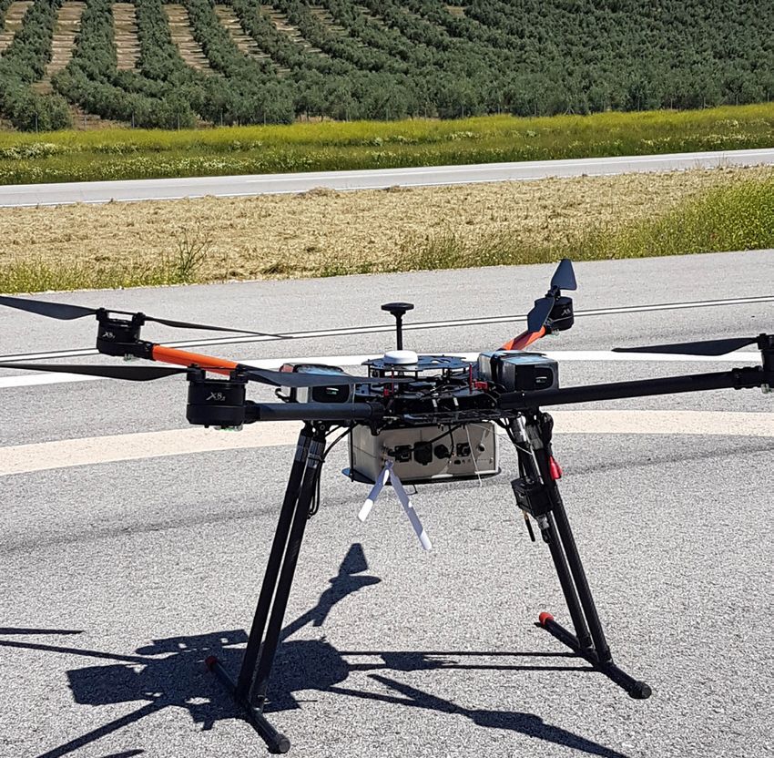
01
                                      E U R O P E A N G LO B A L N AV I G AT I O N S AT E L L I T E S Y S T E M S ( E G N S S ) F O R D R O N E S O P E R AT I O N S   5

                 introduction

 D
      rones are a novel and very quickly emerging technology
      with a vast array of applications. As such, drones will
      grow to outstrip any other user base in the aviation
 market1. GNSS is essential for the safe and reliable navigation
 of drones, and GNSS receivers are implemented on almost
 all new commercial drones as a standard feature. With
 increasing demand for BVLOS (Beyond Visual Line of Sight)
 operations, GNSS (possibly with various augmentations)
 is the most obvious choice of technology for navigation,
 although it is not the only one.

 European GNSS (EGNSS)- EGNOS (European Geostationary
 Navigation Overlay Service) and Galileo, provide significant
 added value to drone navigation, positioning and related
 applications, with respect to other systems. EGNOS cor-
 rections provide over Europe improved robustness and
 higher safety of navigation as well as improved accuracy,
 specially relevant in thevertical axis for drones operations.                   (e.g. spoofing). Several drone navigation receiver manufac-
 With Galileo satellites in addition to GPS, drones may use                      turers already offer EGNSS capabilities in a multiconstellation
 signals from more satellites for position determination                         suite, and the number of models is increasing continuously.
 which improves the accuracy and also will increase the
 availability of received signals (e.g. key in urban canyons).                   The regulatory framework for drones operations is under
 Galileo also offers distinct and unique features benefitting                    development and significant progress has been made in
 drones operations, e.g. Galileo’s authentication will provide                   2019 by the publication by the EC of regulations 2019/945
 additional trust on the veracity of the position, being more                    (CE marking process; technical requirements fron UAS) and
 protected from intentional or unintentional interferences                       of Regulation 2019/947 (Operations of drones in open and
                                                                                 Specific categories and registration of operators and certi-
                                                                                 fied drones). Drones operations in the open category will
                                                                                 have to comply with strict limitations (e.g. flight in visual
                                                                                 line of sight), requirement on remote pilot training , require-
       GNSS is essential for                                                     ments on the operator and depending of the class of drones
       the safe and reliable                                                     technical requirement for the drone such as e-identification,
                                                                                 geo-awareness, height limitations capabilities. As a general
       navigation of drones,                                                     principle, drone operations in the specific category will be
                                                                                 subject to an approval by the competent authority based
       and GNSS receivers are                                                    on a risk assessment performed by the operator. EGNSS can

       implemented on almost all                                                 contribute to more accurate and robust drones operations.

       new commercial drones as                                                  The main objective of this paper is to introduce the added
                                                                                 value of EGNOS and Galileo for current drones operations
       a standard feature.                                                       and future U-Space services.

 1    Source: GNSS Market Report, GSA, issue 5, 2017
02
 2.1 Drone Market
                 Background

 The drone market is growing rapidly, with European demand                                (Figure 1) when it comes to drones, the installed base of
 estimated at in excess of EUR 10 billion annually, in nominal                            GNSS devices in the EU, North America and Asia-Pacific
 terms, to 2035 and over EUR 15 billion annually to 20502. The                            region is comparable. In 2017, 88% of receivers for drones
 service component of the drone mar-                                                                          are provided by North American and
 ket is growing. Today dedicated drone                                                                        Asian suppliers with European com-
 services are being offered by a number                              Drones will be a                          panies providing the remaining 12%.
 of specialised companies. European
 drone service revenues are expected
                                                                    global phenomenon                         Within the drone segment most system
                                                                                                              integrators (i.e. drone manufacturers)
 to nearly double from €32 mln in 2018
 to approximately €60 mln by 2020 and
                                                                    and the number of                         are based in Asia (86%), although Euro-
                                                                                                              pean companies such as Parrot remain
 are eventually forecast to reach €150                              drones equipped                           important players (14% of the market).
 mln by 2023. It is forecasted that from
 2021 onwards, services will increasingly                           with GNSS                                 European companies lead the provi-
                                                                                                              sion of drone related services (Flock,
 be offered in the urban environment.
 Services such as drone package delivery
                                                                    receivers will                            Sensefly) and drone trafc management
                                                                                                              (Altitude Angel, Airmap and Unifly).
 will see initial services kicking off, pav-                         grow significantly
 ing the way towards more mass-market                                                                           Depending on their specific payload
 adoption of drone services3.                                       in the coming years.                        and other characteristics, drones can
                                                                                                                enable a vast array of different appli-
 Drones will be a global phenomenon and the number of                                     cations. Whilst the list of drone use cases is almost endless,
 drones equipped with GNSS receivers will grow significantly                              many of them can be categorised along the following
 in the coming years. As can be seen from the figure below                                classes of application4:

                                                        Figure 1: Installed base of GNSS devices by region
                                           60

                                           50

                                           40
                        Units (millions)

                                           30

                                           20

                                           10

                                           0
                                                2019 2020 2021 2022 2023 2024 2025 2026 2027 2028 2029

                                                  EU28             Non-EU28 Europe              North America
                                                  Asia-Pacific     Middle East + Africa         South America + Caribbean

 2    Source: European Drones Outlook Study: Unlocking the value for Europe; SESAR JU
 3    Source: GSA Market Report 6
 4    GNSS Market Report Issue 5; GSA
E U R O P E A N G LO B A L N AV I G AT I O N S AT E L L I T E S Y S T E M S ( E G N S S ) F O R D R O N E S O P E R AT I O N S   7

y Agriculture & environmental: precision agriculture,                                           y Observation: film, photography, TV/other media-broad-
  crop/field/soil monitoring, variable rate applications,                                         casting (e.g. sport events), etc.
  livestock tracking, insurance, forest monitoring & man-
                                                                                                y Communications: local coverage broadcasting using
  agement, etc
                                                                                                  high altitude drones or HAPS (high-altitude platform
y Inspection & maintenance: bridges, gas & oil infrastruc-                                        stations).
  ture, energy distribution infrastructure, solar panels,
                                                                                                y Leisure: toys, models flying, self-tracking/filming drones
  windmills, etc.
                                                                                                  (first person view), sports (e.g. drone racing), etc.
y Surveying and mapping: environmental monitoring,
                                                                                                y Goods delivery: transport of various types of goods
  cadastral surveying, mine surveying, marine surveying,
                                                                                                  or cargo.
  GIS, photogrammetry, etc.
                                                                                                y Other applications: calibration of aviation nav-aids,
y Government: police applications, crowd observation,
                                                                                                  asset management, advertisement, marketing, enter-
  border control (including maritime), security, etc.
                                                                                                  tainment, etc.
y Public safety: SAR operations, firefighting, urgent med-
                                                                                                y Military
  icine/medical equipment delivery, other natural disaster
  monitoring (e.g. floods, earthquakes), etc.                                                   The expected growth in the drone market is huge. Figure 2
                                                                                                presents this growth from 2019 to 2029 by illustrating the
y Scientific: meteorological monitoring, atmospheric
                                                                                                increasing number of drones equipped with GNSS receivers.
  measurements, swarm techniques, general R&D, etc.
                                                                                                The installed base of GNSS devices for drones is increasing
y Education: teaching tool in schools and faculties (e.g.                                       significantly since 2015 when prices had decreased sufciently
  aeronautics, geomatics, navigation).                                                          for consumer drones to become more widely available.

                                               Figure 2: Installed base of GNSS devices for drones, by application
                                              60

                                              50
                           Units (millions)

                                              40

                                              30

                                              20

                                              10

                                               0
                                                   2019 2020 2021 2022 2023 2024 2025 2026 2027 2028 2029

                                                      Commercial             Prosumer            Consumer

The following definitions are used:
y   Commercial – drones used solely for commercial applications and which are invariably better equipped. These are always assumed to be GNSS-
    equipped.
y   Prosumer – drones which may be used for commercial applications but are also affordable for some recreational use.
y   Consumer – drones used primarily for recreational use. Due to their cost and nature, the type of sensors and cameras that may be carried on
    this category is limited. The integration of GNSS on these devices is limited due to the intended market and planned use of the platform. These
    platforms do not have the expandability or levels of automation demonstrated in the commercial and prosumer categories.
8    BACKGROUND

     2.2 Regulatory Status
     The uptake of drone technologies in Europe is strongly          these comments EASA published Opinion 01/2018 in Feb-
     dependent on regulations governing the use of drones in         ruary 2018, which included a draft delegated regulation “on
     different Member States (MS) with regards to policies on        making unmanned aircraft intended for use in the ‘open’
     authorisation, certification and spatial limitations.           category available on the market, and on third-country UAS
                                                                     operators” and a draft implementing regulation“on rules
                               2.2.1 EASA                            and procedures for the operation of unmanned aircraft”.
The uptake                    Significant progress on develop-
                                                                     On the 22nd of August 2018 the new EASA Basic Regulation
of drone                      ing a common European regu-
                              latory framework for drones has
                                                                     2018/1139 was published. It establishes common rules in the

technologies in               been made in the past 4 years.
                                                                     field of civil aviation and is in force since 11th of September
                                                                     2018. This adoption enabled te formal process of adoption
                              EASA published an advance notice
Europe is strongly            of proposed amendment (A-NPA)
                                                                     of the opinion.

dependent on                  in 2015, proposing a proportional
                              and operation centric approach. It
regulations                   introduces 3 categories of opera-
                              tions, based on the risk the oper-
governing the                 ation is posing to third parties,

use of drones.                and is divided into: Open (low
                              risk), Specific (medium risk) and
                              Certified (high risk). This proposal
     was followed by a technical opinion in December 2015, by
     prototype regulations in August 2016 and building on this
     preparatory work, by a Notice to Proposed Amendment
     (NPA) in May 2017 (NPA 2017-05) for the introduction of
     a regulatory framework for the operation of drones in the
     open and specific category. The NPA received many com-
     ments during the 4 month consultation from all the different
     stakeholders in the drone industry. After consideration of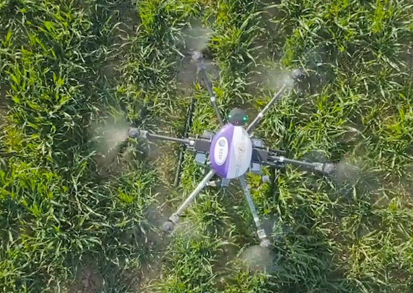
E U R O P E A N G LO B A L N AV I G AT I O N S AT E L L I T E S Y S T E M S ( E G N S S ) F O R D R O N E S O P E R AT I O N S   9

Following consultations involving Member States, the
Council, the Parliament and the manned and unmanned
aircraft Communities, the Commission published the two
regulations mentioned in paragraph 1 Introduction.

This publication is a major milestone but the work does
not stop there. 3 major streams of work can be identified:
y Implementing the regulations:
       Development of Acceptable means of Compliance
        and Guidance Material for Regulation 2019/ 947
        including the methodology for the risk assessment
        in the Specific Category.
         Development of the common unique standard for
          the drone zones.
         Adoption of an Opinion for the first two standard sce-
          narios for the specific category. Standard scenarios
          define the necessary risk mitigation measures for a
                                                                                             -    Operations type #2: Operations of drones in urban
          given type of operation and allow operators to start
                                                                                                  environment using scheduled routes in volume
          operations based on a declaration that they comply
                                                                                                  of airspace where U-space services are provided.
          with those measures.
                                                                                                  This includes operations of drones VTOL (vertical
         Development of the necessary standards to support                                       Take-Off and Landing) type carrying passengers
          the technical requirements for drones included in                                       (i.e. air taxis) and small drones cargo providing
          Regulation 2019/945.                                                                    delivery services.
         Development in cooperation with Member States and                                  -    Operations type #3: Piloted VTOL in urban and
          the drone community of safety promotion material.                                       non urban environment.
         Development of the necessary procedures for mon-
                                                                                   All information regarding the EASA activities on drones can
          itoring the implementation by Member States of
                                                                                   be found here: https://www.easa.europa.eu/easa-and-you/
          Regulation 2019/947.
                                                                                   civil-drones-rpas.
y Developing a high level regulatory framework5 for
  U-Space covering in particular:                                                  2.2.2 JARUS
        The definition of the U-space services                                    The Joint Authorities for Rulemaking on Unmanned Systems
                                                                                   (JARUS) is a group of experts from 60 worldwide national
        The requirements for the service providers and
                                                                                   aviation authorities (NAAs) and 2 regional aviation safety
        The requirements for Member States                                        organisations (EASA and EUROCONTROL), whose aim is to
                                                                                   develop harmonised rules for UAS.. The concept of operation
y Development of an NPA6 for the certified category :
                                                                                   centric regulation with the three categories (open, specific
        The scope of this NPA will cover:                                         and certified) has been developed within JARUS ategories.
                                                                                   JARUS is in charge of developing the methodology for
          -   Operations type #1: IFR operations of certified
                                                                                   Specific Operations Risk Assessment (SORA). SORA v2.0 has
              drones cargo flying in airspace classes A-C and
                                                                                   been published by JARUS in March 2019.
              taking-off and landing at aerodromes under
              EASA’s scope.
                                                                                   More information on JARUS may be found at: http://jarus-
                                                                                   rpas.org/

5       The opinion is scheduled for the end 2019
6       The NPA is scheduled for Q3 2019
10   BACKGROUND

     2.2.3 EUROCONTROL                                              2.2.4 EUROCAE
     As part of their activities aimed at the safe integration of   EUROCAE is the European leader in the development of
     UAS, EUROCONTROL has run several webinars based on             worldwide recognised industry standards for aviation.
     certain hot topics in the UAS domain, with the participation   EUROCAE develops standards by industry/members for
     of the most relevant stakeholders in the different sessions.   the industry that:
     The objective of these webinars was to develop guidelines
                                                                    y Build upon the state of the art expertise of its members
     that are not directly related to a particular regulation.
                                                                      and address global aviation challenges;
     EUROCONTROL has developed and published three dis-             y Are fit for purpose to be adopted internationally;
     cussion documents so far based on the outputs of the
                                                                          Support operational, development and regulatory
     different webinars:
                                                                            processes.
     y UAS ATM Airspace Assessment: in order to ensure the
       safe integration of drones into the European airspace,       EUROCAE is running several Working Groups. The one related
       assessments are essential to enable common and               to drones is WG 105. EUROCAE WG-105, in coordination
       harmonised rules and scenarios. This involves taking         with RTCA SC-228, is developing standards and guidance
       a look at the airspace volume in                                               material to allow the safe operation of
       which operations are taking place,
       in order to examine the associated
                                                       UAS operations                 UAS in all types of airspace, at all times
                                                                                      and for all types of operations. The work
       air and ground risks, and covering all
       related elements and requirements
                                                       can be performed               of WG-105 is organised in six groups
                                                                                      working in specific areas. Some of the
       that must be taken into account (e.g.           by pilots who are              identified areas have GNSS relevance,
       re-design, CNS coverage, geo-fenc-                                             such as geofencing and the emerging
       ing).                                           not necessarily                UAS Traffic Management.
     y UAS ATM CARS Common Altitude                    aware of the                    In February 2019, a new sub-group was
       Reference System: UAS will cer-
       tainly share airspace with manned
                                                       rules of the air.               created: WG-105 SG-62 “GNSS for UAS”.
                                                                                       The group will publish “Guidelines on
       aviation, and this will lead to sep-
                                                                                       the use of multi-GNSS for UAS”, in order
       aration requirements. For this it is essential that the
                                                                    to support operators to design their operations within the
       altitudes of all of these aircraft are well known, with
                                                                    SORA framework by benefitting from EGNSS receivers. This
       no place for ambiguity. Manned aviation uses pressure
                                                                    deliverable is prepared under the H2020 GAUSS project in
       altitude obtained from barometric readings but UAS use
                                                                    close cooperation with EC and GSA.
       inputs from other systems such as satellite based calcu-
       lations. Each system works well in its domain (manned
       or unmanned separately), but to ensure safe separation
       when working together a common altitude reference
       system needs to be defined.
     y UAS ATM Flight Rules: UAS operations can be per-
       formed by pilots who are not necessarily aware of the
       rules of the air. UAS themselves usually have very dif-
       ferent dynamics to manned aircraft – some of them
       are not comparable to conventional aircraft in terms
       of speed and size, implying a certain safety threat to
       manned aviation when sharing airspace (e.g. under VFR).
       New flight rules applicable to UAS and to other aircraft
       operating near them are therefore needed.
E U R O P E A N G LO B A L N AV I G AT I O N S AT E L L I T E S Y S T E M S ( E G N S S ) F O R D R O N E S O P E R AT I O N S 11
2.3 European initiatives – SESAR
SESAR JU is considering initially grouping RPAS into small U4: U-space full services, particularly services offering inte-
drones flying in VLL and larger RPAS in controlled airspace. grated interfaces with manned aviation, support the full
Regarding the second, three phases are foreseen, starting operational capability of U-space and will rely on a very
with IFR RPAS operating in airspace A to C, followed by IFR high level of automation, connectivity and digitalisation
drone in classes A to G, and finally all RPAS in all airspace. for both the drone and the U-space system.
For the VLL side, the U-space itself will also have several
service evolutions, beginning with foundation services, By 2019, U-space is expected to be established with U1
going to full integration by 2035. Its roll-out is presented services enabling new drone operations. In addition, 2019
in Figure 3 below, with four service phases: will deliver pre-operational demonstrations of the initial
U-space services (U2), as well as first results from SESAR
U4 research and development projects, which will pave the
way for the roll-out of U-Space (U2-U4).
U3 U-space
full U-space services, like e.g. geo-fencing, e-identification,
U2 U-space
services and detect and avoid, could benefit
advanced from the introduction of EGNOS
U1 U-space
initial
services and Galileo, as this will improve the It is important
accuracy and robustness of posi-
U-space
foundation
services
ses tioning and navigation. to consider the
crea
services
utom
atio
n i n
It is important to consider the ref-
reference to
e a ses
ron crea
Leve
l o f d
ctivi
t y i n erence to European GNSS in the European GNSS
co nne drones’ regulatory framework, as
Le ve l of d
rone it can have a positive impact. The in the drones’
Space Strategy for Europe adopted
by the Commission in October 2016
regulatory
Figure 3: U-space rollout
stated that the space sector needs
to be better connected to other
framework, as
policies and economic areas and it can have a
U1: U-space foundation services provide e-registration,
e-identification and basic geo-awareness services.
the potential of EGNOS and Galileo
must be better exploited7. Some positive impact.
Member States are already referring
U2: U-space initial services support the management of to the use of EGNSS for drones, e.g. the Spanish authorities
drone operations and may include flight planning, flight (AESA) are already including EGNSS for drones operations
approval, tracking, airspace dynamic information, and pro- in their AMC8.
cedural interfaces with air traffic control.
More information on U-space roll-out can be found at
U3: U-space advanced services support more complex oper- SESAR JU website.
ations in dense areas and may include capacity management
and assistance for conflict detection. Indeed, the availability
of automated (Detect and Avoid) DAA functionalities, in
addition to more reliable means of communication, will lead
to a significant increase of operations in all environments
and may require a more robust framework.
7 Communication from the Commission to the European Parliament, the Council, the European Economic and Social Committee and the Com-
mittee of the Regions, Space Strategy for Europe, Brussels, 26.10.2016, COM(2016) 705 final
8 Requisitos de los Equipos para la Operación con RPAS según el Real Decreto 1036/2017 (Artículo 23 Quáter. Requisitos de los Equipos.)03
A
Localisation of drones
key element of the U-space9 concept defined above
will be geo data, because reliable information on drone
position is a must for its operations.
Pre-tactical (U1 – U-space foundation services) - the
service provides the operator with geo-information
about predefined restricted areas (prisons, etc.) and the
available aeronautical information (NOTAM, AIRAC cycle)
There are several functionalities widely used by drones, used during flight preparation. This service requires the
where accurate, reliable and continuous real-time posi- identification of accredited sources and the availability of
tioning is needed: qualified geo-information related to restricted areas. This
service provides information that
y Geo-fencing10 is a concept whereby allows the drone operator to make
a virtual barrier is placed on a spe- Geo-fencing is a use of the geo-awareness capability
cific real-world geographic area or of the drone.
volume. In the context of drones this concept whereby
Tactical (U-space initial services)
translates into programme airspaces/
classes that are forbidden to drones
a virtual barrier – compared to U1 pre-tacti-
(or only accessible with specific is placed on a cal geo-awareness, tactical
geo-awareness offers the possi-
flight permissions). The geo-fenc-
ing capability can send an alert to specific real- bility to update the operator with
geo-awareness information even
the pilot/operator when the drone
is approaching the restricted area,
world geographic during the flight.
or the drone can be programmed area or volume. Dynamic (U3 – U-space advanced
to handle restricted areas (e.g. auto- services) – compared to tacti-
matically turn back or fail to proceed cal geo-awareness in U2, the
further into the fenced area). Geo-awareness is a ‘softer’ dynamic geo-awareness targets the drone itself and
capability that informs the pilot/drone operator about then this service requires data-link connectivity to a
different access rights and restrictions. There are the geo-aware system that allows the data to be updated
following types of geo-awareness for drones: during the flight11.
y Waypoint navigation, as part of the guidance, naviga-
tion and control (GNC) function. Waypoints define the
desired trajectory to be followed by the drone. Waypoints
are specified geographical locations (3D coordinates)
with the possibility to also indicate a desired change
in direction, speed or altitude along the flight path.
Waypoints allow the drone’s autopilot to follow the path
(e.g. automatic flight with the possibility of interruption
by remote pilot).
y Geotagging during drone missions is the process of
adding timing and geographical information to on-board
measurements from cameras or other sensors, and is a
form of geospatial metadata. This data may consist of
latitude and longitude coordinates, altitude, distance,
place names, camera pointing angles and the time stamp
(e.g. UTC time provided by GNSS).
9 Sesar JU
10 For the time being Regulations 2019/945 and 947 only require geo-awareness
11 European ATM Master Plan: Roadmap for the safe integration of drones into all classes of the airspace, SESAR JUE U R O P E A N G LO B A L N AV I G AT I O N S AT E L L I T E S Y S T E M S ( E G N S S ) F O R D R O N E S O P E R AT I O N S 13
y Drone telemetry is used to provide drone position, 3.1 Current technologies used
velocity and timing (PVT) information to the operator
along with other information such as heading, battery
for drone positioning and
status, distance to home, flight time, attitude, etc. navigation
y Detect and avoid capability is key to avoiding collisions;
The following main technologies are used/tested today for
this feature gives drones autonomous capabilities to
positioning and navigating of drones:
avoid unreported ground obstacles, providing coop-
erative surveillance information on other drone traffic. y stand-alone GNSS,
y E-identification is a function that enables the iden- y augmented GNSS,
tification of a drone without direct physical access to
y visual,
the drone.
y inertial,
y Tracking/surveillance – the position of the drone is
also displayed to the drone operator, enhancing their y signals of opportunity.
situational awareness.
Some of the listed solutions are more in that experimental
y Go-home/Return to Launch (RTL) is a function that
phase rather than the commercially useable phase (e.g.
enables the drone to fly back to its take-off position in
signals of opportunity). What is important to highlight is
case of loss of the Command & Control (C&C) link. In
the fact that the best solution for drone positioning and
general, the function overrides the pilot’s command but
navigation will always be a combination of technologies,
may also be activated by the pilot. The drone stores in its
with a hybridisation of sensors. This will allow the best per-
memory the place from where it took off, and when the
formance and, moreover, will provide a certain redundancy,
RTL is triggered it will automatically return to this spot.
which is very much appreciated in the aviation domain.
y Altitude hold allows the drone to maintain a fixed
altitude. Below you can find a short overview of the most promising
positioning/navigation technologies for drones that use
y Loiter, also known as Position Holding, makes it possible
GNSS.
to maintain the position of the drone at a fixed altitude
and location (i.e. auto hover). This allows a fixed-wing
drone to loiter within a given radius and at a fixed alti-
tude around a fixed point.14 LO C A L I S AT I O N O F D R O N E S
3.1.1 STAND-ALONE GNSS
This is the most basic (and probably cheapest) naviga- EGNOS is the European SBAS system and is already certified
tion solution available today. GNSS infrastructure allows for aviation usage. It offers increased performance over the
users with a compatible device to determine their position, entire ECAC area. EGNOS improves the accuracy and relia-
velocity and time by processing signals from navigation bility of GNSS positioning information, while also providing
satellites providing global coverage. There are four con- a crucial integrity message regarding the continuity and
stellations available today (two of them in the final phase availability of a signal. In addition, EGNOS also transmits an
of full deployment), and all offer free global access to their extremely accurate universal time signal. Certified receiv-
signals. Other advantages are the availability of different ers are already on the market today and are operationally
frequencies and a relatively low power consumption on the used in civil aviation to enable RNP Approaches to LPV
receiver side. Disadvantages are the need for a minimum minima and support other Performance Based Navigation
number of satellites in line of sight, signals that are unable applications.
to penetrate obstacles such as mountains or buildings,
and the fact that the overall solution is PPP: Precise Point Positioning is a
prone to multipath, jamming and spoof- method to achieve high-accuracy posi-
ing. Accuracies better than five metres EGNOS improves tioning solutions. It replaces broadcast
can be achieved. This GNSS stand-alone navigation messages with precise values,
solution is mainly used for leisure drones the accuracy and either by modelling or estimating
and other applications without stringent
navigation requirements.
and reliability of all residual errors at the receiver level.
Real time PPP involves delivery of these
GNSS positioning data to the users in a timely manner,
usually through L-band geostationary
3.1.2 AUGMENTED GNSS information, while satellites. The service is expected to have
SBAS: Satellite-based augmentation
systems use geostationary or geosyn- also providing a global coverage. The main advantages
are absolute positioning solutions and
chronous satellites and a ground refer-
ence network to augment and improve
crucial integrity no need for local or regional reference
stations. For Precise Point Positioning
the performance of GNSS systems. message regarding drone kinematic positioning, horizon-
SBAS systems provide crucial integrity tal accuracy between 10 cm and 1 m
information needed for civil (manned) the continuity and are achievable. Although PPP provides
aviation applications. There are five oper-
ational SBAS systems available today,
availability of very high accuracy it does not provide
integrity information as SBAS systems
each covering a different region (EGNOS a signal. do. As a result it may not be used for
over Europe, WAAS over North America, navigation purposes in civil aviation. Its
MSAS over Japan, GAGAN over India, and main disadvantages are the cost of the
SDCM over Russia). SBAS allows increased accuracy perfor- receivers and the convergence time required to achieve
mances compared to stand-alone GNSS at a relatively low centimetre accuracies: although this strongly depends on
cost. Its signals can be received and applied over, typically, the type of the receiver, it still may reach 5 minutes (e.g. a
continental areas. The integrity information can be used typical receiver for agriculture purposes)12.
in more safety critical applications, and a final advantage
is that SBAS is already a widely adopted technology for RTK: Real time kinematic is a differential GNSS method
navigation in manned aviation. Disadvantages are a need providing high positioning performance in the vicinity of a
for direct line of sight, which can be an issue for low flying base/reference station. The service is offered at local/country
drones in obstacle rich environments and high latitude areas. level and is offered by public authorities (e.g. IGN, CUZK),
Sub-meter accuracy levels are achieved with SBAS and it private providers (e.g. Trimble, Topcon) and expensive in-situ
can therefore be used for linear infrastructure surveillance, own base stations (e.g. connected to the Ground Control
agriculture and surveying (GIS applications). Station of the drone). RTK is a highly accurate technology,
reaching accuracies between 1 and 5 cm. The European
landmass is well covered with network RTK. In this method,
12 GNSS User Technology Report, Issue 2, 2018 reference stations are used and performances are depend-E U R O P E A N G LO B A L N AV I G AT I O N S AT E L L I T E S Y S T E M S ( E G N S S ) F O R D R O N E S O P E R AT I O N S 15
ent on distance to the reference station. Moreover, there (fault detection and exclusion) are able to exclude faulting
is a need for a real time communication link between the satellites from the solution. In addition, work is ongoing
base (for stand-alone solutions) or the RTK provider and the towards Advanced RAIM (ARAIM), aiming at providing a
receiver (drone), which can cause problems in, for example, global integrity service based on multiple constellations and
areas without GSM coverage. Most of the time this is a frequencies, and in particular with GPS and Galileo. Com-
paid service. Due to its high accuracy, this pared to classic RAIM, ARAIM provides
technology is widely adopted in the drone
community, with precision mapping and Introducing the required integrity parameters so
that the aircraft receiver can detect
precision agriculture being the biggest
user groups. However, some solutions also
the integrity and exclude multiple satellite failures
occurrences. Those integrity param-
adopt a private reference station with VHF concept to drone eters, generated at the ground level,
radio link connection to the drone for RTK are encapsulated into the Integrity
augmentation. It is important to mention, navigation is Support Message (ISM) and then pro-
as in the case of PPP, the pricing and con-
vergence time of this solution: the RTK
more and more vided to the aircraft. Introducing the
integrity concept to drone navigation
initialisation time is normally a disadvan- attractive as a is more and more attractive as a result
tage when it comes to drones operations. of emerging applications in stringent
result of emerging environments such as controlled air-
ABAS (Airborne Based Augmentation
Systems) is an avionics solution that pro-
applications. space, urban areas or restricted areas
However, the integrity monitoring
cesses the GNSS signal and other onboard algorithms developed in the aviation
sensors information in order to check integrity. The most domain are tailored to manned aviation operations, and
widely used system is RAIM which uses redundant GNSS have not been yet applied to the majority of drone GNSS
signals to ensure integrity and fault detection (FD), giving receivers available today. Further work may be needed in
the ability to warn the user about a potential error in the order to tailor the concept to specific drones operations
estimated position. More advanced strategies such as FDE and needs.04 G
EGNSS benefits for drones
lobal Navigation Satellite Systems (GNSS) are a key
enabling technology for drones, as we know them
today, and it is expected that this role will continue
to grow. European GNSS, namely EGNOS and Galileo offer
several differentiators that can be leveraged in order to
safely integrate drones into non-segregated airspace and
into the U-space.
GNSS is the Key Enabling Technology for the unmanned
air traffic management system to unlock BVLOS operations
and to enhance U-Space final capacity. GNSS increases
accuracy and contribute to integrity or a measure of trust
on the positioning, which could be further improved by
combining GNSS with other sensors/technologies.
EGNSS receivers for drones are
Global Navigation already in the market. They are
produced by the main players like:
Satellite Systems Novatel, u-Blox, Javad, Septentrio.
The useGALILEO website (https://
(GNSS) are a www.usegalileo.eu/) is listing all
the GNSS receivers that are EGNOS still used to ensure separation between commercial aircraft.
key enabling and/or Galileo capable. Moreover, GNSS offers improved height accuracy for drones and is not
technology drones in VLL airspace also benefit
from EGNSS signals for increased
prone to errors due to temperature gradients in the cities
that can affect barometric measures. In VLL, GNSS height
for drones and it availability and accuracy, thanks to accuracy is expected to be around 5ft/1.5m and pressure
more satellites in view and multifre- altitude will probably not be able to provide such accuracy
is expected that quency capabilitites that improves in all situations. In fact, EGNOS already provides a vertical
this role will the impact of multipath in urban
environments. Special attention is
accuracy within 2 metres and Galileo multifrequenacy capa-
ble receivers are already in the market improving accuracy
continue to grow. given to the need to maintain verti- globally. Galileo will also soon provide accuracy to decimetre
cal separation between drones and level with its upcoming High Accuracy Service13. Therefore,
with conventional aircraft sharing for drones’ vertical separation, a geodetic approach based
the airspace. In order to achieve this goal, it is essential to on a common reference datum (e.g. WGS84 ellipsoid or
know the altitude of each of these platforms and discussions EGM96 geoid) may represent a good mechanism to define
are ongoing to define the approach to vertical separation for a common zero altitude when flying in VLL airspace.
manned and unmanned traffic. The Eurocontrol ‘UAS ATM
Common altitude reference system’ report recommends UAS Separation with manned aviation in VLL using barometer
to select the technical solution best suited to its operation. may be assured at the level of UTM/U-Space with the imple-
mentation of a service which guarantees the separation
Drones often use GNSS reference for altitude determination independently of the sensor used for altitude determination.
and increasing number of commercial flights use GNSS- This approach has at the same time a positive impact on
based altitude information, however, barometric pressure is improving the safety of manned aviation.
13 Eurocontrol UAS ATM Common altitude reference system (CARS).
https://www.eurocontrol.int/publication/uas-atm-common-altitude-reference-system-carsE U R O P E A N G LO B A L N AV I G AT I O N S AT E L L I T E S Y S T E M S ( E G N S S ) F O R D R O N E S O P E R AT I O N S 17
4.1 EGNOS accuracy and integrity
EGNOS improves the accuracy of the position, ensuring EGNOS broadcasts corrections to GPS satellite clock and
more accurate navigation capabilities. As described above, ephemeris data, as well as corrections for the ionospheric
due to the expected high number of drones, their relatively delay experienced by a single frequency user. It also broad-
small size, and most operations in VLL, having an accurate casts parameters that describe the residual range errors after
navigation solution is a key requirement for safe navigation. application of both the clock and ephemeris corrections (the
User Differential Range Error - UDRE) and the ionospheric
Moreover, EGNOS corrections could be tailored in such a corrections (Grid Ionospheric Vertical Error – GIVE). The
way as to support robust navigation of drones and adapt receiver combines satellite/user geometry information with
the integrity concept and protection levels to the needs EGNOS-corrected pseudo-ranges and internal estimates of
of drones, as is done in manned aviation. The Safety of the tropospheric delay and other local errors to compute
Life service provides the most stringent level of signal-in- the precise user position. As a result, the accuracy of an
space performance to all Safety of Life user communities. EGNOS-based position is more precise than with GPS only,
The main objective of the EGNOS SoL service is to support as illustrated in the graphs below. The first figure shows the
civil aviation operations down to Localizer Performance performances registered by the Zurich RIMS station on 11
with Vertical Guidance (LPV) minima. To date, a detailed December 2018. As can be observed, the deviation from
performance characterisation has been conducted only the reference when using EGNOS is 0.66 metres, while with
against the requirements expressed by civil aviation in GPS only the error grows to 1.55 metres.
ICAO documentation. However, the concept of the EGNOS
SoL service might also be used in a wide range of other
application domains, including drones.
Figure 4: Horizontal deviation from reference station (RIMS in Zurich),
11 Dec 2019 with use of GPS only and GPS+EGNOS14
14 Source: https://egnos-user-support.essp-sas.eu/new_egnos_ops/os_gps_egnos18 EGNSS BENEFITS FOR DRONES
The second figure depicts the measured vertical error, in the same RIMS and time, both with and without EGNOS. With
GPS only the error is above 5 metres, while with EGNOS it stays below 2 meters and most of the time is less than 1 metre.
Figure 5: Temporal comparison of position’s vertical error determined
with GPS only and GPS+EGNOS (RIMS ZUR, 10 December)15
The GSA is coordinating several testing campaigns with base station for carrier differential reference position deter-
drones, comparing the positioning performance of GPS mination. It should be noted, however, that as the time
alone and GPS augmented by EGNOS. duration of the RPAS trials is limited to about five minutes
per flight these performance figures do not accurately
represent the mean GNSS accuracy performance figures:
4.1.1 FLIGHT DEMONSTRATIONS WITH EGNOS-ENABLED to determine these with sufficient levels of confidence at
RECEIVERS least one day of observables collection is considered the
bare minimum.
4.1.1.1 DUTCH AEROSPACE CENTRE (NLR)
The table below shows the results of a first flight test As can be seen from the data and graphs above, GPS/EGNOS
campaign, using a Quadcopter drone from the Dutch Aer- delivers a significant accuracy advantage compared to GPS
ospace Centre (NLR), equipped with a Septentrio AsteRx3, alone. The increased accuracy is particularly true for height
a u-blox EVK-M8T and using a Trimble NetR9 receiver as a errors, where errors are reduced by 50% or even more.
15 Source: https://egnos-user-support.essp-sas.eu/new_egnos_ops/os_deviationE U R O P E A N G LO B A L N AV I G AT I O N S AT E L L I T E S Y S T E M S ( E G N S S ) F O R D R O N E S O P E R AT I O N S 19
Figure 6: Height and error profiles of runs with Septentrio AsteRx3 receiver:
C21 using GPS guidance and C22 based on using GPS + EGNOS
Flight path: 25 m radius circle flight at 2 m/s
Errors during flight 95% height error 95% 3D error
C21 (GPS only) 2.4 m 2.5 m
C22 (GPS+EGNOS) 1.4 m 1.5 m
4.1.1.2 REAL PROJECT
Another series of demonstrations was performed within the An assessment was carried out of the accuracy benefits
REAL project with Septentrio AsteRx4 and u-blox NEO-M8N provided by EGNOS during the drone operations, compar-
receivers (described further in chapter 5.2). During these ing GPS-only and GPS+EGNOS against a reference path.
trials, drones were successfully conducted through different The precise trajectory followed by the RPA was obtained
IFPs (Instrument Flight Procedures) under two flight modes: through a post-processed kinematic (PPK) assessment,
automatic and manual. performed with Novatel Inertial Explorer version 8.70 in20 EGNSS BENEFITS FOR DRONES
differential processing mode using both GPS and GLONASS values; however, in the GPS solution the value dispersion
constellations, when available. Two base stations and precise is slightly higher, obtaining a small increment in the 95th
GNSS files were used for each trajectory processing. Solu- percentile. On the other side, noticeable differences are
tions in forward & reverse directions were calculated and obtained in the vertical axis, where the GPS stand-alone
combined. As can be observed in the figure below, lateral solution increases the error between 2 m and 3 m relative
deviations from both solutions are similar on the average to the EGNOS solution.
Figure 7: REAL project Flight 2 - Difference between PP trajectory
and EGNOS/GPS positioning solutions
Table 1: Difference between PPK trajectory and EGNOS/GPS positioning solutions
Flight 2
EGNOS GPS
95% Lateral Positioning Error (m) 1,178 1,505
95% Vertical Positioning Error (m) 1,226 4,241E U R O P E A N G LO B A L N AV I G AT I O N S AT E L L I T E S Y S T E M S ( E G N S S ) F O R D R O N E S O P E R AT I O N S 21
It is important to note that COTS autopilots are not currently The drone was also equipped with a multi-constellation/
able to perform IFPs, so it was a valuable experience for multi-frequency receiver, a Septentrio AsterRx3, in order to
operators to see the added functionality that the navigation record the GNSS observation measurements and compute
system provided. Only by engaging the REAL box system, the “true” path (i.e. the Actual Flight Path, AFP) in post-pro-
consisting of a large number of hardware and software parts cessing using a PPP (Precise Point Positioning) technique.
working together to create an integrated platform providing The AFP is considered the reference against which the
drone navigation and traffic surveillance functions, and con- Navigation System Error (NSE) of the u-blox measurements
necting it to the autopilot, does the navigating experience is computed.
becomes compatible with conventional EGNOS Safety-of-life
aviation procedures (for approach and landing for example). The Total System Error (TSE), on the other hand, is computed
This is something that is currently frequently overlooked. as the difference between the AFP and the Desired Flight
Path (e.g. the hover waypoint in the first set of flights, as
The incorporation of EGNOS into drones will not only explained below). The TSE is a combination of the NSE and
respond to issues related to accuracy of positioning but also the Flight Technical Error (FTE), understood as the ability of
ensure integrity of the data in line with PBN requirements. the autopilot to maintain the desired position based on the
estimated navigation solution, combining measurements
from the GNSS source and other sensors such as accelerom-
4.1.1.3 EUROPEAN SATELLITE SERVICES PROVIDER (ESSP SAS)
eters, gyroscopes, magnetometers, barometers and so on.
The tables and graphs presented in this section reflect the
data gathered and analysed for two sets of flights executed As mentioned above, two different sets of flights were
with ESSP’s EH-1 hexacopter in January 2019. executed, a static or “hover flight” and a dynamic flight:
The hexacopter navigation function makes use of a u-blox y Hover flight: the drone is commanded to fly to a 3D
M8N receiver, which is integrated into its Here2 GNSS module. fixed position (e.g. a waypoint defined by latitude, lon-
gitude and height) and to remain in that position for
several minutes. Two flights were performed, one in
GPS/EGNOS mode and another in GPS-only mode, in
order to compare the FTE and NSE;
y Dynamic flight: the drone was commanded to follow
a pre-defined flight path (Desired Flight Path) using its
autopilot functionality. Two flights were performed, one
in GPS/EGNOS mode and another in GPS-only mode, in
order to compare the FTE and NSE.
4.1.1.3.1 Hover flight
Hover (or static) flight: As mentioned above, two flights
were performed, one lasting around 11 minutes in GPS/
EGNOS mode, and a second flight lasting around 8 minutes
Figure 8: ESSP’s EH-1 hexacopter
in GPS-only mode. Both flights were configured to stay fixed
at the following waypoint:
All flights were executed by configuring the u-blox M8N in
Lat. 40.574300 N
one of the two following modes:
Long. 3.194700 W
y GPS/EGNOS: sensor providing PVT (Position, Velocity
Height Above Ground Level: 30 m
and Time) based on GPS augmented by EGNOS;
y GPS-only: sensor providing PVT based on GPS only.22 EGNSS BENEFITS FOR DRONES
The following figures present the Total System Error and Navigation System Errors computed during both hover flights
as defined in 4.1.1.3 above.
GPS/EGNOS GPS-only
Horizontal TSE Horizontal TSE
Horizontal NSE Horizontal NSE
Vertical NSE Vertical NSE
Figure 9: GPS/EGNOS and GPS-only FTEs and NSEs during hover flightE U R O P E A N G LO B A L N AV I G AT I O N S AT E L L I T E S Y S T E M S ( E G N S S ) F O R D R O N E S O P E R AT I O N S 23
It can be concluded, based on the above results, that during 4.1.1.3.2 Dynamic flights
the hover test GPS/EGNOS performance was better than
Again, two flights were conducted: the first one in GPS/
GPS-only:
EGNOS mode and the second one in GPS-only mode, both
y GPS/EGNOS was more accurate and stable lasting 6 minutes approximately. The flights took place in
good weather conditions and, in particular, with almost
y Percentiles 95 (horizontal):
no wind.
GPS/EGNOS TSE= 0.79 m
The figure below shows the paths followed by the drone
GPS TSE = 1.65 m
during the flights, where the yellow line is the trajectory
y The average EGNOS Navigation System Error was lower followed by the drone in GPS/EGNOS mode and the dark
than 1 m both in the horizontal and vertical domains blue is the trajectory followed when in GPS-only mode. The
whereas GPS NSE was always greater than 1 m. Desired Flight Path, loaded in the drone’s controller (i.e. in
the drone’s Flight Guidance System), is represented in cyan.
Figure 10: Desired Flight Path (cyan) versus GPS/EGNOS and GPS-only trajectories24 EGNSS BENEFITS FOR DRONES
The following figures present the Total System Error and Navigation System Errors computed during both dynamic flights.
GPS/EGNOS GPS-only
Horizontal TSE Horizontal TSE
Horizontal NSE Horizontal NSE
Vertical NSE Vertical NSE
Figure 11: GPS/EGNOS and GPS-only TSEs and NSEs during dynamic flightE U R O P E A N G LO B A L N AV I G AT I O N S AT E L L I T E S Y S T E M S ( E G N S S ) F O R D R O N E S O P E R AT I O N S 25
Figure 12: GPS/EGNOS and GPS-only NSEs
The obtained results indicate that the GPS/EGNOS per- 4.1.1.3.3 EGNOS benefits shown in specific dynamic flight
formance was better than GPS-only in terms of NSE and,
This section shows a GPS flight that required manual inter-
consequently, TSE:
vention, whereas when using EGNOS it flew as specified
y Total System Error with EGNOS was lower than 1 meter in over the designed path.
the horizontal plane, whereas it was greater than 1 meter
for GPS. For the vertical plane, EGNOS was lower than 2 Figure 13 depicts the u-blox computed GPS/EGNOS trajec-
meters, whereas it was greater than 2 meters for GPS. tory in yellow. This flight was carried out to evaluate the
performance of EGNOS-based navigation. As can be seen
y When EGNOS augmentation is used, there is a poten-
in the figure, it flew very close to the PPP/AFP.
tial reduction in the number of operator interventions
thanks to the increased accuracy achieved (see specific
case in 4.1.1.3.2.1).
Figure 13: Desired Flight Path, GPS/EGNOS and PPP (AFP) trajectories26 EGNSS BENEFITS FOR DRONES
It is worth mentioning that, at one point in the GPS flight,
the operator undertook some actions which interrupted the
4.2 Galileo accuracy and
execution of the designed flight pattern to its full extent in availability in the multi-
order to test contingency actions. The drone was instructed
to “Return to Launch” (identified in the figure as (1)) and then
constellation and
ordered to go back to the Designed Flight Path (at point (2)). multifrequency concept
Some seconds after (3), the pilot took command and flew
the drone manually all the way back to the landing zone. Integration of observations from multiple GNSS systems is cur-
rently crucial when developing applications that need precise
One particular issue detected during the flight performed positioning algorithms. Combined multi-GNSS positioning
in GPS-only mode was the big horizontal and vertical errors has an undeniable advantage over standard single GNSS
computed by the end of flight, which required the operator system utilisation in terms of accuracy, reliability, availability
to change the drone’s navigation mode from automatic and convergence of the position solution. Multisystem posi-
to manual in order to land at the designated area. In fact, tioning is especially beneficial in obstructed environments
when still in automatic mode, the drone was more than 2 with limited access to open sky (i.e. urban canyons).
m away from the landing zone.
4.2.1 FLIGHT DEMONSTRATIONS WITH GPS/GPS + GALILEO
Figure 14 shows this situation graphically. This shows a
clear operational benefit when using EGNOS augmentation: On 17 July 2017, the GSA performed several flight tests
there is potential for reducing the number of operator inter- in collaboration with NLR. For the purpose of the tests
ventions and hence the workload, thanks to the increased the Mikrokopter MKGPS V3 carrying the AsteRx3 GNSS
accuracy achieved. receiver was used. The trials were executed within the des-
ignated test airspace available to NLR in Marknesse, using
With this example, we can conclude that when EGNOS single frequency measurements. The flight took place in
augmentation is used, there is a potential reduction in the an open field (e.g. limited buildings and trees around the
number of operator interventions thanks to the increased testing zone). The drone was guided along a rectangular
accuracy achieved. (approximately 43 x 54 meters) pre-defined trajectory. The
Landing zone GPS automatic landing
Figure 14: Landing zone and location where the drone would have landed
with GPS only (in blue), if no operator intervention was triggeredE U R O P E A N G LO B A L N AV I G AT I O N S AT E L L I T E S Y S T E M S ( E G N S S ) F O R D R O N E S O P E R AT I O N S 27
Figure 15: Height and error profiles of runs: B41 based on AsteRx3 receiver using
GPS guidance and B24 based on AsteRx3 receiver using GPS + Galileo
Errors during flight 95% height error 95% 3D error
B41 (GPS) 4.4 m 4.5 m
B24 (GPS+Galileo) 1.3 m 1.4 m28 EGNSS BENEFITS FOR DRONES
navigation performance was determined and is presented monly used in professional UAV-based applications, like
below for the following constellation(s) in use: GPS stand surveying and precision agriculture. Taking into account
alone and GPS+Galileo. It is important to mention that the that dual frequency chips are now also available for the
Galileo system is not (yet) a fully operational constellation mass market, we may soon expect to have dual frequency
and that we can expect even better results when the system receivers for drones as a standard.
reaches FOC (Full Operational Capability, expected 2020).
J. Paziewski and P. Wielgosz from the University of Warmia
As can be seen from the graphs above, Galileo in a mul- and Mazury in Poland (Investigation of some selected strat-
ti-constellation concept increases the 3D accuracy and egies for multi-GNSS instantaneous RTK positioning) made
significantly reduces the height error. The relative perfor- a comparative performance assessment of strategies com-
mances above were taken from two different flights. As the bining GPS + Galileo dual-frequency observations in relative
visible GNSS constellations are highly in-stationary it would kinematic satellite positioning. The work takes into account
be more accurate to determine relative performances from simulated data from the full constellations of Galileo and
one single flight under identical conditions. modernised GPS with L5 signals16. The results obtained by
J. Paziewski and P. Wielgosz prove an important benefit
in the coordinate domain from combining multi-GNSS
4.2.2 SIMULATIONS OF RTK GPS/GPS + GALILEO POSITIONING observations.
The emergence of a high-volume drones market calls for
RTK technologies previously limited to niche markets due More tests and simulations are ongoing with the inclusion
to their complexity and cost. The technology is now com- of Galileo in determining drones position.
Figure 16: Rover coordinate residuals for floating (grey) and fixed (green) solutions (#1- single GPS, #2 GPS+Galileo)
16 In the analysis made by J. Paziewski and P. Wielgosz, the coordinate residuals were obtained by comparing the rover’s positions obtained in
both floating as well as fixed solutions to the benchmark coordinates. Overall, the RTK algorithms estimates the number of double-differenced
ambiguities - and yield either a fixed or floating solution. In a fixed solution, the number of wavelengths is a whole number, or integer. A low
number of visible satellites, poor satellite constellation geometry and a poor radio link between the base station and the rover may prevent a
fixed solution. In a floating solution, the algorithm does not yield an acceptable fixed solution, so the ambiguity is allowed to be a decimal or
floating point number.You can also read