ENHANCING CLOUD CAPABILITIES FOR GLOBAL ISR MISSIONS - SES
←
→
Page content transcription
If your browser does not render page correctly, please read the page content below

Application Note

ENHANCING CLOUD
CAPABILITIES FOR
GLOBAL ISR MISSIONS
                              To ensure information superiority during a mission, Intelligence, Surveillance, and
In national defence, search   Reconnaissance (ISR) teams are leveraging cloud-enabled Internet of Things (IoT),
                              and increasingly adopting artificial intelligence (AI) applications across assets—on
and rescue, maritime          the ground, in the air, and at sea. According to Research and Markets, the global
surveillance, and border      government cloud market is projected to grow by $24.4 billion over the next five
                              years, at a compound annual growth rate (CAGR) of 13.6%.1
security operations,
data is the very core         As expectations grow for cloud computing to transform operational architectures
                              and military information systems, and as cloud capabilities and network
of mission success.           performance improve, ISR technology is rapidly improving too. Equipped with an
                              increasing number of high-fidelity sensors, modern airborne ISR assets can carry
                              out a wider variety of tasks with a reduced need for human intervention. In fact,
                              Unmanned Aerial Vehicles (UAVs) allow many ISR missions to be conducted
                              without any humans on board. These platforms can fly for over 24 hours—across
                              continents and oceans—and generate terabytes of data in a single sortie.

                              Cloud-enabled data processing, analysis, and dissemination systems integrate
                              intelligence products from multiple disparate sources into a common environment.
                              And turn them into actionable information—available in near real time to multiple
                              local and global teams across the entire theatre of operations. This amplifies shared
                              situational awareness, enables predictive analytics, and reduces decision-making
                              timeframes, empowering highly effective missions at the tactical edge. And, in many
                              cases, saving lives.

                              1 Global Industry Analysts Inc, “Government Cloud - Market Analysis, Trends, and Forecasts,” Research and Markets (2020).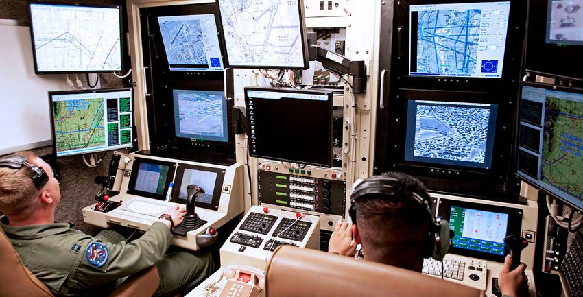
CREATING THE CLOUD-
OPTIMISED MISSION
ENVIRONMENT
The ultimate goal of global integrated ISR operations is            airborne asset lifecycle costs, reduces pilot fatigue, and
to enhance security and defence mission capabilities                increases the probability of early positive identification
while reducing the risk to personnel. With the ability to           (PID) of a critical subject or situation. Yet, as the volume
gather, process, and integrate multi-sensor, multi-domain           of data generated on ISR missions rapidly increases,
intelligence data, you can decrease the number of                   current Processing, Exploitation, and Dissemination (PED)
surveillance missions to execute, and deploy fewer teams            capabilities are struggling to match the scale and pace
at forward operating bases. Reducing the number of sorties          required to keep up. This underscores the need for robust
over a target area not only saves fuel, but also lowers             cloud-enabled connectivity across integrated ISR operations.

Enabling real-time data sharing                                     Maximising network performance
across the intelligence chain                                       for dynamic missions
During military missions, information superiority over              Long-range, strategic manned and UAV operations are highly
adversaries holds tremendous value. Data from ISR assets            complex and dynamic in nature, sometimes taking place over
often needs to be analysed and actioned by multiple teams           large geographical areas. For these missions to be successful,
in near real time. Latency limitations during such missions         they require high-throughput capabilities from start to finish—
cause delays in information sharing, adversely impacting time-      no matter the distance covered. Since fixed beam locations
sensitive operations and decision-making processes. Low-            could easily be out-flown if a mission were to take a different
latency networks are key to mission success.                        direction, satellite networks need to provide beam pointing
                                                                    flexibility as well as mission tracking via beam following to
                                                                    support long-range airborne missions.

Optimising multi-sensor off-boarding                                Ensuring network resilience and security
capabilities on ISR assets                                          ISR missions run a high risk of having communication systems
Multi-sensor ISR assets allow for multiple mission objectives       jammed or intercepted by adversaries. Adopting a resilient
to be satisfied in a single sortie. Data gathered by signals        network ensures these risks can be mitigated, and missions
intelligence (SIGINT) systems on a UAV can be supported by          can be carried out effectively. Having a very flexible satellite
additional intel—such as 4K video feeds and radar images of         beam pattern to include very narrow beams, beam following,
the source location. The composite intel “picture” is invaluable,   changeable frequencies, and multiple ground stations vastly
and is often used to tip and queue other airborne assets or         enhances network resiliency.
mission teams. Satellite networks used for these multi-sensor
ISR missions must be able to dynamically and reliably provide
the required high-throughput return link capabilities.
As the volume of data generated on ISR missions rapidly increases, current Processing, Exploitation, and Dissemination (PED) capabilities are struggling to match the scale and pace required to keep up.
HOW SES ENABLES THE
CLOUD FOR GLOBAL
INTEGRATED ISR
As the only satellite-enabled network services provider with a commercially proven and
fully operational multi-orbit fleet, we are uniquely positioned to meet the growing cloud
connectivity needs of ISR operations—no matter where they take place. Through Medium
Earth Orbit (MEO) or Geostationary Earth Orbit (GEO) links—or a roaming combination of
the two—we ensure multiple ISR assets and the distributed common ground system can
access a secure connection to the cloud in line with large bandwidth requirements.
Our satellite fleet and global terrestrial network allow us to drive                         As ISR operations grow increasingly dependent on cloud
connectivity to multiple cloud platforms, and reach government-                              applications, and cloud-enabled storage, access, and integration of
owned sovereign gateways across the globe. This includes                                     massive amounts of multi-domain data, our network services resolve
remote deployable cloud access nodes to augment fixed cloud                                  key cloud connectivity challenges—allowing ISR teams to access the
access sites. The SES network can also provide access to                                     full potential of the cloud to deliver on mission objectives.
transnational cloud access points supporting multi-national
coalition operations, further enhancing unified mission success.

                                       GEO–MEO–O3b mPower                                                                        1 Airborne ISR multi-sensor operations
                                                            RETURN PATH                                                            O3b mPOWER

                                                            FORWARD PATH                                                         • Very high throughput (up to 100Mbps) flexible
                                                                             Medium/                                               return link rates for diverse platform sizes
                                                                            Large UAVs
                                                                                                                                 • Dynamic bandwidth and power allocation in
                                                                                                                                   real time for quick response capability (QRC)
                                                                                                                                   surges and multiple fleet operations
                                                                                             Encryption    Sensor Platforms:
                                                                                                          Video/Wide Motion/     • Capacity for multiple intelligence (MULTI-INT)
                                                                                                           Signal Intelligence
                                                                                                                                   sensor operations

   VSAT                                     Government
  Antenna                                    Gateway                                                                             2 Edge cloud access
                                                                                             Small UAVs        Helicopter
                                                                                                                                   MEO Reachback
                                                                                                                                 • Low latency allows for cloud computing
                                                                                                                                   at the edge
   Remote      Government    Government     Deployable          VSAT
Cloud Access   Multi Cloud   Data Centres   Government         Antenna                                                           • High bandwidth (up to 500Mbps) enables
                Networks                     Gateway
                                                                                                                                   multi-sensor simultaneous streaming and
                                                                                                                                   raw data processing
                                                                           Ground Control      Cloud            Access
                                                                               Station       Computing           Point
                                                                                                                                   Line of Sight (LOS) Link

                                               SES                                  FOB (Forward Operating Base)
                                             Gateway
                                            (Optional)

                                                                                                                                 3 Mission resilience and global coverage
                                                                                                                                   GEO/MEO
                                                                                                                                 • Primary, alternate, contingency, and emergency (PACE)
                                                                            Small Tactical    Strategic           C2               multi-orbit failover and traffic split capabilities
                                                                              Aircraft         Aircraft         Aircraft
                                                                                                                                 • Efficient bandwidth usage allows for higher
                                                                                                                                   ISR data density
                                                                                                                                 • Global coverage for command and control (C2)
                                                                                                                                   and redeployment connectivity
With a commercially proven and fully operational multi- orbit fleet, we are uniquely positioned to meet the growing cloud connectivity needs of ISR operations. High-throughput return link capabilities With fibre-like MEO throughput capabilities, we enable granular bandwidth increments of up to 100Mbps, and higher, on return links for multi-sensor airborne missions, allowing aggregated data—from SIGINT, electro-optical/infrared (EO/IR), wide-area motion imagery (WAMI), and other video and imaging systems—to be relayed back to the cloud and processing centres. High- bandwidth connectivity also reduces the amount of computing required on airborne platforms, ensuring power, weight, and fuel can be optimised for long-distance and long-term sorties. A low-latency solution Low-latency and high-throughput connectivity ensure large amounts of complex data can be offloaded from ISR assets, and made accessible to multiple intel teams in real time—both locally and globally. The inherent low-latency architecture of our MEO satellite network is best suited for latency-sensitive applications. Dynamic bandwidth allocation Our O3b mPOWER constellation supports flexible forward to return link data ratios, enabling mission planners to adapt capacity to support the bandwidth requirements of multiple sensors on multiple aircraft. The system also enables dynamic bandwidth and power allocation, allowing users to modify connectivity parameters in line with changes in mission operations. Capacity can be activated to bring sensors online, reconfigured inflight, or re-assigned from one location to the other, as requirements evolve. Surges and QRC missions can be easily supported by these dynamic network capabilities, and data can be routed to existing cloud access nodes or to new nodes, as mission needs dictate. Global coverage We provide MEO high-capacity coverage over the full 360° range of longitudes, and to ±50° latitude, offering unparalleled connectivity services in mission-critical areas of operation— especially over well-known global areas of conflict. For mission operations at higher latitudes, coverage via our GEO fleet provides a roaming link. Intelligent multi-orbit resiliency Due to the motion of the MEO satellites and the use of narrow spot beams, our MEO solution is inherently interception- and jamming-resistant, reducing risk of disruption in communications systems during an ISR mission. With seamless integration between our GEO and MEO solutions for mission roaming in higher latitudes, we are able to significantly expand failover resilience, not just across different platforms, but satellite orbits as well.
O3b mPOWER AND
THE FUTURE OF CLOUD-
OPTIMISED ISR MISSIONS
                            Building on our market-proven, first-generation MEO capabilities, the O3b
                            mPOWER satellite network communications system will bring greater system
                            flexibility, performance, and scale to enhance ISR missions in the future.
                            Advanced throughput capabilities of over 100Mbps will enable highly efficient
                            multi-sensor manned and UAV missions, where large volumes of data can
                            be offloaded to the cloud and multi-cast to various sites for quicker decision
                            making. Satellite phased arrays enable high-throughput capabilities, even when
                            using smaller and lighter airborne terminals that aren’t able to meet mission
                            performance requirements on typical GEO satellites. And the O3b mPOWER
The O3b mPOWER              system’s jamming and interception resistance capabilities, together with
                            the ability to land traffic at government-owned gateways, ensure maximum
satellite network           information security during an ISR mission.

communications system       O3b mPOWER is the only satellite system designed from the ground up
                            to deliver cloud services—with terabit-level system scale, low-latency
will bring greater system   performance, and high availability. It is the only non-geostationary orbit
flexibility, performance,   (NGSO) solution based on commercially and operationally proven technology.
                            While low earth orbit (LEO) and GEO HTS solutions fall short of the scale and
|and scale to enhance       performance required for the cloud, O3b mPOWER enables a new generation
                            of cloud-scale services and applications.
future ISR missions.
                            In global integrated ISR operations, information shapes the outcome of national
                            or international security and defence missions. Our current MEO constellation,
                            together with our GEO fleet and O3b mPOWER system, enhances cloud
                            capabilities to ensure information is available to the right people at the right
                            time—no matter where they are.

To learn more about our                                                                                           Request a
cloud-optimised solutions,                                                                                        quote today
please visit
www.ses.com/networks/cloud

                                            Published in June 2020.
                                            This application note is for informational purposes only and it does not constitute an offer by SES.
                                            SES reserves the right to change the information at any time, and assumes no responsibility for any
                                            errors, omissions or changes. All brands and product names used may be registered trademarks and
                                            are hereby acknowledged. For more information about SES, visit www.ses.com
You can also read