ENVIRONMENTAL IMPACT STATEMENT - METRO NORTH
←
→
Page content transcription
If your browser does not render page correctly, please read the page content below
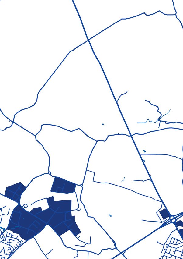
Belinstown

                                               Lissenhall

                                                  Estuary

                                                    Seatown
                                                              ENVIRONMENTAL IMPACT
                                               Swords
                                                              STATEMENT – METRO NORTH
                                                              BELINSTOWN TO
                                 Fosterstown

                                                              ST. STEPHEN’S GREEN
                                                              NON-TECHNICAL SUMMARY
                       Airport

          Dardistown

 Northwood

  Ballymun

Dublin City
University

    Griffith Avenue

       Drumcondra

      Mater

  Parnell Square

    O’Connell Bridge

 St.Stephen’s Green
Metro North Route
Area MN101 – MN107
ENVIRONMENTAL IMPACT
STATEMENT – METRO NORTH
BELINSTOWN TO
ST. STEPHEN’S GREEN
NON-TECHNICAL SUMMARY
Non-Technical Summary
Preface to the Non-Technical Summary                   Availability of the EIS
of the Metro North Environmental
                                                       The EIS may be purchased as a complete document
Impact Statement
                                                       for a sum of €170.00 (Volumes 1, 2 & 3). The EIS can
The Environmental Impact Statement (EIS)               also be purchased as individual books e.g:
for the Metro North scheme comprises the
                                                       -   Copies of Volume 1 may be purchased
following volumes:
                                                           for €30.00 each;

                                                       -   Copies of Volume 2 (individual book e.g. MN101)
Volume 1 Introduction and Baseline Environment
                                                           may be purchased for €15.00 each;
Volume 1 comprises one book containing
                                                       -   Copies of Volume 3 (individual books e.g.
the following:
                                                           Book 1 of 2) may be purchased for €15.00 each;
-   General introductory chapters of the EIS
                                                       -   Copies of the NTS of this EIS may be purchased
    including a section describing the methodology
                                                           for a sum of €5.00.
    used in the environmental impact assessment
    (EIA), the nature of the development, the means    A DVD version of the EIS may be purchased for
    by which alternatives were considered, and an      €15.00 which includes Volume 1, Volume 2
    assessment of potential impacts on Human           (Area MN101 - MN107); Volume 3 (Book 1 of 2
    Health (Chapters 1 to 9);                          and Book 2 of 2) and the Non-Technical Summary.

-   Description of the baseline environment            Copies of the EIS including the Non-Technical
    with respect to all environmental topics           Summary may be purchased by any member
    (Chapters 10 to 25);                               of the public during normal office hours at
                                                       the following location:
-   List of Abbreviations and Glossary of Terms.
                                                       Railway Procurement Agency (RPA)
                                                       Parkgate Business Centre
Volume 2 Impact Assessment
                                                       Parkgate Street
Volume 2 contains the impact assessments with          Dublin 8
respect to all environmental topics (Chapters 1-18).
                                                       This EIS is available for free download
For the purposes of this EIS and for ease of local
                                                       at www. dublinmetronorth.ie
identification and interest, the 18km proposed
alignment has been divided into seven areas
(MN101 to MN107). Volume 2 comprises seven             Stage of design and limits of deviation
books, one for each of the areas MN101 to MN107.
                                                       The Environmental Impact Assessment is based on
Collectively these make up Volume 2 of this EIS.
                                                       the proposed Railway Order design. All proposed
                                                       mitigation measures described in this EIS or
Volume 3 Maps and Relevant Annexes                     shown on drawings are also based on this design.
                                                       Deviations from this design may occur provided
Volume 3 contains all baseline and impact
                                                       these have no significant adverse environmental
assessment maps and Annexes to the EIS. These
                                                       effect in order to facilitate on-site construction
provide additional and supporting information to
                                                       or maintenance and to allow a limited degree of
the chapters in Volume 1 and Volume 2.
                                                       flexibility to react to on-site circumstances which
A table of contents for the EIS can be found           are unforeseeable at this stage.
at the front of each book.
                                                       Lateral deviations of up to 2.5m are permitted
                                                       where the works are situated in a public road,
                                                       10m where the works form part of an underground
                                                       tunnel or stop and 5m elsewhere. Vertical
                                                       deviations of up to 1m upwards or downwards are
                                                       permitted where the works are situated in a public
                                                       road; up to 5m upwards and 10m downwards
                                                       where the works form part of an underground
                                                       tunnel or stop and up to 2m upwards or downwards
                                                       elsewhere. Longitudinal deviations are permitted
                                                       up to 20m. In addition, the internal layout of
                                                       underground stops may be amended provided that
                                                       such amendments do not reduce the accessibility
                                                       or amenity of the publicly accessible areas of the
                                                       stop, and single or interlacing tracks may be laid
                                                       where double tracks are shown.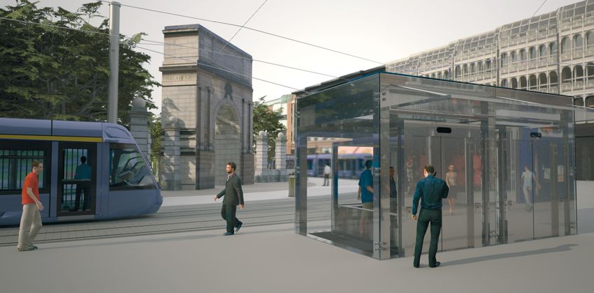
Non Technical
Summary
1.1   Introduction
1.2   EIS Study Team
1.3   Need and Objectives
1.4   Planning and Policy Context
1.5	Alternatives
1.6   Description of the Scheme
1.7	Consultation
1.8   Human Health
2.0   Environmental Topics
      (Baseline, Impacts and Mitigation Measures)
2.1   Introduction
2.2   Human Beings: Landuse
2.3   Human Beings: Socio-economics
2.4   Human Beings: Noise
2.5   Human Beings: Vibration
2.6   Human Beings: Radiation and Stray Current
2.7   Human Beings: Traffic
2.8   Flora and Fauna
2.9   Soil and Geology
2.10 Groundwater
2.11 Surface Water
2.12	Air and Climatic Factors
2.13 Landscape and Visual
2.14	Material Assets: Agronomy
2.15	Material Assets: Archaeology, Architectural Heritage
      and Cultural Heritage
2.16 	Material Assets: Non Agricultural Property
2.17 	Material Assets: Utilities
2.18 Interrelationships, Interactions and Cumulative Impacts
Non-Technical Summary
The Transport (Railway Infrastructure) Act of
2001 as amended by the Planning and Development
(Strategic Infrastructure) Act 2006, sets out the
process under which statutory authority for new
railway projects is to be granted. As part of this
application for a Railway Order it is necessary to
undertake an Environmental Impact Assessment of
a proposed scheme, prepared in accordance with
the legal provisions set out in the Transport (Railway
Infrastructure) Act of 2001, Section 39. The findings
of this report are then presented in an Environmental
Impact Statement and are summarised in this
Non-Technical Summary.
This EIS presents the results of the EIA undertaken
1.1 Introduction to inform the decision-making process. The
objectives of the EIS are summarised as follows:
In November 2005 the Government launched
Transport 21, a capital investment framework under - To identify the likely significant environmental
the National Development Plan developed to meet impacts of the proposed scheme during
Ireland’s current and evolving transportation needs. the construction and operational phases,
Under Transport 21, the Railway Procurement having regard to the characteristics of the
Agency (RPA) has been mandated by the local environment;
Government to deliver two new metro lines and
- To evaluate the magnitude and significance
seven new light rail lines. Metro North, linking
of likely impacts and to propose appropriate
Dublin city centre to Dublin Airport and the north
measures to mitigate potential adverse impacts.
of Swords, is a central part of Transport 21.
This document presents the Non-Technical
The Transport (Railway Infrastructure) Act of 2001
Summary (NTS) of the EIS that has been prepared as
as amended by the Planning and Development
part of the application for the Metro North Railway
(Strategic Infrastructure) Act 2006, sets out the
Order. Written in non-technical language, it presents
process under which authority for new railway
the key findings of the EIA of the construction and
projects is to be granted. As part of this application
operation of the proposed scheme. The complete EIS
for a Railway Order it is necessary to undertake
contains the detailed findings of the EIA and should
an Environmental Impact Assessment (EIA) of the
be referred to for the detailed findings.
proposed Metro North scheme (hereafter referred to
as the ’proposed scheme’), prepared in accordance
with the legal provisions set out in the Transport
1.2 EIS Study Team
(Railway Infrastructure) Act of 2001, Section 39.
The findings of this report are then presented in an Environmental Resources Management (Ireland)
Environmental Impact Statement (EIS). Ltd (‘ERM’) was commissioned by RPA as lead
consultant with overall responsibility for preparing
the EIA for the proposed scheme. A number of
specialists contributed to the preparation of the EIS.
A summary of all contributors is provided in Table 1.1.
Page Non-Technical Summary
Table 1.1 Environmental topics and contributors
Input Contributor
EIS management and compilation ERM and RPA
Human Health EHA Consulting Group
Human Beings: Landuse ERM
Human Beings: Socio-economics ERM
Human Beings: Noise ERM
Human Beings: Vibration Rupert Taylor F.I.O.A and ERM
Human Beings: Radiation and Stray Current ERM
Human Beings: Traffic MVA Consulting
Flora and Fauna ERM
Soil and Geology ERM and Jacobs Engineering Ireland Ltd.
Groundwater AWN Consulting
Surface Water AWN Consulting
Air and Climatic Factors ERM
Landscape and Visual ERM and Digitech
Material Assets: Agronomy Curtin Agricultural Consultants
Material Assets: Archaeology, Architectural Heritage CRDS Ltd.
and Cultural Heritage
Material Assets: Non Agricultural Property ERM and RPA
Material Assets: Utilities ERM and RPA
Interrelationships, Interactions ERM
and Cumulative Impacts
The proposed scheme will have significant reserve
1.3 Need and Objectives capacity to grow to meet Dublin’s long term
transport needs. When it opens, the metro will carry
The proposed scheme will connect the townland
approximately 80,000 passengers per day. This is
of Belinstown to Dublin’s city centre. The selected
forecast to increase significantly over time. The
route for the proposed scheme serves a number of
proposed scheme will have an ultimate capacity
key destinations including Dublin Airport, hospitals,
in excess of 40,000 passengers per hour (20,000
universities and retail centres as well as high
in each direction). This is beyond the capacity of
density residential and employment districts.
an on-street light rail system, but will easily be
The proposed scheme is a key element in the accommodated on metro, which can accommodate
creation of a fully integrated public transport longer light metro vehicles (LMVs) operating at a
network as envisaged in Transport 21. It will higher frequency. The Dublin Transportation Office
interchange with existing Luas Green Line services (DTO) supports proposals for a metro system as
at St. Stephen’s Green and Red Line services at it is anticipated that the demand for travel in the
O’Connell Street. It will also interchange with Greater Dublin Area will increase significantly in
the DART (Dublin Area Rapid Transit), and with the future.
suburban rail services at St. Stephen’s Green
With its dedicated track, the proposed scheme
(via the proposed rail interconnector) and at
will offer a frequent, fast and reliable service for
Drumcondra following the electrification of the
commuters. The journey time from Swords to the
Iarnród Éireann line. 2,600 Park & Ride spaces
city centre will be about 26 minutes, less than
will be provided at key locations along the route
half the time of the same journey by car at peak
so the proposed scheme will benefit people from
rush hour. As with Luas, metro passengers will not
far beyond its immediate catchment area. The
have to worry about timetables. From the start
proposed scheme will also interchange with local
peak time services will run every four minutes, and
and regional bus services, with bus interchange
more frequently as passenger numbers grow. The
facilities being provided at most metro stops.
proposed scheme is expected to carry some 35
million passengers a year once it is operational.
Page Dramatic growth is forecast for Dublin Airport.
Non-Technical Summary
Currently carrying over 20 million passengers each 1.4.2 Transport 21 (2005)
year, this is expected to grow to over 30 million by
Transport 21 was announced in November 2005
2015 - 2016 as detailed in the Inspectors’ Report
and details the Government’s capital investment
1, An Bord Pleanála, PL 06F (2007). The proposed
framework for rail infrastructure in the Greater
scheme offers a journey time of less than 20
Dublin Area.
minutes from the Airport to the city centre and
will become the preferred transport mode for Specific reference is made to Metro North and
many people travelling to and from Dublin Airport. Metro West and according to Transport 21 Metro
The Dublin Airport Masterplan (2006) states that North will begin at St. Stephen’s Green and
‘greatly enhanced public transport provision will potentially serve DCU, Ballymun and Dublin Airport
be paramount to the success and sustainability before terminating at Swords. The proposed
of Dublin Airport’. The Dublin Airport Authority scheme is an essential part of Transport 21 and
views the proposed scheme as a crucial means is in compliance with the scheme as envisaged
of enhancing the public transport provisions for in Transport 21.
Dublin Airport.
Park & Ride sites at strategic locations will 1.4.3 Section 49 Contributions
encourage car drivers from beyond the proposed
Both Dublin City Council and Fingal County Council
scheme catchment area to transfer to metro for a
have adopted a supplementary development
fast journey onwards to the city.
contribution scheme for Metro North under Section
The proposed scheme will not only be used by 49 of the Planning and Development Act 2000.
people living and working along the alignment, but The purpose of this contribution scheme is to
also those commuting from outlying towns who will facilitate contributions from developers of new
make use of it. The proposed scheme will be used developments (residential, retail and commercial)
by people from all regions of the country travelling which will benefit from the new infrastructure.
to Dublin Airport, since it will be connected with These contributions are made to the scheme
the two main intercity railway stations via the Luas developers (RPA via the relevant local authority) and
Red Line and the proposed Interconnector, and will help cover the cost of the proposed scheme.
provide a gateway to Ireland for tourists.
1.4.4 National Policy
1.4 Planning and Policy Context
1.4.4.1 Department of Transport
The proposed scheme conforms to the objectives
Statement of Strategy 2005 – 2007 (DoT)
of all the policies identified of local, regional and
national planning policy and to the objectives The overriding objective of the Department’s
of social and environmental policy documents strategy as embraced in the Mission Statement
pertaining to the area. The proposed scheme will is, ‘…to underpin Ireland’s economic growth
allow for greater sustainable development and and competitiveness and contribute to social
social inclusion through the provision of a safe development through the efficient and effective
and integrated transport system. These are delivery of an appropriately regulated sustainable,
outlined below. safe and integrated transport system’.
Specifically, the department seeks to increase
1.4.1 DTO Strategy – ‘A Platform for Change’ the number of people using public transport; to
increase the modal share of public transport; and
In October 2000 the Dublin Transportation Office
to adopt an integrated approach to public transport
(DTO) published ‘A Platform for Change - Outline
provision. The proposed scheme conforms to the
of an integrated transportation strategy for the
objectives of the Department and provides for
Greater Dublin Area - 2000 to 2016’. The strategy
an appropriately regulated sustainable, safe and
sets out a vision of an integrated multi-modal
integrated transport system.
transportation strategy for the Dublin area. The
strategy identifies a metro system as a key element
of the transport network. 1.4.4.2 National Spatial Strategy 2002-2020
The proposed scheme complies with the broad The National Spatial Strategy for Ireland
principles of the ‘Platform for Change’ document. (NSS) was published by the Department of the
The document envisages a link from Dublin City Environment and Local Government in 2002. The
Centre to Swords via Dublin Airport. However, this strategy is a twenty-year planning framework
link is different to the current proposed scheme designed to achieve a better balance of social,
alignment. The key difference is that the scheme economic, physical development and population
proposed in ‘A Platform For Change’ passes through growth between regions. With regard to public
the Finglas area of Dublin, whereas the proposed transportation in the Greater Dublin Area (GDA),
scheme passes through Ballymun and then to the the NSS states:
airport and Swords.
Page ‘The physical consolidation of Dublin, supported
Non-Technical Summary
by effective landuse policies for the urban area 1.4.4.5 National Climate Change Strategy
itself, is an essential requirement for a competitive 2007 – 2012 (2007)
Dublin. Consolidation is also required for the public
The National Climate Change Strategy (NCCS) 2007
transport to function effectively. In turn, investment
- 2012 was published by the Department of the
in public transport will assist in promoting a more
Environment, Heritage and Local Government in
efficient and competitive Greater Dublin Area’. The
2007 and follows on from the original NCCS, which
proposed scheme supports and facilitates the
was published by the Government in 2000. The
achievement of the goals of the NSS.
2007 NCCS outlines the measures by which Ireland
will meet its commitment to limit its greenhouse
1.4.4.3 National Development Plan gas emissions over the 2008 - 2012 period to 13%
2007 – 2013 (2007) above 1990 levels.
The National Development Plan (NDP) was published The NCCS recognises that one of the key ways
by the Irish Government in 2007. The plan sets out of reducing transport-based greenhouse gas
the economic, infrastructural and social investment emissions is encouraging a modal-shift away
priorities of the State. The priority of direct relevance from private car use and towards public transport
to Metro North is ‘Economic Infrastructure’. One of systems. The proposed scheme supports this
the key objectives under this priority is ‘to deliver a principle. The NCCS also supports the proposed
radically upgraded public transport system in line scheme indirectly in that it supports the broad
with the timetable in Transport 21, especially in the principles of Transport 21.
Greater Dublin Area (GDA)’.
The NDP notes that ‘over the Plan period 2007 1.4.4.6 General National Policy
- 2013, the specific projects will be advanced in
The following national policy documents have also
line with the timetable in Transport 21’ and the
been considered in the relevant chapters of the EIS:
projects that are listed include the ‘completion of
Metro North line from city centre to Swords via - Ten-Year Framework Social Partnership Draft
Dublin Airport’. The proposed scheme therefore Agreement 2006 – 2015 (2006);
fully complies with this policy document and is
- National Action Plan for Social Inclusion 2007-
supported by it.
2016: Building an Inclusive Society (2007);
- National Heritage Plan (2002);
1.4.4.4 Sustainable Development -
A Strategy for Ireland (1997) - National Biodiversity Plan (2002).
The sustainable development strategy for
Ireland was published by the Department of the 1.4.5 Regional Policy
Environment in 1997. The overall aim of the strategy
is to ensure that the economy and society in Ireland
1.4.5.1 Regional Planning Guidelines
can develop to their full potential within a well-
for the Greater Dublin Area, 2004-2016
protected environment without compromising the
quality of that environment and having regard for The Dublin Regional Authority and Mid-East
present and future generations as well as the wider Regional Authority published the Regional Planning
international community. Guidelines for the Greater Dublin Area 2004-2016
(RPGs) in July 2004.
This strategy sets out an agenda to render Irish
transport more environmentally acceptable The key objectives of the RPGs relate to
and to ‘improve public transport systems and consolidation of the urban centres located within
infrastructure with a view to increasing their the metropolitan area based on provision and
market share’. The strategy states that funding facilitation of an integrated public transport
for improvements in rolling stock, signalling and system. The RPGs also promote greater use
track network will further encourage commuters of sustainable transport modes through the
to switch from road to rail. integration of landuse and transport planning.
The proposed scheme supports the broad The proposed scheme facilitates the objectives of
principles of this policy document by encouraging the RPGs by the provision of an integrated public
modal shift to a more sustainable form of transport. transport service to provide better access to
public institutions and centres of employment and
encourages a modal shift to public transport.
Page Non-Technical Summary
1.4.5.2 Fingal County Development Plan 1.4.6 Local Policy and Local Plans
2005 – 2011 (2005)
Local policy, masterplans and area plans which
This plan sets out Fingal County Council’s policies specifically refer to the proposed scheme and that
and objectives for the development of the county have been considered in the design of the proposed
from 2005 to 2011. A number of specific policies scheme include:
in the plan relate to the proposed scheme. For
- Dublin Airport Masterplan (2006);
example; Policy TP12: will facilitate and promote
‘the development of a new and improved rail-based - North Ballymun Local Area Plan (2005);
transport system, including a metro link, from the
- General Local Policy;
city [Dublin] to Swords via the airport’. The Fingal
County Development Plan supports the broad - Dublin Airport Public Safety Zone Study, (ERM
principle of the proposed scheme and recognises on behalf of Department of Transport and the
the important role that it will play in supporting the Department of Environment, Heritage and Local
development of Fingal County. Government, 2005);
- Masterplan for the new Ballymun, (Ballymun
1.4.5.3 Dublin City Development Plan Regeneration Ltd. 1998 – 2004 - as amended).
2005-2011 (2005)
The Dublin City Development Plan 2005-2011
1.5 Alternatives
was adopted by Dublin City Council and came into
effect in March 2005. The overall vision for the city Section 39(1)(d) of the 2001 Act requires that an EIS
as outlined in the plan is to enhance the quality contains an outline of the main alternatives studied
of life and experience of the city for the residents, by the applicant and an indication of the main
workers, commuters and visitors and to consolidate reasons for its chosen option, taking into account
the urban form of the city. the environmental effects.
The development plan supports the measures
currently being implemented or proposed by the 1.5.1 System Concept
RPA. Specific reference is made to the support of
The proposed scheme has been planned as a
Dublin City Council for a ‘City Centre rail connection
metro similar to the metro networks found in
to Dublin International Airport with a preference
many European cities of similar size to Dublin. It
for stops at Dublin City University and Ballymun’.
is fully segregated along the busiest sections of
The proposed scheme complies with and supports
the route between the city centre and Swords and
the policies detailed in Dublin City Council’s
has a limited number of road crossings in the outer
Development Plan 2005 - 2011.
suburban areas north of Swords.
During the development of the proposed scheme
1.4.5.4 Other Regional Policy
prior to the announcement of Transport 21 a
The following regional policy documents have also number of fundamentally different system
been considered in the relevant chapters of the EIS: concepts were examined and rejected in favour of
the metro concept. These included a direct main-
- Strategy for Economic, Social and Cultural
line rail link to Dublin Airport, a pre-metro similar
Development of Fingal 2002-2011 (2002);
to Luas which would be upgraded over time, a fully
- Dublin – A City of Possibilities; Economic, automated metro and a magnetically levitated
Social and Cultural Strategy 2002-2012 (2002); system. These were rejected in favour of the metro
concept which best meets the project objectives.
- Fingal Heritage Plan 2005-2010 (2005);
- Dublin City Heritage Plan 2002-2006 (2002);
- Dublin City Biodiversity Action Plan
2007-2010 (2007).
Page Non-Technical Summary
1.5.2 Methodology for the Evaluation 1.5.4 Engineering and Architectural Design
of Alternatives
Following the selection of a preferred route,
The main alternatives considered for the proposed the engineering and architectural design stage
scheme were evaluated using a multi-criteria concerns itself with the identification and
analysis. RPA’s objectives with respect to the evaluation of detailed design options for individual
proposed scheme are: stops, and the associated track alignment between
stops, along the preferred route corridor.
- Compliance with transport and
landuse strategy; During this process of engineering and architectural
design, environmental assessment and
- Minimising environmental impacts including
consultation continued and more local alternatives
congestion and associated pollution problems;
were studied and evaluated to optimise the design
- Generating social and economic benefits; of the proposed scheme and mitigate potential
significant negative environmental effects.
- Delivering good quality transport integration;
The following categories of alternatives
- Optimising capital and operating costs;
were studied:
- Delivering a safe and operationally
- Proposed stop locations, access and design
efficient system;
including the proposed Metro West interchange;
- Achieving efficiency and minimising risk
- Detailed horizontal and vertical track alignment
during construction.
between stops;
It was considered that these were of a generally
- Location of crossovers and turn backs
equal importance and therefore all weighted equally.
between tracks;
- Location and design of Park & Ride car parks;
1.5.3 Route Selection
- Depot location and design.
The study of alternative route options generally
concerns itself with the identification and This iterative process has also been informed by the
evaluation of the broad route corridors and results of intensive public consultation. A summary
principal destinations that the proposed scheme of the alternatives studied at major locations is
will serve, rather than precise stop locations or given in the following sections.
track alignment. The main vertical alignment
alternatives: tunnel, viaduct or surface running, are
1.5.4.1 Depot
also considered at this stage.
The following depot location options were
Four main alternatives and two variants were
considered:
studied as part of route selection. The main
alternatives were the West Route (via Broadstone - Sillogue;
and Finglas), the Central Route (via Glasnevin and
- Dardistown;
Ballymun), the East Route (via Drumcondra and
Whitehall) and the Alternative Central Route, a - Fosterstown;
combination of the Central and East Routes (via
- Lissenhall;
Drumcondra and Ballymun). The East Route Variant
consisted of a deviation of the East Route to serve - Belinstown.
Kilmore (approximately 1km from Beaumont
It was determined that Sillogue was the least
Hospital) and the Marlborough Street Variant which
preferable depot location based on operational
proposed relocating the proposed stop on O’Connell
and environmental reasons. The Dardistown
Street to the plaza of the Department of Education
location performed well operationally, however
in Marlborough Street.
land costs and development plans at Dardistown
The Alternative Central Route scored strongly rendered this location unsuitable. The Fosterstown
against the other route options under almost location also performed well operationally however,
all assessment criteria including minimising there were many negatives with this site such as
environmental impacts. greenbelt designation, level changes and the need
for watercourse diversions. Various locations at
Lissenhall were eliminated as they occupied land
designated by Fingal County Council for the future
development of Swords. Belinstown was chosen
as the preferred location and during the study of
alternatives, the location of the depot was defined
to avoid potential impacts on archaeology and
optimise the operational efficiency of the depot.
Page Non-Technical Summary
1.5.4.2 Ballymun Vertical Alignment 1.5.4.3 DCU Stop
Various alternatives for the vertical alignment Four alternatives were considered for DCU Stop:
through Ballymun have been studied, including:
- Option 1: Open air stop on Ballymun Road;
- Elevated;
- Option 2: Underground stop on Ballymun Road;
- At-grade (on the surface);
- Option 3: Open air stop in Albert College Park;
- In retained open cut;
- Option 4: Underground stop in Albert College Park.
- In cut and cover tunnel;
Options 3 and 4 had significant environmental
- In bored tunnel. impacts including a permanent loss of amenity
and landscape at Albert College Park, and had
The elevated option has the benefit of a fully
significant visual impact for residents on Ballymun
segregated track alignment at an economic cost,
Road. Options 1 and 2 avoid the long-term
and minimises the long term traffic impacts along
environmental impacts on Albert College Park
Ballymun Road, but it has significant visual impacts
(through loss of habitat) and also have less visual
on properties close to the alignment, and its
impacts for residents on Ballymun Road, but have
approach ramps cause severance on Ballymun Road.
potential for long term noise associated with the
The at-grade option offers significant cost savings operation of the stop. This impact is less with
and greater accessibility to the proposed scheme Option 2 than with Option 1, so that Option 2 was
as the stops on this section of the alignment identified as the preferred option. The impacts are
would be on the surface. However, this option has further mitigated by moving the stop slightly south
long term negative impacts on traffic at the busy so that its northern entrance is further away from
Balbutcher Lane/Shangan Road junction and Albert College Court and its southern entrance is
consequent impacts on the reliability of the service located inside the grounds of a disused presbytery.
to be provided by the proposed scheme and the
tunnel portal ramps cause some severance on
1.5.4.4 Drumcondra to Griffith Avenue
Ballymun Road.
Tunnel Alignment
The retained open cut option also has the benefit of
A total of six alignment options were considered
a fully segregated track alignment at an economic
for the tunnels between Griffith Avenue and
cost, and minimising the long term traffic impacts
Drumcondra Stops.
along Ballymun Road, but its high protective
walls along either side of the open cut would have The preferred tunnel alignment was chosen as it
resulted in significant visual impacts and almost passes under the fewest number of properties, thus
totally severed the properties along each side of reducing the impacts of settlement and vibration
Ballymun Road. on properties during construction. It locates a
required emergency crossover under green fields
The cut and cover tunnel option has the benefit of
which minimises the risk of damage to overhead
a fully segregated track alignment and minimises
properties during its construction. It also follows an
the long term traffic impacts along Ballymun Road.
efficient alignment without significant curves and
It also eliminates any visual impacts and severance
it avoids severe impacts to St. Patrick’s Boys Senior
along Ballymun Road. The biggest disadvantage of
National School, Drumcondra Education Centre,
this option is the high level of disruption which will
St. Patrick’s College and Elmhurst Nursing Home
be caused by the construction of the cut and cover
and Convalescent Centre.
tunnel. Despite this, the cut and cover option was
supported overwhelmingly by local residents and
was also supported by Ballymun Regeneration Ltd. 1.5.4.5 Drumcondra Stop
The bored tunnel option has the advantage over a Five options for the stop at Drumcondra
cut and cover tunnel option of reducing construction were considered:
disruption. It has considerable disadvantages,
- Option 1: Mined Stop beneath Drumcondra Road;
particularly in relation to a significantly higher
construction cost and poorer accessibility as the - Option 2: Partial mined/cut-and-cover stop
stop is much deeper below ground. in land adjacent to St. Joseph’s Avenue;
For the above reasons, the cut and cover tunnel - Option 3: Cut-and-cover stop beneath
option was selected as the preferred option. Drumcondra Road;
- Option 4: Mined stop under St. Joseph’s Avenue;
- Option 5: Cut-and-cover stop in land adjacent to
St. Joseph’s Avenue.
Page Options 1, 2, 3 and 4 were eliminated due to
Non-Technical Summary
engineering, construction and traffic impacts. 1.6.2 Interchange and Connectivity
Option 5 was identified as the preferred option
The proposed scheme will interchange with the
as it avoids having a construction site located on
Luas Green Line at its current terminus at St.
a major traffic artery; it avoids major disruption
Stephen’s Green and with the Luas Red Line at
to utilities on Drumcondra Road and reduces the
Abbey Stop, which is adjacent to the O’Connell
overall construction period. Option 5 also permits
Bridge Stop. The route for the proposed Lucan
the construction of a new interchange between the
Luas line serving the west of the city is still to be
proposed scheme and the existing Drumcondra
determined but is expected to provide interchange
Rail Station, and offers a holding area for crowds
with the proposed scheme at either St. Stephen’s
from Croke Park. While this option requires the
Green or O’Connell Bridge Stops. Transport 21
demolition of a number of properties, including
also includes an orbital light rail line (Metro West)
St. Vincent’s Centre for the Deaf, the option was
running roughly parallel to the M50 from Tallaght in
only chosen following consultation with all affected
the south-west via Clondalkin and Blanchardstown
property owners.
to Dardistown. From here Metro West services
will continue, using the proposed scheme
1.5.4.6 Mater Stop infrastructure, to the Airport and Swords area to the
north or the city centre to the south. The proposed
A number of feasible design and location
scheme will also provide direct interchange with
alternatives were considered in relation to this stop:
the Maynooth rail line and the future DART network
- Option 1: Cut and cover stop under at Drumcondra and at the proposed interconnector
the Mater Hospital car park; station at St. Stephen’s Green.
- Option 2: Cut and cover stop to the west Interchange with bus and taxi will be facilitated
of Dorset Street; throughout the proposed scheme, with bus pull-in
bays and pick-up/drop-off facilities being designed
- Option 3: Mined stop under Dorset Street.
into all at grade stops. Park & Ride facilities are
Option 1 was identified as the preferred option as provided at three stops, (Belinstown, Fosterstown
it minimises construction risk and the potential and Dardistown) which give access to potential
for disruption. Due to the requirement to demolish users living beyond walking distance from public
twenty residential properties in the case of Option transport routes. Cycle facilities are provided at all
2 and the risks associated with mining a stop in stops (excluding the Airport Stop).
boulder clay in the case of Option 3, options 2 and 3
were eliminated.
1.6.3 Characterisation of the Seven Areas
of the Alignment
1.6 Description of the Scheme For ease of local identification, in this EIS the
proposed scheme alignment has been divided
into seven areas. These areas are numbered Area
1.6.1 General Description of the Proposed Scheme
MN101 to Area MN107. The environmental impact
Metro North is the next phase of Dublin’s integrated of the proposed scheme in each of these areas is
light rail network. The proposed scheme will serve set out in individual books numbered MN101 to
an 18km corridor from Belinstown in the north of MN107 and which collectively make up Volume 2 of
County Dublin to St. Stephen’s Green in the city this EIS. A description of the proposed scheme with
centre via Dublin Airport. Metro North is a metro reference to each of these seven areas is as follows:
system running under full signal control on a
segregated alignment between St. Stephen’s Green
1.6.3.1 Area MN101: Belinstown to Swords Stop
and Fosterstown Stops and running on a line of
sight basis, at grade, in underpasses or on elevated Area MN101 begins at Belinstown which is
sections between Fosterstown and Belinstown. located approximately 2km to the north of Swords,
Metro North will run in a mix of bored and cut adjacent to and directly west of the M1 motorway,
and cover tunnels beneath the city and beneath on land that is currently used for agriculture. The
Dublin Airport. maintenance depot, stabling facilities and a 110kV
substation serving the proposed scheme are to be
The forecast journey time between St. Stephen’s
located in this area. The northern terminus stop of
Green and the Airport is approximately 20 minutes
the proposed scheme, Belinstown, lies immediately
and from St. Stephen’s Green to Belinstown is
southwest of the depot. A Park & Ride facility with
approximately 30 minutes. The proposed scheme
2,000 parking spaces, designed as a multi-storey
has the capability to run with a minimum operating
car park, is planned adjacent to the stop.
time of two minutes between services (i.e. two
minute “headway”). The proposed scheme will
operate using 45m long LMVs coupled together to
form 90m trainsets.
The proposed scheme will be interoperable with the
Page 10
existing and proposed Luas and metro systems.From Belinstown, the alignment passes
Non-Technical Summary
southwards, across greenfield land at surface 1.6.3.2 Area MN102: Swords Stop
level, to a provisional stop at Lissenhall. This stop to Dublin Airport North Portal
is located in a greenfield site to the west of the
South of the Swords Stop, the alignment rises up
interchange between the M1 and R132 in an area of
onto an elevated section of track to cross over
potential development proposed by Fingal County
Pinnock Hill Roundabout and continues south to an
Council. The alignment continues southwards and
at grade stop at Fosterstown. This stop is located
crosses the Broad Meadow River and the Ward
north of the Airside retail park on the east side of
River and then runs at surface level along the
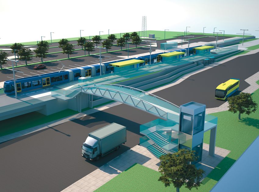
the R132. An at grade Park & Ride car park with 300
western verge of the R132 to a second provisional
spaces is to be provided to the east of this stop. The
stop at Estuary. The alignment then rises up onto
alignment then continues southwards along the
an elevated section of track which crosses over
east side of the R132 and then descends to cross
the Estuary Roundabout, travels along the median
under the R132 just south of the junction at Airside
of the R132 and over the Seatown Roundabout
and Boroimhe.
before descending to reach the next at grade
stop, at Seatown. The Seatown Stop is located in The alignment emerges from the underpass, passes
the central median of the R132. The Estuary and under a new accommodation bridge serving a local
Seatown Roundabouts are to be converted to signal business at Fosterstown, to rise to the surface
controlled junctions. and onto embankments through a greenfield area.
A turn back facility is provided in this area to the
After Seatown Stop, the alignment proceeds
north of the airport to allow some metro services
southwards on the surface along the central
to reverse at the airport in the future. A new
median of the R132 and then descends to pass
agricultural underpass is located beneath the turn
under the Malahide Roundabout. To the south of
back facility. The turn back facility marks the end
the roundabout, the alignment emerges from the
of Area MN102.
underpass and rises to the surface in the median
of the R132 to the Swords Stop which is located
opposite the Pavilions Shopping Centre. Initially,
access to this stop is by pedestrian crossings of the
R132. However, provision is made to allow this stop
to be accessed from a possible future east-west
bridge over the R132. Swords Stop marks the end
of Area MN101.
Fosterstown Stop
and Park & Ride
Page 11Non-Technical Summary
1.6.3.3 Area MN103: Dublin Airport 1.6.3.6 Area MN106: Albert College Park
to Mater Stop
The alignment enters two bored tunnels (one
for northbound metro services and one for The alignment continues in a cut and cover tunnel
southbound) to the north of Dublin Airport. A across Albert College Park, entering twin bored
tunnel portal and ventilation building is located in tunnels near the southern boundary of the Park.
this area. The alignment traverses the airport in a The alignment remains underground in bored
southerly direction passing under the Airport South tunnel until its termination at St. Stephen’s Green.
Perimeter Road (Collinstown Lane) which marks the
Continuing south in bored tunnel from Albert
end of Area MN103. An underground stop, Airport,
College Park, the next stop is Griffith Avenue.
is located on this tunnelled section close to the
This stop is located in the southwest corner of
existing airport terminal and the second terminal
the agricultural lands on the north side of Griffith
currently under construction on the site of the
Avenue. Proceeding in a south-easterly direction,
proposed airport Ground Transportation Centre.
the alignment continues in tunnel under St. Patrick’s
College playing fields. An emergency access and
1.6.3.4 Area MN104: Dublin Airport ventilation shaft is located in the southwest corner
South Portal to Santry Avenue of the college playing fields. The alignment continues
in tunnel under the Tolka River to Drumcondra Stop.
South of the airport perimeter road, the alignment
This stop is located to the west of Lower Drumcondra
emerges from tunnel and rises to surface level. A
Road and adjacent to St. Joseph’s Avenue. An
tunnel portal and ventilation building is located in
interchange with Iarnród Éireann’s suburban rail
this area. The alignment then turns south-west to
services to Maynooth is provided at this stop. The
cross agricultural lands between Dublin Airport and
alignment turns in a south-westerly direction
the M50 motorway. Dardistown Stop is located in
passing under a second mainline railway and the
this area on a greenfield site to the north of the M50.
Royal Canal, to the Mater Stop, located under the
An at grade Park & Ride facility with 300 parking
Mater Hospital’s existing surface car park. Area
spaces is proposed for this location, to the north
MN106 ends 100m further south where the tunnels
of the stop. Space provision is made at this stop
pass under St. Joseph’s Parade.
for a future operational link to the proposed Metro
West line. A 110kV substation is to be located in this
area. Continuing south, the alignment crosses the 1.6.3.7 Area MN107: Mater Stop
M50, associated slip roads, and Old Ballymun Road to St. Stephen’s Green
on bridges. South of these bridges the alignment
On leaving the Mater Hospital the alignment turns
passes over the culverted Santry River, and proceeds
south easterly under the Dorset Street/North
south descending to surface level at the next stop,
Frederick Street junction and on to Parnell Square
Northwood, which is an at grade stop located near
East where a cut and cover stop, Parnell Square,
Santry Lodge, south of the M50.
will be constructed. To the south of Parnell Square,
South of Northwood Stop, the alignment descends the alignment proceeds in tunnel under O’Connell
into a cut and cover tunnel along the median of the Street to O’Connell Bridge Stop. This stop is located
R108 (Ballymun Road). This tunnel passes under under the River Liffey and access to this stop is
Santry Avenue, and is the boundary between the provided to the north and the south of O’Connell
Fingal County Council and Dublin City Council Bridge. Entrances to the north of the River Liffey will
administration areas. facilitate interchange with the Luas Red Line. From
O’Connell Bridge the alignment proceeds beneath
Westmoreland Street and College Green and under
1.6.3.5 Area MN105: Santry Avenue
buildings between Clarendon Street and Grafton
to Albert College Park
Street. The terminus stop, St. Stephen’s Green,
The alignment continues southwards in a cut and is located in the north west corner of the Green.
cover tunnel beneath Ballymun Road, to a shallow Entrances to this stop are outside the Green on
underground stop at Ballymun, adjacent to the St. Stephen’s Green North and St. Stephen’s Green
new civic plaza. Continuing south in a cut and West. This stop will permit interchange with the
cover tunnel along the Ballymun Road, crossing Luas Green Line services and the proposed Iarnród
under Collins Avenue, the next stop is Dublin City Éireann Interconnector. Turn back of LMVs is via a
University (DCU). This is a shallow underground stop tunnel loop under St. Stephen’s Green.
on the east side of Ballymun Road beside Albert
College housing estate. Area MN105 ends at the
DCU access road, just south of the DCU Stop.
Page 12Non-Technical Summary
1.6.4 Characterisation of the Proposed Scheme 1.6.4.5 Depot
The depot at Belinstown includes the headquarters
1.6.4.1 Stop Locations and administration building and associated
facilities, the LMVs maintenance and stabling
A total of 17 new stops are planned as part of the
facilities and the infrastructure maintenance facility.
proposed scheme, nine underground and eight at
grade. Two of the at grade stops, at Estuary and
Lissenhall, are provisional stops to be provided 1.6.4.6 Vehicles
at a later date with minimum disruption to
The LMVs are bi-directional, 2.4m wide and
services and systems.
approximately 45m long, and will operate in a
set of two coupled vehicles. Seats for about 80
1.6.4.2 Tunnels passengers, baggage storage and other designated
facilities for the mobility impaired will be provided.
The proposed scheme will run in tunnel from St.
The drivers’ cabs are air conditioned and the
Stephen’s Green to south of Northwood Stop, a
passenger saloons are equipped with a heating and
distance of approximately 8km. The proposed
ventilation system.
scheme also runs in tunnel beneath Dublin Airport
for a distance of approximately 2km. In addition A fleet of 86 LMVs is required to operate services at
there is a tunnel loop beneath St. Stephen’s Green, a frequency of two minutes. The proposed scheme
to allow LMVs to turn around. will initially operate services at a frequency of four
minutes during the peak hour which requires a fleet
of 44 metro vehicles.
1.6.4.3 Intervention and Ventilation Shafts
An intervention and ventilation shaft is required
1.6.4.7 Park & Ride Facilities
where the distance between stops or between a
stop and the tunnel portal exceeds 1km. The shaft Three Park & Ride facilities are provided as part
provides a safe means of escape to the surface and of the proposed scheme:
access for the emergency services in the event of
- A 2,000 space multi-storey car park
an emergency. It also allows smoke to be ventilated
at Belinstown Stop;
from the tunnels in the event of a fire. A ventilation
and intervention shaft is provided between the - A 300 space surface car park
stops at Drumcondra and Griffith Avenue at at Fosterstown Stop;
St. Patrick’s College. Ventilation shafts are also
- A 300 space surface car park at Dardistown Stop.
provided at each stop.
1.6.5 Operating Characteristics
1.6.4.4 Structures
The proposed scheme is designed to be capable
The proposed scheme includes a number of
of operating services at a maximum frequency
permanent and temporary structures, the most
of two minute headways in each direction. At
significant of which are:
opening, services will run at a frequency of four
- Lissenhall Bridge to cross the minutes. Services will be increased over time to
Broad Meadow River; meet growing demand. Services will generally
operate between 5.00 am and 1.00 am on weekdays
- Ward River and Balheary Bridges
with late night services operating on Fridays and
to cross the Ward River;
Saturdays. Service hours will be shorter on Sundays
- Estuary Viaduct to cross over the Estuary and bank holidays. All services will stop at every
and Seatown Roundabouts (R132); stop on the route.
- Various footbridges along the R132;
1.6.6 Construction of the Proposed Scheme
- Various underpasses along the R132;
All construction work in connection with the
- Pinnock Hill Viaduct to carry the proposed
proposed scheme will be carried out in accordance
scheme over the Pinnock Hill Roundabout (R132);
with relevant health and safety legislation and
- M50 Bridge; best practice.
- Marlborough Street Temporary Bridge to provide
an alternative route across the River Liffey
during construction.
Page 13Construction compounds will be established for
Non-Technical Summary
the storage of materials, plant and equipment and 1.7 Consultation
for site offices. 25 compounds are proposed along
RPA has consulted widely with the public in relation
the route. The location of the major construction
to the proposed scheme, including consulting with
compounds are:
residents, residents’ associations, businesses,
- Belinstown Depot; business representative bodies and elected
representatives. Stakeholder statutory bodies,
- Balheary Demesne to facilitate construction of
bodies with environmental responsibility and
the depot access road, Estuary Viaduct, and the
interest and other interested parties were also
Broad Meadow and Ward River bridges;
consulted in relation to the proposed scheme.
- Pinnock Hill to facilitate construction of the Consultation started in 2006 before the Railway
viaduct and Fosterstown Stop including Order design started and focused on the following
Park & Ride and footbridge; topics during the design process:
- Fosterstown to facilitate construction of the - Alternatives: This focused initially on route
Fosterstown underpass, accommodation bridge corridor options and then progressed to include
and associated earthworks; stop locations, detailed tunnel alignment, and
associated infrastructure designs and locations.
- North and south of the Airport to facilitate
construction of the Airport tunnel and portals; - Scoping: The EIS scoping exercise represented
the beginning of the EIA process for the
- Metropark to facilitate the construction
emerging preferred route corridor. The purpose
of Dardistown Stop and Park & Ride and
of the scoping exercise was to establish
the M50 bridge;
the scope and methodology for the EIS and
- Northwood to facilitate the construction of the to provide the public and relevant bodies
M50 bridge, Northwood Stop and associated with environmental responsibility and other
earthworks, and the northern end of the interested parties with information on the
Ballymun cut and cover tunnel; proposed scheme and to invite their input to
the EIA process.
- Albert College Park to facilitate the construction
of DCU Stop, the cut and cover tunnel and the - Impacts and mitigation: Where the potential
bored tunnels from Albert College Park to St. for significant effects was identified, detailed
Stephen’s Green; consultation with key stakeholders was
undertaken in order to minimise the effects.
- Compounds to facilitate construction of each
of the underground stops Griffith Avenue, - Consultation evolved with the project design
Drumcondra, Mater, Parnell Square and and environmental assessment from general
O’Connell Bridge; topics to more specific topics. Various
approaches were used to facilitate consultation
- St. Stephen’s Green to facilitate the construction
on the project. These included:
of St. Stephen’s Green Stop and to extract the
tunnel boring machines. - Newsletters direct to peoples’ homes
including free post comment cards;
1.6.6.1 Construction Activities and Phasing - Open days in local civic centres, community
halls and hotels;
Construction works are expected to start at the
same time at various locations along the route, - Meetings with residents’ associations,
including all stop locations. Duration is expected businesses, schools, sporting clubs and
to take up to 60 months. The first phase of other groups;
construction involves the diversion of utilities and
- Public meetings;
other advance works including archaeological
excavations, temporary removal of statues and - Direct correspondence and meetings with
other heritage items, junction reconfigurations to individual residents;
facilitate traffic management and the installation
- Detailed discussions and workshops
of the temporary bridge over the River Liffey
with stakeholders;
at Marlborough Street. Following these works,
construction of the stops, tunnels, structures and - Written correspondence including letters,
track is completed. Throughout the construction emails and faxes;
phase, monitoring will be carried out e.g. for noise,
- Presentations and detailed discussions with
vibration and air quality.
local public representatives;
- RPA website, including maps, drawings,
newsletters, responses to frequently asked
questions (FAQs), and an e-mail address to
facilitate questions and information requests.
Page 14A summary of some of the issues raised to date
Non-Technical Summary
during consultation are outlined below and are 1.8.1 Baseline
dealt with in the EIS. Concerns were raised in
The World Health Organisation (WHO) defines
relation to the following:
health as complete physical, psychological and
- the impact of the proposed scheme social well being and not simply in terms of absence
on local businesses; of disease or infirmity. There are clear great
social and environmental positives from having
- the potential for negative health effects
an operational, efficient public transport system
during construction;
serving a large proportion of the Dublin population.
- the potential for negative effects on These benefits will undoubtedly have positive
existing utilities and the navigation system impacts on human health.
at Dublin Airport;
There is remarkably little in the medical literature
- nuisance and disturbance associated overall about the human health effect of railway
with noise and vibration and air quality; lines. Most information that is available about
transport noise indicates rail travel causes fewer
- visual intrusion;
human health problems in comparison to other
- the impact of the proposed scheme transport modes.
on ecology - flora and fauna;
- the potential to pollute surface water 1.8.2 Mitigation Measures and
and groundwater; Residual Impacts During Construction
- traffic disruption; There are very limited effects of night time
noise on sleep or day time noise on educational
- impacts on buses, pedestrians and cyclists;
establishments identified in the EIS during the
- the potential negative effects on property; construction phase of the proposed scheme.
Given the defined time period of these no adverse
- the potential for negative effects on
Human Health impacts are predicted.
St. Stephen’s Green.
Short term effects from vibration and ground
borne noise are predicted on residential, health
1.8 Human Health care, educational and other properties during
the construction phase. Given the relatively short
As part of the consultation process, feedback
duration of these works however no detrimental
from the general public included concerns
health effects on human health are predicted.
regarding human health. As a result, a human
health assessment has been undertaken of the No adverse effect on human health is predicted
proposed scheme. from changes in radon levels as local geology
makes a detrimental change in radon levels
unlikely. In the event that it would occur it will
be detected by monitoring being carried out in
the construction phase. If necessary, mitigation
measures will be put in place.
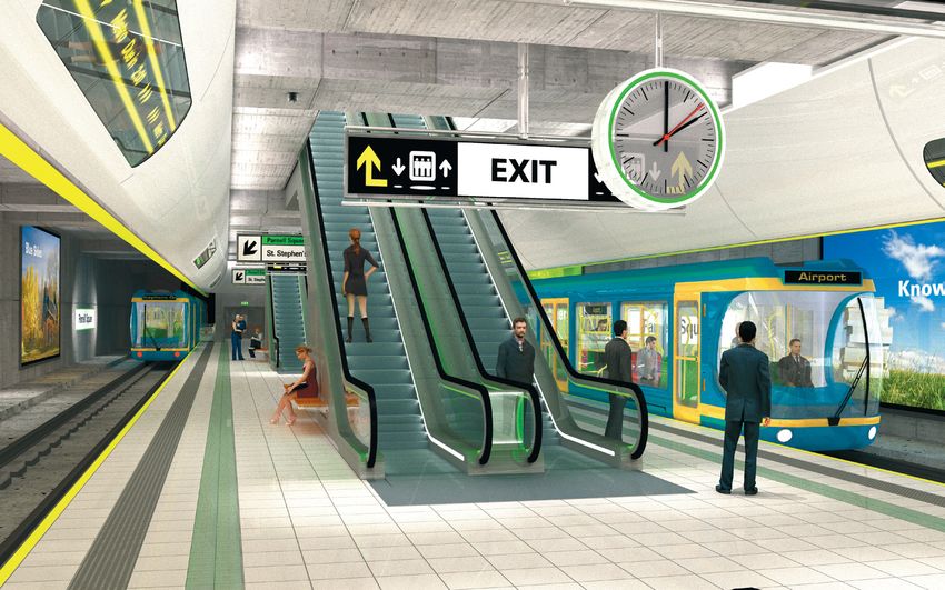
Parnell Square
Stop (platform
level)
Page 15No detrimental human health effects from No significant impact on human health from
Non-Technical Summary
radiation are predicted in the construction phase increased incidents of Leptospirosis is predicted for
of the proposed scheme. the operational phase of the proposed scheme.
As the measures proposed in the National There are potentially great benefits for society,
Guidelines for the Prevention of Nosocomial including therefore general health and well being
Invasive Aspergillosis During Construction/ benefits, with the development of the proposed
Renovation Activities will be followed there is scheme, particularly for people living along the route.
no significant risk of a detrimental effect from
Aspergillus during the construction phase.
2.0 Environmental Topics (baseline,
No significant impact on human health from
impacts and mitigation measures)
increased incidents of Leptospirosis is predicted for
the construction phase of the proposed scheme.
2.1 Introduction
No significant impacts on human health from
changes in groundwater or surface water The objectives of the Environmental Impact
are predicted for the construction phases Assessment include:
of the proposed scheme.
- Identification of the likely significant
No significant impacts on human health from environmental impacts of the proposed
changes in traffic are predicted for the construction scheme during the construction and
phases of the proposed scheme. operational phases, having regard to the
characteristics of the local environment;
No significant impacts on human health from
dusts are predicted for the construction phases - Evaluation of the magnitude and significance
of the proposed scheme. of the impacts and proposal of appropriate
measures to mitigate adverse impacts.
Current evidence suggests that uncovering
unlicensed landfill sites during the construction The impacts related to the proposed scheme are
phase is not likely. In the event of a landfill being summarised under the following environmental
exposed, its removal or other management will be topics. Both the construction and operational
as advised by the Environmental Protection Agency impacts are described.
and no residual health impacts are predicted.
- Human Beings: Landuse;
- Human Beings: Socio-economics;
1.8.3 Mitigation Measures and
Residual Operational Impacts - Human Beings: Noise;
Once mitigation measures described in the Noise - Human Beings: Vibration;
chapter are in place no ongoing adverse noise
- Human Beings: Radiation and Stray Current;
human health effects are predicted during the
operational phase. - Human Beings: Traffic;
No adverse effects on human health from vibration - Flora and Fauna;
or ground borne noise are predicted during the
- Soil and Geology;
operational phase.
- Groundwater;
No adverse human health impact is predicted from
radon as any changes in radon levels, although - Surface Water;
unlikely, will be identified in the construction phase
- Air and Climatic Factors;
and mitigated if necessary.
- Landscape and Visual;
Given the relatively low voltages and currents used
in the proposed scheme no detrimental human - Material Assets: Agronomy;
health effects from radiation are predicted in the
- Material Assets: Archaeology, Architectural
operational phase of the proposed scheme.
Heritage and Cultural Heritage;
While suicides and attempted suicides are an
- Material Assets: Non Agricultural Property;
issue for railways worldwide there is no evidence
that the presence of a railway increases the - Material Assets: Utilities;
incidence of suicide in any way. Therefore no
- Interrelationships, Interactions
significant change in suicide rate is predicted
and Cumulative Impacts.
during the operational phase.
The overall impact of the proposed scheme in
the operational phase on psychosocial health is
considered to be beneficial.
Page 16You can also read