Environmental Impact Statement - Non-Technical Summary - European Investment Bank
←
→
Page content transcription
If your browser does not render page correctly, please read the page content below
Luas Broombridge
          Broombridge                              St. Stephen’s Green to Broombridge
                                                   (Line BXD)

                                                   Environmental
                                                   Impact
                              Cabra
                                                   Statement
                                                   Non-Technical Summary
                        Phibsborough

                            Grangegorman

                                           Broadstone - DIT                      Parnell

                                                              Dominick
                                                                               O’Connell
                                                                                Upper

                                                                                                  Marlborough

                                                                           O’Connell - GPO

                                                                                 Westmoreland

                                                                                                Trinity

                                                                                                   Dawson

                                                                     St. Stephen’s Green

NTS Cover.indd 2                                                                                                10/06/2010 16:15
NTS Cover.indd 1 10/06/2010 16:15
CONTENTS

CONTENTS
 1   Introduction                                                                           3

 2   Luas Broombridge Impacts                                                               23

 3   Interrelationships, Interactions and Cumulative Impacts                                41

                                                   Environmental Impact Statement Luas Broombridge   1
1        INTRODUCTION
                                                    1.1      Introduction....................................................................5
                                                    1.2      Availability of this EIS....................................................5
                                                    1.3      Note on stage of design................................................5
                                                    1.4      Introduction to the proposed scheme..........................5
                                                    1.5      EIS study team...............................................................6
                                                    1.6      Need and Objectives......................................................6
                                                    1.7   Planning and Policy Context.........................................7
Broombridge
                                                    1.7.1 Dublin Transportation Office (DTO) Strategy –
                                                          “A Platform for Change”...................................................7
                                                    1.7.2 Transport 21 (2005).........................................................7
                                                    1.7.3 National policy..................................................................7
                                                    1.7.4 National policy – general..................................................8
                                                    1.7.5 Regional policy.................................................................9
                                                    1.7.6 Local policy and plans......................................................9
                                                    1.8      Alternatives.....................................................................9
                                                    1.8.1    Evaluation of alternatives.................................................9
                                                    1.8.2    System concept..............................................................10
                    Cabra                           1.8.3    Route corridor................................................................10
                                                    1.8.4    Luas Line BX route corridor alternatives........................10
                                                    1.8.5    Luas Line D route corridor alternatives..........................14
                                                    1.8.6    PRC................................................................................15
                                                    1.8.7    PRC design alternatives.................................................15
              Phibsborough                          1.9      Description of the scheme..........................................15
                                                    1.9.1    General description of the proposed scheme................15
                                                    1.9.2    Interchange and connectivity.........................................15
                  Grangegorman                      1.9.3    Characterisation of the two areas of the alignment........16
                                                    1.9.4    Characterisation of the proposed scheme.....................17
                                                    1.9.5    Operating characteristics...............................................19
                                                    1.9.6    Construction of the proposed scheme...........................19
                                                    1.9.7    Construction activities and phasing................................19
                                                    1.10     Consultation.................................................................20
                                 Broadstone - DIT                                Parnell
                                                    1.11     Human Health...............................................................21

                                                              Dominick
                                                                               O’Connell
                                                                                Upper
                                                                                                   Marlborough

                                                                           O’Connell - GPO

                                                                                  Westmoreland

                                                                                                  Trinity

                                                                                                      Dawson

                                                                     St. Stephen’s Green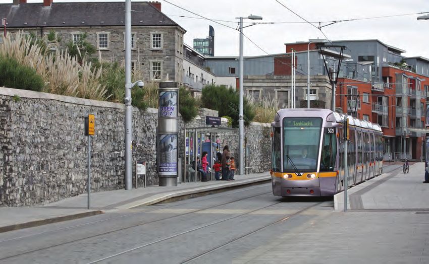
INTRODUCTION

    Photo 1.1 GPO on O’Connell Street

    Photo 1.2 College Green

4   Environmental Impact Statement Luas Broombridge
INTRODUCTION

1.1 INTRODUCTION                                          Copies of this EIS including the NTS may be
Luas Broombridge is the next phase of Dublin’s            purchased by any member of the public during normal
integrated light rail network. The proposed scheme        office hours at the following location:
will serve a 5.6km long corridor from the Luas Green
Line at its current terminus (St. Stephen’s Green West)   Railway Procurement Agency (RPA)
to the Iarnród Éireann Broombridge Station on the         Parkgate Business Centre
Maynooth railway line.                                    Parkgate Street
                                                          Dublin 8
The Environmental Impact Statement (EIS) for Luas
Broombridge is being published as five separate books     The EIS may be purchased as a complete document
and a Non-Technical Summary (NTS) as follows:             for the sum of €145.00.

Book 1 Introduction and Baseline Environment              The EIS can also be purchased as individual books:
■■ General introductory chapters of the EIS including a
   section describing the methodology used, the nature    ■■ Copies of Book 1 may be purchased for €50.00 each
   of the development, the means by which alternatives
   were considered, and an assessment of potential        ■■ Copies of Book 2 may be purchased for €20.00 each
   impacts on human health (Chapters 1–10)
                                                          ■■ Copies of Book 3 may be purchased for €20.00 each
■■ Description of the baseline environment for the
   proposed scheme with respect to all environmental      ■■ Copies of Book 4 may be purchased for €30.00 each
   topics (Chapters 11–26)
                                                          ■■ Copies of Book 5 may be purchased for €20.00 each
■■ A list of abbreviations and a glossary of terms
                                                          ■■ Copies of the NTS may be purchased at the above
Books 2 and 3 Impact Assessment                              location for €5.00 each.
Books 2 and 3 contain the impact assessments
with respect to all environmental topics (Chapters        A DVD version of the whole EIS may be purchased for
1–18). For the purposes of this EIS and for ease of       €15.00. This includes Books 1–5 and the NTS.
local identification and interest, the 5.6km proposed
scheme has been divided into two areas: Area 29 and       1.3 NOTE ON STAGE OF DESIGN
Area 30. Book 2 contains the impact assessment for        This EIS is based on the RO design as set out in the
Area 29 and Book 3 covers Area 30.                        drawings which accompany the RO application. All
                                                          proposed mitigation measures described in this EIS
Book 4 Maps                                               and shown on drawings are also based on this design.
Book 4 contains all baseline and impact assessment        Deviations from this design may occur provided these
maps of this EIS relating to the chapters in Books 1–3.   have no significant adverse environmental effect in
                                                          order to facilitate on-site construction or maintenance
Book 5 Annexes                                            and to allow a limited degree of flexibility to react to
Book 5 contains all baseline and impact assessment        on-site circumstances which are unforeseeable at this
annexes of this EIS. These provide additional and         stage. The deviations contained in the draft RO are as
supporting information to the chapters in Books 1–3.      follows: lateral deviations of up to 2.5m are permitted
                                                          where the works are situated in a public road, and 5m
Non-Technical Summary (NTS)                               elsewhere; vertical deviations of up to 1m upwards or
The NTS has been prepared as part of the Luas             downwards where the works are situated in a public
Broombridge Railway Order (RO) application. Written       road and up to 2m upwards or downwards elsewhere;
in non-technical language, it presents the key findings   and longitudinal deviations up to 20m.
in respect of the construction and operation of the
Luas Broombridge scheme. The detail in relation to all    1.4 INTRODUCTION TO THE PROPOSED
of the topics outlined in this book is presented in the   SCHEME
main EIS, Books 1–5 inclusive.                            In November 2005 the Government launched
                                                          Transport 21, a capital investment framework under
1.2 AVAILABILITY OF THIS EIS                              the National Development Plan (NDP) designed to
This EIS is available to download for free through        meet Ireland’s current and evolving transportation
the Railway Procurement Agency (RPA) website at           needs. Under Transport 21, RPA has been mandated
www.dublinluasbroombridge.ie                              to deliver two new metro lines and seven new light rail

                                                           Environmental Impact Statement Luas Broombridge           5
INTRODUCTION

    lines. Transport 21 specifically proposes the extension   The principal objectives of the EIS are summarised as
    of the Luas Green Line through the city centre, termed    follows:
    BX, and onwards to Broombridge (Liffey Junction) to
    interchange with suburban rail line services. En route,   ■■ To identify the likely significant environmental
    the cross city penetration of the Luas Line would            impacts of the proposed scheme during the
    serve Broadstone and the planned Dublin Institute            construction and operational phases, having regard
    of Technology (DIT) campus at Grangegorman.                  to the characteristics of the local environment
    This latter segment is referred to as Luas Line D.
    Luas Line BX and D are together referred to as Luas       ■■ To evaluate the magnitude and significance of likely
    Broombridge in this EIS.                                     impacts and to propose appropriate measures to
                                                                 mitigate potential adverse impacts
    The Transport (Railway Infrastructure) Act, 2001, as
    amended, hereafter referred to as the 2001 Act, sets      1.5 EIS STUDY TEAM
    out the process under which statutory authority for       This EIS was prepared by RPA which was
    new railway projects is to be granted. A RO is the        responsible for the overall assessments management
    statutory authority required under the 2001 Act to        and co-ordination as well as for the specific topics
    construct, operate and maintain a light railway. As       of Human Beings: Landuse, Human Beings:
    part of this application for a RO it is necessary to      Socio-economics, Material Assets: Property and
    undertake an Enviromental Impact Assessment (EIA)         Material Assets: Utilities. Other members of the study
    of the proposed Luas Broombridge scheme (hereafter        team are identified in Table 1.1.
    referred to as the “proposed scheme”). The findings of
    the process taken to inform the EIA are then presented    1.6 NEED AND OBJECTIVES
    in an EIS, prepared in accordance with Section 39 of      The selected route for the proposed scheme will serve
    the 2001 Act and submitted with the RO application.       a number of key destinations within Dublin city centre
                                                              and beyond. By achieving greater access into the city

    Table 1.1 EIS study team

                            INPUT                                              CONTRIBUTOR

                         Human Health                                        EHA Consulting Group
                    Human Beings: Landuse
                                                                     RPA and Simon Clear and Associates
               Human Beings: Socio-economics
                     Human Beings: Noise
                   Human Beings: Vibration                                         ACCONuk
                    Air and Climatic Factors
          Human Beings: Radiation and Stray Current                     Compliance Engineering Ireland
                     Human Beings: Traffic                                          AECOM
                        Flora and Fauna                                              Natura
               Soil and Geology (including waste)
                          Groundwater                                     Fehily Timoney & Company
                         Surface Water
                                                              Mitchell & Associates and Modelworks Architectural
                     Landscape and Visual
                                                                                 Presentation
      Material Assets: Archaeology and Cultural Heritage                Headland Archaeology (Ireland)
                                                                  David Slattery Architects & Historic Buildings
             Material Assets: Architectural Heritage
                                                                                  Consultants
                   Material Assets: Property                                          RPA
                    Material Assets: Utilities                                        RPA

6   Environmental Impact Statement Luas Broombridge
INTRODUCTION

centre area, the proposed scheme will offer increased       With the full build-out of Transport 21 public transport
accessibility to places of employment, education, and       projects, an additional 12.7 million passenger
retail centres as well as cultural and historic quarters.   boardings are added to the Luas network when the
                                                            proposed scheme is implemented. On this basis
The proposed scheme is a key element in the                 alone, the need for the proposed scheme is significant
development of a fully integrated public transport          in the context of an expanding public transport
network as envisaged in Transport 21 which aims to          network for Dublin.
increase accessibility, ensure sustainability, expand
capacity, increase use and enhance the quality of           The proposed scheme presents an opportunity to
public transport.                                           radically enhance the urban realm of Dublin city centre
                                                            through attractive and sympathetic integration into
The proposed scheme will offer interchange between          the streetscape and a reallocation of road space with
the existing Luas Red and Green Lines and also the          greater emphasis on sustainable modes of transport.
proposed Metro North line at a number of locations:
St. Stephen’s Green, O’Connell Street, Westmoreland         1.7 PLANNING AND POLICY CONTEXT
Street and in the vicinity of Parnell Square. The           The proposed scheme accords with the objectives of
proposed scheme will interchange with the Iarnród           all local, regional and national planning policy and to
Éireann Maynooth railway line at the existing suburban      the goals of social and environmental policy pertaining
railway station at Broombridge and the future               to the area as outlined in the following sections. It will
Iarnród Éireann Dublin Area Rapid Transit (DART)            allow for greater sustainable development and social
Underground at St. Stephen’s Green. Furthermore,            inclusion through the provision of an environmentally
the proposed scheme represents a platform for a             friendly and integrated public transport system.
future extension to Finglas and interchange with
Metro West, the proposed orbital route linking Metro        1.7.1 Dublin Transportation Office (DTO) Strategy –
North at Dardistown with Tallaght Town Centre, via          “A Platform for Change”
Blanchardstown, Liffey Valley and Clondalkin.               In November 2001 the DTO published “A Platform for
                                                            Change – Final Report – An integrated transportation
At present there is a considerable demand for cross         strategy for the Greater Dublin Area 2000–2016”.
city trips which is not adequately catered for by the       The strategy sets out a vision of an integrated multi-
existing public transport provision within the city         modal transportation strategy for the Dublin area
centre. For example, a passenger wishing to complete        and identifies a Luas system as a key element of the
a cross city trip on the Luas Red or Green Line has         transport network.
to transfer between modes to complete this journey.
In January 2005, RPA conducted an attitudinal               The strategy sets out proposals for a Luas and metro
survey of Luas passengers using the Luas Red and            networks and includes a metro link from Dublin city
Green Lines. The results of this survey indicated that      centre to Dublin Airport via the disused Broadstone
there was strong support for the cross city extension       rail alignment. The strategy envisaged “a new
of Luas. Further surveys carried out in 2009 also           North–South Luas Line from Ballymun via Whitehall,
indicated that there is a demand for services which         city centre, Harold’s Cross, Terenure and
further penetrate the city centre. Demand modelling         Rathfarnham to Dundrum”.
undertaken as part of the scheme assessment
indicates that the introduction of the proposed scheme      The proposed scheme accords with the overall
alone will add 10 million passenger boardings per           objectives of “A Platform for Change”.
annum to the Luas network.
                                                            1.7.2 Transport 21 (2005)
In the absence of the proposed scheme, the city’s           Transport 21 was announced in November 2005 and
Luas system will not achieve its ultimate potential and     details the Government’s capital investment framework
all of the opportunities that would be afforded through     for rail infrastructure in the Greater Dublin Area (GDA).
transport integration will not be realised. Furthermore,
the extension of Luas services to a wider catchment         The proposed scheme is an essential part of and is
will provide much needed accessibility, particularly        fully compliant with Transport 21.
for areas of the northwest city and the communities
of Cabra and Phibsborough, and will assist in the           1.7.3 National policy
regeneration of Dominick Street, Parnell Street and         The proposed scheme also conforms to the objectives
Marlborough Street.                                         of the following national strategies, plans and
                                                            agreements:

                                                             Environmental Impact Statement Luas Broombridge             7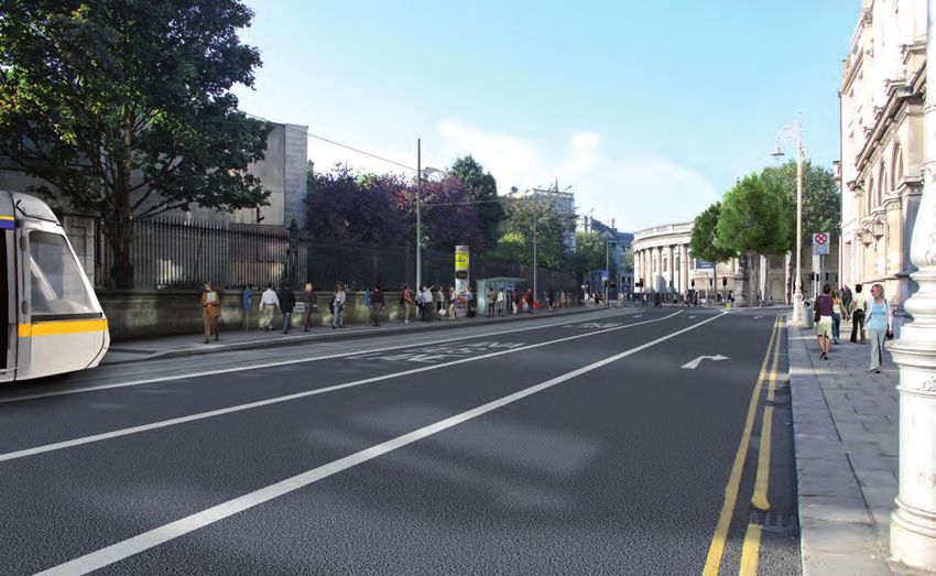
INTRODUCTION

    ■■ Department of Transport (DoT) Statement of             priority of direct relevance to the proposed scheme
       Strategy 2008–2010                                     is “Economic Infrastructure” and one of the key
                                                              objectives under this priority is “to deliver a radically
    ■■ National Spatial Strategy (NSS) 2002–2020 (2002)       upgraded public transport system in line with the
                                                              timetable in Transport 21, especially in the Greater
    ■■ National Development Plan (NDP) 2007–2013              Dublin Area (GDA)”.
       (2007)
                                                              The NDP further notes that “the following projects will be
    ■■ Sustainable Development – A Strategy for Ireland       advanced in line with the timetable in Transport 21” and
       (1997)                                                 the projects that are listed include the “enhancement
                                                              and extension of the Luas network”. The proposed
    ■■ National Climate Change Strategy (NCCS)                scheme therefore accords with and is supported by this
       2007–2012 (2007)                                       policy plan.

    1.7.3.1 Department of Transport (DoT) Statement of        1.7.3.4 Sustainable Development – A Strategy for
    Strategy 2008–2010                                        Ireland (1997)
    The overriding objective of the Department’s              The sustainable development strategy for Ireland was
    strategy as embraced in its Mission Statement             published by the DoEHLG in 1997. The overall aim of
    is “… to underpin Ireland’s economic growth and           the strategy is to ensure that the economy and society
    competitiveness and contribute to social development      in Ireland can develop to their full potential within a
    through the efficient and effective delivery of an        well-protected environment without compromising
    appropriately regulated sustainable, safe and             the quality of that environment and having regard for
    integrated transport system”.                             present and future generations as well as the wider
                                                              international community.
    Specifically, the department seeks to increase the
    number of people using public transport; to increase      This strategy sets out an agenda to render Irish
    the modal share of public transport; and to adopt an      transport more environmentally acceptable and to
    integrated approach to public transport provision.        “improve public transport systems and infrastructure
    The proposed scheme conforms to the above                 with a view to increasing their market share”. The
    objectives and provides for an appropriately regulated    strategy states that funding for improvements in
    sustainable, safe and integrated transport system.        rolling stock, signalling and track network will further
                                                              encourage commuters to switch from road to rail.
    1.7.3.2 National Spatial Strategy (NSS) 2002–2020         The proposed scheme supports the principles of this
    The NSS for Ireland was published by the Department       strategic policy by encouraging modal shift to a more
    of the Environment, Heritage and Local Government         sustainable form of transport.
    (DoEHLG) in 2002. The strategy is a 20-year planning
    framework designed to achieve a better balance            1.7.3.5 National Climate Change Strategy (NCCS)
    of social, economic and physical development and          2007–2012
    population growth between regions.                        The NCCS 2007–2012 was published by the
                                                              DoEHLG in 2007. The NCCS outlines the measures
    With regard to public transportation in the GDA, the      by which Ireland will meet its commitment to limit its
    NSS states: “The physical consolidation of Dublin,        greenhouse gas emissions over the 2008–2012 period
    supported by effective landuse policies for the           to 13% above 1990 levels.
    urban area itself, is an essential requirement for a
    competitive Dublin. Consolidation is also required        The NCCS recognises that one of the key ways of
    for public transport to function effectively. In turn,    reducing transport-based greenhouse gas emissions
    investment in public transport will assist in promoting   is encouraging a modal shift away from private car
    a more efficient and competitive GDA”. The proposed       use and towards public transport systems. The
    scheme therefore supports and facilitates the             proposed scheme supports the principles of the
    achievement of the goals of the NSS.                      NCCS by encouraging modal shift to a form of public
                                                              transport that is associated with less emissions/capita
    1.7.3.3 National Development Plan (NDP) 2007–             than private car use.
    2013
    The NDP was published by the Irish Government in          1.7.4 National policy – general
    2007. The plan sets out the economic, infrastructural     The following national policy documents have also
    and social investment priorities of the State. The        been considered in the relevant chapters of this EIS:

8   Environmental Impact Statement Luas Broombridge
INTRODUCTION
■■ Towards 2016 – Ten-Year Framework Social The proposed scheme complies with and supports the
Partnership Draft Agreement 2006–2015 (2006) policies detailed in the DCDP 2005–2011.
■■ National Action Plan for Social Inclusion 2007– The DCDP is currently under mandatory review
2016: Building an Inclusive Society (2007) which is to be completed by 2011. The new plan will
incorporate a core strategic vision. The Draft Plan
■■ National Heritage Plan (2002) supports implementation of Transport 21 projects,
and together with the proposed Metro North and
■■ National Biodiversity Plan (2002) DART Underground, considers that the BX line will
significantly enhance connectivity within the city
■■ Smarter Travel – A Sustainable Transport Future – centre and between the city centre and the region.
A New Transport Policy for Ireland 2009–2020
1.7.6.2 Additional local policy and plans
1.7.5 Regional policy Local policy, masterplans and area plans that have
1.7.5.1 Regional Planning Guidelines for the GDA been considered in the design of the proposed
2004–2016 scheme include:
The Dublin Regional Authority and Mid-East Regional
Authority published the Regional Planning Guidelines ■■ Dublin – A City of Possibilities; Economic, Social
for the GDA 2004–2016 (commonly referred to as the and Cultural Strategy 2002–2012 (2002)
RPGs) in July 2004. These RPGs aim to give regional
effect to the NSS and to guide the development plans ■■ Dublin City Heritage Plan 2002–2006 (2002)
for the counties within the GDA. The key objectives
of the RPGs relate to consolidation of the urban ■■ Dublin City Biodiversity Action Plan 2008–2012
centres located within the metropolitan area based (2008)
on provision and facilitation of an integrated public
transport system. The RPGs also promote greater use ■■ O’Connell Street Integrated Area Plan (1998)
of sustainable transport modes through the integration
of landuse and transport planning. ■■ Framework Plan for Parnell Square (2005)
The proposed scheme supports largely the objectives ■■ Phibsborough/Mountjoy LAP (2008)
of the RPGs through the provision of a public transport
service to provide better access to public institutions ■■ Grangegorman Masterplan (2008)
and centres of employment and encourages a modal
shift to public transport. ■■ Dublin City Council’s (DCC’s) Draft Culture
Strategy 2010
1.7.5.2 Other regional policy
The Draft RPGs for the GDA 2010–2022, are currently 1.8 ALTERNATIVES
in preparation, and were also considered as part of this Section 39(1)(d) of the 2001 Act requires that an
EIS. EIS contains an outline of the main alternatives
studied by the applicant and an indication of the main
1.7.6 Local policy and plans reasons for its chosen option, taking into account the
1.7.6.1 Dublin City Development Plan (DCDP) environmental effects.
2005–2011
The DCDP 2005–2011 was adopted by DCC and 1.8.1 Evaluation of alternatives
came into effect in March 2005. The overall vision The Department of Finance “Guidelines for the
for the city as outlined in the plan is to enhance Appraisal and Management of Capital Expenditure
the quality of life and experience of the city for the Proposals in the Public Sector” provides advice in
residents, workers, commuters and visitors and to relation to the manner in which projects including
consolidate the urban form of the city. transport schemes are to be assessed.
Paragraph 7.4.0 states “Dublin City Council support the These guidelines suggest projects should be
measures currently being implemented or proposed assessed under the following high level criteria:
by the RPA, Iarnród Éireann, DTO and other agencies
to enhance capacity on existing lines/services and ■■ Economy
provide new infrastructure including … extension of
Luas to the Point Depot and further extension to Luas”. ■■ Safety
Environmental Impact Statement Luas Broombridge 9INTRODUCTION
■■ Environment permeability as light rail and would not lead to the
development of a Luas network. A review of a bus-
■■ Accessibility and social inclusion based alternative to the proposed scheme was
conducted by the DoT and was rejected for the following
■■ Integration reasons:
The main alternatives considered for the proposed ■■ It was considered less attractive to passengers than
scheme were evaluated using a multi-criteria analysis. light rail as it would require a transfer between bus
RPA’s objectives with respect to the proposed scheme and light rail in the city centre to complete a journey
are:
■■ A light rail solution would have a greater effect on
■■ Compliance with transport and landuse strategy commercial decision making in the city centre
■■ Minimising environmental impacts including ■■ A light rail solution would contribute more positively
congestion and associated pollution problems to use of public transport for journeys to work
■■ Generating social and economic benefits 1.8.3 Route corridor
The study of alternative route corridor options
■■ Delivering good quality transport integration generally concerned itself with the identification and
evaluation of the broad route corridors and principal
■■ Optimising capital and operating costs destinations that the proposed scheme will serve,
rather than precise stop locations or detailed track
■■ Delivering a safe and operationally efficient system alignment. In the case of the proposed scheme,
this was a two-staged approach focusing in the first
■■ Achieving efficiency and minimising risk during instance on Luas Line BX from St. Stephen’s Green
construction to O’Connell Street and then on Luas Line D, an
extension of Luas Line BX to Broombridge.
The main alternatives considered as part of the
proposed scheme were considered under the In line with the proposed scheme’s objective of
following headings: providing a link between the two existing Luas Lines
with further penetration of the Luas Green Line into
■■ System concept the city centre, a broad range of route corridor options
was identified for Luas Line BX and Luas Line D.
■■ Route corridor
1.8.4 Luas Line BX route corridor alternatives
■■ Preferred Route Corridor (PRC) Following the elimination of some of the broad range
of route corridor options, five initial route corridor
These are outlined in the following sections and options (A–E) were selected to carry forward for more
further detail is presented in the Alternatives chapter detailed assessment and early public consultation.
of this EIS (Book 1, Chapter 6). These options are illustrated in Figures 1.1–1.5
inclusive.
1.8.2 System concept
A number of concept alternatives were considered for A detailed appraisal of the five route corridor options
the proposed scheme as follows: was carried out based on the methodology outlined in
Section 1.8.1, and Route Option A performed better
■■ The light rail concept than other options on the basis of transport integration
and connectivity, townscape, construction duration and
■■ The metro concept and with reference to the economic criteria. On this basis it was brought forward
proposed Metro North project for further consideration.
■■ Bus-based concepts
It was concluded that the light rail concept would meet
best with the objectives of the proposed scheme. A
metro alternative with its greater spacing between
stops would not offer the same degree of city centre
10 Environmental Impact Statement Luas BroombridgeINTRODUCTION
Figure 1.2 Route Option B
Figure 1.1 Route Option A
Figure 1.3 Route Option C
Environmental Impact Statement Luas Broombridge 11INTRODUCTION
Figure 1.4 Route Option D Figure 1.5 Route Option E
Two alternatives were considered for providing a link the O’Connell Street pedestrian amenity, a revised
between the proposed scheme and the Luas Red proposal for Route Option A together with a sixth
Line: a track connection enabling through running route option, Route Option F was developed following
of services from one line on to the other; or a “flat consultation with DCC, Bus Átha Cliath (BAC) and
crossing” interchange link whereby transfer between other key stakeholders. These route options are
the two lines would be required. Both options were illustrated in Figures 1.6 and 1.7, respectively.
considered in the context of potential connection
points at Marlborough Street and O’Connell Street This Route Option F and the revised Route Option
Lower. A flat crossing was selected as the preferred A were assessed using the methodology as outlined
form of link as it would not impact negatively on previously. Route Option F performed better than the
pedestrians; there would not be any requirement for revised Route Option A under the assessment criteria
demolition of any adjacent buildings; and options for and was thus selected as the PRC for Line BX. It
end-to-end capacity provision on the Luas Red and represents a more feasible operating environment for
Green Lines could be more effectively maintained. a tramway and the wider accessibility to the system is
of greater attraction to future users.
As consultation progressed and in consideration
of the impacts associated with Route Option A on
12 Environmental Impact Statement Luas BroombridgeINTRODUCTION
Figure 1.6 Revised Route Option A Figure 1.7 Route Option F
Environmental Impact Statement Luas Broombridge 13INTRODUCTION
1.8.5 Luas Line D route corridor alternatives 1.8.5.2 Section 2: O’Connell Street Upper to
Luas Line D represented the extension of Luas Broadstone
Line BX from the city centre north to Broombridge Five route options were assessed as part of this
where it would form an interchange with Iarnród appraisal, as illustrated in Figure 1.9
Éireann services on the Maynooth railway line at the
Broombridge railway station. Following the selection Based on the assessment two route options, via
of a preferred route for Luas Line BX and in order Parnell Square West and Dominick Street Lower,
to identify potential route corridors for analysis respectively, were identified for the purposes
and consultation, Luas Line D was divided into of bringing forward to consultation and further
two sections: Section 1 between Broadstone and evaluation. These options performed better on
Broombridge, and Section 2 between O’Connell Street integration and accessibility, impacts on Protected
Upper and Broadstone. Structures and on recreational amenity.
1.8.5.1 Section 1: Broadstone to Broombridge The decision to bring Luas Line D forward to RO
Four route corridor options (see Figure 1.8) for this application stage in tandem with Luas Line BX
section of the line were considered with a common warranted that the connection between the lines
starting point at Constitution Hill/Western Way junction be revisited to ensure the most effective route was
assumed for all. selected. Therefore the option of extending the single
track loop northwards from Cathal Brugha Street on
Arising from this assessment it was decided to to Parnell Street was considered giving rise to sub-
proceed to public consultation on Route Option C options for the two main options of Parnell Square
along the disused former Broadstone railway cutting, West and Dominick Street Lower, those sub-options
an existing corridor free of development. Other options being via either Parnell Street or Cathal Brugha
were discounted due to absence of interchange with Street.
Maynooth railway line services; impacts on residential
amenity; and excessive amounts of shared running.
Figure 1.8 Initial screening route options for Figure 1.9 Initial screening route options for
Line D Section 1 Line D Section 2
14 Environmental Impact Statement Luas BroombridgeINTRODUCTION
The results of the assessment that followed indicated During this process of engineering and architectural
that the route via Dominick Street Lower, and design, environmental assessment and consultation
providing a connection with Luas Line BX via Parnell continued and more local alternatives were studied
Street, performed best and was selected as the PRC and evaluated to optimise the design of the proposed
for Luas Line D. This route option offered greater scheme and mitigate potential significant negative
opportunities for assisting in the regeneration of environmental effects. This iterative process was also
Dominick Street Lower and Parnell Street; avoided informed by feedback from consultation.
potential impacts on the Protected Structures of
Parnell Square West; did not require the removal The following categories of design alternatives studied
of substantial numbers of bus stops and termini on were:
Parnell Square West; and via a stop on Parnell Street,
facilitated better interchange with the planned Metro ■■ Proposed stop locations, access and design
North station at Parnell Square East.
■■ Horizontal and vertical track alignment between
1.8.6 PRC stops
The PRC for Line BXD is presented in Figure 1.10 and
described below in Section 1.9.3. ■■ Location of crossovers and turn backs between
tracks
1.8.7 PRC design alternatives
Following the selection of a preferred route, the ■■ Power supply systems
engineering and architectural design stage concerned
itself with the identification and evaluation of detailed ■■ Depot location and design
design options for individual stops, and the associated
track alignment between stops, along the PRC. An outline of the EPRC design alternatives considered
is presented in the Alternatives chapter of this EIS
(Book 1, Chapter 6).
Figure 1.10 PRC
1.9 DESCRIPTION OF THE SCHEME
1.9.1 General description of the proposed scheme
The proposed scheme will serve a 5.6km long corridor
from the Luas Green Line at its current terminus
(St. Stephen’s Green) to the Iarnród Éireann
Broombridge Station on the Maynooth railway line.
The forecast journey time between St. Stephen’s
Green and Broombridge is expected to be
approximately 24 minutes. The initial service pattern
is likely to be 20 trams per direction per hour during
the peak periods, or one tram every 3 minutes in each
direction. This service pattern will provide capacity
for 6,200 passengers per direction per hour, based
on 43m long trams with each tram having a maximum
capacity of 310 persons.
The proposed scheme will integrate with the existing
and proposed Luas and metro systems.
1.9.2 Interchange and connectivity
The proposed scheme will link Dublin city centre
to Phibsborough and Cabra via Broadstone and
Grangegorman and will provide a fast and reliable
commuter service to the city centre, greatly enhancing
the connectivity of the whole rail based public
transport network.
Environmental Impact Statement Luas Broombridge 15INTRODUCTION
Interchange with the Luas Red Line will be at the The single track crosses O’Connell Bridge and then
Abbey Street Stop and with the proposed Luas that travels along the west edge of the centre median
runs from Lucan to the city centre, at Westmoreland on O’Connell Street Lower. The route crosses the
and Trinity Stops. Luas Red Line tracks at Middle Abbey Street where
an engineering link is provided between the two
The proposed scheme will provide direct interchange lines. The proposed O’Connell - GPO Stop will be
with the proposed DART Underground at St. located on the median between Prince’s Street North
Stephen’s Green. As well as convenient interchange and Middle Abbey Street, affording interchange
with Iarnród Éireann suburban rail and the proposed opportunities between the proposed scheme and the
DART services at Broombridge Station on the Luas Red Line.
Maynooth railway line.
The route continues northwards along the west edge
Interchange with the bus will be facilitated throughout of the median passing the GPO and The Monument of
the system, with convenient access to bus stops from Light (“The Spire”) on to O’Connell Street Upper and
the proposed Luas stops. Furthermore, a number then moving into the median. The proposed O’Connell
of proposed stops are conveniently located close Upper Stop will be located within the median south of
to various “dublinbikes” stations provided as part of the junction with Cathal Brugha Street.
Dublin’s bicycle sharing scheme.
From this point the route then proceeds east on to
1.9.3 Characterisation of the two areas of the Parnell Street for journeys returning southbound
alignment towards St. Stephen’s Green, and also west on
For ease of local identification, in this EIS the proposed to Parnell Street for the journey northbound to
scheme has been divided into two areas. These areas Broombridge.
are Area 29 and Area 30. The EIS in each of these
areas is set out in individual books which collectively From Parnell Street to St. Stephen’s Green West
make up Books 1–3 of this EIS. A description of the Exiting out of O’Connell Street Upper, the route moves
proposed scheme with reference to each of these two onto Parnell Street to the proposed Parnell Stop. The
areas is set out in the following sections. route then turns south and on to Marlborough Street.
The proposed Marlborough Stop will be located on
1.9.3.1 Area 29: St. Stephen’s Green to former the east side of the street and north of the junction
Broadstone railway cutting with Abbey Street Lower. The route then crosses the
The proposed scheme begins at the existing terminus existing Luas Red Line track (where an engineering
of the Luas Green Line at St. Stephen’s Green West. link is provided between the two lines) and proceeds
The twin track arrangement travels northwards from south and on the west side of Marlborough Street to
this point and turns east along St. Stephen’s Green Eden Quay. From there the track crosses the River
North. A single track turn back facility with related Liffey on the proposed Marlborough Street Public
crossover will be provided on the south side of St. Transport Priority Bridge which is being progressed
Stephen’s Green North, and east of Dawson Street by DCC. On the south side of the river the single
to facilitate operational flexibility. The double track track route crosses Burgh Quay on to the west side
then turns north on to Dawson Street. A stop will of Hawkins Street. Emerging out of Hawkins Street
be provided on Dawson Street with offset lateral the single track route crosses Townsend Street
platforms. The northbound platform is proposed to be and Pearse Street and proceeds in a southwesterly
located on the west side of the street between Anne direction along the south side of College Street
Street South and Duke Street and at the exit from where the proposed Trinity Stop will be located. The
Royal Hibernian Way. The southbound platform will single track route then rejoins the double track line at
be located on the east side of the street and north of College Green and proceeds south onto the lower part
Dawson Lane. of Grafton Street, Nassau Street, Dawson Street, St.
Stephen’s Green North and returning to the Luas St.
The route turns west on to Nassau Street and travels Stephen’s Green Stop.
northwards on to Grafton Street (lower) and then
traverses College Green in front of Trinity College From Parnell Street to former Broadstone railway
Dublin (TCD). At this point the tracks diverge, with a cutting
single line track proceeding north on to Westmoreland From the north end of O’Connell Street Upper, the
Street and occupying a position on the east side of proposed scheme turns west onto Parnell Street
the street with the Westmoreland Stop proposed to be where it runs adjacent to the northside footpath in
located between Fleet Street and Aston Quay. front of the Rotunda Hospital. The double track route
16 Environmental Impact Statement Luas BroombridgeINTRODUCTION
passes through the junction with Parnell Square West Photo 1.3 Heuston Stop on the Luas Red Line
and remains on the north side of the street as far as
the junction with Dominick Street Lower. The route
turns north on to Dominick Street Lower running along
the west side of the street with the centre platform
of the proposed Dominick Stop located close to the
junction with Parnell Street. A crossover is proposed
to be located south of the junction with Dominick Lane
to enable services from the Broombridge direction
to turn back at this point. The route crosses Dorset
Street and continues along Dominick Street Upper
to Western Way and then traverses Constitution Hill
to enter the Broadstone environs. The proposed
Broadstone Stop will be located in front of and at a
lower level than the former railway terminus building
which is in use as Broadstone Bus Garage offices.
The line passes along the west side of the Broadstone 1.9.4.2 Track
Bus Depot complex, where provision is made for a Single and double track is provided along the route.
future stop called Grangegorman, before entering the The spacing between the tracks varies between 2.9
former Broadstone railway cutting at the north end of and 3.3m depending on the location. The track gauge
the bus depot. is 1,435mm, which is the same as the Luas Red and
Green Lines. The maximum speed will be 70km/h,
1.9.3.2 Area 30: Former Broadstone railway cutting which will be confined to the off-street sections north
to Broombridge of Broadstone. Derailment containment is provided
Area 30 begins at the existing entrance to the former where appropriate.
Broadstone railway cutting. The route runs along the
disused railway cutting passing under the existing Photo 1.4 Embedded track on the Luas Red Line
road bridges at North Circular Road, Cabra Road and
Fassaugh Road. The proposed Phibsborough Stop
will be located within the railway cutting between
North Circular Road and Cabra Road. A second stop,
also within the railway cutting, will be located north
of Fassaugh Road bridge. From Fassaugh Road the
line continues along the disused railway cutting and
passes over the Iarnród Éireann Phoenix Park railway
line tunnels, before terminating at the proposed
Broombridge Stop alongside the Broombridge Station
on the Maynooth railway line. A depot will be located
at Broombridge as well as additional tracks and
ancillary structures for the stabling and maintenance
of trams.
1.9.4 Characterisation of the proposed scheme 1.9.4.3 Substations
1.9.4.1 Stop locations The trams operate on 750V direct current (DC).
A total of 13 new stops are planned as part of the Substations are required to house the necessary
proposed scheme. The platforms on each of the equipment to transform and rectify the ESB 10kV
stops will all be 53m in length to allow for the possible supply from the national electricity grid and output to
future provision of greater length trams than the the traction system at 750V DC.
43m (nominal) vehicles that are currently in use on
the Luas Green Line. The existing St. Stephen’s Four substations are required to serve the route. Two
Green terminus stop will be lengthened as part of of these substations will be new Medium Voltage (MV)
the proposed scheme in order to facilitate this future substations located above ground, one at Broadstone
provision. along the western perimeter of the Broadstone Bus
Depot, and the other at the east end of the proposed
Broombridge Depot. The existing Luas Green Line
underground substation at St. Stephen’s Green West
Environmental Impact Statement Luas Broombridge 17INTRODUCTION
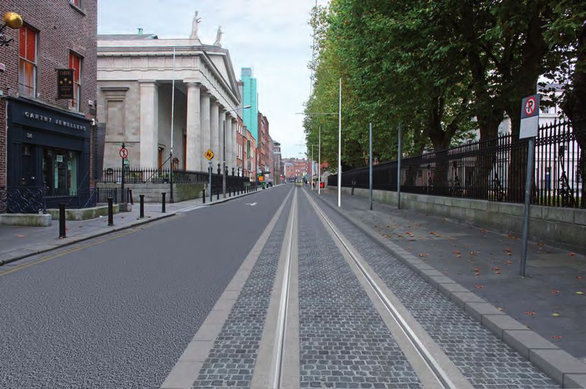
Photomontage 1.1 Dawson Street Year 15
Photomontage 1.2 Trinity Stop Year 15
18 Environmental Impact Statement Luas BroombridgeINTRODUCTION
will be upgraded to meet the additional requirements pattern will provide capacity for 6,200 passengers
for the proposed scheme. The fourth substation will per direction per hour, based on 43m long trams
be provided for at O’Connell Street Lower as part of with each tram having a maximum capacity of 310
the Metro North project, or as a separate substation persons. Services will generally operate between 5am
should the proposed scheme implementation precede and 12.30am on weekdays. Saturday and Sunday
Metro North. service levels are anticipated as being similar to off-
peak levels with some enhancement to cover peak
1.9.4.4 Traction power and signals shopping periods and sporting events. Additional late
The power for the proposed scheme will be supplied night services will be operated to facilitate seasonal
at a nominal voltage of 750V DC fed to the trams (e.g. Christmas) and special events.
through an Overhead Conductor System (OCS). The
overhead power lines will be, at a minimum height of 1.9.6 Construction of the proposed scheme
6.0m above the ground in areas where road traffic can All construction work in connection with the proposed
run directly on or across the alignment, supported by scheme will be carried out in accordance with relevant
poles positioned either alongside or between tracks, health and safety legislation and best practice.
or by cables fixed to building façades.
Construction compounds will be established at
1.9.4.5 Depot designated locations along the proposed scheme for
The depot site at Broombridge occupies an area the storage of materials, plant and equipment and for
of approximately 1.85ha. The depot includes: site offices. The main construction compound will be
maintenance and stabling facilities for trams, a vehicle provided on the depot site at Broombridge with smaller
wash plant and sanding shed, and an operator’s compounds provided in the city centre areas. The
building which will house materials storage for main construction compound at Broombridge will be
operations and maintenance requirements in addition used as the primary location for storage of materials,
to driver welfare facilities and local depot control. plant and equipment, site offices and worker welfare
facilities. The city centre compounds will primarily
1.9.4.6 Vehicles consist of site offices and worker welfare facilities with
The proposed scheme will be operated using trams smaller storage units for handheld and small plant.
which are similar to those currently in operation on the The location of the construction compounds are:
Luas Green Line. The trams are approximately 43m
long comprised of articulated units with flexibility to ■■ St. Stephen’s Green North
permit expansion through the insertion of additional
modules to 53m in length. The trams are bi-directional ■■ Cathal Brugha Street
with a driver’s cab at each end and are 2.4m
wide. Seats for approximately 80 passengers and ■■ Western Way
designated on-board facilities for mobility impaired
persons will be provided. ■■ Broadstone
1.9.4.7 Structures ■■ Grangegorman (Broadstone Bus Depot)
In addition to the construction of a depot at
Broombridge and the provision of Luas stops and ■■ Broombridge
substations, other structures to be provided include:
1.9.7 Construction activities and phasing
■■ An underpass at Broadstone within Area 29 Construction is expected to start at the same time
at various locations along the route, including stop
■■ A crossing of the Phoenix Park railway tunnel in locations. Duration is expected to take approximately
Area 30 33 months. A period for testing and commissioning
of the new system will be required in addition to the
■■ Construction of a pedestrian bridge and associated above referenced time period. The first phase of
lifts over the Maynooth railway line at Broombridge construction involves the diversion of utilities and
Station other advance works including: archaeological testing
and excavations, temporary removal of statues and
1.9.5 Operating characteristics other heritage items and junction reconfigurations
The initial service pattern is likely to be 20 trams to facilitate traffic management. Following these
per direction per hour during the peak periods, or 1 works, construction of the stops, structures and track
tram every 3 minutes in each direction. This service is completed. Throughout the construction phase,
Environmental Impact Statement Luas Broombridge 19INTRODUCTION
monitoring of noise, vibration and air quality will be for significant effects was identified, detailed
carried out. Opportunities for working on a 24 hour consultation with key stakeholders was undertaken
basis will be explored with DCC in efforts to expedite in order to minimise the effects
the works duration, although such opportunities may
be limited in city centre residential areas. ■■ Consultation evolved with the project design and
environmental assessment from general topics to
The indicative timelines and phasing of the proposed more specific topics as the design of the proposed
construction works has considered the potential scheme progressed
for simultaneous construction of other major
infrastructure projects and major developments which Various approaches were used to facilitate consultation
are proposed within the city centre. These proposed on the project. These included:
projects include: Metro North, DART Underground,
Arnotts “Northern Quarter” development and ■■ Newsletters direct to peoples’ homes including free
the “Dublin Central” (Carlton site) development. post comment cards
In developing a construction strategy for Luas
Broombridge, cognisance has been taken of the ■■ Open days in local civic centres, community halls
potential interactions and cumulative impacts during and hotels
the construction of all projects.
■■ Meetings with residents’ associations, businesses,
Subject to receipt of an enforceable RO for the and other groups
proposed scheme within the procurement timelines
for Metro North, it is proposed that elements of the ■■ Public meetings
proposed scheme infrastructure (trackbed, rail, stop
platforms, pole foundations, etc.) would be included ■■ Direct correspondence and meetings with individual
within the Metro North scope of works for the main residents
works contract at St. Stephen’s Green West, St.
Stephen’s Green North, Westmoreland Street, and ■■ Detailed discussions and workshops with
O’Connell Street Lower between Bachelor’s Walk and stakeholders
Henry Street.
■■ Written correspondence including: letters, e-mails
1.10 CONSULTATION and faxes
RPA has consulted widely in relation to the proposed
scheme, including: consulting with residents, ■■ Presentations and detailed discussions with local
residents’ associations, businesses, business public representatives
representative bodies and elected representatives.
Stakeholder statutory bodies, bodies with ■■ RPA website, including: maps, drawings,
environmental responsibility and interest and other newsletters, responses to frequently asked
interested parties were also consulted in relation to questions (FAQs) and an e-mail address to
the proposed scheme. Consultation started in 2005 facilitate questions and information requests
and focused on the following topics:
A summary of some of the issues raised to date during
■■ Alternatives: This focused initially on route corridor consultation are outlined in the following points and
options and then progressed to include: stop are dealt with in the main EIS. Concerns were raised
locations, detailed alignment and associated in relation to the following:
infrastructure designs and locations
■■ The construction impact of the proposed scheme
■■ Scoping: The EIS scoping exercise represented on local business especially in the city centre
the beginning of the EIA for the PRC. The purpose
of the scoping exercise was to establish the scope ■■ Potential for negative health effects associated
and methodology for the EIS and to provide the with the proposed scheme, in particular during the
public and relevant bodies with environmental construction phase
responsibility and other interested parties with
information on the proposed scheme and to invite ■■ Anti-social behaviour at stops
their input to the EIA process
■■ Potential for nuisance and disturbance associated
■■ Impacts and mitigation: Where the potential with the proposed scheme due to noise and vibration
20 Environmental Impact Statement Luas BroombridgeINTRODUCTION
■■ The potential to negatively effect hedgerows, nesting There is remarkably little in the medical literature
birds, badgers, otter, bats and the Royal Canal overall about the human health effect of railway lines.
Most information that is available about transport
■■ Potential visual impacts resulting from lighting and noise indicates rail travel causes fewer problems in
overhead wires comparison to other transport modes.
■■ Potential for negative effects on air quality Some very limited effects of night time noise and
noise close to educational establishments have been
■■ Potential impact on known and previously unknown identified in the EIS related to periods of time within
archaeological material the construction phase. Given the defined time period
of the construction phase no adverse human health
■■ Potential for a negative effect on St. Stephen’s Green impacts are predicted.
■■ Cumulative impacts Once mitigation measures described in the Human
Beings: Noise impact assessment chapter of this EIS
■■ Potential for a negative effect on O’Connell Street (Books 2 and 3, Chapter 4) are in place, no ongoing
adverse noise affecting human health are predicted
■■ Traffic disruption during the operational phase.
■■ Potential impacts on bus stops, routes and services The overall impact of the proposed scheme in
the operational phase on psychosocial health is
■■ Potential impact of construction and operation on considered to be beneficial.
properties and property value
There are potentially great benefits for society,
1.11 HUMAN HEALTH including therefore general health and well being
As part of the consultation process feedback from the benefits, with the development of the proposed
general public included concerns regarding human scheme, particularly for people living along the route.
health. As a result, a human health assessment has
been undertaken of the proposed scheme.
Photomontage 1.3 O’Connell Street Lower – GPO Year 1
Environmental Impact Statement Luas Broombridge 21INTRODUCTION
Photo 1.5 Dominick Street Lower
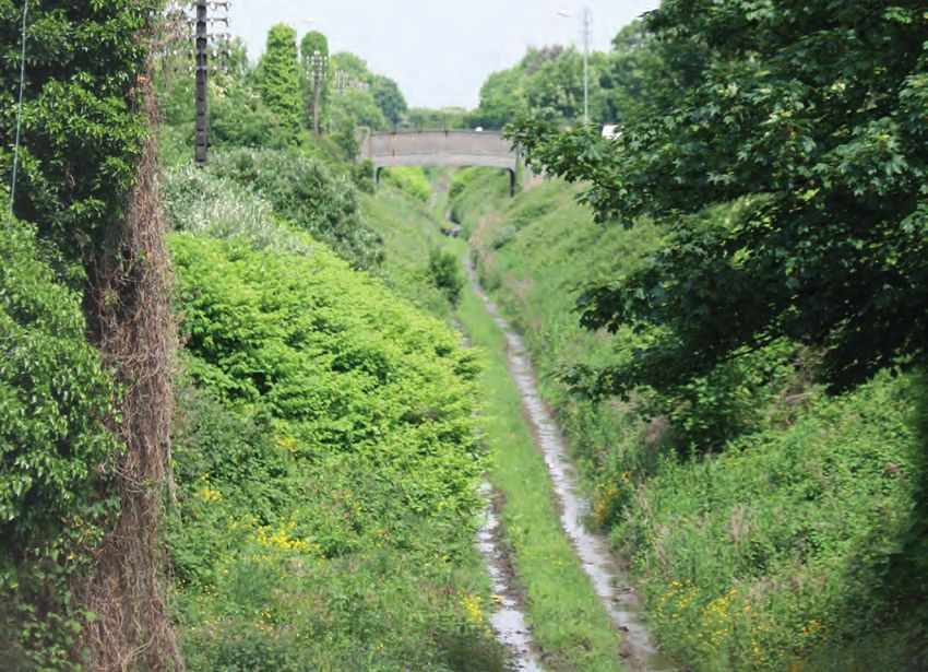
Photo 1.6 Former Broadstone railway cutting
22 Environmental Impact Statement Luas Broombridge2 LUAS BROOMBRIDGE
IMPACTS
2.1 Introduction..................................................................25
2.2 Human Beings: Landuse.............................................25
2.3 Human Beings: Socio-economics..............................26
2.4 Human Beings: Noise..................................................26
2.5 Human Beings: Vibration............................................27
Broombridge 2.6 Human Beings: Radiation and Stray Current............27
2.7 Human Beings: Traffic.................................................28
2.8 Flora and Fauna...........................................................29
2.9 Soil and Geology..........................................................30
2.10 Groundwater.................................................................32
2.11 Surface Water...............................................................33
2.12 Air and Climatic Factors..............................................34
Cabra 2.13 Landscape and Visual.................................................35
2.14 Material Assets: Archaeology and
Cultural Heritage..........................................................36
2.15 Material Assets: Architectural Heritage.....................37
Phibsborough
2.16 Material Assets: Property............................................38
2.17 Material Assets: Utilities..............................................39
Grangegorman
Broadstone - DIT Parnell
Dominick
O’Connell
Upper
Marlborough
O’Connell - GPO
Westmoreland
Trinity
Dawson
St. Stephen’s GreenLUAS BROOMBRIDGE IMPACTS
Photomontage 2.1 College Green Year 15
Photomontage 2.2 Marlborough Street Year 15
24 Environmental Impact Statement Luas BroombridgeLUAS BROOMBRIDGE IMPACTS
2.1 INTRODUCTION There will be impacts on landuse as a result of
The baseline environment and the associated the construction of the proposed scheme. Some
environmental impacts related to the proposed temporary or short-term landtake will occur to
scheme are summarised under the following facilitate the construction of the alignment, stops and
environmental topics: associated features. In Area 29, there will be landtake
from the existing streetscape along the length of
■■ Human Beings: Landuse the proposed scheme, at St. Stephen’s Green and
at Constitution Hill and Broadstone. In all instances
■■ Human Beings: Socio-economics the minimum amount of land necessary will be taken
and provisions will be made for redirecting traffic.
■■ Human Beings: Noise In Area 30 there will be a small area of temporary
landtake from residential gardens at Cabra Road and
■■ Human Beings: Vibration Mount Bernard Park to facilitate access to construct
the Phibsborough and Cabra Stops, respectively.
■■ Human Beings: Radiation and Stray Current Residual impacts are impacts that are still considered
significant after mitigation. There are no residual
■■ Human Beings: Traffic landuse construction impacts in Area 29 and Area
30 as short-term or temporary landtake can be
■■ Flora and Fauna successfully mitigated by restoring the areas post
construction.
■■ Soils and Geology
In addition to the above construction impacts, some
■■ Groundwater areas of land will be severed by the proposed scheme.
■■ Surface Water The entire site of the petrol filling station and adjacent
derelict buildings are to be taken at Constitution Hill,
■■ Air and Climatic Factors to facilitate the provision of the stop. This area will be
replaced by public open space thereby providing a
■■ Landscape and Visual more appropriate landuse adjacent to the stop.
■■ Material Assets: Archaeology and Cultural Heritage There will be permanent severance of green urban
lands to the north of Mount Bernard Park. During
■■ Material Assets: Architectural Heritage the operational phase this land will be visible to
passengers as the trams go past requiring that the
■■ Material Assets: Property area be maintained. It is proposed to mitigate this
impact by agreeing alternative access to the land with
■■ Material Assets: Utilities an adjacent landowner in order to maintain the area.
Further details regarding each of these environmental Operational impacts are long-term impacts associated
topics are provided in the following sections. with the proposed scheme. In Area 30 there will be
permanent landtake of the former Broadstone railway
2.2 HUMAN BEINGS: LANDUSE cutting from Broadstone to Broombridge. Restoring
There are a variety of landuses along the proposed the use of the cutting as a transport corridor is a
scheme in Area 29, including: residential, green open positive impact. Iarnród Éireann lands adjacent to the
space, community, offices, industrial, commercial, Maynooth railway line will also be acquired to facilitate
and sports and leisure as well as lands dedicated the provision of the proposed scheme. To mitigate
to transport infrastructure. The impacts associated potential landuse impacts the existing boundary will be
with landuse are landtake and severance. Landtake relocated.
has the potential to change how the land is used,
particularly in terms of the remaining area outside Most of the impacts in Area 29 and Area 30 can be
the landtake. Severance is where access to an area successfully mitigated by relocating the boundary of
becomes more circuitous or is completely closed. the affected lands or by agreeing an alternative with
An indirect landuse impact of this scheme is where a the landowner.
stop is located on suitable zoned land, which would
enhance the development potential of the site.
Environmental Impact Statement Luas Broombridge 25You can also read