Gap Analysis and Overview of Weather Station Data in British Columbia Agricultural Regions - BC Food Web
←
→
Page content transcription
If your browser does not render page correctly, please read the page content below

Gap Analysis and Overview of Weather Station Data in
British Columbia Agricultural Regions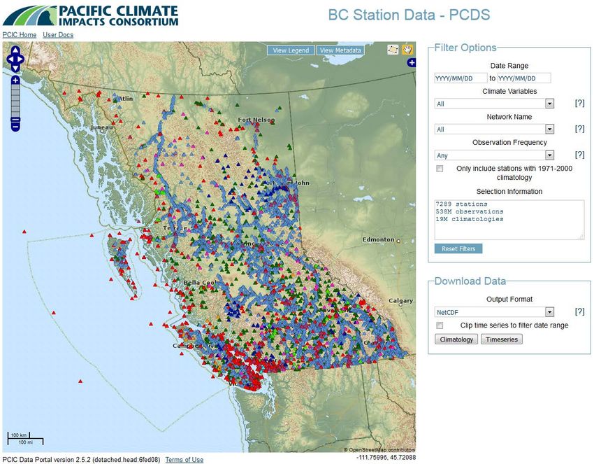
Gap Analysis and Overview of
                     Weather Station Data in
              British Columbia Agricultural Regions

                                        September 2018

AUTHORS:

Stephanie Tam, P.Eng.                               Faron Anslow, Ph.D.
Water Management Engineer                           Lead
B.C. Ministry of Agriculture                        Climate Analysis and Monitoring
Innovation and Adaptation Services Branch           Pacific Climate Impacts Consortium
Abbotsford, B.C.                                    Victoria, B.C.
(Responsible for Overall Report Write-up)           (Responsible for Section 4 and Appendix)

Funding for the weather data gap analysis portion (Section 4 and Appendix) of this project has been
provided by Growing Forward 2, a federal-provincial-territorial initiative.

DISCLAIMER
The data that is presented in this report provides the best estimates. While every effort has been made
to ensure the accuracy and completeness of the information, the information should not be considered
as final. The Governments of Canada and British Columbia are committed to working with industry
partners. Opinions expressed in this document are those of the authors and not necessarily those of the
Governments of Canada and British Columbia.
Acknowledgement
This project was initiated and coordinated by the British Columbia Agricultural Climate Adaptation
Research Network (ACARN). The network is a collaboration between academic, government and
industry groups, and works closely with the B.C. Agriculture and Food Climate Action Initiative to
enhance climate change adaptation research and extension strategies for the agricultural sector in the
Province of British Columbia.

The authors would like to acknowledge the collaborative work of the project steering committee which
comprised of the following individuals:

Project Coordinator:
Jason Lussier              B.C. Agricultural Climate Adaptation         Network Coordinator
                           Research Network
Project Steering Committee:
Andy Black                 University of British Columbia               Professor, Biometeorology
                                                                        and Soil Physics
Serena Black               University of Northern British Columbia      Researcher
Nathaniel K. Newlands      Agriculture and Agri-Food Canada             Research Scientist,
                                                                        Summerland
Rishi Burlakoti            Agriculture and Agri-Food Canada             Research Scientist, Agassiz

Shabtai Bittman            Agriculture and Agri-Food Canada             Research Scientist, Agassiz

Emily MacNair              B.C. Agriculture and Food Climate Action Manager
                           Initiative

The authors also would like to thank the following individuals for their time to review (full or parts of)
the report, and/or for their valuable comments:

Michelle Cook              Okanagan-Kootenay Sterile Insect Release       Project Manager
                           Program
Joshua Espiritu            B.C. Ministry of Agriculture                   Co-op Student
Andrew Petersen            B.C. Ministry of Agriculture                   Water Management
                                                                          Specialist
Mark Raymond               B.C. Ministry of Agriculture                   Manager

Ted van der Gulik          Partnership for Water Sustainability in        President
                           British Columbia

ii                                                                                           September 2018
Executive Summary
The British Columbia Ministry of Agriculture (AGRI) collaborated with Agriculture and Agri-Food Canada
(AAFC) and Pacific Field Corn Association (PFCA) to launch a website called Farmwest.com in 2001 to
provide real-time weather information for free to farmers, irrigators and researchers in British
Columbia. To date, Farmwest is linked to the federal, provincial and private weather networks with over
300 stations across Canada, of which over 150 stations are within B.C. including 18 agricultural stations.
A number of decision tools have been developed on Farmwest utilizing the weather data collected, e.g.,
evapotranspiration, corn heat units, growing degree days, and pest degree days, all publicly available to
help farmers to make informed decision in managing our natural resources.

AGRI and Farmwest are part of the Climate Related Monitoring Program (CRMP) which is an initiative led
by BC Ministry of Environment in 2010, in collaboration with the federal government (Environment and
Climate Change Canada), provincial agencies (Ministries of Agriculture, Forests, Lands, Natural Resource
Operations and Rural Development, and Transportation), private organizations (BC Hydro, and Rio Tinto
Alcan), and a non-profit organization specializing in climate data (Pacific Climate Impacts Consortium).
The objective of the CRMP is to integrate all federal, provincial, municipal and private weather station
networks into a single network for BC, including a standardized data quality control protocol, a
centralized data processing system, and a data-sharing web portal publicly available. The CRMP group
shares a common interest in meteorological monitoring and environmental quality management,
dissemination of environmental information, and promoting science-based decisions, and creating a
climate data set with transparent data sharing to enhance understanding of the scope of climate change
and climate variability within B.C.; thereby, providing long-term public benefits for British Columbians.

There are a number of non-profit agricultural organizations that strive to collaborate within the industry
to advance climate change prediction and develop resilience strategies using weather station networks.
These organizations include the British Columbia Agricultural Climate Adaptation Research Network
(ACARN), Okanagan-Kootenay Sterile Insect Release (SIR) program, Pacific Field Corn Association (PFCA),
Irrigation Industry Association of British Columbia (IIABC), and Partnership for Water Sustainability in
British Columbia (PWSBC).

Real-time weather information and forecast help farmers manage their irrigation water use and predict
what the supply will be, pest disease in orchards and berries, manure and pesticide application, animal
production and welfare. Weather information also helps to prepare and response to air-borne disease
outbreak, drought, flooding, and wildfire management. Climate change adaptation is a long-term
commitment where weather stations provide the data necessary to assess climate change impacts and
develop climate change adaptation strategies for agriculture.

B.C. is only 50% food self-reliant. With increased population growth and climate change, B.C. needs to
become more self-reliant. The Province of B.C. requires improved monitoring of weather stations to
support crop and livestock growth, improve food security for British Columbians, and strengthen the
capacity of B.C. agricultural sector for local and international markets.

Gap Analysis and Overview of Weather Station Data in British Columbia Agricultural Regions               iii
Acronyms
     AAFC      Agriculture and Agri-Food Canada
     ACARN     British Columbia Agricultural Climate Adaptation Research Network
     AEPI      Agriculture Environment Partnership Initiative
     AGRI      British Columbia Ministry of Agriculture
     ALR       Agricultural Land Reserve
     ALUI      Agricultural Land Use Inventory
     ARDCorp   British Columbia Agricultural Research and Development Corporation
     AWDM      Agriculture Water Demand Model
     B.C.      British Columbia
     BCAC      British Columbia Agriculture Council
     BCFC      British Columbia Forage Council
     BCTF      British Columbia Tree Fruits Corporation
     BMP       Beneficial Management Practices
     BRMB      Business Risk Management Branch
     CAP       Canadian Agricultural Partnership
     CBCWSEP   Canada British Columbia Water Supply Expansion Program
     CRD       Capital Regional District
     CRMP      Climate Related Monitoring Program
     ECCC      Environment and Climate Change Canada
     EFN       Environmental Flow Needs
     EFP       Environmental Farm Plan Program
     EMBC      Emergency Management of British Columbia
     ENV       British Columbia Ministry of Environment and Climate Change Strategy
     ET        Evapotranspiration
     DAS       Decision-Aid System
     FLNR      British Columbia Ministry of Forests, Lands, Natural Resource Operations and Rural
               Development
     FVRD      Fraser Valley Regional District
     GF        Growing Forward
     GF2       Growing Forward 2
     GS        Grower’s Supply Co.
     IAF       Investment Agriculture Foundation
     IIABC     Irrigation Industry Association of British Columbia
     MSC       Meteorological Service of Canada
     MV        Metro Vancouver
     NA        Not Applicable
     NoN       Network of Networks
     OBWB      Okanagan Basin Water Board
     PCDS      Provincial Climate Data Set
     PCIC      Pacific Climate Impacts Consortium
     PFCA      Pacific Field Corn Association
     PRFSA     Peace Region Forage Seed Association
     PWSBC     Partnership for Water Sustainability in British Columbia
     SCC       Standards Council of Canada
     SIR       Sterile Insect Release
     TRAN      British Columbia Ministry of Transportation
     WSA       Water Sustainability Act
     WSU       Washington State University

iv                                                                                                  September 2018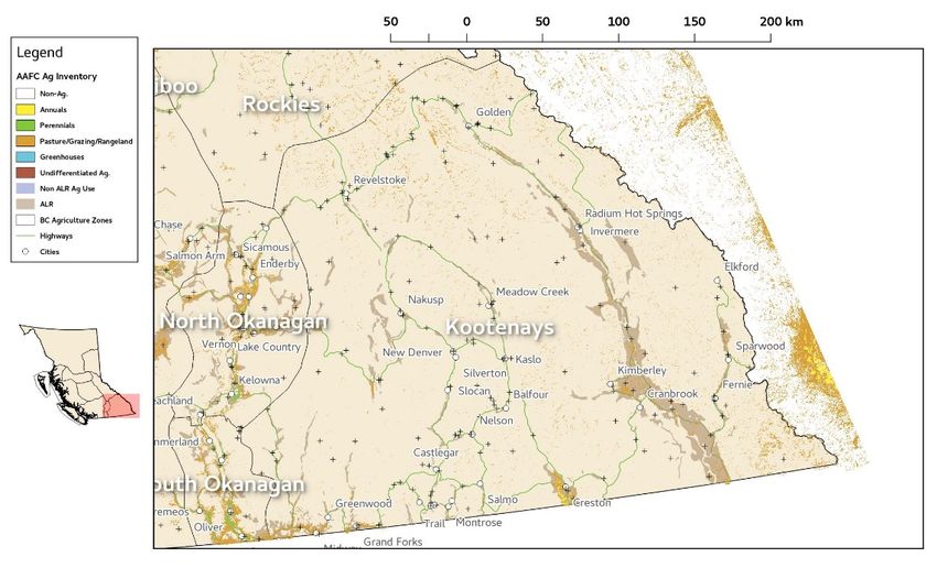
Table of Contents

1.   Introduction .......................................................................................................................................... 1
     1.1 Objective ....................................................................................................................................... 1
     1.2 Deliverables................................................................................................................................... 1
     1.3 B.C. Ministry of Agriculture’s Initiative ......................................................................................... 2
     1.4 Pacific Climate Impacts Consortium (PCIC) ................................................................................... 2
     1.5 B.C. Agricultural Climate Adaptation Research Network (ACARN) ............................................... 2
2.   Weather and Climate Initiatives............................................................................................................ 3
     2.1 Farmwest ...................................................................................................................................... 3
     2.2 Climate Related Monitoring Program (CRMP) .............................................................................. 5
     2.3 Network of Networks (NoN) ......................................................................................................... 8
     2.4 Standards Council of Canada (SCC) ............................................................................................... 8
3.   Regional Agricultural Network ............................................................................................................ 10
     3.1 Okanagan .................................................................................................................................... 10
     3.1.1          Business Risk Management Branch (BRMB) ....................................................................... 10
     3.1.2          Sterile Insect Release (SIR) Program ................................................................................... 10
     3.2 Creston ........................................................................................................................................ 11
     3.3 North Okanagan .......................................................................................................................... 12
     3.4 Peace ........................................................................................................................................... 12
     3.5 Vanderhoof ................................................................................................................................. 12
     3.6 B.C. Agricultural Climate Adaptation Research Network............................................................ 13
     3.7 Other Networks........................................................................................................................... 13
4.   Weather Data Gap Analysis................................................................................................................. 14
     4.1 Data Source ................................................................................................................................. 15
     4.2 Methodology............................................................................................................................... 15
     4.3 General Geographical and Objective Analysis Results................................................................ 16
     4.4 BC-Wide Overview of Network Sufficiency................................................................................. 17
5.   Applications of Weather and Climate Data......................................................................................... 21
     5.1 Agriculture Water Demand Model (AWDM) .............................................................................. 21

Gap Analysis and Overview of Weather Station Data in British Columbia Agricultural Regions                                                                v
5.2 Agricultural Irrigation Scheduling Calculator .............................................................................. 21
     5.3 B.C. Agriculture Water Calculator ............................................................................................... 22
     5.4 Emergency Management ............................................................................................................ 22
     5.5 Other Projects ............................................................................................................................. 22
6.   Recommendations .............................................................................................................................. 23
     6.1 Farmwest.com ............................................................................................................................ 23
     6.2 Provincial Weather Station Network .......................................................................................... 25
     6.3 Collaboration with Other Agricultural Groups ............................................................................ 26
     6.4 Future Research Opportunities................................................................................................... 27
7.   Conclusion ........................................................................................................................................... 28

vi                                                                                                                                     September 2018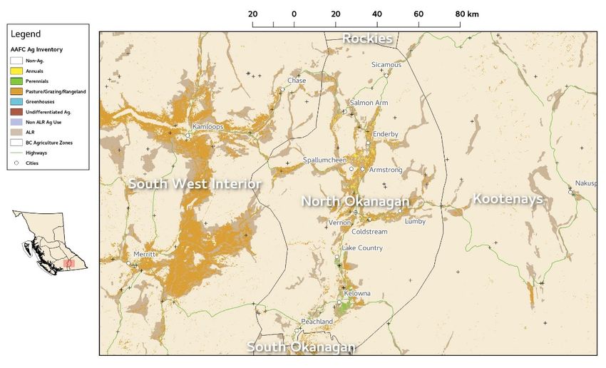
List of Figures
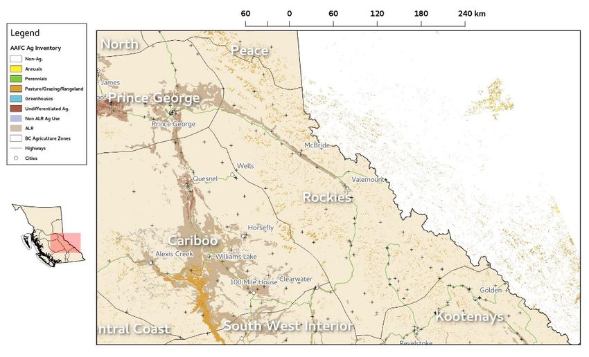
Figure 1. Farmwest Weather Station Map................................................................................................... 4
Figure 2. Provincial Climate Data Set (PCDS) from Pacific Climate Impacts Consortium (PCIC) .................. 7
Figure 3. Map depicting the radius of representativeness about stations in the active observational
network in British Columbia. The radius of influence is for winter (December, January and
February) precipitation and shows the distance at which monthly precipitation total will be
within 30% of a station’s value. This distance is a good indicator of station representativeness
for initially identifying gaps in observational networks for variables with large spatial and
temporal variability. .................................................................................................................... 18
Figure 4. As in Figure 3 but for spring (March, April and May). ................................................................. 18
Figure 5. As in Figure 3 but for summer (June, July and August). .............................................................. 19
Figure 6. As in Figure 3 but for fall (September, October and November). ................................................ 19
Gap Analysis and Overview of Weather Station Data in British Columbia Agricultural Regions vii
List of Tables
Table 1. Number of Weather Stations from the CRMP Partners ................................................................. 6
Table 2. Number of Weather Stations by Agencies/Organizations for the Gap Analysis .......................... 14
Table 3. Statistics describing distances to nearest and second nearest stations in agricultural regions in
         British Columbia within the active observational network. 1st indicates distance to the nearest
         stations while 2nd indicates distance statistics to the second nearest station. ........................... 16
Table 4. Annual Operational Budget of Provincial CRMP Partners ............................................................ 23
Table 5. Estimated Annual Operating Cost for AGRI’s Weather Station Network ..................................... 24

viii                                                                                                         September 2018
1. Introduction
Enhancing weather data accuracy in agricultural regions of British Columbia (BC) is critical for supporting
crop production and mitigating risk due to climate change. These data are determined by weather
stations which have sensors capable of detecting precipitation, temperature, wind speed and direction,
humidity, leaf wetness, and solar radiation. In addition to providing a baseline for climate projection
models, accurate weather data is useful for developing decision-support tools which assist farm
management practices such as irrigation, pest, manure/nutrient application, crop harvest and variety
selection. Historical climate data can be compiled to provide important information on crop phenology,
pest biology and water management in agricultural systems.
There are at least a dozen of weather station networks in the Province that are currently operated
individually by various municipal, provincial and federal agencies, producer groups, private companies
and individuals. The B.C. Ministry of Agriculture (AGRI) is currently utilizing
weather data from 132 stations in these networks to supplement the
existing 18 stations AGRI owns. The data is provided to the sector on
Farmwest.com website.
Many of the weather stations from the partnering networks to Farmwest are located in non-agricultural
areas. They are located where the organization specializes their work activities, and therefore not useful
for agricultural purposes due to extremely high elevation or outside the agricultural areas.
Farmers require weather stations to be located on or close to agricultural lands. The weather
information collected from the stations will be representative of the climate where agricultural activities
occur; and therefore suitable for producers to make informed decisions.
1.1 Objective
The objective of this project is to provide a province-wide analysis of weather station data usage
and spatial distribution of existing weather stations in agricultural regions, and to recommend
steps to enhance weather station networks for supporting climate change adaptation and
mitigation for the agricultural sector.
1.2 Deliverables
The project is intended to:
1. Identify current and future usage of weather station data, challenges and barriers for using
the data in the B.C. agricultural industry
2. Assess the distribution and types of weather data monitored in major agricultural regions in
B.C.
Gap Analysis and Overview of Weather Station Data in British Columbia Agricultural Regions 13. Evaluate the collection, robustness and security of data, and explore methods for
enhancing the quality control of weather data
4. Identify strategies to improve the accuracy, accessibility and application of weather data at
the regional and provincial level to enhance climate change adaptation.
1.3 B.C. Ministry of Agriculture’s Initiative
This project aligns with the Ministry’s Service Plan 2018/19 to 2020/21,
Ministry’s Service Plan
Objective 1.5: Support Climate Adaptation and Mitigation
“To increase agriculture sector capacity to maintain competitiveness, manage
risks, enhance productivity and contribute to economic growth through action
on climate change and increasing environmental sustainability.”
The key strategies that align to this project are to work with industry, local governments, research
organizations, and other government agencies, and support the development and adaptation of
environmental and climate change adaptation and mitigation practices, processes, technologies
and infrastructure.
1.4 Pacific Climate Impacts Consortium (PCIC)
Pacific Climate Impacts Consortium (PCIC) is a regional climate service centre at the University of
Victoria that conducts studies on the impacts of climate change and climate variability in the
Pacific and Yukon region. Results from this work provide regional climate stakeholders with the
information needed to develop plans for reducing the risks associated with climate variability and
change. PCIC plays an important bridging function between climate research and the practical
application of that knowledge by decision makers. PCIC’s applied research program is focused on
hydrologic impacts, regional climate impacts, and climate analysis and monitoring.
1.5 B.C. Agricultural Climate Adaptation Research Network (ACARN)
The B.C. Agricultural Climate Adaptation Research Network (ACARN) was formed in May 2017 to
improve linkages among agricultural researchers, industry specialists, policy-makers, and
producers from across the Province. The aim of the network is to be a provincial hub that fosters a
collaborative approach for agricultural climate change adaptation research and extension
strategies in British Columbia.
2 September 20182. Weather and Climate Initiatives
There have been a number of initiatives concerning weather and climate data at all levels of
government.
2.1 Farmwest
Farmwest.com is a website launched in 2001 to provide weather and climate information as well
as a number of decision-support tools to the agricultural sector for free. The website is made
possible and continues to grow with the partnership of Pacific Field Corn Association (PFCA),
Agriculture and Agri-Food Canada (AAFC), and AGRI.
Farmwest is linked to 397 weather stations across Canada from federal, provincial, municipal and
private weather station networks, among which 179 weather stations are in B.C. including 46
stations set up specifically on agricultural lands (Figure 1).
1. Federal Government
o 49 Environment and Climate Change Canada (ECCC)
2. Provincial Government
o 46 B.C. Ministry of Forests, Lands, Natural Resource Operations and Rural Development
(FLNR)
o 24 B.C. Ministry of Transportation (TRAN)
o 26 B.C. Ministry of Agriculture (AGRI)
3. Municipal Government
o 11 Metro Vancouver (MV)
4. Non-Profit Organization
o 3 Okanagan Basin Water Board (OBWB)
5. Private Networks (Agricultural Stations)
o 20 Grower’s Supply Co. (GS)
Since the inception of Farmwest, a number of decision-support tools have been developed on
Farmwest that integrate weather data for:
1. Temperature monitoring of extreme high and low temperatures to advocate for animal
welfare and production quality (e.g., milk production)
2. Pest degree days for pest disease management in orchards and berries
3. Wind condition for pollination, manure spreading, pesticide spraying, emergency response of
air-borne disease outbreak, e.g., avian influenza
4. Growing degree day and corn heat unit to predict the number of days that corn and other
crops will reach maturity and ready for harvest
5. Evapotranspiration calculator for scheduling irrigation
Gap Analysis and Overview of Weather Station Data in British Columbia Agricultural Regions 3Figure 1. Farmwest Weather Station Map
Farmwest has historically been receiving sponsorship from a number of provincial government
agencies and industry associations. Currently, only the Irrigation Industry Association of British
Columbia (IIABC) provides $1,000 per year to support the operation, administration and
maintenance of the website.
Over the years, Farmwest has gone through a complete redesign of the website, integration of
additional provincial networks into Farmwest database, upgrades of the website functionality, as
well as the addition of a mobile capable version of the entire website. The majority of the funding
came from AGRI base budget to start up the website, and later from a number of provincial-
federal-territorial funding programs, i.e., Canada-British Columbia Water Supply Expansion
Program (CBCWSEP), Growing Forward (GF), and most recently Growing Forward 2 (GF2).
AGRI is the only provincial government agency which has a weather station network to serve
farmers but has not established an annual operational budget contributing to the network.
Weather data is used for many of the long-term agricultural and climate related initiatives that
AGRI commits to in the Ministry’s Service Plan and other strategic plans.
4 September 20182.2 Climate Related Monitoring Program (CRMP)
There are many weather station networks like Farmwest in the Province, each operating on their
own. Each network has their own data processing protocol, and stations within close proximity to
stations in another network. To streamline all the networks in the Province, ENV initiated the
Climate Related Monitoring Program (CRMP) in 2010, in collaboration with all levels of
government and organizations. An MOU with no financial commitment has been signed by the
following partners:
1. Federal Government
o Environment and Climate Change Canada (ECCC)
2. Provincial Government
o Ministry of Agriculture (AGRI)
o Ministry of Forests, Lands, Natural Resource Operations, and Rural Development (FLNR)
o Ministry of Transportation (TRAN)
3. Municipal Government
o Capital Regional District (CRD)
o Metro Vancouver (MV)
4. Crown Corporation
o BC Hydro
5. Private Company
o Rio Tinto Alcan
6. Non-Profit Organization
o Pacific Climate Impacts Consortium (PCIC)
The objectives of the CRMP are to:
• Integrate all federal, provincial and private weather station networks within B.C. into a
single network for the Province of British Columbia, including a standardized data quality
control protocol, a centralized data processing system, and a data-sharing web portal that is
publicly available. Stations from existing CRMP partners are listed in Table 1.
• Harmonize operational standards, plans and technologies across the meteorological
networks operated by the participating networks while maintaining their operational
mandates
• Maintain a unified Provincial Climate Data Set (PCDS) (Figure 2) at PCIC that supplements
the national climate data set maintained by ECCC.
The intent of the CRMP is not to change the existing operations of any individual CRMP partners,
but to maximize data-sharing power that benefits all data users in the Province.
AGRI is part of the CRMP team, and has been providing in-kind support to operate weather
stations in agricultural zones, and supplying weather data to farmers free of charge through
Farmwest.com.
Gap Analysis and Overview of Weather Station Data in British Columbia Agricultural Regions 5Table 1. Number of Weather Stations from the CRMP Partners
Number of
CRMP Partners
Weather Stations
Federal Government
Environment and Climate Change Canada (ECCC) 306
Provincial Government
Ministry of Agriculture (AGRI) Farmwest.com 26
Ministry of Environment and Climate Change Strategy (ENV)
Air Quality Program 50
Snow Program 48
Ministry of Forests, Lands, Natural Resource Operations and Rural
Development (FLNR)
Wildfire Service 221
Forest Ecosystems Research Network 53
Ministry of Transportation (TRAN) Avalanche and Weather Program 172
Municipal Government
Capital Regional District (CRD) Water Services 10
Metro Vancouver (MV)
Planning and Parks 30
Water Services 15
Crown Corporation
BC Hydro
Generation and Hydro-Meteorological Information 61
Site C 8
Private Company
Rio Tinto Alcan 6
6 September 2018Figure 2. Provincial Climate Data Set (PCDS) from Pacific Climate Impacts Consortium (PCIC)
The key successes of the CRMP since its inception include:
A public data portal, i.e., Provincial Climate Data Set (PCDS), hosted by PCIC. This is the first
comprehensive data portal in Canada to make current and historical meteorological data
from weather stations operated by participating networks publicly available, and allows for
the development of climate analysis tools at PCIC.
A centralized data processing system established under ECCC’s Network of Networks
initiative to enhance and exchange quality weather data for all Canadians.
Efficiency in data management/exchange across all parties
Improved coverage to define and monitor climate change in B.C.
Improved observational reliability archived by sharing maintenance practices
Technological improvements to winter precipitation monitoring at a number of sites.
Improved network documentation, i.e., meta-data, for many meteorological sites operated
by participating networks for evaluating the station configuration standards, and financial
resources required for maintenance and improvement.
Gap Analysis and Overview of Weather Station Data in British Columbia Agricultural Regions 72.3 Network of Networks (NoN)
The CRMP is part of the Network of Networks (NoN) initiative led by ECCC to respond to the
government priority of strengthening our national capacity to monitor severe weather and
climate change through collaboration with Provinces/Territories and other data owners. The
initiative is supported by $4.6 million federal funding over 10 years (since August 2014). The
objective of the NoN is to enhance the access, exchange and quality of hydro-meteorological data
in Canada for the benefits of all Canadians. Participation is voluntary to exchange free, open and
quality data among networks operated by public sector data providers under formal data-sharing
Memorandums of Understanding (MOUs). In the NoN pilot phase, task teams have been
established with representatives from agencies for British Columbia and Ontario to develop best
practices, standards and policies.
In B.C., the NoN pilot project consists of three phases:
1. Phase 1 includes the first group of CRMP partners, i.e., ENV, FLNR, and TRAN, and work is
currently in progress:
2. Phase 2 will include the second group of CRMP partners, i.e., AGRI, BC Hydro, and Rio Tinto
Alcan, with a target date of 2019 to commence work:
3. Phase 3 will include the third group of CRMP partners, i.e., CRD, MV and other future
partners.
ECCC will also work on optimizing joint monitoring investments to address redundancies, improve
coverage, and target stations of interests, as well as potential collaboration on network
operations regarding infrastructure, instrumentation, maintenance, and data management. The
benefits of joint network operations will provide opportunities to leverage advancements in
innovation and technology, and improve network operation efficiencies and data quality/accuracy
of public weather information, forecasts and warnings.
ECCC also runs the Meteorological Service of Canada (MSC) which is a service delivery portal to
provide free weather data online for the general public. ECCC has committed $107 million over 11
years to improve the MSC online portal, provide user support desk for guidance of data use, train
staff and allocate a coordinator to communicate with existing provincial partners. This funding is
in addition to the financial commitment to support the NoN initiative.
2.4 Standards Council of Canada (SCC)
The Standards Council of Canada (SCC) is a federal Crown corporation with a mandate to promote
efficient and effective standardization in Canada. SCC hosted a nation-wide meeting in mid-
February 2018 as part of its Standards to Support Resilience in Infrastructure Program, in support
of the Government of Canada’s objective to adapt infrastructure to climate change impacts. Key
stakeholders from existing meteorological and hydro-climate data networks from all provinces
8 September 2018and territories across Canada were invited to this meeting, with AGRI representing the Province of
British Columbia.
This standardization of weather and climate data is part of SCC’s Infrastructure Program which is
supported by a federal commitment of $11.7 million over five years (2016 – 2021), and includes:
• $4.9 million – standardization guidance for weather data, climate information and
projections
• $4.9 million – updating existing infrastructure standards
• $1.9 million – Phase 2 of the Northern Infrastructure Standardization Initiative
The goal of standardization is to develop climate information standards for the collection and
acquisition of weather data and climate information, to support infrastructure design. The
objective is to provide the best advice to proceed to design voluntary standards and allow data to
be shared among intended users across the country, as well as get a better understanding of how
to use the data and the risk of using the data. The standardization is not intended to change the
current operations of individual organizations.
SCC is also working with ECCC to identify common interests and potential collaboration
opportunities on this topic through ECCC’s NoN initiative. SCC’s intent is to build on ECCC’s work
and to leverage the expertise from ECCC and provincial/territorial partners.
By 2020, a series of standards for weather and climate data will be completed, ready for testing.
The standards will be evaluated using ECCC’s NoN data. It is anticipated that AGRI’s weather
network data will be part of this pilot project by then. After the standards are finalized, SCC will
review and revise the standards every five years to keep them current.
Gap Analysis and Overview of Weather Station Data in British Columbia Agricultural Regions 93. Regional Agricultural Network
A number of local and regional agricultural networks have joined or are interested in joining Farmwest.
3.1 Okanagan
In 2002-2004, Grower’s Supply Co. (GS) received $150,000 from the Agriculture Environment
Partnership Initiative (AEPI) of the British Columbia Agriculture Council (BCAC) to purchase and
install 20 weather stations in the Okanagan Valley to help with the tree fruit industry, primarily on
pest management. A data sharing agreement was executed in 2003 to allow Farmwest free access
to the 15-minute weather data from GS’s 20 weather stations for 10 years.
3.1.1 Business Risk Management Branch (BRMB)
The Business Risk Management Branch (BRMB) within AGRI uses weather data to assess
claims and conduct analysis under their Production Insurance program. In mid-2000,
BRMB approached Farmwest for weather data, and found Farmwest offers a very easy
way to download weather data from any stations in B.C. (including GS stations) in
Microsoft Excel format. The BRMB staff in the Production Insurance program are able to
utilize the data conveniently for analysis and claim processing.
When the 10-year data sharing agreement between GS and
Farmwest ended, BRMB wished to have GS weather data
continue to be shared with Farmwest, and therefore executed a
contract to purchase data from GS under the Growing Forward
2 (GF2) funding program. When GF2 ended in March 2018,
BRMB remains a strong partner with Farmwest, and established
a second contract with GS to purchase their data under the five-year Canadian
Agricultural Partnership (CAP) funding program to support their Production Insurance
program.
3.1.2 Sterile Insect Release (SIR) Program
The Okanagan-Kootenay Sterile Insect Release (SIR) program is an environmentally
responsible, area-wide approach to control codling moth pest populations, one of the B.C.
tree fruit industry’s most damaging and costly pests. The SIR serves the following four
regional districts where the tree fruit industry plays an important role in the region:
1. Regional District of Okanagan Similkameen
2. Regional District of Central Okanagan
3. Regional District of North Okanagan
4. Columbia Shuswap Regional District
10 September 2018Sterile codling moths are bred and released at regular intervals in orchards all over the
Okanagan, Similkameen, and Shuswap Valleys. Since the beginning of the SIR Program,
wild codling moth populations have been reduced by 94%, thereby cutting the amount of
pesticide used against the moth by 96%.
For the ongoing successful operation of the SIR program, it is very important to have good
working weather stations in the Program’s region. Accurate and up-to-date weather data
helps the SIR Program track codling moth pest degree days so they can successfully
monitor the life cycle of the codling moth throughout the different microclimates in the
valleys. SIR has collaborated with the B.C. Tree Fruits Cooperative (BCTF), AAFC
Summerland Research Station and the BC Fruit Growers Association over the last 20 years
on a number of climate and pest related projects.
Most recently SIR has collaborated with the Tree Fruit Research
and Development Center at the Washington State University
(WSU) to adopt their successful Decision-Aid System (DAS) to the
SIR Program area. Initial project funding to support the
development, testing and launch of BC DAS has been provided in
part by the SIR and in part by the Governments of Canada and
British Columbia through the Investment Agriculture Foundation (IAF) of BC under
Growing Forward 2, a federal-provincial-territorial initiative.
Around-the-clock and accurate weather data are at the core of BC DAS. BC DAS collects
real-time weather data from local stations (ECCC’s weather stations and BCTF Grower’s
Supply weather stations) to calculate current model conditions. BC DAS uses daily forecast
temperature data to make predictions about pest, disorder, or plant development for up
to 16 days into the future and the local 10-year average temperature values are used to
make predictions up to 42 days ahead. Model outputs are only as good as the model
inputs. Keeping the local weather network running successfully is important to the SIR
Program and the success of the BC DAS project.
In addition to the Grower’s Supply network, the SIR program would like to receive data
from AGRI’s network for their DAS project. However, the DAS tool requires hourly data to
be sent to their database on an hourly basis (or more frequently) for generating real-time
pest disease modelling results. AGRI’s weather stations collect hourly data and sent to
Farmwest database on a daily basis. Increasing data transmission frequency from daily to
hourly would at least double Farmwest’s operating costs. Farmwest cannot afford the
additional costs.
3.2 Creston
The tree fruit producers in the Creston Valley are also interested in collaborating with WSU to
customize DAS in the Valley; however, the Valley is outside of the SIR service area. The Creston
Valley has only one ECCC’s weather station, and is exploring funding opportunities to establish a
weather station network in the Valley that can be connected to Farmwest, and to customize DAS
for the tree fruit producers there.
Gap Analysis and Overview of Weather Station Data in British Columbia Agricultural Regions 113.3 North Okanagan
The B.C. Agricultural Research and Development Corporation (ARDCorp) is the wholly owned
subsidiary of the British Columbia Agriculture Council (BCAC). Working with BCAC and provincial
government, ARDCorp delivers effective, affordable programs and services that advance both the
individual producer and entire agricultural sector while benefiting local communities. ARDCORP is
the delivery agent of the British Columbia Environmental Farm Plan (EFP) program.
The EFP program provides Beneficial Management Practices (BMP) cost-share funding to
producers to establish weather stations on their farm properties for improved management of
our natural resources. To qualify for the BMP funding program, weather stations are required to
be connected to Farmwest.com to share data openly with the agricultural sector. Under this
program, Emerald Bay Agricultural Services Ltd. has installed six weather stations in the North
Okanagan region using equipment from Pessl Instruments.
Two additional weather stations in the North Okanagan region have been operational and
connected to Farmwest.com since May 2018 to help with monitoring and assessment of the
water quality within the Hullcar aquifer #103. This is an emerging environmental issue that ENV is
working on collaboratively with AGRI, Interior Health Authority, and FLNR. This cross-government
team is focused on identifying significant sources of pollutants, assessing a variety of approaches
to resolve the water quality issue, as well as conducting monitoring of the activities above the
aquifer.
The EFP BMP program was/is funded by Growing Forward (GF), Growing Forward 2 (GF2), and
Canadian Agricultural Partnership (CAP), all of which are a federal-provincial-territorial initiative.
3.4 Peace
The Peace Region Forage Seed Association (PRFSA) is currently working with
AGRI to convert the host of their network of 23 weather stations from Weather
Innovations (a company based in Ontario) to Farmwest. The Association wishes
to develop mobile capability for their decision support tools to allow their
members access weather data and decision tools on their mobile devices.
Farmwest has a mobile capability built for the entire website since 2017 with
GF2 funding. The PRFSA therefore would like to explore collaboration
opportunities with Farmwest.
3.5 Vanderhoof
In 2015, the British Columbia Forage Council (BCFC) received funding from Climate Action
Initiative (CAI) to develop an on-farm research demonstration project that included the
establishment of four new stations in the Vanderhoof area. These stations have been connected
12 September 2018to Farmwest since then. The Council continues to support the network as of today, providing
useful weather information to producers in the region.
3.6 B.C. Agricultural Climate Adaptation Research Network
While the newly developed B.C. Agricultural Climate Adaptation Research Network (ACARN) does
not currently oversee weather stations in the Province, the group is interested in developing
strategies to improve weather station data to enhance climate change research and tools.
Members of the network are located across British Columbia and are involved in various
agricultural climate change disciplines. There is strong potential to leverage this interdisciplinary
network by collaborating with regional and provincial groups to develop weather station networks
and weather-based decision aid tools that support producer adaptation to climate change.
3.7 Other Networks
A number of organizations and agencies have expressed interests to connect their weather
stations to Farmwest and join the CRMP, e.g., Fraser Valley Regional District (FVRD), City of
Surrey, and FLNR Aquarius program.
Gap Analysis and Overview of Weather Station Data in British Columbia Agricultural Regions 134. Weather Data Gap Analysis
This section discusses the gap analysis conducted by PCIC of weather data from stations across the
Province. The analysis used a total of 1,092 active stations listed in Table 4-1. More stations have been
added to some of the networks since the analysis was completed, and only the active stations are part
of the analysis; therefore, the numbers in this table may be different from the list in Section 2.
Table 2. Number of Weather Stations by Agencies/Organizations for the Gap Analysis
Number of Weather
Agencies/Organizations
Stations
Federal Government
Environment and Climate Change Canada (ECCC) 306
Provincial Government
Ministry of Agriculture (AGRI) Farmwest.com 18
Ministry of Environment and Climate Change Strategy (ENV) 90
Ministry of Forests, Lands, Natural Resource Operations and Rural
354
Development (FLNR)
Ministry of Transportation (TRAN) 145
Municipal Government
Capital Regional District (CRD) 10
Metro Vancouver 45
Crown Corporation
BC Hydro 80
Non-Profit Organization
BC Forage Council (BCFC) 4
Peace Region Forage Seed Association (PRFSA) 23
University
University of Northern BC 11
Private Company
Rio Tinto Alcan 6
Total = 1,092
14 September 2018The observation of meteorological variables is a crucial aspect of agricultural work for farmers,
researchers and others with interest in crop production. Understanding weather conditions on short
time scales helps with planning while an understanding at longer scales informs about drought and
other seasonal climate effects. At the scale of several decades, the averages of weather variables and
their variability are indicative of growing potential of a given region as well as potential risks involved
with utilizing a given piece of land for crop production. Even those who grow crops in enclosed or semi-
enclosed structures such as greenhouses are subject to weather and climate as heating, cooling or
lighting demands may change under different external conditions. For farmers producing livestock,
temperature and water availability are key factors in the health of the herd with extremes playing a
particularly important role in terms of heat stress, water availability or dangers from extreme cold.
The needs for weather observation are compounded by climate change. As a first measure,
understanding the present-day weather variability and climate at the finest possible spatial scales aids in
projecting the impacts of climate change. This understanding is based on knowledge of long term
averages and their variations as well as frequency and magnitude of extreme events. Such extremes,
although rare, are capable of generating rapid and devastating losses to crops and livestock resulting in
impacts on food availability locally and internationally.
4.1 Data Source
This gap analysis comprises weather observational data, metadata on the operational
observational networks and geographical data that describes spatial coverage within a
geographical information systems context. At present there are more than half a billion
observations of numerous variables in the CRMP database from more than 7,000 observing
locations in B.C. This work is concerned with analyzing the temperature and precipitation data
and summarizing the availability of other variables in the agricultural regions of B.C.
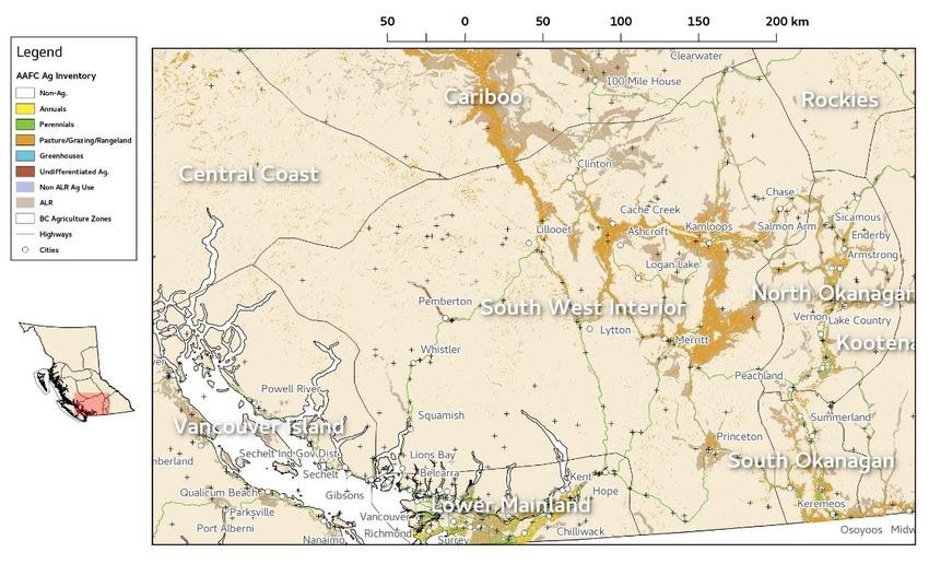
Crop data from the National Annual Crop Inventory as well as AGRI’s Agricultural Land Use
Inventory (ALUI) were used in this analysis. However, the data from the National inventory was
very coarse compared to the parcel based ground-truth ALUI dataset. The ALUI is expected to be
completed for the whole Province of B.C. by Year 2021, by which a revision of the gap analysis can
be conducted.
4.2 Methodology
To approach the objective of investigating the sufficiency of the observational network for
agricultural regions, two approaches were used. First, a quantitative analysis of the
meteorological observation locations and their recorded variables within agricultural regions of
the province was conducted. Secondly, the observational network’s sufficiency in terms of
precipitation and temperature measurements was assessed through objective network analysis.
This research technique investigates the relationships among all observational locations and all
observations throughout the historical observational period.
Gap Analysis and Overview of Weather Station Data in British Columbia Agricultural Regions 154.3 General Geographical and Objective Analysis Results
The most general part of the geographical analysis was the determination of distance statistics
between stations as it varies by region. These results along with the average area results are
presented in Table 4-2 and give an indication of the sparseness of observational stations in each
region. These results are based on the complete active network of stations so distances will be
larger for the subnetworks of individual variables.
• The North region has the largest maximal distance between stations which is not surprising
given the size of the region and its relatively small number of stations. This maximal distance
is almost double that for the next sparsest region.
• The median distances to stations indicate that the Central Coast region might have the most
consistently isolated stations with median separation distances to the first station of 21 km
and 34 km to the next closest.
• The Cariboo and North regions are the next sparsest and show similarly large median inter-
station distances.
• The Lower Mainland, the North Okanagan and South Okanagan have the closest station
spacing with a maximal spacing between stations just over 20 km for the three regions.
• Median distances to the nearest station are less than 10 km for all but four of the regions
which are probably indicative of station clustering near population centres.
In all cases, the median statistics are skewed toward low median distance by clustering of stations
near population centres. These station separation statistics should not be directly compared with
the objective analysis results’ representativeness distances which are typically of the same
magnitude but larger. Doing so would lead to a false inference that no gaps exist in these regions
which is not the case because stations are not homogeneously distributed across space in British
Columbia.
Table 3. Statistics describing distances to nearest and second nearest stations in agricultural regions
in British Columbia within the active observational network. 1st indicates distance to the
nearest stations while 2nd indicates distance statistics to the second nearest station.
Region Med. to 1st (km) Med. to 2nd (km) Max. to 1st (km) Max. to 2nd (km)
North 18 34 152 153
Peace 8 17 68 71
North Coast 7 20 44 99
Prince George 7 14 45 49
Rockies 13 20 46 52
Central Coast 21 34 76 90
Cariboo 18 23 53 60
Kootenay 7 14 49 50
Vancouver Island 7 10 41 78
South Okanagan 8 12 21 21
Lower Mainland 2 5 12 21
Southwest Interior 7 12 47 54
North Okanagan 5 11 17 24
16 September 2018Part of the objective network analysis is quantifying the functional relationship between
correlation and distance between stations for the available data. The decrease in correlation with
distance is not fully diagnostic of representativeness distance scales, but does give an indicator of
how relationships between stations change with distance and how that varies with the month or
season analyzed.
4.4 BC-Wide Overview of Network Sufficiency
An initial assessment of the observational network coverage for the entirety of British Columbia
can be made by looking at the radius of representativeness for precipitation applied to the active
network of observational stations in the Province.
The following maps indicate seasonal averages of representativeness for monthly precipitation
within 30% of the nearby station’s value. These maps have been created with a translucent
indicator of the radius such that areas with many overlapping radii have darker shading than
those with fewer overlaps.
Overall, the radii are smallest for winter (December, January and February) and largest for spring
(March, April and May) while summer (June, July and August) and fall (September, October and
November) are intermediate in radius and thus coverage. The map for winter is given in Figure 3
and shows that the radii are the smallest in northern BC and larger through the central and
coastal parts of B.C. Numerous gaps are present in the north, but there is very little agricultural
activity there based on the limited extent of the Agricultural Land Reserve (ALR) and the lack of
agricultural activities in the 2016 inventory. The exception is Fort Nelson where few observational
stations exist and substantial ALR lands are present. The Lower Mainland and Vancouver Island
are very densely observed and very few gaps in observations exist from this monthly
observational frequency standpoint. Intermediately, gaps can be seen in the Peace region of
northeast B.C. where ALR and the agricultural inventory regions have no or minimal coverage in
some cases. Southwest B.C. and central B.C. show similar gaps where ALR, agricultural use lands,
and agricultural inventoried lands show gaps in coverage or areas with only a single station
providing coverage.
Results for spring (Figure 4) are similar despite the larger radius or representativeness present in
all areas for that season. Large gaps remain in areas with no agricultural activity in northern B.C.
and along the coast while the most densely observed regions are even more so for this season.
Some gaps are smaller or non-existent in southwest B.C. for spring than for winter while gaps in
coverage remain in NE B.C. in the Peace and central B.C. For summer (Figure 5) and fall (Figure 6)
the results are intermediate owing to the intermediate size of the representative areas for each
station. However, the summer results deserve greater attention due to the importance of
weather and climate monitoring for the growing season. The radius of representativeness for
stations in summer is more consistent between the regions of the province. Thus, the coverage in
northern B.C. is better during this season. Despite this, gaps remain near Fort Nelson and in the
northern parts of the Peace region.
Gap Analysis and Overview of Weather Station Data in British Columbia Agricultural Regions 17Figure 3. Map depicting the radius of representativeness about stations in the active observational
network in British Columbia. The radius of influence is for winter (December, January and
February) precipitation and shows the distance at which monthly precipitation total will be
within 30% of a station’s value. This distance is a good indicator of station
representativeness for initially identifying gaps in observational networks for variables
with large spatial and temporal variability.
Figure 4. As in Figure 3 but for spring (March, April and May).
18 September 2018Figure 5. As in Figure 3 but for summer (June, July and August).
Figure 6. As in Figure 3 but for fall (September, October and November).
Gap Analysis and Overview of Weather Station Data in British Columbia Agricultural Regions 19An analysis of the observational network sufficiency for all agricultural regions of BC has been
conducted using a geographical approach and an objective analysis approach. Results show, that
for monthly variables, temperature and precipitation observational coverage is sufficient in
agricultural regions. For shorter observational time scales such as daily or subdaily, there are likely
major gaps in the network and filling those gaps will require conducting triage on available
resources, values of crops grown in various regions and other factors that this report cannot
address. The network is likely insufficient at all timescales in some regions for variables such as
solar and longwave radiation, all-season precipitation, and snow. This needs to be carefully
assessed on a region by region and variable by variable basis using the results of this report and
the maps in the report and the appendix as a guideline.
On a regional basis, the North, North Coast and Central Coast regions are overall sparsely
observed, but they also contain minimal agricultural areas based on the location of the ALR and
agricultural inventories. Other regions such as Vancouver Island and the Lower Mainland have
dense observational networks which may even be sufficient for some areas for short timescale
observations. Other regions have intermediate coverage which is likely sufficient for longer
timescale monitoring needs and for variables with large spatial scales of relationship but are likely
insufficient for shorter timescales and for variables with very large spatial variability and minimal
spatial coherence such as wind or solar radiation.
20 September 20185. Applications of Weather and Climate Data
In addition to the decision-support tools hosted on Farmwest, and other projects described in previous
sections, weather and/or climate data has been used in a number of applications. Some examples are
listed below.
5.1 Agriculture Water Demand Model (AWDM)
AGRI and AAFC have developed the Agriculture Water Demand Model (AWDM) to estimate
current water demand for agriculture using crop, irrigation system, soil, and historical climate
data, and future water demand for additional irrigated farmland using climate change scenarios.
The AWDM uses 500-metre gridded climate data developed for the entire Province of B.C. Each
gridded cell is populated with daily weather data from 1961 to 2010 that includes maximum
temperature, minimum temperature and precipitation. The data allows the AWDM to calculate a
daily reference evapotranspiration (ETo) rate which is used in a series of algorithms to calculate
the water demand.
In 2006, the AWDM was first developed in the Okanagan, one of the driest and most productive
agricultural regions in B.C., and has been expanded to over half of the Province since then. It is
anticipated that the AWDM will be completed for the entire Province by the Year 2021.
The water demand results set the baseline of how much water agriculture needs in each of the
modelling regions. Municipalities can use the results to establish “Dedicated Agriculture Water”
when developing their Water Sustainability Plans (WSPs) that the Water Sustainability Act (WSA)
supports.
5.2 Agricultural Irrigation Scheduling Calculator
AGRI worked with the Irrigation Industry Association of British Columbia (IIABC)
to develop the Agricultural Irrigation Scheduling Calculator that ingests the
evapotranspiration (ET) data from Farmwest to advise producers on irrigation
scheduling. The Quebec office of AAFC was very interested in the Calculator and
therefore partnered with AGRI and IIABC to develop a French version of the
Calculator with ET data feed coming directly from the Quebec provincial
weather station network.
The scheduling calculator helps farmers conserve water in the early part of the season (April to
June) when the weather is cooler, so the water will last longer in the growing season. It is
important to understand that this Calculator serves as a water management tool for Drought
Preparedness at the start of the season, but not for Drought Response in the hottest months (July
and August).
Gap Analysis and Overview of Weather Station Data in British Columbia Agricultural Regions 21You can also read