IRELAND 2040 OUR PLAN - NATIONAL PLANNING FRAMEWORK ANNA MCKENNA 78 GEORGE'S STREET DROGHEDA SUBMITTED ON BEHALF OF DROGHEDA CITY STATUS GROUP
←
→
Page content transcription
If your browser does not render page correctly, please read the page content below
IRELAND 2040 OUR PLAN

National Planning Framework

      Anna McKenna
     78 George’s Street
         Drogheda

   Submitted on behalf of

Drogheda City Status Group

                              1|Page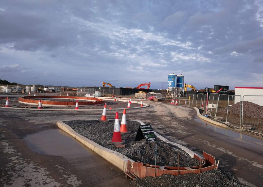
INTRODUCTION

                           A City for the North East

This submission is presented by Drogheda City Status Group a body of concerned
citizens who, six years ago, set about achieving recognition of Drogheda as a City and
National Growth Centre.

Mission Statement of Drogheda City Status Group is as follows:

“To procure City Status for Drogheda to enable its unique history, location and
potential to be appreciated and promoted in industry, business, tourism,
education, health and quality of life to the benefit and advantage of its citizens
and those of the South Louth and East Meath region.”

Drogheda City Status preliminary study came to the conclusion that Drogheda’s
problems stemmed from the lack of understanding and appreciation by policy
makers of the importance and potential of the town and region.
It became clear to us that policy makers in Dublin shared this flawed view of the
Drogheda region and its proper status.

                                                                               2|Page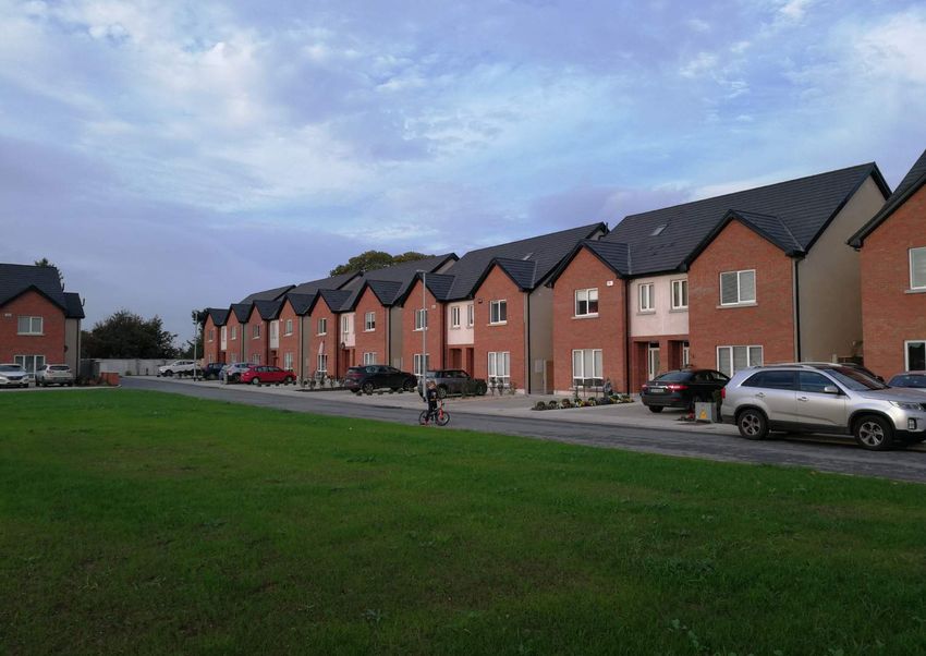
Drogheda, Ireland’s largest town, (formerly a county in its own right) has been a centre
of importance for upwards of 800 years. It has been a Corporate Borough with its own
Mayor, Alderman and Burgesses for all that time until recent local Government reform.
Proudly situated on Ireland’s most historic river and Gateway to the Boyne Valley, its
port has been a life line with Europe and the rest of the world. Drogheda has a unique
position in the North South Dublin - Belfast corridor with exceptional transport
infrastructure, i.e. main railway line Dublin to Belfast, M1 Motorway and the proximity
of Dublin airport and ready access to Dublin Port via the Port Tunnel.

The Drogheda hinterland contributes to its importance and attractiveness with the
coastal communities of Mornington, Bettystown and Laytown south of the Boyne and
Baltray, Termonfeckin and Clogherhead north of the river. It is surrounded by the
great fertile lands of Counties Louth and Meath and the beautiful Boyne Valley to the
West. It is also the major social, commercial and economic centre for a ring of growing
towns and villages in its hinterland, ie Stamullen, Donore, Julianstown, Gormanstown,
Donacarney, Duleek, Slane, Collon, Monasterboice, Tullyallen, Dunleer and Tinure.

The amazing history of Drogheda and the Boyne Valley, both pre and post Christian, sets
it apart in its unique archaeological and historic treasures and with enormous tourist
potential.

The town has a great long industrial tradition and led the country again in the growth of
new industry in the 1930’s, 1940’s, 1950’s, 1960’s and 1970’s. While some of the
industries have closed there is a growing appreciation by industrialists of Drogheda’s
attractions and in recent times a number of new firms have commenced ie Eastcoast
Bakehouse, Boann Distillery and Brewery and Statestreet.

The latest of these firms to set up is Mobile Technologies Inc (MTI) who is establishing a
European Headquarters contact in Drogheda employing 150 workers.          Speaking at the
announcement Minister for Jobs, Enterprise and Innovation Mary Mitchell O’Connor TD
said:

                                                                                3|Page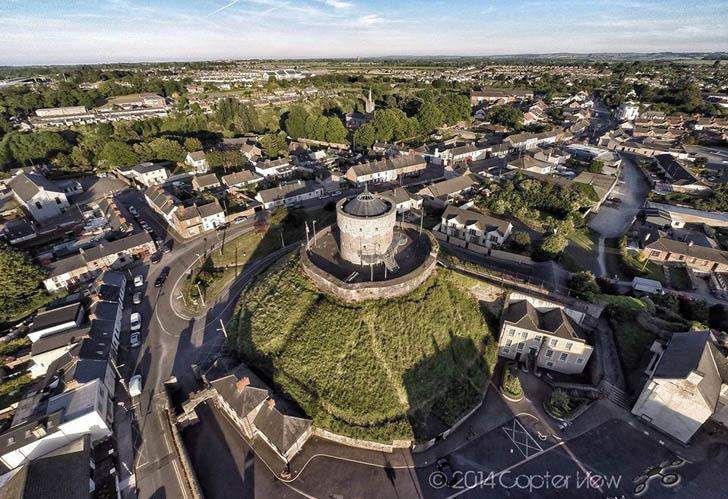
“This is a great announcement by Mobile Technologies Inc., bringing 150
      high skilled jobs to Drogheda. Driving investment into Regional locations
      is a key focus for me. This investment will be of considerable benefit to
      Drogheda and the Border Region, providing a significant boost to
      employment and benefitting the economy of the town and region.”

CEO of IDA Ireland Martin Shanahan said:
      “the high quality jobs created by the company will have a positive knock-on
      effect on the wider region and will promote Drogheda as an ideal location
      for conducting international business.”

As a further example we quote Michael Carey, Managing Director of Eastcoast
Bakehouse as follows:-
      “Drogheda was selected for this new business for a number of reasons:

      a.     Drogheda has network of highly successful food and drink
             businesses. Such a network has provided real and meaningful
             support during the early stages of the establishment of the business,
             providing advice, introductions and other support.

      b.     The road network around Drogheda is unique. While many of the
             employees at Eastcoast Bakehouse are local, some travel from other
             towns. Travel to and from the Bakehouse is very easy. Similarly,
             transportation of ingredients and delivery of finished product to our
             Irish retail customers (or to the ports) is highly efficient.

      c.     Availability of skilled employees in Drogheda is excellent. When it
             was announced that the initial group of 25 Bakehouse production
             staff were to be selected, we received over 2,500 applications in just
             a couple of weeks. Many of the applicants were already in
             employment, but were interested in being part of this start-up given
             its location (avoiding a long commute).

                                                                              4|Page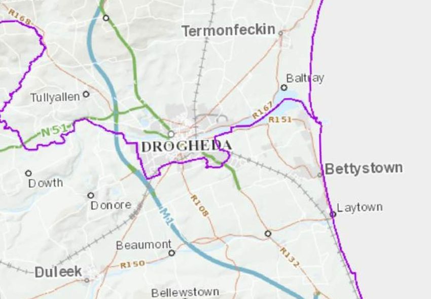
d.     Availability of suitable premises. When considering locations, a key
              requirement was to find an industrial building of the right size and
              shape. A number of available suitable buildings were identified in
              Drogheda.”

All of this has happened and population has grown despite Drogheda not being
prioritized in the last National Spatial Strategy 2002.

Truly Drogheda is a place with a distinguished past with a great growth future if
properly perceived, planned, managed and supported.

We have felt that in the National as well as local and regional interest it is important to
change the perception of this great town by procuring city status as Ireland’s sixth city
and recognition of its potential as a National Growth Centre.

We commissioned Dr Brian Hughes, PhD, MSc Hons. (Spatial Planning), Dip
Envir.Econs., F.S.C.S.I., F.R.I.C.S., FeRSA, MSSISI, Chartered Planning & Development
Surveyor, consulting in Urban Economics and Demography, (at Drogheda City Group’s
own expense), and we have had the benefit of his extensive research and reports.

In March 2012 Drogheda Borough Council passed a resolution,

       “That the members of Drogheda Borough Council from this day forward give
       their consent and approval to the people of Drogheda referring to Drogheda
       as the City of Drogheda”.

It is our understanding that “Ireland 2040 Plan” is in effect the Government’s
implementation of its “PUTTING THE PEOPLE FIRST” document.

                                                                                  5|Page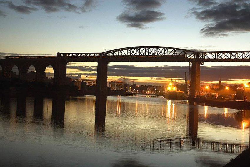
Ireland - 2040
The Minister, Simon Coveney has produced a Draft Plan inviting a new planning
framework for Ireland for the next 25 years.

This Draft Plan acknowledges that “the extra population and homes will happen in the
East Coast” and further that “this will present major challenges around lop-sided
development, under-used potential, congestion and adverse impacts on people’s lives
and the environment”.

If this population increase is foreseen for the Eastern Region (and by implication is
undesirably to be located entirely in Dublin) we submit that a vibrant and flourishing
City of Drogheda (by far the biggest town in the Country) at present should be an
obvious major contributor to the solution of the undesirable challenges identified by
the Minister’s plan. This is particularly the case as Drogheda town and hinterland is
experiencing exponential growth which is mirrored in the growth explosion of the
surrounding villages and towns.

Major growth has been shown to be focused on Cities and this strengthens Drogheda’s
case for City Status and Growth Centre for a separate region from Dublin.

We submit that Drogheda has unique advantages for growth and in the National and
Regional interest it should be identified in the new plan as a major growth centre with
City Status. Substantial growth has been shown to be focused on regions having a city
as there centre.

We set out here-under our vision and our reasons why this opportunity should be
grasped and why scarce resources invested in Drogheda Region will prove to be money
well spent and create a dynamic and attractive regional city focused on the Louth Meath
region helping (inter alia) to solve Dublin’s problems and exploiting all Drogheda’s
advantages in the National Interest.

                                                                                6|Page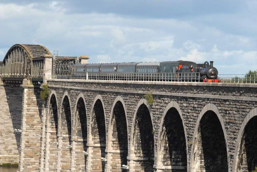
Infrastructure and facilities

When considering areas suitable for the creation of sustainable communities
consideration must be given to the level of infrastructure existing and that required to
be provided from the public purse in the pursuit of that policy. In this respect,
Drogheda and district would have a considerable advantage ahead of many other
centers. The infrastructure provision in Drogheda has been ahead of its time, despite
the lack of recognition provided by the pervious plan. This level of existing provision
provides an excellent basis to start with the infill infrastructure required for the
development of a sustainable growth center which will not compete with Dublin but
will run in parallel and in doing so reduce the pressure on the capital allowing both
centers to develop to their full potential.
When considering Drogheda, and the elements which have proven a strong draw for
residential communities in the past decade we have to be aware of both the natural
occurring infrastructure and the infrastructure which has developed as a result of
private or public investment.

                                                                                    7|Page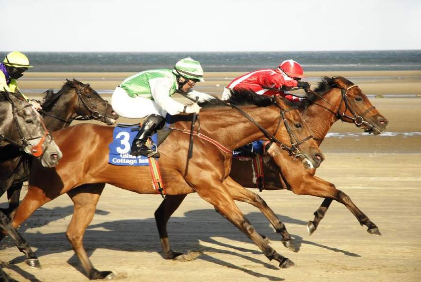
The natural occurring infrastructure in the region exists in abundance and provides a
backdrop to the quality of life afforded to residential communities in the area. These
elements include the wealth of heritage afforded by Drogheda’s position as gateway to
the Boyne Valley including treasures such as Newgrange, Oldbridge and the Battle of the
Boyne site all within walking distance for the town center. Within the town center we
also have the Millmount complex, one of the worlds finest Martello Towers and
Laurence’s Gate, one of the best examples of a Barbican Gate embedded in remaining
sections of the ancient town wall to mention but a few. We also have the majestic Boyne
River and the associated flora & fauna, and the extensive beaches of Laytown,
Bettystown, Mornington, Baltray and Cogherhead. It would be impossible to put a
monetary value on these assets but you can be assured that the cost to replicate them in
an alternative location would be prohibitive to the extent that it would be considered
impossible. A further element of a naturally occurring asset is Drogheda’s proximity to
Ireland’s Capital, Dublin. Located 40km North of Dublin City Centre, Drogheda is
sufficiently close to the capital, with significant transportation links, to allow Drogheda
residents enjoy the cultural and commercial activities within the capital without the
cost and difficulties associated with living in the city.
The developed infrastructure in Drogheda and the region is no less impressive and
breaks down into the spheres of, Transportation, Data Connectivity, Healthcare,
Education and public utilities.
In the area of transportation Drogheda boasts it’s own commercial sea port providing
access to all international ports and handling in excess of 1 million tonnes of product
annually. Drogheda’s train station is on the Dublin-Belfast line and is a high speed rail
line which currently provides 34 trains each way, each day between Dublin and Belfast
with some journey times down to 32 Minutes. The capacity of this line is only limited by
the capacity of the DART section between Howth Junction and Connolly Station, this
DART limitation could be removed, if required, by an adjustment of headroom lengths
to international norms.
Drogheda, like many other centers is well served by motorway infrastructure with
considerable retained capacity due to recent expansions from Lissenhall to the M50
however unlike other centers our M1 motorway infrastructure not only links Drogheda
to the M50 and Dublin within 25 minutes but also links Drogheda directly to Belfast,
Irelands second largest city only 60 minutes away. Drogheda also benefits from having

                                                                                  8|Page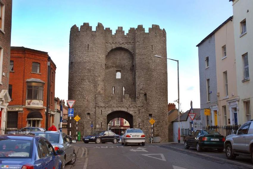
5 dedicated intersections off the motorway (junction 7 to Junction 11) providing
efficient access to the northeast, northwest, west, central and south Drogheda.
Probably the most appealing aspect of Drogheda’s infrastructure is the availability of an
international airport located just 25 minutes to the south, again many centers will
indicate similar proximity to airports however for the consideration of the development
of an international business it is not just the airport but the availability of direct flights
to their parent city. Dublin Airport, on Drogheda’s doorstep, boasts direct flights to 185
destinations in 41 Countries on 4 Continents and businesses located in Drogheda have
easier assess to those flights than any other comparable center. Even Dublin city due to
it’s traffic congestion cannot boast such ease to international connectivity.
In the current modern business world, secure fast data connectivity is essential and in
this respect, whilst other centers are catching, up Drogheda is leading the field in
relation to data connectivity with in excess of 100MB fiber connections currently
available to the business and residential community and 1GB connectivity into some
business centers. In addition to the necessary high speed connectivity Drogheda can
also boast an additional benefit to companies where security of connection is essential,
and that is the level of redundancy provided by providers operating on more than one
network. In many centers even though there may be numerous providers they are
sharing a single network with the potential that a network failure could result in a loss
of service, a second network has been brought into Drogheda by Virgin media allowing
security of continuity for critical data operations even with a catastrophic failure on
one network.
In the area of healthcare, Drogheda’s status in this area has been progressing over the
past decades, with the Lourdes Hospital serving as the regional hospital for the North
East providing acute, emergency, maternity, oncology, palliative and infective disease
medical care among others. The hospital is affiliated to the Royal College of surgeons. In
addition to the regional hospital Drogheda is served by numerous primary care facilities
and nursing homes providing the required full range of care required.
The educational infrastructure in Drogheda and the region has benefited greatly by
being classified as a high growth center by the Department of Education. This has
resulted in a significant level of continuing investment in schools and facilities at all
levels in the area and the development of state of the art Primary and Secondary school
campuses. In addition to Drogheda’s local college of further education the secondary

                                                                                     9|Page
school leavers from the area have an array of college facilities available to them
including DKIT, DCU, UCD, DIT and Trinity with direct train or bus services to these
centers.
The final area of infrastructure available to Drogheda is public utilities including
Electricity, Water and Wastewater, and waste disposal. The development of these
utilities has allowed for significant capacity to accommodate a population in excess of
100,000 people without a requirement for expansion. The municipal wastewater
treatment plant in Drogheda was developed in 2004 and upgraded in 2007 to provide
primary, secondary and tertiary treatment for a population equivalent of 100,000
persons. The water supply and treatment facilities in Drogheda are similarly operating
at significantly less than capacity to the extent that it is capable of facilitating large areas
of Meath also with high quality potable water. Drogheda is also fortunate to have the
Indavar incineration plant located on our doorstep providing a facility to sustainable
dispose of all refuse arising which cannot be recycled and to feed the extracted energy
back into the national grid.
In the consideration of the development of growth centers in Ireland it is essential that
Drogheda, which already has he required infrastructure in place and is a desired
location for residential and commercial development, be considered ahead of other
centers where additional financial resources need to be expended and excessive
encouragements are required to force development.
10 | P a g eTransport
Drogheda has unique accessibility by reason of its situation on the M1 motorway and
on the main North South railway line together with its Port and proximity to Dublin
airport and easy access through the Port Tunnel to Dublin Port. There are also plans
for a new railway station on the North side of the town and the possibility of a Dart
extension to Drogheda.
Education
Drogheda serves as the headquarters for the Louth Meath Education Board and also
serves as the centre of education for the residents of the town and hinterland areas we
seek to include in the Boundary Extension, namely, Drogheda Grammar School, St
Oliver’s Community College, Our Lady’s College, Greenhills, St Joseph’s Secondary
School, Sacred Heart Secondary School, Ballymakenny College, St Mary’s Diocesan
School, Colaiste Na hinse, Laytown, Scoil Ui Mhuire, Dunleer, Ardee Community College
and Gormanstown College, Co Meath, with student populations of 7,364 made up of
residents of both Louth, Drogheda and Meath and currently provides cohesion within
the greater Drogheda community.
The number of Leaving Certificate sits in 2016 in County Louth was 1791.
11 | P a g eDrogheda is favourably situated for attendance by third level students at universities at
Dublin and the Regional College in Dundalk. It is anticipated that out-reach courses
from the Universities will be provided in Drogheda in the near future.
Tourism
A city in the region would be a focus for the tourist development of the Boyne Valley as
yet not nearly realised but with huge potential. Drogheda is the centre of Ireland’s
most historic and archaeological area situated as it is astride the Boyne and Gateway to
the Boyne Valley described by the late TK Whitaker as a “magical area”.
The Treasure Trove of attractions of Drogheda and the Boyne Valley include
Monasterboice
with its round tower and the finest three Celtic High Crosses in the country, Mellifont
Abbey with its impressive remains of the first Cistercian Abbey in Ireland, the
Newgrange Tumulus a World Heritage Site, the tumulus at Knowth and the cairn at
12 | P a g eDowth, the site of the Battle of the Boyne and the Interpretative Centre at
Oldbridge, the Ledwidge Museum at Slane, the Hill of Slane where St Patrick lit the
Pascal Fire, Slane Castle, the Round Tower at Donoughmore and all the way to Trim
with DeLacy’s famous castle.
The town of Drogheda is of great historical interest. Besieged twice and stormed by
Cromwell in 1649. Several Parliaments were held here, Poyning’s Law being passed.
Many storied ruins include the famous Laurence’s Gate, Magdalen Steeple,
Millmount, etc.
The site of the Battle of the Boyne is of great tourist potential with the stone base of
the Oblisk erected after the Battle still existing. The site is of great interest to the
Orange Order whose supporters have acquired a site of 40 acres on which the Oblisk
was erected. They have met with local interests (including the City Status Committee)
with a view to re-erecting the Oblisk to commemorate the Peace Process.
13 | P a g eSporting and Recreational Facilities
Because of its wonderful situation close to the coast Drogheda enjoys the amenities of
the coastal resorts of Mornington, Bettystown, Laytown, Baltray, Termonfeckin and
Clogherhead with their lovely sandy beaches. There are three championship golf
links who often host important National and International competitions.
Water Sports: proximity to the coast and the availability of the River Boyne provides
ideal locations and facilities for all kinds of boating and water sports as well as fishing.
Sporting enthusiasts are well catered for with the fine GAA ground being upgraded to
the County Ground, Drogheda United is a premier League of Ireland club with plans for
a new modern stadium and the Rugby Club have their own ground.
Boyne Trail: Plans are advanced for the delivery of the Boyne Trail a 16.5k cycle and
walkway from the Boyne Estuary at Mornington to the World Heritage Site at New
Grange passing through beautiful scenery and along the towpath of the old Drogheda to
Navan canal which hopefully will be re-opened for navigation in due course.
14 | P a g eArts and Hertigate and Entertainment
Drogheda is an attractive place to enjoy an excellent quality of life. It has all the usual
places of entertainment such as a multiplex cinema, three theatres, a very important
award winning art gallery, a number of Drama Groups, a fine Arts Centre, an abundance
of restaurants, cafes, hotels and licensed premises. The fine St Peter’s parish church
contains the famous Shrine of St Oliver Plunkett.
Shopping
The old attractive centre of the town with its ancient streets and welcoming shops
serving the town residents, hinterland inhabitants and visitors alike. There are also a
number of shopping centres on the town periphery.
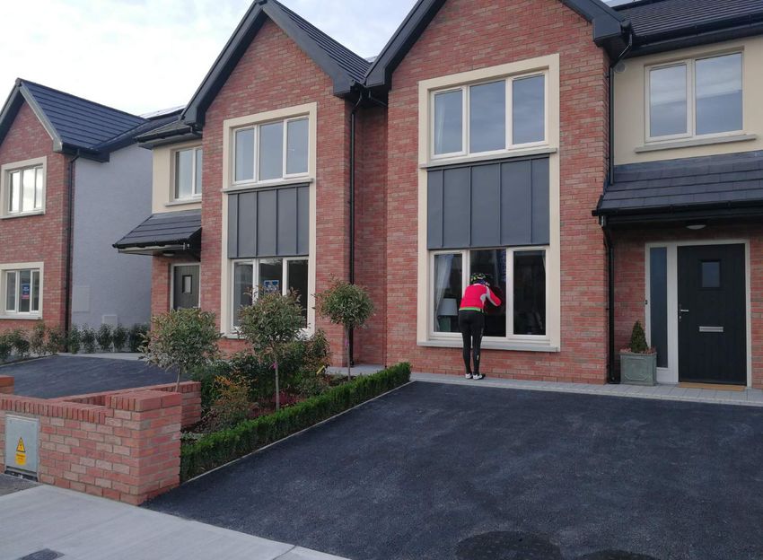
Housing
Drogheda and its hinterland is an attractive place to live which explains its ever growing
population.
Plans are already in existence to erect a new Bridge over the River Boyne to improve
access to the Drogheda Port and Harbour and to open up access to substantial lands for
the erection of up to 10,000 new dwellings on what is called “The Northern Cross
Route”.
Many people of necessity commute daily from the region to Dublin to work. This adds
to Dublin’s congestion problems. Undoubtedly these people would prefer to live and
work in the Drogheda region if and when employment is provided.
Conference Centre
Drogheda is an ideal location for Conferences because of its accessibility and the
provision of a Conference Centre is being actively considered.
15 | P a g eHealth
Drogheda is particularly fortunate in having Our Lady of Lourdes Hospital, one of the
largest hospitals in the East of the country, serving a catchment population of 350,000
people. It is the Regional Trauma Unit and Level 3 Paediatric and Obstetric Unit for the
North East. It has one of the busiest Emergency Departments in the Country with in
excess of 60,000 presentations annually.
Our Lady of Lourdes Hospital (OLOL) is a recognised teaching and training hospital for
medical and nursing staff and accredited for such purposes by many of the affiliated bodies such
as the RCPI, RCSI etc. It is the largest hospital in the North East Region and is the centre for
Trauma, Obstetrics, Paediatrics and Neonatal Medicine.
The current structures were mainly built in the 1950’s, but include elements from the
1990’s, and most recently from the last decade, when the current Phase 1 block was
completed. This recent structure houses the Emergency Department and three floors
of Ward accommodation.
The Phase 2 development currently in progress on the campus will consist of:
• Ground Floor, accommodating an extension to the existing Emergency Department
which will incorporate an extension to the Paediatric treatment area, an increased
space for treating Minor Injuries, Rapid Access and Treatment and enhanced
treatment facilities for complex care including Resuscitation.
• Three Ward Floors configured as single room accommodation to comply fully with
SARI guidelines. (Funding approval is awaited for one level).
• A Theatre Suite comprising five fully compliant operating rooms. (Funding approval
is also awaited for these).
The block will extend to approximately 9,000 single metres and will be linked to the
existing Phase 1 block and the main tower block of the older part of the Hospital. The
construction of shell only units at present for one of the Ward Floors and the Theatre
Suit is due to central funding constraints, however completion is anticipated once
funding becomes available.
16 | P a g eThe expected cost of the whole development is expected to be in excess of £30 million.
The anticipated completion date is expected to be 3rd Quarter 2017.
At present Our Lady of Lourdes hospital employs a staff of 2088 and is a 307 bed Acute
General Hospital incorporating a Regional Trauma Orthopaedic service and Louth
Meath Neonatal Intensive Care and Paediatric services. Surgical Services include
general Surgery, Orthopaedics, Urology and Gynae including early pregnancy
assessment unit. ENT. Medical services include General Medicine, including sub
specialities of Cardiology, Endocrinology, Diabetes, Gastroenterology Oncology,
Dermatology, Elderly Medicine, Respiratory Medicine, Microbiology, Pathology and
Palliative Care. Regional Trauma Orthopaedic service including fracture clinics. Joint
Department of Anaesthetics between Our Lady of Lourdes Hospital Drogheda and Louth
County Hospital. Emergency Medicine services; Emergency Department (ED); The
ICU/HDU/CCU; Acute Medical assessment Unit. Maternity Services, Paediatric;
Neonatal Intensive Care; Oncology Day Services Unit.
Nursing Homes
There are a number of Nursing Homes in the Drogheda area and two substantial new
Nursing Homes are already planned to meet the anticipated requirements to 2020.
The growing Drogheda region with its population explosion clearly calls for proper local
Government administration and governance centred on the City of Drogheda. Drogheda
City as it expands will assist in the orderly growth (which is already happening) of its
large hinterland containing many expanding growing towns and villages and rural areas
and provide support for the residents.
We envisage a Drogheda Region as a Sub-Region of the Eastern Region to ensure more
effective planning in this highly populated and important region.
The growth of tourism in Drogheda and the Boyne Valley will encourage the creation of
small service businesses to service the tourist requirements.
17 | P a g eThere is such a cultural heritage, natural habits and beautiful countryside in this region
that enlightened and sensitive planning is required and best provided by a strong and
visionary Local Government centred in Drogheda.
To quote Dr Hughes “Drogheda, Ireland’s largest freestanding town, is and will continue
to grow dynamically because it is an attractive place to live in, is strategically placed in
the Dublin-Belfast Corridor and not least, because of its proximity and accessibility to
Dublin, to the airport and the M50 employment zone. Its own size will also contribute
to further organic population growth where its demographics are very positive and
promising for the Greater Drogheda Area. It is vital that such growth is complemented
with employment growth, which is the most important issue for Drogheda’s people.’
We have seen examples of how Drogheda was ignored, e.g. in the Spatial Strategy where
Ireland’s largest town was not even given Gateway Status. Another example was the
recent allocation of €150 million Enterprise Fund where towns such as Carlow, Sligo,
Clonmel, Waterford and Dundalk were beneficiaries and Drogheda again was
overlooked. It should be noted that Drogheda is the only town in Ireland to which a toll
applies for motorists entering and exiting the town. A most discriminatory position.
Drogheda is bursting at the seams and has expanded far beyond its existing boundary.
To all intensive purposes Drogheda is a City and in Plan 2040 it should be treated as a
City with all the Regional and National benefits that will flow therefrom.
Agglomeration
We are convinced that the medium to long term objective is to have an extended
administrative area south of the River Boyne to mirror the current administrative
Drogheda areas on the north of the Boyne which includes: Termonfeckin, Tullyallen,
Baltray and Tinure which if mirrored would incorporate Mornington, Bettystown,
Donacarney and Donore into the greater Drogheda area. This increase in population
would provide endless possibilities in respect of status, funding and provision of
services with need for proper local government and planning which would also position
Drogheda as a valid recipient of City Status as per European requirements. This would
make Drogheda Ireland’s newest city as advocated by Dr Brian Hughes.
18 | P a g eIn the north south corridor the British Government have recognised the importance of
Newry and Lisburn by giving them City Status – why not Drogheda which is much larger
than either of these.
We would stress that Drogheda is the only stand alone settlement that adjoins another
large town of 10,000 plus population, ie, Laytown, Bettystown and Mornington. It is
unique because it is now physically linked to this other large town which itself is bigger
than Enniscorthy, Wicklow, Tramore or Cavan.
We attach report from Dr Brian Hughes which makes a cogent case for the
agglomeration of Drogheda with Laytown, Bettystown and Mornington and for the
granting of City Status for Drogheda.
We would respectfully suggest that the “Ireland – 2040 Our Plan” National Planning
Framework, in the National interest would support our ongoing case for the granting of
City Status for this growing and important area.
The advantages of having a city in the North East region will beneficial to Counties
Meath and Louth but will also give support to the economies of Counties Cavan and
Monaghan.
Drogheda is the right place and this is the right time for its potential for sustained
development to be recognised and planned. It will give a great return and a healthy
and vibrant lifestyle for its citizens and those of the Region and help to alleviate Dublin’s
problems in the National Interest.
19 | P a g eBRIAN P. HUGHES
PhD, MSc Hons. (Spatial Planning), Dip. Envir. Econs.,
F.S.C.S.I., F.R.I.C.S., FeRSA, MSSISI.
Chartered Planning & Development Surveyor
Consulting in Urban Economics and Demography
24th October 2017
This Research Study accompanies the Formal Petition for Drogheda-Laytown-Bettystown-
Mornington (including Donacarney) to be made Ireland’s sixth city.
Assessing the Demographic Growth Momentum in Identifying the Emerging
City of Drogheda with Laytown-Bettystown-Mornington (LBM).
This evidence-based research study presents the application of population density grid
analysis in applying the 2015-published Harmonised European Union (HEU) methodology to
this emerging east-coast city. In addition to this methodology, this research also describes
the current housing developments, photographs of new housing and construction, relevant
demographic tables, the map of the new city area and bibliography. It highlights the
following research evidence and conclusions:
The population grid densities confirm the physical agglomeration of Drogheda with
LBM, reflecting their population size and 20-year growth momentum.
This research study confirms that the new, 2015 Harmonised, OECD and EU
Measurement test of what constitutes a ‘city’, applies successfully to Drogheda-
LBM. This relates to population per square kilometre densities.
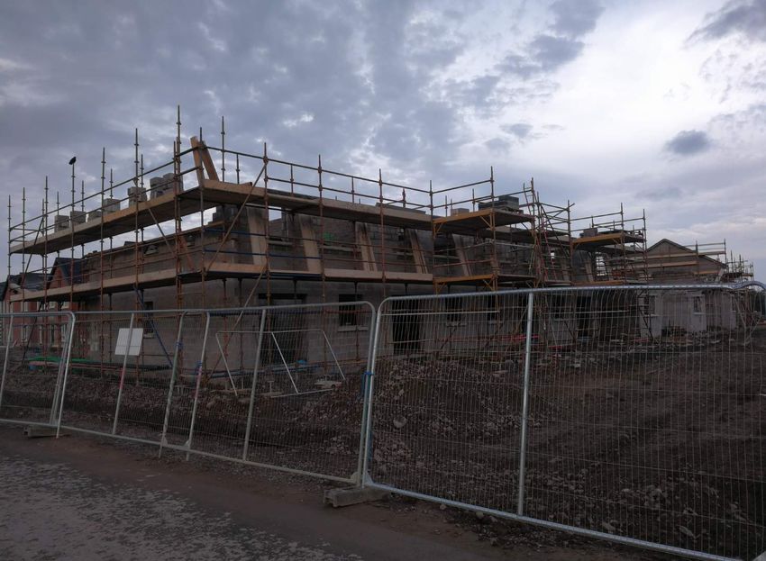
In the eighteen months since the 2016 census, hundreds of newly-constructed
houses have been occupied by upwards of two thousand people, adding to the
combined settlement population, which stood at 52,828 in April 2016.
Hundreds of additional completed houses have yet to be occupied and further
construction is underway in dozens of new construction sites, most notably in
Bettystown and Donacarney and throughout Drogheda. Accordingly, Drogheda-
LBM now has a larger population than Waterford City.
1Abstract:
In earlier research literature this author deployed both population size and daytime
working population data as measures of potential settlements, for selection as
comparable growth centres for the National Spatial Framework, vide Hughes (2013). An
identified problem, encountered in defining urban settlements and that of their spatial
extent, is the dilemma of opposites; of being able to distinguish between the physical
‘separation’ and the agglomerating ‘contiguity’ of discrete settlements.
Focusing on linear distance as its principal ‘separation’ measure, the United Nations
provides a limiting description, for separation, in the task of quantifying singular urban
fields of agglomeration and thus in identifying processes of city formation. In contrast,
The World Bank advocates three ‘D’s which, in addition to Distance and Division, includes
Density (2009). Particularly for Ireland as a sparsely-populated country, this latter
measure assumes particular importance, especially given its scarce number of large
settlements and their linear distances from each other.
The Central Statistics Office (CSO) now has the facility for grid-enabled data, which can be
used in distinguishing between examples of scattered morphology of sparsely-populated
ribbon development in contrast to that which can identify densifying urbanisation cores.
Using the 2016 census area population results, this paper now investigates and applies
population grid data measures based on the CSO grid-based demographic data, applied at
the square kilometre level. Applied to a real-life example, this technique facilitates the
further research objective of identifying Ireland’s emerging city, the east coast
agglomeration of Drogheda with Laytown-Bettystown-Mornington (LBM).
In its census of 2011, the CSO adopted the United Nations updated convention for
Settlement distancing in its application of the ‘100 Metre’ rule for settlement separation.
This is applied to habitable buildings, including both residential and non-residential
structures. Prior to 2011 the linear distance was 200 metres.
The rationale for its use is …to avoid the agglomerating of adjacent towns caused by the
inclusion of low density one off dwellings on the approach routes to town. CSO 2011
Census, Area Volume, Appendix 1. The GDA together with County Louth – which has two
of Ireland’s three largest towns, Drogheda and Dundalk – this area comprises the
Republic’s two million-plus population share of the dynamic Dublin-Belfast economic
corridor area; in all, this corridor comprises just over 50% of the island’s 6.65 million
people.
Analysing the agglomeration of LBM with Drogheda and in comparing this with that of
Blackrock (Louth) with Dundalk, on the basis of the EU Grid criteria, this Paper concludes
by noting the need to distinguish between physical separation and that of physical
agglomeration and proximity densification under the new Harmonised European Union
(The Graz methodology), especially for governance and local administration purposes in
this new Putting People First era of local governance rationalisation. Post 2016 growth of
Residential Developments based on a 17th October 2017 survey, undertaken by the author
and by Peter Monahan of the City Status Group Committee.
21. Census Geography - Applied Measures:
The CSO’s evaluation of settlement size is set out in their Population Classified by Area
Volumes of recent census results vide Appendix 1, Census Geographic Definitions, PP. 151-
155, CSO (2012). It applies the linear distance rule for confirming settlement separation,
applied so as to distinguish between a densely-populated urban field and an adjoining
elongated ribbon of mainly housing development that often occurs on access routes to a
defined city or town settlement. The objective is to provide definitive and regular-shaped
settlements, thereby defining their footprints from their surrounding rural morphology.
Such measures for ‘division’ are effective in statistically isolating discrete new urban areas
such as Bearna from Galway and the Balrothery separation from Balbriggan, resulted in
creating these new town settlements in 2011. However, the application of such tests on
their own, for cases of emerging urban agglomeration are inadequate, especially where two
settlements are expanding towards each other and wherein, the provision of shared, linking
infrastructure, the momentum of development is designed for and is resulting in emergence
of a densified agglomeration, thereby producing a much larger unified settlement, albeit as
one that may have more than one central core.
The opposite effect from an inappropriate application of the ‘100 Metre’ rule can serve to
ignore or overlook cases such as the emergence of bi-centric, adjacent settlements that are
in a process of agglomerating and which are thus forming a larger settlement. One
conspicuous example of an Irish failure to ‘see the wood from the trees’ is that of
Drogheda’s progress in its agglomeration with nearby Laytown-Bettystown-Mornington
(LBM) where a Local Government boundary proposal of late-2015, confined to Drogheda,
with the objective of facilitating its local government administration was rejected. Yet, there
has been no recognition of the bigger, emerging picture, of Drogheda’s agglomeration with
LBM: one that straddles the Elizabethan and adjusted county boundary.
2. Quest for Urban Boundary Changes and Local Governance Issues:
Notwithstanding Ireland’s unusually low level of urbanisation – with a 2016 share of just
62.70% of its population living in settlements of 1,500 and over – its urban development
‘catch up’ process is resulting in both population growth and a spreading of its urban
settlements. Accordingly, many of its cities and towns are experiencing outward growth
wherein its towns and environs are spreading beyond former administrative or county
boundaries. Thus existing settlement boundary lines are being breached with successive
waves of outward development.
Whereas in the census of 1996 the CSO listed twenty settlements whose population
overlapped into another county, by 2011 that number had extended to twenty-eight
settlements, i.e. Populations of Towns or Environs/Suburbs which are located in more than
one county. For modern-day local government administration, such geographic expansion
presents particular difficulty driven by an over-riding objective to manage single-settlement
administration within a one county authority. See Irish Times letter, P. 21, October 20th:
“Local Authorities – time to move on from medieval constraints?”
3The frequency of such county-boundary ‘straddling’ now requires a more inclusive
treatment for local governance purposes than this existing, blunt, solution of adjusting
county boundaries. In implementing local governance reform since the 2011 census the
first-phase in the current processes of local government has focused on the rationalisation
and merging of county and city units, sometimes with considerable, unresolved, controversy
and opposition, as in the case of Cork City and its county.
A second phase in this process of Local Government rationalisation, addresses the dilemma
of governance adjustments for some larger and expanding settlements. It is noted that the
foresighted provisions of Putting People First proposes flexible arrangements for cases of
straddling settlements. However, such aspiration is likely to require updated, matching
legislation that has not yet found its way onto the State’s statute books.
Recent boundary revisions were undertaken under outdated 1991 Local Government
legislation for Waterford City, Drogheda, Carlow and Athlone towns, in descending order of
population size. Their objective was to contain such settlements within a single county for
administrative purposes and to so do by redrawing county boundaries where considered
expedient. Such administrative ‘juggling’ had been intended to be implemented regardless
of the evident extent of local business, resident and sporting opposition. However all four
proposals were firmly rejected and there that matter rests.
However, Drogheda’s urbanisation is unique in Ireland – outside of the Dublin conurbation,
as it is the only large town that is physically agglomerating with another large one, LBM.
3. Drogheda – the grid-based evidence for a City Recognition:
Despite the publication in 2013 of the Government’s visionary Putting People First, Action
Programme for Local Government, the Department of Housing, Planning and Local
Government (DoHCLG), had intended to review Drogheda’s former Borough boundary
under Section 28 of the now dated Local Government Act 1991 Act, rather than
implementing the principles contained in the Putting People First initiative, in pursuance of
the administrative objective to retain larger single settlements within a single county council
area.
It is therefore necessary to distinguish the important and unique case of adjoining and
merging high-density agglomeration for the immediate proximity of Drogheda and LBM, in
contrast to low-density and/or geographically separated low-density ribbon development,
elsewhere in Ireland.
Drogheda-LBM provides a unique situation in Ireland, where two adjoining plus-10,000
settlements are physically merging. The population growth evidence points to Drogheda
continuing its demographic growth of up to three times that of the State population growth
rate since 1996. Since then it became and continues to be Ireland’s largest town. This
ongoing agglomeration momentum is supported by the recent provision and commissioning
of a 100,000 population capacity waste-water tertiary treatment plant at Marsh Road,
Drogheda with its linking sewer networks of investment and likewise with the completion of
the District-level Shopping Centre at Southgate together with the re-commencement of a
4number of residential development that are consolidating the merger of Drogheda with
LBM.
In the current local government rationalisation programme, demographic scale is one of two
principal issues in question of scale-size, that distinguishes the failed Boundary Review that
from all previous Drogheda revisions. This would have resulted in additional 7,000 people
who reside south of the Boyne being ‘placed’ in County Louth; resulting in over 14,000 as
per the 2016 census results, south-river. This would also have involved a transfer to Louth of
several additional square kilometres of what is now part of County Meath. In Drogheda’s
case, previous county boundary ‘adjustments’ on a smaller scale have already resulted in
the cumulative ‘transfer’ of a similar sized area south of the Boyne, from County Meath to
County Louth.
The second issue remains unresolved: that of identifying the emergence of a new city on a
demographic scale of Waterford City. Unlike Waterford, Carlow and Athlone, what
differentiates Drogheda is the zero ‘Distance’ separation cum urban proximity of another
large i.e. plus-10,000 town that presents the most significant factor for the future
administration of Ireland’s emerging city. All three other settlements are ‘stand-alone’ and
unlike Drogheda, they do not adjoin another such settlement.
Of itself LBM in 2016 is Ireland’s thirty-fourth largest town and is on a par with Ashbourne
as one of Meath’s largest towns. The boundary review documentation shows Drogheda’s
proposed indicative and blue-hatched boundary line to the south of the current Borough
area of Drogheda which would have resulted in the town’s new boundary extending to the
western edge of LBM. To accommodate Drogheda’s expansion it would also have been
necessary to adjust its existing northern boundary line within County Louth, which will affect
a further 2,000-plus of the town’s population.
The logical administrative rationalisations under the Putting People First initiative should
result in a Louth-Meath administrative unification, with Drogheda-LBM becoming Ireland’s
fifth largest city and that sub-region’s logical administrative centre with a current population
that is greater than that of Waterford City. With the emergence of Drogheda+LBM as a city,
the boundary transferral of further Meath territory into Louth becomes an administrative
irrelevancy. Drogheda + LBM’s confirmation as Ireland’s next city will complement south of
the border, the North’s earlier initiative to grant city status to both Lisburn and Newry,
within the Dublin-Belfast Corridor.
4. Drogheda-LBM’s Population Urban Field Grid Matrix
The Urban Field of the Drogheda-LBM Population Density Grid on a One Sq. Km. basis is
applicable to the OSI Discovery Series Map 43 (Fourth Edition, 1:50,000 scale) for the 2011
census population is set out in a population grid format, kindly provided by the CSO to this
author in December 2015. The complete matrix for the twin settlement of Drogheda and
LBM confirms a grid formation in a north-south depth of ten kilometre rows. The respective
2011 core populations are set out in an ‘all-border’ format, comprising fourteen medium-
5density central grids totalling 11,297 in population for LBM, located east of and next to the
twenty grids totalling 37,669 for Drogheda. In all, these adjoining 34 sq. km. grids comprise
a core agglomeration population of 48,996 with an average density of 1,440 people per sq.
km., set out as follows:
Drogheda-LBM 2011 census Population Spread – OSI Map Grid References:
Grid cells 6/7 7/8 8/9 9/10 10/11 11/12 12/13 13/14 14/15 15/16 16/17 Totals
79/80 131 54 86 9 28 107 58 97 40 37 - 647
78/79 26 6 27 59 58 84 52 83 5 - - 400
77/78 20 17 61 16 449 153 79 65 99 - - 959
76/77 74 219 2,643 3,308 2,423 10 5 80 489 306 - 9,557
75/76 1,212 1,534 3,226 3,553 823 5 46 112 275 1,059 - 11,845
74/75 1,028 3,631 3,183 2,727 2,411 2,470 673 752 748 691 - 18,314
73/74 73 553 494 705 435 861 56 13 1,224 2,162 185 6,761
72/73 42 20 80 62 45 13 106 11 90 705 392 1,566
71/72 5 25 87 - 85 5 15 20 35 443 1,378 2,098
70/71 51 25 5 61 76 43 52 253 223 21 8 818
Total 2,662 6,084 9,892 10,500 6,833 3,751 1,142 1,486 3,228 5,424 1,963 52,505
Footnote:
So as to maintain local anonymity, the CSO records a count of ‘5’ where grids have recorded census
populations of between 1 and 5. Zero-populated grids are as shown. So as to make the interpretation of the
grid more manageable, it limits the matrix size to eleven kilometres in width and ten kilometres in depth. It is
however recognised that this surface area is therefore somewhat smaller than that of the Drogheda and
District area (population 60,646 in 2011) and somewhat smaller again than the Louth and Meath Rural Areas
plus Drogheda Borough (CSO population 78,594 in 2011 and 83,317 in the Census data of 2016). It is of a size
that captures the adjoining Drogheda and LBM towns and their contiguous environs.
6Based on the 2011 census demographic outcome, augmented by the 2011-2016 growth in
population and the more recent physical evidence of real estate development, there is
today, little physical or demographic separation between the settlements of Drogheda and
LBM. This is confirmed in the Ordnance Survey of Ireland Map ‘spine’, of an unbroken high-
density ‘band’ of population in adjoining grids. This central ‘spine’ extends east-west for ten
square kilometres, identified in an axis along the grid 74/75 (including from references 6/7 to
15/16), as shown in the one-kilometre cells of this Discovery Series, map No. 43.
This is used as the grid-base for the CSO’s grid matrix of populations based on the 2011
census, The west-to-east populations along this ‘spine’ grid line 74/75, comprises an
aggregate population of 18,314, identified in their respective one sq. km. populations which
is set out in the following Greater Drogheda’s Urban Field Grid Matrix, showing this
consolidated ‘spine’ cells extract, thus:-
6/7 7/8 8/9 9/10 10/11 11/12 12/13 13/14 14/15 15/16 Total
74/75 1,028 3,631 3,183 2,727 2,411 2,470 673 752 748 691 18,314
Source: Part of the CSO population grid one-kilometre square matrix dimension, as requested and kindly
provided by the CSO to Brian Hughes, December 2015.
The six left-hand side Drogheda grids, east to include grid 11/12, are immediately followed
by the four right-hand LBM ones from 12/13 eastwards. This agglomeration spine’ for
Drogheda-LBM conclusively presents an interfacing and uninterrupted population density
for these adjoined settlements. Furthermore, these ‘spine’ data represent just one row of a
ten-row deep matrix. Their spatial argument, confirming this twin-settlement merger for
Drogheda-LBM, is based on this east-west spine of the 110 adjacent population grids as laid
out in the full matrix grid. These identified ten adjoining ‘spine’ square kilometre cells have
an average population density of 1,831.4 which is higher than the density of any of the four
provincial cities in Ireland in that census.
A significant distinguishing feature between ‘ribbon development’ morphology and a dense,
continuous ‘urban field’ is the extent and depth of development. This author avers the
selection of one-kilometre-square grids which is a spatially significant one; a measure in
linear terms which is ten-times that of the 100 metre UN distance. However, in evaluating
the process of urbanisation for evolving large settlements and in allowing for pockets of
undeveloped land or of large underdeveloped sites, it is also desirable to balance ‘space’
area with density, discussed as follows, in using the example of the linking of Dundalk with
its adjoining seaside suburb of Blackrock, Co. Louth
75. Dundalk and Blackrock – a Grid Comparison with Drogheda-LBM:
For Ireland third largest town - Louth’s County Town, Dundalk and its seaside suburb of
Blackrock is centred to its south at some three to four kilometres remove. All together they
comprise a 2011 census settlement population of 37,816, where the Blackrock area
comprises 6,500 of its total population. Blackrock is adjudged to conform to the U.N.
distance rule and thus to be included as the southern part of a single Dundalk settlement.
However, the one-kilometre square grid populations, when compared with the above
Drogheda-LBM grid, reveals that its linking cells are less dense than those comparable ones
for Drogheda-LBM, the latter settlement’s identified linking cell density being diluted to 328,
482, 117 and 853 persons per square kilometre because of the presence of an 18-Hole golf
course at Haggardstown. They are set out in a similar OSI Grid-map Discovery Series No. 36
(2007) format including the specified grid-cell references, as follows:
Dundalk-Blackrock 2011 Census
Population Grid – OSI Map References:
Cells 02/03 03/04 04/05 05/06 06/07 07/08 08/09 Totals
09/10 158 676 380 276 - 50 88 1,628
08/09 236 2,650 1,799 120 362 - 54 5,221
07/08 35 2,232 2,314 1,807 1,854 753 272 9,267
06/07 90 1,024 1,304 4,360 2,872 50 19 9,719
05/06 97 85 637 2,802 2,105 - - 5,726
04/05 52 69 29 378 328 117 - 973
03/04 66 39 67 255 482 853 - 1,762
02/03 109 83 159 471 2,028 599 - 3,449
01/02 6 27 21 31 331 - - 416
Total 849 6,885 6,710 10,500 10,362 2,422 433 38,161
Source: CSO Population 2011
Census
Note: The boxed grids delineate the Dundalk-Blackrock ‘spine’, which runs in a north north-west south south-
east axis.
The distorted result of applying the aforementioned 100 metre U.N. distance criterion on its
own, instead of utilising density-proximity measurements is that it masks Ireland’s few
emerging cases of urban agglomeration. Such density research is vital to the task of
settlement selection in the forthcoming National Spatial Framework. From a side-by-side
comparing of the two sets of grid population data, the Drogheda-LBM scale and size of
urban agglomeration is far superior to that of Dundalk-Blackrock. Hence, the following
comparisons are instructive:
8 One Km. Grid Size: Drogheda-LBM = 110 sq. km; Dundalk-Blackrock = 63 sq.km.
Total Grid Populations: Drogheda-LBM = 52,965; Dundalk-Blackrock = 38,161.
Linking 2-grid Populations: Drogheda-LBM = 1,425; Dundalk-Blackrock = 810
2011 Populations: Drogheda = 38,578; Dundalk (excluding Blackrock) = 31,316
2011 LBM and Blackrock Populations: LBM = 10,889; Blackrock = 6,500 (vide Grid).
Densest LBM cell = 2,162; densest Blackrock cell = 2,028 population.
Void cells: Drogheda-LBM = 9 cells; Dundalk-Blackrock = 9 cells.
From a governance standpoint given these brief empiric 2011 comparisons and their
resultant evidence bases, the NSS description of Drogheda’s status and presumed ‘function’,
which is officially described as a ‘support’ town to the Dundalk Gateway, reflects a “tail
wagging dog” assessment, focused on a misguided focus of retention of the current
‘county-town’ status quo arrangement.
It also reflects a rigid local governance mind-set of one that refuses to address the density
and scale-size evidence of Drogheda’s agglomeration with LBM. This is buttressed in
selectively using the U.N. Distance Rule for settlement separation whilst choosing to ignore
the fact that Dundalk inclusive of Blackrock’s 2011 population is less than that of stand-
alone Drogheda, without LBM.
6. Grid Spine Test: comparing Drogheda with Dundalk’s contiguity:
In analysing the population densities of the central spine cells that attach the respective
adjoining settlements, it is possible to clarify the respective levels of agglomeration of
Drogheda+LBM compared with Dundalk including Blackrock Co Louth, in 2011.
By definition, the Dundalk-Blackrock infill typifies a ribbon infill morphology which is
essentially fixed because of the aforementioned presence and hollowing-out effect of its 18-
hole golf course. Along the west side of the golf course, another ‘ribbon’ development links
Dundalk southward to Blackrock represented by the cell grids of 378 and 255 populations. In
contrast, Drogheda’s higher density link-cells already exhibit much superior densities,
despite still having further infill-land development potential. First are shown the data of
Dundalk’s spine cells:
Dundalk’s (2011) spine cells:-
03/04 03/04 04/05 05/06 05/06 05/06 06/07 06/07 06/07
@09/10 @08/09 @07/08 @06/07 @05/06 @04/05 @03/04 @02/03 @01/02 Total
676 2,650 2,314 4,360 2,802 378 482 2,028 331 16,021
Source: OSI Grid-map Discovery Series No. 36 (2007): west-east first, followed by their north-south coordinates
for these nine one-kilometre square populations.
For the convenience of easy comparison, the corresponding Drogheda spine cells are shown
alongside, as follows:
9Greater
Greater
Drogheda’s 2011
Drogheda’s 2011
consolidated
consolidated‘spine’
‘spine’cells:-
cells:-
6/7 6/7 7/8 7/8 8/9 8/9 9/10
9/10 10/11
10/11 11/12
11/12 12/13
12/13 13/14
13/14 14/15
14/15 15/16
15/16 Total
Total
@74/75 1,0281,028 3,6313,631 3,183
@74/75 3,183 2,727
2,727 2,411
2,411 2,470
2,470 673
673 752
752 748
748 691691 18,314
18,314
Source:
Source:
Part Part
of the
of CSO
the CSO
population
population
grid
grid
one-kilometre
one-kilometresquare
square matrix
matrix dimension,
dimension,asaskindly
kindlyprovided
provided
to to
Brian
Brian
Hughes,
Hughes,
December
December
2015.
2015.
ThusThus
Drogheda’s
Drogheda’sinterface
interface
with
with
LBM
LBMis isatatthe
thepoint
point shown
shown asas where
wherecell
cell(population)
(population)2,470
2,470
meets
meets
673;673;
the the
corresponding
correspondingDundalk
Dundalkinterface
interface with
with Blackrock
Blackrock isis atatthe
thepoint
pointwhere
where
population
population
cell cell
2,8022,802
meets
meets378.
378.The
Thenext
nextrespective
respective cells show
show respective
respectivepopulations
populations
of of
482 for
482Dundalk’s
for Dundalk’s
Blackrock
Blackrock
andand
752
752forforDrogheda’s
Drogheda’sLBM.
LBM.
Accordingly,
Accordingly,
the the
Drogheda
Droghedalink-cells
link-cellsare
arenoted
notedasas being
being significantly
significantly denser
denserininpopulations
populations
thanthan
those
those
of Dundalk’s.
of Dundalk’s.
TheThelower
lowerdensities
densitiesfor
forDundalk’s
Dundalk’s link
link cells
cellsare
areexplained
explainedprimarily
primarily
by the
by positioning
the positioning
andand
location
location ofof
thetheaforementioned
aforementioned golf course.
course.Yet,Yet,the
thecontrasting
contrastingcase
case
of Drogheda’s
of Drogheda’s
potential
potential
is is
noted
notedasasoneonewhere
where these
these specific
specific cells
cells contain
containresidentially
residentially
zonedzoned
landslands
which
which
remain
remain
to to
bebe developed
developedand andthus
thusbecome
become denser.
denser.
Contrasting
Contrastingthesethese
twotwo
setssets
of of
adjoining
adjoiningsettlements,
settlements, itit is noted
noted that
thatthe
theNSSNSS20022002 strategy
strategy
had obviously
had obviously ignored
ignored
Drogheda’s
Drogheda’s agglomeration
agglomerationwithwith LBM as as being
beingoneonethat
thatthen
then suggests
suggests
linearlinear
dis-contiguity
dis-contiguity
andand
would
would not
nothave
havehad
hadthe
theparallel
parallel evidence
evidence ofofdensity
densityand and proximity
proximity
as adduced
as adduced above.
above.
In contrast,
In contrast,thetheNSS
NSShad
hadsought
sought to
to rely solely
solelyon onthe
theformulation
formulation of of
far-far-
fetched
fetched
‘Linked
‘Linked
Gateway’
Gateway’ andand
‘Linked
‘LinkedHub’
Hub’concept,
concept, where
where average
averagedistances
distancesare are some
some 19 19
milesmiles
(30 km.)
(30 km.)
separating
separating
individual
individualsettlement
settlementpopulations
populations in in the
the19,000
19,000toto100,000
100,000 range
range
(for Letterkerenny
(for Letterkerenny with
with
Derry),
Derry),
butbuttypically
typicallyfor
forsettlements
settlements of of about
about14,000
14,000toto20,00020,000 (e.g.
(e.g.
Athlone,
Athlone,Tullamore
Tullamore
andandMullingar)
Mullingar)withwithdistances
distances ofof up to to 59
59 km.
km.ItItisisasasif ifthetheurban
urban
economics
economics impediment
impedimentof ‘distance
of ‘distancedecay’
decay’did
didnot
notexist.
exist.
Therefore,
Therefore,
it isitapposite
is appositeto to
address
addressthethedemographic
demographic data supporting
supportingthetheDrogheda-LBM
Drogheda-LBM
agglomeration
agglomerationas asIreland’s
Ireland’snext
nextcity:
city:one
one that
that matches
matches the
the demographics
demographicsofoffifth-city
fifth-city
Waterford,
Waterford,
basedbased
on oncomparative
comparativeevidence
evidenceofof selected
selected growth
growth centres,
centres,including
includingthat
that
of of
Dundalk.
Dundalk.
7. Recent
7. Recent
Demographics
Demographicsand
andthe
theDrogheda-LBM
Drogheda-LBM Growth
GrowthMomentum:
Momentum:
The The
Greater
Greater
Drogheda
Drogheda AreaArea
and andofofitsitssphere-of-influence
sphere-of-influence components
componentsinclude
includethetheLouth
Louth
and and
MeathMeath
Rural
Rural
Areas
Areasincluding
includingthe theDrogheda
Drogheda Borough,
Borough, all
all comprising
comprisinga apopulation
population of of
83,317
83,317
in 2016,
in 2016,
(see(see
Table
Table
3A)3A) – –i.e.i.e.more
morethan
than twice
twice the population
populationofofCounty
CountyLongford.
Longford.
Having
Having
beenbeen46,451
46,451
in 1996,
in 1996,thisthis
increase
increaseofof36,866
36,866represents
represents aagrowth
growthofof79.37%
79.37% over
over
that
that
20-year
20-year
period.
period.
DueDueto the
to the
much
much faster
fasterrates
ratesofofgrowth
growth since the
the1996
1996census,
census,this
this
Appendix
Appendix
confirms
confirms
thatthat
population
population total
total
in in
2016
2016isisalmost
almostevenly
evenly split for
for the
thenorth
northand
andsouth
southbanks
banks
of of
the Boyne.
the Boyne.
TheThe
impressive
impressive additional
additionalgrowth growthininthe
the intervening
intervening eighteen
eighteenmonths
months since
since
thethe
20162016
census,
census,
is augmented
is augmented bybythe theoccupation
occupation of of hundreds
hundreds of of new
newhouses,
houses,asasdetailed
detailed
below.
below.
10
10You can also read