KIRIBATI ASSESSMENT 2010 - Forestry Department - Food and Agriculture Organization of the United ...
←
→
Page content transcription
If your browser does not render page correctly, please read the page content below
Forestry Department
Food and Agriculture Organization of the United Nations

  GLOBAL FOREST RESOURCES
      ASSESSMENT 2010

           COUNTRY REPORT

                KIRIBATI

                                          FRA2010/108
                                           Rome, 2010

                        1
The Forest Resources Assessment Programme
Sustainable managed forests have multiple environmental and socio-economic functions important at
the global, national and local scales, and play a vital part in sustainable development. Reliable and up-
to-date information on the state of forest resources - not only on area and area change, but also on
such variables as growing stock, wood and non-wood products, carbon, protected areas, use of
forests for recreation and other services, biological diversity and forests’ contribution to national
economies - is crucial to support decision-making for policies and programmes in forestry and
sustainable development at all levels.
FAO, at the request of its member countries, regularly monitors the world’s forests and their
management and uses through the Forest Resources Assessment Programme. This country report
forms part of the Global Forest Resources Assessment 2010 (FRA 2010).
The reporting framework for FRA 2010 is based on the thematic elements of sustainable forest
management acknowledged in intergovernmental forest-related fora and includes variables related to
the extent, condition, uses and values of forest resources, as well as the policy, legal and institutional
framework related to forests. More information on the FRA 2010 process and the results - including all
the country reports - is available on the FRA Web site (www.fao.org/forestry/fra ).
The Global Forest Resources Assessment process is coordinated by the Forestry Department at FAO
headquarters in Rome. The contact person for matters related to FRA 2010 is:
Mette Løyche Wilkie
Senior Forestry Officer
FAO Forestry Department
Viale delle Terme di Caracalla
Rome 00153, Italy
E-mail: Mette.LoycheWilkie@fao.org
Readers can also use the following e-mail address: fra@fao.org
DISCLAIMER
The designations employed and the presentation of material in this information product do not
imply the expression of any opinion whatsoever on the part of the Food and Agriculture Organization
of the United Nations concerning the legal status of any country, territory, city or area or of its
authorities, or concerning the delimitation of its frontiers or boundaries.
The Global Forest Resources Assessment Country Report Series is designed to document
and make available the information forming the basis for the FRA reports. The Country Reports have
been compiled by officially nominated country correspondents in collaboration with FAO staff. Prior to
finalisation, these reports were subject to validation by forestry authorities in the respective countries.
2FRA 2010 – Country Report, Kiribati
Contents
INTRODUCTION .................................................................................................................................................. 5
1 TABLE T1 – EXTENT OF FOREST AND OTHER WOODED LAND................................................ 7
2 TABLE T2 – FOREST OWNERSHIP AND MANAGEMENT RIGHTS ............................................ 12
3 TABLE T3 – FOREST DESIGNATION AND MANAGEMENT ........................................................ 16
4 TABLE T4 – FOREST CHARACTERISTICS ...................................................................................... 21
5 TABLE T5 – FOREST ESTABLISHMENT AND REFORESTATION............................................. 26
6 TABLE T6 – GROWING STOCK.......................................................................................................... 28
7 TABLE T7 – BIOMASS STOCK........................................................................................................... 30
8 TABLE T8 – CARBON STOCK ............................................................................................................. 30
9 TABLE T9 – FOREST FIRES ............................................................................................................... 31
10 TABLE T10 – OTHER DISTURBANCES AFFECTING FOREST HEALTH AND VITALITY ..... 33
11 TABLE T11 – WOOD REMOVALS AND VALUE OF REMOVALS ............................................... 36
12 TABLE T12 – NON-WOOD FOREST PRODUCTS REMOVALS AND VALUE OF REMOVALS
37
13 TABLE T13 – EMPLOYMENT ............................................................................................................... 39
14 TABLE T14 – POLICY AND LEGAL FRAMEWORK ....................................................................... 41
15 TABLE T15 – INSTITUTIONAL FRAMEWORK ................................................................................. 44
16 TABLE T16 – EDUCATION AND RESEARCH................................................................................... 47
17 TABLE T17 – PUBLIC REVENUE COLLECTION AND EXPENDITURE ...................................... 49
ACRONYMS AND ABBREVIATIONS............................................................................................................ 53
3FRA 2010 – Country Report, Kiribati
Report preparation and contact persons
The present report was prepared by the following person(s):
Name
(FAMILY NAME, Institution / address E-mail Fax Tables
First name)
Deputy Secretary,
Ministry of
teboranga@melad.gov.ki 00068628334
Ms Teboranga Tioti Environment, Lands 10,11,12
and Agricultural
Development
Agriculture and
Livestock
Department-Ministry
00686 28334/
Ms. Tearimawa Natake of Environment, tearimawa21@yahoo.com.au 1,2,3,4
28121
Lands and
Agricultural
Development
Environment and
Conservation
Ms. Nenenteiti Teariki- Division Ministry of nrtitaake@yahoo.com.au;
00686 28334 1,3,4
Ruatu Environment, Lands teiti.ecd@melad.gov.ki
and Agricultural
Development
Agriculture and
Livestock
Department Ministry
00686 28334/
Mr, Iete Timea of Environment, j_iete@yahoo.com 5,6,7,8
28121
Lands and
Agricultural
Development
Agriculture and
Livestock
Department
00686 28334/
Mr Ata Binoka Ministry of b_aata@yahoo.com.au 9,10,11
28121
Environment, Lands
and Agricultural
Development
Land Management
Department
Ministry of
Environment, Lands
and Agricultural
Development Land
Mr. Tiaontin Enari s98003118@yahoo.com 00686 28334 1,2,3,4
Management
Department
Ministry of
Environment, Lands
and Agricultural
Development
Environment and
Ms Turang Teuea Conservation turang.ecd@melad.gov.ki 00686 28334 1,3,4
Division
Project Planning
Unit-Ministry of
conchitta@melad.gov.ki
Ms. Conchitta Tatireta Environment, Lands 00686 28334 15,16,17
s00003189@yahoo.ie
and Agricultural
Development
4FRA 2010 – Country Report, Kiribati
Introduction
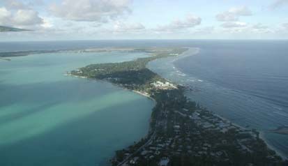
Kiribati is comprised of 33 coral atolls in 3 main groups of islands; the Gilbert, Phoenix
and Line Islands. Only 21 islands are inhabited. The total Land Area is only 811 km2
(around 313 sq mi) but each of the islands is widely dispersed across a 3.5 million km2
EEZ in the middle of Pacific Ocean.
Map 1. Republic of Kiribati Tarawa Atoll, Capital
Detailed Map of Kiribati © Microsoft Corporation. All Rights Reserved. Microsoft ® Encarta ® 2008. © 1993-2007 Microsoft Corporation.
All rights reserved.
Population as of 2005 census is 92,533 with 44% residing on Tarawa Atoll, the capital. The
population in 2000 was 84,494 and when compared with the figure in 2005 it represents an
increase of 9.5% or 8,093 people with an average annual rate of growth of 1.8%. And there
with this annual growth, the population has reached 103,000.
The main diet for I-Kiribati people include: fish, coconut, breadfruit, local root crops,
imported rice, chicken and tin meat (in the form of processed fish, beef e.g. ox and palm, etc).
Fish consumption per capita is one of the highest in the world-almost .5kg/day/capita. Most I-
Kiribati prefer to consume more of those imported from overseas. With this change of
behavior, there is high prevalence of diabetic and hypertension starting from the early age.
Kiribati which is comprised of tiny atolls still claims to have its forest in its own right and
should be respected by countries that have more thick vegetation. Although our forest may
not comply with international notions, they are truly forests to us and we want the world to
understand it. At the regional level forest is defined as; ‘trees that have a certain size of
canopy, they are not agricultural and are not located in urban areas’. Though our trees are
not in this category, they provide ecological services to sustain the lives of creatures in
particular people in terms of food, shelter, medicinal purposes, etc. Kiribati is appreciating the
recognition of atolls’ forest by Food and Agriculture Organisation (FAO) and other United
Nation conventions.
An area that is covered by coconut trees in Kiribati is classified as the first category in
defining the forest and the tree is called the King Tree . Pandanus trees (the Queen Tree) falls
under the second category and mangrove swamp being the third. These trees play important
roles in providing: housing materials for construction, shelter for both human and species,
food, protection of water reserves and coastal areas that are most affected by the climate
change and sea level rise.
With the effect of climate change and sea level rise as well as the increase in population, a
number of trees have eaten away due to erosion, many die and fallen off the ground due to
5FRA 2010 – Country Report, Kiribati
prolong droughts, and some were chopped down for handicraft and building purposes. The
rest have reached their maturity age and are starting to produce less for consumption.
While Kiribati is engaging on the FRA assignment, there are problems encountered especially
in the collection of data, thus affect the quality of information on our forest. For such reasons
Kiribati needs to ask for overseas assistance in the area of getting the digitized data and record
on all known forest trees in Kiribati and to have them stored safely in MapInfo Computer
implemented under the Remote Sensing Programme. Things like forest degradations, coastal
erosions, and other important variables covered under the FRA be incorporated in the
programme mentioned for use by planners in Lands Planning Section, Agriculture Research
and Environment and Conservation.
Mangroves replanting scheme has already begun on affected areas of Tarawa. This is a
voluntary scheme of Environment Youths Club (EYC) instigated by the MELAD and Cosmo
Oil Co from Japan and further inspired by this FAO Forestry Outlook 2020 exercise. Coconut
Replanting has begun in terms of providing the seedlings to outer islands. This was carried
out during the campaign against food crisis in 2008. However there is a need to continue this
project as it will merge with our coconut sawmilling project most probably mid year 2009.
Way forward
Kiribati to await the consideration FAO SAPA to fund the Coconut Sawmilling
Project as expected to start early this year 2009.
Kiribati to await as well the consideration of FAO Samoa to assist in procuring the
MapInfo programme that covers the requirements needed for the management of
forestry in Kiribati.
Increasing community participation by public awareness to get the message through
the mindset of people that planting trees is their supreme responsibility and life
obligation;
6FRA 2010 – Country Report, Kiribati
1 Table T1 – Extent of Forest and Other wooded land
1.1 FRA 2010 Categories and definitions
Category Definition
Forest Land spanning more than 0.5 hectares with trees higher than 5 meters and
a canopy cover of more than 10 percent, or trees able to reach these
thresholds in situ. It does not include land that is predominantly under
agricultural or urban land use.
Other wooded land Land not classified as “Forest”, spanning more than 0.5 hectares; with trees
higher than 5 meters and a canopy cover of 5-10 percent, or trees able to
reach these thresholds in situ; or with a combined cover of shrubs, bushes
and trees above 10 percent. It does not include land that is predominantly
under agricultural or urban land use.
Other land All land that is not classified as “Forest” or “Other wooded land”.
Other land with tree cover Land classified as “Other land”, spanning more than 0.5 hectares with a
(Subordinated to “Other canopy cover of more than 10 percent of trees able to reach a height of 5
land”) meters at maturity.
Inland water bodies Inland water bodies generally include major rivers, lakes and water
reservoirs.
1.2 National data
1.2.1 Data sources
References to sources of information Quality Variable(s) Year(s) Additional comments
(H/M/L)
This working paper is one
of a series of publications
prepared during the course
(1992 – 96) of the
UNDP/FAO South Pacific
Metz, D.W. 1996. The Mangroves of
Forestry Development
Kiribati: An Inventory, Feasibility and
Programme.
Management Study. Vol 1. Prepared for
Mangroves
Agriculture Division, MNRD, Republic of
on four This is also one of the first
Kiribati by USDA Forest Service in H 1995
islands in comprehensive study on
collaboration with South Pacific Forestry
Kiribati mangroves undertaken in
Development Programme
Kiribati.
(FAO/UNDP/RAS/92/361) Suva, Fiji.
Unpublished.
This figure may be slightly
on the lower side, since the
extent of mangroves found
in many small islands is not
available.
Ward, J.D.1998. Mangroves of Kiribati A
Secondary source. Refers to
priceless resources needs protection. Mangrove in
H 1995 185 ha of mangroves on
http://na.fs.fed.us/spfo/pubs/misc/mangrov Kiribati
Butaritari
es/mangroves.htm
Ground survey
Cited in: Ward, J.D. and
South Pacific Forestry Development
Mangrove Metz, W.D. Mangrove
Programme and USDA Forest Service. M 1995
area forests as modifiers of the
1995. Assessment of mangrove resources.
impacts of climate change
on high islands and atolls in
7FRA 2010 – Country Report, Kiribati
References to sources of information Quality Variable(s) Year(s) Additional comments
(H/M/L)
the south pacific: mobilizing
people and governments to
act (atolls). Pacific Islands
Regional Forestry
Programme.
http://www.spcforests.org/L
ibrary/Mangroves/atolls/atol
ls.htm
This figure may be slightly
on the lower side, since the
extent of mangroves found
in many small islands is not
available.
Barr, J.J.F. 1993. Technical Report on
Coconut Research in Kiribati (1990-1992) Plantation 1990
Ministry of Environment & Natural H and natural 1991
Resources Development Division of coconut area 1992
Agriculture
Government of Republic of Kiribati 2004.
State of Environment Report 2000-2002.
2002
http://www.sprep.org/att/IRC/eCOPIES/C
ountries/Kiribati/20.pdf
The country report (below)
and the NBSAP - Kiribati
have been cabinet approved.
MELAD, ECD. 2006. Government of
Kiribati National Biodiversity Strategies
Both the report and the
and Actions Plan to the Conference of the
H 2005 NBSAP- Kiribati reflect
Parties to the Convention on Biological
baseline data on the status
Diversity.
of protected areas and the
http://www.sprep.org/att/IRC/eCOPIES/C
conservation of biological
ountries/Kiribati/9.pdf
diversity in the context of
Kiribati as an atoll nation.
MELAD, ECD. 2007. Kiribati Country
Report to the Conference of Parties (COP)
to the Convention on Biological Diversity
2005
(CBD).
http://www.sprep.org/att/IRC/eCOPIES/C
ountries/Kiribati/93.pdf
1.2.2 Classification and definitions
National class Definition
Coconut forestry Land occupied by coconut only
Land occupied by Pandanus tectorius, Artocapus altilis, Ficus
carica (wild fig), and Calophyllum inophyllum planted by man.
Also includes:
Land with tree/natural Fallow littoral shrubs, bushes Morinda citrifolia a, Tormefortia
woodland argentea,. Pandanus tectorius (wild) Guerttarda speciosa, and
Scavola taccada
Mangrove: Bruguiera gymnorrhiza; Lumnitzera
littorea;Rhizophora mucronata; Sonneratia alba
Areas with absence of
Pond and open fields
trees
8FRA 2010 – Country Report, Kiribati
1.2.3 Original data
Inventory on Kiribati vegetation haven’t carried out ever since therefore data provided based on estimation.
Since it is estimated that 80% of the total land areas is covered with coconut it is estimated that 15% covered by
other trees, bushes and shrubs while 5% used up by ponds, open fields, and building.
Classes Percentage 1000 of hectares FRA classes
Land occupied by coconut 80 Other land with tree
64.8
only cover
Land occupied by 15 Forests
1. Pandanus tectorius,
Artocapus altilis, Ficus carica
(wild fig), and Calophyllum
inophyllum planted by man.
2. Fallow littoral shrubs, bushes
Morinda citrifolia a,
Tormefortia argentea,.
Pandanus tectorius (wild) 12.15
Guerttarda speciosa, and
Scavola taccada.
3. Mangrove
Bruguiera gymnorrhiza;
Lumnitzera
littorea;Rhizophora
mucronata; Sonneratia alba
Areas with absence of trees: 5 Other land and inland
Ponds, open fields and 4.05 water
buildings
Total 100 81.00
Fallow littoral shrubs, bushes, planted land, and mangroves were considered forest area as there is not enough
data to sub-divided in other categories. Note that trees are more than 5 meters high.
Most reliable, recent mangrove
area estimate
ha year
Mangrove 258 1995
Source: Metz 1996.
1.3 Analysis and processing of national data
1.3.1 Calibration
Calibration was not needed.
1.3.2 Estimation and forecasting
Forest and all other classes are considered constant since 1990.
1.3.3 Reclassification into FRA 2010 categories
See Section 1.2.3 above.
9FRA 2010 – Country Report, Kiribati
1.4 Data for Table T1
Area (1000 hectares)
FRA 2010 categories
1990 2000 2005 2010
Forest 12.15 12.15 12.15 12.15
Other wooded land 0 0 0 0
Other land 68.85 68.85 68.85 68.85
...of which with tree cover 64.8 64.8 64.8 64.8
Inland water bodies 0 0 0 0
Total 81 81 81 81
1.5 Comments to Table T1
Variable / category Comments related to data, definitions, Comments on the
etc. reported trend
Forest The total land area included species that Not yet assessed at
are shrubs, but it is not possible to define national level.
the exact extension of these areas. As Forecasting on land
most of the species mentioned in the areas of trees, shrubs,
national class of naturally wood land bushes and mangrove
mainly mangrove are trees with more forest is that they will be
than 5 meters high all these area was re- reduced due to rapid
classified as forest. increase of population
therefore there is a need
Documentation/mapping of existing for deforestation for new
mangrove forested areas of Kiribati residences.
using GPS is under planning for 2009
but this is highly dependent on available Currently, MELAD ECD
external funds and appropriate TAs is engaged in mangrove
(regional or international Technical replanting on the capital
Assistants) who shall work closely with island (South Tarawa).
local counterparts at MELAD ECD There are plans to extend
level. this mangrove replanting
programme to outer
islands. This would start
some time this year.
Other wooded land No available data in
place to adequately
report on this.
Inland water bodies Applied only to swamp and pond.
National data mentioned 4.05 ha of
inland water and open fields.
Other general comments to the table
Inventory on Kiribati vegetation haven’t carried out ever since therefore data provided based on estimation
where believe to be decreasing throughout the year. Since 80% of the total land areas covered with coconut it
estimated that 15% covered by other trees, bushes and shrubs while 5% used up by ponds, open fields, and
building.
10FRA 2010 – Country Report, Kiribati
Expected year for completion of ongoing/planned national forest inventory and/or RS survey / mapping
Within the next 4 years (2009 – 2012). Again this subject to
Field inventory available external funds and overseas TAs that MELAD ECD
could tap to do this specifically.
Within the next 4 years (2009 – 2012). Again this subject to
Remote sensing survey / mapping available external funds and overseas TAs that MELAD as a
whole could tap to do this specifically.
11FRA 2010 – Country Report, Kiribati
2 Table T2 – Forest ownership and management rights
2.1 FRA 2010 Categories and definitions
Category Definition
Public ownership Forest owned by the State; or administrative units of the public
administration; or by institutions or corporations owned by the public
administration.
Private ownership Forest owned by individuals, families, communities, private co-operatives,
corporations and other business entities, private religious and educational
institutions, pension or investment funds, NGOs, nature conservation
associations and other private institutions.
Individuals Forest owned by individuals and families.
(sub-category of Private
ownership)
Private business entities and Forest owned by private corporations, co-operatives, companies and other
institutions business entities, as well as private non-profit organizations such as NGOs,
(sub-category of Private nature conservation associations, and private religious and educational
ownership) institutions, etc.
Local communities Forest owned by a group of individuals belonging to the same community
(sub-category of Private residing within or in the vicinity of a forest area. The community members
ownership) are co-owners that share exclusive rights and duties, and benefits contribute
to the community development.
Indigenous / tribal Forest owned by communities of indigenous or tribal people.
communities
(sub-category of Private
ownership)
Other types of ownership Other kind of ownership arrangements not covered by the categories above.
Also includes areas where ownership is unclear or disputed.
Categories related to the holder of management rights of public forest resources
Public Administration The Public Administration (or institutions or corporations owned by the
Public Administration) retains management rights and responsibilities
within the limits specified by the legislation.
Individuals/households Forest management rights and responsibilities are transferred from the
Public Administration to individuals or households through long-term
leases or management agreements.
Private institutions Forest management rights and responsibilities are transferred from the
Public Administration to corporations, other business entities, private co-
operatives, private non-profit institutions and associations, etc., through
long-term leases or management agreements.
Communities Forest management rights and responsibilities are transferred from the
Public Administration to local communities (including indigenous and
tribal communities) through long-term leases or management agreements.
Other form of management Forests for which the transfer of management rights does not belong to any
rights of the categories mentioned above.
12FRA 2010 – Country Report, Kiribati
2.2 National data
2.2.1 Data sources
References to sources of Quality Variable(s) Year(s) Additional comments
information (H/M/L)
LMD Maps: M 2008
Schlencker Mapping Pty
H 1998
Limited, Australia
2.2.2 Classification and definitions
National class Definition
Public Ownership Forest owned by State only.
Private Ownership Forest owned by individuals, families and communities
Individual Ownership Forest owned by individual and families only
Private Business and
NA
entities
Should be under private ownership. Local Communities can be happened in
Local Communities
short terms due to the Village or island function.
Indigenous/Tribal
NA
Communities
2.2.3 Original data
Data is with Lands Department from which are well consolidated but are not updated yet.
70% of the forest land is public, 30 % is private. A 5% of the private forest area belongs to
individuals, no specific distribution for other types of private lands.
2.3 Analysis and processing of national data
2.3.1 Calibration
Not yet assessed
2.3.2 Estimation and forecasting
Increase due to increase private ownership, however due to population increase forest
ownership will decrease.
2.3.3 Reclassification into FRA 2010 categories
13FRA 2010 – Country Report, Kiribati
2.4 Data for Table T2
Table 2a - Forest ownership
Forest area (1000 hectares)
FRA 2010 Categories
1990 2000 2005
Public ownership 8.505 8.505 8.505
Private ownership 3.645 3.645 3.645
...of which owned by individuals 0.182 0.182 0.182
...of which owned by private business entities and institutions
...of which owned by local communities
...of which owned by indigenous / tribal communities
Other types of ownership
TOTAL 12.15 12.15 12.15
Note: If other types of ownership is reported, please specify details in comment to the table.
Note: Forest ownership in the outer islands throughout Kiribati has not yet been updated. The information as of
2005 are recorded while the past ones are supposed to be submitted by court clerks.
Does ownership of trees coincide with ownership of the X Yes
land on which they are situated? No
If No above, please describe below how the two differ:
It could be a noting that private owners especially in the Northern islands allow
other people to harvest their land e.g. copra cutting and other purposes. It is part of
their tradition and culture but its only happens in special occasions such as
community gathering, rituals, and other sacred gatherings and ceremonies.
Table 2b - Holder of management rights of public forests
Forest area (1000 hectares)
FRA 2010 Categories
1990 2000 2005
Public Administration n.a. n.a. n.a.
Individuals n.a. n.a. n.a.
Private corporations and institutions n.a. n.a. n.a.
Communities n.a. n.a. n.a.
Other n.a. n.a. n.a.
TOTAL n.a. n.a. n.a.
14FRA 2010 – Country Report, Kiribati
2.5 Comments to Table T2
Variable / Comments related to data, definitions, Comments on the reported trend
category etc.
Public ownership Government land areas mainly in the Line Includes littoral forest and mangroves areas.
and Phoenix Islands
Private The forest percent coverage is 30% due to Include coconut plantations.
ownership very small land area of each of the islands
of which owned by private owners
Applicable for lands owned by individuals.
It also applicable to an individual who
buys/lease land from public
Administration
Other types of Applicable to lands used by private
ownership companies, churches and schools
Management Government have full management right,
rights however on the outer islands and through
the local Government the private and
individual land owner may have their
management rights. In Butaritari (Northern
Part of Kiribati). Lands and forests are free
to be accessed in special occasions e.g. for
catechist and church purposes
Other general comments to the table
Data is with Lands Department from which are well consolidated but are not updated yet. 70% of the forest
land is public, 30 % is private. A 5% of the private forest area belongs to individuals, no specific distribution
for other types of private lands.
15FRA 2010 – Country Report, Kiribati
3 Table T3 – Forest designation and management
3.1 FRA 2010 Categories and definitions
Term Definition
Primary designated function The primary function or management objective assigned to a management unit
either by legal prescription, documented decision of the landowner/manager, or
evidence provided by documented studies of forest management practices and
customary use.
Protected areas Areas especially dedicated to the protection and maintenance of biological
diversity, and of natural and associated cultural resources, and managed through
legal or other effective means.
Categories of primary designated functions
Production Forest area designated primarily for production of wood, fibre, bio-energy
and/or non-wood forest products.
Protection of soil and water Forest area designated primarily for protection of soil and water.
Conservation of Forest area designated primarily for conservation of biological diversity.
biodiversity Includes but is not limited to areas designated for biodiversity conservation
within the protected areas.
Social services Forest area designated primarily for social services.
Multiple use Forest area designated primarily for more than one purpose and where none of
these alone is considered as the predominant designated function.
Other Forest areas designated primarily for a function other than production,
protection, conservation, social services or multiple use.
No / unknown No or unknown designation.
Special designation and management categories
Area of permanent forest Forest area that is designated to be retained as forest and may not be converted
estate (PFE) to other land use.
Forest area within Forest area within formally established protected areas independently of the
protected areas purpose for which the protected areas were established.
Forest area under sustain- To be defined and documented by the country.
able forest management
Forest area with Forest area that has a long-term (ten years or more) documented management
management plan plan, aiming at defined management goals, which is periodically revised.
3.2 National data
3.2.1 Data sources
References to sources of Quality Variable(s) Year(s) Additional comments
information (H/M/L)
The designation of the Phoenix
Islands Protected Area (PIPA) also
includes terrestrial biodiversity
Phoenix Islands Protected conservation, which includes
Area (PIPA) Information H 2006 existing flora and fauna available in
Fact Sheet these islands.
16FRA 2010 – Country Report, Kiribati
References to sources of Quality Variable(s) Year(s) Additional comments
information (H/M/L)
The designation of the PIPA came
about after a series of scientific
expeditions by a recognized
research organization (New
England Aquarium), who has been
instrumental in advising the
Government of Kiribati that these
islands and surrounding marine
environment have high biodiversity
values that need to be protected.
The PIPA is now the biggest
protected area designated in the
world.
The PIPA Regulations 2008 is a
PIPA Regulations 2008 H 2008 regulation under the Environment
Act 1999 (as amended 2007)
The Wildlife Conservation
Wildlife Conservation
H 1977 Ordinance will be revised some
Ordinance
time in 2009
The country report and the NBSAP
Government of Kiribati - Kiribati have been cabinet
country report (1st) to the approved and are now ready for
Conference of the Parties submission to the Secretariat of the
to the Convention on Convention on Biological Diversity.
Biological Diversity
H 2005
(CBD) & Government of Both the report and the NBSAP-
Kiribati National Kiribati reflect baseline data on the
Biodiversity Strategies and status of protected areas and the
Actions Plan (NBSAP – conservation of biological diversity
Kiribati) in the context of Kiribati as an atoll
nation.
Maps – Lands
Management Division
(LMD) of Ministry of
H Be available later
Environment, Lands &
Agricultural Development
(MELAD)
This working paper is one of a
Metz, D.W. 1996. The
series of publications prepared
Mangroves of Kiribati: An
during the course (1992 – 96) of the
Inventory, Feasibility and
UNDP/FAO South Pacific Forestry
Management Study. Vol 1.
Development Programme.
Prepared for Agriculture
Mangroves
Division, MNRD,
on four This is also one of the first
Republic of Kiribati by H 1995
islands in comprehensive study on mangroves
USDA Forest Service in
Kiribati undertaken in Kiribati.
collaboration with South
Pacific Forestry
This figure may be slightly on the
Development Programme
lower side, since the extent of
(FAO/UNDP/RAS/92/361)
mangroves found in many small
Suva, Fiji. Unpublished.
islands is not available.
3.2.2 Original data
Mangrove management plan has been completed since 1997 but this plan is yet to be fully
implemented at national level.
17FRA 2010 – Country Report, Kiribati
Most reliable, recent mangrove
area estimate
ha year
Mangrove 258 1995
The designation of the Phoenix Islands Protected Area (PIPA) also includes terrestrial
biodiversity conservation, which includes existing flora and fauna available in these islands.
There is not information available to determine the forest area existing in the littoral of this
protected area.
3.3 Data for Table T3
Table 3a – Primary designated function
Forest area (1000 hectares)
FRA 2010 Categories
1990 2000 2005 2010
Production 0 0 0 0
Protection of soil and water 0 0 0 0
Conservation of biodiversity 0.258 0.258 0.258 0.258
Social services 0 0 0 0
Multiple use 0 0 0 0
Other (please specify in comments below the table) 0 0 0 0
No / unknown 11.892 11.892 11.892 11.892
TOTAL 12.15 12.15 12.15 12.15
Table 3b – Special designation and management categories
Forest area (1000 hectares)
FRA 2010 Categories
1990 2000 2005 2010
Area of permanent forest estate n.d. n.d. n.d. n.d.
Forest area within protected areas n.d. n.d. n.d. n.d.
Forest area under sustainable forest management n.d. n.d. n.d. n.d.
Forest area with management plan 0.258 0.258 0.258 0.258
18FRA 2010 – Country Report, Kiribati
3.4 Comments to Table T3
Variable / Comments related to data, definitions, Comments on the reported trend
category etc.
Production
Protection of soil Water reservoir areas on South Tarawa Information reflected in the Government of
and water (as the capital island) and Kiritimati Kiribati SOE.
Island have been designated and
protected to safeguard ground water
(water lens) for drinking water for the
general public living on South Tarawa –
maps available only.
Conservation of Not yet assessed. Baseline information SOE report is still in draft, information and
biodiversity and maps have been collected mainly. data on conservation of biodiversity is also
These baseline information and data included.
need to be verified. Verification
pending, subject to available funds and
appropriate TAs to be identified, who
would work closely with local
counterparts within ECD MELAD.
However, data on total land areas and
bush areas are available with MELAD
LMD.
All mangrove area has been included in
this category.
Social services
Multiple use Phoenix Islands Protected Area (PIPA) PIPA management plan is still in draft.
Regulations 2008 designate the Phoenix
Islands Group as a Protected Area for
multiple uses under the IUCN Protected
Areas strategy 1b – wilderness area.
Other
No / unknown
designation
Area of permanent
forest estate
Forest area within Forest area within designated
protected areas conservation closed areas (on land and
on conservation off-islets) and wildlife
sanctuaries under the Wildlife
Conservation ordinance 1977 are yet to
be assessed.
19FRA 2010 – Country Report, Kiribati
Variable / Comments related to data, definitions, Comments on the reported trend
category etc.
Forest area with Mangrove management plan has been Mangrove management plan needs to be
management plan completed since 1997 but this plan is yet updated and reassessed. Plans to do update
to be fully implemented at national level. and assessment of islands with mangrove
forests within 2009 – 2012.
Other general comments to the table
The Republic of Kiribati has taken the remarkable step of declaring the Phoenix Islands archipelago and
surrounding waters, an area of 410,500 sq. km., as the Phoenix Islands Protected Area (PIPA). It is the largest
marine protected area in the world today. The Phoenix Islands group is one of the Earth’s last intact oceanic
coral archipelago ecosystems and represents a marine wilderness area that has had very limited human
exploitation due to their extremely remote location.
20FRA 2010 – Country Report, Kiribati
4 Table T4 – Forest characteristics
4.1 FRA 2010 Categories and definitions
Term / category Definition
Naturally regenerated forest Forest predominantly composed of trees established through natural
regeneration.
Introduced species A species, subspecies or lower taxon, occurring outside its natural range
(past or present) and dispersal potential (i.e. outside the range it occupies
naturally or could occupy without direct or indirect introduction or care
by humans).
Characteristics categories
Primary forest Naturally regenerated forest of native species, where there are no clearly
visible indications of human activities and the ecological processes are
not significantly disturbed.
Other naturally regenerated forest Naturally regenerated forest where there are clearly visible indications of
human activities.
Other naturally regenerated forest Other naturally regenerated forest where the trees are predominantly of
of introduced species introduced species.
(sub-category)
Planted forest Forest predominantly composed of trees established through planting
and/or deliberate seeding.
Planted forest of introduced species Planted forest, where the planted/seeded trees are predominantly of
(sub-category) introduced species.
Special categories
Rubber plantations Forest area with rubber tree plantations.
Mangroves Area of forest and other wooded land with mangrove vegetation.
Bamboo Area of forest and other wooded land with predominant bamboo
vegetation.
4.2 National data
4.2.1 Data sources
References to sources of information Quality Variable(s) Year(s) Additional comments
(H/M/L)
This working paper is one
of a series of publications
prepared during the
course (1992 – 96) of the
UNDP/FAO South Pacific
Forestry Development
Metz, D.W. 1996. The Mangroves of Kiribati:
Programme.
An Inventory, Feasibility and Management
Study. Vol 1. Prepared for Agriculture Mangroves
This is also one of the
Division, MNRD, Republic of Kiribati by on four
H 1995 first comprehensive study
USDA Forest Service in collaboration with islands in
on mangroves undertaken
South Pacific Forestry Development Kiribati
in Kiribati.
Programme (FAO/UNDP/RAS/92/361) Suva,
Fiji. Unpublished.
This figure may be
slightly on the lower side,
since the extent of
mangroves found in many
small islands is not
available.
21FRA 2010 – Country Report, Kiribati
References to sources of information Quality Variable(s) Year(s) Additional comments
(H/M/L)
Ground survey
Cited in: Ward, J.D. and
Metz, W.D. Mangrove
forests as modifiers of the
impacts of climate change
on high islands and atolls
in the south pacific:
mobilizing people and
governments to act
South Pacific Forestry Development (atolls). Pacific Islands
Mangrove
Programme and USDA Forest Service. 1995. M 1995 Regional Forestry
area
Assessment of mangrove resources. Programme.
http://www.spcforests.org
/Library/Mangroves/atolls
/atolls.htm
This figure may be
slightly on the lower side,
since the extent of
mangroves found in many
small islands is not
available.
The country report and
the NBSAP - Kiribati
have been cabinet
approved and are now
MELAD, ECD. 2005. Government of Kiribati
ready for submission to
1st Country Report to the Conference of the
the Secretariat of the
Parties to the Convention on Biological
Convention on Biological
Diversity.
Diversity.
H 2005
MELAD, ECD. 2005. Government of Kiribati
Both the report and the
National Biodiversity Strategies and Actions
NBSAP- Kiribati reflect
Plan to the Conference of the Parties to the
baseline data on the status
Convention on Biological Diversity.
of protected areas and the
conservation of biological
diversity in the context of
Kiribati as an atoll nation.
4.2.2 Classification and definitions
National class Definition
Land comprises of Littoral shrubs as in Table 1 with a high indication of
Natural regenerated forests human disturbance in regards for high demand of timber, fuel wood, and
handicraft.
Planted forest with Trees such as bamboo and nitrogen fixations occupying only a limited
Introduced species land areas
These area also fall under Table 1
22FRA 2010 – Country Report, Kiribati
4.2.3 Original data
Classes FRA classes
Land occupied by Pandanus Planted forest
tectorius, Artocapus altilis, Ficus
carica (wild fig), and Calophyllum
inophyllum planted by man.
Fallow littoral shrubs, bushes Naturally regenerated
Morinda citrifolia a, Tormefortia
argentea,. Pandanus tectorius
(wild) Guerttarda speciosa, and
Scavola taccada.
Mangroves Naturally regenerated
Bruguiera gymnorrhiza;
Lumnitzera littorea;Rhizophora
mucronata; Sonneratia alba
Most reliable, recent mangrove
area estimate
1995
ha FRA class
Mangrove 258 natural regenerated
Bamboo introduced from Australia found in agriculture research in the main land and Butaritari in the northern
island both are not common, just occupying a small land area.
Rubber is not available in the country
4.3 Analysis and processing of national data
There are some planted trees, but no data on the area.
Introduced forest including bamboo and other nitrogen fixing trees which are not common in the country found
on a small scale of land. Actual planting on designated planting sites on important atoll forestry have been
carried out mainly on South Tarawa, as the capital island.
From MELAD ECD, actual planting on designated planting sites on important atoll forestry resources have been
carried out mainly on South Tarawa, as the capital island.
Even forest areas situated far from households are disturber for the high demand on timber for households
construction, fuel wood, and handicrafts.
Hence, all forests and woodlands have been classified as Other naturally regenerated forests.
4.3.3 Reclassification into FRA 2010 categories
23FRA 2010 – Country Report, Kiribati
4.4 Data for Table T4
Table 4a
Forest area (1000 hectares)
FRA 2010 Categories
1990 2000 2005 2010
Primary forest 0 0 0 0
Other naturally regenerated forest 12.15 12.15 12.15 12.15
...of which of introduced species 0 0 0 0
Planted forest n.d. n.d. n.d. n.d.
...of which of introduced species 0 0 0 0
TOTAL 12.15 12.15 12.15 12.15
Table 4b
Area (1000 hectares)
FRA 2010 Categories
1990 2000 2005 2010
Rubber plantations (Forest) 0 0 0 0
Mangroves (Forest and OWL) 0.258. 0.258 0.258 0.258
Bamboo (Forest and OWL) n.a. n.a. n.a. n.a.
4.1 Comments to Table T4
Variable / Comments related to data, definitions, Comments on the reported trend
category etc.
Primary forest
Other naturally Not yet assessed Comprises of shrubs
regenerating normally assist in providing timber to the
forest community therefore actually disturbed by
human.
Planted forest Introduced forest including bamboo and The National Adaptation Programme for
other nitrogen fixing trees which are not Action has a component of mangrove
common in the country found on a small plantation in the coastal zone management
scale of land. Actual planting on resilience, enhancement and adaptation.
designated planting sites on important atoll http://unfccc.int/resource/docs/napa/kir01.pdf
forestry have been carried out mainly on
South Tarawa, as the capital island.
From MELAD ECD, actual planting on
designated planting sites on important atoll
forestry resources have been carried out
mainly on South Tarawa, as the capital
island.
Rubber Rubber is not available in the country
plantations
24FRA 2010 – Country Report, Kiribati
Mangroves
Bamboo Bamboo introduced from Australia found
in agriculture research in the main land and
Butaritari in the northern island both are
not common, just occupying a small land
area.
Other general comments to the table
Natural forest in Kiribati involved abandoned areas where wild pandanus, bushes, and shrubs grow naturally.
Unfortunately data are not available as plant/tree inventory haven’t carried out ever since therefore inventory is
one of the country needs which require technical and financial support.
25FRA 2010 – Country Report, Kiribati
5 Table T5 – Forest establishment and reforestation
5.1 FRA 2010 Categories and definitions
Term Definition
Afforestation Establishment of forest through planting and/or deliberate seeding on
land that, until then, was not classified as forest.
Reforestation Re-establishment of forest through planting and/or deliberate seeding on
land classified as forest.
Natural expansion of forest Expansion of forests through natural succession on land that, until then,
was under another land use (e.g. forest succession on land previously
used for agriculture).
5.2 National data
No data available
5.2.1 Data sources
References to sources of Quality Variable(s) Year(s) Additional comments
information (H/M/L)
GEF/UNDP/UNFCCC
REPUBLIC OF
KIRIBATI
Planting General information on the
NATIONAL M
programme plantation strategy.
ADAPTATION
PROGRAM OF ACTION
(NAPA) 2007.
5.2.2 Classification and definitions
National class Definition
Refers to replanting and planting of trees in particular coconut trees,
Replanting mangroves and such to hold and protect the soil from erosion and other natural
disasters and mostly to adapt and minimize adverse impact of climate change.
Refers to forestry combined with farming. Within the Agricultural Division
this section looks after food crops, medicinal plants, fuel wood, nitrogen
fixation plants and other plants that are useful to households. This is where
Agro-forestry they establish mother plant from which they propagate them and sold them to
households such as breadfruit, pandanus, etc however some are free for the
communities, i.e. women’s club, church, youths plus the feed only for starch
crops
Refers to maintaining and improving the life span of coconut trees only. This
Rehabilitation
happens in 1990s,
Land comprises of Littoral shrubs as in Table 1 with a high indication of
Natural regenerated
human disturbance in regards for high demand of timber, fuel wood, and
forests
handicraft.
Planted forest with Trees such as bamboo and nitrogen fixations occupying only a limited land
Introduced species areas
26FRA 2010 – Country Report, Kiribati
5.2.3 Original data
No specific data was available. Information about the species that are to be included in the
planting strategy are presented on the comment section.
5.4 Data for Table T5
Annual forest establishment ...of which of introduced species 1)
FRA 2010 Categories (hectares/year) (hectares/year)
1990 2000 2005 1990 2000 2005
Afforestation NA NA NA NA NA NA
Reforestation NA NA NA NA NA NA
...of which on areas previously planted NA NA NA NA NA NA
Natural expansion of forest NA NA NA NA NA NA
Note: The figures for the reporting years refer to the averages for the 5-year periods 1988-1992, 1998-2002
and 2003-2007 respectively.
5.5 Comments to Table T5
Variable / Comments related to data, definitions, Comments on the reported trend
category etc.
Afforestation
Reforestation
Natural expansion .
of forest
Other general comments to the table
Species to be included in the planting strategy.
Cocos lucifera Coconut
Scaevola sericea Vahl Salt bush
Guettarda spp Guettarda;wut
Tournefortia spp Tree heliotrope
Mirinda citrifolia Beach mulberry
Pemphis acidula forst. (I) Iron wood, pemphis
Rhizophora spp Mangroves
Pandanus tectorius Pandanus tree
Cyrtosperma chamissions Giant Swamp Taro
Casuarina eqiseifola Ironwood, she-oak, beefwood tree
27FRA 2010 – Country Report, Kiribati
6 Table T6 – Growing stock
6.1 FRA 2010 Categories and definitions
Category Definition
Growing stock Volume over bark of all living trees more than X cm in diameter at breast
height (or above buttress if these are higher). Includes the stem from ground
level or stump height up to a top diameter of Y cm, and may also include
branches to a minimum diameter of W cm.
Growing stock of commercial Growing stock (see def. above) of commercial species.
species
6.2 National data
6.2.1 Data sources
References to sources of Quality Variable(s) Year(s) Additional comments
information (H/M/L)
Growing 1994-
Rhett Butler M Species
stock 2006
Growing
World Resources Institute L 2006 Species
stock
6.2.2 Classification and definitions
National class Definition
All living tree/scrub components on forest areas and all living tree/scrub
Growing stock components on Other wooded land areas, suppose the average canopy height
is 7m to all tree/scrub components.
6.2.3 Original data
See table T6b, list of more important species.
6.4 Data for Table T6
Volume (million cubic meters over bark) (the unit used here is globally
acceptable while it is too large for us. Anyway using the 0.0001[eg] will serve
our purpose as well.)
FRA 2010 category
Forest Other wooded land
1990 2000 2005 2010 1990 2000 2005 2010
Total growing stock ND ND ND ND ND ND ND ND
... of which coniferous ND ND ND ND ND ND ND ND
(tree with needle like
leaves and fruits are
cone shaped and usually
small, like casuarinas.
... of which broadleaved ND ND ND ND ND ND ND ND
Growing stock of ND ND ND ND ND ND ND ND
commercial species
28FRA 2010 – Country Report, Kiribati
Table 6b – Growing stock of the 10 most common species
Growing stock in forest
FRA 2010 category / Species name
(million cubic meters)
Rank Scientific name Common name 1990 2000 2005
1st Cocos nucifera Coconut
2nd Scaevola sericea Vahl Salt bush
3rd Guettarda spp Guettarda;wut
4th Tournefortia spp Tree heliotrope
5th Mirinda citrifolia Beach mulberry
6th Pemphis acidula forst. (I) Iron wood, pemphis
7th Rhizophora spp Mangroves
8th Pandanus tectorius Pandanus tree
9th Cyrtosperma chamissions Giant Swamp Taro
Ironwood, she-oak, beefwood
10th Casuarina eqiseifola
tree
Remaining
TOTAL
29FRA 2010 – Country Report, Kiribati
7 Table T7 – Biomass stock
Data is not available for this reporting table.
8 Table T8 – Carbon stock
Data is not available for this reporting table.
30FRA 2010 – Country Report, Kiribati
9 Table T9 – Forest fires
References to sources of Quality Variable(s) Year(s) Additional comments
information (H/M/L)
MELAD, ECD. 2005.
Government of Kiribati 1st
The country report and the NBSAP -
Country Report to the
Kiribati have been cabinet approved
Conference of the Parties
and are now ready for submission to
to the Convention on
the Secretariat of the Convention on
Biological Diversity.
Biological Diversity.
MELAD, ECD. 2005. H forest fires 2005
Both the report and the NBSAP-
Government of Kiribati
Kiribati reflect baseline data on the
National Biodiversity
status of protected areas and the
Strategies and Actions
conservation of biological diversity
Plan to the Conference of
in the context of Kiribati as an atoll
the Parties to the
nation.
Convention on Biological
Diversity.
9.2.2 Classification and definitions
National class Definition
Refers to human induced activity to create fire hazards to neighbouring bush
Indiscriminate burning plots developed over the dispute of land ownership, personal differences,
etc.
2 Original data
It was assumed that less than 1000 hectare has been affected by forest fires. It is estimated a
decrease on the basis of a new method introduced by Agriculture Department which addresses
the impact of indiscriminating burning.
9.3 Analysis and processing of national data
Not Available
9.4 Data for Table T9
Table 9a
Annual average for 5-year period
FRA 2010 category 1990 2000 2005
1000 number of 1000 number 1000 number
hectares fires hectares of fires hectares of fires
Total land area affected by fire 1 1 1
... of which on forest 0 0 0 0 0 0
... of which on other wooded land 0 0 0
... of which on other land 1 1 1
Note: At Island level the impact is very minimal; at family level (land plot) the impact is very significant.
31FRA 2010 – Country Report, Kiribati
Table 9b
Proportion of forest area affected by fire (%)
FRA 2010 category
1990 2000 2005
Wildfire ND ND ND
Planned fire ND ND ND
Note: The figures for the reporting years refer to the averages of annually affected areas for the 5-year periods
1988-1992, 1998-2002 and 2003-2007 respectively
9.5 Comments to Table T9
Variable / Comments related to data, definitions, Comments on the reported trend
category etc.
Area affected by Human induced fire have been confirmed Some forest area was affected before the
fire to be visually observed but have not been 1990. There is no specific information about
formally documented. the area.
Kiribati is made of islands where
indiscriminate fire occurs without reaching
1,000ha. Increase and inflow settlers on
Kiritimati island contributes to increase of
indiscriminate fires.
Number of fires Human induced fire have been confirmed
to be visually observed but have not been
formally documented. Cover less than an
Acre.
Wildfire /
planned fire
Other general comments to the table
No data available for reporting on this table, however the information provided are based on the assumptions.
32FRA 2010 – Country Report, Kiribati
10 Table T10 – Other disturbances affecting forest health and
vitality
10.1 FRA 2010 Categories and definitions
Term Definition
Disturbance Damage caused by any factor (biotic or abiotic) that adversely affects the
vigour and productivity of the forest and which is not a direct result of
human activities.
Invasive species Species that are non-native to a particular ecosystem and whose
introduction and spread cause, or are likely to cause, socio-cultural,
economic or environmental harm or harm to human health.
Category Definition
Disturbance by insects Disturbance caused by insect pests.
Disturbance by diseases Disturbance caused by diseases attributable to pathogens, such as bacteria,
fungi, phytoplasma or virus.
Disturbance by other biotic Disturbance caused by biotic agents other than insects or diseases, such as
agents wildlife browsing, grazing, physical damage by animals, etc.
Disturbance caused by abiotic Disturbances caused by abiotic factors, such as air pollution, snow, storm,
factors drought, etc.
10.2 National data
10.2.1 Data sources
References to sources of information Quality Variable(s) Year(s) Additional
(H/M/L) comments
List of
Agricultural Report on Kiribati invasive species
species
Kiribati National Report to CPBD - CBD was drafted by
Invasive presented
Temakei Tebano with the assistance of Ribanataake Awira and M
species in the
Kaitu Koina, in collaboration with various government ministries
section of
and departments, NGOs and individuals. 1999
comments.
List of
Space, J.C. and Imada, C.T. 2004. Report to the Republic of
invasive
Kiribati on Invasive Plant Species Invasive
H species
on the Islands of Tarawa, Abemama, Butaritari and Maiana species
(flora and
http://www.sprep.org/att/IRC/eCOPIES/Countries/Kiribati/11.pdf
fauna)
10.2.2 Classification and definitions
National class Definition
Disturbance by pests Disturbance caused by rodents
Disturbance by disease Disturbance caused by rot disease affecting fruit trees
Disturbance by abiotic Disturbance caused by climate change (sea level, droughts, coastal erosion)
Disturbance by biotic Not an issue for Kiribati
33FRA 2010 – Country Report, Kiribati
10.4 Data for Table T10
Table 10a – Disturbances
Affected forest area (1000 hectares)
FRA 2010 category
1990 2000 2005
Disturbance by insects ND ND ND
Disturbance by diseases ND ND ND
Disturbance by other biotic agents ND ND ND
Disturbance caused by abiotic factors ND ND ND
Total area affected by disturbances ND ND ND
Notes: The figures for the reporting years refer to the averages of annually affected areas for the 5-year periods
1988-1992, 1998-2002 and 2003-2007 respectively.
The total area affected by disturbances is not necessarily the sum of the individual disturbances as these
may be overlapping.
Table 10b – Major outbreaks of insects and diseases affecting forest health and vitality
Area
Tree species or genera affected Year(s) of affected If cyclic,
Description / name (scientific name) latest (1000 approx. cycle
outbreak hectares) (years)
Ship rat (Rates Rattus) Cocos nucifera Early 1990s ND All around
Breadfruit Mealybug Artocarpus altilis Early 1990s ND All around
Breadfruit rot disease Artocarpus altilis Early 1990s ND All around
Note: Area affected refers to the total area affected during the outbreak.
Table 10c – Area of forest affected by woody invasive species
Forest area
Scientific name of woody invasive species affected 2005
(1000 hectares)
Premna serratifolia ND
Total forest area affected by woody invasive species
Note: The total forest area affected by woody invasive species is not necessary the sum of the values above, as
these may be overlapping.
10.5 Comments to Table T10
Variable / Comments related to data, definitions, Comments on the reported trend
category etc.
Disturbance by
insects
34You can also read