Lessons Learnt from 15 Years of Integrated Watershed Management and Forest Restoration: the Copalita-Zimatán-Huatulco Landscape in Mexico - WWF France
←
→
Page content transcription
If your browser does not render page correctly, please read the page content below
2020

               Lessons Learnt from
               15 Years of Integrated
               Watershed Management
               and Forest Restoration: the
               Copalita-Zimatán-Huatulco
               Landscape in Mexico
               Stephanie Mansourian
               Ignacio Daniel González Mora
               Miguel Angel Palmas Tenorio
               Greta Spota Diericx
               Daniel Vallauri
© WWF Mexico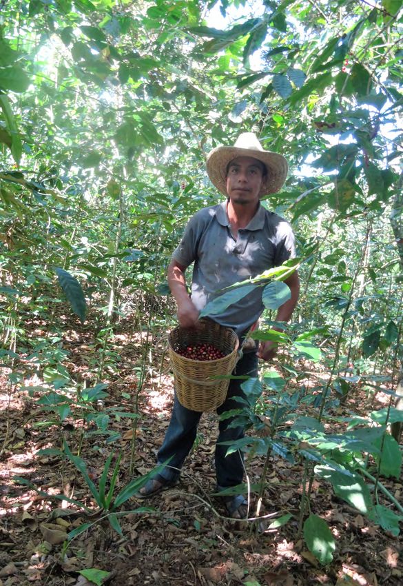
Acknowledgements:
We would like to thank Blanca Sánchez Reyes (Mbis Bin Semilla para la Siembra),
Marinhe Rosas Rodríguez (Los Macuiles Copalita), Romeo Salinas Ramírez
(Alternativa Agrícola Suchixtepec) and Eugenio Barrios (WWF) for providing
valuable insights for the production of this report. We would also like to thank
Anuar Martínez, for the maps and some of the data and Hanna Besirevic,
Mario Contini and Santiago Azuela for donating to WWF-Mexico professional
photos covering the project. Á

Published in 2020 by WWF-France.
© Text 2020 WWF All rights reserved
Any reproduction in full or in part must mention the title and credit the
abovementioned publisher as the copyright owner.

Layout by Sambou-Dubois

WWF is one of the world’s largest and most experienced independent
conservation organizations, with over 5 million supporters and a global Network
active in more than 100 countries.

WWF’s mission is to stop the degradation of the planet’s natural environment
and to build a future in which humans live in harmony with nature, by:
conserving the world’s biological diversity, ensuring that the use of renewable
natural resources is sustainable, and promoting the reduction of pollution and
wasteful consumption.
Preface

PREFACE
If diversity of life forms and human cultures were given

                                                                                            © WWF-Mexico
a price tag, Mexico would be among the wealthiest
nations on the planet. We know of over 20,000 vascu-
lar plant species – and many more to be discovered. We
are home to the splendid monarch butterfly, known for
its long migration from Canada and the US down to our
warmer climes in winter. Vaquita, jaguar and howler
monkey are just a few of the rare and wonderful mam-
mals that call Mexico home. Also in our nation, a total
of 143 languages are spoken, reflecting the multiple
indigenous cultures that co-exist here.

With its tremendous biodiversity and rich cultural heritage, our nation – situated at
the junction between the Nearctic and Neotropical bioregions – has much knowledge
to offer related to our environment. Yet both nature and culture are facing the tragedy
of extinction.

Today this delicate balance between our natural and cultural heritage is threatened by
many pressures, including – but not only – global ones related to markets, urbanisation
and climate change. Restoring this balance is an urgent matter. Our government has
chosen to join the Bonn Challenge and Initiative 20x20, and committed to restoring over
8 million ha of forest landscapes. But forests, water and people are closely intertwined.
We cannot tackle one without the other.

WWF in Mexico has been contributing to restoring watersheds since the start of this cen-
tury. We take an integrated approach linking the upper reaches of watersheds with the
more populated and urbanised lower reaches. Since 2004 with funding from Fundación
Gonzalo Río Arronte (FGRA) and later from Caudalie, we have taken a comprehensive
approach to restoring the Copalita-Zimatán-Huatulco (CZH) watersheds in Oaxaca State.

Our experience in CZH is exemplary and through this publication we seek to share
15 years of effort to improve water, livelihoods and forest in these watersheds.

                                                    Jorge Alejandro Rickards Guevara,
                                                                                CEO
                                                                        WWF Mexico

                                                                                                           1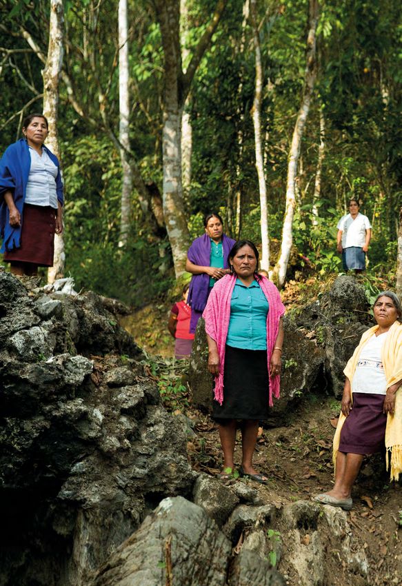
1
                                                         3
                                                         5

               INTRODUCTION                             8

               PRESENTATION OF THE LANDSCAPE            10

               PROJECT PHASES                           14

               IMPLEMENTATION: ACTIVITIES AND RESULTS   16

               PARTNERS AND MAIN ACTORS                 28

               GOVERNANCE                               31

               CAPACITY BUILDING                        33

               COMMUNICATION                            34

               SUSTAINABILITY AND HANDOVER STRATEGY     35

               OVERARCHING LESSONS LEARNT               37

               CONCLUSION AND FUTURE PROSPECTS          41

               References                               42
© WWF Mexico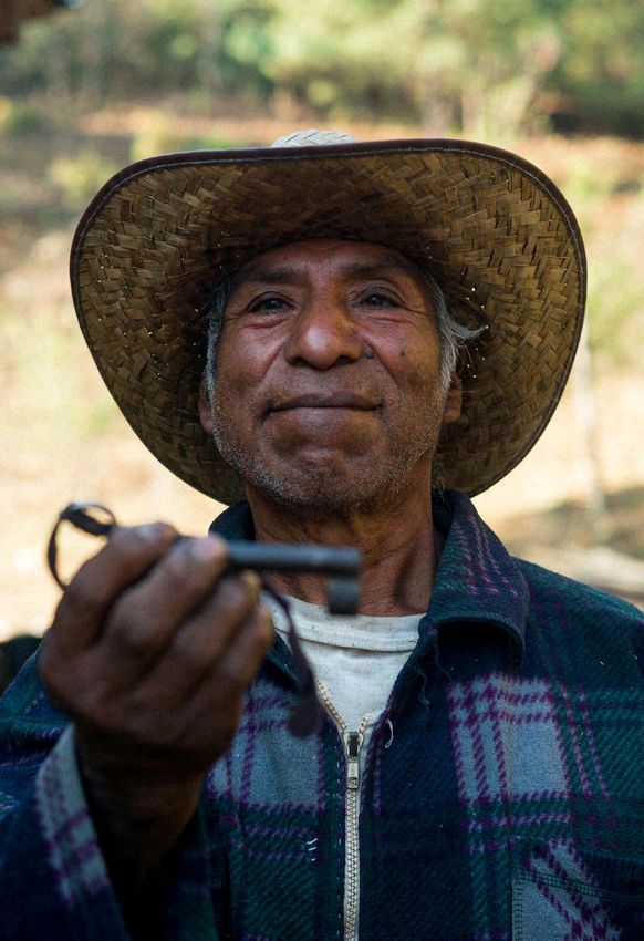
Executive summary

EXECUTIVE SUMMARY                                                                Lessons Learnt from 15 Years
                                                                                 of Integrated Watershed
                                                                                 Management and Forest
                                                                                 Restoration: the Copalita-
                                                                                 Zimatán-Huatulco Landscape
                                               USA
                                                                                 in Mexico

                                                                      G ulf of   The watersheds of Copalita-Zimatán-Huatulco (CZH)
                                  MEXICO                              Mexic o    can be found in the south of Mexico’s state of Oaxaca, in
P a cific
Oce a n                                                                          the Sierra Madre del Sur. They cover an area of 268,023
                                             Mexico City
                                                                                 ha and include 26 of the country’s 34 vegetation types.
      T H E C O PA L I TA - Z I M AT Á N -                                       With an altitudinal range from sea level to 3,500 m, the
       H U AT U L C O L A N D S C A P E
                                                                                 landscape is home to numerous faunal and floral spe-
                                                  S TAT E O F O A X A C A
                                                                                 cies. Yet, forest loss has had an impact on the land, bio-
                                                                                 diversity, water quality and quantity, and local people.

                                             Threats to the landscape include deforestation, fire, advancement of the agricultural
                                             frontier, slash and burn on steep slopes for maize cultivation, reduction in water
                                             availability, sedimentation of coastal zones, unplanned tourism activities and water
                                             contamination from domestic, urban, industrial and agricultural sources.

                                             Starting in 2004, with funding from Fundación Gonzalo Río Arronte (FGRA), WWF
                                             began work in these watersheds. Three phases can be identified: the first phase
                                             (2004-2011) focused on data collection – both biological and socio-economic. The
                                             second phase (2012-2016) sought to consolidate and replicate achievements from
                                             the first phase. The third and current phase (2016-2020) aims to consolidate work
                                             to date, and to continue addressing threats and enhance restoration work for the
                                             benefit of people and nature, in order to achieve water security and biodiversity
                                             conservation.

                                             Activities that were carried out focused on data collection, improving agricultural
                                             practices, nursery establishment and reforestation, participatory water management,
                                             participatory monitoring, awareness raising and reducing water pollution. The proj-
                                             ect benefited a total of 6,433 people directly and 22,196 people indirectly. Significant
                                             results were achieved with enhanced water quality, better agricultural practices that
                                             have led to improved yields, at lower costs and with higher market value, a total
                                             of 2,625 ha reforested across all three levels of the watersheds (upper, middle and
                                             lower). Importantly, communities – including women and youth – have been empow-
                                             ered to take decisions related to land use and natural resources.

                                             Several partners have collaborated with WWF over the years from public authori-
                                             ties, to local community organisations, research bodies and other NGOs. Both for-
                                             mal and informal institutions co-exist in this part of Mexico, with the indigenous
                                             Zapotec communities for example, having ‘primordial titles’ to the land. At the legis-
                                             lative level, the decree on water reserves established in 2018, based on the Mexican
                                             Environmental Flow Standard, has been an important tool nationwide to secure
                                             improvements in protection and management of critical river basins. Although CZH
                                             has still not benefitted from this declaration, all technical studies for supporting the
                                             decree have been completed.

                                                                                                                                                  3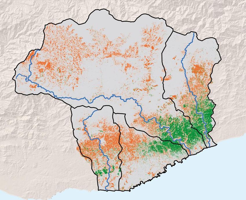
Executive summary

                                 Over the entire 15 years of the project – which represents a whole generation - many
                                 practices promoted by the project (such as agroecological activities, tree nursery tech-
                                 niques and improved water usage) have been integrated into the communities.

                                 The project has benefitted from long term financial support by one donor FGRA and
                                 additional funding by Caudalie. It continues to this day. A handover strategy has not yet
                                 been defined, as more work remains to be done in the landscape.

     Key lessons learnt over the course of this project are:

       1    watershed perspective makes sense to engage stakeholders - Because of linkages between the
           A
           upper, middle and lower parts of a watershed, it makes sense to engage stakeholders and develop activ-
           ities at all levels, recognising the linkages but also the differences between each area. Water provides a
           guiding thread between the upper and lower reaches of the watershed.

       2    tarting with broader actions can support a more focused tree planting intervention several years
           S
           later - Laying the ground work through research, engagement, policies and demonstration sites can be an
           effective way of starting an FLR intervention.

       3
           Integrated  approaches to restoration provide better results than reforestation alone ‑ Addressing
           underlying causes of forest degradation and approaching the restoration process in a comprehensive and
           integrated manner provides faster and more durable results.

       4   I ntegrated approaches across actors and stakeholders, from federal to community level, are impor-
            tant for large-scale achievements - Bringing in political players, social actors, across federal and local
            scales, creates the enabling conditions for long-term success.

       5    roviding alternatives for management and production in the landscape ensures better engagement
           P
           of communities - Providing several different and innovative water, agriculture and forestry management
           alternatives, leads to better engagement by communities who feel empowered to take decisions related to
           their land, livelihoods and future. In turn, this leads to more sustainable results and changes in lifestyle.

       6    aking explicit the link between forests and water to the overall development model of the land-
           M
           scape via a watershed approach leads to better results - This link is not obvious for communities and
           policy makers. Linking upper and lower watershed communities and related land use and management
           leads to positive impacts on water, forests and development.

       7
           Engaging   women and youth in decision-making at local level increases social sustainability -
           Women and youth have a vested interest in land management and innovation in rural areas but are often
           not targeted as key participants and decision-makers.

       8    hampions help to disseminate project results - Enlisting key “champions”, leaders, or change-makers,
           C
           at different geographical levels, can help to promote the project, maintain its momentum beyond its lifetime
           and disseminate its approach.

       9    ong term funding for water and people is an opportunity - Enabling the continuity of funding over the
           L
           necessary 10 to 20 years essential to achieving sustainable results is always a struggle. Bridging water and
           development policies with forest issues helps to secure success in FLR.

4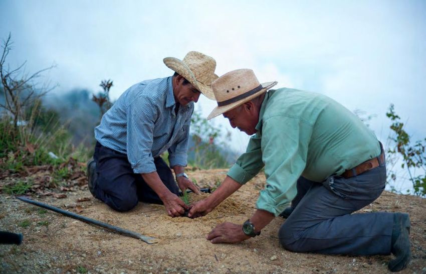
Resumen ejecutivo

   RESUMEN EJECUTIVO                                                            Lecciones aprendidas en 15 años
                                                                                de manejo integrado de cuenca
                                                                                y restauración de bosques en:
                                                                                el paisaje Copalita-Zimatán-
                                                                                Huatulco, en México
                                           ESTADOS
                                            UNIDOS

                                                                                Las cuencas Copalita-Zimatán-Huatulco (CZH) se encuen-
                                                                     Golfo de   tran en la Sierra Madre del Sur, en el estado de Oaxaca,
                                 MÉXICO                              Méx ic o   México. Éstas, cubren un área de 268,023 hectáreas e
Océ a n o
P a cífico                                                                      incluyen 26 de los 34 tipos de vegetación del país. Con una
                                          Ciudad de México
                                                                                altitud de 3,500 metros sobre el nivel de mar, este paisaje
       E L PA I S A J E C O PA L I TA -                                         es el hogar de numerosas especies de flora y fauna. Sin
         Z I M AT Á N - H U AT U L C O
                                                                                embargo, la pérdida de bosque ha tenido un impacto en
                                                 E S TA D O D E O A X A C A
                                                                                el suelo, la biodiversidad, la calidad y cantidad de agua así
                                                                                como en las personas locales.

                                            Las amenazas sobre el paisaje incluyen la deforestación, los incendios, el avance de la
                                            frontera agrícola, la tala y quema de laderas para el cultivo de maíz, la reducción de la
                                            disponibilidad de agua, la sedimentación de zonas costeras, las actividades turísticas no
                                            planeadas, y la contaminación de agua de fuentes domésticas, industriales y agrícolas.

                                            A principios de 2004, con financiamiento de la Fundación Gonzalo Río Arronte (FGRA),
                                            WWF México empezó a trabajar en estas cuencas. Se pueden identificar tres fases: la
                                            primera fase (2004-2011) se enfocó en recolección de datos– tanto biológicos como
                                            socio-económicos. La segunda fase (2012-2016), buscó consolidar y replicar los logros
                                            de la primera fase y en los primeros proyectos socioambientales de manejo del agua. La
                                            tercera y actual fase (2016-2019), consolida el trabajo a la fecha para hacer frente a las
                                            amenazas y promover la labor restaurativa en beneficio de las personas y la naturaleza,
                                            con el fin de lograr seguridad hídrica y la conservación de la biodiversidad.

                                            Las actividades llevadas a cabo se enfocaron en la recolección de datos, mejora de
                                            prácticas agrícolas, establecimiento de viveros forestales y reforestación, gestión par-
                                            ticipativa del agua, monitoreo participativo, creación de conciencia y reducción de la
                                            contaminación del agua. Se logró apoyar y favorecer a un total de 6,433 beneficiarios
                                            directos y 22,196 indirectos. También se alcanzaron resultados significativos con las
                                            mejoras en la calidad de agua y en las prácticas agrícolas que a su vez incrementaron
                                            los rendimientos a un costo menor de producción y con un mayor valor de mercado. Un
                                            total de 2,625 hectáreas se reforestaron en los tres niveles de las cuencas (parte alta,
                                            media y baja), y algo muy importante, comunidades-que incluyen a mujeres y jóvenes-
                                            se empoderaron para integrarlas en los procesos de toma de decisiones acerca del uso
                                            del territorio y sus recursos naturales.

                                            Varios aliados colaboraron con WWF a lo largo de los años, desde autoridades públicas
                                            hasta comunidades y organizaciones locales, centros de investigación y otras ONG. En
                                            esta parte de México, en donde comunidades indígenas Zapotecas retienen derechos
                                            “primordiales a la tierra,” coexisten instituciones formales e informales. A nivel legis-
                                            lativo, el decreto sobre reservas de agua establecido en 2018, que se basa en la norma
                                            mexicana de caudal ecológico, ha sido una herramienta nacional importante para ase-
                                            gurar la protección y manejo sustentable del agua de las cuencas. Aunque CZH todavía
                                            no se beneficia de este decreto, cuenta con todos los estudios técnicos para sustentar

                                                                                                                                                     5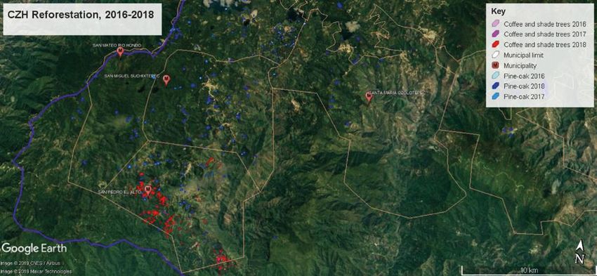
Resumen ejecutivo

                                que se incorpore a las cuencas nacionales que constituyen el programa nacional de
                                reservas de agua para la protección ecológica.

                                Quince años, la duración del Proyecto, representan a toda una generación de personas
                                y muchas de las prácticas que se han promovido -tales como las actividades agroeco-
                                lógicas, las técnicas para el manejo de viveros forestales y la producción de planta, así
                                como las de mejora en el uso sustentable de agua- han sido integradas dentro de las
                                comunidades. Diversas actividades de comunicación para crear conciencia también se
                                han llevado a cabo, incluyendo talleres, videos, conversaciones en radio y exposiciones.

                                El Proyecto se ha beneficiado de financiamiento a largo plazo gracias al donante FGRA
                                y a financiamiento adicional proveniente de la empresa Caudalie. El trabajo de WWF
                                México continúa y hasta este momento no ha definido una estrategia de salida debido a
                                que todavía queda mucho por hacer en este paisaje.

     Las principales lecciones aprendidas en el curso del proyecto son:

       1    a perspectiva de manejo de cuenca hace sentido para involucrar a los interesados en la con-
           L
           servación y restauración de paisajes - Debido a los vínculos entre la parte alta, media y baja de la
           cuenca, tiene sentido involucrar a los diferentes actores interesados y desarrollar actividades en los
           tres niveles, reconociendo estos vínculos y al mismo tiempo las diferencias entre cada área. El agua se
           presenta como un lazo conductor entre la parte alta y baja de la cuenca.

       2   Empezar con acciones más amplias y complementarias puede ayudar a establecer una base para
            la plantación de árboles más enfocada en los años siguientes - Sentar las bases para el trabajo en
            campo desde la investigación, vinculación, desarrollo de políticas y establecimiento de sitios demostra-
            tivos puede ser un camino efectivo para empezar el trabajo de conservación y restauración de paisajes.

       3
           Una  aproximación integrada para restaurar consigue mejores resultados que la reforestación
           por sí sola ‑ Atendiendo las causas que subyacen la degradación de bosques y aproximándose a los
           procesos de restauración desde una perspectiva comprehensiva e integrada permite resultados más
           rápidos y durables.

       4    na perspectiva integral entre los diferentes actores interesados de la cuenca, desde los niveles
           U
           federales hasta los comunitarios, son importantes para conseguir resultados de gran escala -
           Atraer actores tanto políticos como sociales, en los niveles federales y a escala local, crea las condicio-
           nes necesarias para alcanzar resultados exitosos de largo plazo.

       5    roveer alternativas para el manejo y la producción en los paisajes mismos asegura una mejor
           P
           vinculación de las comunidades - Proveer diferentes alternativas innovadoras basadas en las con-
           diciones locales para el manejo de agua, agrícola y de bosques, permite una mejor vinculación de las
           comunidades quienes se sienten empoderadas para tomar decisiones relativas a sus tierras, su nivel de
           vida y su futuro. Esto a su vez permite resultados más sustentables y cambios en los estilos de vida.

       6    acer explícito el vínculo entre bosques y agua, a través de un enfoque de manejo de cuenca,
           H
           permite mejores resultados en el desarrollo integral del modelo de conservación de paisaje - Este
           vínculo no es obvio para las comunidades ni para las personas que hacen política pública. Vincular a
           las comunidades de los tres niveles de la cuenca, y con ello el manejo y uso del territorio, conduce a
           impactos positivos en el agua, en los bosques y en el desarrollo.

6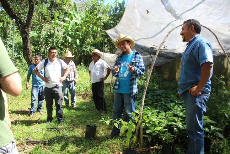
Resumen ejecutivo

7   Involucrar a las mujeres y jóvenes en los procesos de toma de decisiones a nivel local incrementa
    la sustentabilidad social - Las mujeres y los jóvenes tienen intereses establecidos en el manejo del
    territorio y la innovación en áreas rurales y sin embargo no es común que se planteen como participan-
    tes clave y tomadores de decisiones.

8   Campeones ayudan a diseminar los resultados del Proyecto - Reclutar campeones clave, líderes, o
     personas capaces de lograr cambios, en los diferentes niveles geográficos, puede ayudar a promover el
     proyecto, mantener momentum más allá de su vida, y diseminarlo.

9   Financiamiento a largo plazo para el agua y las personas es una oportunidad para la conservación
     y restauración de paisajes - Facilitar la continuidad de financiamiento para los 10 o 20 años necesarios
     para lograr resultados sustentables de conservación y restauración de paisajes siempre es difícil. Crear
     puentes entre la conservación del agua y políticas de desarrollo con temas forestales ayuda.

                                                                                              © Mbis Bin

                                                                                                                               7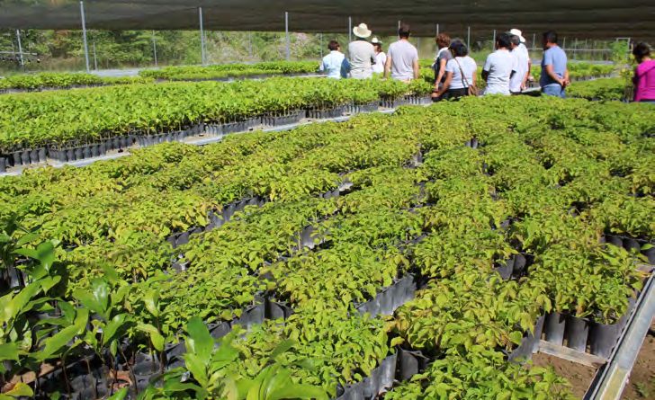
Introduction

                   INTRODUCTION
                                                            With more than 10% of the world’s biodiversity, Mexico
                                                            is rated as one of the planet’s most megadiverse coun-
                                                            tries, based on known species richness (CONABIO, 2016).
                                                            Situated at the intersection of two continents, Mexico
                                                            presents significant genetic and cultural diversity. A total
                                                            of six terrestrial habitat types can be found: tropical rain-
                           forest, tropical dry forest, cloud forest, temperate pine-oak forest, deserts and grasslands
                           (Robson, 2007). Mexico is home to over 20,000 vascular plants, 564 mammal species,
                           close to 1,150 bird species, 864 reptile species and 376 amphibian species (website of the
                           Comisión Nacional para el Conocimiento y Uso de la Biodiversidad).

                           The southern state of Oaxaca, situated on the Pacific coast, is home to about one third of
                           the country’s biodiversity, covering a wide diversity of habitats from temperate, meso-
                           phyllous to dry tropical forests. A total of 8,903 vascular plants have been identified for
                           the state of Oaxaca (Mendoza and Meave, 2011), although much remains to be discov-
             MEXICO IS A   ered. The state is also important for its genetic diversity, notably for its agrobiodiversity
           MEGADIVERSE     including maize, coffee and beans.

         COUNTRY, BASED    The role of communities in managing forests in Mexico is high with an estimated 56–62%
       ON KNOWN SPECIES    of forests under common property regimes (Figel et al., 2011). In the state of Oaxaca, an

           RICHNESS BUT    estimated 80% of forests are under the management and control of approximately 1,400
                           indigenous communities (Robson, 2007). A total of 18 ethnic groups live here, making it
          ALSO CULTURAL    particularly rich from a socio-cultural perspective as well.
              DIVERSITY.   WWF Mexico has been working for 15 years in three river basins across the country:
                           Cuenca alta del río Conchos (in Chihuaha state in the north), Copalita-Zimatán-Huatulco
                           (in Oaxaca State in the south west) and San Pedro Mezquital (in Durango and Nayarit
                           on the west coast). In these three ‘model’ basins, WWF, together with numerous public
                           and non-state local actors, has been working on developing practical experiences and
                           demonstration projects to improve water use and develop a nation-wide network of water
                           reserves for both nature and people based on sound scientific, technical, social and eco-
                           nomic foundations.
                                                                                                                            © D. Vallauri

8
Introduction
Forest loss in Oaxaca has had an impact not only on the land, fauna and flora, but also
on water quality and quantity. As such, WWF has emphasised an integrated approach
to water management, and one of the important tools in this approach is restoration of
forest cover. Forest landscape restoration (FLR) is a means of reconciling ecological and
social objectives focusing on recovery of the role of forests in the wider landscape.
Since 1997, and more intensely in 2004, thanks to funding from the Fundación Gonzalo
Río Arronte (FGRA), WWF Mexico has prioritised the southwest of Oaxaca region focus-
ing on the watersheds of Copalita-Zimatán-Huatulco (CZH). The emphasis has been on
the links between water and forests, across the full altitudinal range of the watersheds.
FLR in WWF’s Global Forest Programme
WWF’s ‘Forests for Life’ programme during the period 2001-2006 centred around
three global targets: protected areas, sustainable forest management and FLR. The
FLR target was “to undertake at least twenty FLR initiatives in the world’s threat-
ened, deforested or degraded forest regions to enhance ecological integrity and hu-
man well-being by 2005”. WWF contributed specific steps along the way to this
global target, including leading the implementation of 10 long-term FLR initiatives.
Outside the WWF network, much has been achieved at an international level to raise
the political profile of FLR and to advance technical understanding through imple-
mentation in key landscapes (Mansourian and Vallauri, 2014). In March 2019, the
UN General Assembly (UNGA) proclaimed 2021-2030 UN Decade on Ecosystem
Restoration.
Today, WWF’s global forest strategy includes as one of its ambitions to contribute
to the international effort to restore ‘350 million hectares of forest landscapes’ by
2030 (New York Declaration on Forests and Bonn Challenge on FLR). These global
efforts aim to reverse the trend of forest loss and degradation by putting an empha-
sis on restoring the ecological functions of degraded forest landscapes.
WWF global work on FLR is set up as an Area of Collective Action and Innova-
tion (ACAI) with active chapters in Africa, Latin America, Asia-Pacific and Europe.
About 200 staffs contribute to it. WWF is an active member of Global Partnership
on Forest Landscape Restoration and is participating to the Initiative 20x20.
9Presentation of the landscape
PRESENTATION
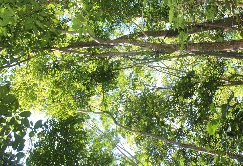
In the south of the state of Oaxaca, in the Sierra Madre del
Sur, lies the landscape encompassing the watersheds of
OF THE LANDSCAPE
Copalita-Zimatán-Huatulco and Coyula (hereafter referred
to interchangeably as ‘the landscape’ or as the ‘CZH water-
sheds’). It covers an area of 268,023 ha within 20 munic-
ipalities, with 854 villages, and boasts high rates of ende-
mism (WWF, 2009, Figures 1, 2, 3)). Of the 34 vegetation
types country-wide, 26 are present in this landscape (WWF,
2009). The area’s exceptional altitudinal range – from sea
level to 3,500 m – contributes to it being considered a unique centre of endemism with dry
forest habitats, but also cloud forest and mangroves all being found in this ecoregion. Inland,
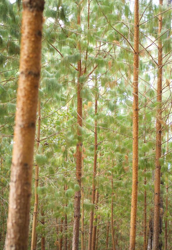
the high peaks of the NW Sierra Madre represent a mix of pine-oak forest, dominated by
Mexican weeping pine (Pinus patula), Oaxacan pine (P. oaxacana), Mexican yellow pine
(P. oocarpa), Pringle’s pine (P. pringlei), smooth-bark Mexican pine (P. pseudostrobus),
teocote (P. teocote), sycamore (Platanus spp.), Oaxacan Douglas fir (Pseudotsuga mensie-
zii var. oaxacana) among others. The dry forests are important for several endangered
and endemic species, such as the Sinaloa Wren (Thryothorus sinaloa), the Golden-cheeked
Woodpecker (Melanerpes chrysogenys) and the West Mexican Chacalaca (Ortalis polio-
cephala), as well as numerous marine mammals that transit the coastline, such as the Pygmy
and False Killer Whales (Feresa attenuata and Pseudorca crassidens) and the Long-finned
Pilot Whale (Globicephala macrorhynchus) (Ramsar website). The vulnerable leatherback
turtle (Dermochelys coriacea) can also be found here. Ocelot (Leopardus pardalis), margay
(Leopardus wiedii), bobcat (Lynx rufus) and jaguar (Panthera onca) are among the many
mammals sharing this territory.
In the year 2000, WWF Mexico conducted an ecoregional assessment of the coastal
mountains of Oaxaca which led to the prioritisation of the CZH watersheds. This land-
scape straddles two ecoregions: ‘Mexican Dry Forests’ and ‘Mesoamerican Pine–Oak
Forest’, defined by WWF’s Global 200, an attempt to identify a set of ecoregions whose
THE COPALITA- conservation would achieve the goal of saving a broad diversity of the Earth’s ecosystems
ZIMATÁN-HUATULCO (Olson and Dinerstein, 2002).
WATERSHEDS The unique biological diversity present in this landscape is matched by a unique cultural
COVER AN AREA OF diversity, with indigenous communities from the Zapotec and pre-Mayan Chontal civili-
268,023 HA WITHIN
sations living here and human presence traced back 15,000 years (Danver, 2015). They
live in eight out of the 20 municipalities in the landscape and have their own customs
20 MUNICIPALITIES, related to land use and a century-long relationship to nature. Their main economic activ-
WITH 854 VILLAGES, ities are collection of seashells, agriculture and tourism. In the upstream portion of the
landscape where more forests are present, the main activity is timber production and
AND BOAST HIGH carpentry specifically in the municipality of San Miguel Suchixtepec.
RATES OF ENDEMISM. Threats to the landscape include deforestation, fire, advance of the agricultural frontier,
slash and burn on steep slopes for maize cultivation, reduction in water availability, sed-
imentation of coastal zones, unplanned tourism activities and water contamination from
domestic, urban, industrial and agricultural sources. Water quality and quantity are sig-
nificant challenges, but so is its equitable distribution.
Climate change is exacerbating local populations’ vulnerability notably by further lim-
iting water availability. Pine and mesophyll forests in the upper and middle watershed
have been the most affected with a 3.9% loss between 2000 and 2005, followed by tropi-
cal dry forests (a loss of 2.5% in the same period) and mangroves at 1.8% loss (Martínez-
Pacheco, 2010). The lower watershed is more urbanised than the upper stretches, and
has been heavily modified by tourism development at Bahías de Huatulco which receives
about 300,000 visitors per year.
10Presentation of the landscape
Embedded in WWF’s Freshwater Programme, the CZH landscape is part of a wider pro-
gramme covering three basins that aims to demonstrate that it is possible to strike a
EMBEDDED IN balance between water use and conservation. The effort in these watersheds builds on
WWF Mexico’s initial work in the Río Conchos basin in Chihuahua State. The lessons
WWF’S FRESHWATER learned and successful results from CZH watersheds were also transferred to San Pedro
PROGRAMME, THE CZH Mezquital. The knowledge and experience achieved in these ‘model’ basins were the cor-
nerstones of both the Mexican Environmental Flow Standard and the Programa Nacional
PILOT PROJECT AIMS de Reservas de Agua (National Water Reserve Programme).
TO DEMONSTRATE
THAT IT IS POSSIBLE TO
BALANCE WATER USE Interpreting the landscape and watershed
AND CONSERVATION. Watersheds are “areas of land that drain all the streams and rainfall to a common
outlet such as the outflow of a reservoir, mouth of a bay, or any point along a stream
channel” (USGS website). A watershed often presents with similar features as a
landscape and thus, frequently, the two can be equated. Various altitudinal gradi-
ents can typically be found in a watershed with activities upstream having signifi-
cant impact downstream.
The term landscape may not necessarily be defined by its size, as it has ecological,
political and socio-cultural dimensions. Thus, a landscape can be defined as “a so-
cio-ecological system that consists of natural and/or human-modified ecosystems,
and which is influenced by distinct ecological, historical, economic and socio-cul-
tural processes and activities” (Chatterton et al., 2016). Thus, a landscape contains
heterogeneous characteristics and land-uses but the main drivers influencing its
overall functioning contribute to its practical delineation.
In the context of this report, the ‘landscape’ encompasses the watersheds of four
main hydrological units (Copalita, Zimatán, Huatulco and Coyula) with one that
© WWF-Mexico
contains intermittent small rivers – Huatulco – and three perennial principal
rivers: Copalita, Zimatán and Coyula.
11Presentation of the landscape
The landscape
USA
Gulf of
Figure 1. Mexico
Location of the landscape
MEXICO
in Oaxaca state.
Pacif ic Mexico City
Ocean
S TAT E O F O A X A C A
San Andrés
Paxtlán
San Sebastián
Río Hondo
San Mateo
Río Hondo Santa María San Juan
Ozolotepec Ozolotepec
San Francisco
San Miguel Ozolotepec ZIMATÁN
Suchixtepec San Marcial
Ozolotepec
La Merced
San Pedro el Alto COPALITA del Potrero
Tierra Blanca El Potrero Jazmín
Santiago Xanica
San Agustín Loma Canela San Mateo Piñas
Llano Flor
Loxicha Malvarisco
Lagunilla
Candelaria Loxicha Pluma Hidalgo
San Miguel del Puerto
Communities reforested
BAJOS DE
Municipalities reforested COYULA
Disturbed
Santa Maria Barra Copalita
Recovery Puente Copalita
Huatulco
Watershed boundaries
Rivers
HUATULCO
La Crucecita
(Huatulco)
San Pedro Pochutla N
Sources: Martinez-Pacheco 2010
0 5 10 km
Figure 2. The CZH watershed and soil degradation stages : disturbed (red), recovery (green), unchanged (grey).
1213
Presentation of the landscape
© WWF Mexico © Gustavo-Ybarra © D. Vallauri
i Lower
© D. Vallauri © Gustavo-Ybarra © WWF Mexico
i Middle
Figure 3. The Copalita-Zimatán-Huatulco watershed in a few images.
© D. Vallauri © Gustavo-Ybarra © D. Vallauri
i UpperProject phases
PROJECT PHASES
WWF began work in these watersheds already in 1997
when it undertook a dry forest conservation project.
In 2004, a seven-year project was approved with the
Fundación Gonzalo Río Arronte (FGRA) which has since
continued to this day. A total of three phases can be iden-
tified, with the French cosmetics company, Caudalie, also
supporting the third phase (see Table 1).
Facing a complete dearth of up-to-date information on the CZH watersheds, the first
phase of WWF’s intervention was to collect data – both biological and socio-economic.
This provided a solid foundation for future work in the next phases of the programme.
The main objective under this first phase was to ensure that Mexican society could sup-
port the wise use of water through an integrated river basin approach that meets the
needs of vulnerable people, while restoring and conserving water resources. Key activi-
ties included: research on environmental flows (González-Mora et al., 2009) and better
understanding the socio-economic context. At this stage, participatory monitoring sys-
tems were also designed. Relationships with several partners – public and private – were
established. For example, in order to develop a management plan for the watershed, a
partnership was initiated with three levels of government, from communities, up to the
federal level. Pilot projects were started in the upper watershed, and later with more
experience and community consensus, in the lower altitudes. Awareness raising cam-
paigns were begun.
The second phase was to consolidate and replicate achievements from the first phase.
This phase emphasised: 1. determining sustainable water balance, taking into account
the environmental flows for each watershed; 2. strengthening water governance through
A TOTAL OF THREE active participation of different stakeholders in the watershed committee; 3. improving
PHASES CAN BE the recognition of forest and river environmental services by beneficiaries and producers;
IDENTIFIED, STARTING 4. securing water for rural communities, through its sustainable management and imple-
mentation of eco-technologies; and 5. communications.
IN 2004, WITH THE
SUPPORT OF THE A milestone in this phase was the approval by the Ramsar Convention’s 12th COP of
Resolution XII.12 proposed by Mexico calling on “action to ensure and protect the water
FUNDACIÓN GONZALO requirements of wetlands for the present and the future”. That initiative was created and
RÍO ARRONTE. promoted by CONAGUA, CONANP and the Alliance WWF-FGRA based on the ‘Programa
Nacional de Reservas de Agua’.
The third and current phase was intended on the one hand to consolidate work to date,
and on the other to continue addressing threats and enhance restoration work for the
benefit of people and nature, in order to achieve water security and biodiversity conser-
vation. Specific objectives for this 2016-2020 phase are to: 1. recover soil, forest cover
and water infiltration to maintain the ecosystem services by producing 335,000 plants
(of native species) per year; 2. reduce the impact of the main threats to the forest: con-
ventional agricultural and livestock activities within the watershed; 3. strengthen three
community-based companies that produces native plants for each types of forest in the
watershed; and 4. improve ten rural communities’ production practices for their social
and economic benefit. Agroecological practices have been promoted in this phase as a
sustainable solution to the twin goals of biodiversity conservation and food production.
14Project phases
Table 1. Programme phases.
Phases Objectives Related event
Phase I The Alliance WWF-FGRA was established. It aimed to bring 2011. Bonn Challenge on FLR
2004-2011 local communities into an integrated watershed management
model, using three basins – one of which is CZH (funded by
Development of new
Fundación Gonzalo Río Arronte, I.A.P. (FGRA)).
models to manage
water basins
The overall objective was to “Ensure that citizens support the
rational use of water through a comprehensive watershed
management that incorporates and satisfies the needs of
the least favoured – while restoring and conserving natural
sources of water.” Five priority strategies were: 1. Recognition
of the environment in the administration of water and
territory, 2. Water governance in the basin, 3. Environmental
services assessment, 4. Strengthening of rural communities
and 5. Recognition of belonging to the basin and the
importance of its conservation.
Phase II This consolidation phase was also funded by FGRA. 2014. New York Declaration
2012-2016 The overall objective was to “Consolidate water management on Forests
based on sustainable extraction that considers the necessary
Consolidation
reserves for ecosystems, efficient use based on demand 2014. Mexico commits to
and replication
management and equitable access to the resource with restore 8.47 million hectares
informed participation and support from society, and public by 2020 under the Bonn
investment that ensures its continuity and sustainability”. Challenge and the Initiative
Five strategies in this phase were: 1. Sustainable hydrological 20x20
balance; 2. Water governance; 3. Environmental services
assessment; 4. Water for rural communities; and 2015. Ramsar Convention,
5. Communication. 12th COP – Resolution XII.12
“Call to action to ensure and
protect the water requirements
of wetlands for the present and
the future”.
Phase III In the current phase, the intention is to improve water 2017. Updating water reserves
Mid 2016-2020 security in Mexico through a national strategy and a network proposal for Copalita, Zimatán
of 300 water reserves for environment (funded by FGRA). and Coyula rivers, in order to
Water, reforestation
The strategies are: 1. Implementation of the National Water meet the Ramsar Convention’s
and innovative
Reserves Programme, 2. Consolidation of the Alliance model Resolution XII.12.
agriculture
(3 model basins) and 3. Appropriation of water reserves for
the environment by society. At the same time, a related project
(funded by Caudalie) aims to reforest pine and mesophyll
forest, riparian forest and dry forest (over 1 million trees
planted), while improving agricultural and livestock practices
enhancing the local capacities of rural communities to recover
the ecosystem services that the forest provides for people and
biodiversity in the CZH watersheds.
15Implementation: activities and results
IMPLEMENTATION: Activities in the landscape
were designed to achieve wider
ACTIVITIES & RESULTS landscape scale results, and in
particular to connect key forest
areas across the landscape
and reduce erosion and
sedimentation.
Activities (Table 2)
Data collection
In the first phase, several surveys were carried out to collect baseline data and better
understand the challenges faced by the watershed and its people. Twenty categories of
land uses were thus defined, including dry forest, coffee growing regions and deforested
zones. Through this exercise, six priority municipalities were identified based on both
environmental and socio-economic criteria: San Miguel Suchixtepec, San Pedro el Alto,
San Marcial Ozolotepec, San Pedro Pochutla, Santa María Huatulco and San Miguel del
Puerto. In the upland municipality of San Miguel Suchixtepec – an 8,450 ha area inhab-
ited by 2,694 people – participatory zoning and land use planning was undertaken using
GIS mapping. As a result, 25 landscape units were identified and for each, five parame-
ters were monitored: hydrological affinity index, slope, anthropic activity, environmen-
tal impact and vegetation cover. A first ecological study of freshwater biodiversity was
undertaken in order to have sufficient information and eco-hydrological understanding
to determine environmental flows. Furthermore, policies affecting land use were identi-
fied and analysed in this first data collection phase.
Agriculture
© D. Vallauri
Organic production was promoted through the project, in particular the use of compost-
ing, bio-fertilisation and eco-silvopastoral practices. Local communities were trained and
began to practice agro-ecological methods for the production of maize under milpa, fruits,
tomatoes and coffee. Alternative agricultural practices have been promoted, including for
shade grown coffee (Coffea arabica), avocado (Persea americana) and vanilla (Vanilla
planifolia). The coffee plant has been grown in the middle part of the watershed for over
60 years. Agricultural improvements centred on biological fertilisation. Technological
innovations related to agro-ecology started already in 2014, but it is not until the third
phase that they were properly tested in the field and systematised. For example, in the
middle watershed bio-fertilisation and mycorrhizal application have been promoted.
Local communities have been trained in these practices in the middle and upper reaches
of the watershed.
Shade grown coffee
Reforestation
Reforestation was a priority at two levels: in the higher grounds to reduce erosion and
also along the banks of the rivers to protect more directly the watercourse. Nurseries were
established, notably by the Río Molino group in 2004 in the upper watershed. Production
of saplings in the nursery Río Molino was increased substantially at the start of the pro-
ject. The group evolved and decided to legally establish itself as ‘Alternativa Agrícola
Suchixtepec’. Seeds were collected from local native trees and germinated in the nurs-
ery. Saplings that reached 20 cm were then used for reforestation. Active reforestation
activities were undertaken in Zemialtepec and Suchixtepec. For example, in 2011, 8,000
trees were planted along the Copalita river to protect river banks. With additional fund-
1617 © D. Vallauri
Implementation: activities and results

                                      ing from Caudalie as of 2016, the nursery run by the Alternativa Agrícola Suchixtepec
                                      was expanded and production of saplings intensified, with 240,000 pines and oaks pro-
                                      duced each year. By 2018, four municipalities in the upper watershed were engaged in
                                      tree planting: San Mateo Río Hondo (25,100 plants), San Sebastián Río Hondo (125,000
                                      plants), San Miguel Suchixtepec (39,900 plants) and San Pedro el Alto (50,000 plants).
        DRY FOREST TREES              In this phase, human urine from the dry ecological bathrooms was used as foliar fertiliser
       ARE MORE DIFFICULT             for its contents of 3 g of nitrogen, 2 g of potassium, 1.5 g of sodium and 0.82 g of phos-
                                      phorus per litre. The dose used was 3 litres of fresh urine per 15 litres of water. Pest and
       TO PROPAGATE, BUT              disease control were carried out manually. To control the fungus attack (Fusarium sp.)
     IMPROVEMENTS IN THE              the humidity of the nursery was lowered by reducing the irrigation and managing solar

        NURSERY ALLOWED
                                      radiation using shade mesh.

           THE POTENTIAL              In the middle part of the watersheds, the organisation ‘Unión San Pedro para la

           PRODUCTION OF              Agricultura Sostenible 100 Sombras (USP)’ established eight nurseries in three commu-
                                      nities (Tierra Blanca, Malvarisco and Lagunilla) to produce 60,000 plants per year, of
         150,000 SAPLINGS             both coffee and shade tree plants, which are resilient to climatic variation. Control of
                PER YEAR.             fungi was done using organic means with Bordelés Broth and Sulfocalcium Broth. Bio-
                                      fertilisers enriched with mineral salts or ground rock meal were also used.

                                      Dry forest plants are more difficult to produce, but improvements in the nursery have
                                      signified that as of 2016, 75,000 saplings of diverse dry forest species are being pro-
                                      duced organically and with the potential for cultivation twice a year, by Los Macuiles
                                      Copalita. A nursery was established in that year, and the development of the plants was
                                      carried out in recycled and biodegradable plastic bags. The plants were cultivated with-
                                      out agrochemicals, using soil from the forest and natural fertiliser. A communal seed
                                      collection campaign was carried out, called ‘Semillatón’, in which schools, government
                                      agencies and hotels participated. In order to have the necessary materials, a massive
                                      collection of plastic was proposed to later be recycled and converted into biodegradable
                                      nursery bags.

                                      The municipality authorities, associations, committees, social and private owners, stu-
                                      dents and the general public received the plants as a donation from WWF and Caudalie,
                                      and they pledged to reforest the plots without financial remuneration. They prepared the
                                      soil and sites to reforest the land.

      Producing dry tropical forest
                                                                                                                                     © WWF Mexico

       species seedlings in a brand
       new nursery maintained by
             Los Macuiles Copalita

18
Implementation: activities and results
Participatory management
Several spaces under the federal legal framework, have been created to encourage and
promote participatory management (see section on governance below). In the coffee zone
in the municipalities of San Pedro el Alto and Santiago Xanica, a first inventory identi-
fied 60 springs, of which 23 were characterised in more detail using GIS mapping and
two communities signed an agreement to co-manage the water spring. In San Miguel
Suchixtepec, the Centre to Sustainably Manage Water (‘Centro de Manejo Sustentable
del Agua’ (CMSA)) was established in 2012 by young professionals, who later combined
forces to form the association ‘Mbis Bin Semilla para la Siembra’, in order to ensure bet-
ter water management for rural communities. These successful participatory experiences
in CZH have since been shared with other watersheds.
Participatory monitoring
The international programme ‘Global Water Watch’ – a network that aims to foster
watershed stewardship through the development of citizen volunteer monitoring of sur-
face waters to improve both water quality and public health – provided training to WWF
technicians as well as community leaders. This was later extended to youth groups who
were directly involved in monitoring of physical, chemical and bacteriological data.
Awareness raising
Several awareness raising and engagement activities have taken place. For example, in
2009, 272 community members were trained in the wise use of water under the MUSA
process (models of sustainable water use) developed by WWF. It included improving
waste management and agricultural production. In the lowlands this focused on the
communities of Bajos del Arenal, Barrio La Guadalupe, Bajos de Coyula and Bahía de San
Agustín, while in the highlands, in the community of San Miguel Suchixtepec. Awareness
raising efforts were undertaken with the coffee producing communities in the middle
watershed, notably through the cooperative ‘Los Productores de Café La Trinidad S.S.S.’
present in the seven communities of Los Naranjos Esquipulas, Loma Canela, Llano Flor,
Malvarisco, Tierra Blanca and Lagunilla from the municipality of San Pedro el Alto and
Santiago Xanica. In 2013, La Trinidad evolved into a new and proactive organisation:
USP, but only with San Pedro el Alto communities. As a result, a growing amount of the
coffee production here is cultivated under shade with agroecological practices, certified
as organic and sold at a premium in more discerning markets.
Meeting and training
© Mbis Bin
with local people
19Implementation: activities and results
Reducing water pollution
To improve water quality under the MUSA, water filters were installed at the level of
households. Dry toilets were also installed and are rapidly being adopted. The local
development of water filters has also served to generate jobs. Regular clearing activities
around water springs and wells have been undertaken to reduce sediments and debris
entering the water.
Table 2. Key activities by phases.
Dates Key activities
Phase I • Land use change analysis (2000-2005 data) – later updated in 2010
2004-2011 • A workshop held with 18 watershed experts to do a rapid analysis of the situation
Development of • A nursery was established in the upper watershed, conducted by the Río Molino organisation that later
new models to became Alternativa Agrícola Suchixtepec
manage water- • Criteria were developed to define and implement demonstration water projects for rural communities
sheds • Reforestation efforts were started with native plants, especially in the upper part of the basin
• A first evaluation of base flows was undertaken in 19 sites
• A working group was set up with the Universidad Nacional Autónoma de México (UNAM)’s Institute of
Biology to monitor biodiversity and watersheds health.
• Analysis of water management and treatment for rural communities
• Establishment of the models of sustainable water use (MUSA) including water treatment facilities in
houses and in schools
• A monitoring system (SISMOC C-Z-H) was set up on the perceptions and participation of communities.
• Five rural communities, living both along the coast and in the mountains, were approached to engage in
the project
Phase II • Securing legal changes to provide for recognition of water reserves and contributing to the establishment
2012-2016 of a Mexican Environmental Flow Standard
•P
roposal to create water reserves in five hydrological basins in CZH watersheds (based on flows required
Consolidation
by both species and people)
and replication
•S
trengthening of watershed committees
•C
onsolidation of MUSA in houses and schools and launching of MUSA in agricultural projects
•S
trengthening of Alternativa Agrícola Suchixtepec as an organic farm and pine nursery
•P
rograma Arbolotón was created to support and spur reforestation effort along the watersheds
•T
ree planting was mainly done in the upper watershed and along the Copalita river banks
•C
reation of Mercado Orgánico Huatulco (organic market for agricultural products from the landscape)
Phase III • Consolidation of tree nurseries and reproduction techniques at all three levels (upper, middle and lower)
2016-2020 of the watershed by local and indigenous community companies
• Expansion of tree planting to the upper, middle and lower watersheds (including riparian forest), with
Water,
organically produced native species
reforestation
and innovative • Technical evaluation on reforestation (plant survival and growth)
agriculture • Capacity building in agroecological practices focused on local and indigenous farmers
• Implementation of agroecological innovation projects strengthening MUSA
• Development of agricultural alternatives (coffee, vanilla, avocado, citrus…)
• Strengthening collaboration with 11 municipalities
• Involvement of stakeholders in participatory management in forest restoration and conservation of
biodiversity in the landscape
• Updating the water reserves for environment and people
20Implementation: activities and results
Results (Table 6)
Water
Water quality has improved as measured in several sites along the three watersheds.
During first phase of the project, two volunteer teams were established to monitor
BALANCING HUMAN water quality in 15 sites, using the Global Water Watch system. The results show
WATER UPTAKE,
a higher oxygen concentration in upper watershed sites (7.3 mg/L) than the lower
ones (6.7 mg/L). The turbidity shows the opposite trend: less turbidity (12.2 JTU) in
REDUCTION OF RIVER upper sites than the lower ones (14.0 JTU). In the case of Escherichia coli, the coli-
POLLUTION AND form bacteria, the mean for the upper sites was 1.2 MPN/100 mL in contrast to 691.1
MPN/100 mL for the lower sites. The general trend is what is expected in these kinds
WATER PROVISION of landscapes since the upper watershed has less pressure than the lower zone due to
FOR SPECIES HELPS the intensity of human activities. However, bacterial contamination indicates a large
difference, of three orders of magnitude, which denotes rivers more contaminated by
TO MAINTAIN BOTH wastewater drainage without treatment in the lower part of the basin.
PEOPLE’S WELL-BEING
AND ECOSYSTEMS. Over the course of the project, demand for dry toilets has expanded. It has led to
reduced water pollution mainly in the upper part of landscape with rural communi-
ties and resulted in increased employment opportunities as well. During the entire
project 280 dry toilets and 204 biofilters for grey waters were built in houses and
schools, which effectively diminished pollution.
Seven municipalities with 29 communities are implementing MUSA activities, thanks
to which, each year water consumption is reduced by 76,000 m3, 8,600 m3 of water
are treated through biofilters, 6,200 m3 of water are re-used and 700 m3 are stored.
The Copalita river at the
bottom of the watershed.
© WWF Mexico
21Implementation: activities and results
The holistic approach for determination of environmentally friendly flows resulted
in the proposed annual allocation of 875 million cubic metres (62% of mean annual
runoff) for ‘water for nature’ (González-Mora, 2013) – i.e. water reserves for the func-
tion and integrity of the ecosystems of CZH landscape. Further to a review carried
out in 2017 as part of the work of the Alliance WWF-FGRA in the Consejo de Cuenca
de la Costa de Oaxaca, an annual volume of 5 million cubic metres was added for
guaranteeing the population’s human right to water until 2070. These proposals were
ratified by the Consejo de Cuenca and are awaiting CONAGUA´s endorsement (and
a final federal decree).
With the knowledge obtained in CZH and the other ´model´ basins, the Mexican
Environmental Flow Standard was approved in 2012. This was a significant step in
ensuring the protection of water courses throughout the country. The three basins
THE PROPOSED that the Alliance WWF-FGRA focused on served as a practical demonstration of the
significance of securing environmental water flows but also of the feasibility of engag-
ANNUAL ALLOCATION ing communities in ensuring sustainable water flows.
OF 880 MILLION CUBIC
In 2017, the environmentally friendly flows studies were updated and a correspond-
METRES FOR THE ing proposal for water reserves was added with the annual volumes to guarantee the
INTEGRITY OF THE human right to water. Also, the proposal included another two watersheds in the
ECOSYSTEMS AND Coast of Oaxaca.
WATER SECURITY Agricultural practices
FOR PEOPLE IS Agricultural practices have improved with more integrated approaches and agroe-
cological practices being applied in the landscape, in specific demonstration sites,
PENDING FEDERAL in order to reduce threats on forests. In total, 13 innovation plots have implemented
ENDORSEMENT. Models of Agroecological Innovation (MIA, in Spanish): four MIA plots of maize
and four of avocado were established in San Miguel Suchixtepec, while the rest were
implemented in coffee agroecosystems in San Pedro el Alto. An area of 134 ha pro-
duces certified coffee. Unión San Pedro has secured that 74% of its coffee produc-
tion plots are organically certified. The total area for MIA and certified plots is 151
ha. MIA plots include efficient use of water through drip systems, recycling water,
application of soil microorganisms and organic fertilisers. A notable example is the
organisation Alternativa Agrícola Suchixtepec which was set up to promote sustain-
able and integrated agricultural practices. Originally a nursery, today it is a com-
prehensive organic farm as well as a tree nursery. Through improved land, forest
and water management systems, this organisation, Mbis Bin Semilla para la Siembra
and other farmers of Guitani have demonstrated tangible results such as the use of
rain water to reduce water extraction from the watershed and improved agricultural
practices reducing water consumption by 64%, mainly in avocado crop. The MIA has
also demonstrated that economic benefits can be achieved by farmers through agroe-
cological practices. The cost of conventional corn production is 12,900 pesos per hec-
tare, 500 kilogrammes of fertiliser are used and the yield is 600 kg. In the production
system with agroecological practices and fractional fertilisation, the production cost
is 8,600 pesos per hectare, with a saving of 33%, reducing fertilisers by 70% and with
a harvest of 800 kg of corn (33% increase in the production). In conventional avocado
cultivation, production cost is 231 pesos per plant in the first three years while with
agroecological management, production cost is 94.8 pesos; the savings correspond to
59%. In one of the MIA plots of the USP organisation, a micro-batch of coffee evalu-
ated as high quality in the cup was obtained and 368 kg of coffee were sold at a price
of 68 pesos, 41% more than the price of conventional coffee. Also, 10 tonnes of coffee
were sold to a Canadian purchaser at 55 pesos per kg, while the price of conventional
coffee was set at 40 pesos per kg. Thus, a 27% gain was obtained thanks to the agro-
ecological management.
22You can also read